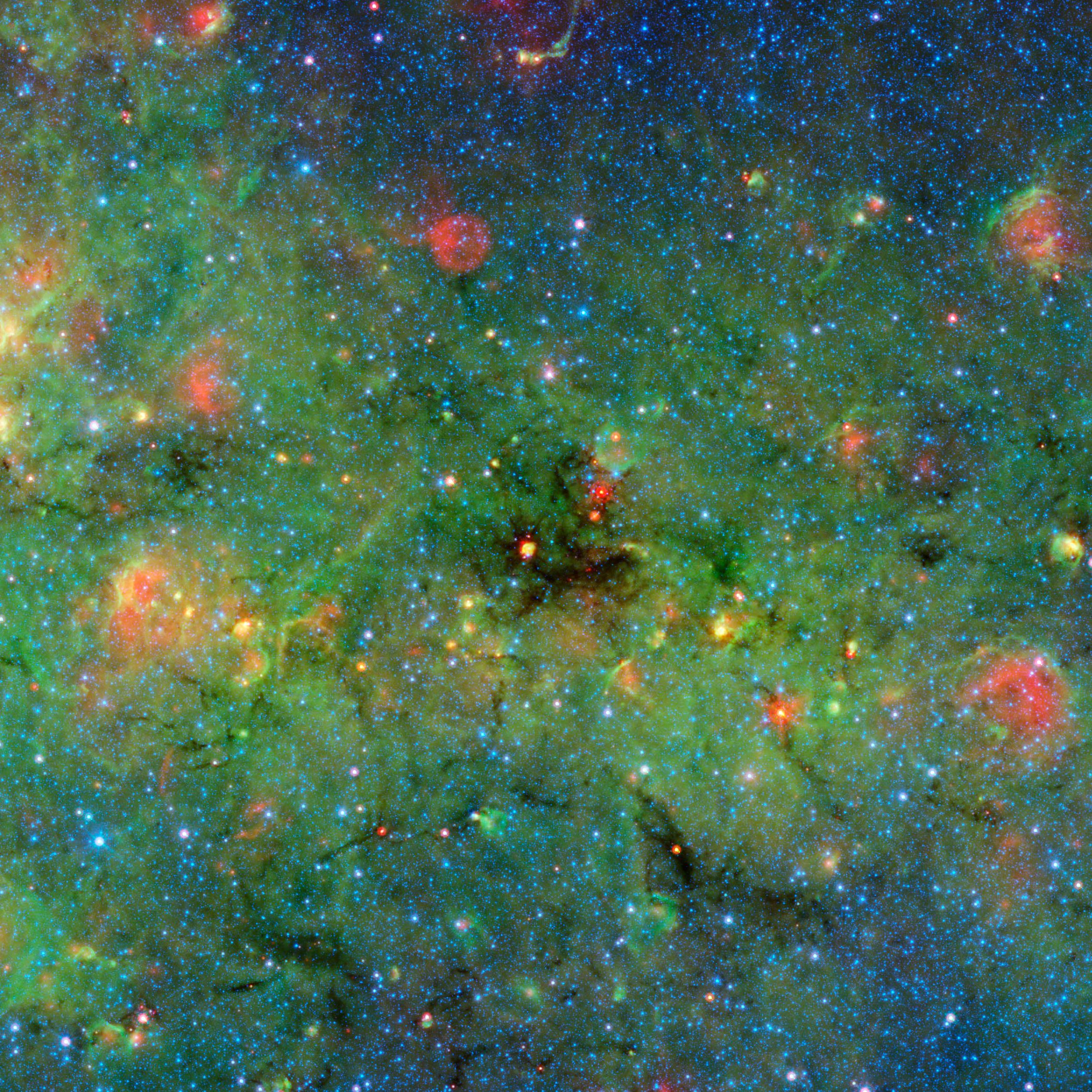
My
List |
Addition Date
|
Target
|
Mission
|
Instrument
|
Size
|

|
2014-05-28 |
|
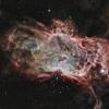
Spitzer Space Telescope
|
IRAC
Two Micron All Sky Survey (2MASS)
|
2251x1476x3 |

|
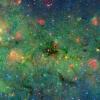
-
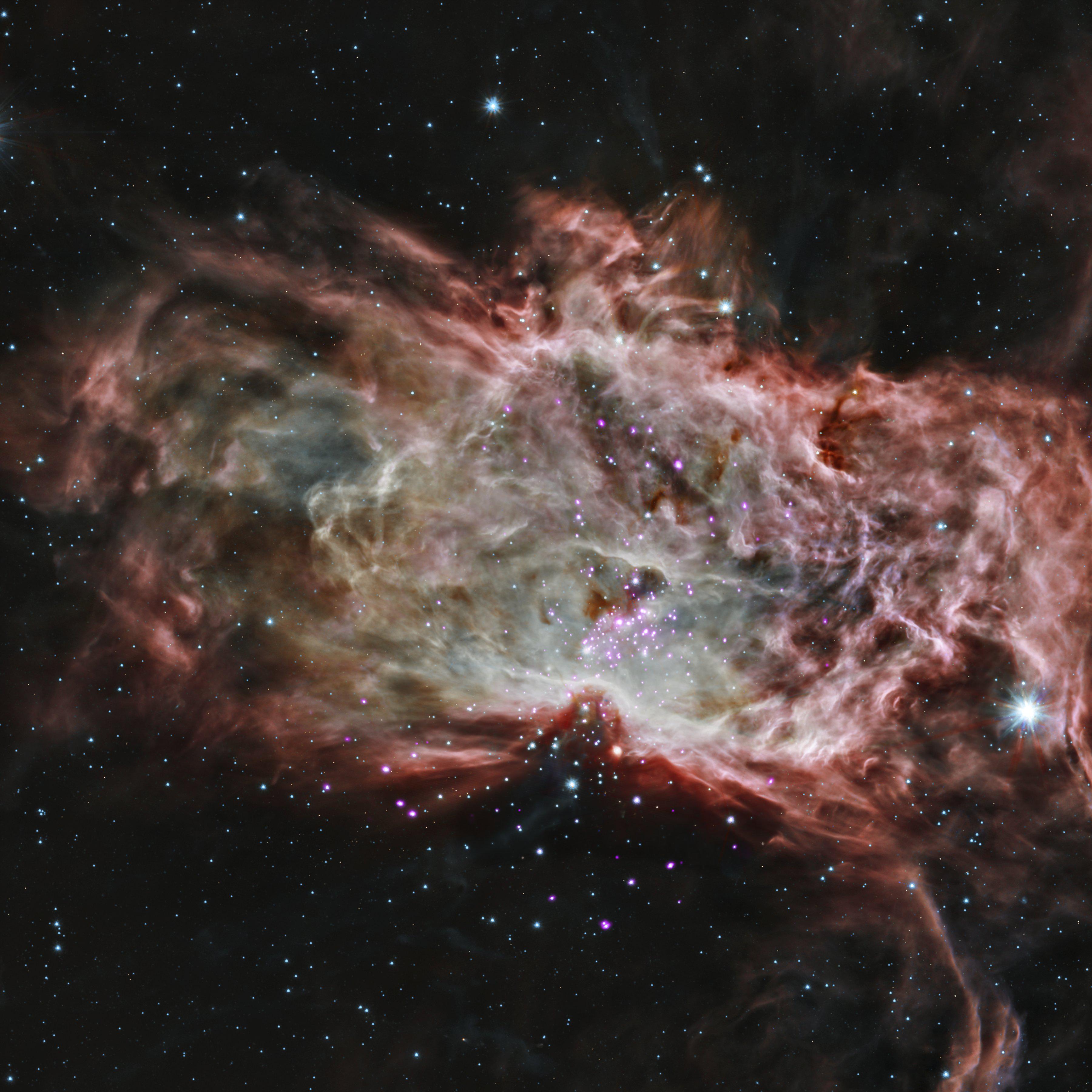
PIA18014:
-
The 'Serpent' Star-Forming Cloud Spawns Stars
Full Resolution:
TIFF
(9.972 MB)
JPEG
(628.5 kB)
|
|
|
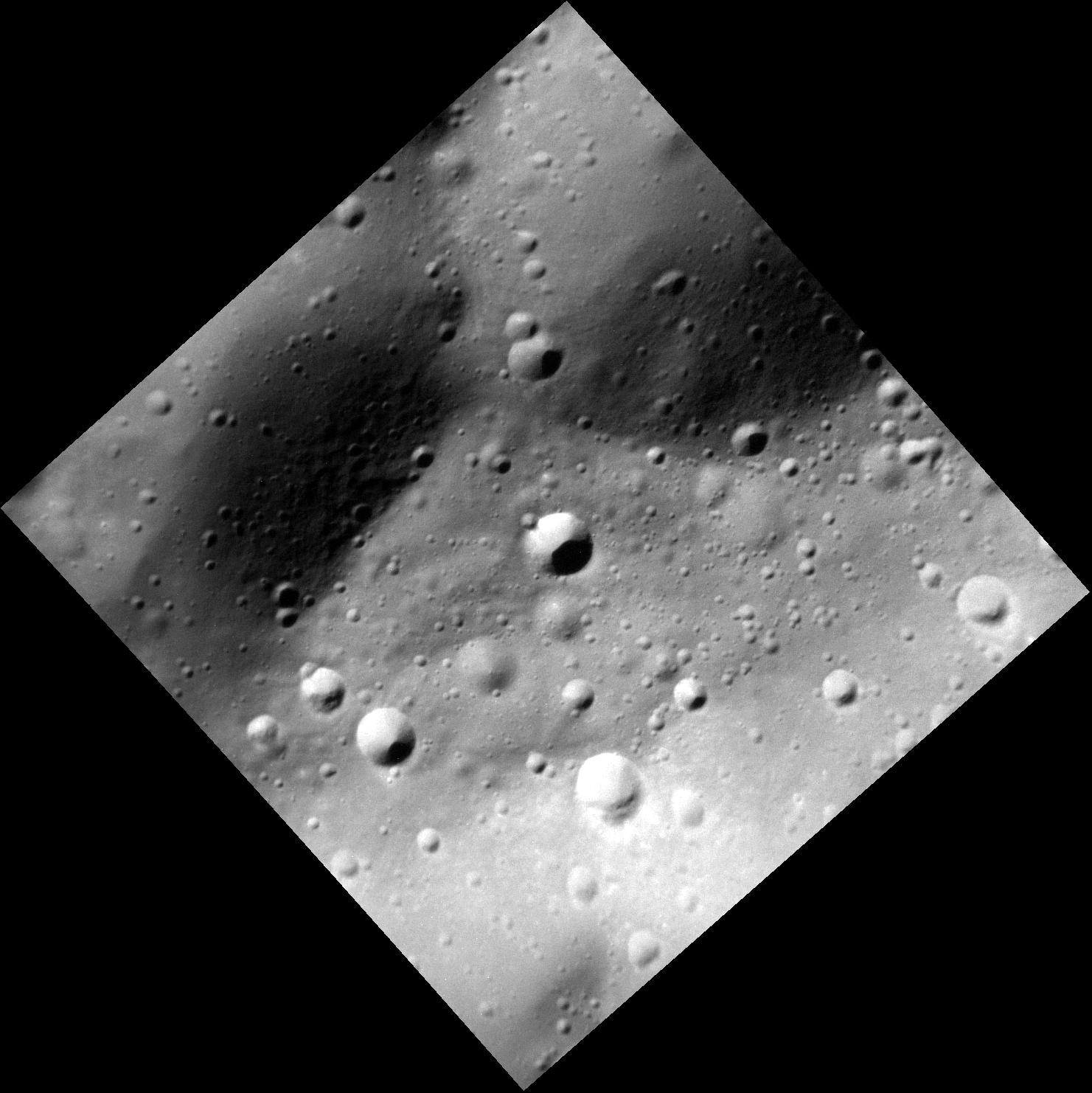
2014-05-28 |
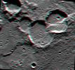
Mercury
|
MESSENGER
|
MDIS - Narrow Angle
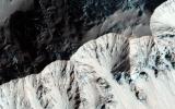
|
1193x1190x1 |
|
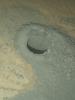
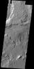
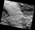
-
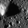
PIA18444:
-
Hollows in Balanchine Crater
Full Resolution:
TIFF
(1.421 MB)
JPEG
(116.9 kB)
|
|
|
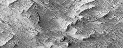
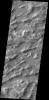
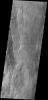
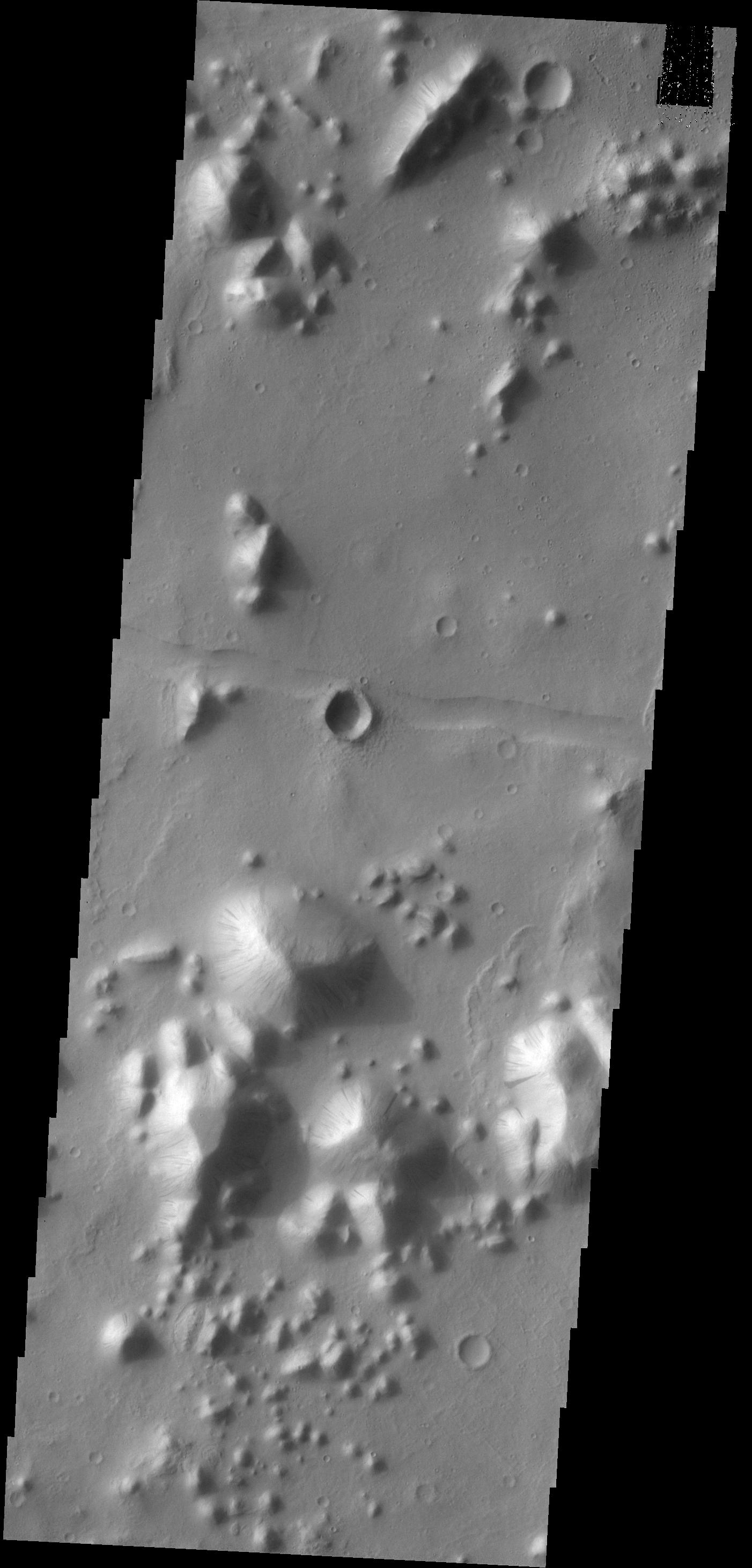
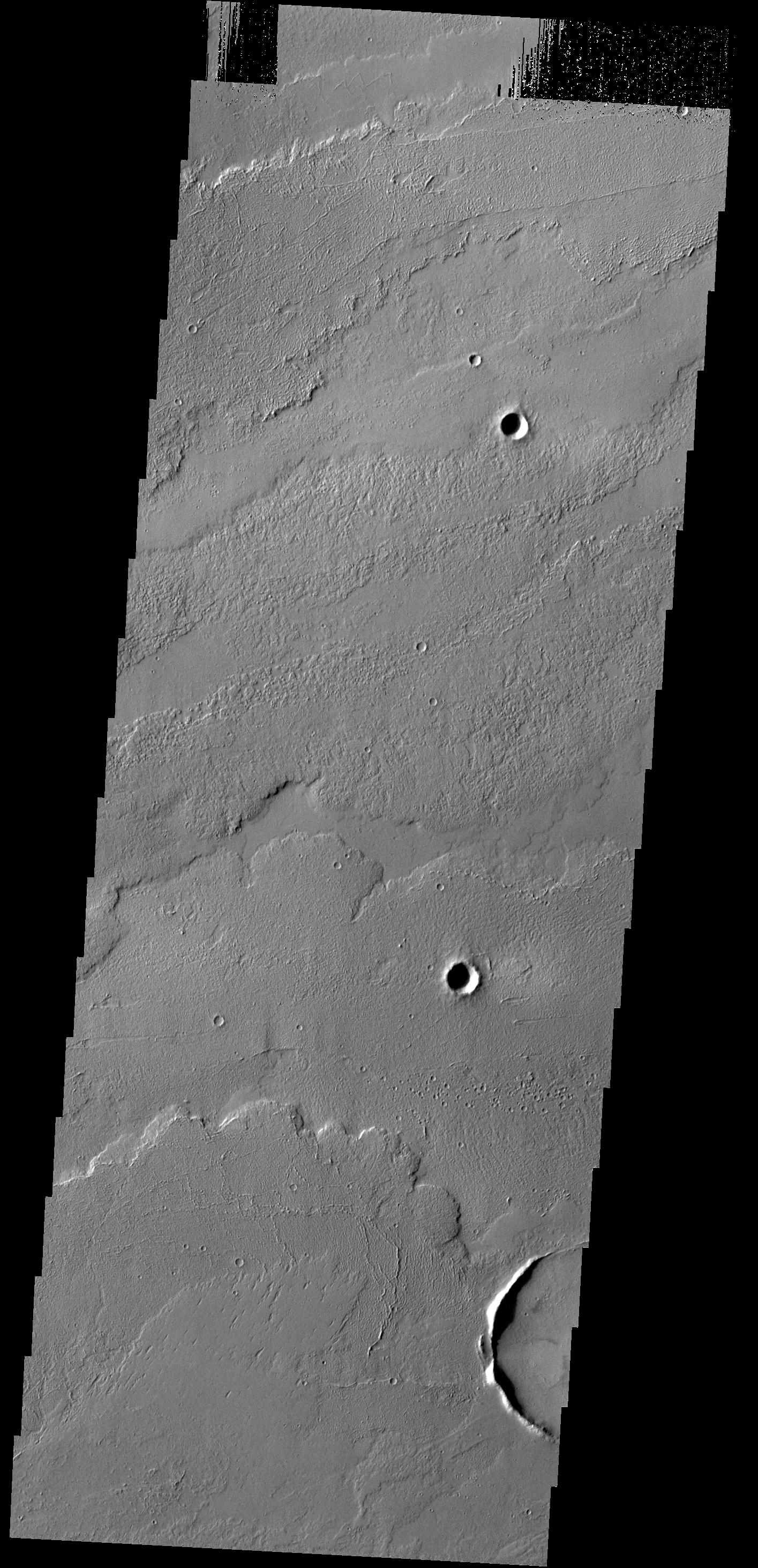
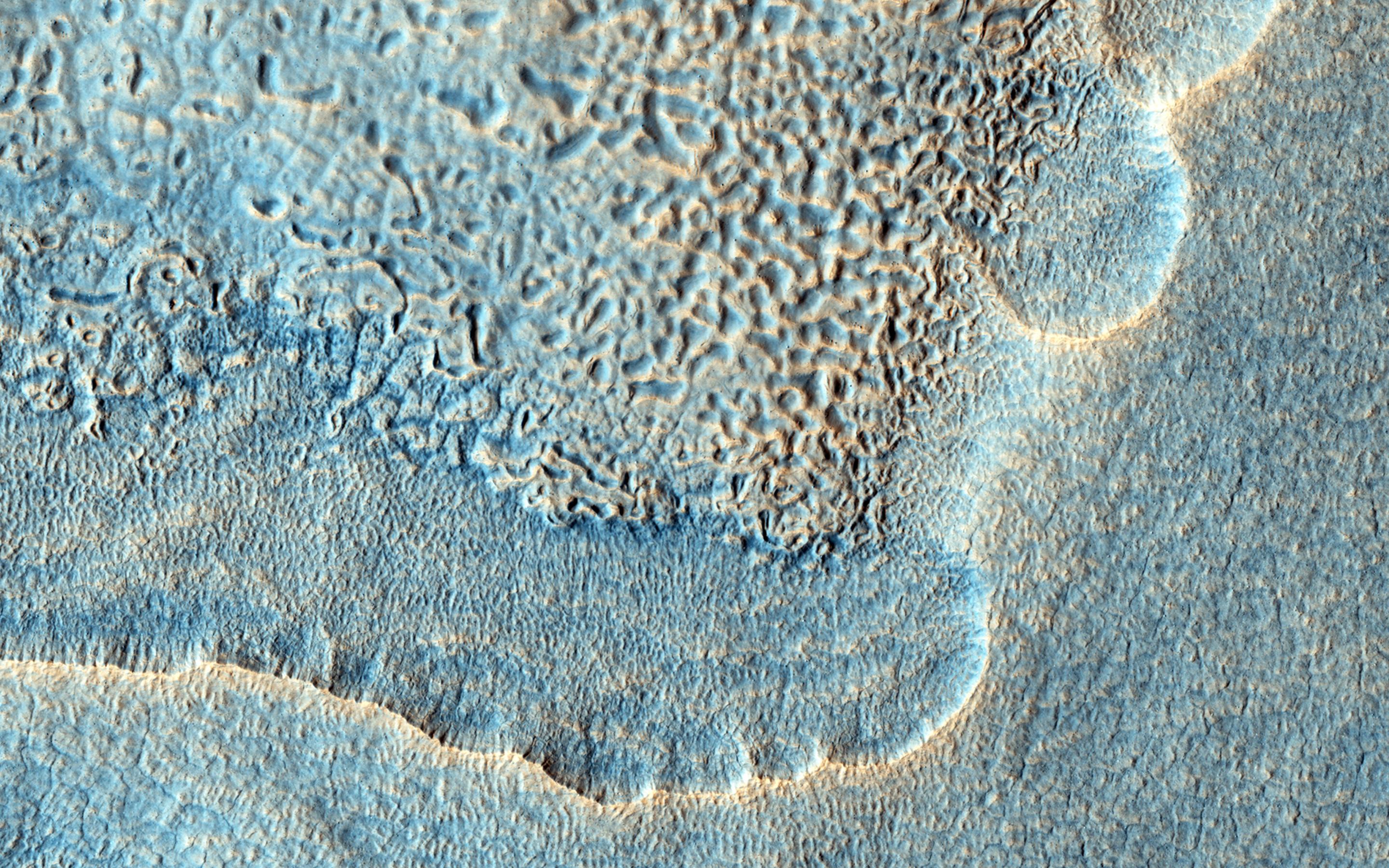
2014-05-28 |
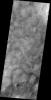
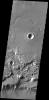
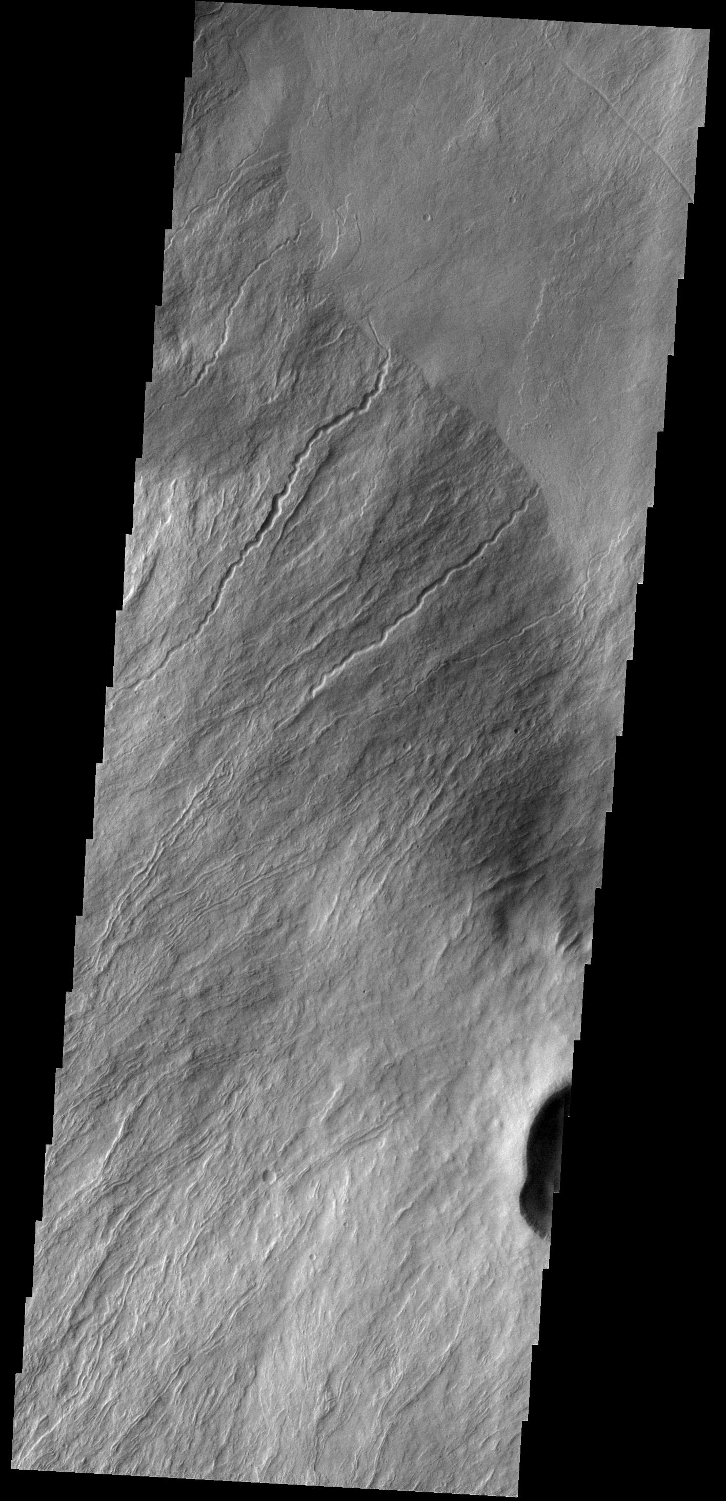
Mars
|
2001 Mars Odyssey
|
THEMIS
|
1416x2926x1 |
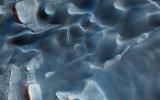
|
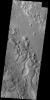
-
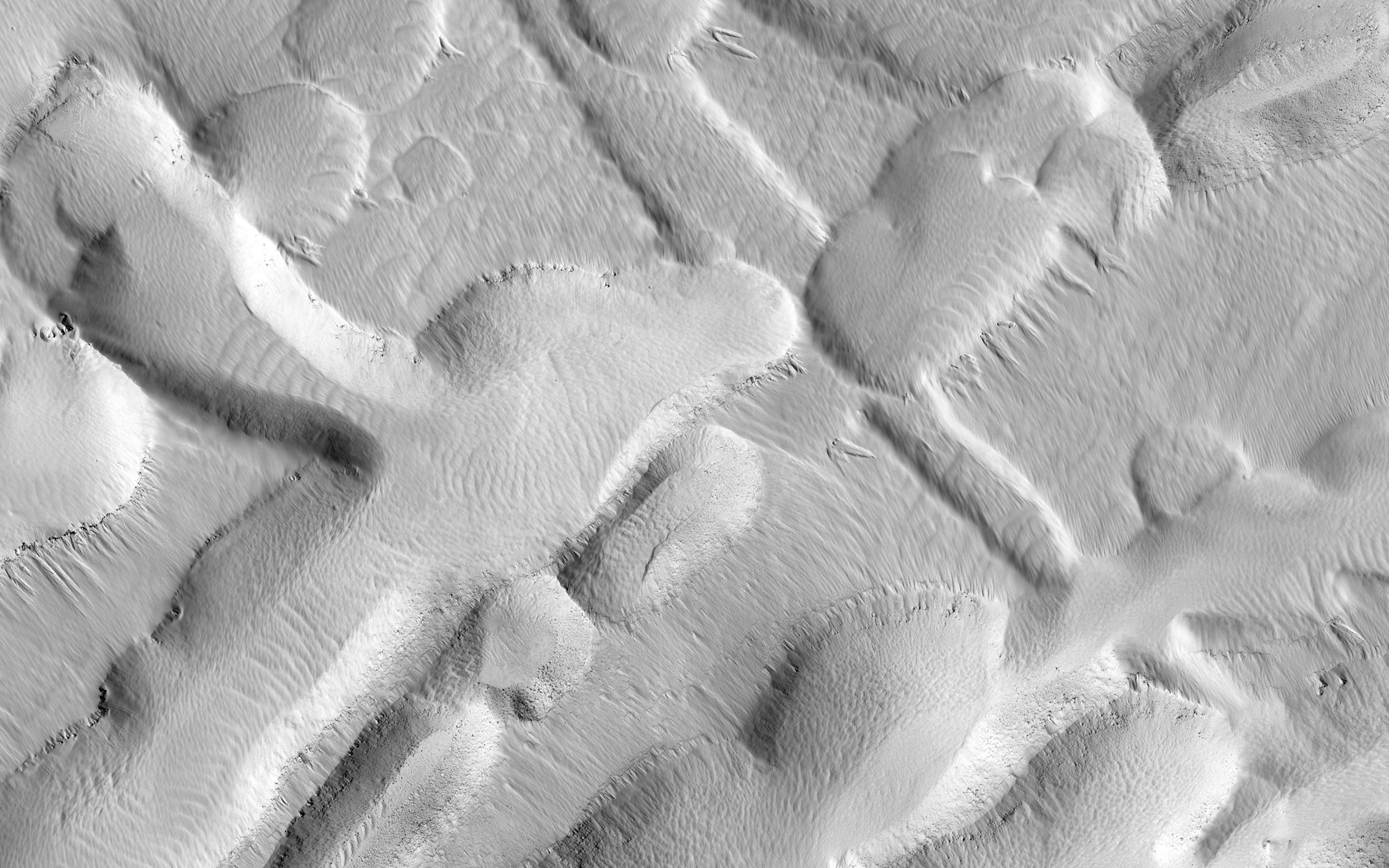
PIA18262:
-
Olympus Rupes
Full Resolution:
TIFF
(4.148 MB)
JPEG
(493.8 kB)
|
|
|
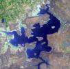
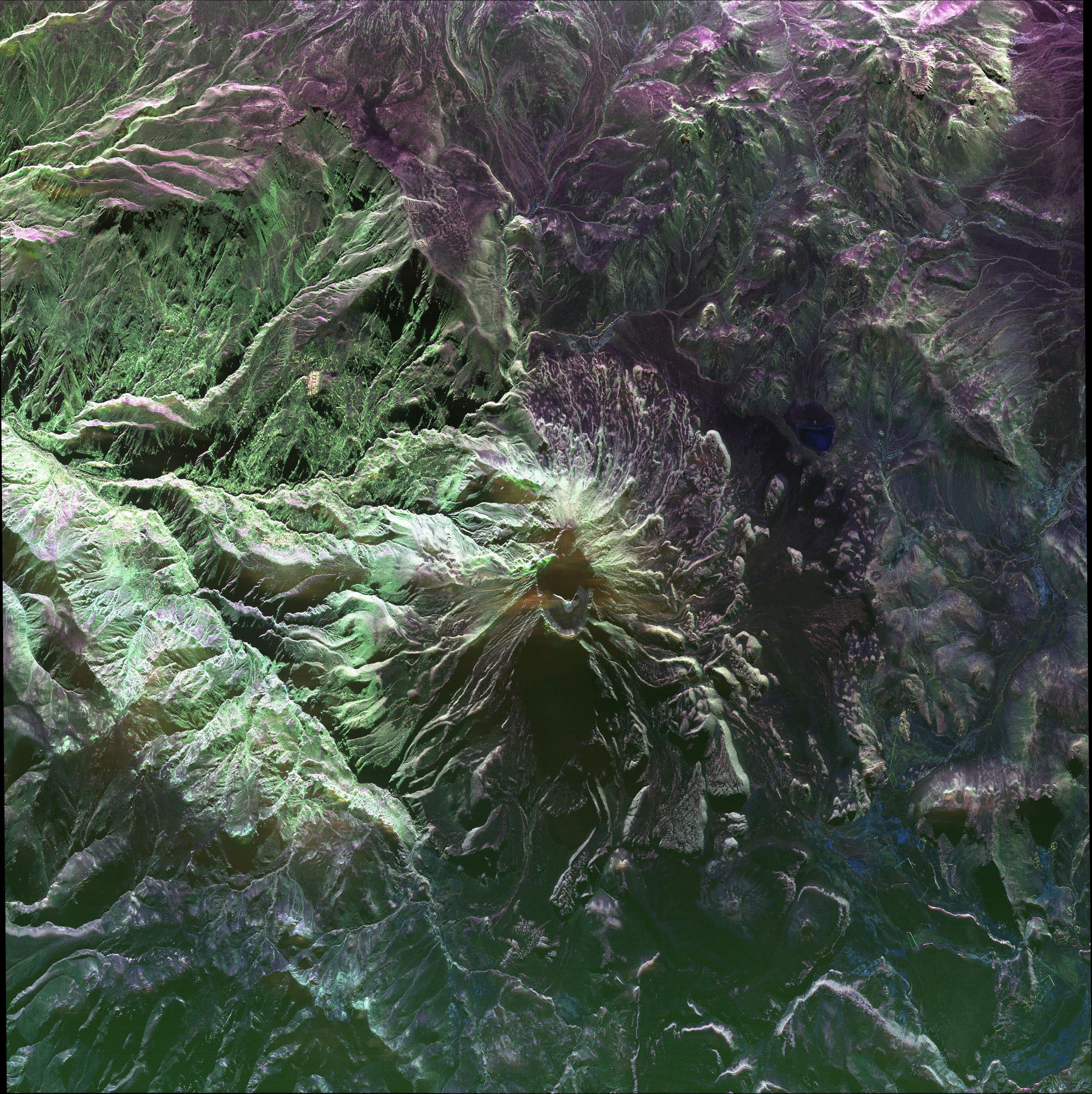
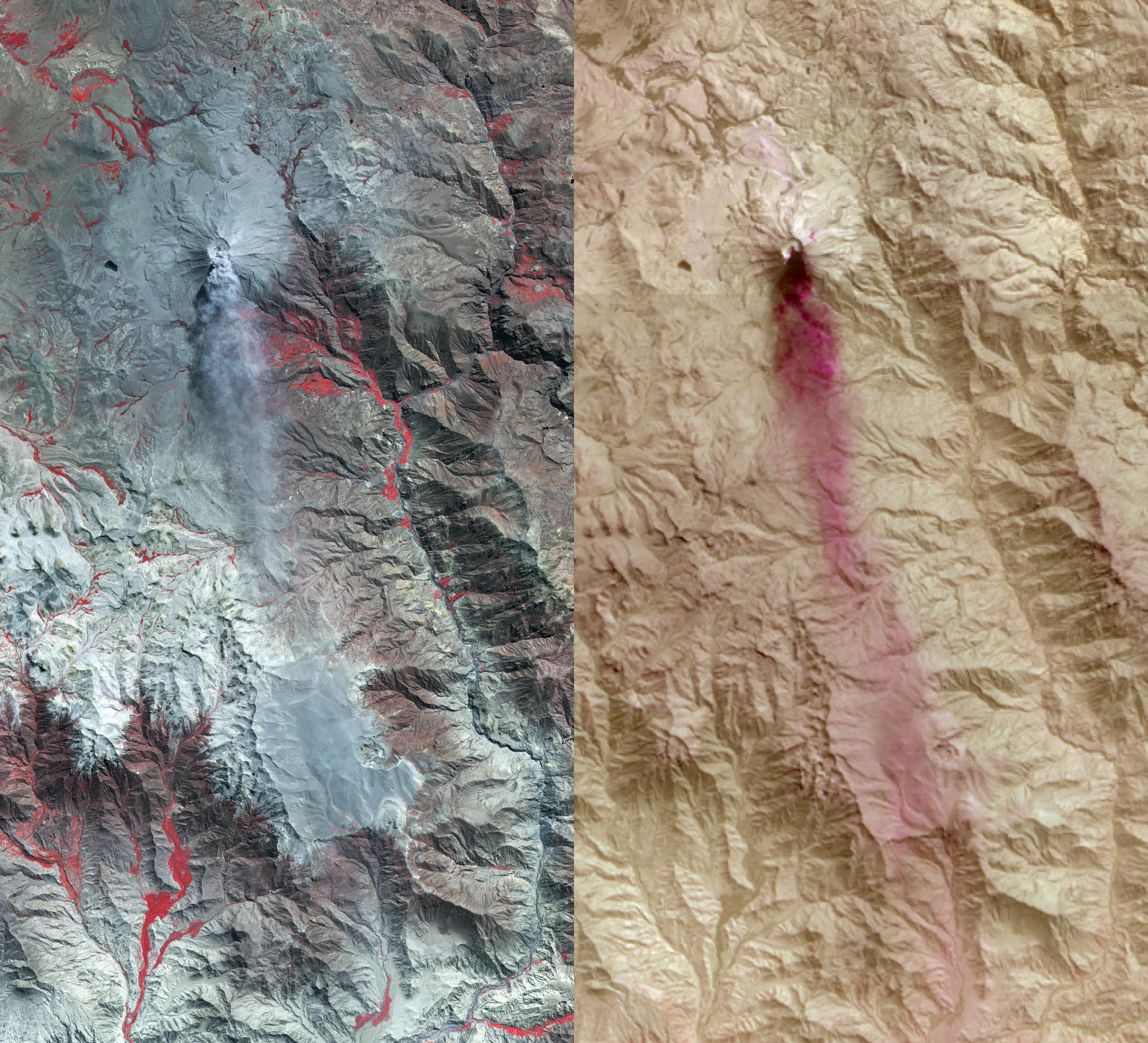
2014-05-27 |
Earth
|
UAVSAR
|
L-Band UAVSAR
|
3238x3244x3 |
|
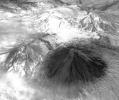
-
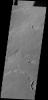
PIA18049:
-
UAVSAR image of Ubinas Volcano
Full Resolution:
TIFF
(31.53 MB)
JPEG
(2.65 MB)
|
|
|
2014-05-27 |
Titan
|
Cassini-Huygens
|
Visual and Infrared Mapping Spectrometer
|
4600x4600x3 |
|
-
PIA18410:
-
Cassini Observes Sunsets on Titan (Artist's Rendering)
Full Resolution:
TIFF
(63.52 MB)
JPEG
(428.5 kB)
|
|
|
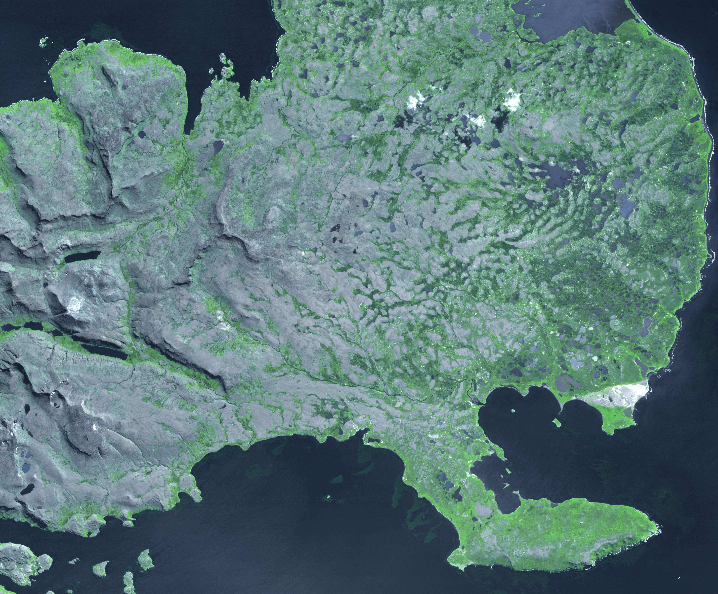
2014-05-27 |
Earth
|
Terra
|
ASTER
|
2855x2360x3 |

|
-
PIA18253:
-
Kerguelen Islands
Full Resolution:
TIFF
(20.22 MB)
JPEG
(997.1 kB)
|
|
|
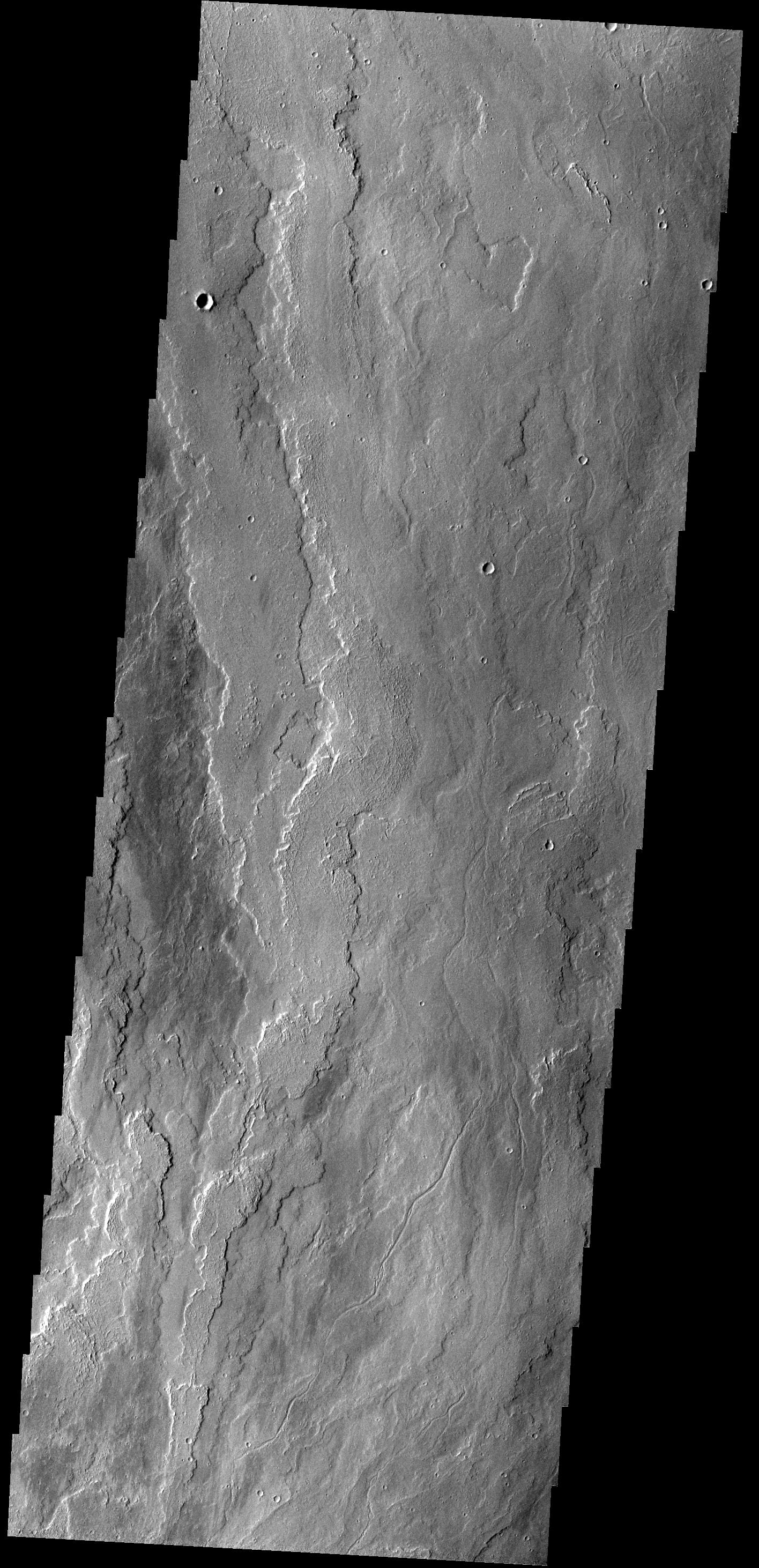
2014-05-27 |
Mars
|
2001 Mars Odyssey
|
THEMIS
|
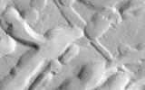
2411x3387x1 |
|
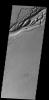
-
PIA18261:
-
More Siton Undae
Full Resolution:
TIFF
(8.175 MB)
JPEG
(403.1 kB)
|
|
|
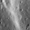
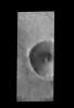
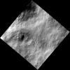
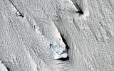
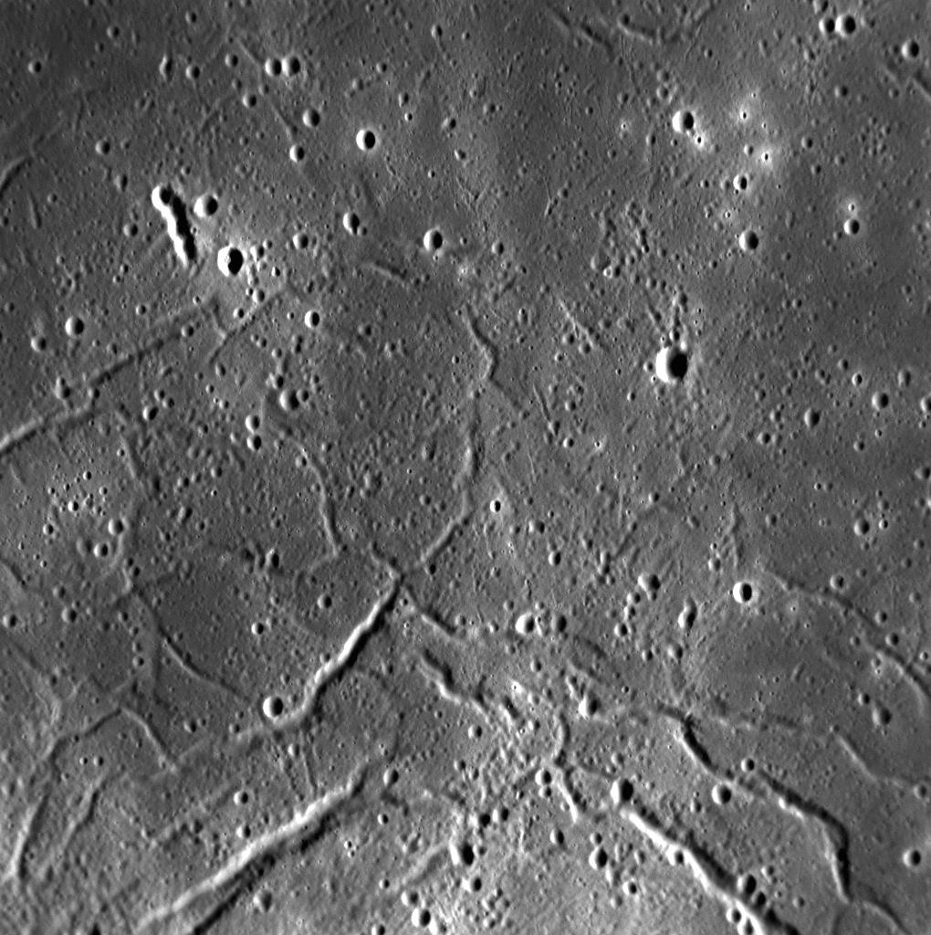
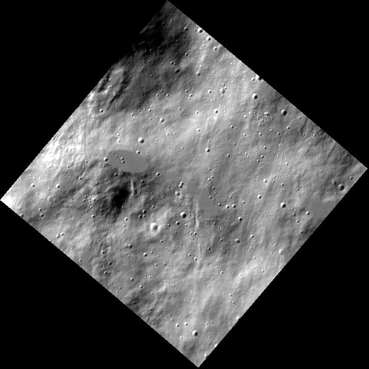
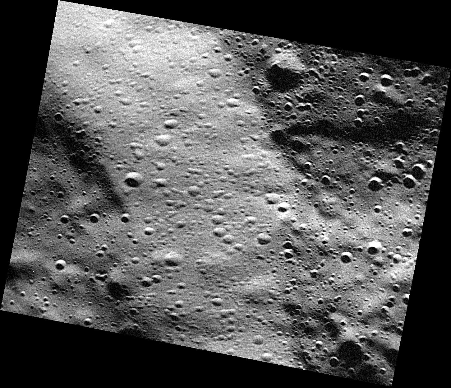
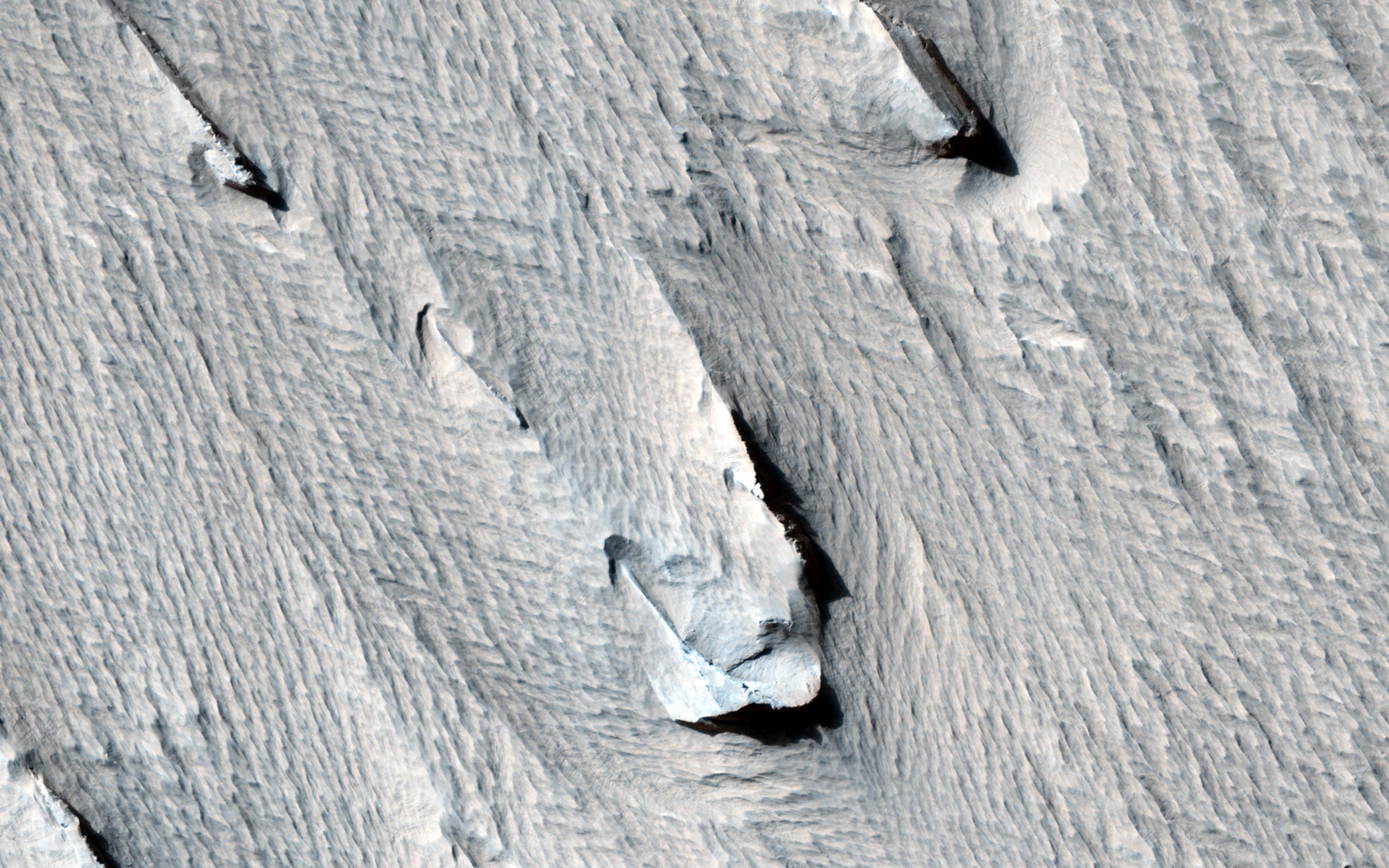
2014-05-26 |
Mercury
|
MESSENGER
|
MDIS - Narrow Angle
|
1020x1024x1 |

|
-
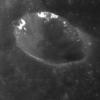
PIA18443:
-
Raditladi's Troughs
Full Resolution:
TIFF
(1.046 MB)
JPEG
(175.2 kB)
|
|
|
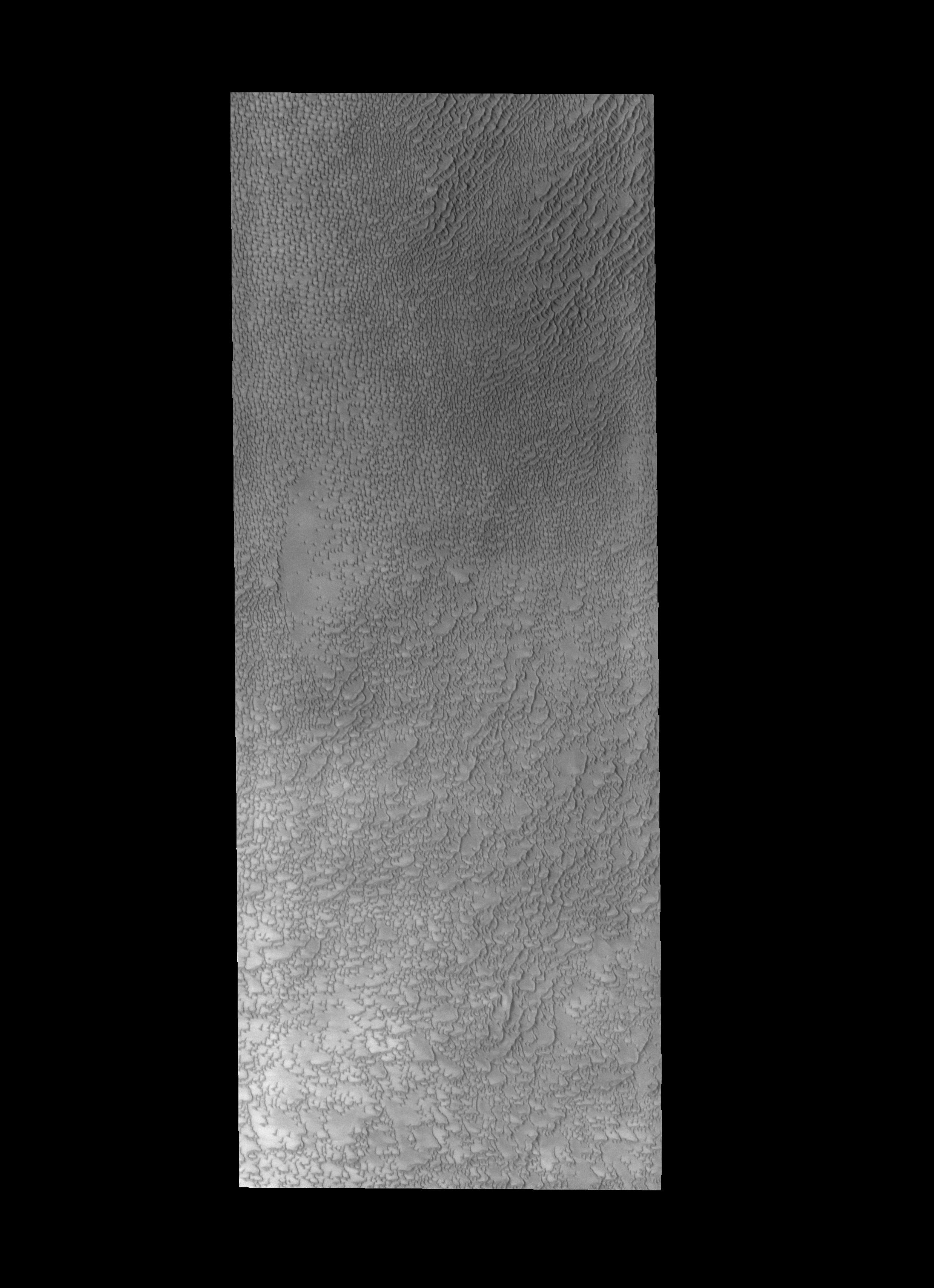
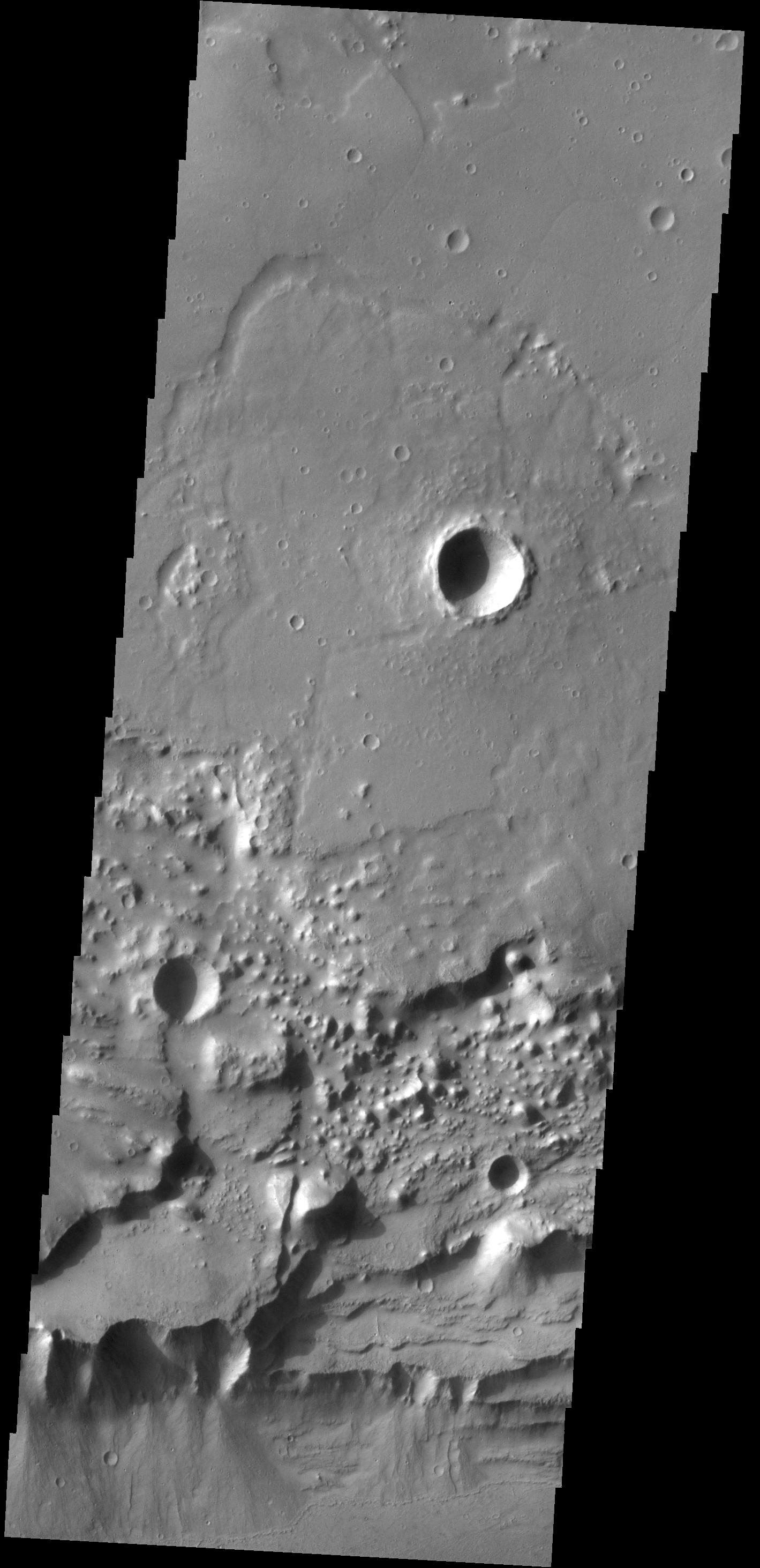
2014-05-26 |
Mars
|
2001 Mars Odyssey
|
THEMIS
|
2476x3416x1 |

|
-
PIA18260:
-
Siton Undae
Full Resolution:
TIFF
(8.467 MB)
JPEG
(561.3 kB)
|
|
|
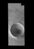
2014-05-26 |
Dione
|
Cassini-Huygens
|
ISS - Narrow Angle
|
381x405x1 |
|
-
PIA17165:
-
Evander Half in Shadow
Full Resolution:
TIFF
(154.7 kB)
JPEG
(3.549 kB)
|
|
|
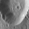
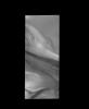
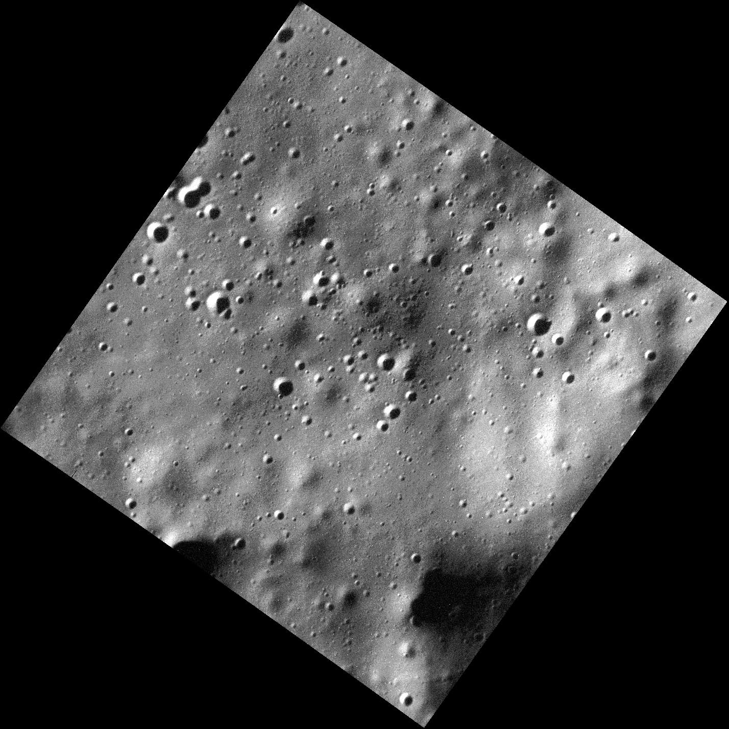
2014-05-23 |
Mercury
|
MESSENGER
|
MDIS - Narrow Angle
|
1094x1330x1 |

|
-
PIA18442:
-
The Madman and the Drunken Celestial
Full Resolution:
TIFF
(1.457 MB)
JPEG
(209.8 kB)
|
|
|
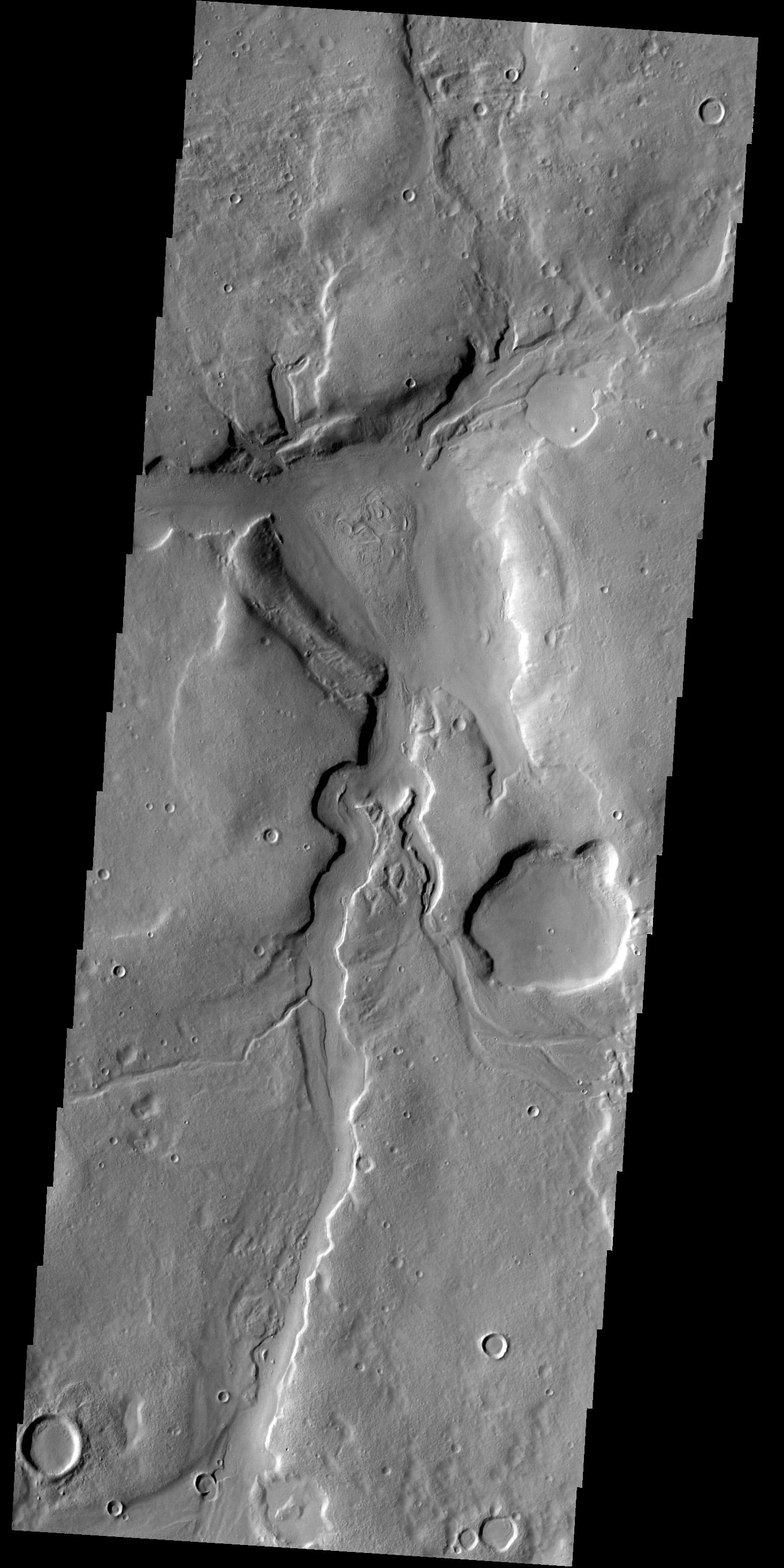
2014-05-23 |
Mars
|
2001 Mars Odyssey
|
THEMIS
|
1466x2931x1 |
|
-
PIA18259:
-
Channels
Full Resolution:
TIFF
(4.302 MB)
JPEG
(405.6 kB)
|
|
|
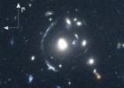
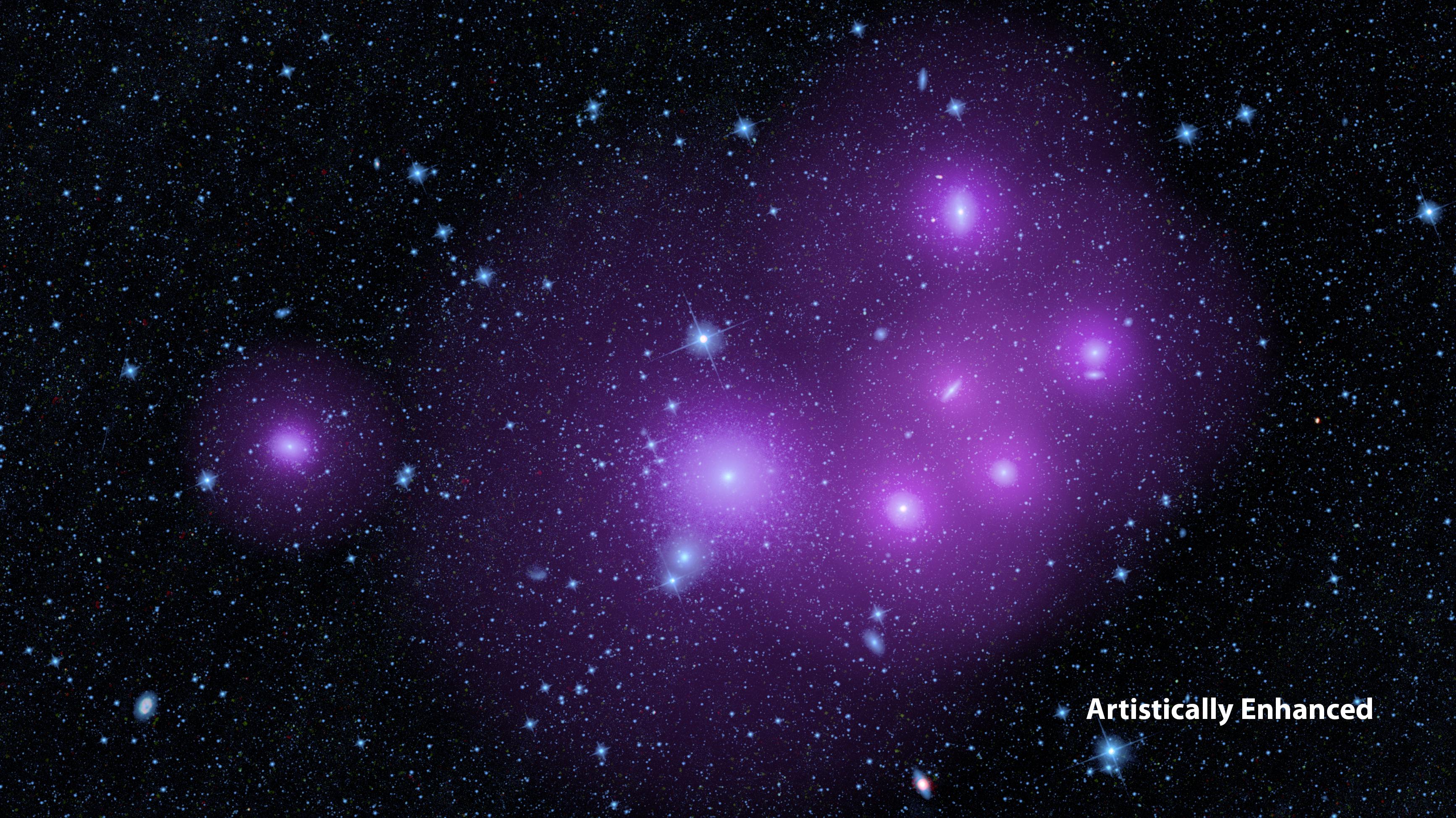
2014-05-22 |
|
Wide-field Infrared Survey Explorer (WISE)
|
|
2550x5500x3 |
|
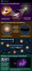
-
PIA18013:
-
Unified, or 'Doughnut,' Theory of Active, Black Holes
Full Resolution:
TIFF
(42.09 MB)
JPEG
(1.276 MB)
|
|
|
2014-05-22 |
|
Wide-field Infrared Survey Explorer (WISE)
|
WISE Telescope
|
3467x1949x3 |
|
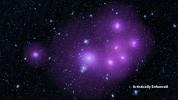
-
PIA18012:
-
The Clumping Behavior of Galaxies
Full Resolution:
TIFF
(20.28 MB)
JPEG
(1.191 MB)
|
|
|
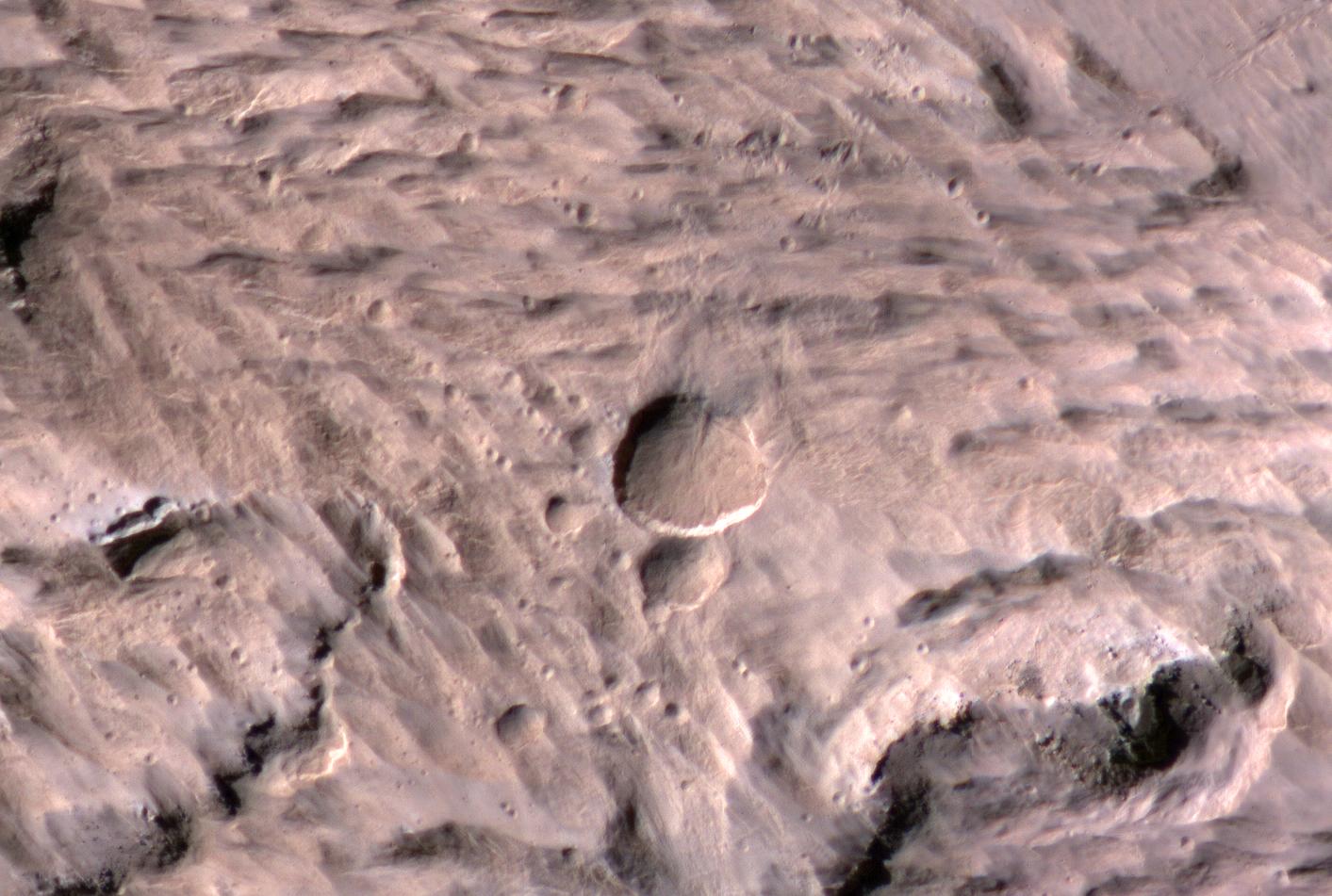
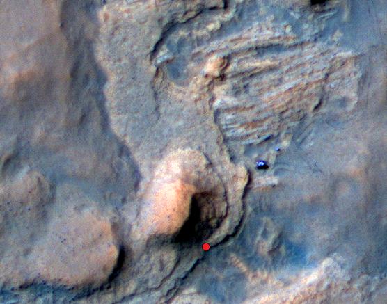
2014-05-22 |
Mars
|
Mars Reconnaissance Orbiter (MRO)
|
HiRISE
|
741x493x3 |
|
-
PIA18385:
-
Landslides Near Fresh Crater on Mars
Full Resolution:
TIFF
(1.097 MB)
JPEG
(56.47 kB)
|
|
|
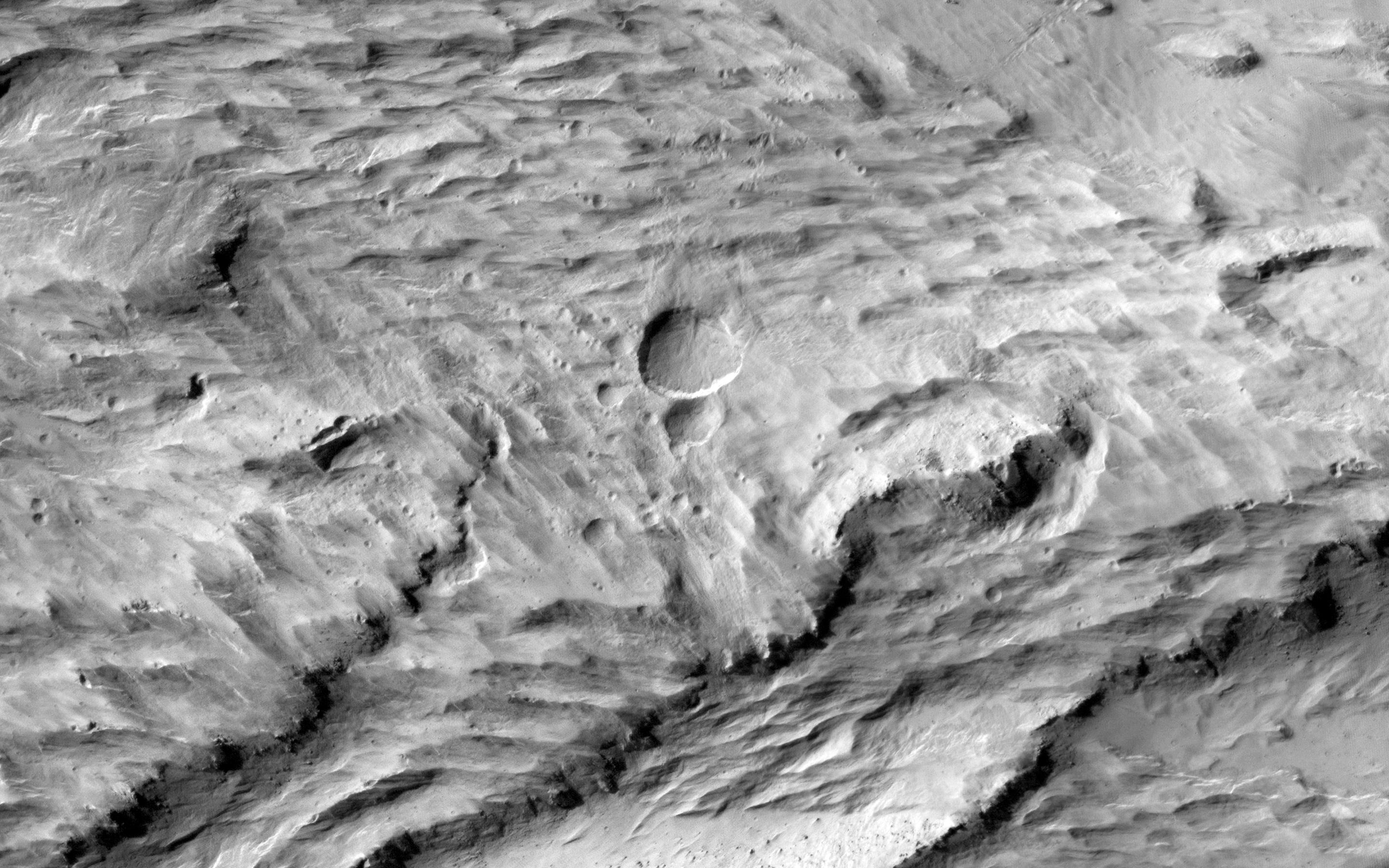
2014-05-22 |
Mars
|
Mars Reconnaissance Orbiter (MRO)
|
HiRISE
|
1413x951x3 |
|
-
PIA18384:
-
Large, Fresh Crater Surrounded by Smaller Craters
Full Resolution:
TIFF
(4.033 MB)
JPEG
(174.3 kB)
|
|
|
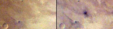
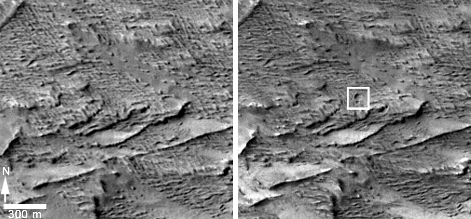
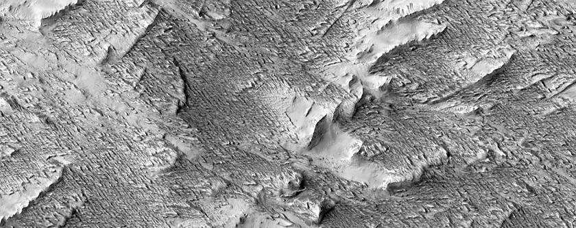
2014-05-22 |
Mars
|
Mars Reconnaissance Orbiter (MRO)
|
CTX
|
1500x699x1 |

|
-
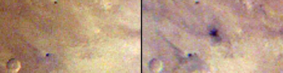
PIA18383:
-
Before-and-After Views Confirm Fresh Craters
Full Resolution:
TIFF
(1.05 MB)
JPEG
(153.2 kB)
|
|
|
2014-05-22 |
Mars
|
Mars Reconnaissance Orbiter (MRO)
|
HiRISE
|
2880x1800x1 |

|
-
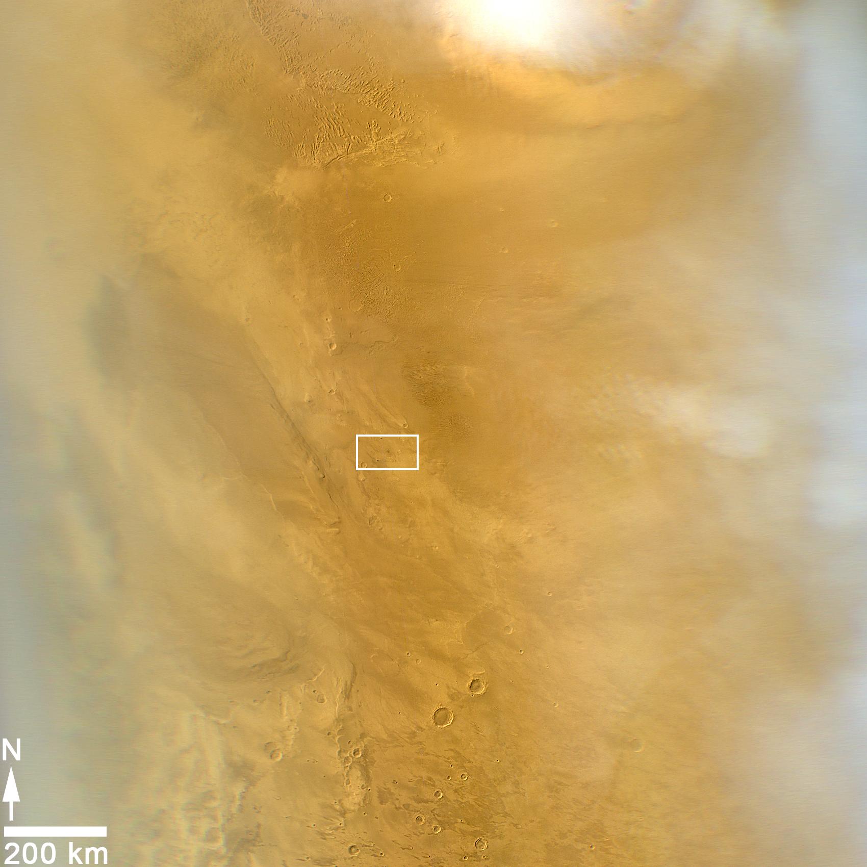
PIA18772:
-
Global Eyes on an Impact Prize
Full Resolution:
TIFF
(5.191 MB)
JPEG
(700.7 kB)
|
|
|
2014-05-22 |
Mars
|
Mars Reconnaissance Orbiter (MRO)
|
CTX
|
1980x2176x1 |
|
-
PIA18382:
-
Fresh Mars Crater Confirmed Within Impact Scar
Full Resolution:
TIFF
(4.313 MB)
JPEG
(1.148 MB)
|
|
|
2014-05-22 |
Mars
|
Mars Reconnaissance Orbiter (MRO)
|
HiRISE
|
2880x1800x3 |
|
-
PIA18771:
-
At the Edge of a Polar Cap
Full Resolution:
TIFF
(15.56 MB)
JPEG
(796.4 kB)
|
|
|
2014-05-22 |
Mars
|
Mars Reconnaissance Orbiter (MRO)
|
HiRISE
|
2880x1800x1 |
|
-
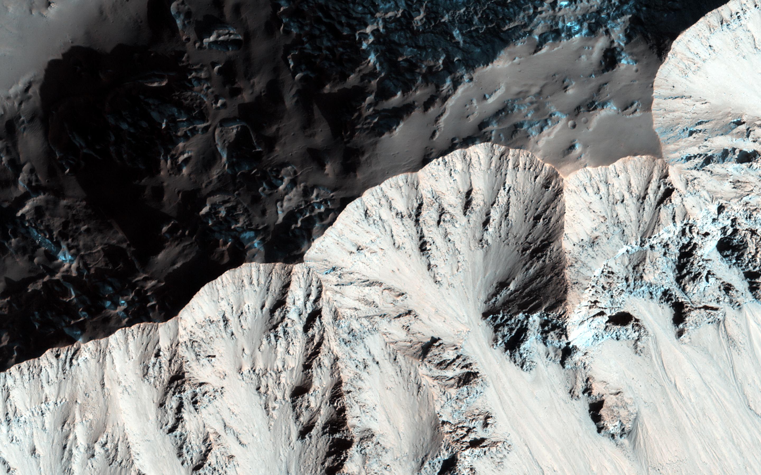
PIA18649:
-
The Busy Flank of Arsia Mons
Full Resolution:
TIFF
(5.191 MB)
JPEG
(682.4 kB)
|
|
|
2014-05-22 |
Mars
|
Mars Reconnaissance Orbiter (MRO)
|
MARCI
|
928x242x3 |
|
-
PIA18381:
Best-Ever Pinning Down When a Space Rock Hit Mars
Full Resolution:
TIFF
(674.2 kB)
JPEG
(28.52 kB)
|
|
|
2014-05-22 |
Mars
|
Mars Reconnaissance Orbiter (MRO)
|
MARCI
|
1700x1700x3 |

|
-
PIA18380:
-
Impact Scar Detected in Mars Weathercam Image
Full Resolution:
TIFF
(8.674 MB)
JPEG
(222.2 kB)
|
|
|
2014-05-22 |
Mars
|
Mars Reconnaissance Orbiter (MRO)
|
HiRISE
|
2880x1800x3 |
|
-
PIA18648:
-
What Gullies Can Say
Full Resolution:
TIFF
(15.56 MB)
JPEG
(696.7 kB)
|
|
|
2014-05-22 |
Mars
|
2001 Mars Odyssey
|
THEMIS
|
1504x2949x1 |
|
-
PIA18257:
-
Utopia Planitia
Full Resolution:
TIFF
(4.44 MB)
JPEG
(538.5 kB)
|
|
|
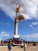
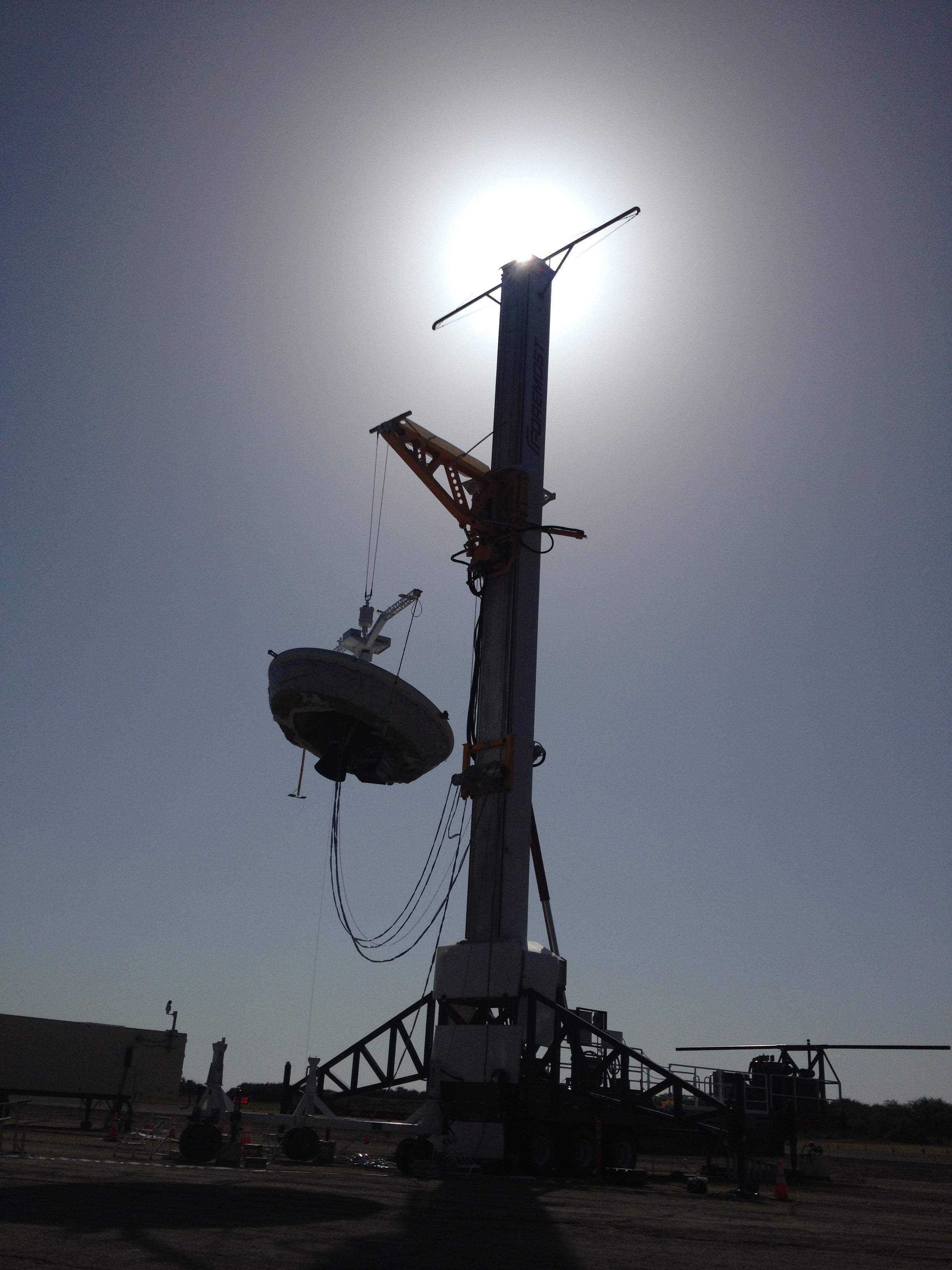
2014-05-21 |
|
LDSD
|
|
2448x3264x3 |
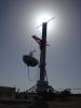
|
-
PIA18011:
-
Before the Drop: Engineers Ready Supersonic Decelerator
Full Resolution:
TIFF
(23.98 MB)
JPEG
(625.3 kB)
|
|
|
2014-05-21 |
|
Spitzer Space Telescope
|
IRAC
|
2500x2500x3 |
|
-
PIA18010:
-
Mapping the Densest Dusty Cloud Cores
Full Resolution:
TIFF
(18.76 MB)
JPEG
(1.225 MB)
|
|
|
2014-05-21 |
Mercury
|
MESSENGER
|
MDIS - Narrow Angle
|
1481x1482x1 |

|
-
PIA18441:
-
Stop Hitting Me
Full Resolution:
TIFF
(2.197 MB)
JPEG
(171.4 kB)
|
|
|
2014-05-21 |
Mars
|
Mars Reconnaissance Orbiter (MRO)
|
HiRISE
|
840x333x1 |
|
-
PIA17482:
-
New Impact Site
Full Resolution:
TIFF
(280.2 kB)
JPEG
(95.43 kB)
|
|
|
2014-05-21 |
Mars
|
2001 Mars Odyssey
|
THEMIS
|
1473x2934x1 |
|
-
PIA18256:
-
Chaos
Full Resolution:
TIFF
(4.327 MB)
JPEG
(442.7 kB)
|
|
|
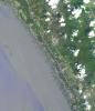
2014-05-20 |
Earth
|
Terra
|
ASTER
|
1504x1267x1 |
|
-
PIA18379:
-
NASA Spacecraft Spots Signs of Erupting Russian Volcano
Full Resolution:
TIFF
(1.908 MB)
JPEG
(297.3 kB)
|
|
|
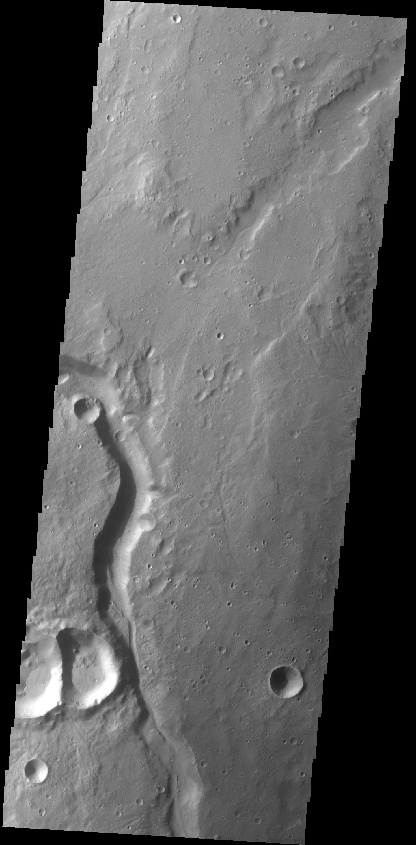
2014-05-20 |
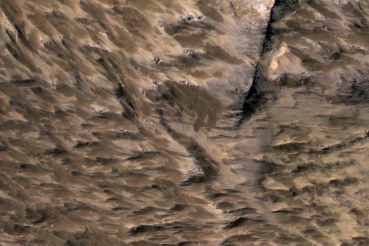
Mars
|
2001 Mars Odyssey
|
THEMIS
|
1432x2924x1 |
|
-
PIA18255:
-
Olympica Fossae
Full Resolution:
TIFF
(4.192 MB)
JPEG
(293.3 kB)
|
|
|
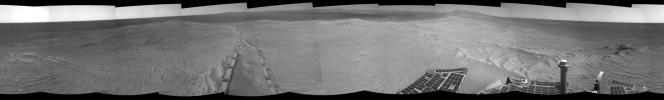
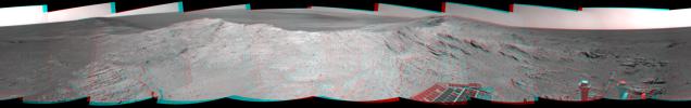
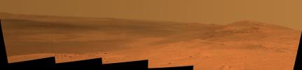
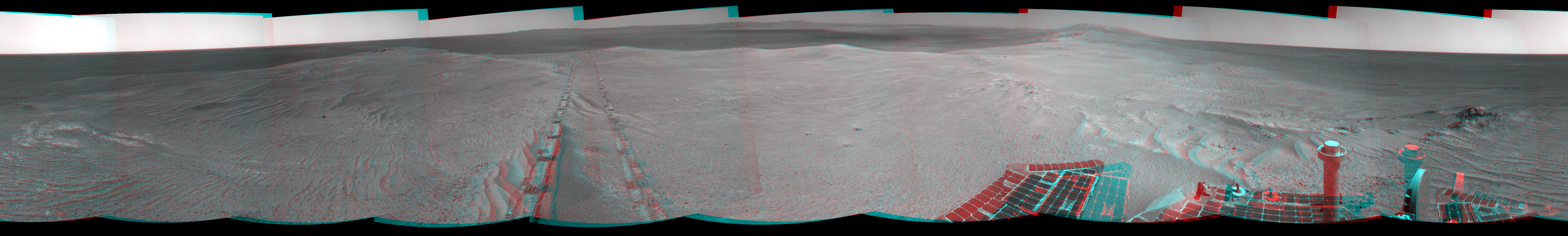
2014-05-19 |
Mars
|
Mars Exploration Rover (MER)
|
Navigation Camera
|
7753x1168x3 |
|
-
PIA18099:
Opportunity's Tracks Near Crater Rim Ridgeline (Stereo)
Full Resolution:
TIFF
(27.18 MB)
JPEG
(1.024 MB)
|
|
|
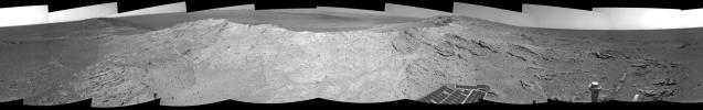
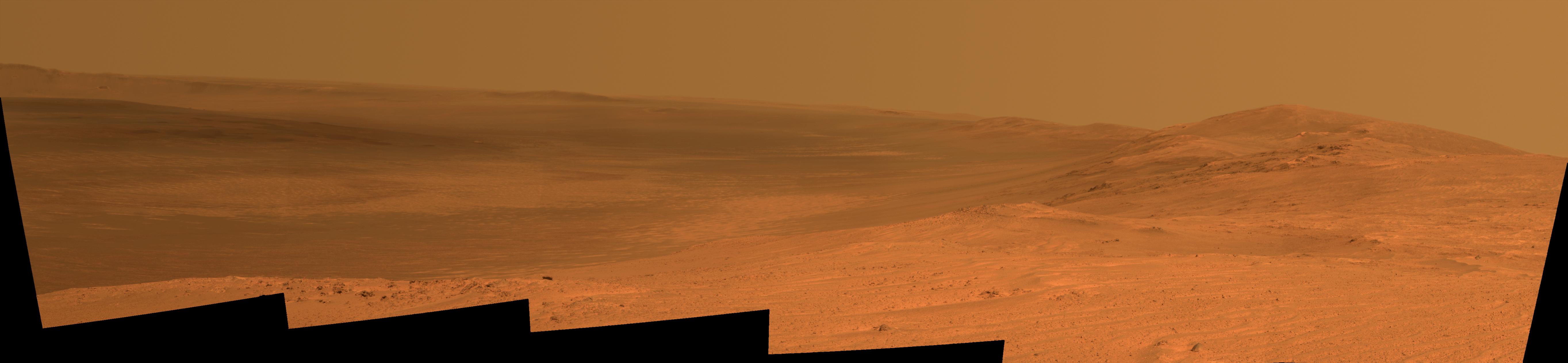
2014-05-19 |
Mars
|
Mars Exploration Rover (MER)
|
Navigation Camera
|
7753x1168x1 |
|
-
PIA18098:
Opportunity's Tracks Near Crater Rim Ridgeline
Full Resolution:
TIFF
(9.065 MB)
JPEG
(993.8 kB)
|
|
|
2014-05-19 |
Mars
|
Mars Exploration Rover (MER)
|
Navigation Camera
|
7753x1217x3 |
|
-
PIA18096:
Approaching a Target Deposit on Mars Crater Rim (Stereo)
Full Resolution:
TIFF
(28.32 MB)
JPEG
(1.311 MB)
|
|
|
2014-05-19 |
Mars
|
Mars Exploration Rover (MER)
|
Navigation Camera
|
7753x1217x1 |
|
-
PIA18095:
Approaching a Target Deposit on Mars Crater Rim
Full Resolution:
TIFF
(9.445 MB)
JPEG
(1.222 MB)
|
|
|
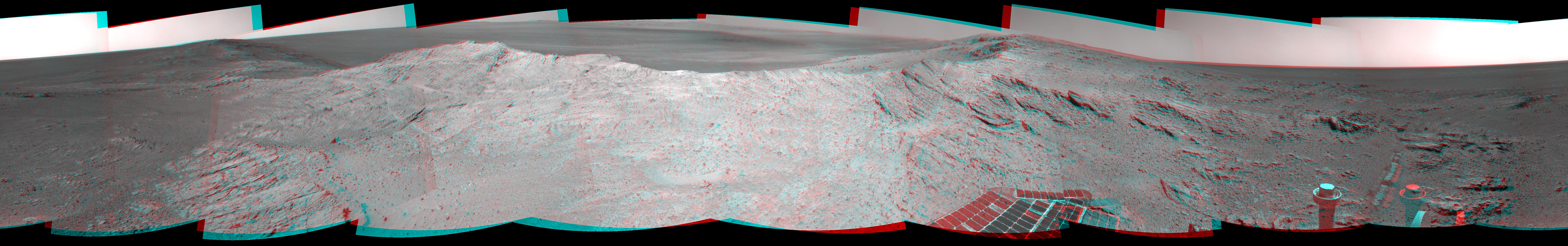
2014-05-19 |
Mars
|
Mars Exploration Rover (MER)
|
Panoramic Camera
|
5454x1264x3 |
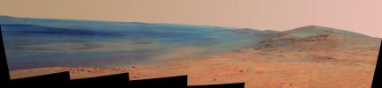
|
-
PIA18094:
Endeavour Crater Rim From 'Murray Ridge' on Mars, False Color
Full Resolution:
TIFF
(20.69 MB)
JPEG
(598 kB)
|
|
|
2014-05-19 |
Mars
|
Mars Exploration Rover (MER)
|
Panoramic Camera
|
5454x1264x3 |
|
-
PIA18093:
Endeavour Crater Rim From 'Murray Ridge' on Mars
Full Resolution:
TIFF
(20.69 MB)
JPEG
(398 kB)
|
|
|
2014-05-19 |
Mercury
|
MESSENGER
|
MDIS - Narrow Angle
|
1020x1024x1 |

|
-
PIA18440:
-
Tears Roll Down
Full Resolution:
TIFF
(1.046 MB)
JPEG
(215.9 kB)
|
|
|
2014-05-19 |
Mars
|
2001 Mars Odyssey
|
THEMIS
|
1441x2924x1 |

|
-
PIA18254:
-
Channel
Full Resolution:
TIFF
(4.218 MB)
JPEG
(318.1 kB)
|
|
|
2014-05-19 |
Tethys
|
Cassini-Huygens
|
ISS - Narrow Angle
|
501x500x1 |
|
-
PIA17164:
-
Tethys' Terrains
Full Resolution:
TIFF
(251 kB)
JPEG
(4.591 kB)
|
|
|
2014-05-16 |
|
LDSD
|
Parachute Deployment Device
|
1067x1600x3 |
|
-
PIA18008:
-
Prepping the Parachute Deployment Device
Full Resolution:
TIFF
(5.124 MB)
JPEG
(200.6 kB)
|
|
|
2014-05-16 |
|
LDSD
|
|
1224x1632x3 |
|
-
PIA18007:
-
Hanging Saucer
Full Resolution:
TIFF
(5.995 MB)
JPEG
(244.8 kB)
|
|
|
2014-05-16 |
|
LDSD
|
|
3264x2448x3 |

|
-
PIA18006:
-
Preparing for a Supersonic Test
Full Resolution:
TIFF
(23.98 MB)
JPEG
(1.005 MB)
|
|
|
2014-05-16 |
Mercury
|
MESSENGER
|
MDIS - Narrow Angle
|
512x512x1 |
|
-
PIA18378:
-
Small Scarp Seen!
Full Resolution:
TIFF
(262.6 kB)
JPEG
(40.53 kB)
|
|
|
2014-05-16 |
Earth
|
Terra
|
ASTER
|
687x798x3 |
|
-
PIA18258:
-
Shipbreaking, Bangladesh
Full Resolution:
TIFF
(1.645 MB)
JPEG
(124.2 kB)
|
|
|
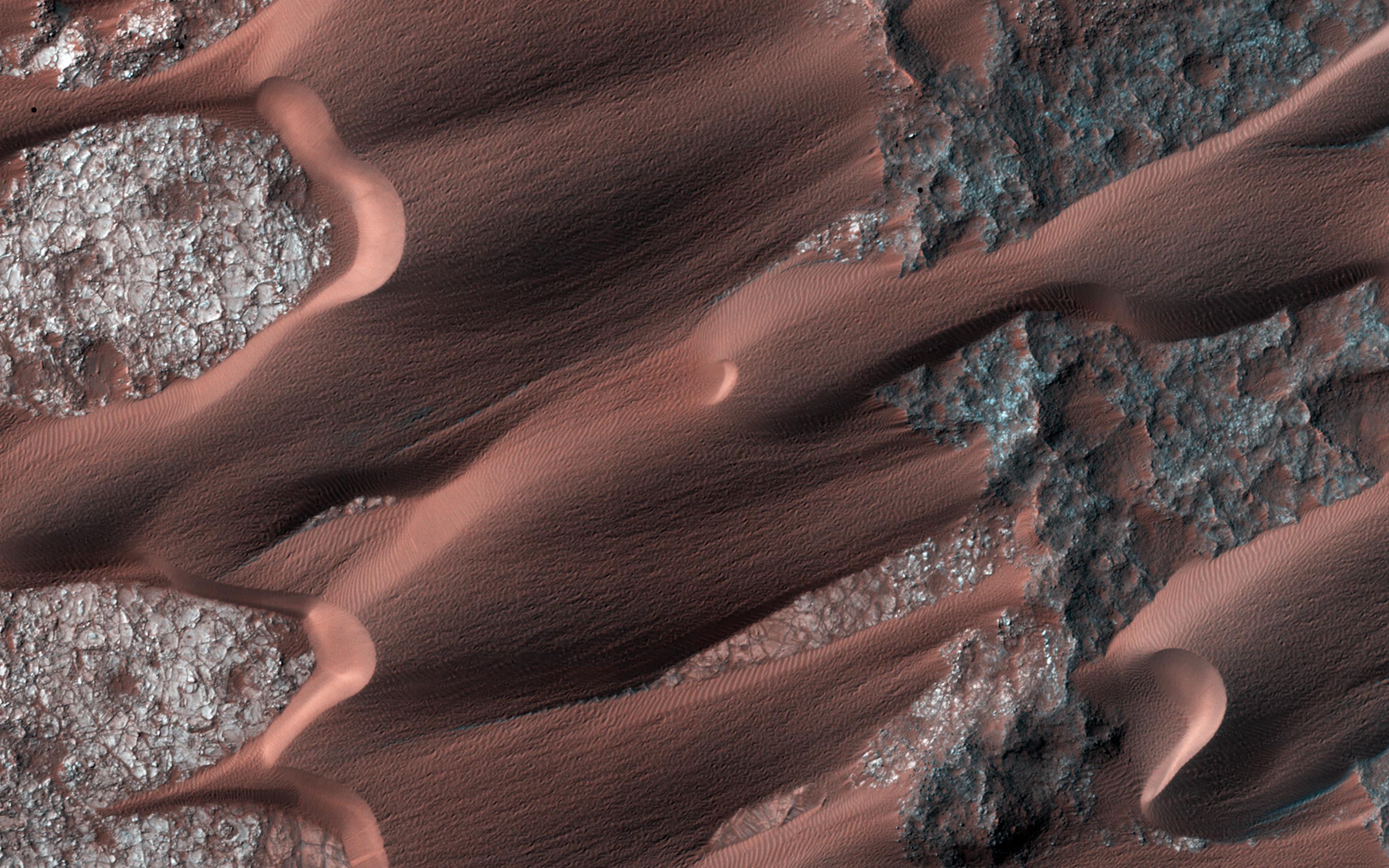
2014-05-16 |
Mars
|
2001 Mars Odyssey
|
THEMIS
|
2346x3374x1 |
|
-
PIA18252:
-
Crater Dunes
Full Resolution:
TIFF
(7.925 MB)
JPEG
(237.9 kB)
|
|
|
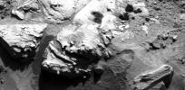
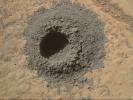
2014-05-15 |
Mars
|
Mars Science Laboratory (MSL)
|
MAHLI
|
1184x1272x3 |
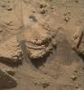
|
-
PIA18092:
-
Mars Rock 'Windjana' After Examination
Full Resolution:
TIFF
(4.52 MB)
JPEG
(331 kB)
|
|
|
2014-05-15 |
Mars
|
Mars Science Laboratory (MSL)
|
MAHLI
|
1181x1580x3 |
|
-
PIA18091:
-
Nighttime Image of Laser Sharpshooting on Mars
Full Resolution:
TIFF
(5.6 MB)
JPEG
(418.9 kB)
|
|
|
2014-05-15 |
Comet
|
Rosetta
|
OSIRIS
|
1000x1000x3 |
|
-
PIA18376:
-
Rosetta's Comet Comes Alive

Full Resolution:
TIFF
(1.003 MB)
JPEG
(121.1 kB)
|
|
|
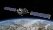
2014-05-15 |
|
OCO-2
|
OCO-2
|
10666x6000x3 |
|
-
PIA18374:
-
NASA's Orbiting Carbon Observatory (OCO)-2 (Artist Concept)
Full Resolution:
TIFF
(192 MB)
JPEG
(2.768 MB)
|
|
|
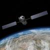
2014-05-15 |
|
OCO-2
|
OCO-2
|
8192x8192x3 |
|
-
PIA18375:
-
NASA's Orbiting Carbon Observatory (OCO)-2 (Artist Concept)
Full Resolution:
TIFF
(201.4 MB)
JPEG
(3.092 MB)
|
|
|
2014-05-15 |
Mars
|
2001 Mars Odyssey
|
THEMIS
|
1464x2928x1 |
|
-
PIA18251:
-
Tempe Terra
Full Resolution:
TIFF
(4.291 MB)
JPEG
(420.5 kB)
|
|
|
2014-05-14 |
Mercury
|
MESSENGER
|
MDIS - Narrow Angle
|
512x512x1 |

|
-
PIA18377:
-
Rim Riddle Revealed!
Full Resolution:
TIFF
(262.6 kB)
JPEG
(26.76 kB)
|
|
|
2014-05-14 |
Mars
|
2001 Mars Odyssey
|
THEMIS
|
2277x3343x1 |
|
-
PIA18250:
-
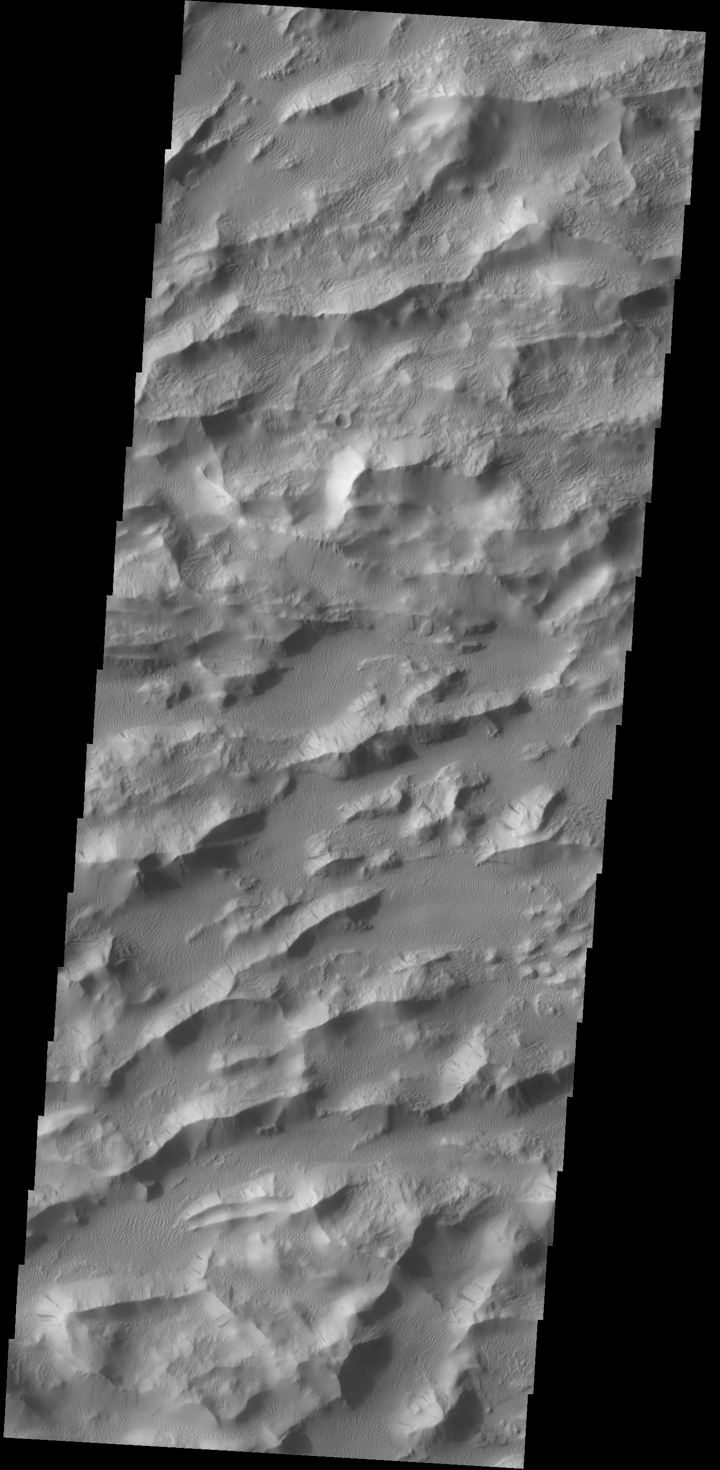
Crater Dunes
Full Resolution:
TIFF
(7.621 MB)
JPEG
(223.3 kB)
|
|
|
2014-05-13 |
Mars
|
2001 Mars Odyssey
|
THEMIS
|
2378x3385x1 |

|
-
PIA18240:
-
Crater Dunes
Full Resolution:
TIFF
(8.059 MB)
JPEG
(270.6 kB)
|
|
|
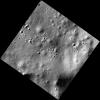
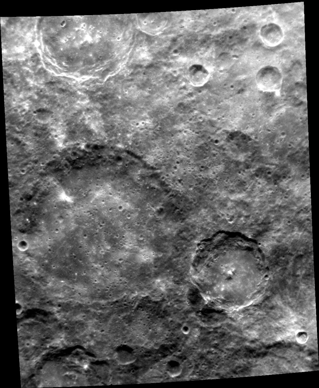
2014-05-12 |
Mercury
|
MESSENGER
|
MDIS - Narrow Angle
|
1024x1024x1 |
|
-
PIA18372:
-
Crater Close-up Captured!
Full Resolution:
TIFF
(1.05 MB)
JPEG
(128.5 kB)
|
|
|
2014-05-12 |
Mars
|
2001 Mars Odyssey
|
THEMIS
|
1402x2922x1 |

|
-
PIA18239:
-
Tartarus Colles
Full Resolution:
TIFF
(4.102 MB)
JPEG
(289 kB)
|
|
|
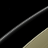
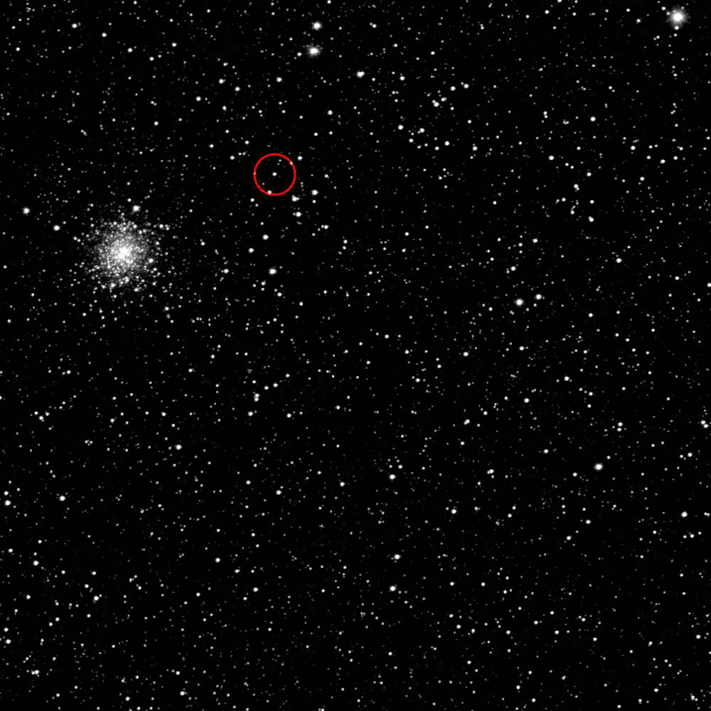
2014-05-12 |
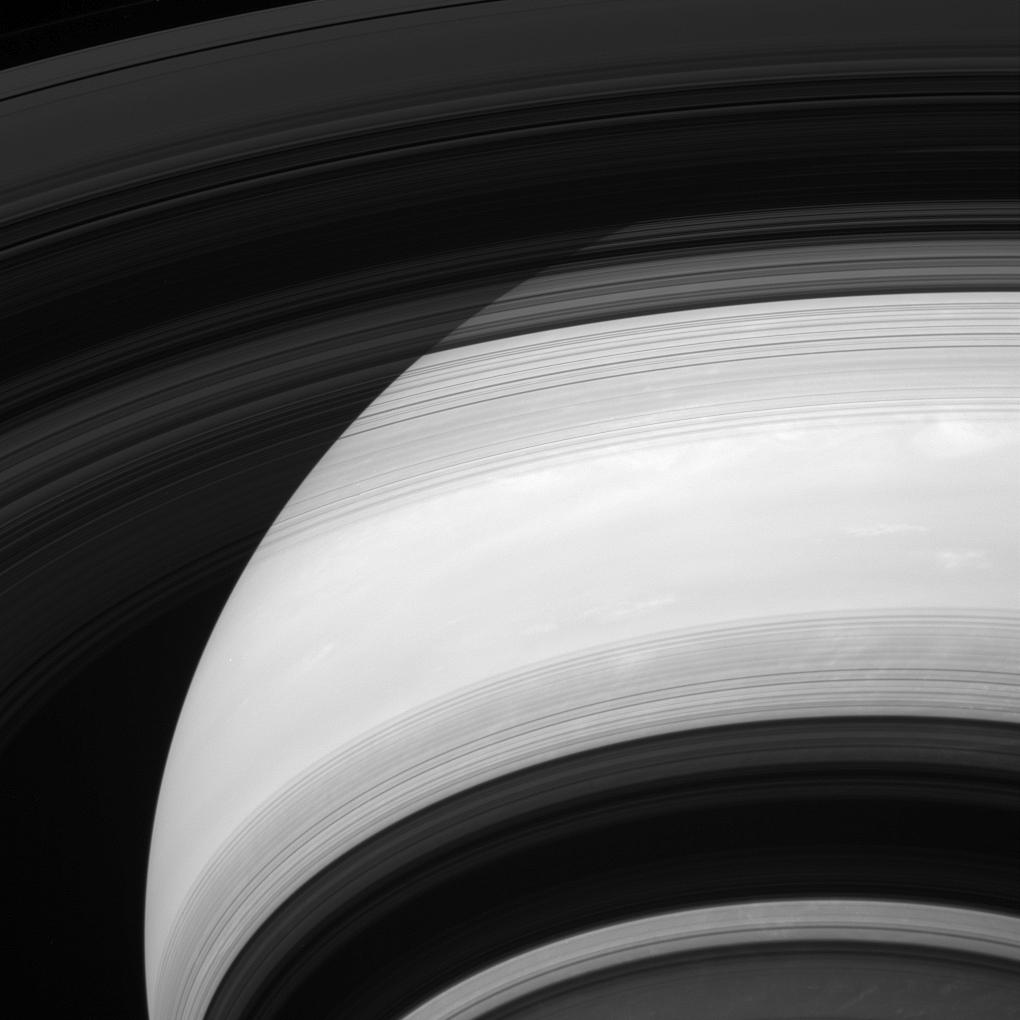
S Rings
|
Cassini-Huygens
|
ISS - Wide Angle
|
1024x1024x1 |
|
-
PIA17143:
-
Still Alive
Full Resolution:
TIFF
(1.05 MB)
JPEG
(69.87 kB)
|
|
|
2014-05-09 |
Earth
|
Terra
|
ASTER
|
1782x1754x3 |
|
-
PIA18373:
-
Nagarjuna Sagar Dam, India
Full Resolution:
TIFF
(9.381 MB)
JPEG
(513.8 kB)
|
|
|
2014-05-09 |
Mercury
|
MESSENGER
|
MDIS - Narrow Angle
|
724x724x1 |
|
-
PIA18371:
-
Circus Maximus
Full Resolution:
TIFF
(524.9 kB)
JPEG
(54.59 kB)
|
|
|
2014-05-09 |
Mars
|
2001 Mars Odyssey
|
THEMIS
|
2907x3561x1 |
|
-
PIA18238:
-
Polar Layers
Full Resolution:
TIFF
(10.37 MB)
JPEG
(385.2 kB)
|
|
|
2014-05-08 |
Mercury
|
MESSENGER
|
MDIS - Narrow Angle
|
1428x1428x1 |
|
-
PIA18370:
-
Up Close and Personal
Full Resolution:
TIFF
(2.042 MB)
JPEG
(304.4 kB)
|
|
|
2014-05-08 |
Mars
|
2001 Mars Odyssey
|
THEMIS
|
2295x3360x1 |

|
-
PIA18237:
-
Polar Dunes
Full Resolution:
TIFF
(7.72 MB)
JPEG
(618.4 kB)
|
|
|
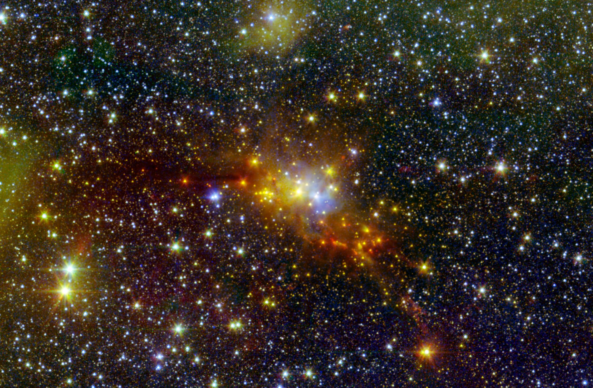
2014-05-07 |
|
Chandra X-ray Observatory
Spitzer Space Telescope
|
|
3600x3600x3 |
|
-
PIA18249:
-
Inside the Flame Nebula
Full Resolution:
TIFF
(38.89 MB)
JPEG
(874.9 kB)
|
|
|
2014-05-07 |
Mars
|
2001 Mars Odyssey
|
THEMIS
|
1434x2928x1 |
|
-
PIA18236:
-
Lycus Sulci
Full Resolution:
TIFF
(4.204 MB)
JPEG
(365.6 kB)
|
|
|
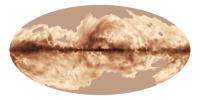
2014-05-06 |
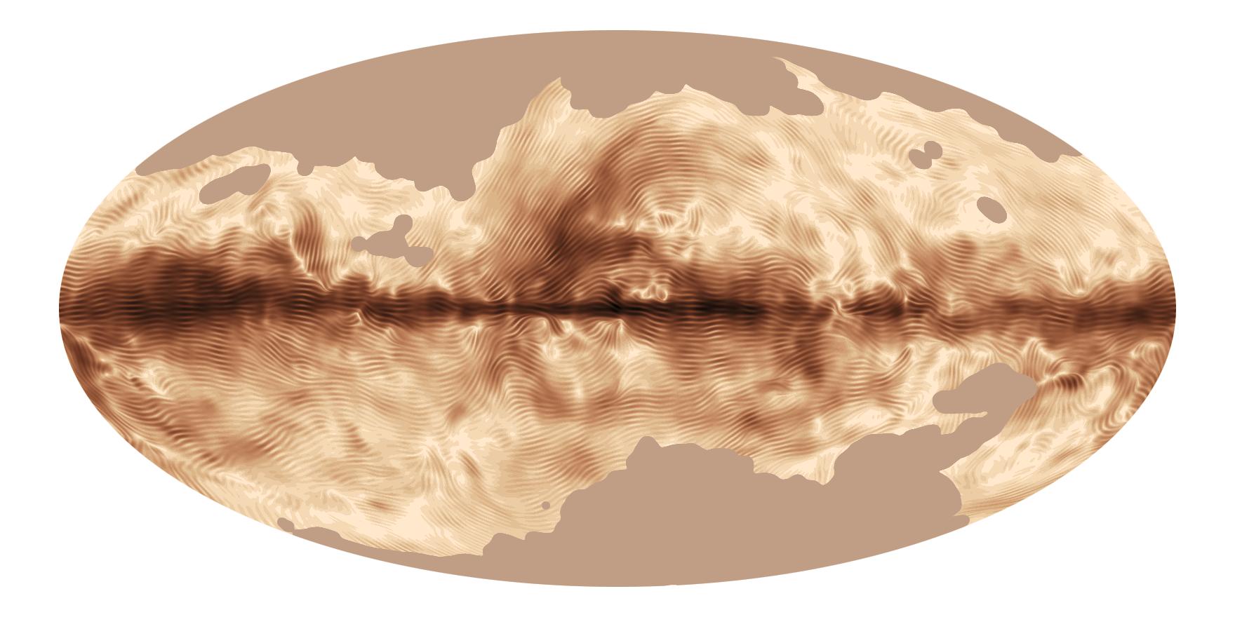
|
Planck
|
|
1760x880x3 |
|
-
PIA18048:
-
Magnetic Map of Milky Way
Full Resolution:
TIFF
(4.648 MB)
JPEG
(127.3 kB)
|
|
|
2014-05-06 |
Mars
|
Mars Science Laboratory (MSL)
|
Navigation Camera
|
598x293x1 |
|
-
PIA18090:
-
Sample-Collection Drill Hole on Martian Sandstone Target 'Windjana'
Full Resolution:
TIFF
(175.6 kB)
JPEG
(42.97 kB)
|
|
|
2014-05-06 |
Mars
|
2001 Mars Odyssey
|
THEMIS
|
1455x2931x1 |

|
-
PIA18235:
-
Ceraunius Fossae
Full Resolution:
TIFF
(4.27 MB)
JPEG
(287.1 kB)
|
|
|
2014-05-05 |
Mercury
|
MESSENGER
|
MDIS - Narrow Angle
|
508x512x1 |
|
-
PIA18248:
-
The Hills
Full Resolution:
TIFF
(260.6 kB)
JPEG
(41.54 kB)
|
|
|
2014-05-05 |
Mars
|
2001 Mars Odyssey
|
THEMIS
|
1415x2924x1 |
|
-
PIA18234:
-
Lava Flows
Full Resolution:
TIFF
(4.142 MB)
JPEG
(609.3 kB)
|
|
|
2014-05-05 |
Titan
|
Cassini-Huygens
|
ISS - Wide Angle
|
1020x1020x1 |

|
-
PIA17163:
-
Titan's Crescents
Full Resolution:
TIFF
(1.042 MB)
JPEG
(21.13 kB)
|
|
|
2014-05-02 |
Mercury
|
MESSENGER
|
MDIS - Narrow Angle
|
1020x1024x1 |
|
-
PIA18247:
-
Hollows on Northern Walls
Full Resolution:
TIFF
(1.046 MB)
JPEG
(122 kB)
|
|
|
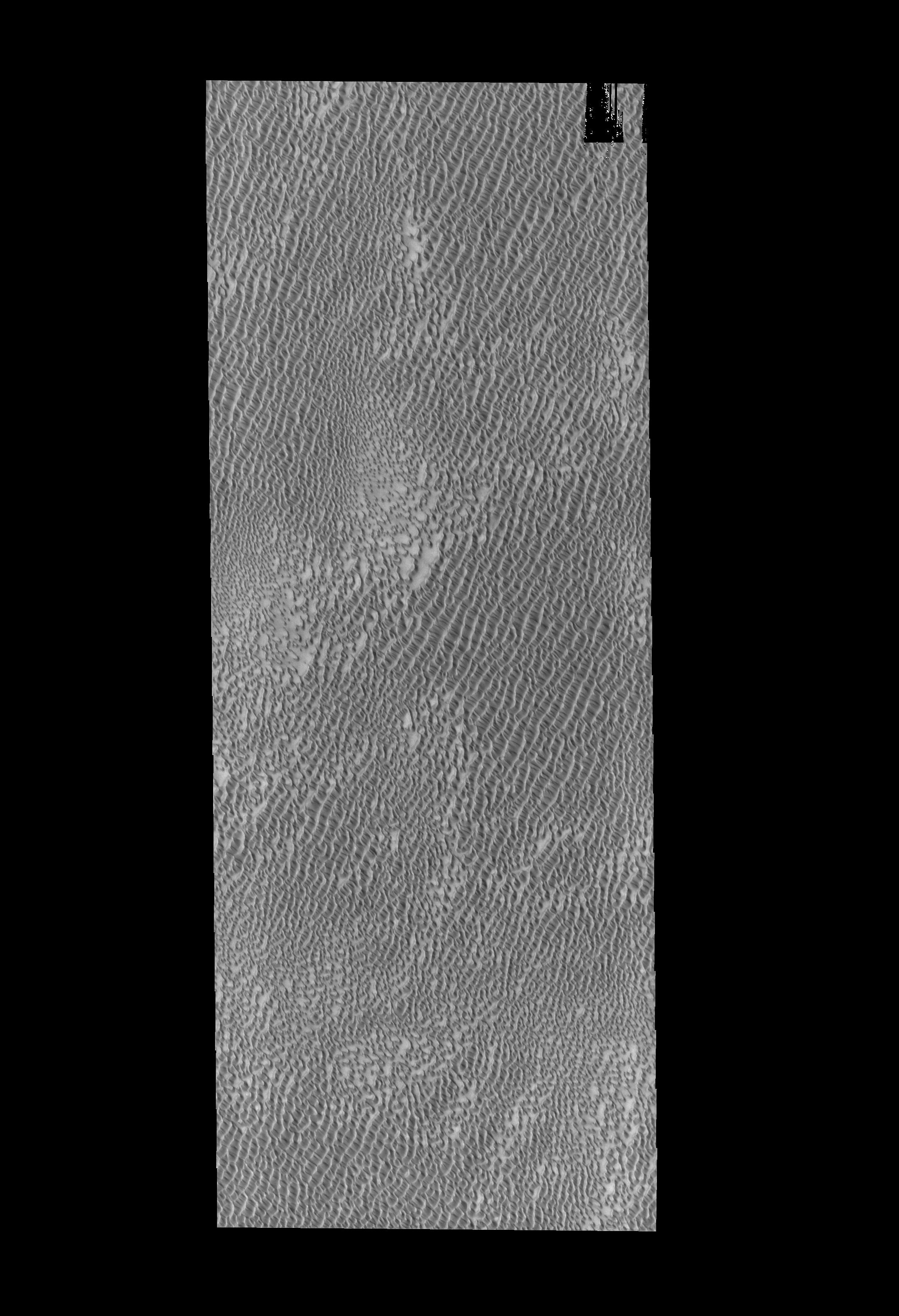
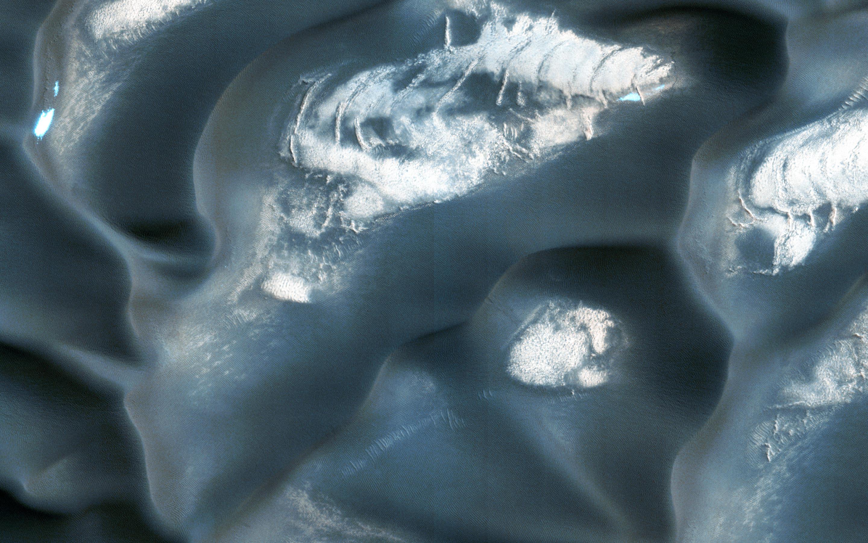
2014-05-02 |
Mars
|
2001 Mars Odyssey
|
THEMIS
|
2898x3568x1 |
|
-
PIA18233:
-
Polar Dunes
Full Resolution:
TIFF
(10.35 MB)
JPEG
(620.9 kB)
|
|
|
2014-05-01 |
Mercury
|
MESSENGER
|
MDIS - Narrow Angle
|
1451x1247x1 |
|
-
PIA18246:
-
Purcell and the Wall
Full Resolution:
TIFF
(1.812 MB)
JPEG
(383.9 kB)
|
|
|
2014-05-01 |
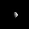
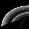
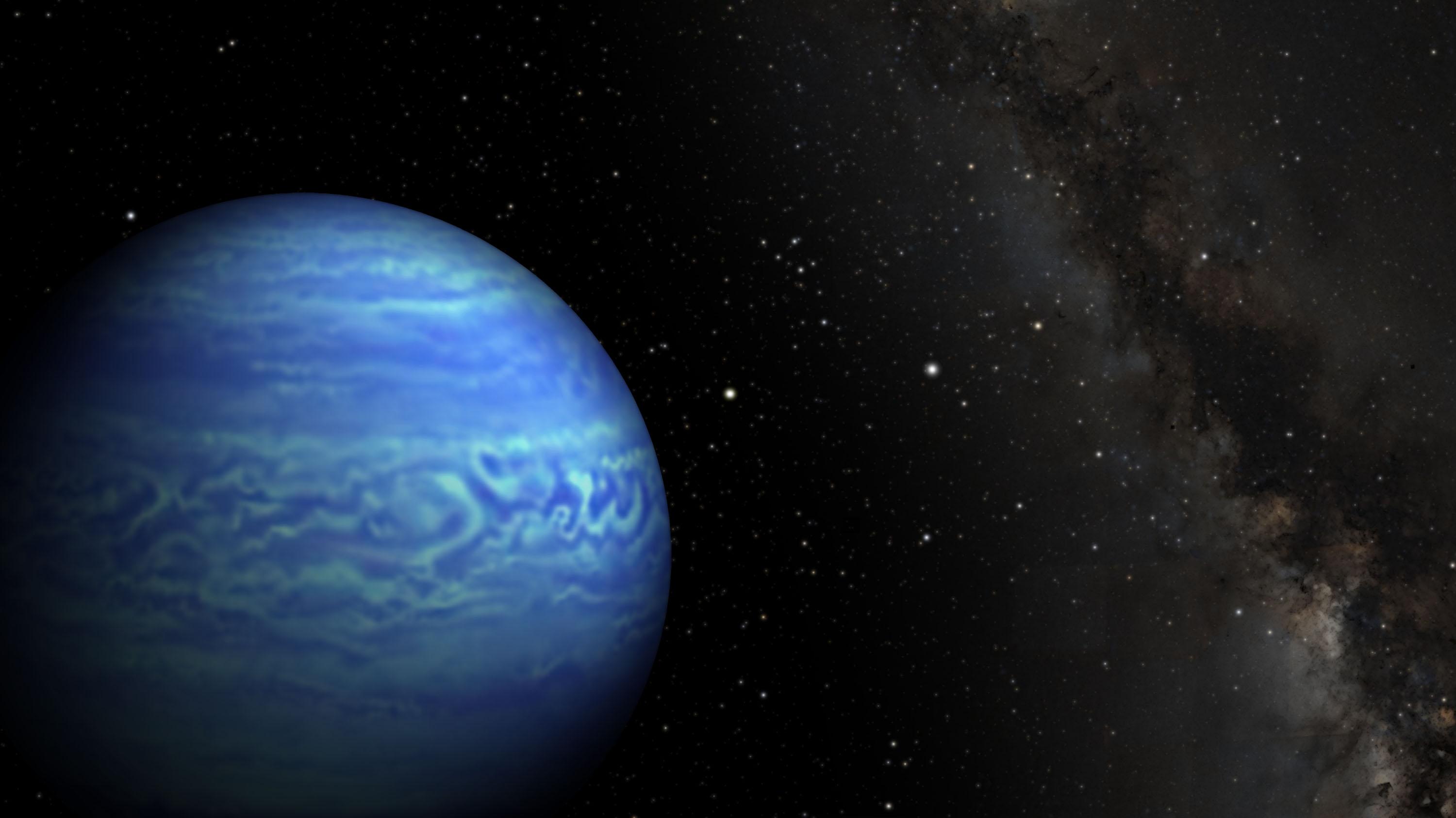
Uranus
|
Cassini-Huygens
|
ISS - Narrow Angle
|
940x940x3 |
|
-
PIA17178:
-
Blue Orb on the Horizon
Full Resolution:
TIFF
(2.652 MB)
JPEG
(137.6 kB)
|
|
|
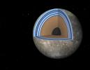
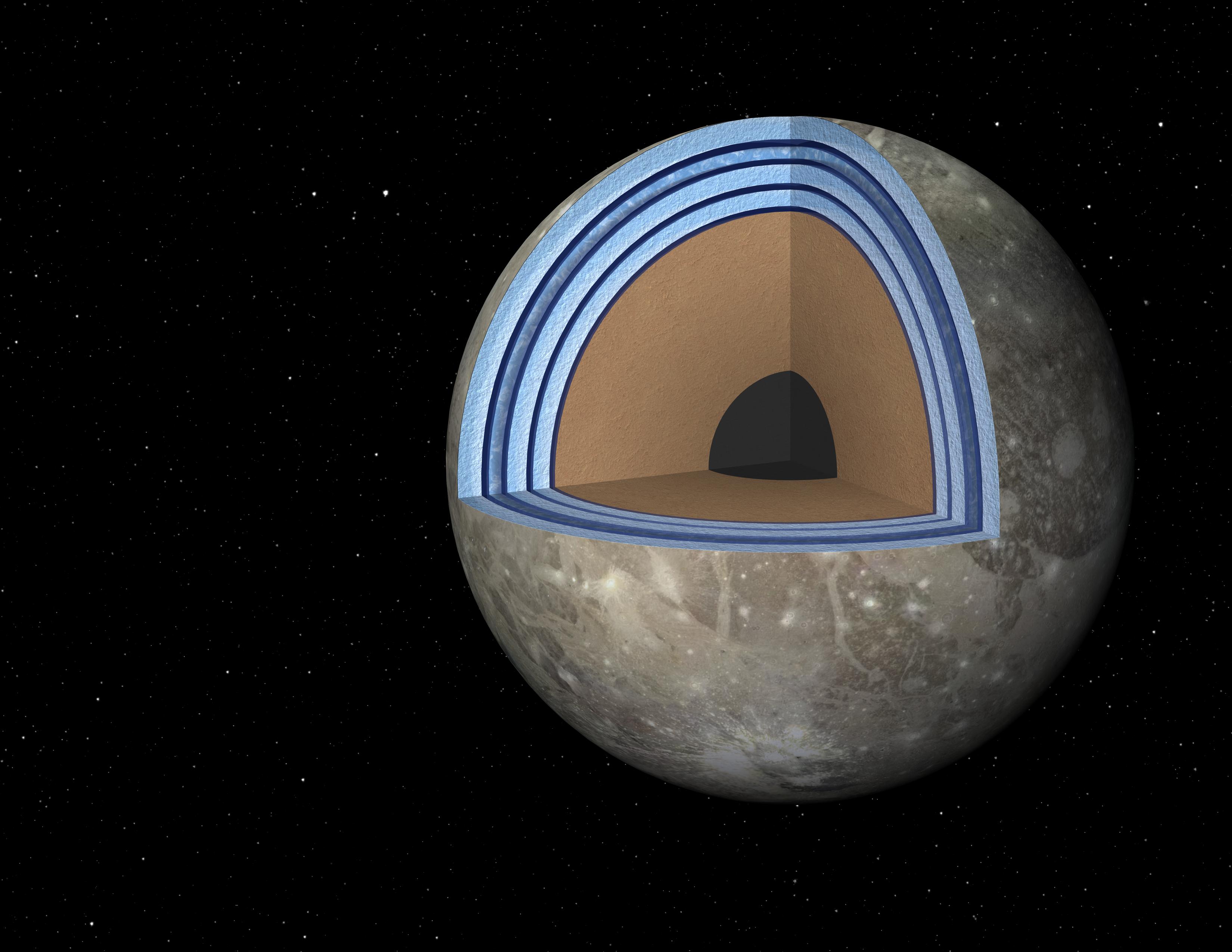
2014-05-01 |
Ganymede
|
|
|
3300x2550x3 |
|
-
PIA18005:
-
Possible "Moonwich" of Ice and Oceans on Ganymede (Artist's Concept)
Full Resolution:
TIFF
(25.26 MB)
JPEG
(514.5 kB)
|
|
|
2014-05-01 |
Earth
|
Terra
|
ASTER
|
4400x4000x3 |
|
-
PIA18245:
-
Ubinas Volcano Activity in Peruvian Andes
Full Resolution:
TIFF
(52.83 MB)
JPEG
(2.566 MB)
|
|
|
2014-05-01 |
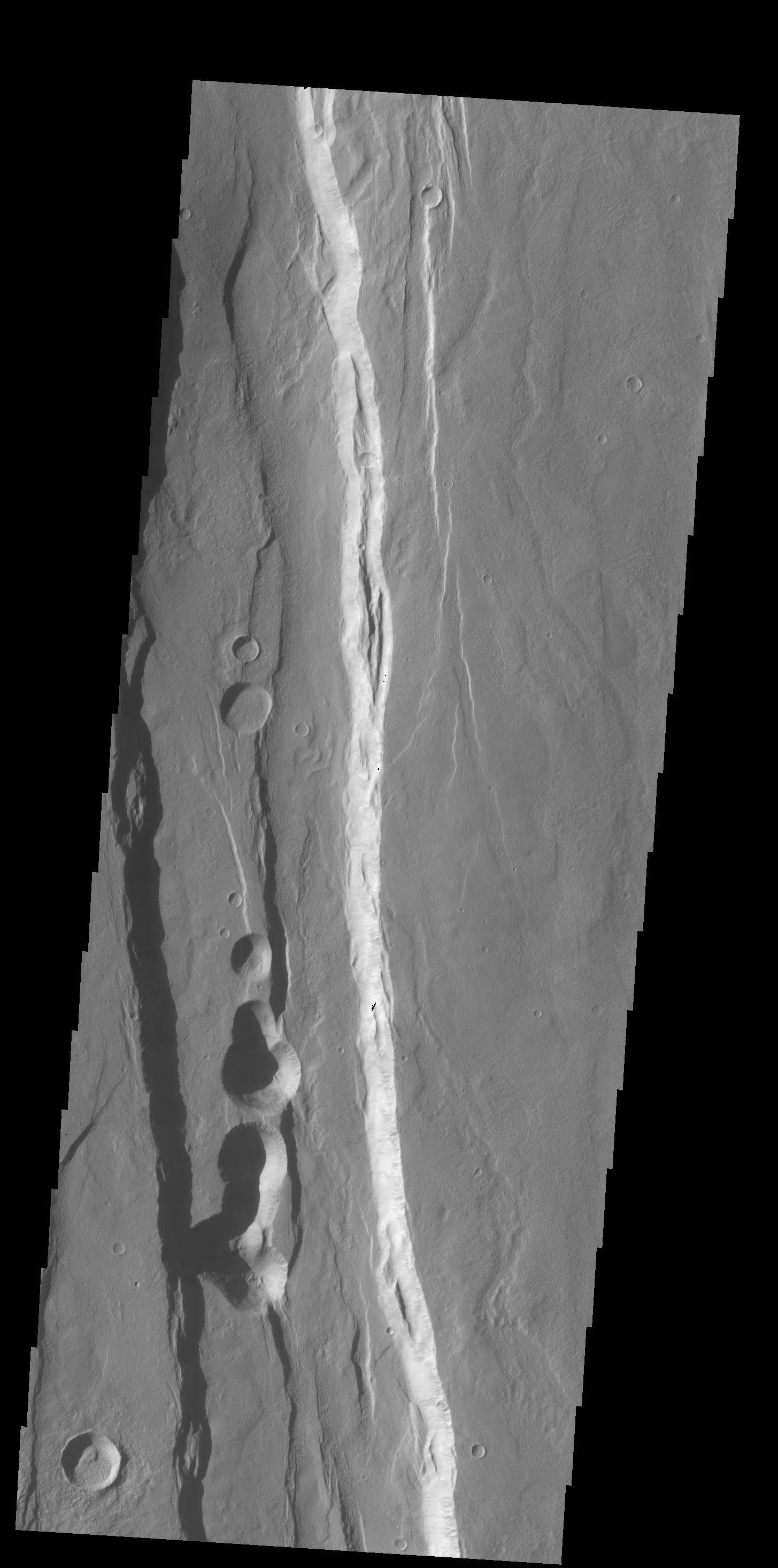
Mars
|
2001 Mars Odyssey
|
THEMIS
|
1416x2925x1 |
|
-
PIA18232:
-
Lava Flows
Full Resolution:
TIFF
(4.147 MB)
JPEG
(652.1 kB)
|
|
|
2014-04-30 |
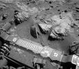
Mars
|
Mars Science Laboratory (MSL)
|
MAHLI
|
1593x1200x3 |
|
-
PIA18089:
-
Preparatory Drilling Test on Martian Target 'Windjana'
Full Resolution:
TIFF
(5.737 MB)
JPEG
(401.4 kB)
|
|
|
2014-04-30 |
Mars
|
Mars Reconnaissance Orbiter (MRO)
|
HiRISE
|
2880x1800x3 |

|
-
PIA18244:
-
The Active Dunes of Nili Patera
Full Resolution:
TIFF
(15.56 MB)
JPEG
(786.7 kB)
|
|
|
2014-04-30 |
Mars
|
Mars Reconnaissance Orbiter (MRO)
|
HiRISE
|
2880x1800x3 |
|
-
PIA18243:
-
Changing Dunes and Ripples in Olympia Undae
Full Resolution:
TIFF
(15.56 MB)
JPEG
(700.2 kB)
|
|
|
2014-04-30 |
Mars
|
Mars Reconnaissance Orbiter (MRO)
|
HiRISE
|
2880x1800x3 |

|
-
PIA18242:
-
Sunken and Pitted Ejecta
Full Resolution:
TIFF
(15.56 MB)
JPEG
(1.028 MB)
|
|
|
2014-04-30 |
Mars
|
Mars Reconnaissance Orbiter (MRO)
|
HiRISE
|
2880x1800x3 |
|
-
PIA18241:
-
Yardangs Forming Near Gordii Dorsum
Full Resolution:
TIFF
(15.56 MB)
JPEG
(734.8 kB)
|
|
|
2014-04-30 |
Mars
|
2001 Mars Odyssey
|
THEMIS
|
1419x2926x1 |
|
-
PIA18223:
-
Alluvial Fans
Full Resolution:
TIFF
(4.157 MB)
JPEG
(322.9 kB)
|
|
|
2014-04-29 |
Mars
|
Mars Science Laboratory (MSL)
|
MAHLI
|
1588x1184x3 |
|
-
PIA18088:
-
Martian Sandstone Target "Windjana" Before and After Brushing
Full Resolution:
TIFF
(1.884 MB)
JPEG
(741.4 kB)
|
|
|
2014-04-29 |
Mercury
|
MESSENGER
|
MDIS - Narrow Angle
|
925x867x3 |
|
-
PIA18231:
-
Cuts Right Through
Full Resolution:
TIFF
(2.407 MB)
JPEG
(169.5 kB)
|
|
|
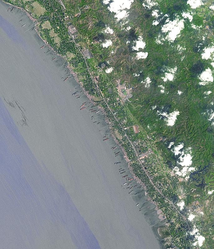
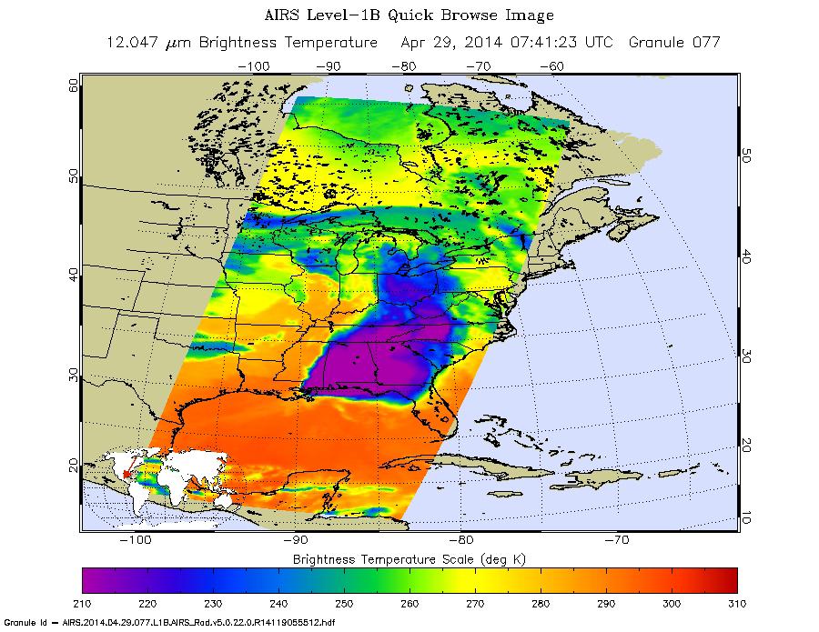
2014-04-29 |
Earth
|
Aqua
|
AIRS
|
900x695x3 |

|
-
PIA18047:
-
NASA Satellite Spots Severe Weather Outbreak in South
Full Resolution:
TIFF
(1.877 MB)
JPEG
(142 kB)
|
|
|
2014-04-29 |
|
Herschel Space Observatory
Hubble Space Telescope
|
HIFI
WFC3
|
1000x712x3 |
|
-
PIA18004:
-
Smeared and Magnified Galaxy
Full Resolution:
TIFF
(2.137 MB)
JPEG
(93.48 kB)
|
|
|
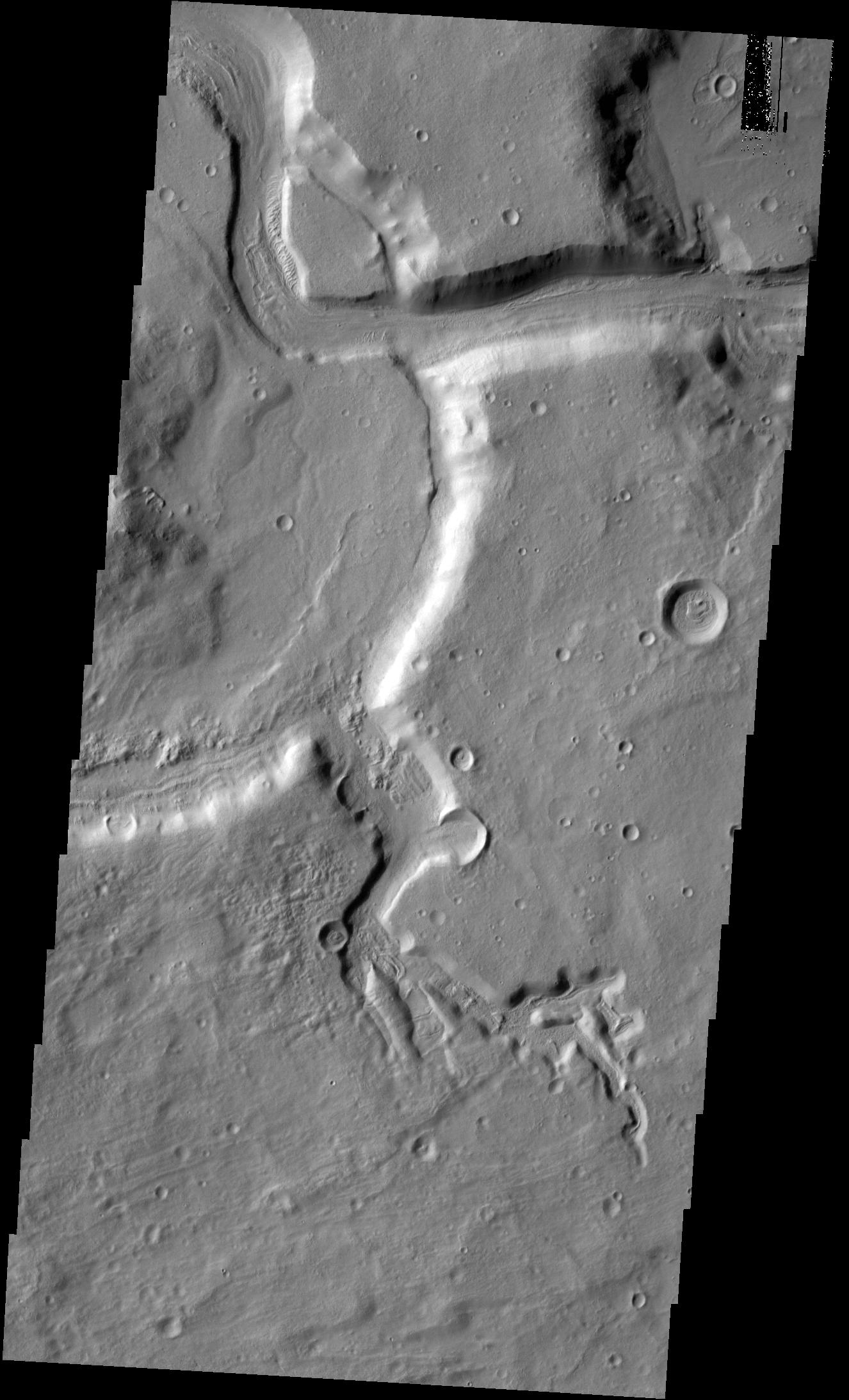
2014-04-29 |
Mars
|
2001 Mars Odyssey
|
THEMIS
|
1326x2184x1 |

|
-
PIA18222:
-
Channels
Full Resolution:
TIFF
(2.899 MB)
JPEG
(277.8 kB)
|
|
|
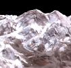
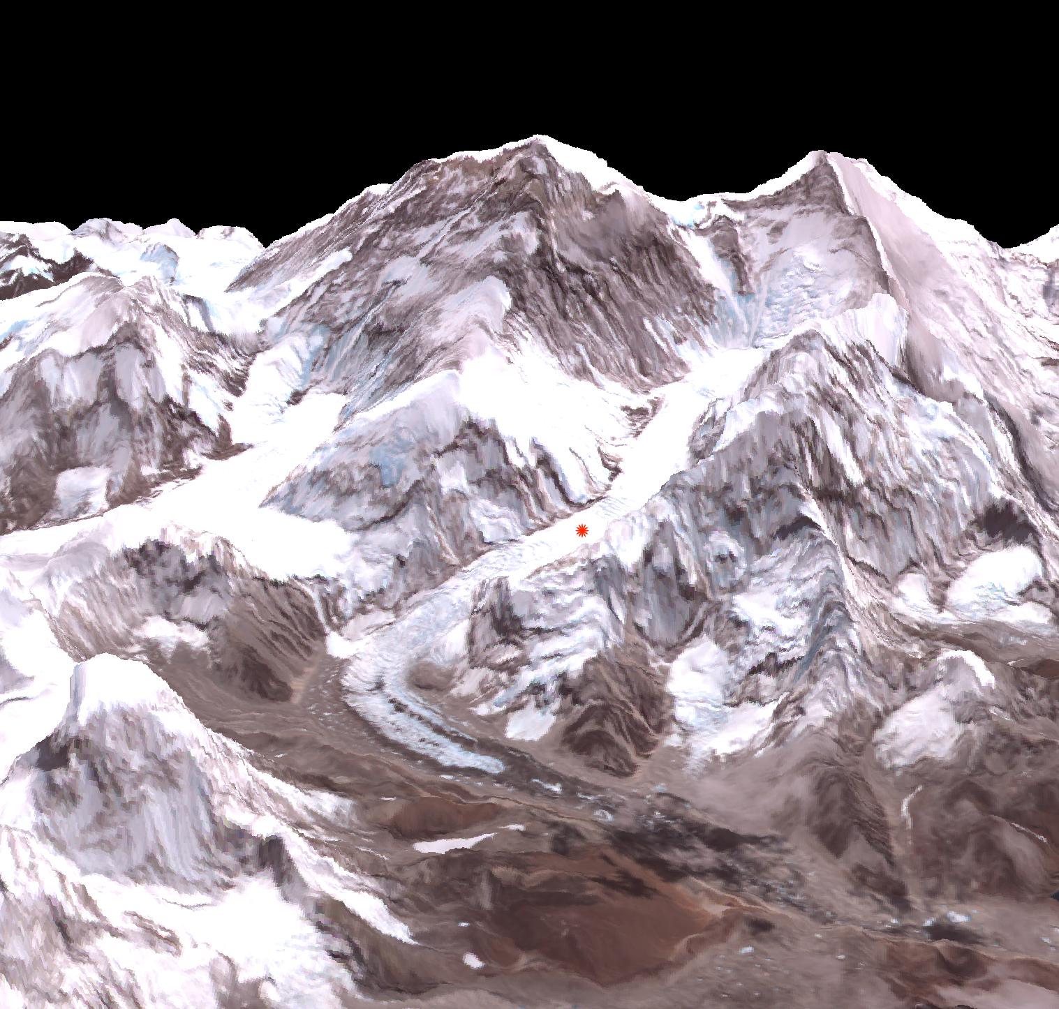
2014-04-28 |
Earth
|
Terra
|
ASTER
|
1517x1446x3 |
|
-
PIA18046:
-
Deadly Everest Avalanche Site Spotted by NASA Spacecraft
Full Resolution:
TIFF
(6.583 MB)
JPEG
(327.9 kB)
|
|
|
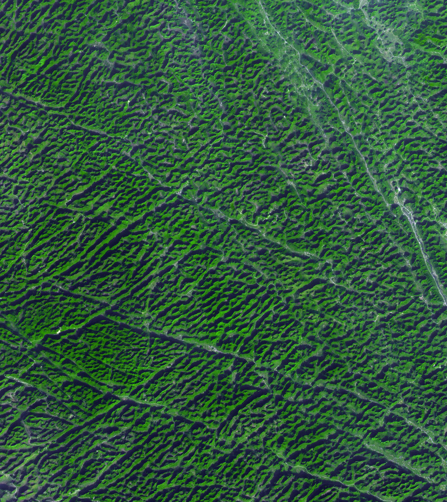
2014-04-28 |
Earth
|
Terra
|
ASTER
|
1868x2097x3 |
|
-
PIA18230:
-
Karst Landscape, China
Full Resolution:
TIFF
(11.76 MB)
JPEG
(857.2 kB)
|
|
|
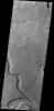
2014-04-28 |
Mars
|
2001 Mars Odyssey
|
THEMIS
|
1438x2924x1 |
|
-
PIA18221:
-
Granicus Valles
Full Resolution:
TIFF
(4.21 MB)
JPEG
(456.2 kB)
|
|
|
2014-04-28 |
S Rings
|
Cassini-Huygens
|
ISS - Wide Angle
|
1020x1020x1 |

|
-
PIA17162:
-
Me and My Shadow
Full Resolution:
TIFF
(1.042 MB)
JPEG
(69.2 kB)
|
|
|
2014-04-25 |
Mars
|
Mars Science Laboratory (MSL)
|
Mastcam
|
2724x2031x3 |
|
-
PIA18087:
-
Sandstone Target 'Windjana' May Be Next Martian Drilling Site
Full Resolution:
TIFF
(16.6 MB)
JPEG
(899.8 kB)
|
|
|
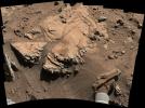
2014-04-25 |
Mars
|
Mars Science Laboratory (MSL)
|
Navcam (MSL)
|
1024x892x1 |
|
-
PIA18086:
-
Curiosity Mars Rover Beside Sandstone Target 'Windjana'
Full Resolution:
TIFF
(914.5 kB)
JPEG
(171.2 kB)
|
|
|
2014-04-25 |
Mars
|
Mars Reconnaissance Orbiter (MRO)
|
HiRISE
|
556x437x3 |

|
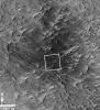
-
PIA18085:
-
Location of Mars Sandstone Target 'Windjana'
Full Resolution:
TIFF
(729.4 kB)
JPEG
(45.28 kB)
|
|
|
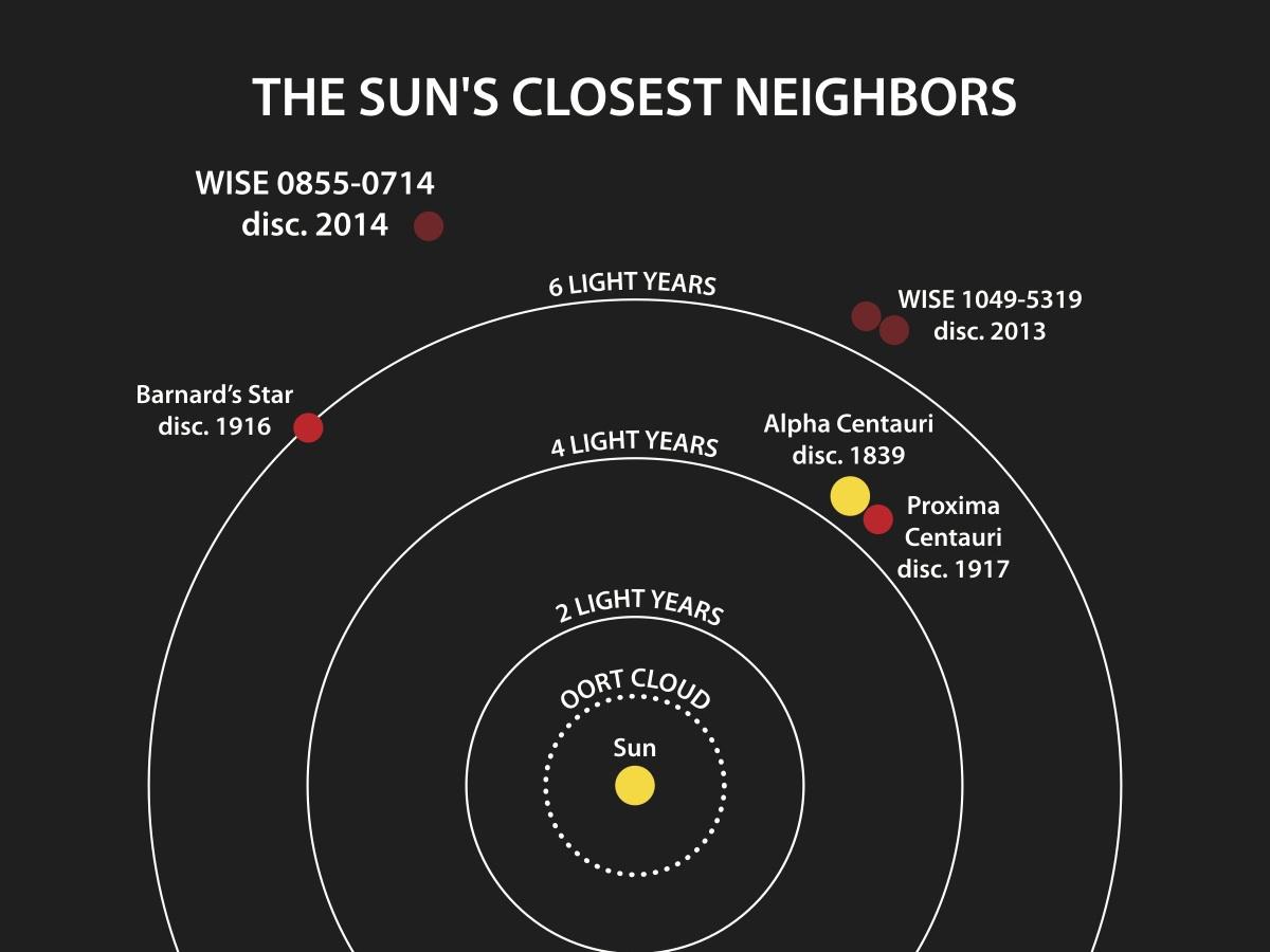
2014-04-25 |
|
Spitzer Space Telescope
Wide-field Infrared Survey Explorer (WISE)
|
|
1200x900x3 |
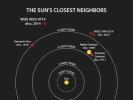
|
-
PIA18003:
-
Welcome to the Sun's Neighborhood
Full Resolution:
TIFF
(3.241 MB)
JPEG
(67.8 kB)
|
|
|
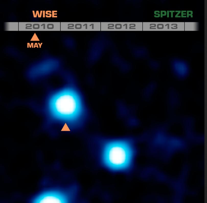
2014-04-25 |
|
Spitzer Space Telescope
Wide-field Infrared Survey Explorer (WISE)
|
|
810x798x3 |
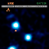
|
-
PIA18002:
-
Cold and Quick: a Fast-Moving Brown Dwarf
Full Resolution:
TIFF
(1.94 MB)
JPEG
(28.72 kB)
|
|
|
2014-04-25 |
|
Wide-field Infrared Survey Explorer (WISE)
|
|
3000x1688x3 |

|
-
PIA18001:
-
Cold and Close Celestial Orb (Artist's Concept)
Full Resolution:
TIFF
(15.2 MB)
JPEG
(215.4 kB)
|
 Planetary Data System


