My
List |
Addition Date
|
Target
|
Mission
|
Instrument
|
Size
|

|
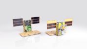
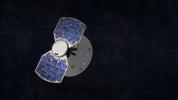
2018-09-13 |
|
MarCO
|
|
2560x1440x3 |
|
-
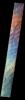
PIA22548:
-
Mars Cube One in Detail
Full Resolution:
TIFF
(3.318 MB)
JPEG
(173.4 kB)
|
|
|
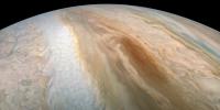
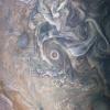
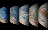
2018-09-13 |
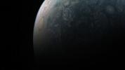
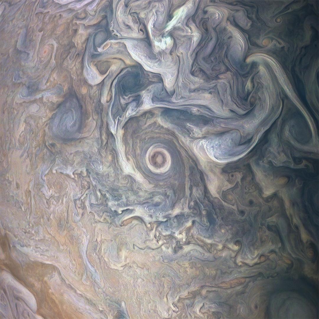
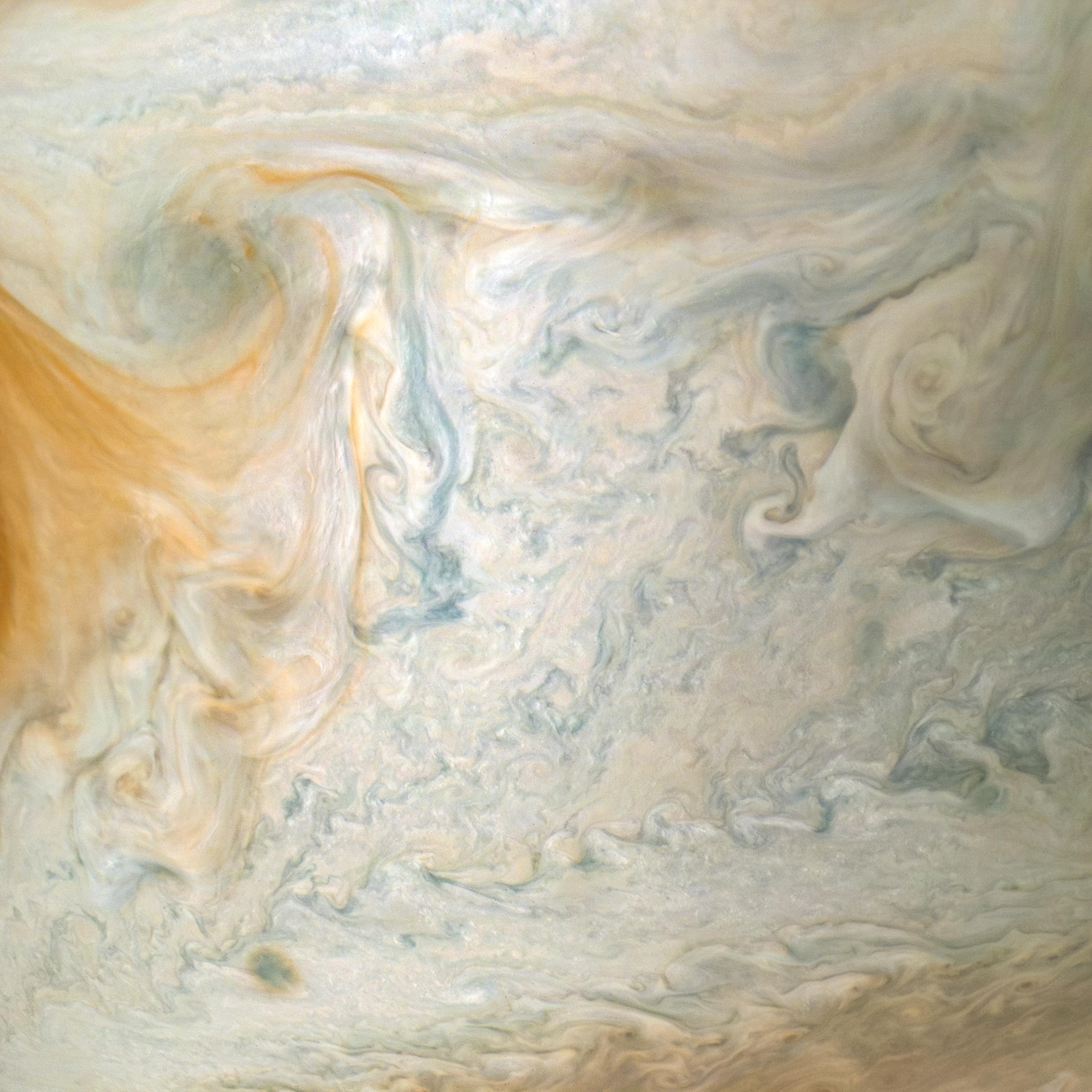
Jupiter
|
Juno
|
JunoCam
|
3600x1800x3 |
|
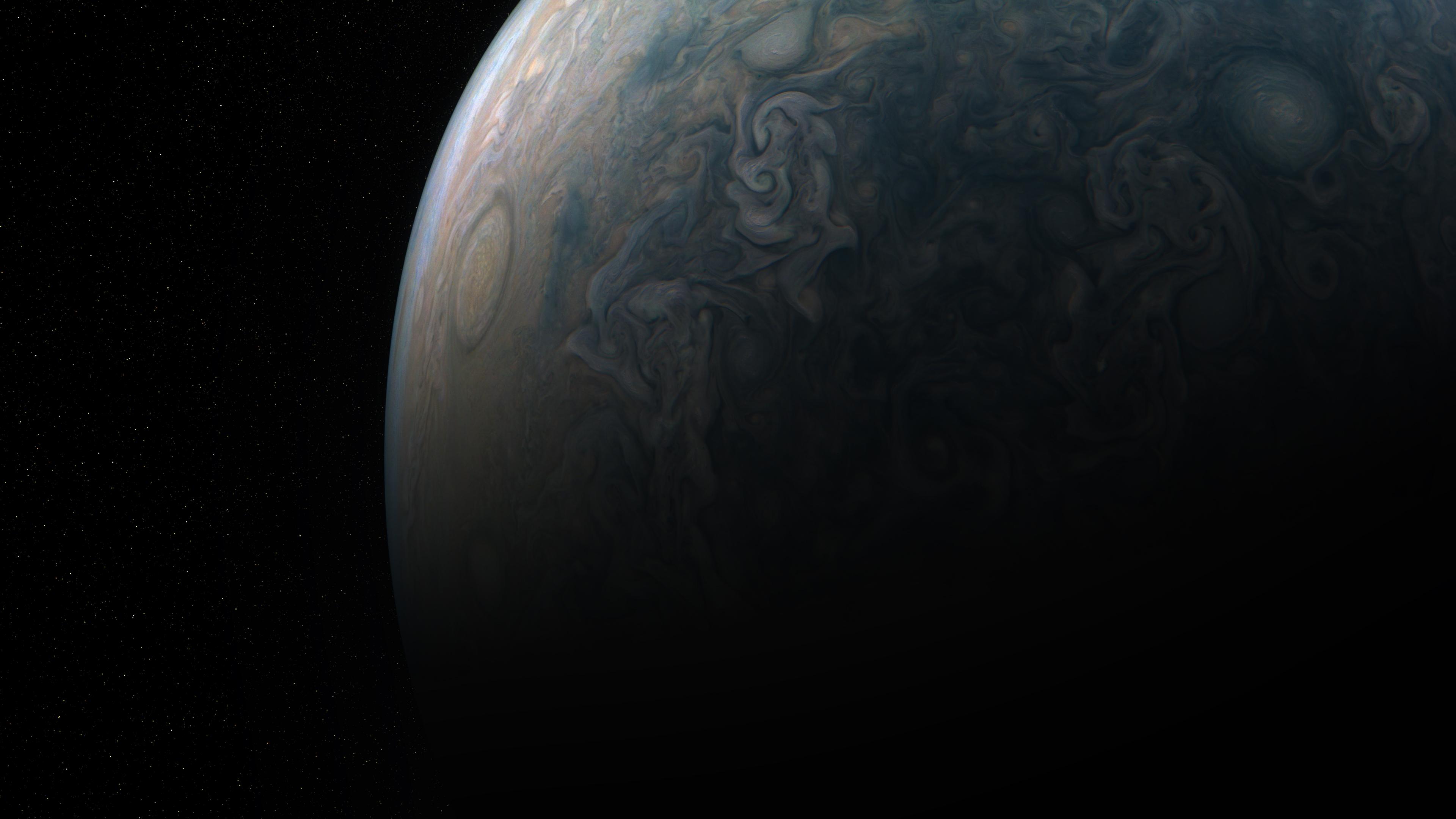
-
PIA22688:
-
Juno Captures Elusive 'Brown Barge'
Full Resolution:
TIFF
(15.84 MB)
JPEG
(623.6 kB)
|
|
|
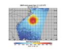
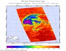
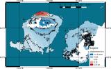
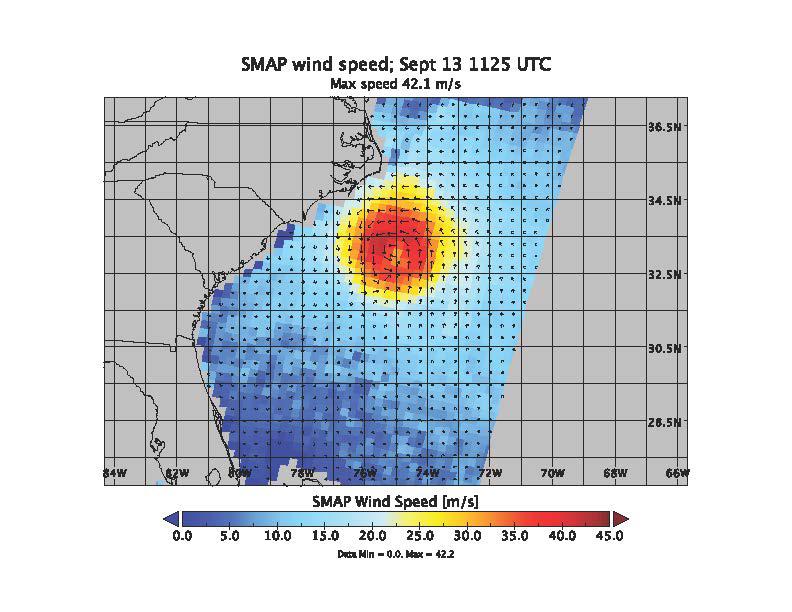
2018-09-13 |
Earth
|
SMAP
|
|
792x612x3 |
|
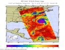
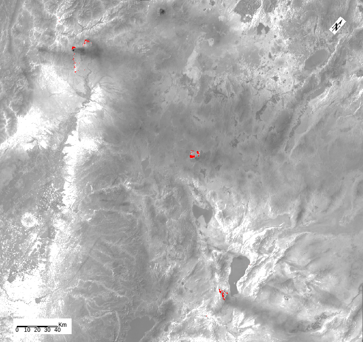
-
PIA22699:
-
Hurricane Florence seen by SMAP Imagery
Full Resolution:
TIFF
(573.5 kB)
JPEG
(81.67 kB)
|
|
|
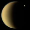
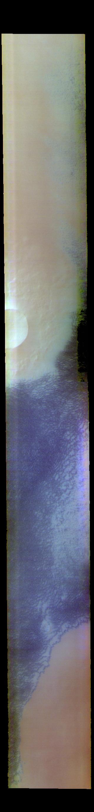
2018-09-13 |
Titan
|
Cassini-Huygens
|
ISS - Narrow Angle
|
3604x2695x1 |

|
-
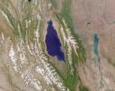
PIA22481:
-
Titan Lakes
Full Resolution:
TIFF
(6.701 MB)
JPEG
(1.067 MB)
|
|
|
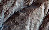
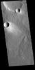
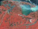
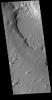
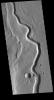
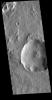
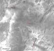
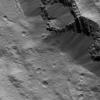
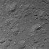
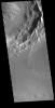
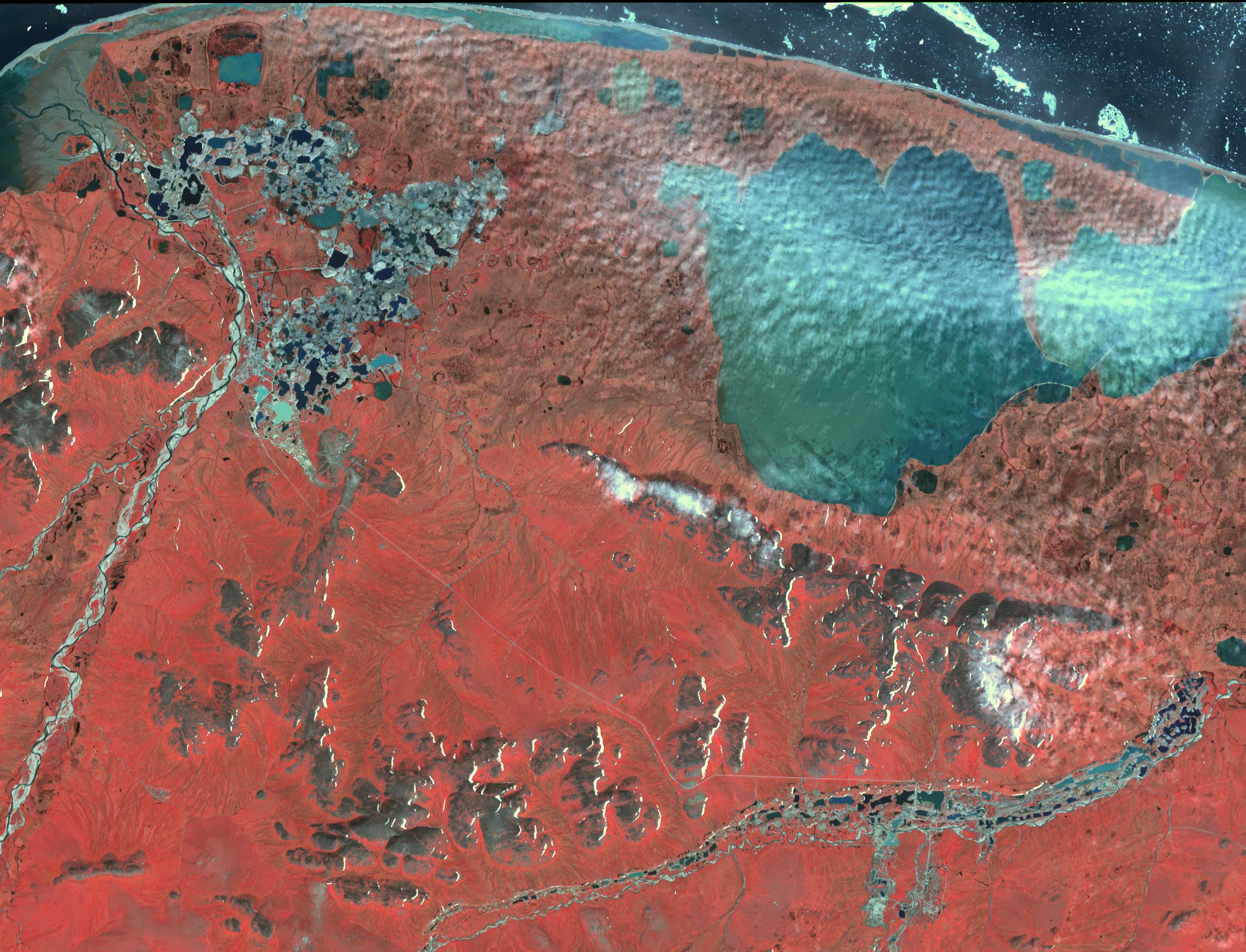
2018-09-13 |
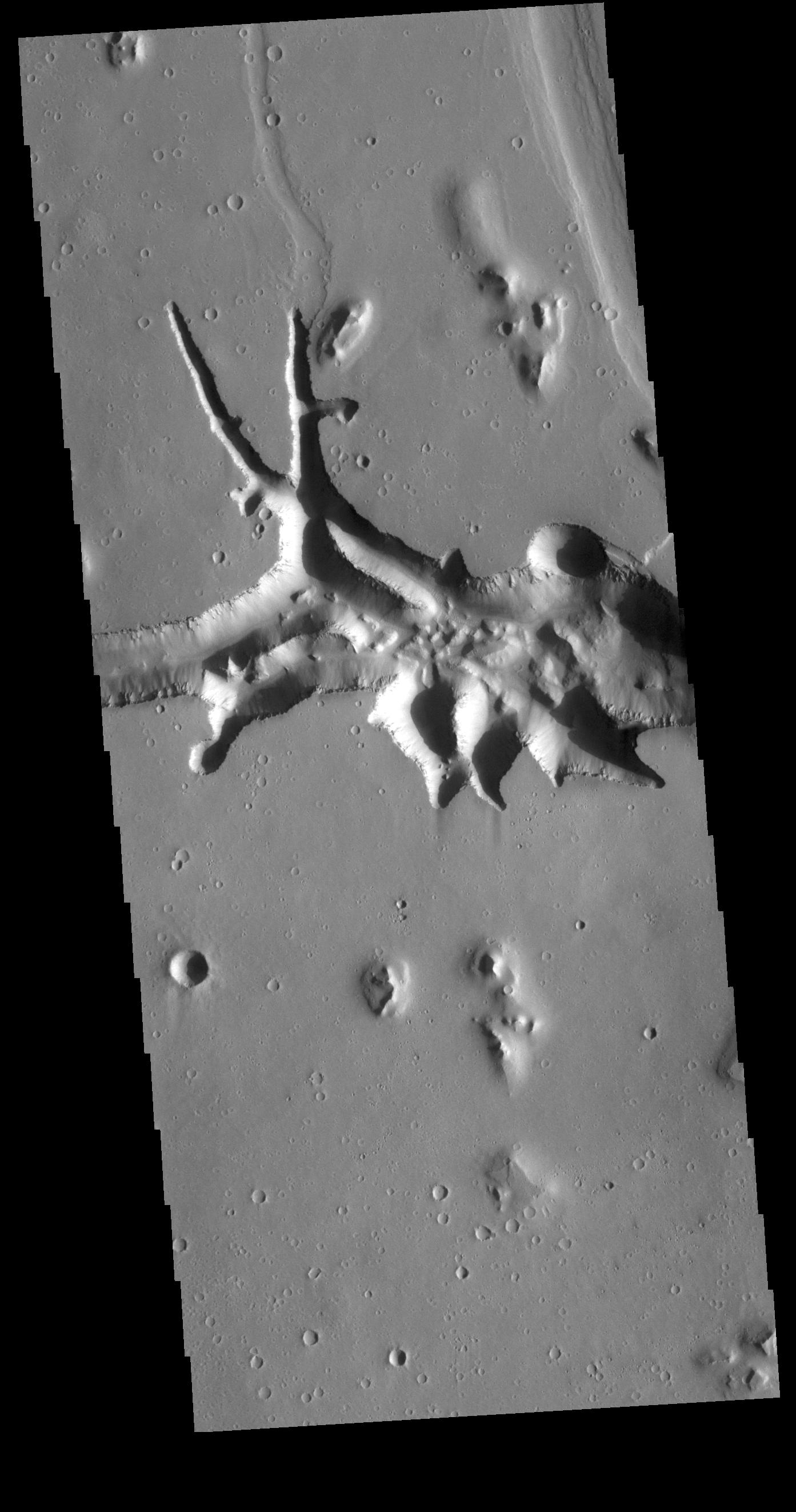
Mars
|
2001 Mars Odyssey
|
THEMIS
|
604x1458x3 |
|
-
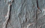
PIA22709:
-
Escorial Crater - False Color
Full Resolution:
TIFF
(2.048 MB)
JPEG
(70.46 kB)
|
|
|
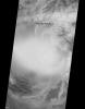
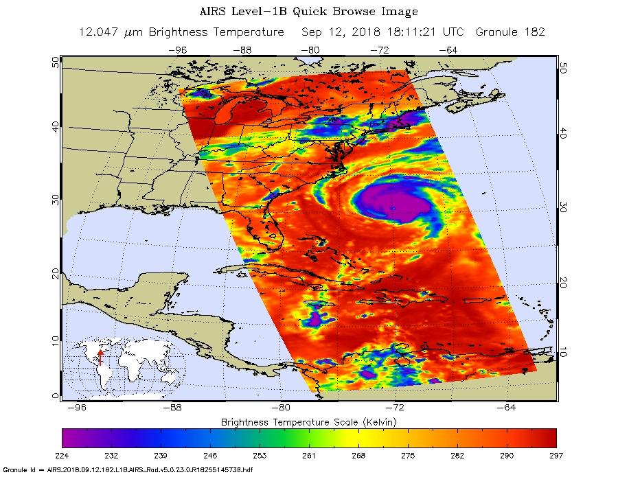
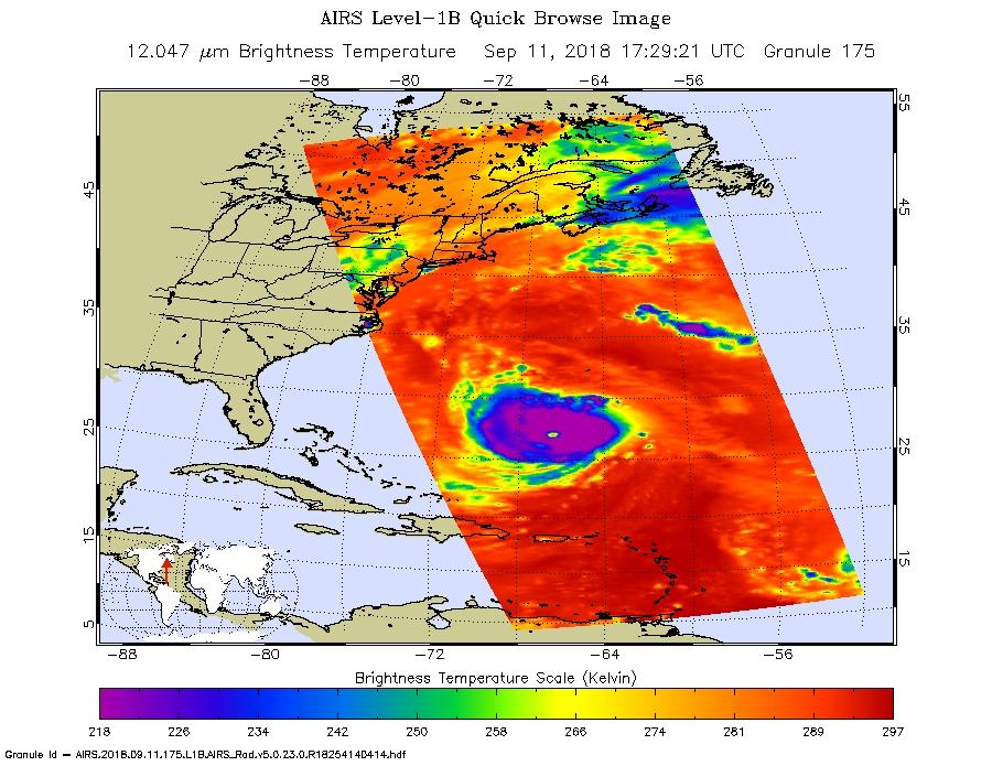
2018-09-12 |
Earth
|
Aqua
|
AIRS
|
900x695x3 |
|
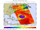
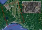
-
PIA22698:
-
Hurricane Florence as seen by NASA's AIRS Instrument
Full Resolution:
TIFF
(791 kB)
JPEG
(140 kB)
|
|
|
2018-09-12 |
Mars
|
2001 Mars Odyssey
|
THEMIS
|
319x2731x3 |

|
-
PIA22708:
-
Siton Undae - False Color
Full Resolution:
TIFF
(2.401 MB)
JPEG
(76.85 kB)
|
|
|
2018-09-12 |
Earth
|
Aqua
|
AIRS
|
900x695x3 |
|
-
PIA22697:
-
Hurricane Florence Captured on Tuesday by NASA's AIRS Instrument
Full Resolution:
TIFF
(752.6 kB)
JPEG
(132.1 kB)
|
|
|
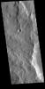
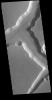
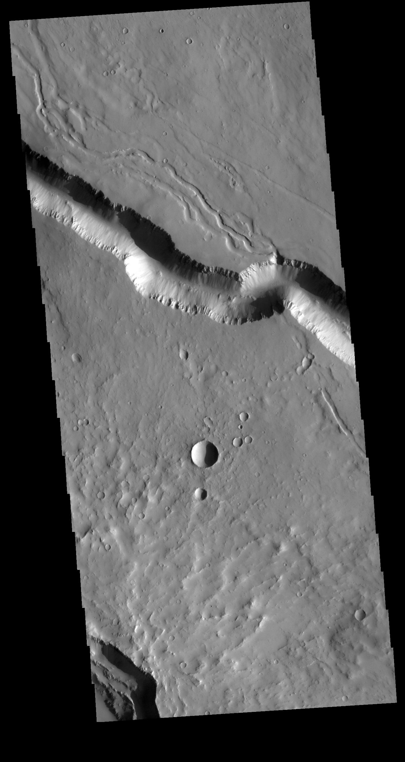
2018-09-11 |
Mars
|
2001 Mars Odyssey
|
THEMIS
|
628x2703x3 |
|
-
PIA22707:
-
Terra Sabaea - False Color
Full Resolution:
TIFF
(2.341 MB)
JPEG
(108.5 kB)
|
|
|
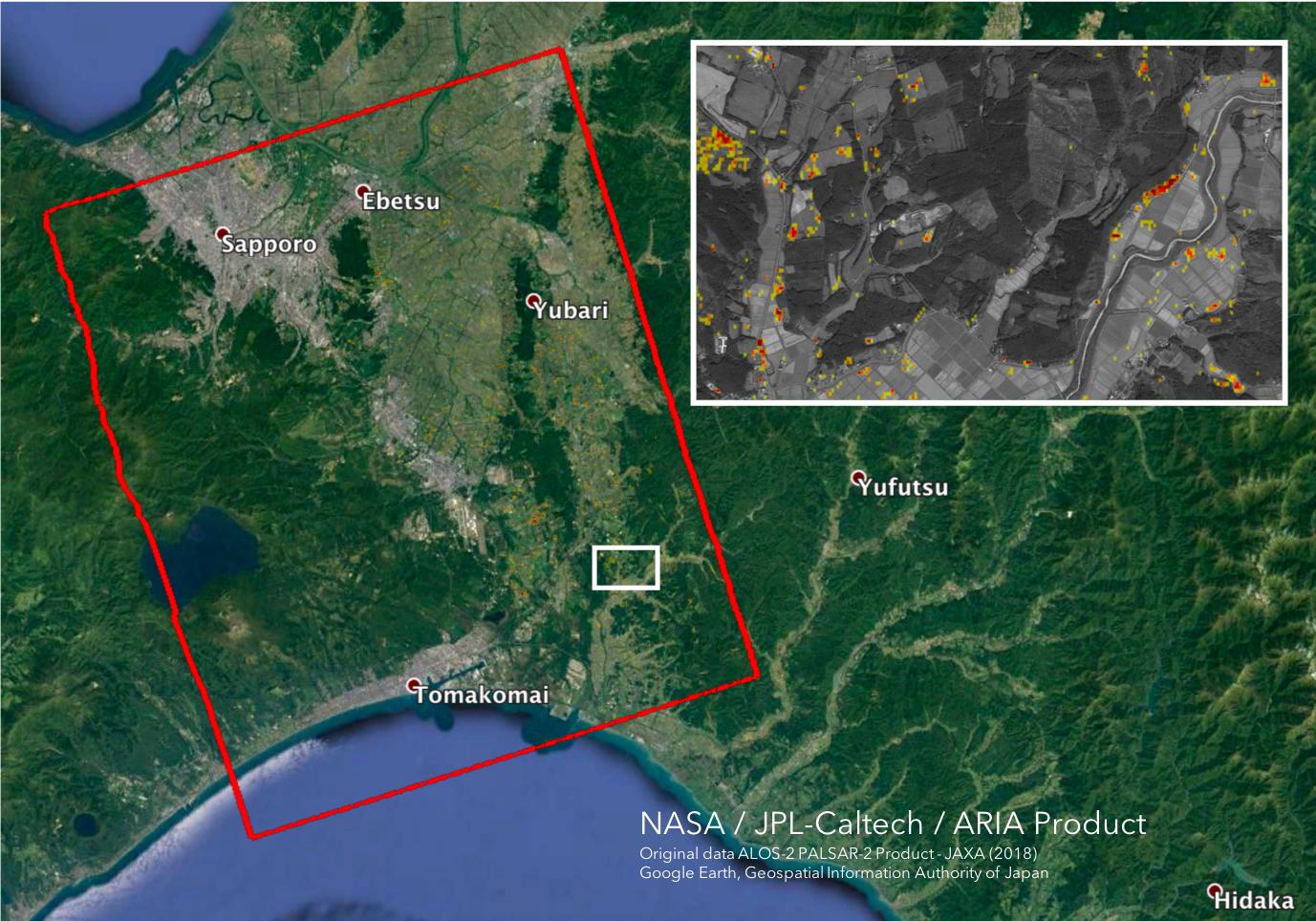
2018-09-10 |
Earth
|
ARIA
|
SAR
|
1377x964x3 |
|
-
PIA22696:
-
Japan Earthquakes (ARIA Damage Proxy Map)
Full Resolution:
TIFF
(3.89 MB)
JPEG
(229.1 kB)
|
|
|
2018-09-10 |
Mars
|
2001 Mars Odyssey
|
THEMIS
|
718x1438x3 |

|
-
PIA22706:
-
Nili Fossae - False Color
Full Resolution:
TIFF
(2.083 MB)
JPEG
(98.24 kB)
|
|
|
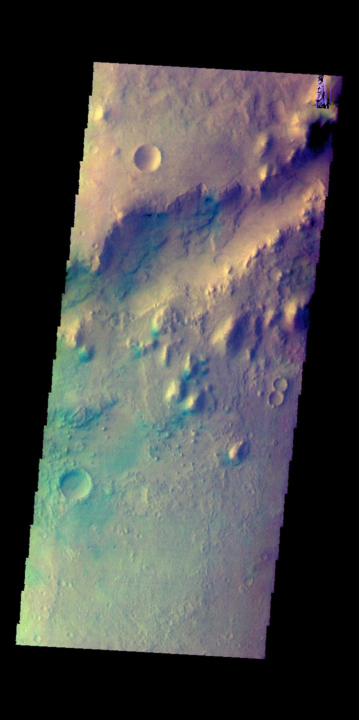
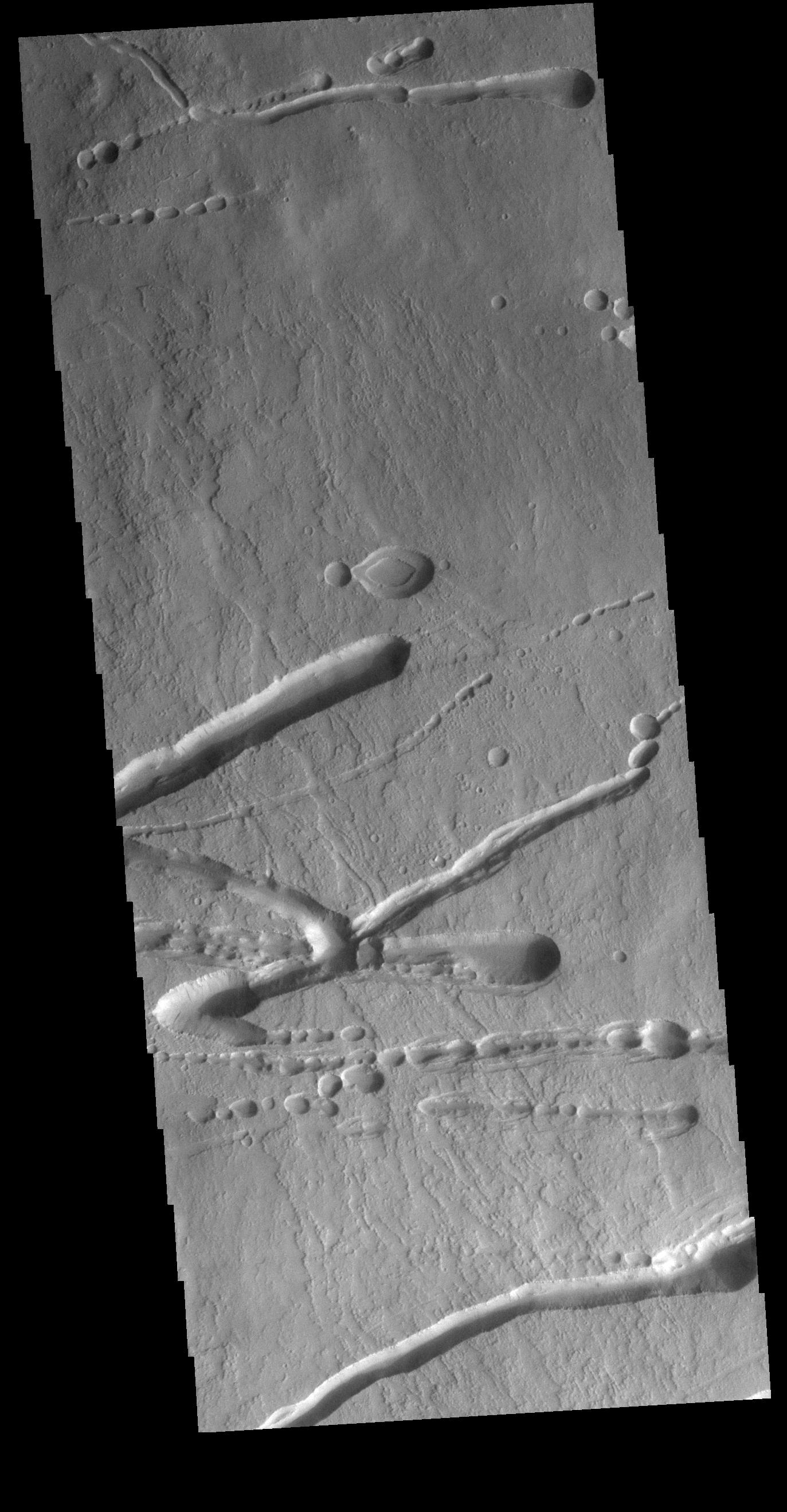
2018-09-07 |
Mars
|
2001 Mars Odyssey
|
THEMIS
|
672x2701x3 |
|
-
PIA22679:
-
Storm Clouds - False Color
Full Resolution:
TIFF
(2.459 MB)
JPEG
(103.1 kB)
|
|
|
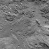
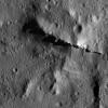
2018-09-06 |
Mars
|
Mars Science Laboratory (MSL)
|
Mastcam
|
10000x2886x3 |

|
-
PIA22545:
-
Panorama of Vera Rubin Ridge
Full Resolution:
TIFF
(67.34 MB)
JPEG
(3.445 MB)
|
|
|
2018-09-06 |
Mars
|
2001 Mars Odyssey
|
THEMIS
|
609x2719x3 |

|
-
PIA22678:
-
Thaumasia Planum - False Color
Full Resolution:
TIFF
(2.239 MB)
JPEG
(107.3 kB)
|
|
|
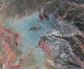
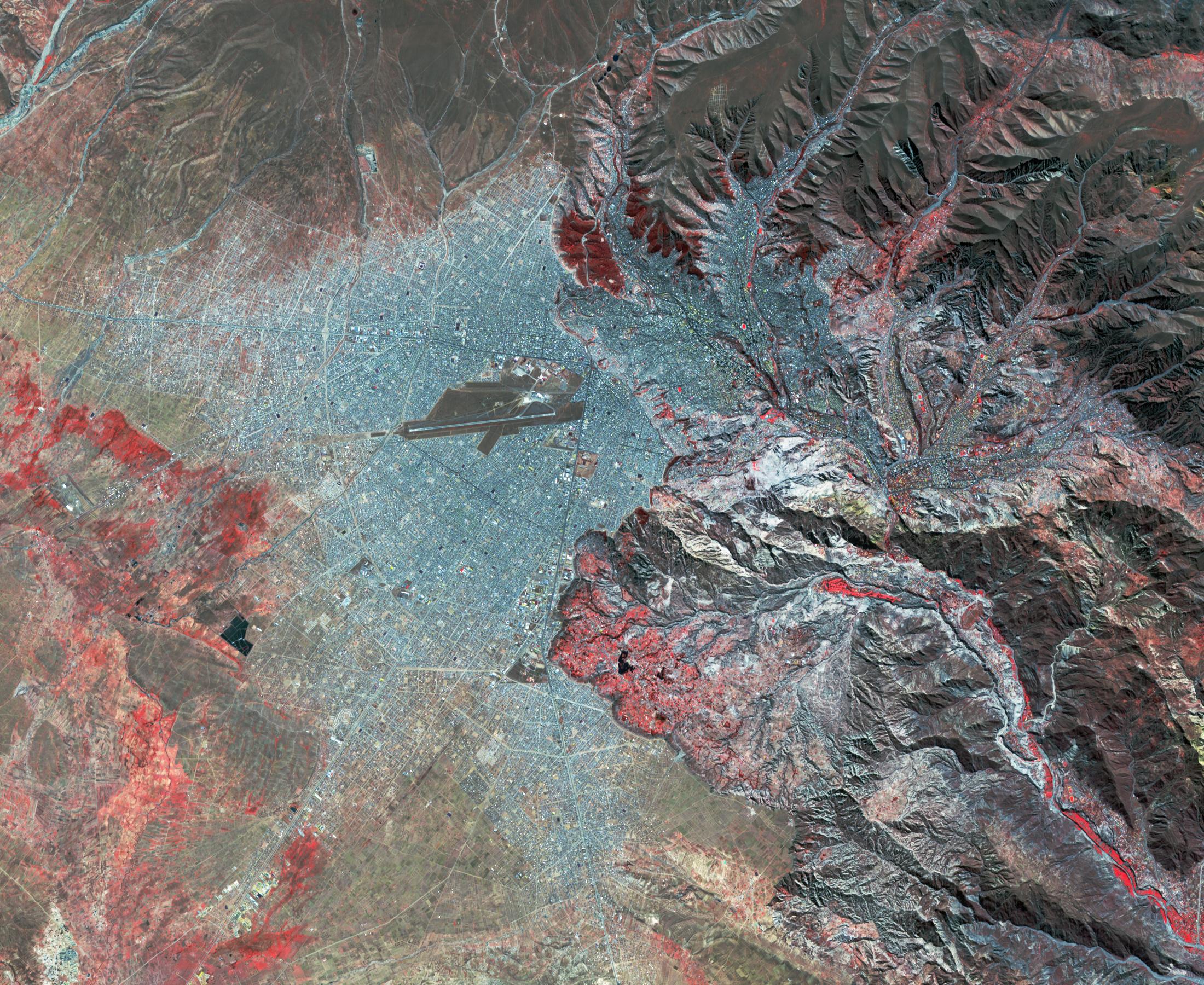
2018-09-05 |
Earth
|
ARIA
|
SAR
|
6776x4377x3 |
|
-
PIA22495:
-
ARIA Damage Proxy Map of Lombok, Indonesia Earthquakes
Full Resolution:
TIFF
(47.99 MB)
JPEG
(2.341 MB)
|
|
|
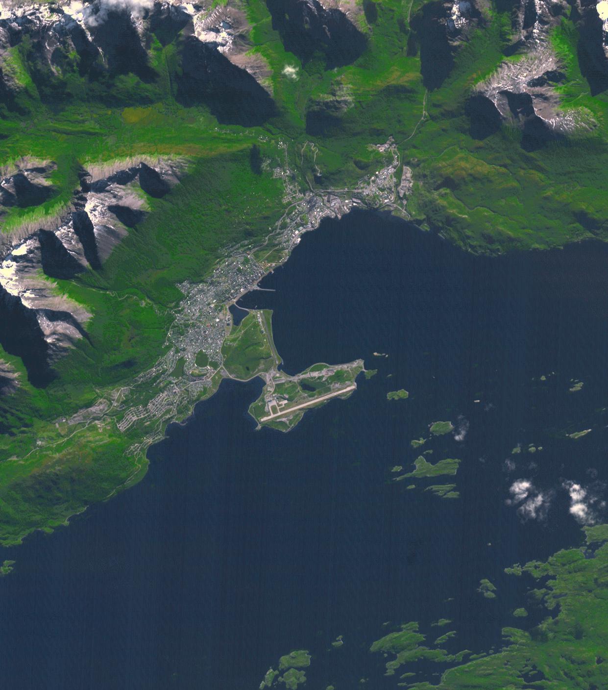
2018-09-05 |
Earth
|
Terra
|
ASTER
|
1241x1407x3 |

|
-
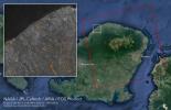
PIA22685:
-
Ushuaia, Argentina
Full Resolution:
TIFF
(4.45 MB)
JPEG
(201.4 kB)
|
|
|
2018-09-05 |
Mars
|
2001 Mars Odyssey
|
THEMIS
|
622x2707x3 |

|
-
PIA22677:
-
Ophir Chasma - False Color
Full Resolution:
TIFF
(2.288 MB)
JPEG
(100.3 kB)
|
|
|
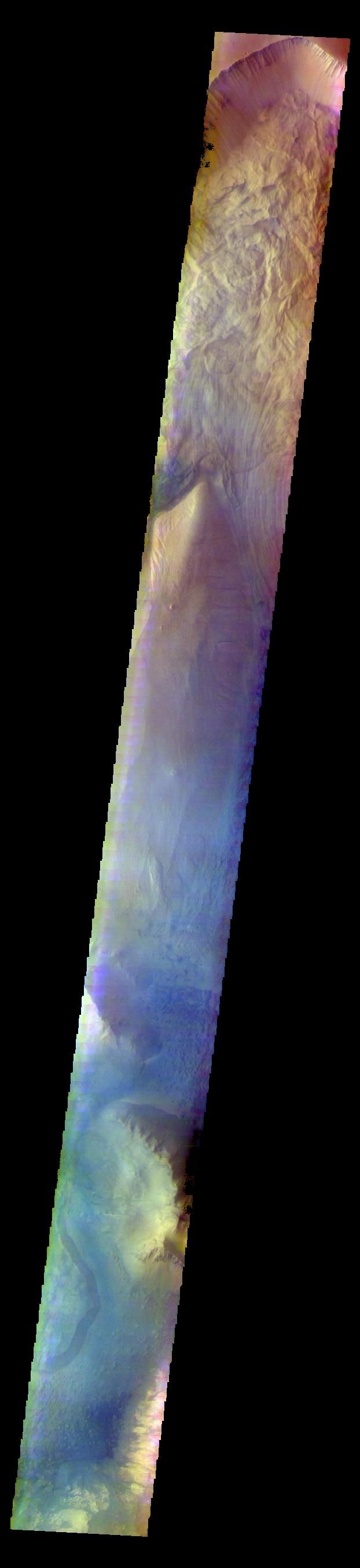
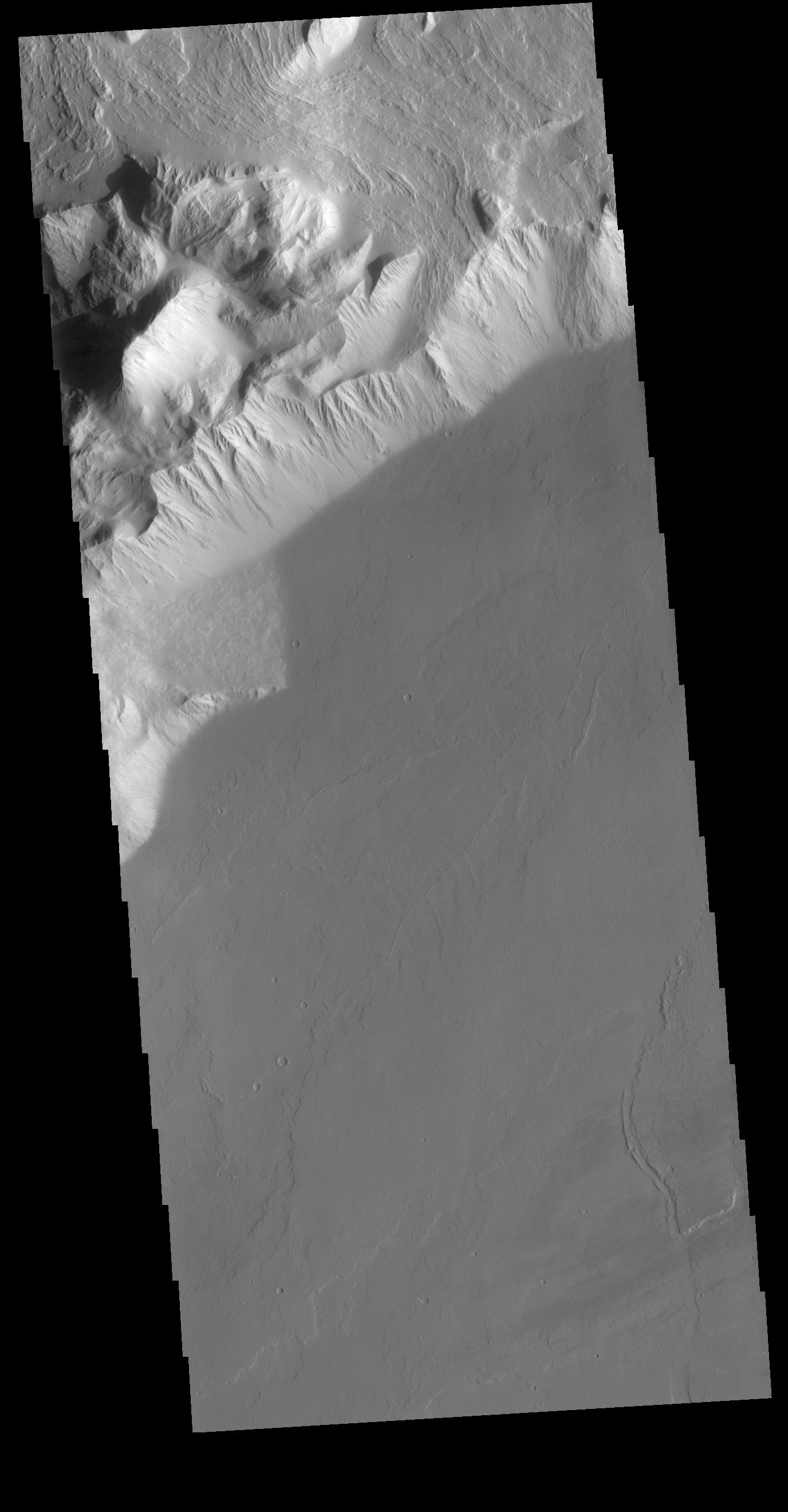
2018-09-04 |
Mars
|
Mars Reconnaissance Orbiter (MRO)
|
HiRISE
|
2880x1800x3 |
|
-
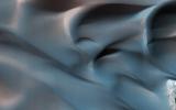
PIA22684:
-
Hanging Sand Dunes within Coprates Chasma
Full Resolution:
TIFF
(15.56 MB)
JPEG
(1.011 MB)
|
|
|
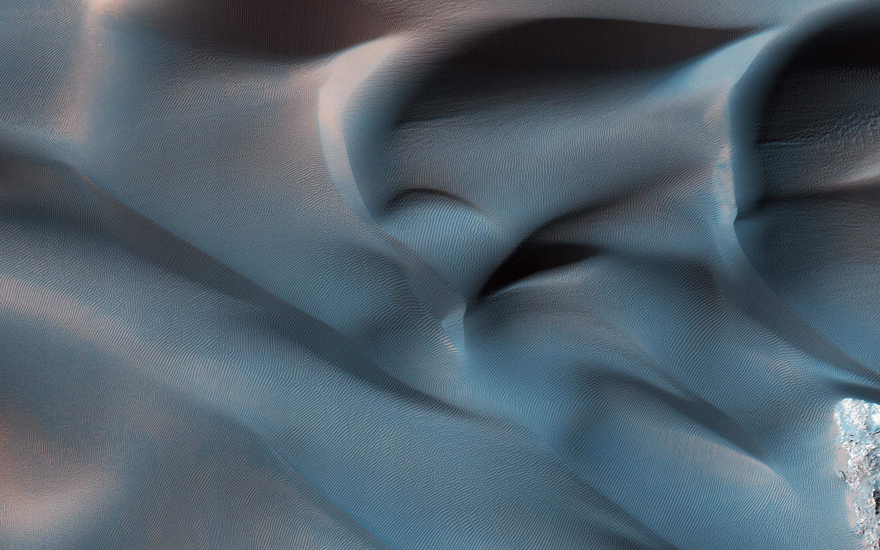
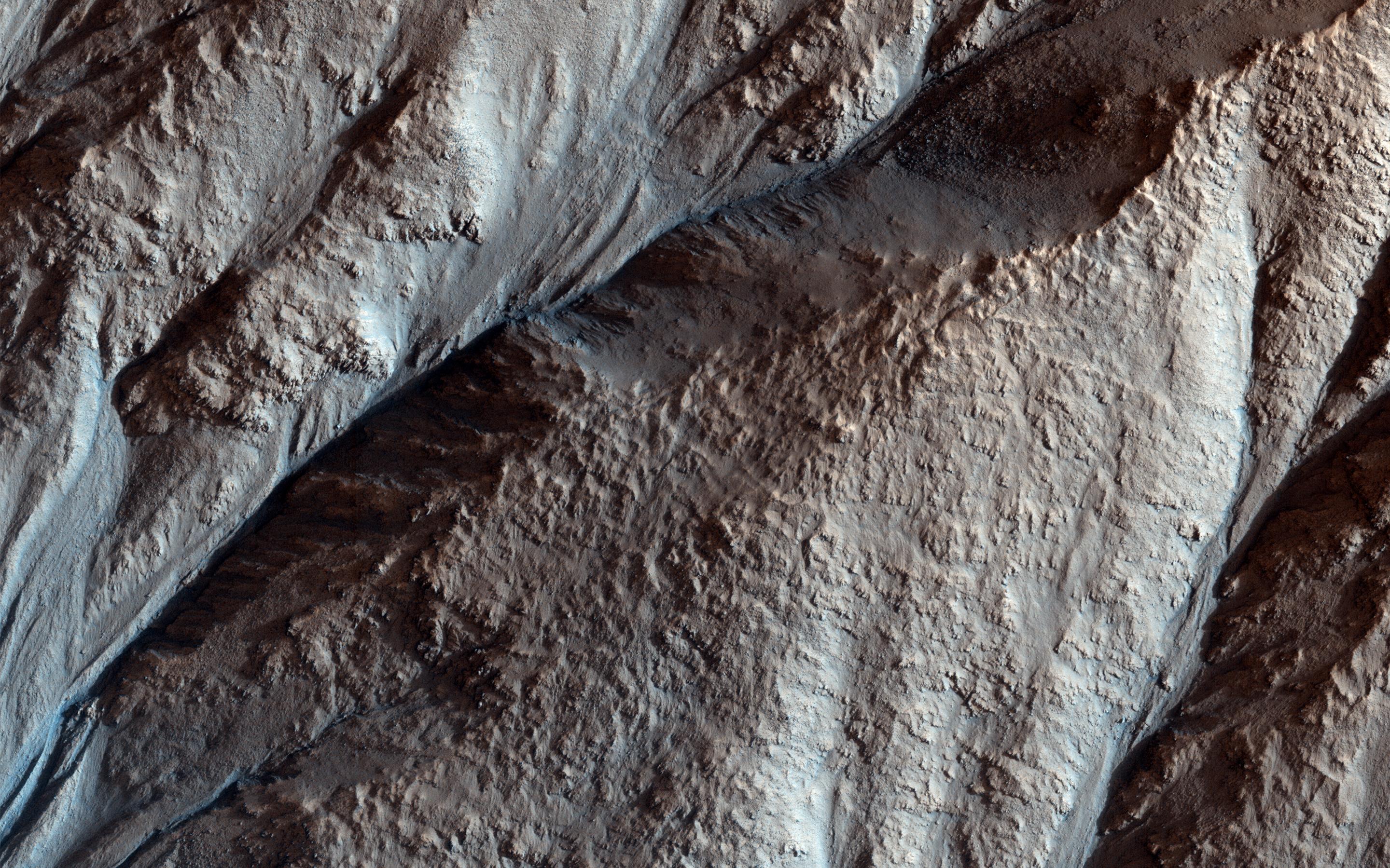
2018-09-04 |
Mars
|
Mars Reconnaissance Orbiter (MRO)
|
HiRISE
|
2880x1800x3 |
|
-
PIA22683:
-
A Fan with Inverted Channels
Full Resolution:
TIFF
(15.56 MB)
JPEG
(1.77 MB)
|
|
|
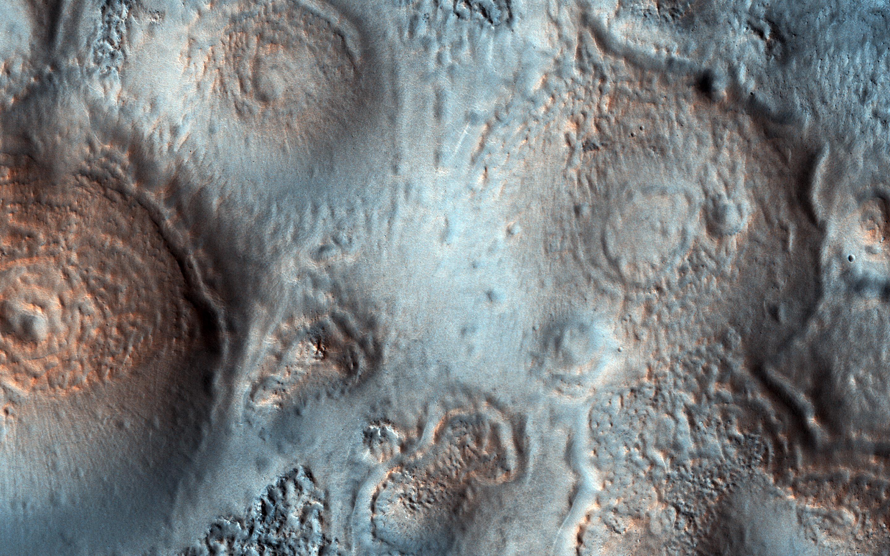
2018-09-04 |
Mars
|
Mars Reconnaissance Orbiter (MRO)
|
HiRISE
|
2880x1800x3 |

|
-
PIA22682:
-
Pitted Cones: Possible Methane Sources?
Full Resolution:
TIFF
(15.56 MB)
JPEG
(938.1 kB)
|
|
|
2018-09-04 |
Mars
|
Mars Reconnaissance Orbiter (MRO)
|
HiRISE
|
2880x1800x3 |
|
-
PIA22681:
-
Crater Gullies and Fractures in Acidalia Planitia
Full Resolution:
TIFF
(15.56 MB)
JPEG
(1.116 MB)
|
|
|
2018-09-04 |
Mars
|
2001 Mars Odyssey
|
THEMIS
|
607x2726x3 |
|
-
PIA22676:
-
Terra Cimmeria - False Color
Full Resolution:
TIFF
(2.231 MB)
JPEG
(115.9 kB)
|
|
|
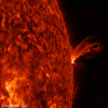
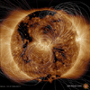
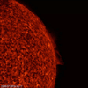
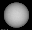
2018-09-03 |
Sol (our sun)
|
SDO
|
Atmosphere Imaging Assembly
|
1780x1750x3 |

|
-
PIA22680:
-
New Active Region Grows Up

Full Resolution:
TIFF
(6.915 MB)
JPEG
(212.3 kB)
|
|
|
2018-09-03 |
Mars
|
2001 Mars Odyssey
|
THEMIS
|
607x2726x3 |

|
-
PIA22675:
-
Terra Cimmeria - False Color
Full Resolution:
TIFF
(2.255 MB)
JPEG
(120.3 kB)
|
|
|
2018-08-31 |
Mars
|
2001 Mars Odyssey
|
THEMIS
|
607x2726x3 |

|
-
PIA22671:
-
Terra Cimmeria - False Color
Full Resolution:
TIFF
(2.255 MB)
JPEG
(120.3 kB)
|
|
|
2018-08-30 |
Jupiter
|
Juno
|
JunoCam
|
1080x1080x3 |
|
-
PIA22687:
-
Jupiter's Swirling Cloudscape
Full Resolution:
TIFF
(3.501 MB)
JPEG
(178.5 kB)
|
|
|
2018-08-30 |
Mars
|
2001 Mars Odyssey
|
THEMIS
|
615x2732x3 |
|
-
PIA22670:
-
Proctor Crater Dunes - False Color
Full Resolution:
TIFF
(2.149 MB)
JPEG
(99.45 kB)
|
|
|
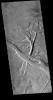
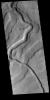
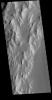
2018-08-29 |
Mars
|
2001 Mars Odyssey
|
THEMIS
|
1373x2638x1 |

|
-
PIA22669:
-
Ascraeus Mons
Full Resolution:
TIFF
(2.574 MB)
JPEG
(363 kB)
|
|
|
2018-08-28 |
Mars
|
2001 Mars Odyssey
|
THEMIS
|
1345x2649x1 |
|
-
PIA22668:
-
Windstreaks
Full Resolution:
TIFF
(2.49 MB)
JPEG
(316.1 kB)
|
|
|
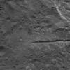
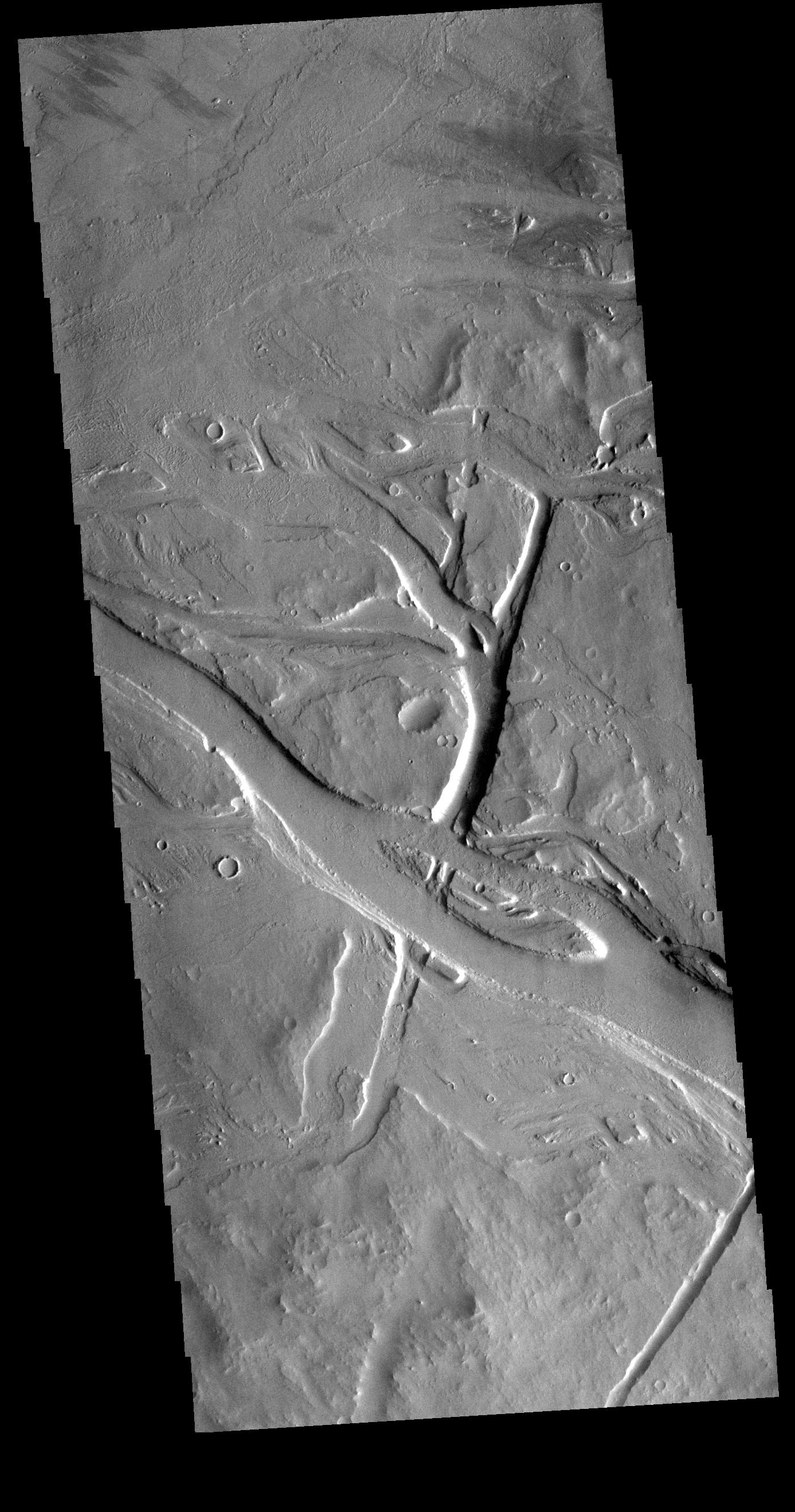
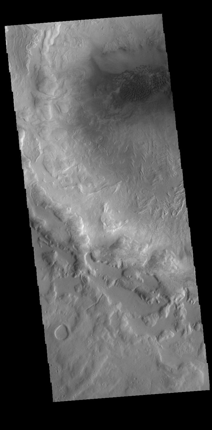
2018-08-27 |
Mars
|
2001 Mars Odyssey
|
THEMIS
|
1388x2640x1 |
|
-
PIA22667:
-
Tharsis Volcanics
Full Resolution:
TIFF
(2.79 MB)
JPEG
(441.2 kB)
|
|
|
2018-08-25 |
Earth
|
Terra
|
MISR
|
1963x2502x1 |
|
-
PIA22494:
-
MISR Hurricane Lane
Full Resolution:
TIFF
(2.337 MB)
JPEG
(213.7 kB)
|
|
|
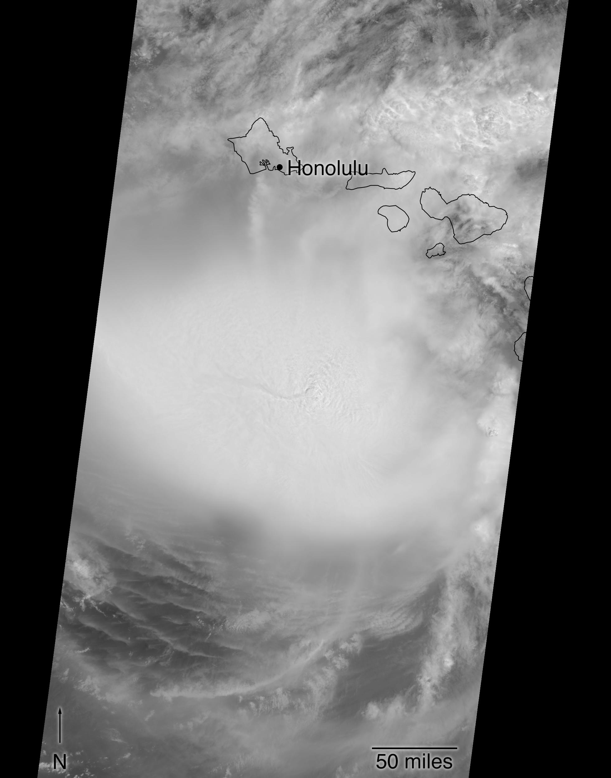
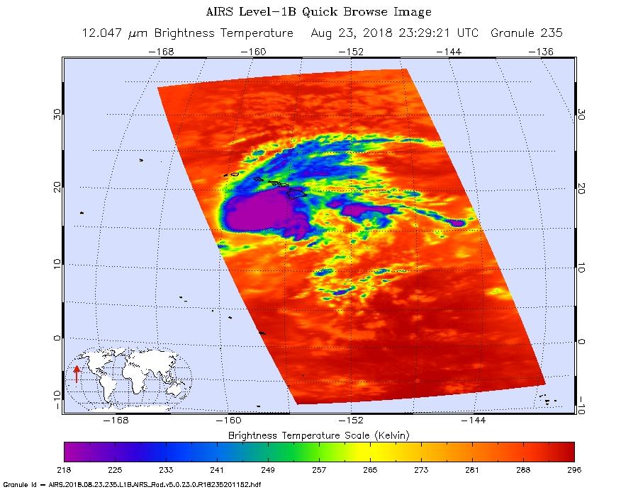
2018-08-24 |
Earth
|
Aqua
|
AIRS
|
900x695x3 |
|
-
PIA22493:
-
Hurricane Lane as Viewed by NASA's AIRS Instrument
Full Resolution:
TIFF
(676.9 kB)
JPEG
(104.3 kB)
|
|
|
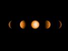
2018-08-24 |
Jupiter
|
Juno
|
JunoCam
|
3458x2160x3 |
|
-
PIA22686:
-
Time-lapse Sequence of Jupiter's North
Full Resolution:
TIFF
(16.3 MB)
JPEG
(772 kB)
|
|
|
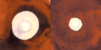
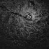
2018-08-24 |
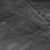
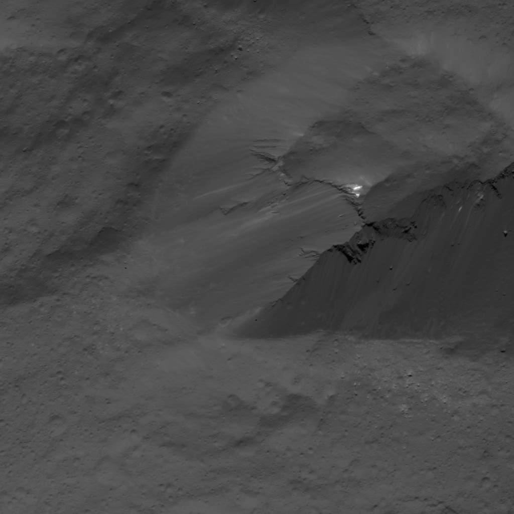
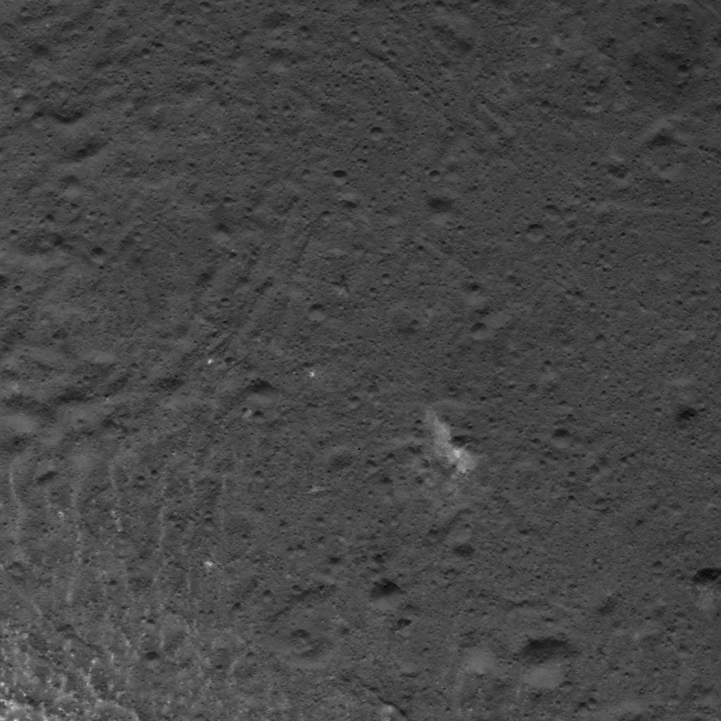
Ceres
|
Dawn
|
Framing Camera
|
1024x1024x1 |
|
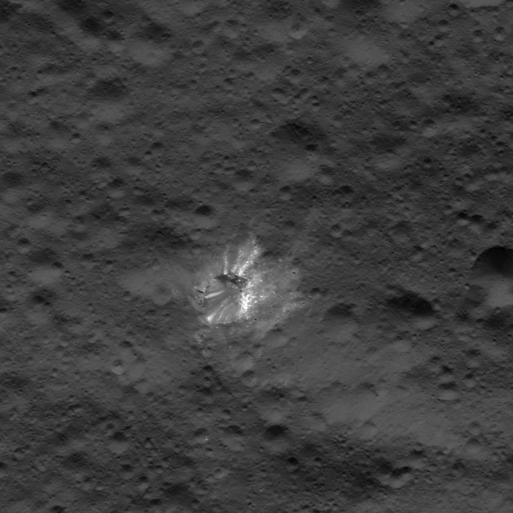
-
PIA22674:
-
Boulders Along Urvara Crater's Wall
Full Resolution:
TIFF
(1.05 MB)
JPEG
(150.3 kB)
|
|
|
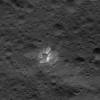
2018-08-24 |
Mars
|
2001 Mars Odyssey
|
THEMIS
|
1335x2636x1 |
|
-
PIA22666:
-
Pavonis Mons
Full Resolution:
TIFF
(2.541 MB)
JPEG
(380.9 kB)
|
|
|
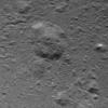
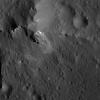
2018-08-23 |
Mars
|
2001 Mars Odyssey
|
THEMIS
|
1385x2639x1 |
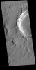
|
-
PIA22665:
-
Crater in Tharsis
Full Resolution:
TIFF
(2.587 MB)
JPEG
(349.5 kB)
|
|
|
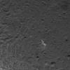
2018-08-22 |
Earth
|
Terra
|
ASTER
|
2429x1856x3 |
|
-
PIA22672:
-
Gold Mining, Siberia
Full Resolution:
TIFF
(13.53 MB)
JPEG
(738.8 kB)
|
|
|
2018-08-22 |
Mars
|
2001 Mars Odyssey
|
THEMIS
|
1334x2654x1 |
|
-
PIA22664:
-
Tyrrhena Fossae
Full Resolution:
TIFF
(2.406 MB)
JPEG
(248.3 kB)
|
|
|
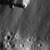
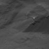
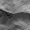
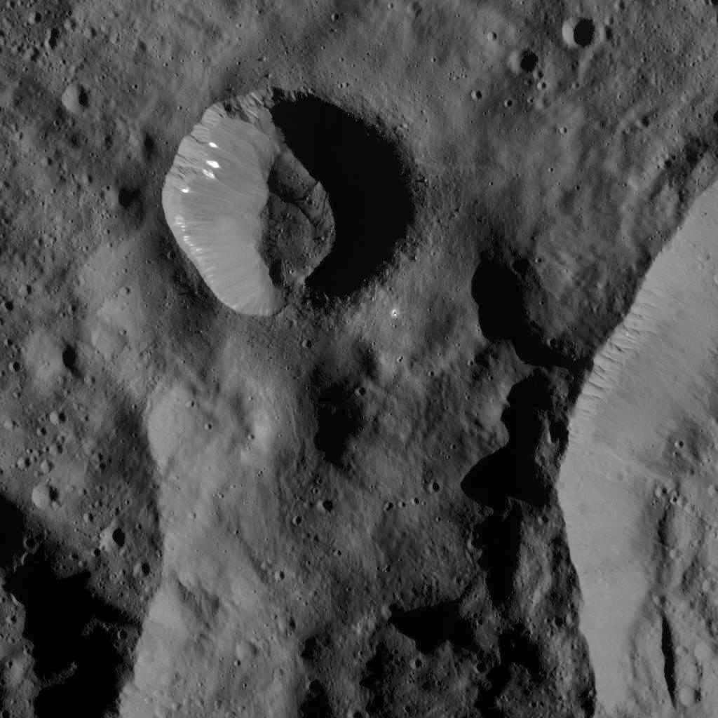
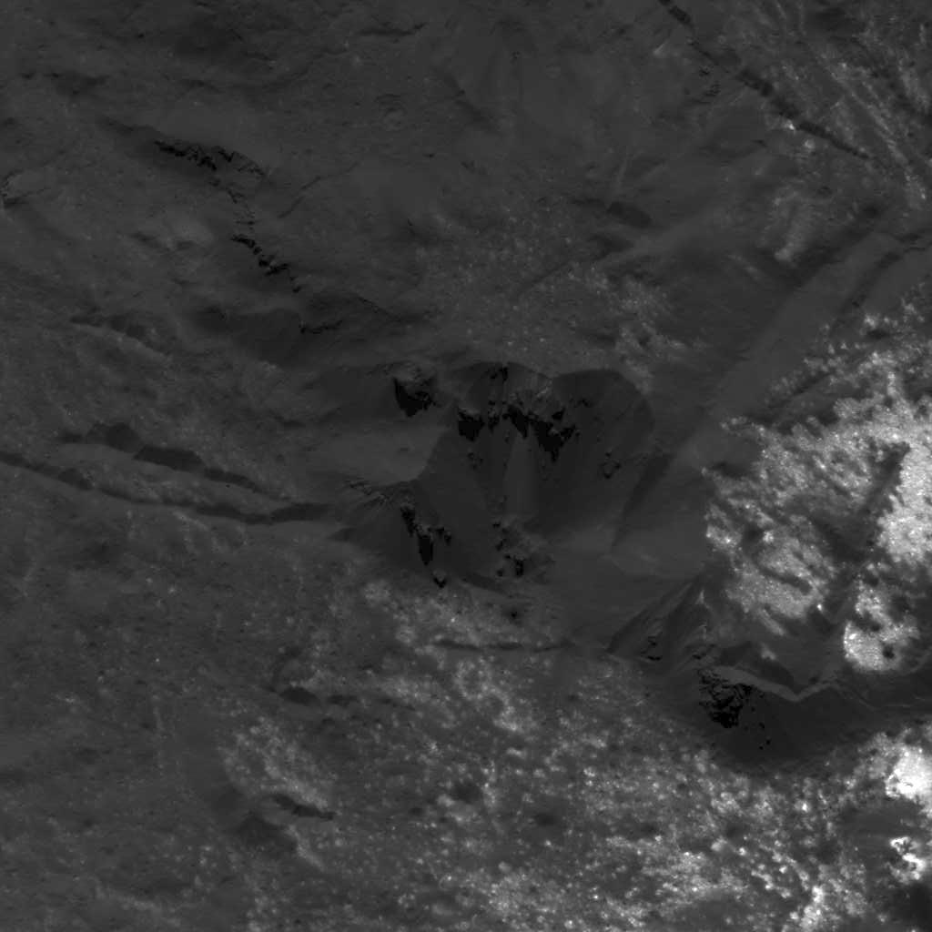
2018-08-21 |
Ceres
|
Dawn
|
Framing Camera
|
2461x1432x1 |
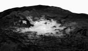
|
-
PIA22480:
-
Mosaic of Cerealia Facula
Full Resolution:
TIFF
(2.394 MB)
JPEG
(247.4 kB)
|
|
|
2018-08-21 |
Mars
|
2001 Mars Odyssey
|
THEMIS
|
1338x2697x1 |

|
-
PIA22663:
-
Russell Crater Dunes
Full Resolution:
TIFF
(2.452 MB)
JPEG
(255.9 kB)
|
|
|
2018-08-20 |
Sol (our sun)
|
SDO
|
Atmosphere Imaging Assembly
|
1498x1500x3 |
|
-
PIA22673:
-
Twisting Outburst
Full Resolution:
TIFF
(3.898 MB)
JPEG
(196.1 kB)
|
|
|
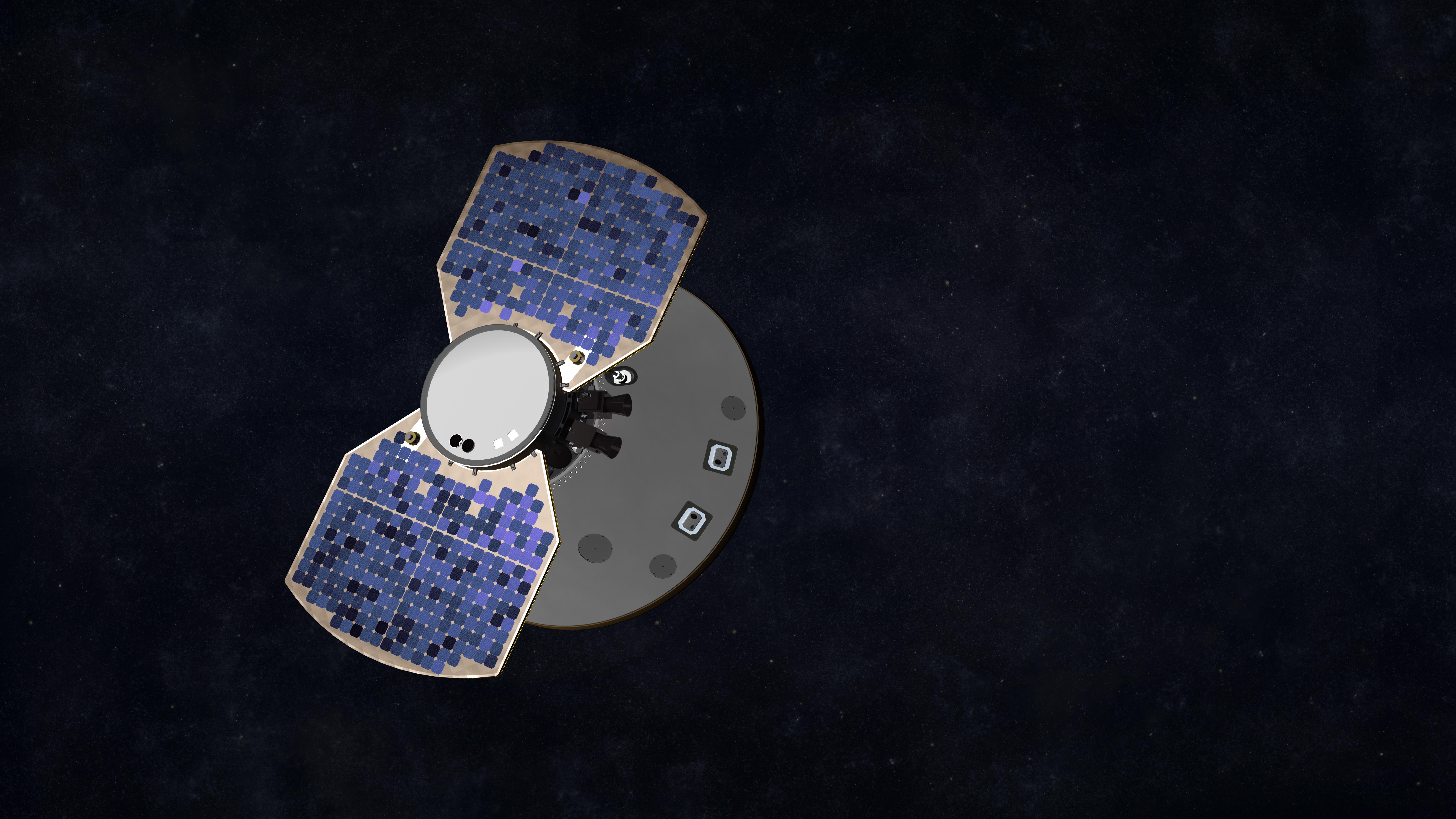
2018-08-20 |
|
InSight
|
|
6500x3656x3 |
|
-
PIA22547:
-
InSight Cruises to Mars (Artist's Concept)
Full Resolution:
TIFF
(36.76 MB)
JPEG
(1.828 MB)
|
|
|
2018-08-20 |
Mars
|
InSight
|
Instrument Context Camera (ICC)
|
1129x1125x3 |
|
-
PIA22647:
-
InSight's Inner Sanctum Revealed
Full Resolution:
TIFF
(3.284 MB)
JPEG
(245.7 kB)
|
|
|
2018-08-20 |
|
2001 Mars Odyssey
|
THEMIS
|
1376x2640x1 |
|
-
PIA22659:
-
Olympus Rupes
Full Resolution:
TIFF
(2.125 MB)
JPEG
(215.2 kB)
|
|
|
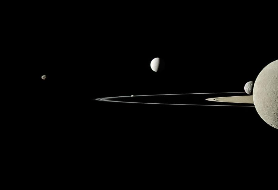
2018-08-20 |
Tethys
|
Cassini-Huygens
|
ISS - Narrow Angle
|
1015x1014x3 |
|
-
PIA22648:
-
Tête-à-tête
Full Resolution:
TIFF
(1.443 MB)
JPEG
(28.34 kB)
|
|
|
2018-08-17 |
|
2001 Mars Odyssey
|
THEMIS
|
1372x2644x1 |
|
-
PIA22658:
-
Eumenides Dorsum
Full Resolution:
TIFF
(2.758 MB)
JPEG
(413.4 kB)
|
|
|
2018-08-16 |
|
2001 Mars Odyssey
|
THEMIS
|
1395x2644x1 |

|
-
PIA22657:
-
Sacra Fossae
Full Resolution:
TIFF
(2.534 MB)
JPEG
(298.1 kB)
|
|
|
2018-08-15 |
|
2001 Mars Odyssey
|
THEMIS
|
1386x2643x1 |
|
-
PIA22656:
-
Orcus Patera
Full Resolution:
TIFF
(2.519 MB)
JPEG
(231.4 kB)
|
|
|
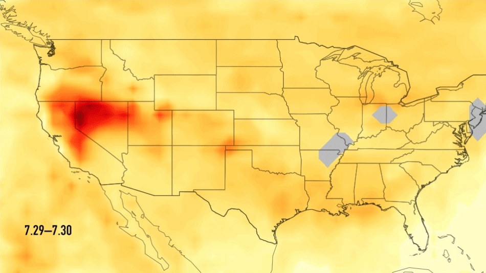
2018-08-14 |
Earth
|
Aqua
|
AIRS
|
950x534x3 |
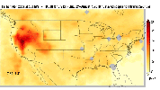
|
-
PIA22492:
-
Carbon Monoxide Transport from California Wildfires, July 30-August 7, 2018
Full Resolution:
TIFF
(452.9 kB)
JPEG
(421.9 kB)
|
|
|
2018-08-14 |
Sol (our sun)
|
SDO
|
Atmosphere Imaging Assembly
|
1800x1800x3 |
|
-
PIA22662:
-
Magnetic Field Portrayed
Full Resolution:
TIFF
(8.707 MB)
JPEG
(757.2 kB)
|
|
|
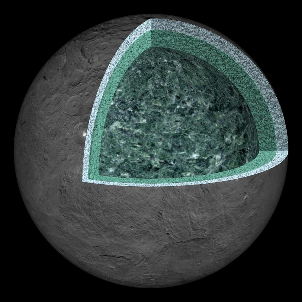
2018-08-14 |
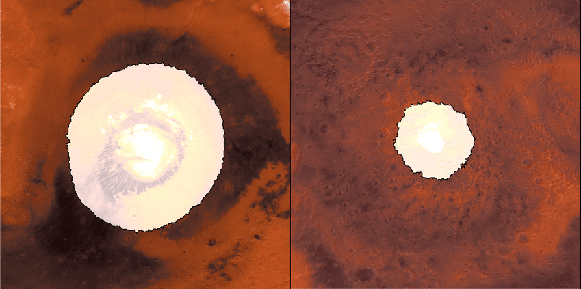
Ceres
|
Dawn
|
Framing Camera
|
1000x1000x3 |
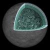
|
-
PIA22660:
-
Ceres' Internal Structure (Artist's Concept)
Full Resolution:
TIFF
(1.88 MB)
JPEG
(123.1 kB)
|
|
|
2018-08-14 |
|
2001 Mars Odyssey
|
THEMIS
|
1397x2645x1 |

|
-
PIA22625:
-
Lycus Sulci
Full Resolution:
TIFF
(2.377 MB)
JPEG
(227.1 kB)
|
|
|
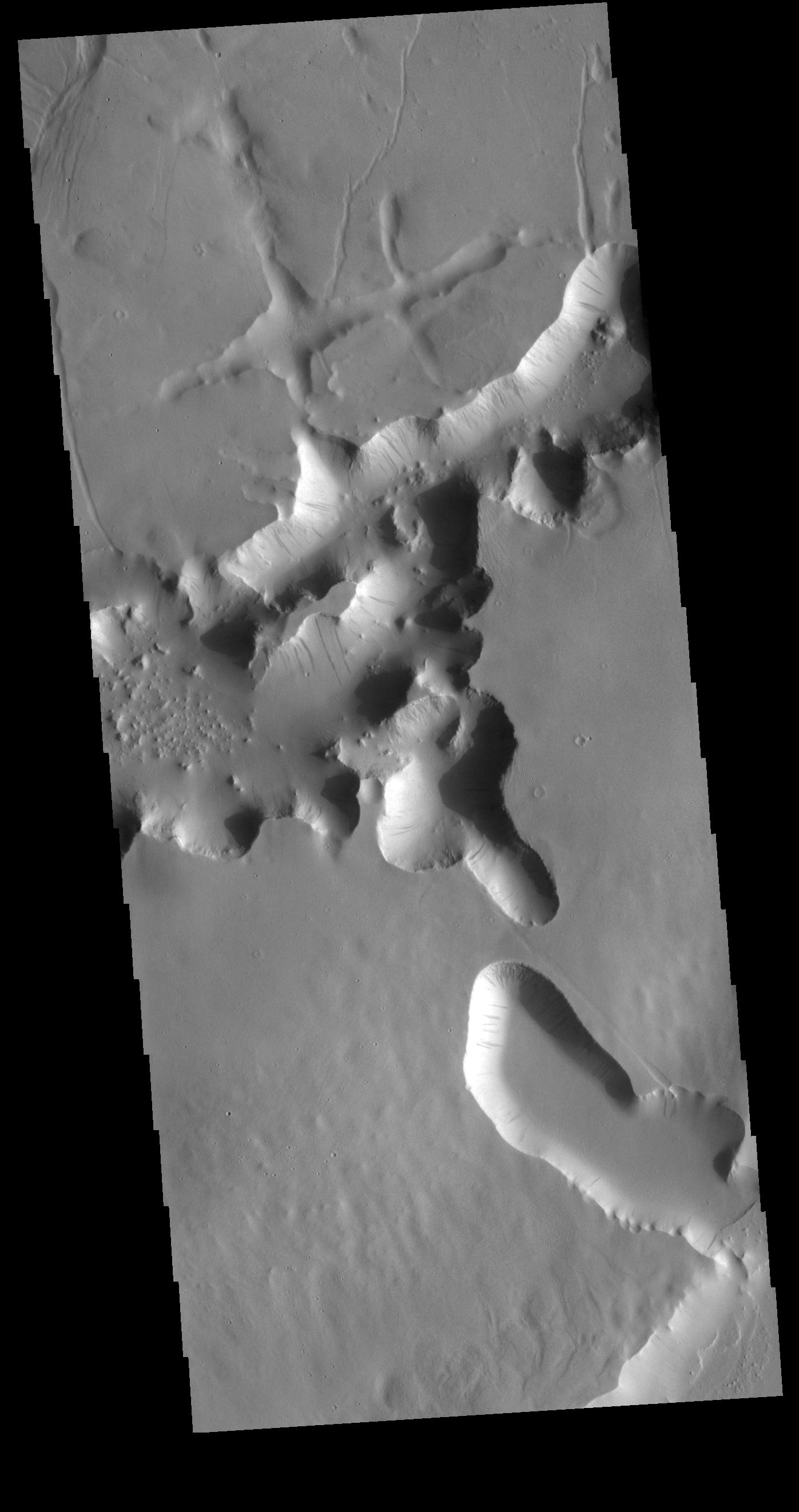
2018-08-13 |
Mars
|
2001 Mars Odyssey
|
THEMIS
|
1372x2645x1 |
|
-
PIA22624:
-
Aram Chaos
Full Resolution:
TIFF
(2.565 MB)
JPEG
(266 kB)
|
|
|
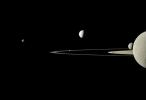
2018-08-13 |
Saturn
|
Cassini-Huygens
|
ISS - Narrow Angle
|
1933x998x3 |
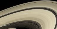
|
-
PIA14943:
-
Translucent Arcs
Full Resolution:
TIFF
(3.965 MB)
JPEG
(188.2 kB)
|
|
|
2018-08-10 |
Jupiter
|
Juno
|
JunoCam
|
3000x3000x3 |
|
-
PIA22429:
-
Jovian Tapestry
Full Resolution:
TIFF
(25.18 MB)
JPEG
(874.4 kB)
|
|
|
2018-08-10 |
Mars
|
2001 Mars Odyssey
|
THEMIS
|
1416x2646x1 |
|
-
PIA22623:
-
Buvinda Vallis
Full Resolution:
TIFF
(2.535 MB)
JPEG
(278.1 kB)
|
|
|
2018-08-09 |
|
Hubble Space Telescope
Spitzer Space Telescope
|
|
15556x11667x3 |
|
-
PIA22565:
-
Ultrahot Jupiter WASP-121b
Full Resolution:
TIFF
(23.61 MB)
JPEG
(3.002 MB)
|
|
|
2018-08-09 |
Mars
|
2001 Mars Odyssey
|
THEMIS
|
1357x2644x1 |
|
-
PIA22622:
-
Dark Slope Streaks
Full Resolution:
TIFF
(2.452 MB)
JPEG
(234 kB)
|
|
|
2018-08-08 |
|
Terra
|
ASTER
|
2200x1800x3 |
|
-
PIA21220:
-
La Paz, Bolivia
Full Resolution:
TIFF
(11.89 MB)
JPEG
(986.6 kB)
|
|
|
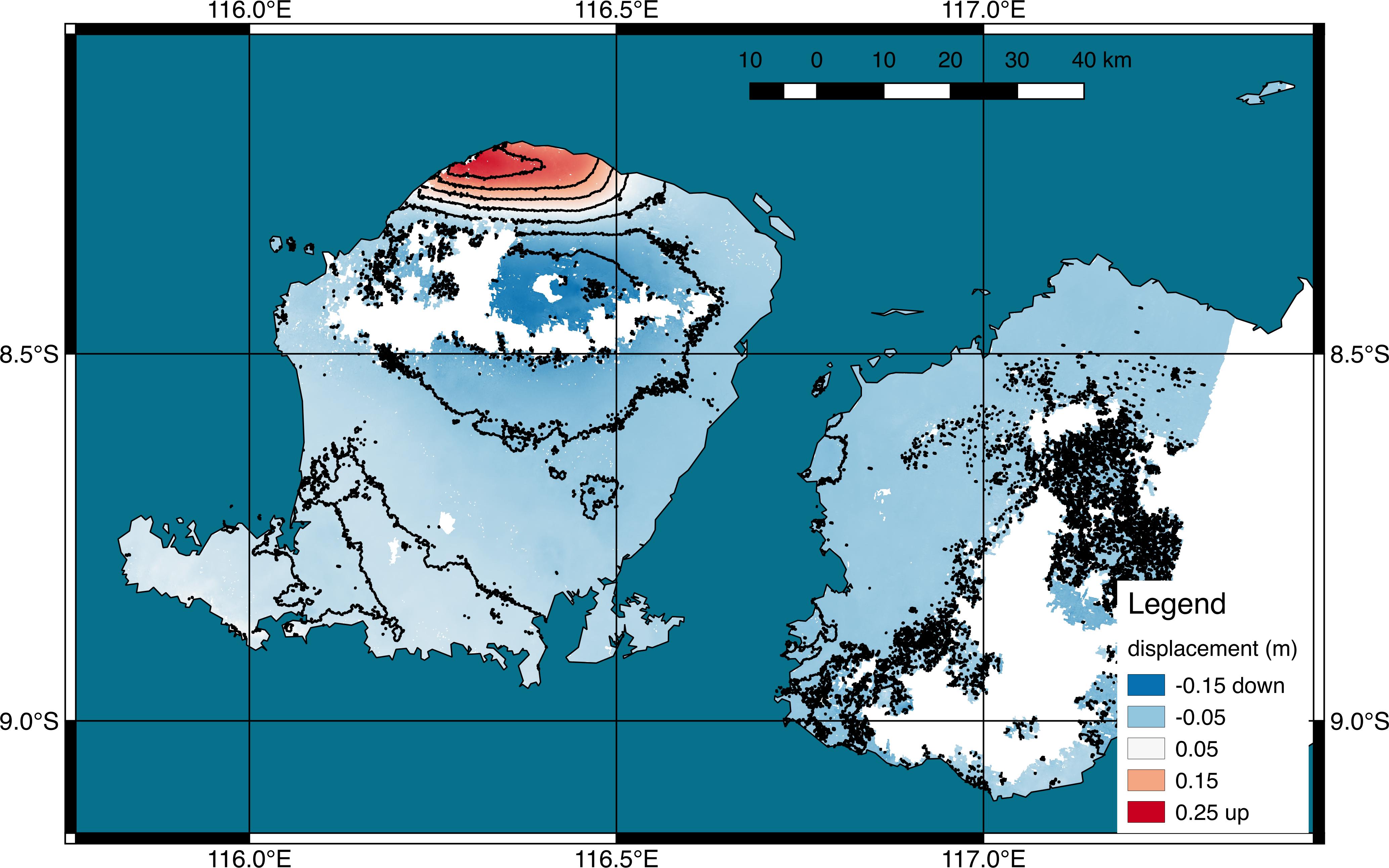
2018-08-08 |
Earth
|
ARIA
|
|
4135x2584x3 |
|
-
PIA22491:
-
NASA's ARIA Project Generates Satellite-Derived Map of Ground Deformation from Earthquake beneath Lombok, Indonesia
Full Resolution:
TIFF
(4.273 MB)
JPEG
(840 kB)
|
|
|
2018-08-08 |
Mars
|
2001 Mars Odyssey
|
THEMIS
|
1393x2645x1 |

|
-
PIA22621:
-
Hephaestus Fossae
Full Resolution:
TIFF
(2.383 MB)
JPEG
(282.3 kB)
|
|
|
2018-08-07 |
Sol (our sun)
|
SDO
|
Atmosphere Imaging Assembly
|
1687x1684x3 |
|
-
PIA22661:
-
Twisting Prominences
Full Resolution:
TIFF
(3.843 MB)
JPEG
(231.7 kB)
|
|
|
2018-08-07 |
Mars
|
2001 Mars Odyssey
|
THEMIS
|
1377x2642x1 |
|
-
PIA22620:
-
Dark Slope Streaks
Full Resolution:
TIFF
(2.493 MB)
JPEG
(254 kB)
|
|
|
2018-08-06 |
Mars
|
Mars Reconnaissance Orbiter (MRO)
Mars Global Surveyor (MGS)
|
MCS
Thermal Emission Spectrometer
|
849x423x3 |
|
-
PIA22546:
-
Growth and Retreat of the CO2 Ice at the Martian Poles
Full Resolution:
TIFF
(562.4 kB)
JPEG
(383.2 kB)
|
|
|
2018-08-06 |
Mars
|
2001 Mars Odyssey
|
THEMIS
|
1405x2646x1 |

|
-
PIA22619:
-
Elysium Fossae
Full Resolution:
TIFF
(2.365 MB)
JPEG
(253.5 kB)
|
|
|
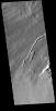
2018-08-03 |
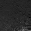
Mars
|
2001 Mars Odyssey
|
THEMIS
|
718x1458x1 |

|
-
PIA22618:
-
Crater Dunes
Full Resolution:
TIFF
(735.7 kB)
JPEG
(80.45 kB)
|
|
|
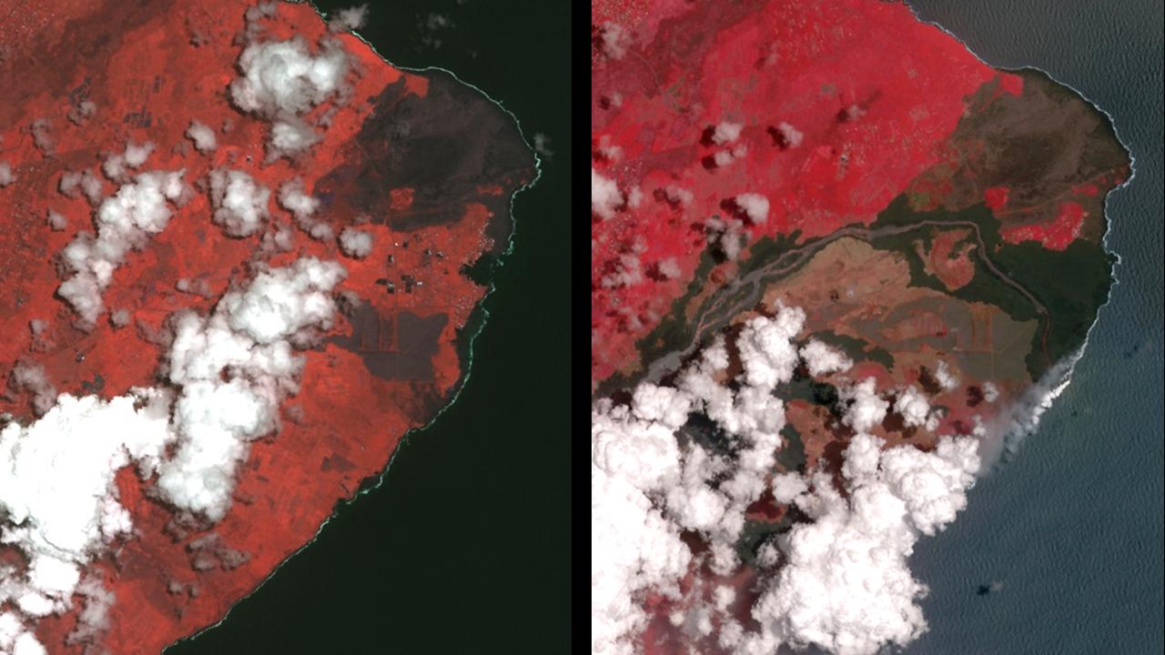
2018-08-02 |
Earth
|
ECOSTRESS
|
|
740x697x3 |
|
-
PIA22490:
-
ECOSTRESS Detects Wildfires in Western U.S.
Full Resolution:
TIFF
(668.4 kB)
JPEG
(367.8 kB)
|
|
|
2018-08-02 |
Jupiter
|
Juno
|
JunoCam
|
3840x2160x3 |
|
-
PIA22428:
-
Artistic Portrait of Jupiter
Full Resolution:
TIFF
(10.1 MB)
JPEG
(341.5 kB)
|
|
|
2018-08-02 |
|
Spitzer Space Telescope
|
IRAC
|
1234x960x3 |
|
-
PIA22564:
-
Spitzer Spies Supernova Remnant HBH 3
Full Resolution:
TIFF
(3.555 MB)
JPEG
(311.6 kB)
|
|
|
2018-08-02 |
Mars
|
2001 Mars Odyssey
|
THEMIS
|
1381x2643x1 |
|
-
PIA22617:
-
Sacra Fossae
Full Resolution:
TIFF
(2.19 MB)
JPEG
(172.7 kB)
|
|
|
2018-08-01 |
Earth
|
Terra
|
MISR
|
4200x3300x3 |
|
-
PIA22591:
-
MISR Where on Earth ...? MISR Mystery Image Quiz #30
Full Resolution:
TIFF
(41.61 MB)
JPEG
(1.578 MB)
|
|
|
2018-08-01 |
Mars
|
2001 Mars Odyssey
|
THEMIS
|
1362x2651x1 |
|
-
PIA22616:
-
Ganges Chasma Landslide
Full Resolution:
TIFF
(2.56 MB)
JPEG
(294.3 kB)
|
|
|
2018-07-31 |
Earth
|
Terra
|
MISR
|
1629x1019x3 |
|
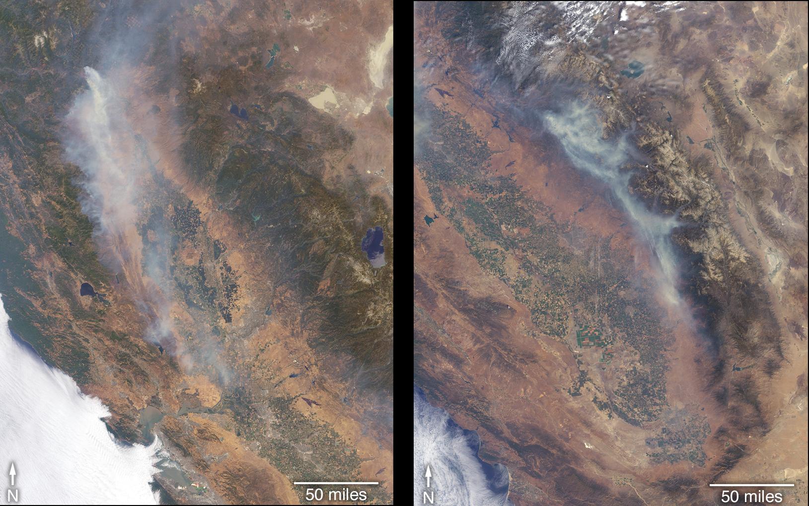
-
PIA22488:
-
California Wildfires Captured by NASA Satellite
Full Resolution:
TIFF
(4.982 MB)
JPEG
(290.4 kB)
|
|
|
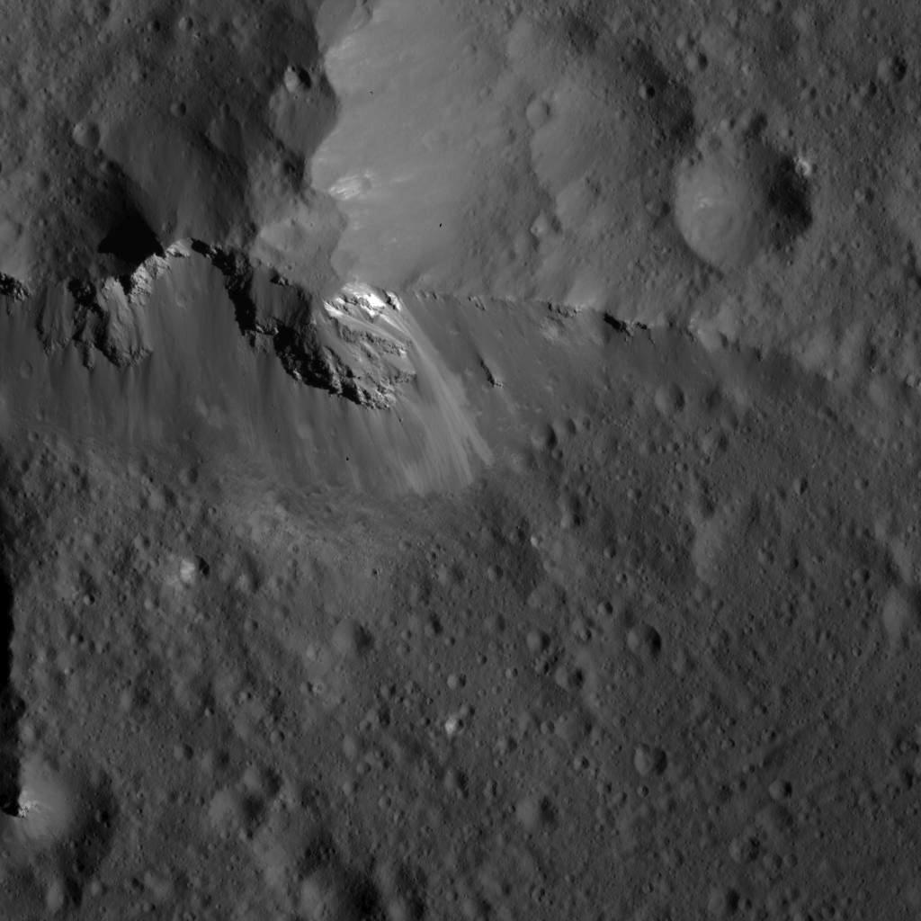
2018-07-31 |
Ceres
|
Dawn
|
Framing Camera
|
1024x1024x1 |
|
-
PIA22644:
-
Detail of the Vinalia Faculae in Occator Crater
Full Resolution:
TIFF
(983.1 kB)
JPEG
(104.5 kB)
|
|
|
2018-07-31 |
Ceres
|
Dawn
|
Framing Camera
|
1024x1024x1 |
|
-
PIA22643:
-
Landslides Along Occator Crater's Wall
Full Resolution:
TIFF
(1.019 MB)
JPEG
(128 kB)
|
|
|
2018-07-31 |
Ceres
|
Dawn
|
Framing Camera
|
1024x1024x1 |
|
-
PIA22642:
-
Lobate Flows on Occator Crater's Floor
Full Resolution:
TIFF
(1.035 MB)
JPEG
(154.1 kB)
|
|
|
2018-07-31 |
Ceres
|
Dawn
|
Framing Camera
|
1024x1024x1 |
|
-
PIA22641:
-
Bright Crater on Ceres
Full Resolution:
TIFF
(862.5 kB)
JPEG
(103.1 kB)
|
|
|
2018-07-31 |
Ceres
|
Dawn
|
Framing Camera
|
1024x1024x1 |
|
-
PIA22640:
-
Scarp in Occator Crater
Full Resolution:
TIFF
(622.6 kB)
JPEG
(54.61 kB)
|
|
|
2018-07-31 |
Ceres
|
Dawn
|
Framing Camera
|
1024x1024x1 |
|
-
PIA22639:
-
Domes and Fractures in Occator Crater
Full Resolution:
TIFF
(890.7 kB)
JPEG
(111.9 kB)
|
|
|
2018-07-31 |
Ceres
|
Dawn
|
Framing Camera
|
1024x1024x1 |
|
-
PIA22638:
-
Complex Bright and Dark Material Relationships in Occator Crater
Full Resolution:
TIFF
(661.1 kB)
JPEG
(56.53 kB)
|
|
|
2018-07-31 |
Ceres
|
Dawn
|
Framing Camera
|
1024x1024x1 |
|
-
PIA22637:
-
Fractures Across Occator Crater's Floor
Full Resolution:
TIFF
(736.4 kB)
JPEG
(80.28 kB)
|
|
|
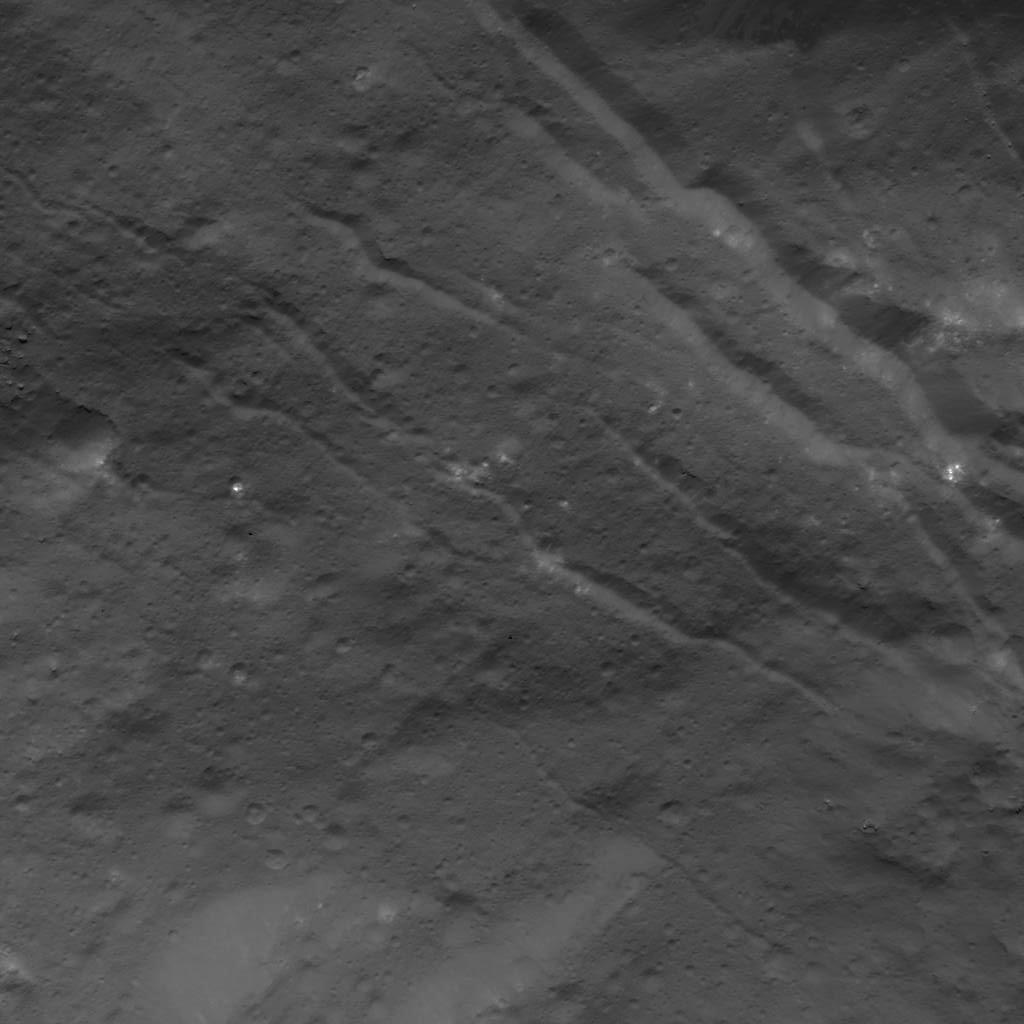
2018-07-31 |
Ceres
|
Dawn
|
Framing Camera
|
1024x1024x1 |
|
-
PIA22636:
-
Urvara Crater's Ridge
Full Resolution:
TIFF
(1.05 MB)
JPEG
(146.4 kB)
|
|
|
2018-07-31 |
Ceres
|
Dawn
|
Framing Camera
|
1024x1024x1 |

|
-
PIA22635:
-
Bright Spots in Small Crater on Ceres
Full Resolution:
TIFF
(1.05 MB)
JPEG
(121.3 kB)
|
|
|
2018-07-31 |
Ceres
|
Dawn
|
Framing Camera
|
1024x1024x1 |
|
-
PIA22634:
-
Fractures in Occator Crater
Full Resolution:
TIFF
(765.1 kB)
JPEG
(80.24 kB)
|
|
|
2018-07-31 |
Ceres
|
Dawn
|
Framing Camera
|
1024x1024x1 |
|
-
PIA22633:
-
Occator Crater Wall
Full Resolution:
TIFF
(968.5 kB)
JPEG
(121.3 kB)
|
|
|
2018-07-31 |
Ceres
|
Dawn
|
Framing Camera
|
1024x1024x1 |
|
-
PIA22632:
-
Dome in Occator Crater
Full Resolution:
TIFF
(1.002 MB)
JPEG
(148.8 kB)
|
|
|
2018-07-31 |
Ceres
|
Dawn
|
Framing Camera
|
1024x1024x1 |
|
-
PIA22631:
-
Complex Patterns on Occator Crater's Floor
Full Resolution:
TIFF
(912.9 kB)
JPEG
(134.5 kB)
|
|
|
2018-07-31 |
Ceres
|
Dawn
|
Framing Camera
|
1024x1024x1 |
|
-
PIA22630:
-
Fracture Pattern Near Cerealia Facula
Full Resolution:
TIFF
(648.8 kB)
JPEG
(64.62 kB)
|
|
|
2018-07-31 |
Ceres
|
Dawn
|
Framing Camera
|
1024x1024x1 |

|
-
PIA22629:
-
Bright Material in Occator Crater
Full Resolution:
TIFF
(747.8 kB)
JPEG
(70.91 kB)
|
|
|
2018-07-31 |
Ceres
|
Dawn
|
Framing Camera
|
1024x1024x1 |
|
-
PIA22628:
-
Fractures in Occator Crater's Floor
Full Resolution:
TIFF
(945.8 kB)
JPEG
(127.3 kB)
|
|
|
2018-07-31 |
Ceres
|
Dawn
|
Framing Camera
|
1024x1024x1 |
|
-
PIA22627:
-
Detail of Urvara Crater's Central Ridge
Full Resolution:
TIFF
(976.9 kB)
JPEG
(100.6 kB)
|
|
|
2018-07-31 |
Ceres
|
Dawn
|
Framing Camera
|
1024x1024x1 |
|
-
PIA22626:
-
Vinalia Faculae Detail
Full Resolution:
TIFF
(933.1 kB)
JPEG
(116.3 kB)
|
|
|
2018-07-31 |
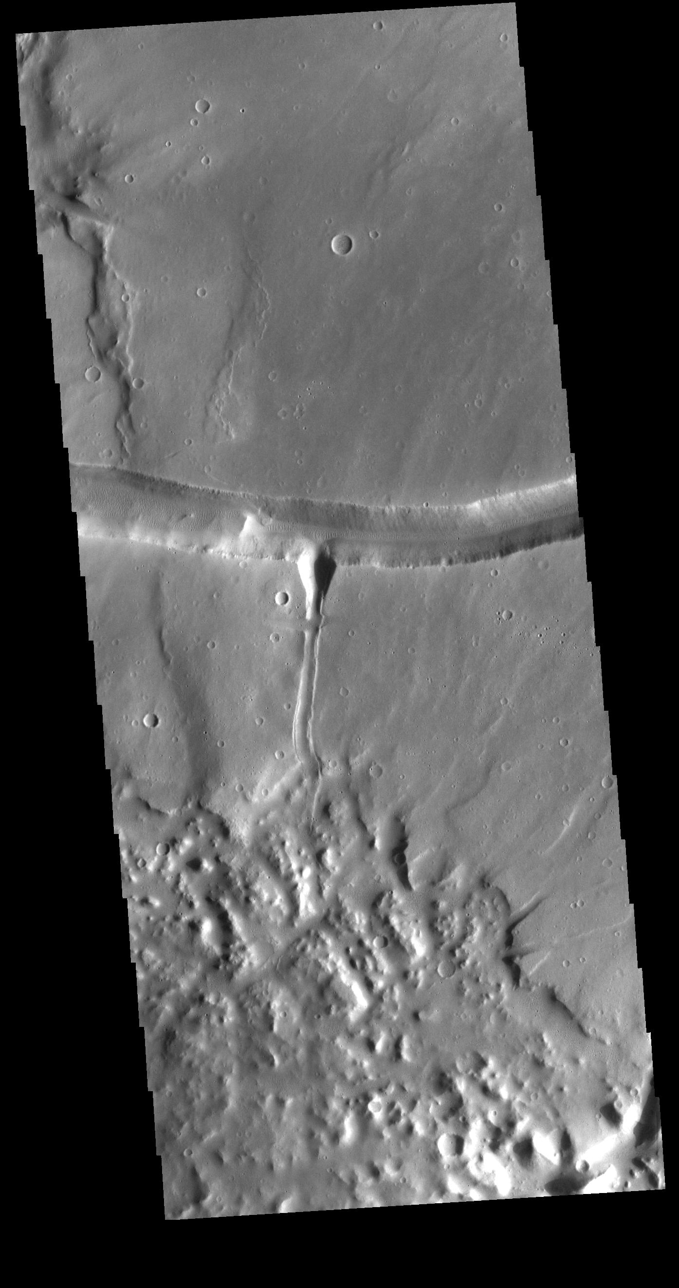
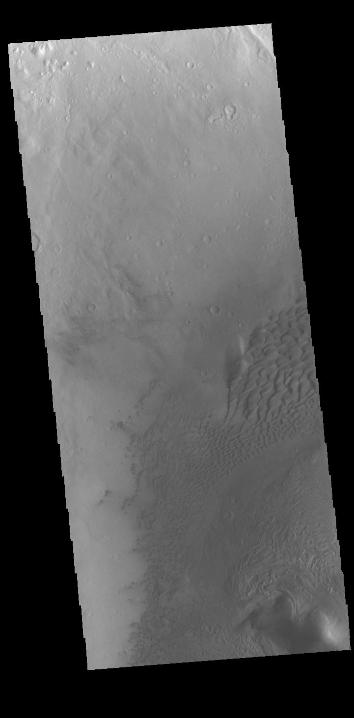
Mars
|
2001 Mars Odyssey
|
THEMIS
|
721x1461x1 |

|
-
PIA22615:
-
Moreux Crater Dunes
Full Resolution:
TIFF
(640.1 kB)
JPEG
(58.44 kB)
|
|
|
2018-07-31 |
Sol (our sun)
|
SDO
|
Atmosphere Imaging Assembly
|
1740x1635x1 |
|
-
PIA22646:
-
An Almost Spotless Record
Full Resolution:
TIFF
(1.411 MB)
JPEG
(157.9 kB)
|
|
|
2018-07-30 |
Mars
|
2001 Mars Odyssey
|
THEMIS
|
1353x2645x1 |
|
-
PIA22614:
-
Daedalia Planum Crater
Full Resolution:
TIFF
(2.399 MB)
JPEG
(284.6 kB)
|
|
|
2018-07-30 |
Saturn
|
Cassini-Huygens
|
ISS - Narrow Angle
|
916x627x3 |
|
-
PIA12797:
-
Group Portrait
Full Resolution:
TIFF
(162.1 kB)
JPEG
(16.74 kB)
|
|
|
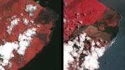
2018-07-28 |
Earth
|
Terra
|
ASTER
|
1280x720x3 |
|
-
PIA22593:
-
Dramatic Changes from Kilauea Leilani Estates Lava Flows Seen by NASA Spacecraft
Full Resolution:
TIFF
(2.739 MB)
JPEG
(114.3 kB)
|
|
|
2018-07-27 |
|
CAL
|
|
960x1280x3 |
|
-
PIA22563:
-
Cold Atom Lab Physics Package
Full Resolution:
TIFF
(3.026 MB)
JPEG
(95.8 kB)
|
|
|
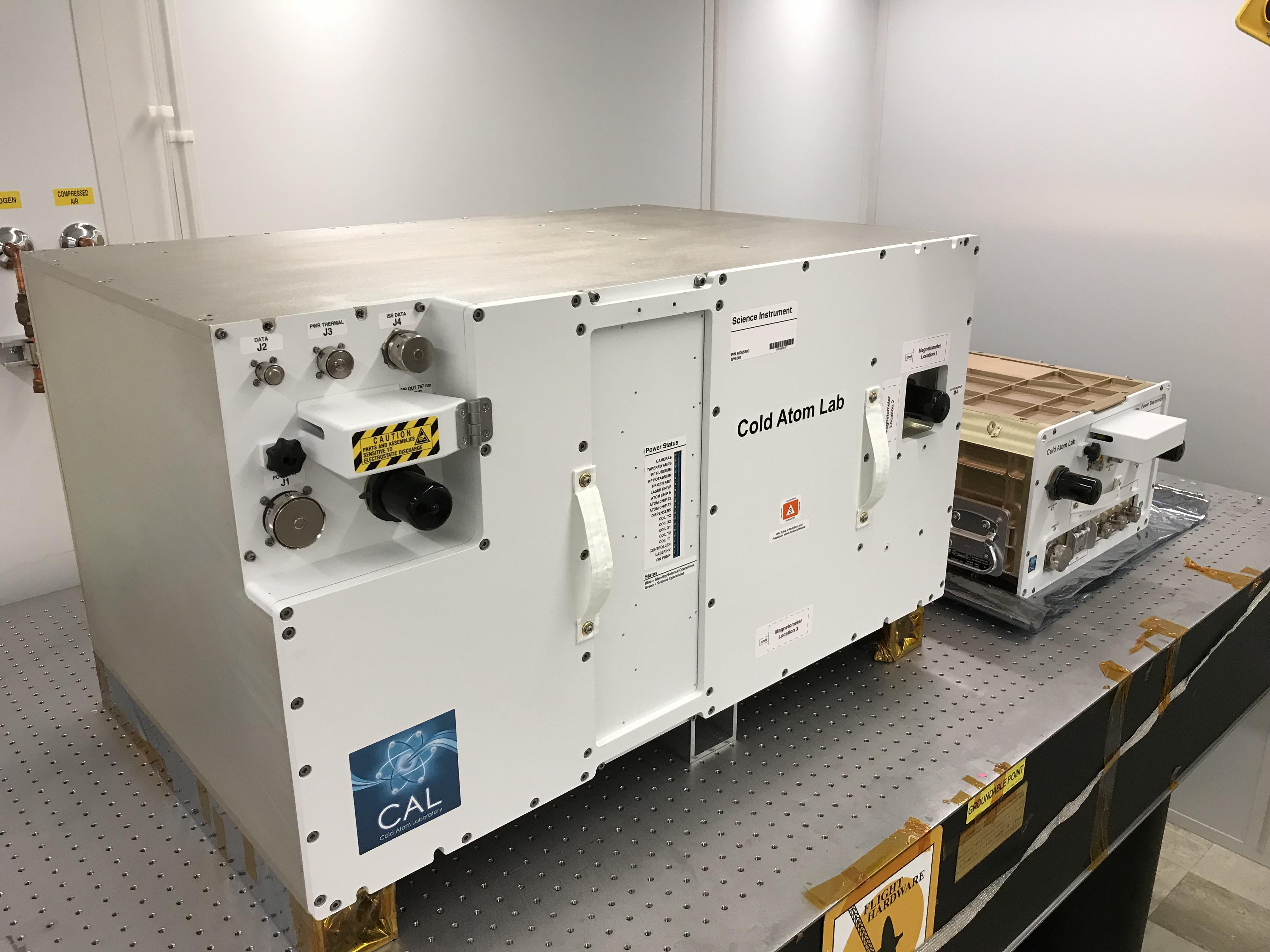
2018-07-27 |
|
CAL
|
|
4032x3024x3 |
|
-
PIA22562:
-
CAL Before Flight
Full Resolution:
TIFF
(23.34 MB)
JPEG
(828.4 kB)
|
|
|
2018-07-27 |
|
CAL
|
|
1623x940x3 |
|
-
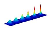
PIA22561:
-
Bose-Einstein Condensate Graph
Full Resolution:
TIFF
(649 kB)
JPEG
(99.19 kB)
|
 Planetary Data System


