Click on an image for detailed information
Click on a column heading to sort in ascending or descending order

My
List |
Addition Date
|
Target
|
Mission
|
Instrument
|
Size
|

|
2009-01-22 |
Mars
|
Mars Exploration Rover (MER)
|
Navigation Camera
|
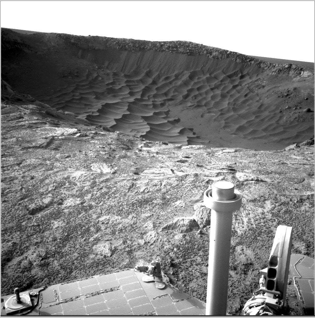
4000x4000x1 |

|
-
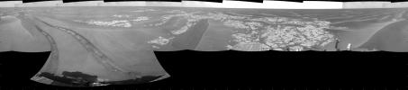
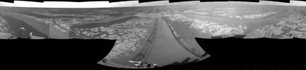
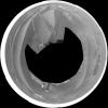
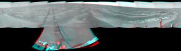
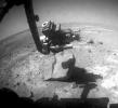
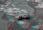
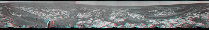
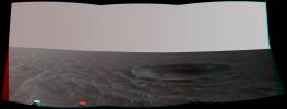
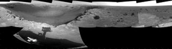
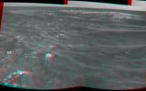
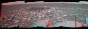
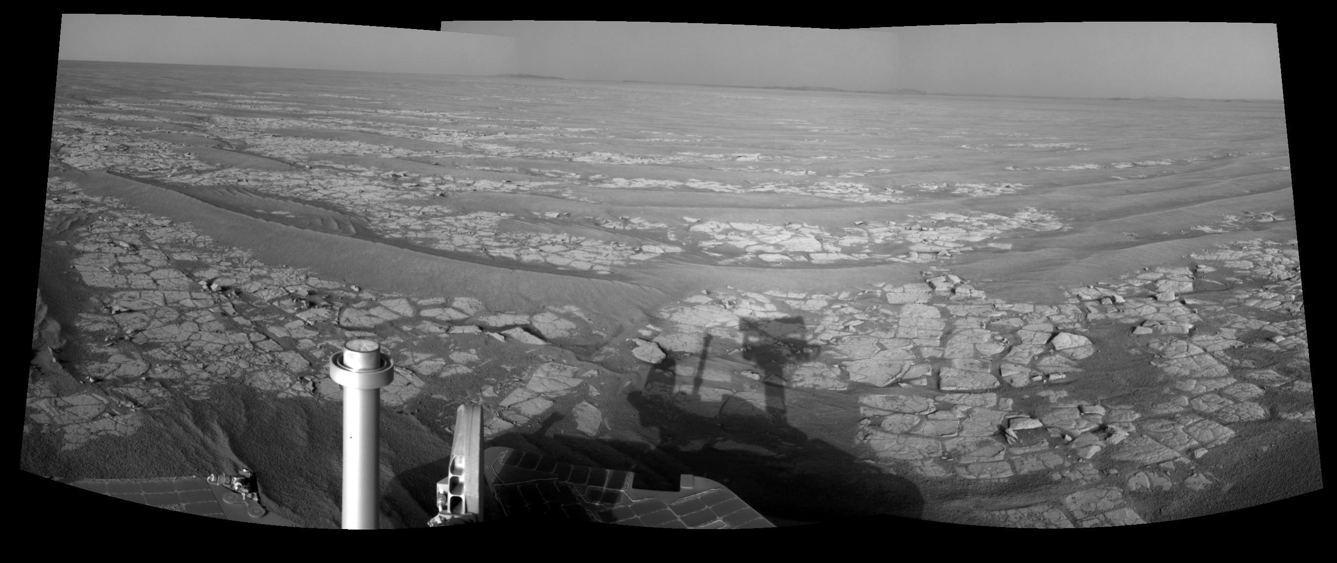
PIA11388:
-
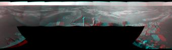
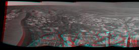
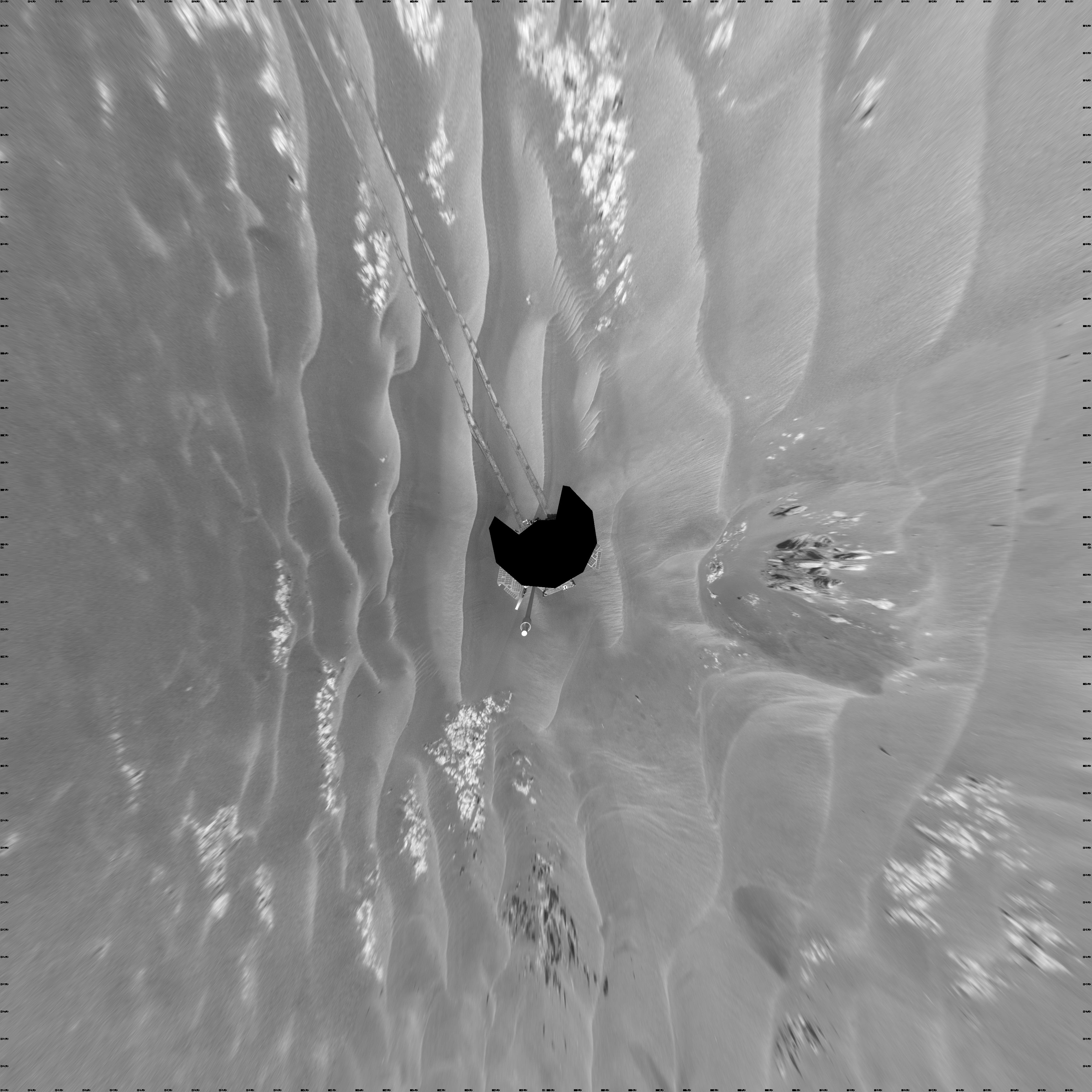
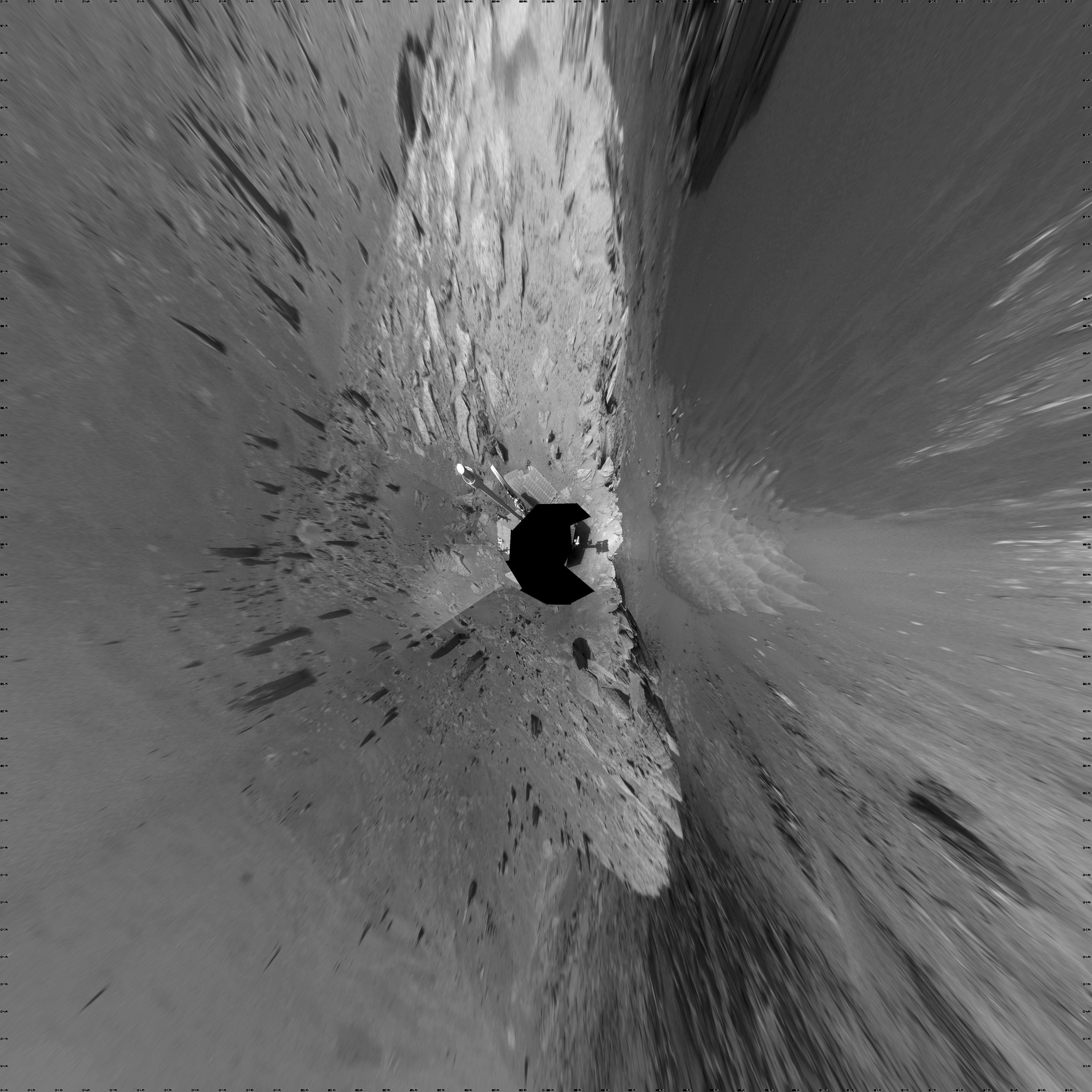
View from West of Victoria Crater, Sol 1664 (Vertical)
Full Resolution:
TIFF
(16.02 MB)
JPEG
(1.093 MB)
|
|
|
2009-02-03 |
Mars
|
Mars Exploration Rover (MER)
|
Navigation Camera
|
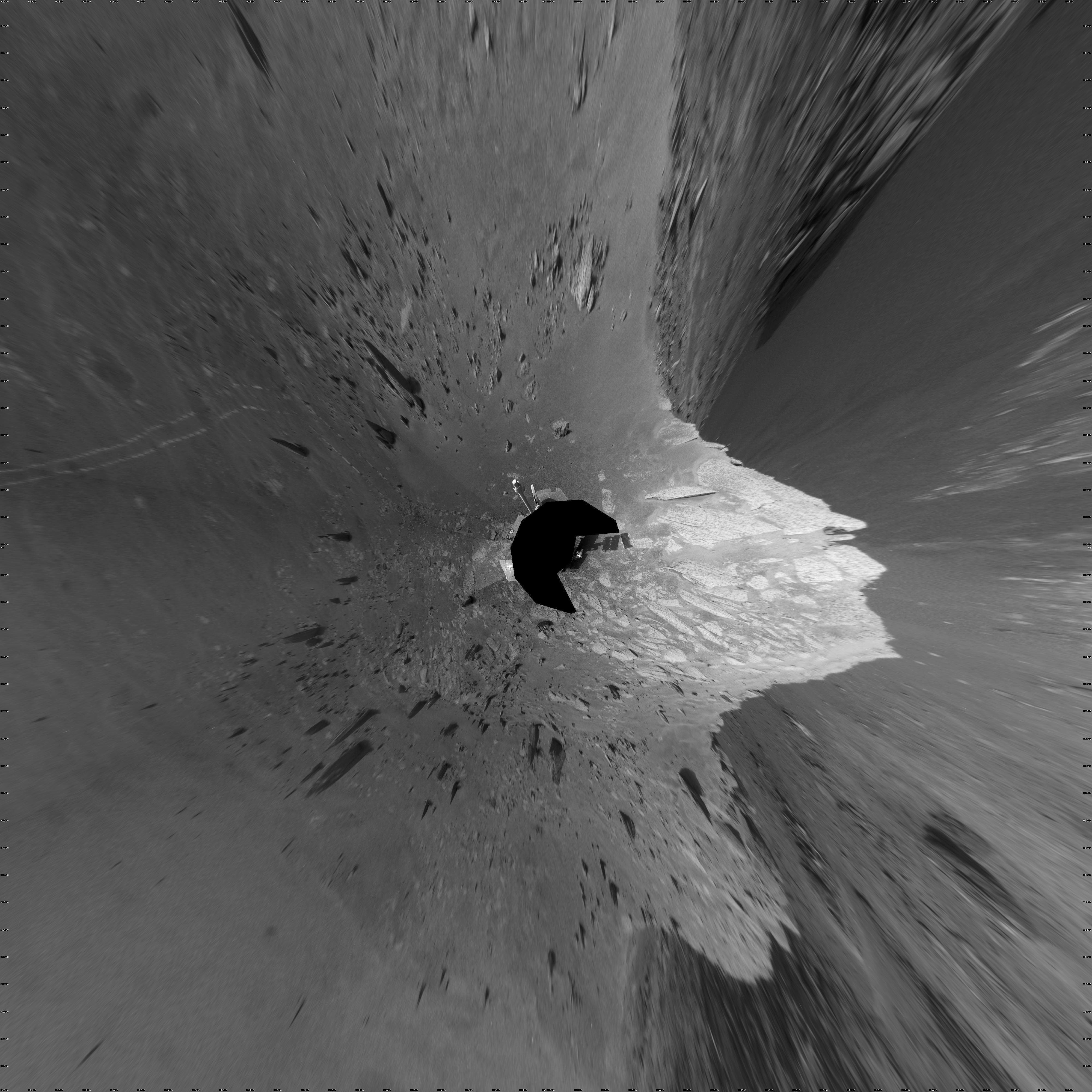
4000x4000x1 |
|
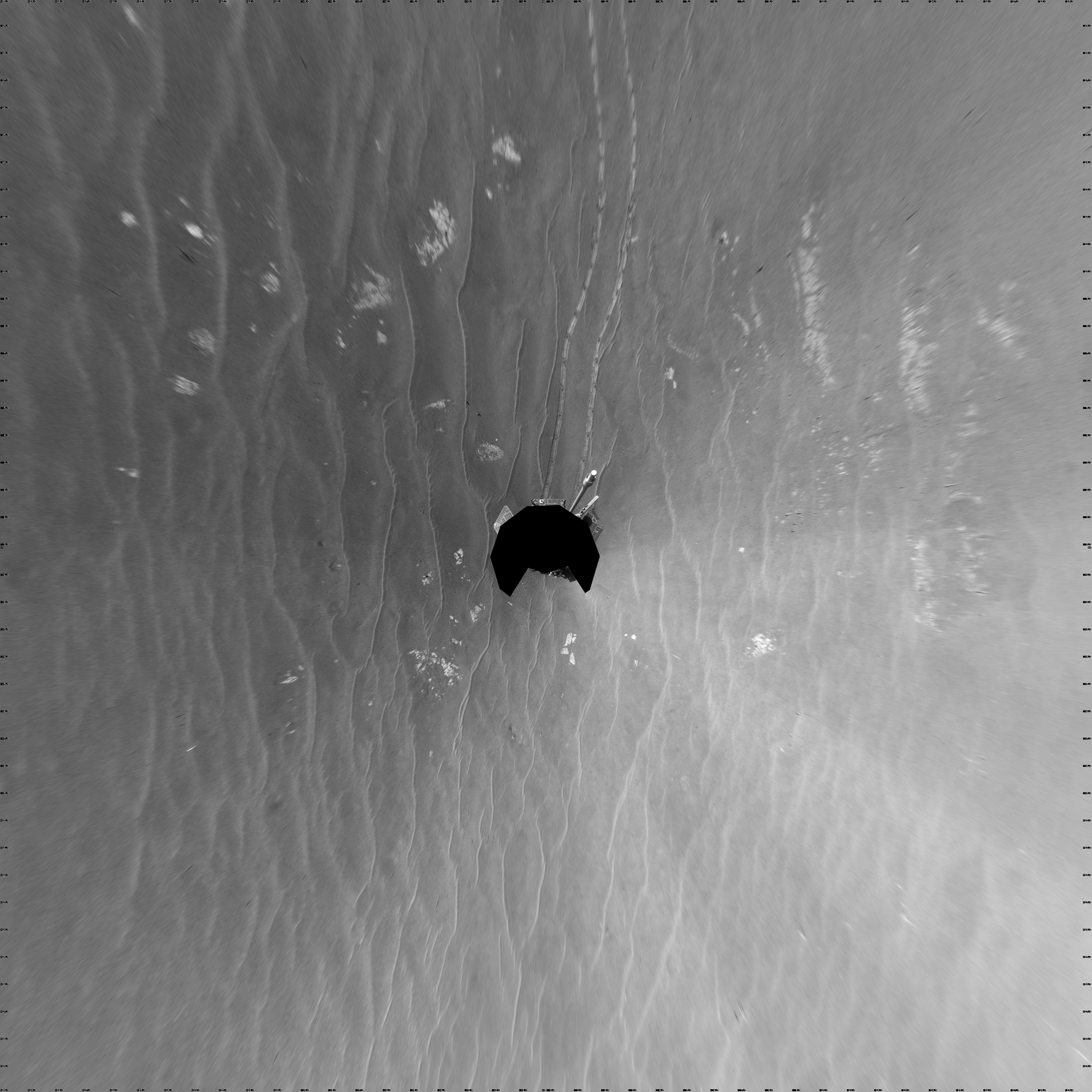
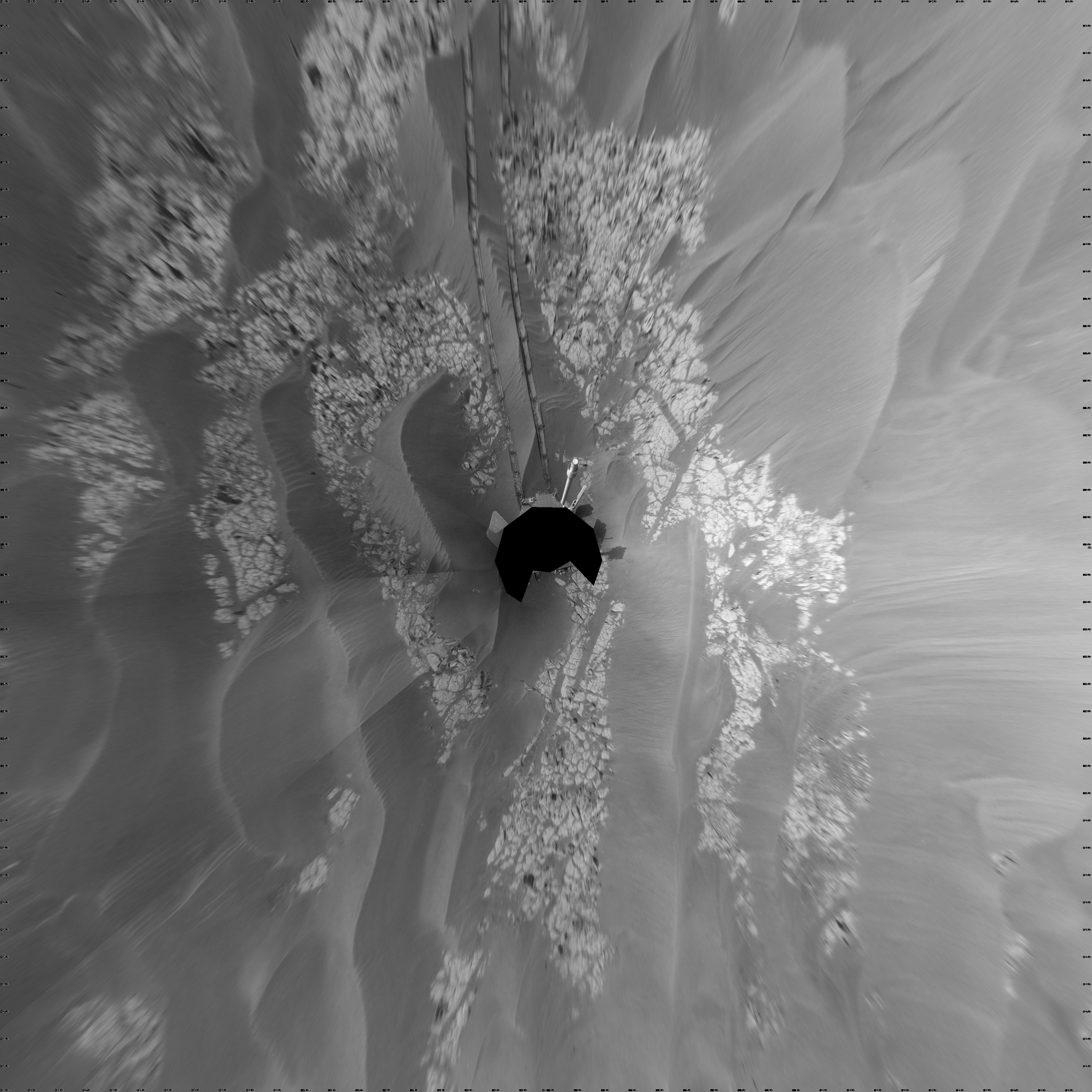
-
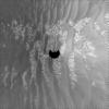
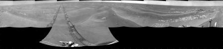
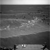
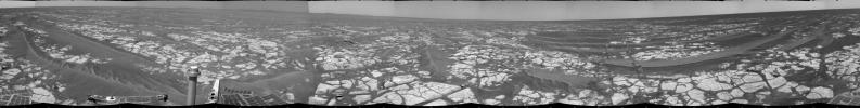
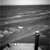
PIA11785:
-
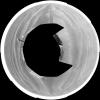
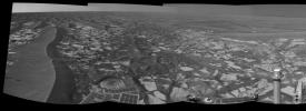
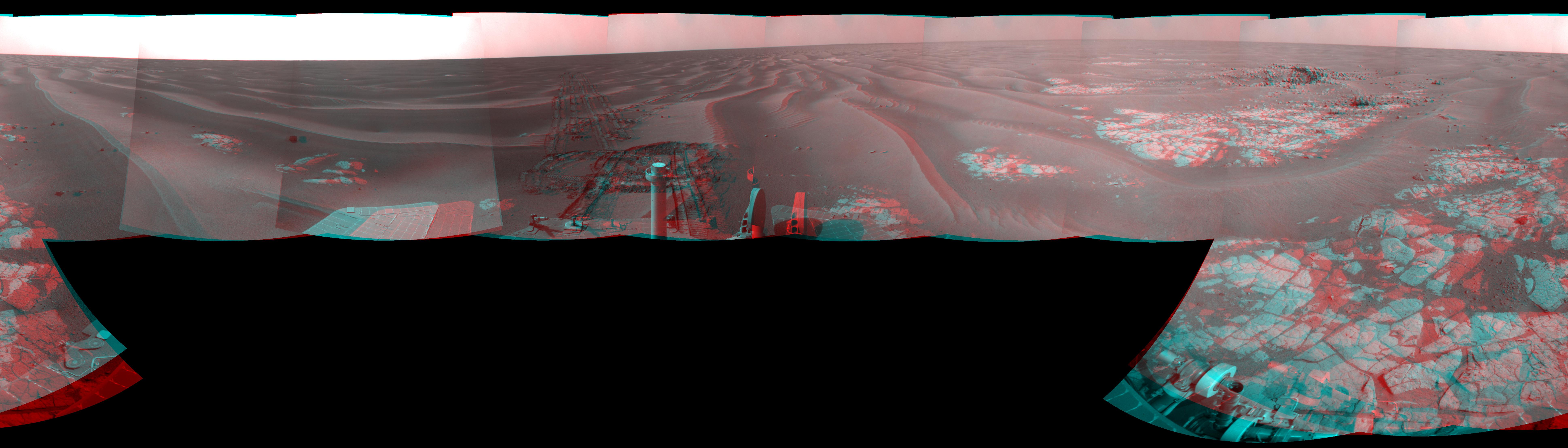
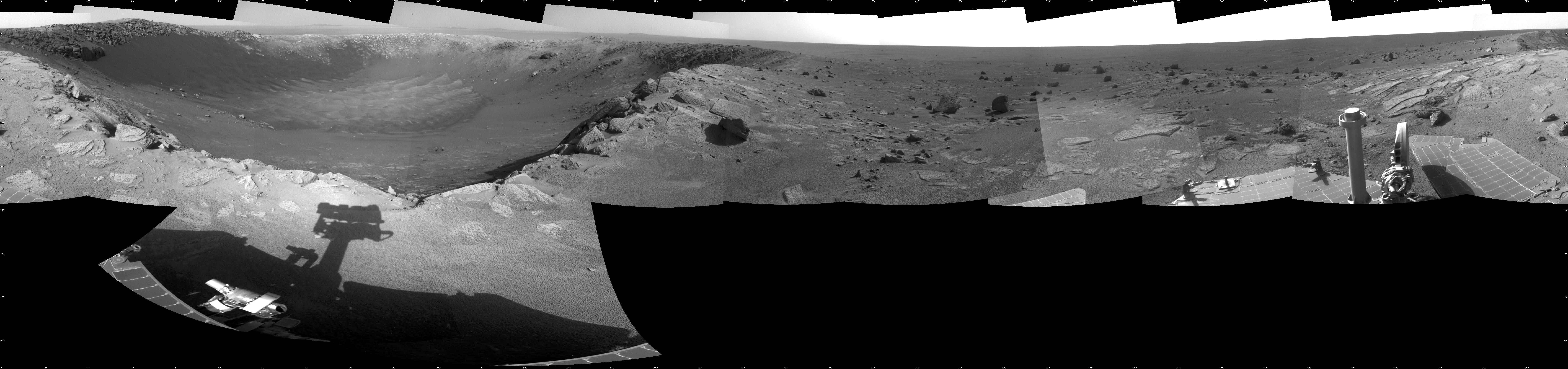
Opportunity View During Exploration in 'Duck Bay,' Sols 1506-1510 (Vertical)
Full Resolution:
TIFF
(16.02 MB)
JPEG
(1.191 MB)
|
|
|
2009-02-03 |
Mars
|
Mars Exploration Rover (MER)
|
Navigation Camera
|
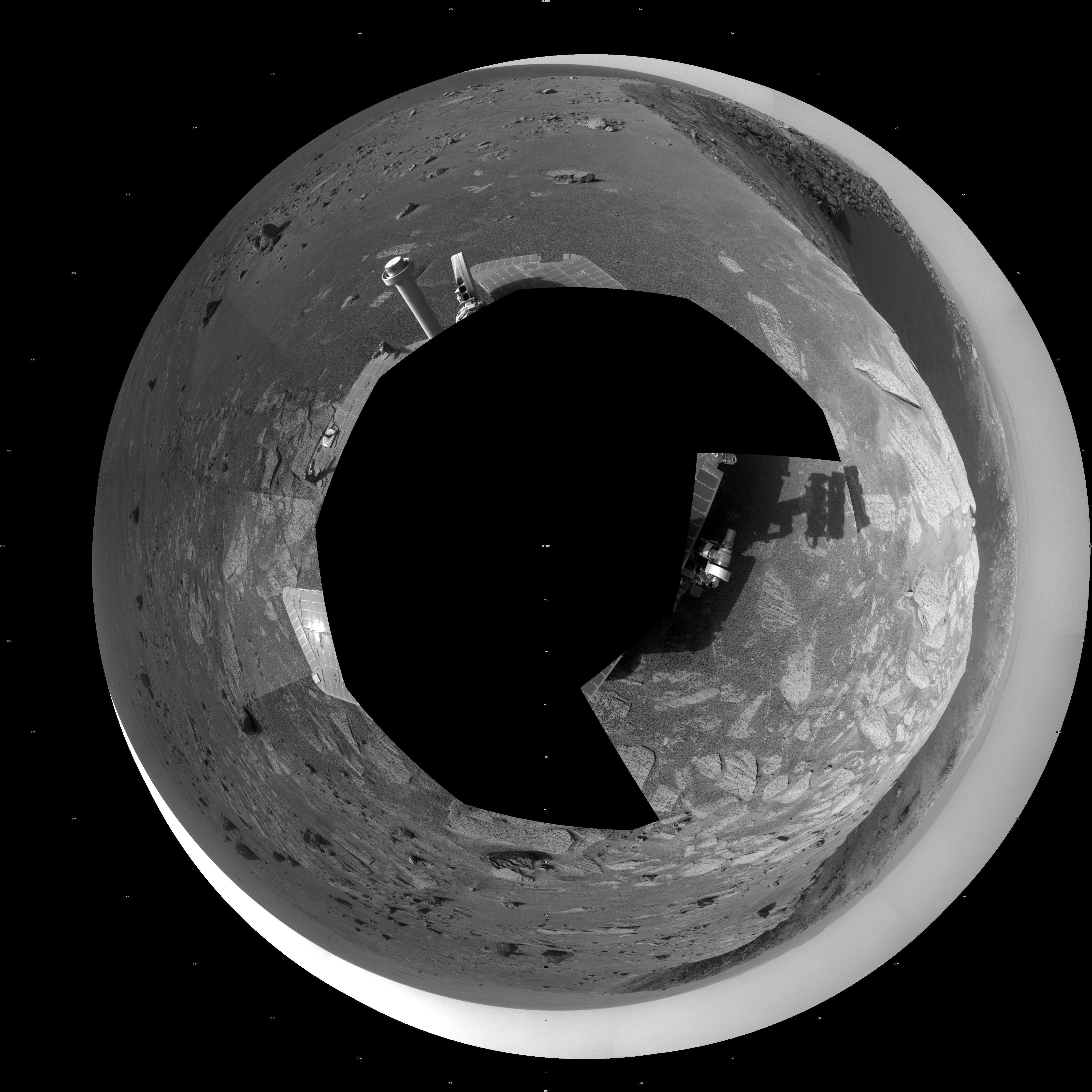
5245x5245x1 |

|
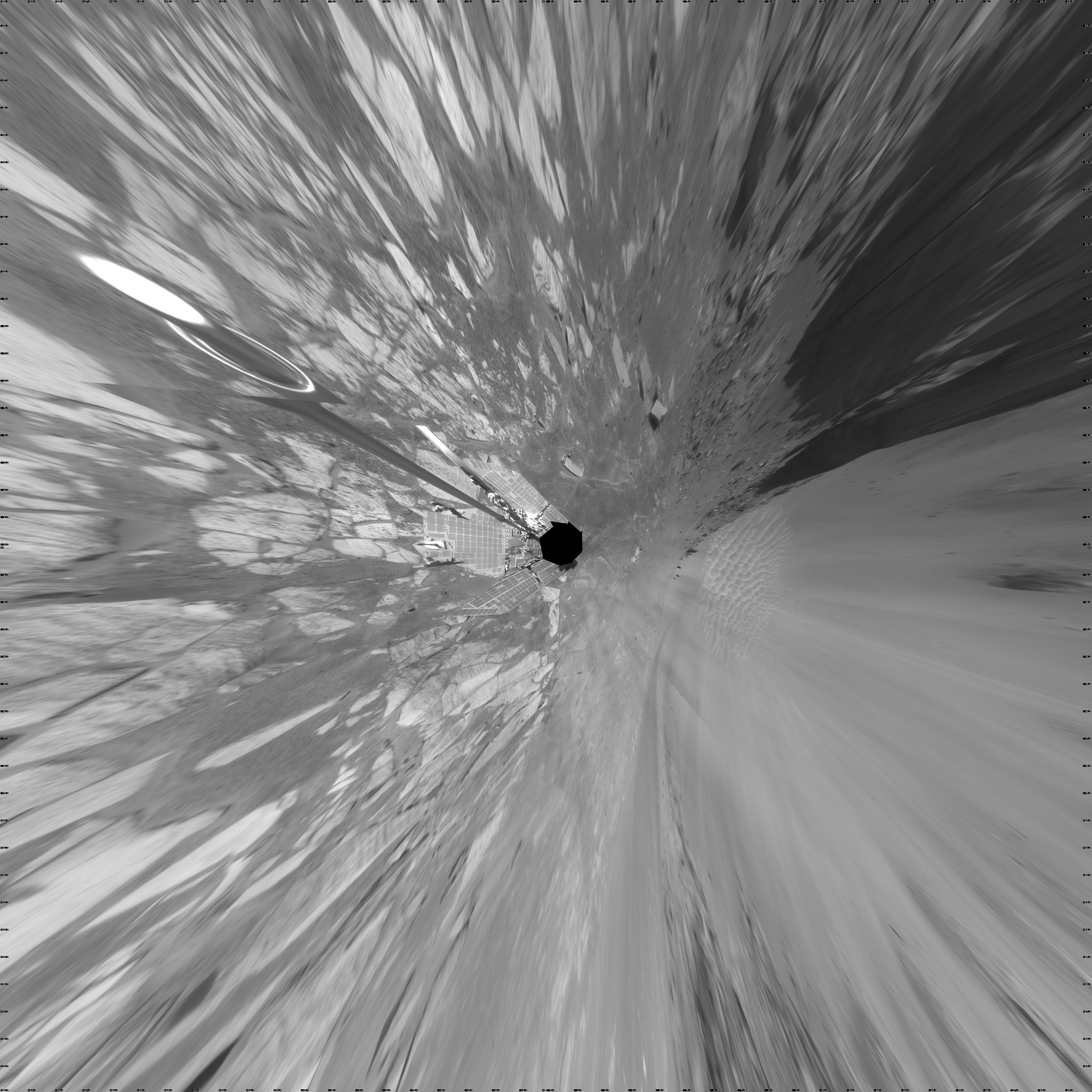
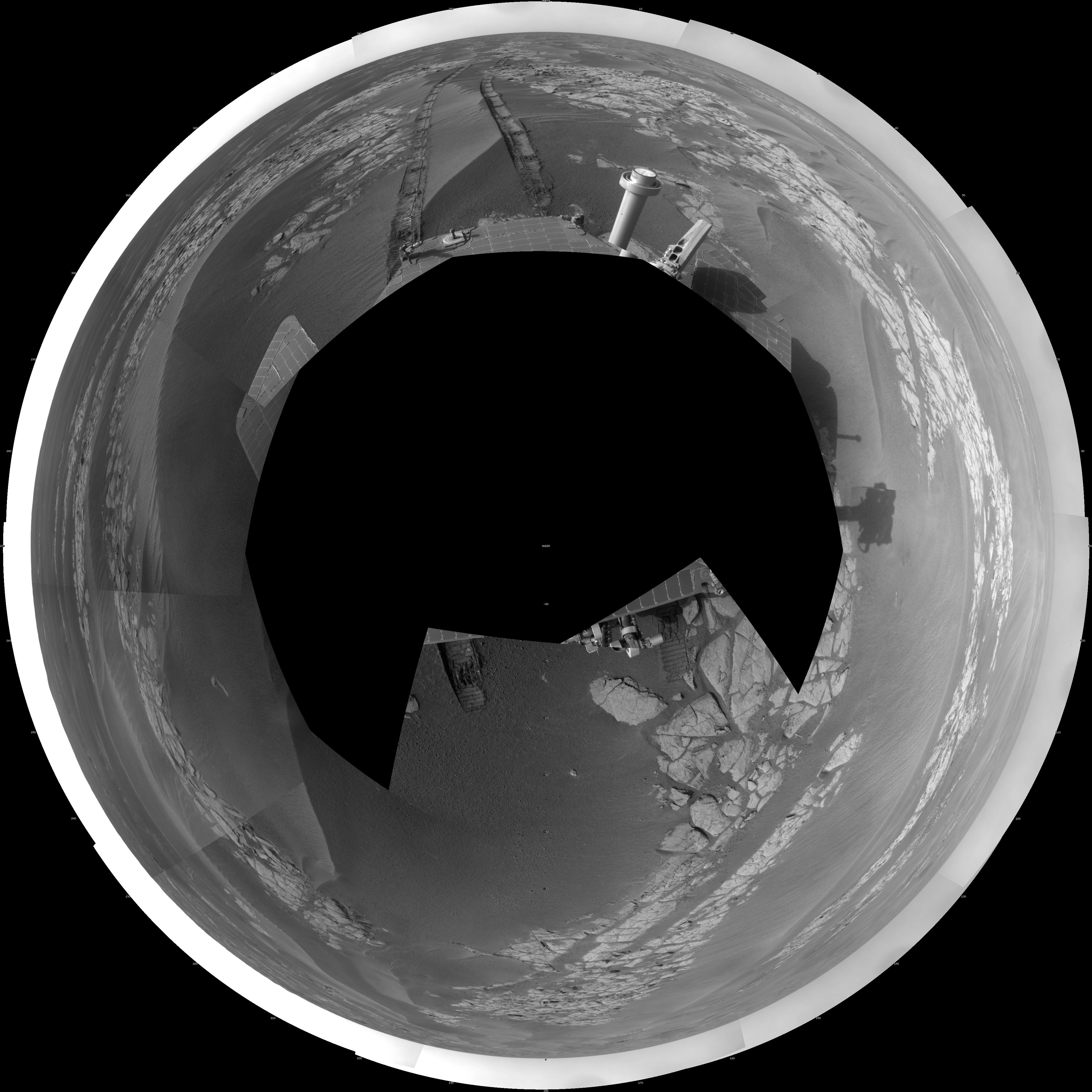
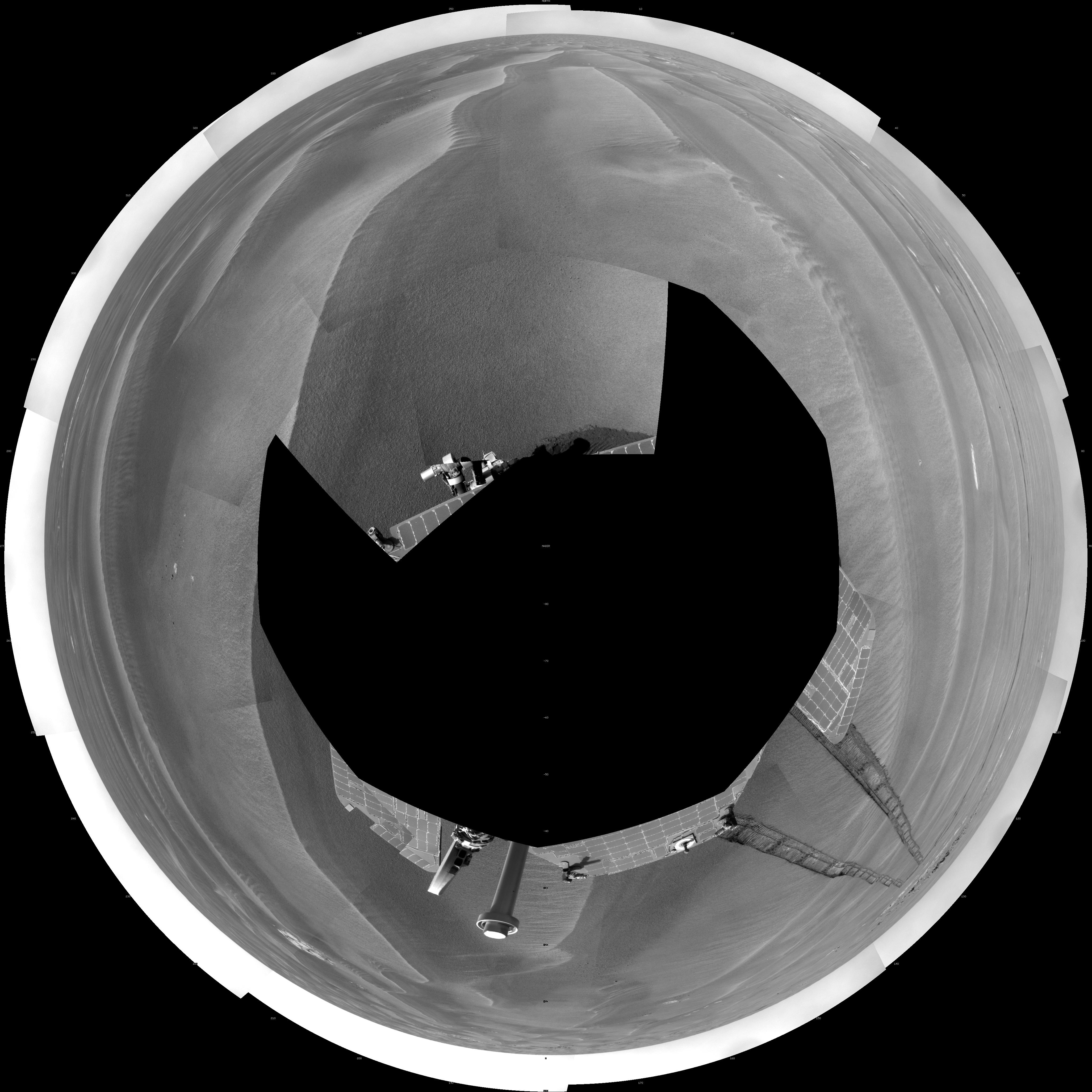
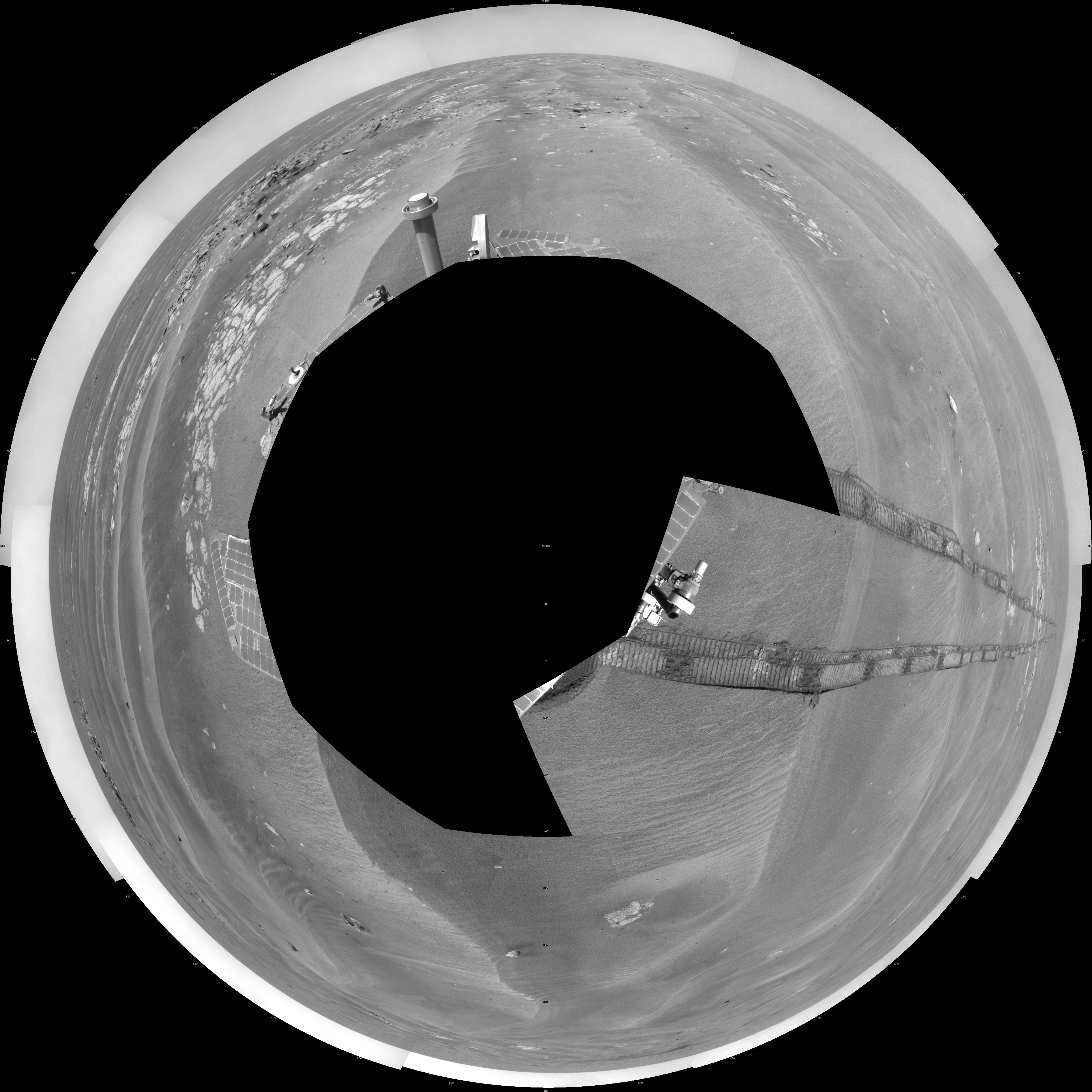
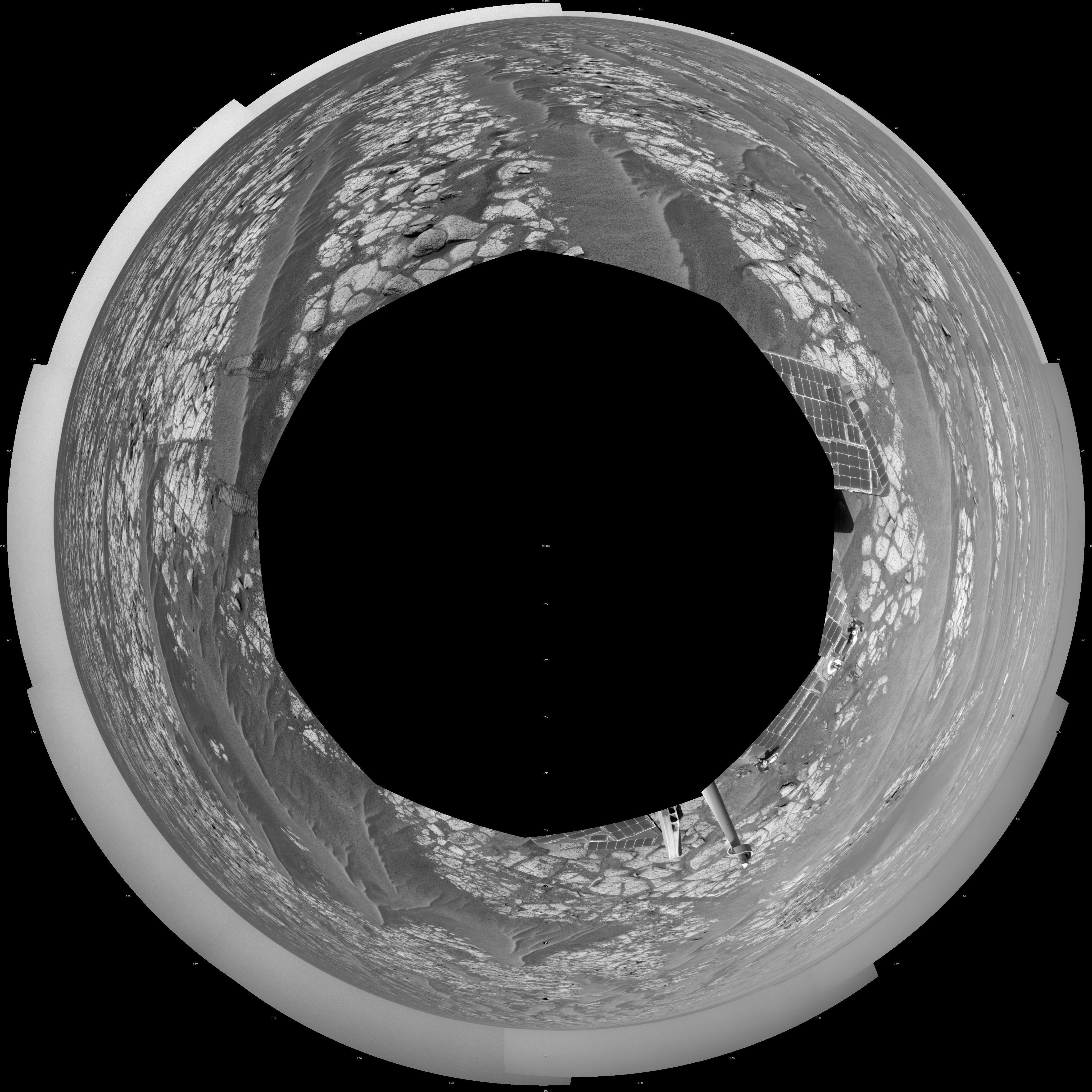
-
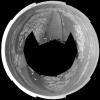
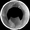
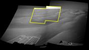
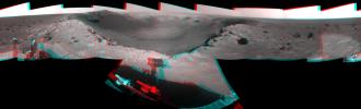
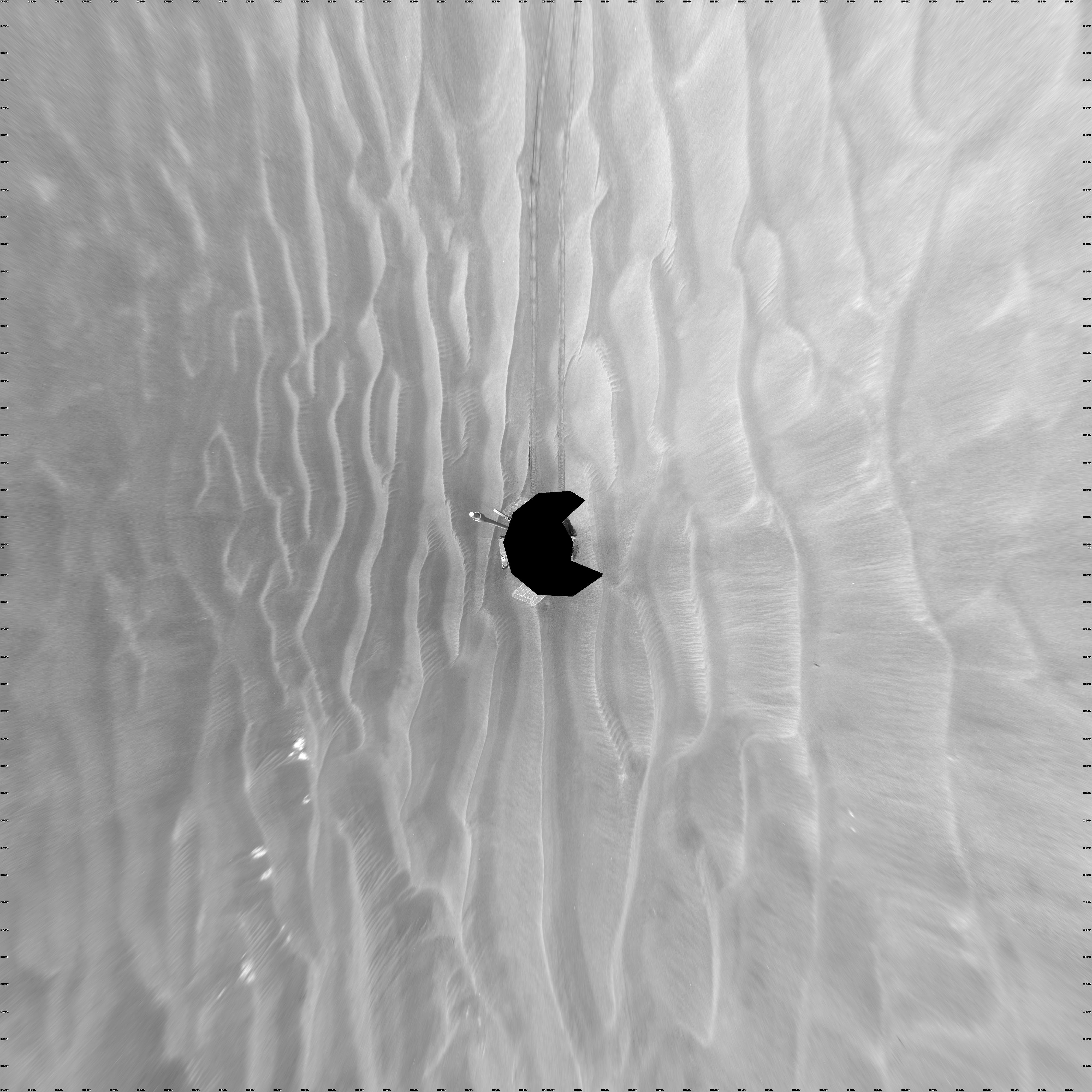
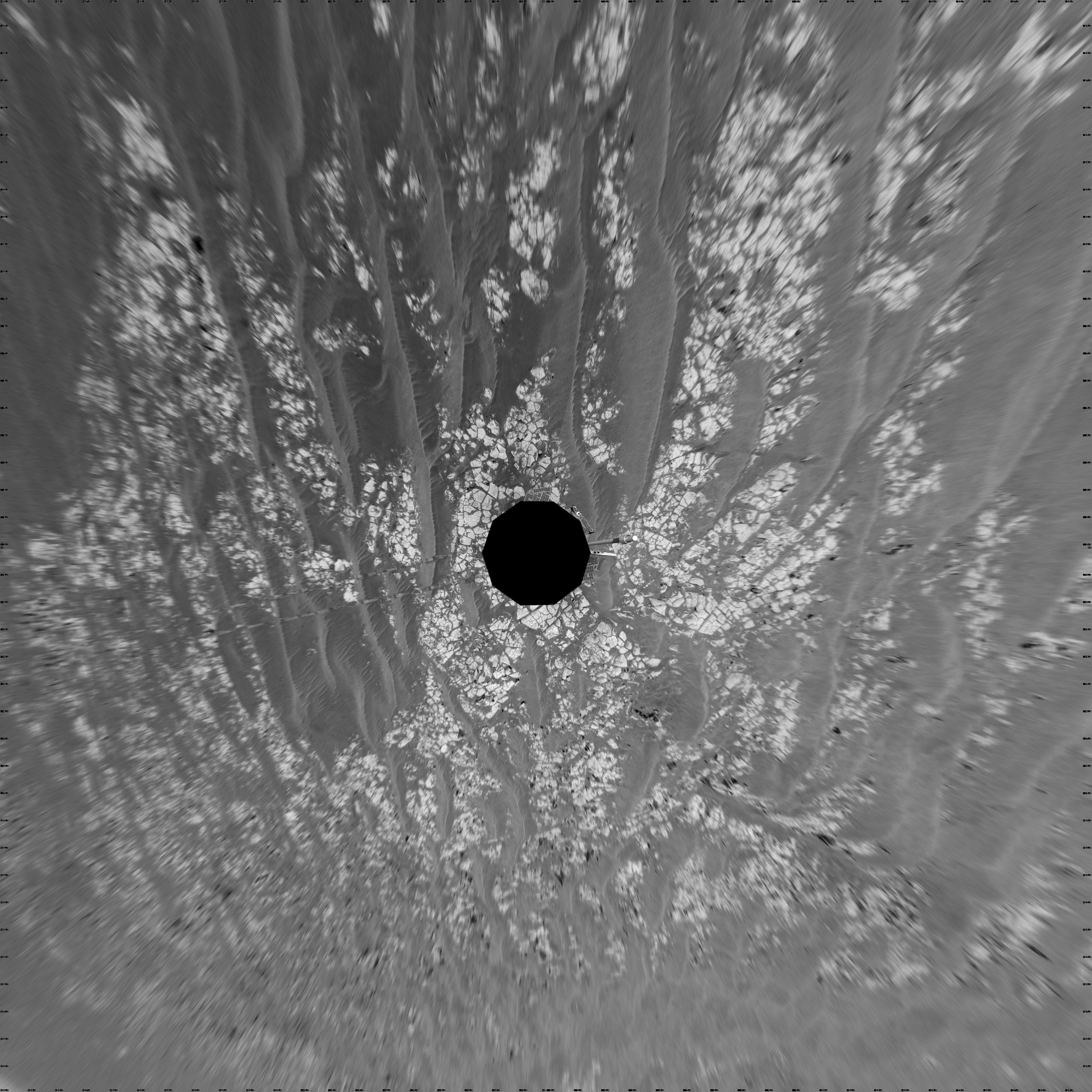
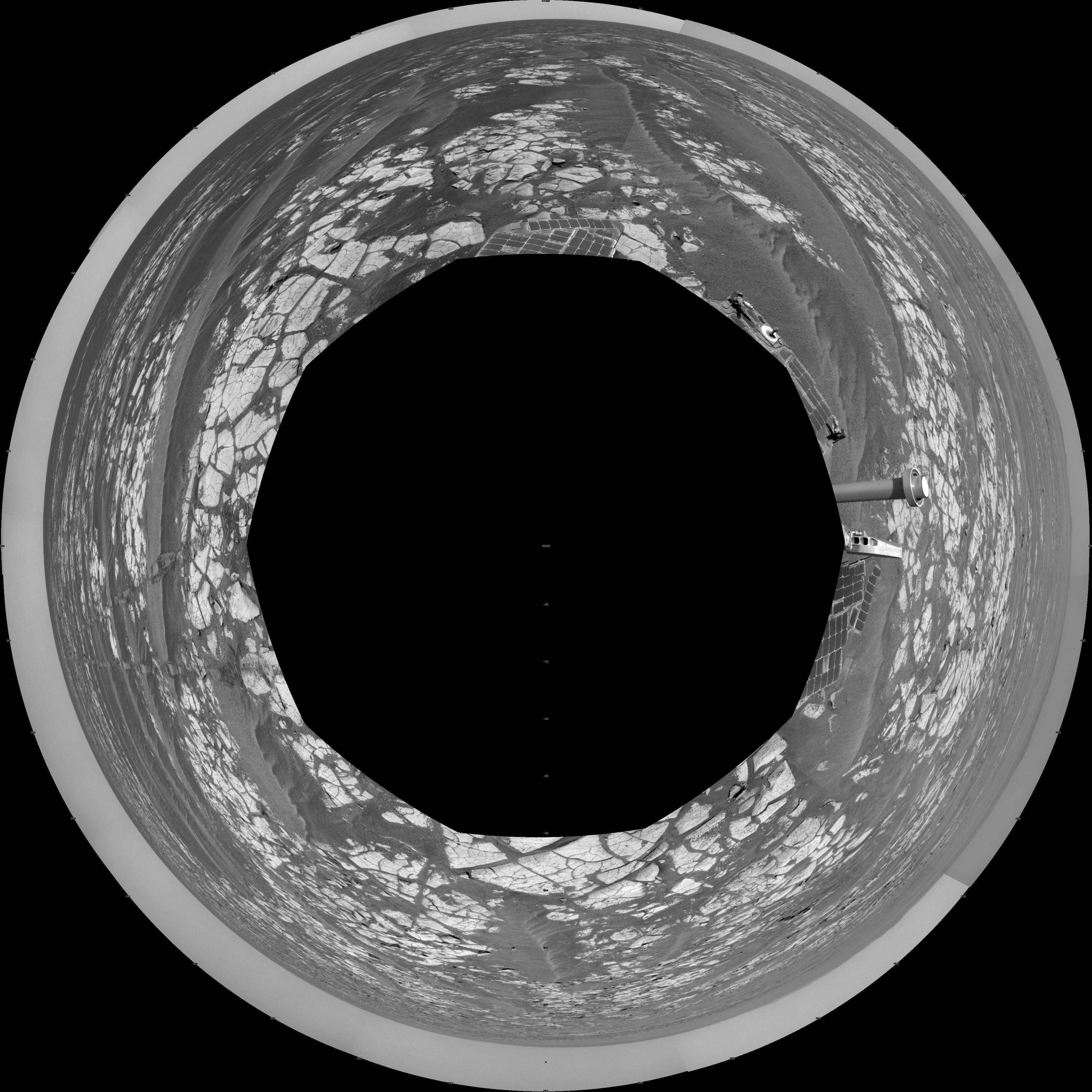
PIA11786:
-
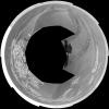
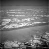
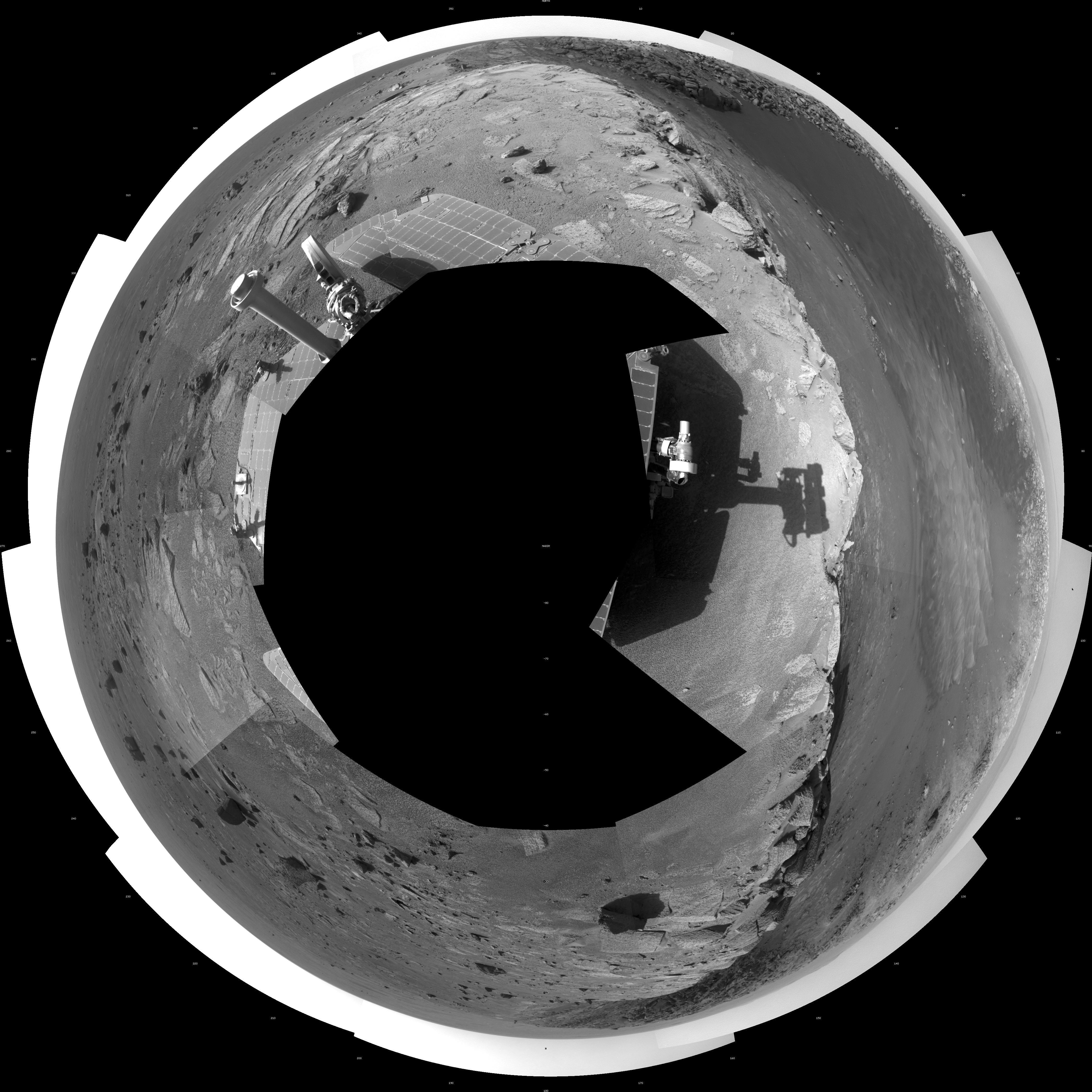
Opportunity View During Exploration in 'Duck Bay,' Sols 1506-1510 (Polar)
Full Resolution:
TIFF
(27.55 MB)
JPEG
(1.756 MB)
|
|
|
2009-02-03 |
Mars
|
Mars Exploration Rover (MER)
|
Navigation Camera
|
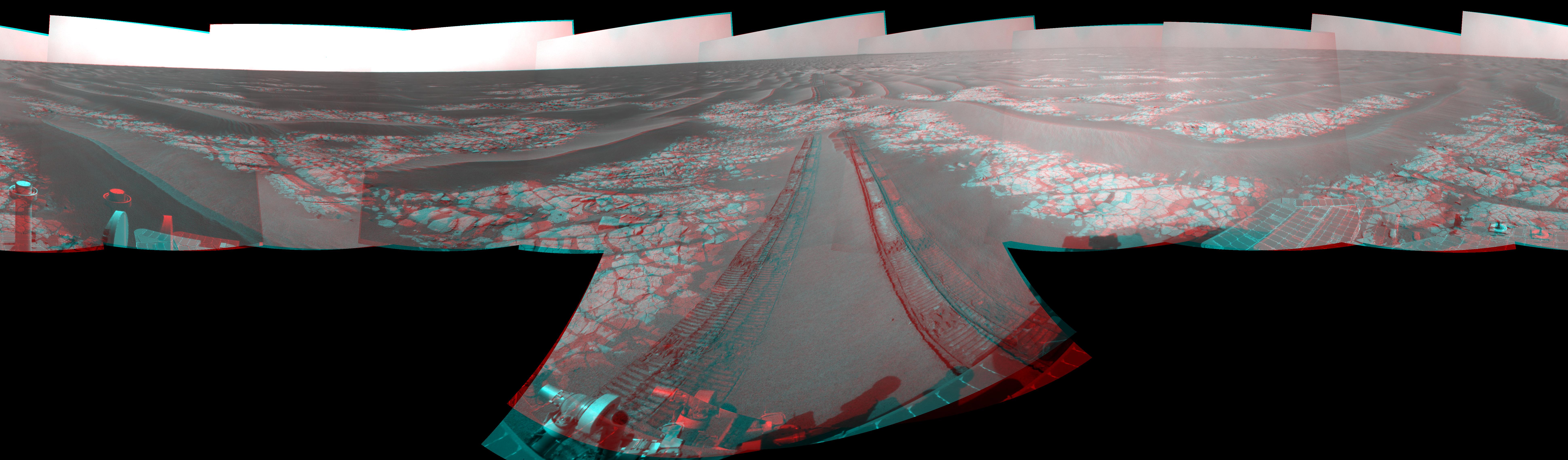
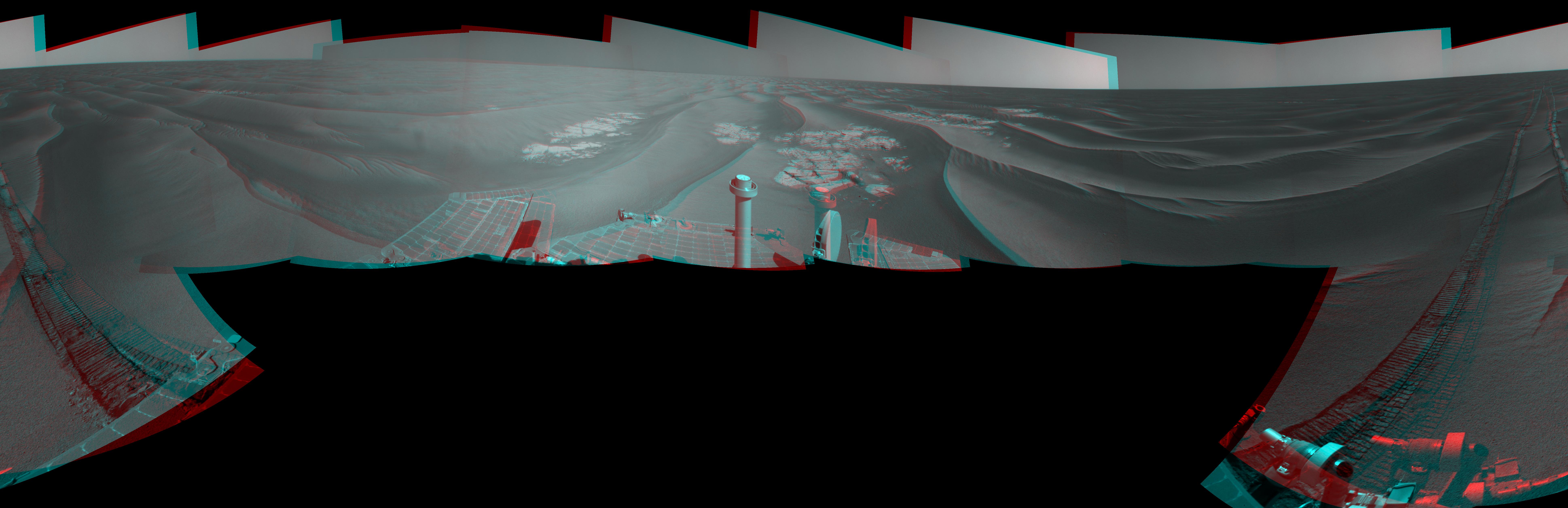
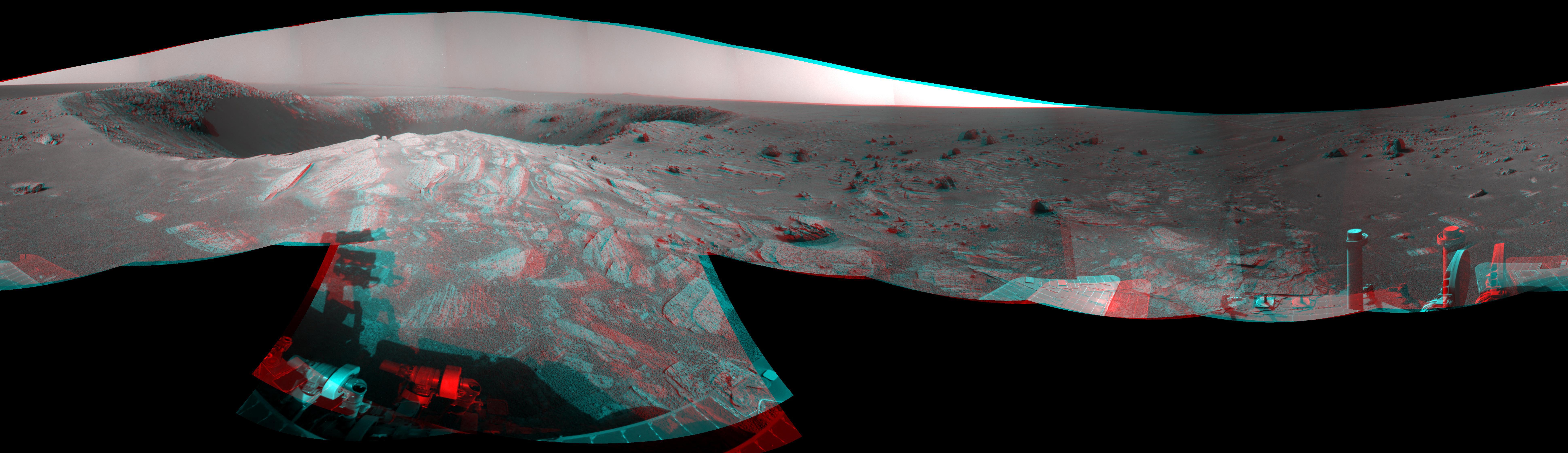
7753x3446x3 |
|
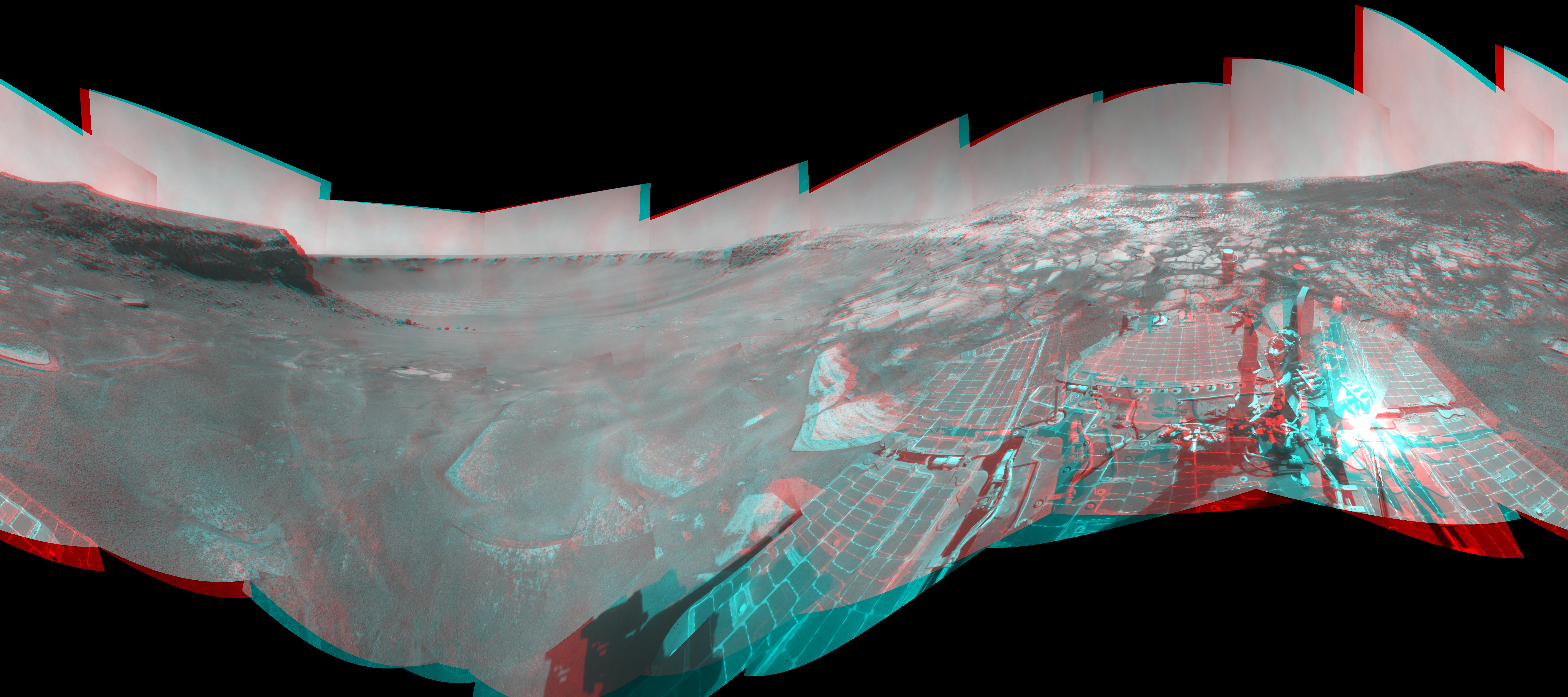
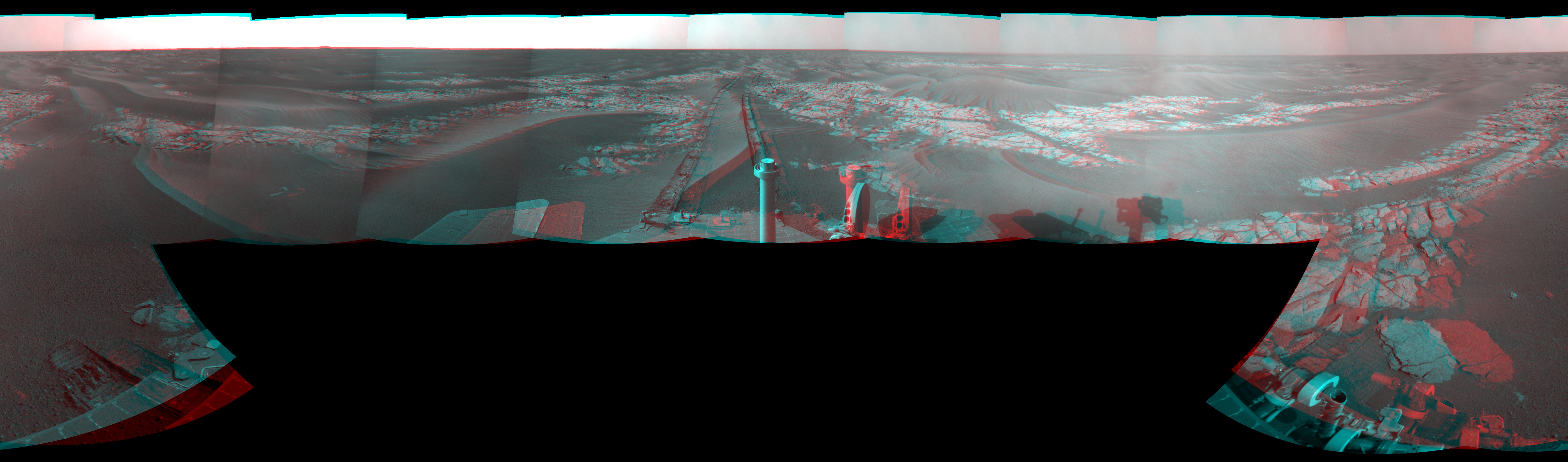
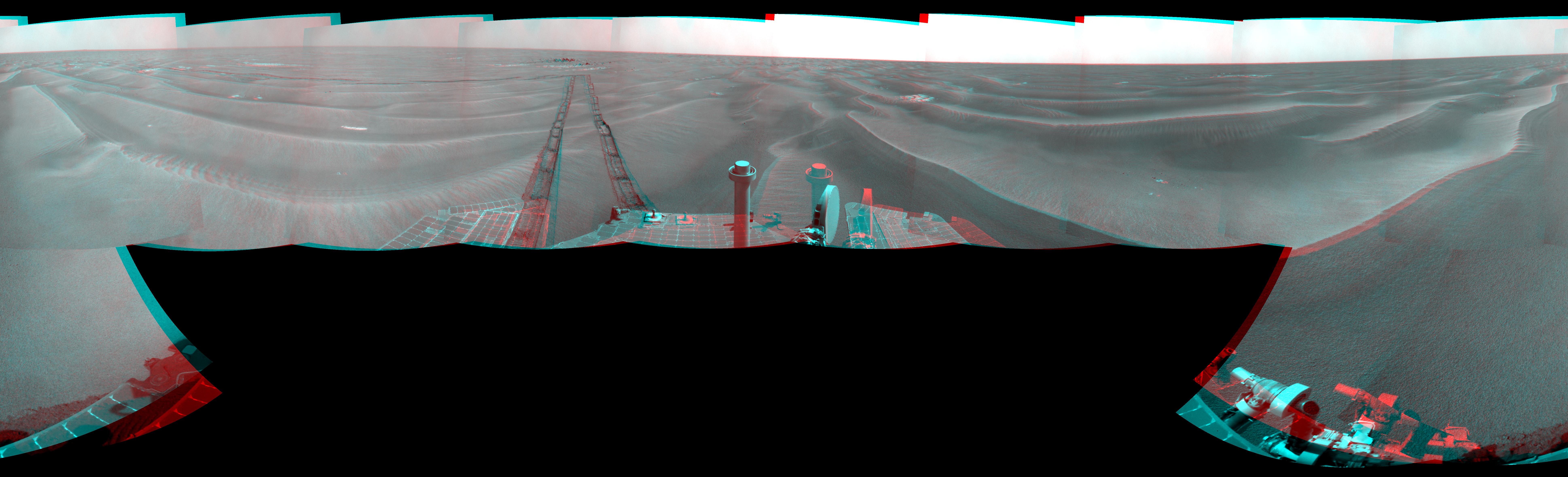
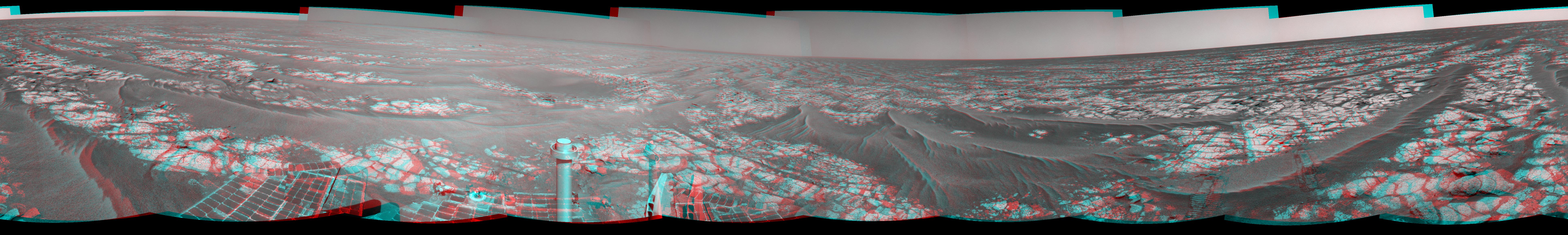
-
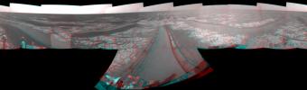
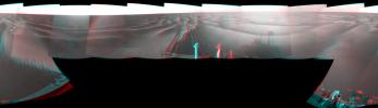
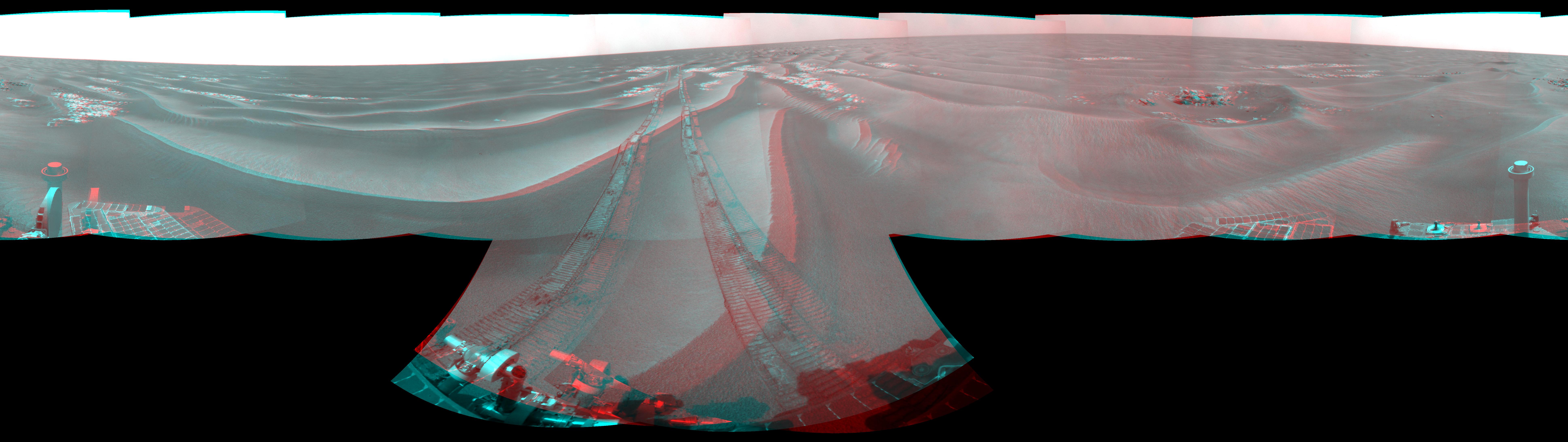
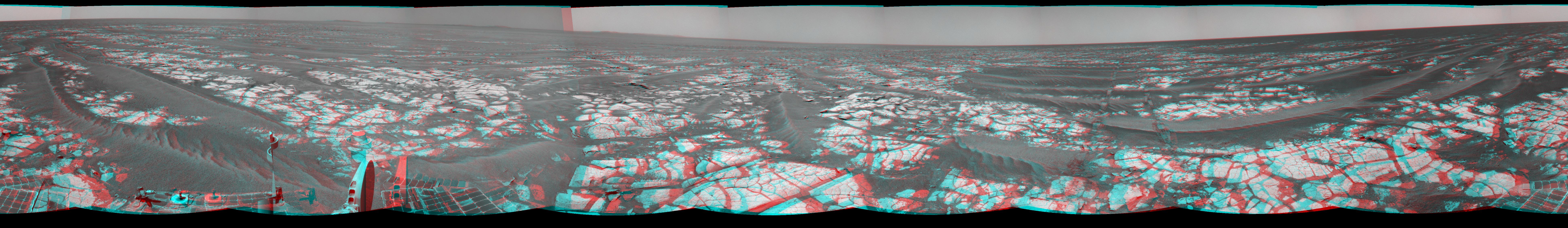
PIA11787:
-
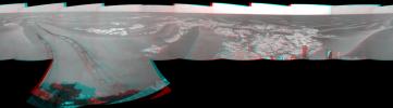
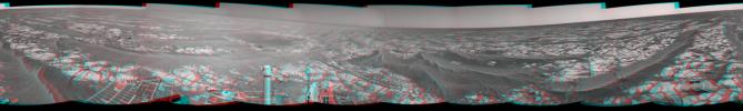
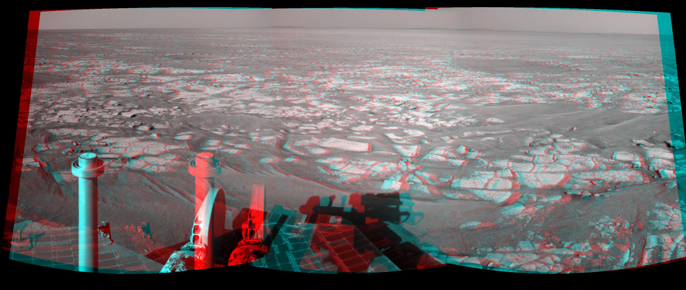
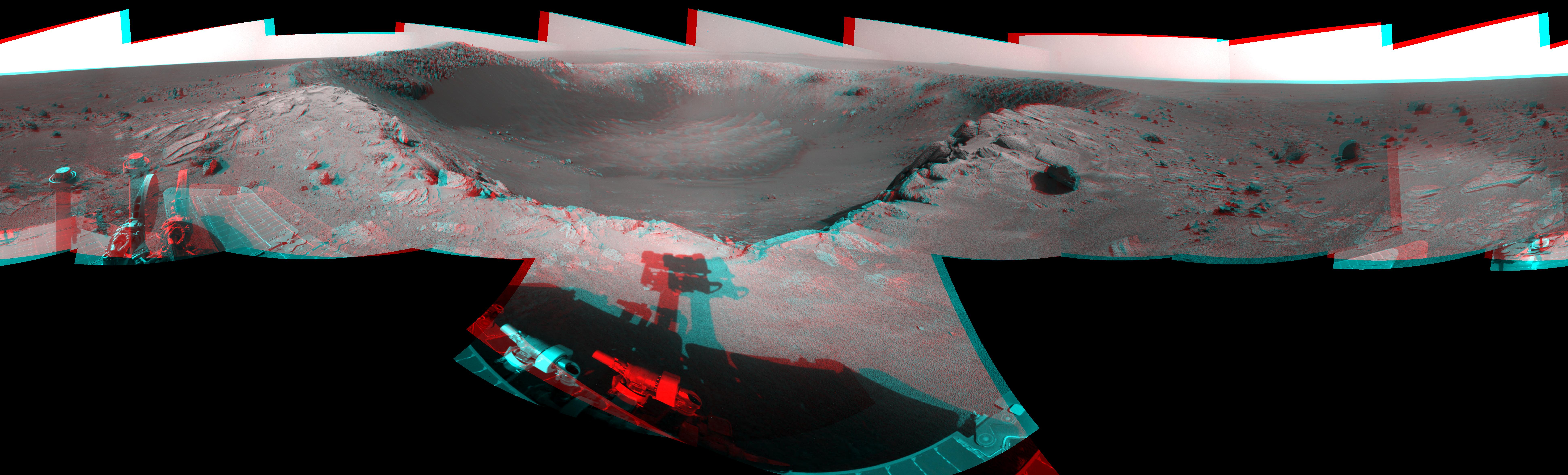
Opportunity View During Exploration in 'Duck Bay,' Sols 1506-1510 (Stereo)
Full Resolution:
TIFF
(80.15 MB)
JPEG
(2.041 MB)
|
|
|
2009-02-03 |
Mars
|
Mars Exploration Rover (MER)
|
Navigation Camera
|
7688x2291x1 |
|
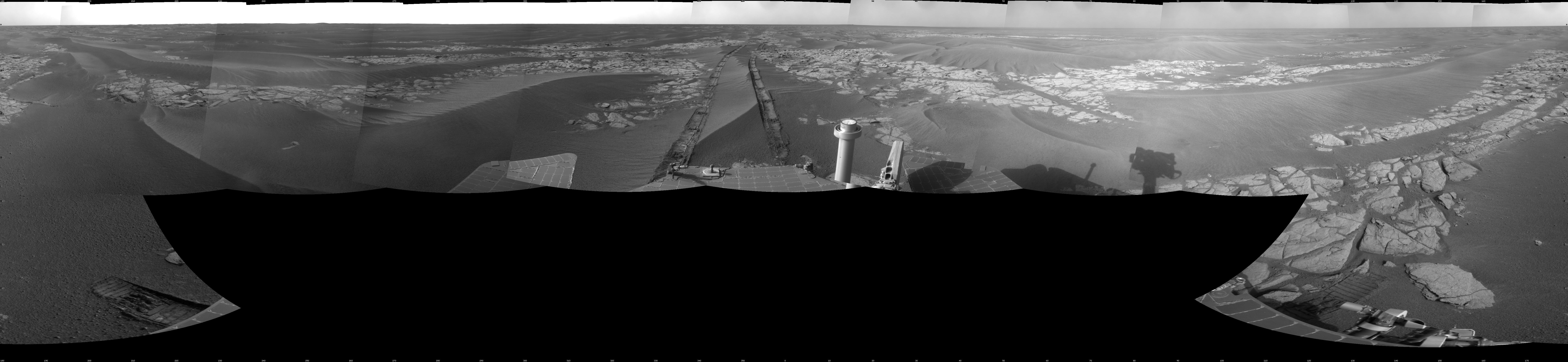
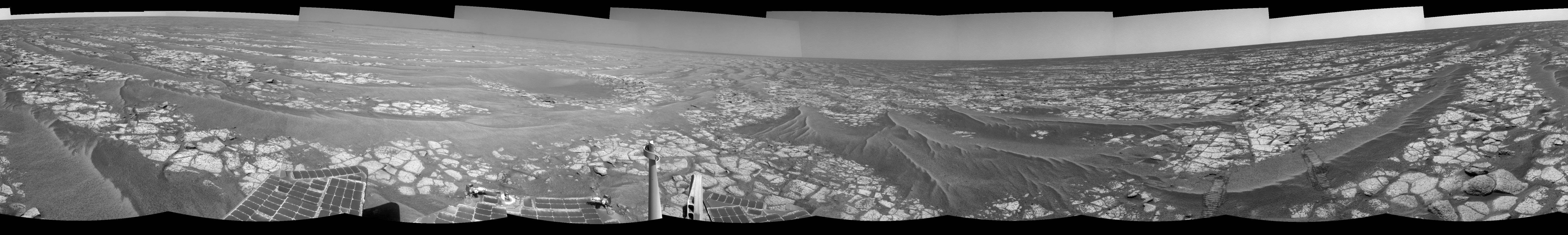
-
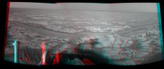
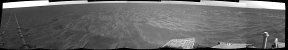
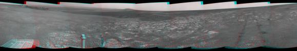
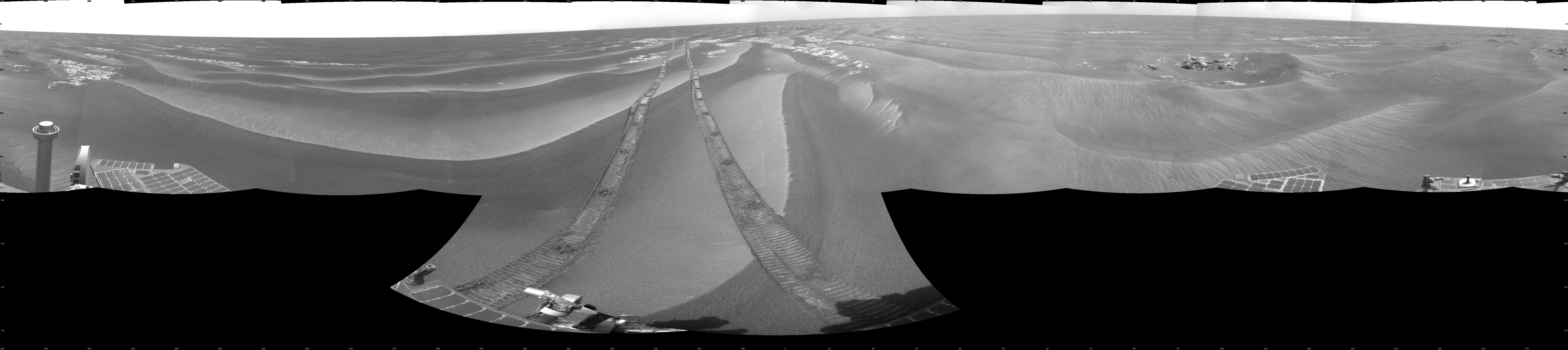
PIA11788:
-
Opportunity View During Exploration in 'Duck Bay,' Sols 1506-1510
Full Resolution:
TIFF
(17.63 MB)
JPEG
(1.481 MB)
|
|
|
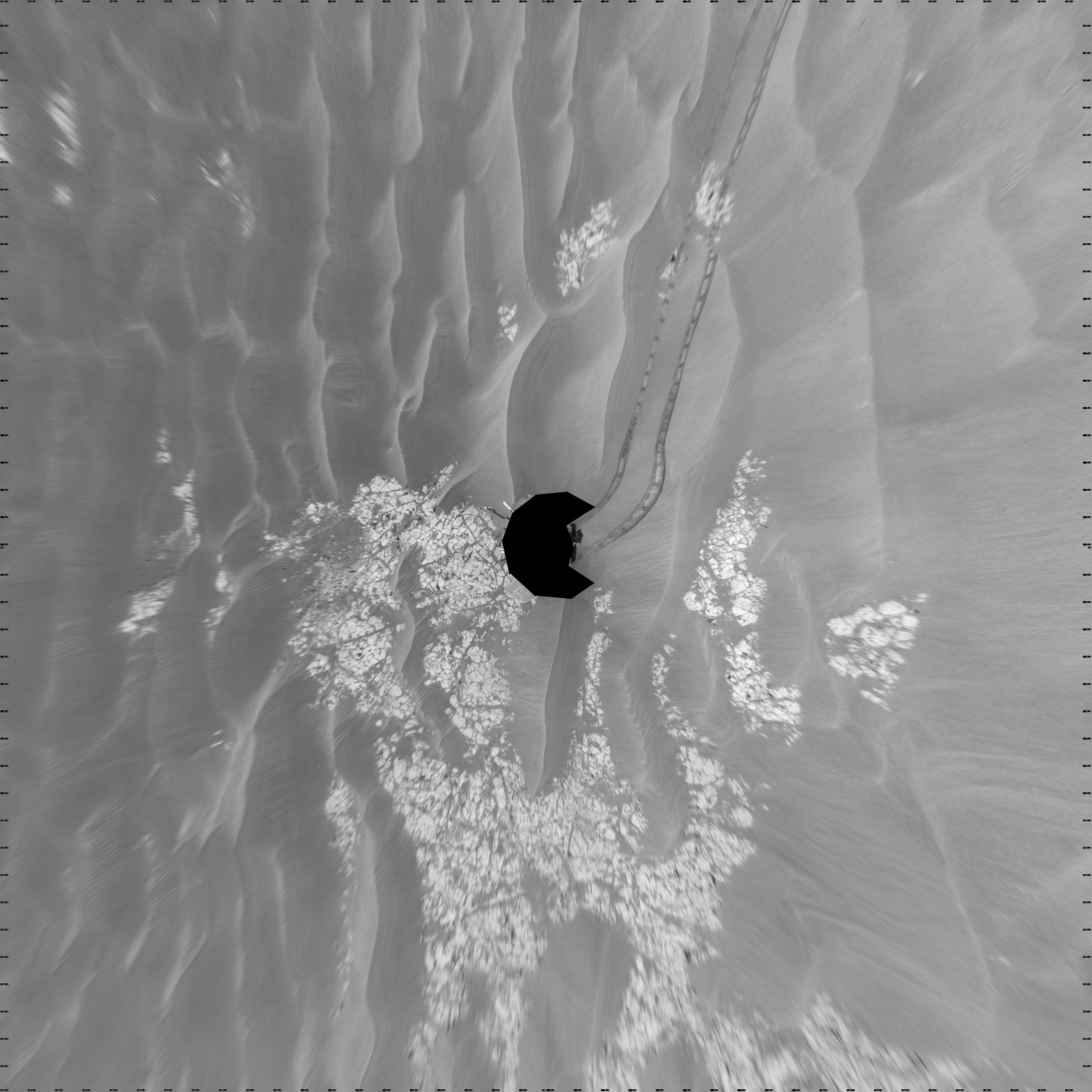
2009-02-04 |
Mars
|
Mars Exploration Rover (MER)
|
Navigation Camera
|
4000x4000x1 |
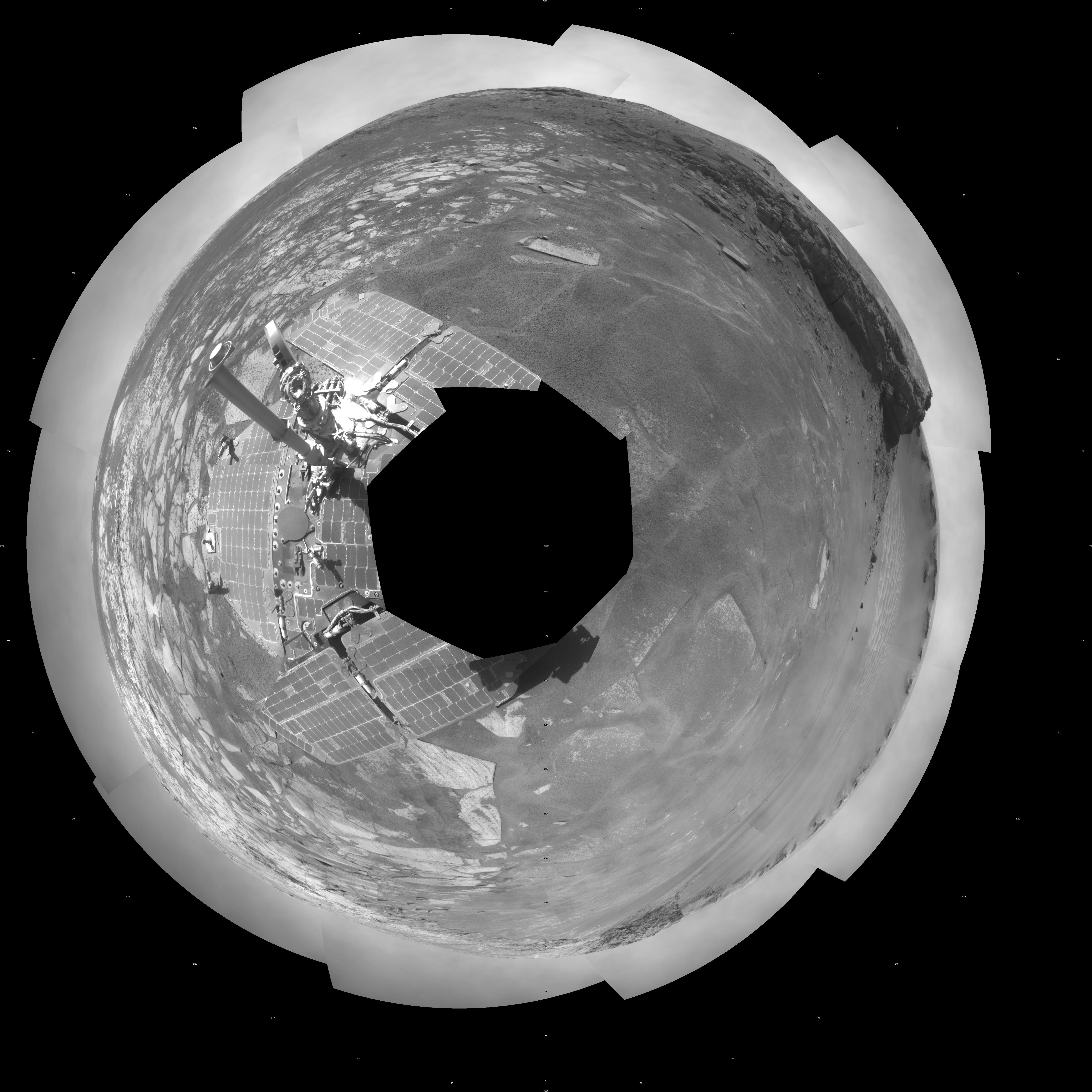
|
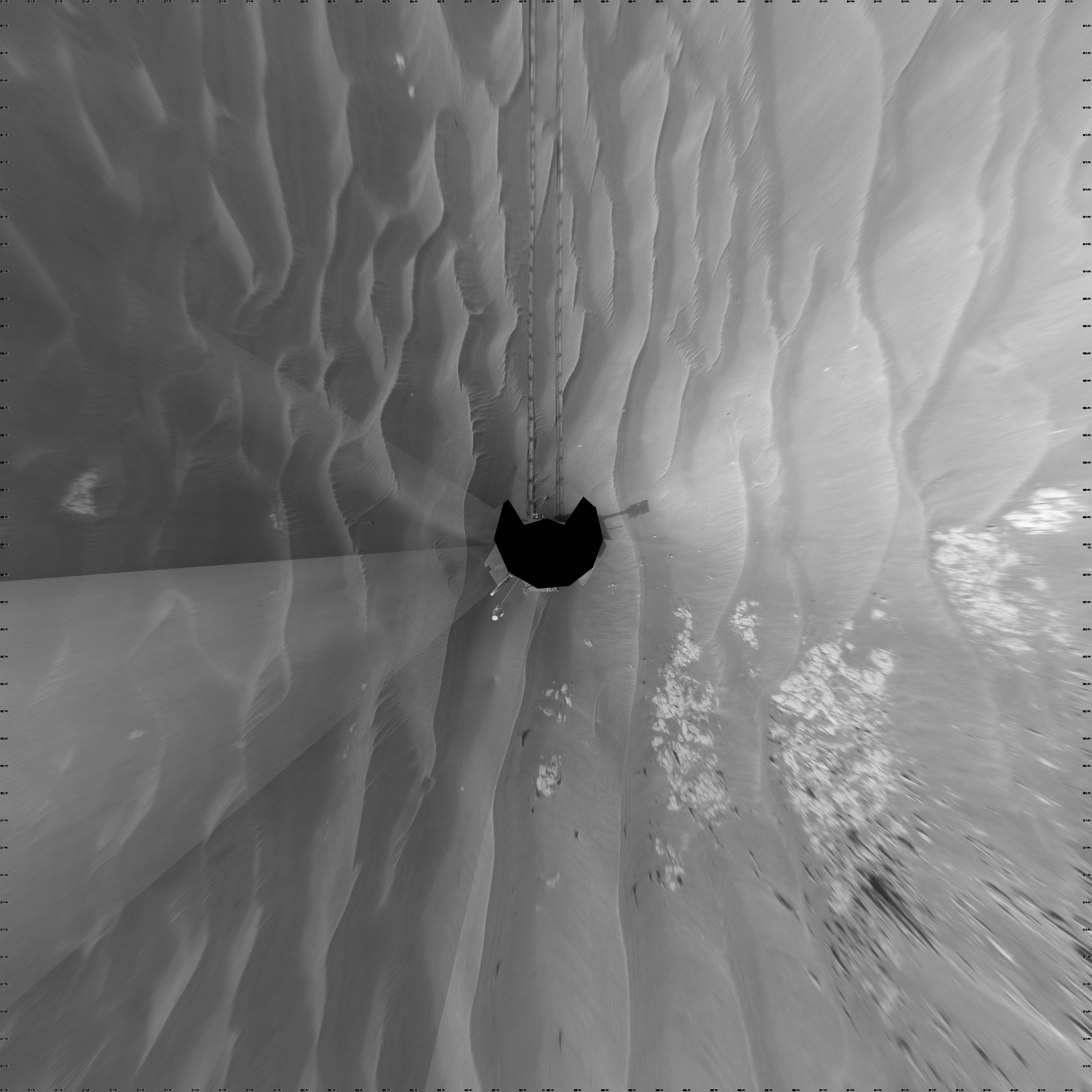
-
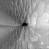
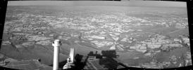
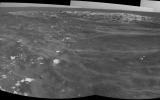
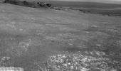
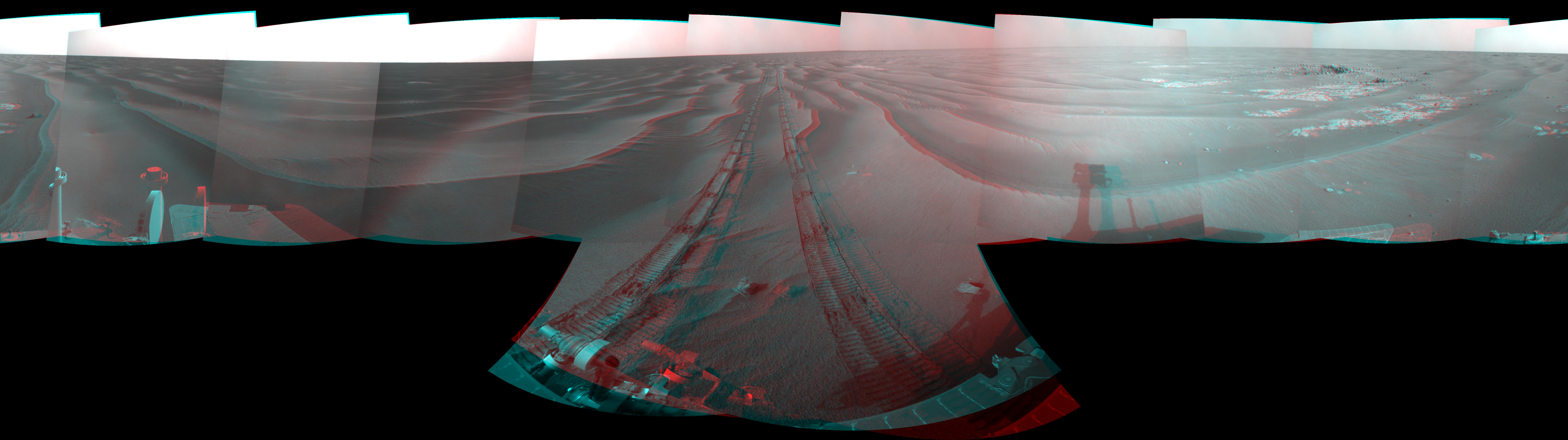
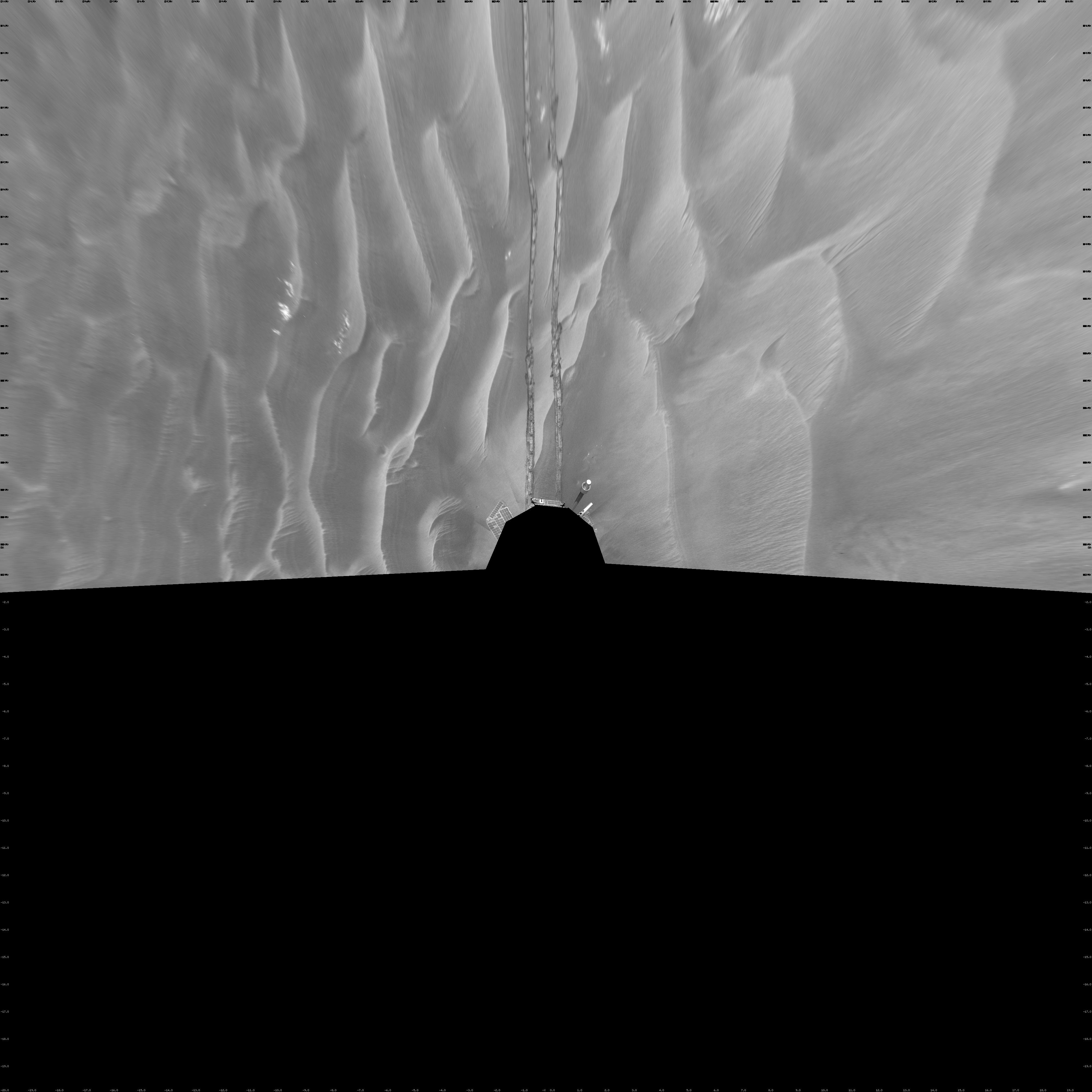
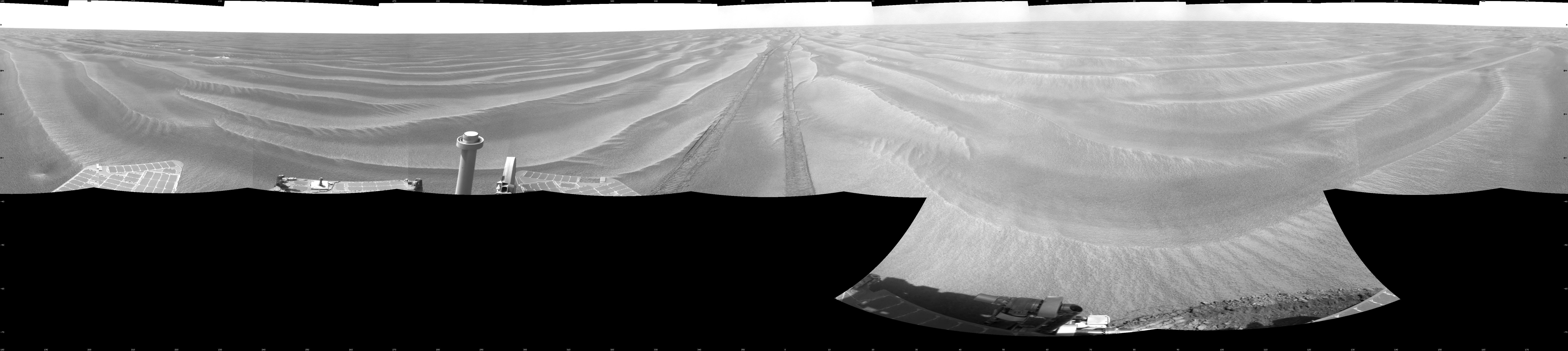
PIA11789:
-
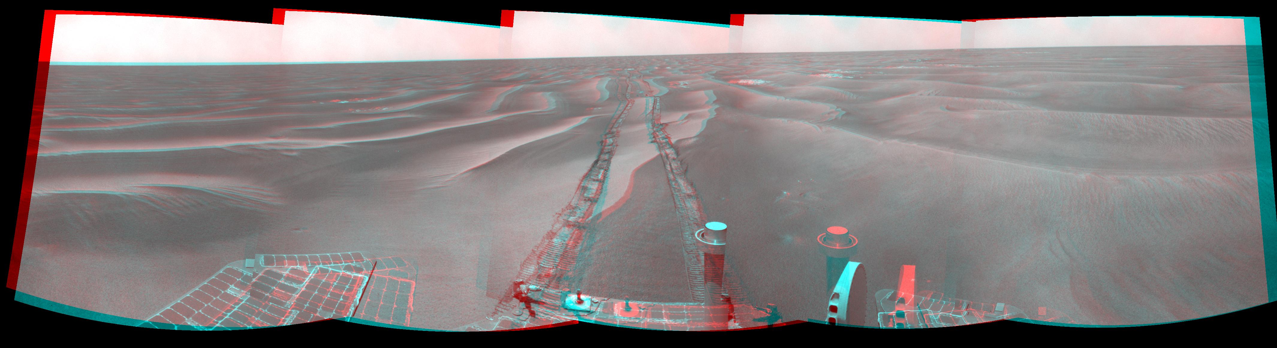
Opportunity's View After Long Drive on Sol 1770 (Vertical)
Full Resolution:
TIFF
(16.02 MB)
JPEG
(989.2 kB)
|
|
|
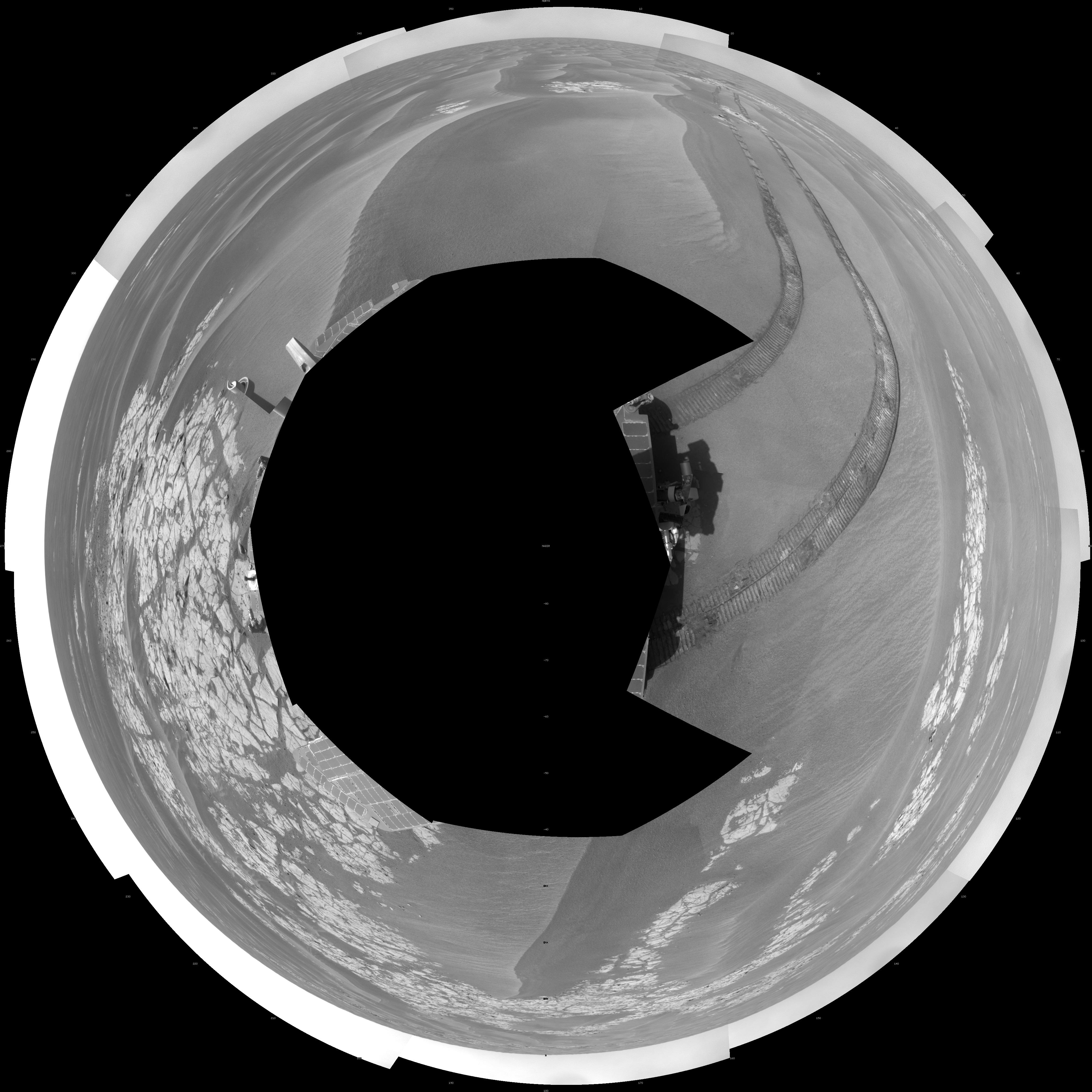
2009-02-04 |
Mars
|
Mars Exploration Rover (MER)
|
Navigation Camera
|
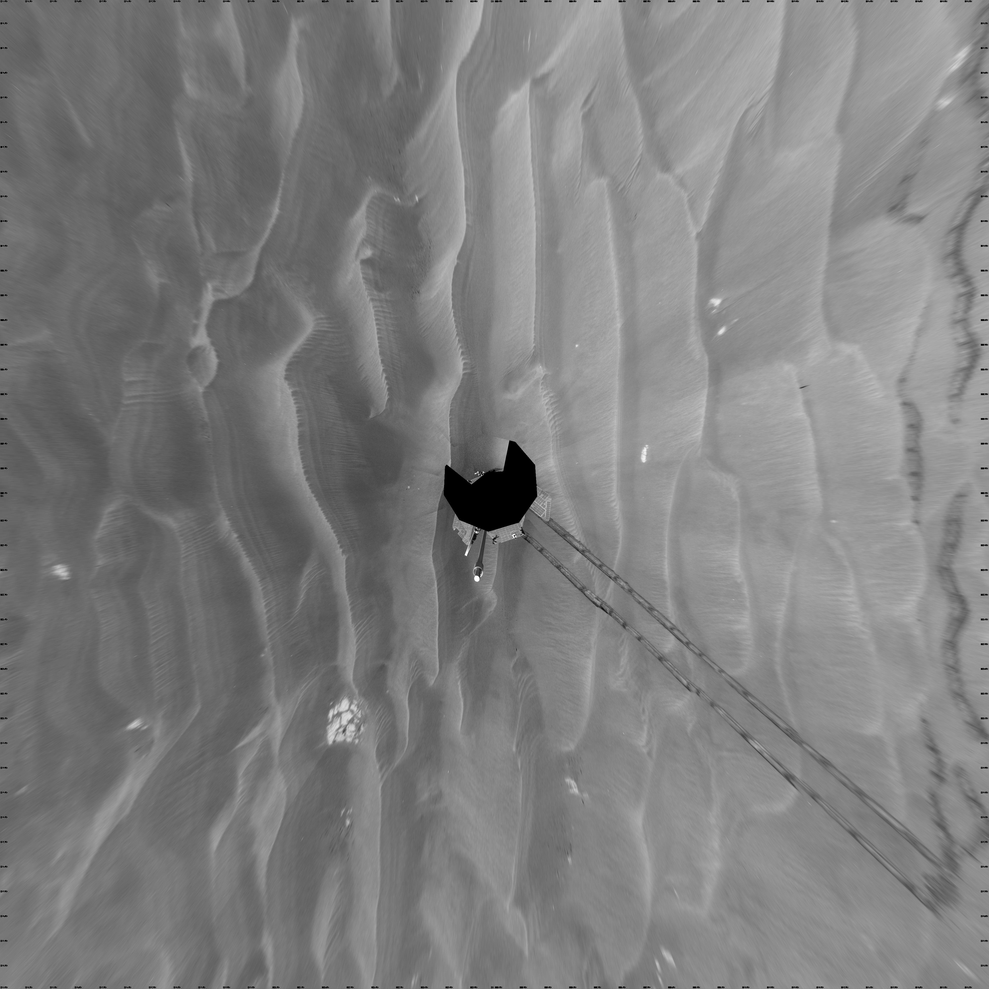
4097x4097x1 |

|
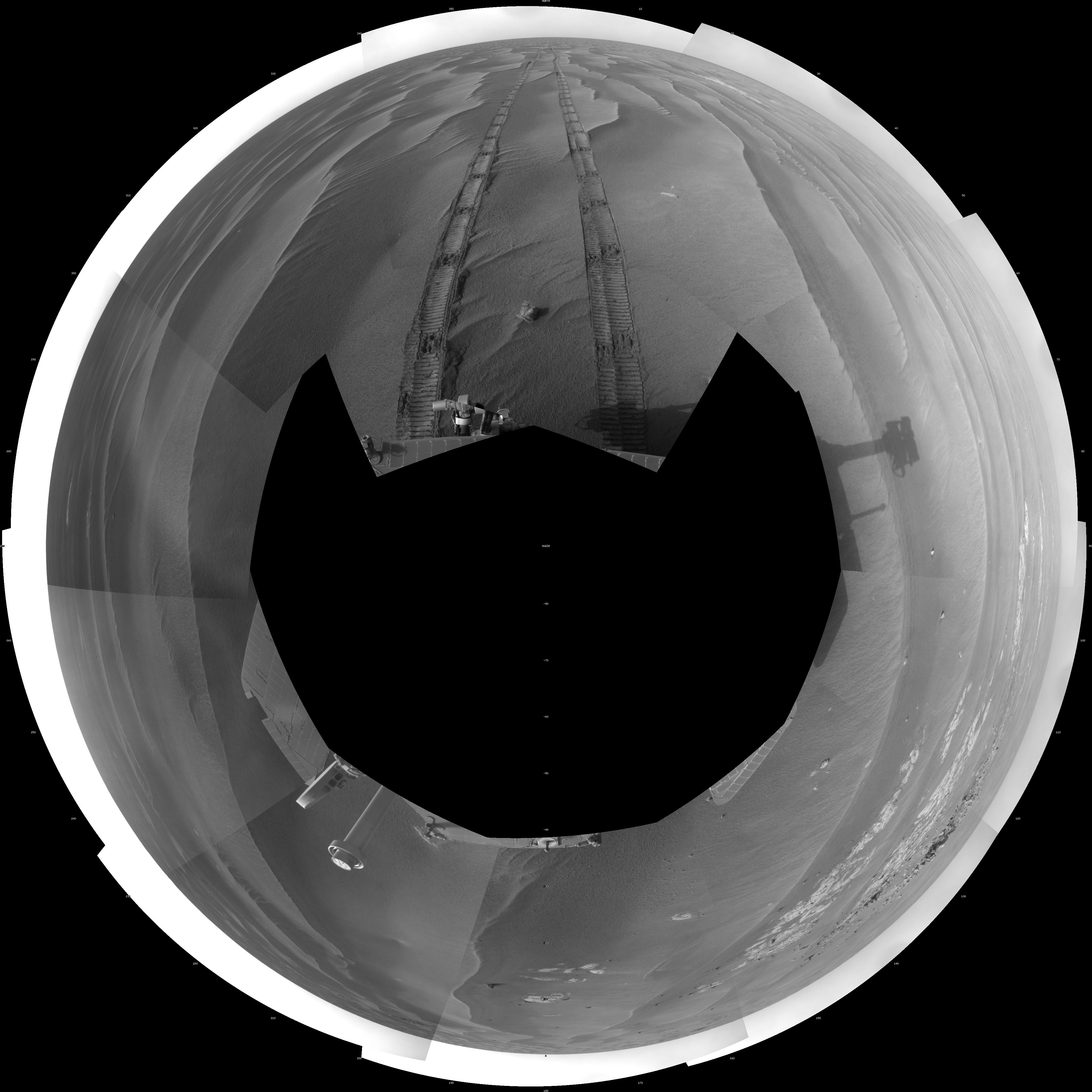
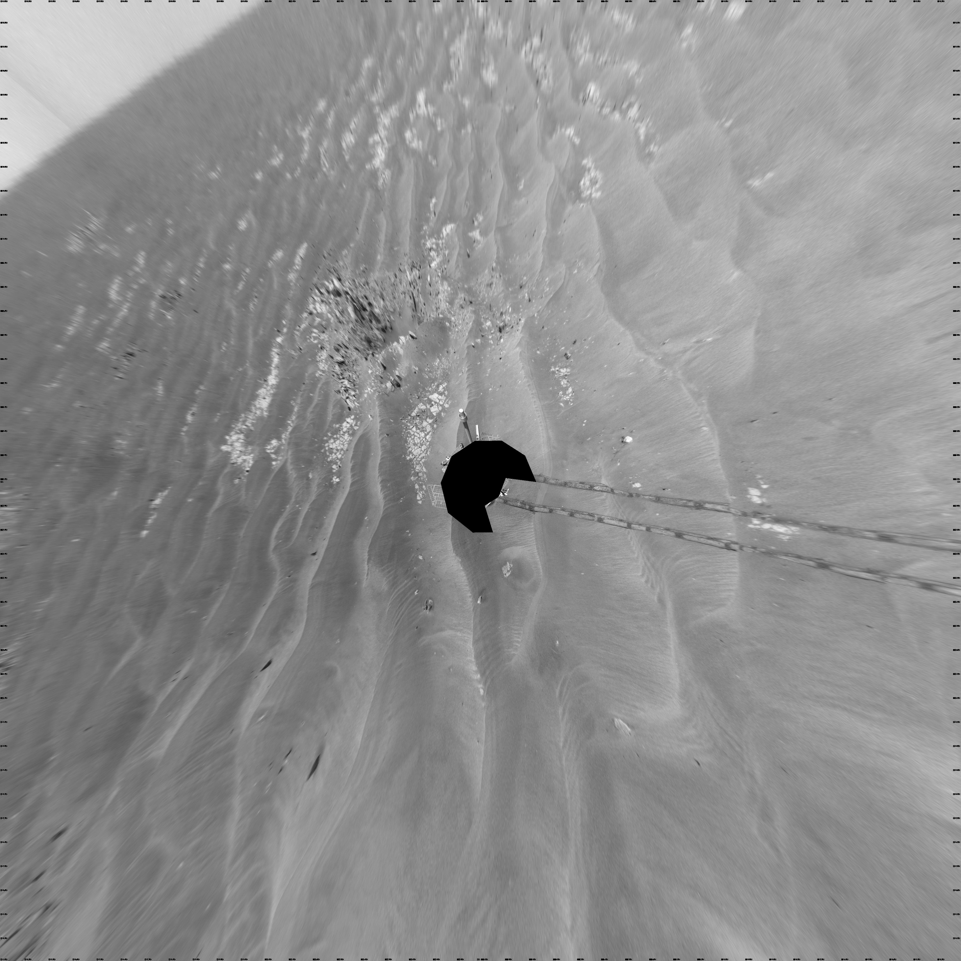
-
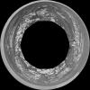
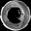
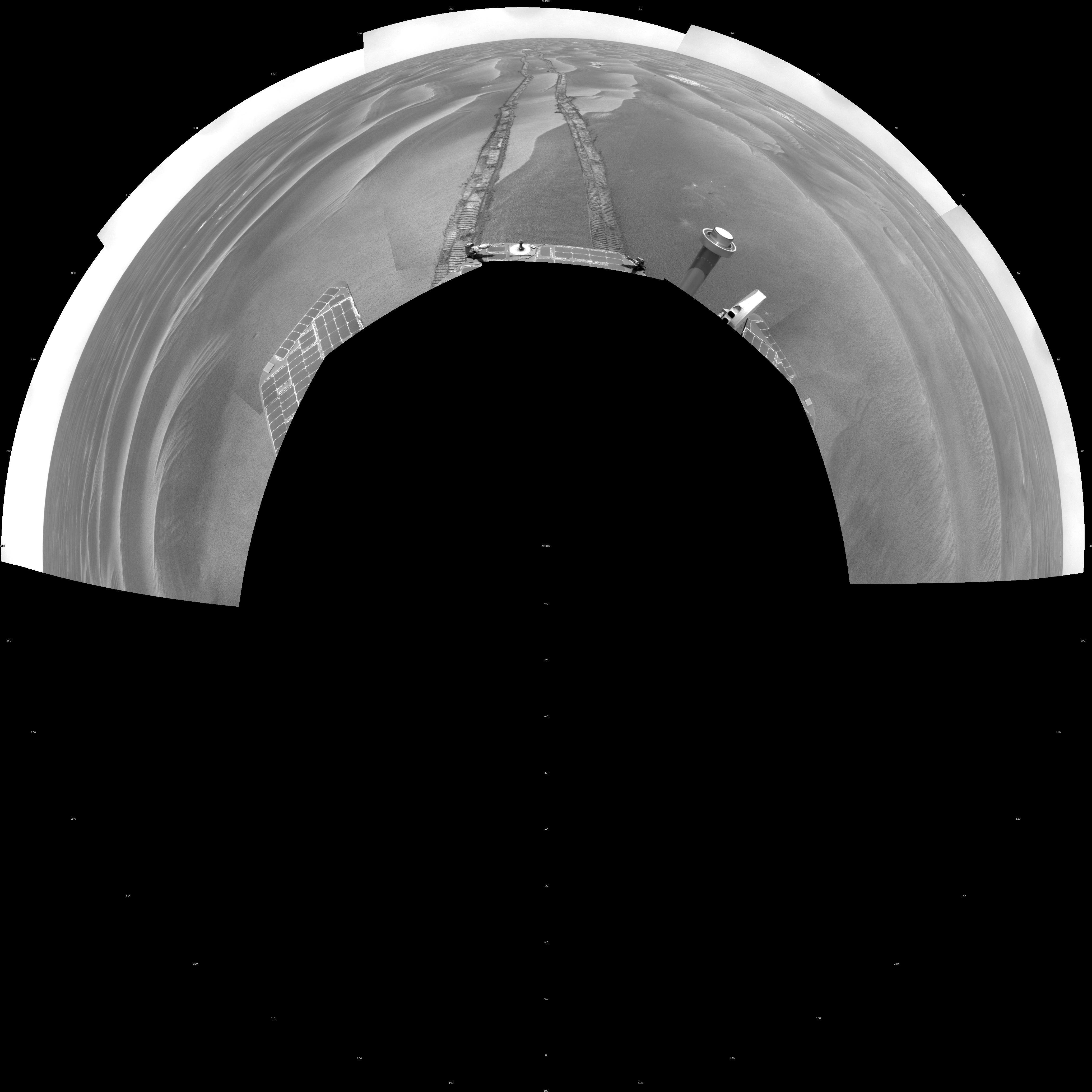
PIA11790:
-
Opportunity's View After Long Drive on Sol 1770 (Polar)
Full Resolution:
TIFF
(16.82 MB)
JPEG
(1.11 MB)
|
|
|
2009-02-04 |
Mars
|
Mars Exploration Rover (MER)
|
Navigation Camera
|
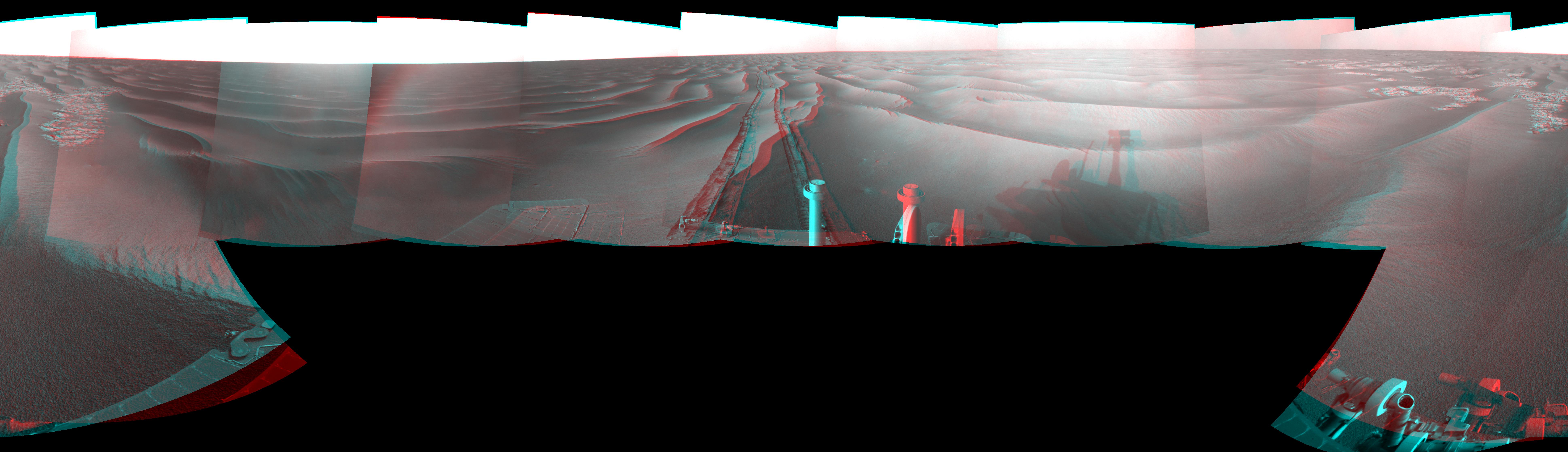
7753x2286x3 |
|
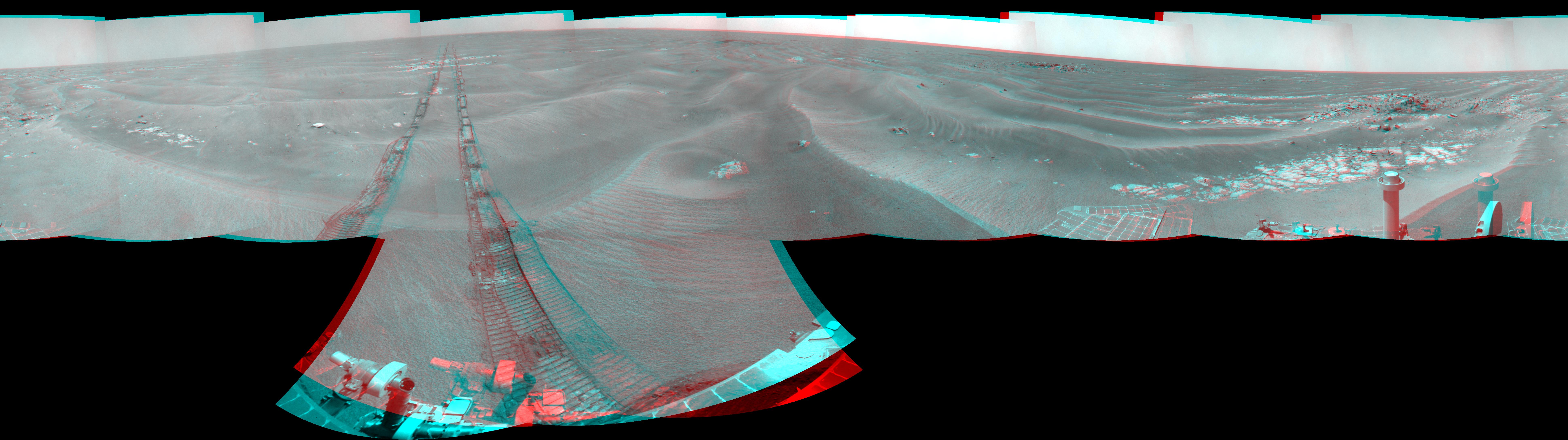
-
PIA11791:
-
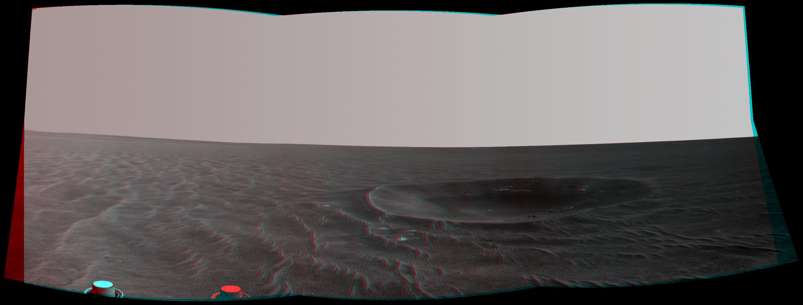
Opportunity's View After Long Drive on Sol 1770 (Stereo)
Full Resolution:
TIFF
(53.17 MB)
JPEG
(1.193 MB)
|
|
|
2009-02-04 |
Mars
|
Mars Exploration Rover (MER)
|
Navigation Camera
|
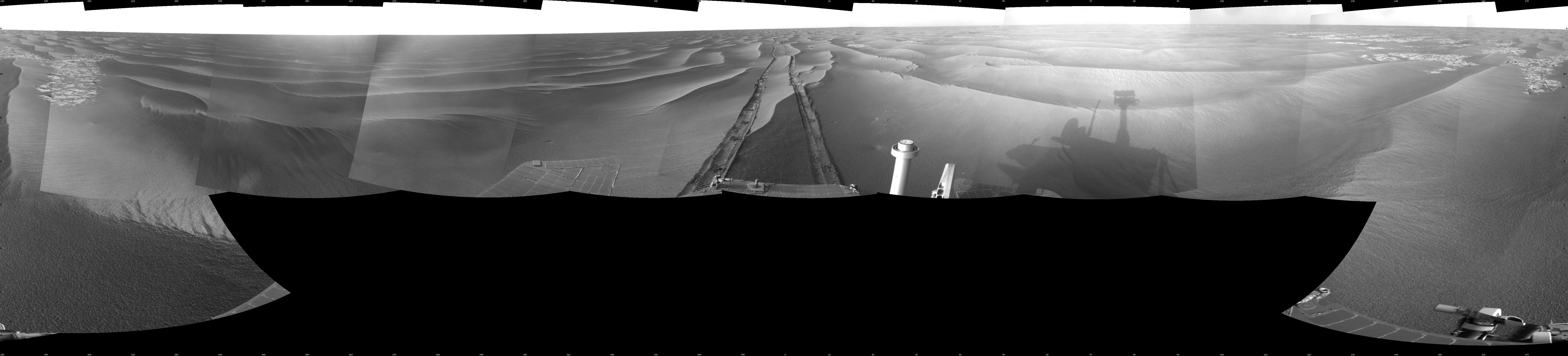
7688x1776x1 |

|
-
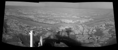
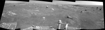
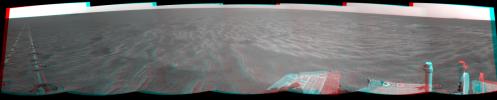
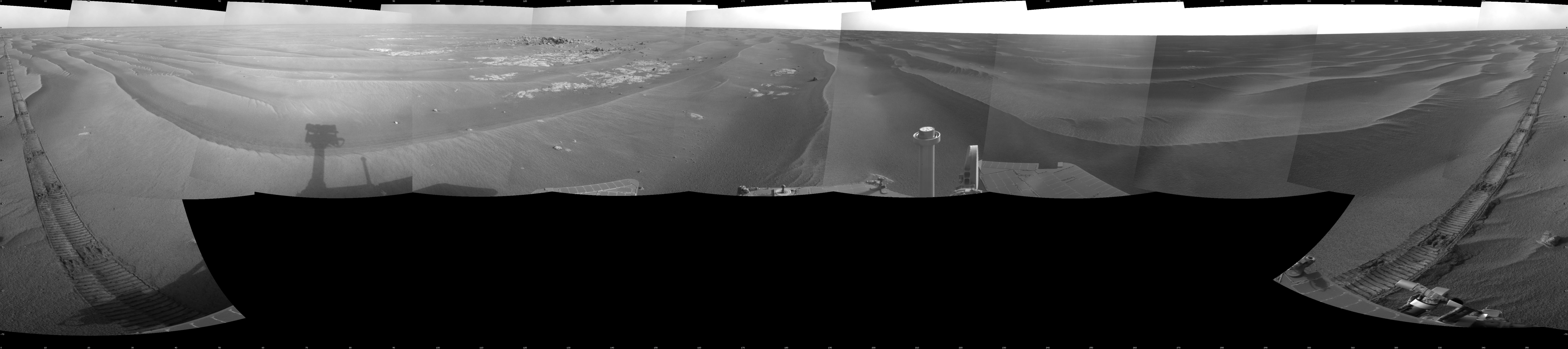
PIA11792:
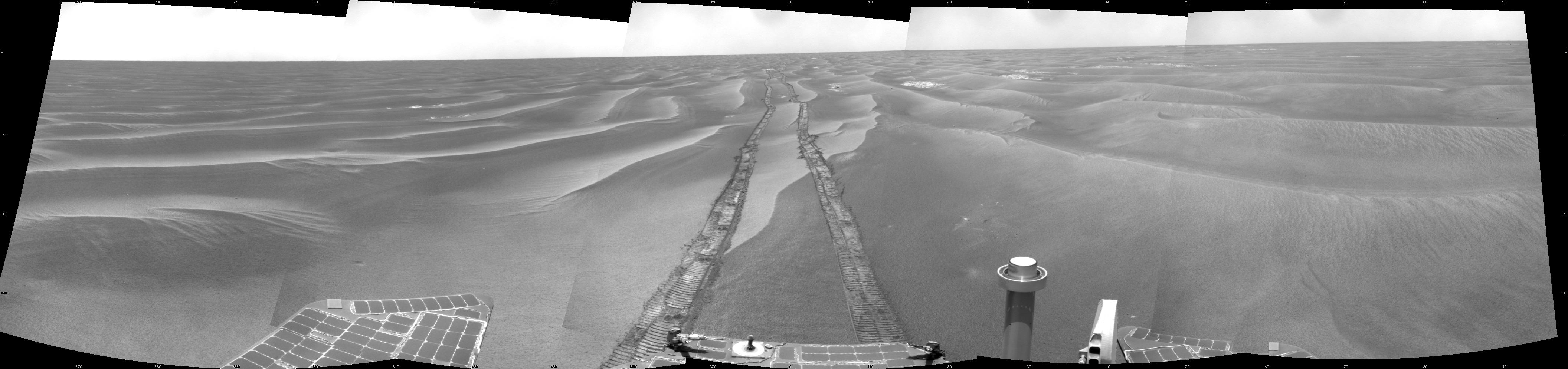
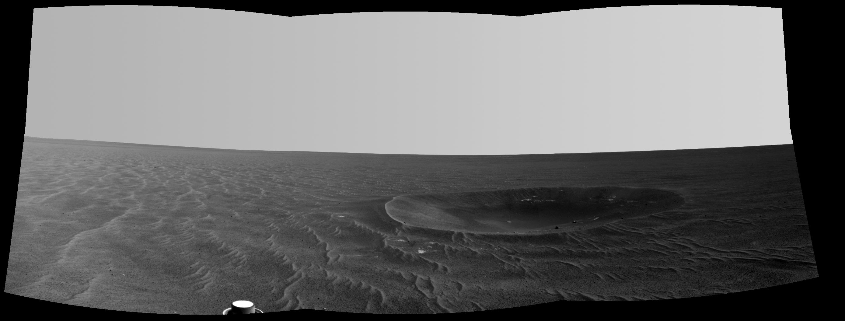
Opportunity's View After Long Drive on Sol 1770
Full Resolution:
TIFF
(13.67 MB)
JPEG
(964.9 kB)
|
|
|
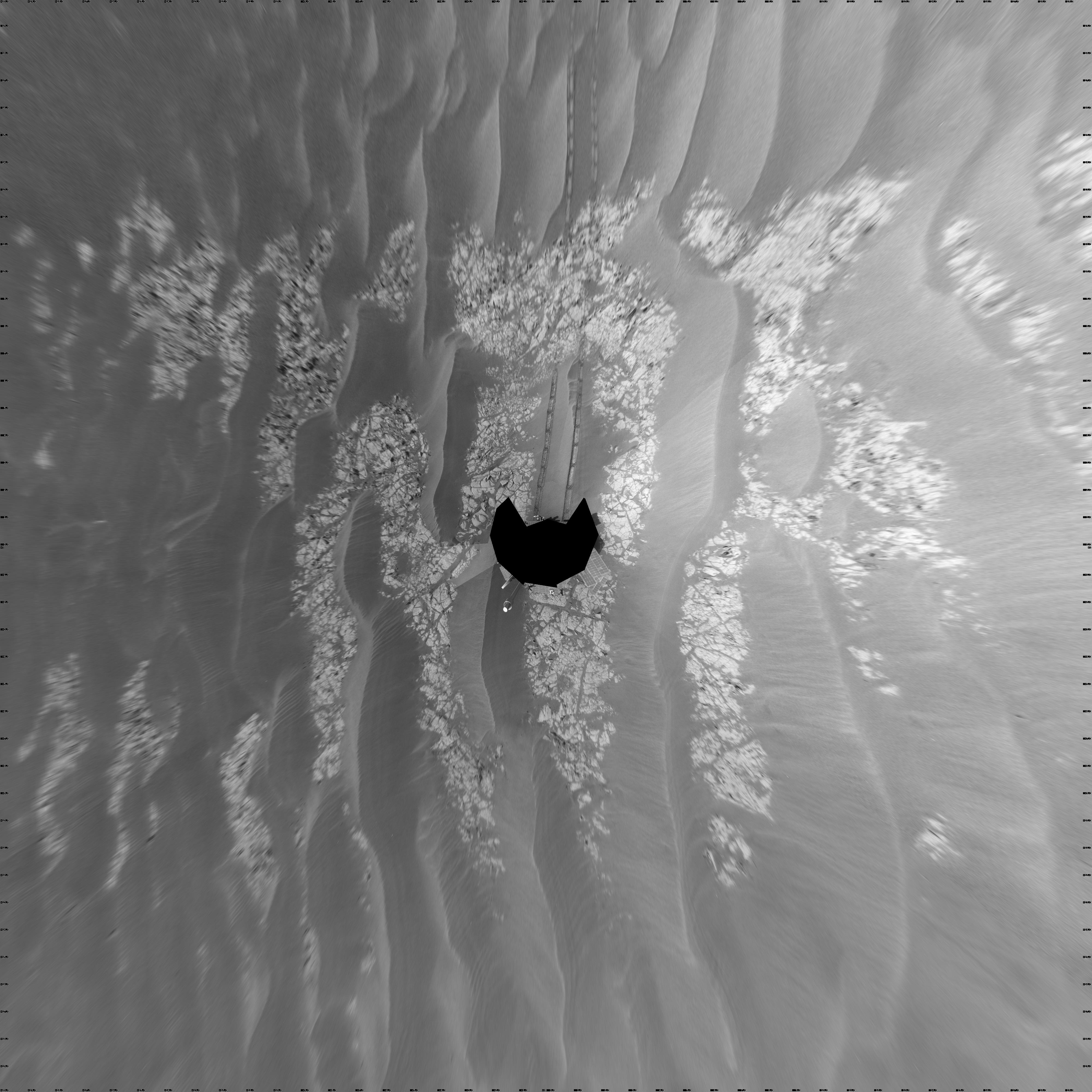
2009-03-03 |
Mars
|
Mars Exploration Rover (MER)
|
Navigation Camera
|
4000x4000x1 |
|
-
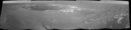
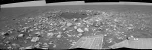
PIA11810:
-
Opportunity's View on Sols 1803 and 1804 (Vertical)
Full Resolution:
TIFF
(16.02 MB)
JPEG
(1.129 MB)
|
|
|
2009-03-03 |
Mars
|
Mars Exploration Rover (MER)
|
Navigation Camera
|
7753x2149x3 |
|
-
PIA11812:
Opportunity's View on Sols 1803 and 1804 (Stereo)
Full Resolution:
TIFF
(49.98 MB)
JPEG
(1.162 MB)
|
|
|
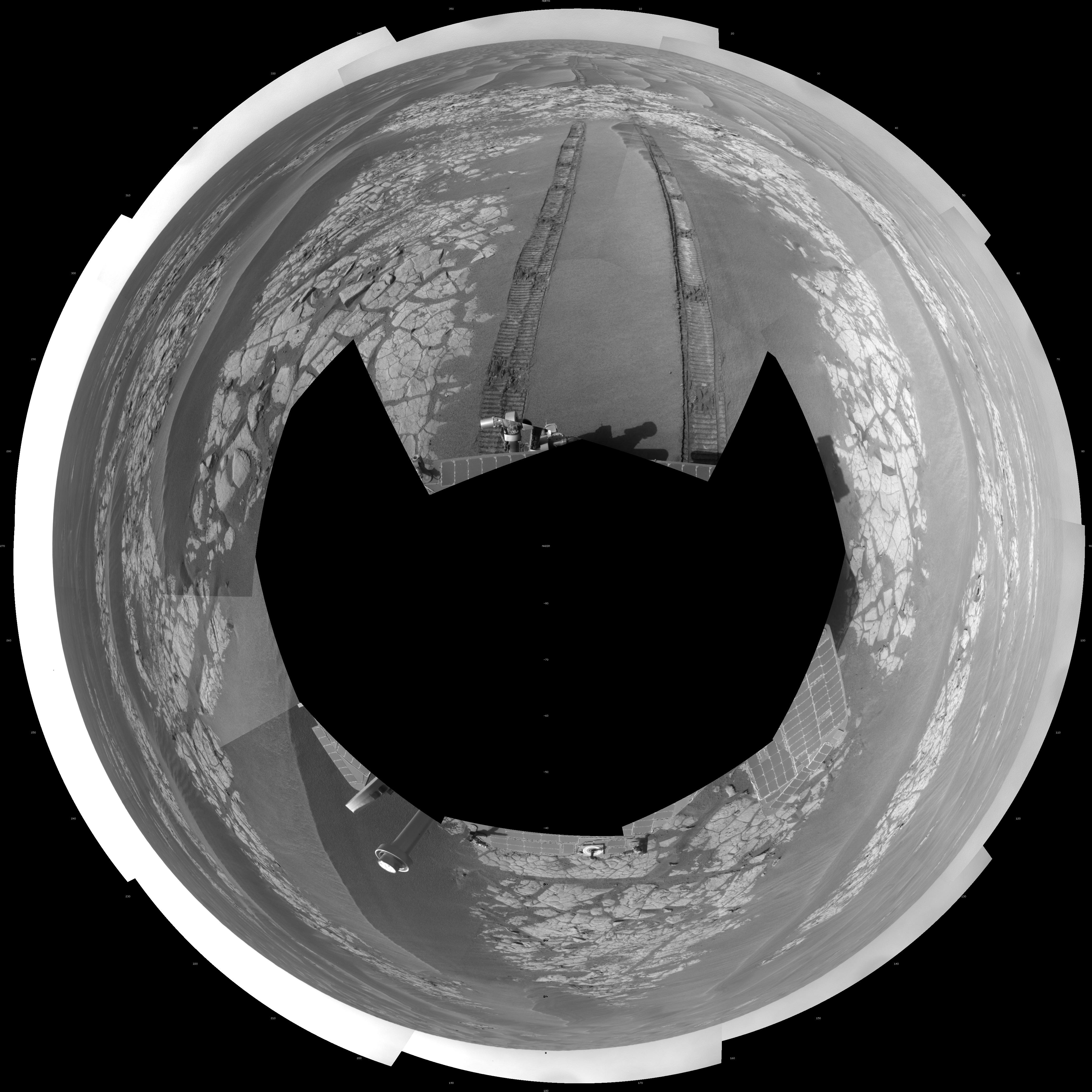
2009-03-03 |
Mars
|
Mars Exploration Rover (MER)
|
Navigation Camera
|
4131x4131x1 |
|
-
PIA11811:
-
Opportunity's View on Sols 1803 and 1804 (Polar)
Full Resolution:
TIFF
(17.1 MB)
JPEG
(1.2 MB)
|
|
|
2009-03-03 |
Mars
|
Mars Exploration Rover (MER)
|
Navigation Camera
|
7688x1698x1 |
|
-
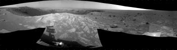
PIA11813:
Opportunity's View on Sols 1803 and 1804
Full Resolution:
TIFF
(13.07 MB)
JPEG
(980.2 kB)
|
|
|
2009-03-03 |
Mars
|
Mars Exploration Rover (MER)
|
Navigation Camera
|
4000x4000x1 |
|
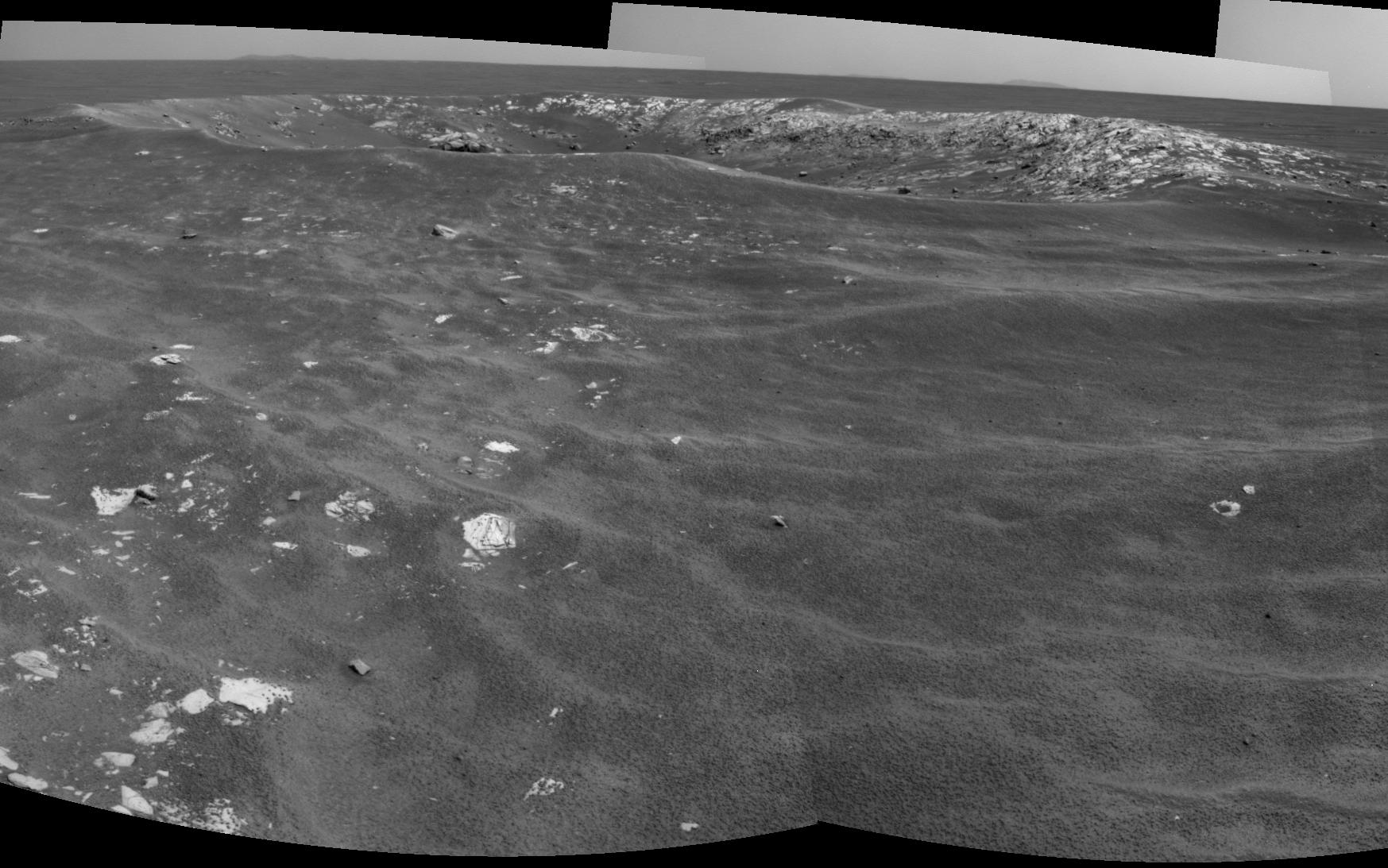
-
PIA11814:
-
Opportunity's View After Drive on Sol 1806 (Vertical)
Full Resolution:
TIFF
(16.02 MB)
JPEG
(1.157 MB)
|
|
|
2009-03-03 |
Mars
|
Mars Exploration Rover (MER)
|
Navigation Camera
|
4151x4151x1 |
|
-
PIA11815:
-
Opportunity's View After Drive on Sol 1806 (Polar)
Full Resolution:
TIFF
(17.26 MB)
JPEG
(1.258 MB)
|
|
|
2009-03-03 |
Mars
|
Mars Exploration Rover (MER)
|
Navigation Camera
|
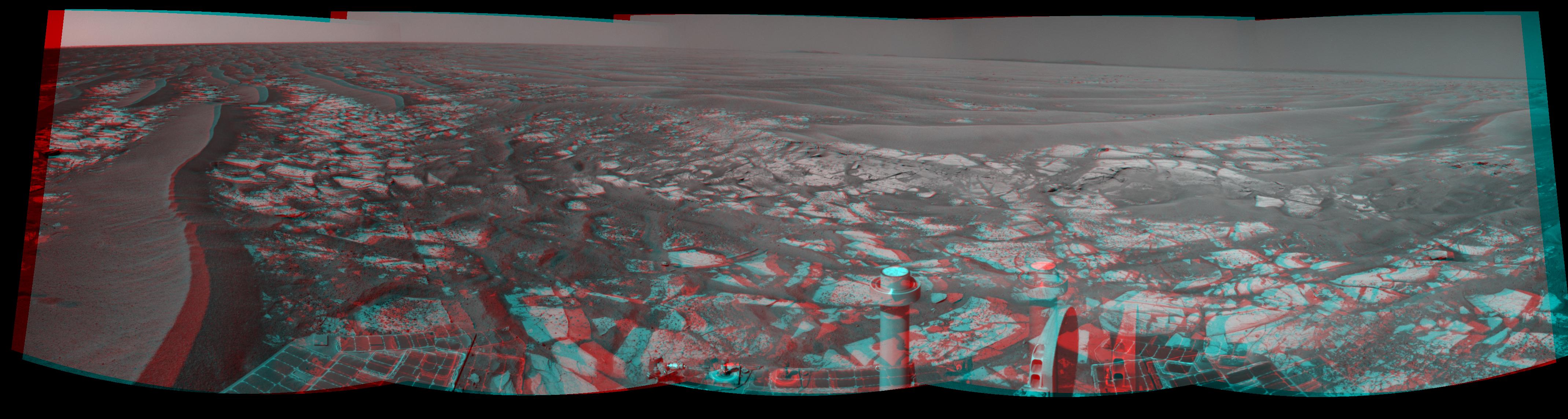
7753x2275x3 |
|
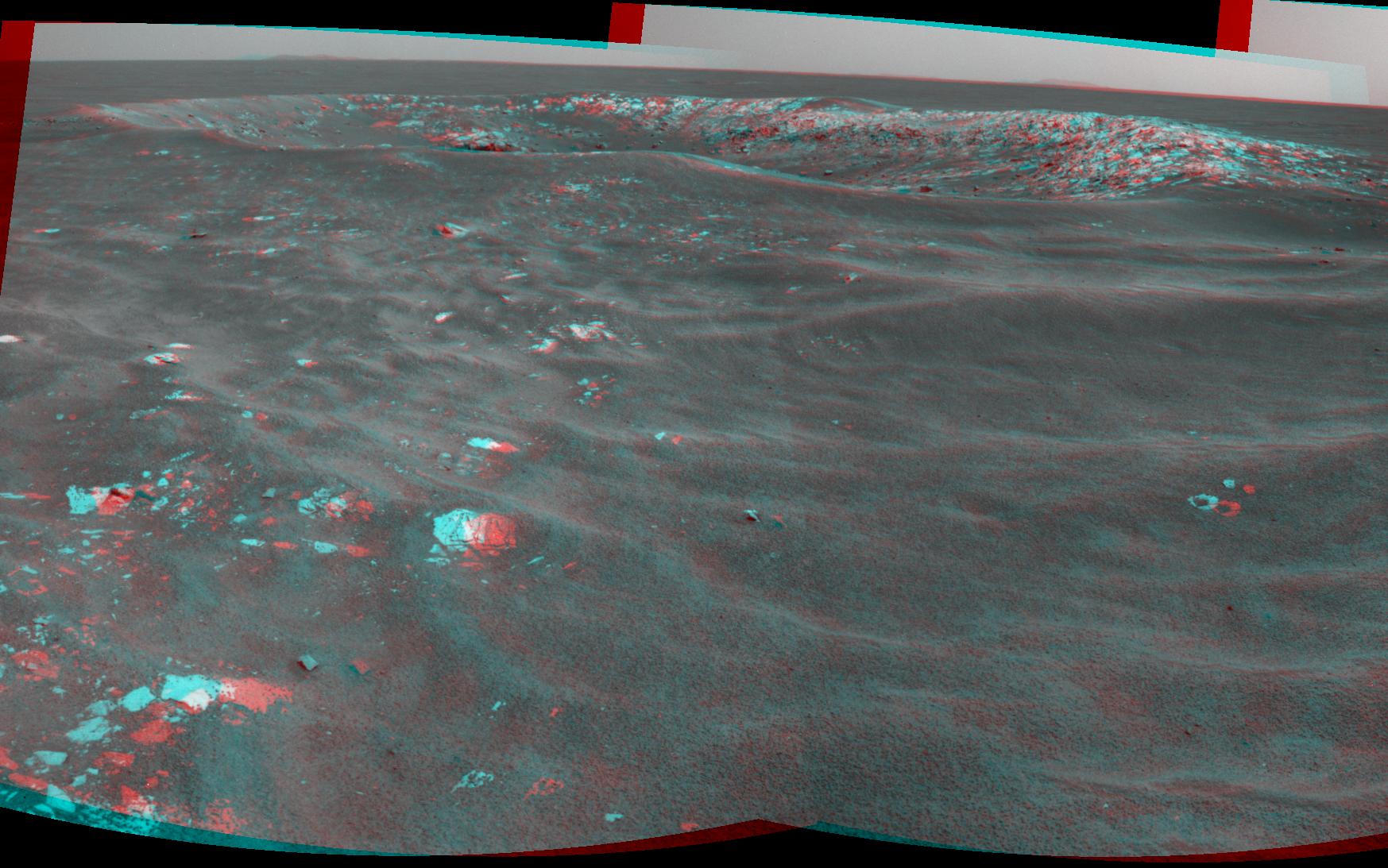
-
PIA11816:
-
Opportunity's View After Drive on Sol 1806 (Stereo)
Full Resolution:
TIFF
(52.91 MB)
JPEG
(1.29 MB)
|
|
|
2009-03-03 |
Mars
|
Mars Exploration Rover (MER)
|
Navigation Camera
|
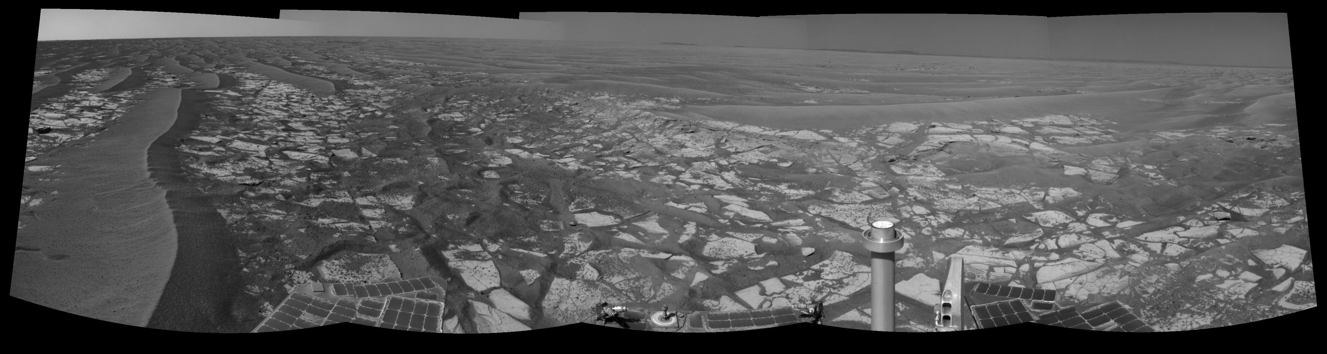
7688x1770x1 |
|
-
PIA11817:
Opportunity's View After Drive on Sol 1806
Full Resolution:
TIFF
(13.62 MB)
JPEG
(1.074 MB)
|
|
|
2009-03-03 |
Mars
|
Mars Exploration Rover (MER)
|
Navigation Camera
|
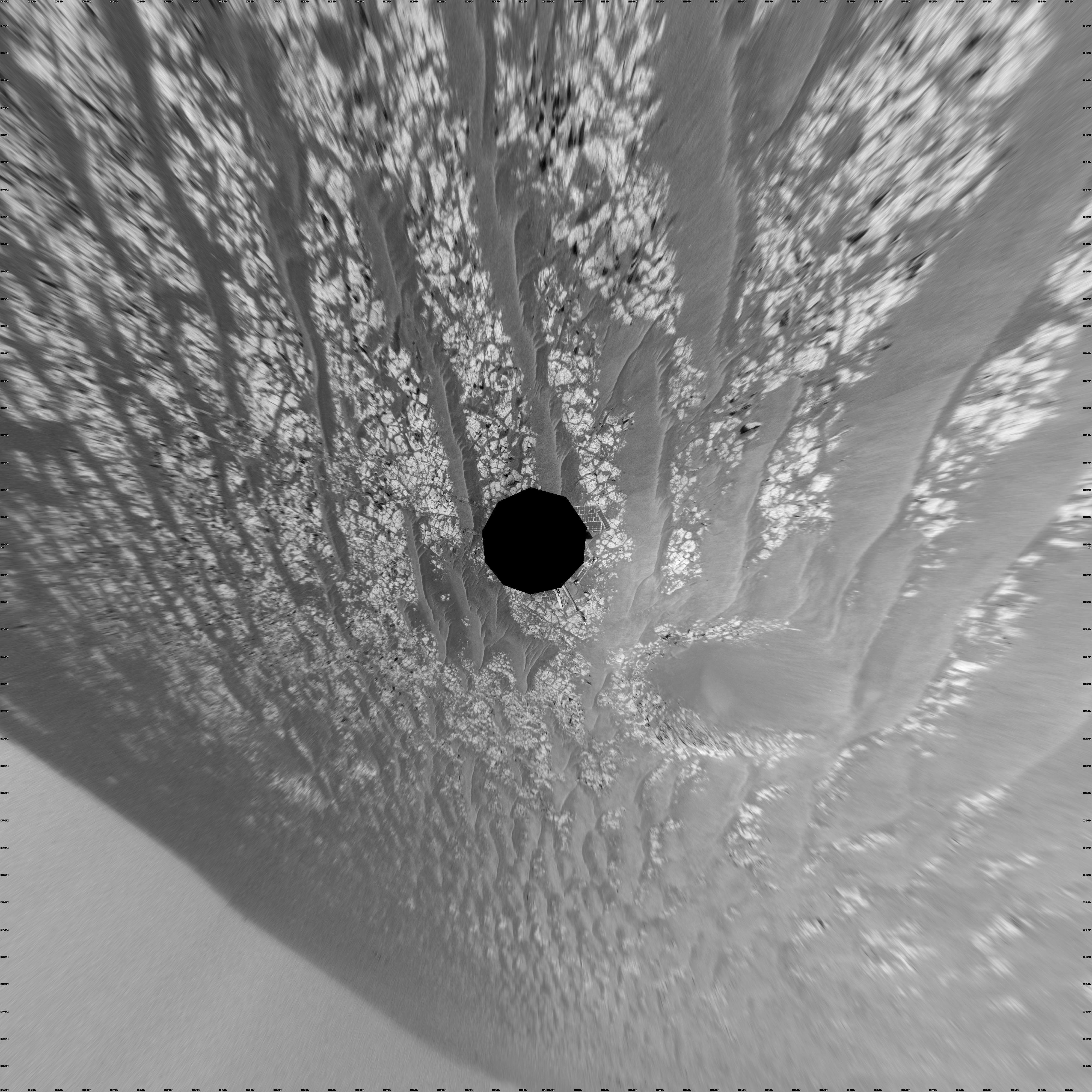
4135x4135x1 |
|
-
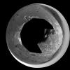
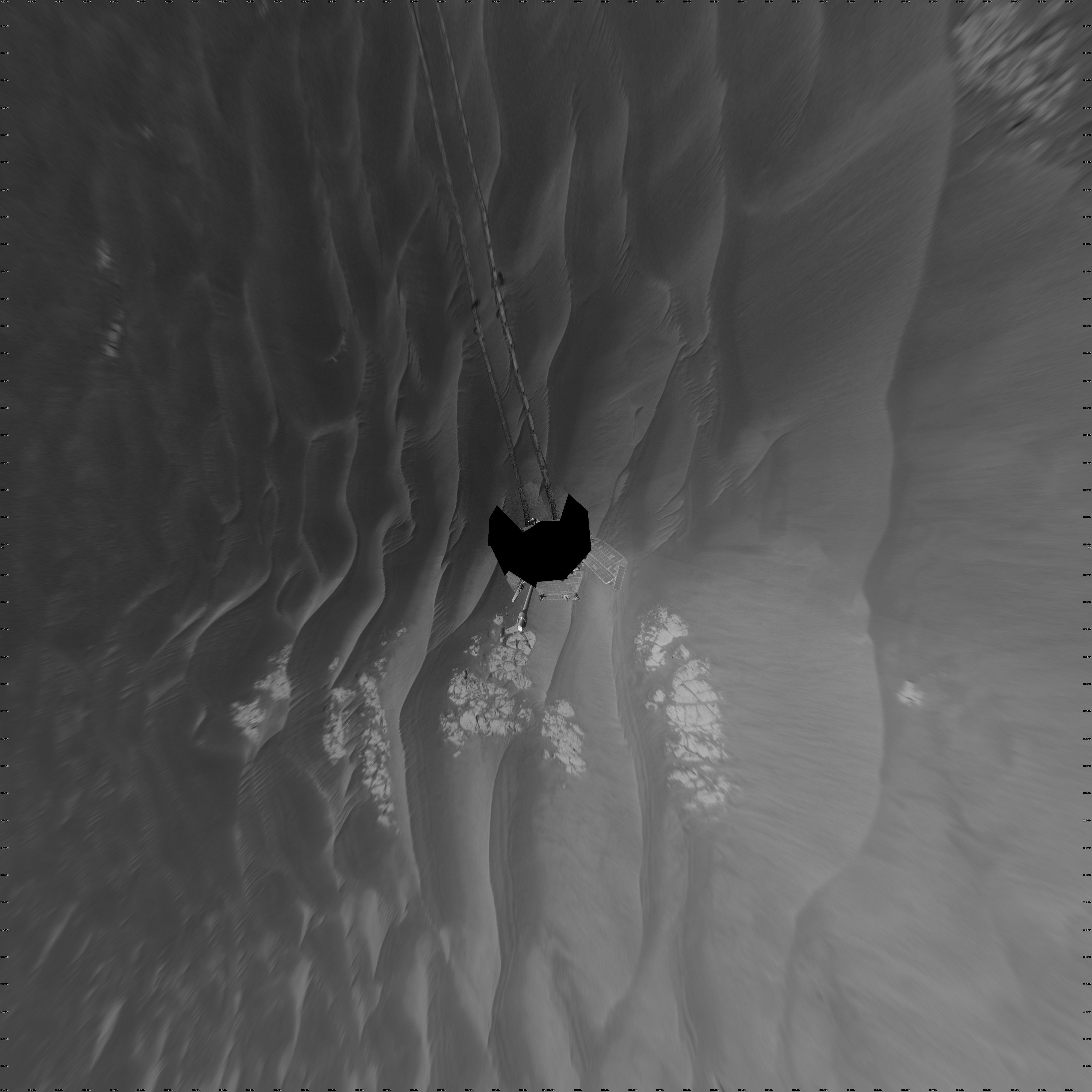
PIA11819:
-
Wind-Sculpted Vicinity After Opportunity's Sol 1797 Drive (Polar)
Full Resolution:
TIFF
(17.13 MB)
JPEG
(1.073 MB)
|
|
|
2009-03-03 |
Mars
|
Mars Exploration Rover (MER)
|
Navigation Camera
|
4000x4000x1 |
|
-
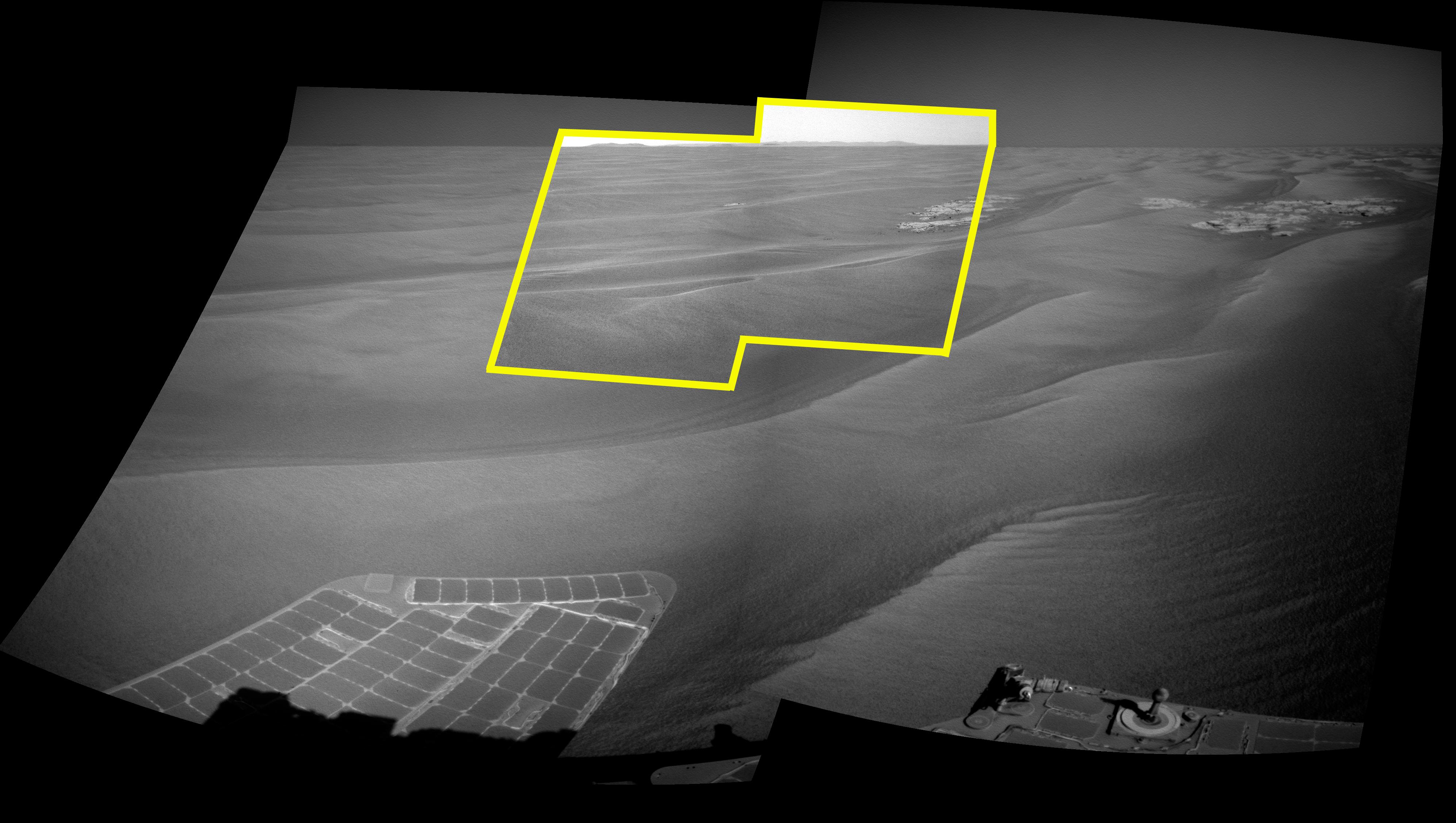
PIA11818:
-
Wind-Sculpted Vicinity After Opportunity's Sol 1797 Drive (Vertical)
Full Resolution:
TIFF
(16.02 MB)
JPEG
(1.033 MB)
|
|
|
2009-03-03 |
Mars
|
Mars Exploration Rover (MER)
|
Navigation Camera
|
7753x2235x3 |
|
-
PIA11820:
-
Wind-Sculpted Vicinity After Opportunity's Sol 1797 Drive (Stereo)
Full Resolution:
TIFF
(51.98 MB)
JPEG
(1.099 MB)
|
|
|
2009-03-03 |
Mars
|
Mars Exploration Rover (MER)
|
Navigation Camera
|
7688x1747x1 |

|
-
PIA11821:
Wind-Sculpted Vicinity After Opportunity's Sol 1797 Drive
Full Resolution:
TIFF
(13.45 MB)
JPEG
(946 kB)
|
|
|
2009-03-23 |
Mars
|
Mars Exploration Rover (MER)
|
Navigation Camera
|
4000x4000x1 |
|
-
PIA11840:
-
Opportunity's Surroundings After Sol 1820 Drive (Vertical)
Full Resolution:
TIFF
(16.02 MB)
JPEG
(944.5 kB)
|
|
|
2009-03-23 |
Mars
|
Mars Exploration Rover (MER)
|
Navigation Camera
|
4107x4107x1 |

|
-
PIA11841:
-
Opportunity's Surroundings After Sol 1820 Drive (Polar)
Full Resolution:
TIFF
(16.9 MB)
JPEG
(1.159 MB)
|
|
|
2009-03-23 |
Mars
|
Mars Exploration Rover (MER)
|
Navigation Camera
|
7753x2357x3 |
|
-
PIA11842:
-
Opportunity's Surroundings After Sol 1820 Drive (Stereo)
Full Resolution:
TIFF
(54.82 MB)
JPEG
(1.314 MB)
|
|
|
2009-03-23 |
Mars
|
Mars Exploration Rover (MER)
|
Navigation Camera
|
7688x1815x1 |
|
-
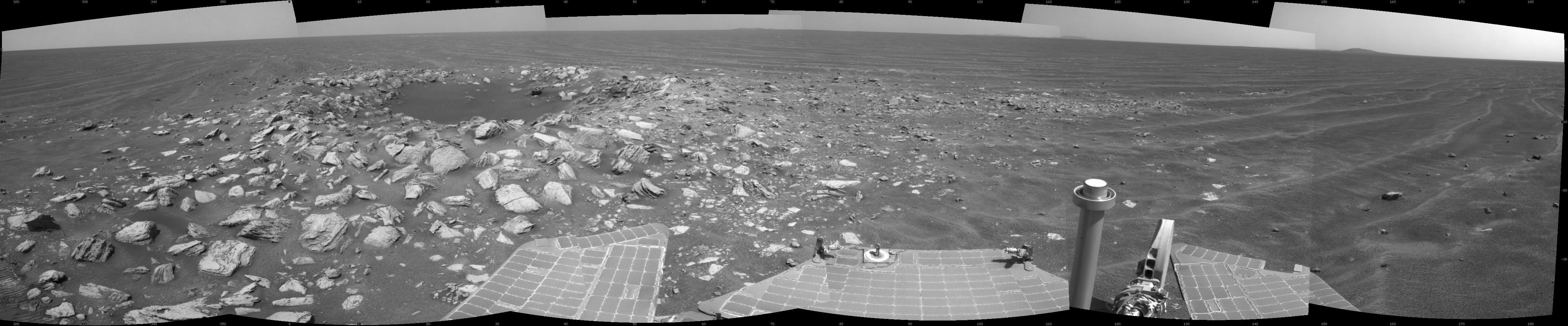
PIA11843:
Opportunity's Surroundings After Sol 1820 Drive
Full Resolution:
TIFF
(13.97 MB)
JPEG
(1.053 MB)
|
|
|
2009-03-23 |
Mars
|
Mars Exploration Rover (MER)
|
Navigation Camera
|
4000x4000x1 |

|
-
PIA11844:
-
Opportunity's Surroundings on Sol 1818 (Vertical)
Full Resolution:
TIFF
(16.02 MB)
JPEG
(778.4 kB)
|
|
|
2009-03-23 |
Mars
|
Mars Exploration Rover (MER)
|
Navigation Camera
|
4127x4127x1 |

|
-
PIA11845:
-
Opportunity's Surroundings on Sol 1818 (Polar)
Full Resolution:
TIFF
(17.07 MB)
JPEG
(939 kB)
|
|
|
2009-03-23 |
Mars
|
Mars Exploration Rover (MER)
|
Navigation Camera
|
7753x2177x3 |
|
-
PIA11846:
Opportunity's Surroundings on Sol 1818 (Stereo)
Full Resolution:
TIFF
(50.64 MB)
JPEG
(970 kB)
|
|
|
2009-03-23 |
Mars
|
Mars Exploration Rover (MER)
|
Navigation Camera
|
7688x1714x1 |

|
-
PIA11847:
Opportunity's Surroundings on Sol 1818
Full Resolution:
TIFF
(13.19 MB)
JPEG
(800.1 kB)
|
|
|
2009-03-23 |
Mars
|
Mars Exploration Rover (MER)
|
Navigation Camera
|
4000x4000x1 |

|
-
PIA11848:
-
Opportunity's Surroundings on Sol 1798 (Vertical)
Full Resolution:
TIFF
(16.02 MB)
JPEG
(609.2 kB)
|
|
|
2009-03-23 |
Mars
|
Mars Exploration Rover (MER)
|
Navigation Camera
|
4133x4133x1 |

|
-
PIA11849:
-
Opportunity's Surroundings on Sol 1798 (Polar)
Full Resolution:
TIFF
(17.11 MB)
JPEG
(645.9 kB)
|
|
|
2009-03-23 |
Mars
|
Mars Exploration Rover (MER)
|
Navigation Camera
|
4260x1161x3 |

|
-
PIA11850:
Opportunity's Surroundings on Sol 1798 (Stereo)
Full Resolution:
TIFF
(14.84 MB)
JPEG
(449.3 kB)
|
|
|
2009-03-23 |
Mars
|
Mars Exploration Rover (MER)
|
Navigation Camera
|
4225x995x1 |

|
-
PIA11851:
Opportunity's Surroundings on Sol 1798
Full Resolution:
TIFF
(4.212 MB)
JPEG
(394.7 kB)
|
|
|
2009-03-23 |
Mars
|
Mars Exploration Rover (MER)
|
Navigation Camera
|
4000x4000x1 |
|
-
PIA11852:
-
Opportunity at 'Cook Islands' (Vertical)
Full Resolution:
TIFF
(16.02 MB)
JPEG
(948.2 kB)
|
|
|
2009-03-23 |
Mars
|
Mars Exploration Rover (MER)
|
Navigation Camera
|
4093x4093x1 |
|
-
PIA11853:
-
Opportunity at 'Cook Islands' (Polar)
Full Resolution:
TIFF
(16.77 MB)
JPEG
(1.106 MB)
|
|
|
2009-03-23 |
Mars
|
Mars Exploration Rover (MER)
|
Navigation Camera
|
7753x2218x3 |

|
-
PIA11854:
-
Opportunity at 'Cook Islands' (Stereo)
Full Resolution:
TIFF
(51.59 MB)
JPEG
(1.162 MB)
|
|
|
2009-03-23 |
Mars
|
Mars Exploration Rover (MER)
|
Navigation Camera
|
7688x1738x1 |
|
-
PIA11855:
Opportunity at 'Cook Islands'
Full Resolution:
TIFF
(13.38 MB)
JPEG
(967.1 kB)
|
|
|
2009-07-15 |
Mars
|
Mars Exploration Rover (MER)
|
Navigation Camera
|
4274x1922x1 |
|
-
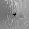
PIA12131:
-
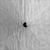
Skirting an Obstacle, Opportunity's Sol 1867
Full Resolution:
TIFF
(8.23 MB)
JPEG
(681.5 kB)
|
|
|
2009-07-15 |
Mars
|
Mars Exploration Rover (MER)
|
Navigation Camera
|
4091x4091x1 |
|
-
PIA12123:
-
Opportunity's Surroundings After Backwards Drive, Sol 1850 (Polar)
Full Resolution:
TIFF
(16.75 MB)
JPEG
(1.095 MB)
|
|
|
2009-07-15 |
Mars
|
Mars Exploration Rover (MER)
|
Navigation Camera
|
4000x4000x1 |
|
-
PIA12124:
-
Opportunity's Surroundings After Backwards Drive, Sol 1850 (Vertical)
Full Resolution:
TIFF
(16.02 MB)
JPEG
(1.151 MB)
|
|
|
2009-07-15 |
Mars
|
Mars Exploration Rover (MER)
|
Navigation Camera
|
7753x2186x3 |
|
-
PIA12125:
Opportunity's Surroundings After Backwards Drive, Sol 1850 (Stereo)
Full Resolution:
TIFF
(50.84 MB)
JPEG
(1.08 MB)
|
|
|
2009-07-15 |
Mars
|
Mars Exploration Rover (MER)
|
Navigation Camera
|
7688x1719x1 |
|
-
PIA12126:
Opportunity's Surroundings After Backwards Drive, Sol 1850
Full Resolution:
TIFF
(13.23 MB)
JPEG
(931.6 kB)
|
|
|
2009-07-15 |
Mars
|
Mars Exploration Rover (MER)
|
Navigation Camera
|
4099x4099x1 |
|
-
PIA12127:
-
Opportunity's View After 72-Meter Drive, Sol 1912 (Polar)
Full Resolution:
TIFF
(16.83 MB)
JPEG
(1.215 MB)
|
|
|
2009-07-15 |
Mars
|
Mars Exploration Rover (MER)
|
Navigation Camera
|
4000x4000x1 |
|
-
PIA12128:
-
Opportunity's View After 72-Meter Drive, Sol 1912 (Vertical)
Full Resolution:
TIFF
(16.02 MB)
JPEG
(1.21 MB)
|
|
|
2009-07-15 |
Mars
|
Mars Exploration Rover (MER)
|
Navigation Camera
|
7753x2187x3 |
|
-
PIA12129:
Opportunity's View After 72-Meter Drive, Sol 1912 (Stereo)
Full Resolution:
TIFF
(50.87 MB)
JPEG
(1.249 MB)
|
|
|
2009-07-15 |
Mars
|
Mars Exploration Rover (MER)
|
Navigation Camera
|
7688x1720x1 |
|
-
PIA12130:
Opportunity's View After 72-Meter Drive, Sol 1912
Full Resolution:
TIFF
(13.24 MB)
JPEG
(1.042 MB)
|
|
|
2009-07-23 |
Mars
|
Mars Exploration Rover (MER)
|
Navigation Camera
|
4103x4103x1 |

|
-
PIA12152:
-
Opportunity's Surroundings on Sol 1950 (Polar)
Full Resolution:
TIFF
(16.87 MB)
JPEG
(1.262 MB)
|
|
|
2009-07-23 |
Mars
|
Mars Exploration Rover (MER)
|
Navigation Camera
|
4000x4000x1 |

|
-
PIA12153:
-
Opportunity's Surroundings on Sol 1950 (Vertical)
Full Resolution:
TIFF
(16.02 MB)
JPEG
(1.143 MB)
|
|
|
2009-07-23 |
Mars
|
Mars Exploration Rover (MER)
|
Navigation Camera
|
7753x2178x3 |
|
-
PIA12154:
Opportunity's Surroundings on Sol 1950 (Stereo)
Full Resolution:
TIFF
(50.66 MB)
JPEG
(1.35 MB)
|
|
|
2009-07-23 |
Mars
|
Mars Exploration Rover (MER)
|
Navigation Camera
|
7688x1715x1 |
|
-
PIA12155:
Opportunity's Surroundings on Sol 1950
Full Resolution:
TIFF
(13.2 MB)
JPEG
(1.089 MB)
|
|
|
2009-10-03 |
Mars
|
Mars Exploration Rover (MER)
|
Navigation Camera
|
1024x1024x1 |
|
-
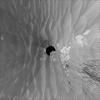
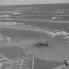
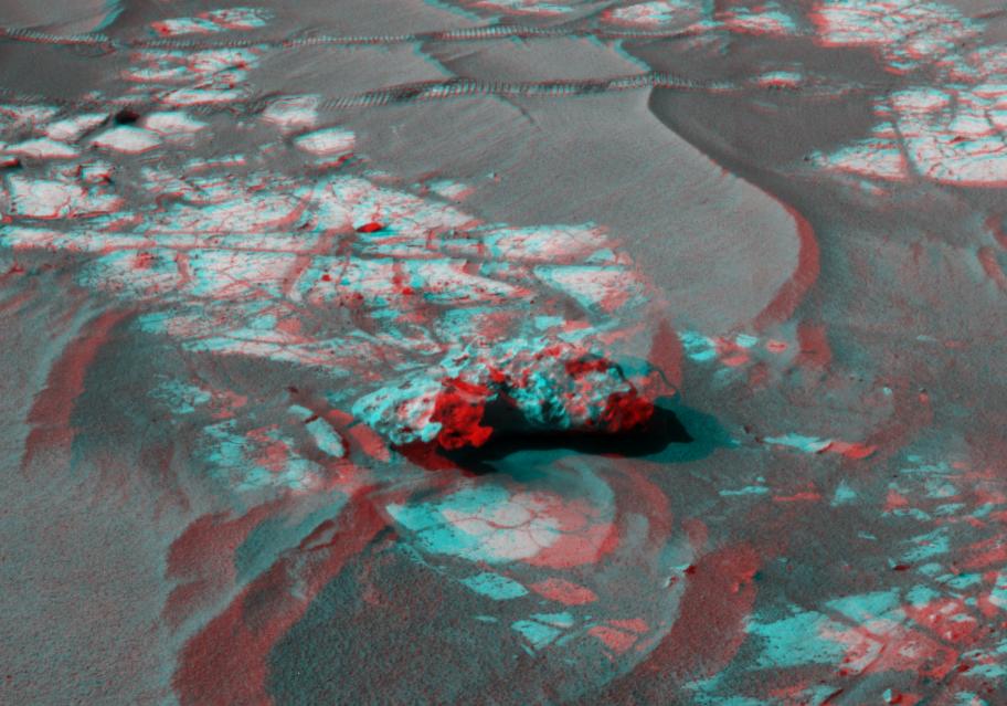
PIA12254:
-
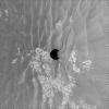
Opportunity Finds Another Meteorite
Full Resolution:
TIFF
(1.05 MB)
JPEG
(96.74 kB)
|
|
|
2009-12-01 |
Mars
|
Mars Exploration Rover (MER)
|
Navigation Camera
|
1024x1024x1 |
|
-
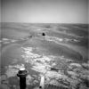
PIA12474:
-
Approaching 'Marquette Island'
Full Resolution:
TIFF
(1.05 MB)
JPEG
(224.9 kB)
|
|
|
2009-12-01 |
Mars
|
Mars Exploration Rover (MER)
|
Navigation Camera
|
707x649x1 |
|
-
PIA12475:
-
Examining 'Marquette Island'
Full Resolution:
TIFF
(459.5 kB)
JPEG
(61.24 kB)
|
|
|
2010-03-23 |
Mars
|
Mars Exploration Rover (MER)
|
Navigation Camera
|
1024x1024x3 |
|
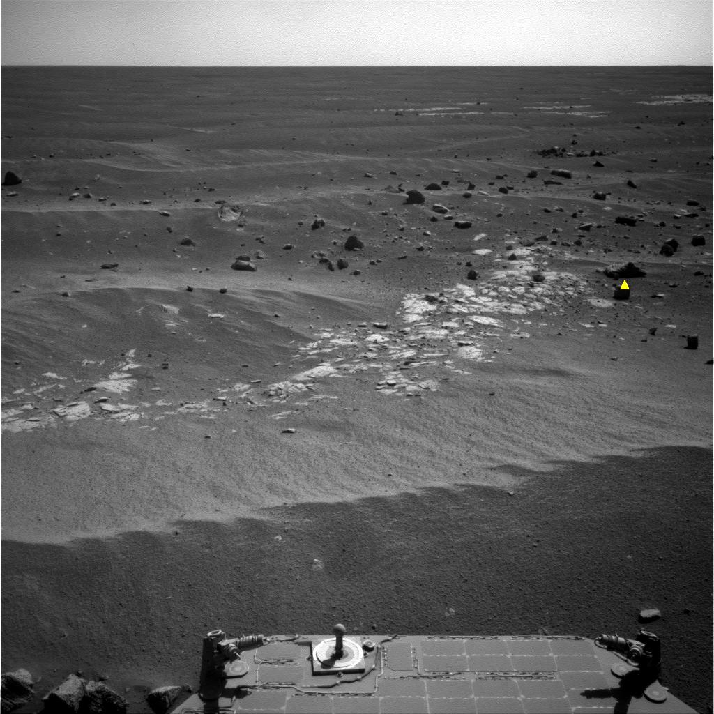
-
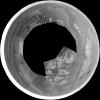
PIA12973:
-
Image Analyzed by Mars Rover for Selection of Target
Full Resolution:
TIFF
(1.051 MB)
JPEG
(166.4 kB)
|
|
|
2010-04-30 |
Mars
|
Mars Exploration Rover (MER)
|
Navigation Camera
|
3988x2253x3 |
|
-
PIA13084:
-
Endeavour on the Horizon (Context View)
Full Resolution:
TIFF
(26.96 MB)
JPEG
(784.3 kB)
|
|
|
2010-05-03 |
Mars
|
Mars Exploration Rover (MER)
|
Navigation Camera
|
1024x1024x43 |
|
-
PIA13088:
-
Opportunity's Wheel Tracks at Victoria Crater

Full Resolution:
TIFF
(1.05 MB)
JPEG
(76.85 kB)
|
|
|
2010-05-19 |
Mars
|
Mars Exploration Rover (MER)
|
Navigation Camera
|
1024x1024x1 |

|
-
PIA13147:
-
Opportunity Looks Back After Hop to a New Pad
Full Resolution:
TIFF
(1.05 MB)
JPEG
(164.8 kB)
|
|
|
2010-06-25 |
Mars
|
Mars Exploration Rover (MER)
|
Navigation Camera
|
4000x4000x1 |
|
-
PIA13219:
-
Opportunity's Surroundings After Sol 2220 Drive (Vertical)
Full Resolution:
TIFF
(16.02 MB)
JPEG
(669 kB)
|
|
|
2010-06-25 |
Mars
|
Mars Exploration Rover (MER)
|
Navigation Camera
|
4205x4205x1 |
|
-
PIA13220:
-
Opportunity's Surroundings After Sol 2220 Drive (Polar)
Full Resolution:
TIFF
(17.72 MB)
JPEG
(892.6 kB)
|
|
|
2010-06-25 |
Mars
|
Mars Exploration Rover (MER)
|
Navigation Camera
|
7688x1896x1 |
|
-
PIA13222:
Opportunity's Surroundings After Sol 2220 Drive
Full Resolution:
TIFF
(14.59 MB)
JPEG
(846.1 kB)
|
|
|
2010-06-25 |
Mars
|
Mars Exploration Rover (MER)
|
Navigation Camera
|
7753x2513x3 |
|
-
PIA13221:
-
Opportunity's Surroundings After Sol 2220 Drive (Stereo)
Full Resolution:
TIFF
(58.45 MB)
JPEG
(1.074 MB)
|
|
|
2010-09-07 |
Mars
|
Mars Exploration Rover (MER)
|
Navigation Camera
|
4278x1143x3 |
|
-
PIA13371:
-
'Cambridge Bay' Outcrop Examined by Opportunity (Stereo)
Full Resolution:
TIFF
(14.67 MB)
JPEG
(549.4 kB)
|
|
|
2010-09-07 |
Mars
|
Mars Exploration Rover (MER)
|
Navigation Camera
|
4278x1143x1 |
|
-
PIA13372:
-
'Cambridge Bay' Outcrop Examined by Opportunity
Full Resolution:
TIFF
(4.899 MB)
JPEG
(522.6 kB)
|
|
|
2010-09-09 |
Mars
|
Mars Exploration Rover (MER)
|
Navigation Camera
|
1024x1024x1 |
|
-
PIA13375:
-
View from Halfway Through Multi-Year Trek
Full Resolution:
TIFF
(1.05 MB)
JPEG
(196 kB)
|
|
|
2010-09-29 |
Mars
|
Mars Exploration Rover (MER)
|
Navigation Camera
|
4000x4000x1 |

|
-
PIA13413:
-
Opportunity's Surroundings After Sol 2363 Drive (Vertical)
Full Resolution:
TIFF
(16.02 MB)
JPEG
(1.586 MB)
|
|
|
2010-09-29 |
Mars
|
Mars Exploration Rover (MER)
|
Navigation Camera
|
4127x4127x1 |

|
-
PIA13414:
-
Opportunity's Surroundings After Sol 2363 Drive (Polar)
Full Resolution:
TIFF
(17.07 MB)
JPEG
(1.483 MB)
|
|
|
2010-09-29 |
Mars
|
Mars Exploration Rover (MER)
|
Navigation Camera
|
7753x1161x3 |
|
-
PIA13415:
Opportunity's Surroundings After Sol 2363 Drive (Stereo)
Full Resolution:
TIFF
(27 MB)
JPEG
(1.221 MB)
|
|
|
2010-09-29 |
Mars
|
Mars Exploration Rover (MER)
|
Navigation Camera
|
7753x1161x1 |

|
-
PIA13416:
Opportunity's Surroundings After Sol 2363 Drive
Full Resolution:
TIFF
(9.011 MB)
JPEG
(1.171 MB)
|
|
|
2010-09-29 |
Mars
|
Mars Exploration Rover (MER)
|
Navigation Camera
|
912x639x3 |
|
-
PIA13417:
-
Opportunity's Close-up of 'Oileán Ruaidh' (Stereo)
Full Resolution:
TIFF
(1.751 MB)
JPEG
(91.42 kB)
|
|
|
2010-10-19 |
Mars
|
Mars Exploration Rover (MER)
|
Navigation Camera
|
2719x1145x3 |
|
-
PIA13491:
-
Opportunity's Eastward View After Sol 2382 Drive (Stereo)
Full Resolution:
TIFF
(9.349 MB)
JPEG
(332.7 kB)
|
|
|
2010-10-19 |
Mars
|
Mars Exploration Rover (MER)
|
Navigation Camera
|
2719x1145x1 |
|
-
PIA13492:
-
Opportunity's Eastward View After Sol 2382 Drive
Full Resolution:
TIFF
(3.117 MB)
JPEG
(308.4 kB)
|
|
|
2010-11-12 |
Mars
|
Mars Exploration Rover (MER)
|
Navigation Camera
|
4000x4000x1 |

|
-
PIA13591:
-
Opportunity's Surroundings After Sol 2393 Drive (Vertical)
Full Resolution:
TIFF
(16.02 MB)
JPEG
(1.529 MB)
|
|
|
2010-11-12 |
Mars
|
Mars Exploration Rover (MER)
|
Navigation Camera
|
4077x4077x1 |
|
-
PIA13590:
-
Opportunity's Surroundings After Sol 2393 Drive (Polar)
Full Resolution:
TIFF
(16.64 MB)
JPEG
(1.452 MB)
|
|
|
2010-11-12 |
Mars
|
Mars Exploration Rover (MER)
|
Navigation Camera
|
7753x1131x3 |
|
-
PIA13589:
Opportunity's Surroundings After Sol 2393 Drive (Stereo)
Full Resolution:
TIFF
(26.31 MB)
JPEG
(1.238 MB)
|
|
|
2010-11-12 |
Mars
|
Mars Exploration Rover (MER)
|
Navigation Camera
|
7688x970x1 |
|
-
PIA13588:
Opportunity's Surroundings After Sol 2393 Drive
Full Resolution:
TIFF
(7.465 MB)
JPEG
(1.064 MB)
|
|
|
2010-11-12 |
Mars
|
Mars Exploration Rover (MER)
|
Navigation Camera
|
2681x1133x3 |

|
-
PIA13587:
-
Opportunity's Eastward View After Sol 2401 Drive (Stereo)
Full Resolution:
TIFF
(9.122 MB)
JPEG
(390.4 kB)
|
|
|
2010-11-12 |
Mars
|
Mars Exploration Rover (MER)
|
Navigation Camera
|
2659x971x1 |
|
-
PIA13586:
-
Opportunity's Eastward View After Sol 2401 Drive
Full Resolution:
TIFF
(2.585 MB)
JPEG
(348.3 kB)
|
|
|
2010-11-12 |
Mars
|
Mars Exploration Rover (MER)
|
Navigation Camera
|
4176x980x1 |
|
-
PIA13592:
'Intrepid' Crater on Opportunity's Martian Trek
Full Resolution:
TIFF
(4.101 MB)
JPEG
(439.6 kB)
|
|
|
2010-11-18 |
Mars
|
Mars Exploration Rover (MER)
|
Navigation Camera
|
2777x1055x1 |

|
-
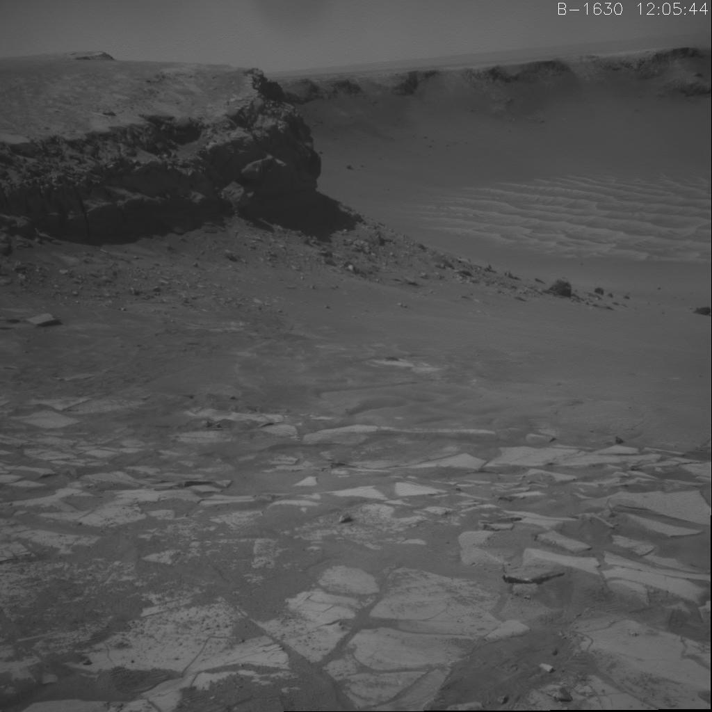
PIA13596:
-
'Yankee Clipper' Crater on Mars
Full Resolution:
TIFF
(2.934 MB)
JPEG
(180.2 kB)
|
|
|
2010-11-18 |
Mars
|
Mars Exploration Rover (MER)
|
Navigation Camera
|
2777x1055x3 |
|
-
PIA13597:
-
'Yankee Clipper' Crater on Mars (Stereo)
Full Resolution:
TIFF
(8.789 MB)
JPEG
(184.1 kB)
|
|
|
2010-12-16 |
Mars
|
Mars Exploration Rover (MER)
|
Navigation Camera
|
3451x1001x1 |
|
-
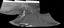
PIA13707:
-
Opportunity's View of Santa Maria Crater, Sol 2450
Full Resolution:
TIFF
(3.459 MB)
JPEG
(464.5 kB)
|
|
|
2011-01-03 |
Mars
|
Mars Exploration Rover (MER)
|
Navigation Camera
|
7688x1752x1 |
|
-
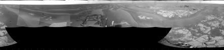
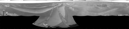
PIA13750:
-
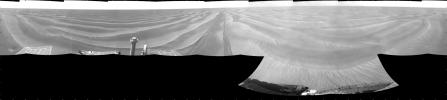
'Santa Maria' Crater in 360-Degree View, Sol 2451
Full Resolution:
TIFF
(13.48 MB)
JPEG
(1.236 MB)
|
|
|
2011-01-03 |
Mars
|
Mars Exploration Rover (MER)
|
Navigation Camera
|
7753x2243x3 |

|
-
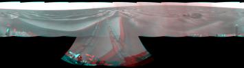
PIA13751:
-
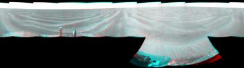
'Santa Maria' Crater in 360-Degree View, Sol 2451 (Stereo)
Full Resolution:
TIFF
(52.17 MB)
JPEG
(1.44 MB)
|
|
|
2011-01-03 |
Mars
|
Mars Exploration Rover (MER)
|
Navigation Camera
|
4443x4443x1 |
|
-
PIA13752:
-
'Santa Maria' Crater in 360-Degree View, Sol 2451 (Polar)
Full Resolution:
TIFF
(19.78 MB)
JPEG
(1.462 MB)
|
|
|
2011-01-03 |
Mars
|
Mars Exploration Rover (MER)
|
Navigation Camera
|
4000x4000x1 |

|
-
PIA13753:
-
'Santa Maria' Crater in 360-Degree View, Sol 2451 (Vertical)
Full Resolution:
TIFF
(16.02 MB)
JPEG
(1.289 MB)
|
|
|
2011-01-13 |
Mars
|
Mars Exploration Rover (MER)
|
Navigation Camera
|
1027x1036x1 |

|
-
PIA13755:
-
Textures of 'Santa Maria' Crater, Sol 2476
Full Resolution:
TIFF
(1.065 MB)
JPEG
(226.6 kB)
|
|
|
2011-01-13 |
Mars
|
Mars Exploration Rover (MER)
|
Navigation Camera
|
7688x1812x1 |
|
-
PIA13756:
-
View of 'Santa Maria' Crater from Western Rim, Sol 2454
Full Resolution:
TIFF
(13.95 MB)
JPEG
(1.253 MB)
|
|
|
2011-01-13 |
Mars
|
Mars Exploration Rover (MER)
|
Navigation Camera
|
7753x2352x3 |
|
-
PIA13757:
-
View of 'Santa Maria' Crater from Western Rim, Sol 2454 (Stereo)
Full Resolution:
TIFF
(54.71 MB)
JPEG
(1.487 MB)
|
|
|
2011-01-13 |
Mars
|
Mars Exploration Rover (MER)
|
Navigation Camera
|
4187x4187x1 |
|
-
PIA13758:
-
View of 'Santa Maria' Crater from Western Rim, Sol 2454 (Polar)
Full Resolution:
TIFF
(17.56 MB)
JPEG
(1.44 MB)
|
|
|
2011-01-13 |
Mars
|
Mars Exploration Rover (MER)
|
Navigation Camera
|
4000x4000x1 |

|
-
PIA13759:
-
View of 'Santa Maria' Crater from Western Rim, Sol 2454 (Vertical)
Full Resolution:
TIFF
(16.02 MB)
JPEG
(1.38 MB)
|
|
|
2011-05-04 |
Mars
|
Mars Exploration Rover (MER)
|
Navigation Camera
|
1747x1093x1 |
|
-
PIA13988:
-
Martian 'Freedom 7' Crater 50 Years After Freedom 7 Flight
Full Resolution:
TIFF
(1.912 MB)
JPEG
(239.2 kB)
|
|
|
2011-05-04 |
Mars
|
Mars Exploration Rover (MER)
|
Navigation Camera
|
1747x1093x3 |
|
-
PIA13989:
-
Martian 'Freedom 7' Crater 50 Years After Freedom 7 Flight (Stereo)
Full Resolution:
TIFF
(5.737 MB)
JPEG
(245.7 kB)
|
|
|
2011-05-18 |
Mars
|
Mars Exploration Rover (MER)
|
Navigation Camera
|
5685x989x1 |
|
-
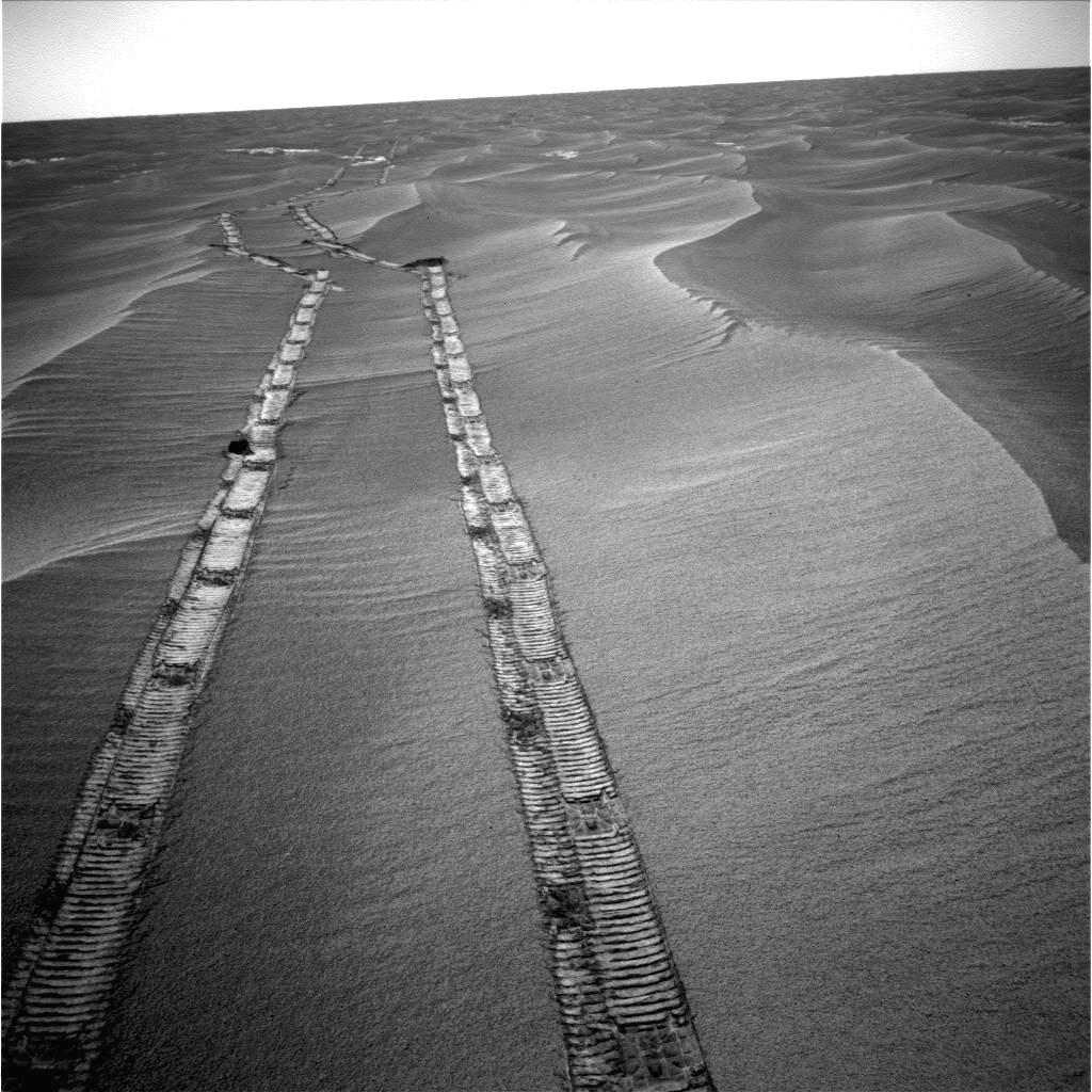
PIA14129:
Autonomous Hazard Checks Leave Patterned Rover Tracks on Mars
Full Resolution:
TIFF
(5.631 MB)
JPEG
(692.8 kB)
|
|
|
2011-05-18 |
Mars
|
Mars Exploration Rover (MER)
|
Navigation Camera
|
5733x1153x3 |
|
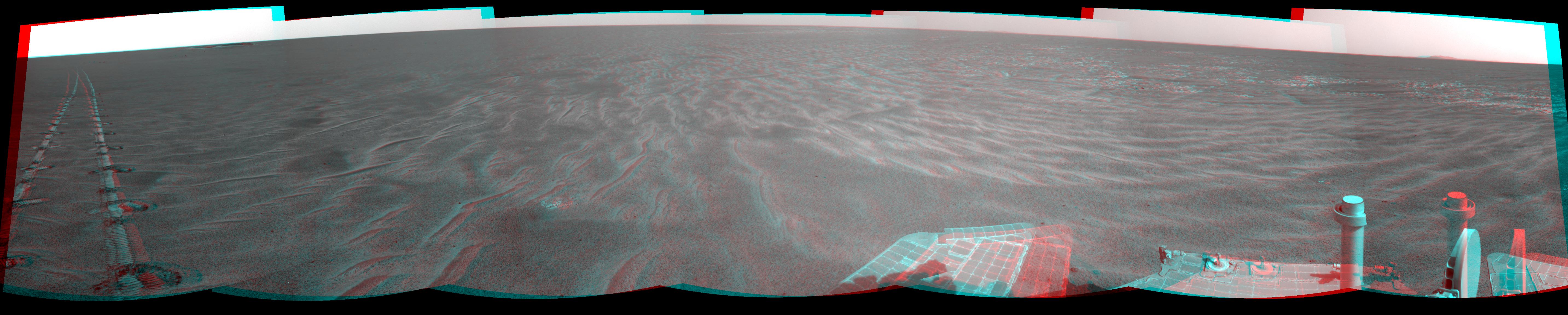
-
PIA14130:
Autonomous Hazard Checks Leave Patterned Rover Tracks on Mars (Stereo)
Full Resolution:
TIFF
(19.83 MB)
JPEG
(736.2 kB)
|
|
|
2011-06-02 |
Mars
|
Mars Exploration Rover (MER)
|
Navigation Camera
|
4865x1013x1 |
|
-
PIA14132:
-
Opportunity Beside a Small, Young Crater
Full Resolution:
TIFF
(4.937 MB)
JPEG
(609.6 kB)
|
|
|
2011-06-02 |
Mars
|
Mars Exploration Rover (MER)
|
Navigation Camera
|
4905x1182x3 |
|
-
PIA14133:
-
Opportunity Beside a Small, Young Crater (Stereo)
Full Resolution:
TIFF
(17.39 MB)
JPEG
(702.3 kB)
|
|
|
2011-07-19 |
Mars
|
Mars Exploration Rover (MER)
|
Navigation Camera
|
1024x1024x1 |
|
-
PIA14269:
-
Drive Direction Image by Opportunity After Surpassing 20 Miles
Full Resolution:
TIFF
(1.05 MB)
JPEG
(189.9 kB)
|
|
|
2011-08-15 |
Mars
|
Mars Exploration Rover (MER)
|
Navigation Camera
|
6767x1169x3 |
|
-
PIA14531:
'Spirit Point' Vista from Opportunity, in Stereo
Full Resolution:
TIFF
(23.73 MB)
JPEG
(1.008 MB)
|
|
|
2011-09-01 |
Mars
|
Mars Exploration Rover (MER)
|
Navigation Camera
|
8192x4843x1 |

|
-
PIA14538:
-
Opportunity's View Across 'Botany Bay' and Endeavour on Sol 2678
Full Resolution:
TIFF
(39.71 MB)
JPEG
(3.319 MB)
|
|
|
2011-09-01 |
Mars
|
Mars Exploration Rover (MER)
|
Navigation Camera
|
8192x4809x1 |
|
-
PIA14539:
-
Bright Veins in 'Botany Bay' on rim of Endeavour Crater on Mars
Full Resolution:
TIFF
(39.43 MB)
JPEG
(3.268 MB)
|


