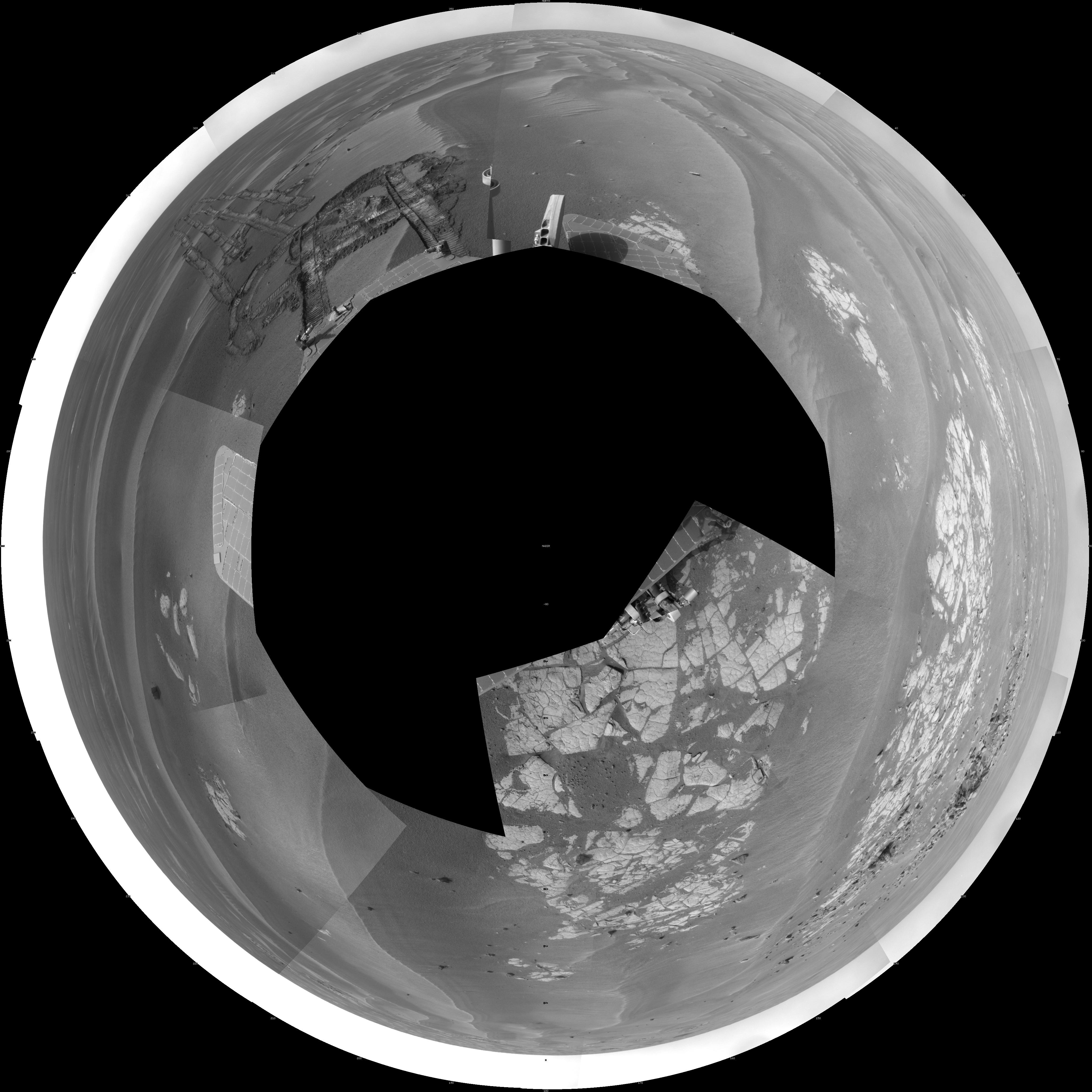
NASA's Mars Exploration Rover Opportunity used its navigation camera to take the images combined into this full-circle view of the rover's surroundings during the 1,825th Martian day, or sol, of Opportunity's surface mission (March 12, 2009). North is at the top.
This view is presented as a polar projection with geometric seam correction.
The rover had driven half a meter (1.5 feet) earlier on Sol 1825 to fine-tune its location for placing its robotic arm onto an exposed patch of outcrop including a target area informally called "Cook Islands." On the preceding sol, Opportunity turned around to drive frontwards and then drove 4.5 meters (15 feet) toward this outcrop. The tracks from the SOl 1824 drive are visible near the center of this view at about the 11 o'clock position. For scale, the distance between the parallel wheel tracks is about 1 meter (about 40 inches). Opportunity had previously been driving backward as a strategy to redistribute lubrication in a wheel drawing more electrical current than usual.
The outcrop exposure that includes "Cook Islands" is visible just below the center of the image.
The terrain in this portion of Mars' Meridiani Planum region includes dark-toned sand ripples and lighter-toned bedrock.
