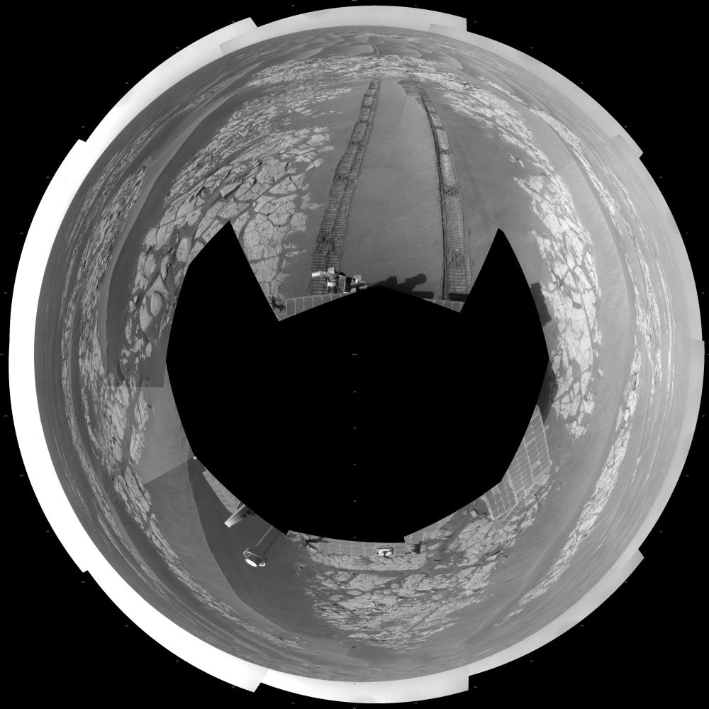
NASA's Mars Exploration Rover Opportunity used its navigation camera to take the images combined into this full-circle view of the rover's surroundings just after driving 60.86 meters (200 feet) on the 1,806th Martian day, or sol, of Opportunity's surface mission (Feb. 21, 2009). North is at the center; south at both ends.
Tracks from the drive extend northward across dark-toned sand ripples and light-toned patches of exposed bedrock in the Meridiani Planum region of Mars. For scale, the distance between the parallel wheel tracks is about 1 meter (about 40 inches).
Engineers designed the Sol 1806 drive to be driven backwards as a strategy to redistribute lubricant in the rovers wheels. The right-front wheel had been showing signs of increased friction.
The rover's position after the Sol 1806 drive was about 2 kilometer (1.2 miles) south southwest of Victoria Crater. Cumulative odometry was 14.74 kilometers (9.16 miles) since landing in January 2004, including 2.96 kilometers (1.84 miles) since climbing out of Victoria Crater on the west side of the crater on Sol 1634 (August 28, 2008).
This view is presented as a polar projection with geometric seam correction.