My
List |
Addition Date
|
Target
|
Mission
|
Instrument
|
Size
|

|
2020-03-20 |
Mars
|
Mars Science Laboratory (MSL)
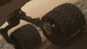
|
Navcam (MSL)
|
860x858x1 |
|
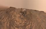
-
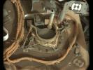
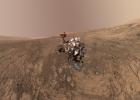
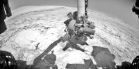
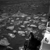
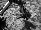
PIA23625:
-
Navcam Movie of How Curiosity Takes a Selfie
Full Resolution:
TIFF
(630.2 kB)
JPEG
(79.92 kB)
|
|
|
2020-03-20 |
Mars
|
Mars Science Laboratory (MSL)
|
MAHLI
|
18030x11428x3 |
|
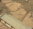
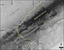
-
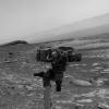
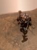
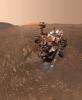
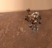
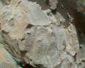
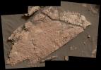
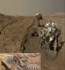
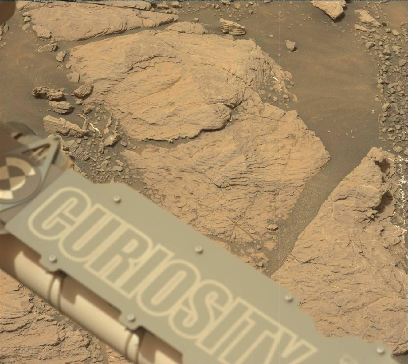
PIA23624:
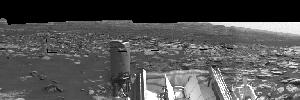
-
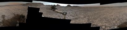
Curiosity at the Hutton Drill Site
Full Resolution:
TIFF
(425.5 MB)
JPEG
(14.93 MB)
|
|
|
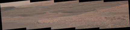
2020-03-04 |
Mars
|
Mars Science Laboratory (MSL)
|
Mastcam
|
2960x765x3 |
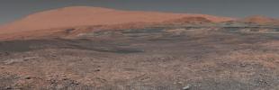
|
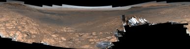
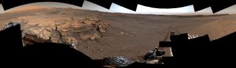
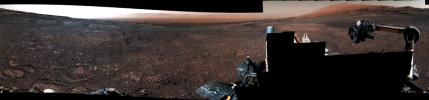
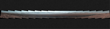
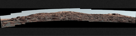
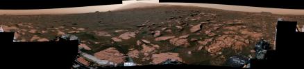
-
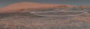
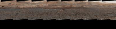
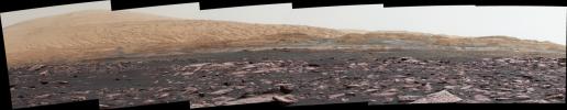
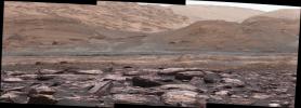
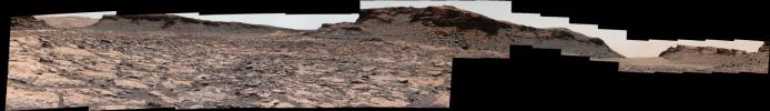
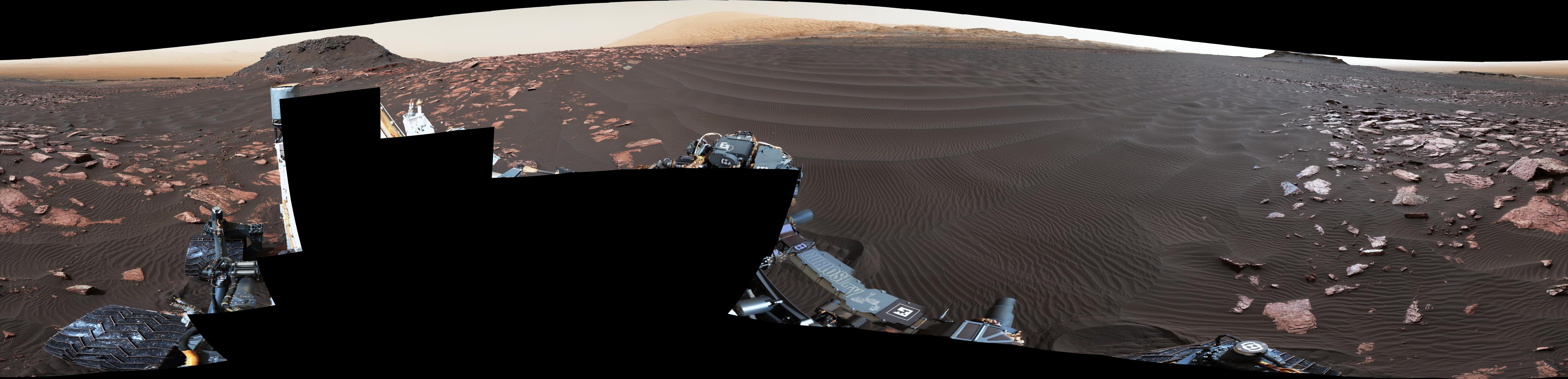
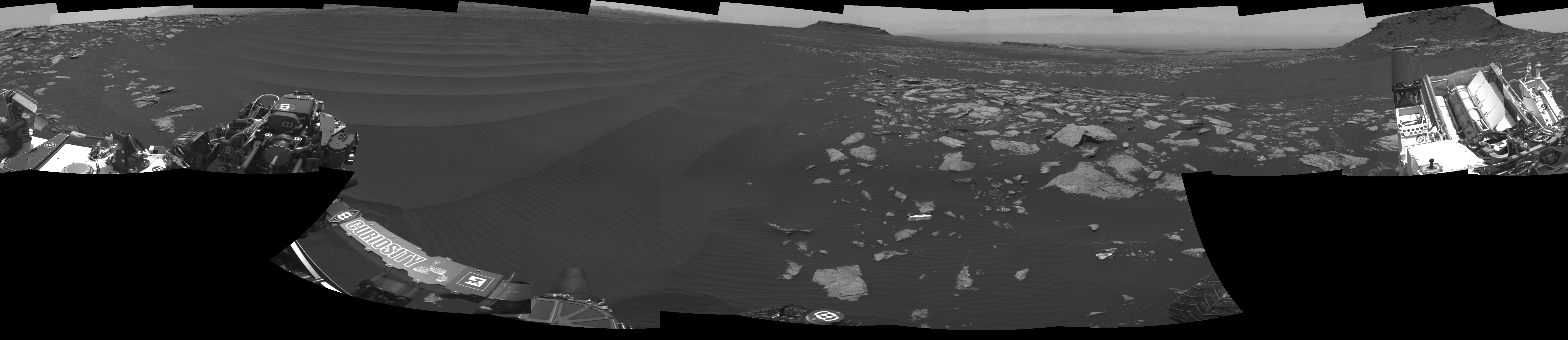
PIA23623:
Curiosity's 1.8-Billion-Pixel Panorama
Full Resolution:
TIFF
(4.436 MB)
JPEG
(350.2 kB)
|
|
|
2019-10-24 |
Mars
|
Mars Science Laboratory (MSL)
|
MAHLI
|
8938x11845x3 |
|
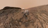
-
PIA23378:
-
Curiosity at Glen Etive
Full Resolution:
TIFF
(279.2 MB)
JPEG
(9.169 MB)
|
|
|
2019-08-22 |
Mars
|
Mars Science Laboratory (MSL)
|
HiRISE
MAHLI
|
4200x2550x3 |
|
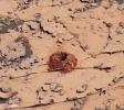
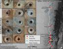
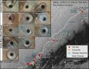
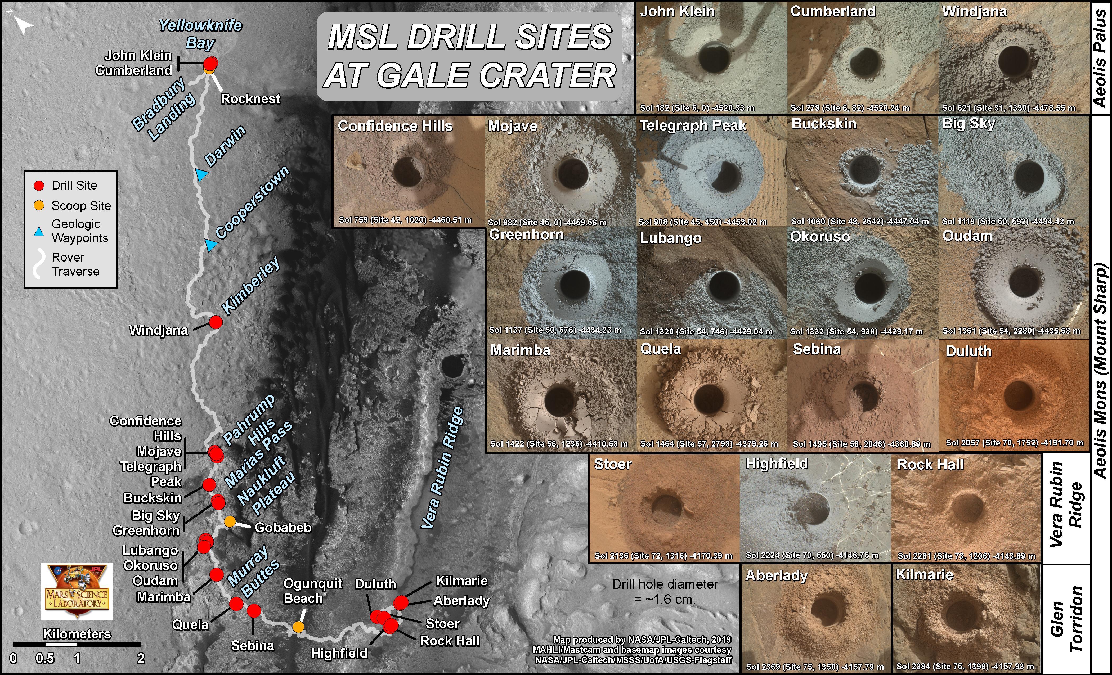
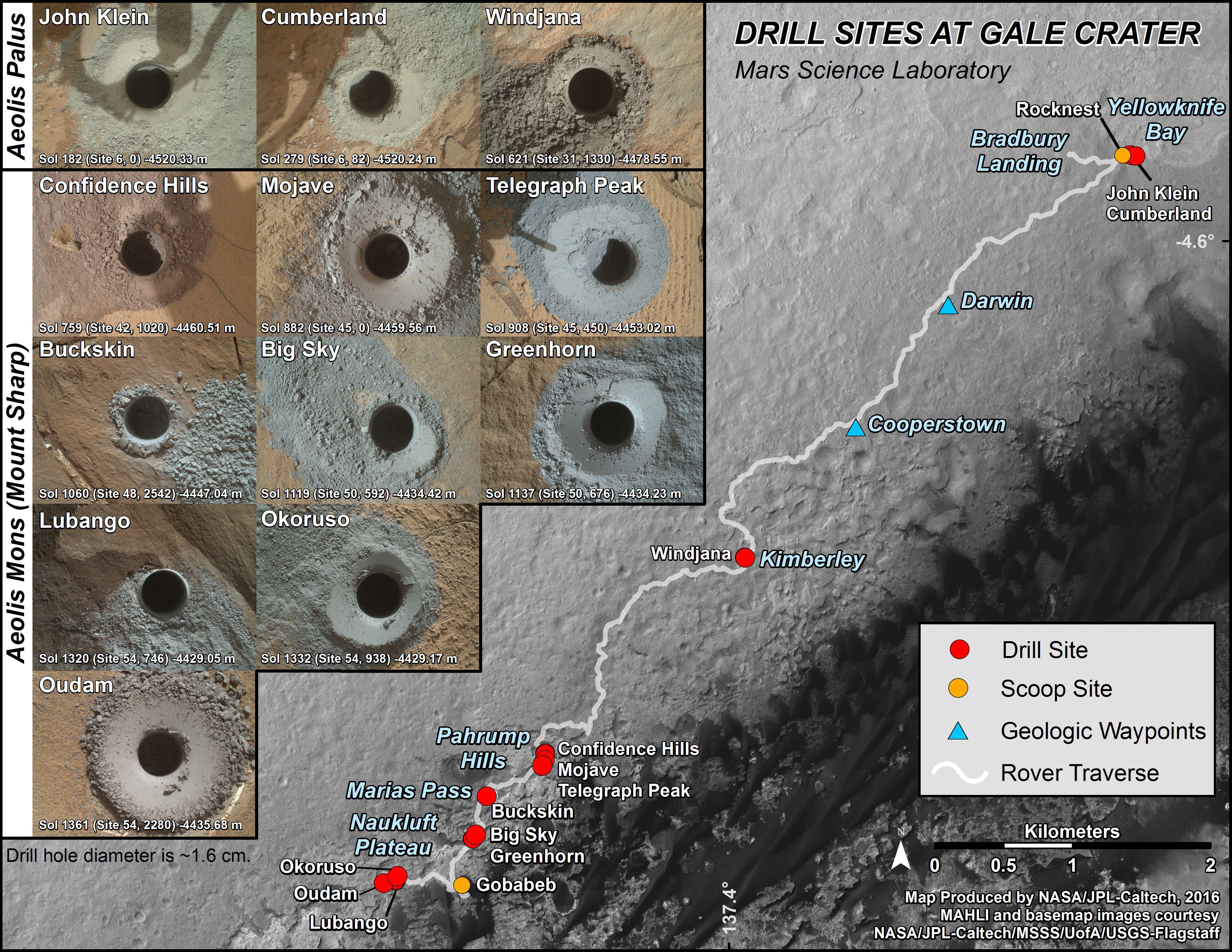
-
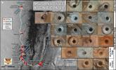
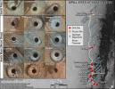
PIA23413:
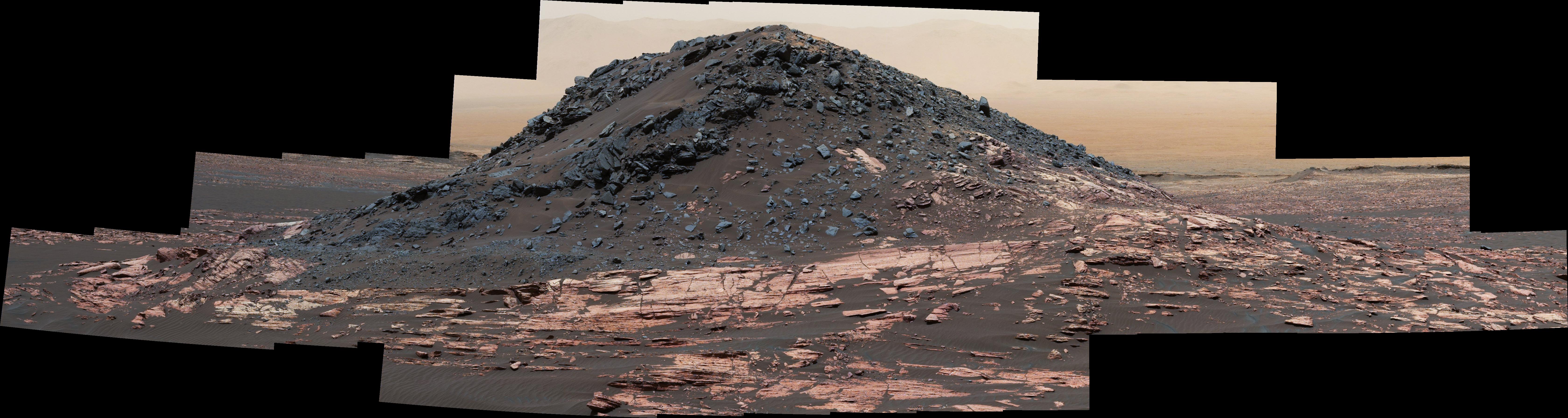
-
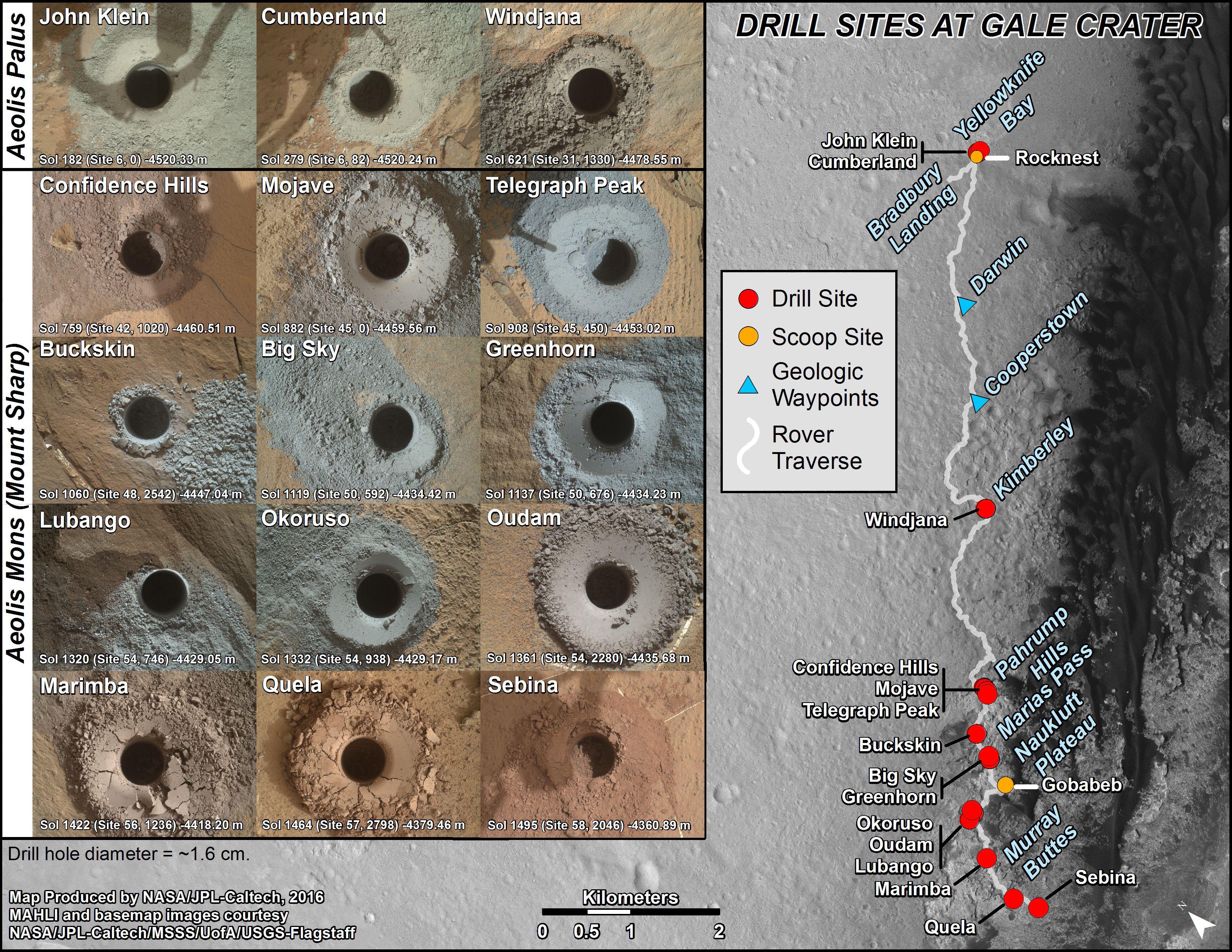
Curiosity's 21 Drill Holes on Mars
Full Resolution:
TIFF
(25.48 MB)
JPEG
(2.573 MB)
|
|
|
2019-08-22 |
Mars
|
Mars Science Laboratory (MSL)
|
HiRISE
|
3300x2550x3 |
|
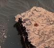
-
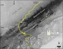
PIA23412:
-
Mid-2019 Map of NASA's Curiosity Rover Mission
Full Resolution:
TIFF
(13.3 MB)
JPEG
(1.669 MB)
|
|
|
2019-08-05 |
Mars
|
Mars Science Laboratory (MSL)
|
Mastcam
|
7455x3249x3 |
|
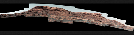
-
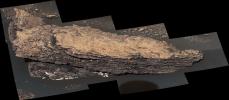
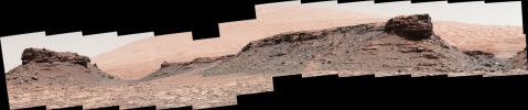
PIA23348:
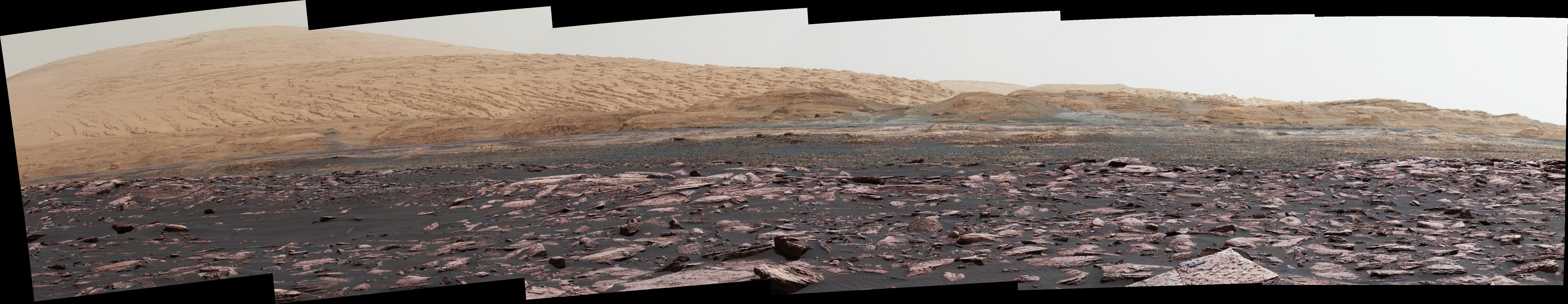
-
Mastcam Views Strathdon
Full Resolution:
TIFF
(40.66 MB)
JPEG
(2.437 MB)
|
|
|
2019-08-05 |
Mars
|
Mars Science Laboratory (MSL)
|
MAHLI
|
6336x3375x3 |
|
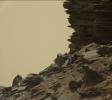
-
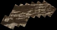
PIA23347:
-
Close-up of Strathdon
Full Resolution:
TIFF
(25.02 MB)
JPEG
(1.129 MB)
|
|
|
2019-08-05 |
Mars
|
Mars Science Laboratory (MSL)
|
Mastcam
|
29163x8474x3 |
|
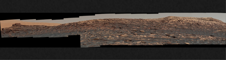
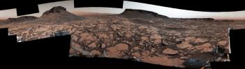
-
PIA23346:
-
Curiosity Surveys Teal Ridge
Full Resolution:
TIFF
(397.9 MB)
JPEG
(26.02 MB)
|
|
|
2019-05-29 |
Mars
|
Mars Science Laboratory (MSL)
|
Navcam (MSL)
|
2300x1200x1 |
|
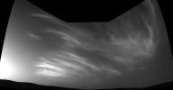
-
PIA23243:
-
Curiosity's Three-Frame Mosaic of Clouds
Full Resolution:
TIFF
(1.896 MB)
JPEG
(105.3 kB)
|
|
|
2019-05-29 |
Mars
|
Mars Science Laboratory (MSL)
|
Navcam (MSL)
|
1022x1022x1 |
|
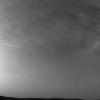
-
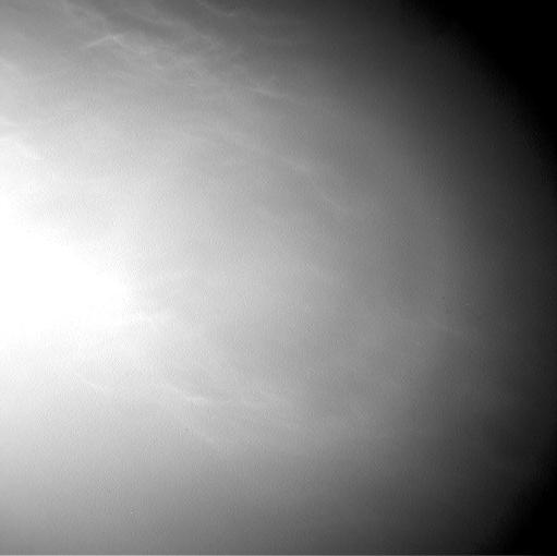
PIA23242:
-
Curiosity Sees More Clouds Over Gale Crater
Full Resolution:
TIFF
(1.004 MB)
JPEG
(73.52 kB)
|
|
|
2019-05-29 |
Mars
|
Mars Science Laboratory (MSL)
|
Navcam (MSL)
|
1022x1022x1 |
|
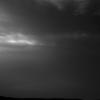
-
PIA23241:
-
Curiosity Sees Drifting Clouds Over Gale Crater
Full Resolution:
TIFF
(894.7 kB)
JPEG
(33.78 kB)
|
|
|
2019-05-29 |
Mars
|
Mars Science Laboratory (MSL)
|
MAHLI
|
9990x12161x3 |
|
-
PIA23240:
-
Curiosity's Selfie at Aberlady and Kilmarie
Full Resolution:
TIFF
(275.7 MB)
JPEG
(9.774 MB)
|
|
|
2019-04-11 |
Mars
|
Mars Science Laboratory (MSL)
|
Mastcam
|
2000x1800x3 |
|
-
PIA23138:
-
Curiosity's First Clay Unit Drill Hole
Full Resolution:
TIFF
(9.931 MB)
JPEG
(494.8 kB)
|
|
|
2019-04-11 |
Mars
|
Mars Science Laboratory (MSL)
|
Mastcam
|
5699x1322x3 |
|
-
PIA23137:
Curiosity Sees Waves in the Clay Unit
Full Resolution:
TIFF
(18.56 MB)
JPEG
(1.306 MB)
|
|
|
2019-04-11 |
Mars
|
Mars Science Laboratory (MSL)
|
Mastcam
|
4700x2308x3 |
|
-
PIA23139:
-
Curiosity Surveys the Clay-Bearing Unit
Full Resolution:
TIFF
(26.05 MB)
JPEG
(1.911 MB)
|
|
|
2019-04-04 |
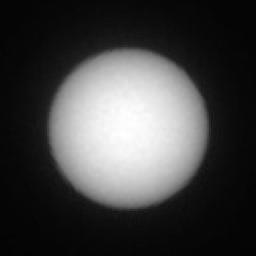
Phobos
|
Mars Science Laboratory (MSL)
|
Navcam (MSL)
|
1800x1800x1 |

|
-
PIA23135:
-
Curiosity Observes Sunset Eclipse: Sol 2358
Full Resolution:
TIFF
(1.554 MB)
JPEG
(67.65 kB)
|
|
|
2019-04-04 |
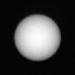
Deimos
|
Mars Science Laboratory (MSL)
|
Mastcam
|
256x256x1 |
|
-
PIA23134:
-
Curiosity Observes Deimos Eclipse: Sol 2350
Full Resolution:
TIFF
(52.08 kB)
JPEG
(3.197 kB)
|
|
|
2019-04-04 |
Phobos
|
Mars Science Laboratory (MSL)
|
Mastcam
|
256x256x1 |
|
-
PIA23133:
-
Curiosity Observes Phobos Eclipse: Sol 2359
Full Resolution:
TIFF
(44.39 kB)
JPEG
(3.074 kB)
|
|
|
2019-02-22 |
Mars
|
Mars Science Laboratory (MSL)
|
Mastcam
|
1328x1184x3 |
|
-
PIA23047:
-
Curiosity on the Clay Unit
Full Resolution:
TIFF
(4.41 MB)
JPEG
(175 kB)
|
|
|
2019-02-08 |
Mars
|
Mars Science Laboratory (MSL)
|
Mastcam
|
2000x466x3 |
|
-
PIA23042:
Curiosity's 360 Panorama of Rock Hall
Full Resolution:
TIFF
(1.967 MB)
JPEG
(163.3 kB)
|
|
|
2019-01-28 |
Mars
|
Mars Science Laboratory (MSL)
|
MAHLI
|
10758x10008x3 |
|
-
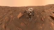
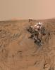
PIA22960:
-
Curiosity's Selfie at Rock Hall
Full Resolution:
TIFF
(268.3 MB)
JPEG
(11.55 MB)
|
|
|
2018-09-06 |
Mars
|
Mars Science Laboratory (MSL)
|
Mastcam
|
10000x2886x3 |

|
-
PIA22545:
-
Panorama of Vera Rubin Ridge
Full Resolution:
TIFF
(67.34 MB)
JPEG
(3.445 MB)
|
|
|
2018-06-20 |
Mars
|
Mars Science Laboratory (MSL)
|
Mastcam
|
2374x1083x3 |

|
-
PIA22330:
-
Duluth After Dust Storm
Full Resolution:
TIFF
(7.17 MB)
JPEG
(332.7 kB)
|
|
|
2018-06-20 |
Mars
|
Mars Science Laboratory (MSL)
|
MAHLI
|
18033x10144x3 |
|
-
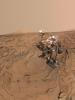
PIA22486:
-
Curiosity's Dusty Selfie
Full Resolution:
TIFF
(400.4 MB)
JPEG
(13.25 MB)
|
|
|
2018-06-13 |
Mars
|
Mars Science Laboratory (MSL)
|
Mastcam
|
4054x1808x3 |
|
-
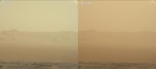
PIA22520:
-
Curiosity's View of the June 2018 Dust Storm
Full Resolution:
TIFF
(6.58 MB)
JPEG
(235 kB)
|
|
|
2018-06-07 |
Mars
|
Mars Science Laboratory (MSL)
|
SAM
|
1920x1080x3 |
|
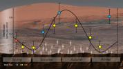
-
PIA22328:
-
Mars' Mysterious Methane
Full Resolution:
TIFF
(4.777 MB)
JPEG
(303.1 kB)
|
|
|
2018-06-04 |
Mars
|
Mars Science Laboratory (MSL)
|
Mastcam
|
1600x1200x3 |
|
-
PIA22327:
-
Inlet Cover On the Curiosity Rover
Full Resolution:
TIFF
(5.638 MB)
JPEG
(242.7 kB)
|
|
|
2018-05-23 |
Mars
|
Mars Science Laboratory (MSL)
|
Mastcam
|
1328x1184x3 |
|
-
PIA22326:
-
Curiosity Successfully Drills "Duluth"
Full Resolution:
TIFF
(4.719 MB)
JPEG
(316.6 kB)
|
|
|
2018-05-23 |
Mars
|
Mars Science Laboratory (MSL)
|
Mastcam
|
1328x1184x3 |
|
-
PIA22325:
-
First Drilled Sample on Mars Since 2016
Full Resolution:
TIFF
(4.719 MB)
JPEG
(321.8 kB)
|
|
|
2018-03-22 |
Mars
|
Mars Science Laboratory (MSL)
|
Mastcam
|
8000x2583x3 |
|
-
PIA22313:
-
Curiosity is Ready for Clay
Full Resolution:
TIFF
(52.28 MB)
JPEG
(3.6 MB)
|
|
|
2018-03-22 |
Mars
|
Mars Science Laboratory (MSL)
|
Mastcam
|
9216x2976x3 |
|
-
PIA22312:
-
Curiosity is Ready for Clay (Highlighted)
Full Resolution:
TIFF
(65.5 MB)
JPEG
(5.146 MB)
|
|
|
2018-02-28 |
Mars
|
Mars Science Laboratory (MSL)
|
Mastcam
|
1328x1184x3 |
|
-
PIA22224:
-
Curiosity Tests a New Drill Method on Mars
Full Resolution:
TIFF
(4.605 MB)
JPEG
(285.8 kB)
|
|
|
2018-02-08 |
Mars
|
Mars Science Laboratory (MSL)
|
MAHLI
|
1544x887x3 |
|
-
PIA22214:
-
Brushed Vein in 'Rona' on 'Vera Rubin Ridge'
Full Resolution:
TIFF
(4.11 MB)
JPEG
(304.6 kB)
|
|
|
2018-02-08 |
Mars
|
Mars Science Laboratory (MSL)
|
MAHLI
|
1584x1184x3 |
|
-
PIA22213:
-
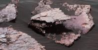
Stick-Shape, Rice-Size Features on Martian Rock "Haroldswick"
Full Resolution:
TIFF
(5.628 MB)
JPEG
(361.3 kB)
|
|
|
2018-02-08 |
Mars
|
Mars Science Laboratory (MSL)
|
MAHLI
|
1451x1160x3 |
|
-
PIA22212:
-
Stereo View of Martian Rock Target 'Funzie'
Full Resolution:
TIFF
(5.052 MB)
JPEG
(241 kB)
|
|
|
2018-02-08 |
Mars
|
Mars Science Laboratory (MSL)
|
MAHLI
|
3273x2884x3 |

|
-
PIA22211:
-
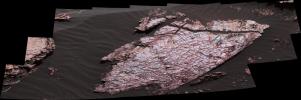
Crystal Shapes and Two-Toned Veins on Martian Ridge
Full Resolution:
TIFF
(15.51 MB)
JPEG
(809.6 kB)
|
|
|
2018-01-31 |
Mars
|
Mars Science Laboratory (MSL)
|
MAHLI
|
14000x10000x3 |
|
-
PIA22207:
-
Mount Sharp 'Photobombs' Curiosity
Full Resolution:
TIFF
(337.3 MB)
JPEG
(12.27 MB)
|
|
|
2018-01-30 |
Mars
|
Mars Science Laboratory (MSL)
|
Mastcam
|
17478x1369x3 |
|
-
PIA22210:
Wide-Angle Panorama from Ridge in Mars' Gale Crater
Full Resolution:
TIFF
(48.73 MB)
JPEG
(2.447 MB)
|
|
|
2018-01-30 |
Mars
|
Mars Science Laboratory (MSL)
|
Mastcam
|
4697x2263x3 |
|
-
PIA22209:
-
Telephoto Vista from Ridge in Mars' Gale Crater
Full Resolution:
TIFF
(23.4 MB)
JPEG
(1.283 MB)
|
|
|
2018-01-30 |
Mars
|
Mars Science Laboratory (MSL)
|
|
2550x3300x3 |
|
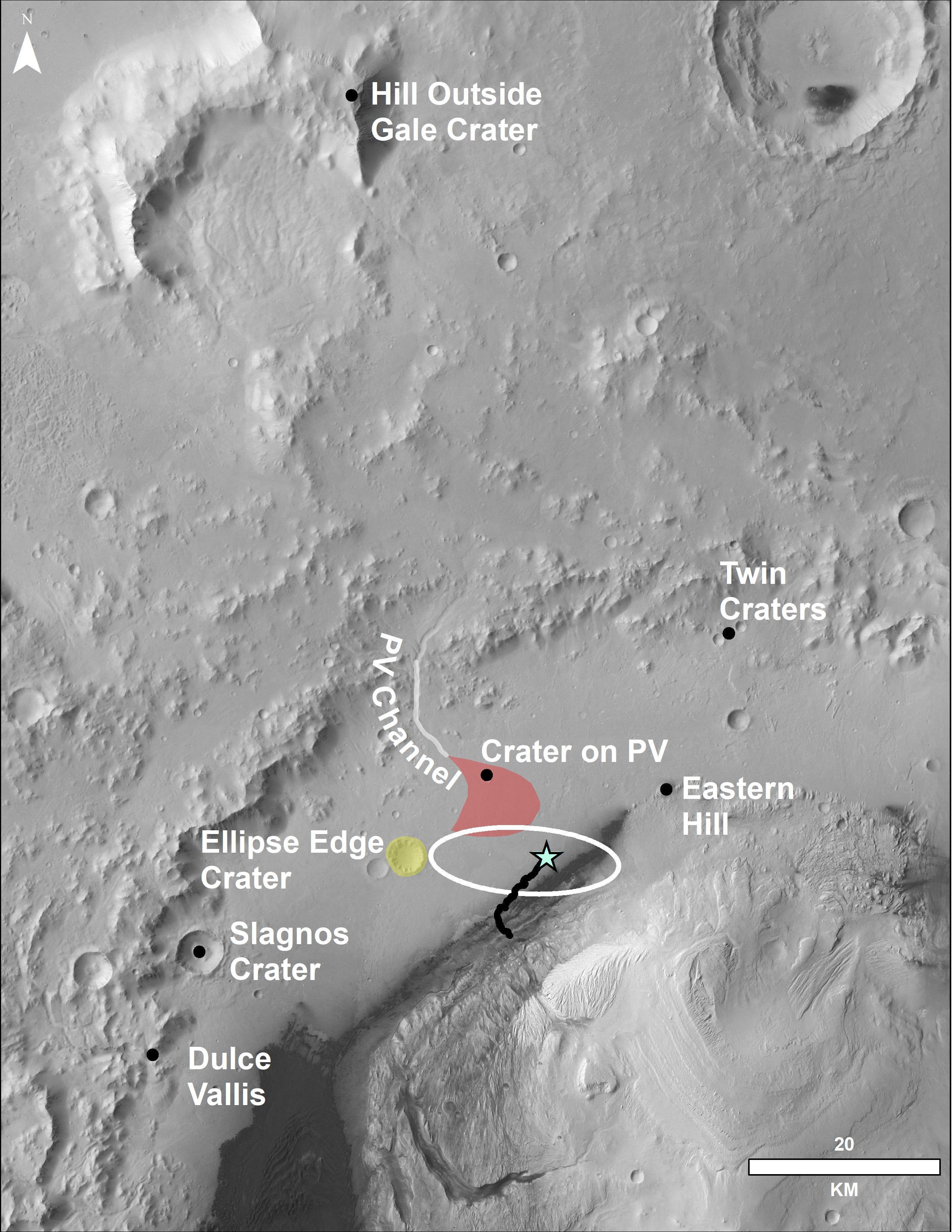
-
PIA22208:
-
Locator Map for Features in Curiosity Panorama
Full Resolution:
TIFF
(11.68 MB)
JPEG
(916.2 kB)
|
|
|
2017-11-01 |
Mars
|
Mars Science Laboratory (MSL)
|
ChemCam
|
3075x2233x3 |
|
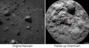
-
PIA22068:
-
Curiosity's ChemCam Checks 'Christmas Cove' Colors
Full Resolution:
TIFF
(3.576 MB)
JPEG
(458.1 kB)
|
|
|
2017-11-01 |
Mars
|
Mars Science Laboratory (MSL)
|
Mastcam
|
1328x1184x3 |
|
-
PIA22067:
-
Curiosity Checks Under the Dust on a Martian Rock
Full Resolution:
TIFF
(4.719 MB)
JPEG
(179.5 kB)
|
|
|
2017-11-01 |
Mars
|
Mars Science Laboratory (MSL)
|
Mastcam
|
1260x1123x3 |
|
-
PIA22066:
-
Science-Filters Study of Martian Rock Sees Hematite
Full Resolution:
TIFF
(4.247 MB)
JPEG
(266.4 kB)
|
|
|
2017-11-01 |
Mars
|
Mars Science Laboratory (MSL)
|
Mastcam
|
6690x3024x3 |

|
-
PIA22065:
-
Mastcam Special Filters Help Locate Variations Ahead
Full Resolution:
TIFF
(53.49 MB)
JPEG
(4.335 MB)
|
|
|
2017-11-01 |
Mars
|
Mars Science Laboratory (MSL)
|
MAHLI
|
1198x1609x3 |

|
-
PIA22064:
-
Dust Removal Target on 'Vera Rubin Ridge'
Full Resolution:
TIFF
(5.785 MB)
JPEG
(400.9 kB)
|
|
|
2017-10-23 |
Mars
|
Mars Science Laboratory (MSL)
|
|
1024x512x1 |
|
-
PIA22063:
-
Mars Rover Step Toward Possible Resumption of Drilling
Full Resolution:
TIFF
(525 kB)
JPEG
(84.28 kB)
|
|
|
2017-09-13 |
Mars
|
Mars Science Laboratory (MSL)
|
Mastcam
|
13333x1925x3 |
|
-
PIA21851:
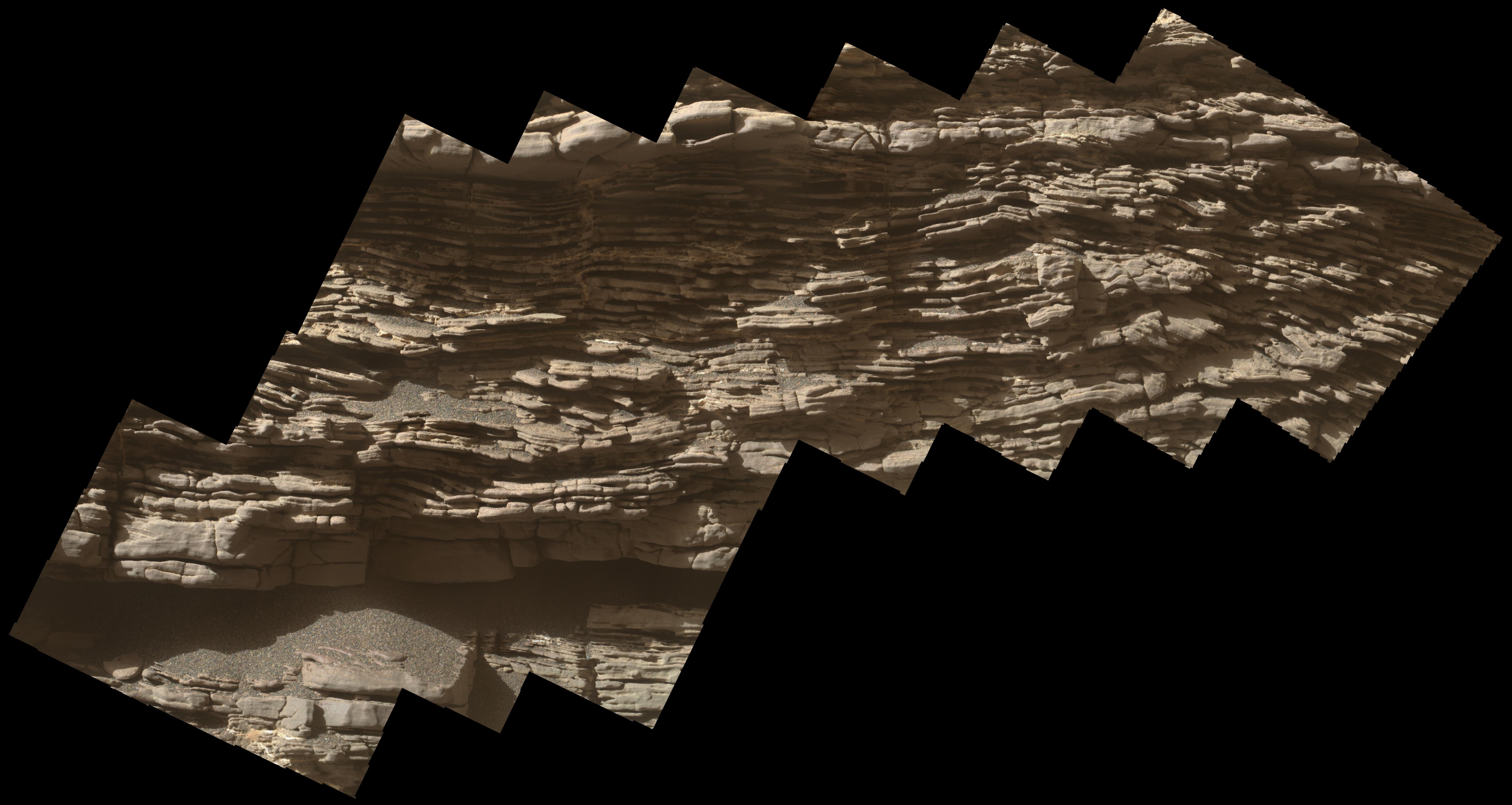
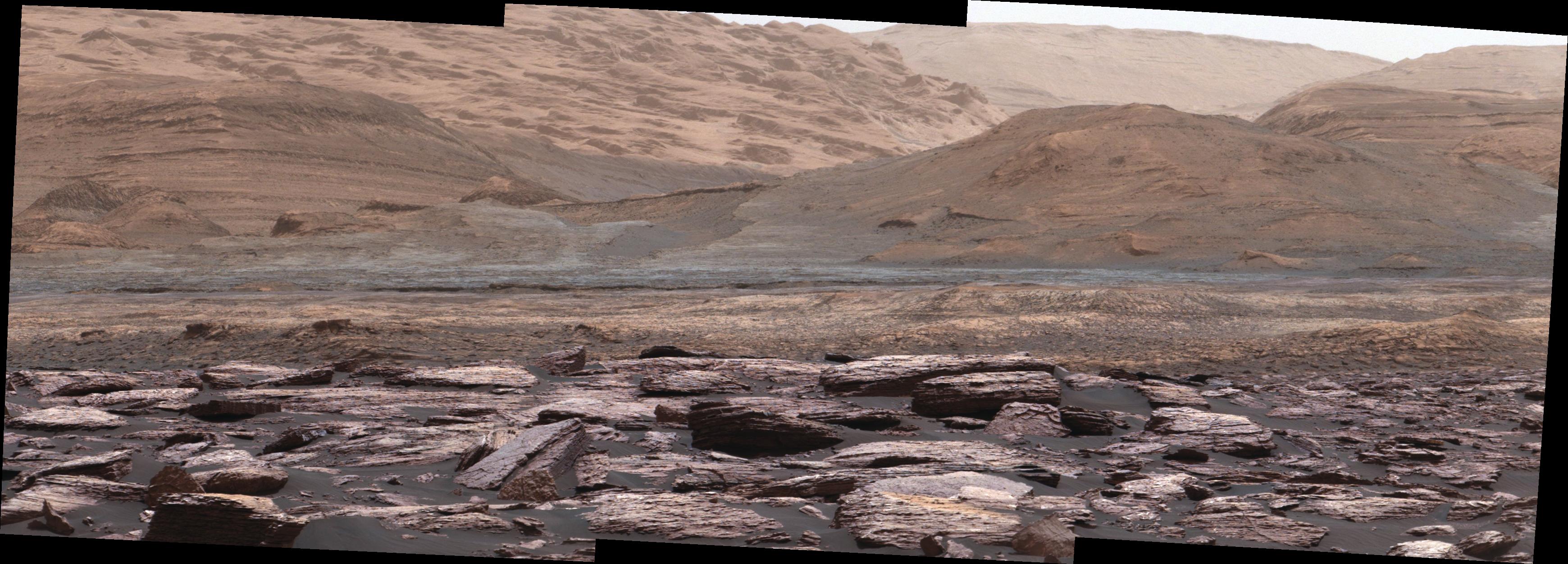
Looking Up at Layers of 'Vera Rubin Ridge' on Sol 1790
Full Resolution:
TIFF
(43.18 MB)
JPEG
(3.654 MB)
|
|
|
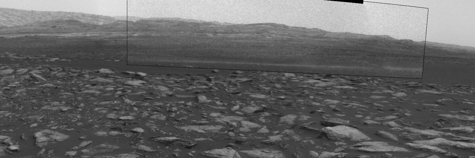
2017-09-13 |
Mars
|
Mars Science Laboratory (MSL)
|
Mastcam
|
11829x2500x3 |
|
-
PIA21850:
Martian Ridge Looming Above Curiosity Prior to Ascent
Full Resolution:
TIFF
(37.28 MB)
JPEG
(3.092 MB)
|
|
|
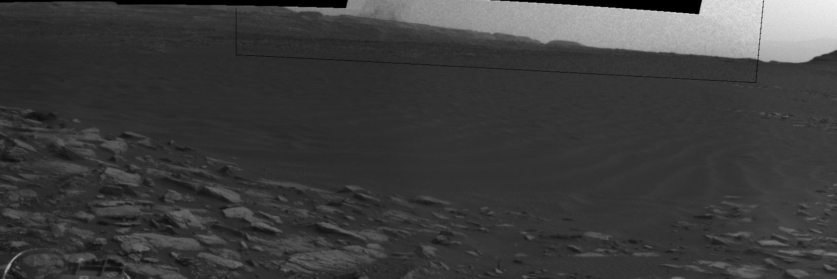
2017-09-13 |
Mars
|
Mars Science Laboratory (MSL)
|
Mastcam
|
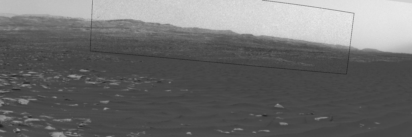
15270x2348x3 |
|
-
PIA21849:
Curiosity View of 'Vera Rubin Ridge' From Below, Sol 1734
Full Resolution:
TIFF
(79.96 MB)
JPEG
(5.458 MB)
|
|
|
2017-08-09 |
Mars
|
Mars Science Laboratory (MSL)
|
Navcam (MSL)
|
511x510x1 |
|
-
PIA21842:
-
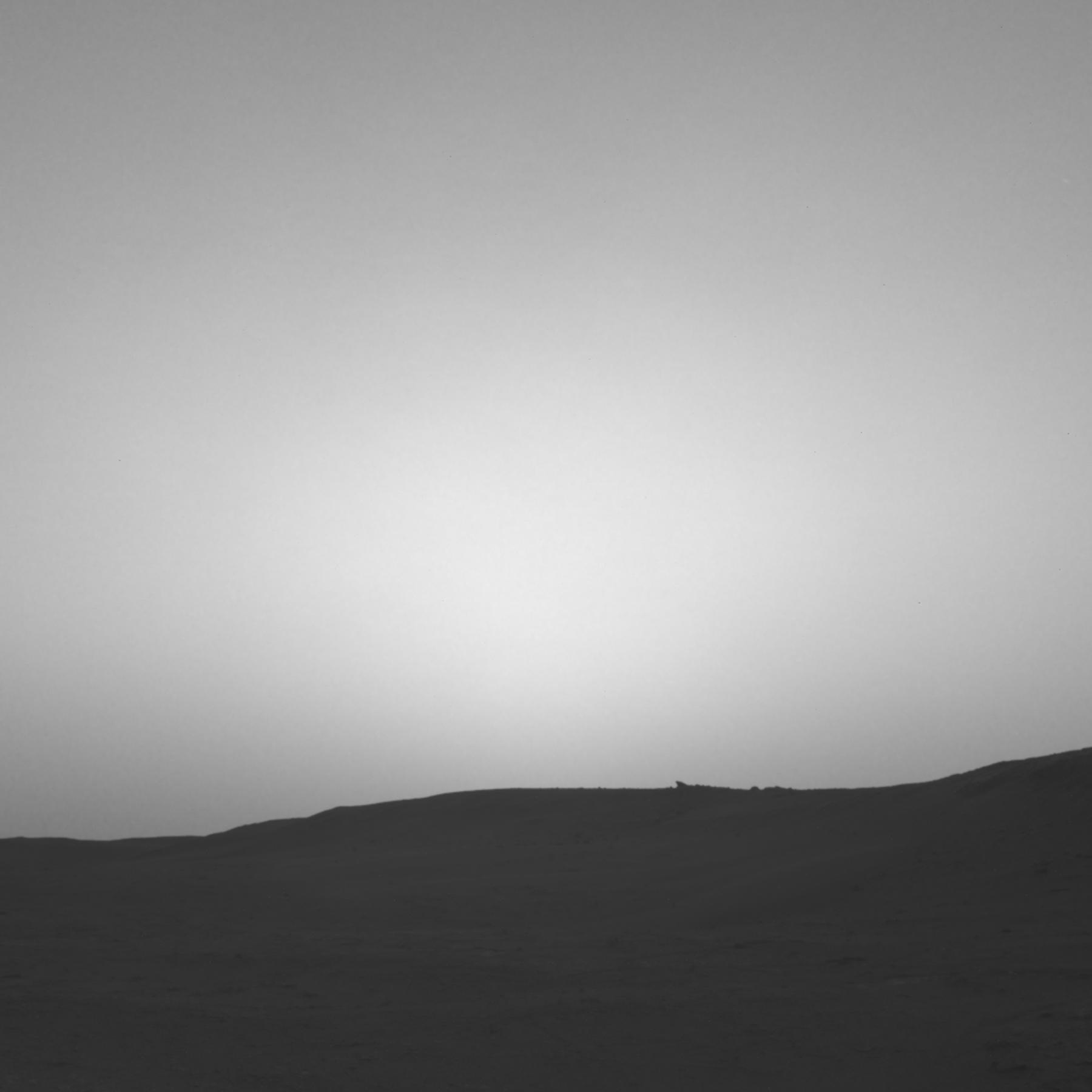
Clouds Sailing Overhead on Mars, Unenhanced

Full Resolution:
TIFF
(261.1 kB)
JPEG
(15.55 kB)
|
|
|
2017-08-09 |
Mars
|
Mars Science Laboratory (MSL)
|
Navcam (MSL)
|
511x511x1 |
|
-
PIA21841:
-
Clouds Sailing Overhead on Mars, Enhanced
Full Resolution:
TIFF
(261.6 kB)
JPEG
(91.08 kB)
|
|
|
2017-08-09 |
Mars
|
Mars Science Laboratory (MSL)
|
Navcam (MSL)
|
511x511x1 |
|
-
PIA21840:
-
Clouds Sailing Above Martian Horizon, Enhanced
Full Resolution:
TIFF
(261.6 kB)
JPEG
(89.02 kB)
|
|
|
2017-07-11 |
Mars
|
Mars Science Laboratory (MSL)
|
HiRISE
|
3300x2550x3 |
|
-
PIA21720:
-
Mid-2017 Map of NASA's Curiosity Mars Rover Mission
Full Resolution:
TIFF
(14.25 MB)
JPEG
(1.627 MB)
|
|
|
2017-07-11 |
Mars
|
Mars Science Laboratory (MSL)
|
Mastcam
|
5000x1210x3 |

|
-
PIA21719:
'Nathan Bridges Dune' on a Martian Mountain
Full Resolution:
TIFF
(10.71 MB)
JPEG
(669.7 kB)
|
|
|
2017-07-11 |
Mars
|
Mars Science Laboratory (MSL)
|
Mastcam
|
6720x1795x3 |

|
-
PIA21718:
'Ireson Hill' on Mount Sharp, Mars
Full Resolution:
TIFF
(23.06 MB)
JPEG
(1.461 MB)
|
|
|
2017-07-11 |
Mars
|
Mars Science Laboratory (MSL)
|
Mastcam
|
10000x727x3 |
|
-
PIA21717:
Wide 'Vera Rubin Ridge' Ahead of Curiosity Mars Rover
Full Resolution:
TIFF
(13.46 MB)
JPEG
(936 kB)
|
|
|
2017-07-11 |
Mars
|
Mars Science Laboratory (MSL)
|
Mastcam
|
6828x1323x3 |
|
-
PIA21716:
View Toward 'Vera Rubin Ridge' on Mount Sharp, Mars
Full Resolution:
TIFF
(21.93 MB)
JPEG
(1.269 MB)
|
|
|
2017-06-20 |
Mars
|
Mars Reconnaissance Orbiter (MRO)
Mars Science Laboratory (MSL)
|
HiRISE
|
1403x789x3 |

|
-
PIA21710:
-
Curiosity Rover on Mount Sharp, Seen from Mars Orbit
Full Resolution:
TIFF
(3.322 MB)
JPEG
(215.9 kB)
|
|
|
2017-06-09 |
Mars
|
Mars Science Laboratory (MSL)
|
Mastcam
|
2550x1364x3 |
|
-
PIA21709:
-
Key Locations Studied at 'Pahrump Hills' on Mars
Full Resolution:
TIFF
(10.29 MB)
JPEG
(738.2 kB)
|
|
|
2017-05-30 |
Mars
|
Mars Science Laboratory (MSL)
|
Navcam (MSL)
|
1607x1000x1 |
|
-
PIA21649:
-
Halos in Martian Sandstone
Full Resolution:
TIFF
(1.532 MB)
JPEG
(199.6 kB)
|
|
|
2017-05-04 |
Mars
|
Mars Science Laboratory (MSL)
|
Mastcam
|
4336x2224x3 |

|
-
PIA11242:
-
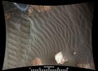
Textures Where Curiosity Rover Studied a Martian Dune
Full Resolution:
TIFF
(28.61 MB)
JPEG
(1.904 MB)
|
|
|
2017-05-04 |
Mars
|
Mars Science Laboratory (MSL)
|
Mastcam
|
8776x2000x3 |
|
-
PIA11241:
Panorama with Active Linear Dune in Gale Crater, Mars
Full Resolution:
TIFF
(35.9 MB)
JPEG
(2.349 MB)
|
|
|
2017-03-21 |
Mars
|
Mars Science Laboratory (MSL)
|
MAHLI
|
1446x825x3 |
|
-
PIA21486:
-
Break in Raised Tread on Curiosity Wheel
Full Resolution:
TIFF
(2.727 MB)
JPEG
(101 kB)
|
|
|
2017-02-27 |
Mars
|
Mars Science Laboratory (MSL)
|
Navcam (MSL)
|
1650x550x1 |

|
-
PIA21483:
-
Swirling Dust in Gale Crater, Mars, Sol 1613
Full Resolution:
TIFF
(673.4 kB)
JPEG
(80.89 kB)
|
|
|
2017-02-27 |
Mars
|
Mars Science Laboratory (MSL)
|
Navcam (MSL)
|
1650x550x1 |
|
-
PIA21482:
-
Curiosity Observes Whirlwinds Carrying Martian Dust
Full Resolution:
TIFF
(691 kB)
JPEG
(105.6 kB)
|
|
|
2017-02-27 |
Mars
|
Mars Science Laboratory (MSL)
|
Navcam (MSL)
|
1650x550x1 |
|
-
PIA21481:
-
Dust Devil Passes Near Martian Sand Dune
Full Resolution:
TIFF
(664.3 kB)
JPEG
(66.26 kB)
|
|
|
2017-02-27 |
Mars
|
Mars Science Laboratory (MSL)
|
Navcam (MSL)
|
1650x550x1 |

|
-
PIA21270:
-
Martian Dust Devil Action in Gale Crater, Sol 1597
Full Resolution:
TIFF
(809.6 kB)
JPEG
(114.5 kB)
|
|
|
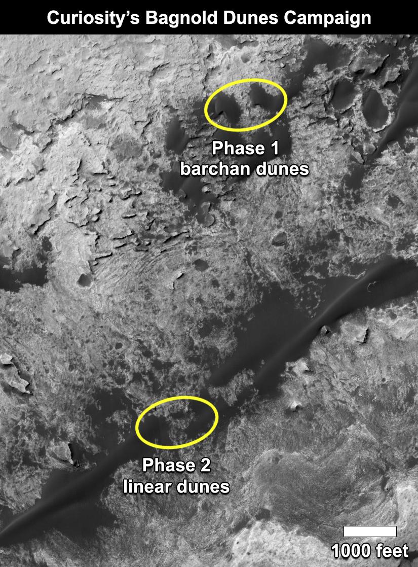
2017-02-27 |
Mars
|
Mars Reconnaissance Orbiter (MRO)
Mars Science Laboratory (MSL)
|
HiRISE
|
825x1118x3 |
|
-
PIA21269:
-
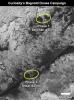
Curiosity's Bagnold Dunes Campaign: Two Types of Dunes
Full Resolution:
TIFF
(1.475 MB)
JPEG
(200.6 kB)
|
|
|
2017-02-27 |
Mars
|
Mars Science Laboratory (MSL)
|
Navcam (MSL)
|
7696x1669x1 |

|
-
PIA21268:
Full-Circle Vista With a Linear Shaped Martian Sand Dune
Full Resolution:
TIFF
(6.643 MB)
JPEG
(788.3 kB)
|
|
|
2017-02-27 |
Mars
|
Mars Science Laboratory (MSL)
|
MARDI
|
2108x1533x3 |
|
-
PIA21143:
-
Sand Moving Under Curiosity, One Day to Next
Full Resolution:
TIFF
(7.113 MB)
JPEG
(214.8 kB)
|
|
|
2017-01-17 |
Mars
|
Mars Science Laboratory (MSL)
|
Mastcam
|
4229x2149x3 |
|
-
PIA21263:
-
Possible Signs of Ancient Drying in Martian Rock
Full Resolution:
TIFF
(27.28 MB)
JPEG
(1.565 MB)
|
|
|
2017-01-17 |
Mars
|
Mars Science Laboratory (MSL)
|
Mastcam
|
3705x1230x3 |
|
-
PIA21262:
-
Mars Rover's Mastcam View of Possible Mud Cracks
Full Resolution:
TIFF
(10.7 MB)
JPEG
(635.8 kB)
|
|
|
2017-01-17 |
Mars
|
Mars Science Laboratory (MSL)
|
MAHLI
|
2954x2063x3 |
|
-
PIA21261:
-
Possible Mud Cracks Preserved in Martian Rock
Full Resolution:
TIFF
(13.89 MB)
JPEG
(809.2 kB)
|
|
|
2016-12-13 |
Mars
|
Mars Science Laboratory (MSL)
|
Mastcam
|
3480x1252x3 |
|
-
PIA21256:
-
Color Variations on Mount Sharp, Mars (White Balanced)
Full Resolution:
TIFF
(12.05 MB)
JPEG
(631.9 kB)
|
|
|
2016-12-13 |
Mars
|
Mars Science Laboratory (MSL)
|
|
1920x1080x3 |
|
-
PIA21255:
-
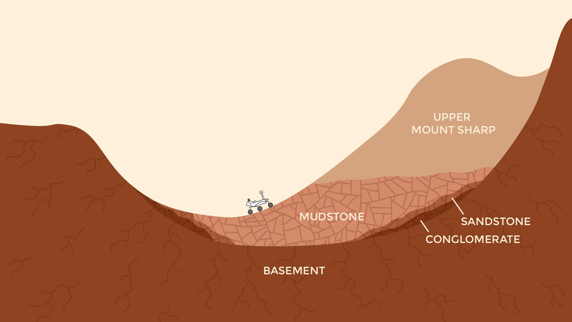
Now and Long Ago at Gale Crater, Mars (Illustration)
Full Resolution:
TIFF
(491.6 kB)
JPEG
(77.52 kB)
|
|
|
2016-12-13 |
Mars
|
Mars Reconnaissance Orbiter (MRO)
Mars Science Laboratory (MSL)
|
HiRISE
MAHLI
|
3300x2550x3 |
|
-
PIA21254:
-
Curiosity's Rock or Soil Sampling Sites on Mars, Through November 2016
Full Resolution:
TIFF
(21.14 MB)
JPEG
(2.213 MB)
|
|
|
2016-12-05 |
Mars
|
Mars Science Laboratory (MSL)
|
Navcam (MSL)
|
1024x1024x1 |
|
-
PIA21140:
-
Martian Terrain Near Curiosity's 'Precipice' Target
Full Resolution:
TIFF
(1.019 MB)
JPEG
(167.9 kB)
|
|
|
2016-10-03 |
Mars
|
Mars Science Laboratory (MSL)
|
HiRISE
|
3300x2550x3 |
|
-
PIA20846:
-
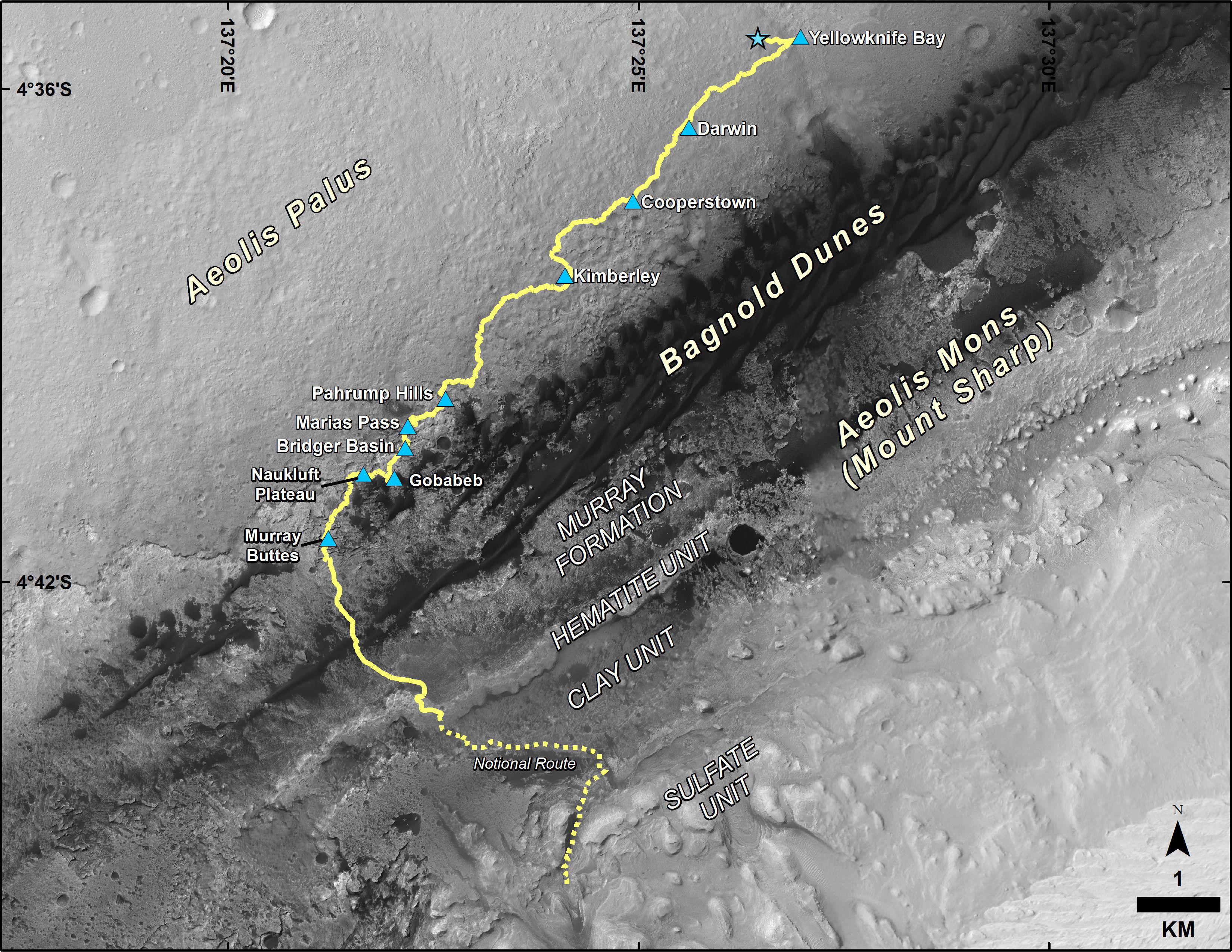
Curiosity Destinations for Second Extended Mission
Full Resolution:
TIFF
(13.9 MB)
JPEG
(1.797 MB)
|
|
|
2016-10-03 |
Mars
|
Mars Science Laboratory (MSL)
|
HiRISE
MAHLI
|
3300x2550x3 |
|
-
PIA20845:
-
Curiosity's First 16 Rock or Soil Sampling Sites on Mars
Full Resolution:
TIFF
(20.59 MB)
JPEG
(2.195 MB)
|
|
|
2016-10-03 |
Mars
|
Mars Science Laboratory (MSL)
|
MAHLI
|
8000x4769x3 |
|
-
PIA20844:
-
Curiosity Self-Portrait at 'Murray Buttes'
Full Resolution:
TIFF
(83.67 MB)
JPEG
(3.836 MB)
|
|
|
2016-10-03 |
Mars
|
Mars Science Laboratory (MSL)
|
Mastcam
|
10000x5027x3 |

|
-
PIA20843:
-
Butte 'M9a' in 'Murray Buttes' on Mars
Full Resolution:
TIFF
(122 MB)
JPEG
(6.811 MB)
|
|
|
2016-10-03 |
Mars
|
Mars Science Laboratory (MSL)
|
Mastcam
|
10000x1441x3 |
|
-
PIA20842:
Cluster of Martian Mesas on Lower Mount Sharp, Sols 1438 and 1439
Full Resolution:
TIFF
(30.84 MB)
JPEG
(2.17 MB)
|
|
|
2016-10-03 |
Mars
|
Mars Science Laboratory (MSL)
|
Mastcam
|
10000x2086x3 |
|
-
PIA20841:
Martian Mesas in 'Murray Buttes' Area, Sol 1434
Full Resolution:
TIFF
(40.52 MB)
JPEG
(2.487 MB)
|
|
|
2016-10-03 |
Mars
|
Mars Science Laboratory (MSL)
|
Mastcam
|
10000x2848x3 |
|
-
PIA20840:
Rover's Panorama Taken Amid 'Murray Buttes' on Mars
Full Resolution:
TIFF
(56.19 MB)
JPEG
(3.787 MB)
|
|
|
2016-09-09 |
Mars
|
Mars Science Laboratory (MSL)
|
Mastcam
|
1344x1200x3 |
|
-
PIA21045:
-
Farewell to Murray Buttes (Image 5)
Full Resolution:
TIFF
(3.097 MB)
JPEG
(140.9 kB)
|
|
|
2016-09-09 |
Mars
|
Mars Science Laboratory (MSL)
|
Mastcam
|
1344x1200x3 |
|
-
PIA21044:
-
Farewell to Murray Buttes (Image 4)
Full Resolution:
TIFF
(4.439 MB)
JPEG
(225.6 kB)
|
|
|
2016-09-09 |
Mars
|
Mars Science Laboratory (MSL)
|
Mastcam
|
1344x1200x3 |
|
-
PIA21043:
-
Farewell to Murray Buttes (Image 3)
Full Resolution:
TIFF
(4.415 MB)
JPEG
(226.6 kB)
|
|
|
2016-09-09 |
Mars
|
Mars Science Laboratory (MSL)
|
Mastcam
|
1344x1200x3 |
|
-
PIA21042:
-
Farewell to Murray Buttes (Image 2)
Full Resolution:
TIFF
(3.002 MB)
JPEG
(140.9 kB)
|
|
|
2016-09-09 |
Mars
|
Mars Science Laboratory (MSL)
|
Mastcam
|
1344x1200x3 |
|
-
PIA21041:
-
Farewell to Murray Buttes (Image 1)
Full Resolution:
TIFF
(3.732 MB)
JPEG
(200.2 kB)
|
|
|
2016-08-19 |
Mars
|
Mars Science Laboratory (MSL)
|
Mastcam
|
4893x2642x3 |

|
-
PIA20836:
-
Breccia-Conglomerate Rocks on Lower Mount Sharp, Mars (Stereo)
Full Resolution:
TIFF
(18.52 MB)
JPEG
(976.6 kB)
|
|
|
2016-08-19 |
Mars
|
Mars Science Laboratory (MSL)
|
Mastcam
|
10253x2500x3 |
|
-
PIA20765:
Rover's Panorama of Entrance to 'Murray Buttes' on Mars
Full Resolution:
TIFF
(46.47 MB)
JPEG
(2.912 MB)
|
|
|
2016-08-04 |
Mars
|
Mars Science Laboratory (MSL)
|
Navcam (MSL)
|
982x726x1 |
|
-
PIA20764:
-
Curiosity's Arm Over 'Marimba' Target on Mount Sharp
Full Resolution:
TIFF
(713.9 kB)
JPEG
(138.6 kB)
|
|
|
2016-07-21 |
Mars
|
Mars Science Laboratory (MSL)
|
ChemCam
Navcam (MSL)
|
1570x859x3 |
|
-
PIA20762:
-
Autonomous Selection of a Rover's Laser Target on Mars
Full Resolution:
TIFF
(1.823 MB)
JPEG
(184.7 kB)
|
|
|
2016-06-30 |
Mars
|
Mars Science Laboratory (MSL)
|
Mastcam
|
9091x1089x3 |
|
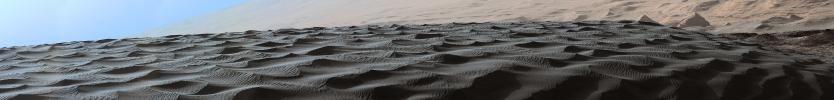
-
PIA20755:
Two Sizes of Ripples on Surface of Martian Sand Dune
Full Resolution:
TIFF
(23.73 MB)
JPEG
(1.353 MB)
|
|
|
2016-06-27 |
Mars
|
Mars Science Laboratory (MSL)
|
MAHLI
|
3744x4003x3 |
|
-
PIA20752:
-
NASA's Curiosity at Site of Clues About Ancient Oxygen
Full Resolution:
TIFF
(30.84 MB)
JPEG
(1.236 MB)
|
|
|
2016-06-13 |
Mars
|
Mars Science Laboratory (MSL)
|
MAHLI
|
4400x3400x3 |
|
-
PIA20748:
-
Curiosity's First 14 Rock or Soil Sampling Sites on Mars
Full Resolution:
TIFF
(32.94 MB)
JPEG
(3.357 MB)
|
|
|
2016-06-13 |
Mars
|
Mars Science Laboratory (MSL)
|
MAHLI
|
5000x6414x3 |
|
-
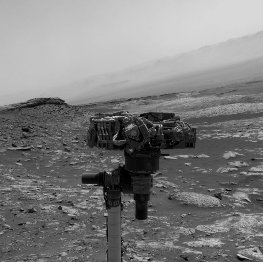
PIA20603:
-
Curiosity Self-Portrait at 'Okoruso' Drill Hole
Full Resolution:
TIFF
(81.41 MB)
JPEG
(22.92 MB)
|
|
|
2016-06-13 |
Mars
|
Mars Science Laboratory (MSL)
|
MAHLI
|
5000x6710x3 |
|
-
PIA20602:
-
Curiosity Self-Portrait at 'Okoruso' Drill Hole
Full Resolution:
TIFF
(83.61 MB)
JPEG
(21.83 MB)
|
|
|
2016-05-11 |
Mars
|
Mars Science Laboratory (MSL)
|
SAM
|
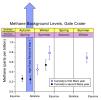
926x919x3 |
|
-
PIA20601:
-
Methane Background Levels at Gale Crater, Mars
Full Resolution:
TIFF
(242.8 kB)
JPEG
(79.46 kB)
|
 Planetary Data System


