Your search criteria found
12760
images
Target is Mars (and available satellites)
Go to PIAxxxxx:
Refine this list of images by:
Target:
Deimos
Mars
Phobos
Mission:
2001 Mars Odyssey
Antarctic Meteorite Location and Mapping Project (AMLAMP)
Dawn
ExoMars
Hubble Space Telescope
InSight
MAVEN
Mariner Mars 1964 (Mariner 4)
Mariner Mars 1969 (Mariner 7)
Mariner Mars 1971 (Mariner 9)
Mars 2020
Mars 2020 Rover
Mars Atmosphere and Volatile Evolution MissioN (MAVEN)
Mars Climate Orbiter
Mars Cube One (MarCO)
Mars Exploration Rover (MER)
Mars Express (MEX)
Mars Global Surveyor (MGS)
Mars Helicopter
Mars Pathfinder (MPF)
Mars Reconnaissance Orbiter (MRO)
Mars Sample Return
Mars Sample Return (MSR)
Mars Science Laboratory (MSL)
Phoenix
Rosetta
Viking
Spacecraft:
2001 Mars Odyssey
Curiosity
Dawn
InSight Mars Lander
Ingenuity
MAVEN
MarCO-B
Mariner 4
Mariner 7
Mariner 9
Mars Climate Orbiter
Mars Express (MEX)
Mars Express (MEX) Orbiter
Mars Global Surveyor Orbiter
Mars Pathfinder Lander
Mars Pathfinder Rover
Mars Reconnaissance Orbiter (MRO)
Mars Sample Return
Mars Science Laboratory (MSL)
NASA's Mars Pathfinder Lander
Opportunity
Perseverance
Philae Lander
Phoenix Lander
Phoenix Mars Lander
Spirit
Viking Lander 1
Viking Lander 2
Viking Orbiter 1
Viking Orbiter 2
Instrument:
Alpha Particle X-ray Spectrometer
Alpha Particle X-ray Spectrometer (MSL)
Atmospheric Structure / Meteorology Instrument
CHIMRA
Camera 1
Camera 2
Chemistry & Mineralogy (CheMin)
Chemistry and Camera (ChemCam)
Comet Infrared and Visible Analyser (CIVA
Compact Reconnaissance Imaging Spectrometer for Mars (CRISM)
Context Camera (CTX)
Deep Space Network
Descent Image Motion Estimation System (DIMES)
Dynamic Albedo of Neutrons
Dynamic Albedo of Neutrons (DAN)
Gamma Ray Spectrometer - Neutron Spectrometer
Gamma Ray Spectrometer Suite
Hazard Avoidance Camera
Hazard Avoidance Camera (M2020)
Hazard Avoidance Camera (MSL)
Heat and Physical Properties Package (HP3)
High Resolution Imaging Science Experiment (HiRISE)
High Resolution Instrument (HRI)
High Resolution Stereo Camera
Imager for Mars Pathfinder
Imaging Ultraviolet Spectrograph
Imaging Ultraviolet Spectrograph (IUVS)
Instrument Context Camera (ICC)
Instrument Deployment Camera (IDC)
Lander Vision System Camera (LCAM)
Magnetometer
Mars Advanced Radar for Subsurface and Ionosphere Sounding (MARSIS)
Mars Advanced Radar for Subsurface and Ionospheric Sounding (MARSIS)
Mars Climate Sounder (MCS)
Mars Color Imager (MARCI)
Mars Descent Imager
Mars Environmental Dynamics Analyzer (MEDA)
Mars Hand Lens Imager (MAHLI)
Mars Horizon Sensor Assembly
Mars Orbiter Camera (MOC)
Mars Orbiter Laser Altimeter
Mars Radiation Experiment
Mastcam
Mastcam-Z
Microscopic Imager
Microscopy Electrochemistry and Conductivity Analyzer (MECA)
Miniature Thermal Emission Spectrometer
Moessbauer Spectrometer
Navigation Camera
Navigation Camera (M2020)
Navigation Camera (MSL)
Neutral Gas and Ion Mass Spectrometer
Neutron Spectrometer
Optical Microscope
Optical Navigation Camera
Panoramic Camera
Planetary Instrument for X-ray Lithochemistry (PIXL)
Radar System
Radiation Assessment Detector (RAD)
Radio Science Subsystem
Robotic Arm
Robotic Arm (MSL)
Robotic Arm Camera (RAC)
Rock Abrasion Tool (RAT)
Rover Cameras
Rover Environmental Monitoring Station (REMS)
Sample Analysis at Mars (SAM)
Scanning Habitable Environments with Raman & Luminescence for Organics and Chemicals (SHERLOC)
Seismic Experiment for Interior Structure (SEIS)
Shallow Subsurface Radar (SHARAD)
Stereo Imager (SSI)
SuperCam
Surface Stereo Imager (SSI)
Thermal Emission Imaging System
Thermal Emission Spectrometer
Thermal and Electrical Conductivity Probe
Thermal and Evolved Gas Analyzer
Trace Gas Orbiter
Visual Imaging Subsystem
Visual Imaging Subsystem - Camera A
Visual Imaging Subsystem - Camera B
Wide Field Planetary Camera 2
Click on an image for detailed information
Click on a column heading to sort in ascending or descending order
My
List
Addition Date
Target
Mission
Instrument
Size
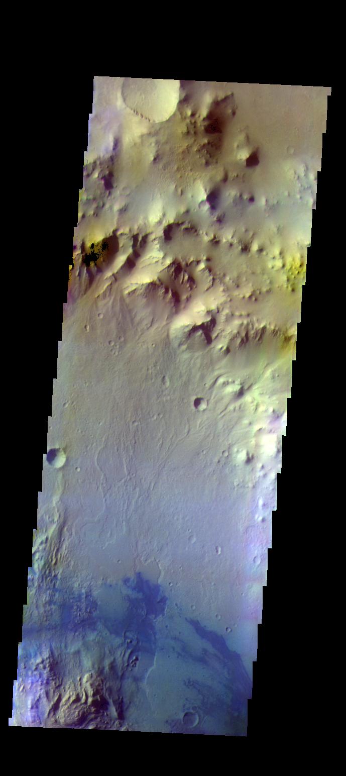
2016-11-24
Mars
2001 Mars Odyssey
THEMIS
706x1547x3
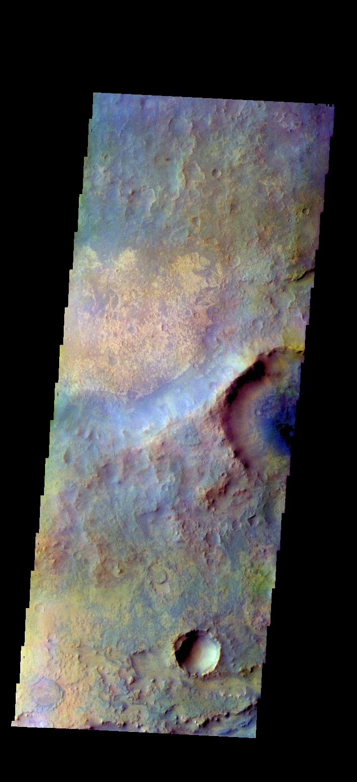
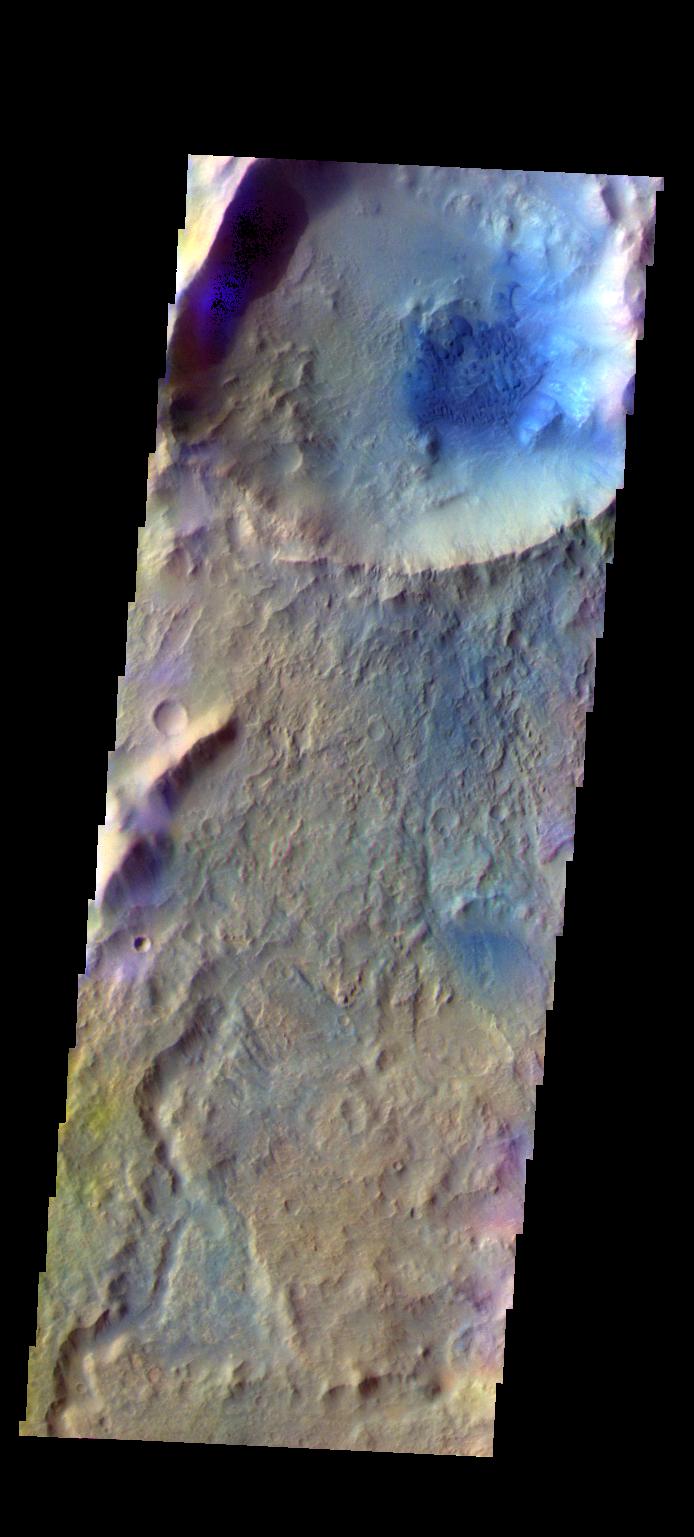
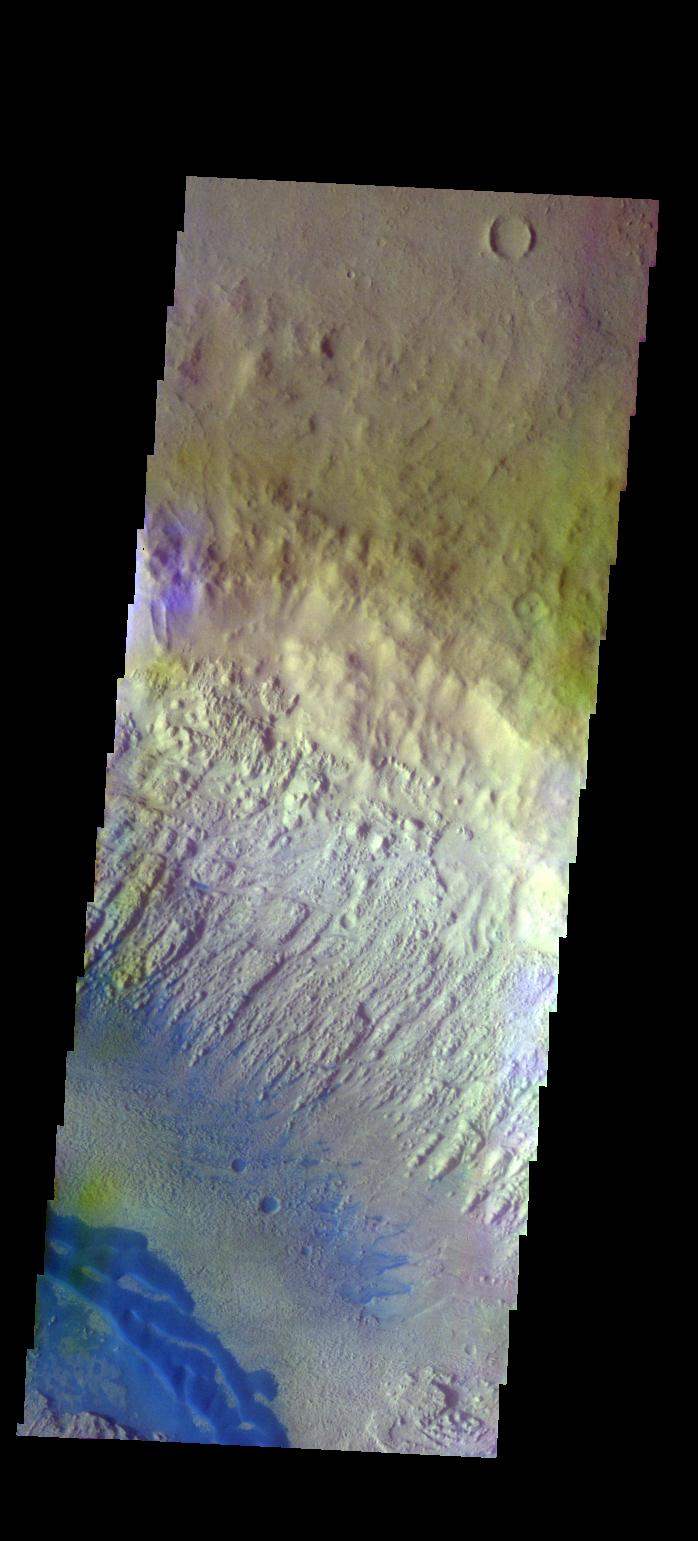
PIA21174:
Syrtis Major - False Color
Full Resolution:
TIFF
(2.212 MB)
JPEG
(111.1 kB)
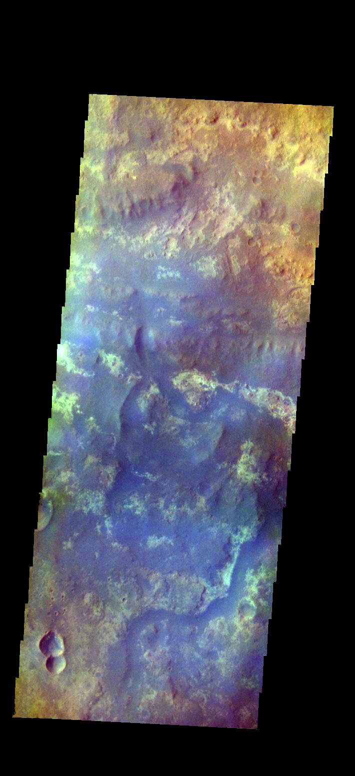
2016-11-25
Mars
2001 Mars Odyssey
THEMIS
694x1537x3
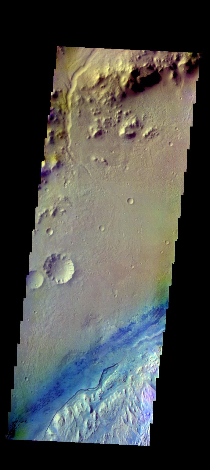
PIA21175:
Dulovo Crater - False Color
Full Resolution:
TIFF
(2.199 MB)
JPEG
(103 kB)
2016-11-28
Mars
2001 Mars Odyssey
THEMIS
1319x2648x1
PIA21176:
Noctis Labyrinthus
Full Resolution:
TIFF
(2.039 MB)
JPEG
(155.8 kB)
2016-11-29
Mars
2001 Mars Odyssey
THEMIS
1321x2660x1
PIA21177:
Sirenum Fossae
Full Resolution:
TIFF
(2.389 MB)
JPEG
(250.3 kB)
2016-11-29
Mars
ExoMars
Trace Gas Orbiter
1789x1304x3
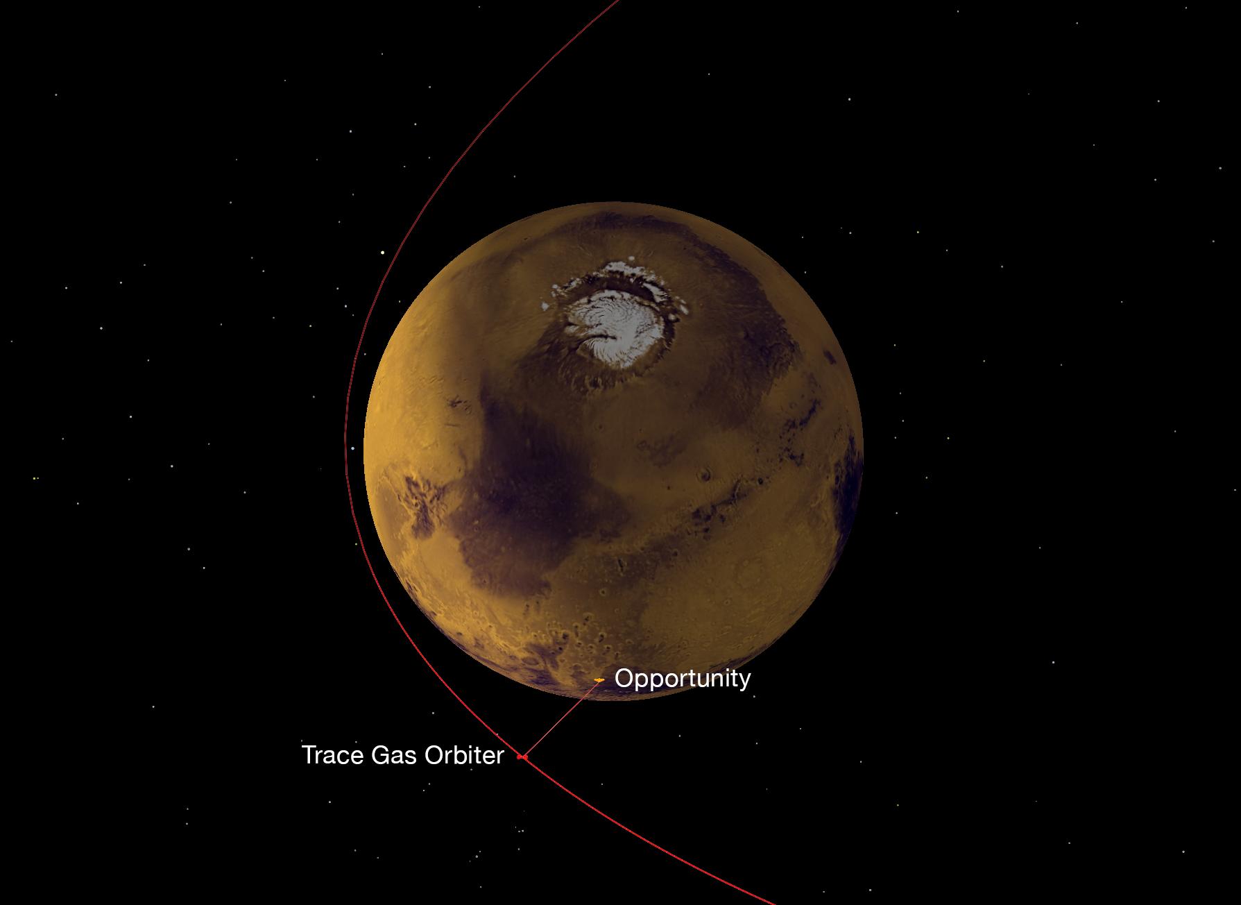
PIA21139:
Strengthening the Mars Telecommunications Network
Full Resolution:
TIFF
(1.27 MB)
JPEG
(91.46 kB)
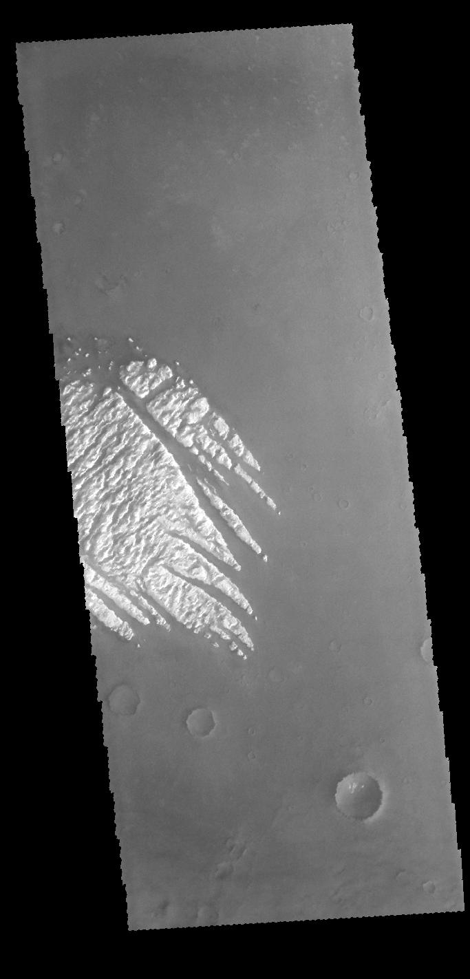
2016-11-30
Mars
2001 Mars Odyssey
THEMIS
589x1443x1
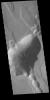
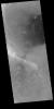
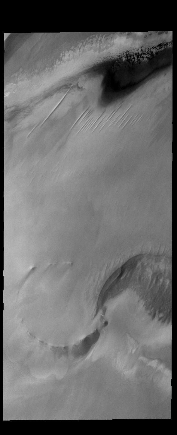
PIA21178:
North Polar Cap
Full Resolution:
TIFF
(728.9 kB)
JPEG
(72.6 kB)
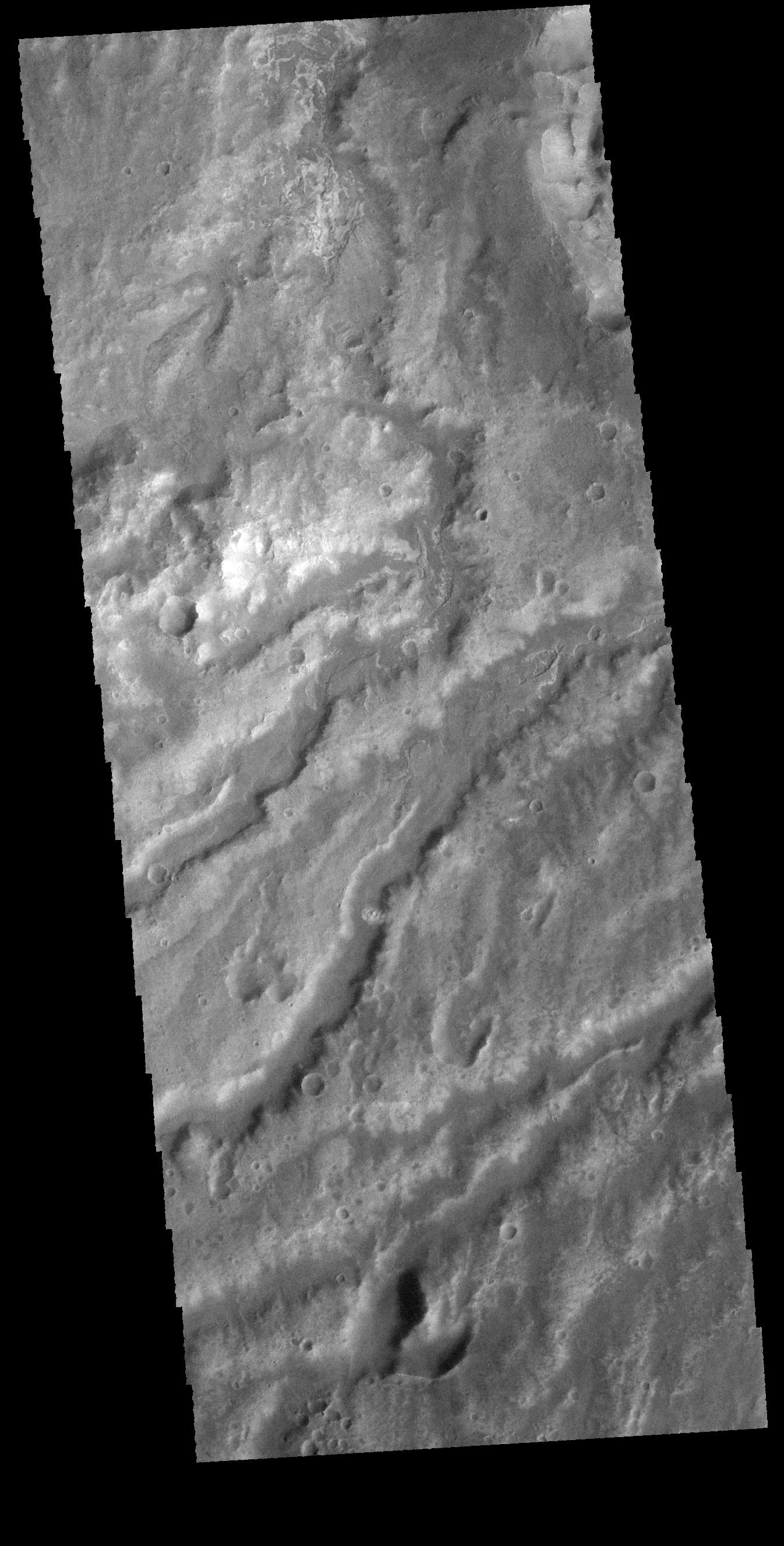
2016-12-01
Mars
2001 Mars Odyssey
THEMIS
1322x2659x1
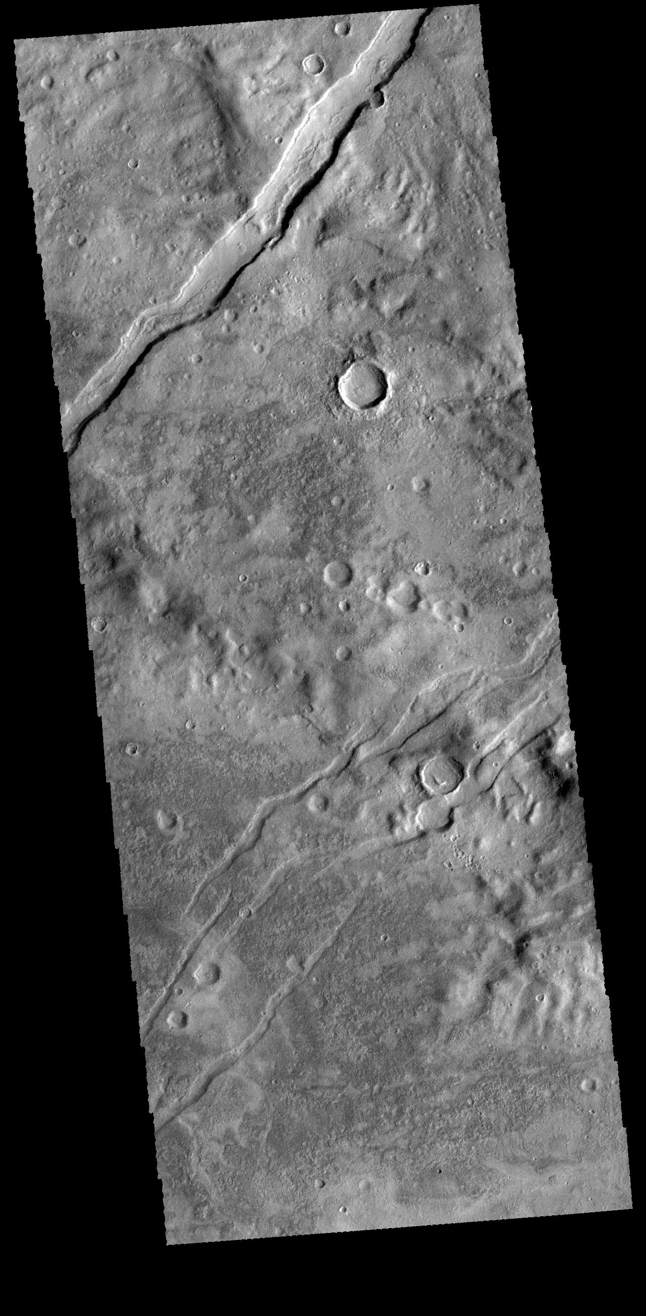
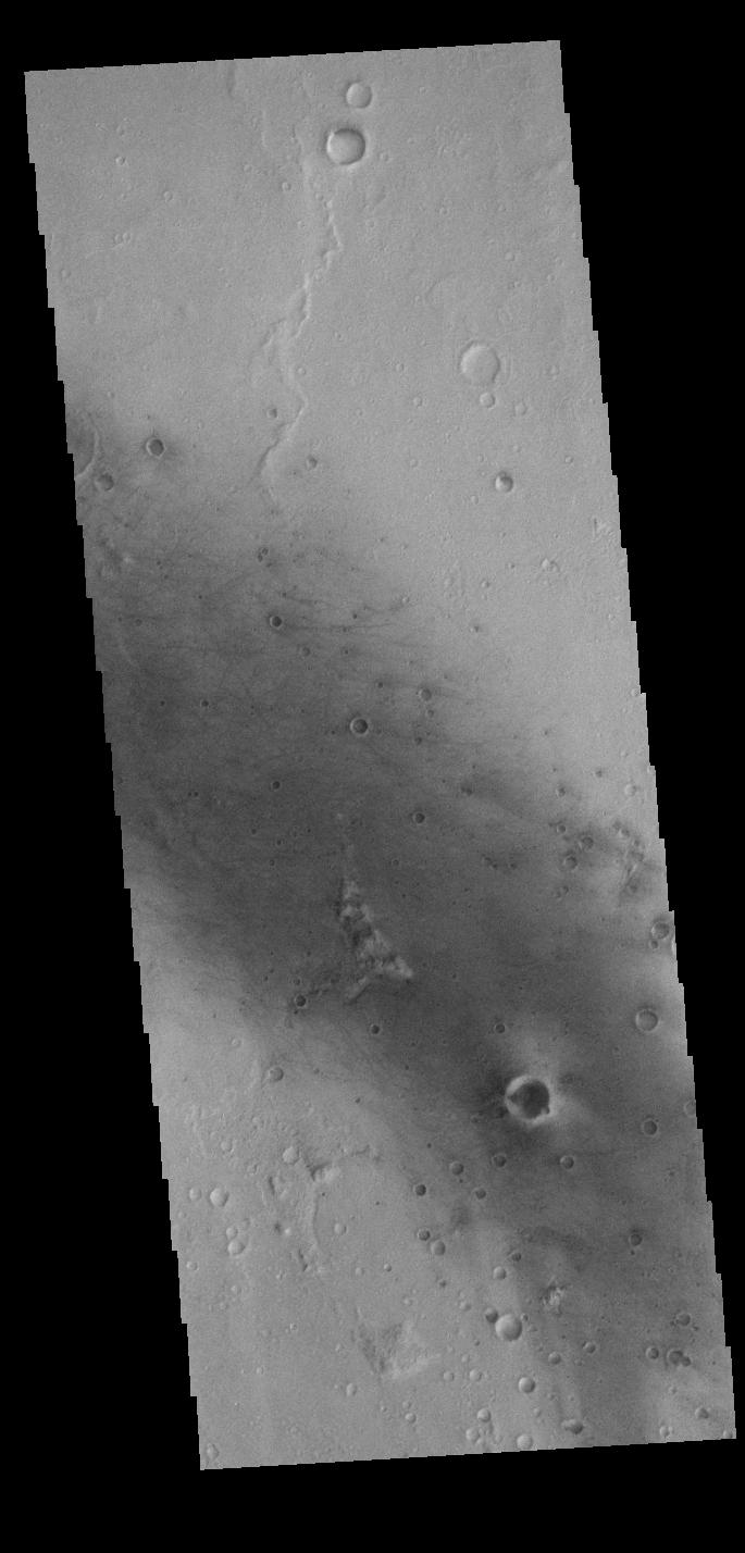
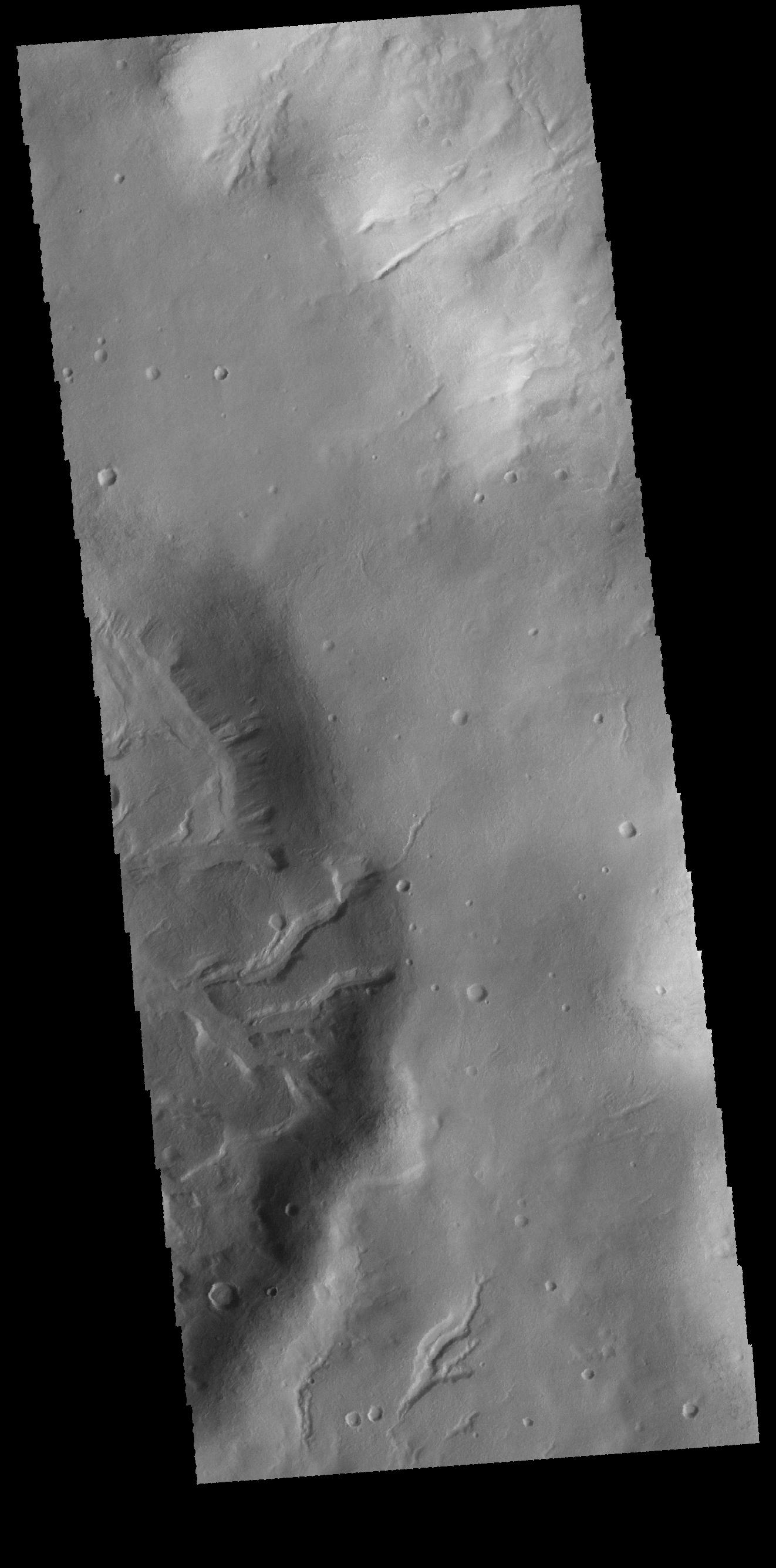
PIA21179:
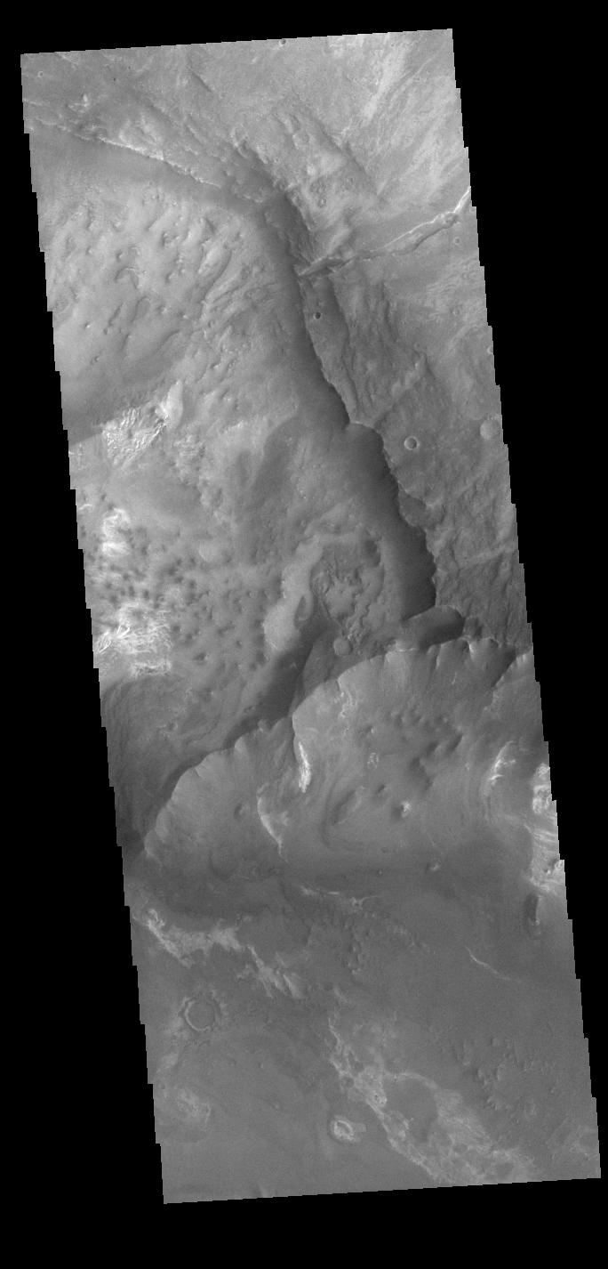
Noachis Terra Channels
Full Resolution:
TIFF
(2.512 MB)
JPEG
(309.6 kB)
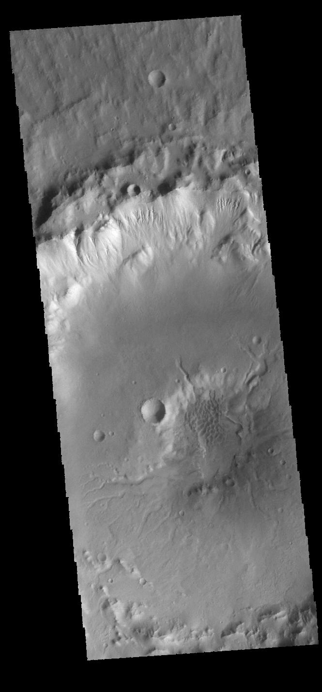
2016-12-02
Mars
2001 Mars Odyssey
THEMIS
1323x2662x1
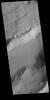
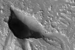
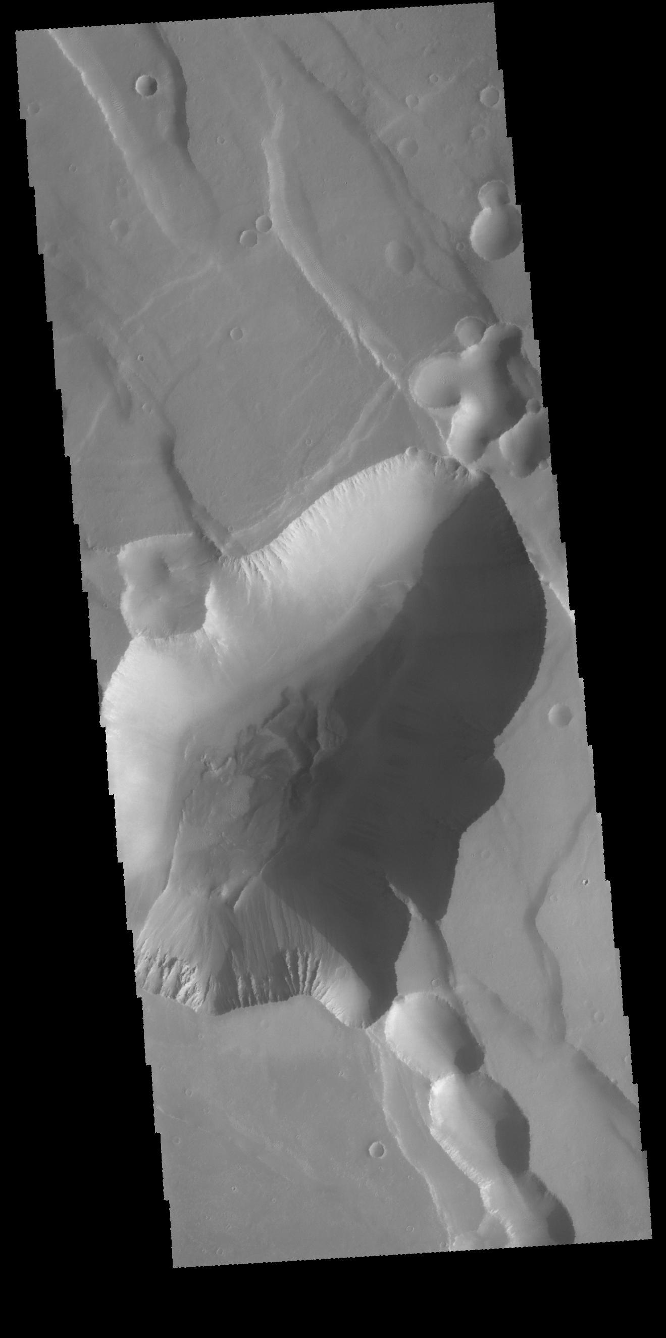
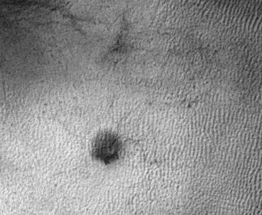
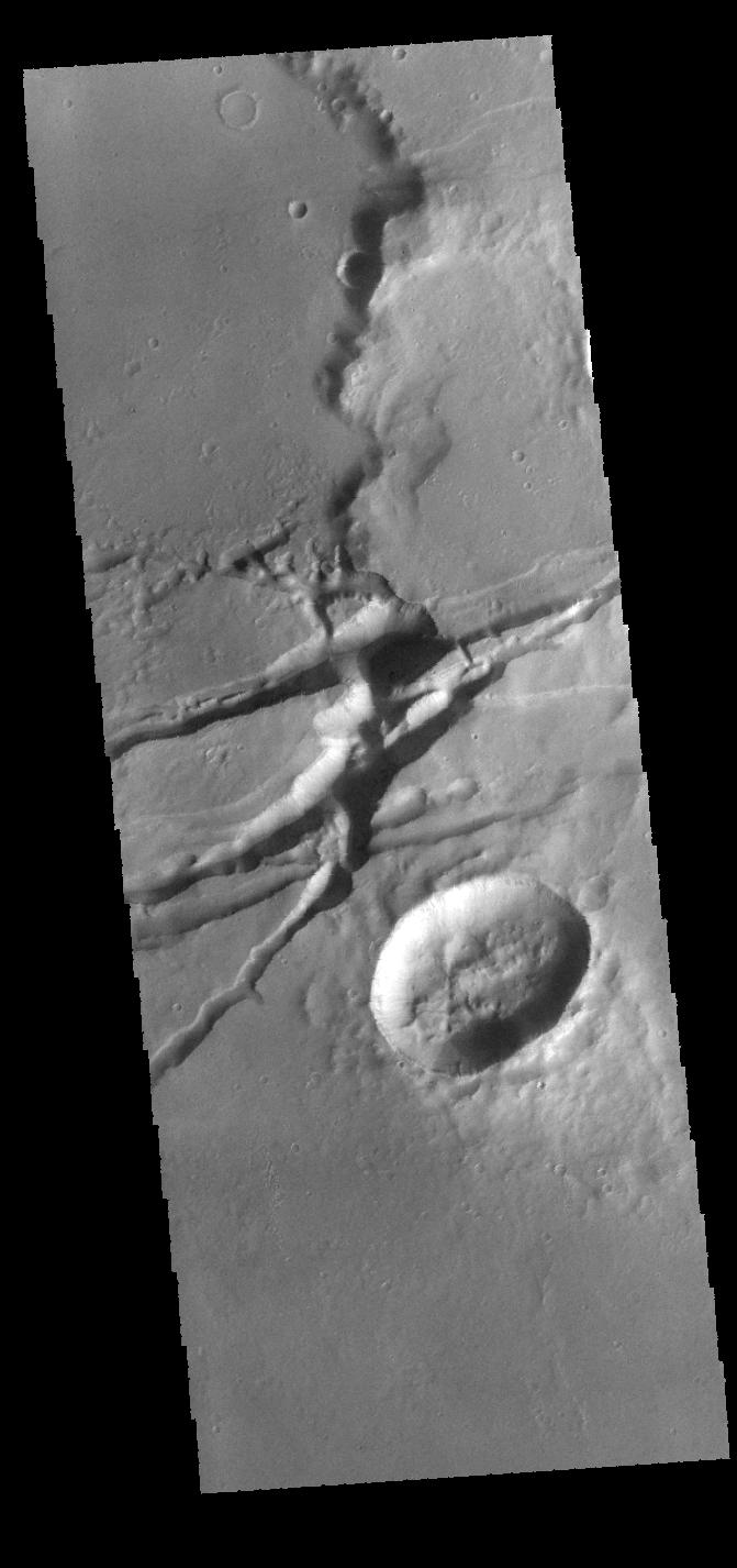
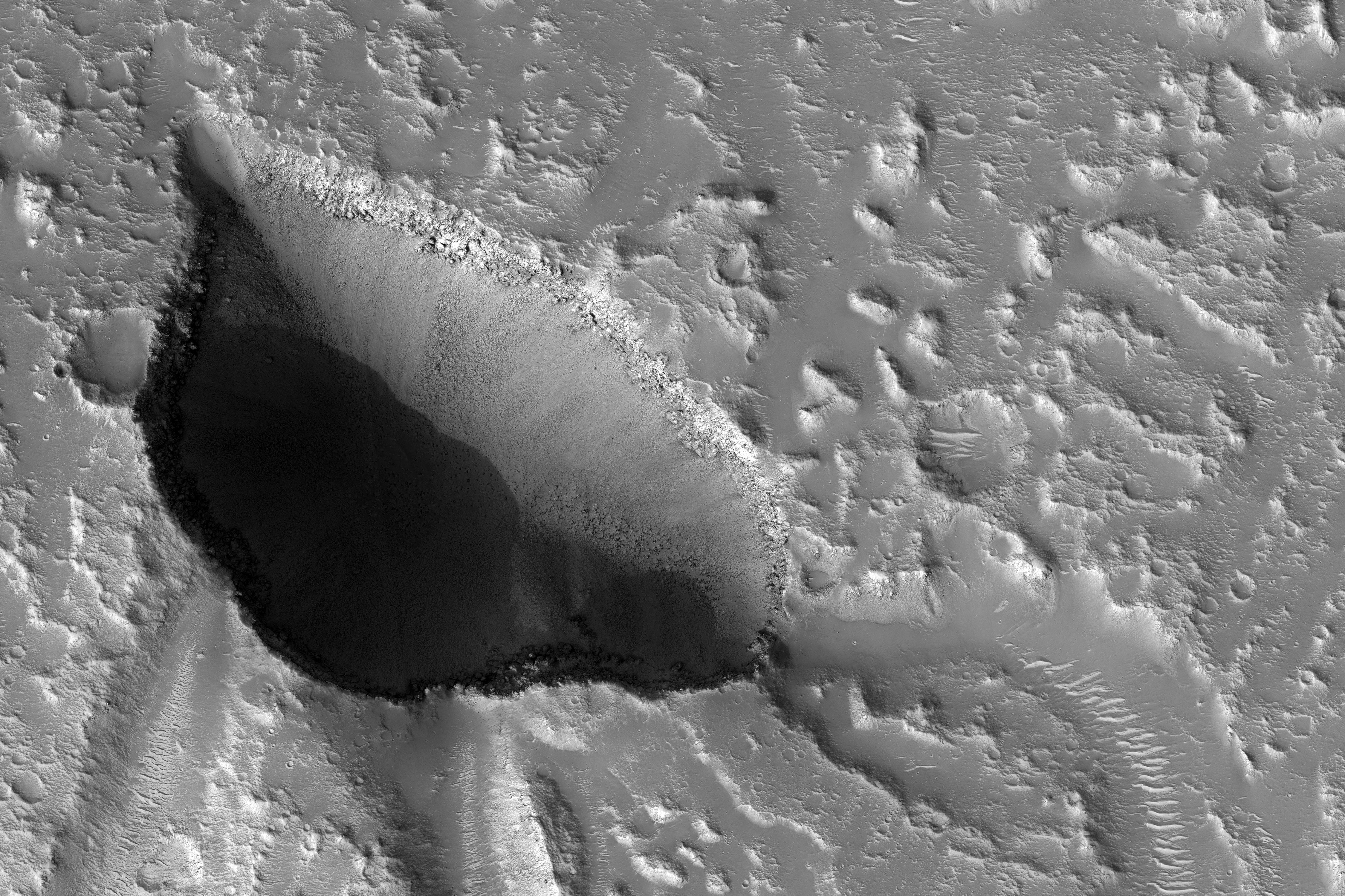
PIA21180:
Pit Crater
Full Resolution:
TIFF
(2.464 MB)
JPEG
(298.5 kB)
2016-12-05
Mars
2001 Mars Odyssey
THEMIS
684x1426x1
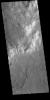
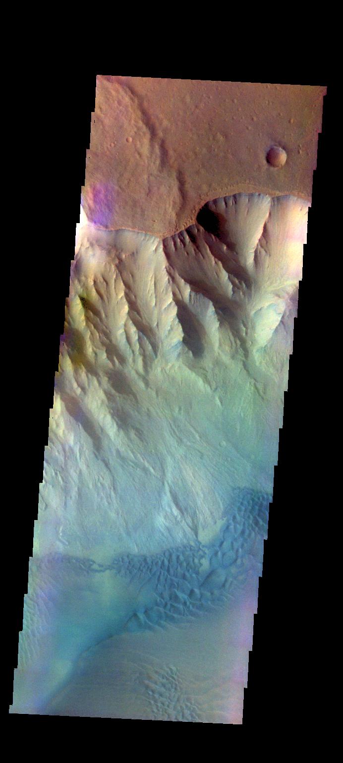
PIA21181:
Melas Chasma
Full Resolution:
TIFF
(686.8 kB)
JPEG
(79.81 kB)
2016-12-05
Mars
Mars Science Laboratory (MSL)
Navcam (MSL)
1024x1024x1
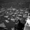
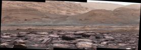
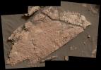
PIA21140:
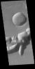
Martian Terrain Near Curiosity's 'Precipice' Target
Full Resolution:
TIFF
(1.019 MB)
JPEG
(167.9 kB)
2016-12-06
Mars
2001 Mars Odyssey
THEMIS
664x1433x1
PIA21183:
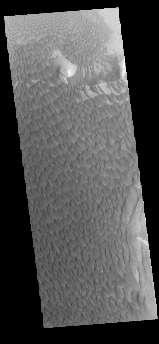
Rabe Crater Dunes
Full Resolution:
TIFF
(686.6 kB)
JPEG
(77.06 kB)
2016-12-07
Mars
2001 Mars Odyssey
THEMIS
663x1435x1
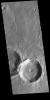
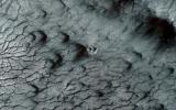
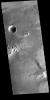
PIA21184:
Crater on Crater
Full Resolution:
TIFF
(707.3 kB)
JPEG
(86.63 kB)
2016-12-07
Mars
Mars Reconnaissance Orbiter (MRO)
HiRISE
2880x1800x3
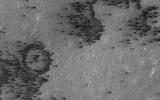
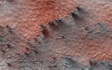
PIA21214:
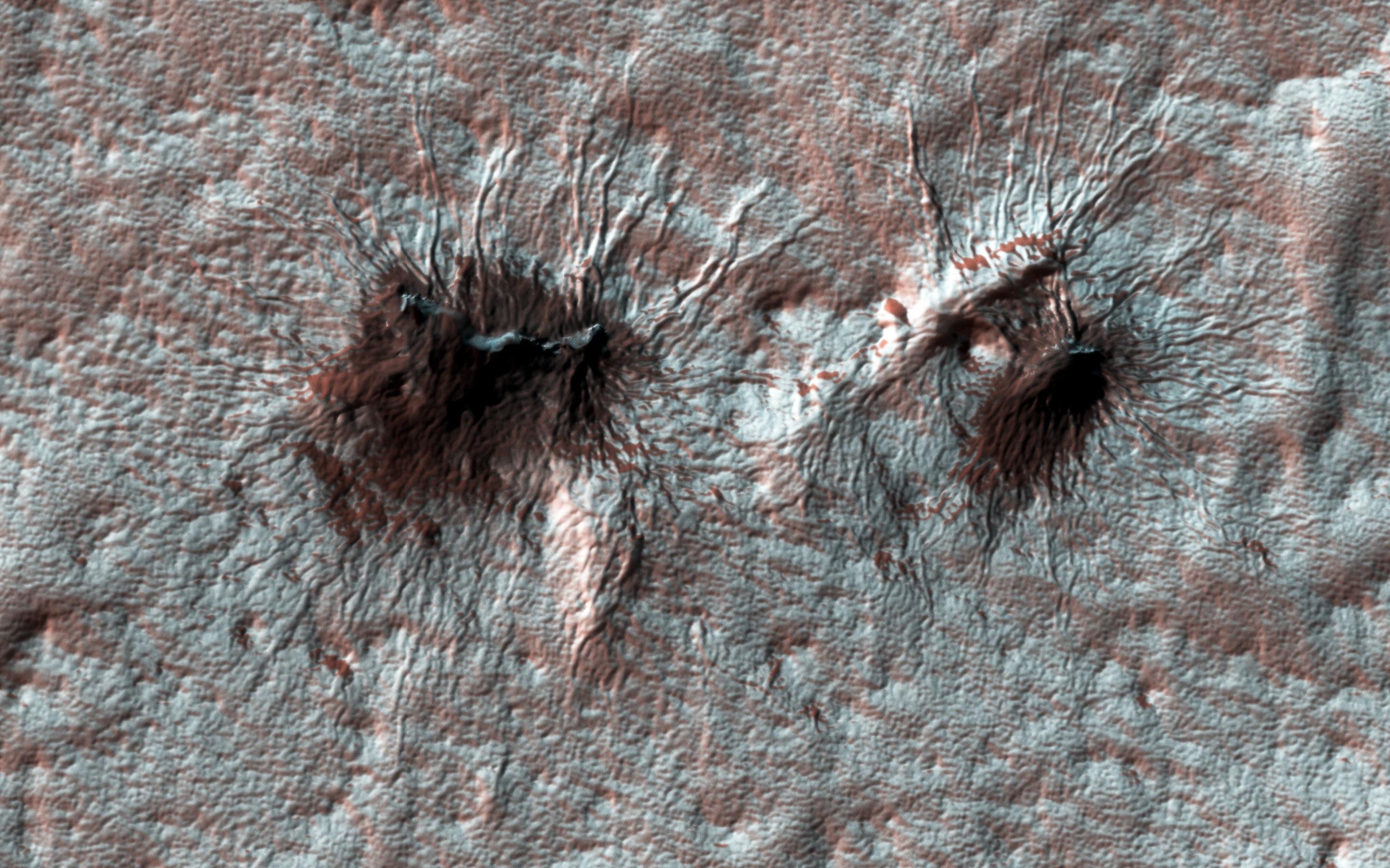
Painting with Frost
Full Resolution:
TIFF
(15.56 MB)
JPEG
(806.3 kB)
2016-12-07
Mars
Mars Reconnaissance Orbiter (MRO)
HiRISE
2880x1800x3
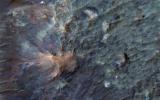
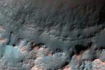
PIA21215:
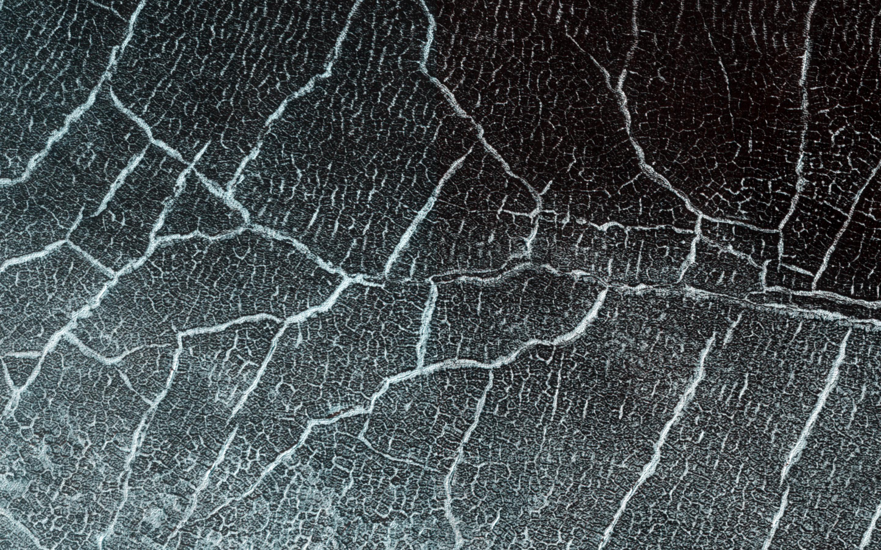
Cracks in a Crater's Ice
Full Resolution:
TIFF
(15.56 MB)
JPEG
(1.168 MB)
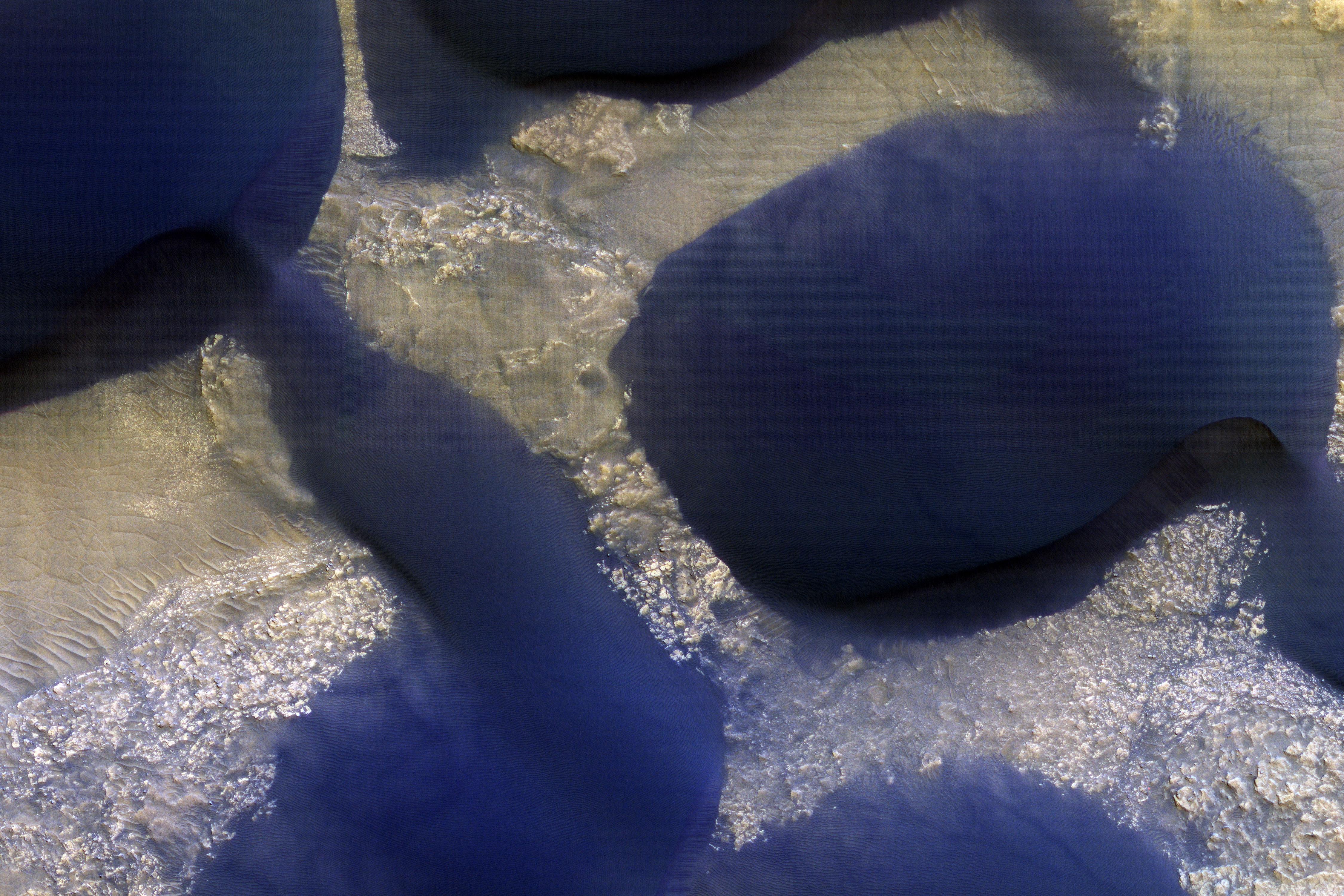
2016-12-07
Mars
Mars Reconnaissance Orbiter (MRO)
HiRISE
2880x1800x3
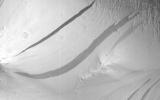
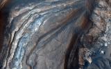
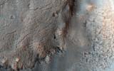
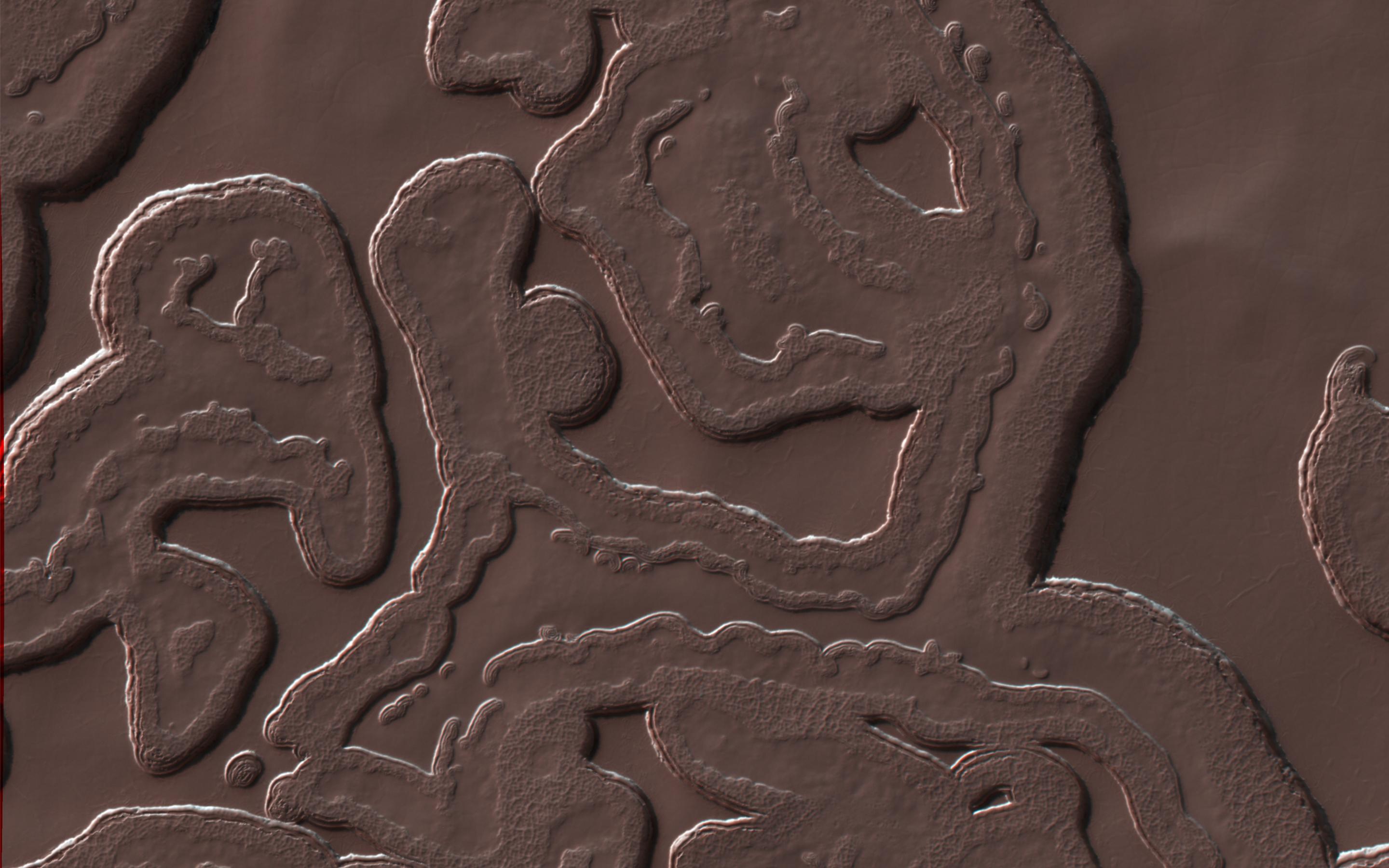
PIA21216:
The Coolest Landscape on Mars (or Earth)
Full Resolution:
TIFF
(10.51 MB)
JPEG
(375.8 kB)
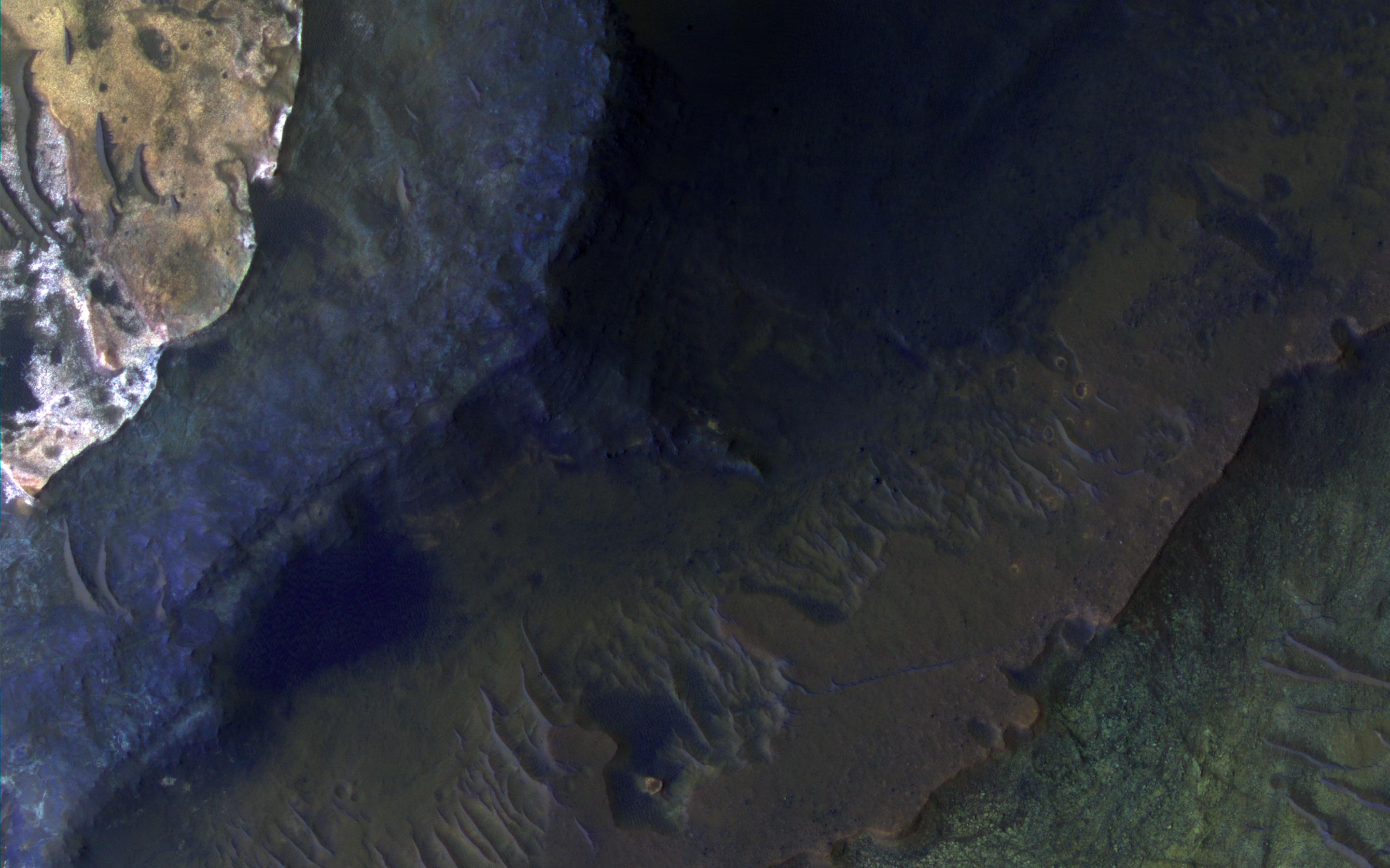
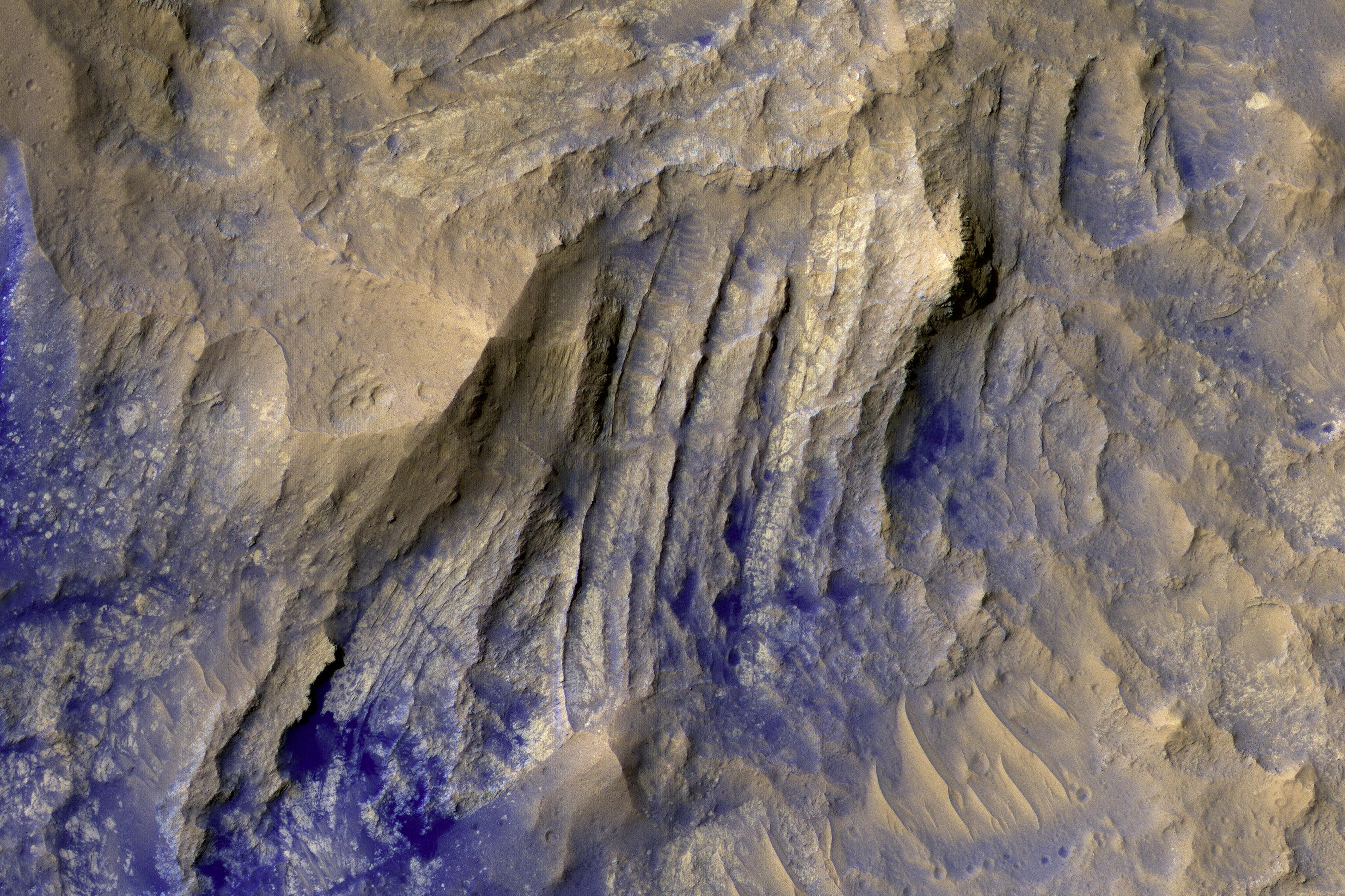
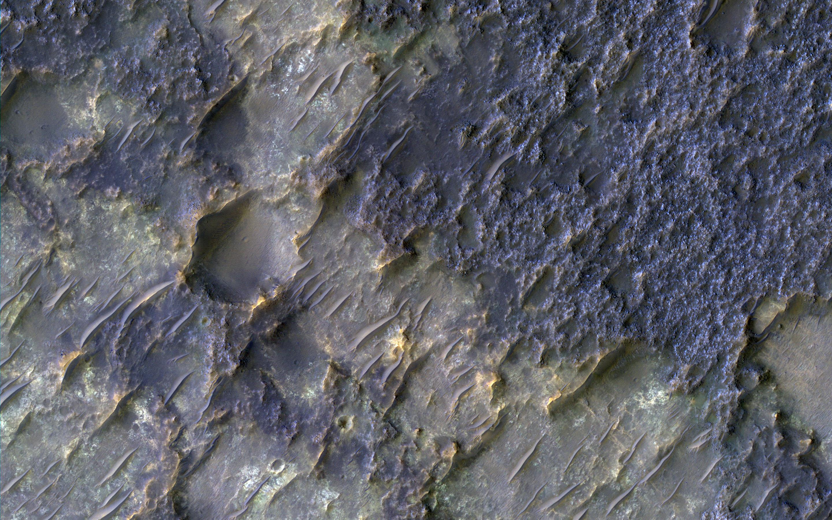
2016-12-07
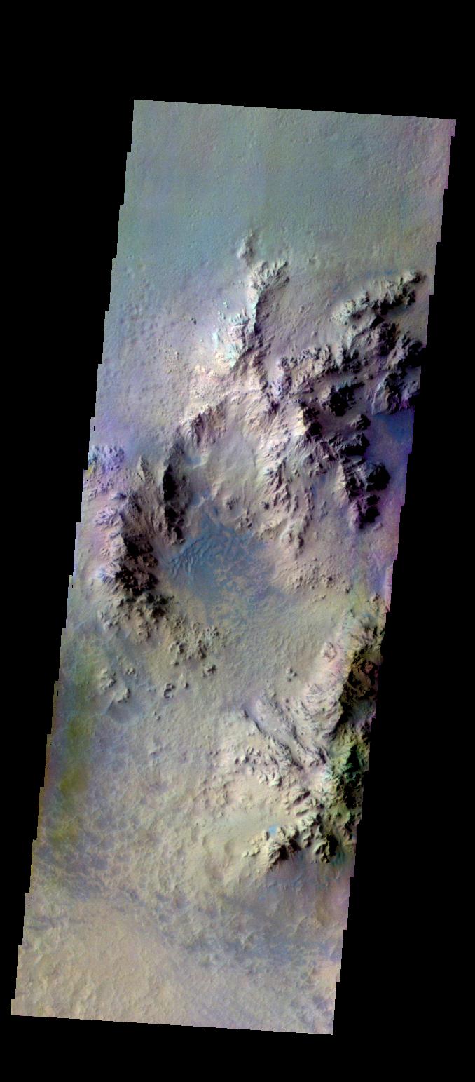
Mars
Mars Reconnaissance Orbiter (MRO)
HiRISE
2880x1800x3
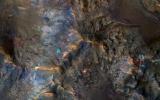
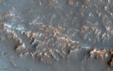
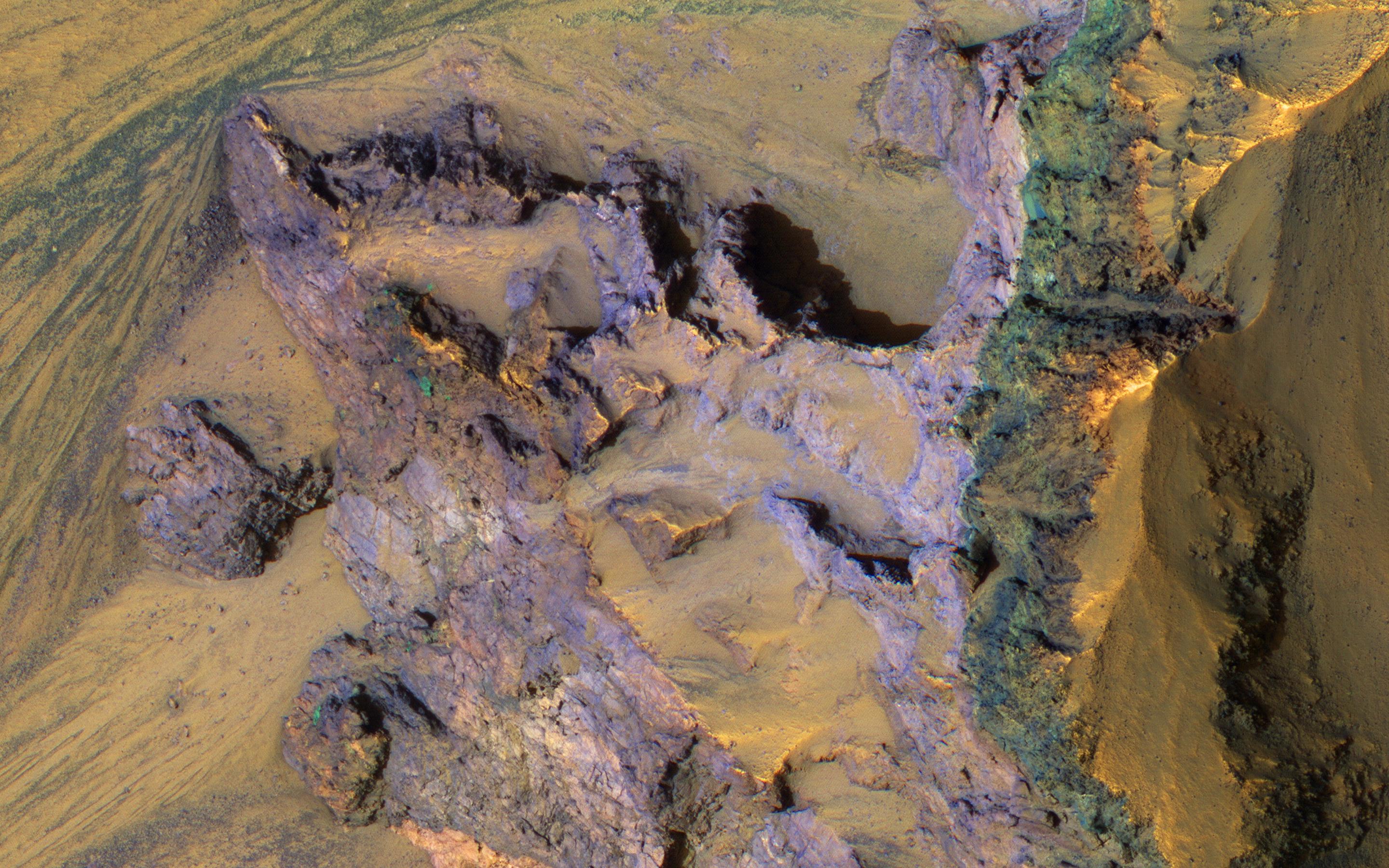
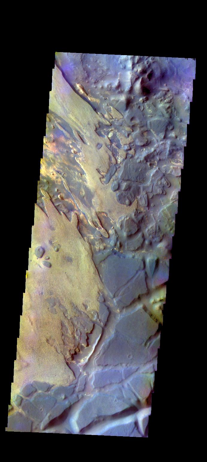
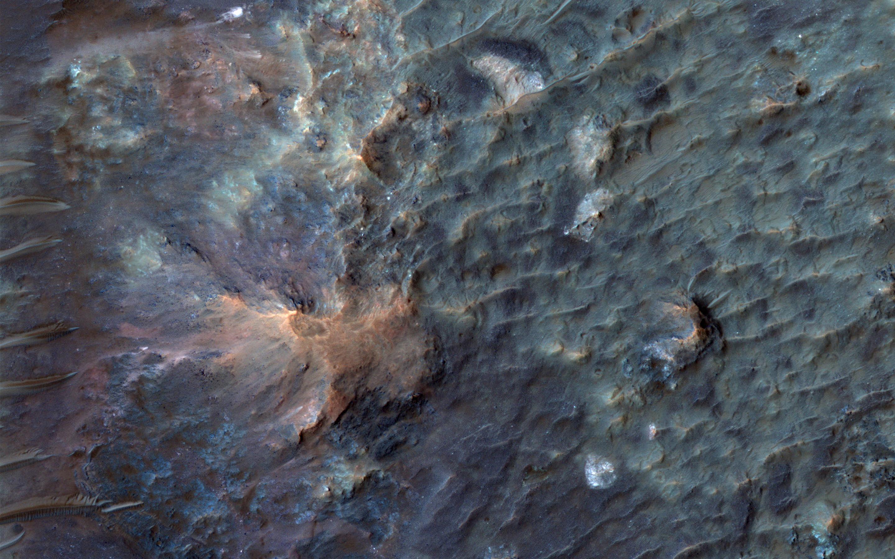
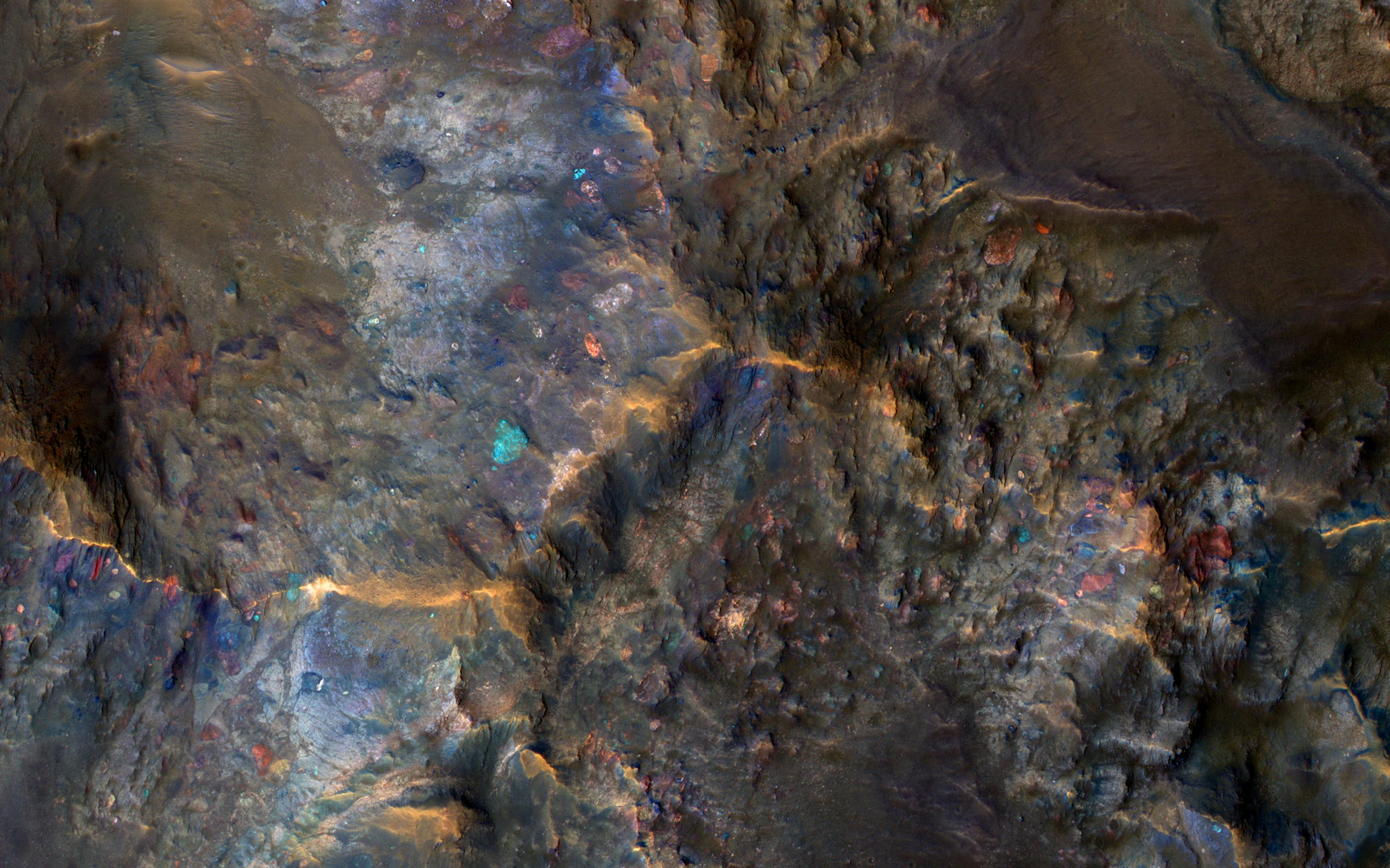
PIA21217:
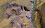
Colorful Bedrock Exposed in a Landslide Scarp
Full Resolution:
TIFF
(15.56 MB)
JPEG
(892.3 kB)
2016-12-07
Mars
Mars Exploration Rover (MER)
Microscopic Imager
1714x1605x3
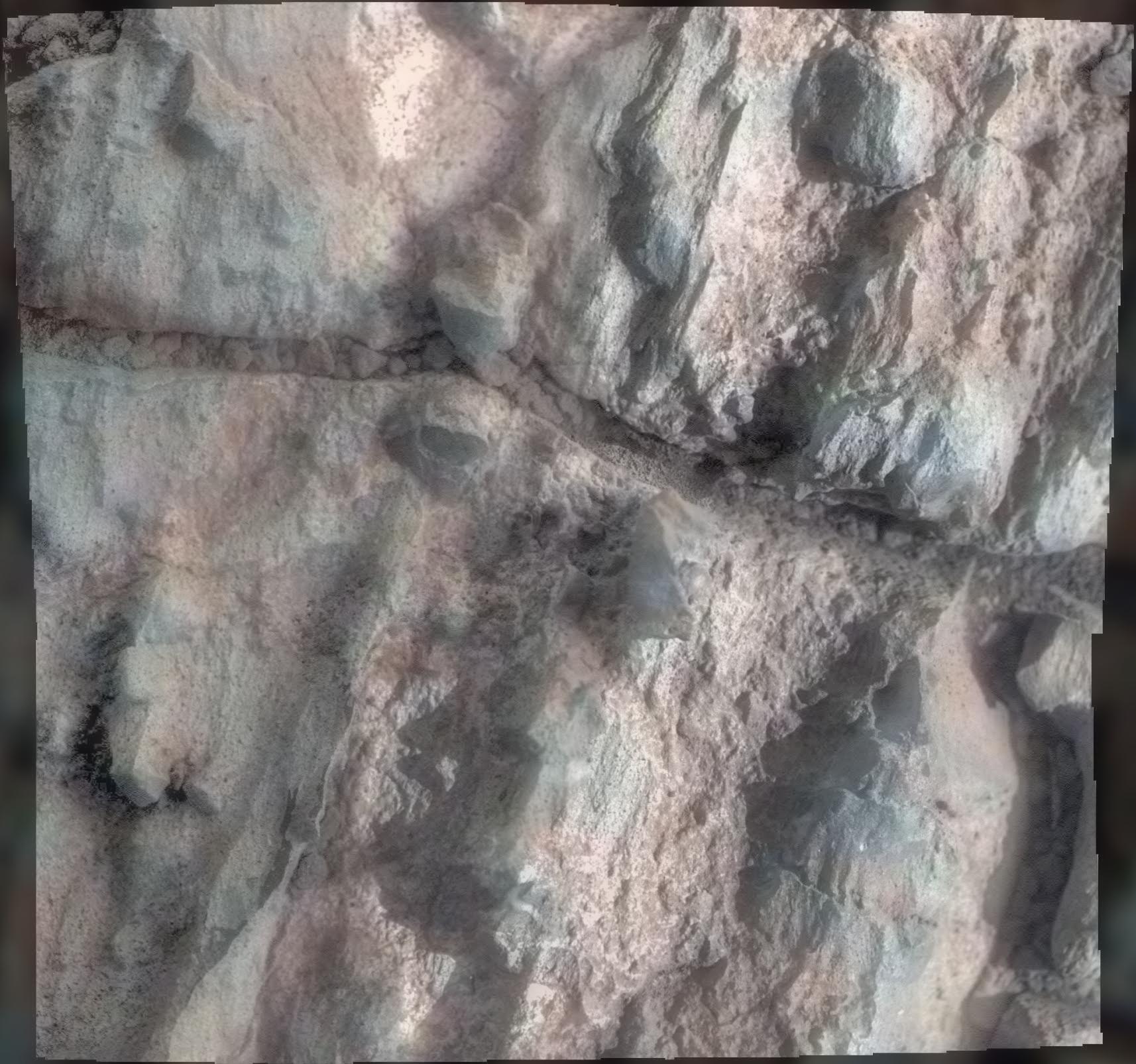
PIA21141:
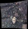
Opportunity Inspects 'Gasconade' on 'Spirit Mound' of Mars
Full Resolution:
TIFF
(8.038 MB)
JPEG
(323.3 kB)
2016-12-07
Mars
Mars Exploration Rover (MER)
Microscopic Imager
2055x2122x3
PIA21142:
Opportunity View of 'Private Joseph Field' on Mars
Full Resolution:
TIFF
(9.269 MB)
JPEG
(445.2 kB)
2016-12-08
Mars
2001 Mars Odyssey
THEMIS
1315x2678x1
PIA21185:
Icaria Fossae
Full Resolution:
TIFF
(2.757 MB)
JPEG
(489.9 kB)
2016-12-09
Mars
2001 Mars Odyssey
THEMIS
667x1428x1
PIA21186:
Crater Gullies
Full Resolution:
TIFF
(727 kB)
JPEG
(103.3 kB)
2016-12-12
Mars
2001 Mars Odyssey
THEMIS
685x1428x1
PIA21187:
Gusev Crater Windstreaks
Full Resolution:
TIFF
(681.8 kB)
JPEG
(79.53 kB)
2016-12-13
Mars
2001 Mars Odyssey
THEMIS
1340x2645x1
PIA21188:
Mega-Gully
Full Resolution:
TIFF
(2.082 MB)
JPEG
(179.4 kB)
2016-12-13
Mars
Mars Reconnaissance Orbiter (MRO)
Mars Science Laboratory (MSL)
HiRISE
1456x1125x3
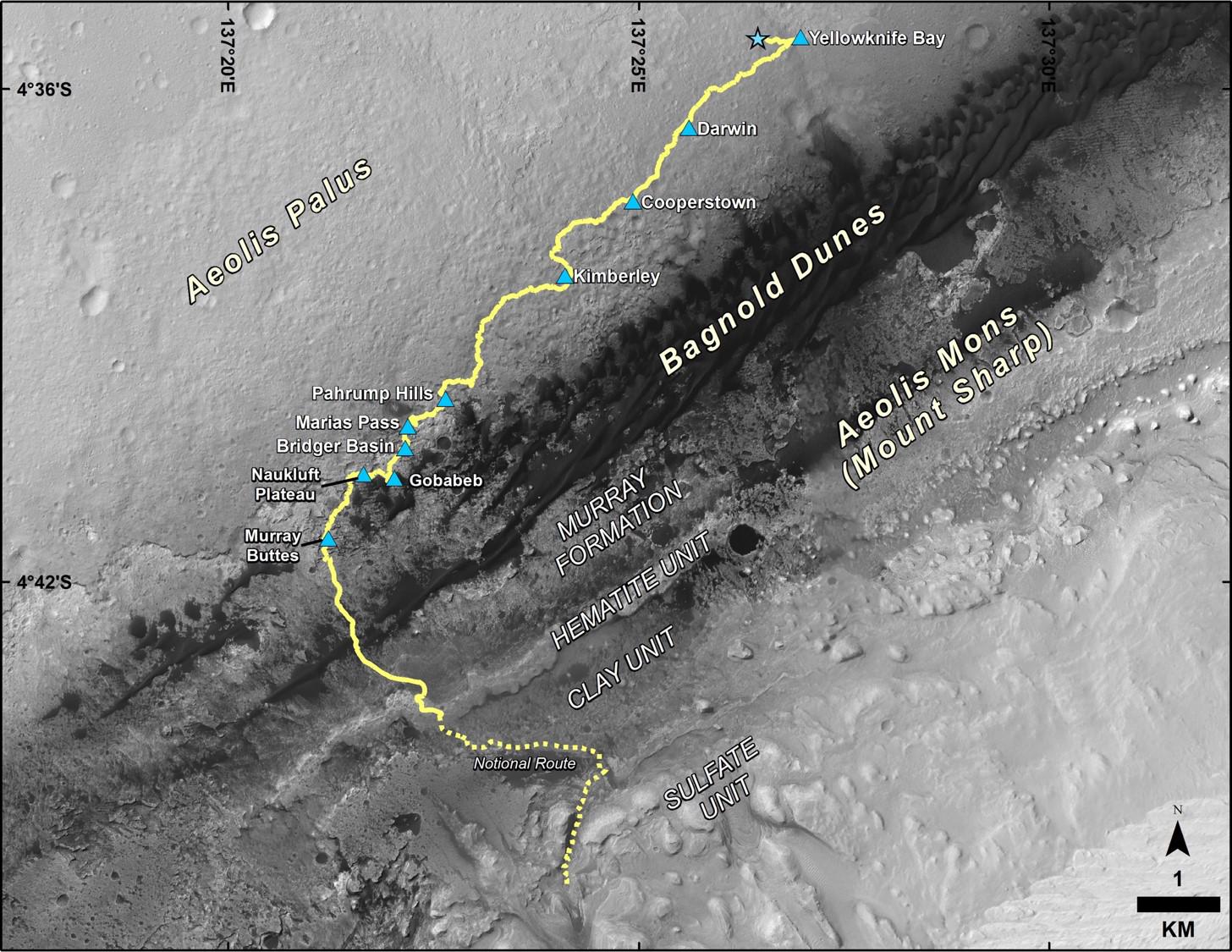
PIA21144:
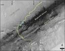
Late 2016 Map of NASA's Curiosity Mars Rover Mission
Full Resolution:
TIFF
(2.946 MB)
JPEG
(288 kB)
2016-12-13
Mars
Mars Science Laboratory (MSL)
1490x804x3
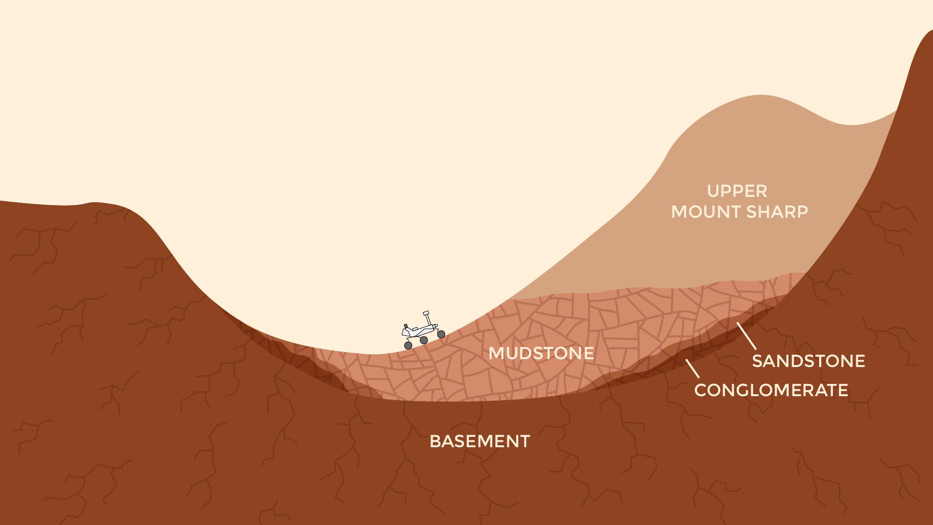
PIA21145:
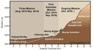
Curiosity Rover's Martian Mission, Exaggerated Cross Section
Full Resolution:
TIFF
(994.6 kB)
JPEG
(101.3 kB)
2016-12-13
Mars
Mars Science Laboratory (MSL)
CheMin
1708x982x3
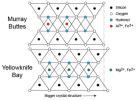
PIA21146:
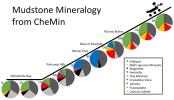
Mudstone Mineralogy from Curiosity's CheMin, 2013 to 2016
Full Resolution:
TIFF
(796.4 kB)
JPEG
(126.5 kB)
2016-12-13
Mars
Mars Science Laboratory (MSL)
CheMin
660x424x3
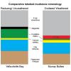
PIA21147:
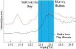
Detecting a Difference in Clay Minerals at Two Gale Crater Sites
Full Resolution:
TIFF
(216.5 kB)
JPEG
(30.38 kB)
2016-12-13
Mars
Mars Science Laboratory (MSL)
CheMin
534x391x3
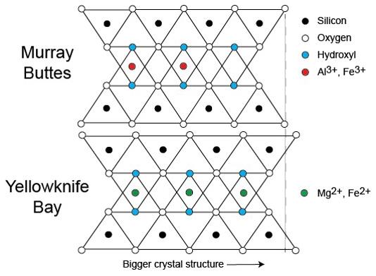
PIA21148:
Clay Mineral Crystal Structure Tied to Composition
Full Resolution:
TIFF
(131.6 kB)
JPEG
(35.44 kB)
2016-12-13
Mars
Mars Science Laboratory (MSL)
CheMin
583x583x3
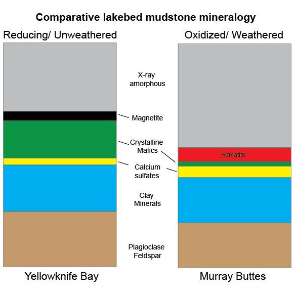
PIA21149:
Mineral Content Comparison at Two Gale Crater Sites
Full Resolution:
TIFF
(178.4 kB)
JPEG
(34.83 kB)
2016-12-13
Mars
Mars Reconnaissance Orbiter (MRO)
Mars Science Laboratory (MSL)
ChemCam
HiRISE
2809x2025x3
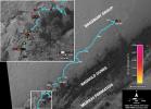
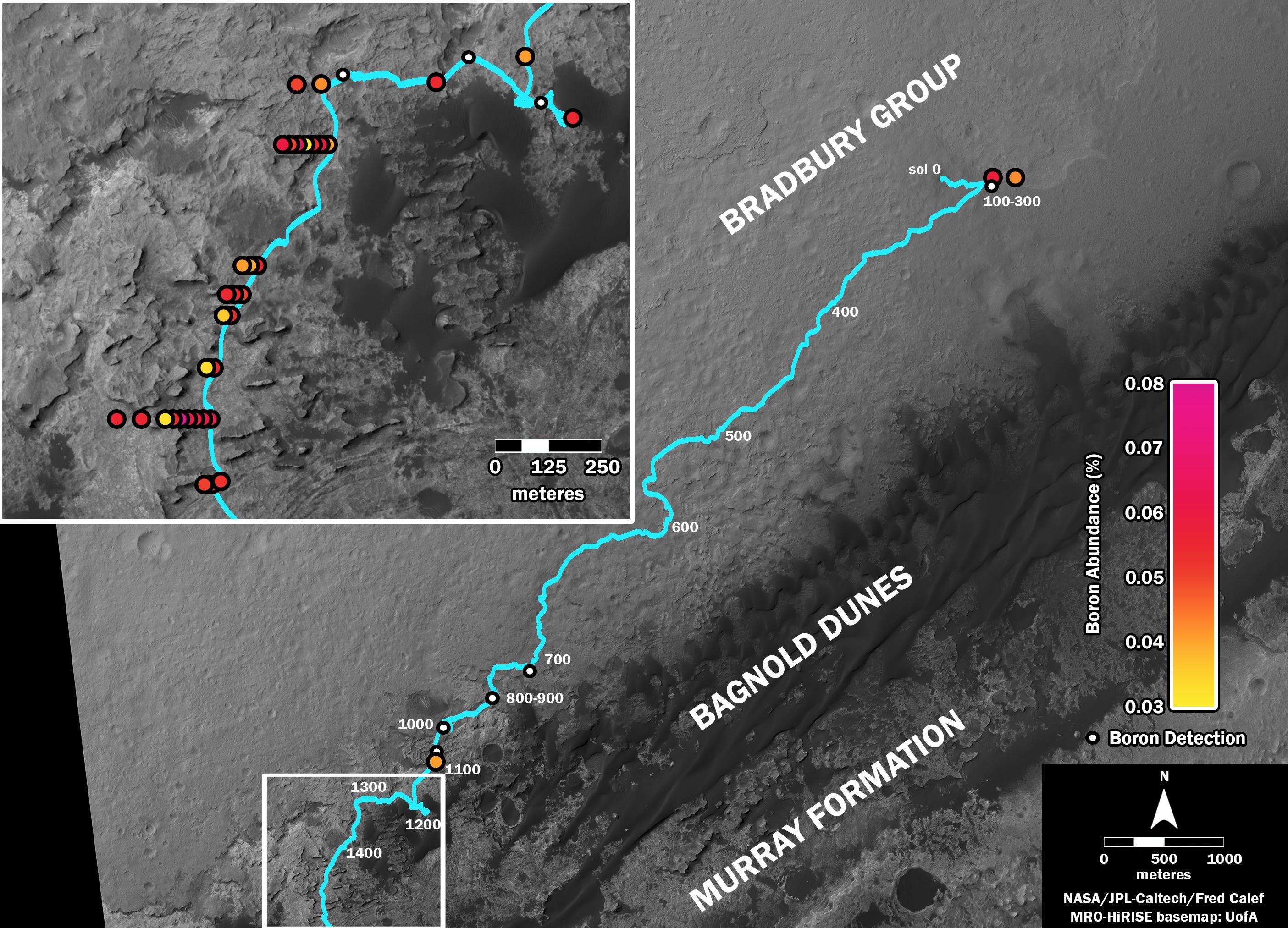
PIA21150:
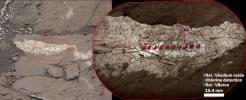
Where's Boron? Mars Rover Detects It
Full Resolution:
TIFF
(7.738 MB)
JPEG
(838.4 kB)
2016-12-13
Mars
Mars Science Laboratory (MSL)
ChemCam
Mastcam
1996x1758x3
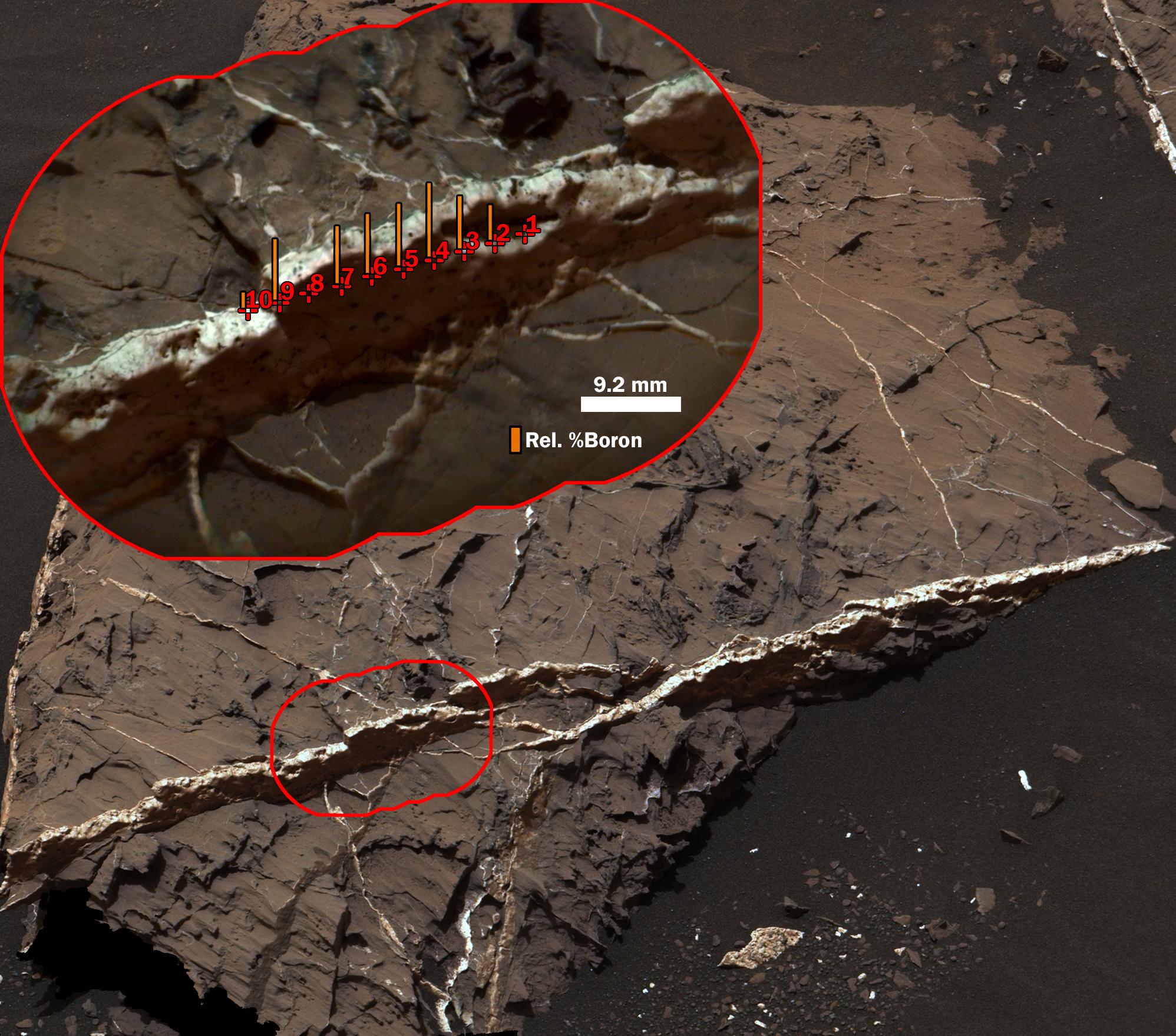
PIA21251:
Boron in Calcium Sulfate Vein at 'Catabola,' Mars
Full Resolution:
TIFF
(9.623 MB)
JPEG
(465.6 kB)
2016-12-13
Mars
Mars Science Laboratory (MSL)
ChemCam
Mastcam
2399x974x3
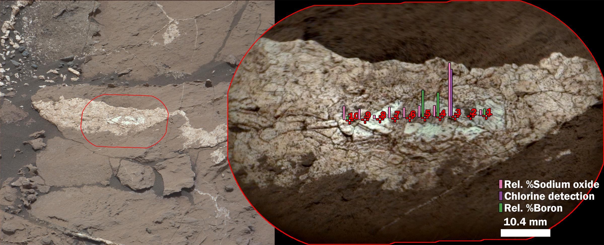
PIA21252:
Boron, Sodium and Chlorine in Mineral Vein 'Diyogha,' Mars
Full Resolution:
TIFF
(6.453 MB)
JPEG
(339.6 kB)
2016-12-13
Mars
Mars Science Laboratory (MSL)
2969x1612x3
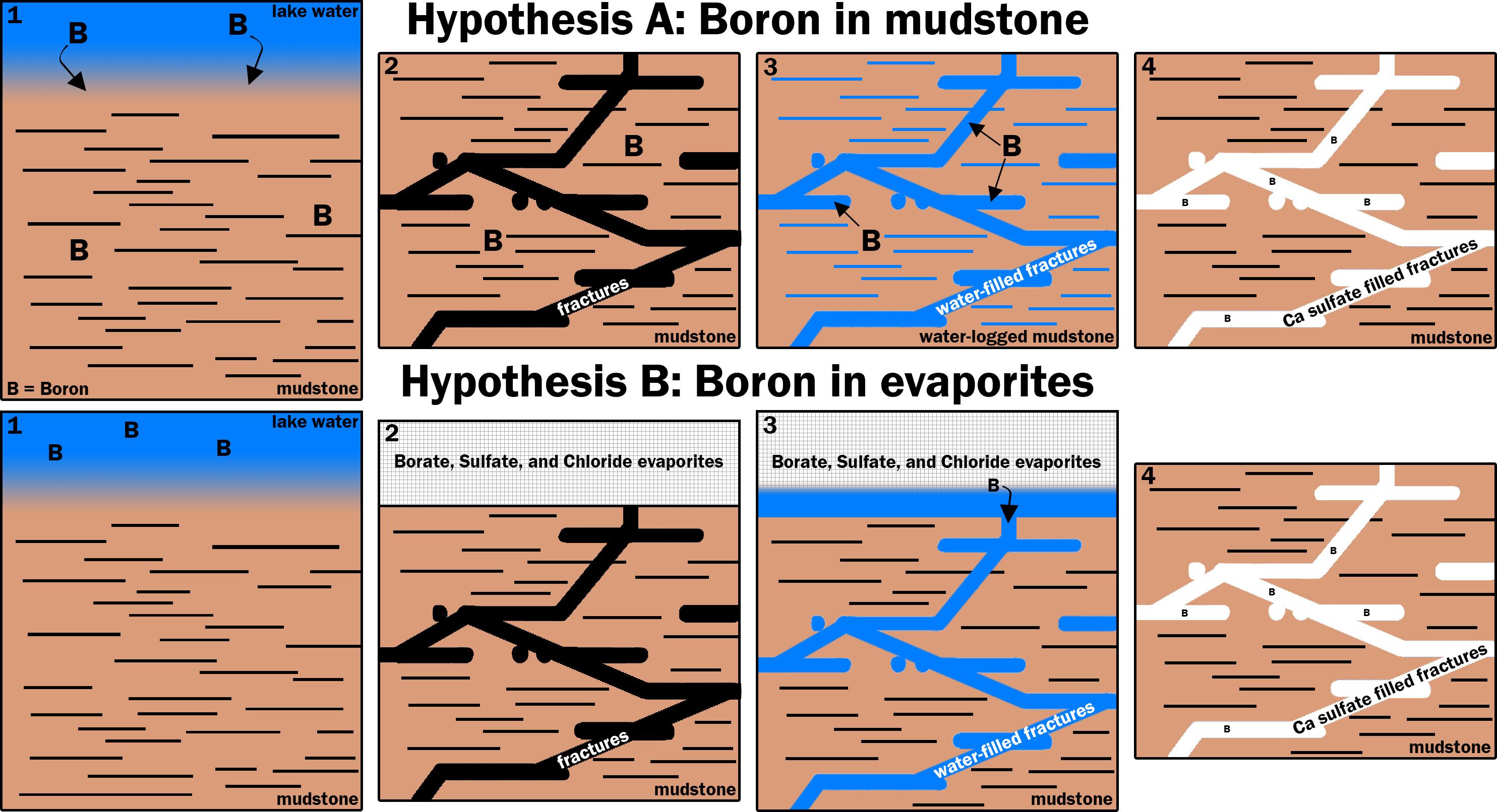
PIA21253:
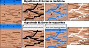
Two Possible Ways Boron Got into Veins on Mount Sharp
Full Resolution:
TIFF
(1.52 MB)
JPEG
(540.5 kB)
2016-12-13
Mars
Mars Reconnaissance Orbiter (MRO)
Mars Science Laboratory (MSL)
HiRISE
MAHLI
3300x2550x3
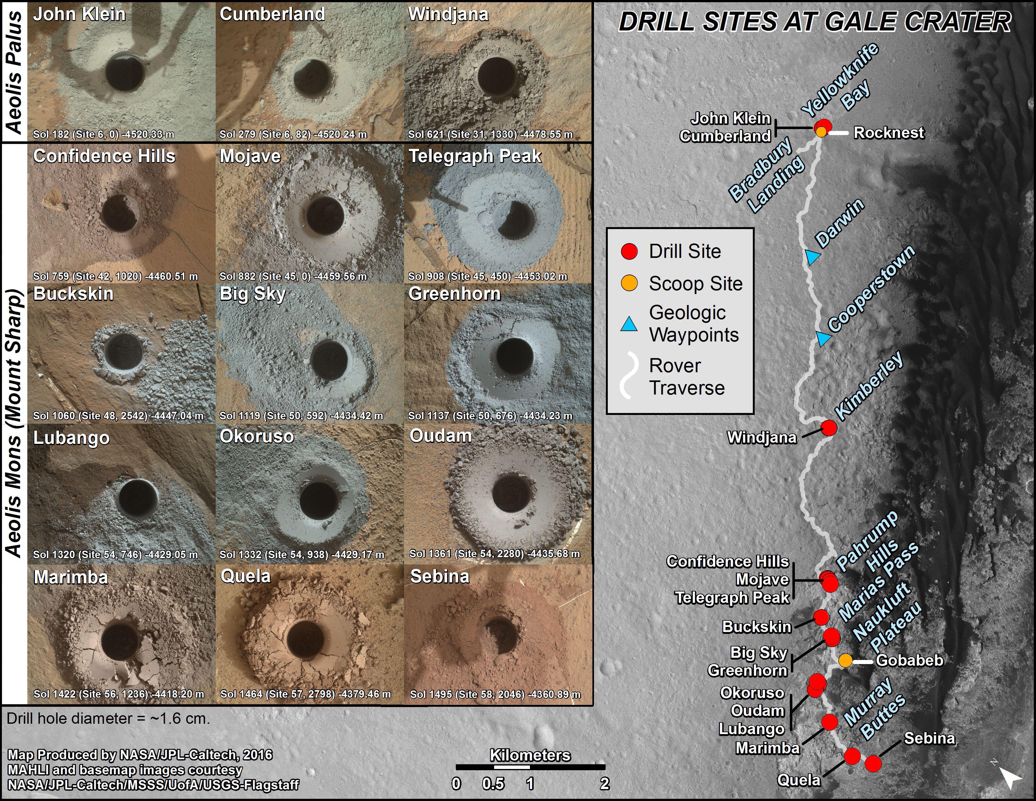
PIA21254:
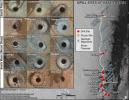
Curiosity's Rock or Soil Sampling Sites on Mars, Through November 2016
Full Resolution:
TIFF
(21.14 MB)
JPEG
(2.213 MB)
2016-12-13
Mars
Mars Science Laboratory (MSL)
1920x1080x3
PIA21255:
Now and Long Ago at Gale Crater, Mars (Illustration)
Full Resolution:
TIFF
(491.6 kB)
JPEG
(77.52 kB)
2016-12-13
Mars
Mars Science Laboratory (MSL)
Mastcam
3480x1252x3
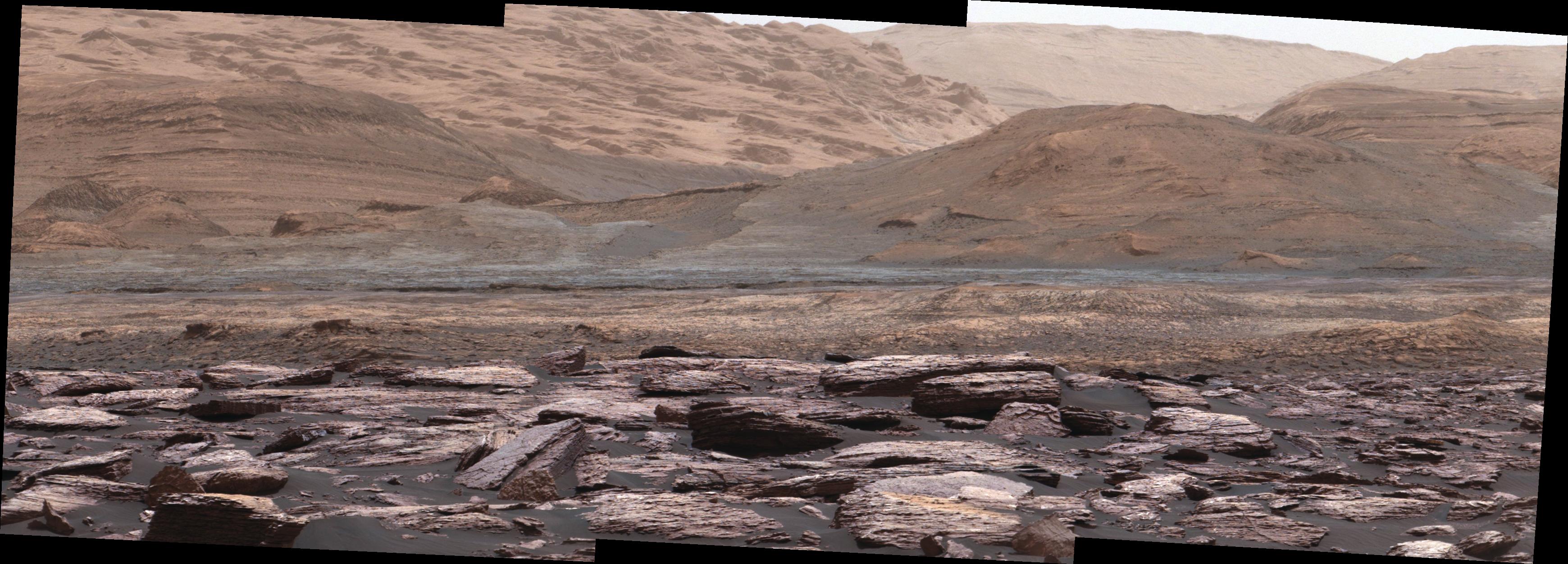
PIA21256:
Color Variations on Mount Sharp, Mars (White Balanced)
Full Resolution:
TIFF
(12.05 MB)
JPEG
(631.9 kB)
2016-12-14
Mars
2001 Mars Odyssey
THEMIS
668x1428x1
PIA21190:
Terra Sirenum Channel
Full Resolution:
TIFF
(732.2 kB)
JPEG
(111.3 kB)
2016-12-14
Mars
Mars Reconnaissance Orbiter (MRO)
HiRISE
2880x1800x1
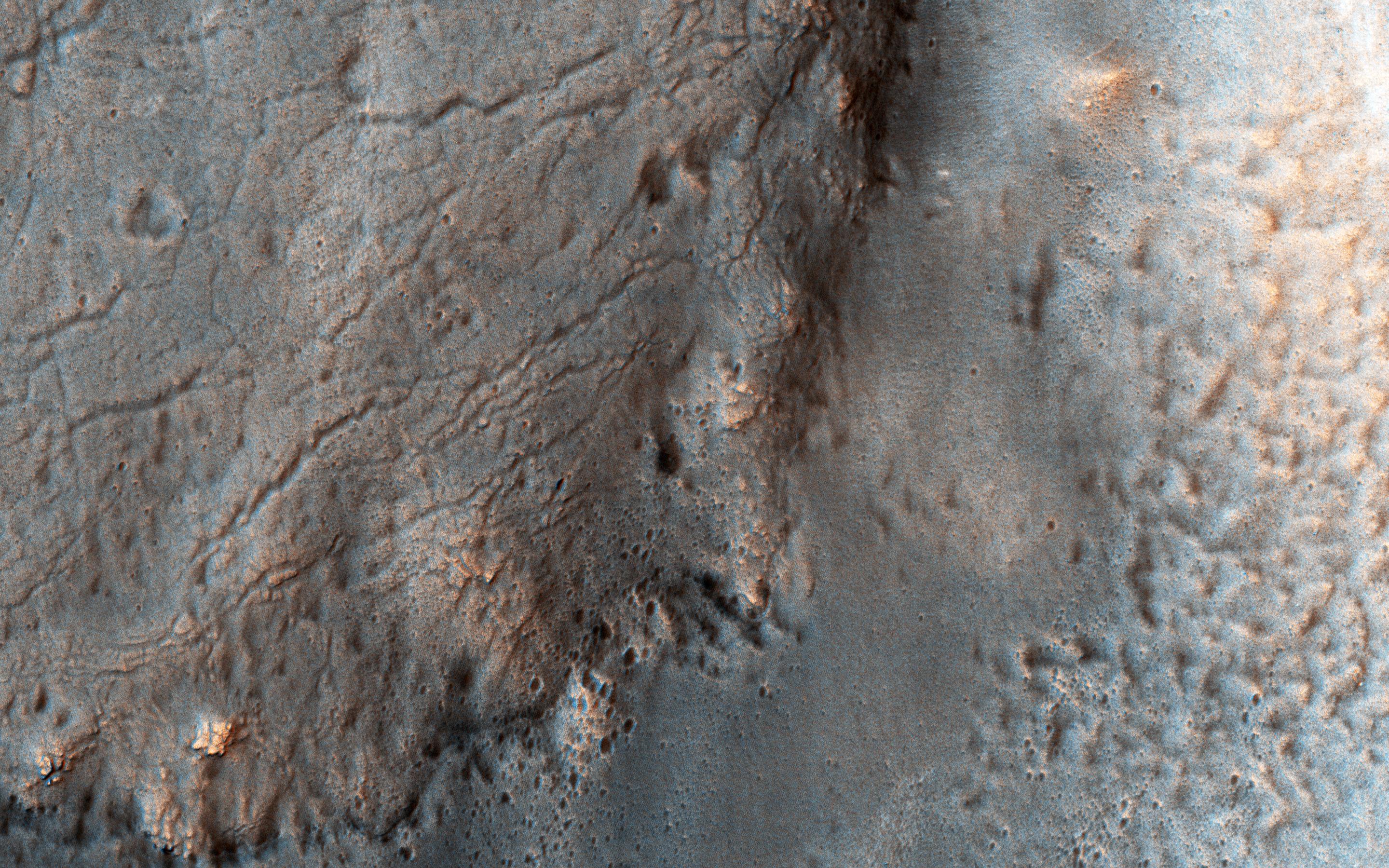
PIA21271:
Fans on Crater Rims
Full Resolution:
TIFF
(5.191 MB)
JPEG
(1.075 MB)
2016-12-14
Mars
Mars Reconnaissance Orbiter (MRO)
HiRISE
2880x1800x1
PIA21272:
Slope Streaks or RSL?
Full Resolution:
TIFF
(4.836 MB)
JPEG
(569.6 kB)
2016-12-14
Mars
Mars Reconnaissance Orbiter (MRO)
HiRISE
2880x1800x3
PIA21273:
Possible Layers on Floor of Suzhi Crater
Full Resolution:
TIFF
(15.56 MB)
JPEG
(998.8 kB)
2016-12-14
Mars
Mars Reconnaissance Orbiter (MRO)
HiRISE
2880x1800x3
PIA21274:
Hematite-Rich Deposits in Capri Chasma
Full Resolution:
TIFF
(13.86 MB)
JPEG
(446.5 kB)
2016-12-15
Mars
2001 Mars Odyssey
THEMIS
1346x2654x1
PIA21191:
Arda Valles
Full Resolution:
TIFF
(2.74 MB)
JPEG
(397.2 kB)
2016-12-16
Mars
2001 Mars Odyssey
THEMIS
673x1433x1
PIA21192:
Hale Crater
Full Resolution:
TIFF
(712.7 kB)
JPEG
(93.77 kB)
2016-12-19
Mars
2001 Mars Odyssey
THEMIS
689x1544x3
PIA21193:
Gale Crater - False Color
Full Resolution:
TIFF
(2.172 MB)
JPEG
(89.09 kB)
2016-12-20
Mars
2001 Mars Odyssey
THEMIS
711x1552x3
PIA21194:
Mawrth Vallis - False Color
Full Resolution:
TIFF
(2.308 MB)
JPEG
(115.8 kB)
2016-12-20
Mars
Mars Reconnaissance Orbiter (MRO)
HiRISE
369x302x1
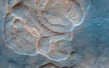
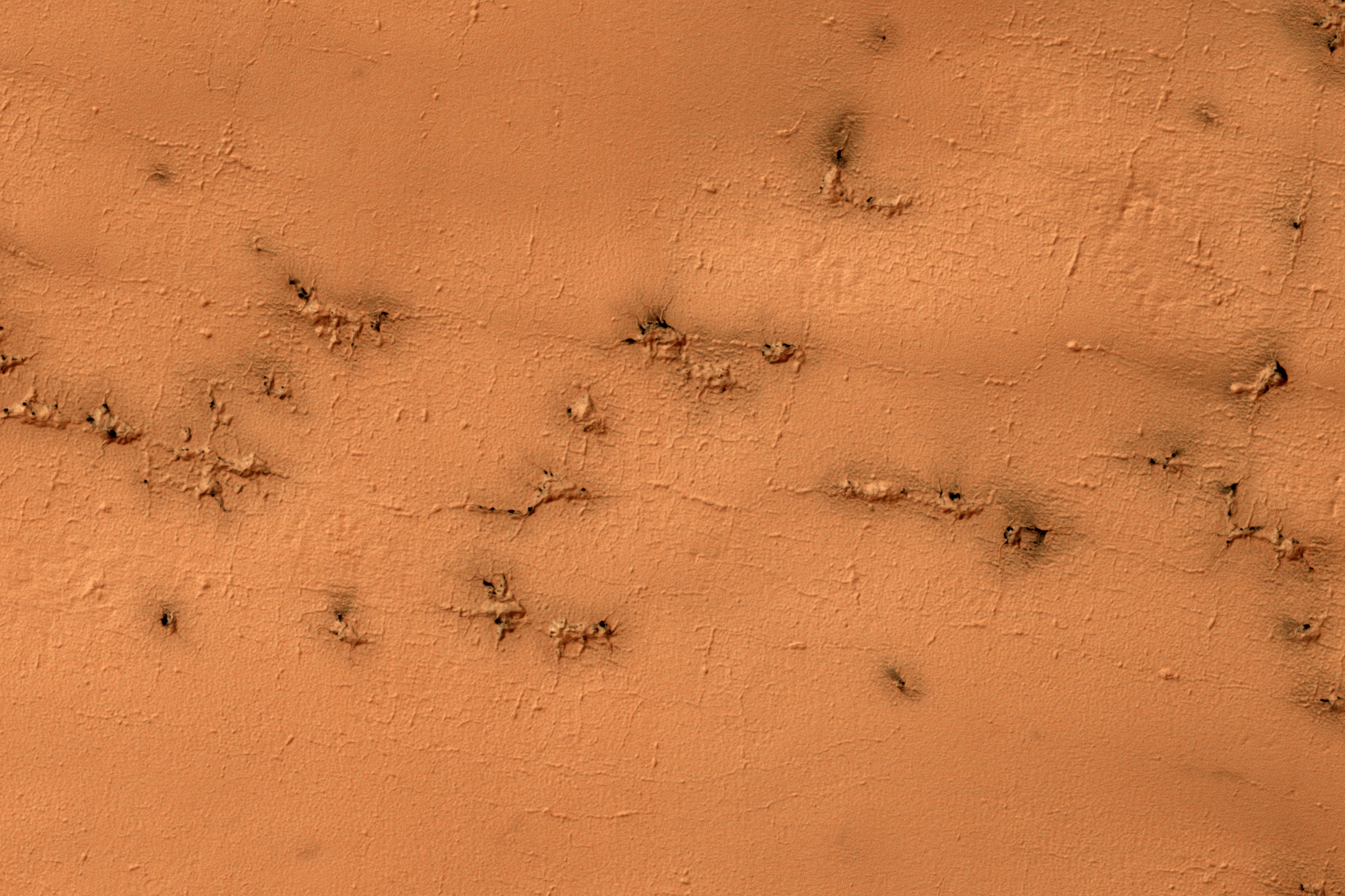
PIA21257:
'Baby Spider': Growth of a Martian Trough Network
Full Resolution:
TIFF
(111.8 kB)
JPEG
(24.75 kB)
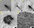
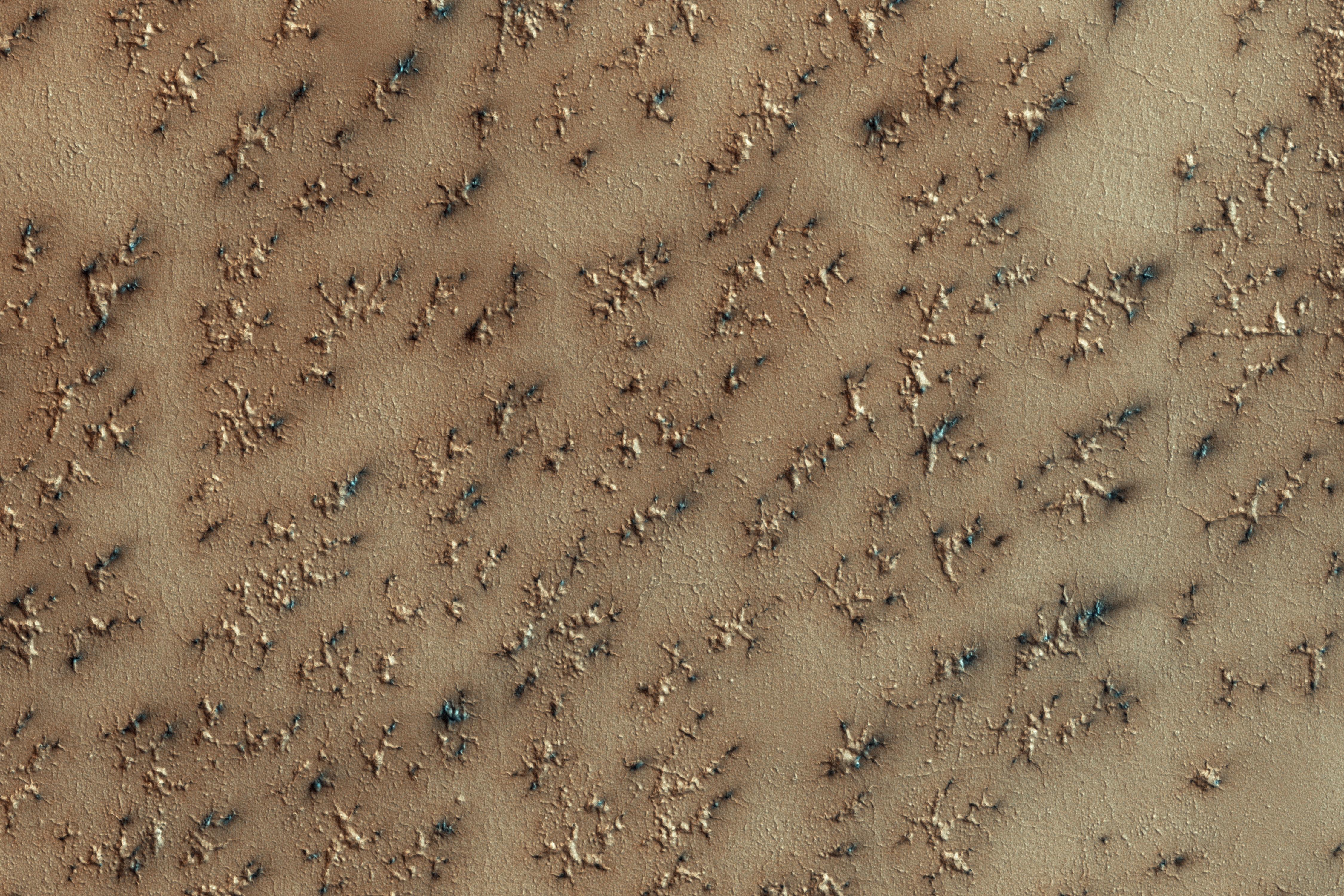
2016-12-20
Mars
Mars Reconnaissance Orbiter (MRO)
HiRISE
2110x1745x3
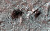
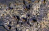
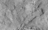
PIA21258:
Possible Development Stages of Martian 'Spiders'
Full Resolution:
TIFF
(5.708 MB)
JPEG
(557 kB)
2016-12-21
Mars
2001 Mars Odyssey
THEMIS
692x1542x3
PIA21195:
Aram Chaos - False Color
Full Resolution:
TIFF
(2.243 MB)
JPEG
(112.6 kB)
2016-12-21
Mars
Mars Reconnaissance Orbiter (MRO)
HiRISE
2880x1800x3
PIA14450:
Secondary Craters
Full Resolution:
TIFF
(13.96 MB)
JPEG
(384.2 kB)
2016-12-21
Mars
Mars Reconnaissance Orbiter (MRO)
HiRISE
2880x1800x1
PIA14451:
Lace on Mars
Full Resolution:
TIFF
(5.191 MB)
JPEG
(1.415 MB)
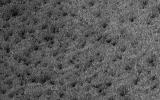
2016-12-21
Mars
Mars Reconnaissance Orbiter (MRO)
HiRISE
2880x1800x3
PIA14452:
Spiders on Mounds
Full Resolution:
TIFF
(15.56 MB)
JPEG
(1.445 MB)
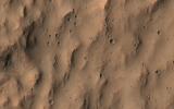
2016-12-21
Mars
Mars Reconnaissance Orbiter (MRO)
HiRISE
2880x1800x3
PIA14453:
Soffen Crater Floor
Full Resolution:
TIFF
(15.56 MB)
JPEG
(692.6 kB)
2016-12-22
Mars
2001 Mars Odyssey
THEMIS
688x1538x3
PIA21196:
Gale Crater - False Color
Full Resolution:
TIFF
(2.127 MB)
JPEG
(105.3 kB)
2016-12-23
Mars
2001 Mars Odyssey
THEMIS
691x1539x3
PIA21197:
Meridiani Planum - False Color
Full Resolution:
TIFF
(2.248 MB)
JPEG
(113.6 kB)
2016-12-26
Mars
2001 Mars Odyssey
THEMIS
698x1541x3
PIA21198:
Danielson Crater - False Color
Full Resolution:
TIFF
(2.157 MB)
JPEG
(106.2 kB)
2016-12-27
Mars
2001 Mars Odyssey
THEMIS
692x1539x3
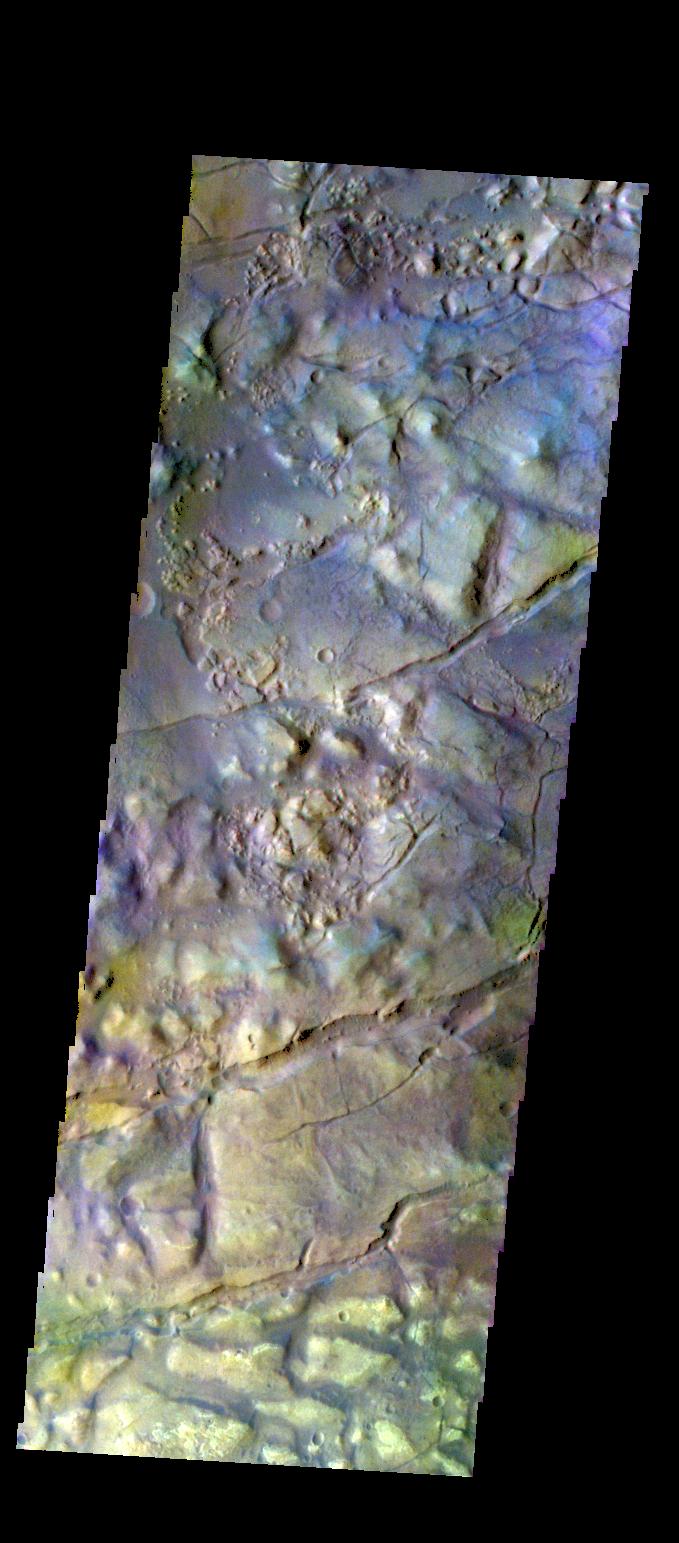
PIA21199:
Juventae Chasma - False Color
Full Resolution:
TIFF
(2.213 MB)
JPEG
(94.9 kB)
2016-12-28
Mars
2001 Mars Odyssey
THEMIS
679x1539x3
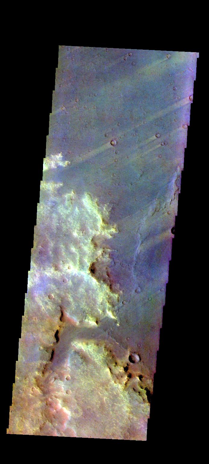
PIA21200:
Terra Sabaea - False Color
Full Resolution:
TIFF
(2.245 MB)
JPEG
(159.7 kB)
2016-12-29
Mars
2001 Mars Odyssey
THEMIS
681x1537x3
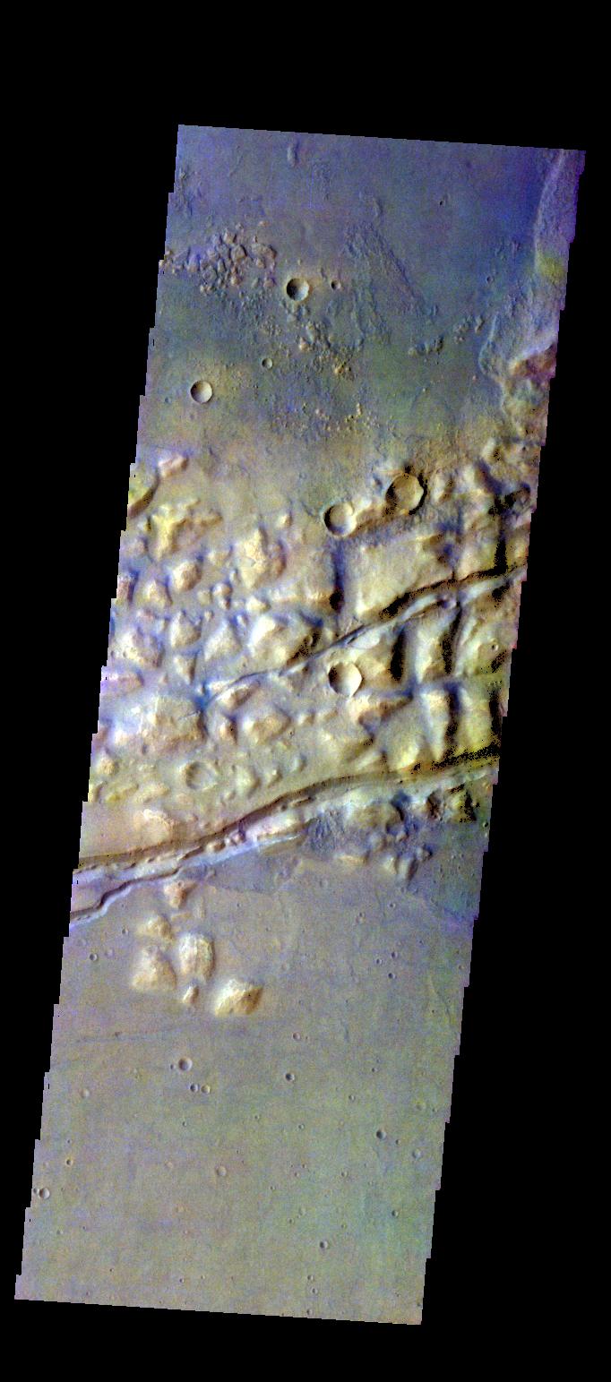
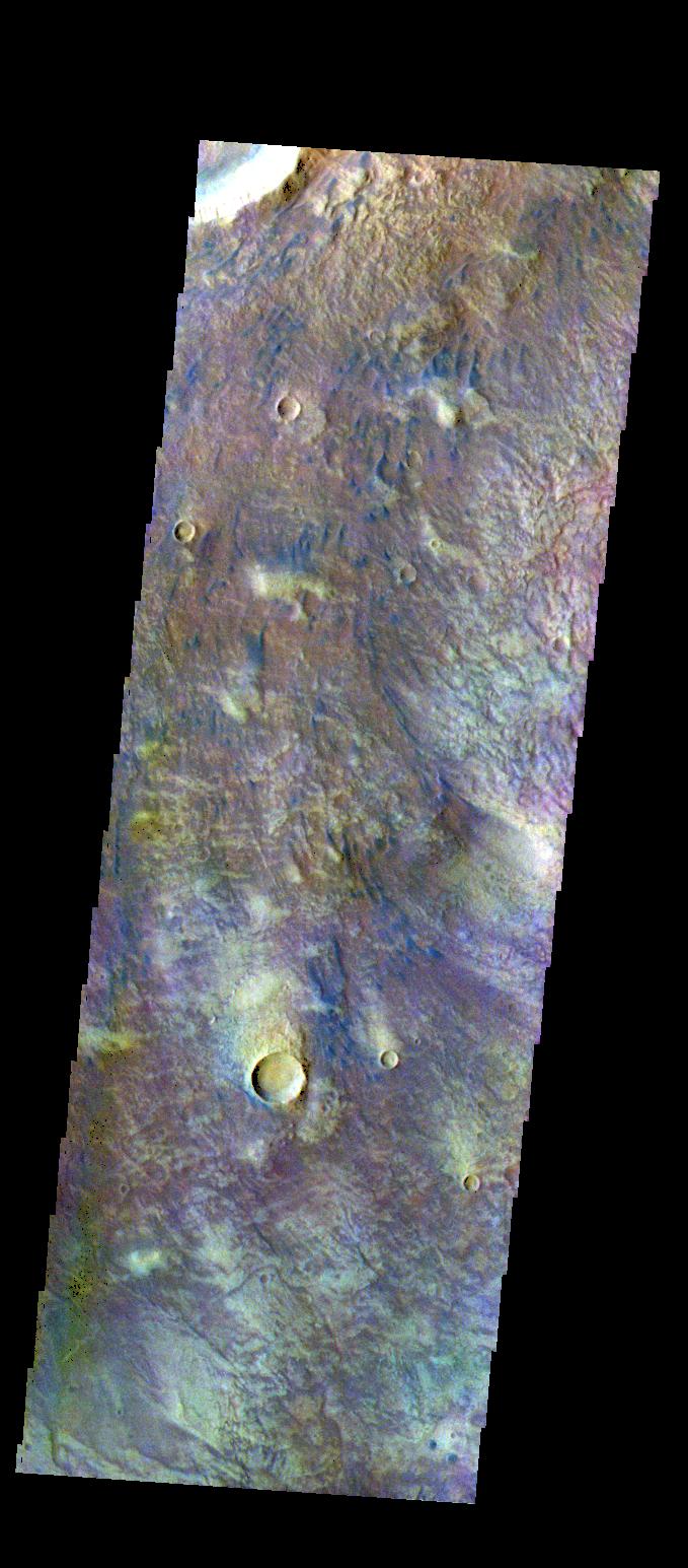
PIA21276:
Arda Valles - False Color
Full Resolution:
TIFF
(2.218 MB)
JPEG
(121.4 kB)
2016-12-30
Mars
2001 Mars Odyssey
THEMIS
679x1543x3
PIA21277:
Gorgonum Chaos - False Color
Full Resolution:
TIFF
(2.215 MB)
JPEG
(120.3 kB)
2017-01-02
Mars
2001 Mars Odyssey
THEMIS
694x1539x3
PIA21278:
Syrtis Major Planum - False Color
Full Resolution:
TIFF
(2.225 MB)
JPEG
(124.1 kB)
2017-01-02
Mars
Mars Reconnaissance Orbiter (MRO)
HiRISE
2880x1800x3
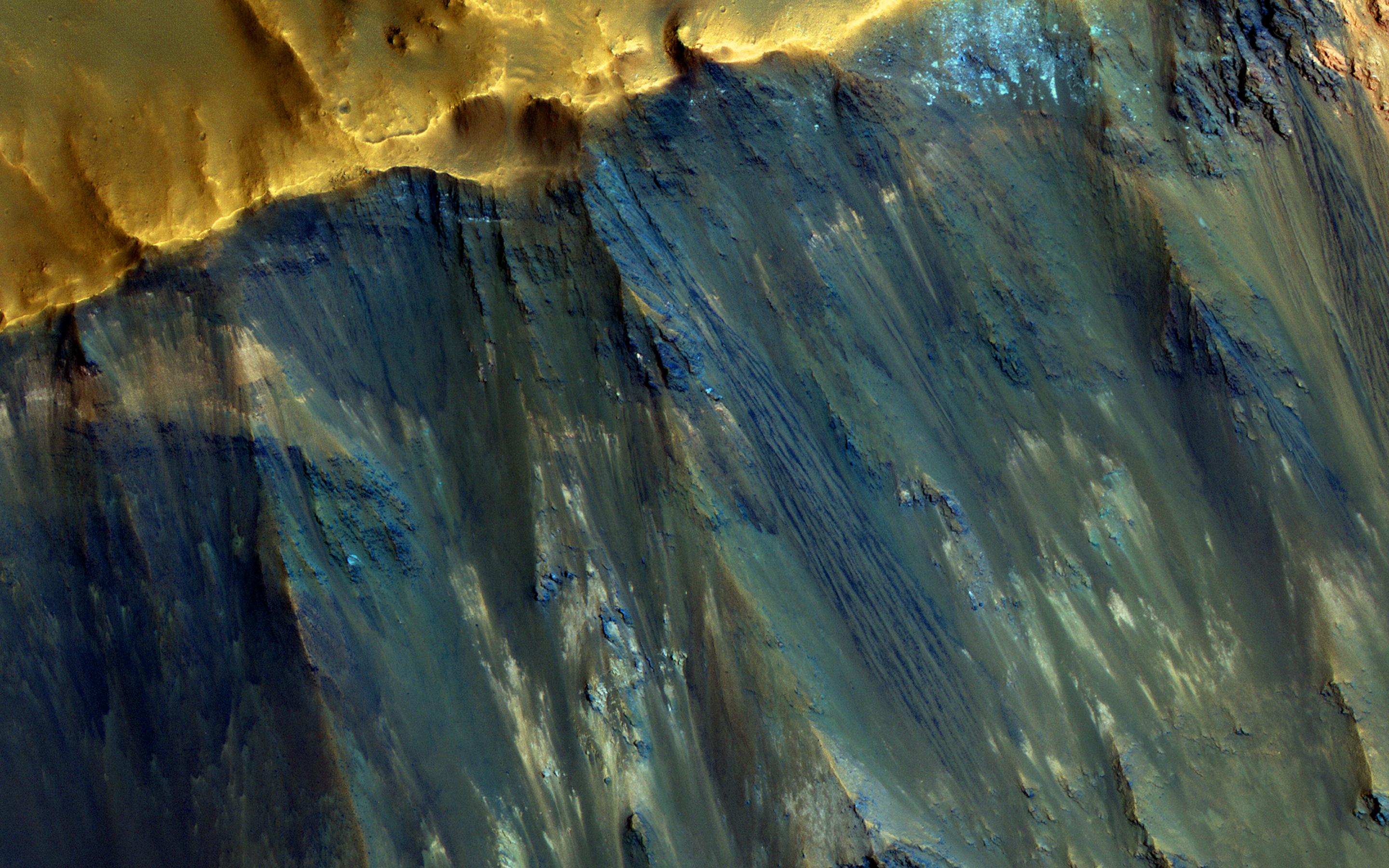
PIA14454:
Hues in a Crater Slope
Full Resolution:
TIFF
(15.56 MB)
JPEG
(743.1 kB)
2017-01-03
Mars
2001 Mars Odyssey
THEMIS
682x1543x3
PIA21279:
Gorgonum Chaos - False Color
Full Resolution:
TIFF
(2.154 MB)
JPEG
(120.3 kB)
2017-01-03
Mars
Mars Reconnaissance Orbiter (MRO)
HiRISE
2880x1800x3
PIA14455:
Light-Toned Layering in a Labyrinthus Noctis Pit
Full Resolution:
TIFF
(15.56 MB)
JPEG
(1.026 MB)
2017-01-04
Mars
2001 Mars Odyssey
THEMIS
679x1545x3
PIA21280:
Newton Crater - False Color
Full Resolution:
TIFF
(2.227 MB)
JPEG
(137.3 kB)
2017-01-05
Mars
2001 Mars Odyssey
THEMIS
682x1538x3
PIA21281:
Terra Sabaea - False Color
Full Resolution:
TIFF
(2.184 MB)
JPEG
(130.8 kB)
2017-01-05
Mars
Mars Reconnaissance Orbiter (MRO)
HiRISE
2880x1800x3
PIA15149:
Raised Bedrock in Terra Cimmeria
Full Resolution:
TIFF
(15.56 MB)
JPEG
(734 kB)
2017-01-06
Mars
2001 Mars Odyssey
THEMIS
692x1539x3
PIA21282:
Firsoff Crater - False Color
Full Resolution:
TIFF
(2.208 MB)
JPEG
(115 kB)
2017-01-09
Mars
2001 Mars Odyssey
THEMIS
1363x2645x1
PIA21283:
Memnonia Sulci
Full Resolution:
TIFF
(2.863 MB)
JPEG
(429.7 kB)
2017-01-09
Mars
Mars Reconnaissance Orbiter (MRO)
HiRISE
2880x1800x3
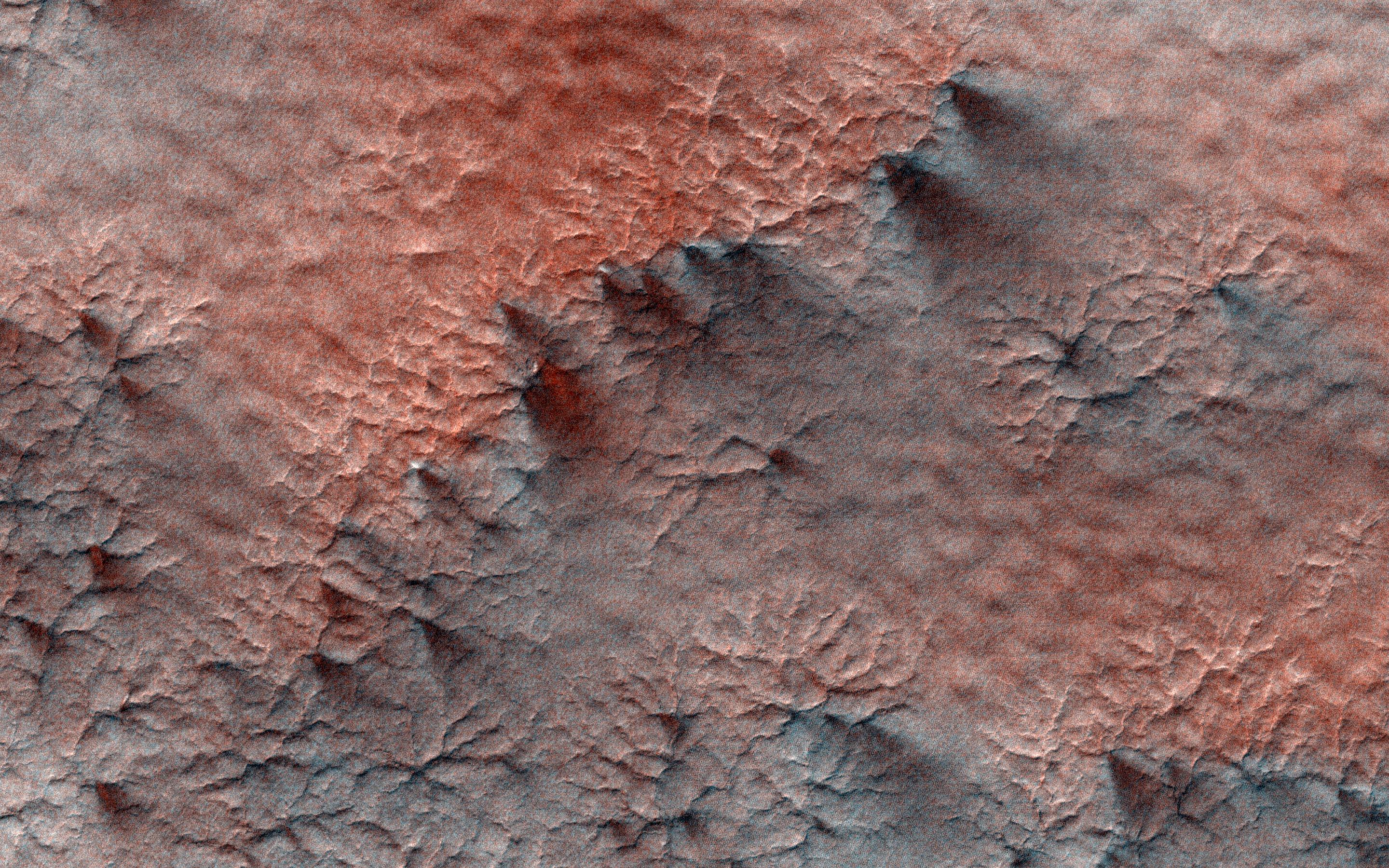
PIA13485:
Eroded Scallops with Layers
Full Resolution:
TIFF
(15.56 MB)
JPEG
(1.153 MB)
2017-01-10
Mars
2001 Mars Odyssey
THEMIS
1334x2692x1
PIA21285:
Noachis Terra Dunes
Full Resolution:
TIFF
(2.232 MB)
JPEG
(212.8 kB)
2017-01-10
Mars
Mars Reconnaissance Orbiter (MRO)
HiRISE
2880x1800x1
PIA13181:
Muddy Ejecta Flow
Full Resolution:
TIFF
(5.191 MB)
JPEG
(1.387 MB)
2017-01-11
Mars
2001 Mars Odyssey
THEMIS
1322x2672x1
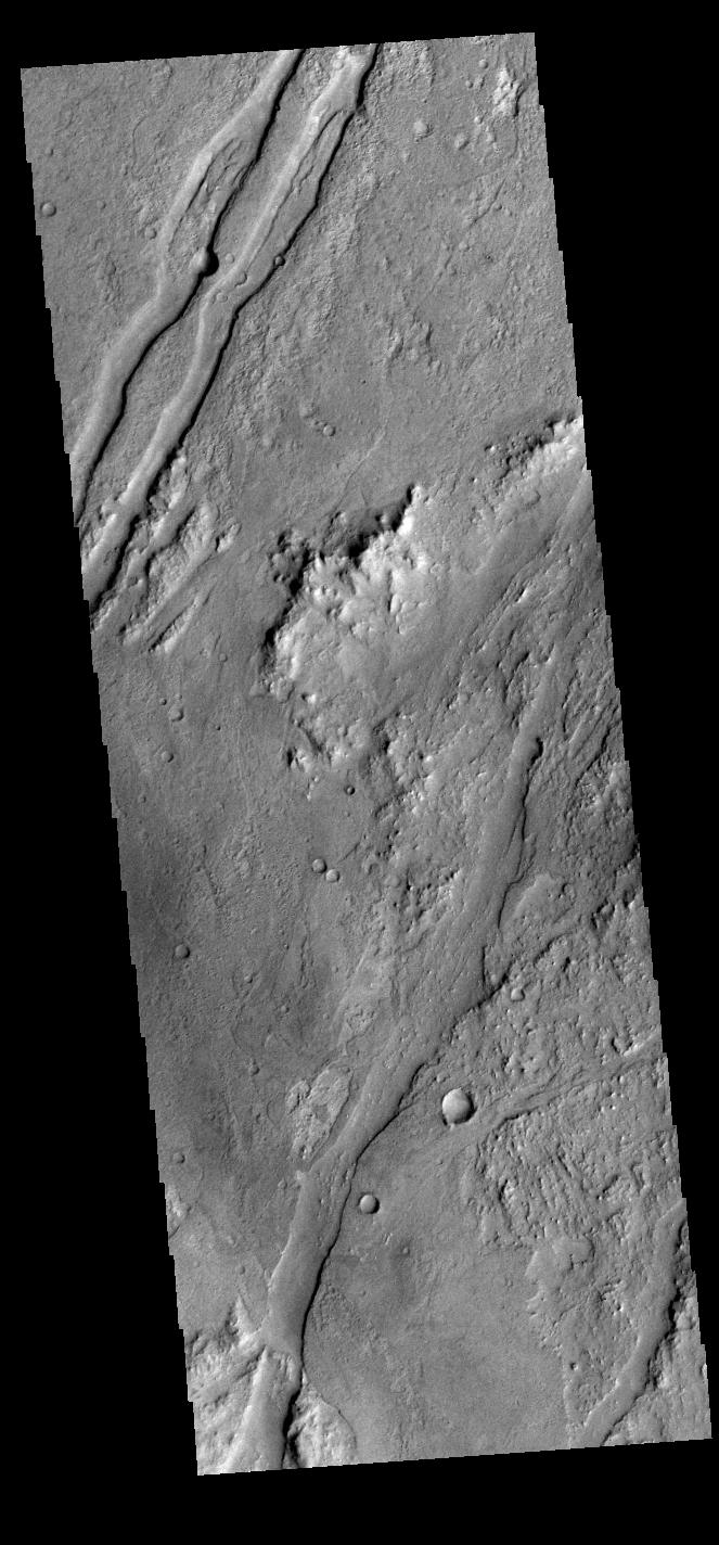
PIA21286:
Noachis Terra Channels
Full Resolution:
TIFF
(2.43 MB)
JPEG
(261.1 kB)
2017-01-11
Mars
Mars Reconnaissance Orbiter (MRO)
HiRISE
2880x1800x3
PIA13151:
Wide, Branching Channels
Full Resolution:
TIFF
(15.56 MB)
JPEG
(1.306 MB)
2017-01-12
Mars
2001 Mars Odyssey
THEMIS
671x1426x1
PIA21287:
Sirenum Fossae
Full Resolution:
TIFF
(679.6 kB)
JPEG
(81.82 kB)
2017-01-12
Mars
Mars Reconnaissance Orbiter (MRO)
HiRISE
2880x1800x3
PIA13078:
Well-Preserved Impact Ejecta and Impact Melt-Rich Deposits in Terra Sabaea
Full Resolution:
TIFF
(15.02 MB)
JPEG
(785.4 kB)
2017-01-13
Mars
2001 Mars Odyssey
THEMIS
663x1424x1
PIA21288:
Claritas Fossae
Full Resolution:
TIFF
(738.7 kB)
JPEG
(134.6 kB)
2017-01-13
Mars
Mars Reconnaissance Orbiter (MRO)
HiRISE
2880x1800x3
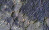
PIA12968:
Smooth and Fractured Deposits in Eridania Valleys
Full Resolution:
TIFF
(15.56 MB)
JPEG
(1.203 MB)
2017-01-16
Mars
2001 Mars Odyssey
THEMIS
1319x2680x1
PIA21289:
Terra Sirenum
Full Resolution:
TIFF
(2.447 MB)
JPEG
(294.5 kB)
2017-01-17
Mars
2001 Mars Odyssey
THEMIS
690x1538x3
PIA21290:
Coprates Chasma - False Color
Full Resolution:
TIFF
(2.083 MB)
JPEG
(85.21 kB)
2017-01-17
Mars
Mars Reconnaissance Orbiter (MRO)
HiRISE
4500x3000x3
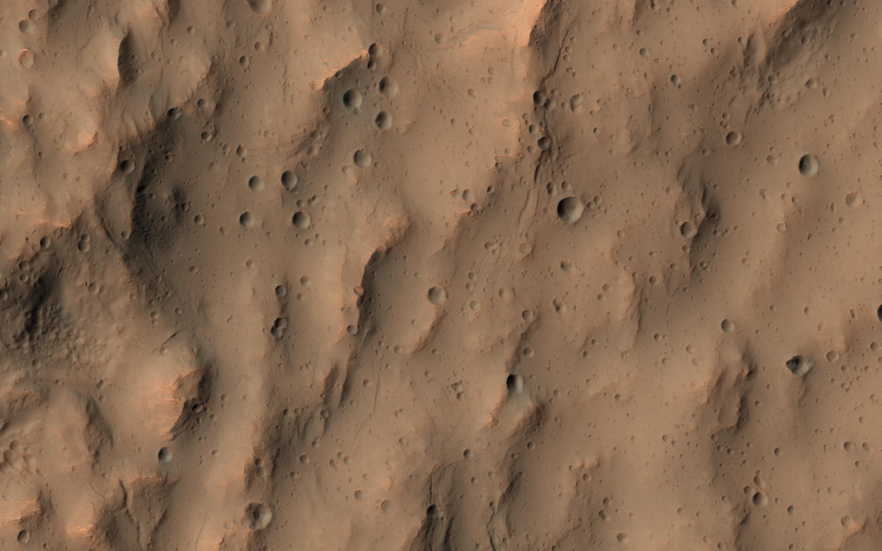
PIA12328:
Crater with Exposed Layers
Full Resolution:
TIFF
(40.16 MB)
JPEG
(2.299 MB)
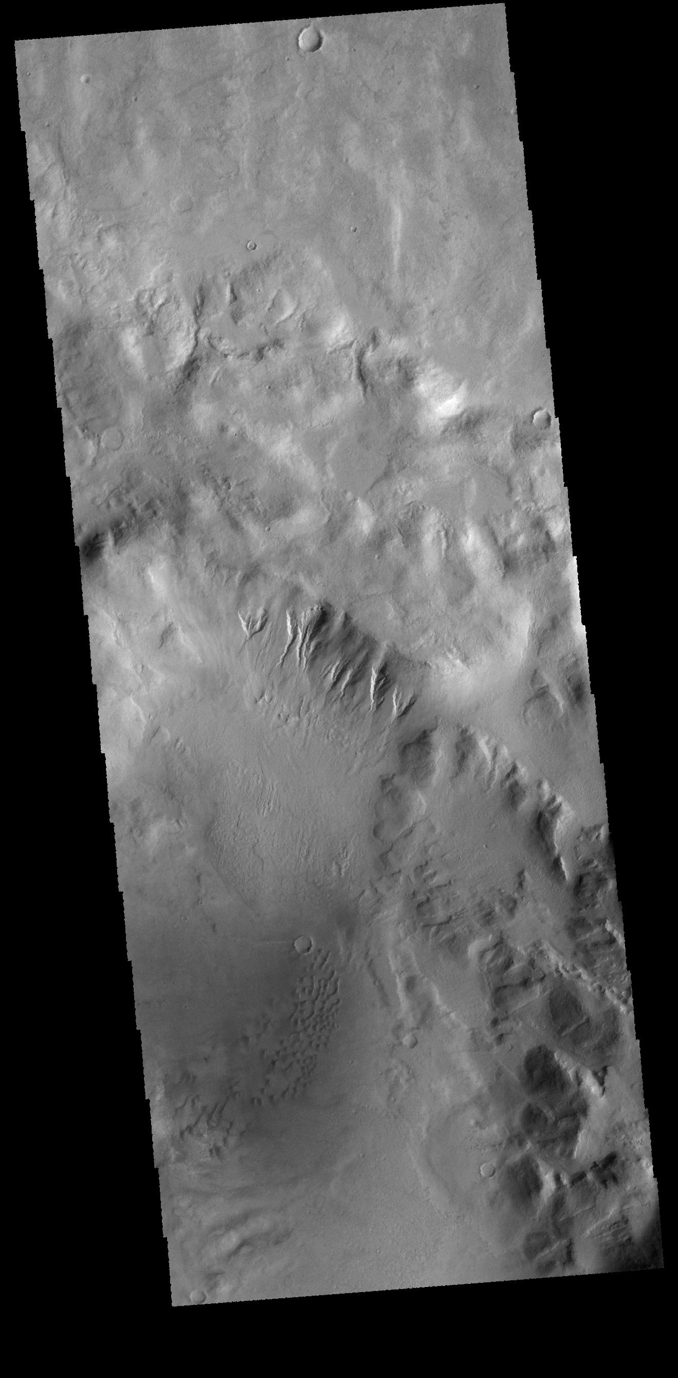
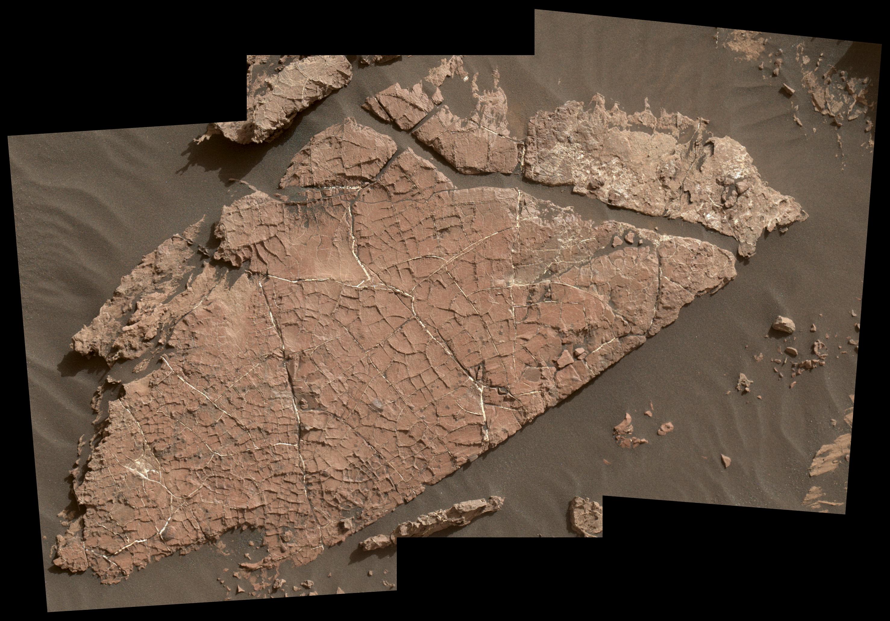
2017-01-17
Mars
Mars Science Laboratory (MSL)
MAHLI
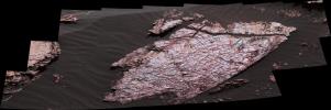
2954x2063x3
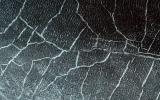
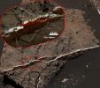
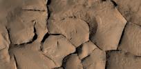
PIA21261:
Possible Mud Cracks Preserved in Martian Rock
Full Resolution:
TIFF
(13.89 MB)
JPEG
(809.2 kB)
2017-01-17
Mars
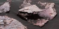
Mars Science Laboratory (MSL)
Mastcam
3705x1230x3
PIA21262:
Mars Rover's Mastcam View of Possible Mud Cracks
Full Resolution:
TIFF
(10.7 MB)
JPEG
(635.8 kB)
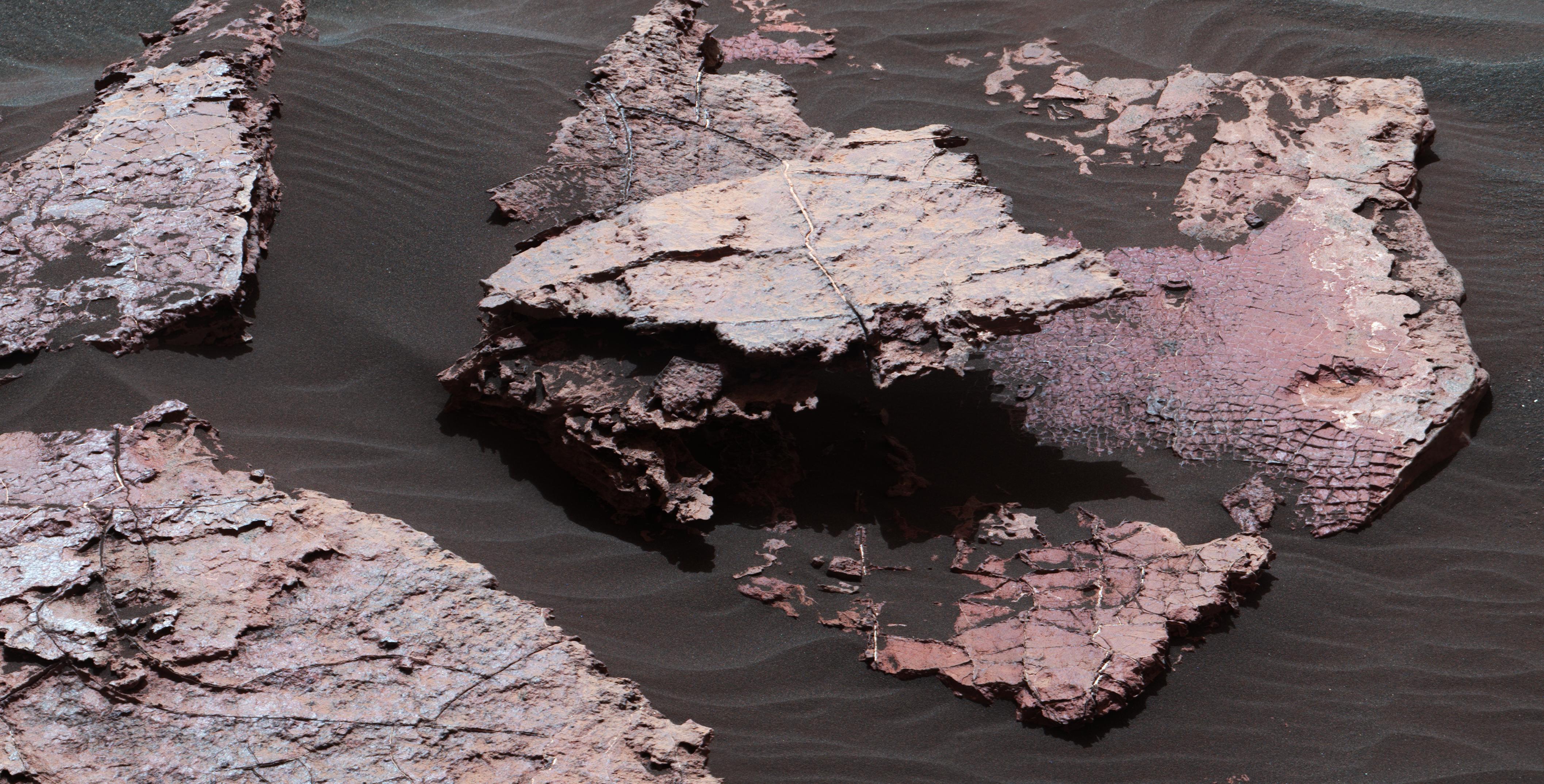
2017-01-17
Mars
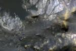
Mars Science Laboratory (MSL)
Mastcam
4229x2149x3
PIA21263:
Possible Signs of Ancient Drying in Martian Rock
Full Resolution:
TIFF
(27.28 MB)
JPEG
(1.565 MB)
2017-01-18
Mars
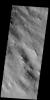
2001 Mars Odyssey
THEMIS
680x1548x3
PIA21291:
Rabe Crater Dunes - False Color
Full Resolution:
TIFF
(2.232 MB)
JPEG
(96.63 kB)
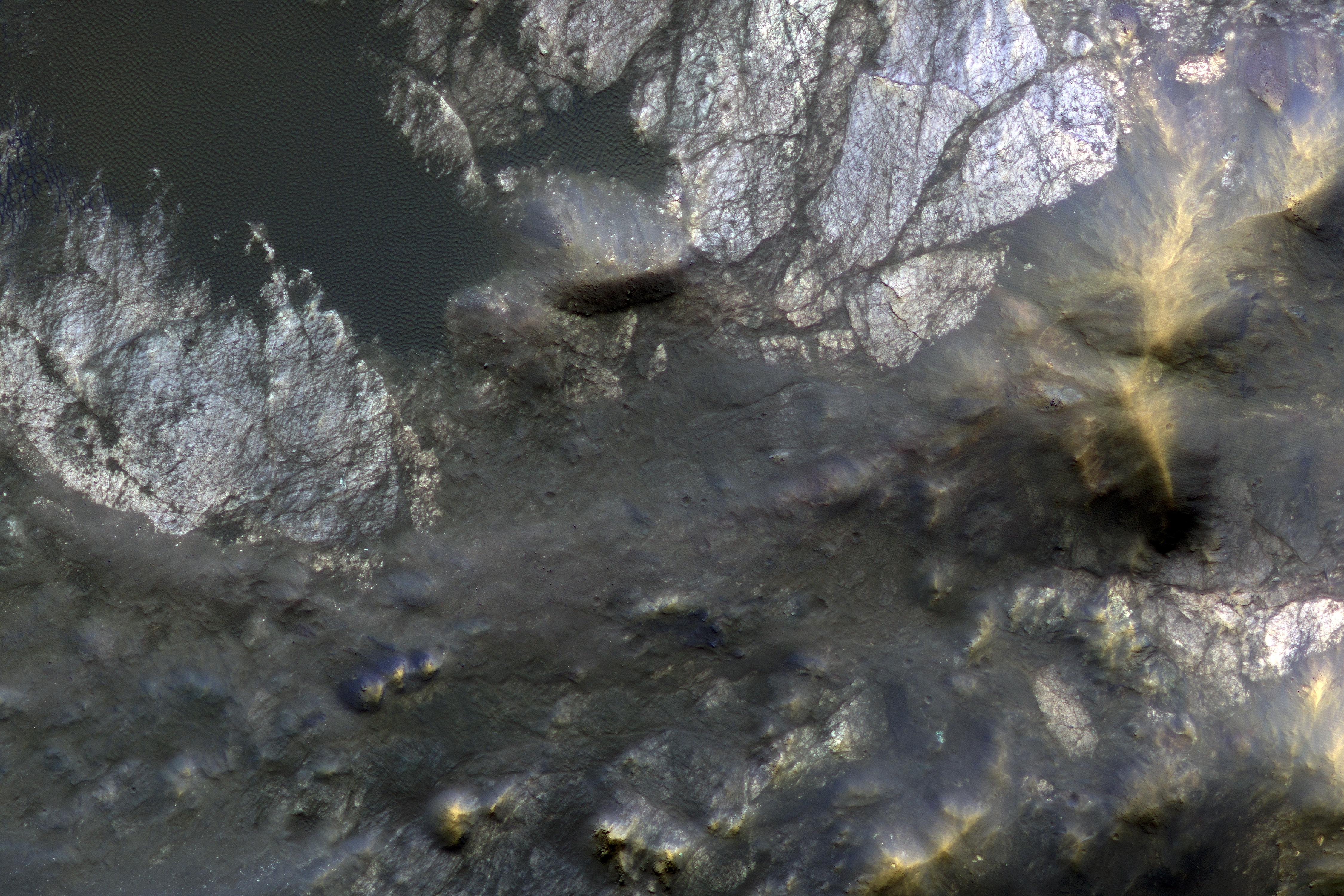
2017-01-18
Mars
Mars Reconnaissance Orbiter (MRO)
HiRISE
4500x3000x3
PIA12291:
Bedrock Exhumed from the Deep
Full Resolution:
TIFF
(38.2 MB)
JPEG
(2.161 MB)
2017-01-19
Mars
2001 Mars Odyssey
THEMIS
678x1543x3
PIA21292:
Hale Crater - False Color
Full Resolution:
TIFF
(2.114 MB)
JPEG
(112 kB)
2017-01-19
Mars
Mars Reconnaissance Orbiter (MRO)
HiRISE
4500x3000x3
PIA12289:
The Changing Dunes of Wirtz Crater
Full Resolution:
TIFF
(40.52 MB)
JPEG
(2.437 MB)
2017-01-20
Mars
2001 Mars Odyssey
THEMIS
692x1538x3
PIA21293:
Gale Crater - False Color
Full Resolution:
TIFF
(2.187 MB)
JPEG
(104.9 kB)
2017-01-20
Mars
Mars Reconnaissance Orbiter (MRO)
HiRISE
4500x3000x3
PIA12178:
The Beauty of Layered Stratigraphy
Full Resolution:
TIFF
(40.52 MB)
JPEG
(2.705 MB)
2017-01-23
Mars
2001 Mars Odyssey
THEMIS
1339x2676x1
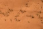
PIA21294:
Dust Devil Tracks
Full Resolution:
TIFF
(2.696 MB)
JPEG
(365.9 kB)
2017-01-24
Mars
2001 Mars Odyssey
THEMIS
683x1423x1
PIA21295:
Pollack Crater
Full Resolution:
TIFF
(626.4 kB)
JPEG
(68.14 kB)
2017-01-24
Mars
Mars Exploration Rover (MER)
Panoramic Camera
1024x1024x1
PIA12290:
Opportunity for Moon-Gazing
Full Resolution:
TIFF
(72.71 kB)
JPEG
(21.49 kB)
2017-01-24
Mars
Mars Reconnaissance Orbiter (MRO)
HiRISE
4500x3000x3
PIA11706:
How Gas Carves Channels
Full Resolution:
TIFF
(40.52 MB)
JPEG
(2.754 MB)
2017-01-25
Mars
2001 Mars Odyssey
THEMIS
665x1427x1
PIA21296:
Crater and Channels
Full Resolution:
TIFF
(678.7 kB)
JPEG
(76.61 kB)
2017-01-25
Mars
Mars Reconnaissance Orbiter (MRO)
HiRISE
2880x1800x3
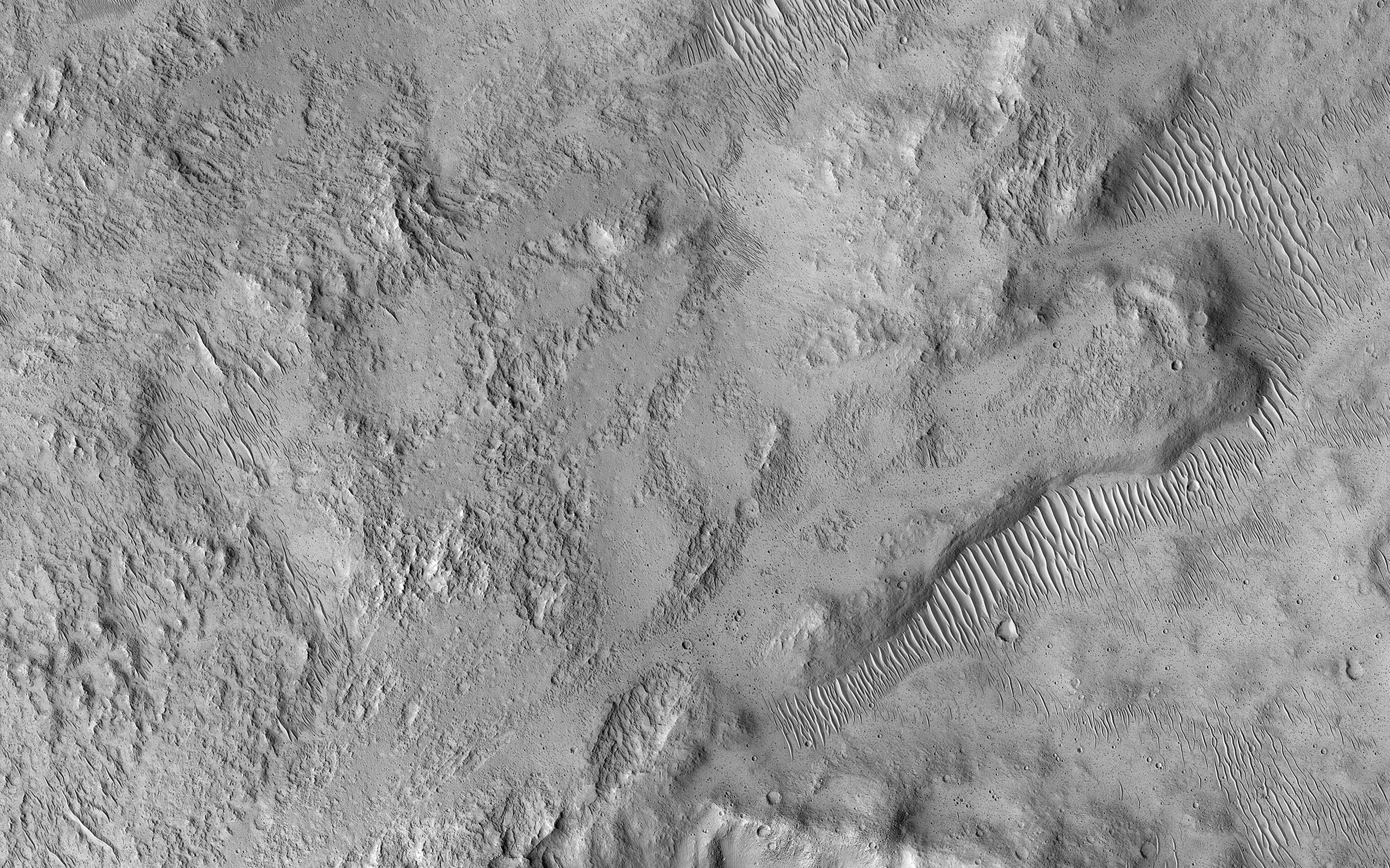
PIA11705:
Contact between Two Distinct Types of Bedrock Northwest of Hellas Planitia
Full Resolution:
TIFF
(15.56 MB)
JPEG
(998.8 kB)
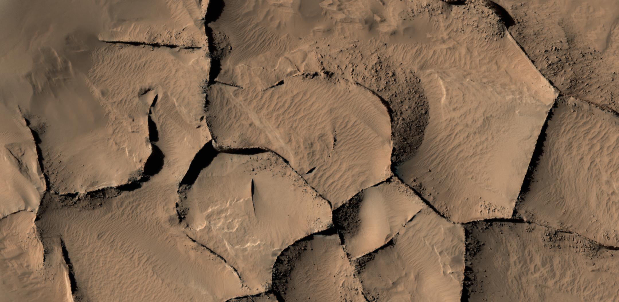
2017-01-25
Mars
Mars Reconnaissance Orbiter (MRO)
HiRISE
2159x1056x3
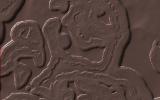
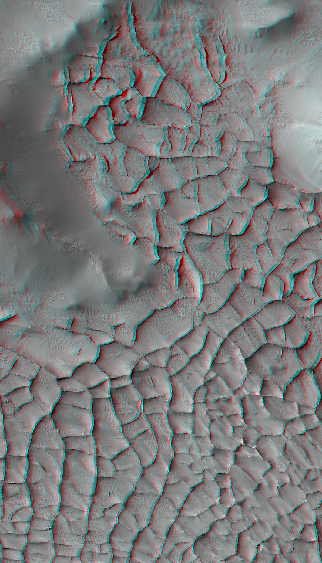
PIA21264:
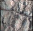
Blade-Like Martian Walls Outline Polygons
Full Resolution:
TIFF
(5.927 MB)
JPEG
(271.4 kB)
2017-01-25
Mars
Mars Reconnaissance Orbiter (MRO)
HiRISE
1062x1855x3
PIA21265:
Blade-Like Martian Walls Outline Polygons (Stereo)
Full Resolution:
TIFF
(5.31 MB)
JPEG
(331.2 kB)
2017-01-26
Mars
2001 Mars Odyssey
THEMIS
1332x2652x1
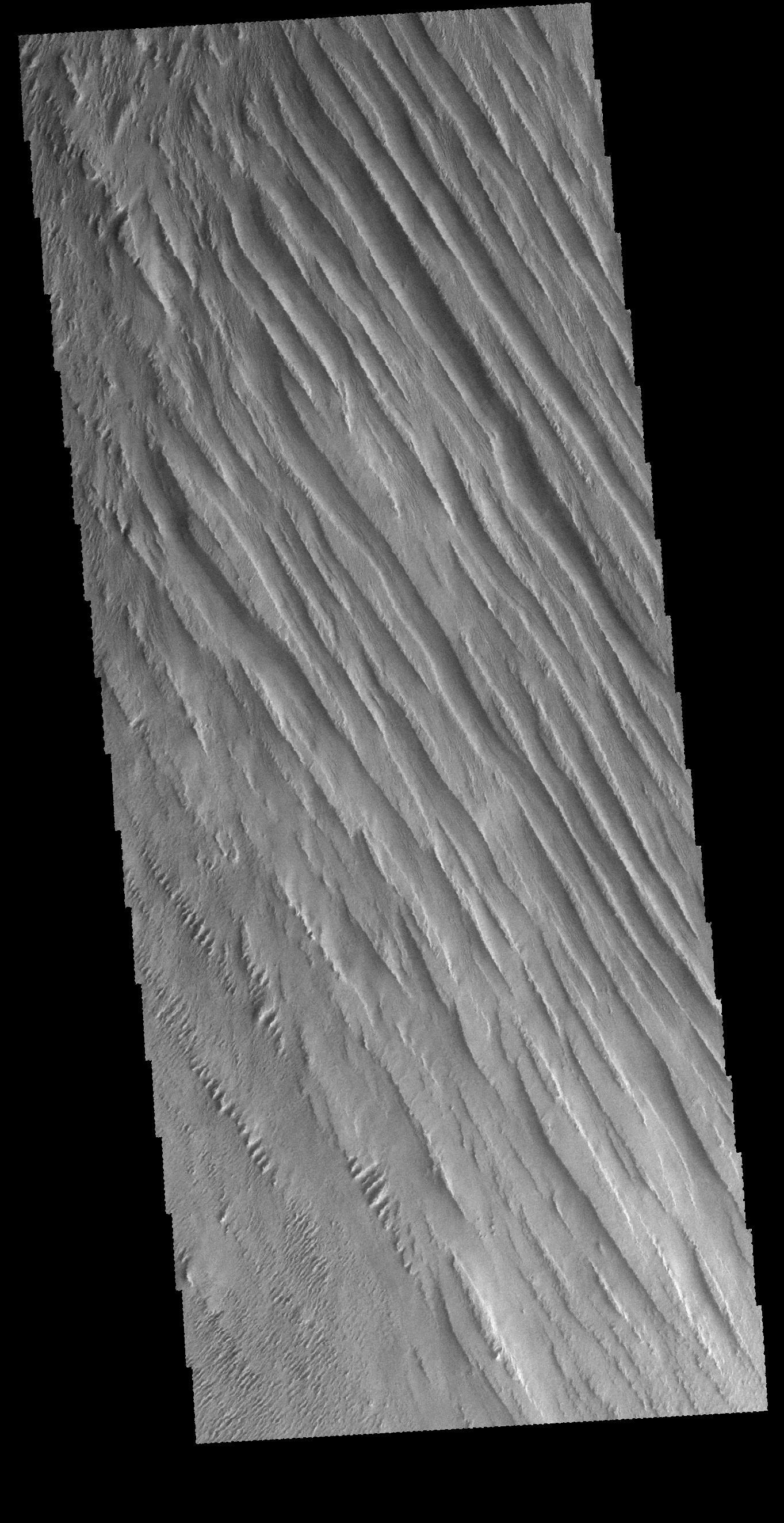
PIA21297:
Daedalia Planum
Full Resolution:
TIFF
(2.684 MB)
JPEG
(412.5 kB)
2017-01-26
Mars
Mars Reconnaissance Orbiter (MRO)
HiRISE
4500x3000x1
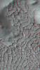
PIA11704:
Pits and Channels of Hebrus Valles
Full Resolution:
TIFF
(13.52 MB)
JPEG
(2.535 MB)
2017-01-27
Mars
2001 Mars Odyssey
THEMIS
664x1429x1
PIA21298:
Reull Vallis
Full Resolution:
TIFF
(709.6 kB)
JPEG
(94.23 kB)
2017-01-27
Mars
Mars Reconnaissance Orbiter (MRO)
HiRISE
4500x3000x3
PIA11238:
Rectangles with Wiggly Sides
Full Resolution:
TIFF
(40.52 MB)
JPEG
(2.842 MB)
1-100
101-200
201-300
301-400
401-500
501-600
601-700
701-800
801-900
901-1000
Currently displaying images:
9701 - 9800
of 12760


