Your search criteria found
12760
images
Target is Mars (and available satellites)
Go to PIAxxxxx:
Refine this list of images by:
Target:
Deimos
Mars
Phobos
Mission:
2001 Mars Odyssey
Antarctic Meteorite Location and Mapping Project (AMLAMP)
Dawn
ExoMars
Hubble Space Telescope
InSight
MAVEN
Mariner Mars 1964 (Mariner 4)
Mariner Mars 1969 (Mariner 7)
Mariner Mars 1971 (Mariner 9)
Mars 2020
Mars 2020 Rover
Mars Atmosphere and Volatile Evolution MissioN (MAVEN)
Mars Climate Orbiter
Mars Cube One (MarCO)
Mars Exploration Rover (MER)
Mars Express (MEX)
Mars Global Surveyor (MGS)
Mars Helicopter
Mars Pathfinder (MPF)
Mars Reconnaissance Orbiter (MRO)
Mars Sample Return
Mars Sample Return (MSR)
Mars Science Laboratory (MSL)
Phoenix
Rosetta
Viking
Spacecraft:
2001 Mars Odyssey
Curiosity
Dawn
InSight Mars Lander
Ingenuity
MAVEN
MarCO-B
Mariner 4
Mariner 7
Mariner 9
Mars Climate Orbiter
Mars Express (MEX)
Mars Express (MEX) Orbiter
Mars Global Surveyor Orbiter
Mars Pathfinder Lander
Mars Pathfinder Rover
Mars Reconnaissance Orbiter (MRO)
Mars Sample Return
Mars Science Laboratory (MSL)
NASA's Mars Pathfinder Lander
Opportunity
Perseverance
Philae Lander
Phoenix Lander
Phoenix Mars Lander
Spirit
Viking Lander 1
Viking Lander 2
Viking Orbiter 1
Viking Orbiter 2
Instrument:
Alpha Particle X-ray Spectrometer
Alpha Particle X-ray Spectrometer (MSL)
Atmospheric Structure / Meteorology Instrument
CHIMRA
Camera 1
Camera 2
Chemistry & Mineralogy (CheMin)
Chemistry and Camera (ChemCam)
Comet Infrared and Visible Analyser (CIVA
Compact Reconnaissance Imaging Spectrometer for Mars (CRISM)
Context Camera (CTX)
Deep Space Network
Descent Image Motion Estimation System (DIMES)
Dynamic Albedo of Neutrons
Dynamic Albedo of Neutrons (DAN)
Gamma Ray Spectrometer - Neutron Spectrometer
Gamma Ray Spectrometer Suite
Hazard Avoidance Camera
Hazard Avoidance Camera (M2020)
Hazard Avoidance Camera (MSL)
Heat and Physical Properties Package (HP3)
High Resolution Imaging Science Experiment (HiRISE)
High Resolution Instrument (HRI)
High Resolution Stereo Camera
Imager for Mars Pathfinder
Imaging Ultraviolet Spectrograph
Imaging Ultraviolet Spectrograph (IUVS)
Instrument Context Camera (ICC)
Instrument Deployment Camera (IDC)
Lander Vision System Camera (LCAM)
Magnetometer
Mars Advanced Radar for Subsurface and Ionosphere Sounding (MARSIS)
Mars Advanced Radar for Subsurface and Ionospheric Sounding (MARSIS)
Mars Climate Sounder (MCS)
Mars Color Imager (MARCI)
Mars Descent Imager
Mars Environmental Dynamics Analyzer (MEDA)
Mars Hand Lens Imager (MAHLI)
Mars Horizon Sensor Assembly
Mars Orbiter Camera (MOC)
Mars Orbiter Laser Altimeter
Mars Radiation Experiment
Mastcam
Mastcam-Z
Microscopic Imager
Microscopy Electrochemistry and Conductivity Analyzer (MECA)
Miniature Thermal Emission Spectrometer
Moessbauer Spectrometer
Navigation Camera
Navigation Camera (M2020)
Navigation Camera (MSL)
Neutral Gas and Ion Mass Spectrometer
Neutron Spectrometer
Optical Microscope
Optical Navigation Camera
Panoramic Camera
Planetary Instrument for X-ray Lithochemistry (PIXL)
Radar System
Radiation Assessment Detector (RAD)
Radio Science Subsystem
Robotic Arm
Robotic Arm (MSL)
Robotic Arm Camera (RAC)
Rock Abrasion Tool (RAT)
Rover Cameras
Rover Environmental Monitoring Station (REMS)
Sample Analysis at Mars (SAM)
Scanning Habitable Environments with Raman & Luminescence for Organics and Chemicals (SHERLOC)
Seismic Experiment for Interior Structure (SEIS)
Shallow Subsurface Radar (SHARAD)
Stereo Imager (SSI)
SuperCam
Surface Stereo Imager (SSI)
Thermal Emission Imaging System
Thermal Emission Spectrometer
Thermal and Electrical Conductivity Probe
Thermal and Evolved Gas Analyzer
Trace Gas Orbiter
Visual Imaging Subsystem
Visual Imaging Subsystem - Camera A
Visual Imaging Subsystem - Camera B
Wide Field Planetary Camera 2
Click on an image for detailed information
Click on a column heading to sort in ascending or descending order
My
List
Addition Date
Target
Mission
Instrument
Size
2013-09-03
Mars
2001 Mars Odyssey
THEMIS
320x1808x1
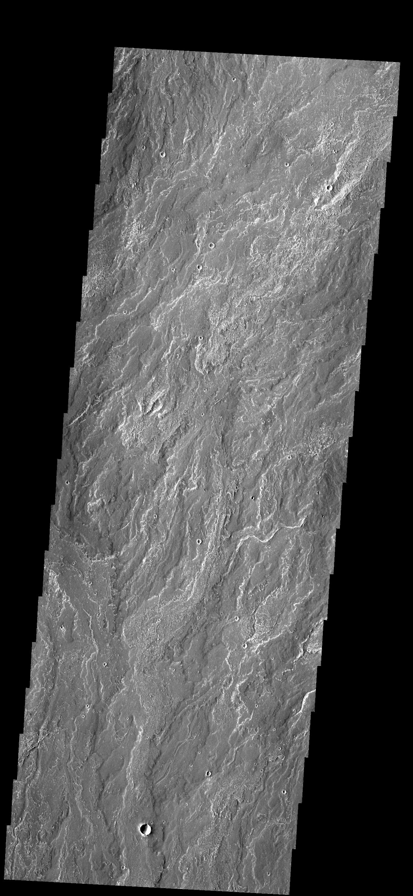
PIA17438:
Nanedi Valles
Full Resolution:
TIFF
(579.4 kB)
JPEG
(113 kB)
2013-09-03
Mars
Mars Reconnaissance Orbiter (MRO)
HiRISE
2880x1800x3
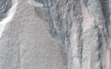
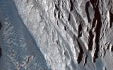
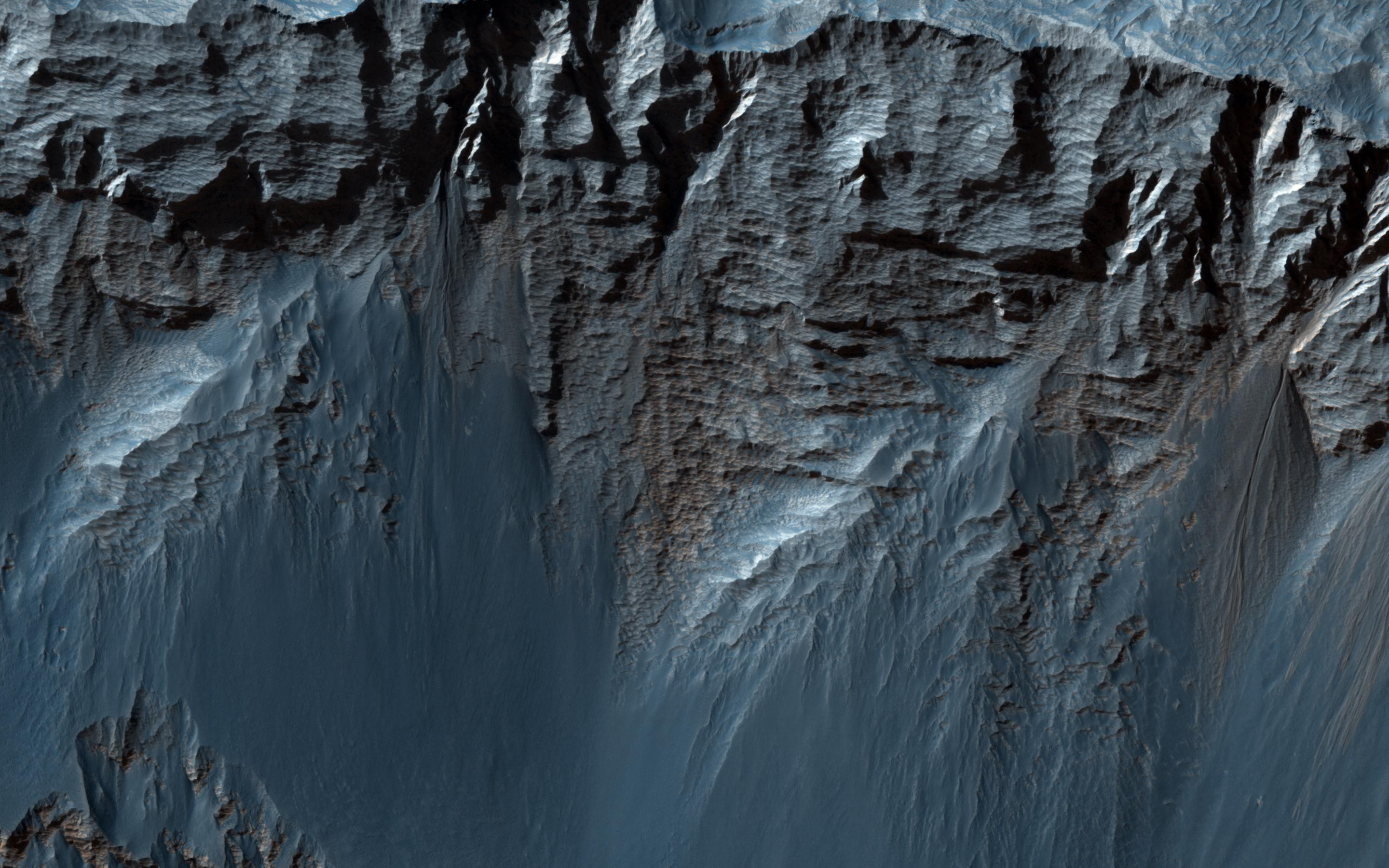
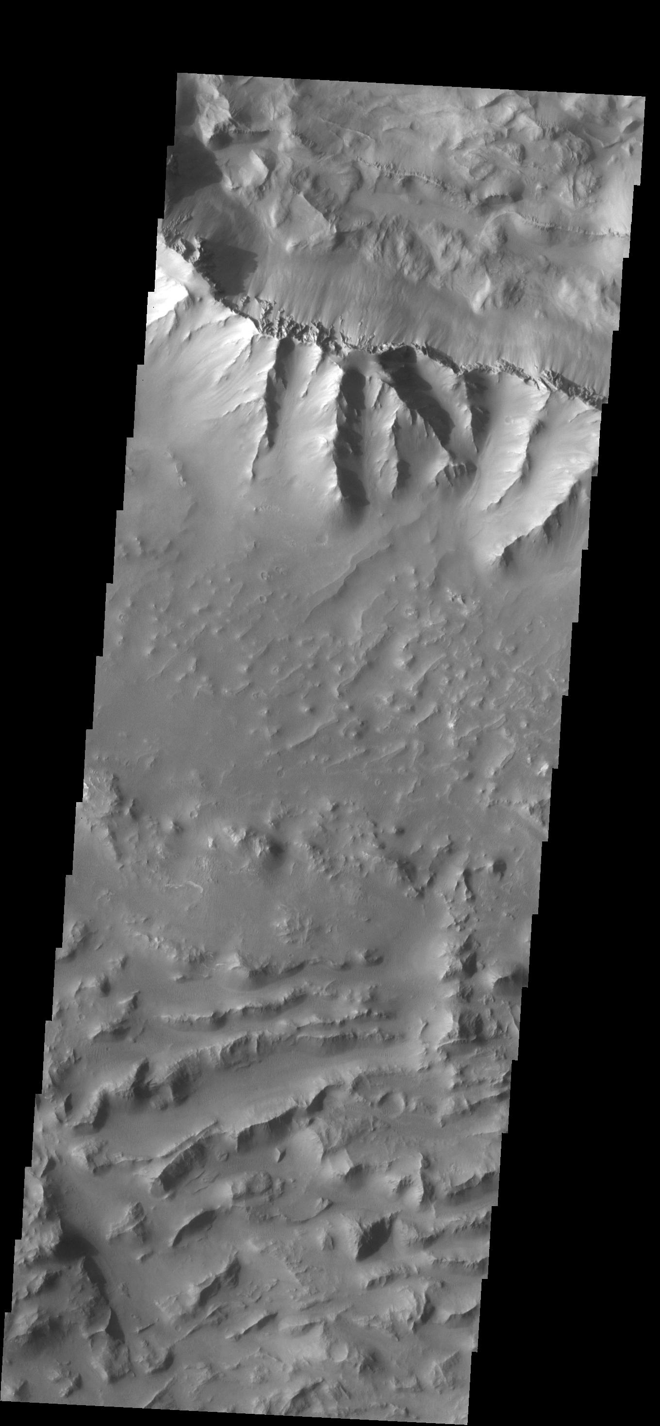
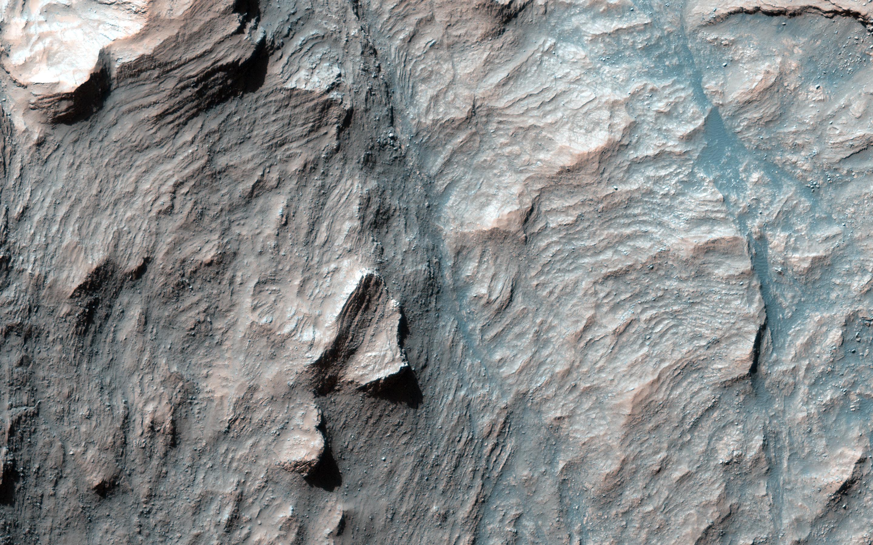
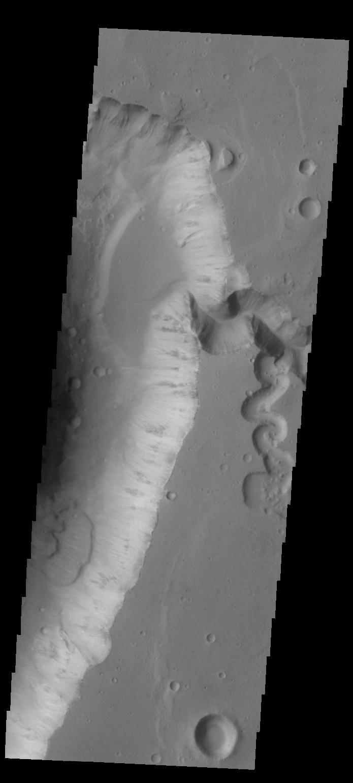
PIA17647:
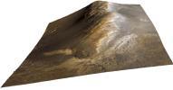
Gullied Massif in the Nereidum Montes
Full Resolution:
TIFF
(15.56 MB)
JPEG
(1.114 MB)
2013-09-03
Mars
Mars Reconnaissance Orbiter (MRO)
HiRISE
2880x1800x3
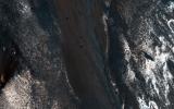
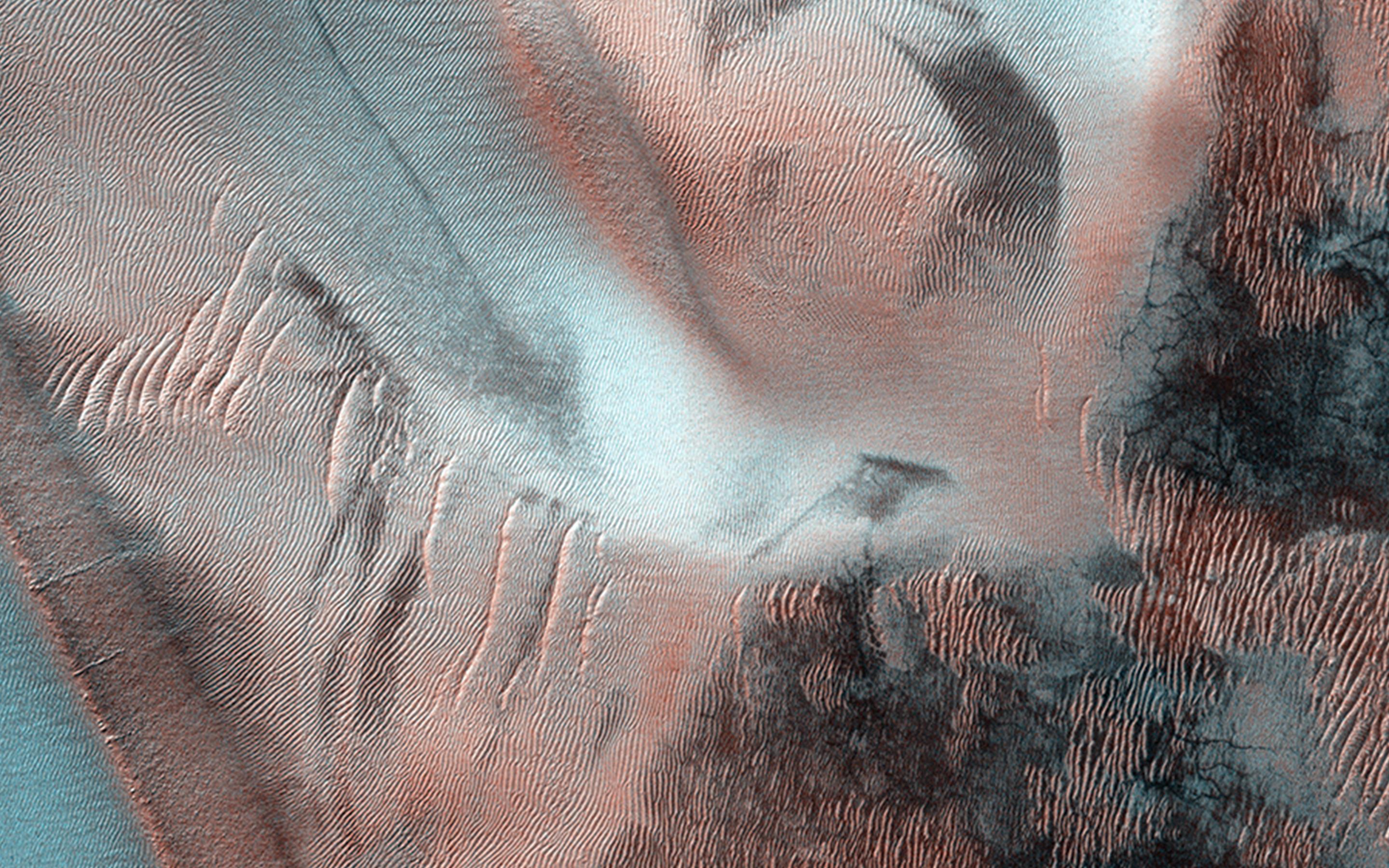
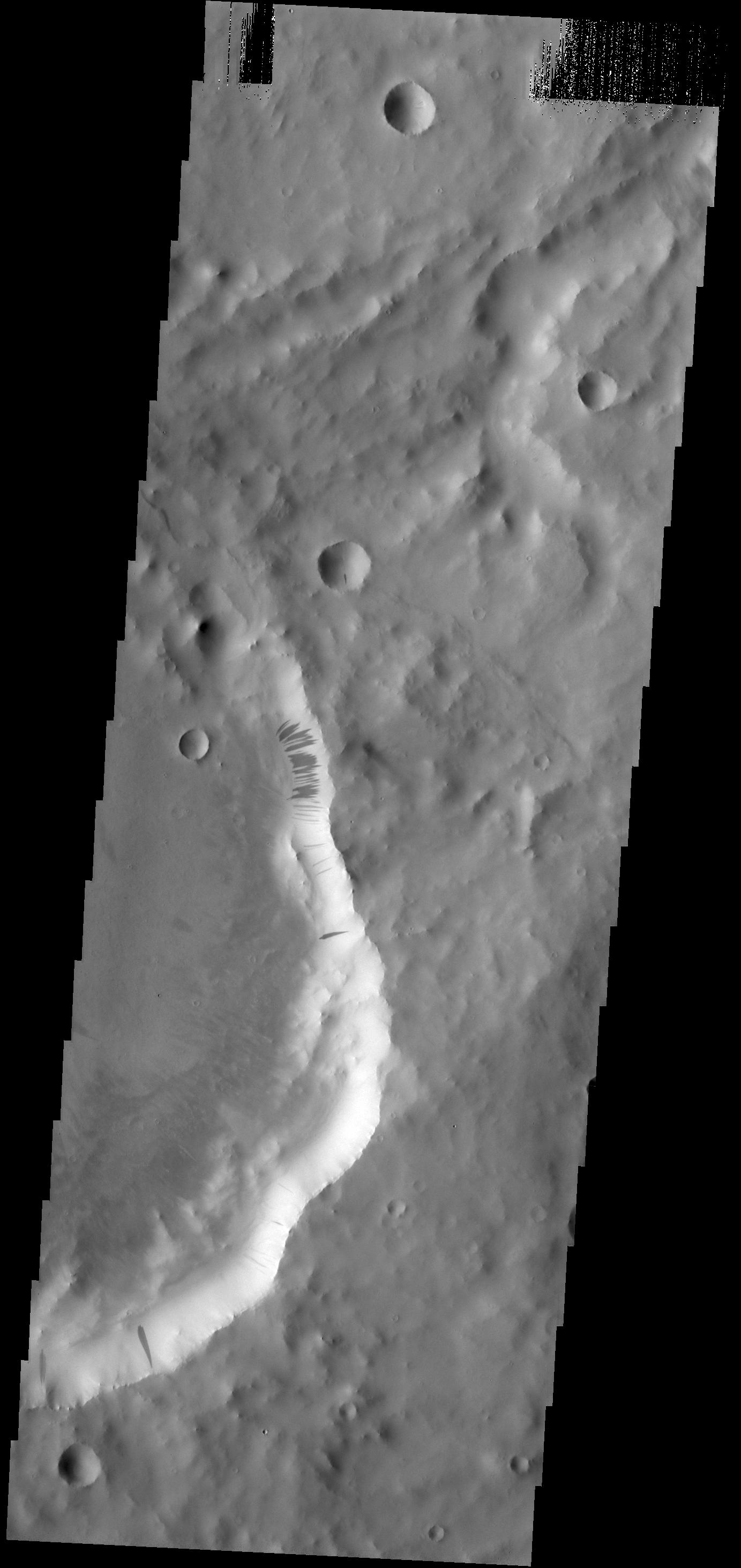
PIA17648:
Slope Lineae along Coprates Chasma Ridge
Full Resolution:
TIFF
(15.56 MB)
JPEG
(862.3 kB)
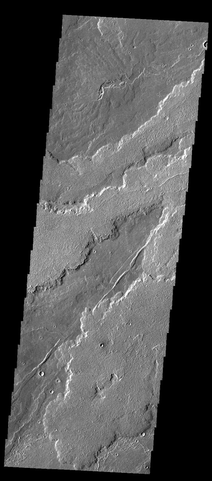
2013-09-04
Mars
2001 Mars Odyssey
THEMIS
1370x2930x1
PIA17439:
Tinto and Palos
Full Resolution:
TIFF
(4.019 MB)
JPEG
(248.3 kB)
2013-09-04
Mars
InSight
Mars Global Surveyor (MGS)
MOLA
4000x2298x3
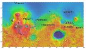
PIA17357:
NASA's Mars Landing Sites, including InSight
Full Resolution:
TIFF
(27.59 MB)
JPEG
(2.27 MB)
2013-09-05
Mars
2001 Mars Odyssey
THEMIS
1383x2983x1
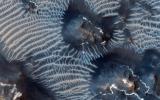
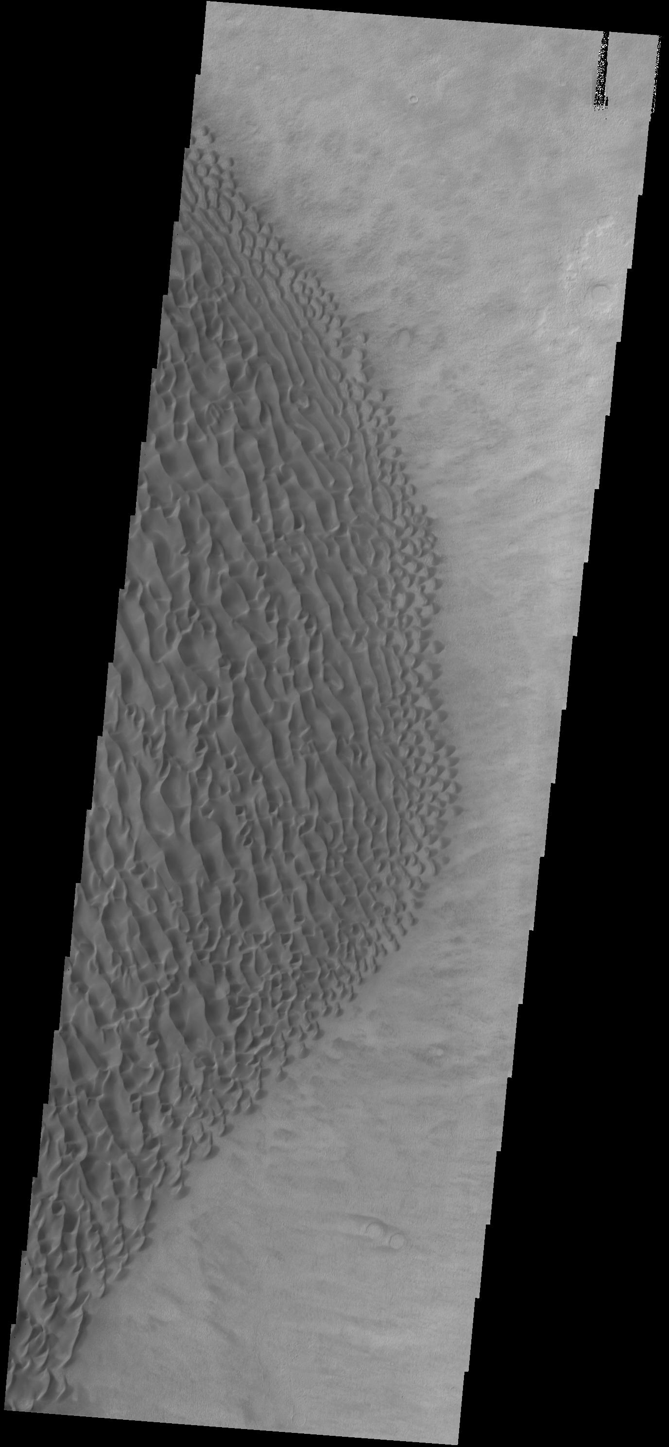
PIA17420:
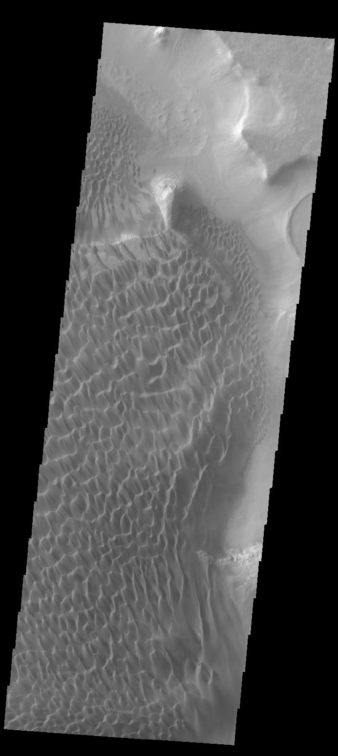
Dunes in Noachis Terra
Full Resolution:
TIFF
(4.13 MB)
JPEG
(249.6 kB)
2013-09-06
Mars
2001 Mars Odyssey
THEMIS
1384x2975x1
PIA17421:
Proctor Crater Dunes
Full Resolution:
TIFF
(4.122 MB)
JPEG
(226.1 kB)
2013-09-09
Mars
2001 Mars Odyssey
THEMIS
1063x731x1
PIA17422:
Dunes in Terra Sirenum
Full Resolution:
TIFF
(778.1 kB)
JPEG
(72.52 kB)
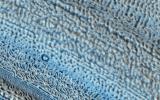
2013-09-10
Mars
2001 Mars Odyssey
THEMIS
689x1550x1
PIA17423:
Dunes in Argyre Planitia
Full Resolution:
TIFF
(1.069 MB)
JPEG
(63.8 kB)
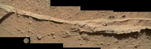
2013-09-10
Mars
Mars Science Laboratory (MSL)
Navcam (MSL)
1840x718x1
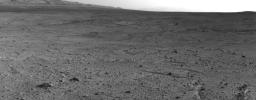
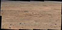
PIA17359:
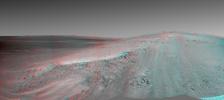
Curiosity's View from 'Panorama Point' to 'Waypoint 1' and Outcrop 'Darwin'
Full Resolution:
TIFF
(1.323 MB)
JPEG
(210.5 kB)
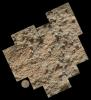
2013-09-10
Mars
Mars Science Laboratory (MSL)
Mastcam
4605x2258x3
PIA17360:
'Darwin' Outcrop at 'Waypoint 1' of Curiosity's trek to Mount Sharp
Full Resolution:
TIFF
(31.21 MB)
JPEG
(1.826 MB)
2013-09-11
Mars
2001 Mars Odyssey
THEMIS
1364x2934x1
PIA17424:
Dunes in Terra Cimmeria
Full Resolution:
TIFF
(4.006 MB)
JPEG
(266.3 kB)
2013-09-12
Mars
2001 Mars Odyssey
THEMIS
1364x2950x1
PIA17425:
Rim Channels
Full Resolution:
TIFF
(4.028 MB)
JPEG
(285.9 kB)
2013-09-12
Mars
Mars Reconnaissance Orbiter (MRO)
HiRISE
2880x1800x3
PIA17630:
Layers, Bedrock Ridges, and Dark Sand in Schiaparelli Crater
Full Resolution:
TIFF
(15.56 MB)
JPEG
(908.3 kB)
2013-09-12
Mars
Mars Reconnaissance Orbiter (MRO)
HiRISE
2880x1800x3
PIA17631:
Terraced Craters and Layered Targets
Full Resolution:
TIFF
(15.56 MB)
JPEG
(1.341 MB)
2013-09-13
Mars
2001 Mars Odyssey
THEMIS
1379x2925x1
PIA17488:
Windstreaks
Full Resolution:
TIFF
(4.038 MB)
JPEG
(404.8 kB)
2013-09-13
Mars
Mars Science Laboratory (MSL)
Mastcam
1344x1200x3
PIA17481:
Evolving Excitement Over 'Darwin' Rock Outcrop at 'Waypoint 1'
Full Resolution:
TIFF
(4.84 MB)
JPEG
(253.3 kB)
2013-09-16
Mars
2001 Mars Odyssey
THEMIS
1356x2935x1
PIA17489:
Coprates Chasma
Full Resolution:
TIFF
(3.984 MB)
JPEG
(278.5 kB)
2013-09-17
Mars
2001 Mars Odyssey
THEMIS
687x1538x1
PIA17490:
Coprates Chasma
Full Resolution:
TIFF
(1.058 MB)
JPEG
(64.61 kB)
2013-09-18
Mars
2001 Mars Odyssey
THEMIS
1366x2958x1
PIA17491:
Candor Chasma
Full Resolution:
TIFF
(4.046 MB)
JPEG
(252.4 kB)
2013-09-18
Mars
Mars Reconnaissance Orbiter (MRO)
HiRISE
2880x1800x3
PIA17628:
Two Generations of Windblown Sediments
Full Resolution:
TIFF
(15.56 MB)
JPEG
(641.7 kB)
2013-09-18
Mars
Mars Reconnaissance Orbiter (MRO)
HiRISE
2880x1800x3
PIA17629:
Martian Glaciers and Brain Terrain
Full Resolution:
TIFF
(15.56 MB)
JPEG
(1.045 MB)
2013-09-19
Mars
2001 Mars Odyssey
THEMIS
1382x2972x1
PIA17492:
Bogia Crater Dunes
Full Resolution:
TIFF
(4.112 MB)
JPEG
(301.6 kB)
2013-09-20
Mars
2001 Mars Odyssey
THEMIS
1361x2934x1
PIA17493:
Crater Dunes
Full Resolution:
TIFF
(3.997 MB)
JPEG
(271.4 kB)
2013-09-23
Mars
2001 Mars Odyssey
THEMIS
688x1538x1
PIA17494:
Daedalia Planum
Full Resolution:
TIFF
(1.059 MB)
JPEG
(154.5 kB)
2013-09-23
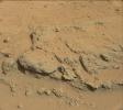
Mars
Mars Science Laboratory (MSL)
MAHLI
4818x1577x3
PIA17361:
Close-up of Ridge in Rock Outcrop at Curiosity's 'Waypoint 1'
Full Resolution:
TIFF
(22.81 MB)
JPEG
(1.889 MB)
2013-09-23
Mars
Mars Science Laboratory (MSL)
MAHLI
4216x4650x3
PIA17362:
Pebbly Sandstone Conglomerate Rock at Curiosity's 'Waypoint 1'
Full Resolution:
TIFF
(58.85 MB)
JPEG
(2.769 MB)
2013-09-23
Mars
Mars Science Laboratory (MSL)
Hazcam (MSL)
1024x1024x1
PIA17363:
Curiosity Uses X-ray Instrument's Data for Proximity Placement
Full Resolution:
TIFF
(1.05 MB)
JPEG
(115.4 kB)
2013-09-24
Mars
2001 Mars Odyssey
THEMIS
320x3600x1
PIA17507:
Rabe Crater Dunes
Full Resolution:
TIFF
(1.153 MB)
JPEG
(168.1 kB)
2013-09-25
Mars
2001 Mars Odyssey
THEMIS
320x8208x1
PIA17508:
Pollack Crater
Full Resolution:
TIFF
(2.629 MB)
JPEG
(451.3 kB)
2013-09-26
Mars
2001 Mars Odyssey
THEMIS
1372x2970x1
PIA17509:
Rabe Crater Dunes
Full Resolution:
TIFF
(4.08 MB)
JPEG
(244.2 kB)
2013-09-27
Mars
2001 Mars Odyssey
THEMIS
1347x2952x1
PIA17510:
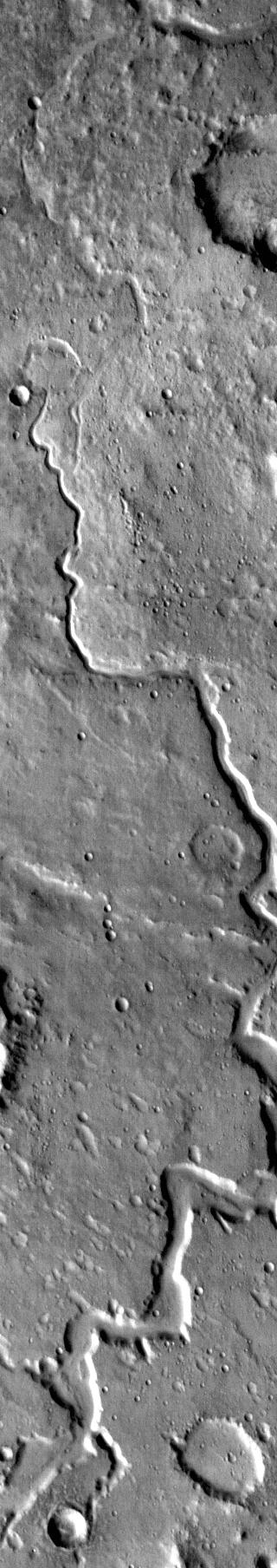
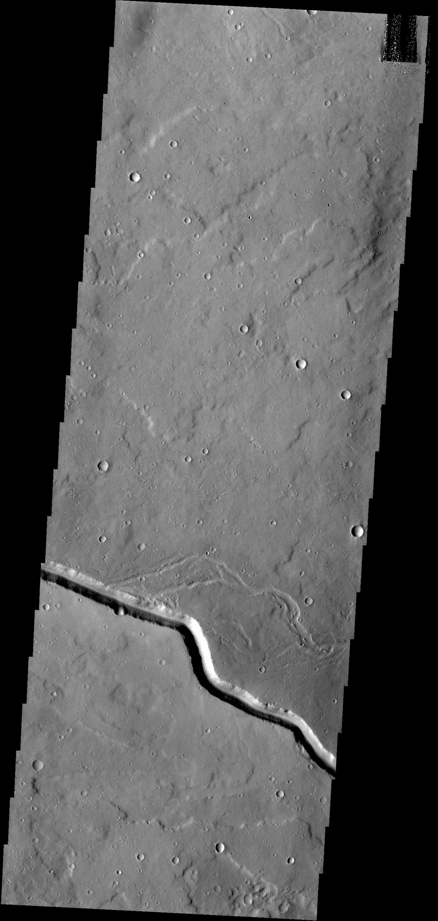
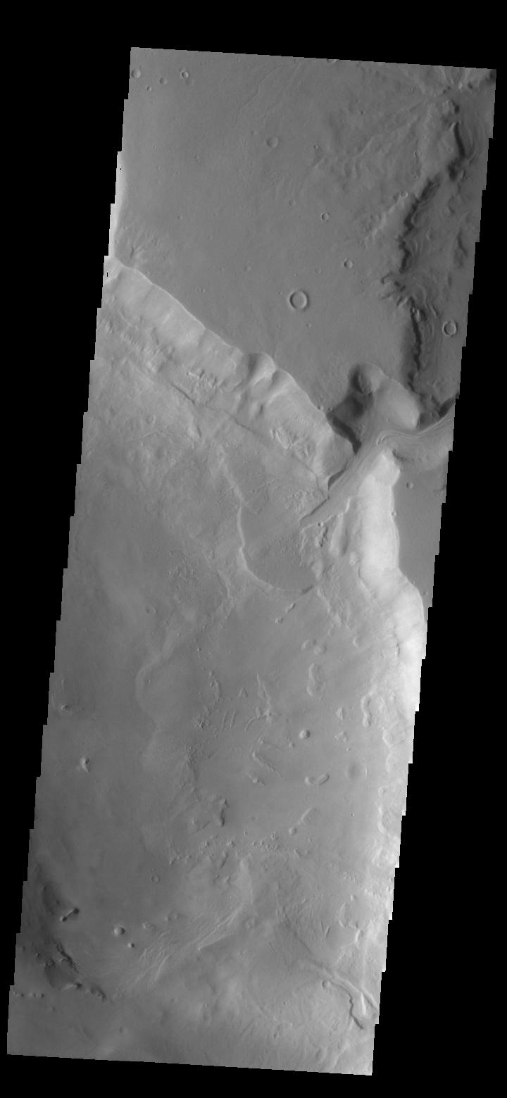
Channel
Full Resolution:
TIFF
(3.98 MB)
JPEG
(418.1 kB)
2013-09-30
Mars
2001 Mars Odyssey
THEMIS
1362x2928x1
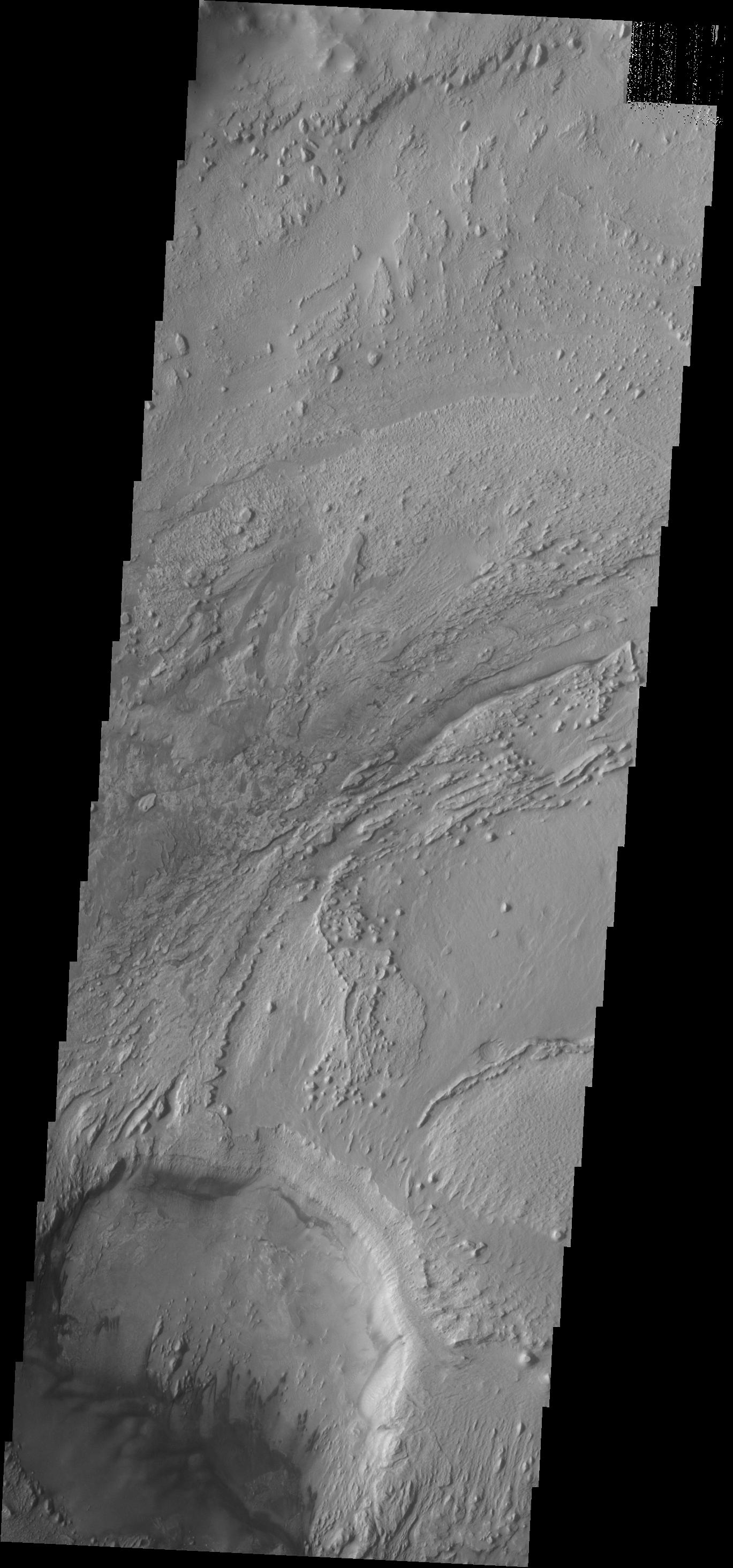
PIA17511:
Landslide
Full Resolution:
TIFF
(3.992 MB)
JPEG
(261.3 kB)
2013-10-01
Mars
2001 Mars Odyssey
THEMIS
1353x2939x1
PIA17512:
Dark Slope Streaks
Full Resolution:
TIFF
(3.981 MB)
JPEG
(314.6 kB)
2013-10-02
Mars
2001 Mars Odyssey
THEMIS
1362x2937x1
PIA17517:
Coprates Chasma
Full Resolution:
TIFF
(4.004 MB)
JPEG
(220.8 kB)
2013-10-02
Mars
Mars Reconnaissance Orbiter (MRO)
HiRISE
2880x1800x1
PIA17575:
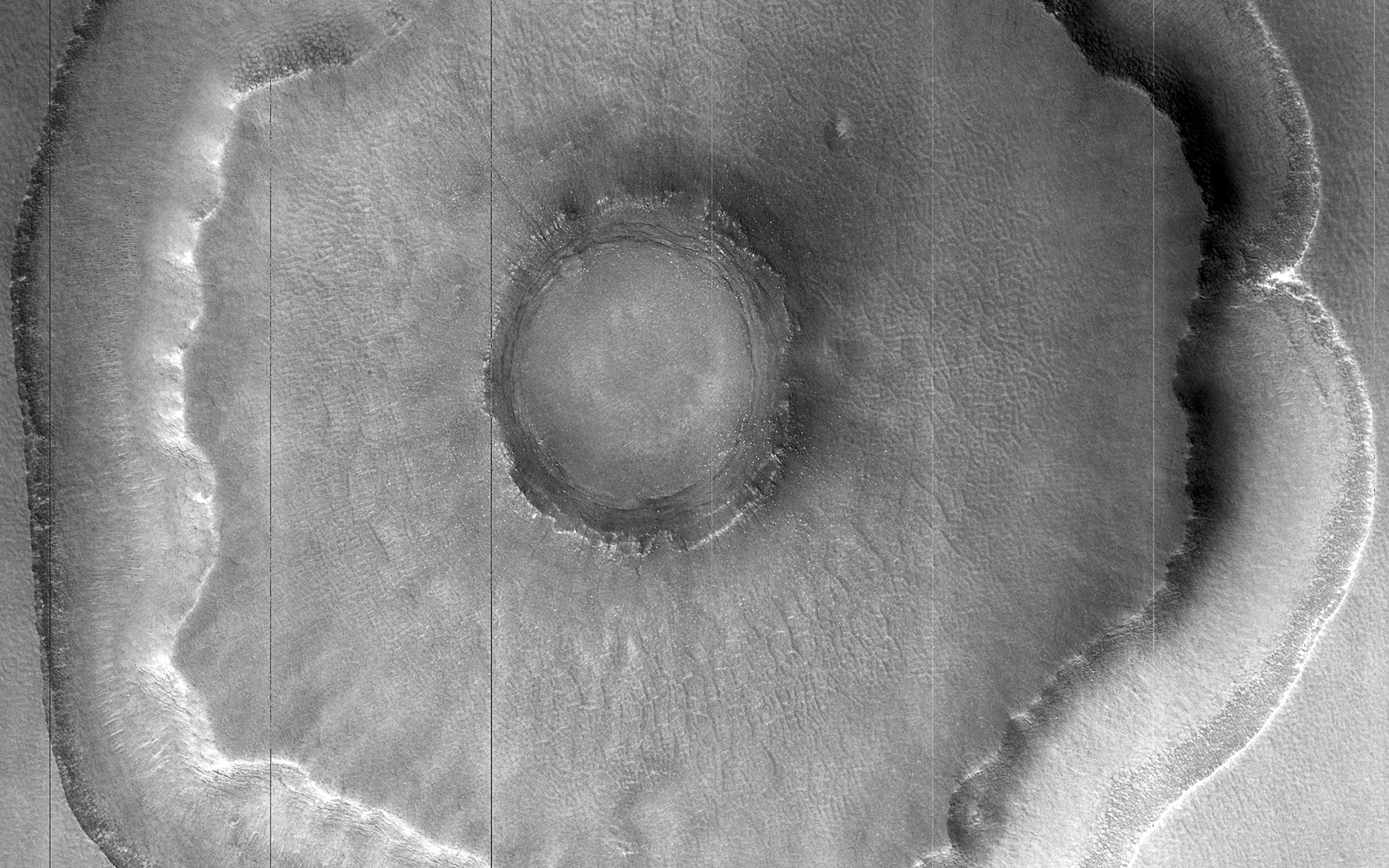
Differential Compaction around a Crater Peak
Full Resolution:
TIFF
(5.191 MB)
JPEG
(915.7 kB)
2013-10-02
Mars
Mars Reconnaissance Orbiter (MRO)
HiRISE
2880x1800x3
PIA17572:
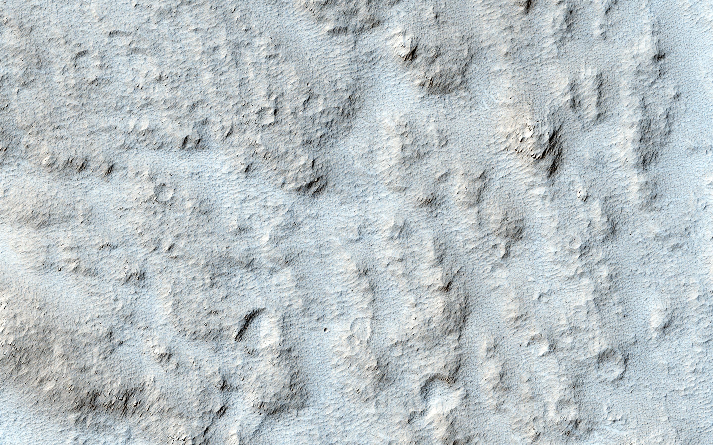
Aligned Scallops
Full Resolution:
TIFF
(15.56 MB)
JPEG
(1.475 MB)
2013-10-02
Mars
Mars Reconnaissance Orbiter (MRO)
HiRISE
1898x1007x3
PIA17573:
Colorful Dunes
Full Resolution:
TIFF
(5.736 MB)
JPEG
(301.4 kB)
2013-10-16
Mars
Mars Reconnaissance Orbiter (MRO)
HiRISE
2880x1800x3
PIA17548:
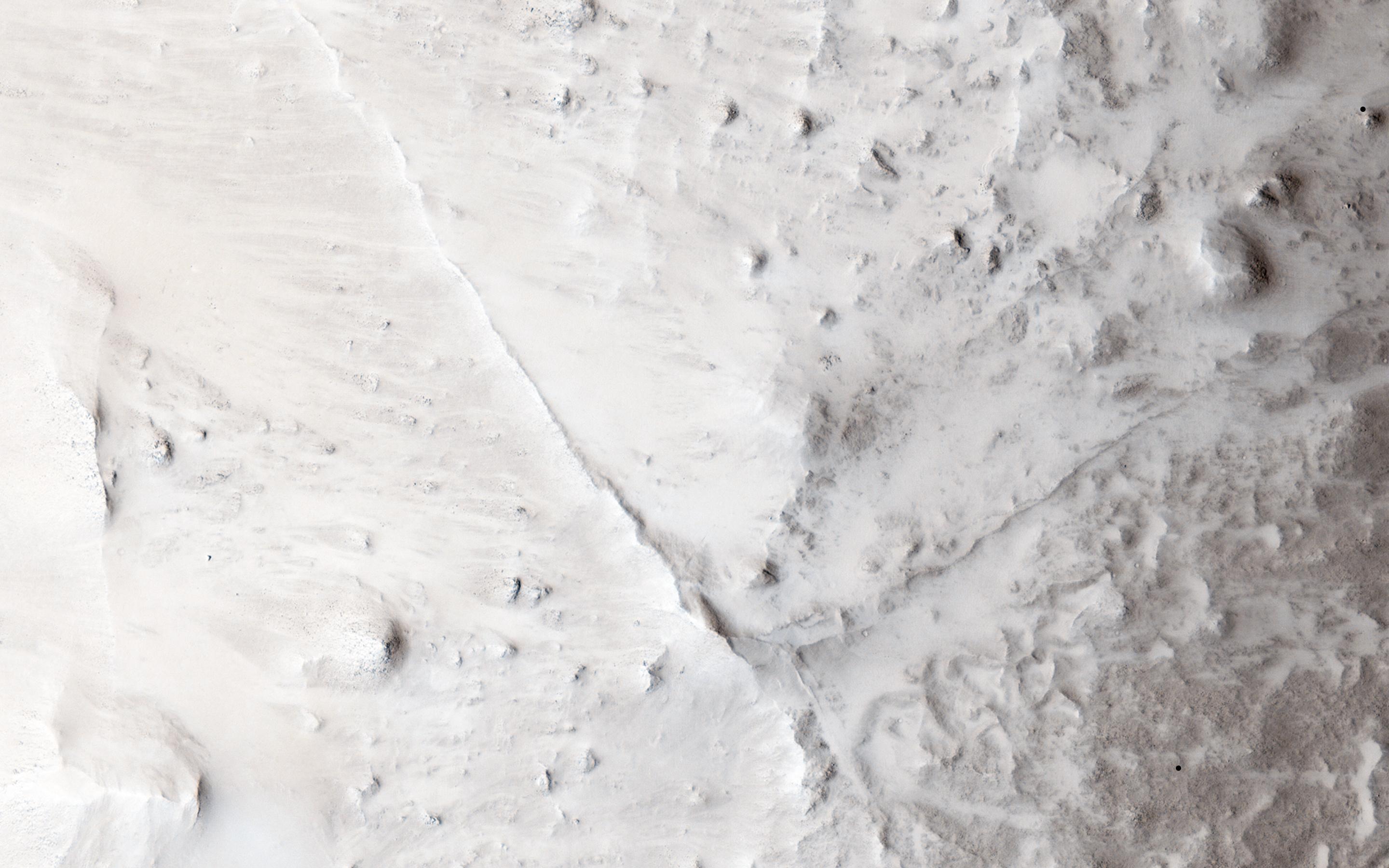
Fall Frosting
Full Resolution:
TIFF
(15.56 MB)
JPEG
(887.8 kB)
2013-10-16
Mars
Mars Reconnaissance Orbiter (MRO)
HiRISE
2880x1800x3
PIA17549:
Possible Impacts from MSL Hardware
Full Resolution:
TIFF
(15.56 MB)
JPEG
(1.513 MB)
2013-10-16
Mars
Mars Reconnaissance Orbiter (MRO)
HiRISE
2880x1800x3
PIA17570:
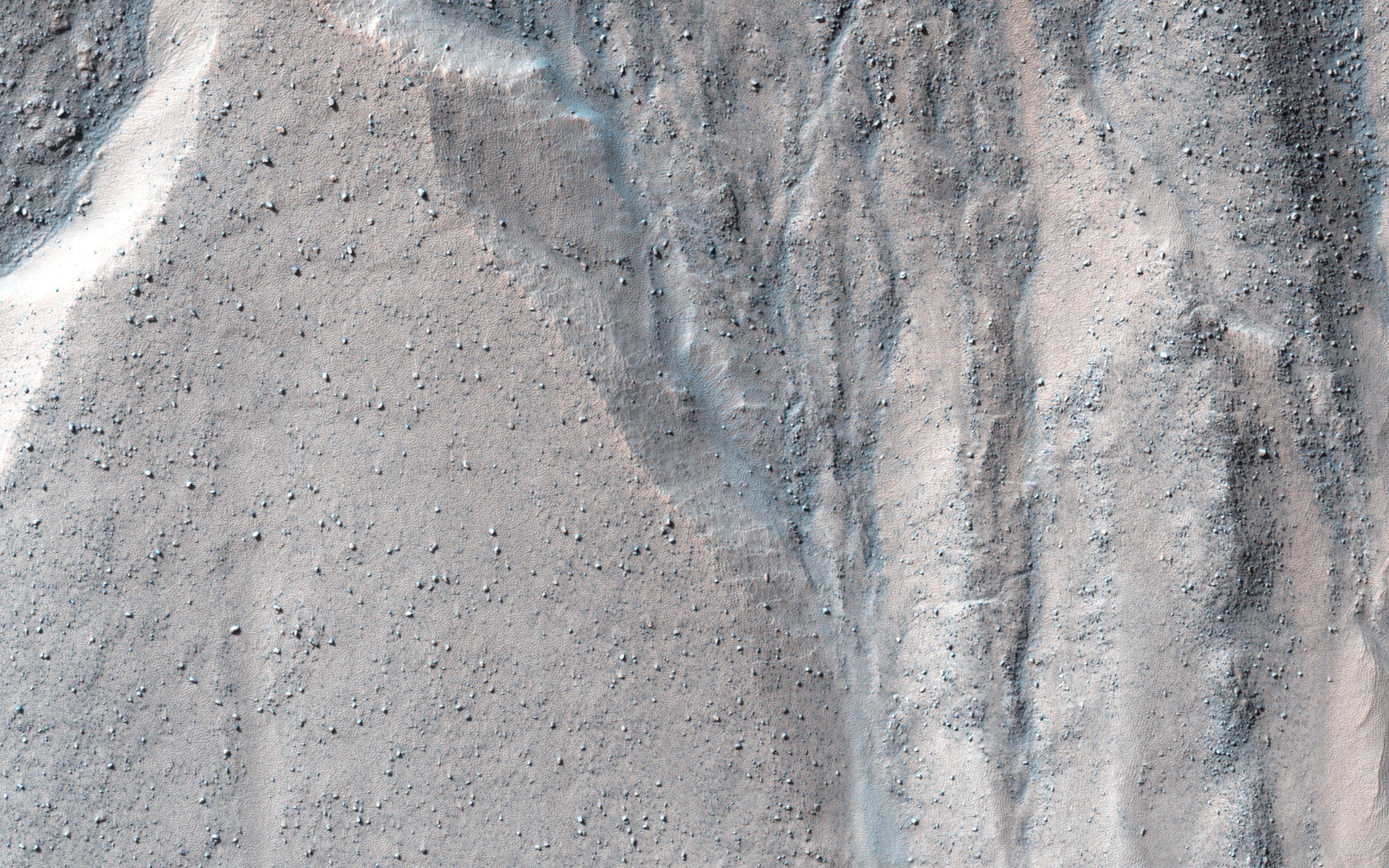
Bedding Details in Layered Rock
Full Resolution:
TIFF
(15.56 MB)
JPEG
(600.1 kB)
2013-10-16
Mars
Mars Reconnaissance Orbiter (MRO)
HiRISE
2880x1800x3
PIA17571:
Fretted Terrains and Ground Deformation
Full Resolution:
TIFF
(15.56 MB)
JPEG
(1.05 MB)
2013-10-17
Mars
2001 Mars Odyssey
THEMIS
320x3600x1
PIA17532:
Coprates Labes
Full Resolution:
TIFF
(1.153 MB)
JPEG
(169.8 kB)
2013-10-17
Mars
2001 Mars Odyssey
THEMIS
1377x2979x1
PIA17518:
Proctor Crater Dunes
Full Resolution:
TIFF
(4.107 MB)
JPEG
(257.8 kB)
2013-10-17
Mars
2001 Mars Odyssey
THEMIS
1350x2968x1
PIA17519:
Baltisk Crater
Full Resolution:
TIFF
(4.011 MB)
JPEG
(242.3 kB)
2013-10-17
Mars
2001 Mars Odyssey
THEMIS
1340x2953x1
PIA17520:
Graben
Full Resolution:
TIFF
(3.961 MB)
JPEG
(310 kB)
2013-10-17
Mars
2001 Mars Odyssey
THEMIS
1353x2978x1
PIA17521:
Proctor Crater Dunes
Full Resolution:
TIFF
(4.033 MB)
JPEG
(265.4 kB)
2013-10-17
Mars
2001 Mars Odyssey
THEMIS
1380x2929x1
PIA17522:
Ascraeus Mons Collapse Pits
Full Resolution:
TIFF
(4.047 MB)
JPEG
(332.9 kB)
2013-10-17
Mars
2001 Mars Odyssey
THEMIS
1400x2925x1
PIA17523:
Olympus Mons
Full Resolution:
TIFF
(4.1 MB)
JPEG
(255.7 kB)
2013-10-17
Mars
2001 Mars Odyssey
THEMIS
1383x2926x1
PIA17524:
Wind Erosion
Full Resolution:
TIFF
(4.052 MB)
JPEG
(517 kB)
2013-10-17
Mars
2001 Mars Odyssey
THEMIS
1402x2924x1
PIA17525:
Lycus Sulci
Full Resolution:
TIFF
(4.104 MB)
JPEG
(290.2 kB)
2013-10-17
Mars
2001 Mars Odyssey
THEMIS
1360x2937x1
PIA17533:
Valles Marineris
Full Resolution:
TIFF
(3.998 MB)
JPEG
(270.4 kB)
2013-10-17
Mars
2001 Mars Odyssey
THEMIS
678x1537x1
PIA17534:
Daedalia Planum
Full Resolution:
TIFF
(1.043 MB)
JPEG
(179.2 kB)
2013-10-17
Mars
Mars Reconnaissance Orbiter (MRO)
HiRISE
1920x1080x3
PIA17447:
Mountainous Crater Rim on Mars
Full Resolution:
TIFF
(6.223 MB)
JPEG
(169.6 kB)
2013-10-17
Mars
Mars Science Laboratory (MSL)
MAHLI
1607x1196x3
PIA17365:
Mars Hand Lens Imager Sends Ultra High-Res Photo from Mars
Full Resolution:
TIFF
(5.768 MB)
JPEG
(527 kB)
2013-10-18
Mars
2001 Mars Odyssey
THEMIS
1426x2929x1
PIA17535:
Dark Slope Streaks
Full Resolution:
TIFF
(4.182 MB)
JPEG
(245.7 kB)
2013-10-18
Mars
Mars Reconnaissance Orbiter (MRO)
HiRISE
2880x1800x1
PIA17574:
Sinuous Ridge Cutting Across Geologic Units of the Medusae Fossae Formation
Full Resolution:
TIFF
(5.191 MB)
JPEG
(1.039 MB)
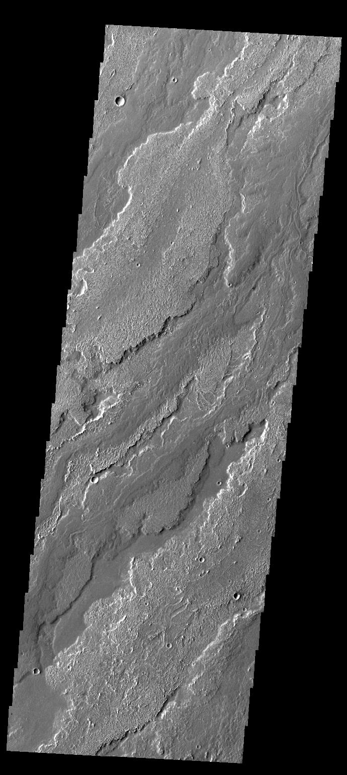
2013-10-21
Mars
2001 Mars Odyssey
THEMIS
1393x2924x1
PIA17536:
Landslide
Full Resolution:
TIFF
(4.078 MB)
JPEG
(369.5 kB)
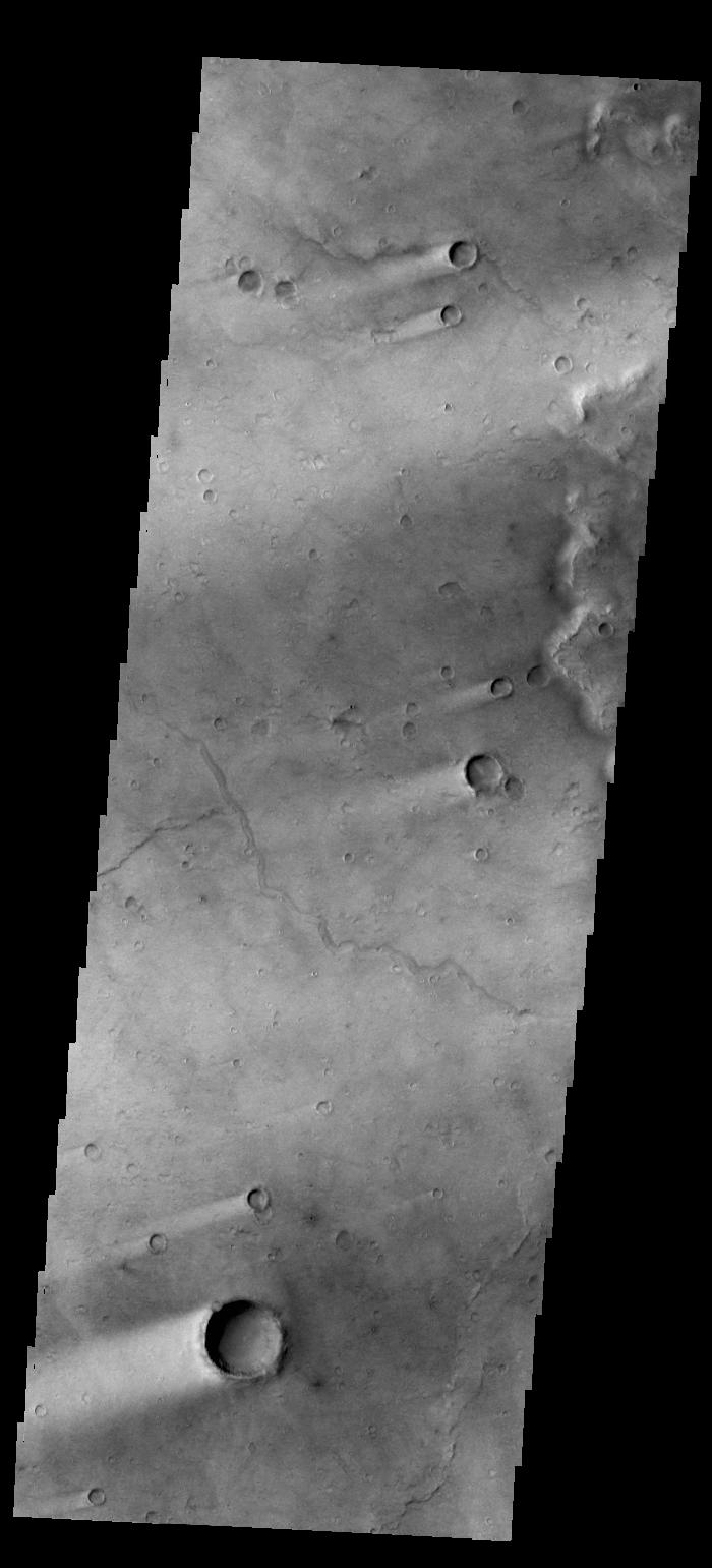
2013-10-22
Mars
2001 Mars Odyssey
THEMIS
1422x2927x1
PIA17537:
Channels
Full Resolution:
TIFF
(4.167 MB)
JPEG
(407.1 kB)
2013-10-23
Mars
2001 Mars Odyssey
THEMIS
1391x2924x1
PIA17543:
Elysium Fossae
Full Resolution:
TIFF
(4.072 MB)
JPEG
(402 kB)
2013-10-23
Mars
Mars Exploration Rover (MER)
Navigation Camera
4243x1135x1
PIA17366:
Mars Hill-Climbing Opportunity at 'Solander Point'
Full Resolution:
TIFF
(4.825 MB)
JPEG
(376 kB)
2013-10-23
Mars
Mars Exploration Rover (MER)
Navigation Camera
4278x1333x3
PIA17367:
Mars Hill-Climbing Opportunity at 'Solander Point,' in Stereo
Full Resolution:
TIFF
(17.12 MB)
JPEG
(474 kB)
2013-10-24
Mars
2001 Mars Odyssey
THEMIS
1369x2927x1
PIA17544:
Dark Dunes
Full Resolution:
TIFF
(4.012 MB)
JPEG
(380.5 kB)
2013-10-25
Mars
2001 Mars Odyssey
THEMIS
1364x2928x1
PIA17545:
Ravi Vallis
Full Resolution:
TIFF
(3.998 MB)
JPEG
(290.1 kB)
2013-10-28
Mars
2001 Mars Odyssey
THEMIS
1365x2928x1
PIA17546:
Ravi Vallis Crater
Full Resolution:
TIFF
(4.001 MB)
JPEG
(388.6 kB)
2013-10-29
Mars
2001 Mars Odyssey
THEMIS
689x1537x1
PIA17610:
Daedalia Planum
Full Resolution:
TIFF
(1.06 MB)
JPEG
(156.5 kB)
2013-10-29
Mars
Mars Science Laboratory (MSL)
Navcam (MSL)
1323x456x1
PIA17580:
Curiosity's View of "Cooperstown" Outcrop on Route to Mount Sharp
Full Resolution:
TIFF
(604.1 kB)
JPEG
(97.89 kB)
2013-10-30
Mars
2001 Mars Odyssey
THEMIS
1387x2923x1
PIA17611:
Amazonis Planitia
Full Resolution:
TIFF
(4.059 MB)
JPEG
(255.4 kB)
2013-10-30
Mars
Mars Reconnaissance Orbiter (MRO)
HiRISE
2880x1800x3
PIA17623:
Spring Slide
Full Resolution:
TIFF
(15.56 MB)
JPEG
(659.6 kB)
2013-10-30
Mars
Mars Reconnaissance Orbiter (MRO)
HiRISE
2880x1800x3
PIA17624:
Beautiful Layers in the Central Uplift of Mazamba Crater
Full Resolution:
TIFF
(15.56 MB)
JPEG
(935.8 kB)
2013-10-30
Mars
Mars Reconnaissance Orbiter (MRO)
HiRISE
2880x1800x3
PIA17625:
Enigmatic Channels on the Floor of Mangala Valles
Full Resolution:
TIFF
(15.56 MB)
JPEG
(1.052 MB)
2013-10-30
Mars
Mars Reconnaissance Orbiter (MRO)
HiRISE
2880x1800x3
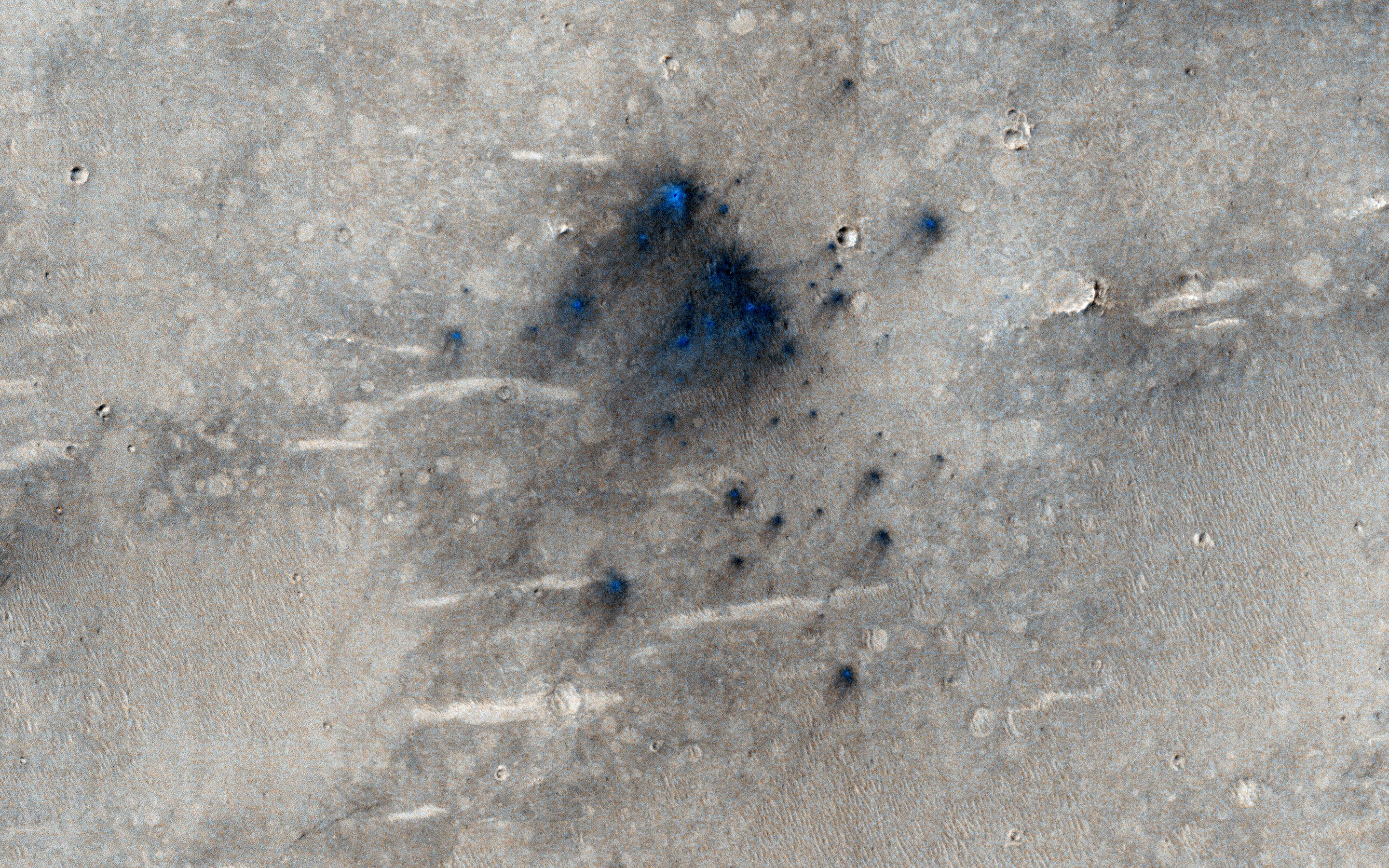
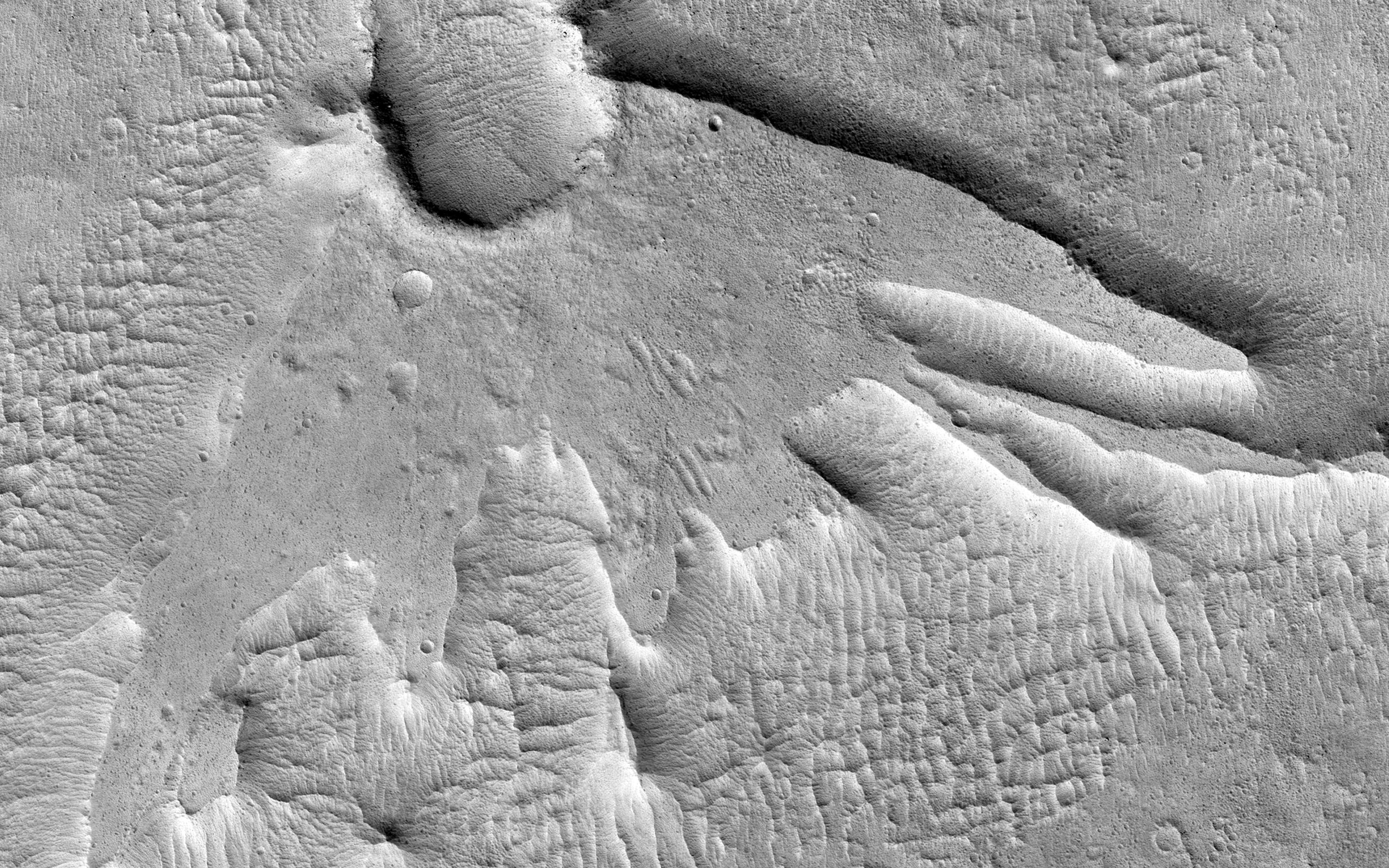
PIA17626:
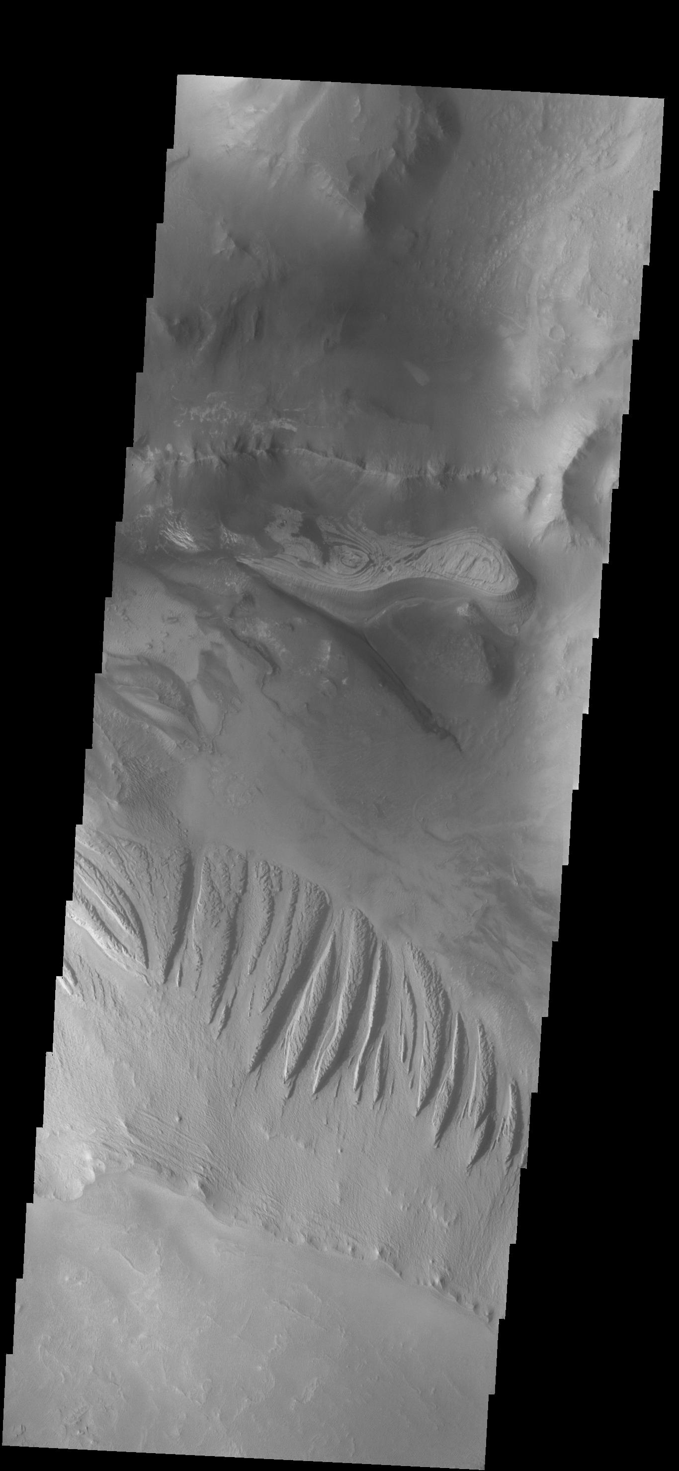
Martian Thunderbird
Full Resolution:
TIFF
(5.191 MB)
JPEG
(1.13 MB)
2013-10-31
Mars
2001 Mars Odyssey
THEMIS
690x1538x1
PIA17612:
Ophir Chasma
Full Resolution:
TIFF
(1.063 MB)
JPEG
(89.17 kB)
2013-11-01
Mars
2001 Mars Odyssey
THEMIS
1356x2943x1
PIA17613:
Daedalia Planum
Full Resolution:
TIFF
(3.995 MB)
JPEG
(599.8 kB)
2013-11-04
Mars
2001 Mars Odyssey
THEMIS
1383x2925x1
PIA17614:
Dark Slope Streaks in Terra Sabaea
Full Resolution:
TIFF
(4.05 MB)
JPEG
(241.9 kB)
2013-11-05
Mars
2001 Mars Odyssey
THEMIS
695x1540x1
PIA17615:
Shalbatana Vallis
Full Resolution:
TIFF
(1.072 MB)
JPEG
(58.07 kB)
2013-11-06
Mars
2001 Mars Odyssey
THEMIS
1367x2931x1
PIA17616:
Landslide
Full Resolution:
TIFF
(4.012 MB)
JPEG
(300.5 kB)
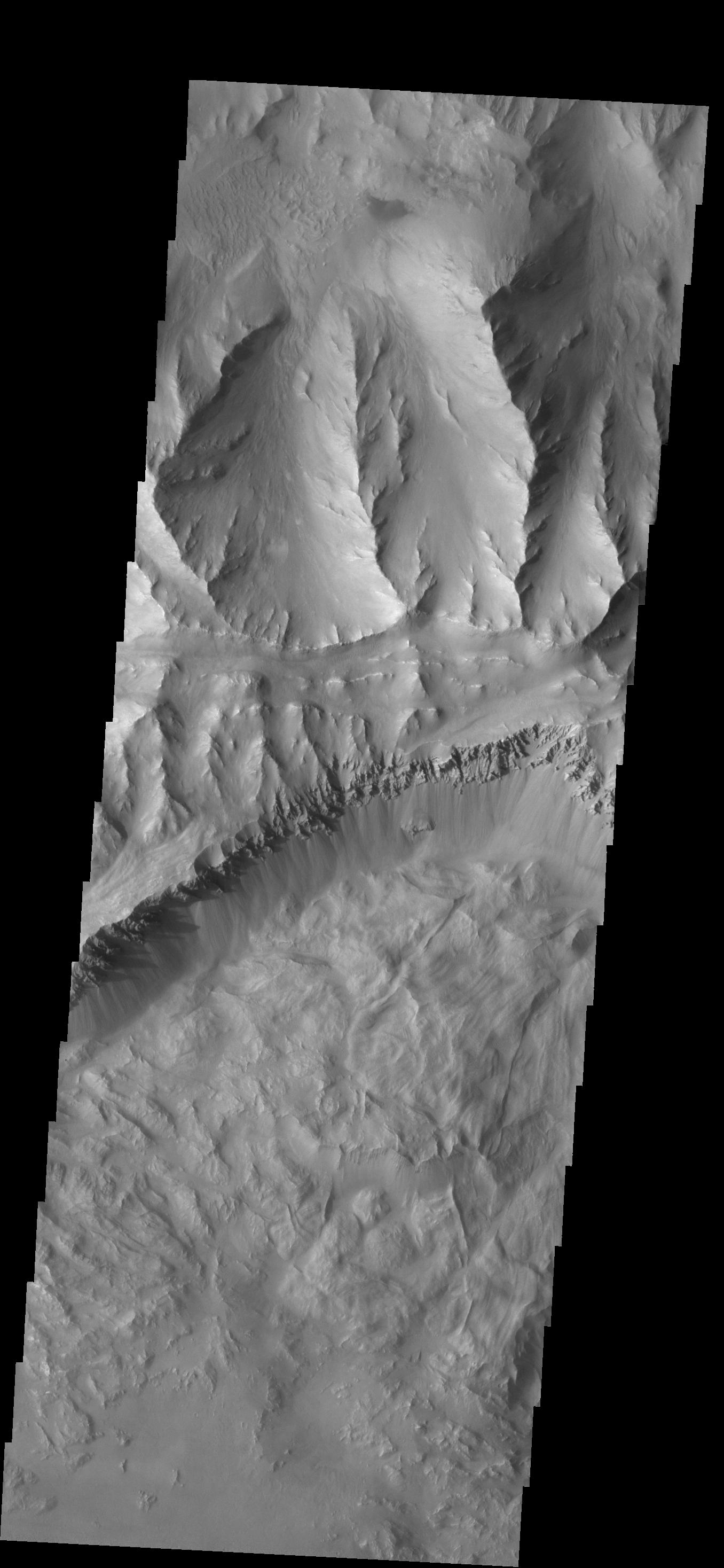
2013-11-06
Mars
Mars Reconnaissance Orbiter (MRO)
HiRISE
2880x1800x3
PIA17670:
Dust Covered Channels on Tharsis Tholus
Full Resolution:
TIFF
(15.56 MB)
JPEG
(747.6 kB)
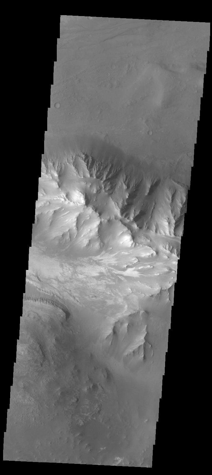
2013-11-06
Mars
Mars Reconnaissance Orbiter (MRO)
HiRISE
2880x1800x3
PIA17671:
Hints of an Ancient Shoreline in Southern Isidis Planitia
Full Resolution:
TIFF
(15.56 MB)
JPEG
(1.058 MB)
2013-11-06
Mars
Mars Reconnaissance Orbiter (MRO)
HiRISE
2880x1800x3
PIA17672:
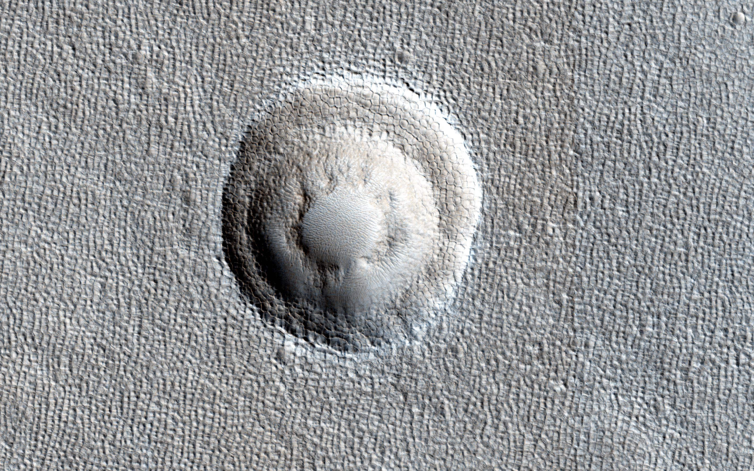
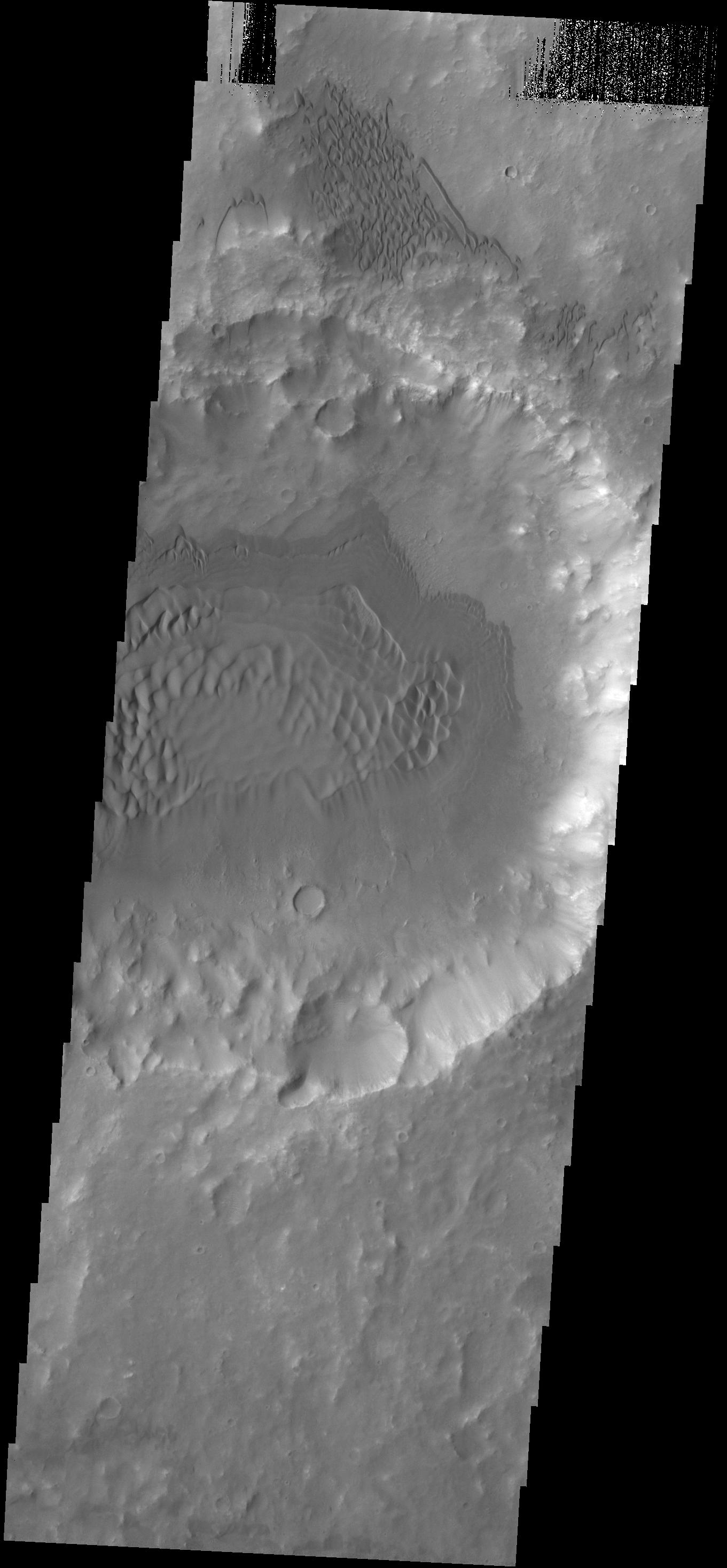
Breached Rim of a Circular Depression
Full Resolution:
TIFF
(15.56 MB)
JPEG
(617.4 kB)
2013-11-06
Mars
Mars Reconnaissance Orbiter (MRO)
HiRISE
2880x1800x3
PIA17673:
Cratered Cones in Tartarus Montes
Full Resolution:
TIFF
(15.56 MB)
JPEG
(783.3 kB)
2013-11-07
Mars
2001 Mars Odyssey
THEMIS
686x1538x1
PIA17617:
Arda Valles
Full Resolution:
TIFF
(1.056 MB)
JPEG
(96.16 kB)
2013-11-08
Mars
2001 Mars Odyssey
THEMIS
678x1543x1
PIA17618:
Gullies
Full Resolution:
TIFF
(1.047 MB)
JPEG
(87.22 kB)
2013-11-08
Mars
Mars Reconnaissance Orbiter (MRO)
HiRISE
1280x960x3
PIA17675:
Dunes on the Rim of the Hellas Impact Basin
Full Resolution:
TIFF
(3.688 MB)
JPEG
(290.9 kB)
2013-11-11
Mars
2001 Mars Odyssey
THEMIS
1355x2943x1
PIA17619:
Memnonia Fossae
Full Resolution:
TIFF
(3.992 MB)
JPEG
(222.6 kB)
2013-11-12
Mars
2001 Mars Odyssey
THEMIS
692x1548x1
PIA17620:
Rabe Crater Dunes
Full Resolution:
TIFF
(1.073 MB)
JPEG
(73.44 kB)
2013-11-13
Mars
2001 Mars Odyssey
THEMIS
720x1559x1
PIA17681:
Delta Deposit
Full Resolution:
TIFF
(1.124 MB)
JPEG
(64.46 kB)
2013-11-13
Mars
Mars Reconnaissance Orbiter (MRO)
HiRISE
2880x1800x1
PIA17688:
Rafts of Lava with Strange Infrared Properties
Full Resolution:
TIFF
(5.191 MB)
JPEG
(1.161 MB)
2013-11-13
Mars
Mars Reconnaissance Orbiter (MRO)
HiRISE
2880x1800x1
PIA17689:
Crater with Trough in Utopia Rupes
Full Resolution:
TIFF
(5.191 MB)
JPEG
(856.5 kB)
2013-11-13
Mars
Mars Reconnaissance Orbiter (MRO)
HiRISE
2880x1800x3
PIA17690:
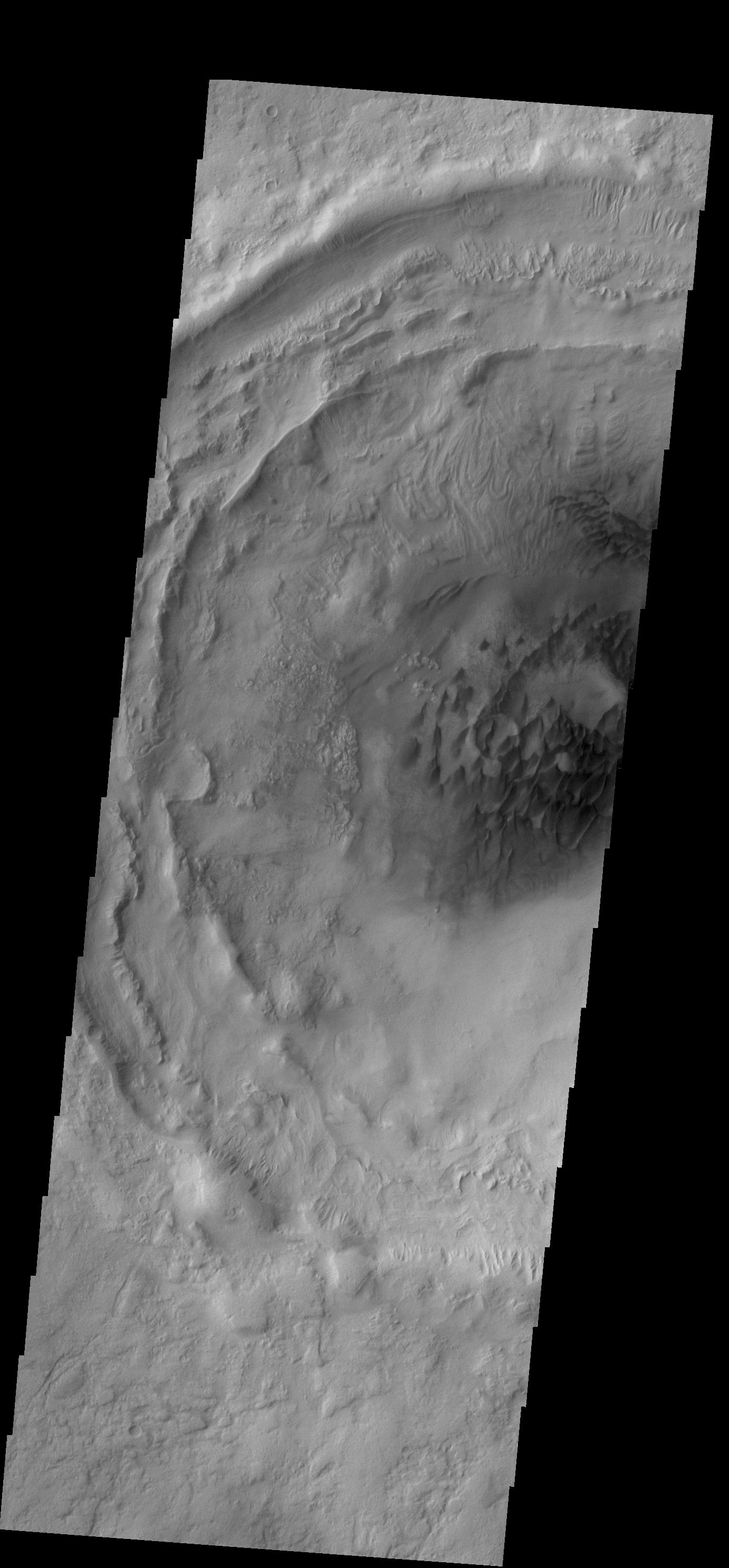
Linear Ridges
Full Resolution:
TIFF
(15.56 MB)
JPEG
(474.1 kB)
2013-11-13
Mars
Mars Reconnaissance Orbiter (MRO)
HiRISE
2880x1800x3
PIA17691:
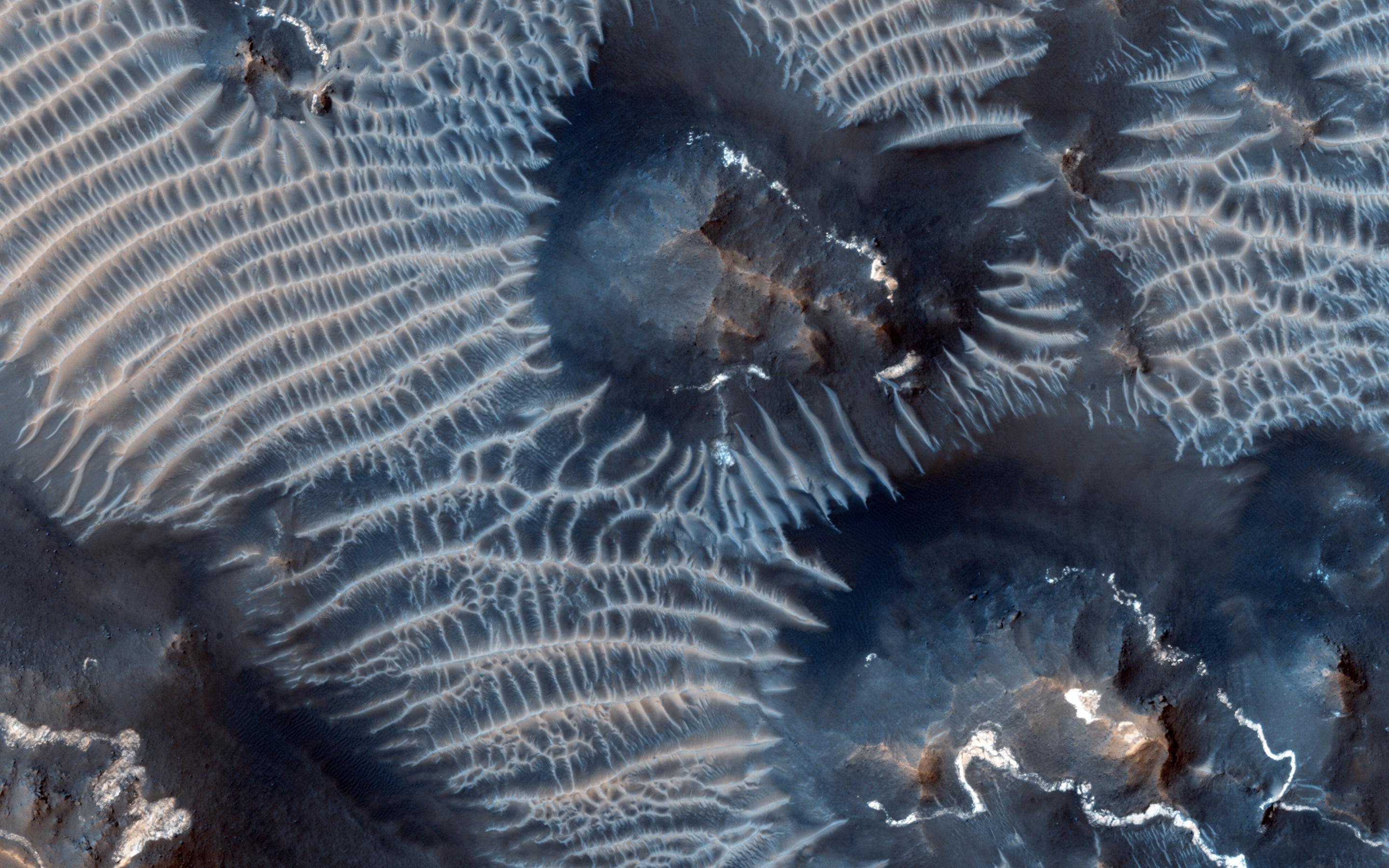
Sandstone Cliffs and Hematite Lag Deposits of Ophir Mensa
Full Resolution:
TIFF
(15.56 MB)
JPEG
(750.2 kB)
2013-11-13
Mars
Mars Exploration Rover (MER)
Panoramic Camera
9908x3546x3
PIA17582:
'Murray Ridge' on Rim of Endeavour Crater on Mars
Full Resolution:
TIFF
(105.4 MB)
JPEG
(3.421 MB)
2013-11-13
Mars
Mars Exploration Rover (MER)
Panoramic Camera
9908x3546x3
PIA17583:
'Murray Ridge' on Rim of Endeavour Crater on Mars, False Color
Full Resolution:
TIFF
(105.4 MB)
JPEG
(4.847 MB)
2013-11-13
Mars
Mars Exploration Rover (MER)
Navigation Camera
4253x1820x1
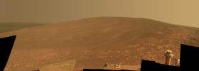
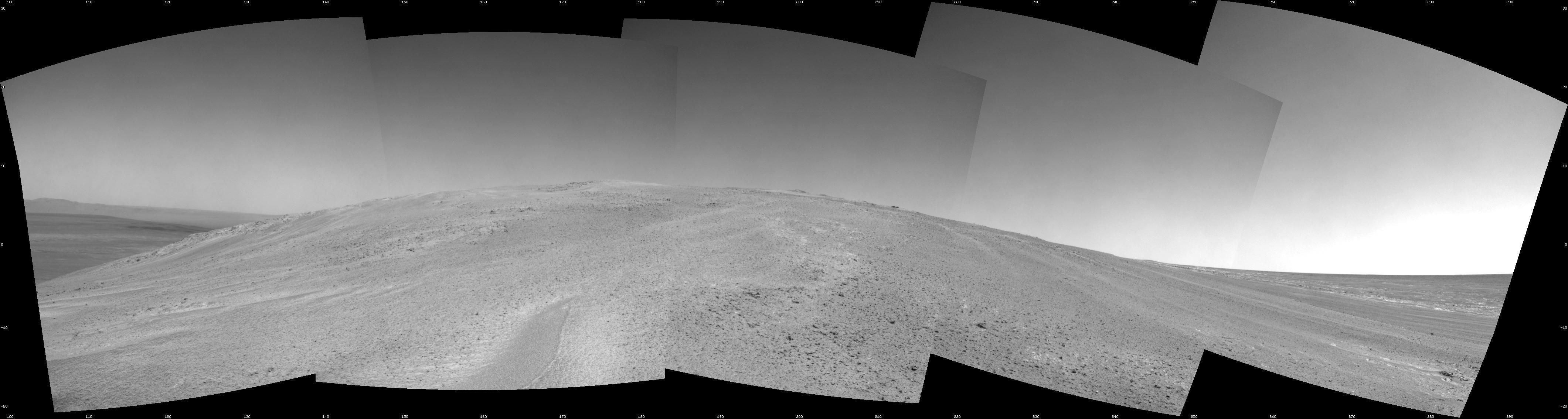
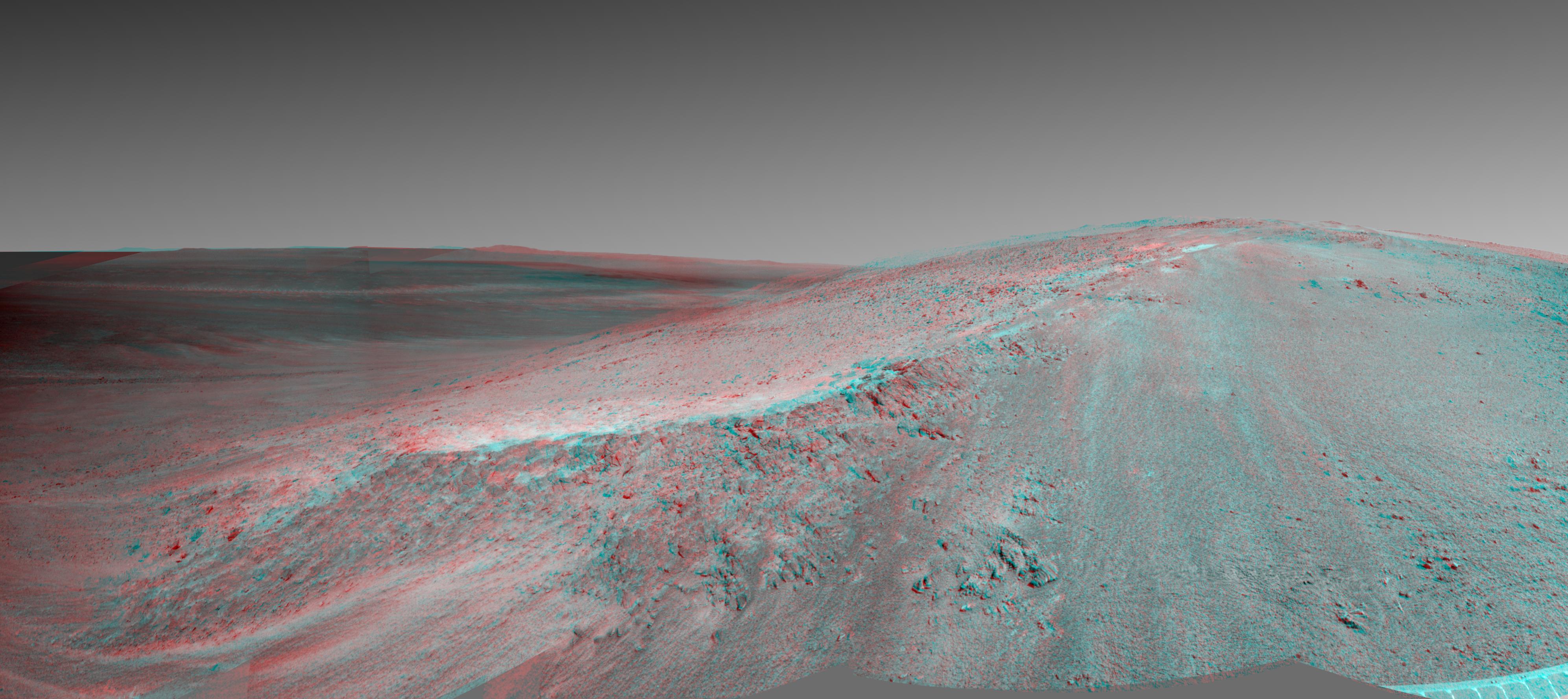
PIA17585:
Opportunity's View Climbing 'Murray Ridge'
Full Resolution:
TIFF
(7.755 MB)
JPEG
(596.5 kB)
2013-11-13
Mars
Mars Reconnaissance Orbiter (MRO)
HiRISE
1152x1072x1
PIA17587:
'Murray Buttes' at Foot of Mount Sharp on Mars
Full Resolution:
TIFF
(1.236 MB)
JPEG
(248 kB)
2013-11-13
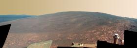
Mars
Mars Exploration Rover (MER)
Mars Reconnaissance Orbiter (MRO)
HiRISE
8192x4298x3
PIA17586:
A New Perspective on Murray Ridge
Full Resolution:
TIFF
(105.7 MB)
JPEG
(2.803 MB)
2013-11-13
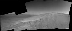
Mars
Mars Exploration Rover (MER)
Navigation Camera
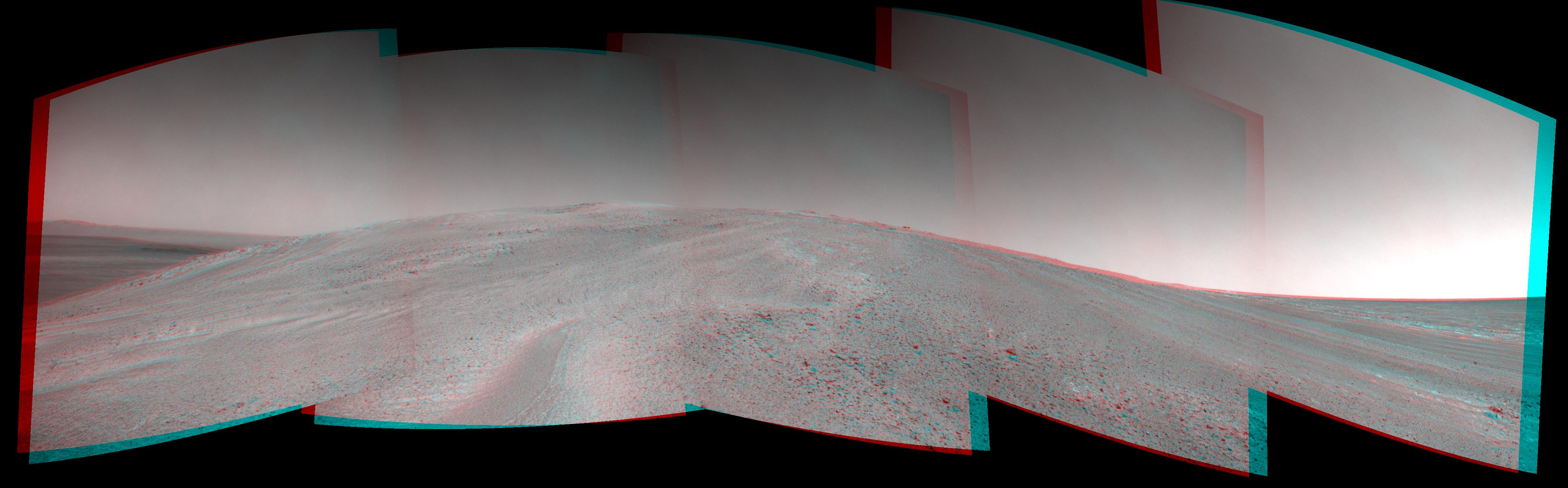
3985x1776x3
PIA17588:
'Murray Ridge' in Stereo from Mars Rover Opportunity
Full Resolution:
TIFF
(21.24 MB)
JPEG
(747.4 kB)
2013-11-14
Mars
2001 Mars Odyssey
THEMIS
680x1549x1
PIA17682:
Rabe Crater Dunes
Full Resolution:
TIFF
(1.055 MB)
JPEG
(88.31 kB)
2013-11-15
Mars
2001 Mars Odyssey
THEMIS
700x1541x1
PIA17683:
Wind Streaks
Full Resolution:
TIFF
(1.08 MB)
JPEG
(86.72 kB)
2013-11-18
Mars
2001 Mars Odyssey
THEMIS
690x1539x1
PIA17684:
Daedalia Planum
Full Resolution:
TIFF
(1.063 MB)
JPEG
(174.6 kB)
1-100
101-200
201-300
301-400
401-500
501-600
601-700
701-800
801-900
901-1000
Currently displaying images:
8101 - 8200
of 12760


