Your search criteria found
12748
images
Target is Mars (and available satellites)
Go to PIAxxxxx:
Refine this list of images by:
Target:
Deimos
Mars
Phobos
Mission:
2001 Mars Odyssey
Antarctic Meteorite Location and Mapping Project (AMLAMP)
Dawn
ExoMars
Hubble Space Telescope
InSight
MAVEN
Mariner Mars 1964 (Mariner 4)
Mariner Mars 1969 (Mariner 7)
Mariner Mars 1971 (Mariner 9)
Mars 2020
Mars 2020 Rover
Mars Atmosphere and Volatile Evolution MissioN (MAVEN)
Mars Climate Orbiter
Mars Cube One (MarCO)
Mars Exploration Rover (MER)
Mars Express (MEX)
Mars Global Surveyor (MGS)
Mars Helicopter
Mars Pathfinder (MPF)
Mars Reconnaissance Orbiter (MRO)
Mars Sample Return
Mars Sample Return (MSR)
Mars Science Laboratory (MSL)
Phoenix
Rosetta
Viking
Spacecraft:
2001 Mars Odyssey
Curiosity
Dawn
InSight Mars Lander
Ingenuity
MAVEN
MarCO-B
Mariner 4
Mariner 7
Mariner 9
Mars Climate Orbiter
Mars Express (MEX)
Mars Express (MEX) Orbiter
Mars Global Surveyor Orbiter
Mars Pathfinder Lander
Mars Pathfinder Rover
Mars Reconnaissance Orbiter (MRO)
Mars Sample Return
Mars Science Laboratory (MSL)
NASA's Mars Pathfinder Lander
Opportunity
Perseverance
Philae Lander
Phoenix Lander
Phoenix Mars Lander
Spirit
Viking Lander 1
Viking Lander 2
Viking Orbiter 1
Viking Orbiter 2
Instrument:
Alpha Particle X-ray Spectrometer
Alpha Particle X-ray Spectrometer (MSL)
Atmospheric Structure / Meteorology Instrument
CHIMRA
Camera 1
Camera 2
Chemistry & Mineralogy (CheMin)
Chemistry and Camera (ChemCam)
Comet Infrared and Visible Analyser (CIVA
Compact Reconnaissance Imaging Spectrometer for Mars (CRISM)
Context Camera (CTX)
Deep Space Network
Descent Image Motion Estimation System (DIMES)
Dynamic Albedo of Neutrons
Dynamic Albedo of Neutrons (DAN)
Gamma Ray Spectrometer - Neutron Spectrometer
Gamma Ray Spectrometer Suite
Hazard Avoidance Camera
Hazard Avoidance Camera (M2020)
Hazard Avoidance Camera (MSL)
Heat and Physical Properties Package (HP3)
High Resolution Imaging Science Experiment (HiRISE)
High Resolution Instrument (HRI)
High Resolution Stereo Camera
Imager for Mars Pathfinder
Imaging Ultraviolet Spectrograph
Imaging Ultraviolet Spectrograph (IUVS)
Instrument Context Camera (ICC)
Instrument Deployment Camera (IDC)
Lander Vision System Camera (LCAM)
Magnetometer
Mars Advanced Radar for Subsurface and Ionosphere Sounding (MARSIS)
Mars Advanced Radar for Subsurface and Ionospheric Sounding (MARSIS)
Mars Climate Sounder (MCS)
Mars Color Imager (MARCI)
Mars Descent Imager
Mars Environmental Dynamics Analyzer (MEDA)
Mars Hand Lens Imager (MAHLI)
Mars Horizon Sensor Assembly
Mars Orbiter Camera (MOC)
Mars Orbiter Laser Altimeter
Mars Radiation Experiment
Mastcam
Mastcam-Z
Microscopic Imager
Microscopy Electrochemistry and Conductivity Analyzer (MECA)
Miniature Thermal Emission Spectrometer
Moessbauer Spectrometer
Navigation Camera
Navigation Camera (M2020)
Navigation Camera (MSL)
Neutral Gas and Ion Mass Spectrometer
Neutron Spectrometer
Optical Microscope
Optical Navigation Camera
Panoramic Camera
Planetary Instrument for X-ray Lithochemistry (PIXL)
Radar System
Radiation Assessment Detector (RAD)
Radio Science Subsystem
Robotic Arm
Robotic Arm (MSL)
Robotic Arm Camera (RAC)
Rock Abrasion Tool (RAT)
Rover Cameras
Rover Environmental Monitoring Station (REMS)
Sample Analysis at Mars (SAM)
Scanning Habitable Environments with Raman & Luminescence for Organics and Chemicals (SHERLOC)
Seismic Experiment for Interior Structure (SEIS)
Shallow Subsurface Radar (SHARAD)
Stereo Imager (SSI)
SuperCam
Surface Stereo Imager (SSI)
Thermal Emission Imaging System
Thermal Emission Spectrometer
Thermal and Electrical Conductivity Probe
Thermal and Evolved Gas Analyzer
Trace Gas Orbiter
Visual Imaging Subsystem
Visual Imaging Subsystem - Camera A
Visual Imaging Subsystem - Camera B
Wide Field Planetary Camera 2
Click on an image for detailed information
Click on a column heading to sort in ascending or descending order
My
List
Addition Date
Target
Mission
Instrument
Size
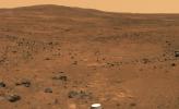
2005-11-15
Mars
Mars Exploration Rover (MER)
Panoramic Camera
892x871x1
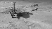
PIA03201:
'Mars-shine'
Full Resolution:
TIFF
(777.9 kB)
JPEG
(64.48 kB)
2005-11-15
Mars
Mars Exploration Rover (MER)
Microscopic Imager
Rock Abrasion Tool (RAT)
2292x2154x1
PIA03202:
A Closer Look at 'Kalavrita'
Full Resolution:
TIFF
(4.943 MB)
JPEG
(606.8 kB)
2005-11-16
Mars
Mars Global Surveyor (MGS)
Mars Orbiter Camera (MOC)
672x1244x1
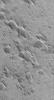
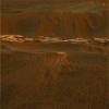
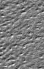
PIA03546:
Small Yardangs
Full Resolution:
TIFF
(837 kB)
JPEG
(173.5 kB)
2005-11-16
Mars
2001 Mars Odyssey
THEMIS
1375x2916x1
PIA03548:
Nili Caldera
Full Resolution:
TIFF
(4.014 MB)
JPEG
(446.9 kB)
2005-11-17
Mars
Mars Global Surveyor (MGS)
Mars Orbiter Camera (MOC)
827x1955x1
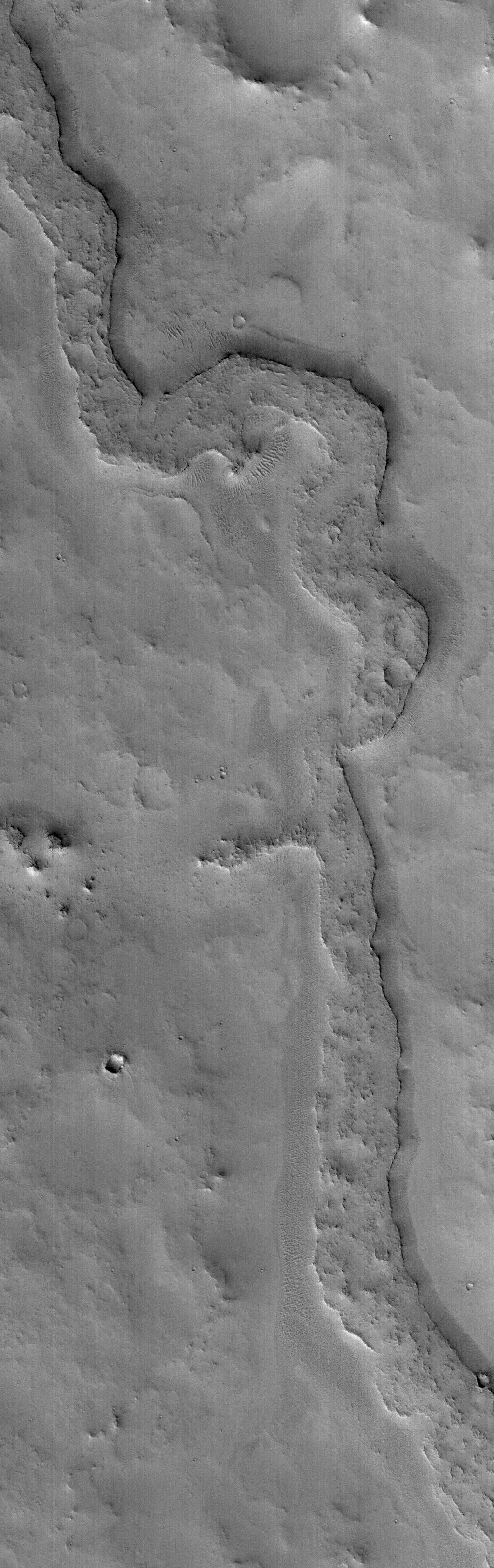
PIA03547:
Dust-covered Flow
Full Resolution:
TIFF
(1.619 MB)
JPEG
(239.4 kB)
2005-11-17
Mars
2001 Mars Odyssey
THEMIS
1343x2938x1
PIA03549:
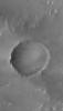
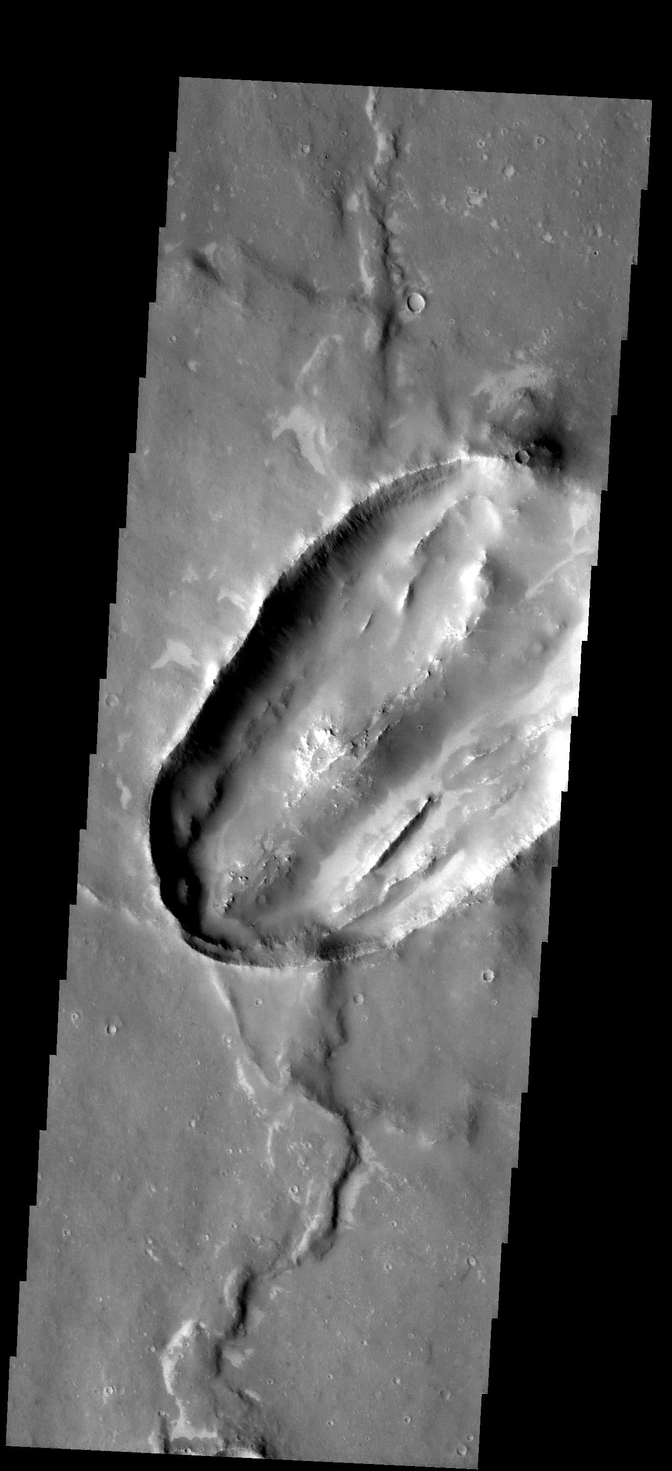
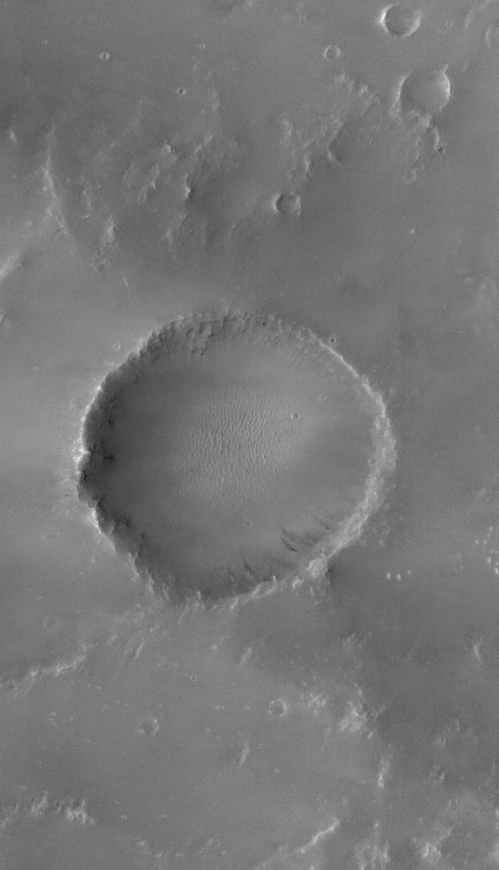
Odd Crater
Full Resolution:
TIFF
(3.95 MB)
JPEG
(319.9 kB)
2005-11-18
Mars
2001 Mars Odyssey
THEMIS
992x3018x1
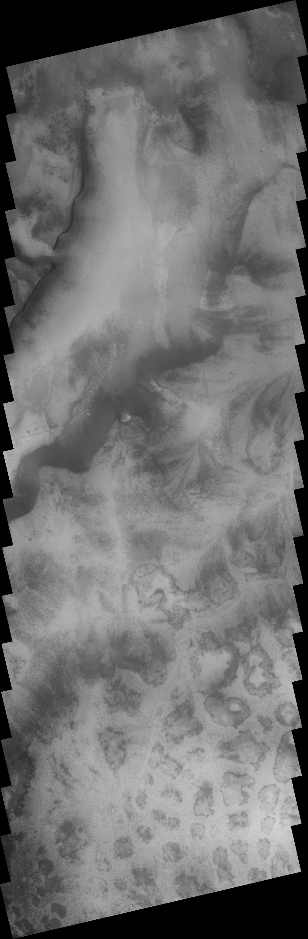
PIA03577:
Polar Terrains
Full Resolution:
TIFF
(2.997 MB)
JPEG
(257.1 kB)
2005-11-18
Mars
Mars Global Surveyor (MGS)
Mars Orbiter Camera (MOC)
836x3390x1
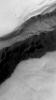
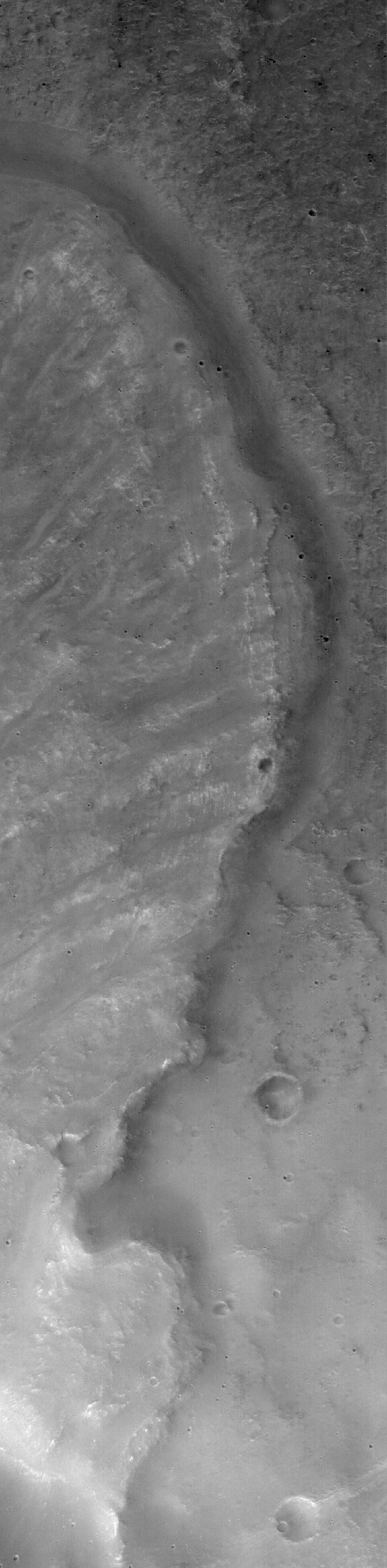
PIA03584:
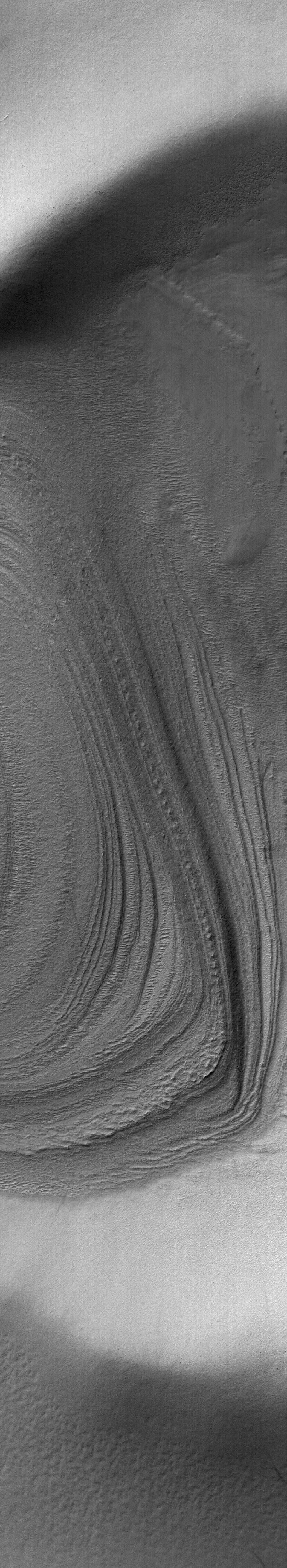
Landslide in Mutch
Full Resolution:
TIFF
(2.837 MB)
JPEG
(330.9 kB)
2005-11-19
Mars
Mars Global Surveyor (MGS)
Mars Orbiter Camera (MOC)
1536x2003x1
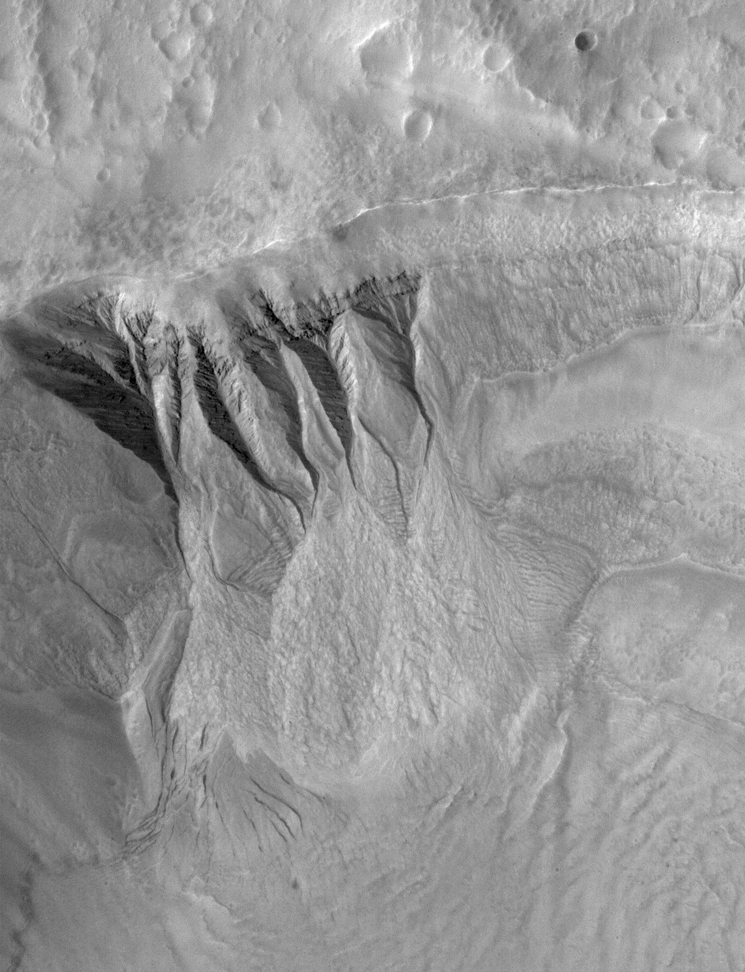
PIA03585:
South Mid-latitude Gullies
Full Resolution:
TIFF
(3.08 MB)
JPEG
(542.5 kB)
2005-11-20
Mars
Mars Global Surveyor (MGS)
Mars Orbiter Camera (MOC)
1024x1140x1
PIA03586:
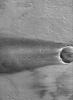
8�N 7�W Crater
Full Resolution:
TIFF
(1.169 MB)
JPEG
(280.5 kB)
2005-11-21
Mars
2001 Mars Odyssey
THEMIS
1238x2737x1
PIA03578:
Lucus Planum
Full Resolution:
TIFF
(3.392 MB)
JPEG
(670.7 kB)
2005-11-21
Mars
Mars Global Surveyor (MGS)
Mars Orbiter Camera (MOC)
672x1224x1
PIA03587:
Crater in Arabia
Full Resolution:
TIFF
(823.6 kB)
JPEG
(93.38 kB)
2005-11-21
Mars
Mars Exploration Rover (MER)
Navigation Camera
2400x1350x3
PIA03230:
Special-Effects Spirit in "Columbia Hills"
Full Resolution:
TIFF
(3.245 MB)
JPEG
(289.5 kB)
2005-11-21
Mars
Mars Exploration Rover (MER)
Panoramic Camera
12787x6607x3
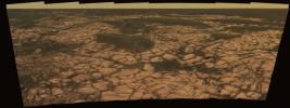
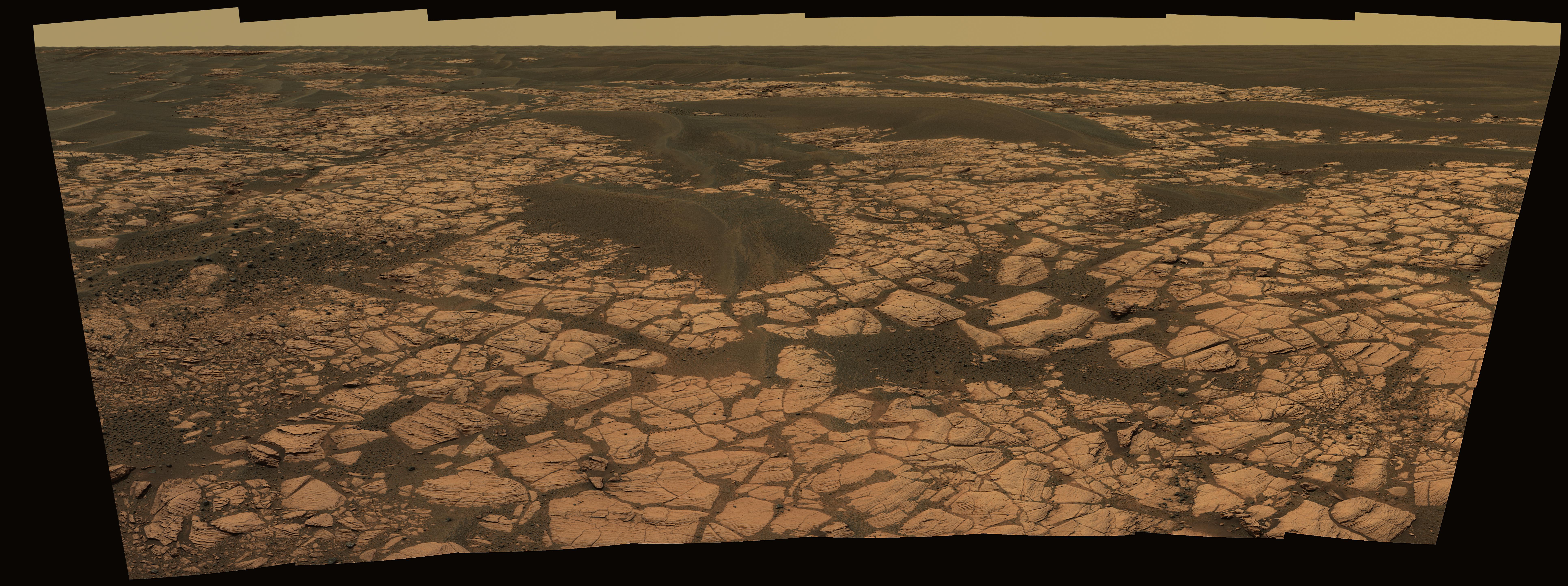
PIA03231:
Special-Effects Spirit on Flank of "Husband Hill"
Full Resolution:
TIFF
(253.5 MB)
JPEG
(4.248 MB)
2005-11-21
Mars
Mars Exploration Rover (MER)
Panoramic Camera
2486x1914x3
PIA03232:
Special-Effects Spirit Silhouetted on "Jibsheet"
Full Resolution:
TIFF
(14.29 MB)
JPEG
(106.8 kB)
2005-11-21
Mars
Mars Exploration Rover (MER)
Panoramic Camera
9805x2290x3
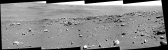
PIA03233:
'East Basin' Panorama
Full Resolution:
TIFF
(67.36 MB)
JPEG
(2.49 MB)
QTVR
(2.787 MB)
2005-11-22
Mars
2001 Mars Odyssey
THEMIS
1373x2917x1
PIA03579:
Gigas Sulci Features
Full Resolution:
TIFF
(4.01 MB)
JPEG
(726.1 kB)
2005-11-22
Mars
Mars Global Surveyor (MGS)
Mars Orbiter Camera (MOC)
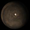
640x640x3
PIA03588:
Mars at Ls 324�: Elysium/Mare Cimmerium
Full Resolution:
TIFF
(411.8 kB)
JPEG
(20.47 kB)
2005-11-22
Mars
Mars Exploration Rover (MER)
Navigation Camera
1143x920x3
PIA03234:
Simulated View for Rover Activity Planning
Full Resolution:
TIFF
(1.054 MB)
JPEG
(153.5 kB)
2005-11-23
Mars
2001 Mars Odyssey
THEMIS
1333x2926x1
PIA03580:
Crater Dunes
Full Resolution:
TIFF
(3.904 MB)
JPEG
(324.7 kB)
2005-11-23
Mars
Mars Global Surveyor (MGS)
Mars Orbiter Camera (MOC)
1024x2096x1
PIA03589:
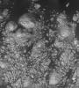
Light-toned Rocks
Full Resolution:
TIFF
(2.149 MB)
JPEG
(373.6 kB)
2005-11-24
Mars
2001 Mars Odyssey
THEMIS
974x3126x1
PIA03581:
Polar Layers
Full Resolution:
TIFF
(3.048 MB)
JPEG
(289.6 kB)
2005-11-24
Mars
Mars Global Surveyor (MGS)
Mars Orbiter Camera (MOC)
836x1499x1
PIA03590:
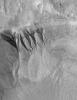
Gullied Slope
Full Resolution:
TIFF
(1.255 MB)
JPEG
(280.4 kB)
2005-11-25
Mars
2001 Mars Odyssey
THEMIS
1234x2755x1
PIA03582:
Landslide
Full Resolution:
TIFF
(3.404 MB)
JPEG
(593.1 kB)
2005-11-25
Mars
Mars Global Surveyor (MGS)
Mars Orbiter Camera (MOC)
2048x2315x1
PIA03591:
Mid-latitude Gullies
Full Resolution:
TIFF
(4.746 MB)
JPEG
(939.2 kB)
2005-11-26
Mars
Mars Global Surveyor (MGS)
Mars Orbiter Camera (MOC)
836x2866x1
PIA03592:
Argyre Streaks
Full Resolution:
TIFF
(2.399 MB)
JPEG
(464.9 kB)
2005-11-27
Mars
Mars Global Surveyor (MGS)
Mars Orbiter Camera (MOC)
672x1141x1
PIA03593:
Dust Devil Streaks
Full Resolution:
TIFF
(767.8 kB)
JPEG
(180 kB)
2005-11-28
Mars
2001 Mars Odyssey
THEMIS
1051x2859x1
PIA03583:
Southern Crater
Full Resolution:
TIFF
(3.008 MB)
JPEG
(315.7 kB)
2005-11-28
Mars
Mars Global Surveyor (MGS)
Mars Orbiter Camera (MOC)
1024x2304x1
PIA03594:
Meridiani Outcrops
Full Resolution:
TIFF
(2.362 MB)
JPEG
(623.3 kB)
2005-11-28
Mars
Mars Exploration Rover (MER)
Navigation Camera
Panoramic Camera
1024x1024x3
PIA03576:
Windblown Ripple 'Scylla'
Full Resolution:
TIFF
(3.15 MB)
JPEG
(163.9 kB)
2005-11-29
Mars
Mars Global Surveyor (MGS)
Mars Orbiter Camera (MOC)
640x640x3
PIA03595:
Mars at Ls 324�: South Polar Region
Full Resolution:
TIFF
(411.8 kB)
JPEG
(25.63 kB)
2005-11-29
Mars
2001 Mars Odyssey
THEMIS
1164x2773x1
PIA03596:
Argyre Gullies
Full Resolution:
TIFF
(3.231 MB)
JPEG
(341.2 kB)
2005-11-30
Mars
Mars Express (MEX)
Mars Global Surveyor (MGS)
MARSIS
Mars Orbiter Laser Altimeter
979x666x3
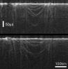
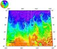
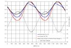
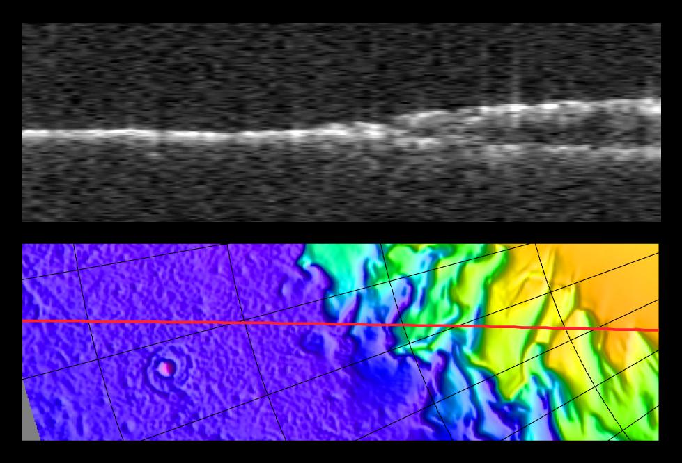
PIA03235:
Radargram of Mars' North Polar Layered Deposits with Topographic Map
Full Resolution:
TIFF
(1.959 MB)
JPEG
(95.14 kB)
2005-11-30
Mars
Mars Express (MEX)
MARSIS
769x786x1
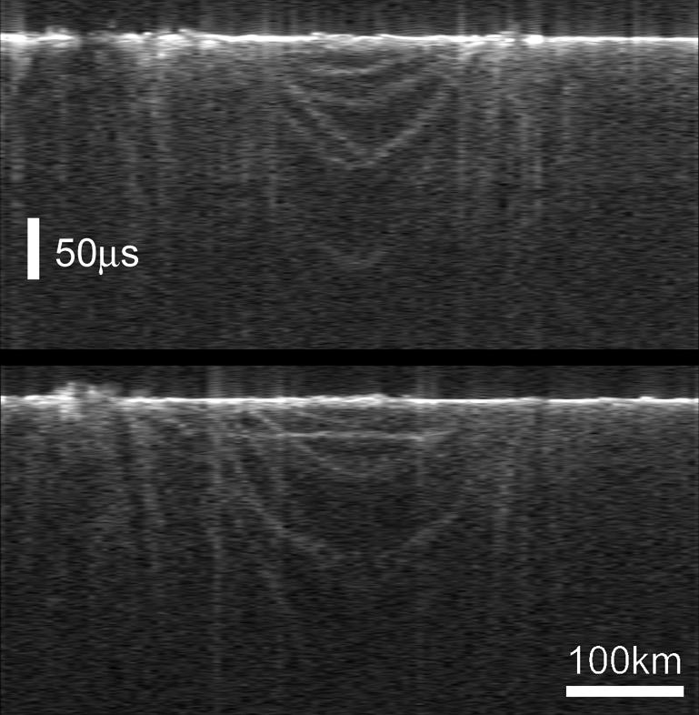
PIA03236:
Radargrams of Buried Basin from Two Adjacent Orbits
Full Resolution:
TIFF
(605.3 kB)
JPEG
(79.49 kB)
2005-11-30
Mars
Mars Express (MEX)
Mars Global Surveyor (MGS)
Mars Advanced Radar for Subsurface and Ionospheric Sounding (MARSIS)
Mars Orbiter Laser Altimeter
788x683x3
PIA03237:
Topographic Map of Chryse Planitia with Location of Possible Buried Basin
Full Resolution:
TIFF
(1.617 MB)
JPEG
(106.2 kB)
2005-11-30
Mars
Mars Express (MEX)
MARSIS
1371x950x3
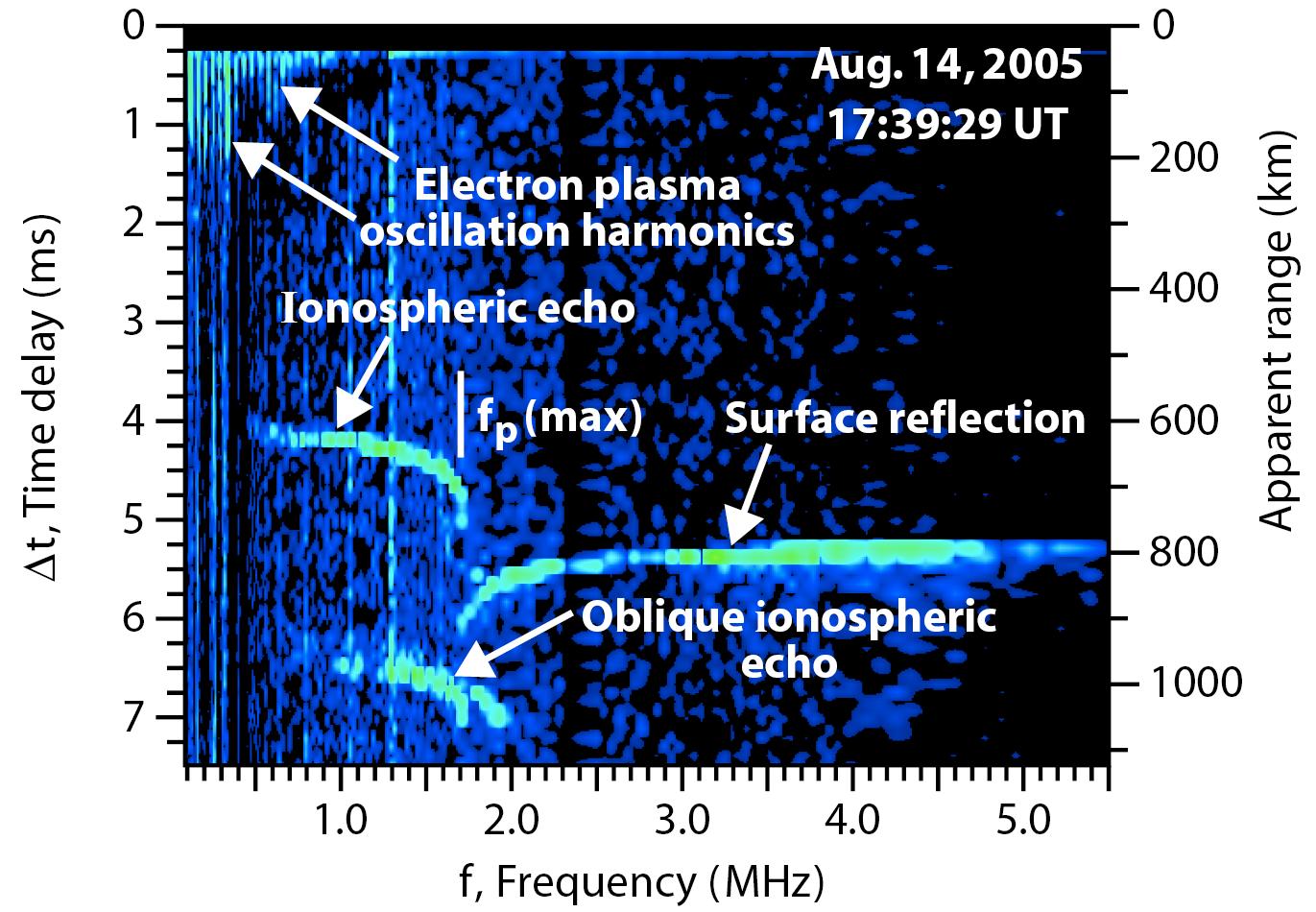
PIA03238:
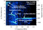
Radar Ionogram with Oblique Ionospheric Echo
Full Resolution:
TIFF
(3.915 MB)
JPEG
(206.6 kB)
2005-11-30
Mars
Mars Global Surveyor (MGS)
Mars Orbiter Camera (MOC)
672x2076x1
PIA03572:
Crater Interior
Full Resolution:
TIFF
(1.397 MB)
JPEG
(345.6 kB)
2005-11-30
Mars
2001 Mars Odyssey
THEMIS
972x2989x1
PIA03597:
Polar Lines
Full Resolution:
TIFF
(2.909 MB)
JPEG
(347.3 kB)
2005-12-01
Mars
2001 Mars Odyssey
THEMIS
1344x3027x1
PIA03598:
Canyon Floor Deposits
Full Resolution:
TIFF
(4.073 MB)
JPEG
(432.4 kB)
2005-12-01
Mars
Mars Global Surveyor (MGS)
Mars Orbiter Camera (MOC)
1024x1408x1
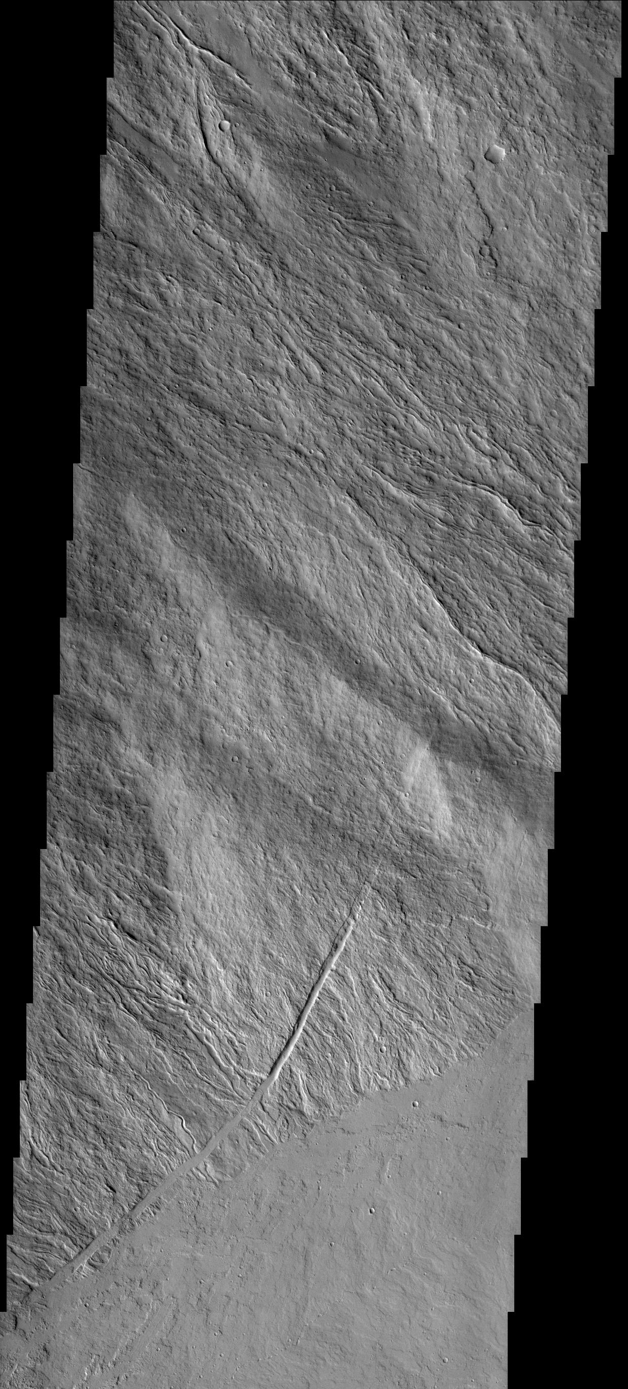
PIA03573:
Daedalia Streak
Full Resolution:
TIFF
(1.443 MB)
JPEG
(571 kB)
2005-12-02
Mars
2001 Mars Odyssey
THEMIS
1044x2853x1
PIA03599:
Polar Variety
Full Resolution:
TIFF
(2.982 MB)
JPEG
(270.6 kB)
2005-12-02
Mars
Mars Global Surveyor (MGS)
Mars Orbiter Camera (MOC)
1024x1874x1
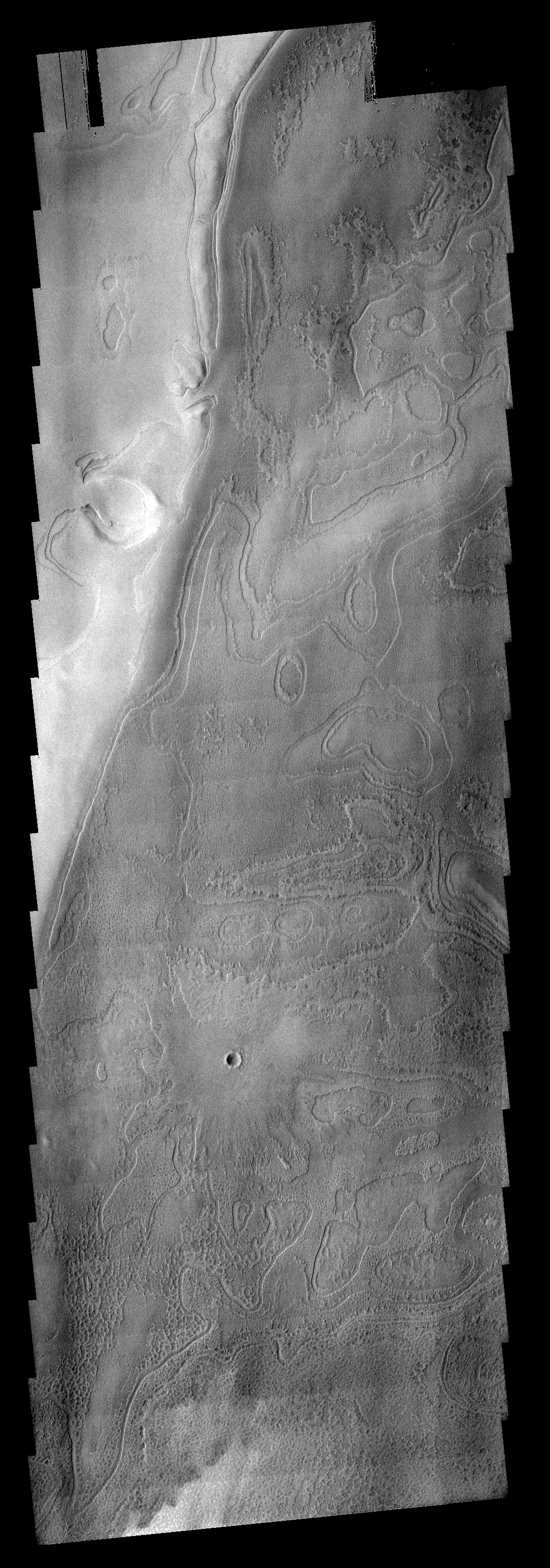
PIA03574:
Lycus Sulci
Full Resolution:
TIFF
(1.921 MB)
JPEG
(261.8 kB)
2005-12-03
Mars
Mars Global Surveyor (MGS)
Mars Orbiter Camera (MOC)
836x2204x1
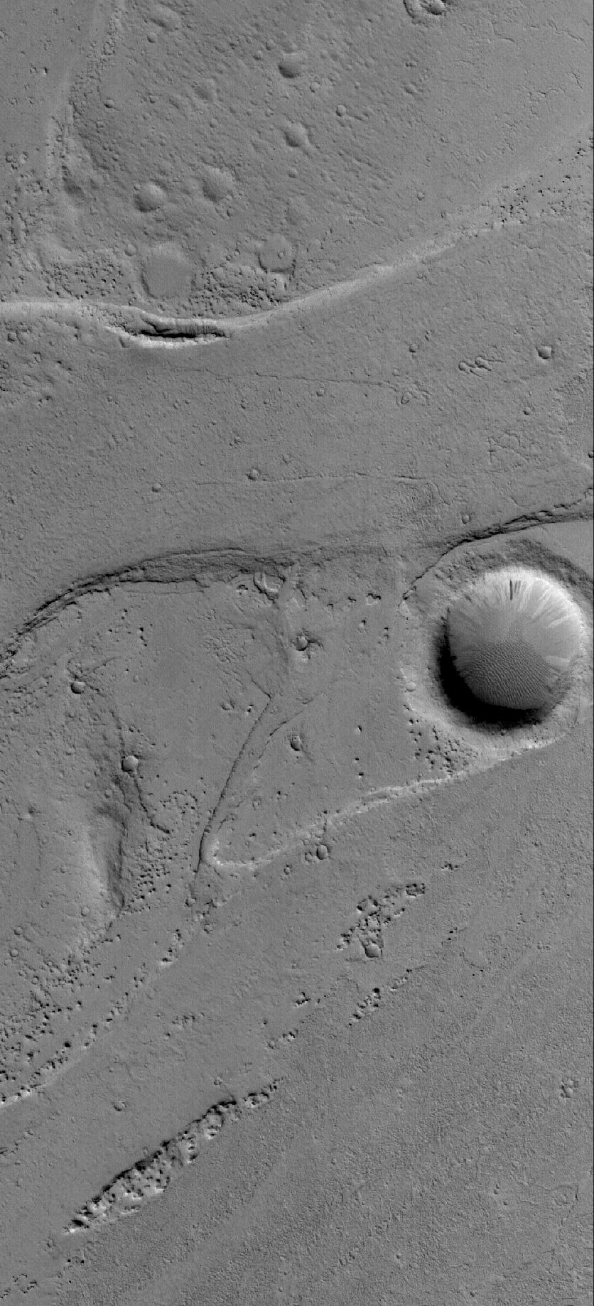
PIA03575:
Tractus Catena Pits
Full Resolution:
TIFF
(1.845 MB)
JPEG
(248.6 kB)
2005-12-04
Mars
Mars Global Surveyor (MGS)
Mars Orbiter Camera (MOC)
1024x1712x1
PIA03618:
Crater and Streaks
Full Resolution:
TIFF
(1.755 MB)
JPEG
(281.2 kB)
2005-12-05
Mars
2001 Mars Odyssey
THEMIS
1344x2857x1
PIA03632:
Spallanzani Cr. Floor
Full Resolution:
TIFF
(3.844 MB)
JPEG
(345.6 kB)
2005-12-05
Mars
Mars Global Surveyor (MGS)
Mars Orbiter Camera (MOC)
672x1764x1
PIA03619:
Gullied Crater
Full Resolution:
TIFF
(1.187 MB)
JPEG
(278.7 kB)
2005-12-05
Mars
Mars Exploration Rover (MER)
911x623x3
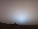
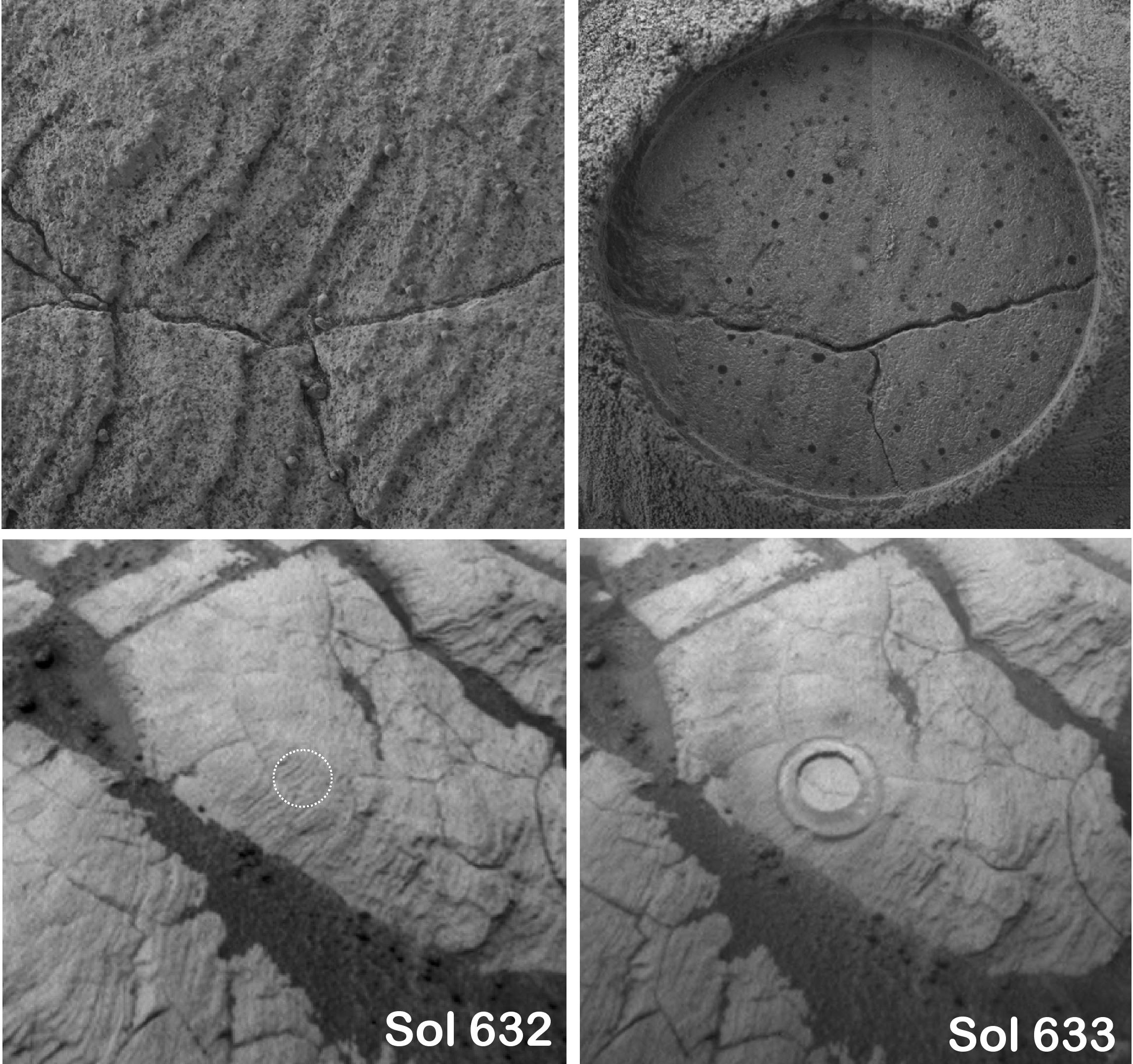
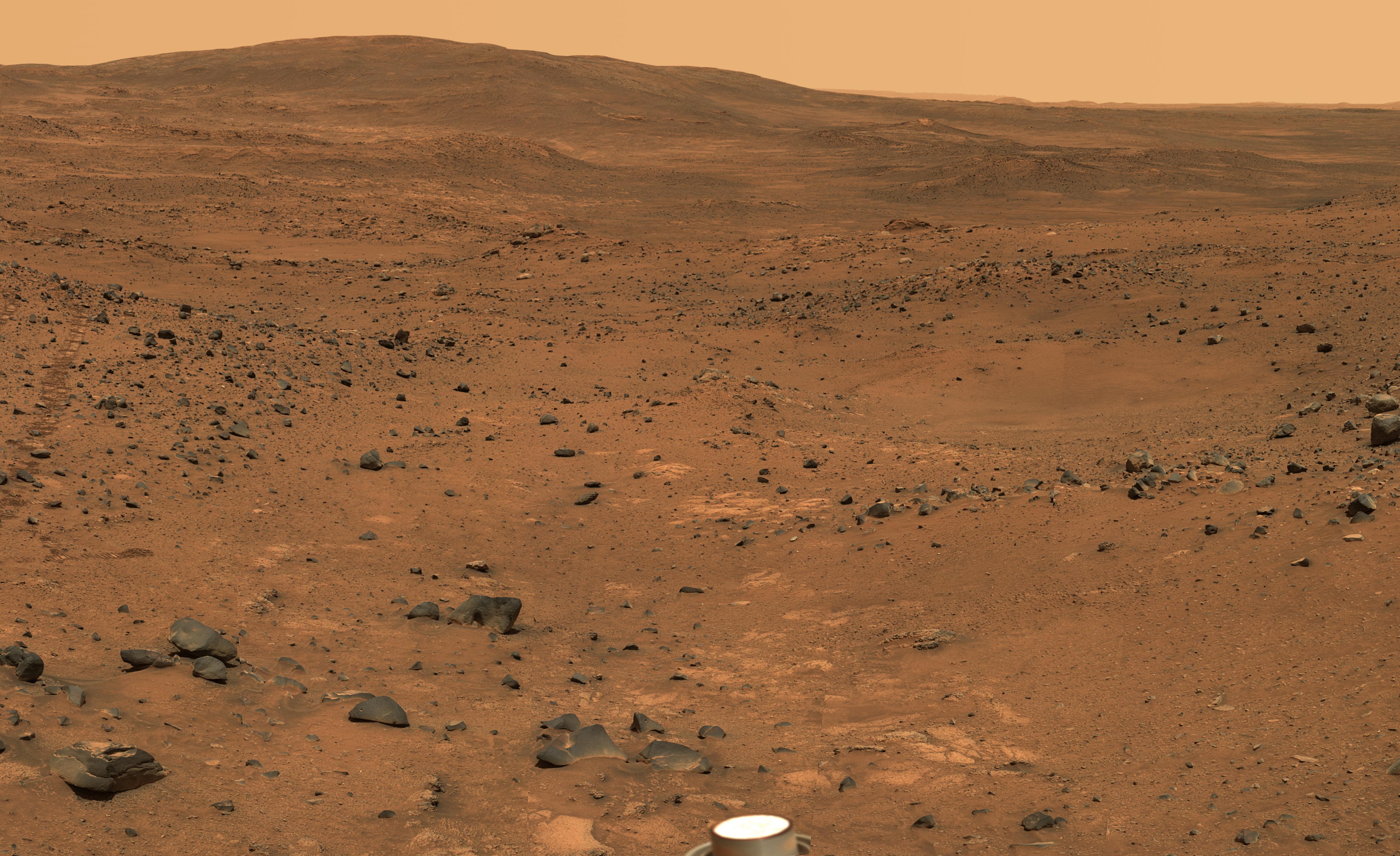
PIA03607:
Solar Power on Mars
Full Resolution:
TIFF
(570 kB)
JPEG
(84.61 kB)
2005-12-05
Mars
Mars Exploration Rover (MER)
896x549x3
PIA03608:
Solar-Panel Dust Accumulation and Cleanings
Full Resolution:
TIFF
(494.2 kB)
JPEG
(57.98 kB)
2005-12-05
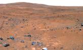
Mars
Mars Global Surveyor (MGS)
Mars Exploration Rover (MER)
Mars Orbiter Camera (MOC)
1039x691x3
PIA03624:
Spirit Traverse Map, Sol 680
Full Resolution:
TIFF
(2.157 MB)
JPEG
(131 kB)
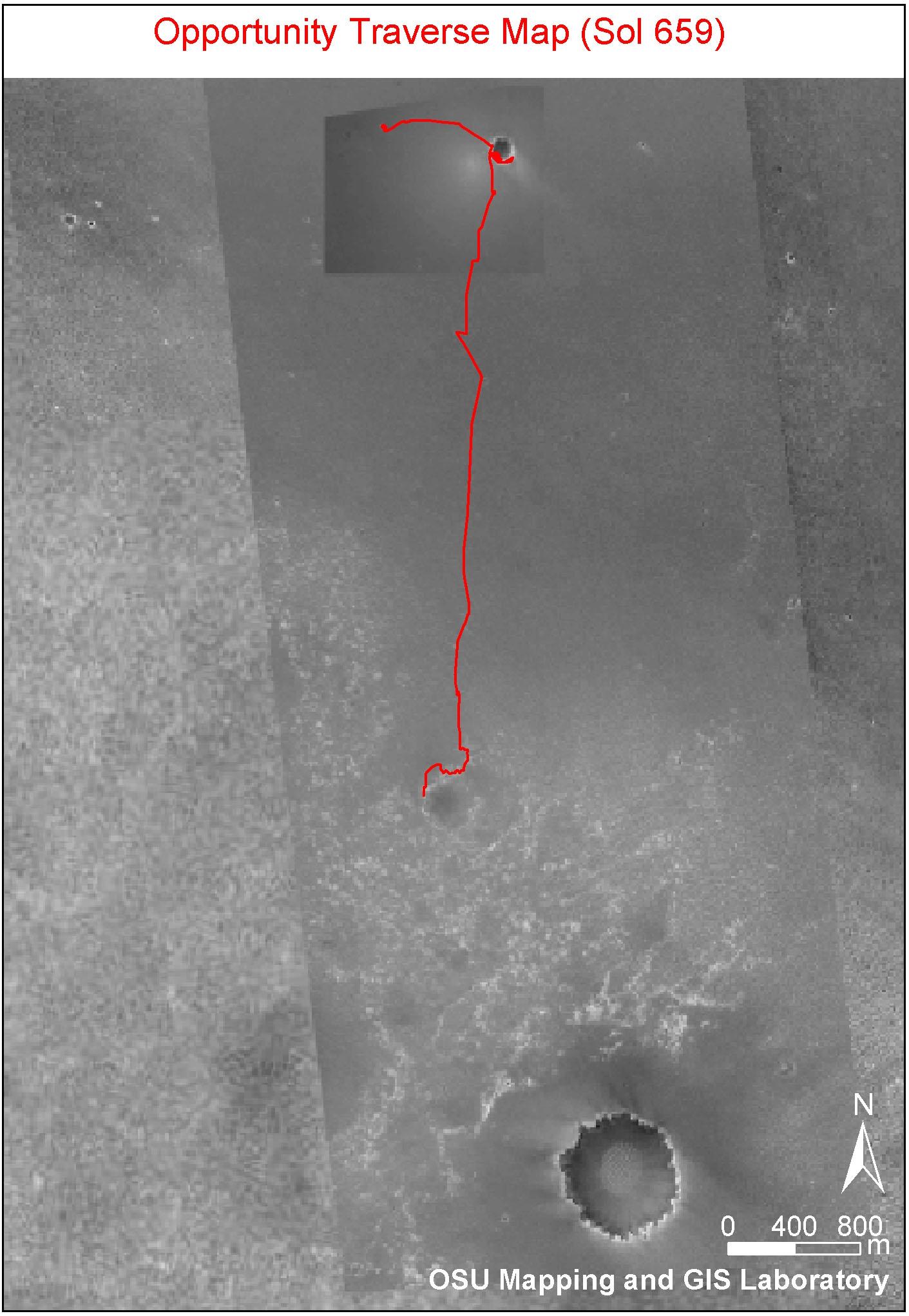
2005-12-05
Mars
Mars Global Surveyor (MGS)
Mars Exploration Rover (MER)
2001 Mars Odyssey
Descent Image Motion Estimation System (DIMES)
Mars Orbiter Camera
Thermal Emission Imaging System
1415x2044x3
PIA03609:
Opportunity Traverse Map, Sol 656
Full Resolution:
TIFF
(8.693 MB)
JPEG
(249.9 kB)
2005-12-05
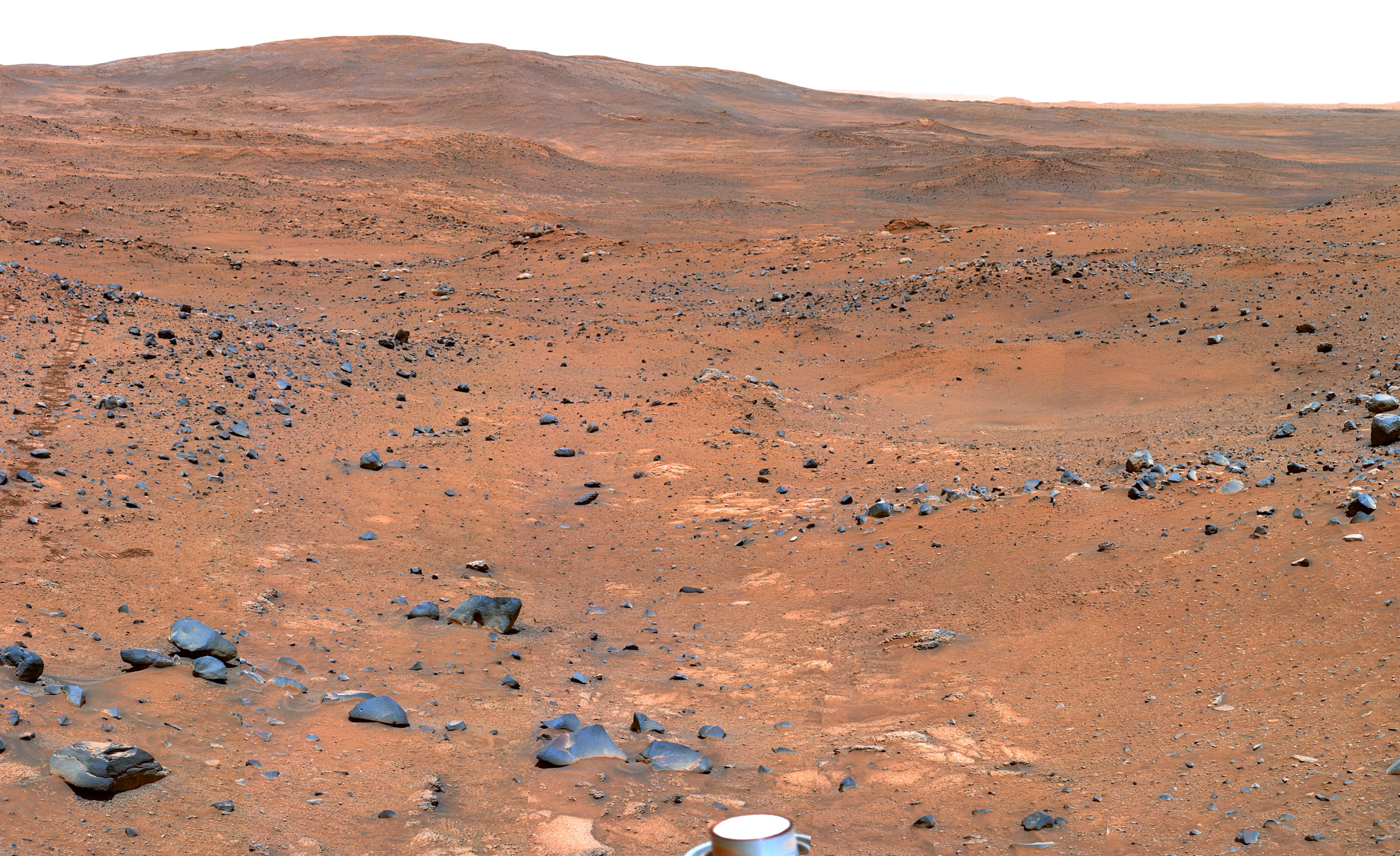
Mars
Mars Exploration Rover (MER)
Panoramic Camera
22348x6547x3
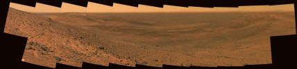
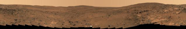
PIA03610:
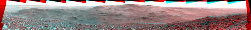
Summit Panorama with Rover Deck
Full Resolution:
TIFF
(438.9 MB)
JPEG
(10.62 MB)
QTVR
(1.233 MB)
2005-12-05
Phobos
Mars Exploration Rover (MER)
Panoramic Camera
720x480x1
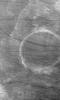
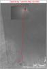
PIA03611:
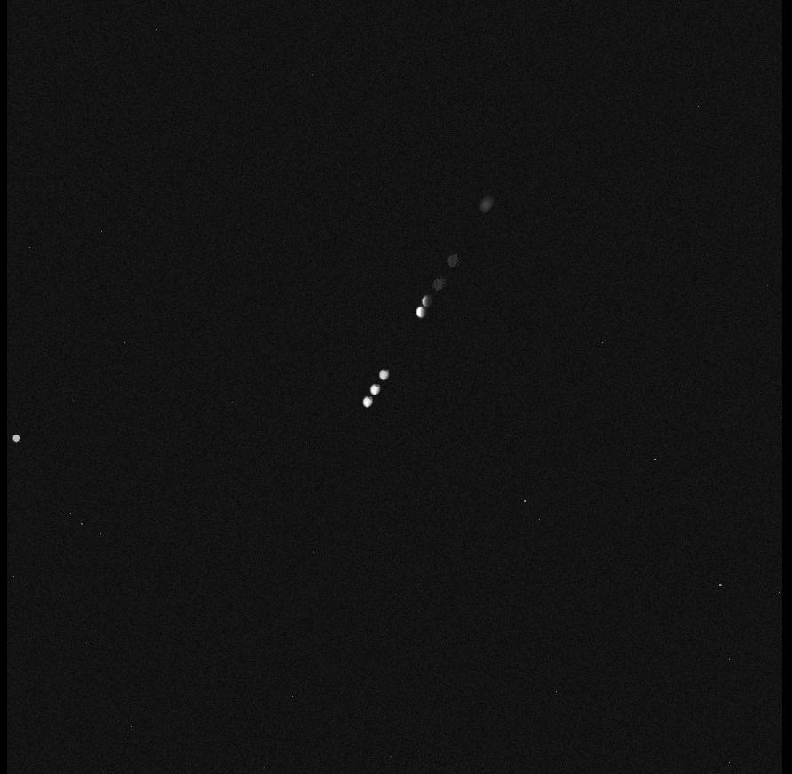
Spirit Movie of Phobos Eclipse, Sol 675
Full Resolution:
TIFF
(346.2 kB)
JPEG
(4.511 kB)
2005-12-05
Phobos
Mars Exploration Rover (MER)
Panoramic Camera
392x396x1
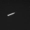
PIA03612:
Spirit View of Phobos Eclipse, Sol 675
Full Resolution:
TIFF
(155.6 kB)
JPEG
(14.22 kB)
2005-12-05
Mars
Mars Exploration Rover (MER)
Panoramic Camera
1024x1024x1
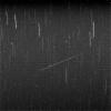
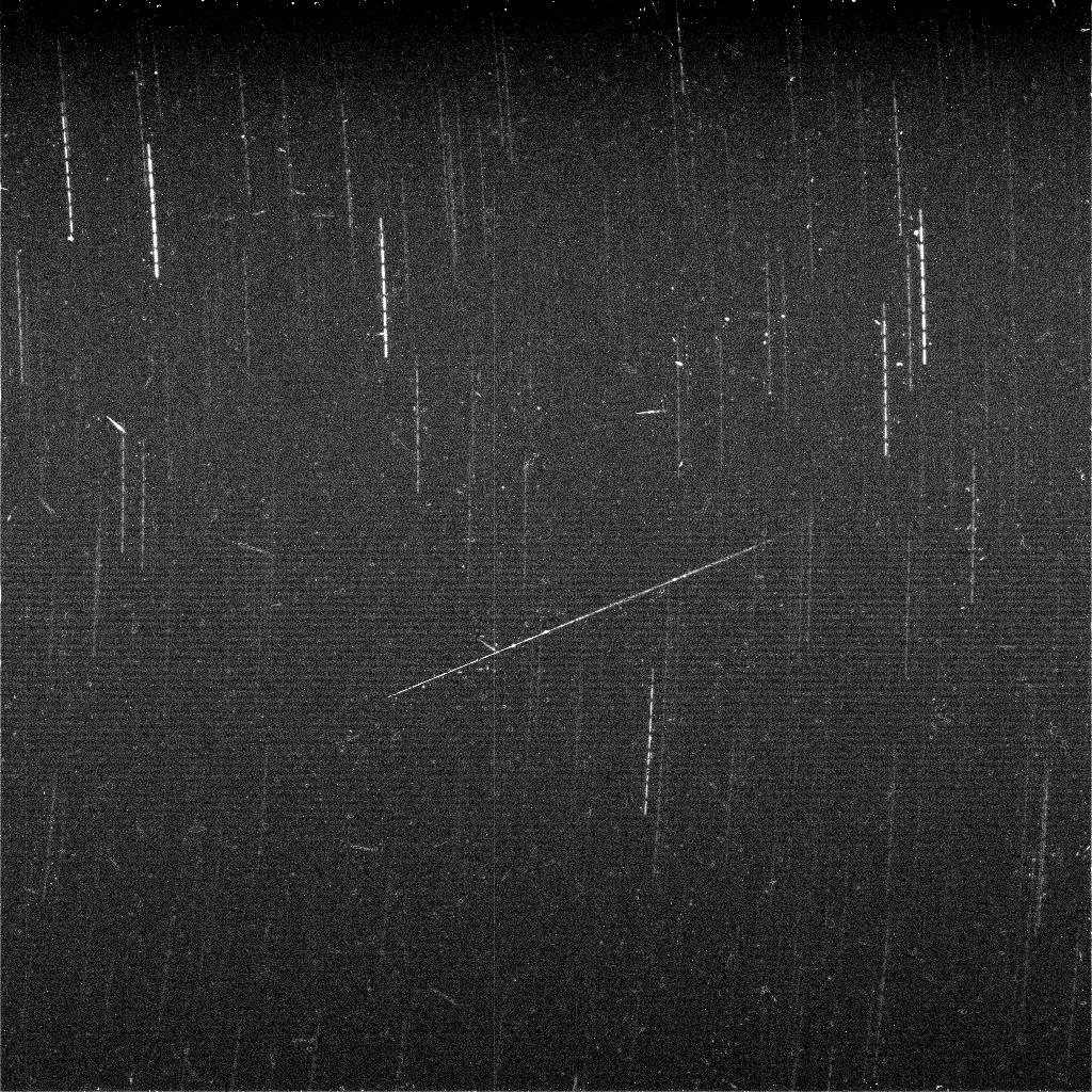
PIA03613:
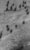
Meteor Search by Spirit, Sol 643
Full Resolution:
TIFF
(1.05 MB)
JPEG
(329.8 kB)
2005-12-05
Mars
Mars Exploration Rover (MER)
Panoramic Camera
3712x1120x1
PIA03614:
'Algonquin' Outcrop on Spirit's Sol 680
Full Resolution:
TIFF
(4.162 MB)
JPEG
(831.7 kB)
2005-12-05
Mars
Mars Exploration Rover (MER)
Panoramic Camera
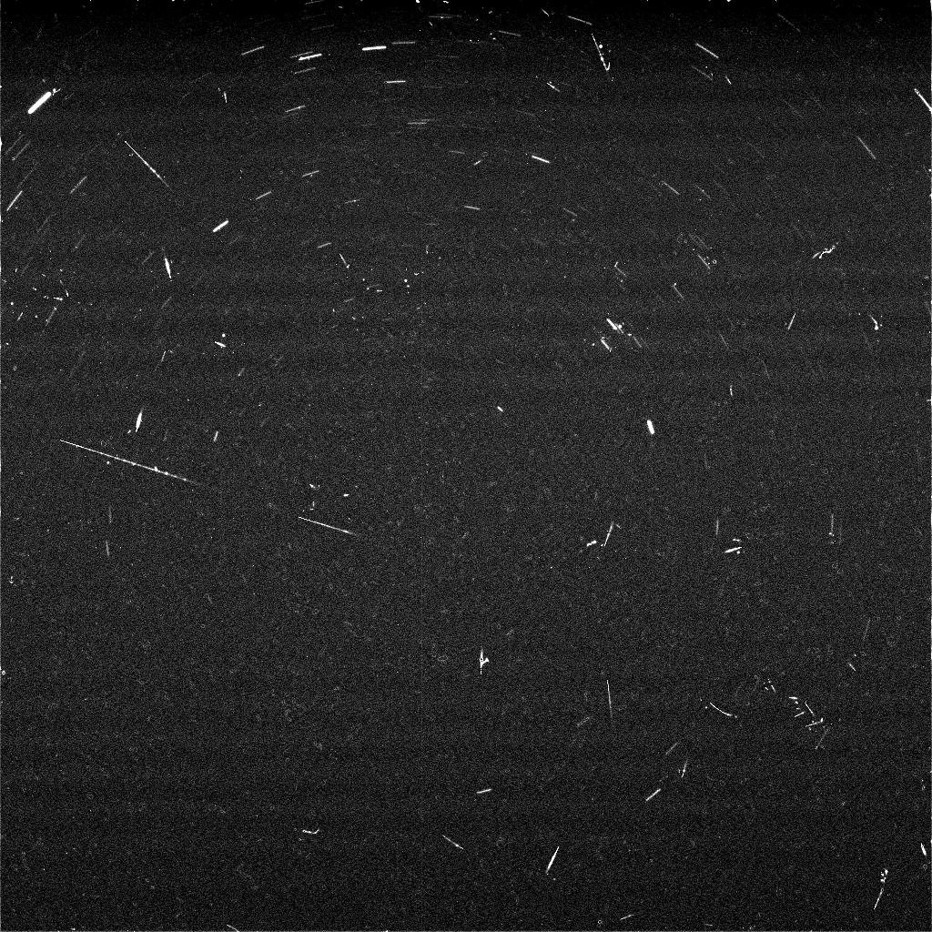
1024x1024x1
PIA03615:
Meteor Search by Spirit, Sol 668
Full Resolution:
TIFF
(1.05 MB)
JPEG
(308.9 kB)
2005-12-05
Mars
2001 Mars Odyssey
Mars Global Surveyor (MGS)
Mars Exploration Rover (MER)
Descent Image Motion Estimation System (DIMES)
Mars Orbiter Camera
Thermal Emission Imaging System
1411x2043x3
PIA03616:
Partway to 'Victoria'
Full Resolution:
TIFF
(8.665 MB)
JPEG
(265.7 kB)
2005-12-05
Mars
Mars Exploration Rover (MER)
Panoramic Camera
4705x2877x3
PIA03617:
Partial 'Seminole' Panorama (False Color)
Full Resolution:
TIFF
(40.61 MB)
JPEG
(2.511 MB)
2005-12-05
Mars
Mars Exploration Rover (MER)
Panoramic Camera
7726x2890x3
PIA03621:
Opportunity's 'Olympia' Panorama
Full Resolution:
TIFF
(66.98 MB)
JPEG
(3.024 MB)
QTVR
(3.349 MB)
2005-12-05
Mars
Mars Exploration Rover (MER)
Panoramic Camera
952x587x3
PIA03622:
Rim of 'Erebus'
Full Resolution:
TIFF
(1.679 MB)
JPEG
(94.88 kB)
2005-12-05
Mars
Mars Exploration Rover (MER)
Panoramic Camera
4705x2877x3
PIA03623:
Partial 'Seminole' Panorama
Full Resolution:
TIFF
(40.61 MB)
JPEG
(1.825 MB)
2005-12-06
Mars
2001 Mars Odyssey
THEMIS
1232x2737x1
PIA03633:
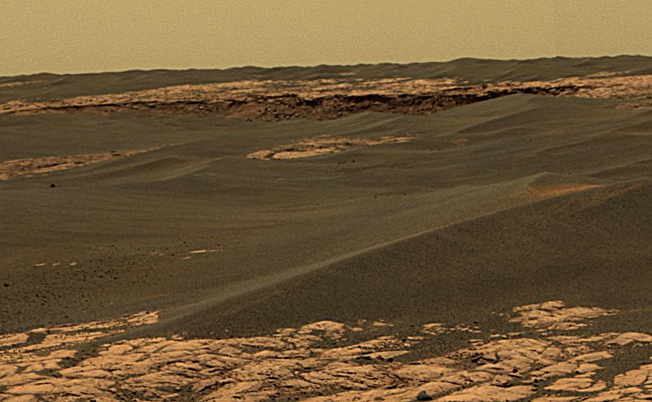
Olympus Mons Flows
Full Resolution:
TIFF
(3.376 MB)
JPEG
(472.6 kB)
2005-12-06
Mars
Mars Global Surveyor (MGS)
Mars Orbiter Camera (MOC)
640x640x3
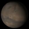
PIA03620:
Mars at Ls 341�: Tharsis
Full Resolution:
TIFF
(411.8 kB)
JPEG
(21.4 kB)
2005-12-07
Mars
2001 Mars Odyssey
THEMIS
1354x2929x1
PIA03634:
Dunes
Full Resolution:
TIFF
(3.97 MB)
JPEG
(231.2 kB)
2005-12-07
Mars
Mars Global Surveyor (MGS)
Mars Orbiter Camera (MOC)
836x2155x1
PIA03626:
Northeast Isidis
Full Resolution:
TIFF
(1.804 MB)
JPEG
(467.7 kB)
2005-12-08
Mars
2001 Mars Odyssey
THEMIS
1085x2973x1
PIA03635:
Dark and Bright
Full Resolution:
TIFF
(3.229 MB)
JPEG
(361.7 kB)
2005-12-08
Mars
Mars Global Surveyor (MGS)
Mars Orbiter Camera (MOC)
2048x3154x1
PIA03627:
South Polar Cap
Full Resolution:
TIFF
(6.466 MB)
JPEG
(1.559 MB)
2005-12-09
Mars
2001 Mars Odyssey
THEMIS
1038x2886x1
PIA03636:
Where the Ice Ends
Full Resolution:
TIFF
(2.999 MB)
JPEG
(376.1 kB)
2005-12-09
Mars
Mars Global Surveyor (MGS)
Mars Orbiter Camera (MOC)
672x1192x1
PIA03628:
Polar Pit
Full Resolution:
TIFF
(802.1 kB)
JPEG
(96.87 kB)
2005-12-10
Mars
Mars Global Surveyor (MGS)
Mars Orbiter Camera (MOC)
836x4566x1
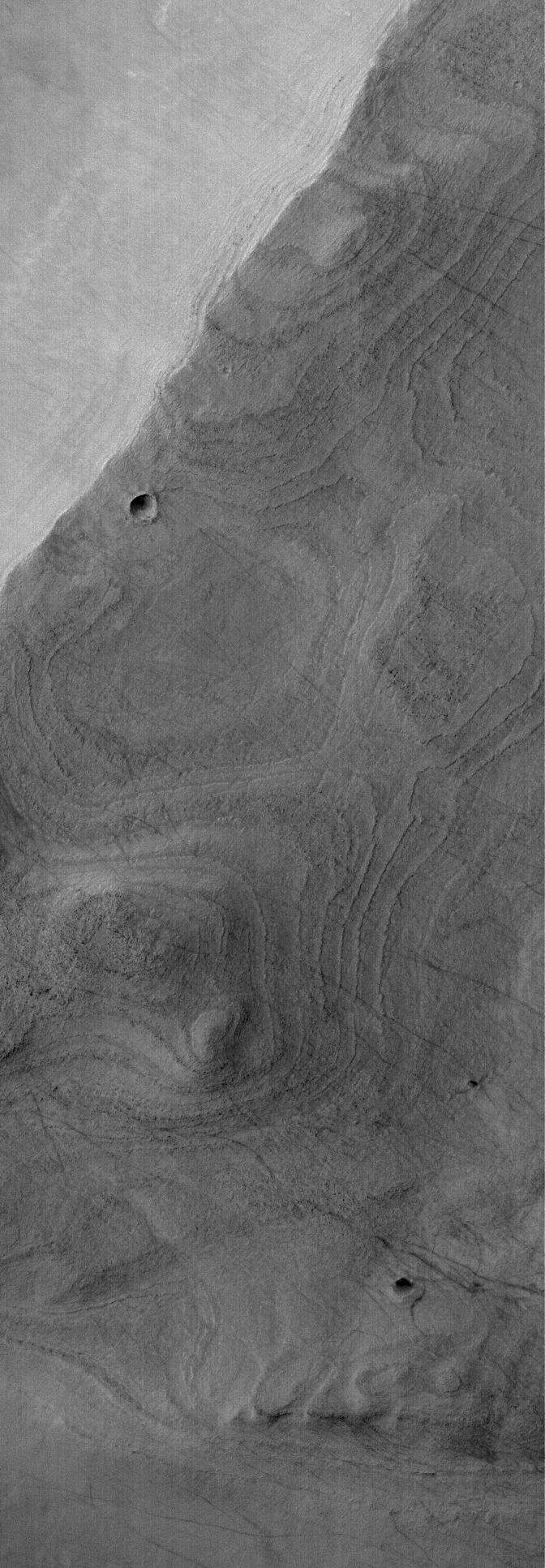
PIA03629:
Polar Layers
Full Resolution:
TIFF
(3.821 MB)
JPEG
(657.3 kB)
2005-12-11
Mars
Mars Global Surveyor (MGS)
Mars Orbiter Camera (MOC)
672x1608x1
PIA03630:
West Candor Rocks
Full Resolution:
TIFF
(1.082 MB)
JPEG
(347.6 kB)
2005-12-12
Mars
2001 Mars Odyssey
THEMIS
1375x2980x1
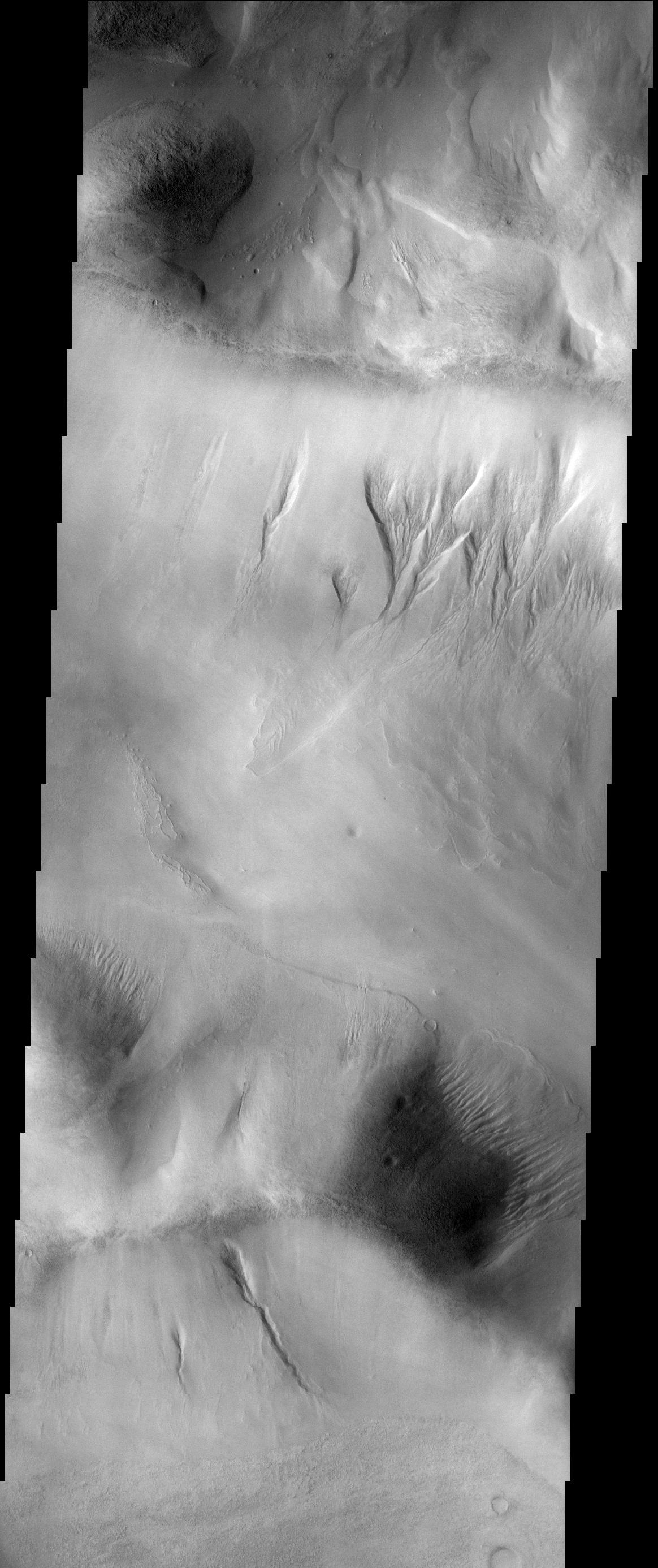
PIA03637:
Galle Cr. Dunes
Full Resolution:
TIFF
(4.102 MB)
JPEG
(367.4 kB)
2005-12-12
Mars
Mars Global Surveyor (MGS)
Mars Orbiter Camera (MOC)
672x1934x1
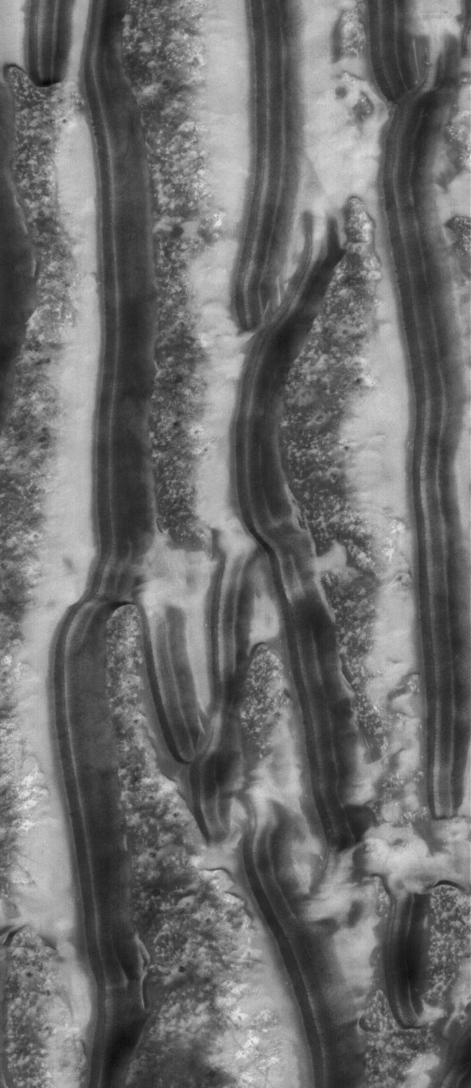
PIA03631:
Banded Argyre
Full Resolution:
TIFF
(1.301 MB)
JPEG
(213.6 kB)
2005-12-13
Mars
2001 Mars Odyssey
THEMIS
1008x2945x1
PIA03638:
Polar Textures
Full Resolution:
TIFF
(2.972 MB)
JPEG
(694.1 kB)
2005-12-13
Mars
Mars Global Surveyor (MGS)
Mars Orbiter Camera (MOC)
640x640x3
PIA03639:
Mars at Ls 341�: Acidalia/Mare Erythraeum
Full Resolution:
TIFF
(411.8 kB)
JPEG
(22.49 kB)
2005-12-14
Mars
Mars Exploration Rover (MER)
Panoramic Camera
22348x3504x3
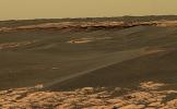
PIA03640:
Descent from the Summit of 'Husband Hill'
Full Resolution:
TIFF
(234.9 MB)
JPEG
(9.508 MB)
QTVR
(10.52 MB)
2005-12-14
Mars
Mars Exploration Rover (MER)
Panoramic Camera
22348x3504x3
PIA03641:
Descent from the Summit of 'Husband Hill' (False Color)
Full Resolution:
TIFF
(234.9 MB)
JPEG
(13.1 MB)
2005-12-14
Mars
Mars Global Surveyor (MGS)
Mars Orbiter Camera (MOC)
1024x2128x1
PIA03642:
Dust Devil Art
Full Resolution:
TIFF
(2.181 MB)
JPEG
(592.7 kB)
2005-12-14
Mars
2001 Mars Odyssey
THEMIS
1376x2986x1
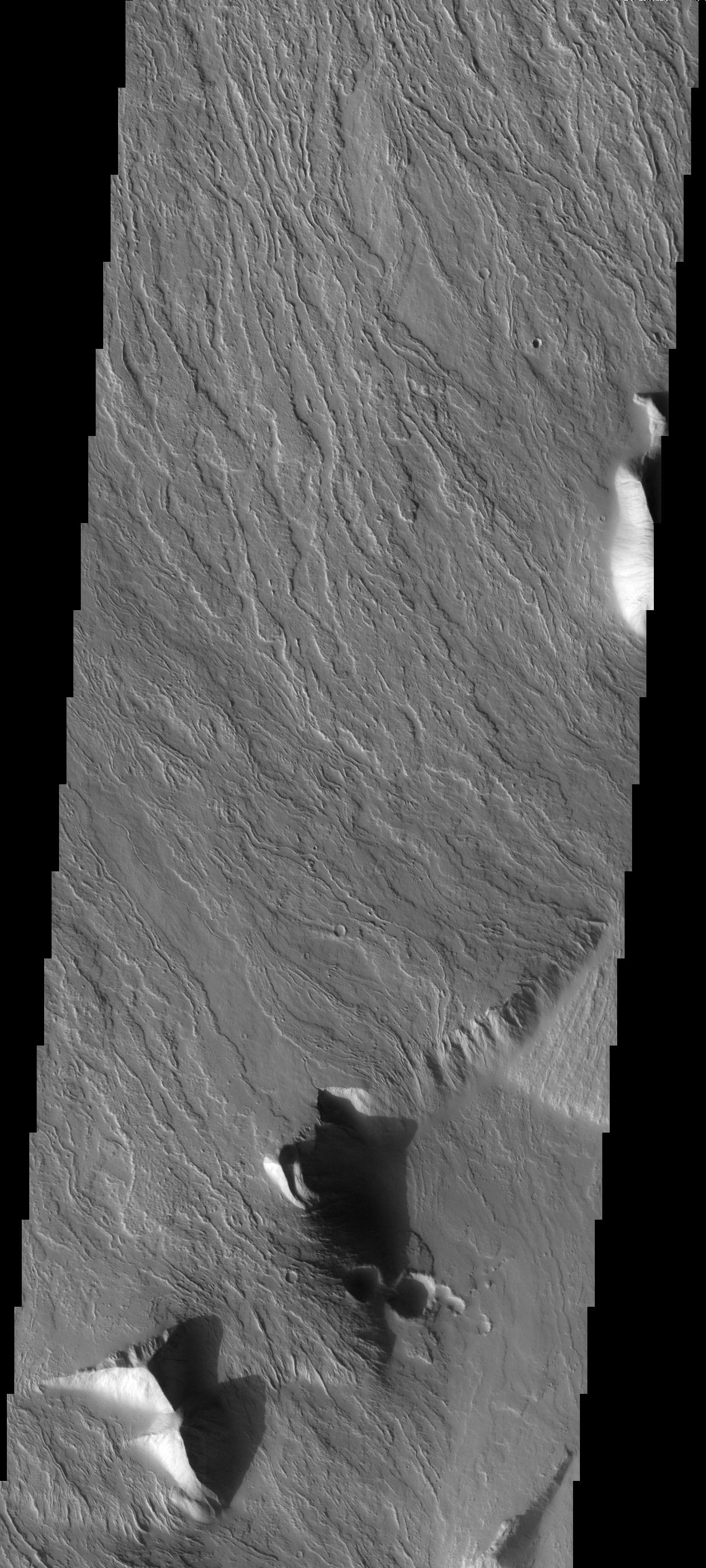
PIA03645:
Brashear Cr. Dunes
Full Resolution:
TIFF
(4.114 MB)
JPEG
(322.1 kB)
2005-12-15
Mars
Mars Global Surveyor (MGS)
Mars Orbiter Camera (MOC)
1024x3248x1
PIA03643:
Inverted Valley
Full Resolution:
TIFF
(3.329 MB)
JPEG
(535 kB)
2005-12-15
Mars
2001 Mars Odyssey
THEMIS
1084x3088x1
PIA03646:
Polar Textures
Full Resolution:
TIFF
(3.351 MB)
JPEG
(615.8 kB)
2005-12-16
Mars
2001 Mars Odyssey
THEMIS
1237x2737x1
PIA03647:
Ascraeus Mons
Full Resolution:
TIFF
(3.39 MB)
JPEG
(604.1 kB)
2005-12-16
Mars
Mars Global Surveyor (MGS)
Mars Orbiter Camera (MOC)
836x1838x1
PIA03644:
Marte Vallis
Full Resolution:
TIFF
(1.538 MB)
JPEG
(274.2 kB)
2005-12-17
Mars
Mars Global Surveyor (MGS)
Mars Orbiter Camera (MOC)
2048x2928x1
PIA03649:
Polar Features
Full Resolution:
TIFF
(6.003 MB)
JPEG
(1.596 MB)
2005-12-18
Mars
Mars Global Surveyor (MGS)
Mars Orbiter Camera (MOC)
512x869x1
PIA03650:
Meridiani Scene
Full Resolution:
TIFF
(445.6 kB)
JPEG
(98.6 kB)
2005-12-19
Mars
2001 Mars Odyssey
THEMIS
1237x2755x1
PIA03648:
Students' Target
Full Resolution:
TIFF
(3.412 MB)
JPEG
(270.6 kB)
2005-12-19
Mars
Mars Global Surveyor (MGS)
Mars Orbiter Camera (MOC)
1024x1896x1
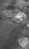
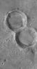
PIA03651:
Double Impact
Full Resolution:
TIFF
(1.944 MB)
JPEG
(677.2 kB)
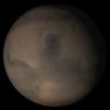
2005-12-20
Mars
Mars Global Surveyor (MGS)
Mars Orbiter Camera (MOC)
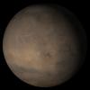
640x640x3
PIA03256:
Mars at Ls 341�: Syrtis Major
Full Resolution:
TIFF
(411.8 kB)
JPEG
(22.78 kB)
2005-12-20
Mars
2001 Mars Odyssey
THEMIS
1364x2924x1
PIA03280:
Shalbatana Vallis
Full Resolution:
TIFF
(3.992 MB)
JPEG
(341.6 kB)
2005-12-21
Mars
Mars Global Surveyor (MGS)
Mars Orbiter Camera (MOC)
365x491x1
PIA03257:
Eyes of Ganges
Full Resolution:
TIFF
(179.6 kB)
JPEG
(43.26 kB)
2005-12-21
Mars
2001 Mars Odyssey
THEMIS
1365x2929x1
PIA03281:
Canyon Variety
Full Resolution:
TIFF
(4.002 MB)
JPEG
(320 kB)
2005-12-22
Mars
Mars Global Surveyor (MGS)
Mars Orbiter Camera (MOC)
512x851x1
PIA03258:
Copernicus Dunes
Full Resolution:
TIFF
(436.4 kB)
JPEG
(106 kB)
2005-12-22
Mars
2001 Mars Odyssey
THEMIS
1387x2922x1
PIA03282:
Tharsis Tholus
Full Resolution:
TIFF
(4.058 MB)
JPEG
(405.4 kB)
2005-12-23
Mars
Mars Exploration Rover (MER)
Panoramic Camera
10451x1263x3
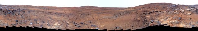
PIA03250:
Sweeping View of the "Columbia Hills" and Gusev Crater (3-D)
Full Resolution:
TIFF
(39.6 MB)
JPEG
(2.541 MB)
2005-12-23
Mars
Mars Exploration Rover (MER)
Panoramic Camera
13220x3440x3
PIA03251:
Sweeping View of the "Columbia Hills" and Gusev Crater (False Color)
Full Resolution:
TIFF
(136.4 MB)
JPEG
(7.784 MB)
2005-12-23
Mars
Mars Exploration Rover (MER)
Panoramic Camera
13220x3440x3
PIA03252:
Sweeping View of the "Columbia Hills" and Gusev Crater (Approximate True Color)
Full Resolution:
TIFF
(136.4 MB)
JPEG
(5.799 MB)
QTVR
(6.535 MB)
2005-12-23
Mars
Mars Global Surveyor (MGS)
Mars Orbiter Camera (MOC)
2048x4608x1
PIA03259:
Outcrops in Aram
Full Resolution:
TIFF
(9.447 MB)
JPEG
(1.937 MB)
2005-12-23
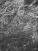
Mars
2001 Mars Odyssey
THEMIS
1373x2920x1
PIA03283:
Elysium Winds
Full Resolution:
TIFF
(4.014 MB)
JPEG
(662.9 kB)
2005-12-24
Mars
Mars Global Surveyor (MGS)
Mars Orbiter Camera (MOC)
1024x1784x1
PIA03260:
Lonely Crater
Full Resolution:
TIFF
(1.829 MB)
JPEG
(201.6 kB)
2005-12-25
Mars
Mars Global Surveyor (MGS)
Mars Orbiter Camera (MOC)
672x1550x1
PIA03261:
Richardson Dunes
Full Resolution:
TIFF
(1.043 MB)
JPEG
(130 kB)
1-100
101-200
201-300
301-400
401-500
501-600
601-700
701-800
801-900
901-1000
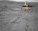
Currently displaying images:
3901 - 4000
of 12748


