Click on an image for detailed information
Click on a column heading to sort in ascending or descending order

My
List |
Addition Date
|
Target
|
Mission
|
Instrument
|
Size
|

|
2011-11-17 |
Mars
|
Mars Reconnaissance Orbiter (MRO)
|
HiRISE
|
920x1016x1 |
|
-
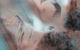
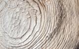
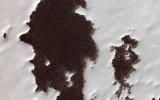
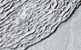
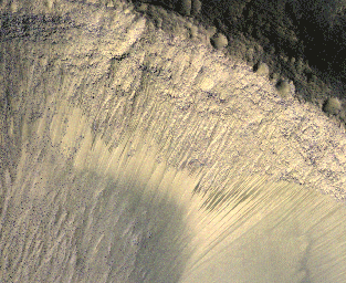
PIA14876:
-
Blowing in the Martian Wind

Full Resolution:
TIFF
(936 kB)
JPEG
(106.7 kB)
|
|
|
2011-11-17 |
Mars
|
Mars Reconnaissance Orbiter (MRO)
|
HiRISE
|
781x1019x1 |
|
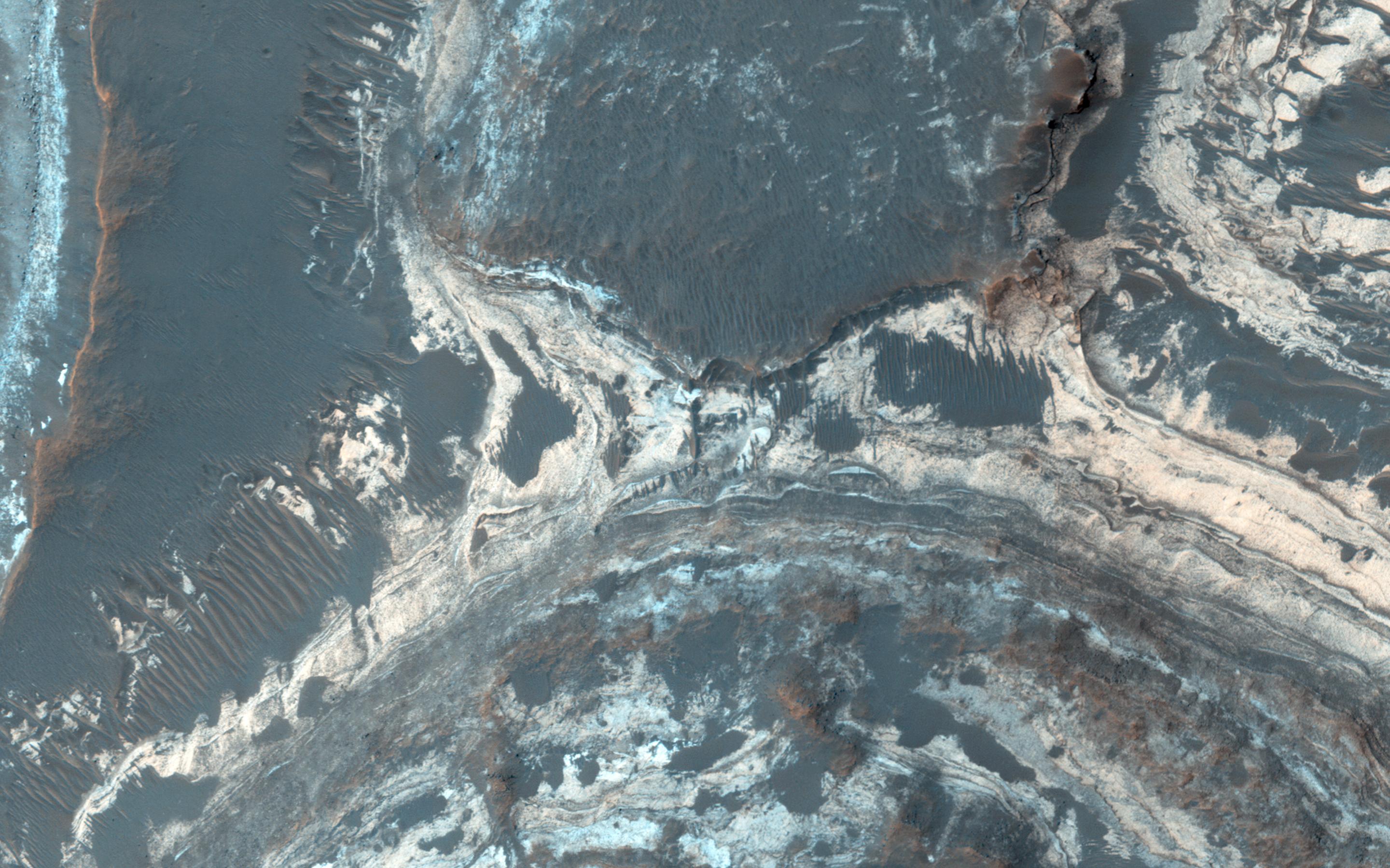
-
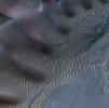
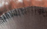
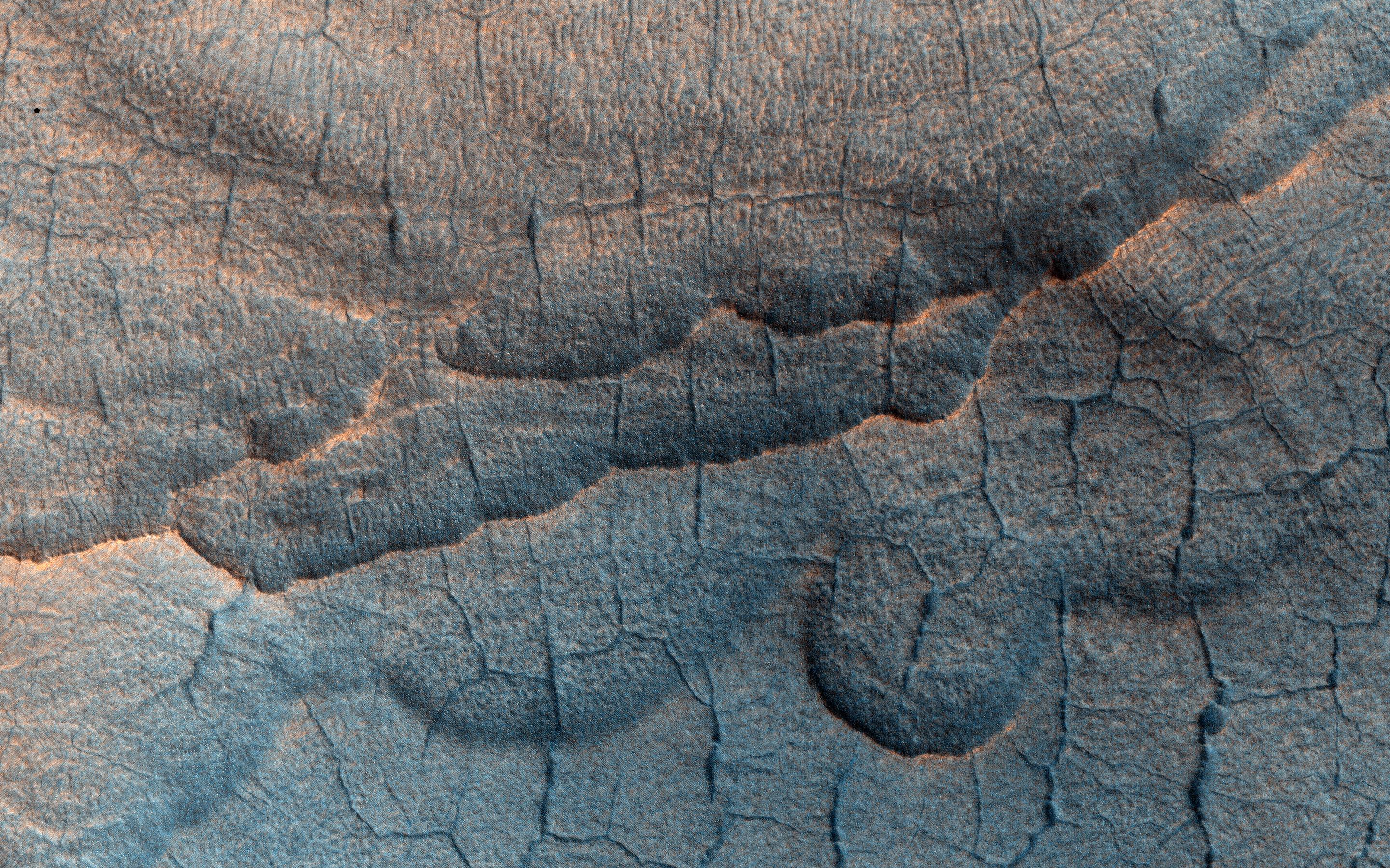
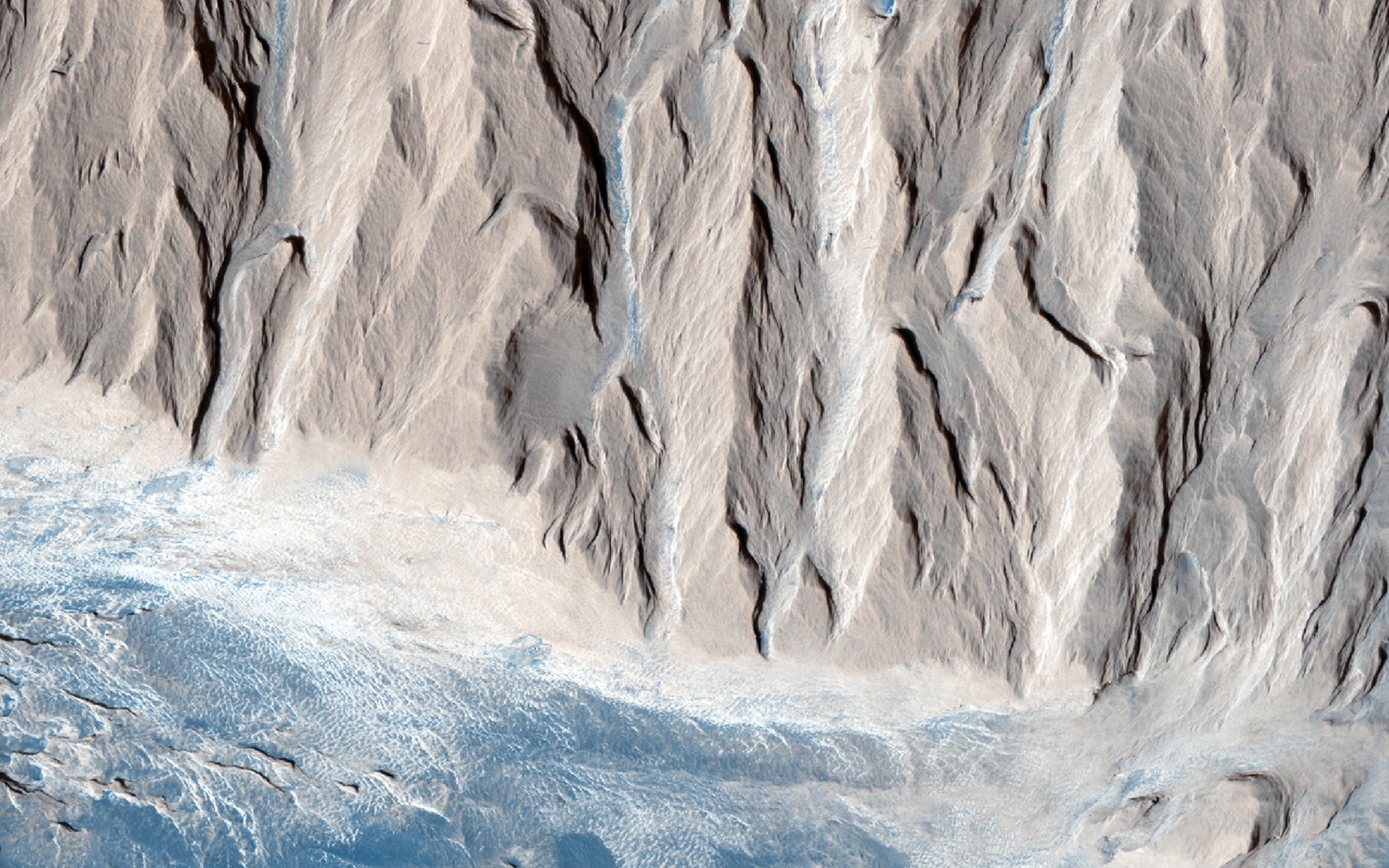
PIA14877:
-
Shifting Sand in Herschel Crater
Full Resolution:
TIFF
(796.9 kB)
JPEG
(171.2 kB)
|
|
|
2011-11-17 |
Mars
|
Mars Reconnaissance Orbiter (MRO)
|
HiRISE
|
738x604x1 |
|
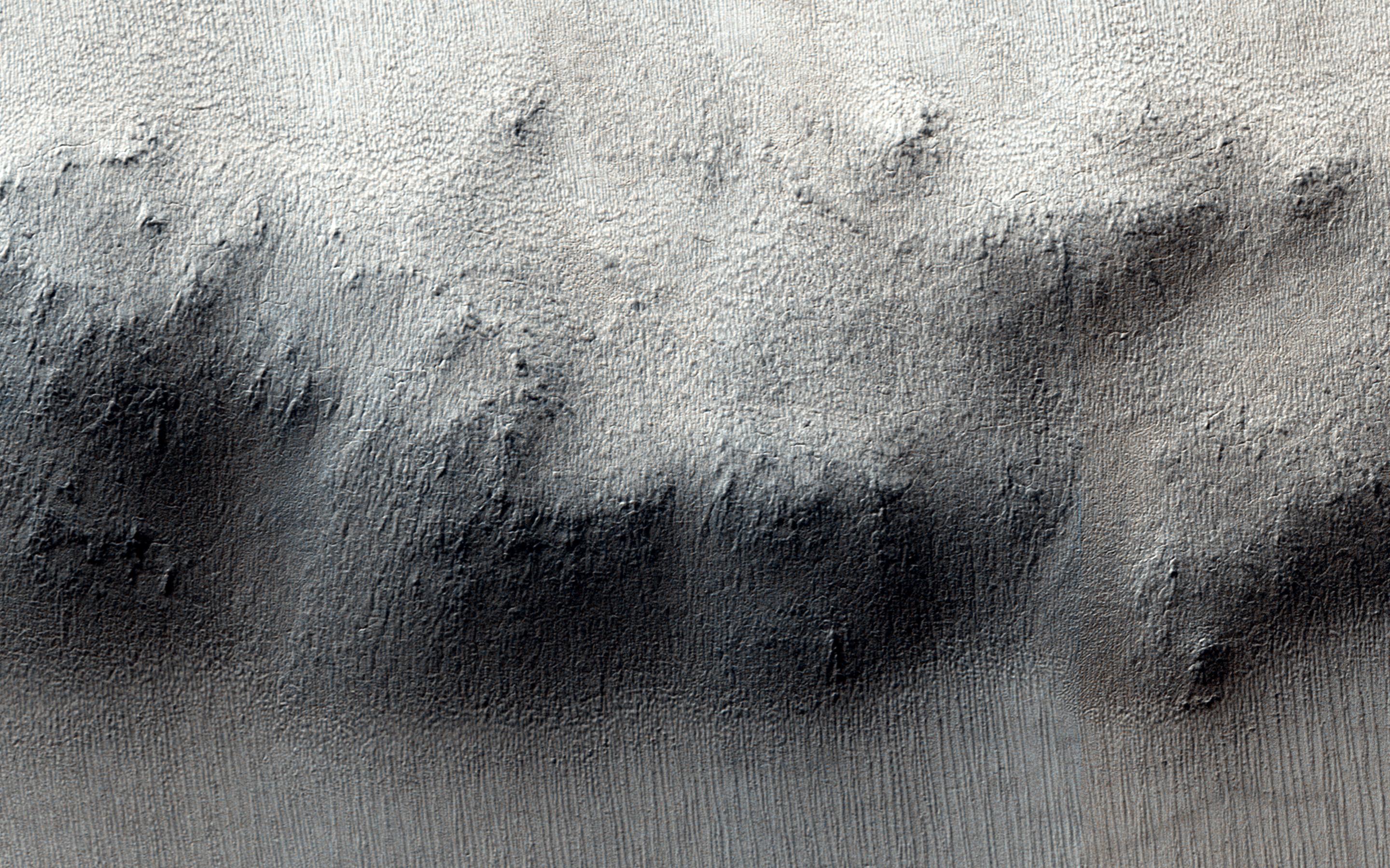
-
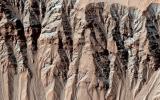
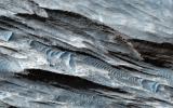
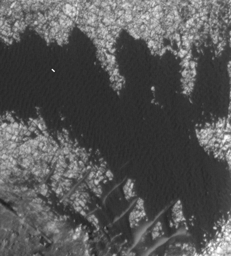
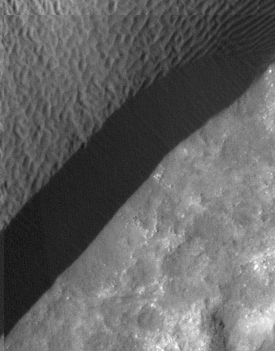
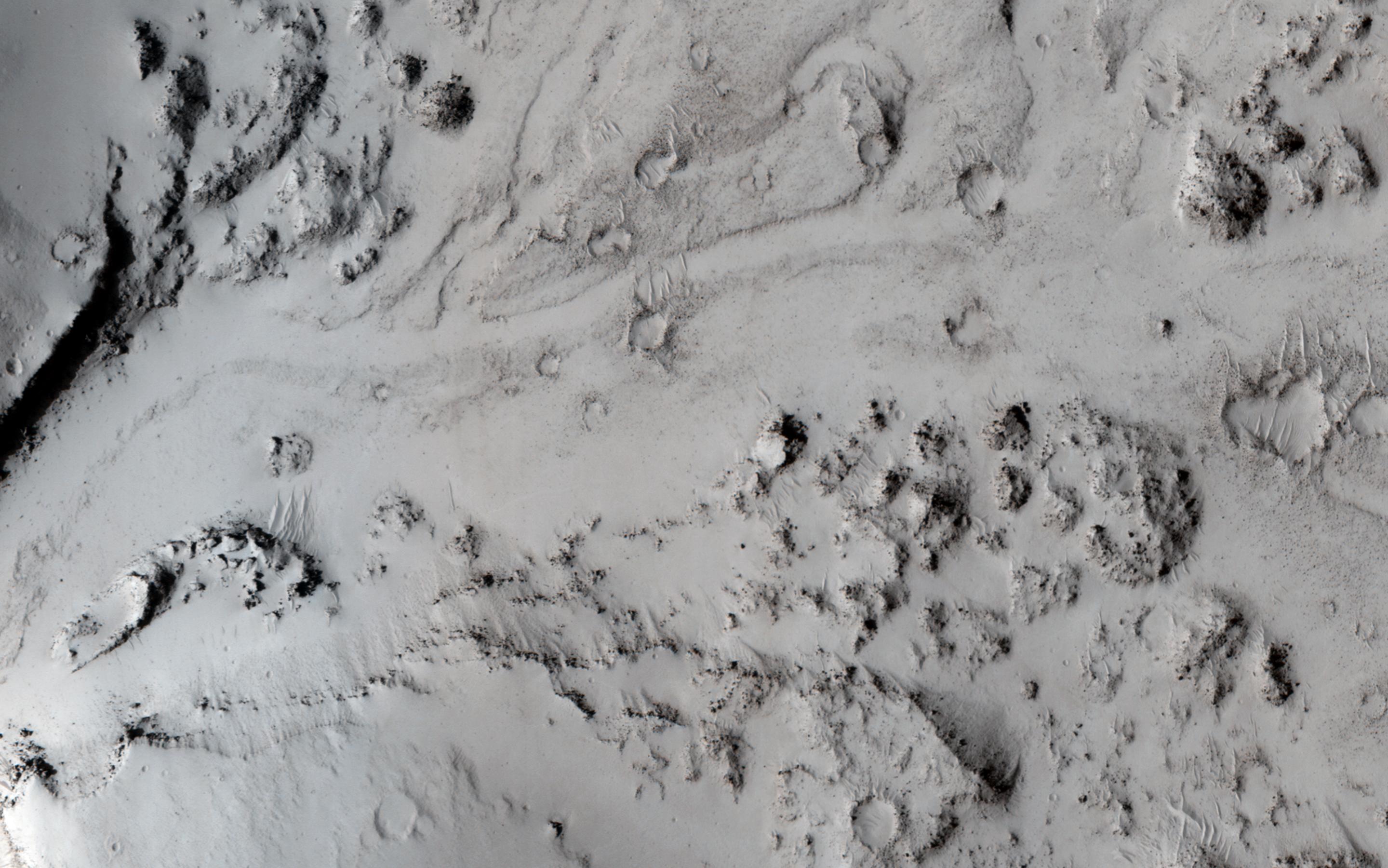
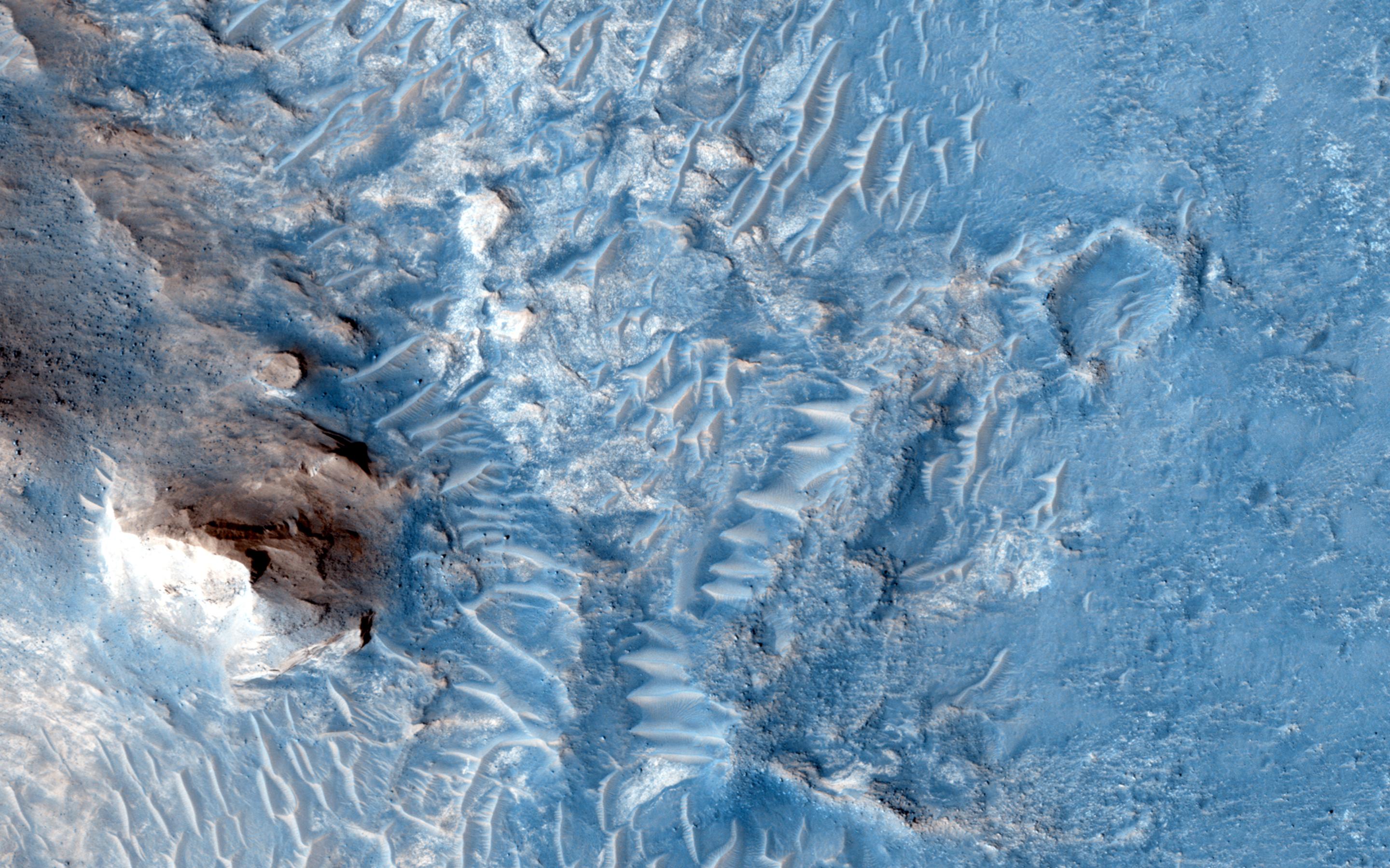
PIA14878:
-
Rippling Dune Front in Herschel Crater on Mars
Full Resolution:
TIFF
(446.4 kB)
JPEG
(72.31 kB)
|
|
|
2011-11-17 |
Mars
|
Mars Reconnaissance Orbiter (MRO)
|
HiRISE
|
878x1120x1 |
|
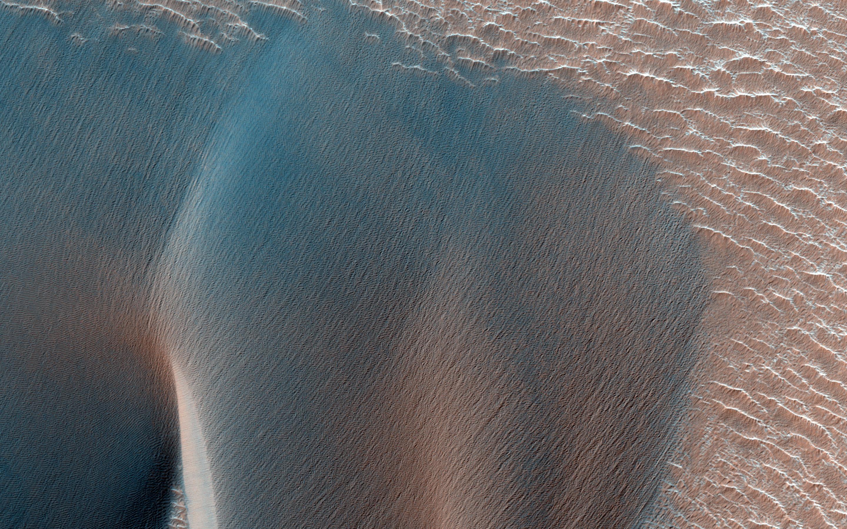
-
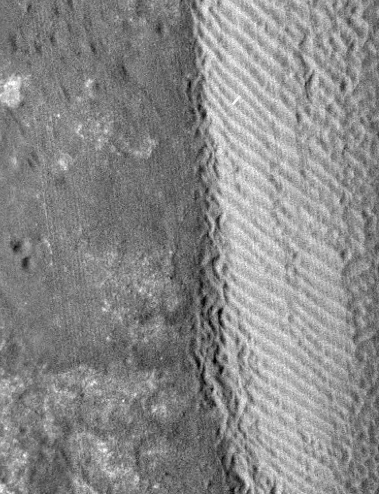
PIA14879:
-
Rippling Dune Front in Herschel Crater on Mars
Full Resolution:
TIFF
(984.6 kB)
JPEG
(119.5 kB)
|
|
|
2011-11-17 |
Mars
|
Mars Reconnaissance Orbiter (MRO)
|
HiRISE
|
1225x925x1 |
|
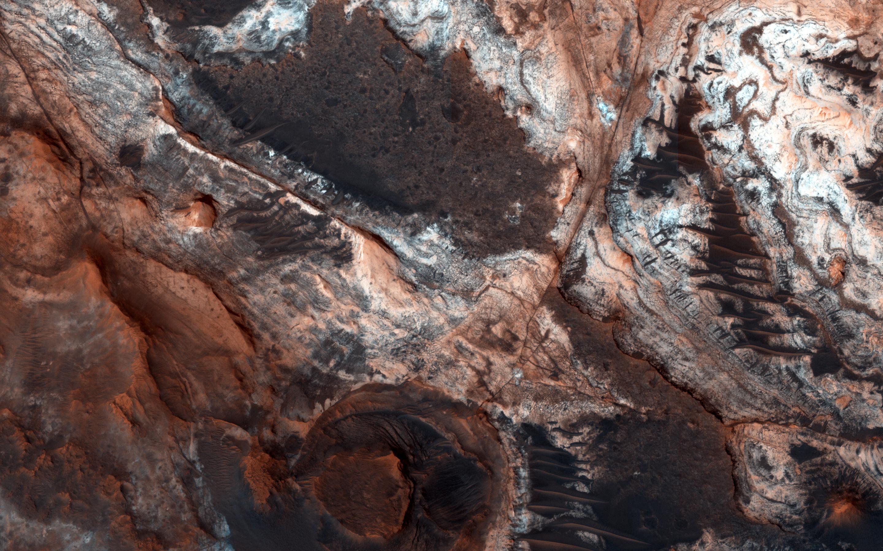
-
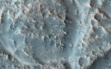
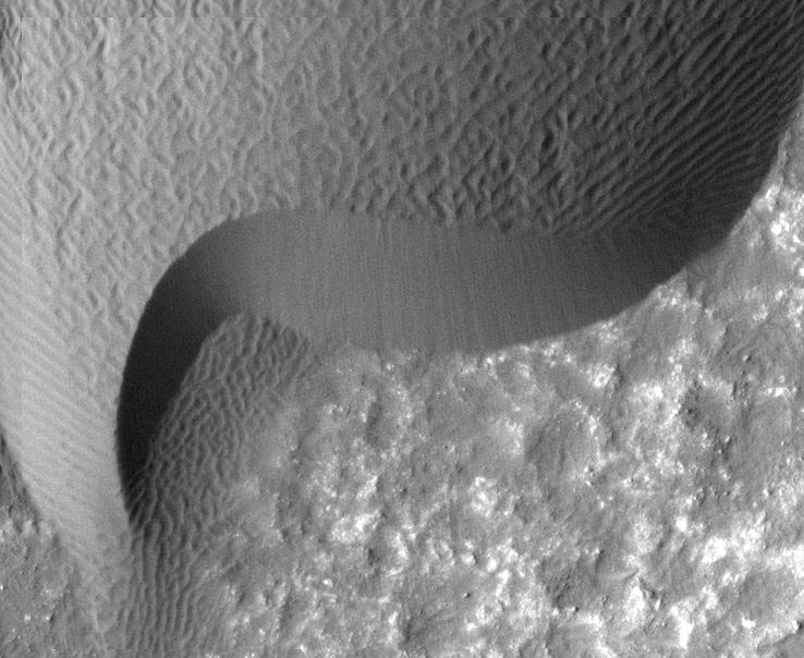
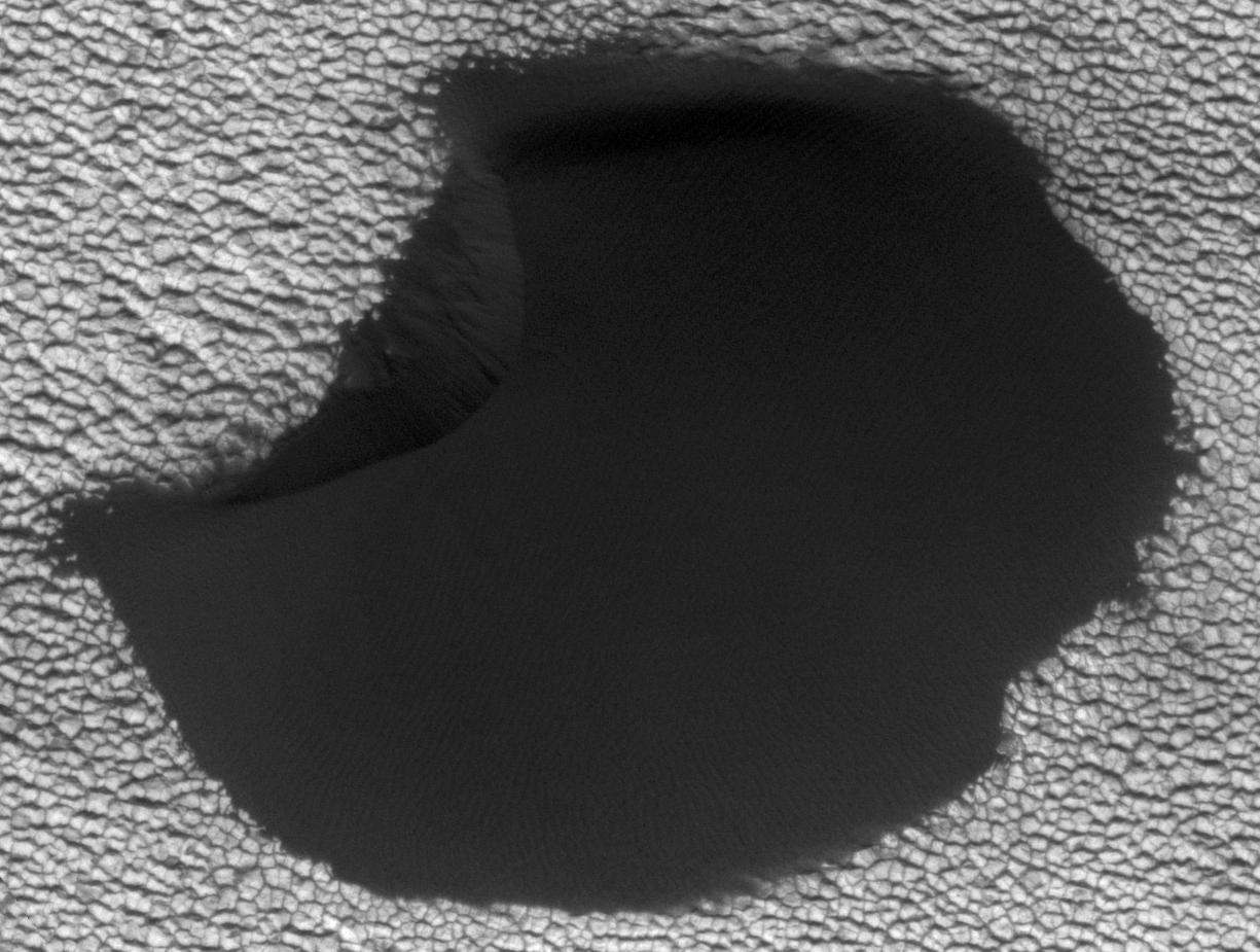
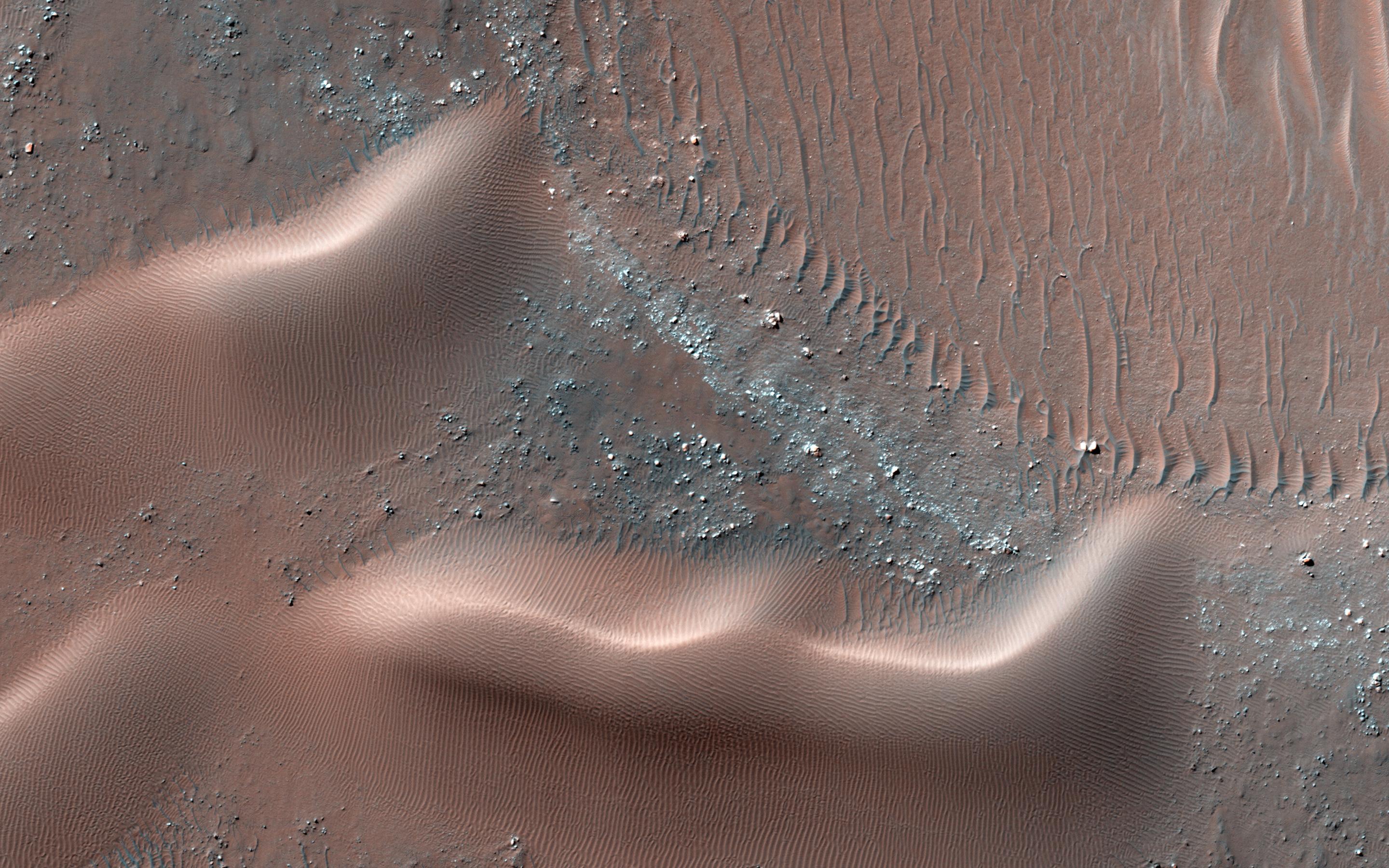
PIA14880:
-
Movement in Martian Dune Field
Full Resolution:
TIFF
(1.135 MB)
JPEG
(144.5 kB)
|
|
|
2011-11-21 |
Mars
|
Mars Reconnaissance Orbiter (MRO)
|
HiRISE
|
950x720x1 |
|
-
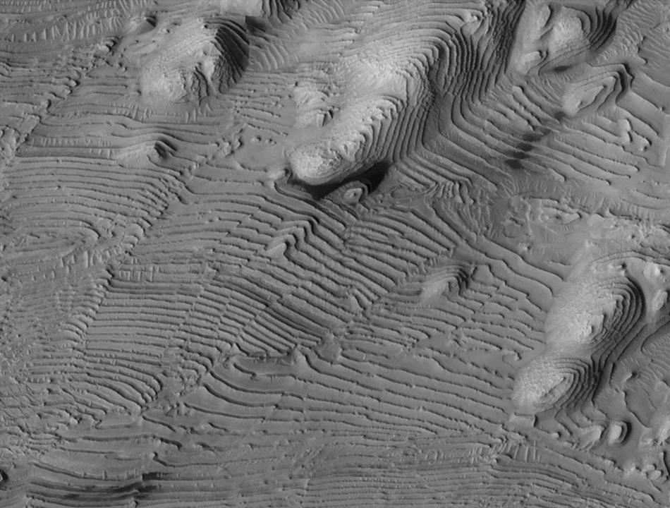
PIA15092:
-
Rhythmic Layering in Danielson Crater on Mars
Full Resolution:
TIFF
(685 kB)
JPEG
(113.5 kB)
|
|
|
2011-11-21 |
Mars
|
Mars Reconnaissance Orbiter (MRO)
|
HiRISE
|
923x690x3 |
|
-
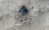
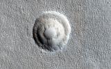
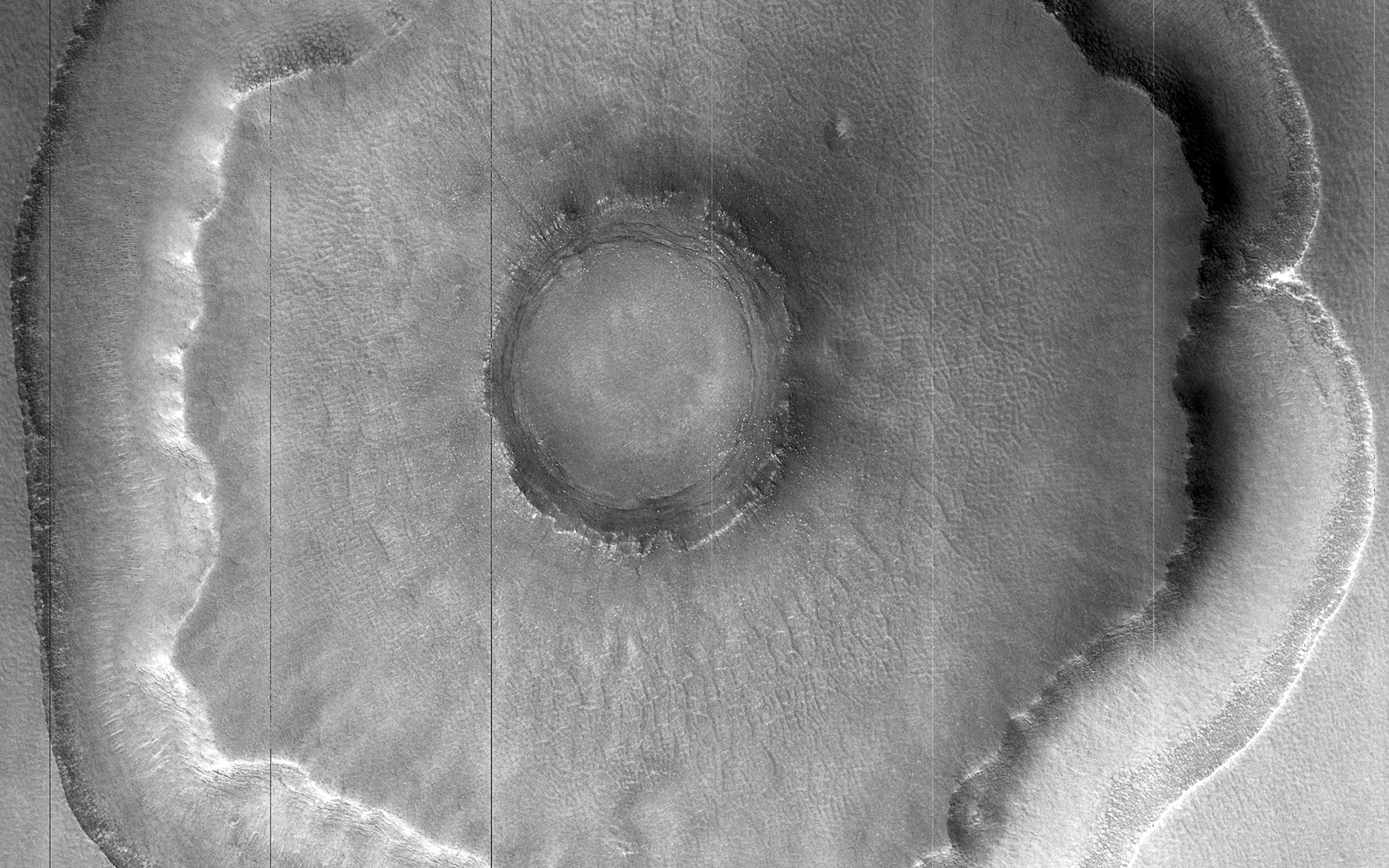
PIA15096:
-
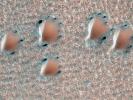
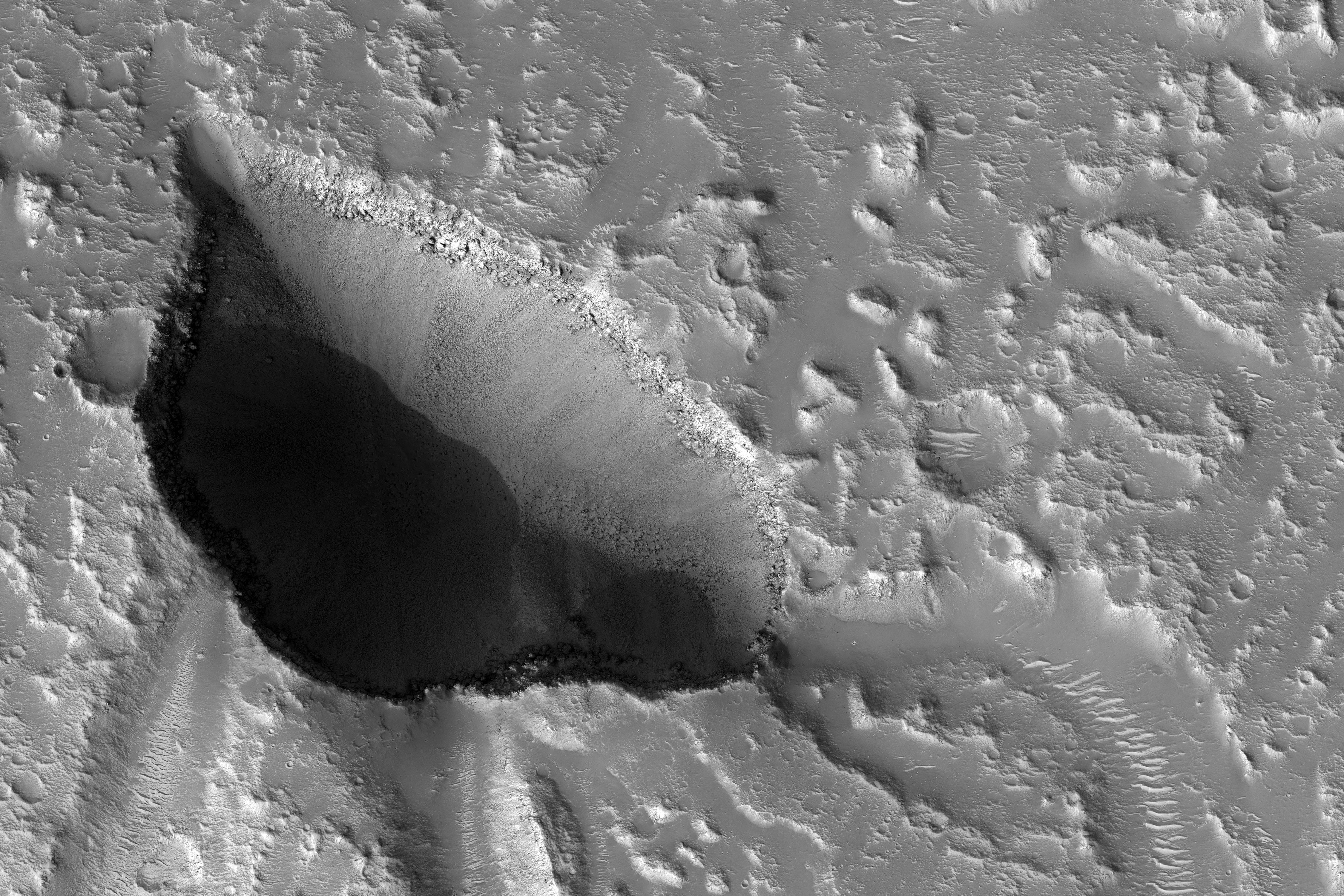
Fresh Crater Revealing Buried Ice
Full Resolution:
TIFF
(1.914 MB)
JPEG
(132.1 kB)
|
|
|
2011-11-21 |
Mars
|
Mars Reconnaissance Orbiter (MRO)
|
CRISM
CTX
|
935x720x3 |
|
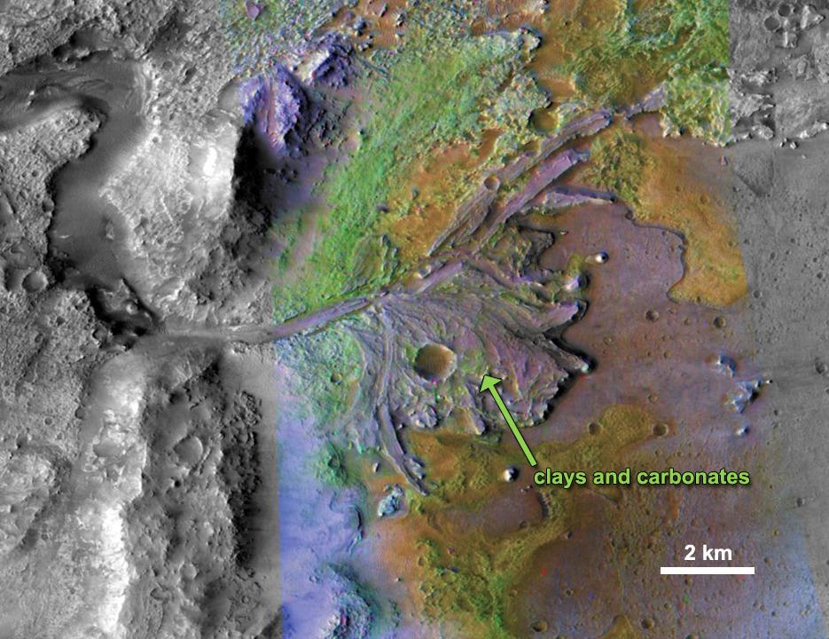
-
PIA15097:
-
Chemical Alteration by Water, Jezero Crater Delta
Full Resolution:
TIFF
(2.023 MB)
JPEG
(132 kB)
|
|
|
2011-11-21 |
Mars
|
Mars Reconnaissance Orbiter (MRO)
|
HiRISE
|
860x647x3 |
|
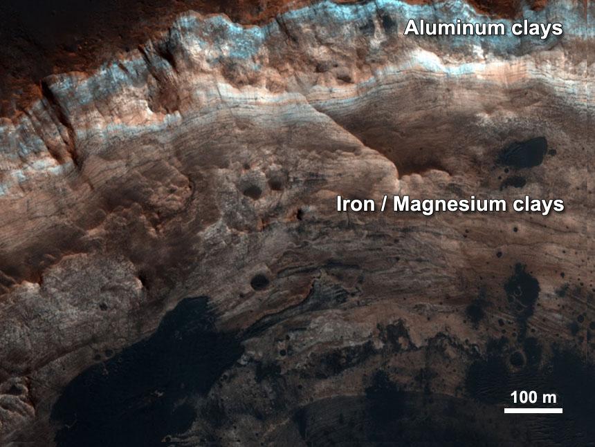
-
PIA15098:
-
Chemical Alteration by Water, Mawrth Vallis
Full Resolution:
TIFF
(1.671 MB)
JPEG
(95.97 kB)
|
|
|
2011-11-21 |
Mars
|
Mars Reconnaissance Orbiter (MRO)
|
CRISM
CTX
|
857x517x3 |

|
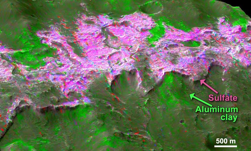
-
PIA15099:
-
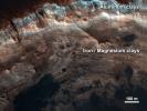
Sulfates and Clays in Columbus Crater, Mars
Full Resolution:
TIFF
(1.331 MB)
JPEG
(97.63 kB)
|
|
|
2011-12-07 |
Mars
|
Mars Reconnaissance Orbiter (MRO)
|
HiRISE
|
2560x1920x3 |
|
-
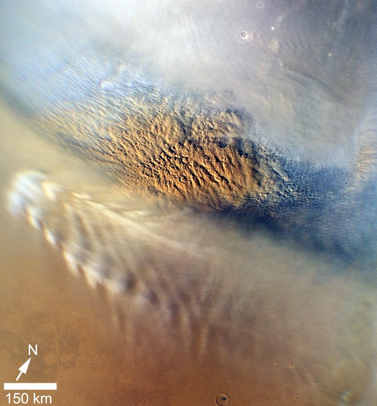
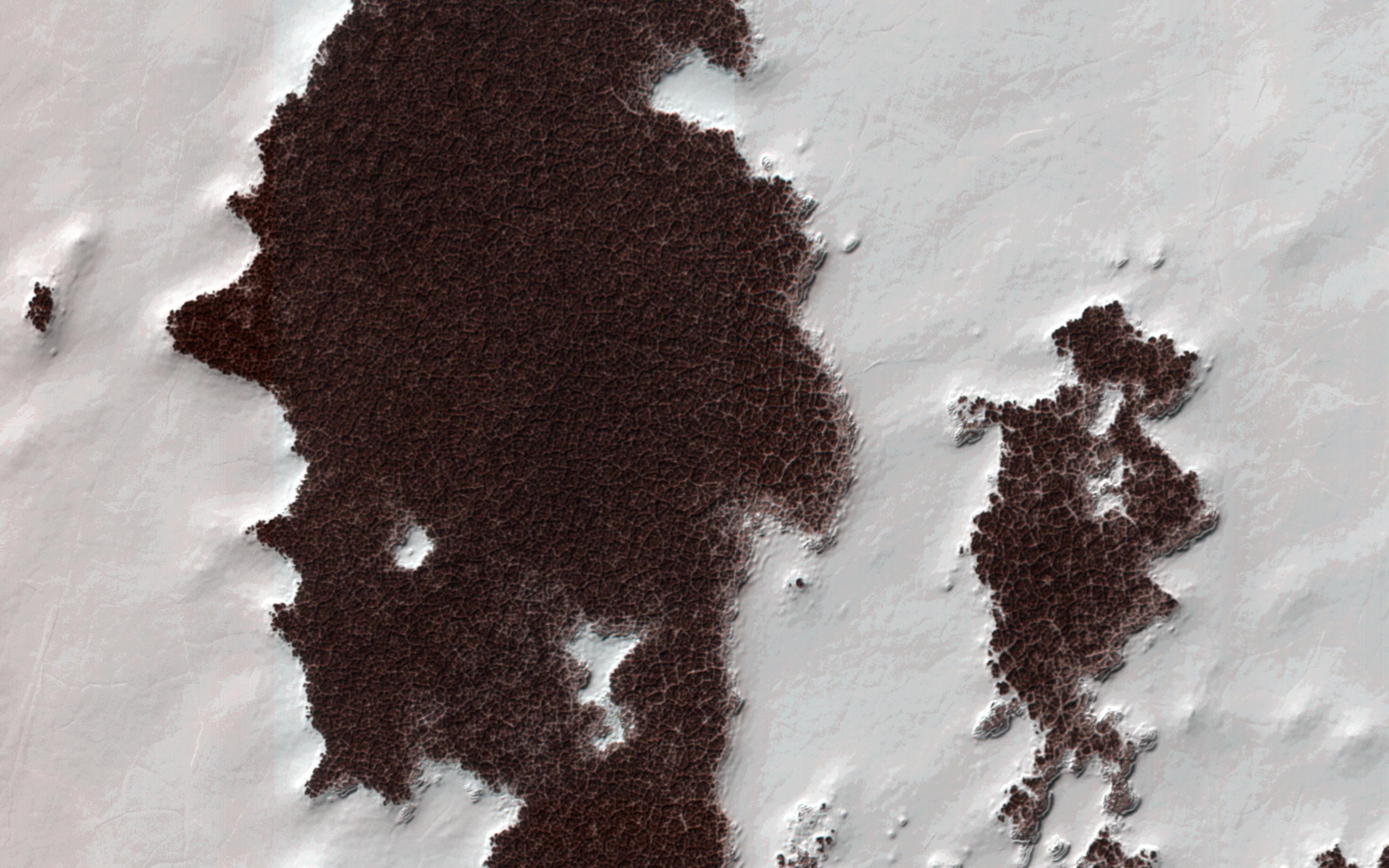
PIA14861:
-
Edge of North Polar Erg
Full Resolution:
TIFF
(14.76 MB)
JPEG
(1.041 MB)
|
|
|
2011-12-07 |
Mars
|
Mars Reconnaissance Orbiter (MRO)
|
HiRISE
|
8192x4774x3 |
|
-
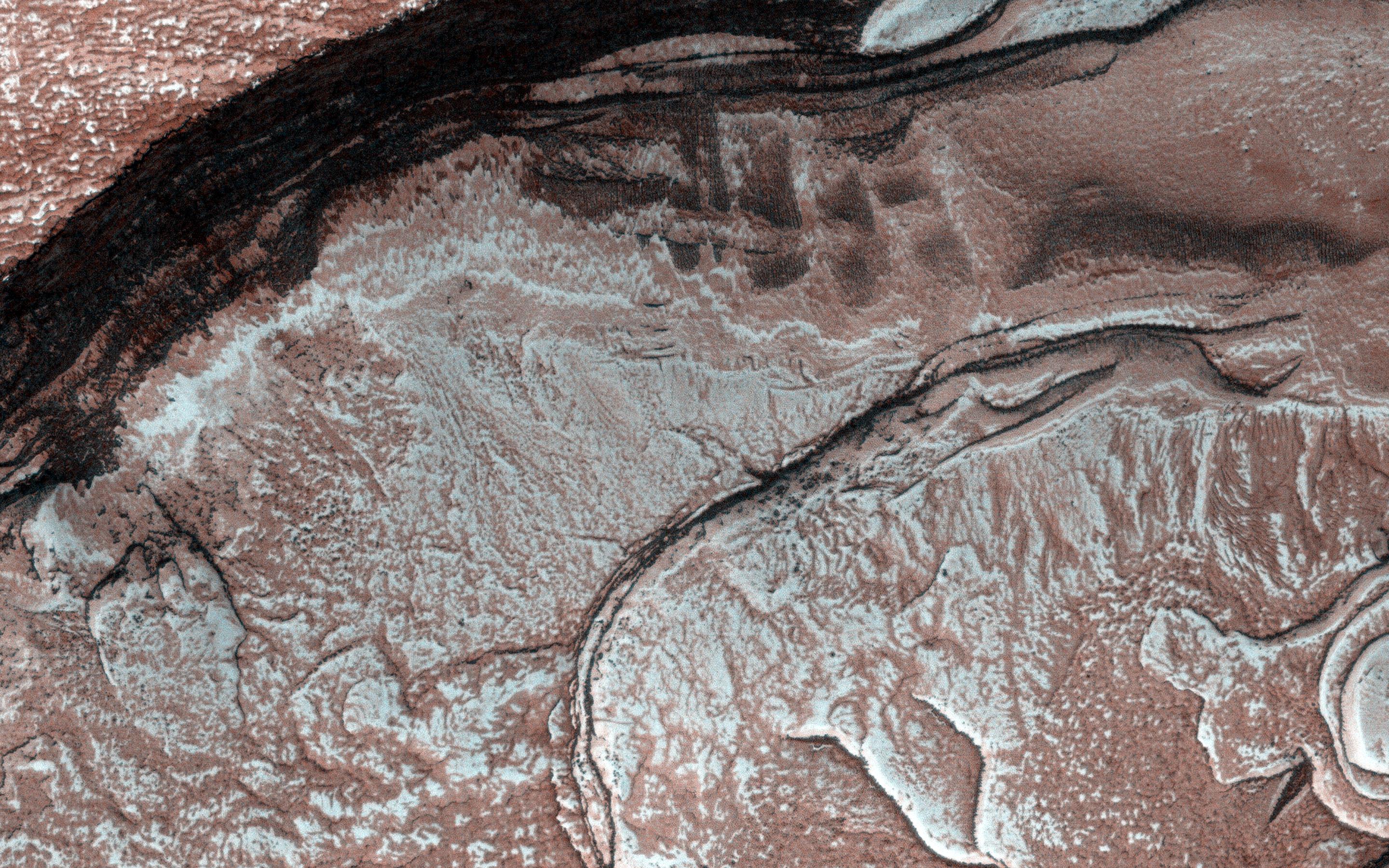
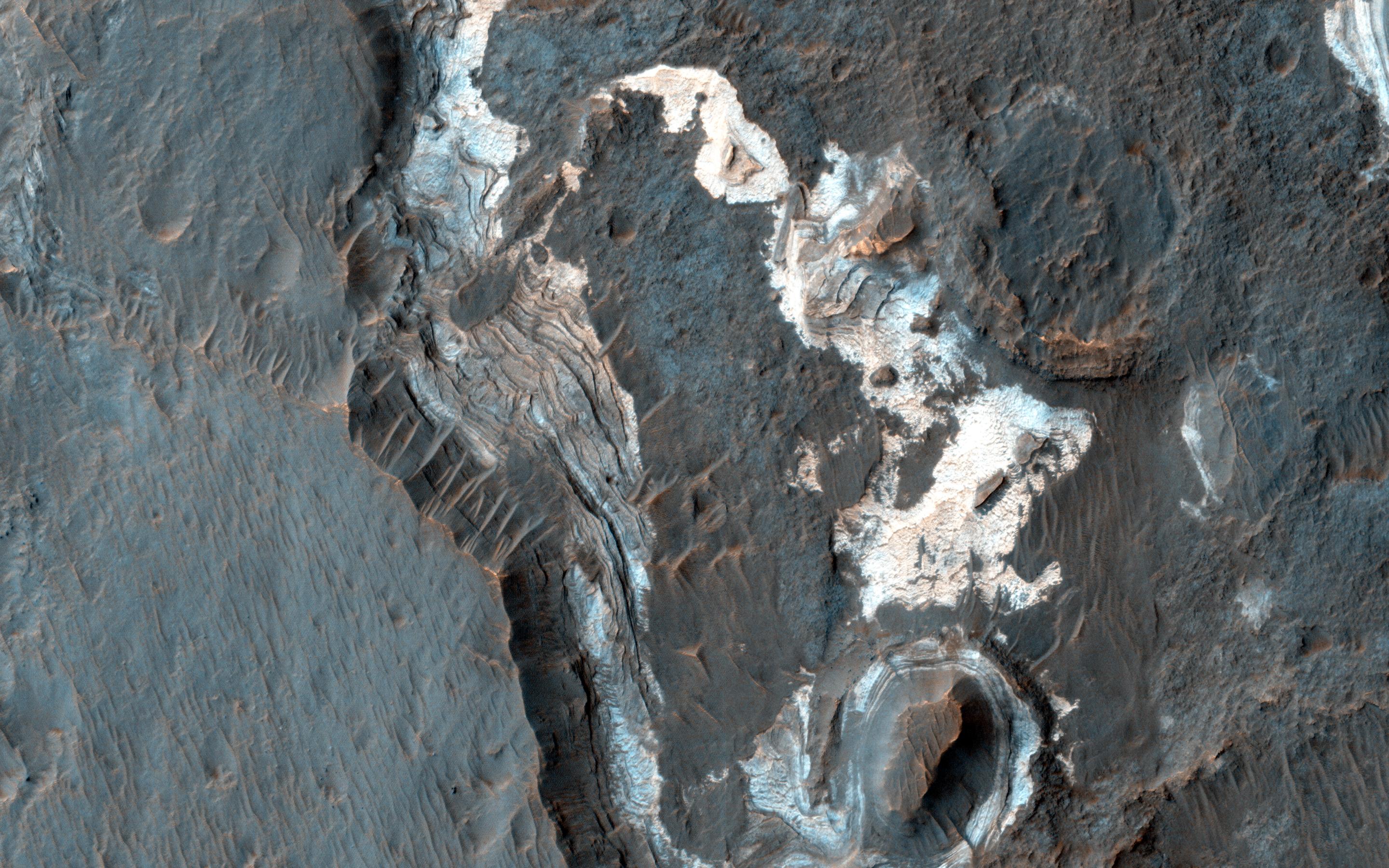
PIA15111:
-
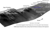
West Rim of Endeavour with Vertical Exaggeration
Full Resolution:
TIFF
(117.3 MB)
JPEG
(3.007 MB)
|
|
|
2011-12-07 |
Mars
|
Mars Reconnaissance Orbiter (MRO)
|
HiRISE
|
960x720x3 |
|
-
PIA15112:
-
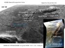
'Botany Bay' and 'Cape York' with Vertical Exaggeration
Full Resolution:
TIFF
(2.077 MB)
JPEG
(144.3 kB)
|
|
|
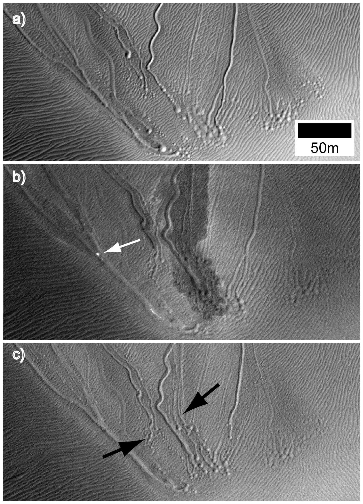
2014-07-10 |
Mars
|
Mars Reconnaissance Orbiter (MRO)
|
HiRISE
|
2880x1800x3 |
|
-
PIA18538:
-
Activity in Martian Gully
Full Resolution:
TIFF
(15.56 MB)
JPEG
(1.044 MB)
|
|
|
2012-01-25 |
Mars
|
Mars Reconnaissance Orbiter (MRO)
|
HiRISE
|
2023x2008x3 |
|
-
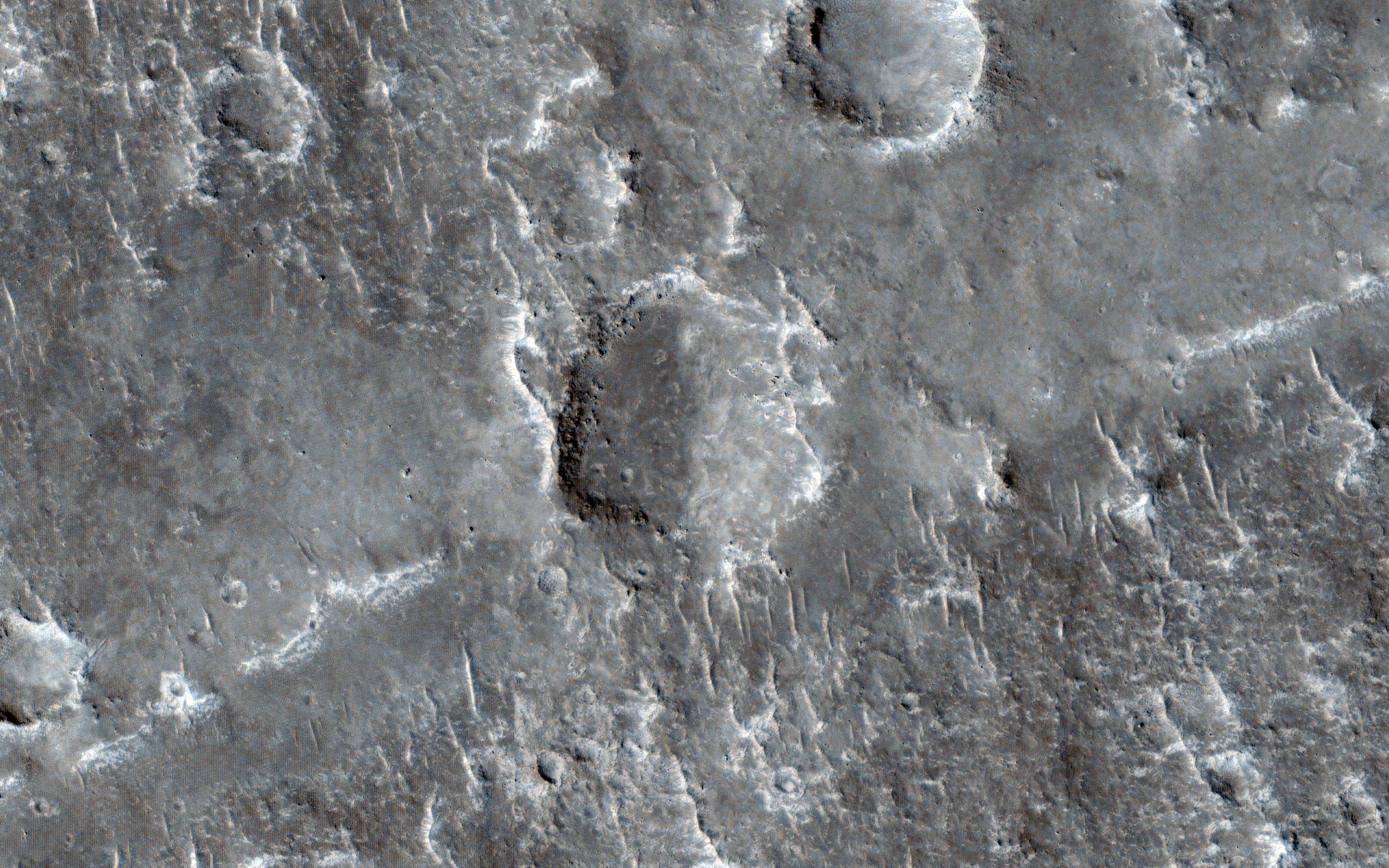
PIA15283:
-
Dunes in Noachis Terra Region of Mars
Full Resolution:
TIFF
(12.2 MB)
JPEG
(593 kB)
|
|
|
2012-03-07 |
Mars
|
Mars Reconnaissance Orbiter (MRO)
|
HiRISE
|
2093x1389x3 |
|
-
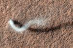
PIA15116:
-
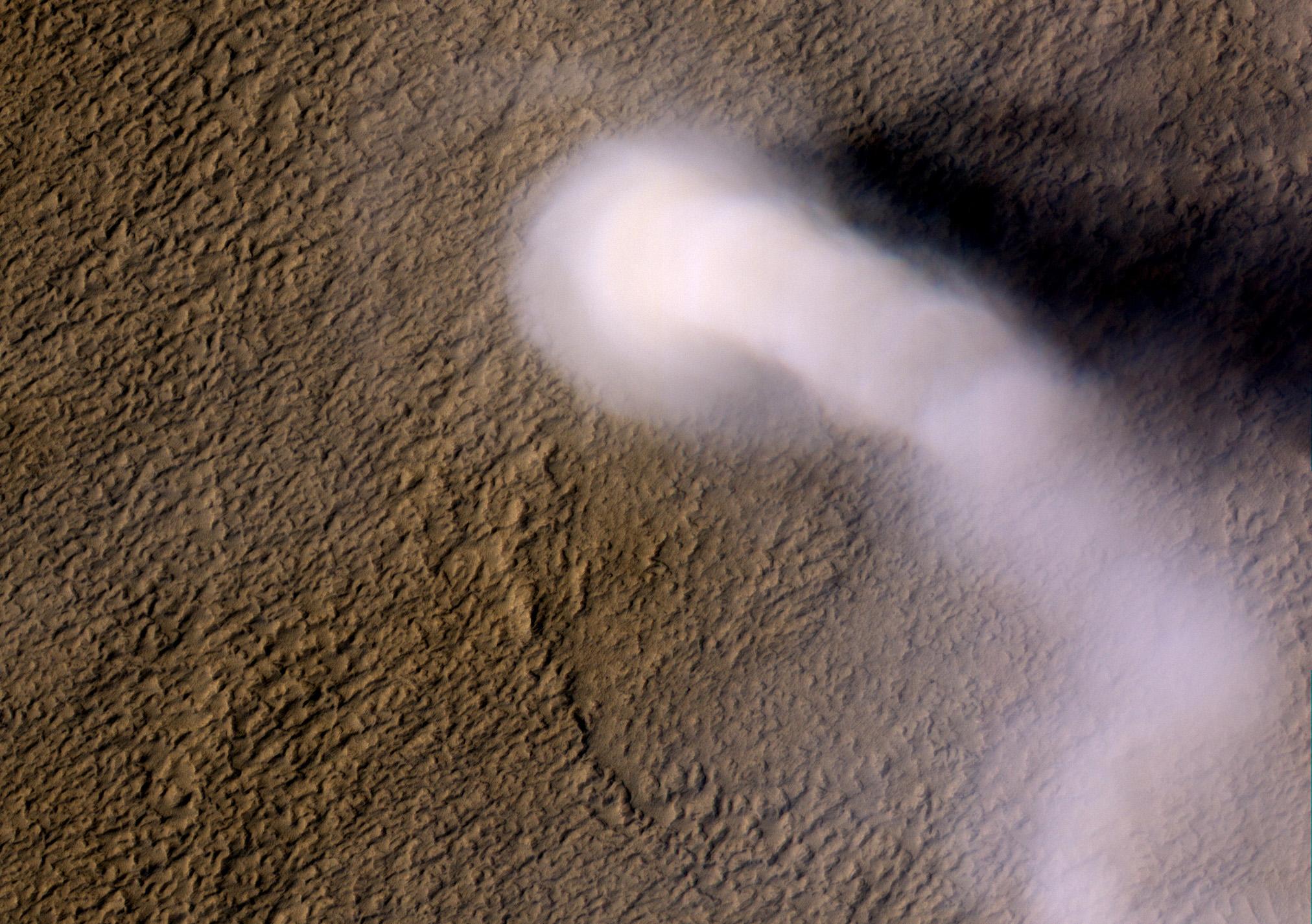
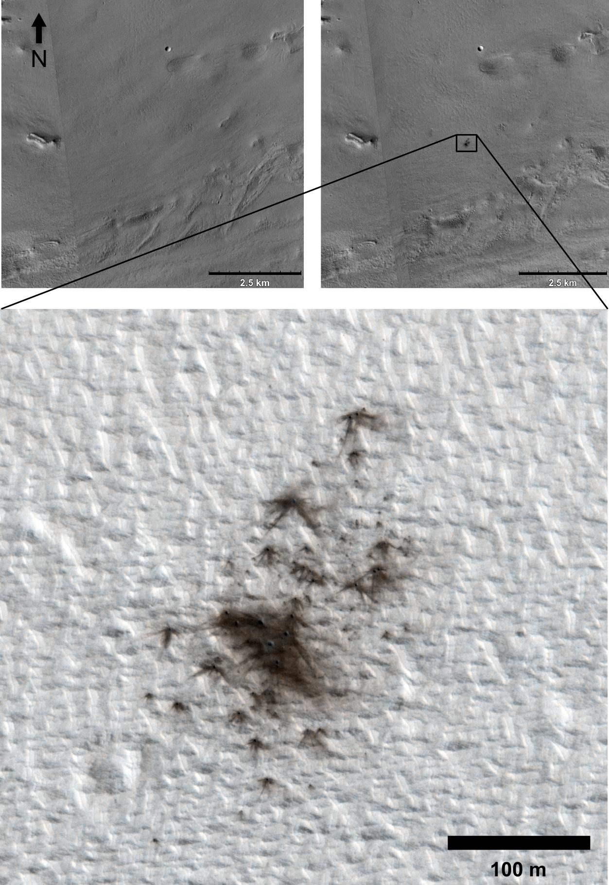
The Serpent Dust Devil of Mars
Full Resolution:
TIFF
(8.733 MB)
JPEG
(520.7 kB)
|
|
|
2012-04-04 |
Mars
|
Mars Reconnaissance Orbiter (MRO)
|
HiRISE
|
2024x1426x3 |
|
-
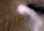
PIA15545:
-
Mars' Whirling Dust Devil
Full Resolution:
TIFF
(8.67 MB)
JPEG
(423.6 kB)
|
|
|
2017-01-26 |
Mars
|
Mars Reconnaissance Orbiter (MRO)
|
HiRISE
|
4500x3000x1 |
|
-
PIA11704:
-
Pits and Channels of Hebrus Valles
Full Resolution:
TIFF
(13.52 MB)
JPEG
(2.535 MB)
|
|
|
2012-05-09 |
Mars
|
Mars Reconnaissance Orbiter (MRO)
|
HiRISE
|
1115x776x1 |
|
-
PIA15295:
-
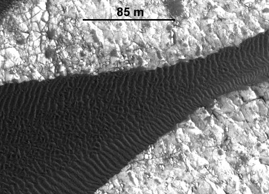
Advancing Dune in Nili Patera, Mars
Full Resolution:
TIFF
(866.4 kB)
JPEG
(143.5 kB)
|
|
|
2012-05-09 |
Mars
|
Mars Reconnaissance Orbiter (MRO)
|
HiRISE
|
533x386x1 |
|
-
PIA15680:
-
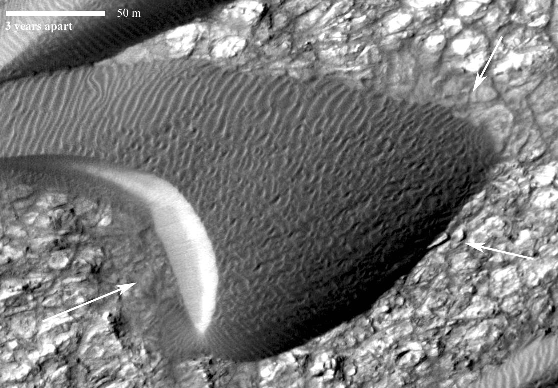
Ripple Movement on Sand Dune in Nili Patera, Mars
Full Resolution:
TIFF
(206.2 kB)
JPEG
(50.09 kB)
|
|
|
2012-08-02 |
Mars
|
Mars Reconnaissance Orbiter (MRO)
|
MARCI
|
1300x1400x3 |
|
-
PIA15959:
-
Martian Dust Storm
Full Resolution:
TIFF
(5.462 MB)
JPEG
(402.9 kB)
|
|
|
2012-09-11 |
Mars
|
Mars Reconnaissance Orbiter (MRO)
|
MCS
|
1095x1018x3 |

|
-
PIA16138:
-
Carbon-Dioxide Snowfall on Mars
Full Resolution:
TIFF
(3.346 MB)
JPEG
(184.6 kB)
|
|
|
2012-11-21 |
Mars
|
Mars Reconnaissance Orbiter (MRO)
|
MARCI
|
2881x1441x3 |
|
-
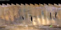
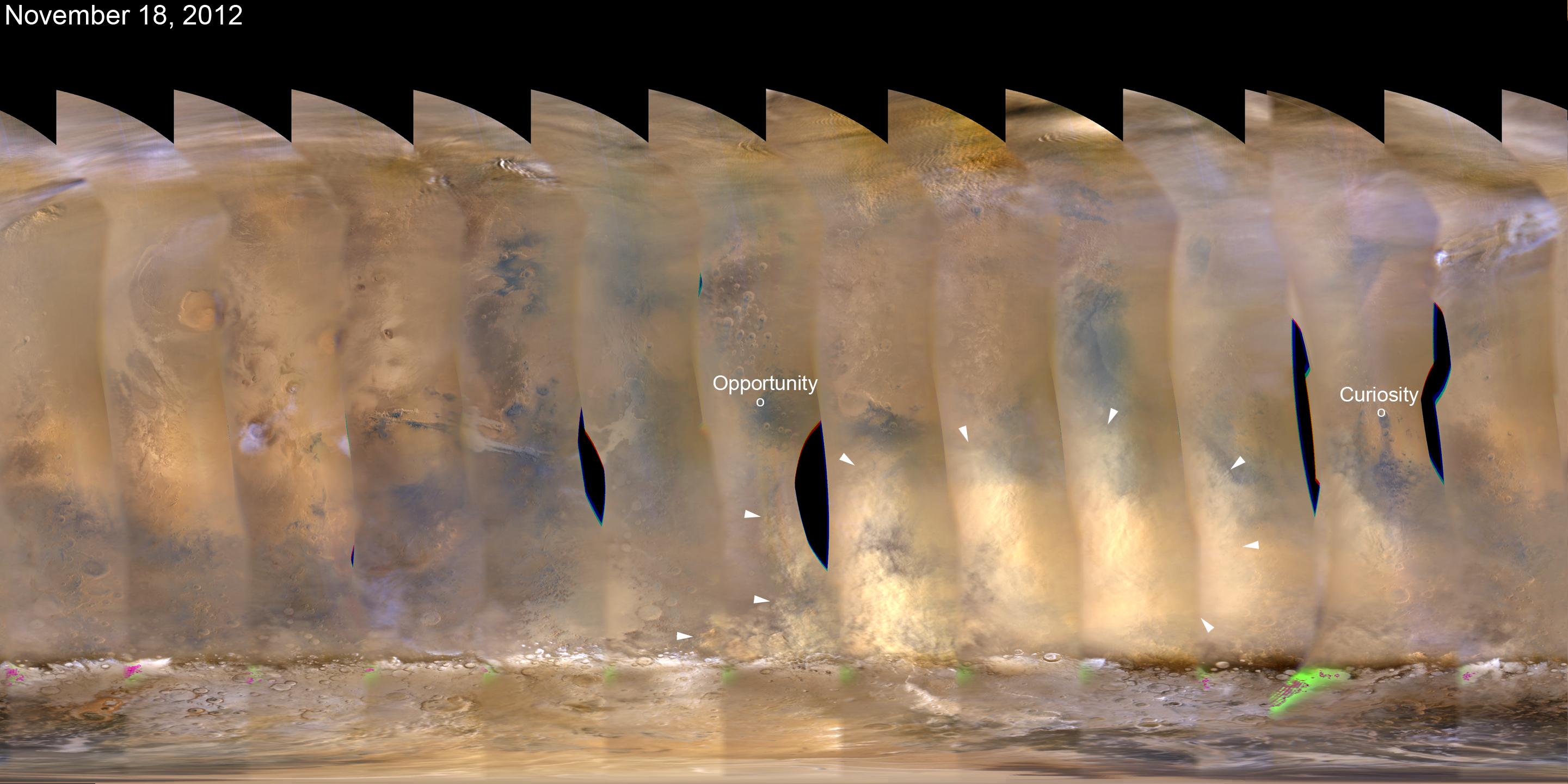
PIA16450:
-
Martian Dust Storm, Nov. 18, 2012
Full Resolution:
TIFF
(12.46 MB)
JPEG
(314.4 kB)
|
|
|
2012-11-27 |
Mars
|
Mars Reconnaissance Orbiter (MRO)
|
MARCI
|
2881x1441x3 |
|
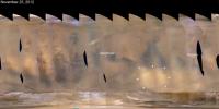
-
PIA16454:
-
Regional Dust Storm Weakening, Nov. 25, 2012
Full Resolution:
TIFF
(12.46 MB)
JPEG
(266 kB)
|
|
|
2013-01-20 |
Mars
|
Mars Reconnaissance Orbiter (MRO)
|
HiRISE
|
612x431x3 |
|
-
PIA16710:
-
Layers with Carbonate Content Inside McLaughlin Crater on Mars
Full Resolution:
TIFF
(791.8 kB)
JPEG
(45.18 kB)
|
|
|
2013-01-24 |
Mars
|
Mars Reconnaissance Orbiter (MRO)
|
HiRISE
|
503x340x3 |
|
-
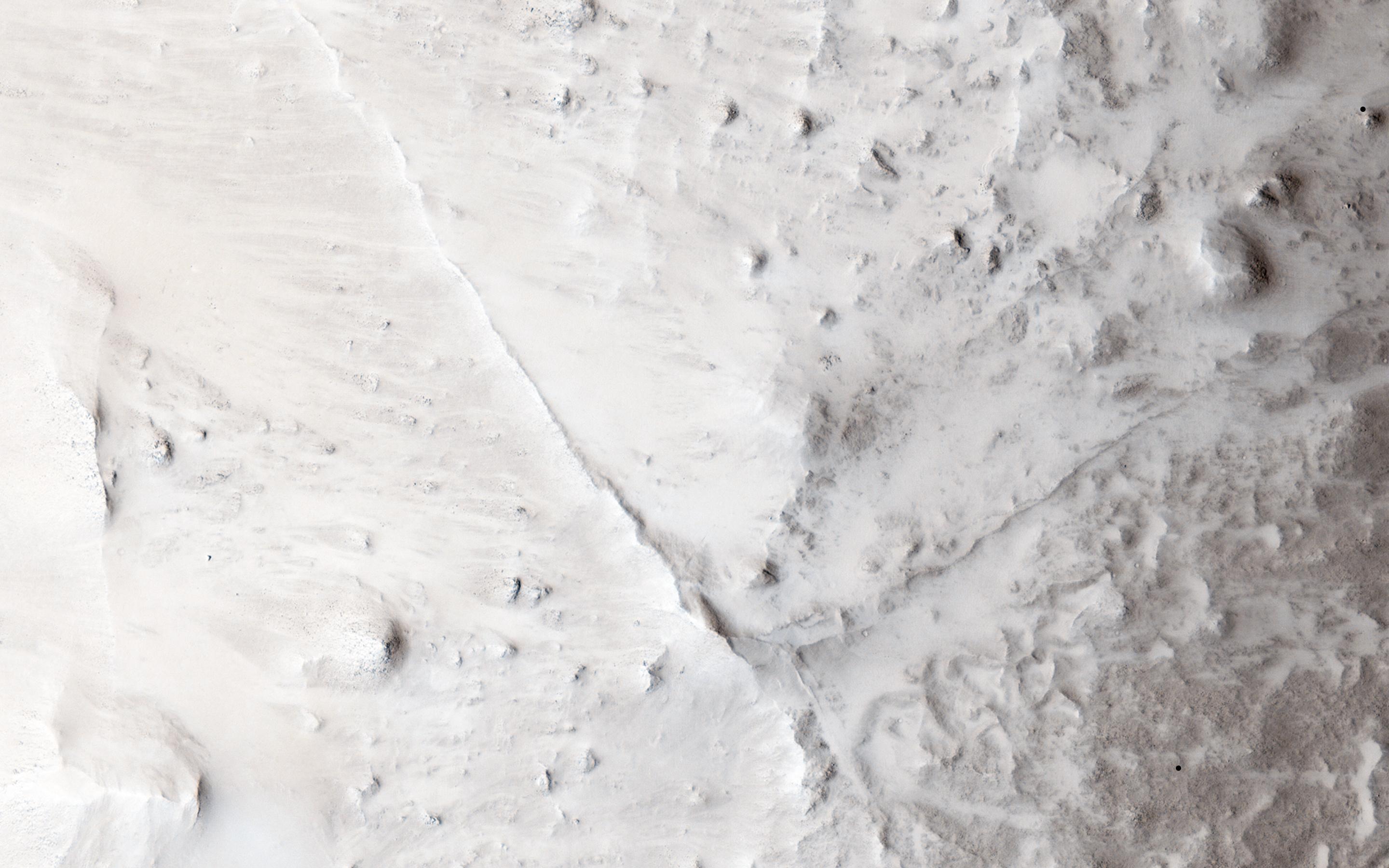
PIA16715:
-
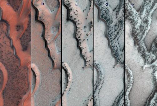
Seasonal Changes on Far-Northern Mars
Full Resolution:
TIFF
(513.5 kB)
JPEG
(35.91 kB)
|
|
|
2013-03-07 |
Mars
|
Mars Reconnaissance Orbiter (MRO)
|
Shallow Subsurface Radar (SHARAD)
|
1000x692x3 |
|
-
PIA16767:
-
Visualization of Buried Marte Vallis Channels
Full Resolution:
TIFF
(2.077 MB)
JPEG
(74.88 kB)
|
|
|
2013-04-11 |
Mars
|
Mars Reconnaissance Orbiter (MRO)
|
HiRISE
|
3505x1786x3 |
|
-
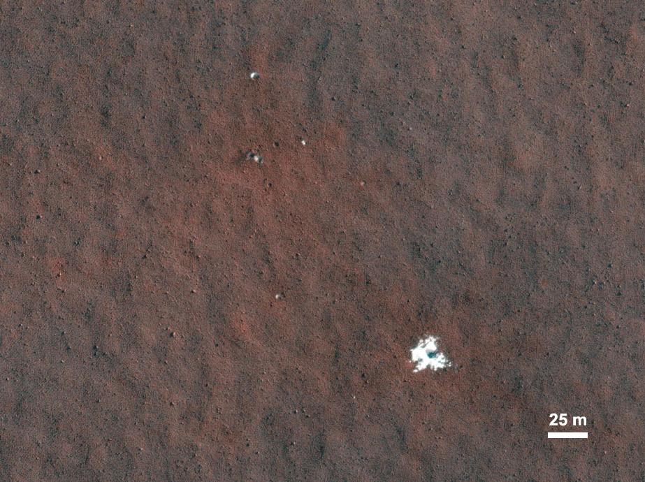
PIA16920:
-
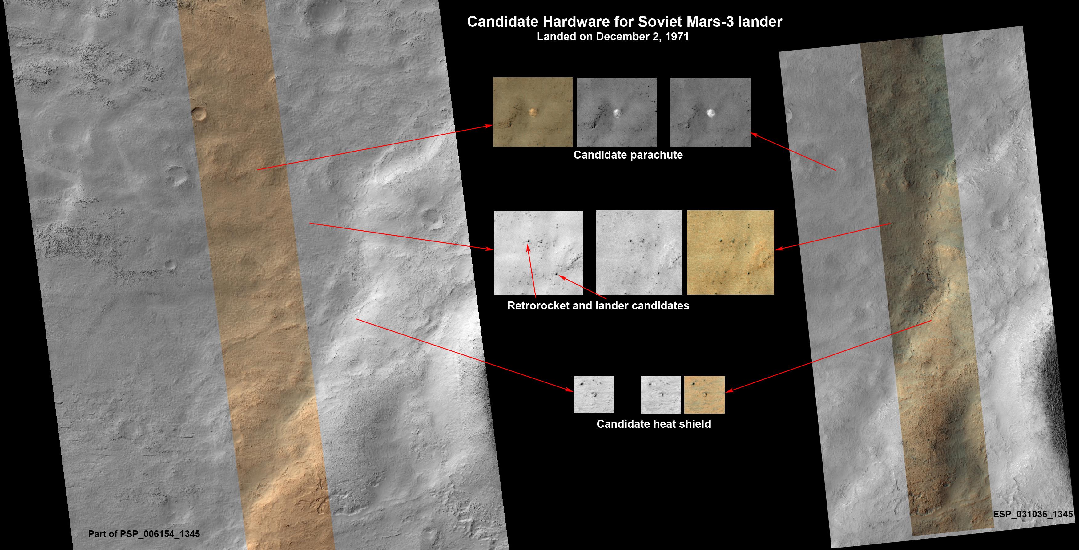
Could This Be the Mars Soviet 3 Lander?
Full Resolution:
TIFF
(18.79 MB)
JPEG
(727.8 kB)
|
|
|
2013-05-15 |
Mars
|
Mars Reconnaissance Orbiter (MRO)
|
CTX
HiRISE
|
1253x1822x3 |
|
-
PIA16928:
-
Fresh Cluster of Impact Craters on Mars
Full Resolution:
TIFF
(6.852 MB)
JPEG
(311.5 kB)
|
|
|
2013-06-07 |
Mars
|
Mars Reconnaissance Orbiter (MRO)
|
HiRISE
|
2040x4116x3 |
|
-
PIA17072:
-
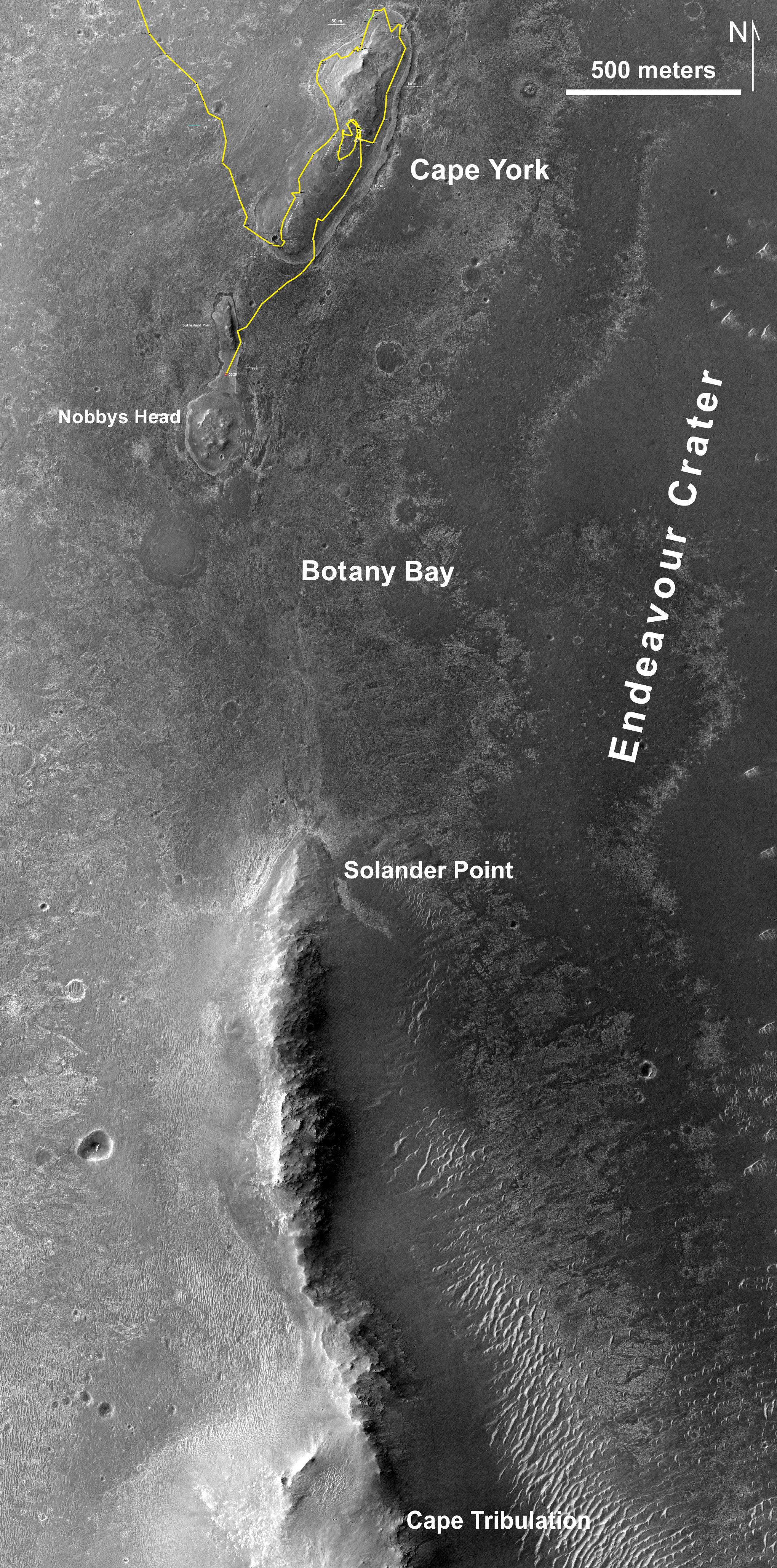
Southbound Opportunity, June 2013
Full Resolution:
TIFF
(25.2 MB)
JPEG
(2.025 MB)
|
|
|
2013-06-11 |
Mars
|
Mars Reconnaissance Orbiter (MRO)
|
HiRISE
|
1457x835x1 |
|
-
PIA17260:
-
Linear Gullies Inside Russell Crater, Mars
Full Resolution:
TIFF
(1.218 MB)
JPEG
(238 kB)
|
|
|
2013-06-11 |
Mars
|
Mars Reconnaissance Orbiter (MRO)
|
HiRISE
|
1439x1993x1 |
|
-
PIA17261:
-
Some Gullies on Mars Could Be Tracks of Sliding Dry Ice
Full Resolution:
TIFF
(2.871 MB)
JPEG
(568.4 kB)
|
|
|
2013-06-12 |
Mars
|
Mars Reconnaissance Orbiter (MRO)
|
MCS
|
1883x2437x3 |
|
-
PIA17263:
-
Scanning Martian Atmospheric Temperatures (Graphic)
Full Resolution:
TIFF
(13.77 MB)
JPEG
(337.9 kB)
|
|
|
2014-05-22 |
Mars
|
Mars Reconnaissance Orbiter (MRO)
|
HiRISE
|
2880x1800x1 |
|
-
PIA18649:
-
The Busy Flank of Arsia Mons
Full Resolution:
TIFF
(5.191 MB)
JPEG
(682.4 kB)
|
|
|
2013-10-17 |
Mars
|
Mars Reconnaissance Orbiter (MRO)
|
HiRISE
|
1920x1080x3 |

|
-
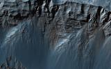
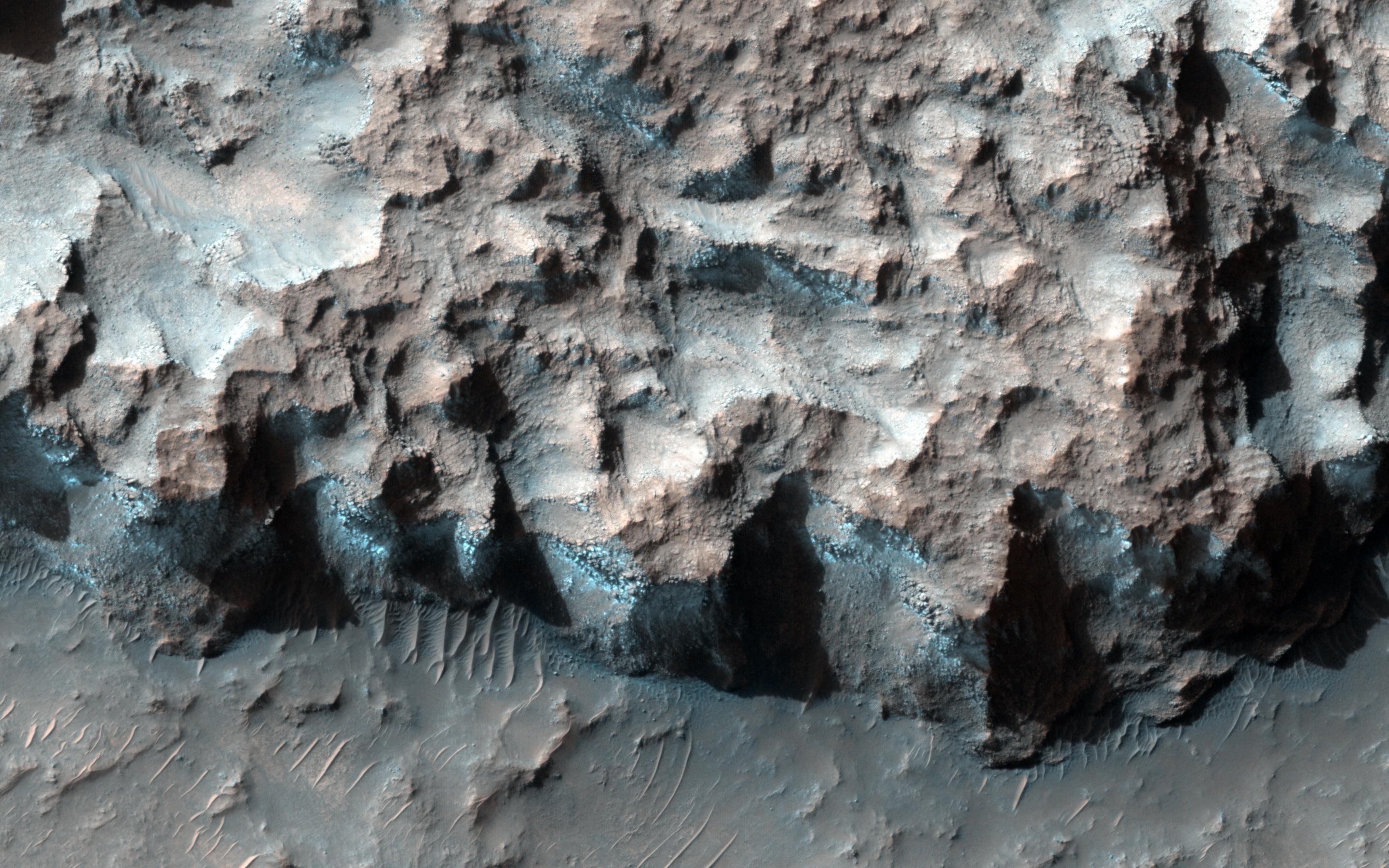
PIA17447:
-
Mountainous Crater Rim on Mars
Full Resolution:
TIFF
(6.223 MB)
JPEG
(169.6 kB)
|
|
|
2013-10-16 |
Mars
|
Mars Reconnaissance Orbiter (MRO)
|
HiRISE
|
2880x1800x3 |
|
-
PIA17548:
-
Fall Frosting
Full Resolution:
TIFF
(15.56 MB)
JPEG
(887.8 kB)
|
|
|
2013-10-16 |
Mars
|
Mars Reconnaissance Orbiter (MRO)
|
HiRISE
|
2880x1800x3 |
|
-
PIA17549:
-
Possible Impacts from MSL Hardware
Full Resolution:
TIFF
(15.56 MB)
JPEG
(1.513 MB)
|
|
|
2013-10-16 |
Mars
|
Mars Reconnaissance Orbiter (MRO)
|
HiRISE
|
2880x1800x3 |
|
-
PIA17570:
-
Bedding Details in Layered Rock
Full Resolution:
TIFF
(15.56 MB)
JPEG
(600.1 kB)
|
|
|
2013-10-16 |
Mars
|
Mars Reconnaissance Orbiter (MRO)
|
HiRISE
|
2880x1800x3 |
|
-
PIA17571:
-
Fretted Terrains and Ground Deformation
Full Resolution:
TIFF
(15.56 MB)
JPEG
(1.05 MB)
|
|
|
2013-10-02 |
Mars
|
Mars Reconnaissance Orbiter (MRO)
|
HiRISE
|
2880x1800x3 |
|
-
PIA17572:
-
Aligned Scallops
Full Resolution:
TIFF
(15.56 MB)
JPEG
(1.475 MB)
|
|
|
2013-10-02 |
Mars
|
Mars Reconnaissance Orbiter (MRO)
|
HiRISE
|
1898x1007x3 |
|
-
PIA17573:
-
Colorful Dunes
Full Resolution:
TIFF
(5.736 MB)
JPEG
(301.4 kB)
|
|
|
2013-10-18 |
Mars
|
Mars Reconnaissance Orbiter (MRO)
|
HiRISE
|
2880x1800x1 |
|
-
PIA17574:
-
Sinuous Ridge Cutting Across Geologic Units of the Medusae Fossae Formation
Full Resolution:
TIFF
(5.191 MB)
JPEG
(1.039 MB)
|
|
|
2013-10-02 |
Mars
|
Mars Reconnaissance Orbiter (MRO)
|
HiRISE
|
2880x1800x1 |

|
-
PIA17575:
-
Differential Compaction around a Crater Peak
Full Resolution:
TIFF
(5.191 MB)
JPEG
(915.7 kB)
|
|
|
2013-10-30 |
Mars
|
Mars Reconnaissance Orbiter (MRO)
|
HiRISE
|
2880x1800x3 |
|
-
PIA17623:
-
Spring Slide
Full Resolution:
TIFF
(15.56 MB)
JPEG
(659.6 kB)
|
|
|
2013-10-30 |
Mars
|
Mars Reconnaissance Orbiter (MRO)
|
HiRISE
|
2880x1800x3 |
|
-
PIA17624:
-
Beautiful Layers in the Central Uplift of Mazamba Crater
Full Resolution:
TIFF
(15.56 MB)
JPEG
(935.8 kB)
|
|
|
2013-10-30 |
Mars
|
Mars Reconnaissance Orbiter (MRO)
|
HiRISE
|
2880x1800x3 |
|
-
PIA17625:
-
Enigmatic Channels on the Floor of Mangala Valles
Full Resolution:
TIFF
(15.56 MB)
JPEG
(1.052 MB)
|
|
|
2013-10-30 |
Mars
|
Mars Reconnaissance Orbiter (MRO)
|
HiRISE
|
2880x1800x3 |

|
-
PIA17626:
-
Martian Thunderbird
Full Resolution:
TIFF
(5.191 MB)
JPEG
(1.13 MB)
|
|
|
2013-09-18 |
Mars
|
Mars Reconnaissance Orbiter (MRO)
|
HiRISE
|
2880x1800x3 |
|
-
PIA17628:
-
Two Generations of Windblown Sediments
Full Resolution:
TIFF
(15.56 MB)
JPEG
(641.7 kB)
|
|
|
2013-09-18 |
Mars
|
Mars Reconnaissance Orbiter (MRO)
|
HiRISE
|
2880x1800x3 |
|
-
PIA17629:
-
Martian Glaciers and Brain Terrain
Full Resolution:
TIFF
(15.56 MB)
JPEG
(1.045 MB)
|
|
|
2013-09-12 |
Mars
|
Mars Reconnaissance Orbiter (MRO)
|
HiRISE
|
2880x1800x3 |
|
-
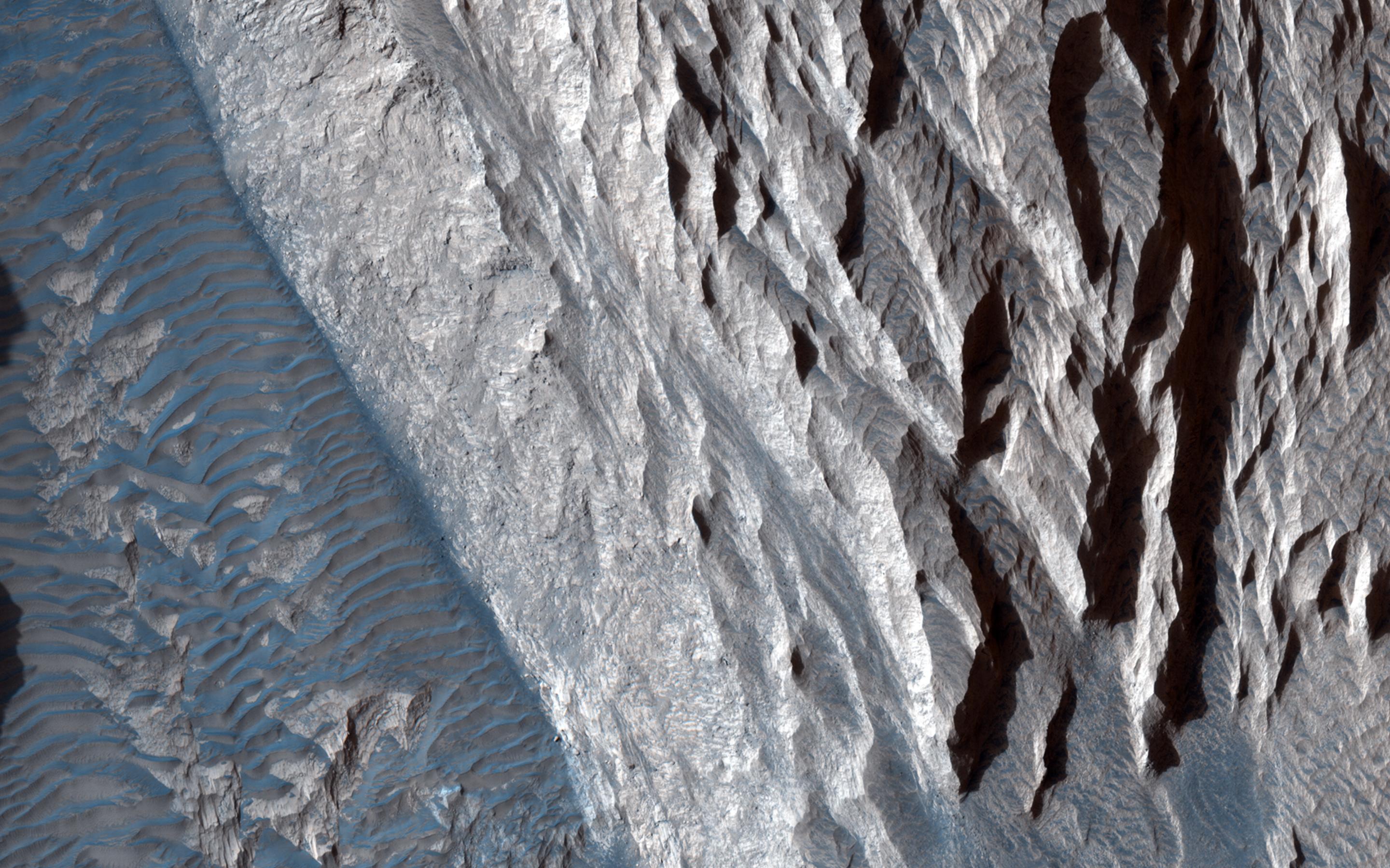
PIA17630:
-
Layers, Bedrock Ridges, and Dark Sand in Schiaparelli Crater
Full Resolution:
TIFF
(15.56 MB)
JPEG
(908.3 kB)
|
|
|
2013-09-12 |
Mars
|
Mars Reconnaissance Orbiter (MRO)
|
HiRISE
|
2880x1800x3 |
|
-
PIA17631:
-
Terraced Craters and Layered Targets
Full Resolution:
TIFF
(15.56 MB)
JPEG
(1.341 MB)
|
|
|
2013-11-06 |
Mars
|
Mars Reconnaissance Orbiter (MRO)
|
HiRISE
|
2880x1800x3 |
|
-
PIA17670:
-
Dust Covered Channels on Tharsis Tholus
Full Resolution:
TIFF
(15.56 MB)
JPEG
(747.6 kB)
|
|
|
2013-11-06 |
Mars
|
Mars Reconnaissance Orbiter (MRO)
|
HiRISE
|
2880x1800x3 |
|
-
PIA17671:
-
Hints of an Ancient Shoreline in Southern Isidis Planitia
Full Resolution:
TIFF
(15.56 MB)
JPEG
(1.058 MB)
|
|
|
2013-11-06 |
Mars
|
Mars Reconnaissance Orbiter (MRO)
|
HiRISE
|
2880x1800x3 |
|
-
PIA17672:
-
Breached Rim of a Circular Depression
Full Resolution:
TIFF
(15.56 MB)
JPEG
(617.4 kB)
|
|
|
2013-11-06 |
Mars
|
Mars Reconnaissance Orbiter (MRO)
|
HiRISE
|
2880x1800x3 |
|
-
PIA17673:
-
Cratered Cones in Tartarus Montes
Full Resolution:
TIFF
(15.56 MB)
JPEG
(783.3 kB)
|
|
|
2013-08-08 |
Mars
|
Mars Reconnaissance Orbiter (MRO)
|
HiRISE
|
2880x1800x3 |

|
-
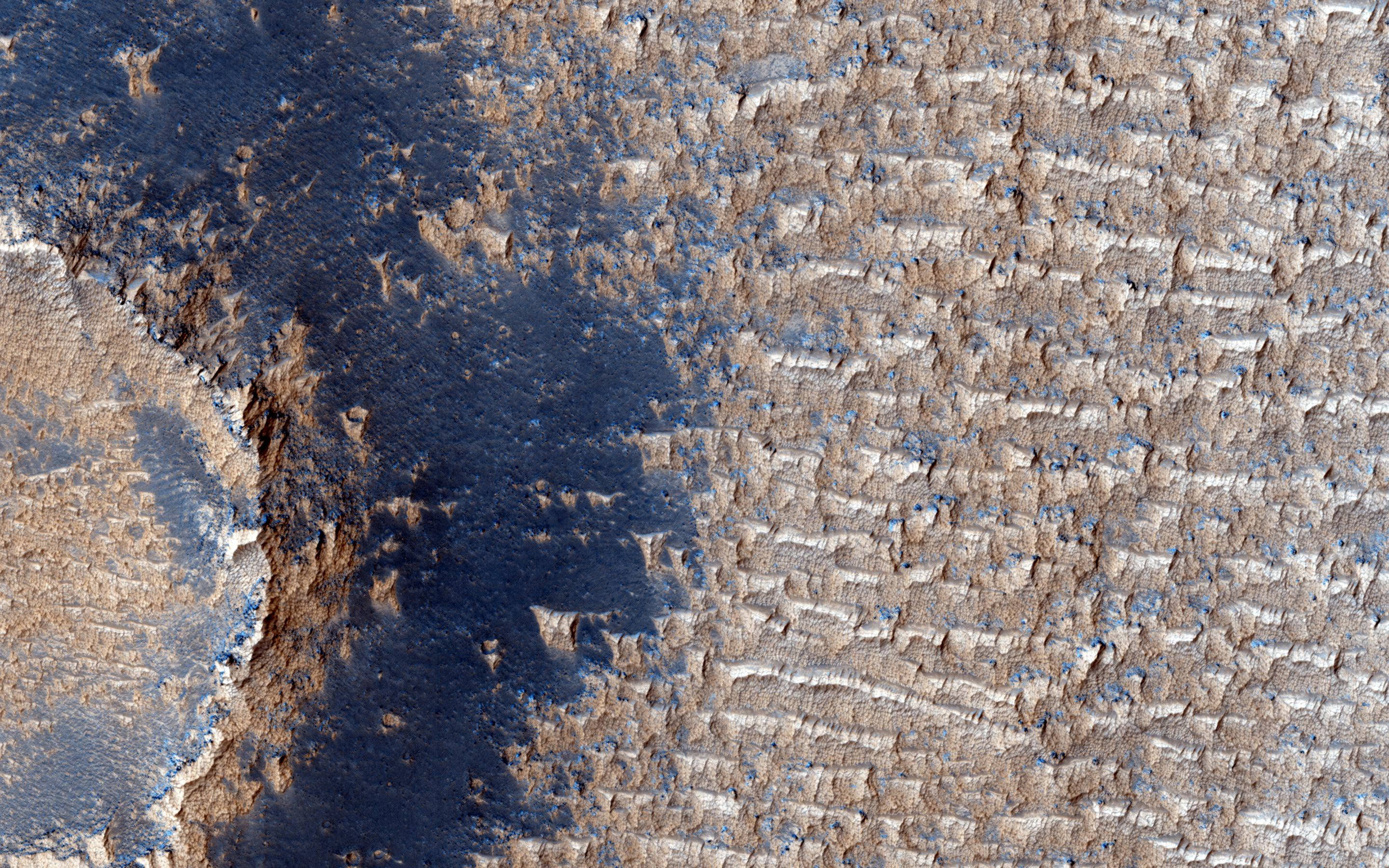
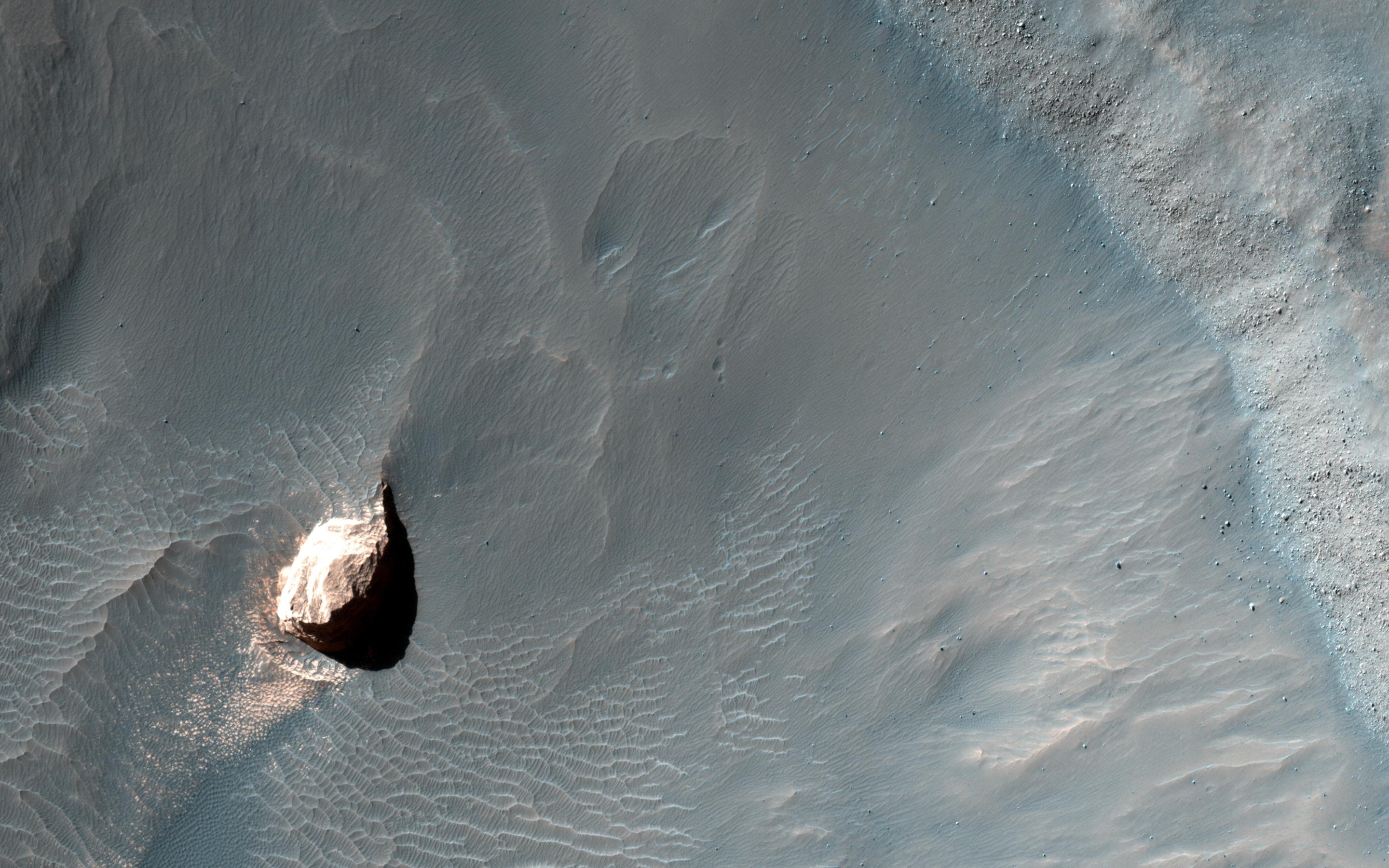
PIA17635:
-
Possible Cyclic Bedding within a Crater in Arabia Terra
Full Resolution:
TIFF
(15.56 MB)
JPEG
(749.6 kB)
|
|
|
2013-07-24 |
Mars
|
Mars Reconnaissance Orbiter (MRO)
|
HiRISE
|
2880x1800x3 |
|
-
PIA17634:
-
Ice Deposition and Loss in an Impact Crater in Utopia Basin
Full Resolution:
TIFF
(15.56 MB)
JPEG
(1.03 MB)
|
|
|
2013-11-08 |
Mars
|
Mars Reconnaissance Orbiter (MRO)
|
HiRISE
|
1280x960x3 |
|
-
PIA17675:
-
Dunes on the Rim of the Hellas Impact Basin
Full Resolution:
TIFF
(3.688 MB)
JPEG
(290.9 kB)
|
|
|
2013-08-08 |
Mars
|
Mars Reconnaissance Orbiter (MRO)
|
HiRISE
|
2880x1800x3 |
|
-
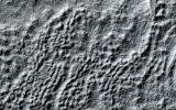
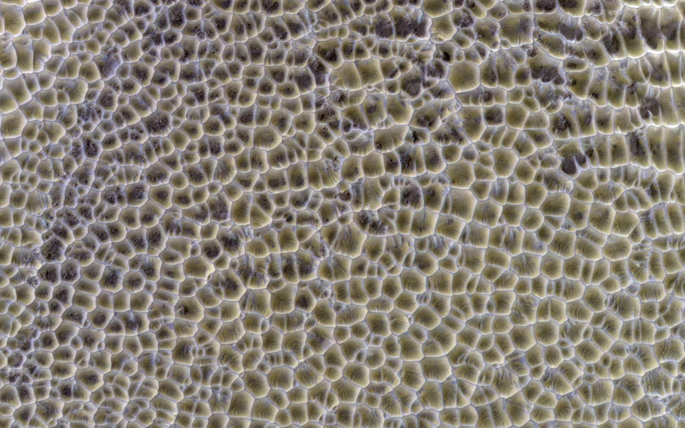
PIA17636:
-
Polygonal Surface Patterns at the South Pole
Full Resolution:
TIFF
(15.56 MB)
JPEG
(553.2 kB)
|
|
|
2013-08-08 |
Mars
|
Mars Reconnaissance Orbiter (MRO)
|
HiRISE
|
2880x1800x3 |
|
-
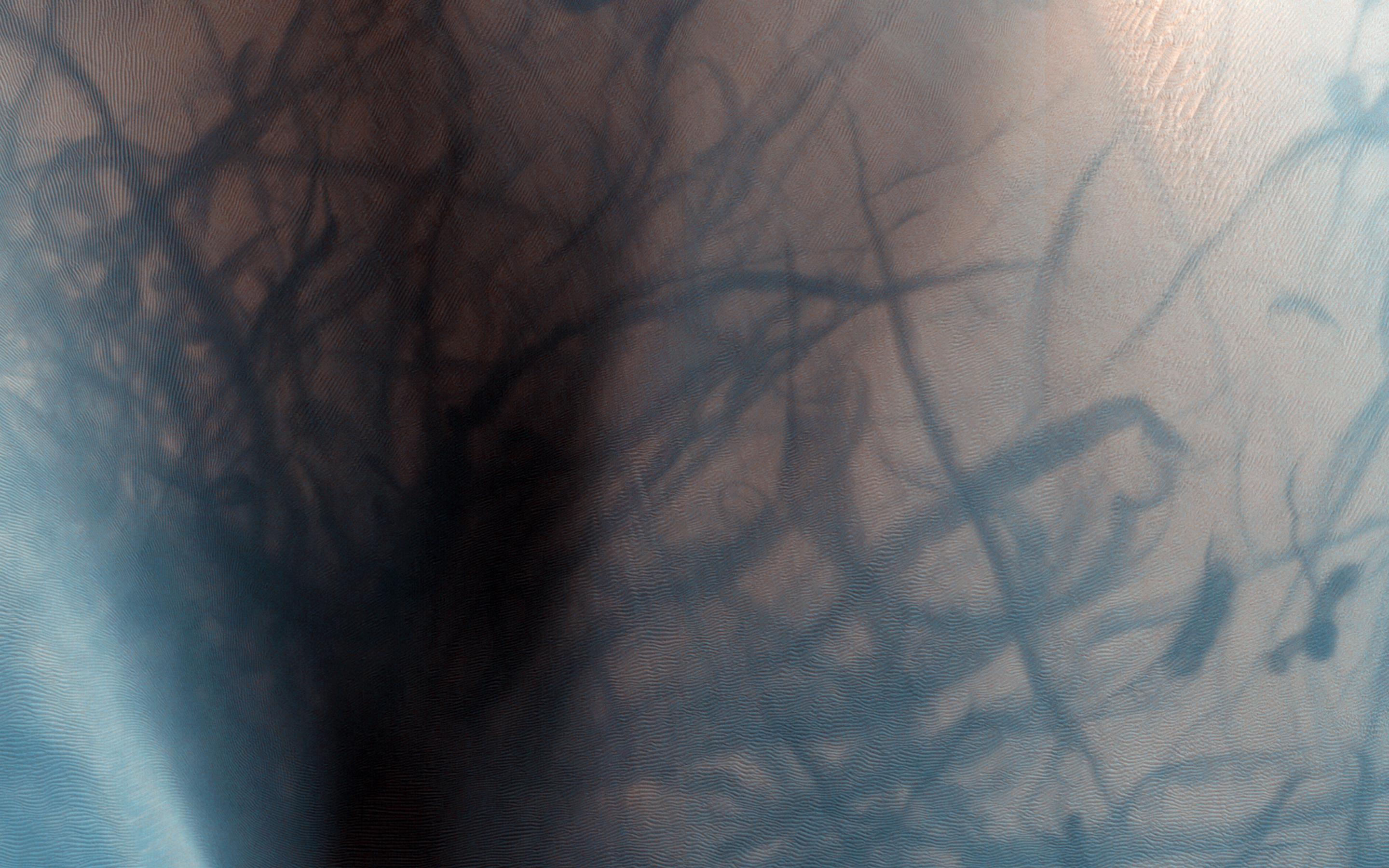
PIA17637:
-
Diffuse Winter Lighting of the Chasma Boreale Scarp
Full Resolution:
TIFF
(15.56 MB)
JPEG
(1.183 MB)
|
|
|
2013-08-08 |
Mars
|
Mars Reconnaissance Orbiter (MRO)
|
HiRISE
|
2880x1800x3 |
|
-
PIA17638:
-
Bright Dunes in Syria Planum
Full Resolution:
TIFF
(15.56 MB)
JPEG
(1.179 MB)
|
|
|
2013-08-21 |
Mars
|
Mars Reconnaissance Orbiter (MRO)
|
HiRISE
|
2880x1800x3 |
|
-
PIA17639:
-
Small Crater within Pollack Crater Containing Light-Toned Material
Full Resolution:
TIFF
(15.56 MB)
JPEG
(665.2 kB)
|
|
|
2013-08-21 |
Mars
|
Mars Reconnaissance Orbiter (MRO)
|
HiRISE
|
2880x1800x3 |
|
-
PIA17640:
-
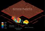
Lava Against an Impact Crater in Elysium Planitia
Full Resolution:
TIFF
(15.56 MB)
JPEG
(1.028 MB)
|
|
|
2013-08-21 |
Mars
|
Mars Reconnaissance Orbiter (MRO)
|
HiRISE
|
2880x1800x3 |
|
-
PIA17641:
-
Frosted Impact Crater in Late Northern Winter
Full Resolution:
TIFF
(15.56 MB)
JPEG
(822.3 kB)
|
|
|
2013-08-21 |
Mars
|
Mars Reconnaissance Orbiter (MRO)
|
HiRISE
|
2880x1800x3 |

|
-
PIA17642:
-
Looking for Changes in Dust Drifts West of Alba Mons
Full Resolution:
TIFF
(15.56 MB)
JPEG
(852.5 kB)
|
|
|
2013-08-21 |
Mars
|
Mars Reconnaissance Orbiter (MRO)
|
HiRISE
|
2880x1800x3 |
|
-
PIA17643:
-
Basin in the West Candor Chasma Layered Deposits
Full Resolution:
TIFF
(15.56 MB)
JPEG
(877.5 kB)
|
|
|
2013-08-21 |
Mars
|
Mars Reconnaissance Orbiter (MRO)
|
HiRISE
|
2880x1800x3 |
|
-
PIA17644:
-
Oxbows and Cutoffs in Idaeus Fossae
Full Resolution:
TIFF
(15.56 MB)
JPEG
(1.256 MB)
|
|
|
2013-08-28 |
Mars
|
Mars Reconnaissance Orbiter (MRO)
|
HiRISE
|
2880x1800x3 |
|
-
PIA17645:
-
Breaching a Crater Rim in Tartarus Montes
Full Resolution:
TIFF
(15.56 MB)
JPEG
(538.9 kB)
|
|
|
2013-08-28 |
Mars
|
Mars Reconnaissance Orbiter (MRO)
|
HiRISE
|
2880x1800x3 |
|
-
PIA17646:
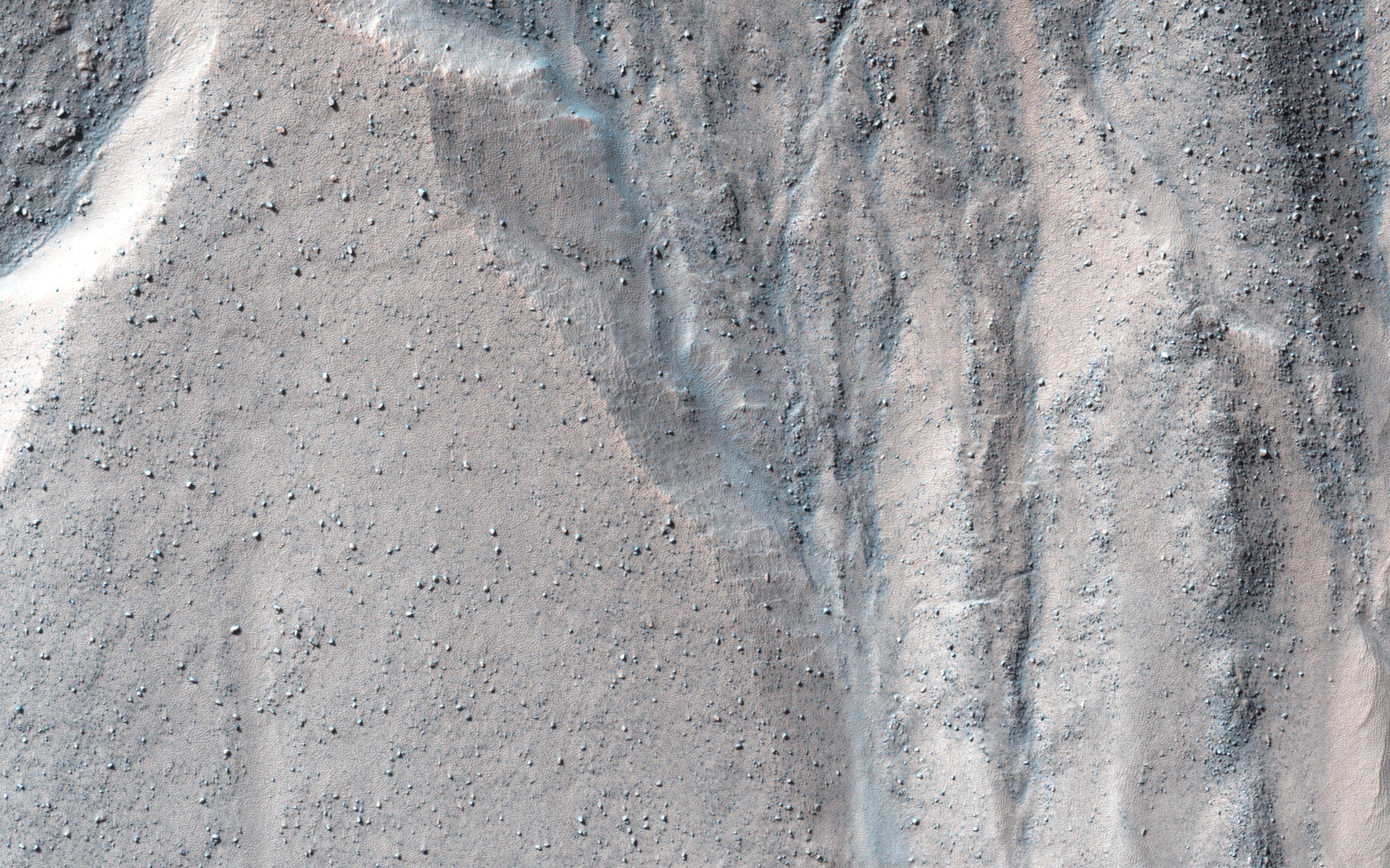
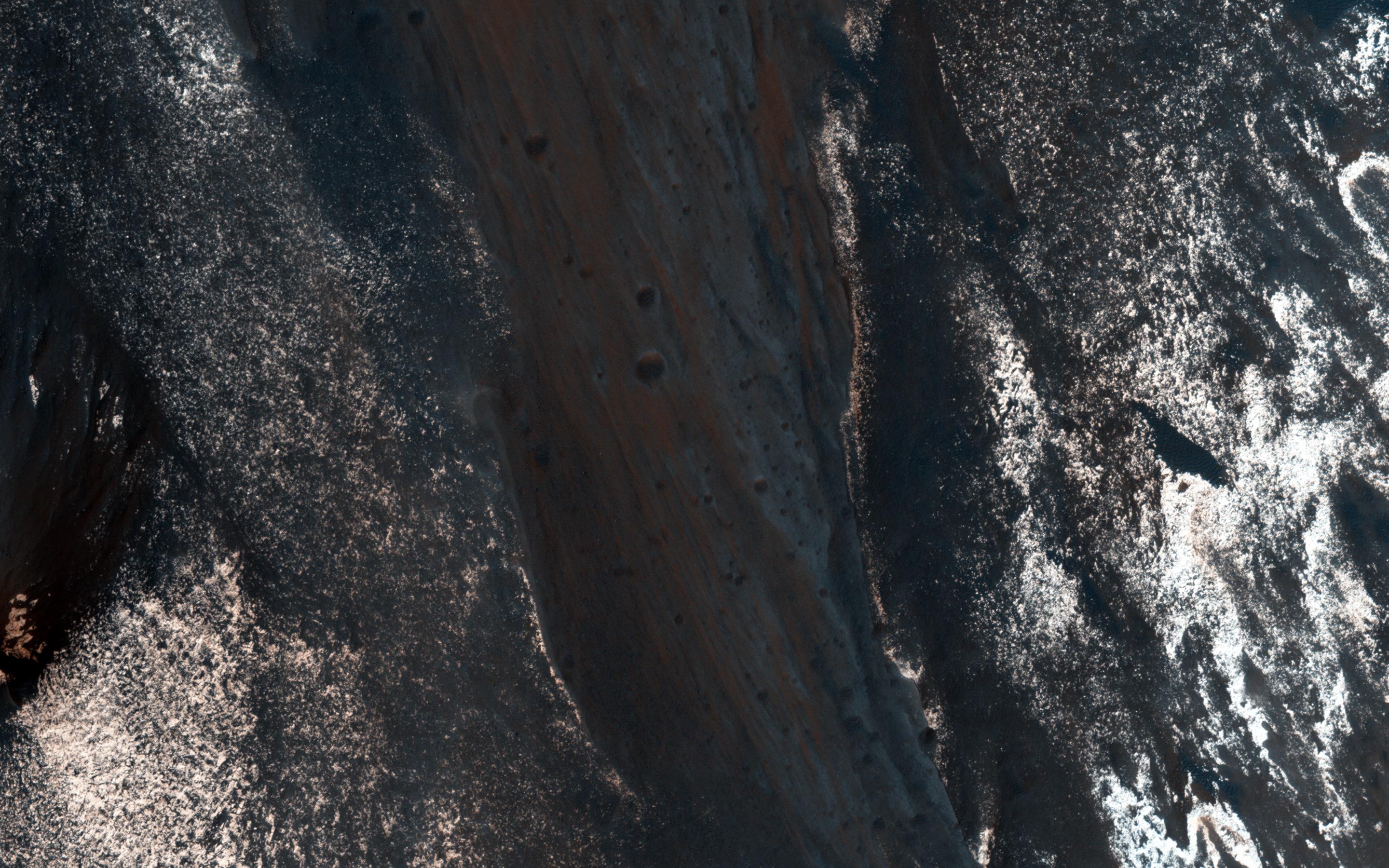
-
Migrating and Static Sand Ripples on Mars
Full Resolution:
TIFF
(15.56 MB)
JPEG
(820.1 kB)
|
|
|
2013-09-03 |
Mars
|
Mars Reconnaissance Orbiter (MRO)
|
HiRISE
|
2880x1800x3 |
|
-
PIA17647:
-
Gullied Massif in the Nereidum Montes
Full Resolution:
TIFF
(15.56 MB)
JPEG
(1.114 MB)
|
|
|
2013-09-03 |
Mars
|
Mars Reconnaissance Orbiter (MRO)
|
HiRISE
|
2880x1800x3 |
|
-
PIA17648:
-
Slope Lineae along Coprates Chasma Ridge
Full Resolution:
TIFF
(15.56 MB)
JPEG
(862.3 kB)
|
|
|
2013-07-24 |
Mars
|
Mars Reconnaissance Orbiter (MRO)
|
HiRISE
|
2880x1800x3 |
|
-
PIA17633:
-
Utopia Planitia's Surface
Full Resolution:
TIFF
(15.56 MB)
JPEG
(1.607 MB)
|
|
|
2013-11-13 |
Mars
|
Mars Reconnaissance Orbiter (MRO)
|
HiRISE
|
2880x1800x1 |
|
-
PIA17688:
-
Rafts of Lava with Strange Infrared Properties
Full Resolution:
TIFF
(5.191 MB)
JPEG
(1.161 MB)
|
|
|
2013-11-13 |
Mars
|
Mars Reconnaissance Orbiter (MRO)
|
HiRISE
|
2880x1800x1 |

|
-
PIA17689:
-
Crater with Trough in Utopia Rupes
Full Resolution:
TIFF
(5.191 MB)
JPEG
(856.5 kB)
|
|
|
2013-11-13 |
Mars
|
Mars Reconnaissance Orbiter (MRO)
|
HiRISE
|
2880x1800x3 |
|
-
PIA17690:
-
Linear Ridges
Full Resolution:
TIFF
(15.56 MB)
JPEG
(474.1 kB)
|
|
|
2013-11-13 |
Mars
|
Mars Reconnaissance Orbiter (MRO)
|
HiRISE
|
2880x1800x3 |
|
-
PIA17691:
-
Sandstone Cliffs and Hematite Lag Deposits of Ophir Mensa
Full Resolution:
TIFF
(15.56 MB)
JPEG
(750.2 kB)
|
|
|
2013-11-20 |
Mars
|
Mars Reconnaissance Orbiter (MRO)
|
HiRISE
|
2880x1800x1 |

|
-
PIA17701:
-
Nirgal Vallis Tributaries
Full Resolution:
TIFF
(5.191 MB)
JPEG
(826.1 kB)
|
|
|
2013-11-20 |
Mars
|
Mars Reconnaissance Orbiter (MRO)
|
HiRISE
|
2880x1800x3 |
|
-
PIA17702:
-
Hydrated Sulfate Landslides in Ophir Chasma
Full Resolution:
TIFF
(15.56 MB)
JPEG
(801 kB)
|
|
|
2013-11-20 |
Mars
|
Mars Reconnaissance Orbiter (MRO)
|
HiRISE
|
2880x1800x3 |

|
-
PIA17704:
-
Martian Intersection
Full Resolution:
TIFF
(15.56 MB)
JPEG
(703.6 kB)
|
|
|
2013-11-20 |
Mars
|
Mars Reconnaissance Orbiter (MRO)
|
HiRISE
|
2880x1800x3 |
|
-
PIA17703:
-
A Textured Mesa
Full Resolution:
TIFF
(15.56 MB)
JPEG
(751.1 kB)
|
|
|
2013-07-17 |
Mars
|
Mars Reconnaissance Orbiter (MRO)
|
HiRISE
|
2880x1800x1 |
|
-
PIA17697:
-
Channel in the Cerberus Palus Region
Full Resolution:
TIFF
(5.191 MB)
JPEG
(790.8 kB)
|
|
|
2013-07-17 |
Mars
|
Mars Reconnaissance Orbiter (MRO)
|
HiRISE
|
2880x1800x3 |
|
-
PIA17698:
-
An Icy Crater on Mars
Full Resolution:
TIFF
(15.56 MB)
JPEG
(1.058 MB)
|
|
|
2013-07-17 |
Mars
|
Mars Reconnaissance Orbiter (MRO)
|
HiRISE
|
2880x1800x3 |
|
-
PIA17699:
-
Colorful Sediments near Hellas Basin
Full Resolution:
TIFF
(15.56 MB)
JPEG
(692.2 kB)
|
|
|
2013-07-10 |
Mars
|
Mars Reconnaissance Orbiter (MRO)
|
HiRISE
|
2880x1800x3 |
|
-
PIA17722:
-
Knob in the South Polar Layered Deposits of Mars
Full Resolution:
TIFF
(15.56 MB)
JPEG
(1.072 MB)
|
|
|
2013-07-10 |
Mars
|
Mars Reconnaissance Orbiter (MRO)
|
HiRISE
|
2880x1800x3 |
|
-
PIA17723:
-
Mawrth Vallis Geodiversity
Full Resolution:
TIFF
(15.56 MB)
JPEG
(815.4 kB)
|
|
|
2013-07-10 |
Mars
|
Mars Reconnaissance Orbiter (MRO)
|
HiRISE
|
2880x1800x3 |
|
-
PIA17724:
-
Northwest Ius Chasma Landslide and Dune Field
Full Resolution:
TIFF
(15.56 MB)
JPEG
(983.4 kB)
|
|
|
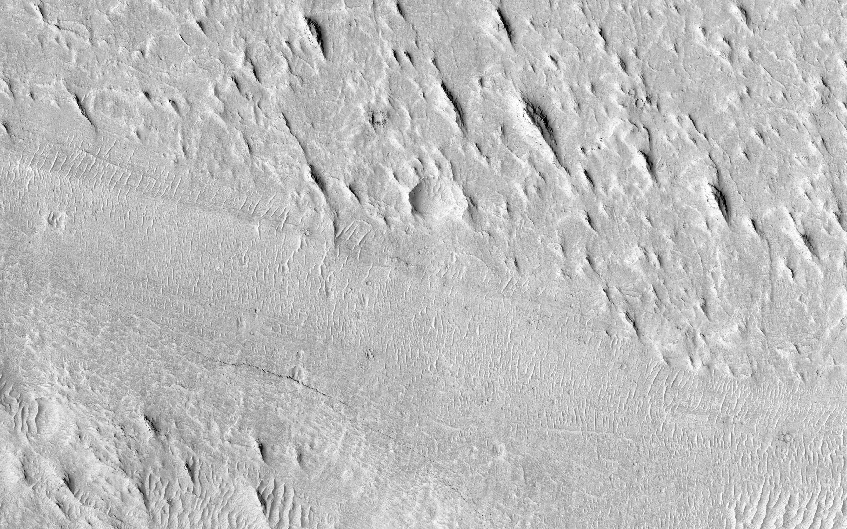
2013-07-10 |
Mars
|
Mars Reconnaissance Orbiter (MRO)
|
HiRISE
|
2880x1800x3 |
|
-
PIA17725:
-
Sediments in Ladon Basin
Full Resolution:
TIFF
(15.56 MB)
JPEG
(882.9 kB)
|
|
|
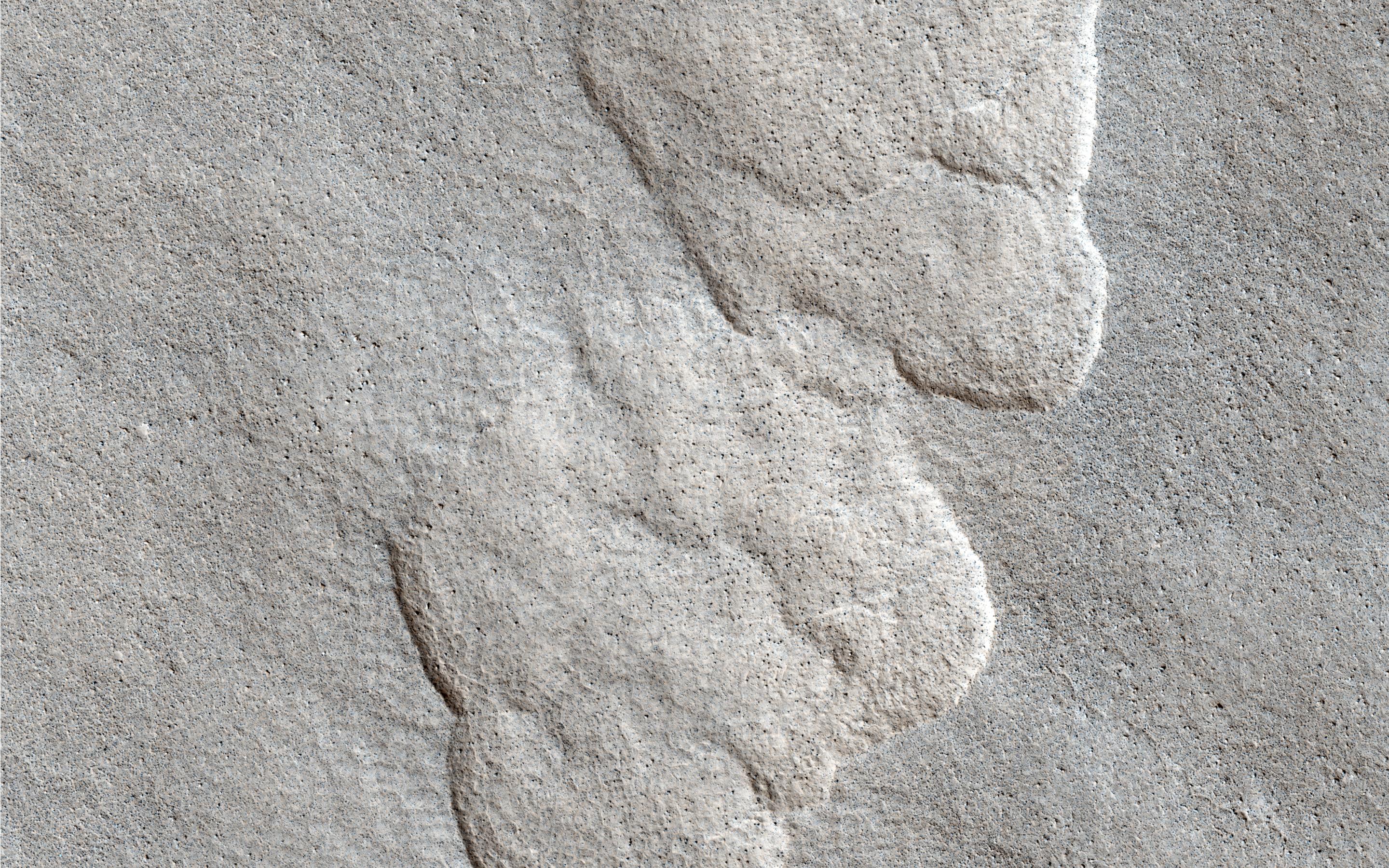
2013-05-15 |
Mars
|
Mars Reconnaissance Orbiter (MRO)
|
HiRISE
|
2880x1800x3 |
|
-
PIA17726:
-
Polygonal Dunes
Full Resolution:
TIFF
(15.56 MB)
JPEG
(686.3 kB)
|
|
|
2013-05-15 |
Mars
|
Mars Reconnaissance Orbiter (MRO)
|
HiRISE
|
2880x1800x3 |
|
-
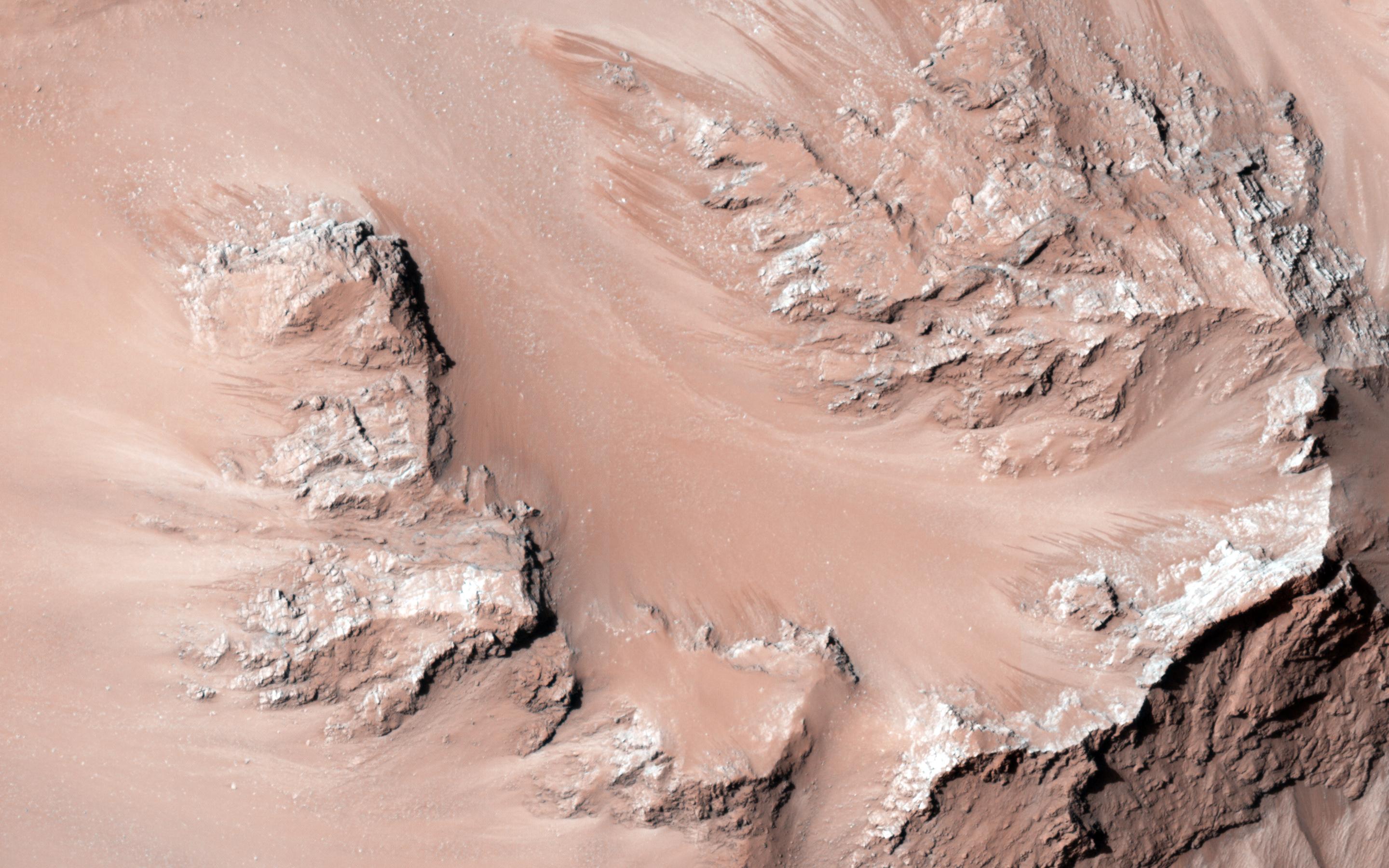
PIA17727:
-
Seasonal Flows in Palikir Crater
Full Resolution:
TIFF
(15.56 MB)
JPEG
(926.5 kB)
|
|
|
2013-05-15 |
Mars
|
Mars Reconnaissance Orbiter (MRO)
|
HiRISE
|
2880x1800x3 |
|
-
PIA17728:
-
Dust Devil Tracks and Slope Streaks on Martian Sand Dunes
Full Resolution:
TIFF
(15.56 MB)
JPEG
(599.8 kB)
|
|
|
2013-05-15 |
Mars
|
Mars Reconnaissance Orbiter (MRO)
|
HiRISE
|
2880x1800x3 |
|
-
PIA17729:
-
A Possible Landing Site for NASA's InSight Mission
Full Resolution:
TIFF
(15.56 MB)
JPEG
(1.028 MB)
|
|
|
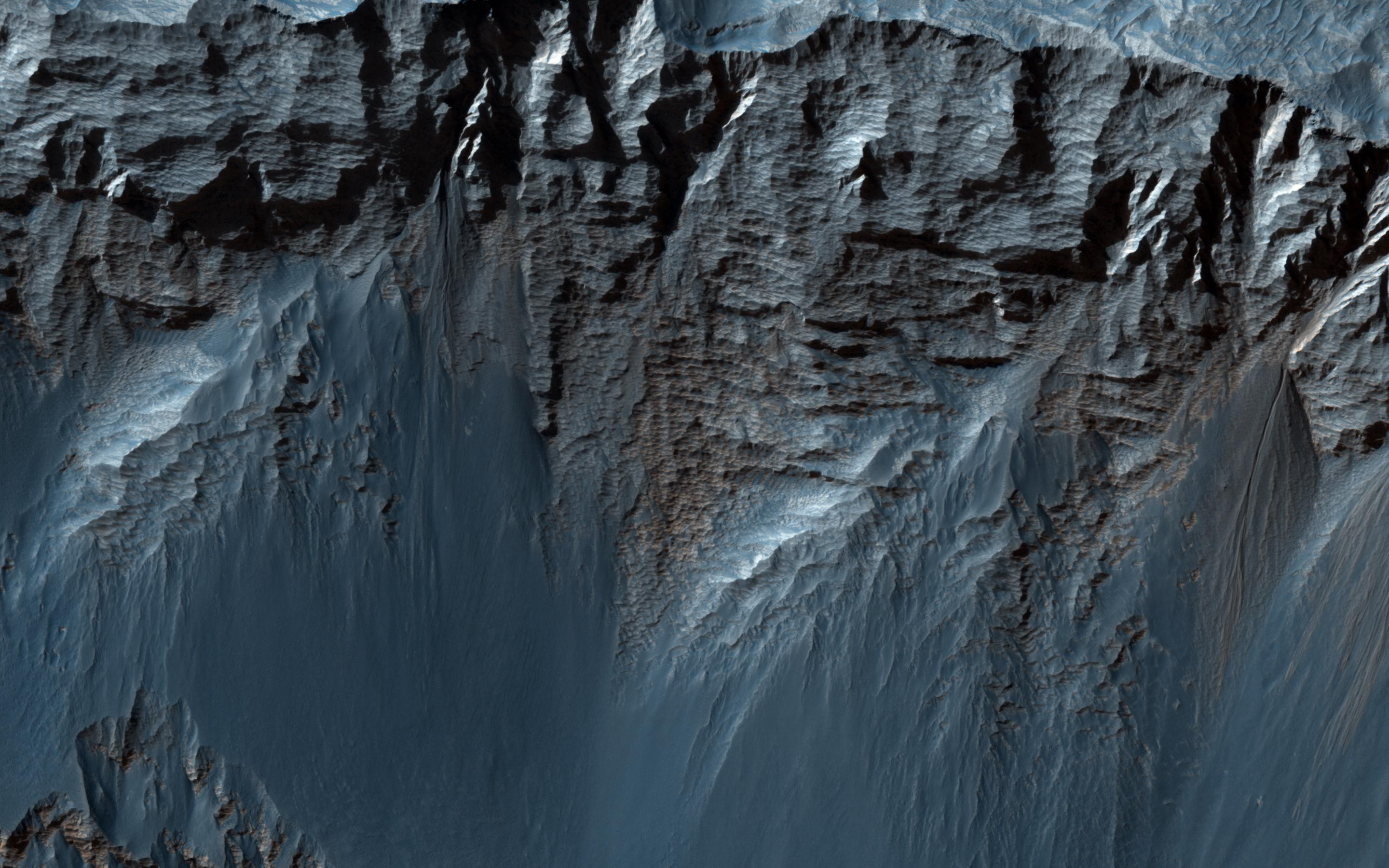
2013-05-22 |
Mars
|
Mars Reconnaissance Orbiter (MRO)
|
HiRISE
|
2880x1800x3 |
|
-
PIA17730:
-
Eastern Valles Marineris Bedrock Stratigraphy and Falling Dunes
Full Resolution:
TIFF
(5.191 MB)
JPEG
(484.3 kB)
|
|
|
2013-05-22 |
Mars
|
Mars Reconnaissance Orbiter (MRO)
|
HiRISE
|
2880x1800x3 |
|
-
PIA17731:
-
How Did the Mound in Gale Crater Form?
Full Resolution:
TIFF
(15.56 MB)
JPEG
(724.9 kB)
|
|
|
2013-05-22 |
Mars
|
Mars Reconnaissance Orbiter (MRO)
|
HiRISE
|
2880x1800x3 |
|
-
PIA17732:
-
Ridges and a Valley with Flow Fronts
Full Resolution:
TIFF
(15.56 MB)
JPEG
(764.9 kB)
|
|
|
2013-05-22 |
Mars
|
Mars Reconnaissance Orbiter (MRO)
|
HiRISE
|
2880x1800x3 |

|
-
PIA17733:
-
Ice in a Chlorite-Bearing Escarpment in Northwest Hellas
Full Resolution:
TIFF
(15.56 MB)
JPEG
(767.7 kB)
|
|
|
2013-05-29 |
Mars
|
Mars Reconnaissance Orbiter (MRO)
|
HiRISE
|
2880x1800x3 |
|
-
PIA17734:
-
Active Slope Flows on the Central Hills of Hale Crater
Full Resolution:
TIFF
(15.56 MB)
JPEG
(579.8 kB)
|
|
|
2013-05-29 |
Mars
|
Mars Reconnaissance Orbiter (MRO)
|
HiRISE
|
2880x1800x3 |
|
-
PIA17735:
-
Crater with Debris Aprons in Tyrrhena Terra
Full Resolution:
TIFF
(15.56 MB)
JPEG
(821.8 kB)
|
|
|
2013-05-29 |
Mars
|
Mars Reconnaissance Orbiter (MRO)
|
HiRISE
|
2880x1800x3 |
|
-
PIA17736:
-
Valleys in Tyrrhena Terra
Full Resolution:
TIFF
(15.56 MB)
JPEG
(949.2 kB)
|
|
|
2013-12-10 |
Mars
|
Mars Reconnaissance Orbiter (MRO)
|
HiRISE
|
684x720x3 |
|
-
PIA17605:
-
Long, Recurring Linear Marking on Martian Slope
Full Resolution:
TIFF
(1.478 MB)
JPEG
(128 kB)
|
|
|
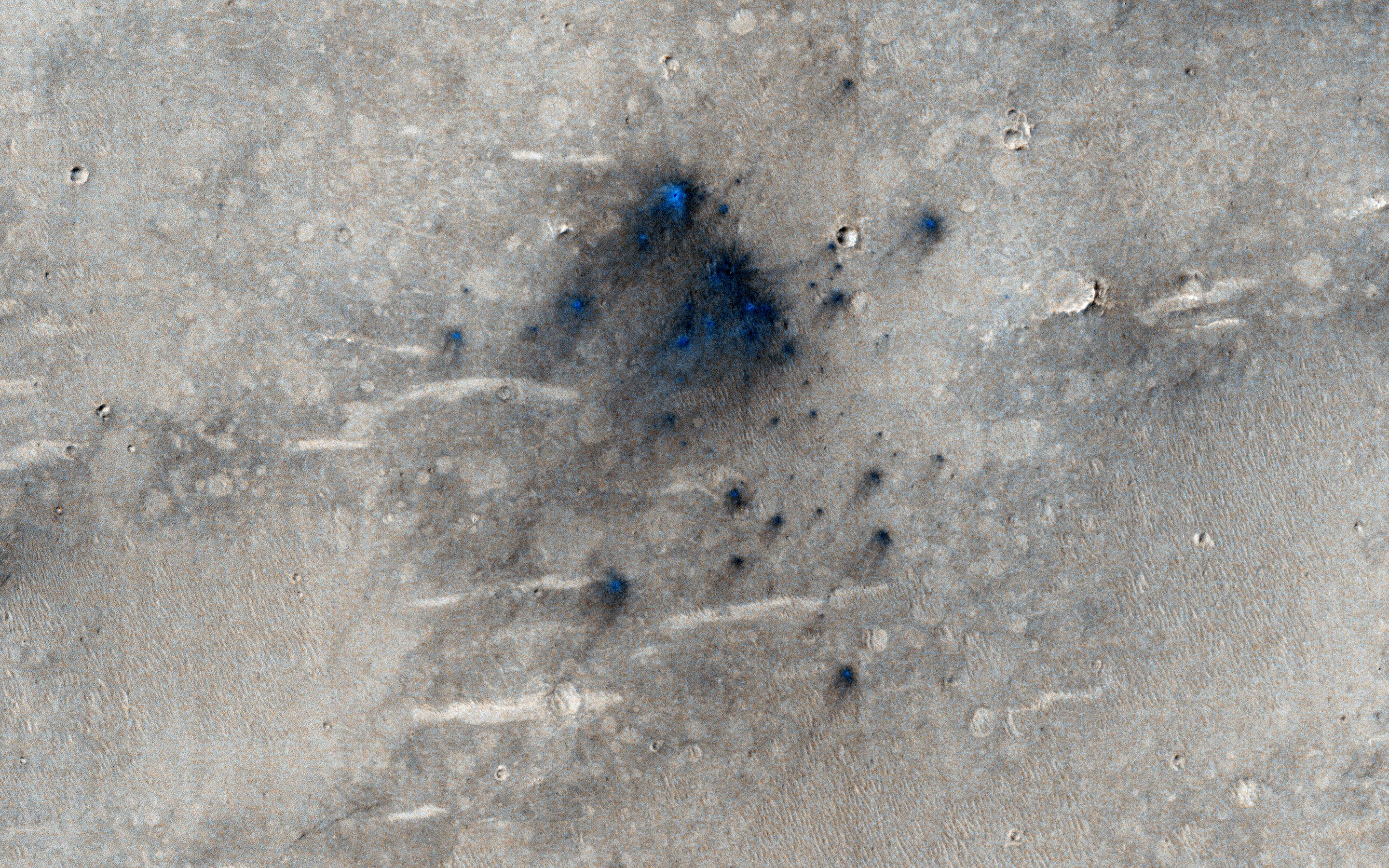
2013-12-10 |
Mars
|
Mars Reconnaissance Orbiter (MRO)
|
HiRISE
|
1653x1352x3 |
|
-
PIA17606:
-
Seasonal Changes in Dark Marks on an Equatorial Martian Slope
Full Resolution:
TIFF
(2.239 MB)
JPEG
(426.6 kB)
|


