My
List |
Addition Date
|
Target
|
Mission
|
Instrument
|
Size
|

|
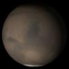
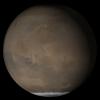
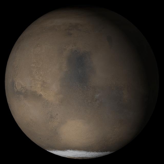
2005-06-28 |
Mars
|
Mars Global Surveyor (MGS)
|
Mars Orbiter Camera (MOC)
|
640x640x3 |
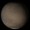
|
-
PIA03972:
-
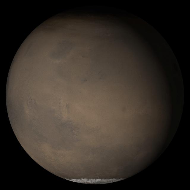
Mars at Ls 230°: Elysium/Mare Cimmerium
Full Resolution:
TIFF
(411.8 kB)
JPEG
(18.46 kB)
|
|
|
2005-06-28 |
Mars
|
2001 Mars Odyssey
|
THEMIS
|
915x2952x1 |
|
-
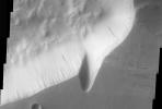
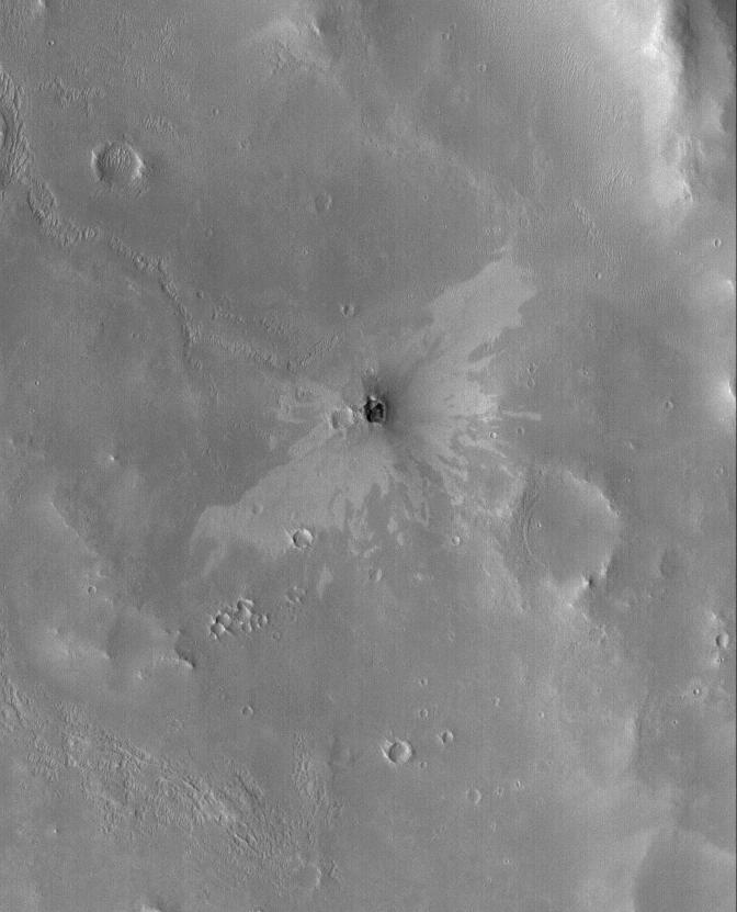
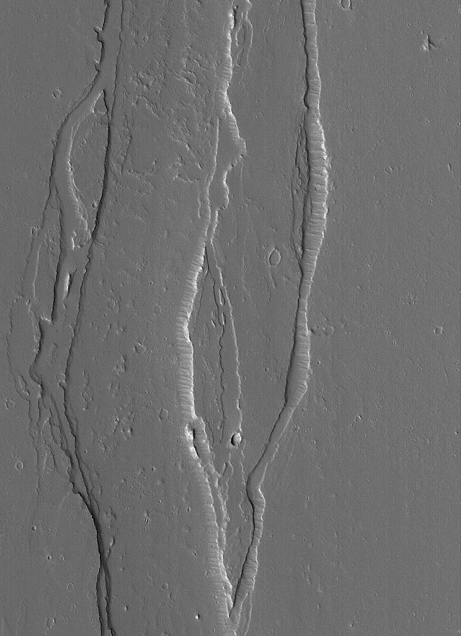
PIA03971:
-
Arsia Mons Western Flows
Full Resolution:
TIFF
(2.704 MB)
JPEG
(369.6 kB)
|
|
|
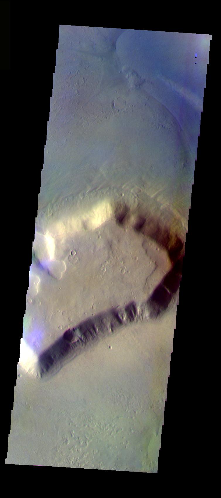
2005-06-27 |
Mars
|
Mars Global Surveyor (MGS)
|
Mars Orbiter Camera (MOC)
|
2048x4050x1 |

|
-
PIA03969:
-
South Amazonis Yardangs
Full Resolution:
TIFF
(8.303 MB)
JPEG
(1.092 MB)
|
|
|
2005-06-26 |
Mars
|
Mars Global Surveyor (MGS)
|
Mars Orbiter Camera (MOC)
|
2048x2816x1 |
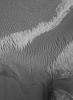
|
-
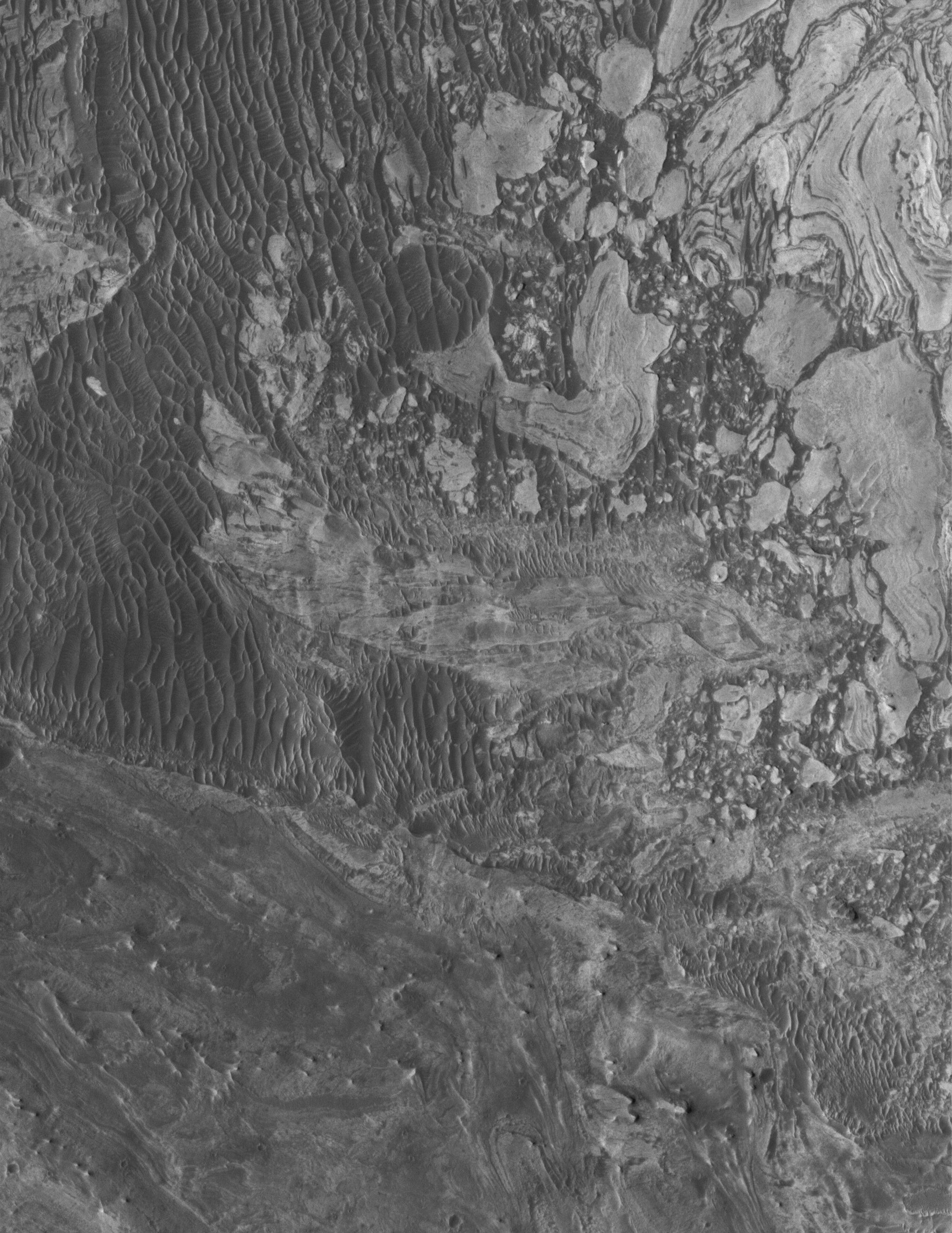
PIA03968:
-
West Tithonium Scene
Full Resolution:
TIFF
(5.773 MB)
JPEG
(794.5 kB)
|
|
|
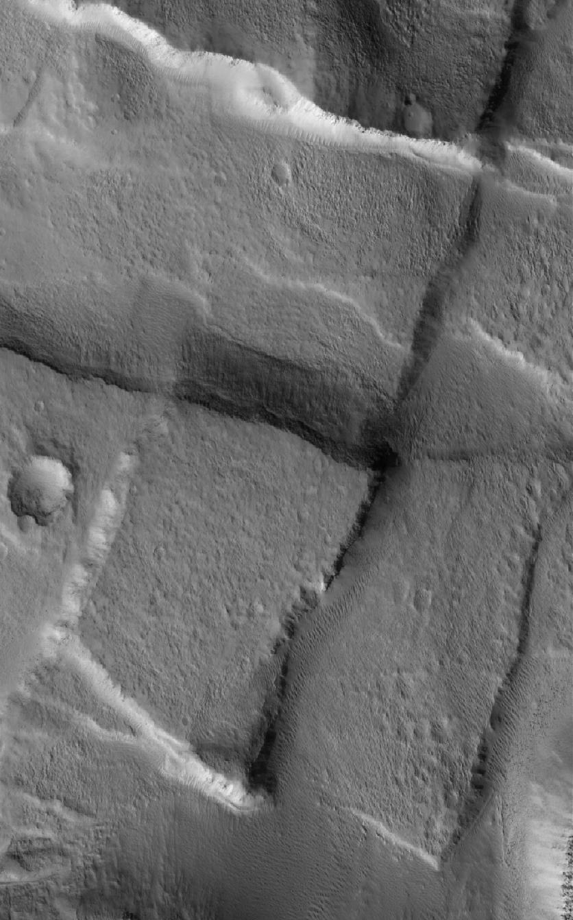
2005-06-25 |
Mars
|
Mars Global Surveyor (MGS)
|
Mars Orbiter Camera (MOC)
|
1024x2624x1 |
|
-
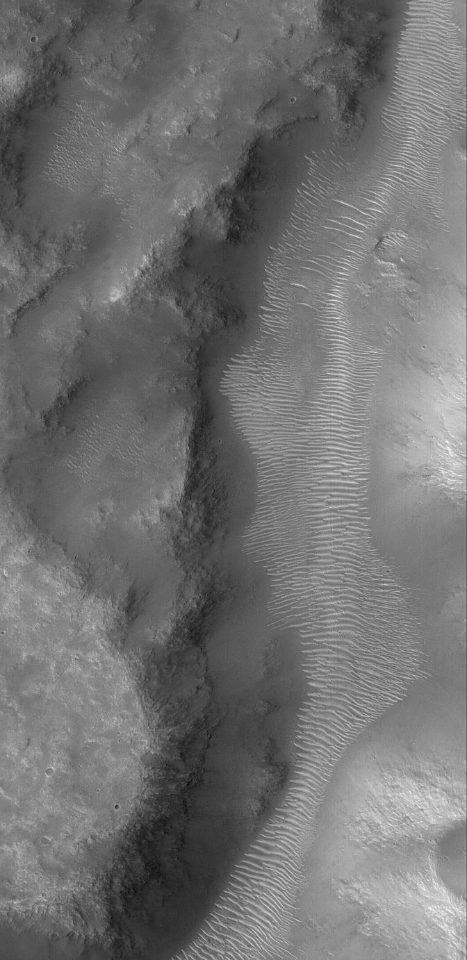
PIA03967:
-
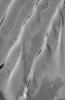
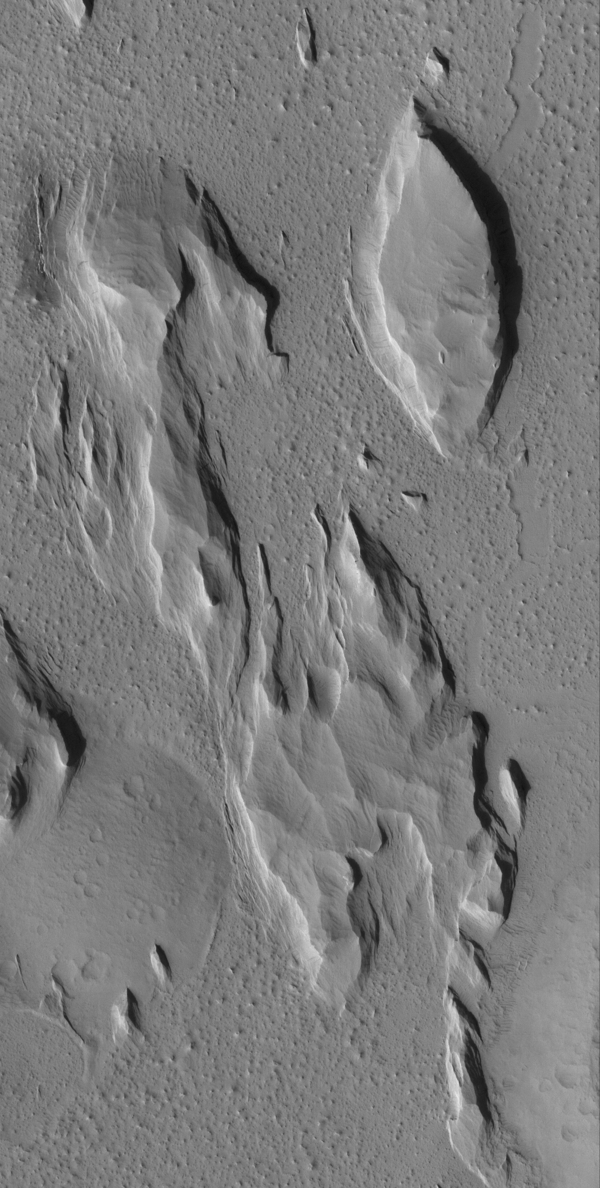
Troughs in Tharsis
Full Resolution:
TIFF
(2.69 MB)
JPEG
(323.6 kB)
|
|
|
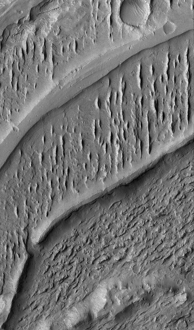
2005-06-24 |
Mars
|
Mars Global Surveyor (MGS)
|
Mars Orbiter Camera (MOC)
|
1024x2121x1 |
|
-
PIA03966:
-
Tikhonravov Layers
Full Resolution:
TIFF
(2.174 MB)
JPEG
(380 kB)
|
|
|
2005-06-24 |
Mars
|
2001 Mars Odyssey
|
THEMIS
|
900x2661x1 |
|
-
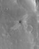
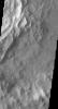
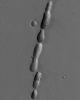
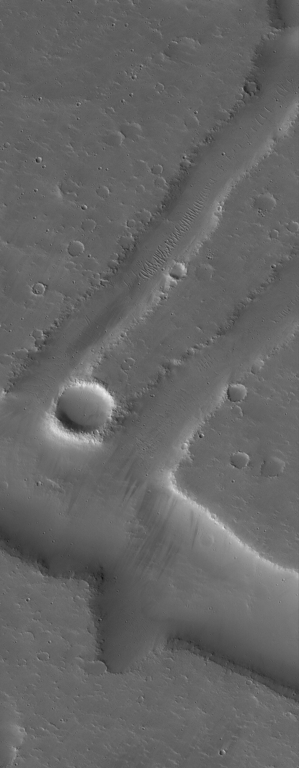
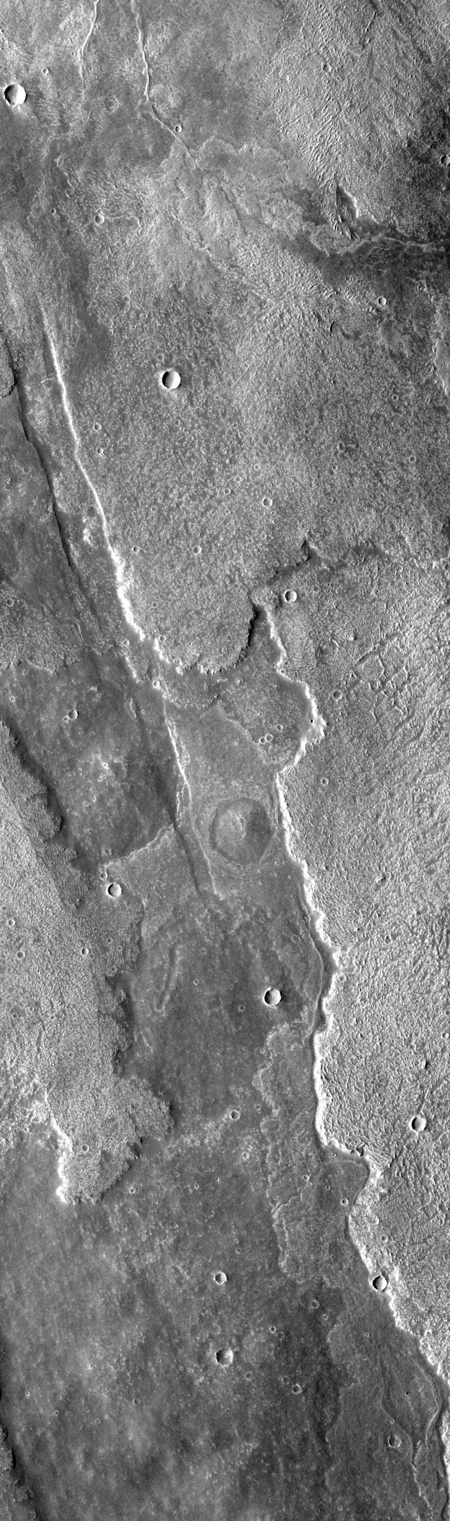
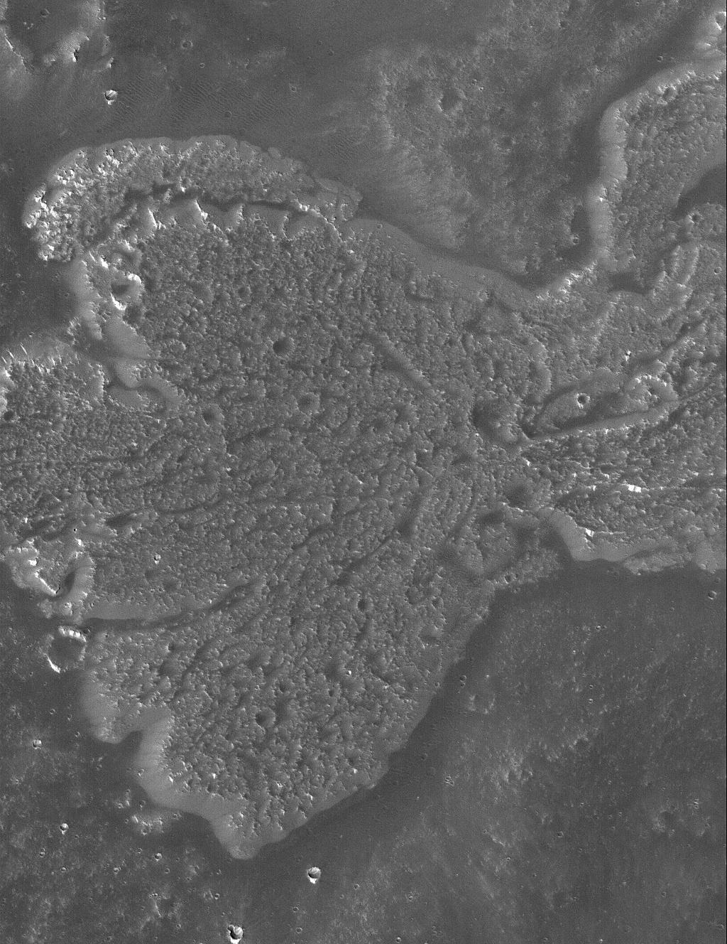
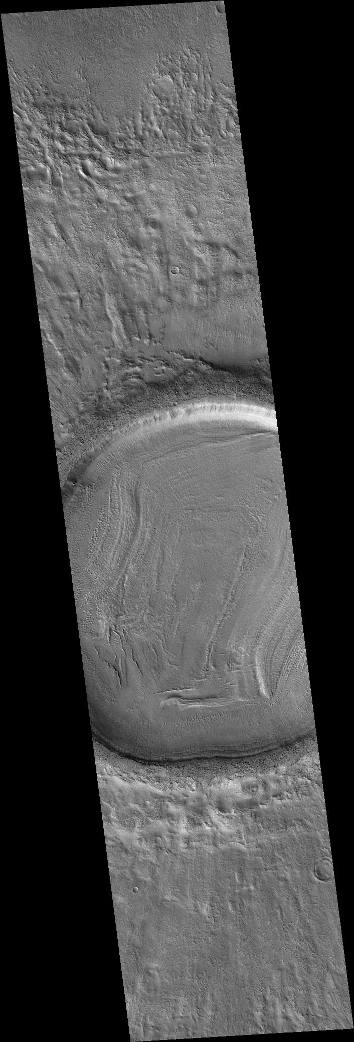
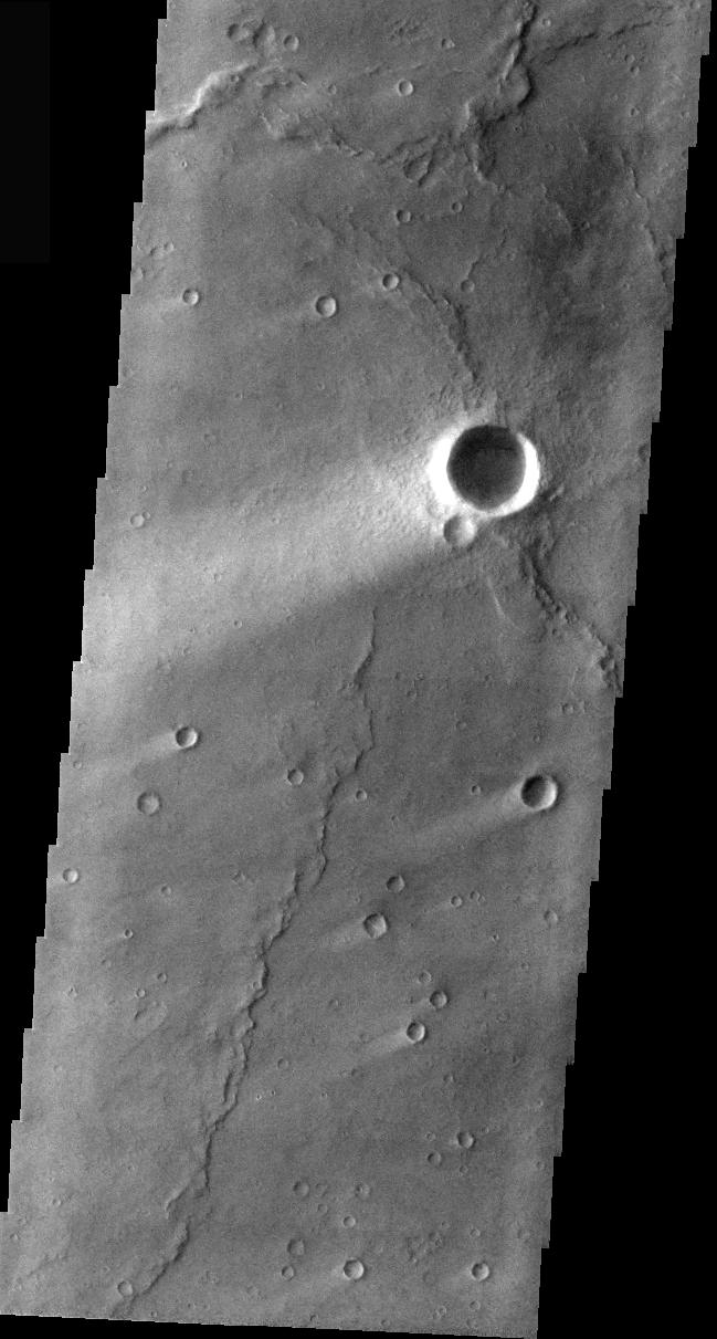
PIA03970:
-
Filled Crater
Full Resolution:
TIFF
(2.397 MB)
JPEG
(455.2 kB)
|
|
|
2005-06-23 |
Mars
|
Mars Global Surveyor (MGS)
|
Mars Orbiter Camera (MOC)
|
672x1220x1 |

|
-
PIA03962:
-
Tikhonravov Layers
Full Resolution:
TIFF
(820.9 kB)
JPEG
(119.8 kB)
|
|
|
2005-06-23 |
Mars
|
2001 Mars Odyssey
|
THEMIS
|
880x2971x1 |
|
-
PIA03965:
-
Arsia Mons Overlapping Flows
Full Resolution:
TIFF
(2.617 MB)
JPEG
(570.9 kB)
|
|
|
2005-06-22 |
Mars
|
2001 Mars Odyssey
|
THEMIS
|
879x2978x1 |
|
-
PIA03964:
-
Arsia Mons Surface Flow
Full Resolution:
TIFF
(2.621 MB)
JPEG
(689.5 kB)
|
|
|
2005-06-22 |
Mars
|
Mars Global Surveyor (MGS)
|
Mars Orbiter Camera (MOC)
|
672x831x1 |
|
-
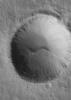
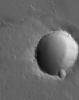
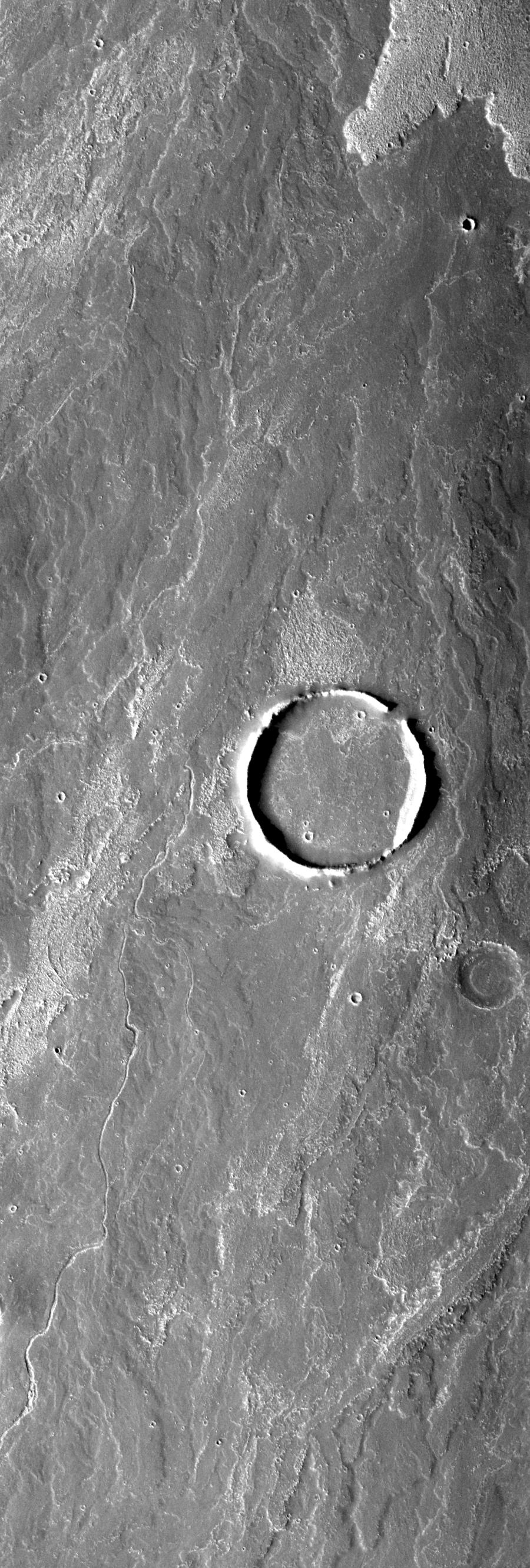
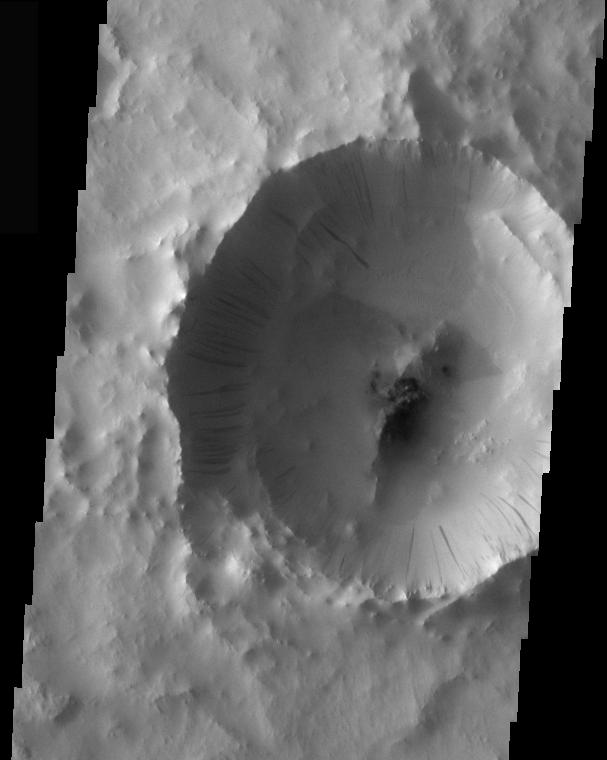
PIA03961:
-
Small Impact Crater
Full Resolution:
TIFF
(559.2 kB)
JPEG
(58.91 kB)
|
|
|
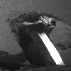
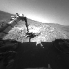
2005-06-21 |
Mars
|
Mars Exploration Rover (MER)
|
Navigation Camera
|
1024x1024x1 |
|
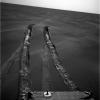
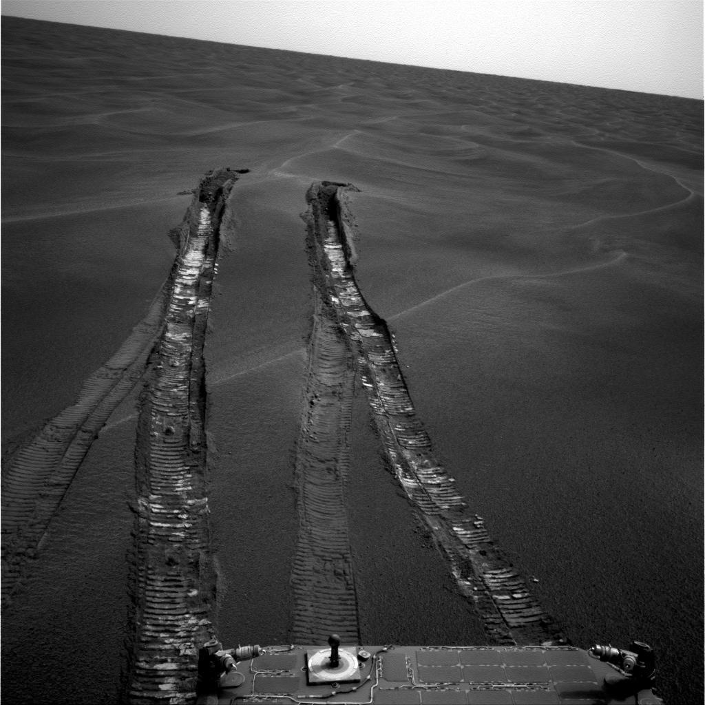
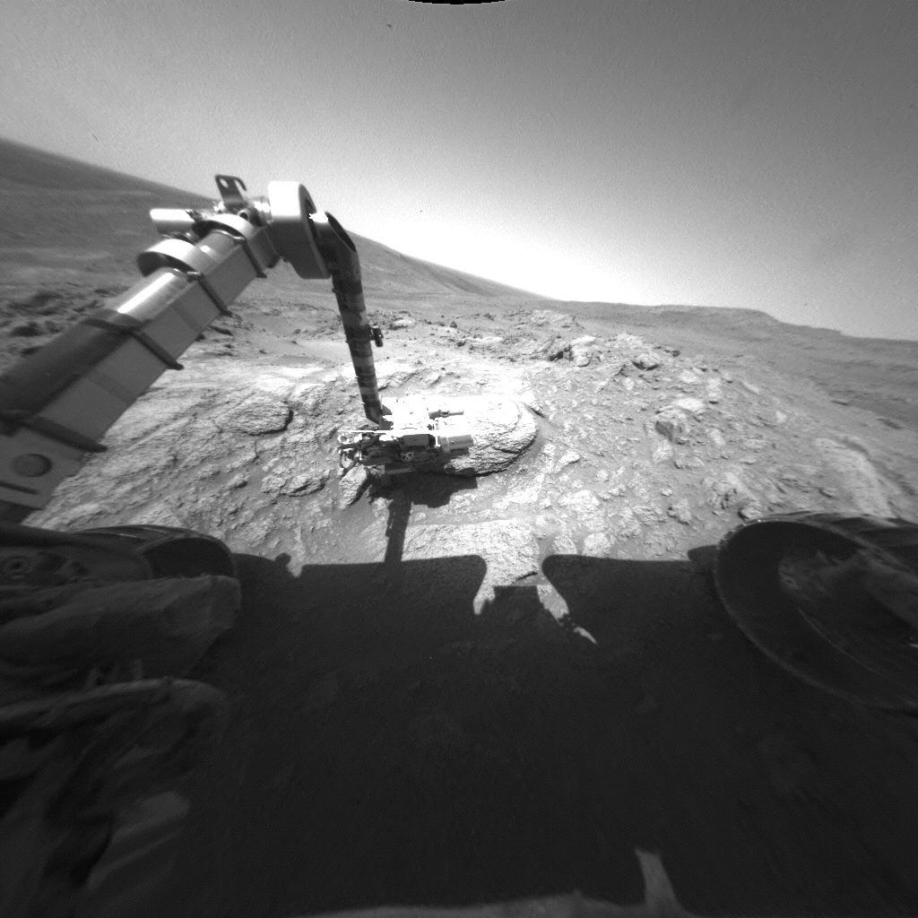
-
PIA07999:
-
Looking Back at 'Purgatory Dune'
Full Resolution:
TIFF
(1.05 MB)
JPEG
(140.2 kB)
|
|
|
2005-06-21 |
Mars
|
2001 Mars Odyssey
|
THEMIS
|
1396x3247x1 |
|
-
PIA03963:
-
Arsia Mons Lava Flows
Full Resolution:
TIFF
(4.538 MB)
JPEG
(806 kB)
|
|
|
2005-06-21 |
Mars
|
Mars Global Surveyor (MGS)
|
Mars Orbiter Camera (MOC)
|
640x640x3 |
|
-
PIA03960:
-
Mars at Ls 230°: Syrtis Major
Full Resolution:
TIFF
(411.8 kB)
JPEG
(19.45 kB)
|
|
|
2005-06-20 |
Mars
|
Mars Global Surveyor (MGS)
|
Mars Orbiter Camera (MOC)
|
512x725x1 |

|
-
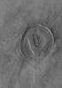
PIA03957:
-
Crater with Streak
Full Resolution:
TIFF
(371.8 kB)
JPEG
(51.15 kB)
|
|
|
2005-06-20 |
Mars
|
2001 Mars Odyssey
|
THEMIS
|
1405x3240x1 |
|
-
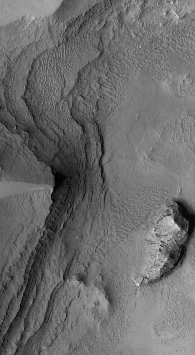
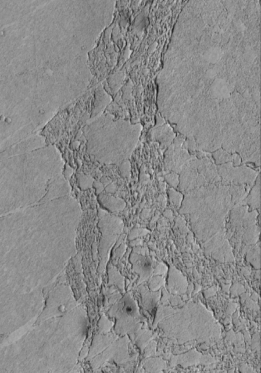
PIA03958:
-
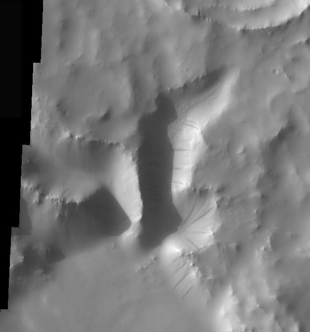
Collapse Features on Arsia Mons
Full Resolution:
TIFF
(4.558 MB)
JPEG
(712.3 kB)
|
|
|
2005-06-20 |
Mars
|
2001 Mars Odyssey
|
THEMIS
|
1388x3241x1 |
|
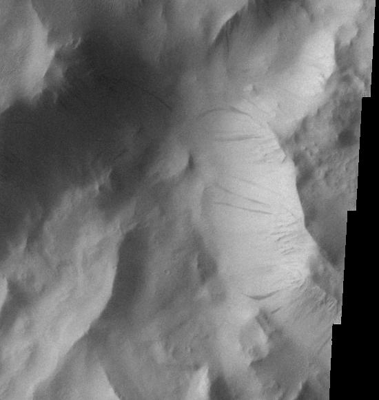
-
PIA03959:
-
Arsia Mons Southern Flank
Full Resolution:
TIFF
(4.504 MB)
JPEG
(337.6 kB)
|
|
|
2005-06-19 |
Mars
|
Mars Global Surveyor (MGS)
|
Mars Orbiter Camera (MOC)
|
672x870x1 |
|
-
PIA03956:
-
Defrosting Sand
Full Resolution:
TIFF
(585.5 kB)
JPEG
(141.7 kB)
|
|
|
2005-06-18 |
Mars
|
Mars Global Surveyor (MGS)
|
Mars Orbiter Camera (MOC)
|
1280x1773x1 |
|
-
PIA03955:
-
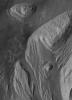
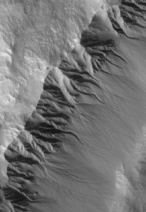
South Hemisphere Gullies
Full Resolution:
TIFF
(2.272 MB)
JPEG
(460.2 kB)
|
|
|
2005-06-17 |
Mars
|
Mars Global Surveyor (MGS)
|
Mars Orbiter Camera (MOC)
|
836x1079x1 |
|
-
PIA03954:
-
Candor Chasma Features
Full Resolution:
TIFF
(903.2 kB)
JPEG
(90.14 kB)
|
|
|
2005-06-16 |
Mars
|
Mars Global Surveyor (MGS)
|
Mars Orbiter Camera (MOC)
|
601x871x1 |
|
-
PIA03953:
-
Gullied Crater Wall
Full Resolution:
TIFF
(524.2 kB)
JPEG
(80.54 kB)
|
|
|
2005-06-16 |
Mars
|
2001 Mars Odyssey
|
THEMIS
|
1403x3241x1 |
|
-
PIA03952:
-
Arsia Mons Flank
Full Resolution:
TIFF
(4.553 MB)
JPEG
(591.7 kB)
|
|
|
2005-06-15 |
Mars
|
Mars Global Surveyor (MGS)
|
Mars Orbiter Camera (MOC)
|
1254x1969x1 |
|
-
PIA03951:
-
Olympica Fossae Landforms
Full Resolution:
TIFF
(2.472 MB)
JPEG
(317.4 kB)
|
|
|
2005-06-15 |
Mars
|
2001 Mars Odyssey
|
THEMIS
|
1410x3231x1 |
|
-
PIA03950:
-
Arsia Mons Caldera Rim
Full Resolution:
TIFF
(4.561 MB)
JPEG
(239 kB)
|
|
|
2005-06-14 |
Mars
|
2001 Mars Odyssey
|
THEMIS
|
1416x3242x1 |

|
-
PIA03949:
-
Arsia Mons Caldera
Full Resolution:
TIFF
(4.596 MB)
JPEG
(739.2 kB)
|
|
|
2005-06-14 |
Mars
|
Mars Global Surveyor (MGS)
|
Mars Orbiter Camera (MOC)
|
640x640x3 |
|
-
PIA03947:
-
Mars at Ls 230°: Acidalia/Mare Erythraeum
Full Resolution:
TIFF
(411.8 kB)
JPEG
(20.32 kB)
|
|
|
2005-06-13 |
Mars
|
2001 Mars Odyssey
|
THEMIS
|
2024x3350x1 |
|
-
PIA03948:
-
Arsia Mons Mosaic
Full Resolution:
TIFF
(6.787 MB)
JPEG
(1.012 MB)
|
|
|
2005-06-13 |
Mars
|
Mars Global Surveyor (MGS)
|
Mars Orbiter Camera (MOC)
|
672x816x1 |
|
-
PIA03946:
-
Windstreaked Plain
Full Resolution:
TIFF
(549.1 kB)
JPEG
(88.36 kB)
|
|
|
2005-06-12 |
Mars
|
Mars Global Surveyor (MGS)
|
Mars Orbiter Camera (MOC)
|
1374x1933x1 |
|
-
PIA03945:
-
Bouldery Impact
Full Resolution:
TIFF
(2.659 MB)
JPEG
(244.8 kB)
|
|
|
2005-06-11 |
Mars
|
Mars Global Surveyor (MGS)
|
Mars Orbiter Camera (MOC)
|
836x1009x1 |
|
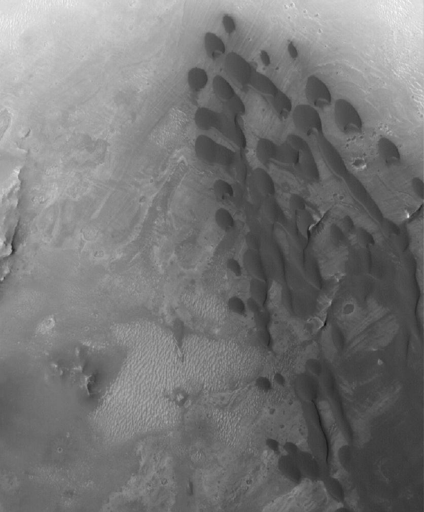
-
PIA03944:
-
Arabian Dunes
Full Resolution:
TIFF
(844.7 kB)
JPEG
(76.84 kB)
|
|
|
2005-06-10 |
Mars
|
Mars Exploration Rover (MER)
|
Panoramic Camera
|
2486x1914x3 |

|
-
PIA07997:
-
A Moment Frozen in Time
Full Resolution:
TIFF
(14.29 MB)
JPEG
(105.7 kB)
|
|
|
2005-06-10 |
Mars
|
2001 Mars Odyssey
|
THEMIS
|
1014x1876x1 |
|
-
PIA03943:
-
Crater Dust Avalanches
Full Resolution:
TIFF
(1.904 MB)
JPEG
(152 kB)
|
|
|
2005-06-10 |
Mars
|
Mars Global Surveyor (MGS)
|
Mars Orbiter Camera (MOC)
|
1024x1298x3 |

|
-
PIA03941:
-
Inverted Channels
Full Resolution:
TIFF
(1.331 MB)
JPEG
(216.7 kB)
|
|
|
2005-06-09 |
Mars
|
2001 Mars Odyssey
|
THEMIS
|
607x760x1 |

|
-
PIA03942:
-
Tikhonravov Crater Dust Avalanches
Full Resolution:
TIFF
(462 kB)
JPEG
(35.67 kB)
|
|
|
2005-06-09 |
Mars
|
Mars Global Surveyor (MGS)
|
Mars Orbiter Camera (MOC)
|
5196x1328x3 |
|
-
PIA03940:
-
Daedalia Flow
Full Resolution:
TIFF
(1.361 MB)
JPEG
(258.3 kB)
|
|
|
2005-06-08 |
Mars
|
Mars Global Surveyor (MGS)
|
Mars Orbiter Camera (MOC)
|
836x1041x1 |
|
-
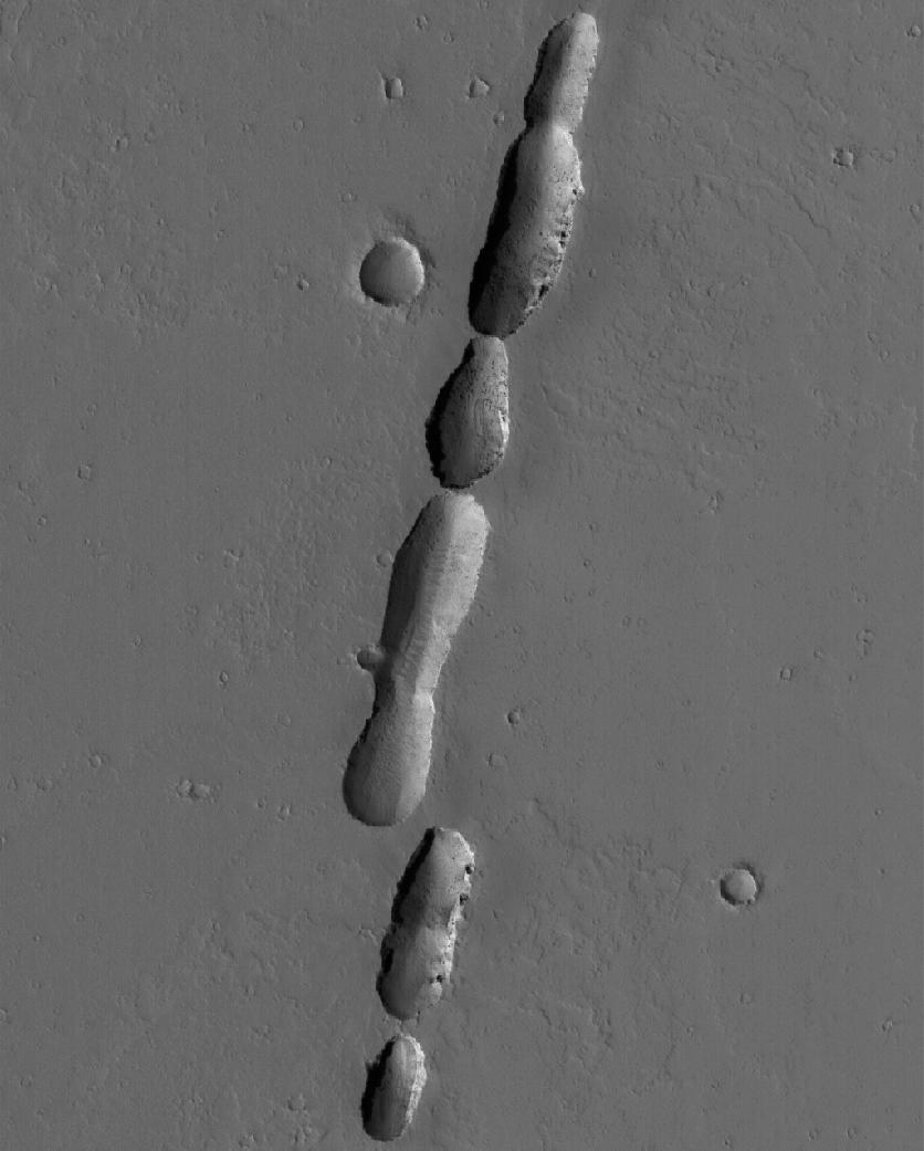
PIA03930:
-
Chain of Pits
Full Resolution:
TIFF
(871.4 kB)
JPEG
(68.94 kB)
|
|
|
2005-06-07 |
Mars
|
Mars Global Surveyor (MGS)
|
Mars Orbiter Camera (MOC)
|
640x640x3 |

|
-
PIA03929:
-
Mars at Ls 230°: Tharsis
Full Resolution:
TIFF
(411.8 kB)
JPEG
(20.02 kB)
|
|
|
2005-06-07 |
Mars
|
2001 Mars Odyssey
|
THEMIS
|
627x672x1 |

|
-
PIA03939:
-
Crater Dust Avalanches
Full Resolution:
TIFF
(422 kB)
JPEG
(26.16 kB)
|
|
|
2005-06-07 |
Mars
|
2001 Mars Odyssey
|
THEMIS
|
1036x702x1 |
|
-
PIA03938:
-
Hebes Chasma Dust Avalanches
Full Resolution:
TIFF
(728.3 kB)
JPEG
(48.82 kB)
|
|
|
2005-06-06 |
Mars
|
2001 Mars Odyssey
|
THEMIS
|
550x581x1 |

|
-
PIA03937:
-
Lycus Sulci Dust Avalanches
Full Resolution:
TIFF
(320.1 kB)
JPEG
(30.51 kB)
|
|
|
2005-06-06 |
Mars
|
Mars Global Surveyor (MGS)
|
Mars Orbiter Camera (MOC)
|
1024x1290x1 |
|
-
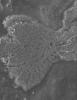
PIA03927:
-
Flow Front and Crater
Full Resolution:
TIFF
(1.322 MB)
JPEG
(98.26 kB)
|
|
|
2005-06-06 |
Mars
|
Mars Global Surveyor (MGS)
|
Mars Orbiter Camera (MOC)
|
836x1117x1 |

|
-
PIA03928:
-
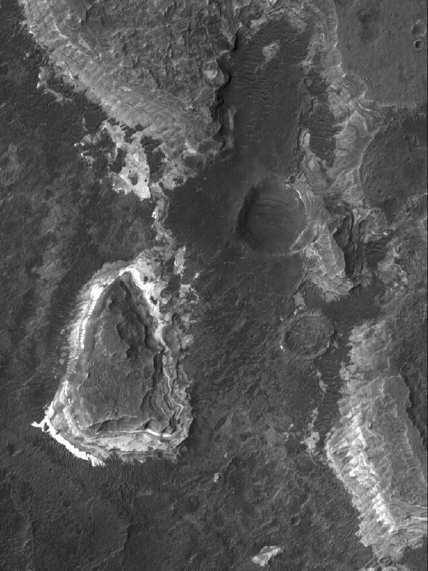
Ladon Sedimentary Rocks
Full Resolution:
TIFF
(935 kB)
JPEG
(169.4 kB)
|
|
|
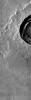
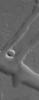
2005-06-04 |
Mars
|
Mars Global Surveyor (MGS)
|
Mars Orbiter Camera (MOC)
|
512x730x1 |
|
-
PIA03926:
-
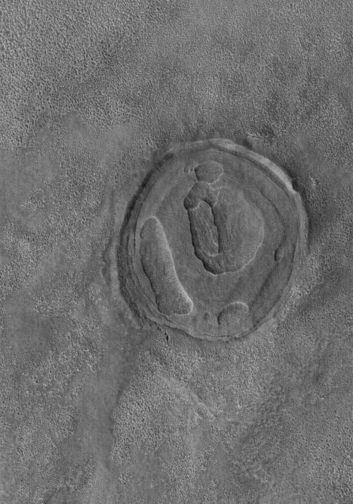
Exhuming Crater
Full Resolution:
TIFF
(374.4 kB)
JPEG
(77.04 kB)
|
|
|
2005-06-03 |
Mars
|
Mars Global Surveyor (MGS)
|
Mars Orbiter Camera (MOC)
|
706x2078x1 |

|
-
PIA07995:
-
MOC's 200,000th Image
Full Resolution:
TIFF
(1.469 MB)
JPEG
(204.5 kB)
|
|
|
2005-06-03 |
Mars
|
Mars Global Surveyor (MGS)
|
Mars Orbiter Camera (MOC)
|
611x514x1 |

|
-
PIA07996:
-
MOC's 200,001st Image
Full Resolution:
TIFF
(314.6 kB)
JPEG
(27.99 kB)
|
|
|
2005-06-03 |
Mars
|
2001 Mars Odyssey
|
THEMIS
|
739x1757x1 |
|
-
PIA03936:
-
IR Windstreaks
Full Resolution:
TIFF
(1.3 MB)
JPEG
(182.6 kB)
|
|
|
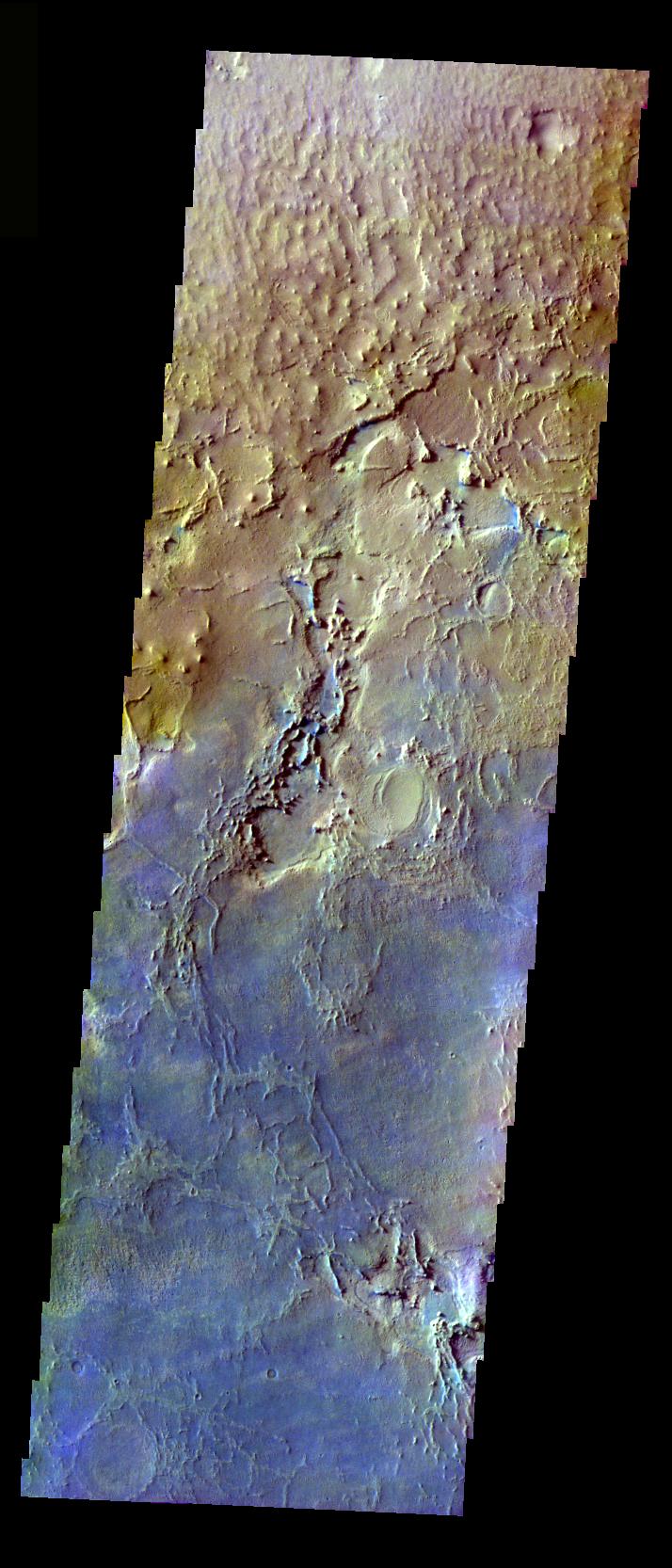
2005-06-02 |
Mars
|
2001 Mars Odyssey
|
THEMIS
|
2400x2550x3 |
|
-
PIA07993:
-
Olivine-Rich Bedrock Around Nili Fossae
Full Resolution:
TIFF
(18.38 MB)
JPEG
(971.5 kB)
|
|
|
2005-06-02 |
Mars
|
2001 Mars Odyssey
|
THEMIS
|
739x1757x1 |

|
-
PIA03935:
-
Olympus Mons Windstreaks
Full Resolution:
TIFF
(1.3 MB)
JPEG
(182.6 kB)
|
|
|
2005-06-02 |
Mars
|
Mars Global Surveyor (MGS)
|
Mars Orbiter Camera (MOC)
|
836x1197x1 |
|
-
PIA03925:
-
Platy Flows
Full Resolution:
TIFF
(1.002 MB)
JPEG
(221.5 kB)
|
|
|
2005-06-01 |
Mars
|
Mars Exploration Rover (MER)
|
Panoramic Camera
|
250x1000x3 |

|
-
PIA07228:
-
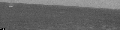
Earth as Seen from Mars
Full Resolution:
TIFF
(751 kB)
JPEG
(23.25 kB)
|
|
|
2005-06-01 |
Mars
|
2001 Mars Odyssey
|
THEMIS
|
743x928x1 |
|
-
PIA03934:
-
Alba Patera Windstreaks
Full Resolution:
TIFF
(690.4 kB)
JPEG
(92.95 kB)
|
|
|
2005-06-01 |
Mars
|
Mars Global Surveyor (MGS)
|
Mars Orbiter Camera (MOC)
|
656x905x1 |
|
-
PIA03924:
-
Channel Near Olympus
Full Resolution:
TIFF
(594.5 kB)
JPEG
(84.29 kB)
|
|
|
2005-05-31 |
Mars
|
Mars Exploration Rover (MER)
|
Navigation Camera
|
1024x256x1 |
|
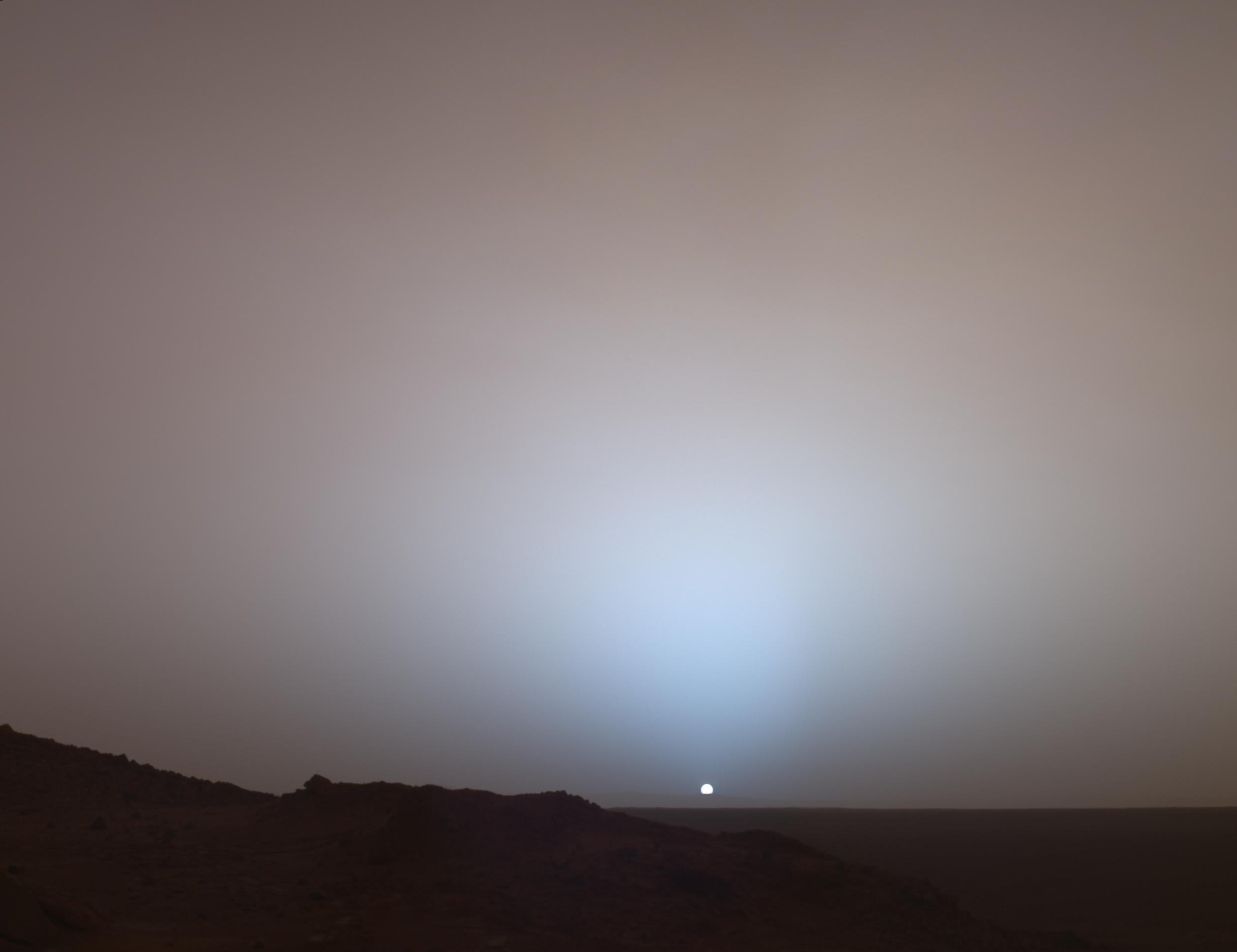
-
PIA07253:
Wind-Driven Traveler on Mars (Spirit Sol 486)

Full Resolution:
TIFF
(262.6 kB)
JPEG
(49.11 kB)
|
|
|
2005-05-31 |
Mars
|
2001 Mars Odyssey
|
THEMIS
|
863x1323x1 |
|
-
PIA03933:
-
Elysium Windstreaks
Full Resolution:
TIFF
(1.143 MB)
JPEG
(81.21 kB)
|
|
|
2005-05-31 |
Mars
|
Mars Global Surveyor (MGS)
|
Mars Orbiter Camera (MOC)
|
640x640x3 |

|
-
PIA03923:
-
Mars at Ls 211°: South Polar Region
Full Resolution:
TIFF
(411.8 kB)
JPEG
(33.48 kB)
|
|
|
2005-05-30 |
Mars
|
2001 Mars Odyssey
|
THEMIS
|
649x1211x1 |

|
-
PIA03932:
-
Wind Streaks in Syrtis Major
Full Resolution:
TIFF
(787 kB)
JPEG
(92.85 kB)
|
|
|
2005-05-30 |
Mars
|
Mars Global Surveyor (MGS)
|
Mars Orbiter Camera (MOC)
|
2048x2860x1 |
|
-
PIA03922:
-
East Candor Outcrops
Full Resolution:
TIFF
(5.863 MB)
JPEG
(646.5 kB)
|
|
|
2005-05-29 |
Mars
|
Mars Global Surveyor (MGS)
|
Mars Orbiter Camera (MOC)
|
836x1082x1 |

|
-
PIA03921:
-
Defrosting Features
Full Resolution:
TIFF
(905.8 kB)
JPEG
(191.3 kB)
|
|
|
2005-05-28 |
Mars
|
Mars Global Surveyor (MGS)
|
Mars Orbiter Camera (MOC)
|
672x941x1 |
|
-
PIA03920:
-
Slope-Streaked Knob
Full Resolution:
TIFF
(633.2 kB)
JPEG
(65.06 kB)
|
|
|
2005-05-27 |
Mars
|
2001 Mars Odyssey
|
THEMIS
|
689x1346x3 |
|
-
PIA03931:
-
Acidalia Planitia Channel Margin
Full Resolution:
TIFF
(2.786 MB)
JPEG
(98.36 kB)
|
|
|
2005-05-27 |
Mars
|
Mars Global Surveyor (MGS)
|
Mars Orbiter Camera (MOC)
|
2048x2207x1 |

|
-
PIA03919:
-
Young Impact
Full Resolution:
TIFF
(4.525 MB)
JPEG
(685.8 kB)
|
|
|
2005-05-26 |
Mars
|
Mars Global Surveyor (MGS)
|
Mars Orbiter Camera (MOC)
|
1710x1226x1 |

|
-
PIA07992:
-
Aram Chaos Complexity
Full Resolution:
TIFF
(2.099 MB)
JPEG
(401.4 kB)
|
|
|
2005-05-26 |
Mars
|
2001 Mars Odyssey
|
THEMIS
|
753x1695x3 |
|
-
PIA07990:
-
Cratered Acidalia Planitia
Full Resolution:
TIFF
(3.834 MB)
JPEG
(126.2 kB)
|
|
|
2005-05-25 |
Mars
|
Mars Global Surveyor (MGS)
|
Mars Orbiter Camera (MOC)
|
1463x1978x1 |

|
-
PIA07991:
-
Looking Into a Trough
Full Resolution:
TIFF
(2.897 MB)
JPEG
(284.8 kB)
|
|
|
2005-05-25 |
Mars
|
2001 Mars Odyssey
|
THEMIS
|
742x1680x3 |
|
-
PIA07989:
-
Elysium Mons
Full Resolution:
TIFF
(3.744 MB)
JPEG
(140.2 kB)
|
|
|
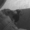
2005-05-24 |
Mars
|
Mars Exploration Rover (MER)
|
Hazcam
|
256x256x1 |
|
-
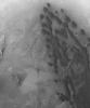
PIA07986:
-
Slow Progress in Dune (Left Rear Wheel)
Full Resolution:
TIFF
(65.83 kB)
JPEG
(8.512 kB)
|
|
|
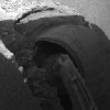
2005-05-24 |
Mars
|
Mars Exploration Rover (MER)
|
Hazcam
|
256x256x1 |
|
-
PIA07985:
-
Slow Progress in Dune (Right Rear Wheel)
Full Resolution:
TIFF
(65.83 kB)
JPEG
(8.226 kB)
|
|
|
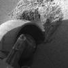
2005-05-24 |
Mars
|
Mars Exploration Rover (MER)
|
Hazcam
|
256x256x1 |
|
-
PIA07984:
-
Slow Progress in Dune (Right Front Wheel)
Full Resolution:
TIFF
(65.83 kB)
JPEG
(7.488 kB)
|
|
|
2005-05-24 |
Mars
|
Mars Exploration Rover (MER)
|
Hazcam
|
256x256x1 |
|
-
PIA07983:
-
Slow Progress in Dune (Left Front Wheel)
Full Resolution:
TIFF
(65.83 kB)
JPEG
(9.574 kB)
|
|
|
2005-05-24 |
Mars
|
Mars Exploration Rover (MER)
|
Hazcam
|
1024x1024x1 |
|
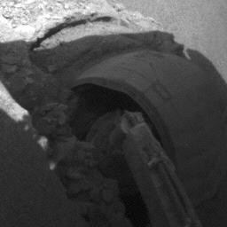
-
PIA07982:
-
Spirit Arm Movements for Mosaic of "Keystone"
Full Resolution:
TIFF
(1.05 MB)
JPEG
(113.7 kB)
|
|
|
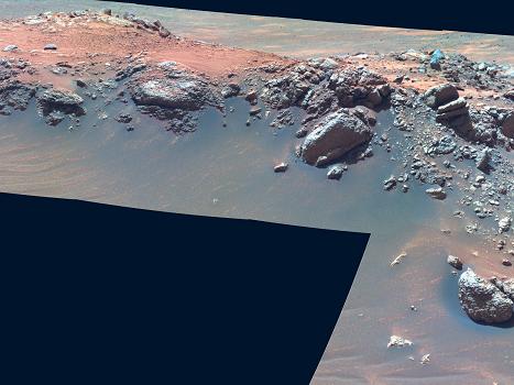
2005-05-24 |
Mars
|
Mars Exploration Rover (MER)
|
Panoramic Camera
|
350x350x3 |
|
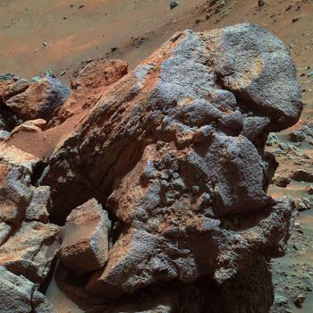
-
PIA07981:
-
'Larry's Outcrop' in False Color
Full Resolution:
TIFF
(368.1 kB)
JPEG
(34.23 kB)
|
|
|
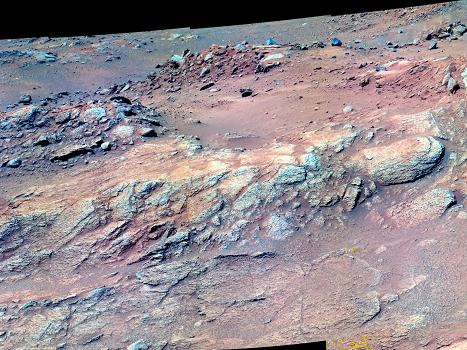
2005-05-24 |
Mars
|
Mars Exploration Rover (MER)
|
Panoramic Camera
|
467x350x1 |

|
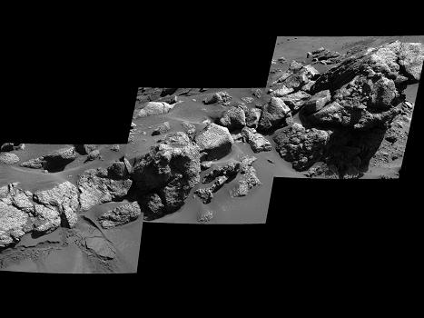
-
PIA07980:
-
Spirit View of 'Larry's Outcrop'
Full Resolution:
TIFF
(163.8 kB)
JPEG
(24.3 kB)
|
|
|
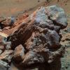
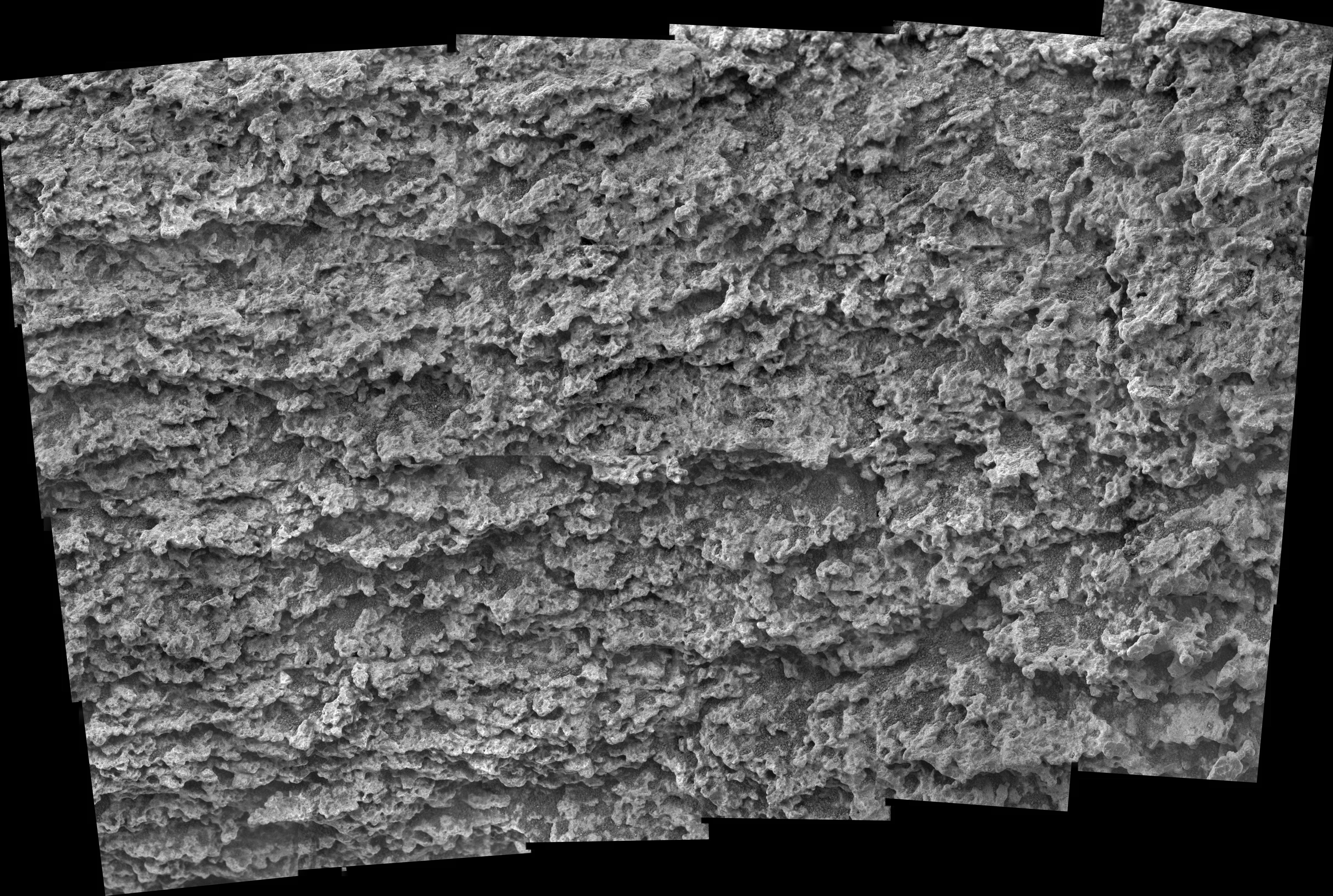
2005-05-24 |
Mars
|
Mars Exploration Rover (MER)
|
Microscopic Imager
|
934x701x1 |
|
-
PIA07979:
-
Texture of Rock at 'Jibsheet'
Full Resolution:
TIFF
(655.7 kB)
JPEG
(104.4 kB)
|
|
|
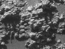
2005-05-24 |
Mars
|
Mars Exploration Rover (MER)
|
Microscopic Imager
|
5626x3784x3 |
|
-
PIA07977:
-
Close-up of 'Keystone' on 'Methuselah' Outcrop
Full Resolution:
TIFF
(21.32 MB)
JPEG
(3.111 MB)
|
|
|
2005-05-24 |
Mars
|
Mars Exploration Rover (MER)
|
Panoramic Camera
|
467x350x3 |
|
-
PIA07978:
-
'Methuselah' in False Color
Full Resolution:
TIFF
(491.1 kB)
JPEG
(56.95 kB)
|
|
|
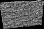
2005-05-24 |
Mars
|
Mars Exploration Rover (MER)
|
Microscopic Imager
|
2233x2136x1 |
|
-
PIA07976:
-
Close-up of 'Davis' on 'Jibsheet' Outcrop
Full Resolution:
TIFF
(4.776 MB)
JPEG
(684 kB)
|
|
|
2005-05-24 |
Mars
|
Mars Exploration Rover (MER)
|
Panoramic Camera
|
467x350x3 |
|
-
PIA07975:
-
'Jibsheet' in False Color
Full Resolution:
TIFF
(491.1 kB)
JPEG
(30.33 kB)
|
|
|
2005-05-24 |
Mars
|
2001 Mars Odyssey
|
THEMIS
|
714x1666x3 |
|
-
PIA07987:
-
More Meridiani
Full Resolution:
TIFF
(3.573 MB)
JPEG
(175 kB)
|
|
|
2005-05-24 |
Mars
|
Mars Global Surveyor (MGS)
|
Mars Orbiter Camera (MOC)
|
640x640x3 |
|
-
PIA07988:
-
Mars at Ls 211°: Elysium/Mare Cimmerium
Full Resolution:
TIFF
(411.8 kB)
JPEG
(22.34 kB)
|
|
|
2005-05-23 |
Mars
|
Mars Exploration Rover (MER)
|
Panoramic Camera
|
13122x2500x3 |
|
-
PIA07958:
Spirit's 'Lookout Panorama' in 3-D
Full Resolution:
TIFF
(98.42 MB)
JPEG
(4.672 MB)
|
|
|
2005-05-23 |
Mars
|
2001 Mars Odyssey
|
THEMIS
|
717x1670x3 |
|
-
PIA07974:
-
Meridiani
Full Resolution:
TIFF
(3.597 MB)
JPEG
(145.1 kB)
|
|
|
2005-05-23 |
Mars
|
Mars Global Surveyor (MGS)
|
Mars Orbiter Camera (MOC)
|
537x1185x1 |
|
-
PIA07972:
-
Four Mars Years of Change
Full Resolution:
TIFF
(637.2 kB)
JPEG
(108.4 kB)
|
|
|
2005-05-22 |
Mars
|
Mars Global Surveyor (MGS)
|
Mars Orbiter Camera (MOC)
|
836x1242x1 |

|
-
PIA07971:
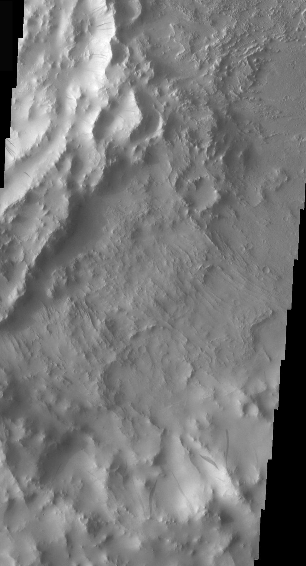
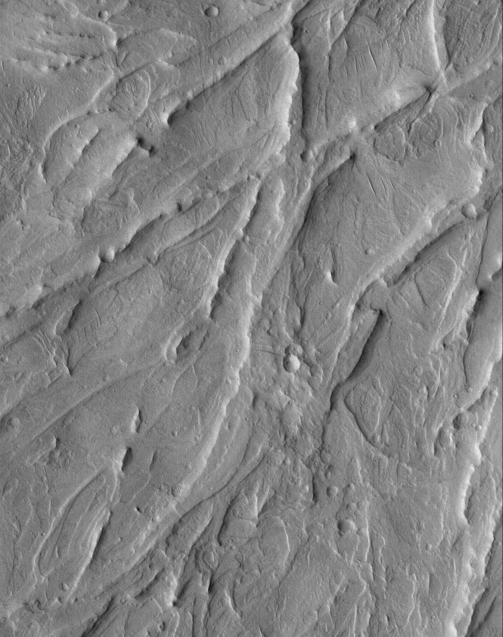
-
Tithonium Yardangs
Full Resolution:
TIFF
(1.04 MB)
JPEG
(222.7 kB)
|
|
|
2005-05-21 |
Mars
|
Mars Global Surveyor (MGS)
|
Mars Orbiter Camera (MOC)
|
672x1382x1 |
|
-
PIA07970:
-
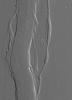
Martian Valley
Full Resolution:
TIFF
(929.9 kB)
JPEG
(132.4 kB)
|
|
|
2005-05-20 |
Mars
|
2001 Mars Odyssey
|
THEMIS
|
738x1683x3 |
|
-
PIA07973:
-
Downstream in Mawrth Valles
Full Resolution:
TIFF
(3.731 MB)
JPEG
(130.7 kB)
|
|
|
2005-05-20 |
Mars
|
Mars Global Surveyor (MGS)
|
Mars Orbiter Camera (MOC)
|
1672x2033x1 |
|
-
PIA07959:
-
Gullied Slope
Full Resolution:
TIFF
(3.403 MB)
JPEG
(396.5 kB)
|
|
|
2005-05-19 |
Mars
|
2001 Mars Odyssey
|
THEMIS
|
737x1682x3 |
|
-
PIA07957:
-
Mawrth Valles
Full Resolution:
TIFF
(3.724 MB)
JPEG
(104.1 kB)
|
|
|
2005-05-18 |
Mars
|
2001 Mars Odyssey
|
THEMIS
|
762x1694x3 |

|
-
PIA07956:
-
Moreux Crater Dunes
Full Resolution:
TIFF
(3.877 MB)
JPEG
(104.1 kB)
|
|
|
2005-05-18 |
Mars
|
Mars Global Surveyor (MGS)
|
Mars Orbiter Camera (MOC)
|
2048x2652x1 |
|
-
PIA07951:
-
Broken Sedimentary Rocks
Full Resolution:
TIFF
(5.437 MB)
JPEG
(793.7 kB)
|
|
|
2005-05-17 |
Mars
|
2001 Mars Odyssey
|
THEMIS
|
739x1679x3 |
|
-
PIA07955:
-
Antoniadi Crater
Full Resolution:
TIFF
(3.727 MB)
JPEG
(153.3 kB)
|
|
|
2005-05-17 |
Mars
|
Mars Global Surveyor (MGS)
|
Mars Orbiter Camera (MOC)
|
640x640x3 |
|
-
PIA07950:
-
Mars at Ls 211°: Syrtis Major
Full Resolution:
TIFF
(411.8 kB)
JPEG
(24.01 kB)
|
|
|
2005-05-16 |
Mars
|
2001 Mars Odyssey
|
THEMIS
|
755x1697x3 |
|
-
PIA07954:
-
Deuteronilus Mensae
Full Resolution:
TIFF
(3.848 MB)
JPEG
(87 kB)
|
|
|
2005-05-16 |
Mars
|
Mars Global Surveyor (MGS)
|
Mars Orbiter Camera (MOC)
|
836x1342x1 |

|
-
PIA07949:
-
Cross-Cutting Faults
Full Resolution:
TIFF
(1.123 MB)
JPEG
(160.3 kB)
|
|
|
2005-05-15 |
Mars
|
Mars Global Surveyor (MGS)
|
Mars Orbiter Camera (MOC)
|
672x1144x1 |

|
-
PIA07948:
-
Inverted Channels
Full Resolution:
TIFF
(769.8 kB)
JPEG
(201.1 kB)
|
|
|
2005-05-14 |
Mars
|
Mars Global Surveyor (MGS)
|
Mars Orbiter Camera (MOC)
|
836x1033x1 |
|
-
PIA07947:
-
Old Crater Bottom
Full Resolution:
TIFF
(864.7 kB)
JPEG
(111.4 kB)
|
|
|
2005-05-13 |
Mars
|
2001 Mars Odyssey
|
THEMIS
|
719x1670x3 |
|
-
PIA07953:
-
Candor Chasma
Full Resolution:
TIFF
(3.607 MB)
JPEG
(172.5 kB)
|
|
|
2005-05-13 |
Mars
|
Mars Global Surveyor (MGS)
|
Mars Orbiter Camera (MOC)
|
836x1211x1 |
|
-
PIA07946:
-
Gullied Wall
Full Resolution:
TIFF
(1.014 MB)
JPEG
(159.5 kB)
|
|
|
2005-05-12 |
Mars
|
2001 Mars Odyssey
|
THEMIS
|
719x1670x3 |
|
-
PIA07952:
-
Hebes Chasma Wall
Full Resolution:
TIFF
(3.607 MB)
JPEG
(76.52 kB)
|
|
|
2005-05-12 |
Mars
|
Mars Global Surveyor (MGS)
|
Mars Orbiter Camera (MOC)
|
768x1187x1 |
|
-
PIA07945:
-
Spring Defrosting
Full Resolution:
TIFF
(912.8 kB)
JPEG
(136.2 kB)
|
|
|
2005-05-11 |
Mars
|
Mars Global Surveyor (MGS)
|
Mars Orbiter Camera (MOC)
|
672x2000x1 |
|
-
PIA07940:
-
Athabasca Streamlines
Full Resolution:
TIFF
(1.346 MB)
JPEG
(233.8 kB)
|
 Planetary Data System


