Click on an image for detailed information
Click on a column heading to sort in ascending or descending order

My
List |
Addition Date
|
Target
|
Mission
|
Instrument
|
Size
|

|
2011-07-22 |
Mars
|
Mars Science Laboratory (MSL)
|
HiRISE
|
1920x1080x3 |

|
-
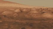
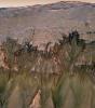
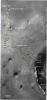
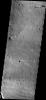
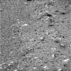
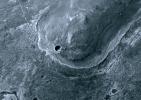
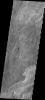
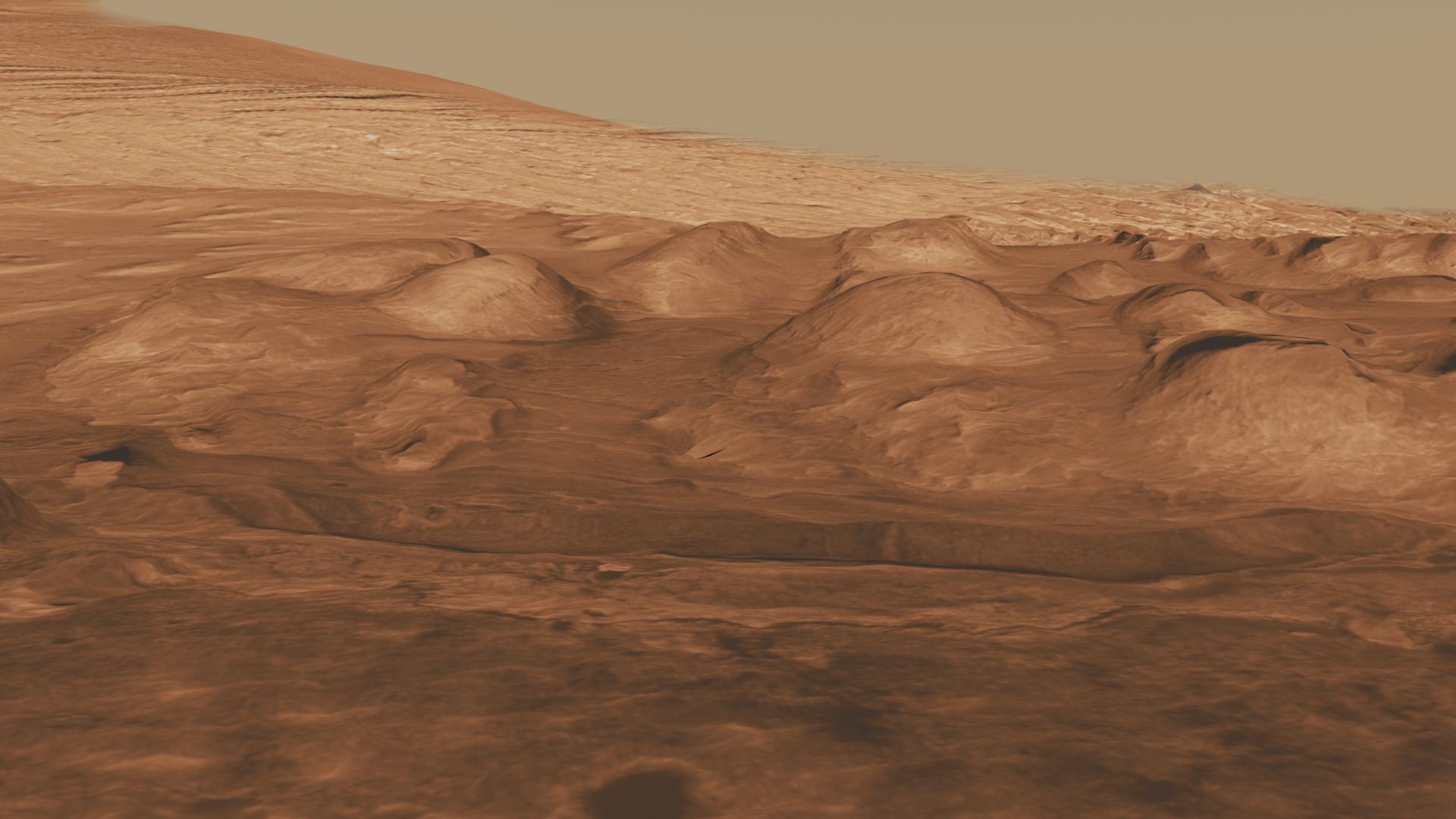
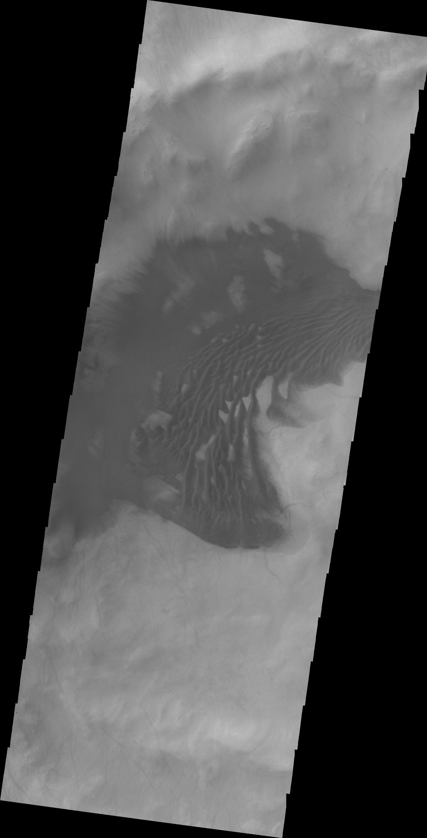
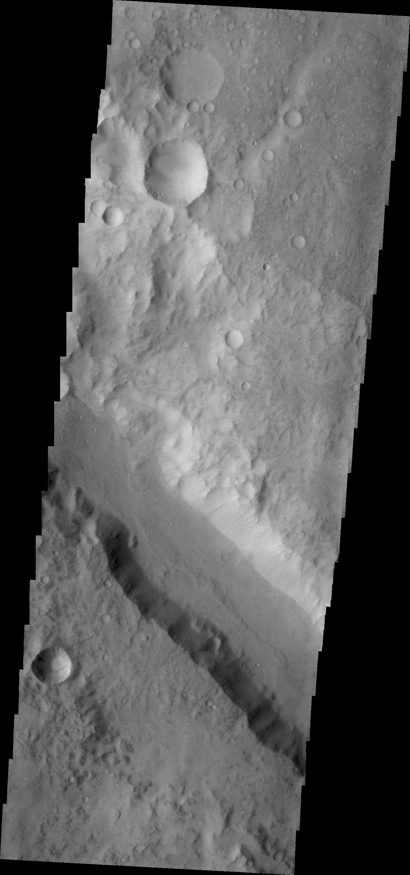
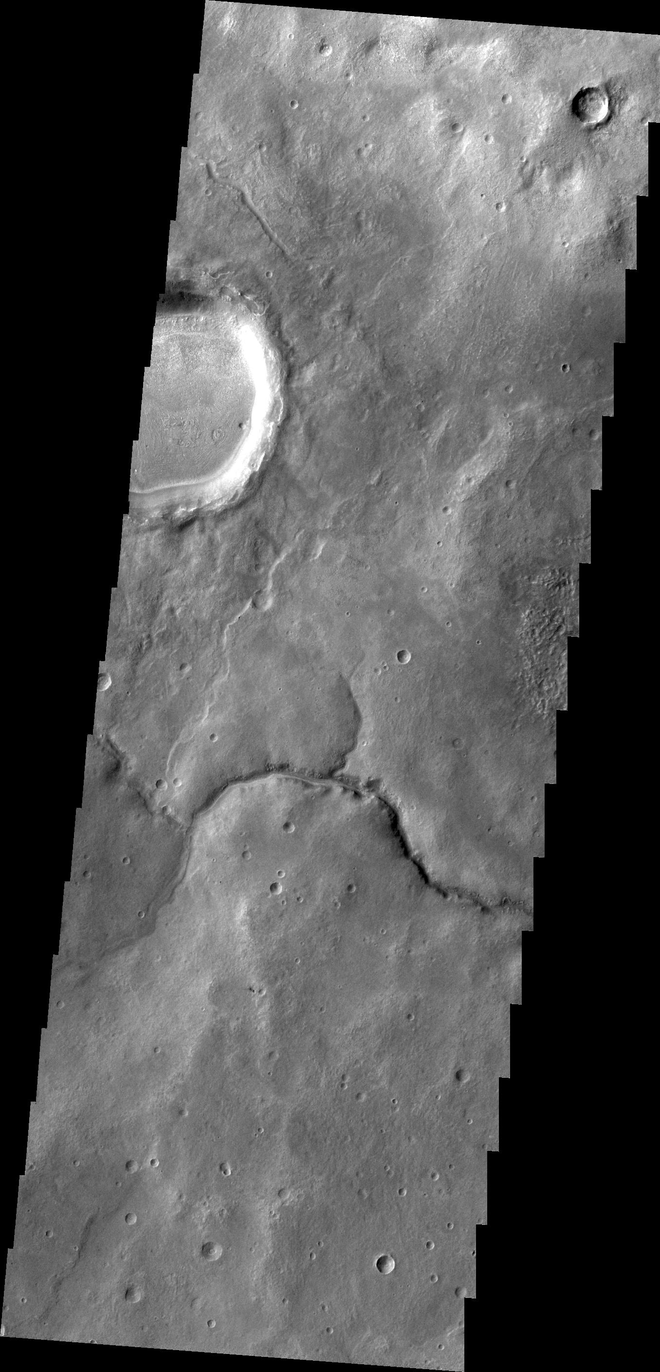
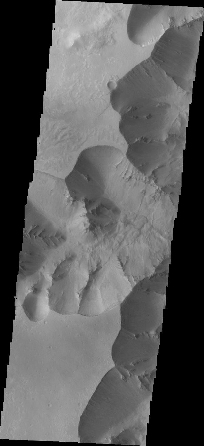
PIA14296:
-
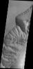
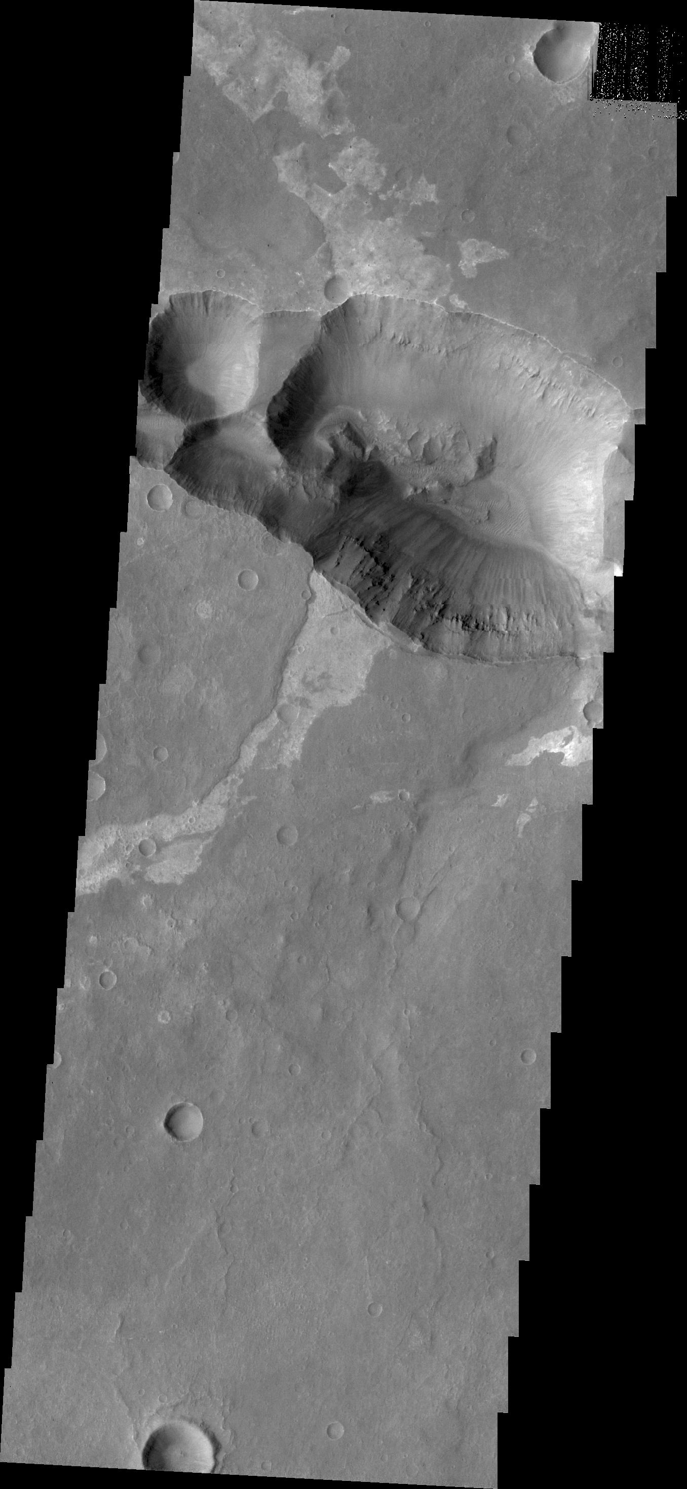
Lower Portion of Mound Inside Gale Crater
Full Resolution:
TIFF
(6.23 MB)
JPEG
(219.5 kB)
|
|
|
2011-07-22 |
Mars
|
Mars Science Laboratory (MSL)
|
HiRISE
|
1920x1080x3 |
|
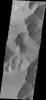
-
PIA14297:
-
Rock Layers in Lower Mound in Gale Crater
Full Resolution:
TIFF
(6.23 MB)
JPEG
(157.1 kB)
|
|
|
2011-07-22 |
Mars
|
Mars Science Laboratory (MSL)
|
HiRISE
|
1920x1080x3 |
|
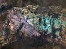
-
PIA14298:
-
Rock Types in Gale Crater
Full Resolution:
TIFF
(6.23 MB)
JPEG
(221.8 kB)
|
|
|
2011-07-22 |
Mars
|
Mars Science Laboratory (MSL)
|
|
1280x720x3 |

|
-
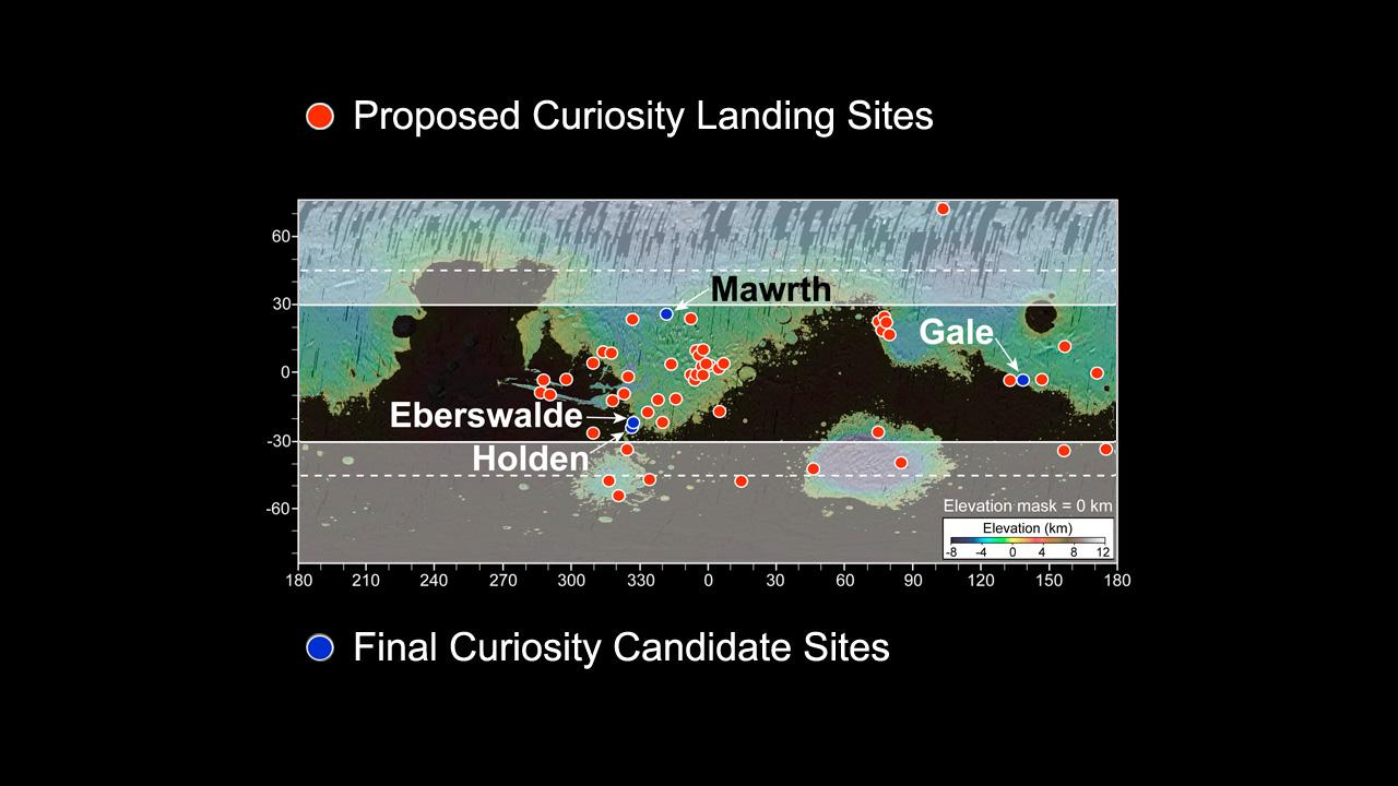
PIA14299:
-
More Than 60 Sites Considered for Next Mars Rover Landing
Full Resolution:
TIFF
(2.768 MB)
JPEG
(87.84 kB)
|
|
|
2011-07-22 |
Mars
|
Mars Science Laboratory (MSL)
|
HiRISE
|
1280x720x3 |
|
-
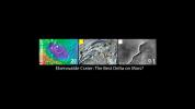
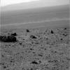
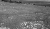
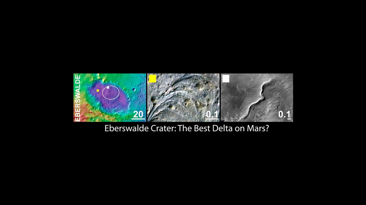
PIA14300:
-
Eberswalde Crater, a Finalist Not Selected as Landing Site for Curiosity
Full Resolution:
TIFF
(2.768 MB)
JPEG
(53.99 kB)
|
|
|
2011-07-22 |
Mars
|
Mars Science Laboratory (MSL)
|
HiRISE
|
1280x720x3 |
|
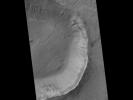
-
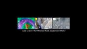
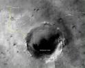
PIA14301:
-
Gale Crater, the Selected Landing Site for Curiosity
Full Resolution:
TIFF
(2.768 MB)
JPEG
(50.68 kB)
|
|
|
2011-07-22 |
Mars
|
Mars Science Laboratory (MSL)
|
HiRISE
|
1280x720x3 |

|
-
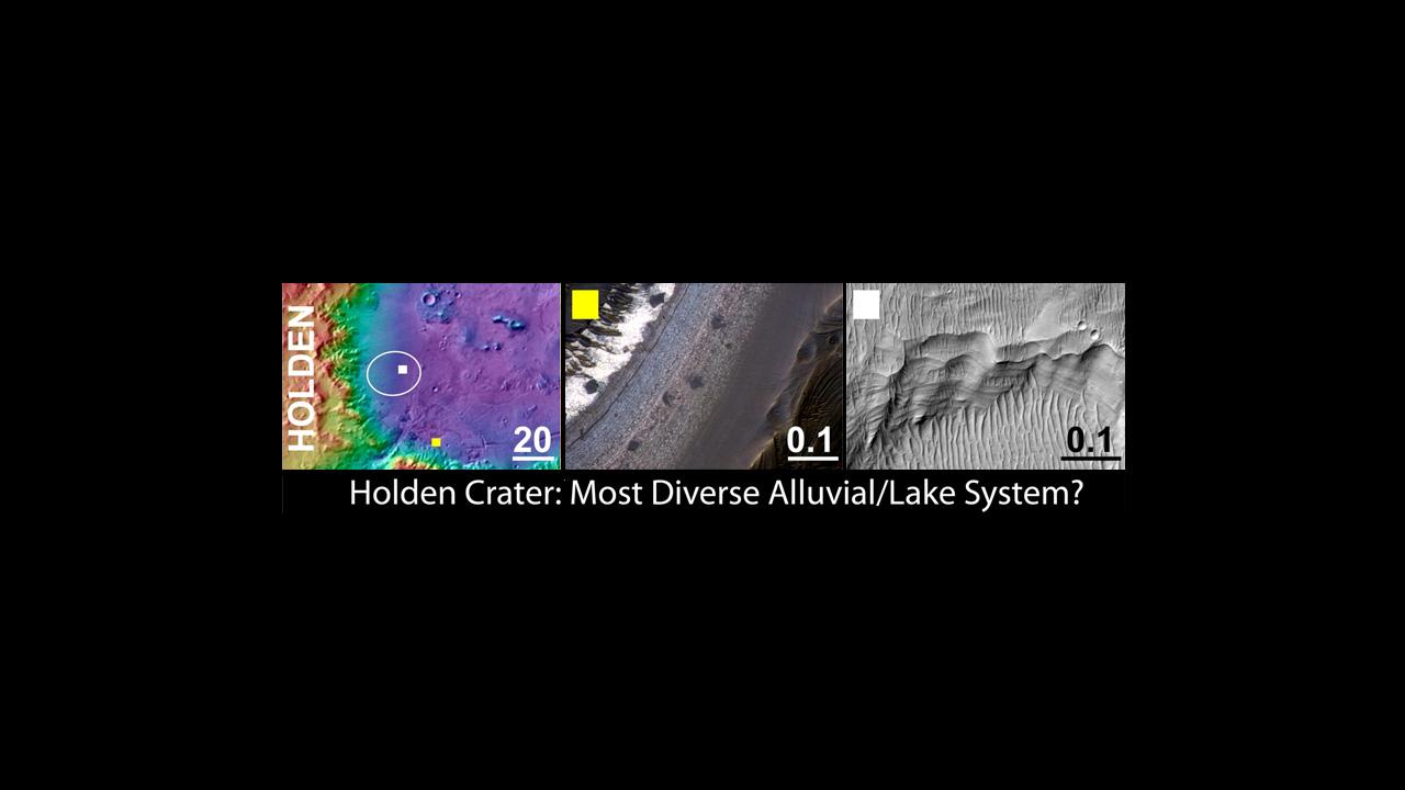
PIA14302:
-
Holden Crater, a Finalist Not Selected as Landing Site for Curiosity
Full Resolution:
TIFF
(2.768 MB)
JPEG
(53.81 kB)
|
|
|
2011-07-22 |
Mars
|
Mars Science Laboratory (MSL)
|
HiRISE
|
1280x720x3 |
|
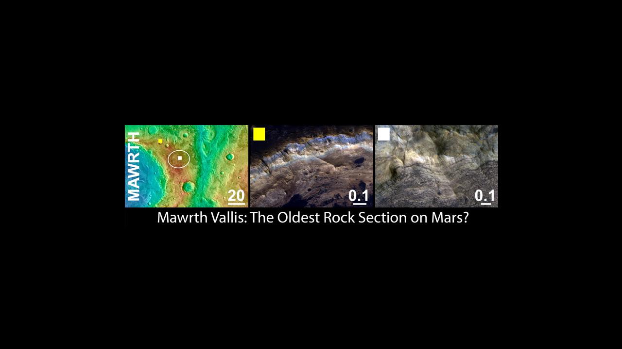
-
PIA14303:
-
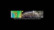
Mawrth Vallis, a Finalist Not Selected as a Landing Site for Curiosity
Full Resolution:
TIFF
(2.768 MB)
JPEG
(53.93 kB)
|
|
|
2011-07-22 |
Mars
|
Mars Science Laboratory (MSL)
|
|
892x647x3 |

|
-
PIA14305:
-
Attractions for Study in and near Curiosity's Selected Landing Site
Full Resolution:
TIFF
(1.733 MB)
JPEG
(87.89 kB)
|
|
|
2011-07-22 |
Mars
|
Mars Science Laboratory (MSL)
|
|
818x720x3 |
|
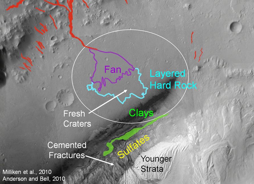
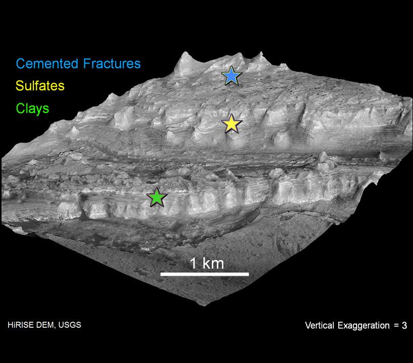
-
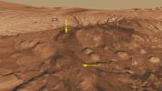
PIA14306:
-
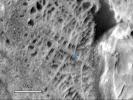
Attractions in Layers of Mountain Inside Gale Crater
Full Resolution:
TIFF
(1.769 MB)
JPEG
(76.68 kB)
|
|
|
2011-07-22 |
Mars
|
Mars Science Laboratory (MSL)
|
HiRISE
|
868x655x3 |
|
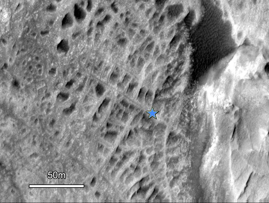
-
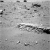
PIA14307:
-
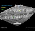
Cemented Fractures in Mountain Inside Gale Crater on Mars
Full Resolution:
TIFF
(1.708 MB)
JPEG
(100.7 kB)
|
|
|
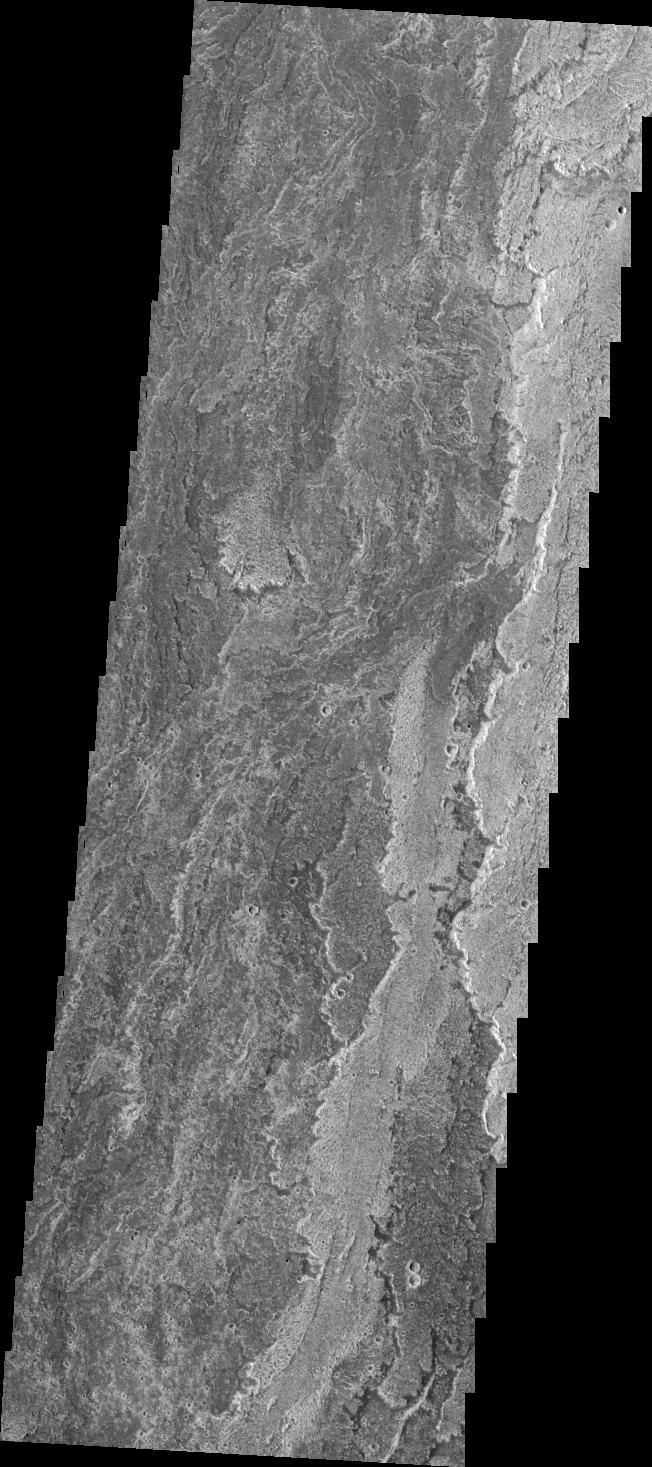
2011-07-22 |
Mars
|
2001 Mars Odyssey
|
THEMIS
|
1331x2776x1 |
|
-
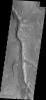
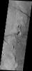
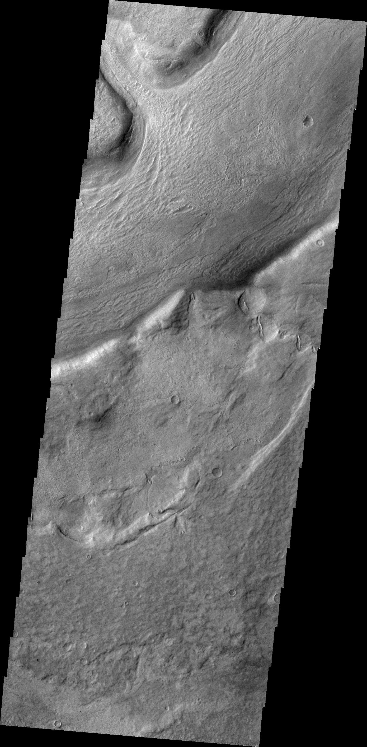
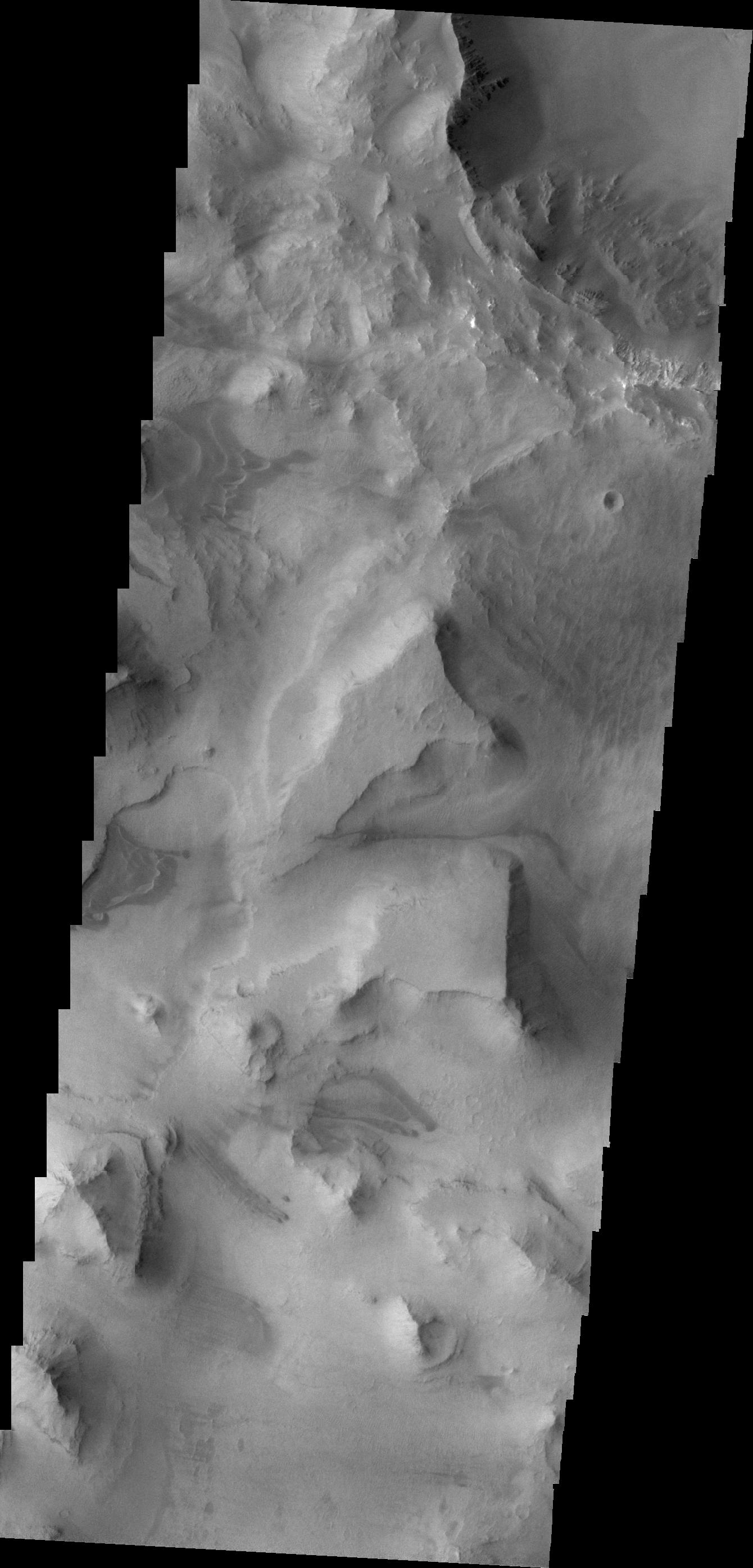
PIA14469:
-
Ophir Chasma
Full Resolution:
TIFF
(3.699 MB)
JPEG
(223.3 kB)
|
|
|
2011-07-25 |
Mars
|
2001 Mars Odyssey
|
THEMIS
|
1390x2828x1 |
|
-
PIA14481:
-
Reull Vallis
Full Resolution:
TIFF
(3.936 MB)
JPEG
(504.8 kB)
|
|
|
2011-07-26 |
Mars
|
2001 Mars Odyssey
|
THEMIS
|
1349x2786x1 |
|
-
PIA14482:
-
Windstreaks
Full Resolution:
TIFF
(3.762 MB)
JPEG
(602.1 kB)
|
|
|
2011-07-27 |
Mars
|
2001 Mars Odyssey
|
THEMIS
|
1404x2838x1 |
|
-
PIA14483:
-
Dust Devil Tracks
Full Resolution:
TIFF
(3.989 MB)
JPEG
(389.1 kB)
|
|
|
2011-07-28 |
Mars
|
2001 Mars Odyssey
|
THEMIS
|
1354x2782x1 |
|
-
PIA14484:
-
Tinto Vallis
Full Resolution:
TIFF
(3.771 MB)
JPEG
(256.9 kB)
|
|
|
2011-07-29 |
Mars
|
2001 Mars Odyssey
|
THEMIS
|
1320x2934x1 |

|
-
PIA14485:
-
Candor Chasma
Full Resolution:
TIFF
(3.877 MB)
JPEG
(273 kB)
|
|
|
2011-08-01 |
Mars
|
2001 Mars Odyssey
|
THEMIS
|
1397x2823x1 |

|
-
PIA14486:
-
Hellas Dunes
Full Resolution:
TIFF
(3.948 MB)
JPEG
(265.1 kB)
|
|
|
2011-08-02 |
Mars
|
2001 Mars Odyssey
|
THEMIS
|
1393x2954x1 |
|
-
PIA14487:
-
Sirenum Fossae
Full Resolution:
TIFF
(4.12 MB)
JPEG
(557.2 kB)
|
|
|
2011-08-03 |
Mars
|
2001 Mars Odyssey
|
THEMIS
|
1459x2866x1 |

|
-
PIA14513:
-
Dunes in Sisyphi Planum
Full Resolution:
TIFF
(4.186 MB)
JPEG
(160.2 kB)
|
|
|
2011-08-04 |
Mars
|
2001 Mars Odyssey
|
THEMIS
|
1040x2861x1 |
|
-
PIA14517:
-
Dunes in Sisyphi Cavi
Full Resolution:
TIFF
(2.979 MB)
JPEG
(160.4 kB)
|
|
|
2011-08-04 |
Mars
|
2001 Mars Odyssey
|
Gamma Ray Spectrometer - Neutron Spectrometer
|
2536x1465x3 |
|
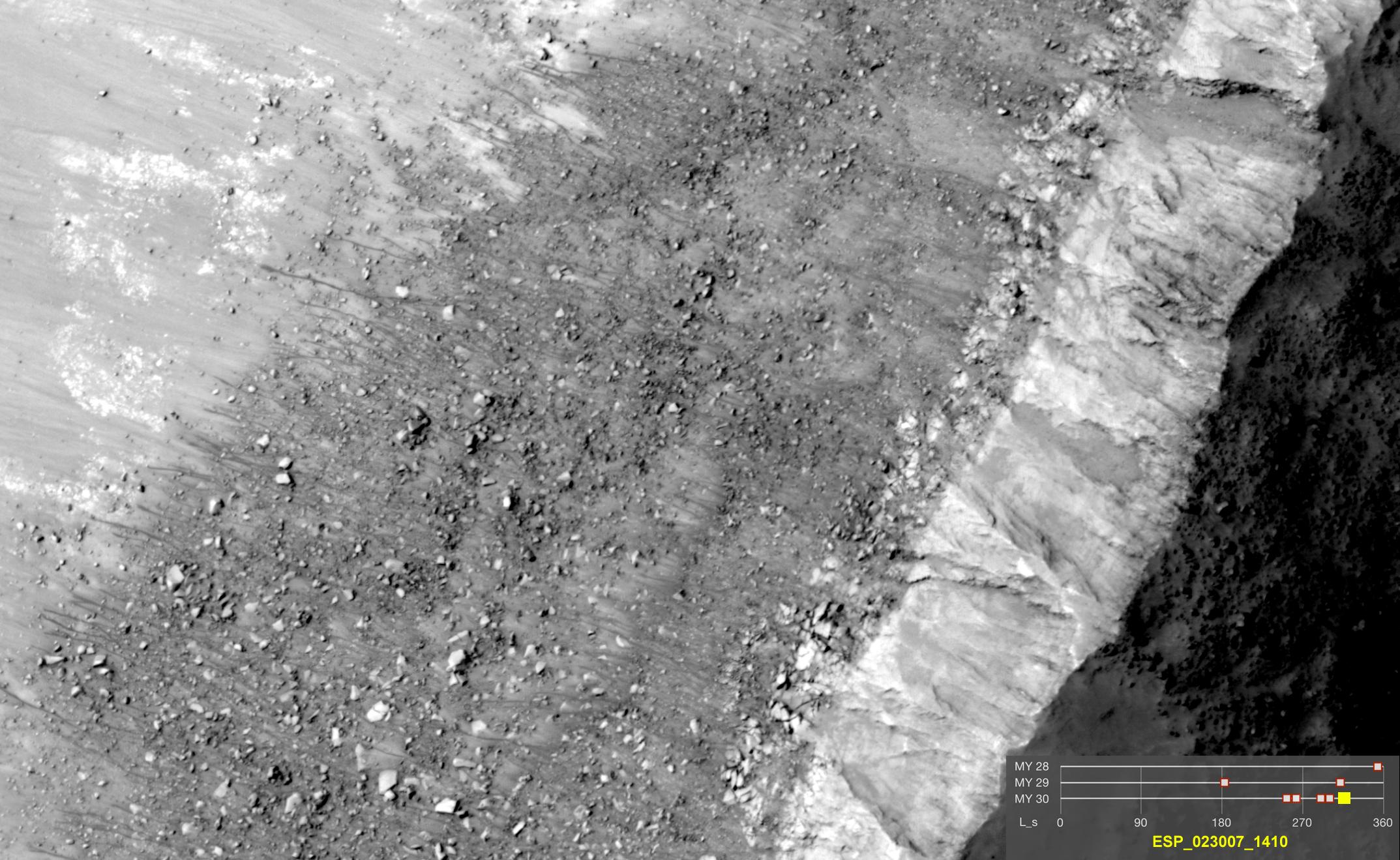
-
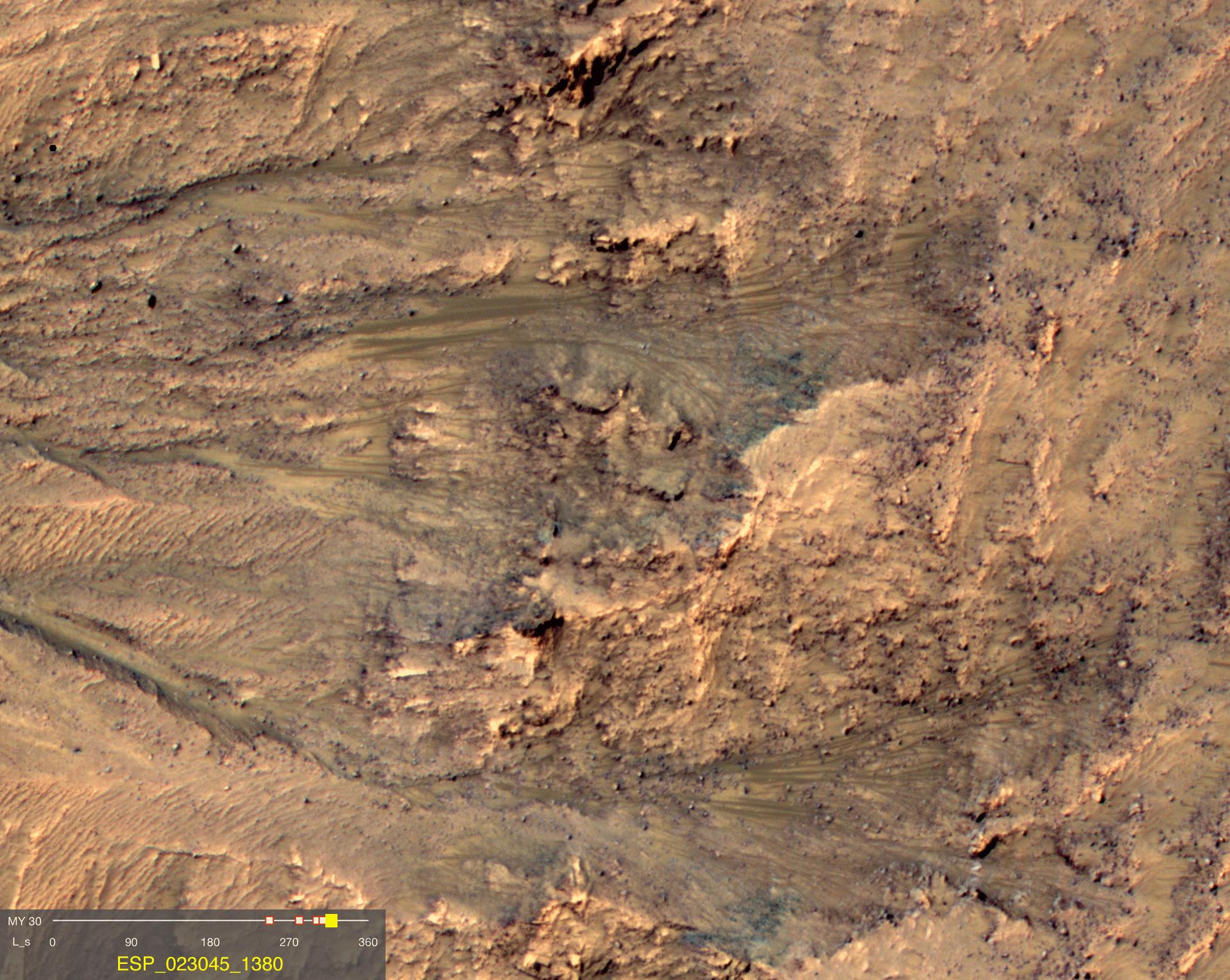
PIA14470:
-
Ice, Salt and Warm-Season Flows on Mars
Full Resolution:
TIFF
(11.16 MB)
JPEG
(798 kB)
|
|
|
2011-08-04 |
Mars
|
Mars Reconnaissance Orbiter (MRO)
|
HiRISE
|
1839x1518x3 |
|
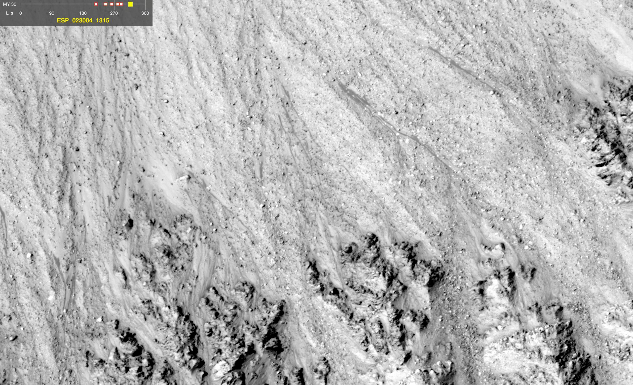
-
PIA14472:
-
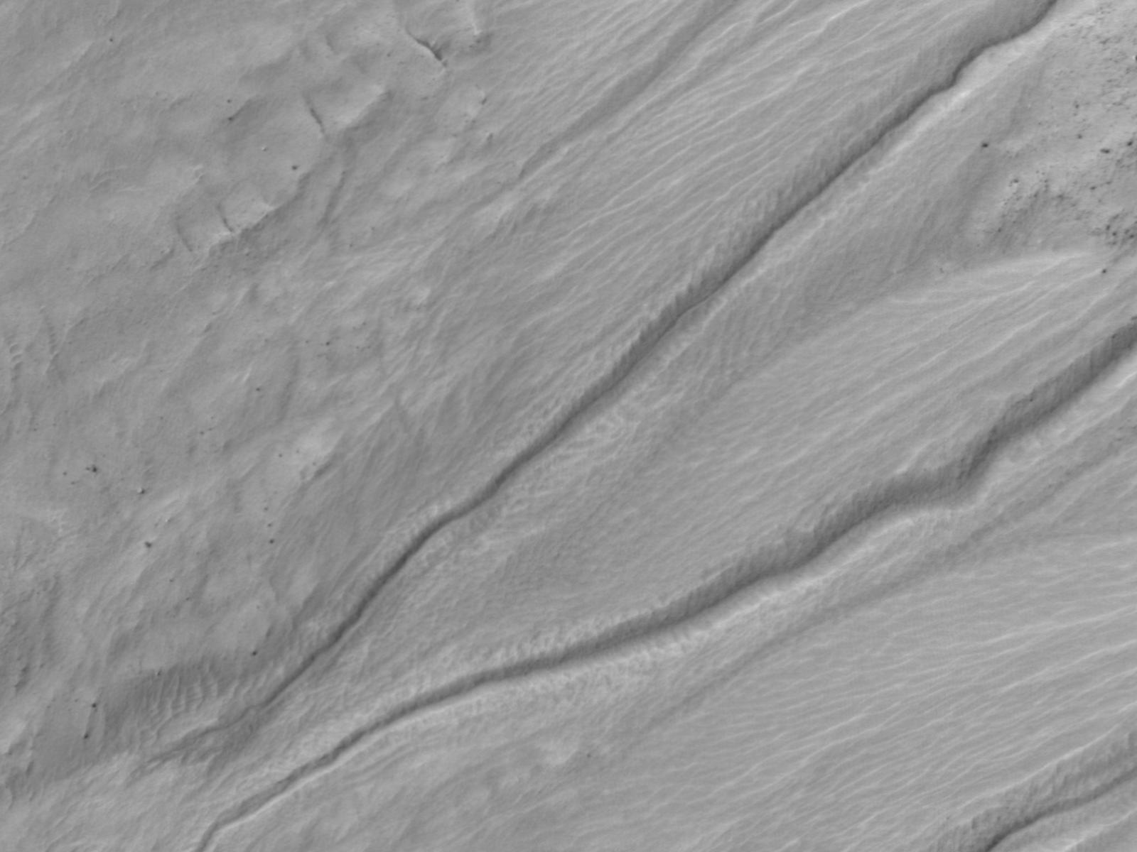
Warm-Season Flows on Slope in Newton Crater (Six-Image Sequence)
Full Resolution:
TIFF
(2.796 MB)
JPEG
(373.5 kB)
|
|
|
2011-08-04 |
Mars
|
Mars Reconnaissance Orbiter (MRO)
|
HiRISE
|
1917x1528x3 |
|
-
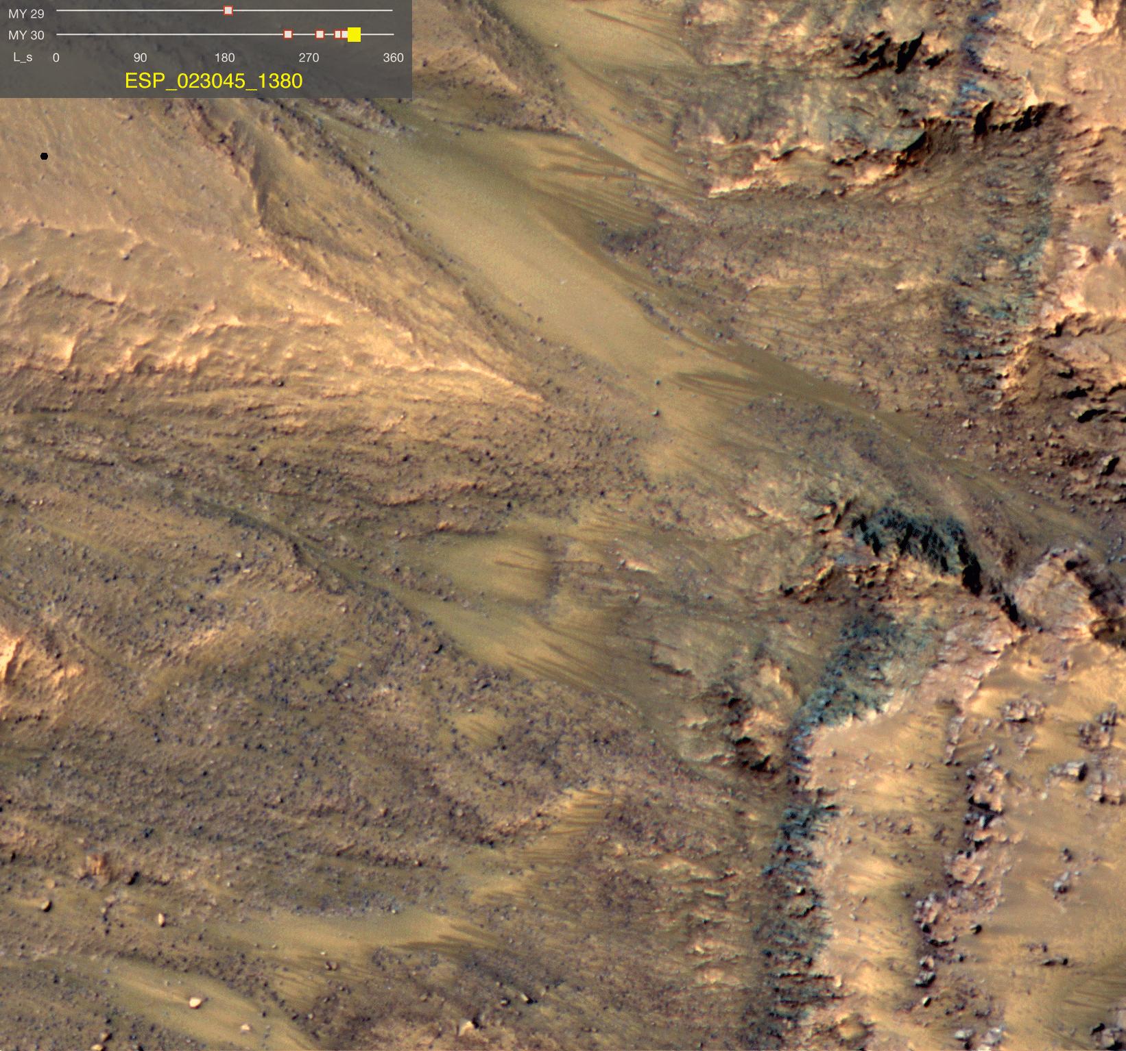
PIA14473:
-
Warm-Season Flows on Slope in Newton Crater (Five-Image Sequence)
Full Resolution:
TIFF
(2.934 MB)
JPEG
(471.7 kB)
|
|
|
2011-08-04 |
Mars
|
Mars Reconnaissance Orbiter (MRO)
|
HiRISE
|
1642x1534x3 |

|
-
PIA14474:
-
Dark Flows in Newton Crater Extending During Summer (Six-Image Sequence)
Full Resolution:
TIFF
(2.524 MB)
JPEG
(394.1 kB)
|
|
|
2011-08-04 |
Mars
|
Mars Reconnaissance Orbiter (MRO)
|
HiRISE
|
2453x2033x3 |
|
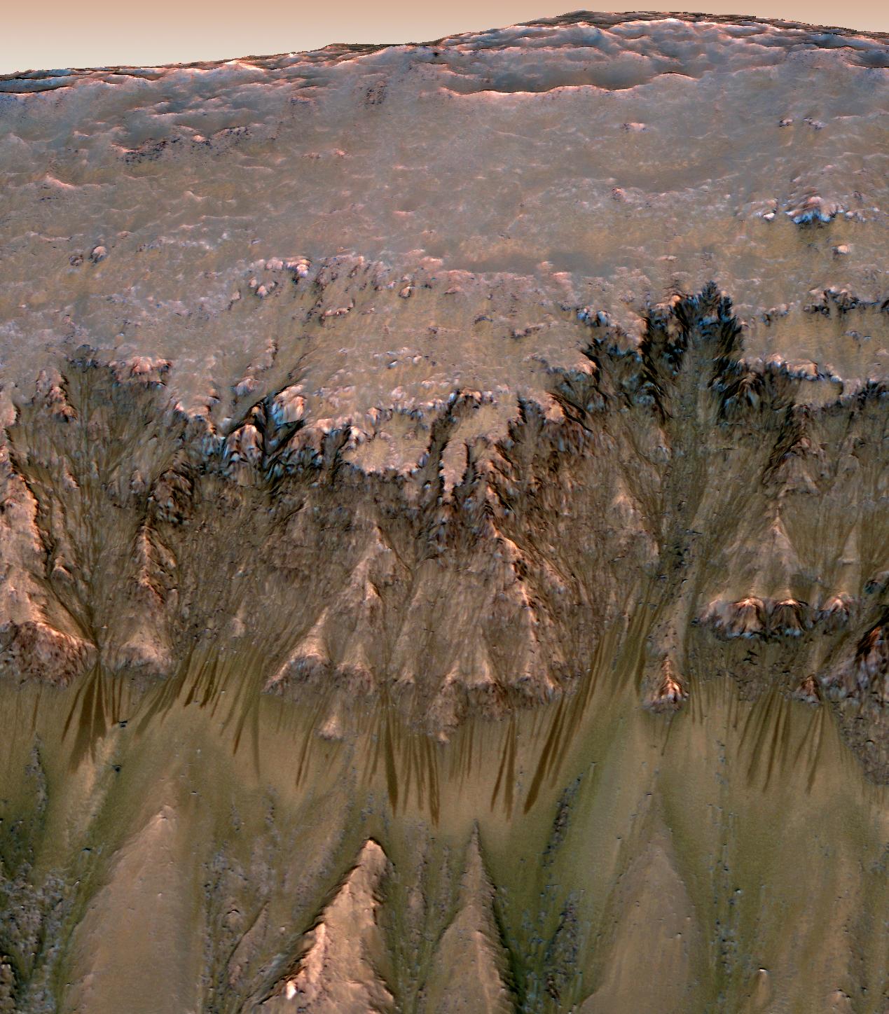
-
PIA14476:
-
Warm-Season Flows on Slope in Horowitz Crater (Nine-Image Sequence)
Full Resolution:
TIFF
(4.994 MB)
JPEG
(594.9 kB)
|
|
|
2011-08-04 |
Mars
|
Mars Reconnaissance Orbiter (MRO)
|
HiRISE
|
2147x1319x3 |
|
-
PIA14477:
-
Warm-Season Flows on Steep Slope in Slope in Terra Cimmeria (Eight-Image Sequence)
Full Resolution:
TIFF
(2.837 MB)
JPEG
(404.1 kB)
|
|
|
2011-08-04 |
Mars
|
Mars Reconnaissance Orbiter (MRO)
|
HiRISE
|
2515x1530x3 |
|
-
PIA14478:
-
Warm-Season Flows in Well-Preserved Crater in Terra Sirenum (Six-Image Sequence)
Full Resolution:
TIFF
(3.854 MB)
JPEG
(597.1 kB)
|
|
|
2011-08-04 |
Mars
|
Mars Reconnaissance Orbiter (MRO)
|
HiRISE
|
1269x1448x3 |
|
-
PIA14479:
-
Oblique View of Warm Season Flows in Newton Crater
Full Resolution:
TIFF
(5.519 MB)
JPEG
(285.1 kB)
|
|
|
2011-08-04 |
Mars
|
Mars Reconnaissance Orbiter (MRO)
|
HiRISE
|
1600x1200x1 |
|
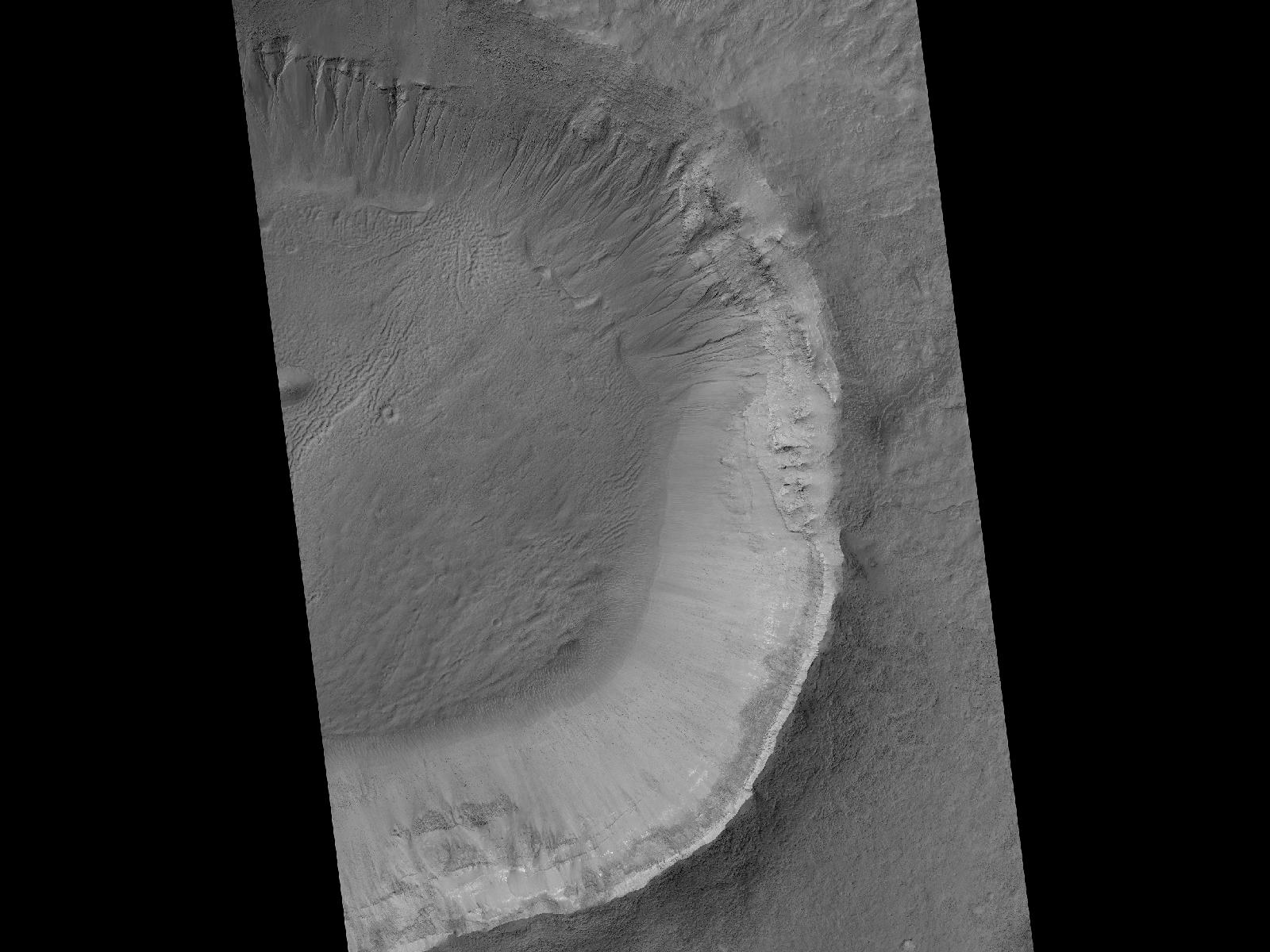
-
PIA14501:
-
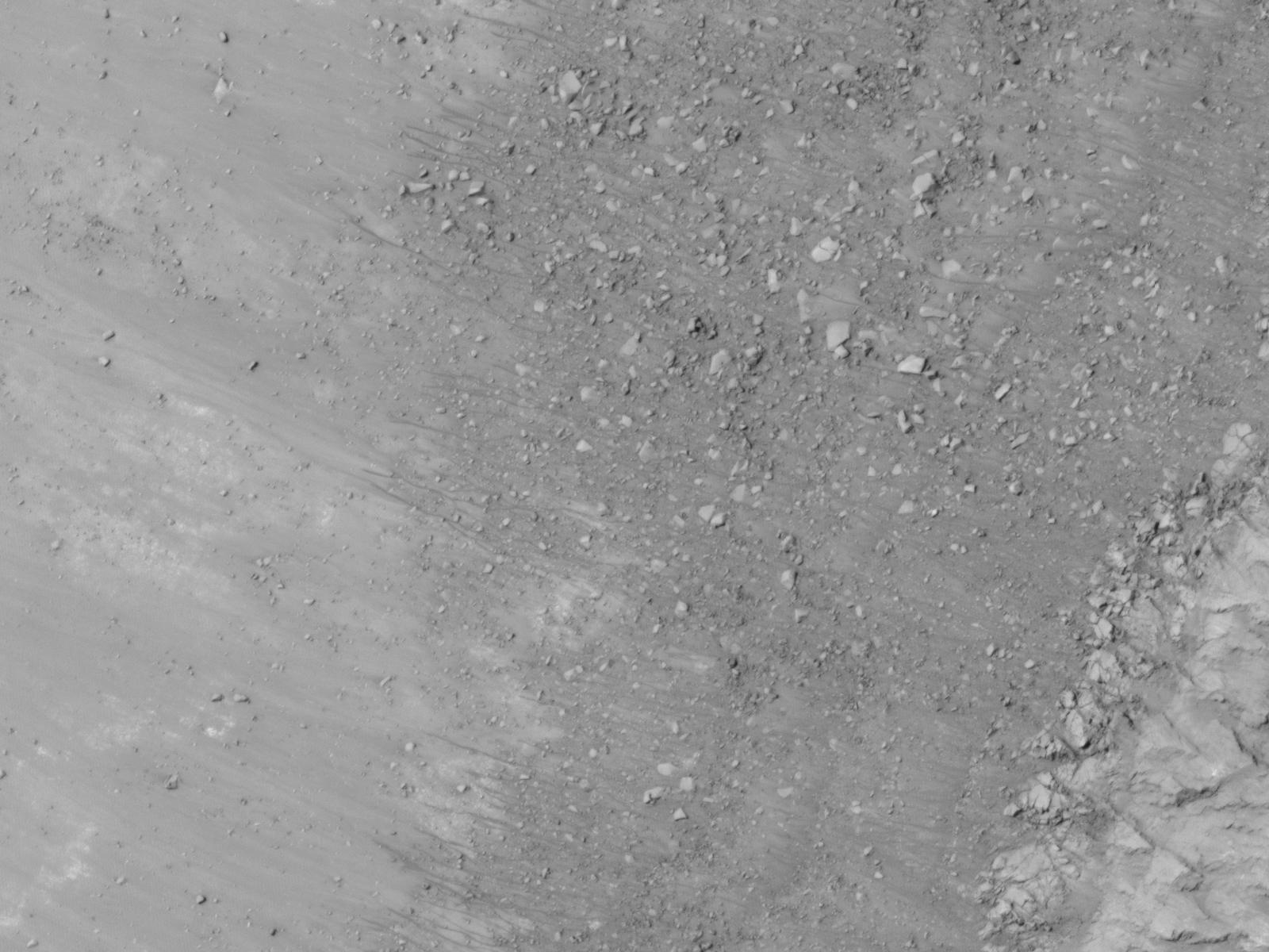
Gullies and Newly Identified Flow Features in Same Mars Crater
Full Resolution:
TIFF
(1.922 MB)
JPEG
(196.2 kB)
|
|
|
2011-08-04 |
Mars
|
Mars Reconnaissance Orbiter (MRO)
|
HiRISE
|
1600x1200x1 |
|
-
PIA14502:
-
Site of Warm Season Flows in Mars Crater
Full Resolution:
TIFF
(1.922 MB)
JPEG
(209.1 kB)
|
|
|
2011-08-04 |
Mars
|
Mars Reconnaissance Orbiter (MRO)
|
HiRISE
|
1600x1200x1 |
|
-
PIA14503:
-
Changes in a Gully in a Mars Crater (Two-Image Comparison)
Full Resolution:
TIFF
(1.922 MB)
JPEG
(136.2 kB)
|
|
|
2011-08-05 |
Mars
|
2001 Mars Odyssey
|
THEMIS
|
1356x2937x1 |

|
-
PIA14518:
-
Coprates Catena
Full Resolution:
TIFF
(3.987 MB)
JPEG
(342.3 kB)
|
|
|
2011-08-05 |
Mars
|
Mars Exploration Rover (MER)
|
CTX
|
943x1989x3 |
|
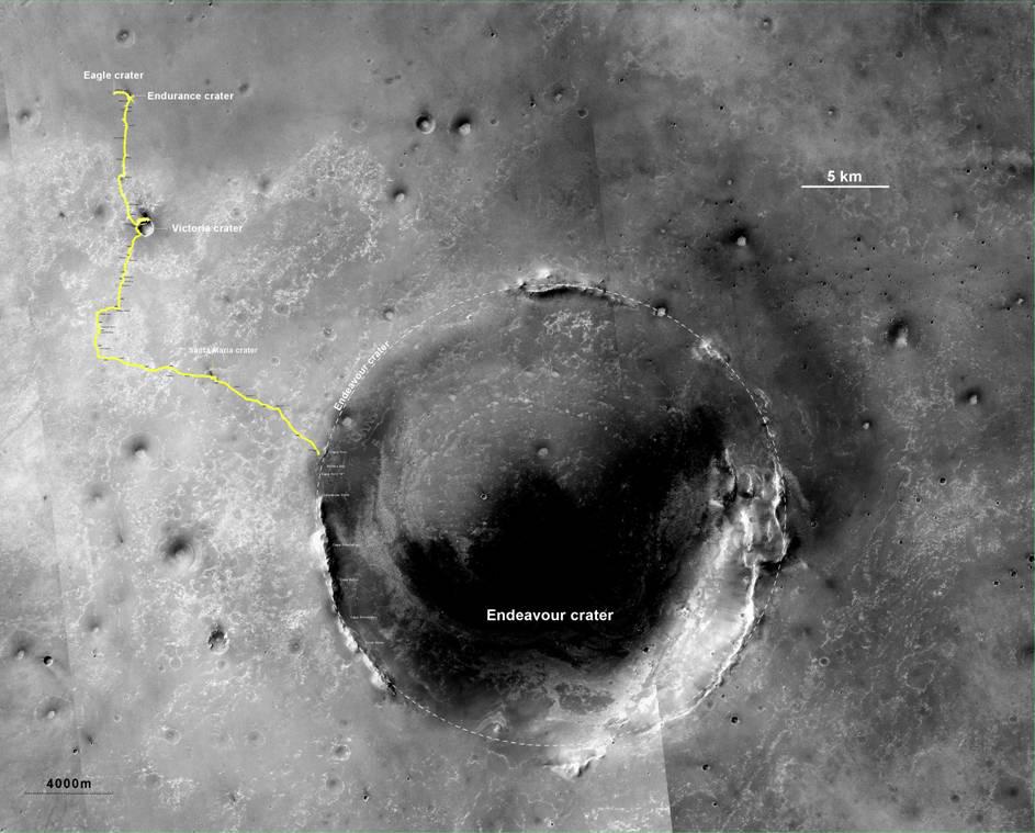
-
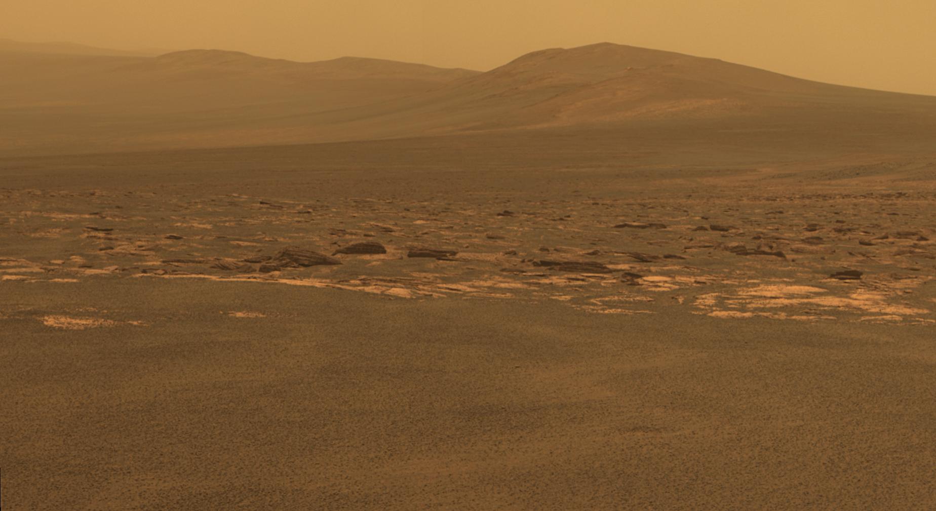
PIA14504:
-
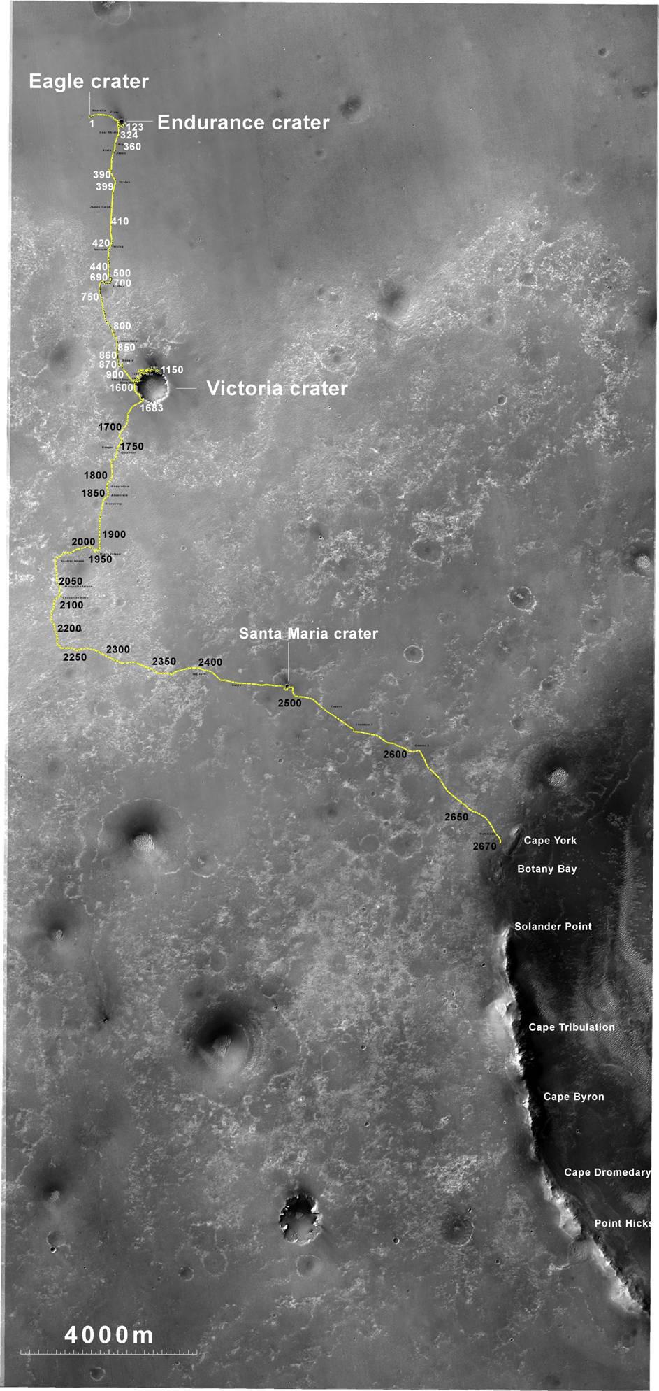
Opportunity's Route to Endeavour Crater
Full Resolution:
TIFF
(5.635 MB)
JPEG
(260 kB)
|
|
|
2011-08-05 |
Mars
|
Mars Exploration Rover (MER)
|
CTX
|
943x759x3 |
|
-
PIA14505:
-
Opportunity's Route to Endeavour Crater (Wide View)
Full Resolution:
TIFF
(2.15 MB)
JPEG
(101 kB)
|
|
|
2011-08-08 |
Mars
|
2001 Mars Odyssey
|
THEMIS
|
1412x2842x1 |

|
-
PIA14519:
-
Dunes in Aonia Planum
Full Resolution:
TIFF
(4.018 MB)
JPEG
(250 kB)
|
|
|
2011-08-08 |
Mars
|
Mars Exploration Rover (MER)
|
Panoramic Camera
|
2908x1246x1 |
|
-
PIA14506:
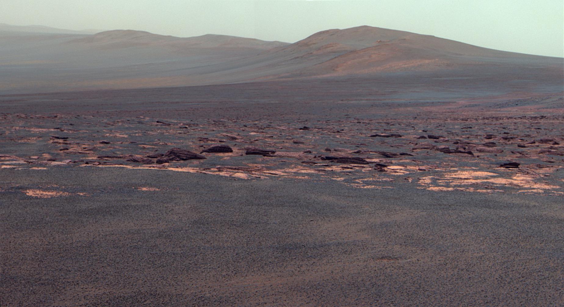
-
Opportunity's View Approaching Rim of Endeavour
Full Resolution:
TIFF
(3.629 MB)
JPEG
(510.5 kB)
|
|
|
2011-08-09 |
Mars
|
2001 Mars Odyssey
|
THEMIS
|
1363x2945x1 |
|
-
PIA14520:
-
Samara Valles
Full Resolution:
TIFF
(4.018 MB)
JPEG
(408.6 kB)
|
|
|
2011-08-10 |
Mars
|
2001 Mars Odyssey
|
THEMIS
|
1273x2762x1 |
|
-
PIA14521:
-
Ascraeus Mons
Full Resolution:
TIFF
(3.52 MB)
JPEG
(510.1 kB)
|
|
|
2011-08-10 |
Mars
|
Mars Exploration Rover (MER)
|
Panoramic Camera
|
1848x1009x3 |
|
-
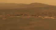
PIA14507:
-
West Rim of Endeavour Crater on Mars (False Color)
Full Resolution:
TIFF
(5.602 MB)
JPEG
(242.4 kB)
|
|
|
2011-08-10 |
Mars
|
Mars Exploration Rover (MER)
|
Panoramic Camera
|
1848x1009x3 |
|
-
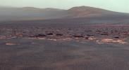
PIA14508:
-
West Rim of Endeavour Crater on Mars
Full Resolution:
TIFF
(5.602 MB)
JPEG
(167.1 kB)
|
|
|
2011-08-10 |
Mars
|
Mars Exploration Rover (MER)
|
Panoramic Camera
|
4383x1200x1 |
|
-
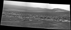
PIA14509:
Arrival at 'Spirit Point' by Mars Rover Opportunity
Full Resolution:
TIFF
(5.269 MB)
JPEG
(448.8 kB)
|
|
|
2011-08-10 |
Mars
|
Mars Exploration Rover (MER)
|
Panoramic Camera
|
1024x1024x1 |

|
-
PIA14510:
-
Small 'Odyssey' Crater on Rim of Huge 'Endeavour' Crater
Full Resolution:
TIFF
(1.05 MB)
JPEG
(286.7 kB)
|
|
|
2011-08-11 |
Mars
|
2001 Mars Odyssey
|
THEMIS
|
1356x2793x1 |

|
-
PIA14522:
-
Channels
Full Resolution:
TIFF
(3.791 MB)
JPEG
(451.3 kB)
|
|
|
2011-08-12 |
Mars
|
2001 Mars Odyssey
|
THEMIS
|
1381x2777x1 |

|
-
PIA14523:
-
Valles Marineris
Full Resolution:
TIFF
(3.84 MB)
JPEG
(209 kB)
|
|
|
2011-08-15 |
Mars
|
Mars Exploration Rover (MER)
|
Navigation Camera
|
6767x1169x3 |
|
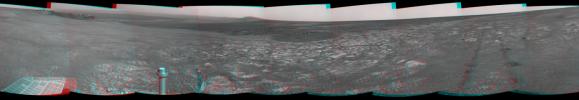
-
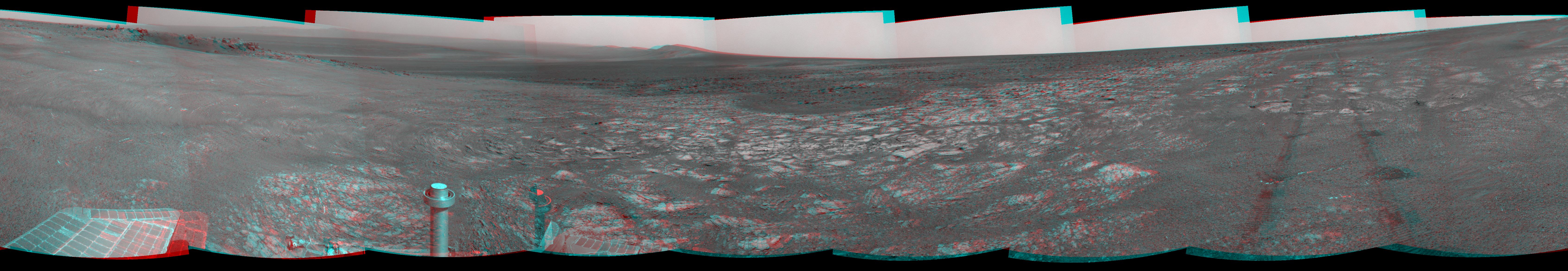
PIA14531:
'Spirit Point' Vista from Opportunity, in Stereo
Full Resolution:
TIFF
(23.73 MB)
JPEG
(1.008 MB)
|
|
|
2011-08-15 |
Mars
|
2001 Mars Odyssey
|
THEMIS
|
1333x2817x1 |

|
-
PIA14524:
-
Coracis Fossae
Full Resolution:
TIFF
(3.759 MB)
JPEG
(458.8 kB)
|
|
|
2011-08-16 |
Mars
|
2001 Mars Odyssey
|
THEMIS
|
1315x2923x1 |
|
-
PIA14525:
-
Windstreaks
Full Resolution:
TIFF
(3.848 MB)
JPEG
(498.5 kB)
|
|
|
2011-08-17 |
Mars
|
2001 Mars Odyssey
|
THEMIS
|
1346x2787x1 |
|
-
PIA14526:
-
Windstreak
Full Resolution:
TIFF
(3.755 MB)
JPEG
(555.9 kB)
|
|
|
2011-08-18 |
Mars
|
2001 Mars Odyssey
|
THEMIS
|
666x1471x1 |
|
-
PIA14527:
-
Daedalia Planum
Full Resolution:
TIFF
(980.9 kB)
JPEG
(182.1 kB)
|
|
|
2011-08-19 |
Mars
|
Mars Exploration Rover (MER)
|
Panoramic Camera
|
650x410x1 |

|
-
PIA14532:
-
'Ridout' Rock on Rim of Odyssey Crater
Full Resolution:
TIFF
(267 kB)
JPEG
(43.24 kB)
|
|
|
2011-08-19 |
Mars
|
Mars Exploration Rover (MER)
|
Panoramic Camera
|
1024x1024x1 |
|
-
PIA14533:
-
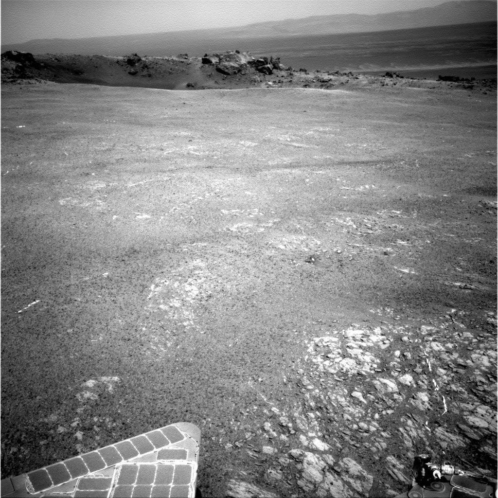
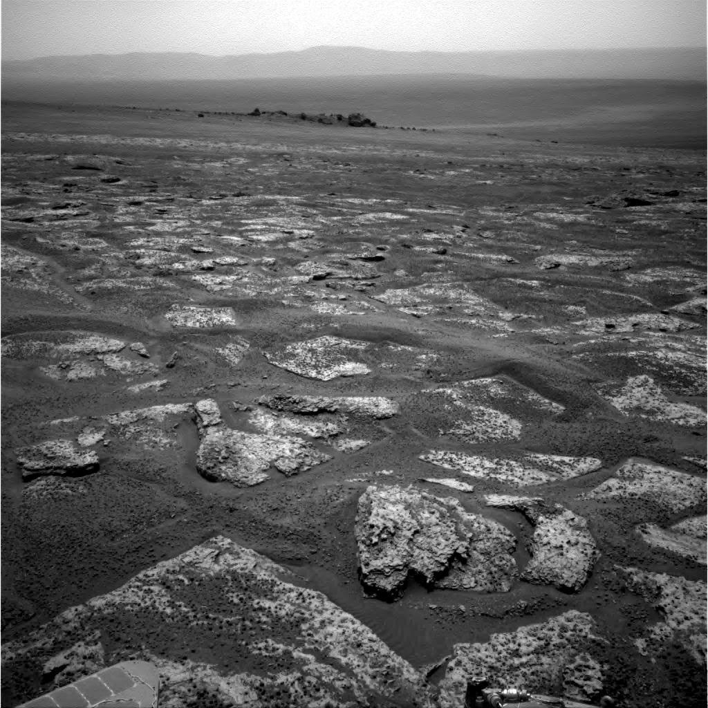
On Different Ground: Soil on Endeavour Rim
Full Resolution:
TIFF
(1.05 MB)
JPEG
(299.6 kB)
|
|
|
2011-08-19 |
Mars
|
Mars Exploration Rover (MER)
|
Panoramic Camera
|
1024x1024x1 |
|
-
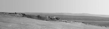
PIA14534:
-
View Across Endeavour Crater
Full Resolution:
TIFF
(1.05 MB)
JPEG
(167.3 kB)
|
|
|
2011-08-19 |
Mars
|
Mars Exploration Rover (MER)
|
Panoramic Camera
|
1024x1024x1 |
|
-
PIA14535:
-
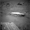
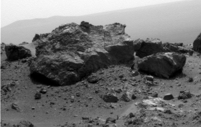
'Tisdale 2' Rock, Next Stop for Opportunity
Full Resolution:
TIFF
(1.05 MB)
JPEG
(300.5 kB)
|
|
|
2011-08-22 |
Mars
|
2001 Mars Odyssey
|
THEMIS
|
678x1470x1 |
|
-
PIA14559:
-
Margaritifer Terra
Full Resolution:
TIFF
(997.9 kB)
JPEG
(131.3 kB)
|
|
|
2011-08-23 |
Mars
|
2001 Mars Odyssey
|
THEMIS
|
976x2776x1 |
|
-
PIA14560:
-
South Polar Surface
Full Resolution:
TIFF
(2.712 MB)
JPEG
(286 kB)
|
|
|
2011-08-24 |
Mars
|
2001 Mars Odyssey
|
THEMIS
|
1372x2959x1 |

|
-
PIA14561:
-
Landslides in Terra Sirenum
Full Resolution:
TIFF
(4.065 MB)
JPEG
(324.9 kB)
|
|
|
2011-08-25 |
Mars
|
2001 Mars Odyssey
|
THEMIS
|
1354x2778x1 |
|
-
PIA14562:
-
Channel
Full Resolution:
TIFF
(3.765 MB)
JPEG
(584.3 kB)
|
|
|
2011-08-26 |
Mars
|
2001 Mars Odyssey
|
THEMIS
|
1086x2939x1 |

|
-
PIA14563:
-
Dust Devil Tracks
Full Resolution:
TIFF
(3.195 MB)
JPEG
(412.4 kB)
|
|
|
2011-08-29 |
Mars
|
2001 Mars Odyssey
|
THEMIS
|
1382x2935x1 |
|
-
PIA14564:
-
Valles Marineris Canyon
Full Resolution:
TIFF
(4.061 MB)
JPEG
(247.3 kB)
|
|
|
2011-08-30 |
Mars
|
2001 Mars Odyssey
|
THEMIS
|
1385x2842x1 |

|
-
PIA14565:
-
Small Dunes
Full Resolution:
TIFF
(3.941 MB)
JPEG
(279.4 kB)
|
|
|
2011-09-01 |
Mars
|
Mars Exploration Rover (MER)
Mars Reconnaissance Orbiter (MRO)
|
CTX
|
5664x7979x3 |
|
-
PIA14536:
-
Opportunity Traverses Through 2,700 Martian Days
Full Resolution:
TIFF
(45.26 MB)
JPEG
(6.766 MB)
|
|
|
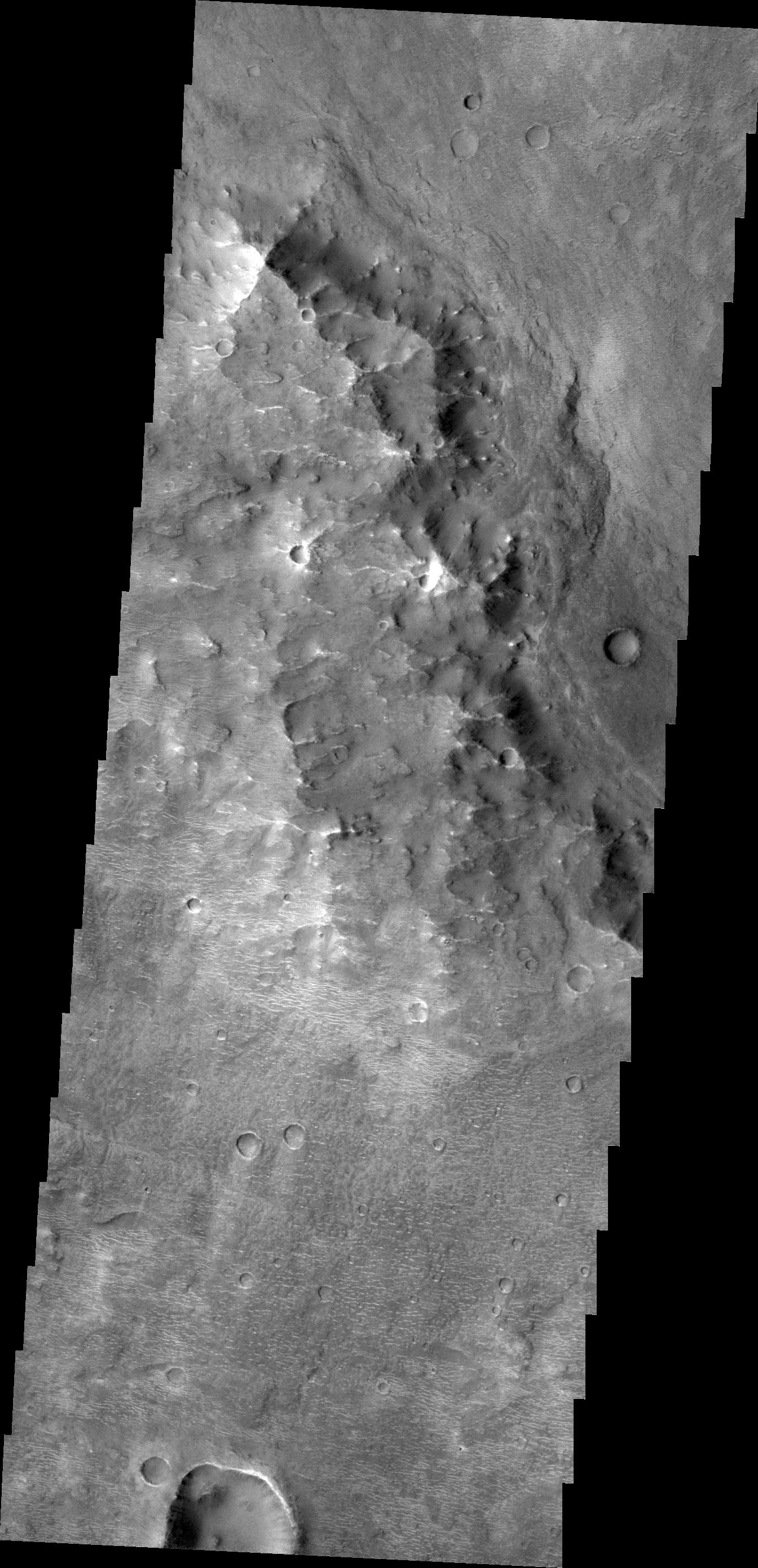
2011-09-01 |
Mars
|
Mars Exploration Rover (MER)
Mars Reconnaissance Orbiter (MRO)
|
HiRISE
|
8192x5786x3 |
|
-
PIA14537:
-
Opportunity's First Neighborhood on Rim of Endeavour
Full Resolution:
TIFF
(142.2 MB)
JPEG
(5.631 MB)
|
|
|
2011-09-01 |
Mars
|
Mars Exploration Rover (MER)
|
Navigation Camera
|
8192x4843x1 |

|
-
PIA14538:
-
Opportunity's View Across 'Botany Bay' and Endeavour on Sol 2678
Full Resolution:
TIFF
(39.71 MB)
JPEG
(3.319 MB)
|
|
|
2011-09-01 |
Mars
|
Mars Exploration Rover (MER)
|
Navigation Camera
|
8192x4809x1 |
|
-
PIA14539:
-
Bright Veins in 'Botany Bay' on rim of Endeavour Crater on Mars
Full Resolution:
TIFF
(39.43 MB)
JPEG
(3.268 MB)
|
|
|
2011-09-01 |
Mars
|
Mars Exploration Rover (MER)
|
Panoramic Camera
|
1024x1024x3 |
|
-
PIA14540:
-
Rock 'Tisdale 2' on Endeavour Crater Rim (False Color)
Full Resolution:
TIFF
(3.15 MB)
JPEG
(324.2 kB)
|
|
|
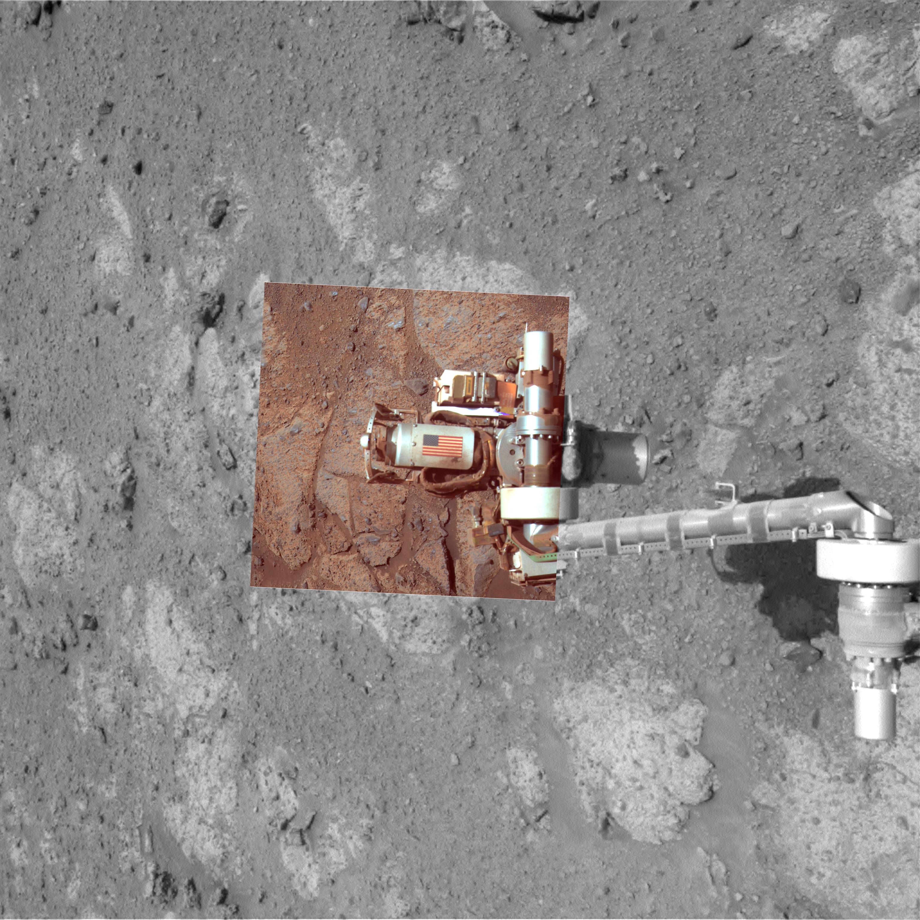
2011-09-01 |
Mars
|
Mars Exploration Rover (MER)
|
Microscopic Imager
Panoramic Camera
|
7680x7671x3 |
|
-
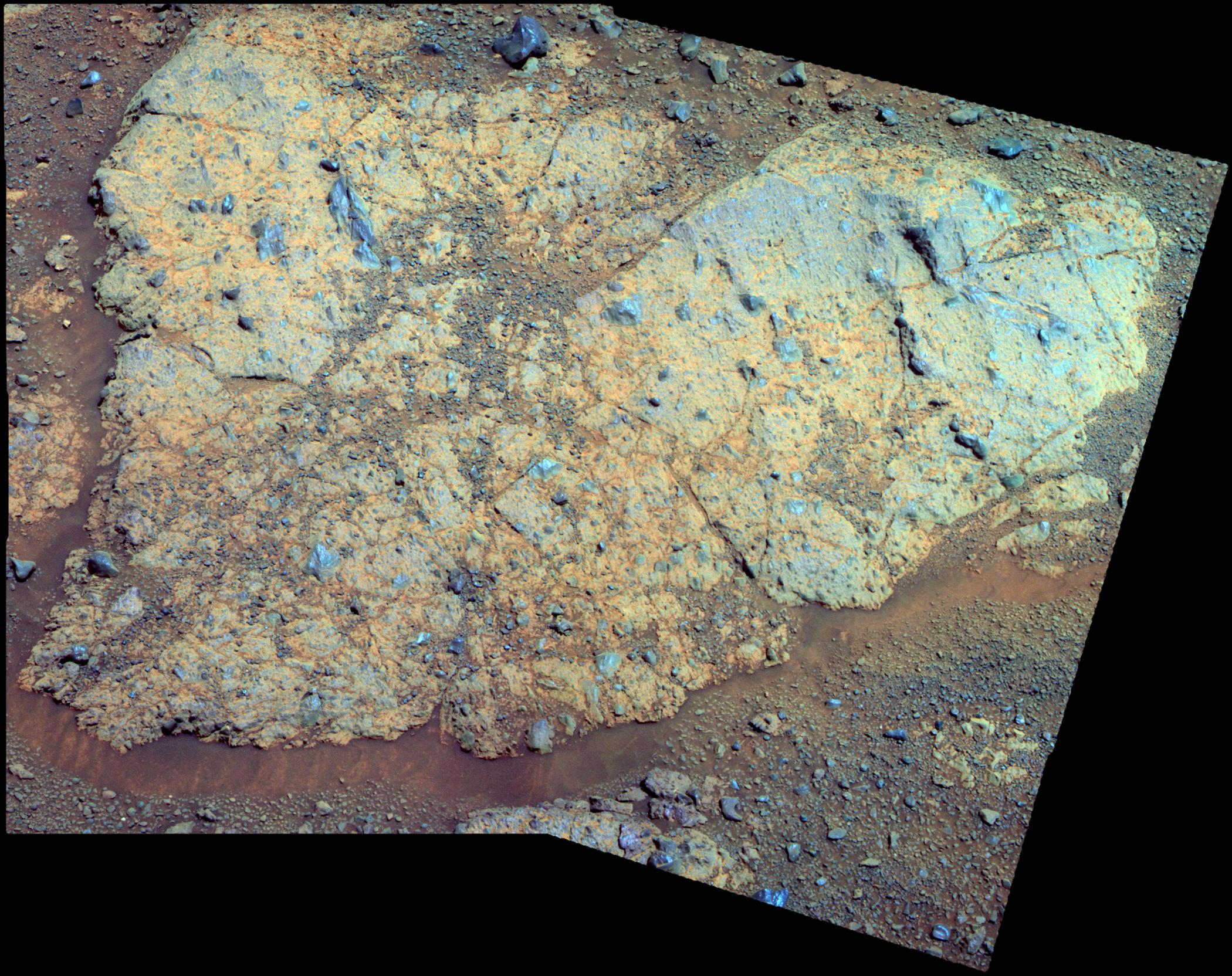
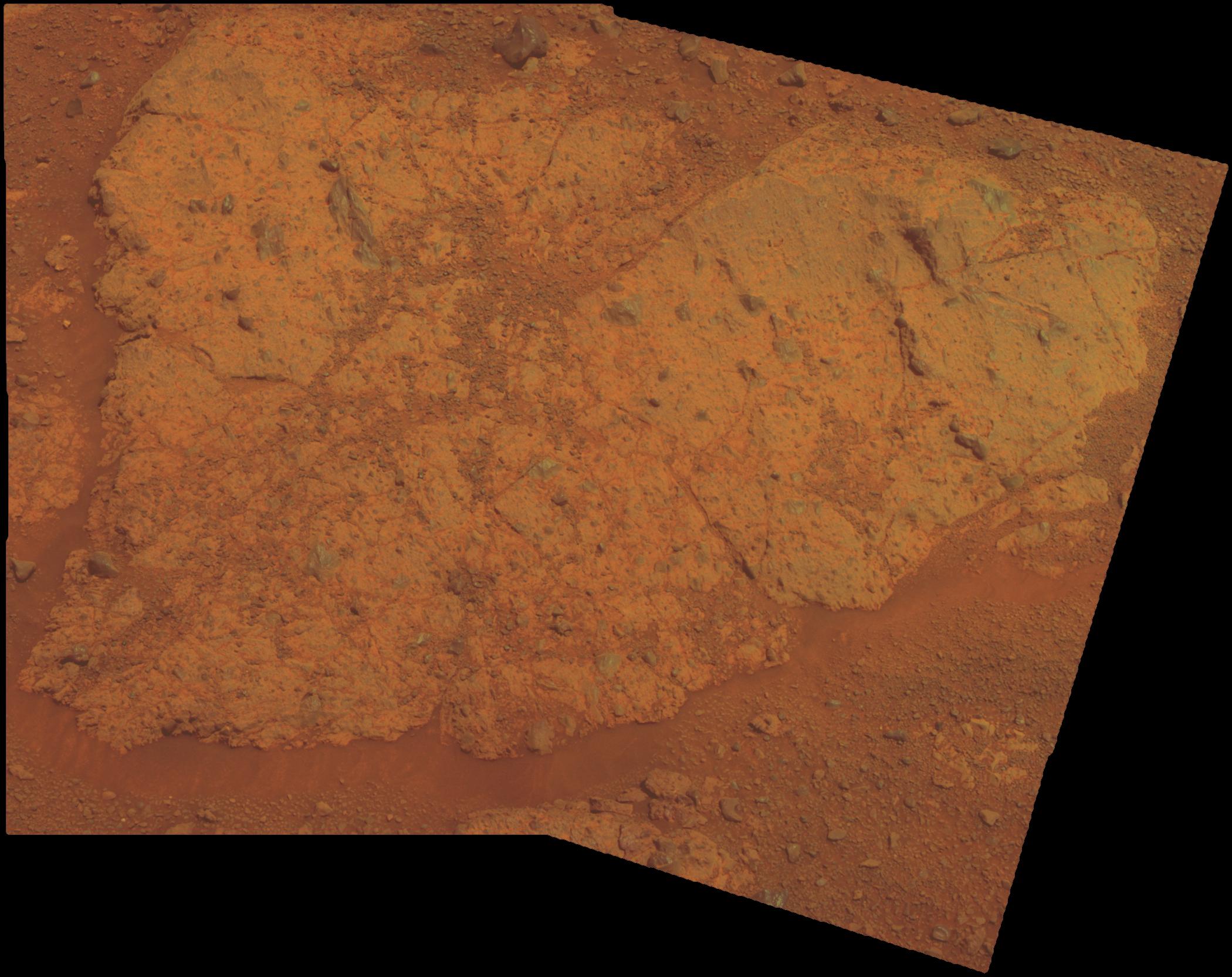
PIA14745:
-
Locations of Microscopic Imager Observations on 'Tisdale 2'
Full Resolution:
TIFF
(176.7 MB)
JPEG
(4.45 MB)
|
|
|
2011-09-01 |
Mars
|
Mars Exploration Rover (MER)
|
Microscopic Imager
|
6621x6488x1 |
|
-
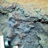
PIA14746:
-
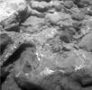
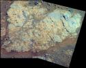
Magnified View of Texture on Part of "Tisdale 2" Rock
Full Resolution:
TIFF
(43.01 MB)
JPEG
(2.786 MB)
|
|
|
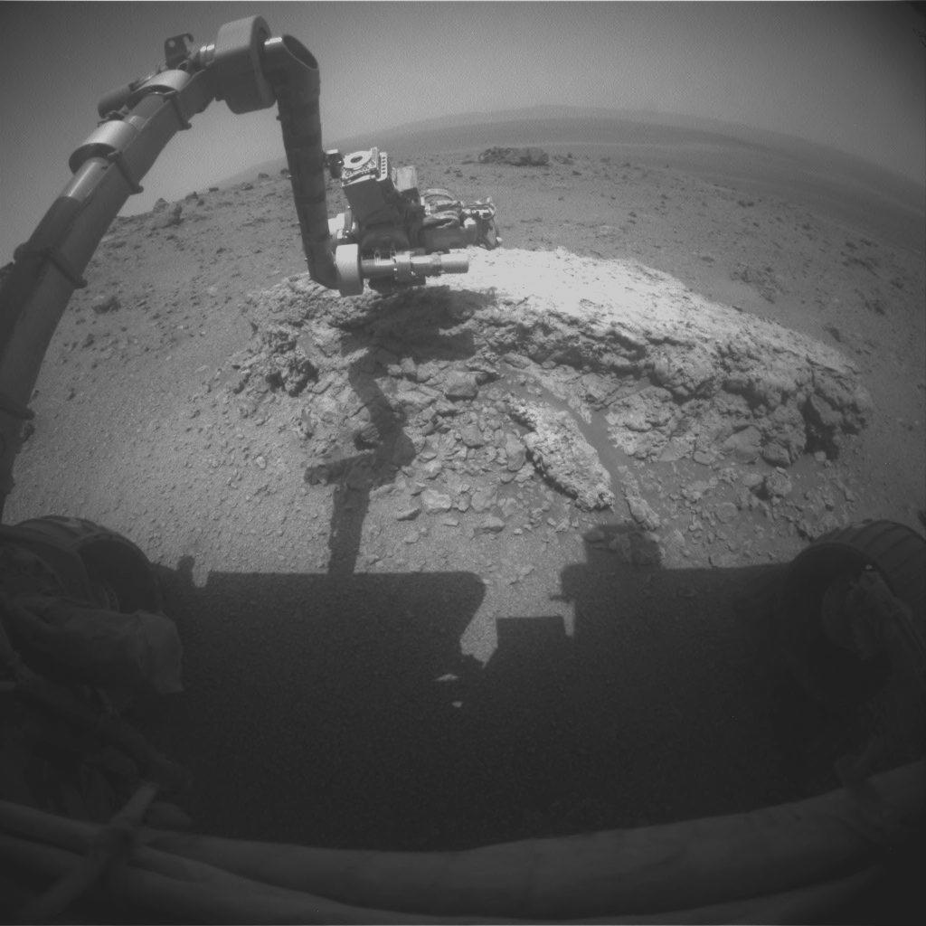
2011-09-01 |
Mars
|
Mars Exploration Rover (MER)
|
Alpha Particle X-ray Spectrometer
|
934x673x3 |
|
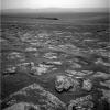
-
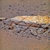
PIA14747:
-
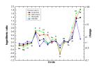
Elevated Zinc and Bromine in Rock on Endeavour Rim
Full Resolution:
TIFF
(631 kB)
JPEG
(64.27 kB)
|
|
|
2011-09-01 |
Mars
|
Mars Exploration Rover (MER)
|
Navigation Camera
|
1024x1024x1 |
|
-
PIA14748:
-
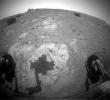
Approaching 'Tisdale 2' Rock on Rim of Endeavour Crater, Sol 2690
Full Resolution:
TIFF
(1.05 MB)
JPEG
(192.7 kB)
|
|
|
2011-09-01 |
Mars
|
Mars Exploration Rover (MER)
|
Hazcam
|
1024x1024x1 |

|
-
PIA14749:
-
Opportunity at Work Examining 'Tisdale 2,' Sol 2695
Full Resolution:
TIFF
(1.05 MB)
JPEG
(100.3 kB)
|
|
|
2011-09-05 |
Mars
|
2001 Mars Odyssey
|
THEMIS
|
652x1467x1 |
|
-
PIA14566:
-
Arsia Mons Flows
Full Resolution:
TIFF
(957.7 kB)
JPEG
(167.7 kB)
|
|
|
2011-09-06 |
Mars
|
2001 Mars Odyssey
|
THEMIS
|
1344x2782x1 |

|
-
PIA14567:
-
Small Dunes
Full Resolution:
TIFF
(3.743 MB)
JPEG
(450.3 kB)
|
|
|
2011-09-07 |
Mars
|
2001 Mars Odyssey
|
THEMIS
|
1328x2815x1 |
|
-
PIA14568:
-
Claritas Fossae
Full Resolution:
TIFF
(3.742 MB)
JPEG
(417.5 kB)
|
|
|
2011-09-08 |
Mars
|
2001 Mars Odyssey
|
THEMIS
|
678x1476x1 |
|
-
PIA14569:
-
Terby Crater
Full Resolution:
TIFF
(1.002 MB)
JPEG
(80.28 kB)
|
|
|
2011-09-09 |
Mars
|
2001 Mars Odyssey
|
THEMIS
|
1451x2862x1 |
|
-
PIA14768:
-
Darwin Crater Dunes
Full Resolution:
TIFF
(4.158 MB)
JPEG
(260.6 kB)
|
|
|
2011-09-12 |
Mars
|
Mars Exploration Rover (MER)
|
Navigation Camera
Panoramic Camera
|
3072x3072x3 |

|
-
PIA14750:
-
Memorial Image Taken on Mars on Sept. 11, 2011
Full Resolution:
TIFF
(28.31 MB)
JPEG
(1.098 MB)
|
|
|
2011-09-14 |
Mars
|
2001 Mars Odyssey
|
THEMIS
|
1383x2818x1 |
|
-
PIA14773:
-
Gullies on Argyre Planitia
Full Resolution:
TIFF
(3.902 MB)
JPEG
(327.3 kB)
|
|
|
2011-09-14 |
Mars
|
2001 Mars Odyssey
|
THEMIS
|
1378x2940x1 |

|
-
PIA14774:
-
Ma'adim Valles
Full Resolution:
TIFF
(4.056 MB)
JPEG
(381.9 kB)
|
|
|
2011-09-14 |
Mars
|
Mars Exploration Rover (MER)
|
Hazcam
|
1024x933x1 |
|
-
PIA14751:
-
Shadow Across 'Chester Lake' on Endeavour Rim, Sol 2710
Full Resolution:
TIFF
(956.6 kB)
JPEG
(131.7 kB)
|
|
|
2011-09-14 |
Mars
|
Mars Exploration Rover (MER)
|
Panoramic Camera
|
2100x1664x3 |
|
-
PIA14752:
-
'Chester Lake' Bedrock on Rim of Endeavour Crater (False Color)
Full Resolution:
TIFF
(10.5 MB)
JPEG
(657.4 kB)
|
|
|
2011-09-14 |
Mars
|
Mars Exploration Rover (MER)
|
Panoramic Camera
|
2100x1664x3 |

|
-
PIA14753:
-
'Chester Lake' Bedrock on Rim of Endeavour Crater
Full Resolution:
TIFF
(10.5 MB)
JPEG
(361.7 kB)
|
|
|
2011-09-15 |
Mars
|
2001 Mars Odyssey
|
THEMIS
|
1350x2788x1 |
|
-
PIA14775:
-
Dunes in Briault Crater
Full Resolution:
TIFF
(3.768 MB)
JPEG
(380.1 kB)
|
|
|
2011-09-19 |
Mars
|
2001 Mars Odyssey
|
THEMIS
|
1356x2816x1 |

|
-
PIA14781:
-
Channel near Pulawy Crater
Full Resolution:
TIFF
(3.822 MB)
JPEG
(415.6 kB)
|
|
|
2011-09-20 |
Mars
|
2001 Mars Odyssey
|
THEMIS
|
1435x2957x1 |
|
-
PIA14782:
-
Rabe Crater Dunes
Full Resolution:
TIFF
(4.248 MB)
JPEG
(178.2 kB)
|
|
|
2011-09-21 |
Mars
|
2001 Mars Odyssey
|
THEMIS
|
1349x2771x1 |

|
-
PIA14783:
-
Windstreaks in Syrtis Major Planum
Full Resolution:
TIFF
(3.742 MB)
JPEG
(454.5 kB)
|
|
|
2011-09-22 |
Mars
|
2001 Mars Odyssey
|
THEMIS
|
661x1468x1 |
|
-
PIA14784:
-
Daedalia Planum
Full Resolution:
TIFF
(971.6 kB)
JPEG
(189.9 kB)
|
|
|
2011-09-23 |
Mars
|
2001 Mars Odyssey
|
THEMIS
|
672x1464x1 |
|
-
PIA14785:
-
Juventae Chasma
Full Resolution:
TIFF
(985 kB)
JPEG
(66.49 kB)
|
|
|
2011-10-05 |
Mars
|
Mars Reconnaissance Orbiter (MRO)
|
HiRISE
|
2560x1920x3 |
|
-
PIA14890:
-
Colorful Central Peak in an Unnamed Crater
Full Resolution:
TIFF
(14.76 MB)
JPEG
(581.1 kB)
|
|
|
2011-10-10 |
Mars
|
Mars Exploration Rover (MER)
|
Navigation Camera
|
1024x1024x1 |
|
-
PIA14759:
-
Approaching Endeavour Crater, Sol 2,680
Full Resolution:
TIFF
(1.05 MB)
JPEG
(204.5 kB)
|
|
|
2011-10-11 |
Mars
|
2001 Mars Odyssey
|
THEMIS
|
1378x2780x1 |

|
-
PIA14899:
-
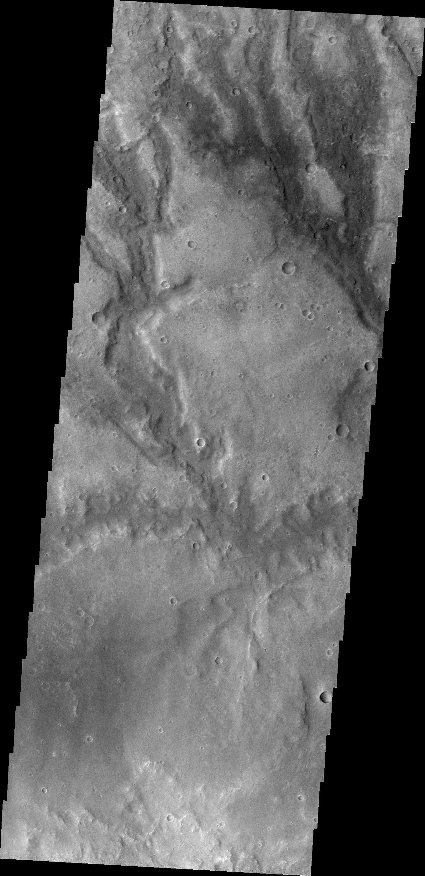
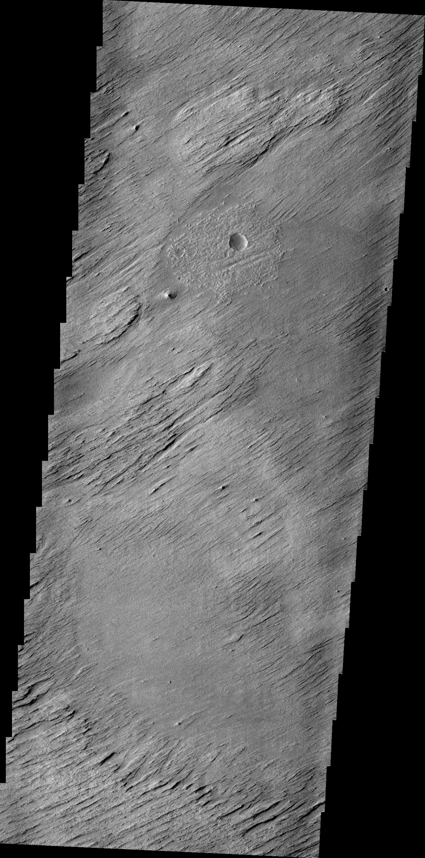
Erosion
Full Resolution:
TIFF
(3.836 MB)
JPEG
(683.3 kB)
|
|
|
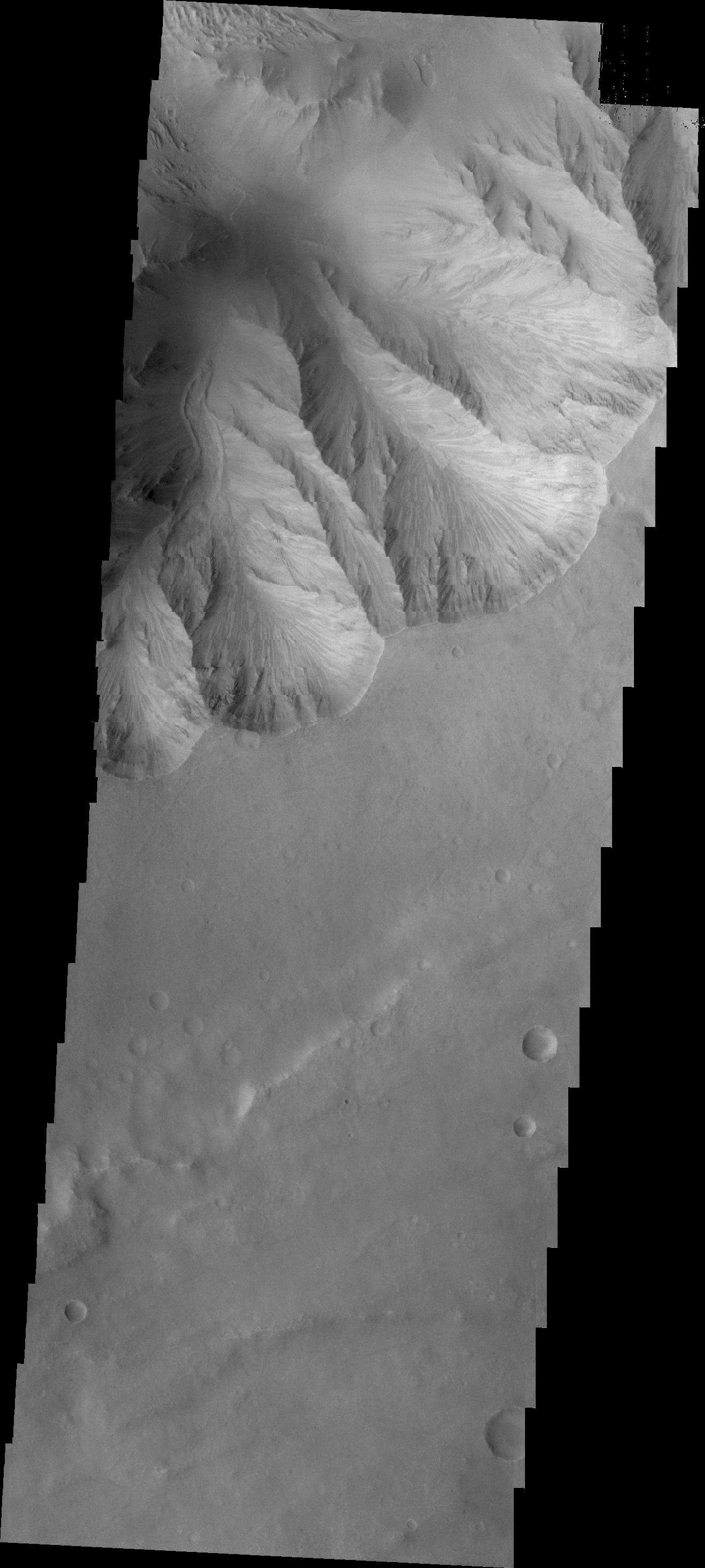
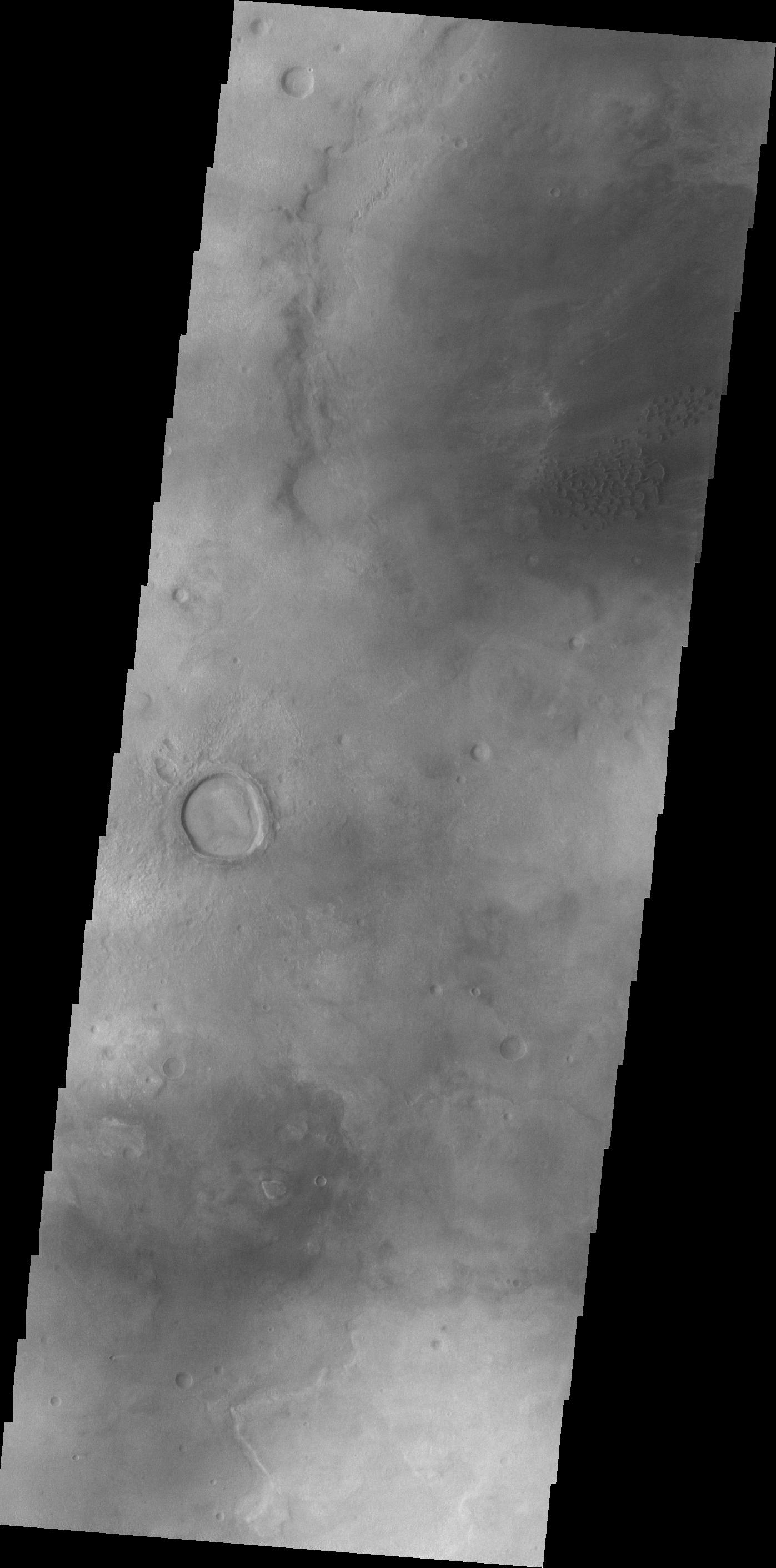
2011-10-12 |
Mars
|
2001 Mars Odyssey
|
THEMIS
|
1413x2958x1 |
|
-
PIA14950:
-
Channel in Tyrrhena Terra
Full Resolution:
TIFF
(4.185 MB)
JPEG
(533.2 kB)
|
|
|
2011-10-13 |
Mars
|
2001 Mars Odyssey
|
THEMIS
|
735x1562x1 |
|
-
PIA14951:
-
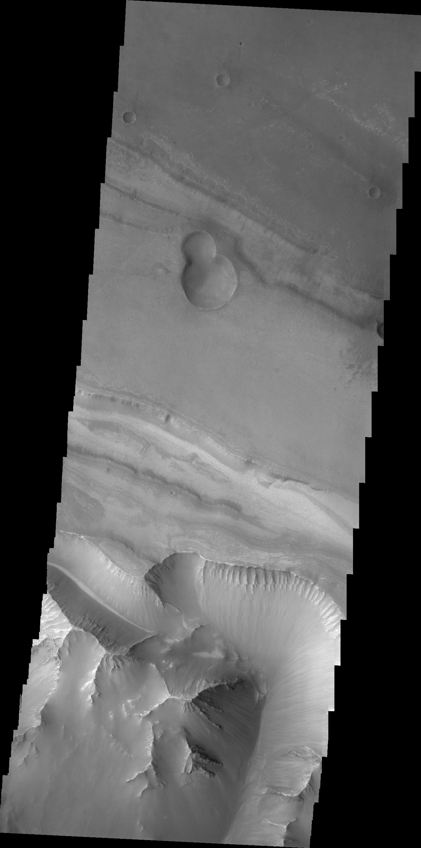
Lava Layers
Full Resolution:
TIFF
(1.149 MB)
JPEG
(128.8 kB)
|
|
|
2011-10-14 |
Mars
|
2001 Mars Odyssey
|
THEMIS
|
1340x2792x1 |
|
-
PIA14952:
-
Mesas of Capri Chasma
Full Resolution:
TIFF
(3.745 MB)
JPEG
(301.2 kB)
|
|
|
2011-10-17 |
Mars
|
2001 Mars Odyssey
|
THEMIS
|
1117x2888x1 |
|
-
PIA14965:
-
Clouds over Charlier Crater
Full Resolution:
TIFF
(3.229 MB)
JPEG
(131.2 kB)
|
|
|
2011-10-18 |
Mars
|
2001 Mars Odyssey
|
THEMIS
|
728x1557x1 |
|
-
PIA14966:
-
Naktong Vallis
Full Resolution:
TIFF
(1.135 MB)
JPEG
(104.8 kB)
|
|
|
2011-10-19 |
Mars
|
2001 Mars Odyssey
|
THEMIS
|
1387x2788x1 |
|
-
PIA14967:
-
Margaritifer Chaos
Full Resolution:
TIFF
(3.872 MB)
JPEG
(369.9 kB)
|
|
|
2011-10-20 |
Mars
|
2001 Mars Odyssey
|
THEMIS
|
1572x3030x1 |

|
-
PIA14968:
-
Darwin Crater Dunes
Full Resolution:
TIFF
(4.768 MB)
JPEG
(341 kB)
|
|
|
2011-10-21 |
Mars
|
2001 Mars Odyssey
|
THEMIS
|
1349x2916x1 |

|
-
PIA14969:
-
Tiu Valles
Full Resolution:
TIFF
(3.938 MB)
JPEG
(420.3 kB)
|
|
|
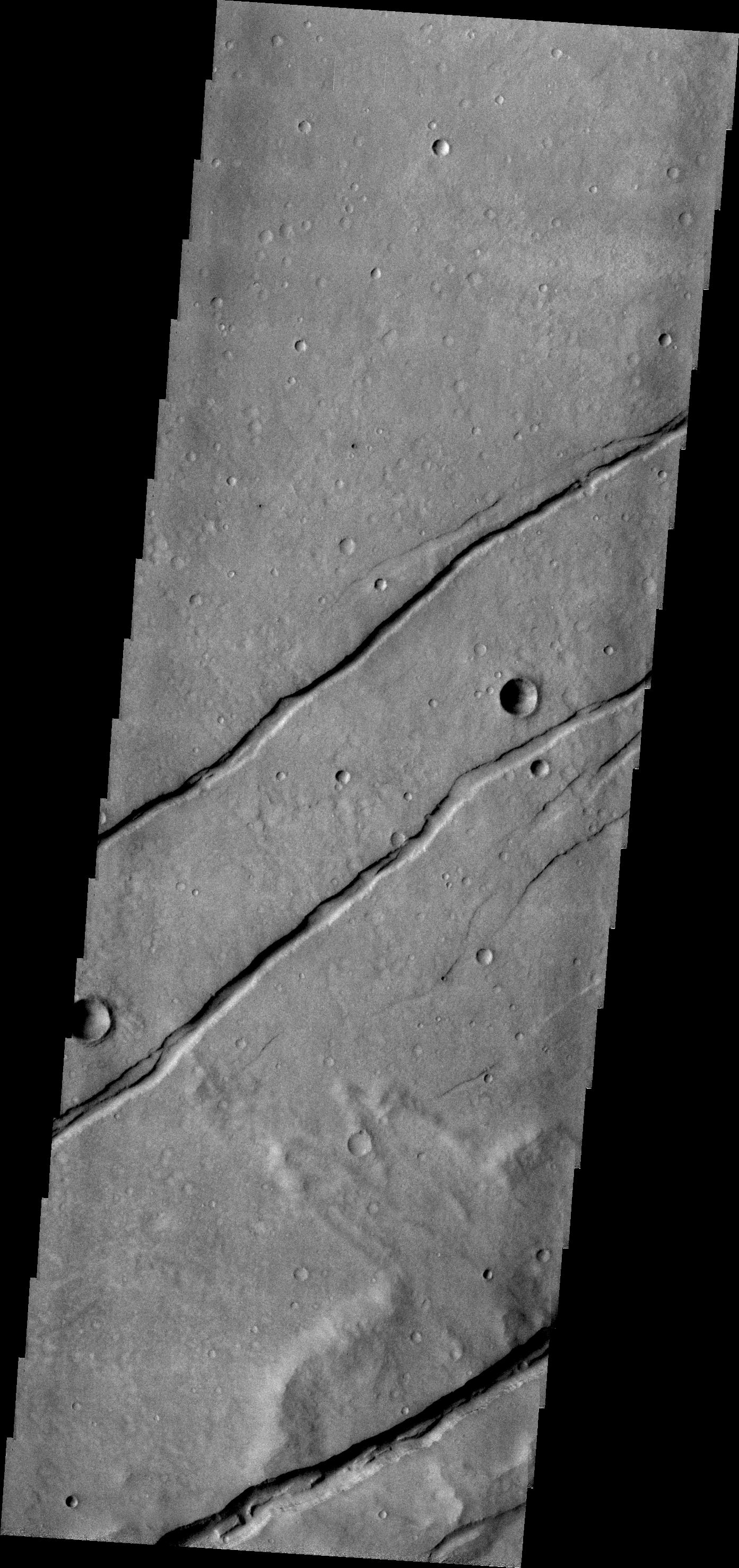
2011-10-24 |
Mars
|
2001 Mars Odyssey
|
THEMIS
|
1384x2801x1 |
|
-
PIA14970:
-
Tectonism
Full Resolution:
TIFF
(3.881 MB)
JPEG
(390.7 kB)
|


