My
List |
Addition Date
|
Target
|
Mission
|
Instrument
|
Size
|

|
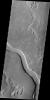
2012-09-11 |
Mars
|
2001 Mars Odyssey
|
THEMIS
|
1382x2920x1 |
|
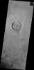
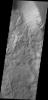
-
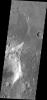
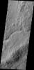
PIA15941:
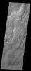
-
Channels
Full Resolution:
TIFF
(4.04 MB)
JPEG
(274.7 kB)
|
|
|
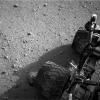
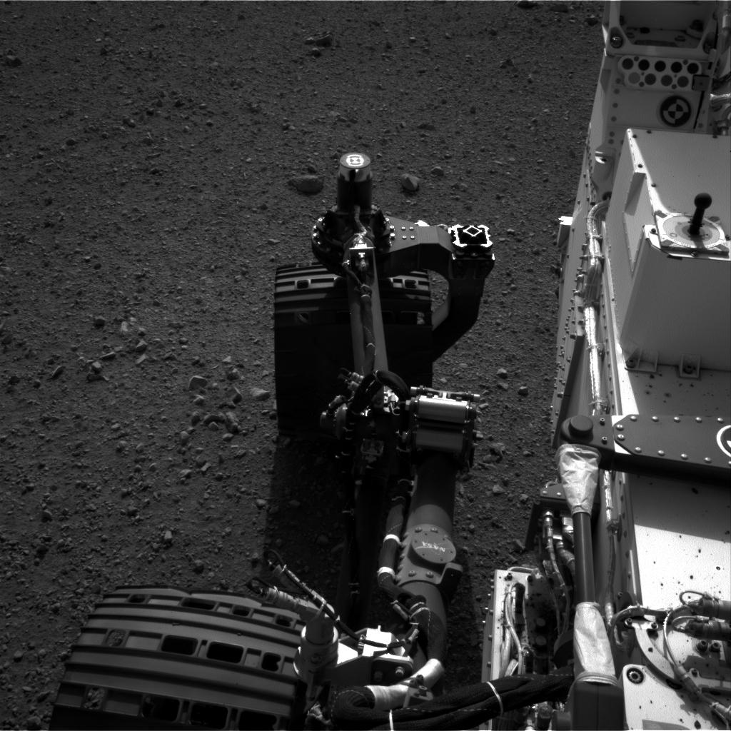
2012-09-10 |
Mars
|
Mars Science Laboratory (MSL)
|
MAHLI
|
5768x2624x3 |
|
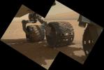
-
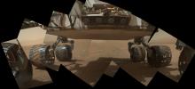
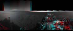
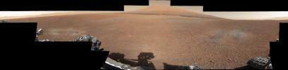
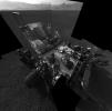
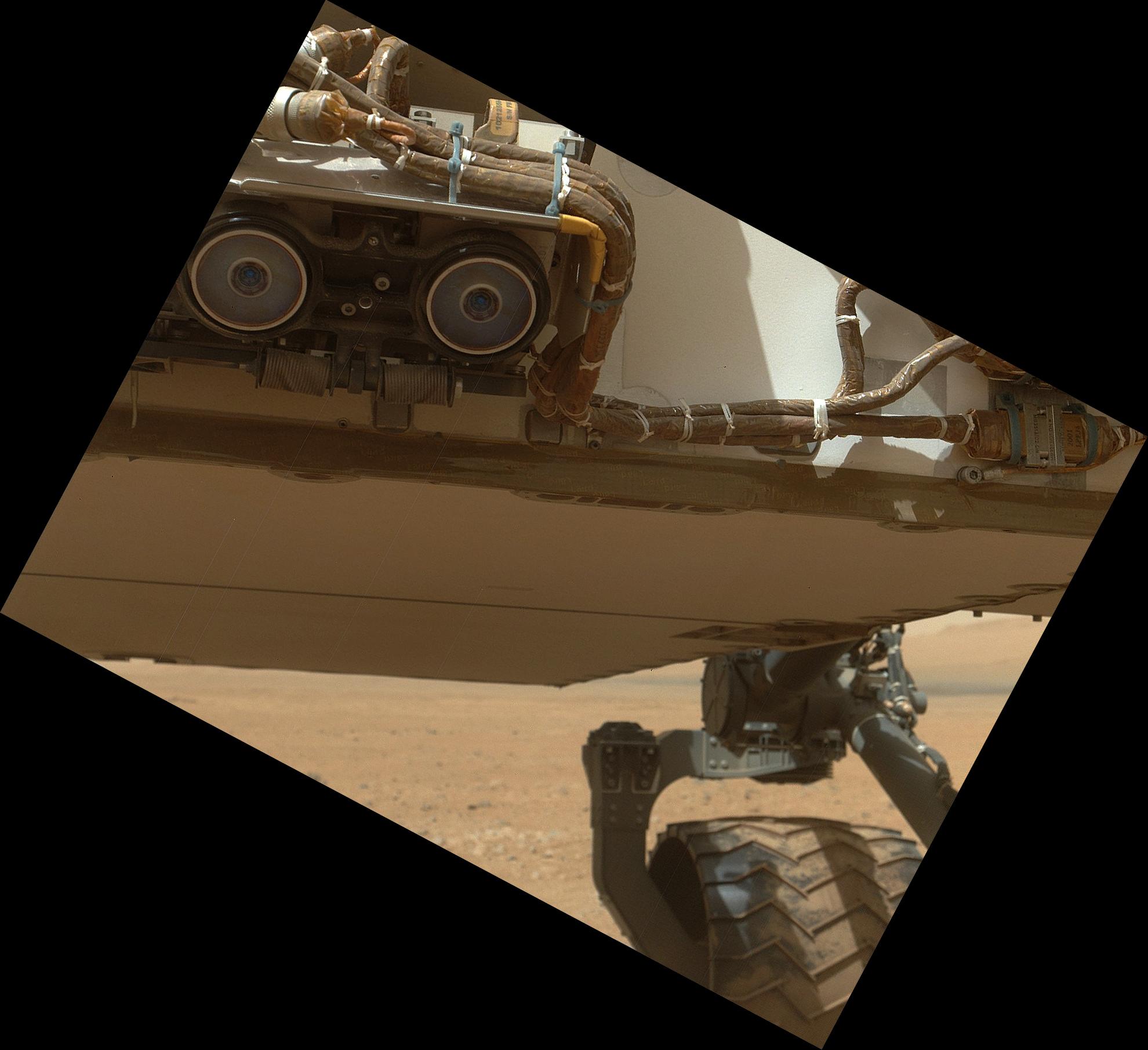
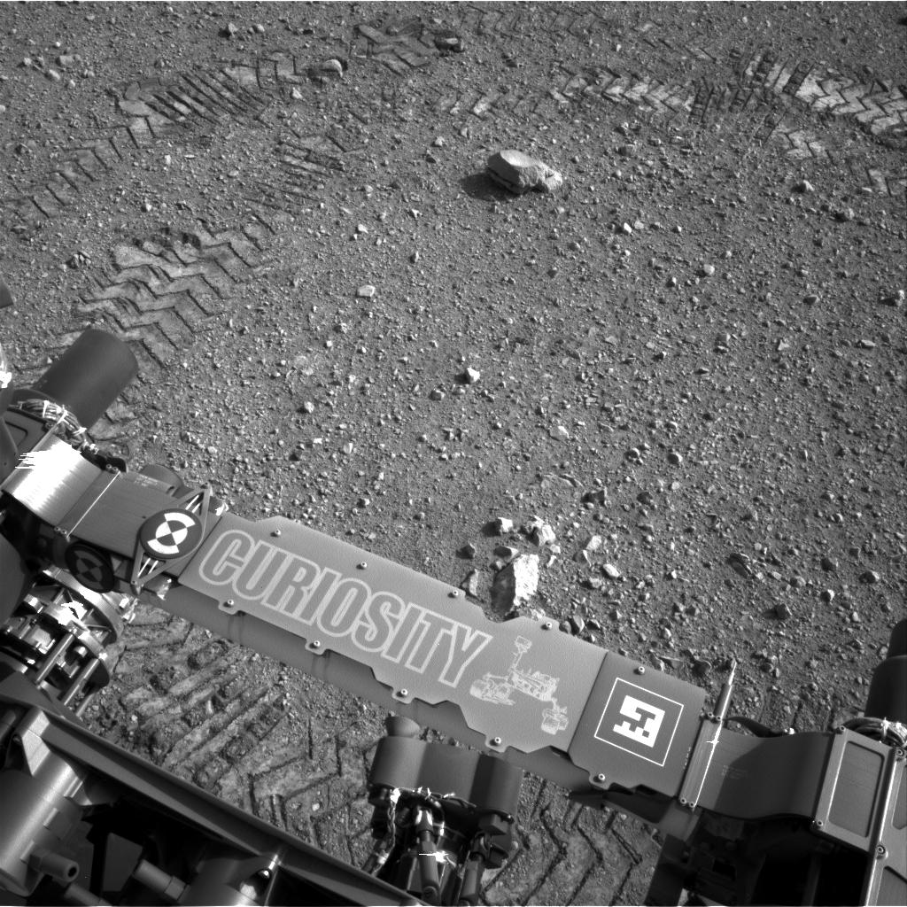
PIA16137:
-
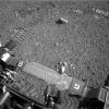
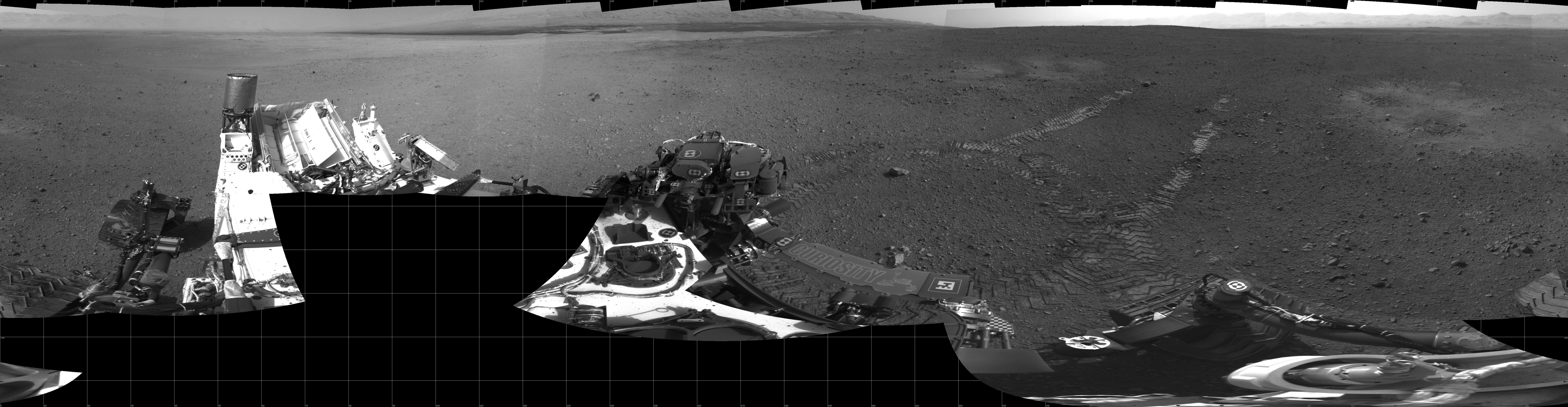
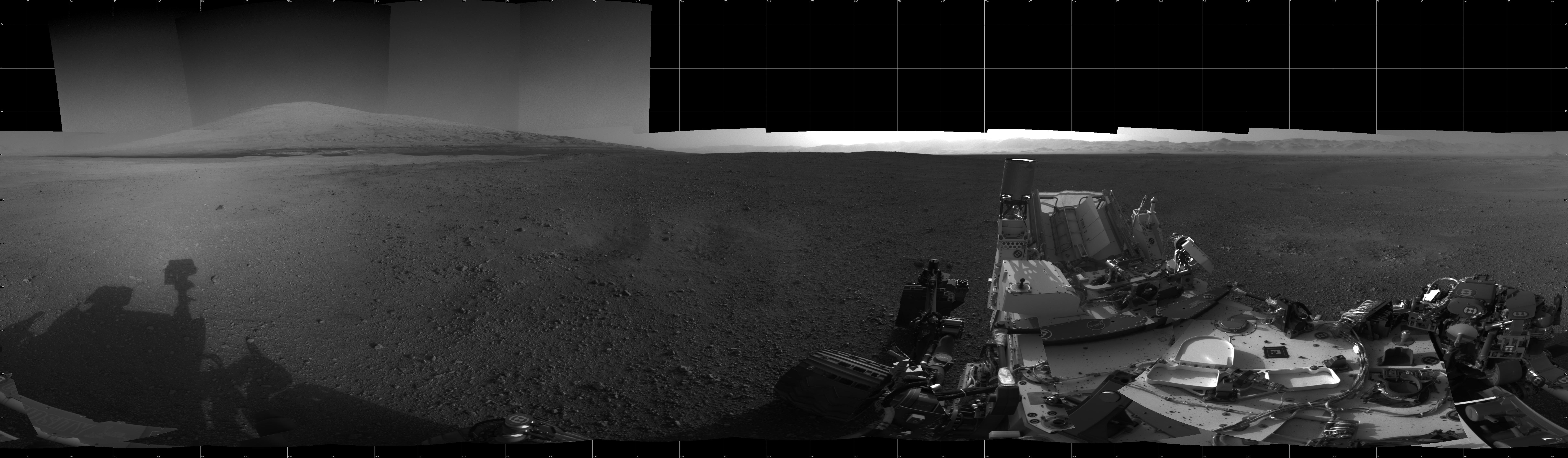
Panorama of Curiosity's Belly Check
Full Resolution:
TIFF
(45.43 MB)
JPEG
(934.1 kB)
|
|
|
2012-09-10 |
Mars
|
Mars Science Laboratory (MSL)
|
MAHLI
|
2023x1876x3 |
|
-
PIA16136:
-
A Piece of New Mexico on Mars
Full Resolution:
TIFF
(11.39 MB)
JPEG
(408.7 kB)
|
|
|
2012-09-10 |
Mars
|
Mars Science Laboratory (MSL)
|
MAHLI
|
1988x1839x3 |
|
-
PIA16135:
-
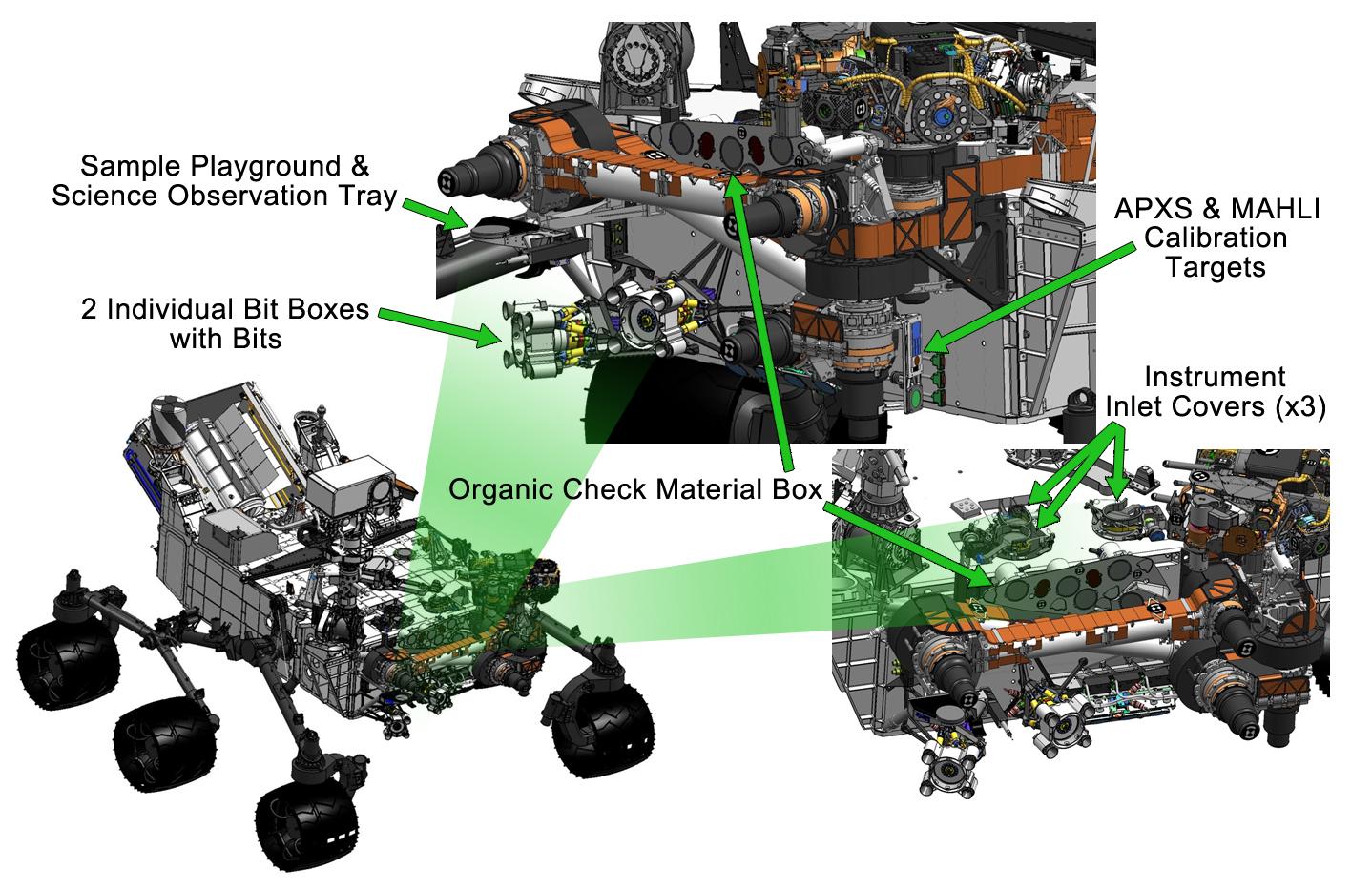
Sealed Organic Check Material on Curiosity
Full Resolution:
TIFF
(10.97 MB)
JPEG
(235.8 kB)
|
|
|
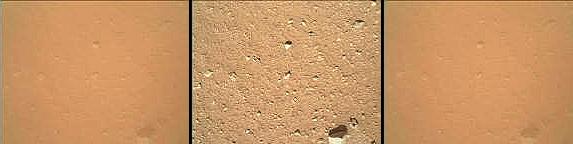
2012-09-10 |
Mars
|
2001 Mars Odyssey
|
THEMIS
|
1449x2950x1 |
|
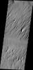
-
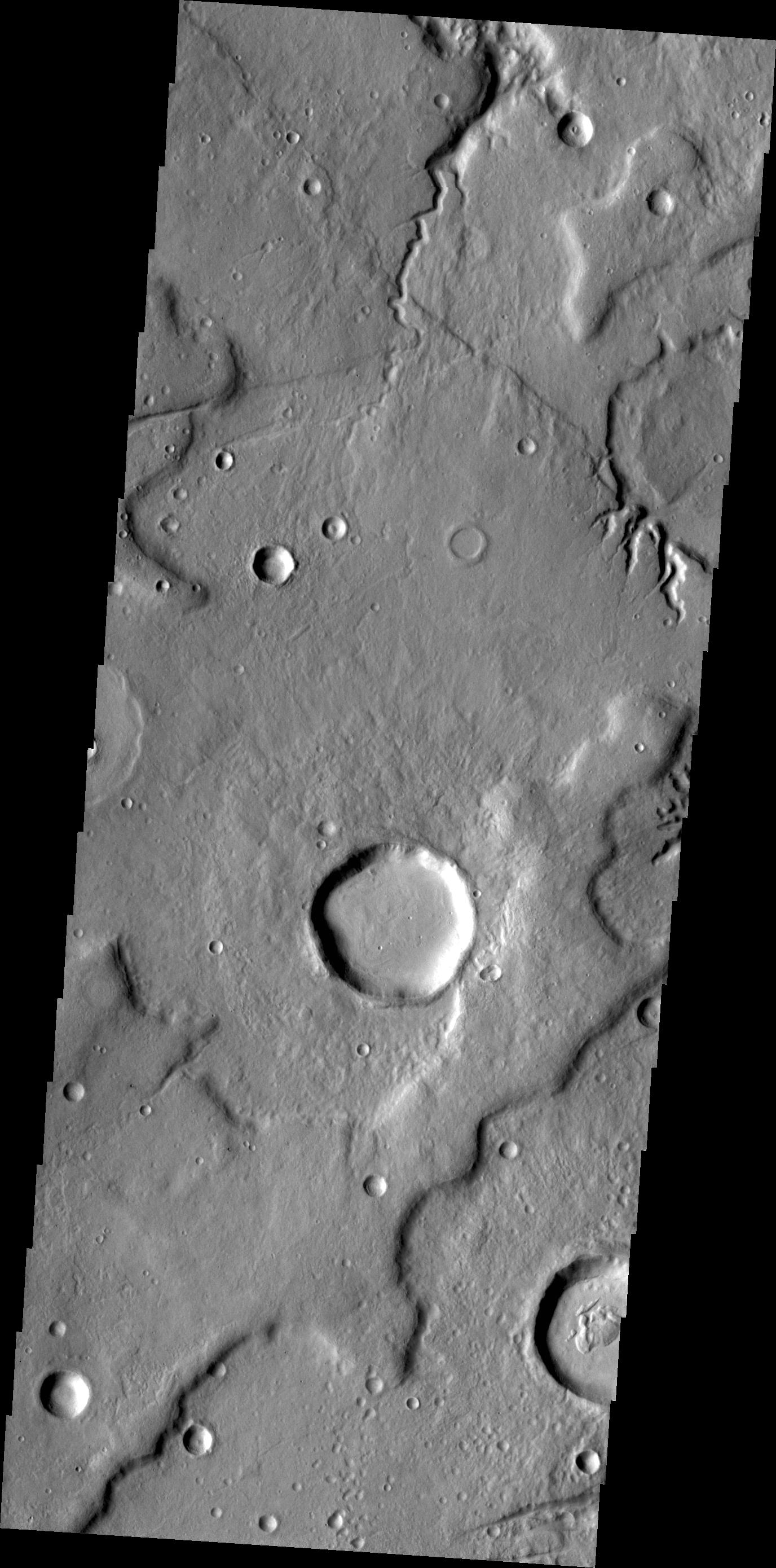
PIA15940:
-
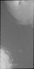
Dust Devil Tracks
Full Resolution:
TIFF
(4.279 MB)
JPEG
(315.7 kB)
|
|
|
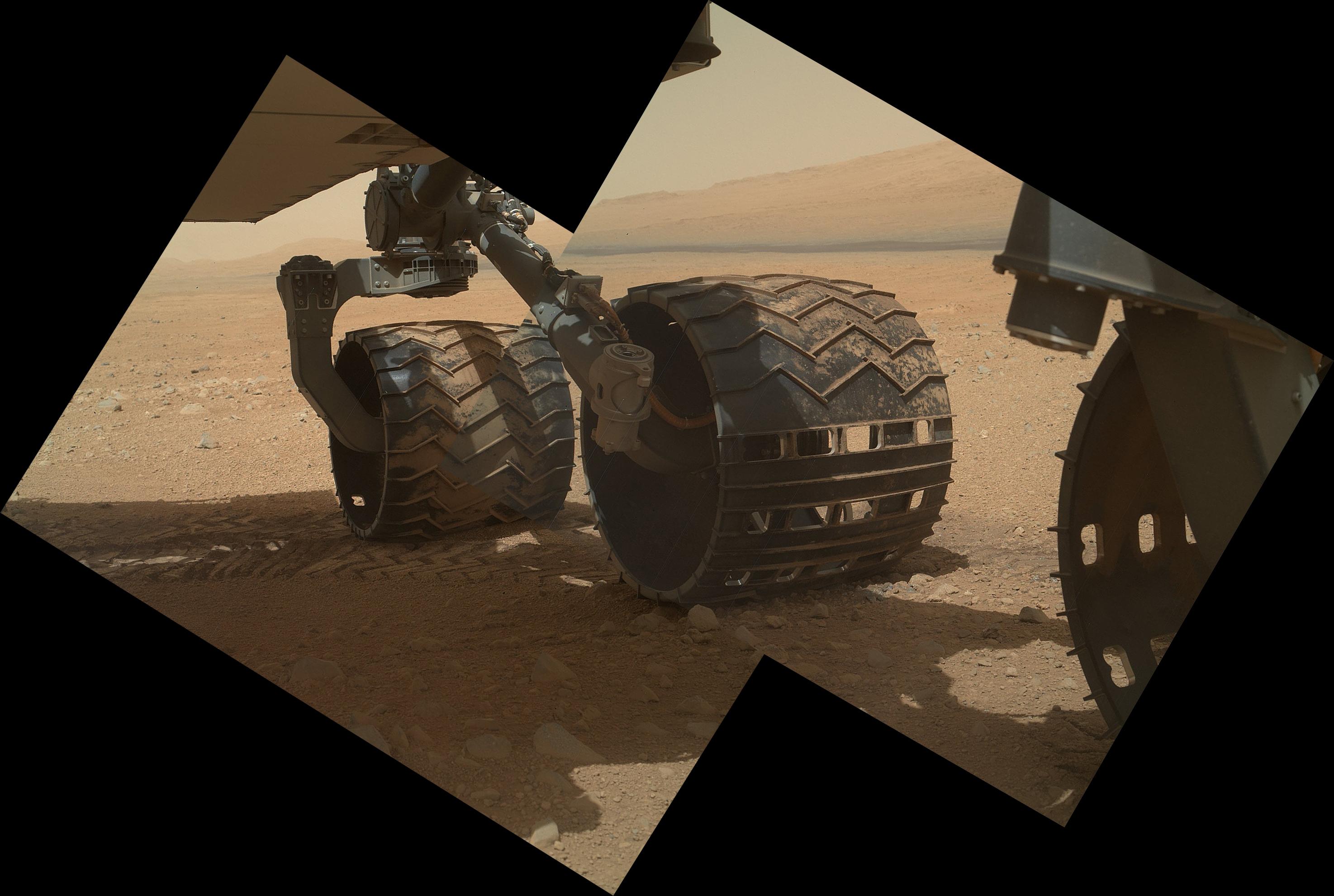
2012-09-10 |
Mars
|
Mars Science Laboratory (MSL)
|
MAHLI
|
2949x1981x3 |
|
-
PIA16134:
-
Wheels and a Destination
Full Resolution:
TIFF
(17.53 MB)
JPEG
(453.3 kB)
|
|
|
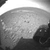
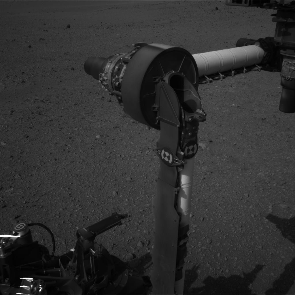
2012-09-10 |
Mars
|
Mars Science Laboratory (MSL)
|
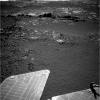
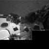
Hazcam (MSL)
MAHLI
|
-1x-1x3 |
|
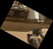
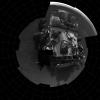
-
PIA16133:
-
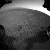
Belly Check for Curiosity
Full Resolution:
TIFF
(10.76 MB)
JPEG
(237.4 kB)
|
|
|
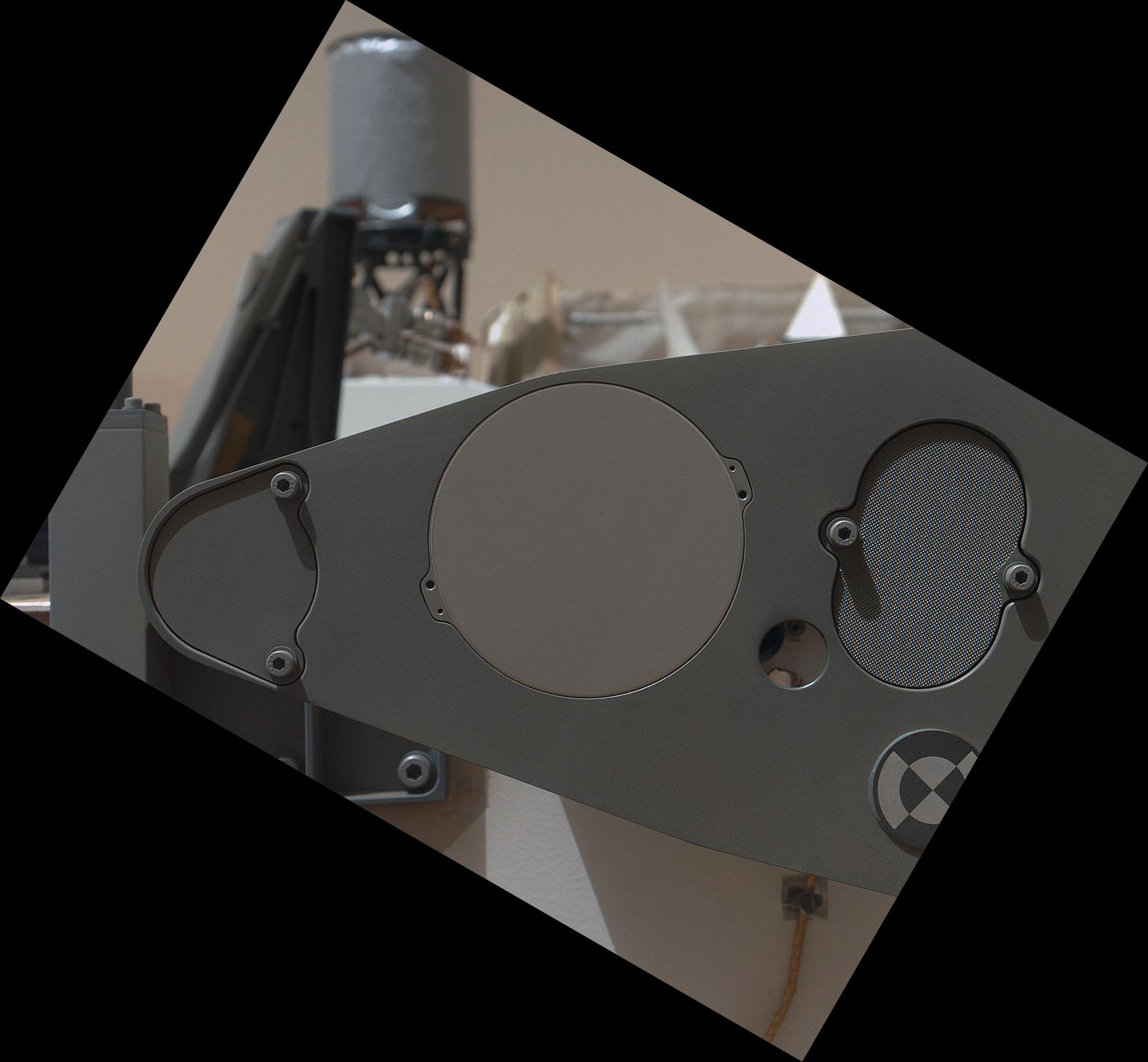
2012-09-10 |
Mars
|
Mars Science Laboratory (MSL)
|
MAHLI
|
1991x1852x3 |
|
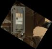
-
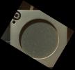
PIA16132:
-
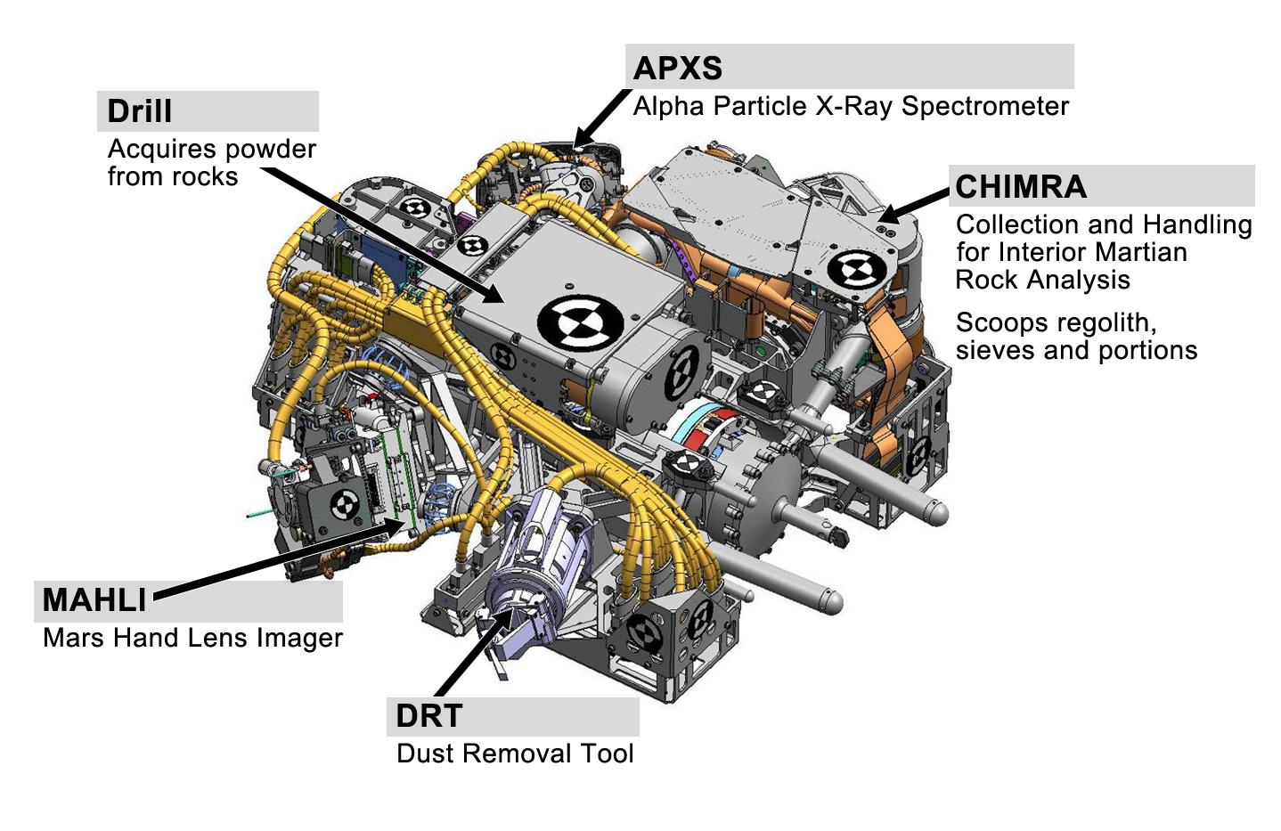
Calibration Target for Curiosity's Arm Camera
Full Resolution:
TIFF
(11.07 MB)
JPEG
(266.1 kB)
|
|
|
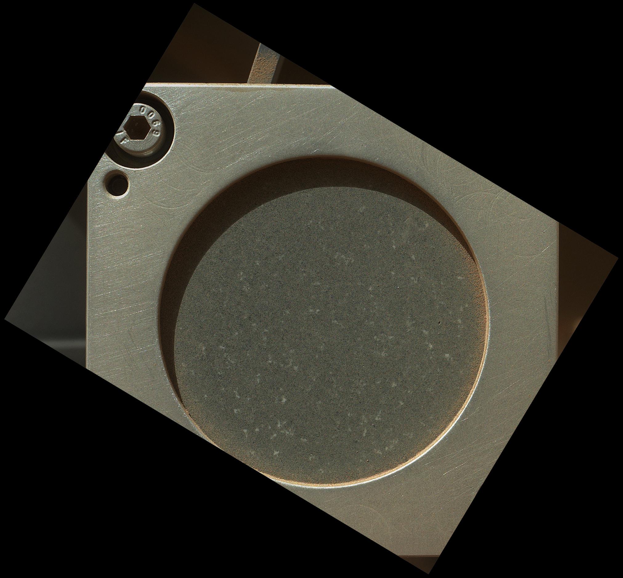
2012-09-10 |
Mars
|
Mars Science Laboratory (MSL)
|
MAHLI
|
1987x1839x3 |
|
-
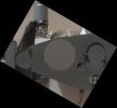
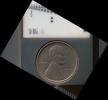
PIA16131:
-
Lincoln Penny on Mars in Camera's Calibration Target
Full Resolution:
TIFF
(10.97 MB)
JPEG
(430.3 kB)
|
|
|
2012-09-09 |
Mars
|
Mars Science Laboratory (MSL)
|
MAHLI
|
1605x1193x3 |
|
-
PIA16130:
-
First Image From Curiosity's Arm Camera With Dust Cover Open
Full Resolution:
TIFF
(5.746 MB)
JPEG
(624.3 kB)
|
|
|
2012-09-09 |
Mars
|
Mars Science Laboratory (MSL)
|
MAHLI
|
573x144x3 |
|
-
PIA16129:
Martian Ground Seen by Arm Camera With and Without Dust Cover (Thumbnails)
Full Resolution:
TIFF
(247.8 kB)
JPEG
(13.73 kB)
|
|
|
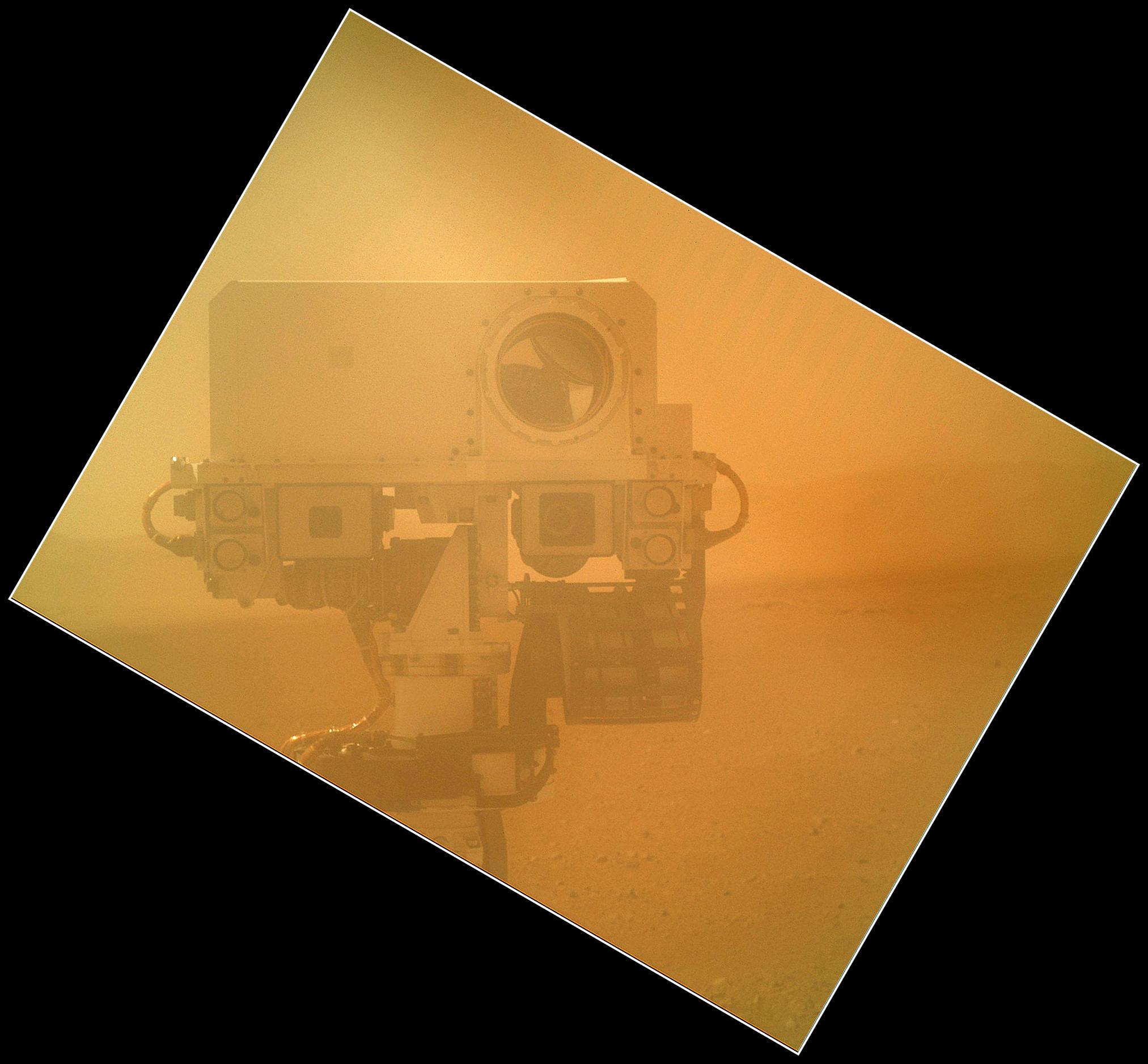
2012-09-08 |
Mars
|
Mars Science Laboratory (MSL)
|
MAHLI
|
2025x1877x3 |
|
-
PIA16149:
-
Rover Takes Self Portrait
Full Resolution:
TIFF
(11.41 MB)
JPEG
(268.4 kB)
|
|
|
2012-09-07 |
Mars
|
Mars Exploration Rover (MER)
|
Panoramic Camera
|
2979x624x3 |

|
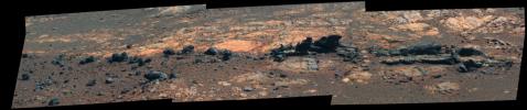
-
PIA16128:
Opportunity Eyes Rock Fins on Cape York, Sol 3058
Full Resolution:
TIFF
(5.579 MB)
JPEG
(233.9 kB)
|
|
|
2012-09-07 |
Mars
|
Mars Exploration Rover (MER)
|
Panoramic Camera
|
2979x624x3 |
|
-
PIA16126:
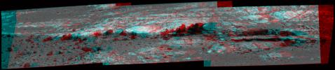
Opportunity Eyes Rock Fins on Cape York, Sol 3058 (Stereo)
Full Resolution:
TIFF
(5.579 MB)
JPEG
(297.1 kB)
|
|
|
2012-09-07 |
Mars
|
Mars Exploration Rover (MER)
|
Panoramic Camera
|
2979x624x3 |
|
-
PIA16127:
Opportunity Eyes Rock Fins on Cape York, Sol 3058 (False Color)
Full Resolution:
TIFF
(5.579 MB)
JPEG
(302.9 kB)
|
|
|
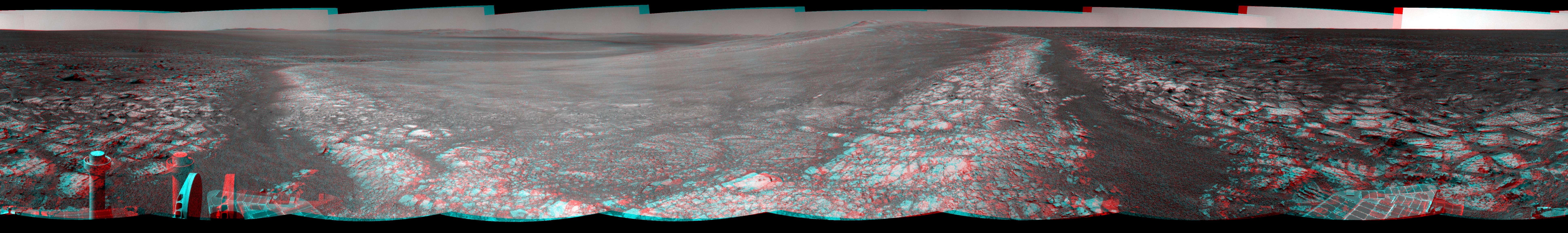
2012-09-07 |
Mars
|
Mars Exploration Rover (MER)
|
Navigation Camera
|
4000x4000x1 |
|
-
PIA16125:
-
Opportunity's Surroundings on 3,000th Sol, Vertical Projection
Full Resolution:
TIFF
(16.02 MB)
JPEG
(1.55 MB)
|
|
|
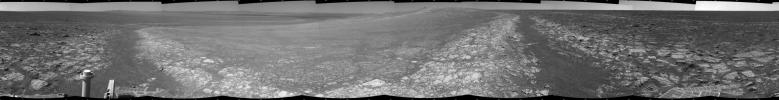
2012-09-07 |
Mars
|
Mars Exploration Rover (MER)
|
Navigation Camera
|
4111x4111x1 |

|
-
PIA16124:
-
Opportunity's Surroundings on 3,000th Sol, Polar Projection
Full Resolution:
TIFF
(16.93 MB)
JPEG
(1.518 MB)
|
|
|
2012-09-07 |
Mars
|
Mars Exploration Rover (MER)
|
Navigation Camera
|
7753x1152x3 |

|
-
PIA16123:
Opportunity's Surroundings on 3,000th Sol, in 3-D
Full Resolution:
TIFF
(26.8 MB)
JPEG
(1.421 MB)
|
|
|
2012-09-07 |
Mars
|
Mars Exploration Rover (MER)
|
Navigation Camera
|
7688x987x1 |
|
-
PIA16122:
Opportunity's Surroundings on 3,000th Sol
Full Resolution:
TIFF
(7.596 MB)
JPEG
(1.148 MB)
|
|
|
2012-09-07 |
Mars
|
Mars Exploration Rover (MER)
|
Navigation Camera
|
1024x1024x1 |
|
-
PIA16121:
-
Outcrop Beckoning Opportunity, Sol 3057
Full Resolution:
TIFF
(1.05 MB)
JPEG
(218.8 kB)
|
|
|
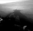
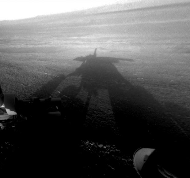
2012-09-07 |
Mars
|
Mars Exploration Rover (MER)
|
Hazcam
|
620x582x1 |
|
-
PIA16120:
-
Shadow Self-Portrait by Opportunity at Endeavour Crater
Full Resolution:
TIFF
(361.4 kB)
JPEG
(27.52 kB)
|
|
|
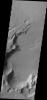
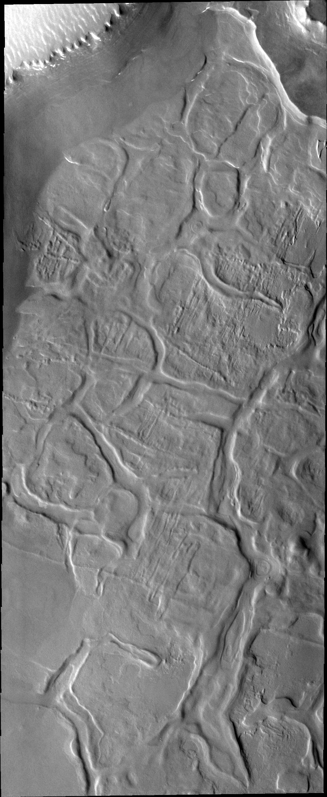
2012-09-07 |
Mars
|
2001 Mars Odyssey
|
THEMIS
|
1380x2776x1 |
|
-
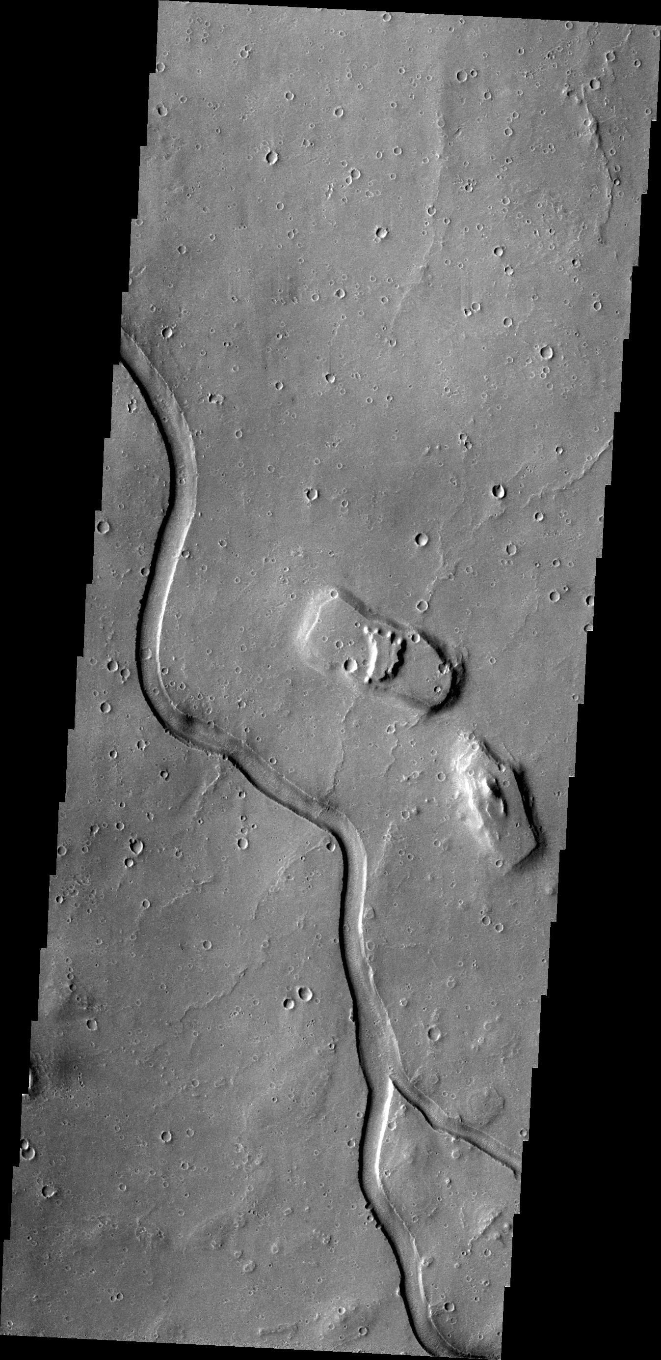
PIA15939:
-
Hrad Vallis
Full Resolution:
TIFF
(3.836 MB)
JPEG
(494.1 kB)
|
|
|
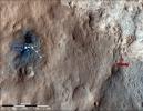
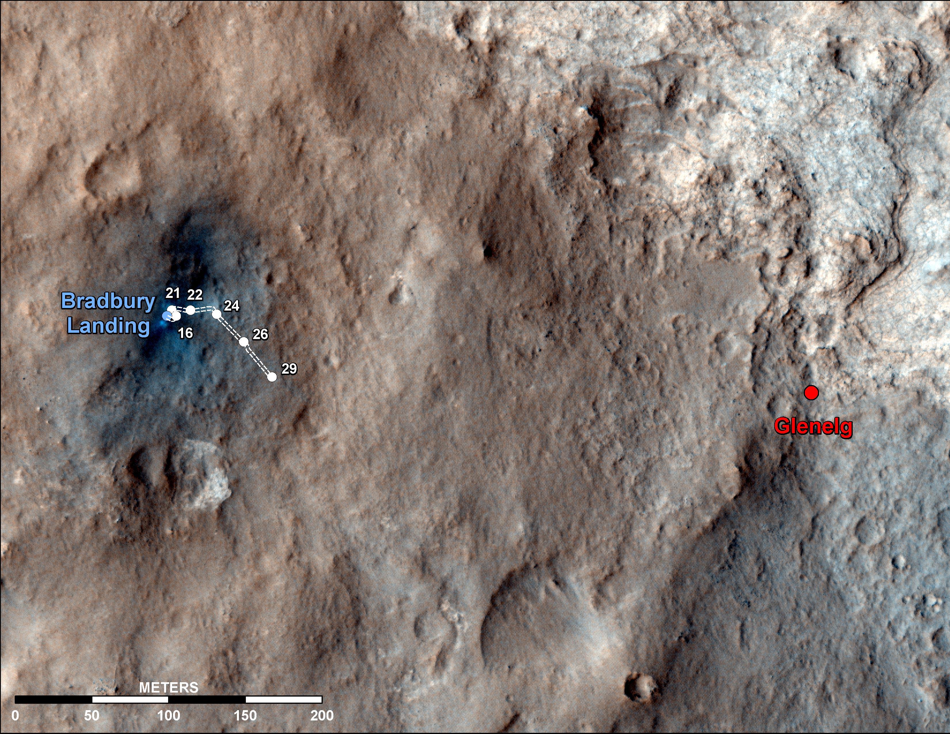
2012-09-06 |
Mars
|
Mars Science Laboratory (MSL)
|
HiRISE
|
3300x2550x3 |
|
-
PIA16148:
-
Curiosity Traverse Map Through Sol 29
Full Resolution:
TIFF
(25.26 MB)
JPEG
(1.558 MB)
|
|
|
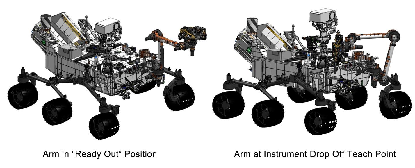
2012-09-06 |
Mars
|
Mars Science Laboratory (MSL)
|
|
1427x578x3 |
|
-
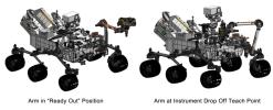
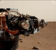
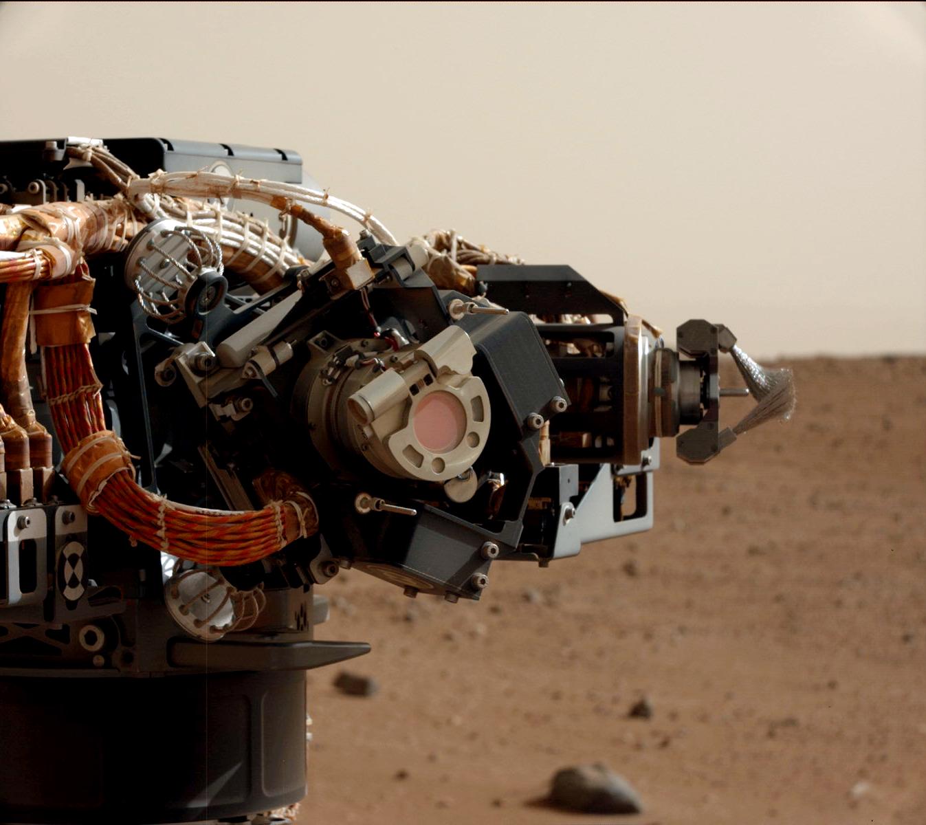
PIA16147:
-
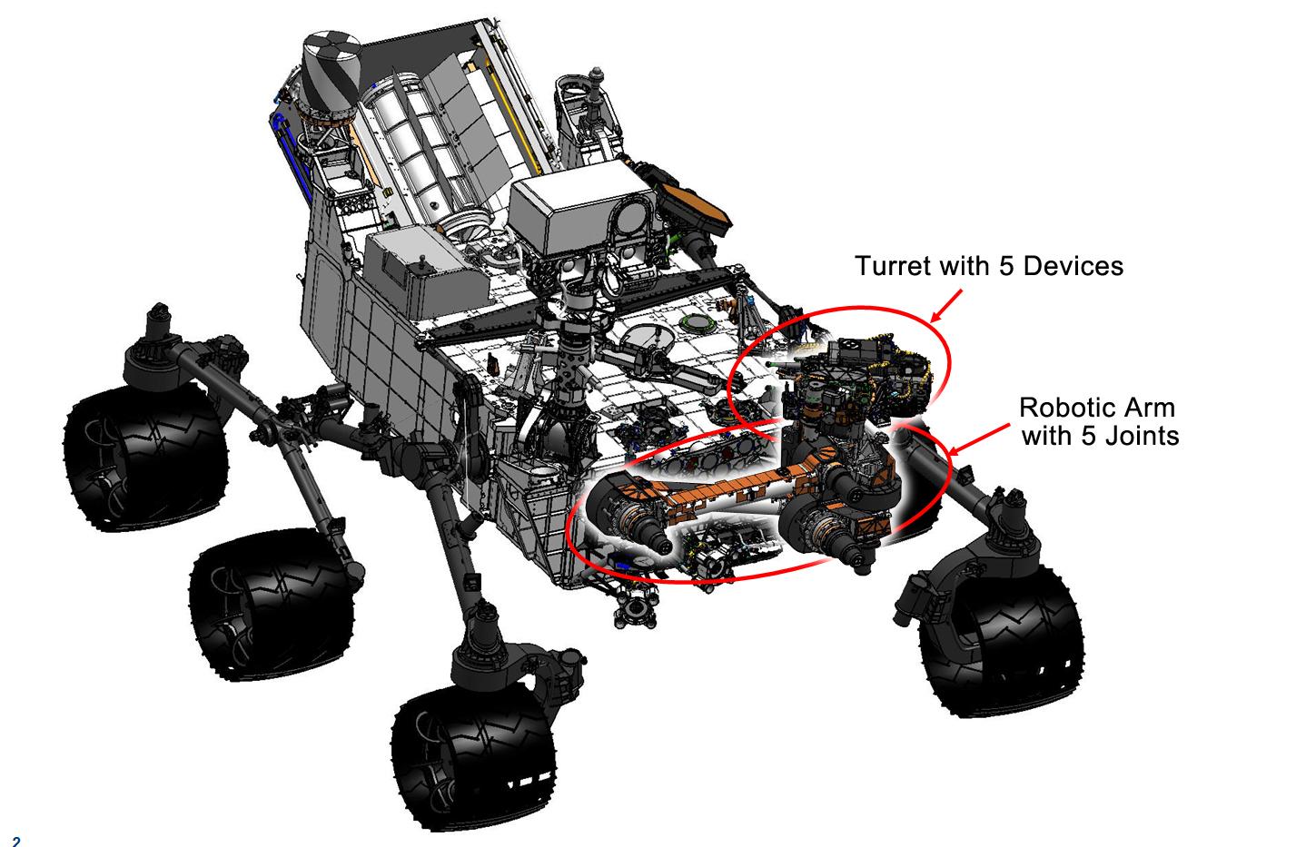
Flexing Curiosity's Arm
Full Resolution:
TIFF
(2.476 MB)
JPEG
(116.9 kB)
|
|
|
2012-09-06 |
Mars
|
Mars Science Laboratory (MSL)
|
|
1438x933x3 |
|
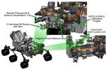
-
PIA16146:
-
Curiosity's Work Bench
Full Resolution:
TIFF
(4.027 MB)
JPEG
(223.4 kB)
|
|
|
2012-09-06 |
Mars
|
Mars Science Laboratory (MSL)
|
|
1438x933x3 |

|
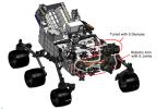
-
PIA16145:
-
Tools at Curiosity's 'Fingertips'
Full Resolution:
TIFF
(4.027 MB)
JPEG
(192.1 kB)
|
|
|
2012-09-06 |
Mars
|
Mars Science Laboratory (MSL)
|
|
1438x933x3 |
|
-
PIA16144:
-
Curiosity's Robotic Arm
Full Resolution:
TIFF
(4.027 MB)
JPEG
(169 kB)
|
|
|
2012-09-06 |
Mars
|
Mars Science Laboratory (MSL)
|
HiRISE
|
2055x1437x3 |
|
-
PIA16143:
-
Dissecting the Scene of Sky Crane Crash
Full Resolution:
TIFF
(8.863 MB)
JPEG
(454.9 kB)
|
|
|
2012-09-06 |
Mars
|
Mars Science Laboratory (MSL)
|
HiRISE
|
579x538x3 |
|
-
PIA16142:
-
Relics of Rover's Landing
Full Resolution:
TIFF
(935 kB)
JPEG
(34.81 kB)
|
|
|
2012-09-06 |
Mars
|
Mars Science Laboratory (MSL)
|
HiRISE
|
574x643x3 |
|
-
PIA16141:
-
A Rover's Journey Begins
Full Resolution:
TIFF
(1.108 MB)
JPEG
(51.17 kB)
|
|
|
2012-09-06 |
Mars
|
Mars Science Laboratory (MSL)
|
MAHLI
Mastcam
|
1347x1200x3 |
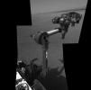
|
-
PIA15699:
-
Camera on Curiosity's Arm as Seen by Camera on Mast
Full Resolution:
TIFF
(4.851 MB)
JPEG
(136.8 kB)
|
|
|
2012-09-06 |
Mars
|
Mars Science Laboratory (MSL)
|
Navcam (MSL)
|
7703x1749x1 |

|
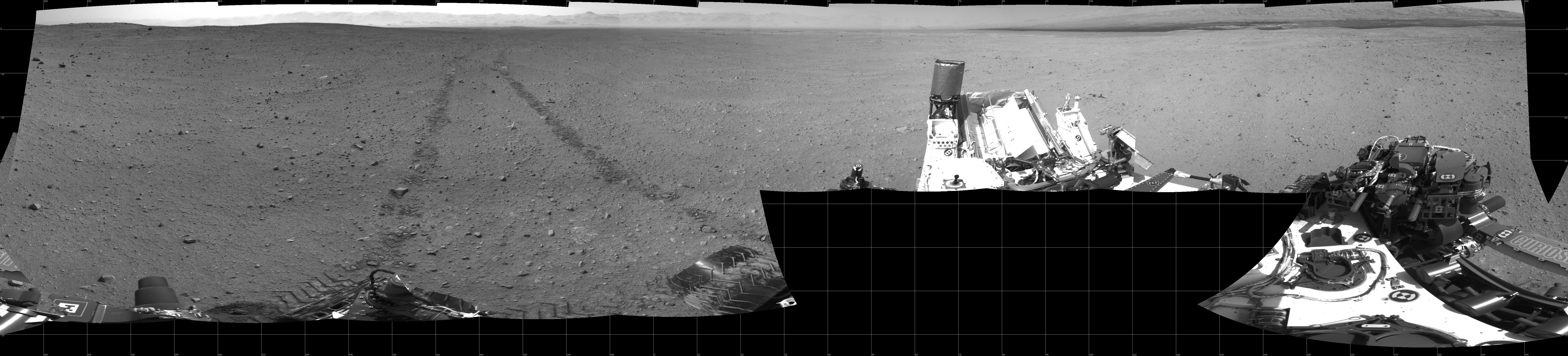
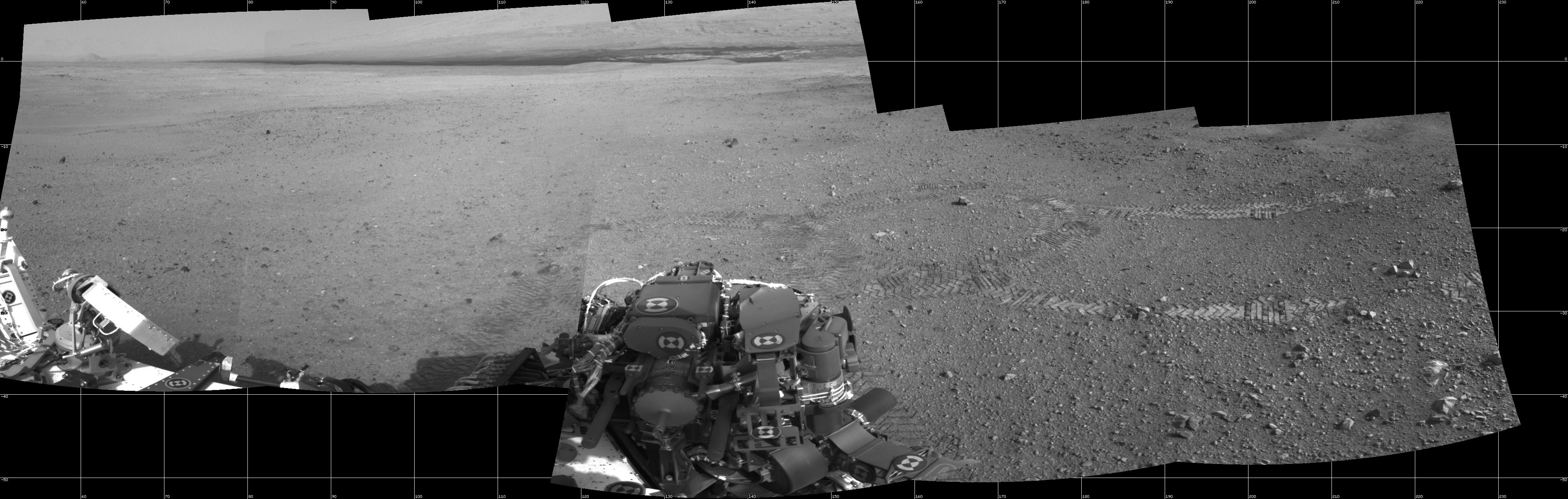
-
PIA15698:
Curiosity's Location During Arm Checkouts
Full Resolution:
TIFF
(13.49 MB)
JPEG
(1.578 MB)
|
|
|
2012-09-06 |
Mars
|
2001 Mars Odyssey
|
THEMIS
|
1140x2920x1 |

|
-
PIA15938:
-
Abalos Undae
Full Resolution:
TIFF
(3.332 MB)
JPEG
(371.2 kB)
|
|
|
2012-09-05 |
Mars
|
2001 Mars Odyssey
|
THEMIS
|
1351x2772x1 |

|
-
PIA15937:
-
Kasei Valles
Full Resolution:
TIFF
(3.749 MB)
JPEG
(373.8 kB)
|
|
|
2012-09-04 |
Mars
|
Mars Science Laboratory (MSL)
|
|
7824x3337x3 |
|
-
PIA16140:
-
3-D View from Bradbury Landing Site
Full Resolution:
TIFF
(78.35 MB)
JPEG
(1.916 MB)
|
|
|
2012-09-04 |
Mars
|
2001 Mars Odyssey
|
THEMIS
|
1376x2779x1 |

|
-
PIA15936:
-
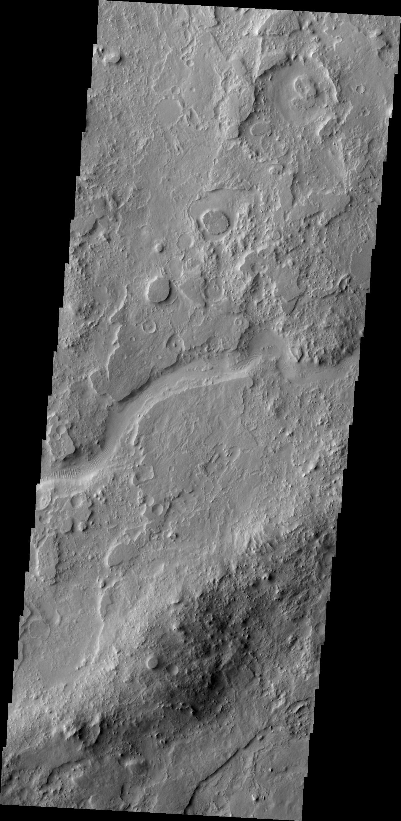
Channels
Full Resolution:
TIFF
(3.829 MB)
JPEG
(391.9 kB)
|
|
|
2012-09-03 |
Mars
|
2001 Mars Odyssey
|
THEMIS
|
1347x2768x1 |
|
-
PIA15935:
-
Hebrus Valles
Full Resolution:
TIFF
(3.732 MB)
JPEG
(517 kB)
|
|
|
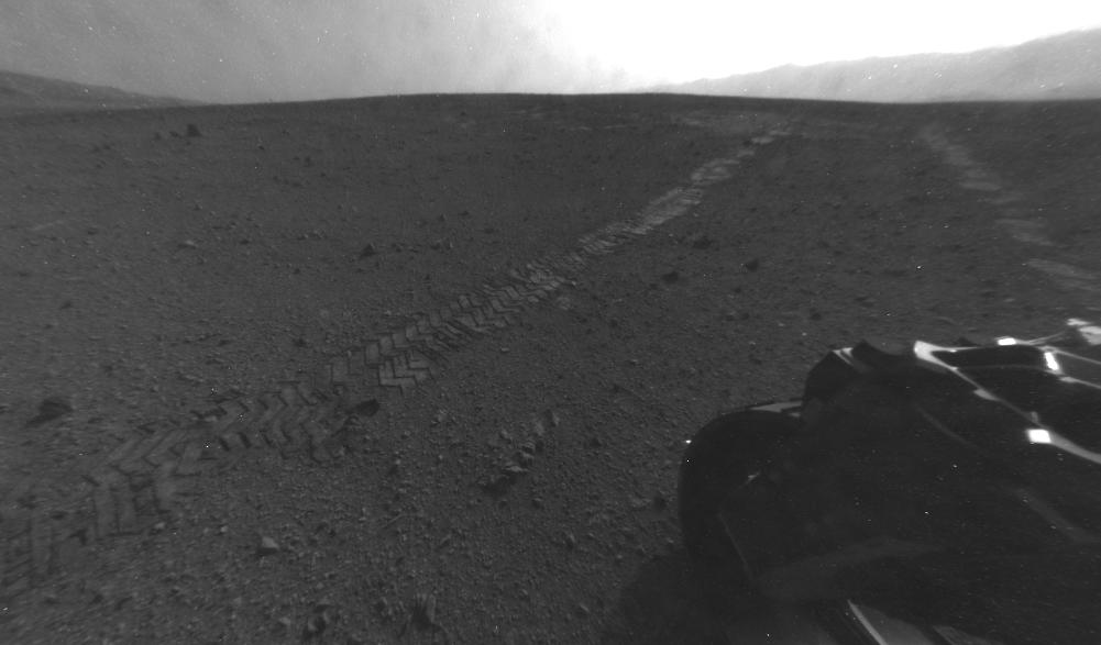
2012-08-31 |
Mars
|
Mars Science Laboratory (MSL)
|
Hazcam (MSL)
|
7703x977x1 |

|
-
PIA15697:
Looking Back at Tracks from Sol 24 Drive
Full Resolution:
TIFF
(7.534 MB)
JPEG
(1.005 MB)
|
|
|
2012-08-31 |
Mars
|
Mars Reconnaissance Orbiter (MRO)
Mars Science Laboratory (MSL)
|
HiRISE
|
2800x1800x1 |
|
-
PIA15696:
-
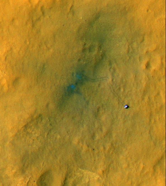
Orbiter View of Curiosity From Nearly Straight Overhead
Full Resolution:
TIFF
(5.047 MB)
JPEG
(578.1 kB)
|
|
|
2012-08-31 |
Mars
|
2001 Mars Odyssey
|
THEMIS
|
1217x3072x1 |

|
-
PIA15934:
-
Sand Sheet
Full Resolution:
TIFF
(3.743 MB)
JPEG
(207.8 kB)
|
|
|
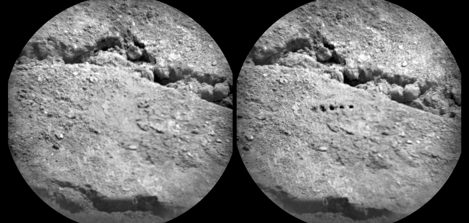
2012-08-30 |
Mars
|
Mars Science Laboratory (MSL)
|
ChemCam
|
1512x720x1 |
|
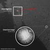
-
PIA15695:
-
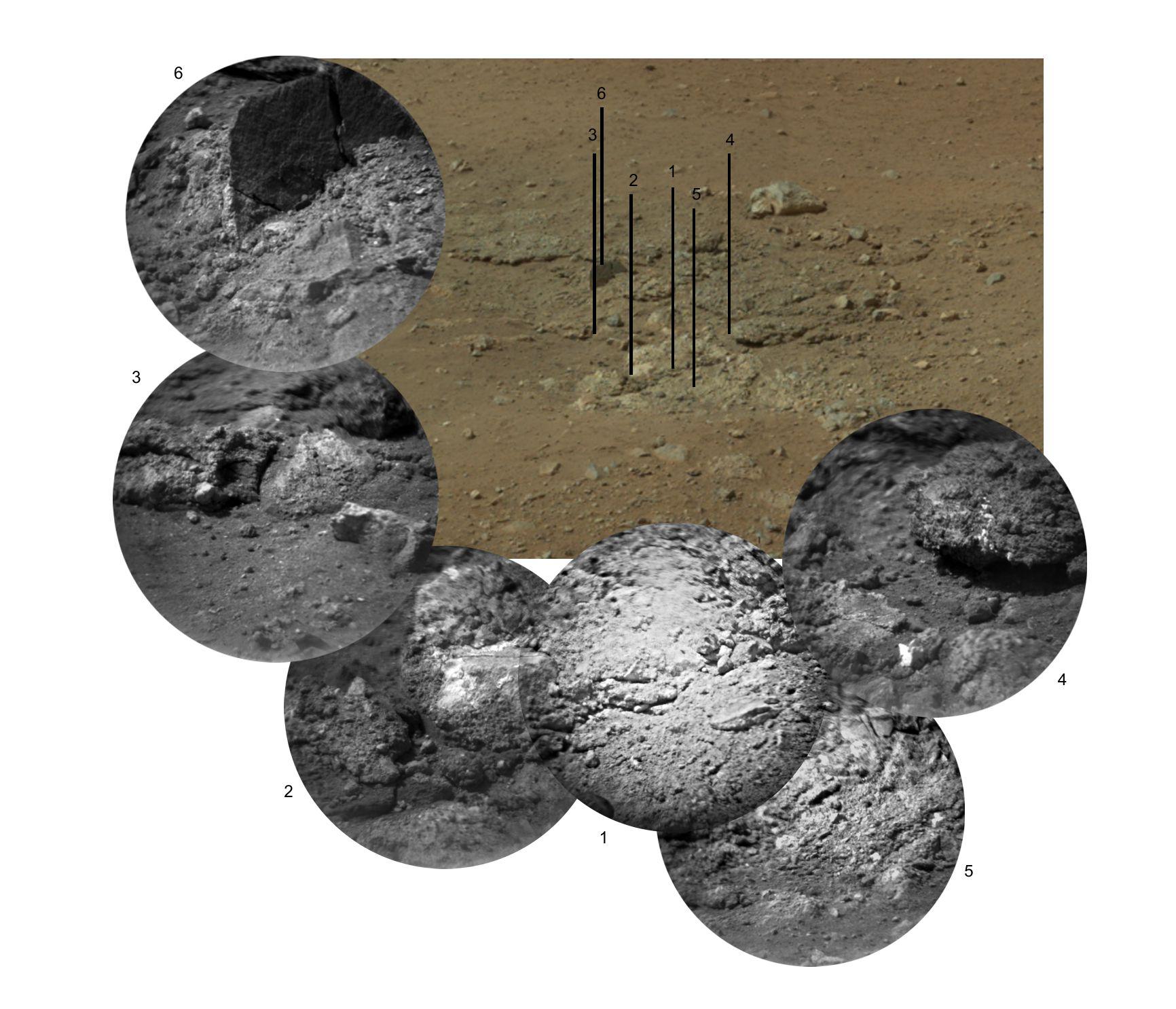
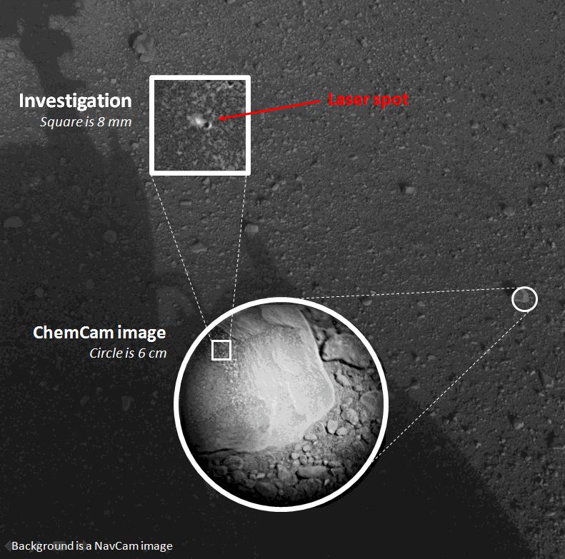
Marks of Laser Exam on Martian Soil
Full Resolution:
TIFF
(1.09 MB)
JPEG
(156 kB)
|
|
|
2012-08-30 |
Mars
|
2001 Mars Odyssey
|
THEMIS
|
1308x2764x1 |
|
-
PIA15933:
-
Ascraeus Mons
Full Resolution:
TIFF
(3.619 MB)
JPEG
(421.9 kB)
|
|
|
2012-08-29 |
Mars
|
Mars Science Laboratory (MSL)
|
Hazcam (MSL)
|
1001x587x1 |
|
-
PIA15694:
-
Tracks from Eastbound Drive on Curiosity's Sol 22
Full Resolution:
TIFF
(588.4 kB)
JPEG
(49.86 kB)
|
|
|
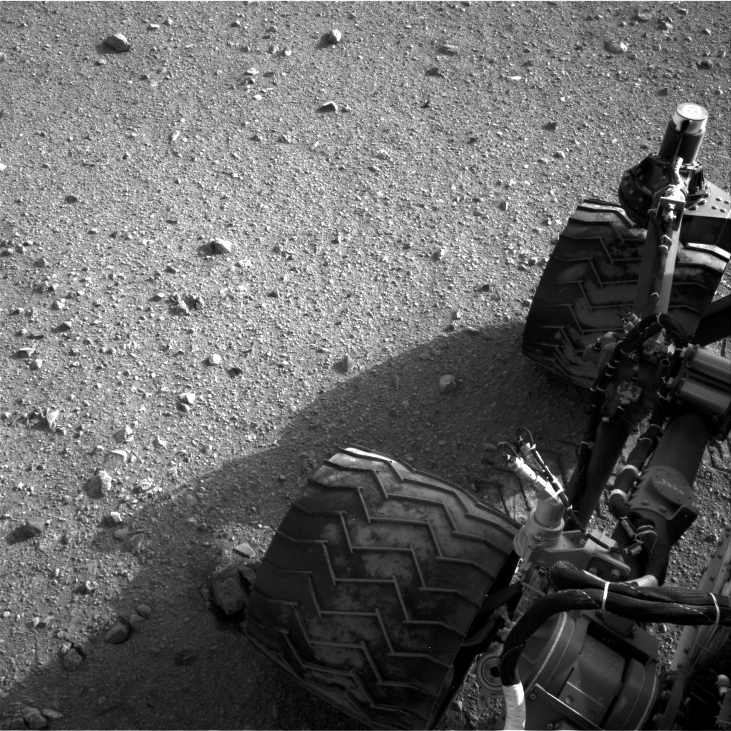
2012-08-29 |
Mars
|
Mars Science Laboratory (MSL)
|
Navcam (MSL)
|
1024x1024x1 |
|
-
PIA15693:
-
Martian Soil on Curiosity's Wheels After Sol 22 Drive
Full Resolution:
TIFF
(1.05 MB)
JPEG
(247.4 kB)
|
|
|
2012-08-29 |
Mars
|
Mars Science Laboratory (MSL)
|
|
1024x1024x1 |
|
-
PIA16112:
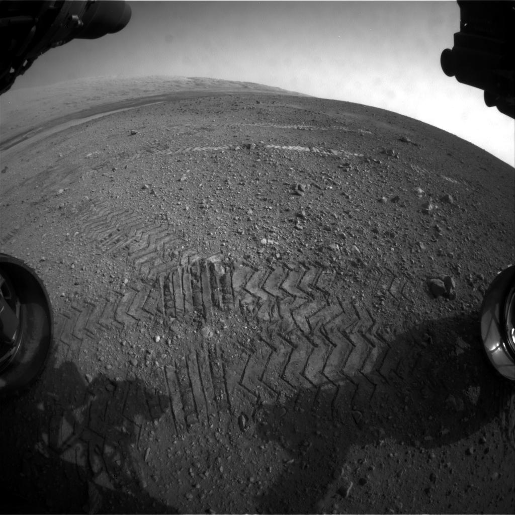
-
Curiosity Tracks Its Tracks
Full Resolution:
TIFF
(1.05 MB)
JPEG
(174.8 kB)
|
|
|
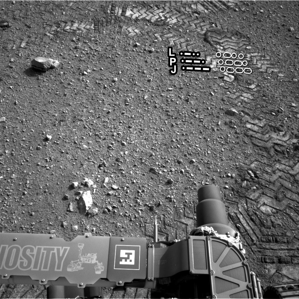
2012-08-29 |
Mars
|
Mars Science Laboratory (MSL)
|
|
1024x1024x1 |
|
-
PIA16111:
-
Reading the Rover's Tracks
Full Resolution:
TIFF
(1.05 MB)
JPEG
(274.3 kB)
|
|
|
2012-08-29 |
Mars
|
Mars Science Laboratory (MSL)
|
|
1024x1024x1 |
|
-
PIA16093:
-
Curiosity Leaves Its Mark
Full Resolution:
TIFF
(1.05 MB)
JPEG
(245.6 kB)
|
|
|
2012-08-29 |
Mars
|
2001 Mars Odyssey
|
THEMIS
|
1132x2310x1 |
|
-
PIA15932:
-
Olympia Undae
Full Resolution:
TIFF
(2.618 MB)
JPEG
(198.6 kB)
|
|
|
2012-08-28 |
Mars
|
2001 Mars Odyssey
|
THEMIS
|
679x1536x1 |
|
-
PIA15931:
-
Daedalia Planum
Full Resolution:
TIFF
(1.044 MB)
JPEG
(147.9 kB)
|
|
|
2012-08-27 |
Mars
|
Mars Science Laboratory (MSL)
|
|
4024x1282x1 |

|
-
PIA16110:
-
From Infinity and Beyond
Full Resolution:
TIFF
(5.164 MB)
JPEG
(628.4 kB)
|
|
|
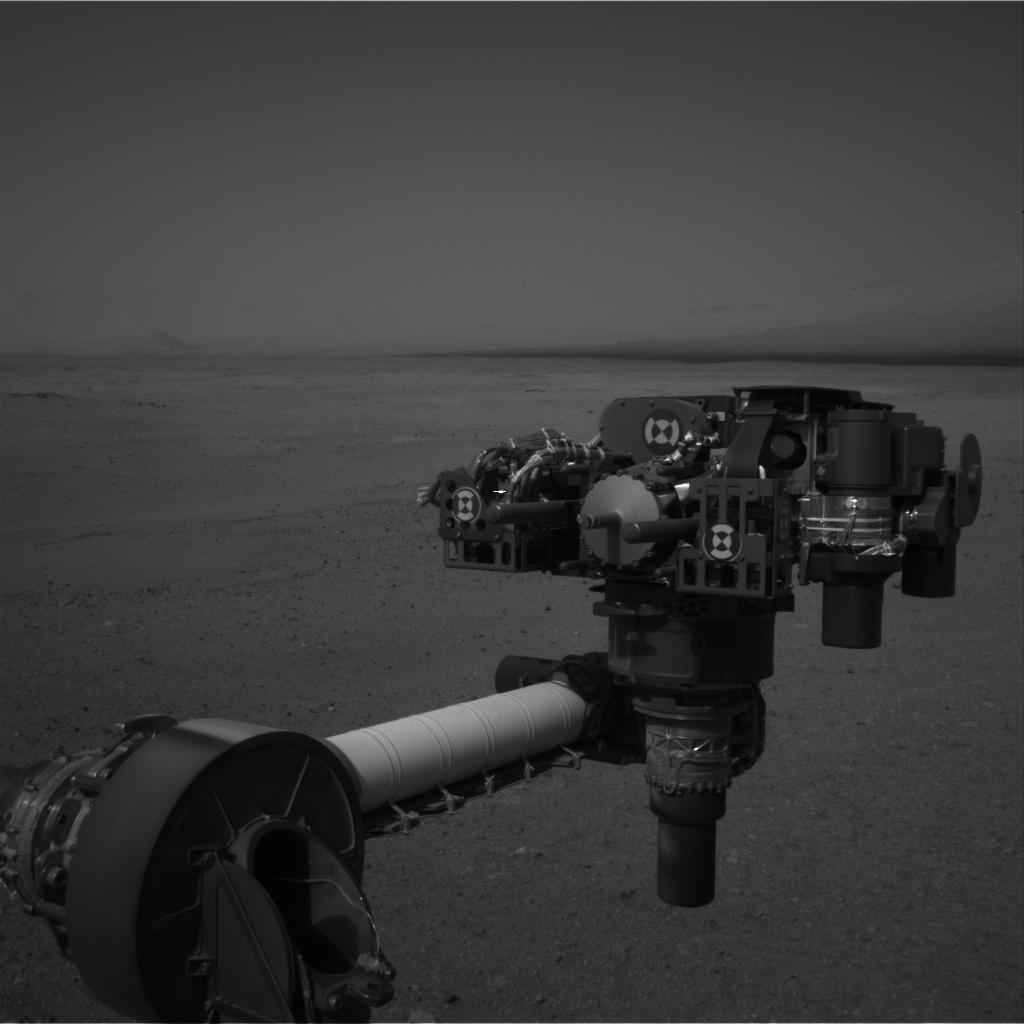
2012-08-27 |
Mars
|
Mars Science Laboratory (MSL)
|
|
1024x1024x1 |
|
-
PIA16109:
-
Big Wheels Keep on Rollin'
Full Resolution:
TIFF
(1.05 MB)
JPEG
(133.4 kB)
|
|
|
2012-08-27 |
Mars
|
Mars Science Laboratory (MSL)
|
|
1024x1024x1 |
|
-
PIA16108:
-
Evidence of Curiosity's Second Drive
Full Resolution:
TIFF
(1.05 MB)
JPEG
(89.13 kB)
|
|
|
2012-08-27 |
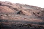
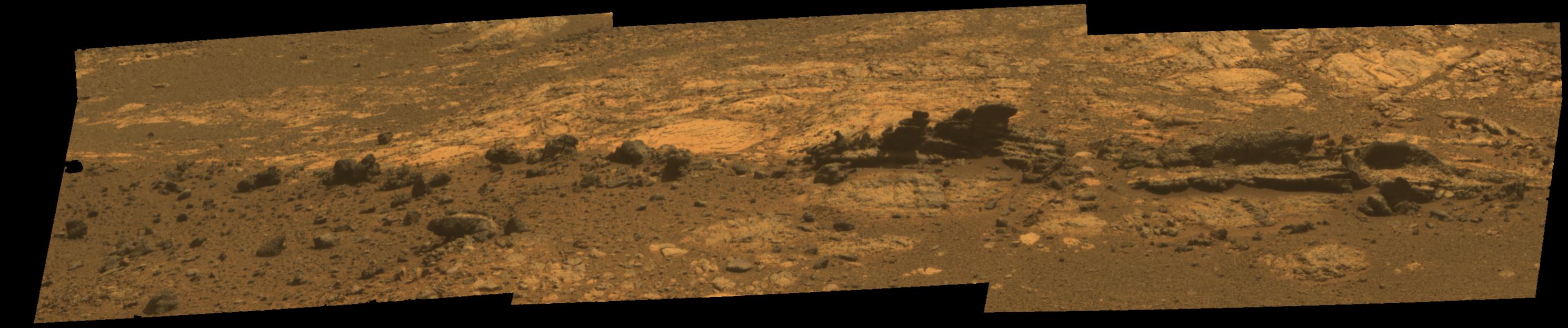
Mars
|
Mars Science Laboratory (MSL)
|
Mastcam
|
1463x978x3 |
|
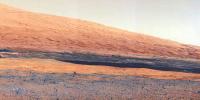
-
PIA16105:
-
Layers at the Base of Mount Sharp
Full Resolution:
TIFF
(4.294 MB)
JPEG
(222.6 kB)
|
|
|
2012-08-27 |
Mars
|
Mars Science Laboratory (MSL)
|
Mastcam
|
1463x1928x3 |
|
-
PIA16104:
-
Focusing the 100-millimeter Mastcam
Full Resolution:
TIFF
(8.465 MB)
JPEG
(523.5 kB)
|
|
|
2012-08-27 |
Mars
|
Mars Science Laboratory (MSL)
|
Mastcam
|
1375x1148x3 |
|
-
PIA16103:
-
Focusing the 34-millimeter Mastcam
Full Resolution:
TIFF
(4.738 MB)
JPEG
(276.7 kB)
|
|
|
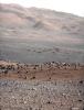
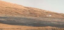
2012-08-27 |
Mars
|
Mars Science Laboratory (MSL)
|
Mastcam
|
14494x3560x3 |
|
-
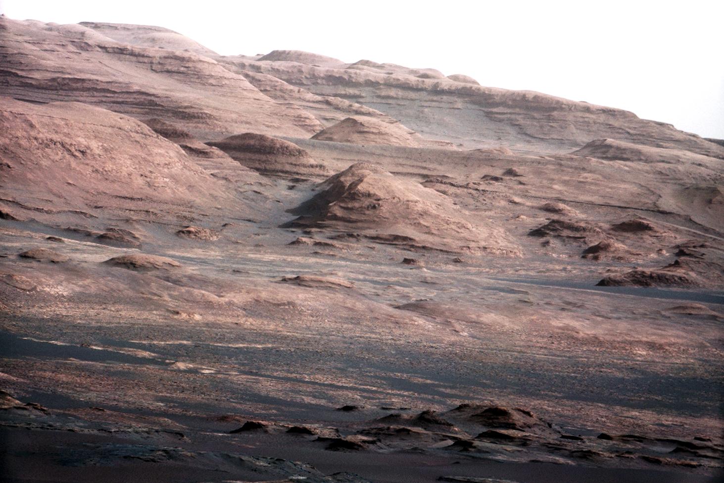
PIA16101:
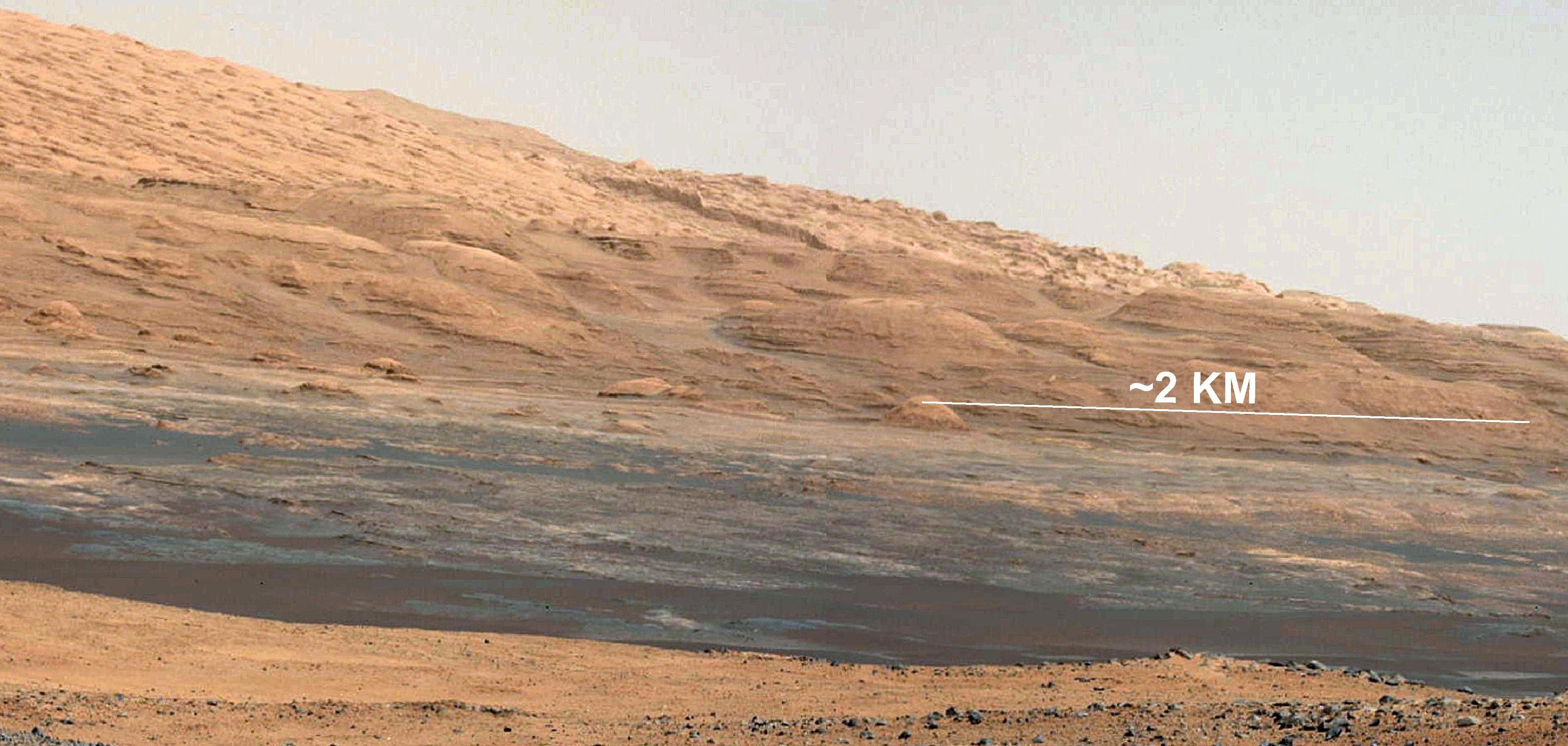
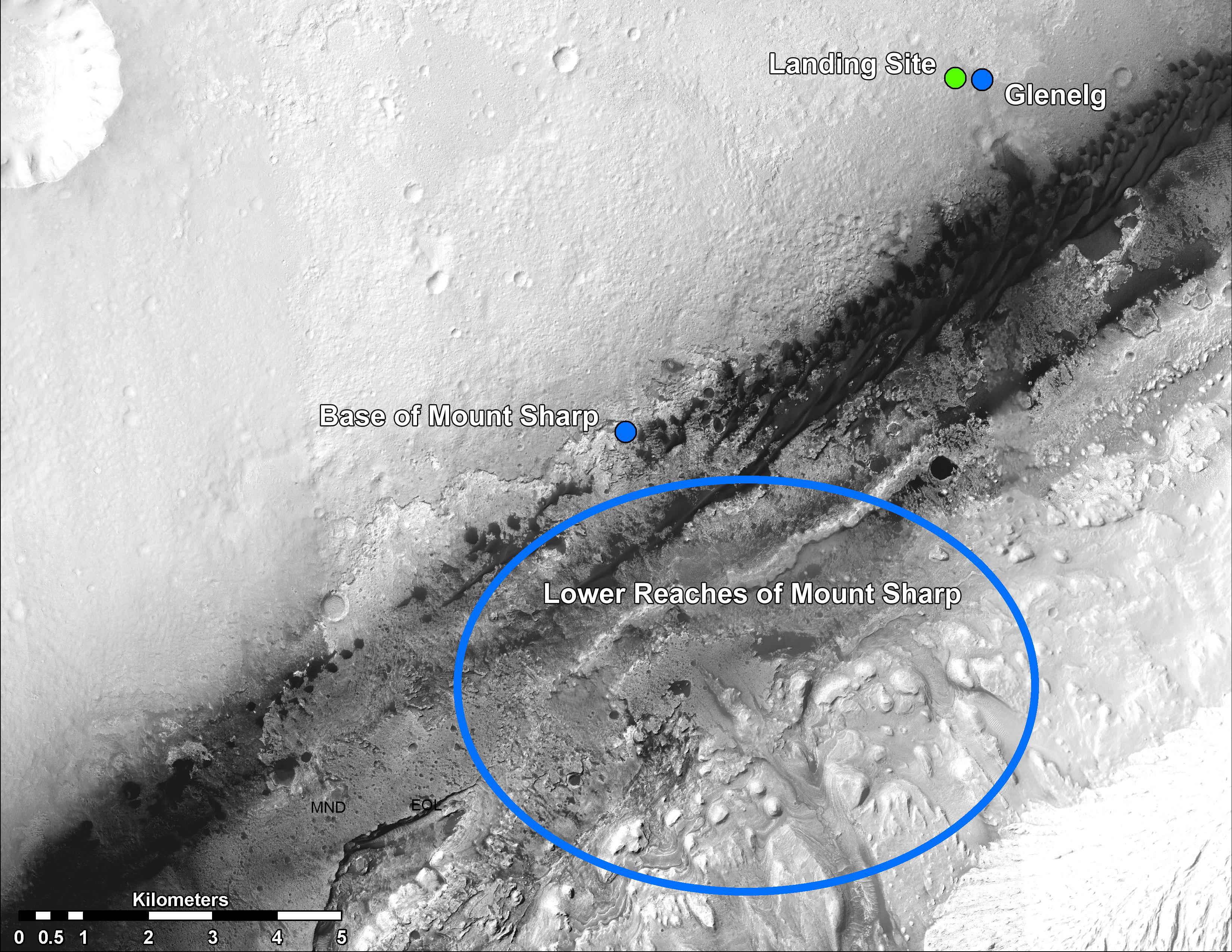
Landing Site Panorama, with the Heights of Mount Sharp
Full Resolution:
TIFF
(154.8 MB)
JPEG
(6.485 MB)
|
|
|
2012-08-27 |
Mars
|
Mars Science Laboratory (MSL)
|
Mastcam
|
3313x1660x3 |
|
-
PIA16099:
-
Getting to Know Mount Sharp
Full Resolution:
TIFF
(16.51 MB)
JPEG
(1.314 MB)
|
|
|
2012-08-27 |
Mars
|
2001 Mars Odyssey
|
THEMIS
|
1354x2768x1 |

|
-
PIA15930:
-
Lava Channels
Full Resolution:
TIFF
(3.752 MB)
JPEG
(484.2 kB)
|
|
|
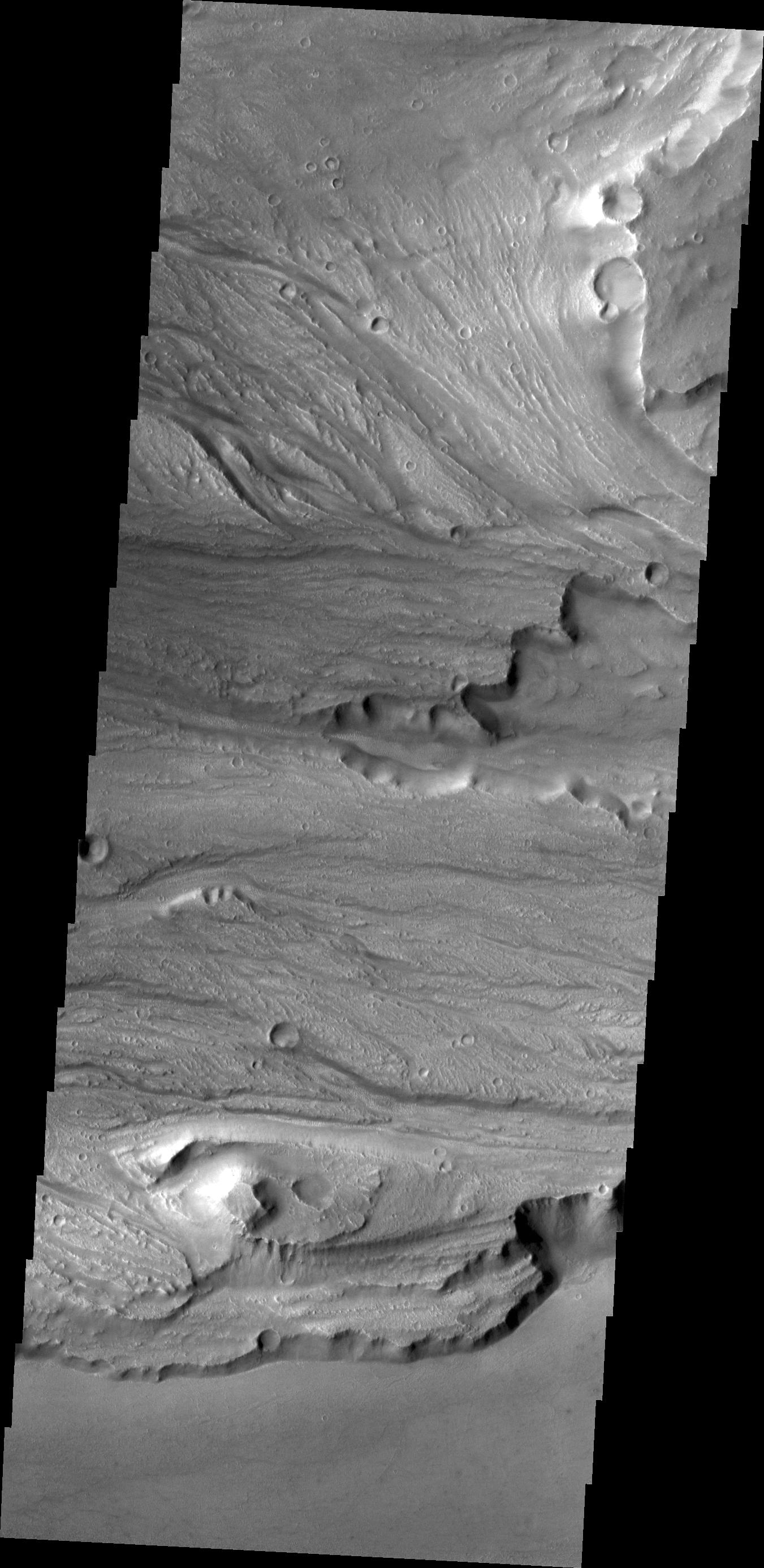
2012-08-24 |
Mars
|
2001 Mars Odyssey
|
THEMIS
|
1345x2907x1 |

|
-
PIA15929:
-
Lava Channels
Full Resolution:
TIFF
(3.914 MB)
JPEG
(483.9 kB)
|
|
|
2012-08-23 |
Mars
|
2001 Mars Odyssey
|
THEMIS
|
1165x2725x1 |
|
-
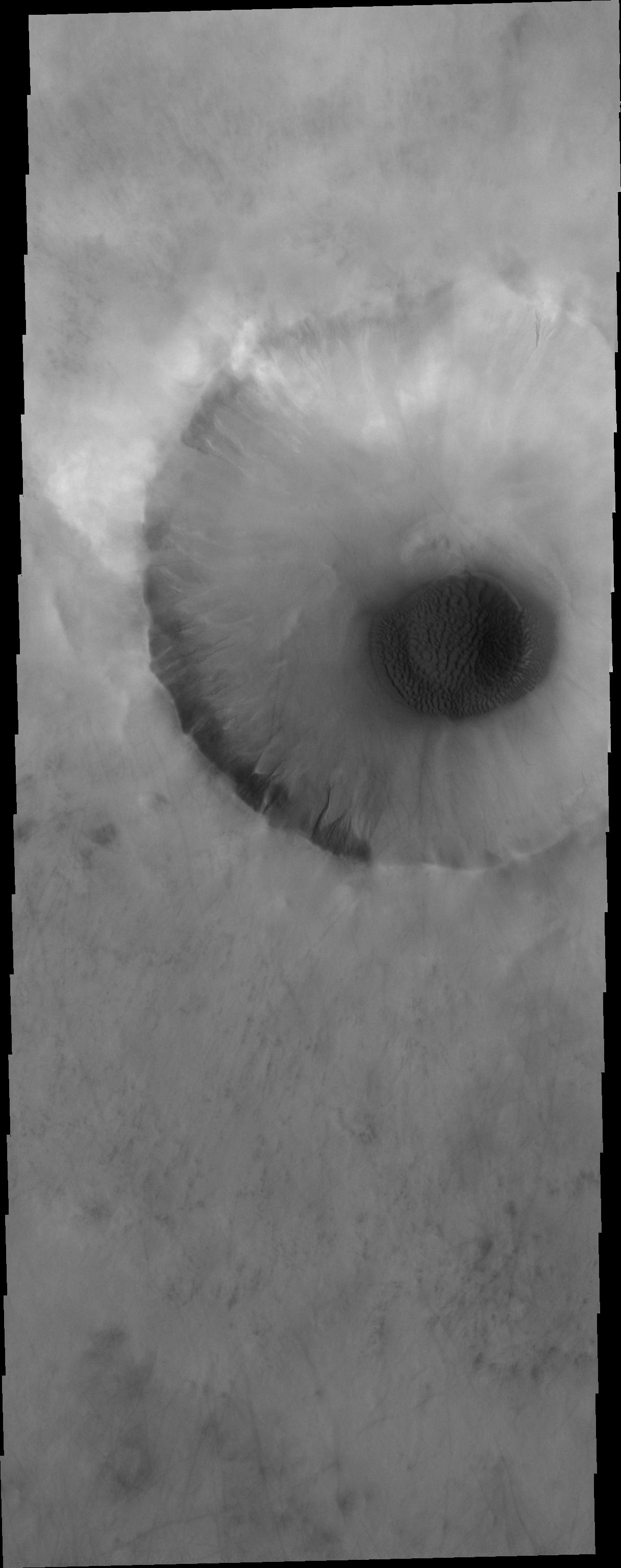
PIA15928:
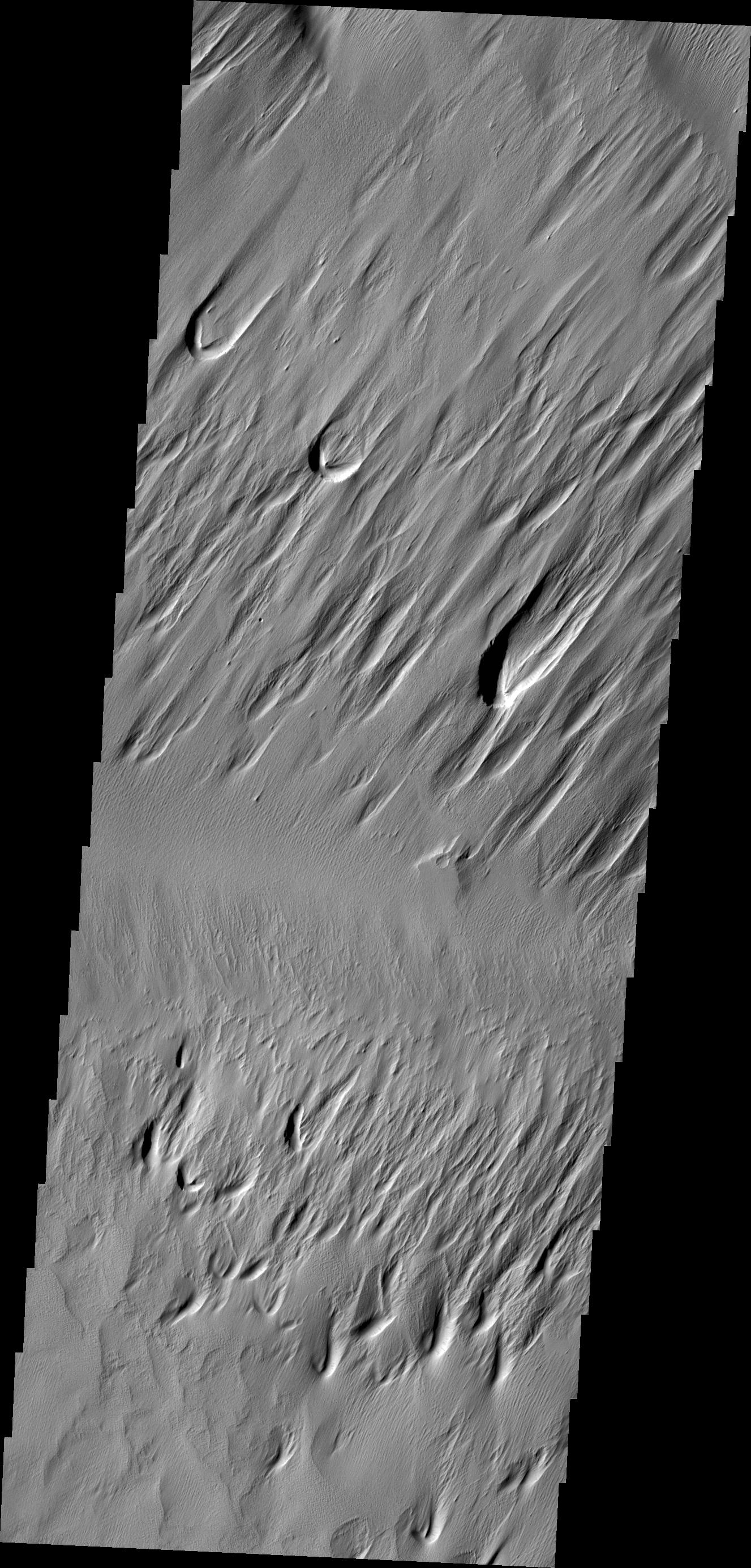
-
Crater Dunes
Full Resolution:
TIFF
(3.178 MB)
JPEG
(151.9 kB)
|
|
|
2012-08-22 |
Mars
|
Mars Science Laboratory (MSL)
|
Navcam (MSL)
Robotic Arm (MSL)
|
2089x2074x1 |
|
-
PIA16096:
-
Curiosity's First Arm Extension, Full Resolution
Full Resolution:
TIFF
(4.338 MB)
JPEG
(262 kB)
|
|
|
2012-08-22 |
Mars
|
Mars Science Laboratory (MSL)
|
|
1024x1024x1 |
|
-
PIA16095:
-
Making Tracks on Mars
Full Resolution:
TIFF
(1.05 MB)
JPEG
(131.4 kB)
|
|
|
2012-08-22 |
Mars
|
Mars Science Laboratory (MSL)
|
|
1600x1600x1 |

|
-
PIA16094:
-
Rover Takes Its First 'Steps'
Full Resolution:
TIFF
(2.563 MB)
JPEG
(378.2 kB)
|
|
|
2012-08-22 |
Mars
|
Mars Science Laboratory (MSL)
|
|
7703x1997x1 |

|
-
PIA16092:
Curiosity's First Track Marks on Mars
Full Resolution:
TIFF
(15.4 MB)
JPEG
(1.667 MB)
|
|
|
2012-08-22 |
Mars
|
Mars Science Laboratory (MSL)
|
|
1024x1024x1 |
|
-
PIA16091:
-
After the Laser Shots

Full Resolution:
TIFF
(1.05 MB)
JPEG
(107.4 kB)
|
|
|
2012-08-22 |
Mars
|
Mars Science Laboratory (MSL)
|
|
1732x1486x3 |

|
-
PIA16090:
-
Zapping Rocks Exposed by the Sky Crane's Thrusters
Full Resolution:
TIFF
(7.724 MB)
JPEG
(280.9 kB)
|
|
|
2012-08-22 |
Mars
|
2001 Mars Odyssey
|
THEMIS
|
1126x2745x1 |
|
-
PIA15927:
-
Hyperboreus Labyrinthus
Full Resolution:
TIFF
(3.094 MB)
JPEG
(414.3 kB)
|
|
|
2012-08-21 |
Mars
|
Mars Science Laboratory (MSL)
|
|
1024x1024x1 |
|
-
PIA16087:
-
Wiggle in the Gravel
Full Resolution:
TIFF
(1.05 MB)
JPEG
(156.9 kB)
|
|
|
2012-08-21 |
Mars
|
Mars Science Laboratory (MSL)
|
Mastcam
|
1024x1024x1 |
|
-
PIA16086:
-
Part of Curiosity's Outstretched Arm, Full-Resolution
Full Resolution:
TIFF
(1.05 MB)
JPEG
(103.8 kB)
|
|
|
2012-08-21 |
Mars
|
Mars Science Laboratory (MSL)
|
Robotic Arm (MSL)
|
1024x1024x1 |

|
-
PIA16085:
-
End of Curiosity's Extended Arm, Full-Resolution
Full Resolution:
TIFF
(1.05 MB)
JPEG
(66.03 kB)
|
|
|
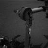
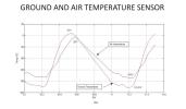
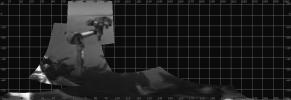
2012-08-21 |
Mars
|
Mars Science Laboratory (MSL)
|
|
1367x798x3 |
|
-
PIA16081:
-
Taking Mars' Temperature
Full Resolution:
TIFF
(3.274 MB)
JPEG
(89.58 kB)
|
|
|
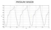
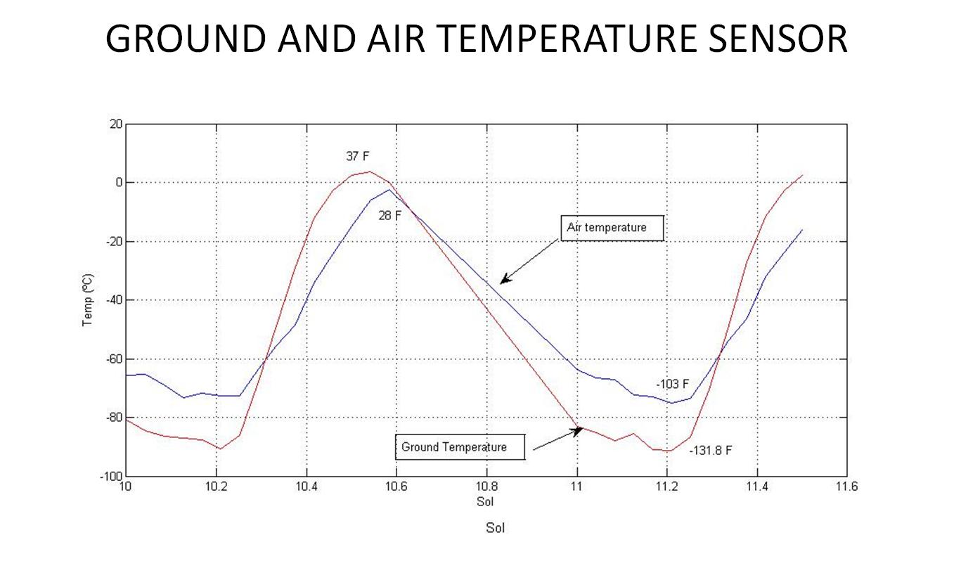
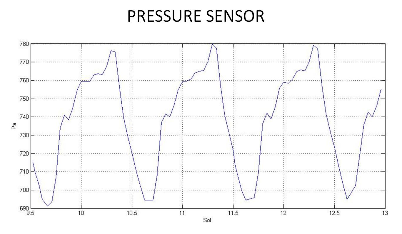
2012-08-21 |
Mars
|
Mars Science Laboratory (MSL)
|
|
1367x798x3 |
|
-
PIA16080:
-
First Pressure Readings on Mars
Full Resolution:
TIFF
(3.274 MB)
JPEG
(98.91 kB)
|
|
|
2012-08-21 |
Mars
|
2001 Mars Odyssey
|
THEMIS
|
1363x2915x1 |

|
-
PIA15926:
-
Channels
Full Resolution:
TIFF
(3.977 MB)
JPEG
(395.7 kB)
|
|
|
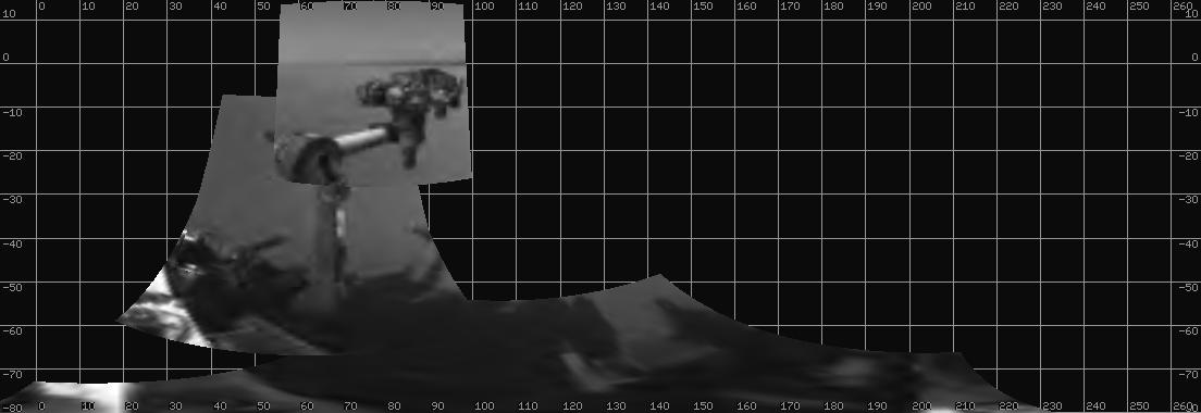
2012-08-20 |
Mars
|
Mars Science Laboratory (MSL)
|
Navcam (MSL)
Robotic Arm (MSL)
|
1104x380x1 |
|
-
PIA15692:
-
Curiosity Extends Arm for First Time on Mars
Full Resolution:
TIFF
(420.2 kB)
JPEG
(46.28 kB)
|
|
|
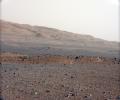
2012-08-20 |
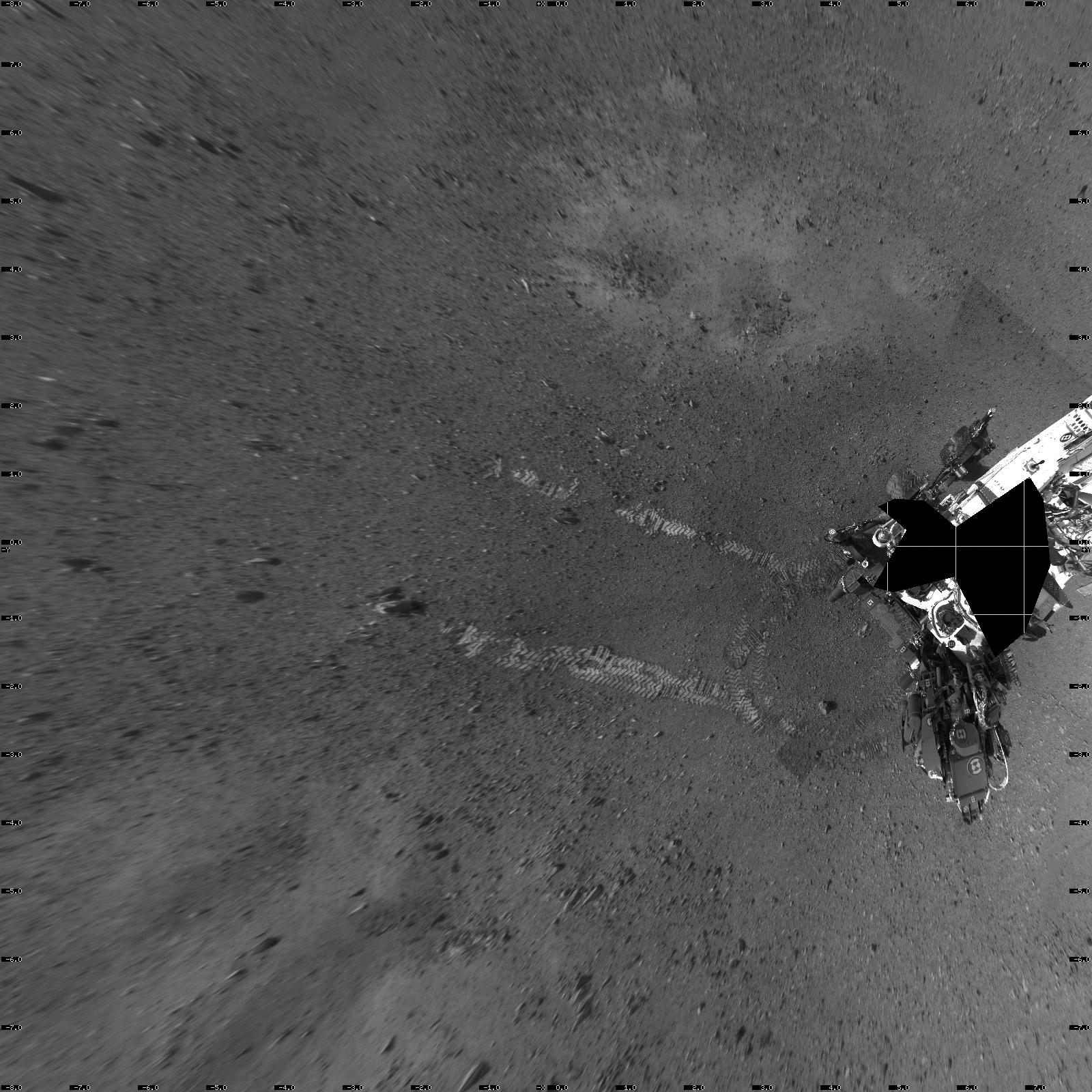
Mars
|
Mars Science Laboratory (MSL)
|
Navcam (MSL)
|
7703x2253x1 |

|
-
PIA16077:
-
The Heights of Mount Sharp
Full Resolution:
TIFF
(17.37 MB)
JPEG
(1.363 MB)
|
|
|
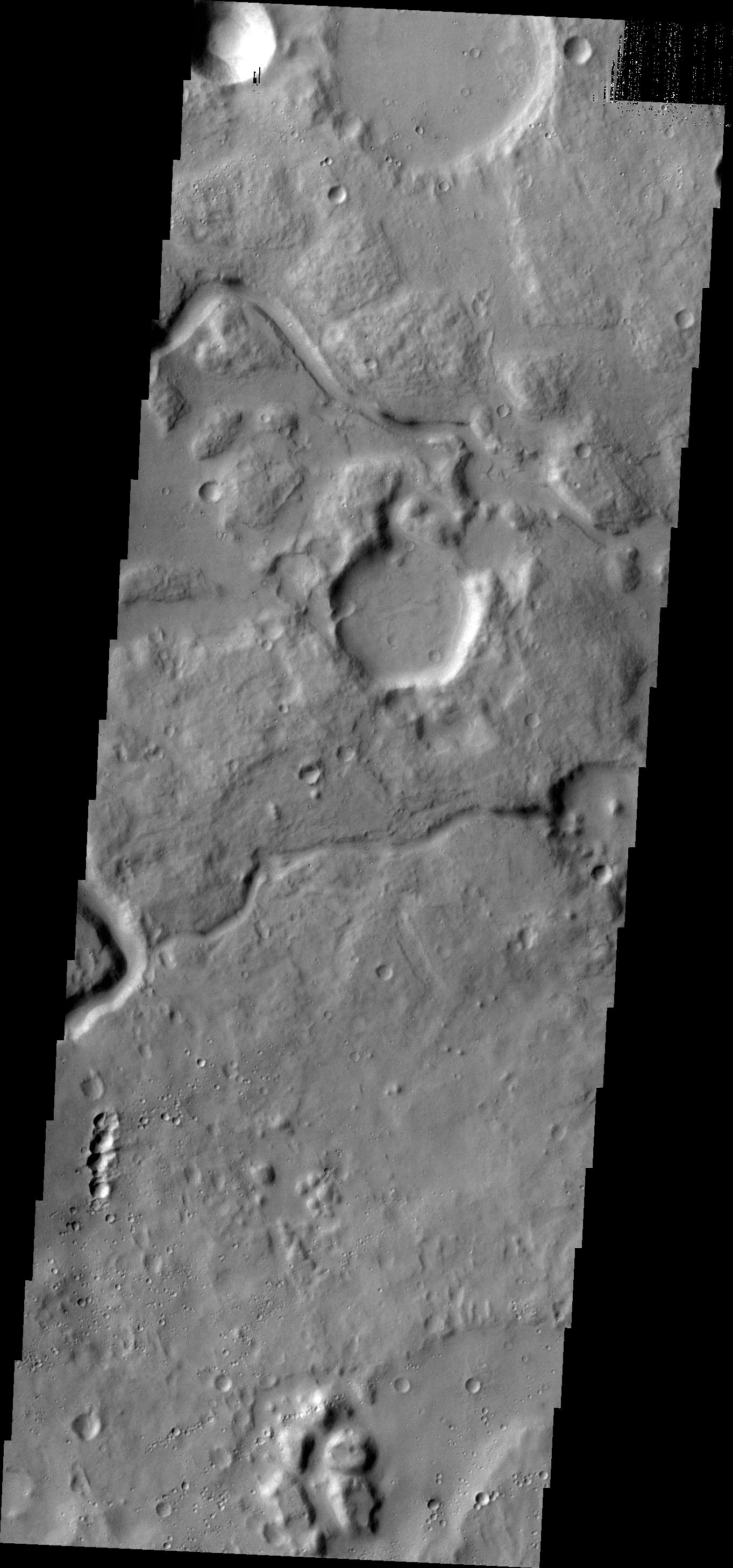
2012-08-20 |
Mars
|
2001 Mars Odyssey
|
THEMIS
|
1355x2771x1 |
|
-
PIA15925:
-
Auqakuh Vallis
Full Resolution:
TIFF
(3.759 MB)
JPEG
(413.1 kB)
|
|
|
2012-08-19 |
Mars
|
Mars Science Laboratory (MSL)
|
ChemCam
|
791x783x3 |
|
-
PIA16075:
-
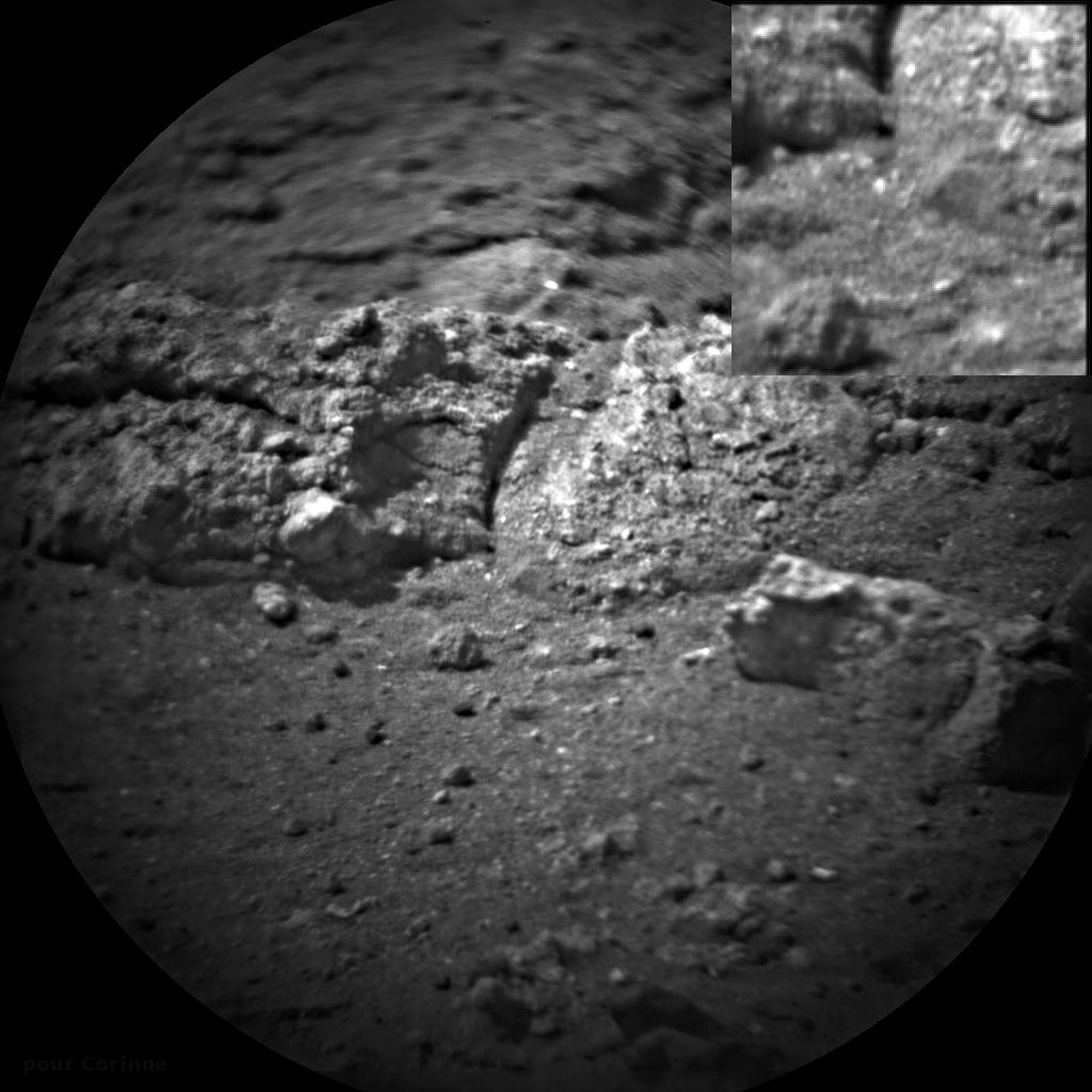
First Laser-Zapped Rock on Mars
Full Resolution:
TIFF
(621.8 kB)
JPEG
(102.3 kB)
|
|
|
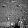
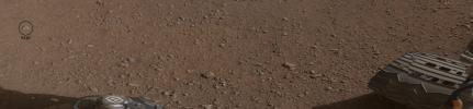
2012-08-17 |
Mars
|
Mars Science Laboratory (MSL)
|
Hazcam (MSL)
|
2399x867x1 |

|
-
PIA16061:
-
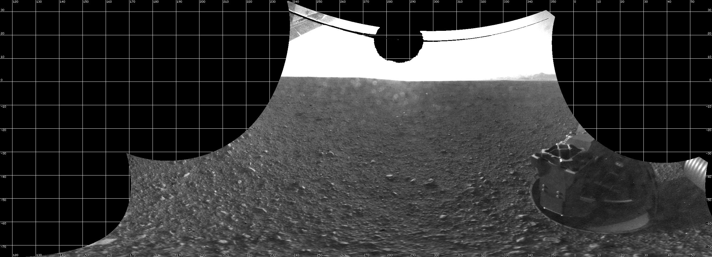
A View From Below the Rover Deck
Full Resolution:
TIFF
(2.082 MB)
JPEG
(232.5 kB)
|
|
|
2012-08-17 |
Mars
|
Mars Science Laboratory (MSL)
|
Hazcam (MSL)
|
2370x825x1 |
|
-
PIA16060:
-
Curiosity's View From Below
Full Resolution:
TIFF
(1.958 MB)
JPEG
(199.9 kB)
|
|
|
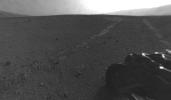
2012-08-17 |
Mars
|
Mars Science Laboratory (MSL)
|
|
7703x1678x1 |

|
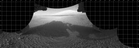
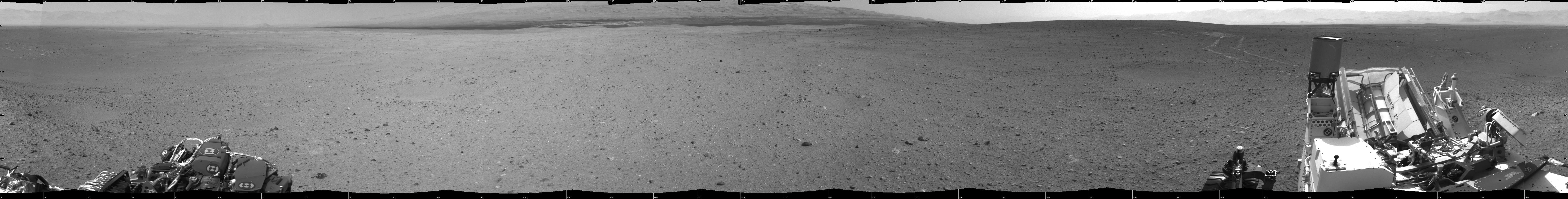
-
PIA16074:
All Around Curiosity
Full Resolution:
TIFF
(12.94 MB)
JPEG
(1.173 MB)
|
|
|
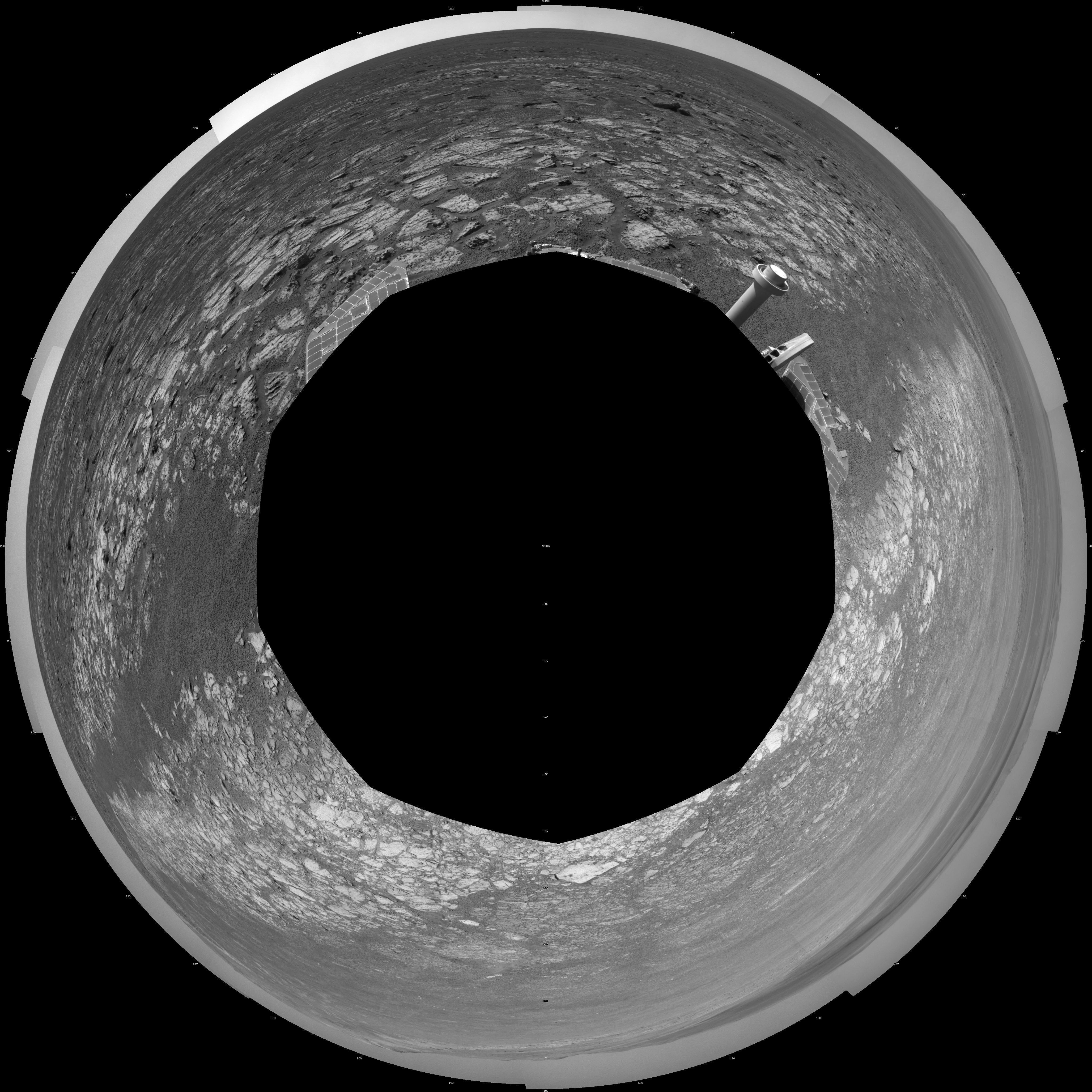
2012-08-17 |
Mars
|
Mars Science Laboratory (MSL)
|
Mastcam
|
258x276x3 |
|
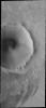
-
PIA16073:
-
Curiosity's First Rock Star, Up-Close
Full Resolution:
TIFF
(213.9 kB)
JPEG
(10.32 kB)
|
|
|
2012-08-17 |
Mars
|
Mars Science Laboratory (MSL)
|
|
10400x2415x3 |
|
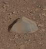
-
PIA16072:
Curiosity's First Rock Star
Full Resolution:
TIFF
(75.37 MB)
JPEG
(3.518 MB)
|
|
|
2012-08-17 |
Mars
|
Mars Science Laboratory (MSL)
|
ChemCam
|
5632x2048x1 |
|
-
PIA16071:
-
Checking out ChemCam's View
Full Resolution:
TIFF
(11.55 MB)
JPEG
(466.7 kB)
|
|
|
2012-08-17 |
Mars
|
Mars Science Laboratory (MSL)
|
ChemCam
|
2343x915x3 |

|
-
PIA16070:
-
Pre-Launch Calibration Target for ChemCam
Full Resolution:
TIFF
(6.434 MB)
JPEG
(143.5 kB)
|
|
|
2012-08-17 |
Mars
|
Mars Science Laboratory (MSL)
|
ChemCam
|
1024x1024x1 |
|
-
PIA16069:
-
Readying ChemCam
Full Resolution:
TIFF
(1.05 MB)
JPEG
(128.1 kB)
|
|
|
2012-08-17 |
Mars
|
Mars Science Laboratory (MSL)
|
|
3294x1568x3 |
|
-
PIA16068:
-
The Promised Land
Full Resolution:
TIFF
(15.5 MB)
JPEG
(597 kB)
|
|
|
2012-08-17 |
Mars
|
Mars Science Laboratory (MSL)
|
|
1536x1028x3 |
|
-
PIA16067:
-
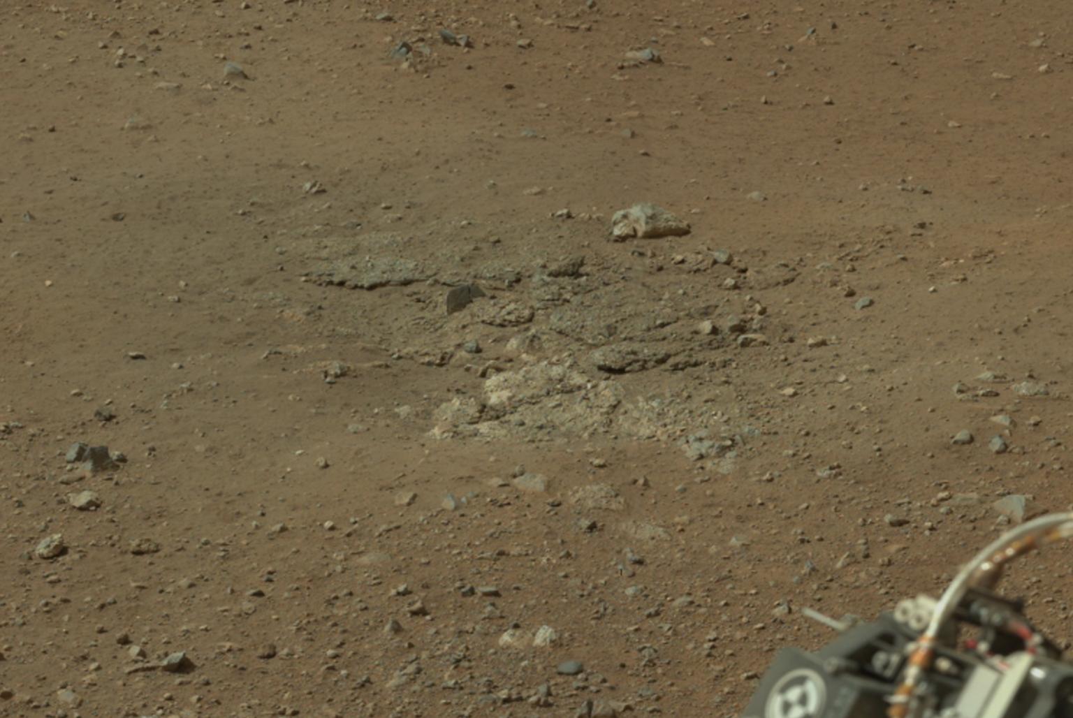
Goulburn Scour Mark
Full Resolution:
TIFF
(4.739 MB)
JPEG
(171.3 kB)
|
|
|
2012-08-17 |
Mars
|
Mars Science Laboratory (MSL)
|
|
2000x720x3 |
|
-
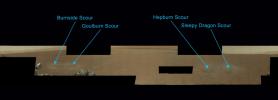
PIA16066:
-
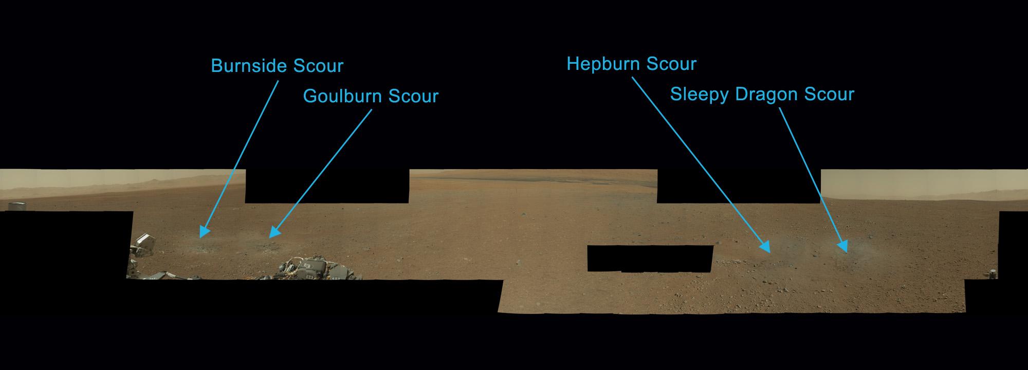
Naming the Scour Marks
Full Resolution:
TIFF
(4.322 MB)
JPEG
(84.68 kB)
|
|
|
2012-08-17 |
Mars
|
Mars Science Laboratory (MSL)
|
HiRISE
|
3289x1958x3 |
|
-
PIA16065:
-
Glenelg Intrigue
Full Resolution:
TIFF
(19.33 MB)
JPEG
(943.7 kB)
|
|
|
2012-08-17 |
Mars
|
Mars Science Laboratory (MSL)
|
HiRISE
|
3300x2550x3 |
|
-
PIA16064:
-
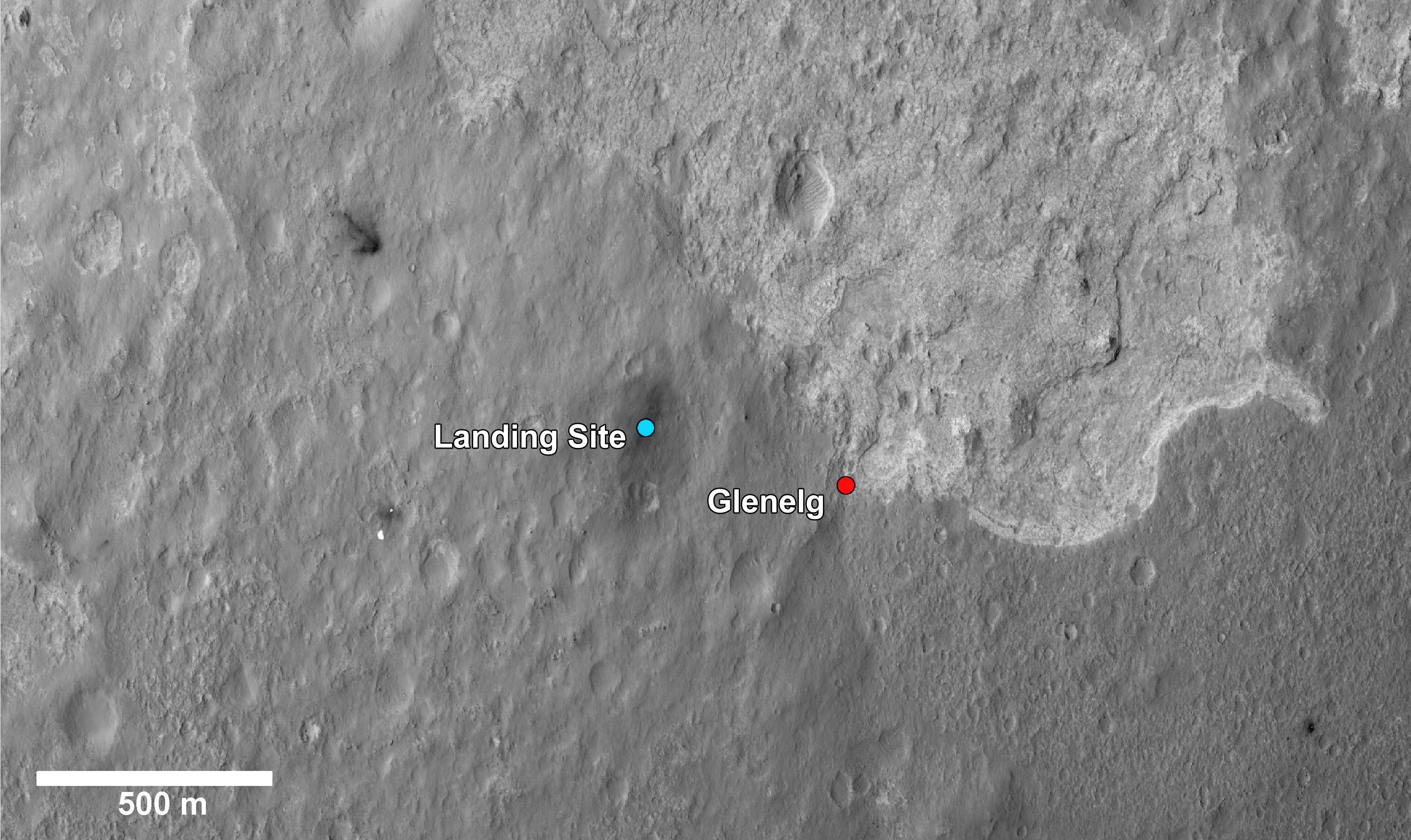
Martian Treasure Map
Full Resolution:
TIFF
(25.26 MB)
JPEG
(1.713 MB)
|
|
|
2012-08-17 |
Mars
|
Mars Science Laboratory (MSL)
|
Navcam (MSL)
|
5341x5301x1 |
|
-
PIA16063:
-
Still Life with Rover
Full Resolution:
TIFF
(28.36 MB)
JPEG
(1.591 MB)
|
|
|
2012-08-17 |
Mars
|
Mars Science Laboratory (MSL)
|
|
4061x4061x1 |
|
-
PIA16062:
-
Bird's Eye View of Curiosity
Full Resolution:
TIFF
(16.51 MB)
JPEG
(1.219 MB)
|
|
|
2012-08-17 |
Mars
|
2001 Mars Odyssey
|
THEMIS
|
1327x2772x1 |
|
-
PIA15924:
-
Eumenides Dorsum
Full Resolution:
TIFF
(3.682 MB)
JPEG
(523.5 kB)
|
|
|
2012-08-16 |
Mars
|
2001 Mars Odyssey
|
THEMIS
|
1325x2776x1 |
|
-
PIA15923:
-
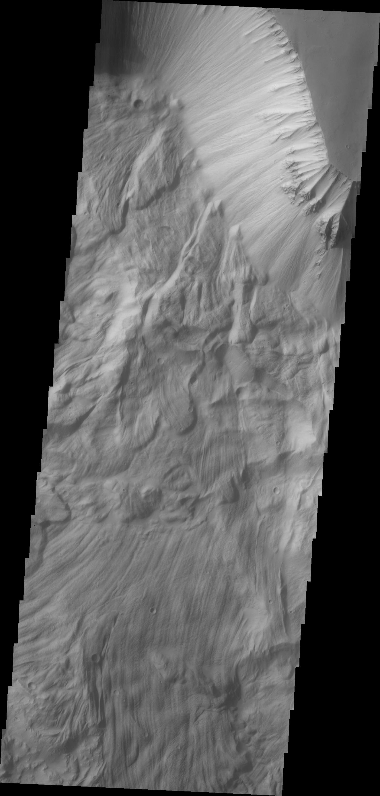
Ophir Chasma Landslide
Full Resolution:
TIFF
(3.682 MB)
JPEG
(246.6 kB)
|
|
|
2012-08-15 |
Mars
|
2001 Mars Odyssey
|
THEMIS
|
1348x2771x1 |
|
-
PIA15922:
-
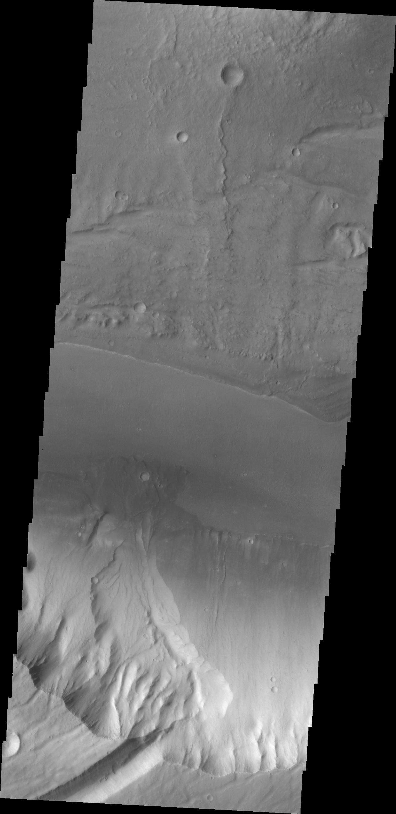
Kasei Valles Fan
Full Resolution:
TIFF
(3.739 MB)
JPEG
(209.6 kB)
|
|
|
2012-08-14 |
Mars
|
Mars Science Laboratory (MSL)
|
Context Camera
High Resolution Stereo Camera
|
2560x1600x3 |
|
-
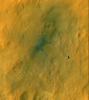
PIA16058:
-
Curiosity Cradled by Gale Crater
Full Resolution:
TIFF
(12.29 MB)
JPEG
(273.2 kB)
|
|
|
2012-08-14 |
Mars
|
Mars Reconnaissance Orbiter (MRO)
Mars Science Laboratory (MSL)
|
HiRISE
|
3022x2515x3 |
|
-
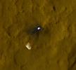
PIA16057:
-
Curiosity in Exaggerated Color
Full Resolution:
TIFF
(22.81 MB)
JPEG
(1.151 MB)
|
|
|
2012-08-14 |
Mars
|
Mars Reconnaissance Orbiter (MRO)
Mars Science Laboratory (MSL)
|
HiRISE
|
1511x13401x3 |
|
-
PIA16056:
-
A Whole New World for Curiosity
Full Resolution:
TIFF
(60.77 MB)
JPEG
(2.358 MB)
|
|
|
2012-08-14 |
Mars
|
2001 Mars Odyssey
|
THEMIS
|
1403x2801x1 |

|
-
PIA15921:
-
Dust Devil Tracks
Full Resolution:
TIFF
(3.935 MB)
JPEG
(294.7 kB)
|
|
|
2012-08-13 |
Mars
|
2001 Mars Odyssey
|
THEMIS
|
1305x2766x1 |
|
-
PIA15920:
-
Pavonis Chasma
Full Resolution:
TIFF
(3.614 MB)
JPEG
(164.4 kB)
|
 Planetary Data System


