Your search criteria found 12718 images
Target is Mars
Go to PIAxxxxx:
Refine this list of images by:
Target:
Mission:
Spacecraft:
Instrument:
Click on an image for detailed information
Click on a column heading to sort in ascending or descending order
My
List
Addition DateSort Ascending Target Mission Instrument Size
Add Image to Favorite List 2006-01-27 Mars Mars Exploration Rover (MER)
Panoramic Camera
1020x1024x3
Gusev Rocks Solidified from Lava (False Color)
PIA06101:
Gusev Rocks Solidified from Lava (False Color)
Full Resolution:     TIFF (3.138 MB)     JPEG (184 kB)
Add Image to Favorite List 2006-01-27 Mars Mars Exploration Rover (MER)
Panoramic Camera
1020x1024x3
Gusev Rocks Solidified from Lava (Approximate True Color)
PIA06102:
Gusev Rocks Solidified from Lava (Approximate True Color)
Full Resolution:     TIFF (3.138 MB)     JPEG (157.1 kB)
Add Image to Favorite List 2006-01-28 Mars Mars Global Surveyor (MGS)
Mars Orbiter Camera (MOC)
2048x2865x1
NASA's Mars Global Surveyor shows a summer scene from the south polar region of Mars. The circular feature in the northeast (upper right) corner of the image is an old meteor impact crater that has been partially filled and buried.
PIA06103:
South Polar Hills
Full Resolution:     TIFF (5.873 MB)     JPEG (718.7 kB)
Add Image to Favorite List 2006-01-29 Mars Mars Global Surveyor (MGS)
Mars Orbiter Camera (MOC)
672x968x1
NASA's Mars Global Surveyor shows a spotted, high latitude plain, south of the Argyre basin on Mars.
PIA06104:
Number 8
Full Resolution:     TIFF (651.4 kB)     JPEG (130.7 kB)
Add Image to Favorite List 2006-01-30 Mars 2001 Mars Odyssey
THEMIS
1407x2917x1
This dust avalanche is located on the rim material of an unnamed crater to the east of Tikhonravov Crater on Mars as seen by NASA's 2001 Mars Odyssey.
PIA06763:
Dust on the Move
Full Resolution:     TIFF (4.109 MB)     JPEG (299.2 kB)
Add Image to Favorite List 2006-01-30 Mars Mars Global Surveyor (MGS)
Mars Orbiter Camera (MOC)
601x1372x1
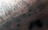
NASA's Mars Global Surveyor shows a typical view of the martian northern plains during northern summer. In spring and summer, dust devils crisscross the plains, creating dark, filamentary streaks.
PIA06108:
Northern Plains Scene
Full Resolution:     TIFF (825.6 kB)     JPEG (294.6 kB)
Add Image to Favorite List 2006-01-31 Mars Mars Global Surveyor (MGS)
Mars Orbiter Camera (MOC)
640x640x3
NASA's Mars Global Surveyor shows the south polar region of Mars in mid-January 2006.
PIA02150:
Mars at Ls 357°: South Polar Region
Full Resolution:     TIFF (411.8 kB)     JPEG (37.87 kB)
Add Image to Favorite List 2006-01-31 Mars 2001 Mars Odyssey
THEMIS
1053x3048x1
This image from NASA's 2001 Mars Odyssey is of the south polar region on Mars shows layered material. It is not known if the layers are formed yearly or if they form over the period of 10s to 100s of years or more.
PIA02153:
Polar Layers
Full Resolution:     TIFF (3.213 MB)     JPEG (385.7 kB)
Add Image to Favorite List 2006-02-01 Mars Mars Global Surveyor (MGS)
Mars Orbiter Camera (MOC)
2048x3024x1
This image from NASA's Mars Global Surveyor spacecraft shows a suite of gullies on a scarp in Lyell Crater.
PIA02151:
South High-latitude Gullies
Full Resolution:     TIFF (6.199 MB)     JPEG (1.313 MB)
Add Image to Favorite List 2006-02-01 Mars 2001 Mars Odyssey
THEMIS
1342x2939x1
The discontinuous channels in this image are collapsed lava tubes on Mars as seen by NASA's 2001 Mars Odyssey spacecraft.
PIA02154:
Collapse Tubes
Full Resolution:     TIFF (3.948 MB)     JPEG (570.1 kB)
Add Image to Favorite List 2006-02-02 Mars Mars Global Surveyor (MGS)
Mars Orbiter Camera (MOC)
672x1176x1
This image from NASA's Mars Global Surveyor spacecraft polygonally patterned ground on the floor of a trough in the southern hemisphere of Mars. The polygons could be an indicator that ground ice is or was present at this location.
PIA02152:
Broken Plain
Full Resolution:     TIFF (791.3 kB)     JPEG (172.2 kB)
Add Image to Favorite List 2006-02-02 Mars 2001 Mars Odyssey
THEMIS
1086x2932x1
These bright and dark markings occurred near the end of summer in the south polar region on Mars as seen by NASA's 2001 Mars Odyssey spacecraft. The dark material is likely dust that has been freed of frost cover.
PIA02155:
Polar Markings
Full Resolution:     TIFF (3.188 MB)     JPEG (363.2 kB)
Add Image to Favorite List 2006-02-02 Mars Mars Exploration Rover (MER)
Navigation Camera
1024x1024x1
In January 2006, NASA's Mars Exploration Rover team adopted a new strategy for carrying Opportunity's robotic arm (the instrument deployment device with its turret of four tools at the end) when the rover is driving.
PIA02156:
Opportunity's Arm in 'Hover-Stow' Position
Full Resolution:     TIFF (1.05 MB)     JPEG (147.6 kB)
Add Image to Favorite List 2006-02-02 Mars Mars Exploration Rover (MER)
Microscopic Imager
1024x1024x1
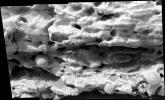
NASA's Mars Exploration Rover Spirit used its microscopic imager to capture this spectacular, jagged mini-landscape on a rock called 'GongGong.'
PIA02157:
Hardened Lava Meets Wind on Mars
Full Resolution:     TIFF (1.05 MB)     JPEG (190.6 kB)
Add Image to Favorite List 2006-02-03 Mars 2001 Mars Odyssey
THEMIS
1384x2920x1
This image shows how the wind is eroding the material of Gordii Dorsum on Mars as seen by NASA's 2001 Mars Odyssey spacecraft.
PIA02159:
Gordii Dorsum
Full Resolution:     TIFF (4.046 MB)     JPEG (520.5 kB)
Add Image to Favorite List 2006-02-03 Mars Mars Global Surveyor (MGS)
Mars Orbiter Camera (MOC)
512x1660x1
This image from NASA's Mars Global Surveyor spacecraft shows streaks created by late spring and early summer dust devils on a field of dark sand dunes on the floor of Hooke Crater.
PIA02161:
D and D (Dunes and Devils)
Full Resolution:     TIFF (851 kB)     JPEG (67.5 kB)
Add Image to Favorite List 2006-02-04 Mars Mars Global Surveyor (MGS)
Mars Orbiter Camera (MOC)
672x1104x1
This image from NASA's Mars Global Surveyor spacecraft image shows dark streaks created by dust devils on a plain southwest of Hellas Planitia.
PIA02162:
Streaked Plain
Full Resolution:     TIFF (742.9 kB)     JPEG (234.4 kB)
Add Image to Favorite List 2006-02-05 Mars Mars Global Surveyor (MGS)
Mars Orbiter Camera (MOC)
672x1552x1
This image from NASA's Mars Global Surveyor shows a channel extending northward from the Elysium Mons caldera at the volcano's summit.
PIA02163:
Elysium Summit
Full Resolution:     TIFF (1.044 MB)     JPEG (130.4 kB)
Add Image to Favorite List 2006-02-06 Mars 2001 Mars Odyssey
THEMIS
1367x2925x1
This large landslide is located within Ganges Chasma on Mars as seen by NASA's 2001 Mars Odyssey spacecraft.
PIA02160:
Landslide
Full Resolution:     TIFF (4.003 MB)     JPEG (266.8 kB)
Add Image to Favorite List 2006-02-06 Mars Mars Global Surveyor (MGS)
Mars Orbiter Camera (MOC)
1230x869x3
This pair of images color images from NASA's Mars Global Surveyor shows early autumn clouds over the Arsia Mons volcano, plus the shadow of the innermost of the two martain moons, Phobos.
PIA02164:
Arsia and Phobos
Full Resolution:     TIFF (3.21 MB)     JPEG (93.8 kB)
Add Image to Favorite List 2006-02-07 Mars 2001 Mars Odyssey
THEMIS
1452x2922x1
The channel in this image is called Apsus Vallis and it is located near the Elysium volcanic complex. Lava may have played a part in the formation of Apsus Vallis on Mars as seen by NASA's 2001 Mars Odyssey.
PIA02170:
Apsus Vallis
Full Resolution:     TIFF (4.248 MB)     JPEG (636 kB)
Add Image to Favorite List 2006-02-07 Mars Mars Global Surveyor (MGS)
Mars Orbiter Camera (MOC)
640x640x3
This picture is a composite of NASA's Mars Global Surveyor (MGS) Mars Orbiter Camera (MOC) daily global images acquired at Ls 12° during a previous Mars year.
PIA02165:
Mars at Ls 12°: Tharsis
Full Resolution:     TIFF (411.8 kB)     JPEG (34.2 kB)
Add Image to Favorite List 2006-02-08 Mars Mars Global Surveyor (MGS)
Mars Orbiter Camera (MOC)
672x1160x1
NASA's Mars Global Surveyor shows an area adjacent to Mar's south polar residual cap that hosts several intricate fracture networks.
PIA02167:
South Polar Landforms
Full Resolution:     TIFF (780.5 kB)     JPEG (251.2 kB)
Add Image to Favorite List 2006-02-08 Mars 2001 Mars Odyssey
THEMIS
1069x2958x1
These clouds formed in the south polar region on Mars. The faintness of the cloud system likely indicates that these are mainly ice clouds, with relatively little dust content as seen by NASA's 2001 Mars Odyssey.

PIA02171:
Cloud Front
Full Resolution:     TIFF (3.166 MB)     JPEG (421.2 kB)
Add Image to Favorite List 2006-02-09 Mars Mars Global Surveyor (MGS)
Mars Orbiter Camera (MOC)
672x1728x1
NASA's Mars Global Surveyor shows layering in terrain at the high southern latitudes of Mars. South polar layers are commonly assumed to consist of varying amounts of dust and ice.
PIA02168:
South Polar Terraces
Full Resolution:     TIFF (1.163 MB)     JPEG (154.2 kB)
Add Image to Favorite List 2006-02-09 Mars 2001 Mars Odyssey
THEMIS
1366x2925x1
These yardangs are being formed by wind erosion of the Memnonia Sulci deposits on Mars as seen by NASA's 2001 Mars Odyssey.
PIA02172:
Memnonia Sulci
Full Resolution:     TIFF (4 MB)     JPEG (573.2 kB)
Add Image to Favorite List 2006-02-10 Mars Mars Global Surveyor (MGS)
Mars Orbiter Camera (MOC)
1024x1919x1
NASA's Mars Global Surveyor shows a crater that in south central Syrtis Major Planum on Mars. The image also captures a portion of the light-toned wind streak formed in the lee (to the left) of the crater. A wind streak is also present.
PIA02169:
Syrtis Crater
Full Resolution:     TIFF (1.967 MB)     JPEG (190.2 kB)
Add Image to Favorite List 2006-02-10 Mars 2001 Mars Odyssey
THEMIS
1345x2935x1
This image of the east end of Coprates Chasma on Mars contains several dune fields. The dunes in the center of the image are larger and darker than the dunes at the bottom as seen by NASA's 2001 Mars Odyssey.
PIA02173:
Dune Variety
Full Resolution:     TIFF (3.952 MB)     JPEG (336.1 kB)
Add Image to Favorite List 2006-02-11 Mars Mars Global Surveyor (MGS)
Mars Orbiter Camera (MOC)
672x1464x1
NASA's Mars Global Surveyor shows cracked surfaces in the south polar layered terrain of Mars. The cracks in this scene have formed complex dendritic arrays.
PIA02176:
South Polar Terrain
Full Resolution:     TIFF (985 kB)     JPEG (193.4 kB)
Add Image to Favorite List 2006-02-12 Mars Mars Global Surveyor (MGS)
Mars Orbiter Camera (MOC)
1024x2098x1
NASA's Mars Global Surveyor shows a portion of a large landslide deposit on the floor of western Tithonium Chasma on Mars.
PIA02177:
Tithonium Landslide
Full Resolution:     TIFF (2.151 MB)     JPEG (670.7 kB)
Add Image to Favorite List 2006-02-13 Mars Mars Global Surveyor (MGS)
Mars Orbiter Camera (MOC)
672x1366x1
NASA's Mars Global Surveyor shows an impact crater in western Chryse Planitia on Mars surrounded by a flat plain riddled by hundreds of smaller impact craters.
PIA02178:
Chryse Plains
Full Resolution:     TIFF (919.1 kB)     JPEG (261.4 kB)
Add Image to Favorite List 2006-02-14 Mars 2001 Mars Odyssey
THEMIS
1443x2919x1
This isolated mesa has an almost heart-shaped margin. Happy Valentine's Day from Mars as seen by NASA's 2001 Mars Odyssey.
PIA02174:
Valentine's Day
Full Resolution:     TIFF (4.217 MB)     JPEG (334.1 kB)
Add Image to Favorite List 2006-02-14 Mars Mars Global Surveyor (MGS)
Mars Orbiter Camera (MOC)
281x413x1
This image from NASA's Mars Global Surveyor shows a heart-shaped, eroded and partially-filled crater located near the southeast wall of Columbus Crater in the Mare Sirenum region of Mars.
PIA02179:
Valentine 2006
Full Resolution:     TIFF (116.4 kB)     JPEG (27.6 kB)
Add Image to Favorite List 2006-02-15 Mars 2001 Mars Odyssey
THEMIS
1239x2737x1
This image of part of Aram Chaos on Mars shows two different surface textures with distinctly different brightnesses. The lighter layer appears to be on top (therefore younger) than the darker surface as seen by NASA's 2001 Mars Odyssey.
PIA02175:
Surface Variety
Full Resolution:     TIFF (3.395 MB)     JPEG (533.1 kB)
Add Image to Favorite List 2006-02-15 Mars Mars Global Surveyor (MGS)
Mars Orbiter Camera (MOC)
640x640x3
NASA's Mars Global Surveyor shows the Acidalia/Mare Erythraeum face of Mars in mid-February 2006.
PIA02181:
Mars at Ls 12°: Acidalia/Mare Erythraeum
Full Resolution:     TIFF (411.8 kB)     JPEG (36.1 kB)
Add Image to Favorite List 2006-02-16 Mars 2001 Mars Odyssey
THEMIS
1082x2755x1
In this image the martian surface is completely hidden from view by thick clouds. The thickness of the clouds indicates the dust is a major component of the clouds as seen by NASA's 2001 Mars Odyssey.
PIA02182:
Where's the Surface?
Full Resolution:     TIFF (2.984 MB)     JPEG (255.7 kB)
Add Image to Favorite List 2006-02-16 Mars Mars Global Surveyor (MGS)
Mars Orbiter Camera (MOC)
2048x2616x1
This image from NASA's Mars Global Surveyor shows a portion of the south polar residual cap where the effects of sublimation are apparent. Over extended periods of time, sublimation eats away at the smoother appearing material.
PIA02183:
A Matter of Time
Full Resolution:     TIFF (5.363 MB)     JPEG (949.8 kB)
Add Image to Favorite List 2006-02-17 Mars Mars Global Surveyor (MGS)
Mars Orbiter Camera (MOC)
836x1698x1
This image from NASA's Mars Global Surveyor shows a surface in Isidis Planitia, littered with degraded impact craters. Windblown ripples of various sizes and shapes are prevalent with wave-like patterns on the floors of some of the larger impact craters.
PIA02184:
Isidis Plains
Full Resolution:     TIFF (1.421 MB)     JPEG (237.6 kB)
Add Image to Favorite List 2006-02-17 Mars 2001 Mars Odyssey
THEMIS
1368x2989x1
Dust devil activity in this region between Brashear and Ross Craters is very common. Large regions of dust devil tracks surround the south polar region of Mars as seen by NASA's 2001 Mars Odyssey.
PIA02185:
A Dust Devil Playground
Full Resolution:     TIFF (4.094 MB)     JPEG (655.3 kB)
Add Image to Favorite List 2006-02-17 Mars Mars Exploration Rover (MER)
Microscopic Imager
2948x1193x1
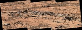
This image mosaic from NASA's Mars Exploration Rover Opportunity shows detailed structure of a small fin-like structure dubbed 'Roosevelt,' which sticks out from the outcrop pavement at the edge of 'Erebus Crater,' taken on Feb. 8, 2006.
PIA02186:
Revealing Roosevelt
Full Resolution:     TIFF (3.522 MB)     JPEG (269.1 kB)
Add Image to Favorite List 2006-02-17 Mars Mars Exploration Rover (MER)
Panoramic Camera
1936x746x1
This image taken on Feb 7, 2006 by NASA's Mars Exploration Rover Spirit shows 'Home Plate' looks like the home plate of a baseball diamond, a roughly circular feature that might be an old impact crater or volcanic feature.
PIA02187:
Spirit Hits a Home Run
Full Resolution:     TIFF (1.446 MB)     JPEG (298.5 kB)
Add Image to Favorite List 2006-02-18 Mars Mars Global Surveyor (MGS)
Mars Orbiter Camera (MOC)
2048x3048x1
This image from NASA's Mars Global Surveyor shows a group of rounded hills surrounded by a vast, cratered plain in northeastern Isidis Planitia.
PIA02192:
Isidis Landforms
Full Resolution:     TIFF (6.249 MB)     JPEG (1.03 MB)
Add Image to Favorite List 2006-02-19 Mars Mars Global Surveyor (MGS)
Mars Orbiter Camera (MOC)
672x1008x1
This image from NASA's Mars Global Surveyor shows dark streaks on a plain south of the giant impact basin, Hellas Planitia. The streaks map the routes traveled by dozens of individual southern spring and early summer dust devils.
PIA02193:
Devil-Streaked Plain
Full Resolution:     TIFF (678.3 kB)     JPEG (135.2 kB)
Add Image to Favorite List 2006-02-20 Mars Mars Global Surveyor (MGS)
Mars Orbiter Camera (MOC)
768x2000x1
This image from NASA's Mars Global Surveyor shows layered, sedimentary rock exposures in the Sinus Meridiani region.
PIA02194:
Meridiani Materials
Full Resolution:     TIFF (1.538 MB)     JPEG (195 kB)
Add Image to Favorite List 2006-02-20 Mars 2001 Mars Odyssey
THEMIS
1356x2926x1
This type of 'broken-up' terrain on Mars is called chaos as seen by NASA's 2001 Mars Odyssey spacecraft.
PIA02196:
Aureum Chaos
Full Resolution:     TIFF (3.972 MB)     JPEG (364.3 kB)
Add Image to Favorite List 2006-02-21 Mars Mars Global Surveyor (MGS)
Mars Orbiter Camera (MOC)
640x640x3
NASA's Mars Global Surveyor shows the Syrtis Major face of Mars in mid-February 2006.
PIA02195:
Mars at Ls 12°: Syrtis Major
Full Resolution:     TIFF (411.8 kB)     JPEG (39.14 kB)
Add Image to Favorite List 2006-02-21 Mars 2001 Mars Odyssey
THEMIS
1353x2931x1
This dust avalanche is located in part of Noctis Labyrinthus on Mars as seen by NASA's 2001 Mars Odyssey spacecraft.
PIA02197:
Dust
Full Resolution:     TIFF (3.97 MB)     JPEG (189.3 kB)
Add Image to Favorite List 2006-02-22 Mars Mars Global Surveyor (MGS)
Mars Orbiter Camera (MOC)
836x1216x1
This image from NASA's Mars Global Surveyor shows a transition from one of the many layered troughs in the north polar region of Mars to the relatively homogeneous-looking upper surface of the polar cap.
PIA02198:
Smooth Transition
Full Resolution:     TIFF (1.018 MB)     JPEG (239.7 kB)
Add Image to Favorite List 2006-02-22 Mars 2001 Mars Odyssey
THEMIS
1342x2943x1
The linear features in this image are called graben and are formed when two parallel faults have a downdropped block of material between them. These graben are located between Syria Planum and Claritas Rupes as seen by NASA's 2001 Mars Odyssey.
PIA02297:
Graben
Full Resolution:     TIFF (3.954 MB)     JPEG (539.1 kB)
Add Image to Favorite List 2006-02-23 Mars Mars Global Surveyor (MGS)
Mars Orbiter Camera (MOC)
1024x2848x1
This image from NASA's Mars Global Surveyor shows an unusally-shaped (not circular) impact crater in the Elysium region of Mars. A dark-toned lava flow surface is seen in the southern (lower) portion of the image.
PIA02199:
Kidney-Shaped Impact
Full Resolution:     TIFF (2.919 MB)     JPEG (530.2 kB)
Add Image to Favorite List 2006-02-23 Mars 2001 Mars Odyssey
THEMIS
617x1444x1
This image contains several different impact craters on Mars as seen by NASA's 2001 Mars Odyssey spacecraft.
PIA02298:
Crater Variety
Full Resolution:     TIFF (892.1 kB)     JPEG (117.2 kB)
Add Image to Favorite List 2006-02-24 Mars Mars Global Surveyor (MGS)
Mars Orbiter Camera (MOC)
1024x2496x1
This image from NASA's Mars Global Surveyor shows dark dunes superposed on the rippled floor of Proctor Crater in Noachis Terra. Winds blowing predominantly from east (right) to west (left) were responsible for the formation of these dunes on Mars.
PIA02261:
Wayward Travelers
Full Resolution:     TIFF (2.559 MB)     JPEG (528 kB)
Add Image to Favorite List 2006-02-24 Mars 2001 Mars Odyssey
THEMIS
1345x2941x1
These lava flows are part of the Arsia Mons complex on Mars as seen by NASA's 2001 Mars Odyssey spacecraft.
PIA02299:
Lava Flows
Full Resolution:     TIFF (3.96 MB)     JPEG (824 kB)
Add Image to Favorite List 2006-02-25 Mars Mars Global Surveyor (MGS)
Mars Orbiter Camera (MOC)
672x960x1
This image from NASA's Mars Global Surveyor image shows the remains of a once more laterally extensive layer overlying undulating terrain very near the south polar residual cap on Mars.
PIA02262:
South Polar Remnants
Full Resolution:     TIFF (646 kB)     JPEG (185.4 kB)
Add Image to Favorite List 2006-02-26 Mars Mars Global Surveyor (MGS)
Mars Orbiter Camera (MOC)
672x1104x1
This image from NASA's Mars Global Surveyor shows gullies formed in the wall of a depression located on the floor of Rabe Crater west of the giant impact basin, Hellas Planitia on Mars.
PIA02295:
Gullied Depression
Full Resolution:     TIFF (742.9 kB)     JPEG (162 kB)
Add Image to Favorite List 2006-02-27 Mars 2001 Mars Odyssey
THEMIS
1372x2968x1
These sand dunes are located on the floor of Kaiser Crater on Mars as seen by NASA's 2001 Mars Odyssey spacecraft.
PIA02351:
Sand Dunes
Full Resolution:     TIFF (4.077 MB)     JPEG (248.6 kB)
Add Image to Favorite List 2006-02-27 Mars Mars Global Surveyor (MGS)
Mars Orbiter Camera (MOC)
1024x1800x1
This image from NASA's Mars Global Surveyor shows layered buttes, knobs, and other landforms exposed by erosion in the Aeolis region of Mars.
PIA02296:
Aeolis Landforms
Full Resolution:     TIFF (1.845 MB)     JPEG (280.3 kB)
Add Image to Favorite List 2006-02-28 Mars Mars Global Surveyor (MGS)
Mars Orbiter Camera (MOC)
640x640x3
NASA's Mars Global Surveyor shows the Elysium/Mare Cimmerium face of Mars in mid-February 2006.
PIA02612:
Mars at Ls 12°: Elysium/Mare Cimmerium
Full Resolution:     TIFF (411.8 kB)     JPEG (37.93 kB)
Add Image to Favorite List 2006-02-28 Mars 2001 Mars Odyssey
THEMIS
1365x2926x1
In this section of Tinto Vallis on Mars there are no tributary stream channels joining the main channel. This tells us that whatever carved the channel originated in some other region as seen by NASA's 2001 Mars Odyssey.
PIA02682:
Tinto Vallis
Full Resolution:     TIFF (3.998 MB)     JPEG (295 kB)
Add Image to Favorite List 2006-03-01 Mars Mars Exploration Rover (MER)
Navigation Camera
7466x1547x1
NASA's Mars Exploration Rover Spirit recorded this view in February 2006 while approaching the northwestern edge of 'Home Plate,' a circular plateau-like area of bright, layered outcrop material.
PIA02399:
Rover Team Decides: Safety First
Full Resolution:     TIFF (11.56 MB)     JPEG (732.8 kB)
Add Image to Favorite List 2006-03-01 Mars Mars Global Surveyor (MGS)
Mars Orbiter Camera (MOC)
672x1152x1
NASA's Mars Global Surveyor shows a layered mound, buried under a thin coating of material hard enough to have been cut by shallow fractures, on the floor of the giant Argyre Basin.
PIA02613:
Argyre Bull's-Eye
Full Resolution:     TIFF (775.1 kB)     JPEG (151.6 kB)
Add Image to Favorite List 2006-03-01 Mars 2001 Mars Odyssey
THEMIS
1430x2924x1
This image shows the summit of Hecates Tholus on Mars. The summit caldera is located in the top of the image as seen by NASA's 2001 Mars Odyssey.
PIA02683:
Tholus Summit
Full Resolution:     TIFF (4.186 MB)     JPEG (501.1 kB)
Add Image to Favorite List 2006-03-02 Mars Mars Global Surveyor (MGS)
Mars Orbiter Camera (MOC)
2048x4496x1
NASA's Mars Global Surveyor shows an impact crater located in Terra Sabaea on Mars. South of the impact crater is a second, more subdued circular feature which is probably an ancient impact crater that was buried and only partially exhumed.
PIA02680:
Up Close and Personal
Full Resolution:     TIFF (9.217 MB)     JPEG (1.005 MB)
Add Image to Favorite List 2006-03-02 Mars 2001 Mars Odyssey
THEMIS
1370x2923x1
These dust avalanches occur in a crater within Iani Chaos on Mars as seen by NASA's 2001 Mars Odyssey spacecraft.
PIA02684:
Dust Slides
Full Resolution:     TIFF (4.009 MB)     JPEG (322.7 kB)
Add Image to Favorite List 2006-03-03 Mars 2001 Mars Odyssey
THEMIS
1366x2927x1
The many small channels in this image are part of the larger Sabis Vallis on Mars as seen by NASA's 2001 Mars Odyssey spacecraft.
PIA02685:
Sabis Vallis
Full Resolution:     TIFF (4.003 MB)     JPEG (470.2 kB)
Add Image to Favorite List 2006-03-03 Mars Mars Global Surveyor (MGS)
Mars Orbiter Camera (MOC)
672x1152x1
NASA's Mars Global Surveyor shows two barchan dunes in the north polar region of Mars. The orientation of the dunes, with the steep faces pointed toward the southeast, indicates that the winds responsible for their formation blew from the northwest.
PIA02681:
Lonely Barchans
Full Resolution:     TIFF (775.1 kB)     JPEG (139.5 kB)
Add Image to Favorite List 2006-03-04 Mars Mars Global Surveyor (MGS)
Mars Orbiter Camera (MOC)
1024x1860x1
NASA's Mars Global Surveyor shows a landscape in the eastern Cerberus region on Mars scoured by catastrophic floods, and later cut by a deep, dark-walled trough. The trough is radial to the Elysium volcanic region, and formed along faults in the bedrock.
PIA02691:
East Cerberus
Full Resolution:     TIFF (1.907 MB)     JPEG (281.7 kB)
Add Image to Favorite List 2006-03-05 Mars Mars Global Surveyor (MGS)
Mars Orbiter Camera (MOC)
1024x1860x1
NASA's Mars Global Surveyor shows a dark-toned, cratered plain in southwest Utopia Planitiaon Mars. Large, light-toned, windblown ripples reside on the floors of many of the depressions in the scene, including a long, linear, trough.
PIA02692:
Utopia Plain
Full Resolution:     TIFF (1.907 MB)     JPEG (281.9 kB)
Add Image to Favorite List 2006-03-06 Mars Mars Global Surveyor (MGS)
Mars Orbiter Camera (MOC)
836x2005x1
NASA's Mars Global Surveyor shows a frosty, springtime scene in the north polar region of Mars. The area is blanketed by a maze of sand dunes; their appearance is enhanced by subliming, seasonal carbon dioxide frost.
PIA02693:
Dune-tastic
Full Resolution:     TIFF (1.678 MB)     JPEG (332.5 kB)
Add Image to Favorite List 2006-03-06 Mars 2001 Mars Odyssey
THEMIS
1074x3089x1
These clouds occurred near the south polar cap on Mars at the end of southern summer as seen by NASA's 2001 Mars Odyssey.
PIA02694:
Southern Clouds
Full Resolution:     TIFF (3.321 MB)     JPEG (380.1 kB)
Add Image to Favorite List 2006-03-06 Mars Mars Exploration Rover (MER)
Panoramic Camera
Rock Abrasion Tool (RAT)
1021x1024x3
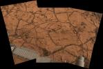
This image shows two flat-topped, layered rocks with angular edges almost side by side, except they are separated by a smaller rock and two thin channels of reddish-brown sand. The bare rock surfaces are a light blue-gray.
PIA02686:
Spirit Studies Rock Outcrop at 'Home Plate'
Full Resolution:     TIFF (3.141 MB)     JPEG (224.1 kB)
Add Image to Favorite List 2006-03-06 Mars Mars Exploration Rover (MER)
Panoramic Camera
10525x2877x3
This panorama shows two rock-strewn slopes on the left and right sides of a broad, U-shaped dip in the middle. The sandy surface in front of the rover is reddish brown; individual rocks and more distant features are blue-gray.
PIA02687:
Spirit's 'Paige' Panorama of the Interior of 'Home Plate' (False Color)
Full Resolution:     TIFF (90.84 MB)     JPEG (3.327 MB)
Add Image to Favorite List 2006-03-06 Mars Mars Exploration Rover (MER)
Panoramic Camera
10525x2877x3
This panorama shows two reddish-brown, rock-strewn slopes on the left and right sides of a broad, U-shaped dip in the middle. In the distance are the broad slopes of 'McCool Hill.' Above that is an orangish-yellow sky.
PIA02688:
Spirit's 'Paige' Panorama of the Interior of 'Home Plate'
Full Resolution:     TIFF (90.84 MB)     JPEG (2.646 MB)     QTVR (2.964 MB)
Add Image to Favorite List 2006-03-06 Mars Mars Exploration Rover (MER)
Panoramic Camera
10860x4315x3
This image shows finely layered rocks interspersed with sand sloping downward and inward toward the center of the panorama from either side. Here and there on the outcrop, a chunk of rock has become displaced and lies at an angle on the surface.
PIA02689:
'Gibson' Panorama by Spirit at 'Home Plate' (False Color)
Full Resolution:     TIFF (140.6 MB)     JPEG (5.054 MB)
Add Image to Favorite List 2006-03-06 Mars Mars Exploration Rover (MER)
Panoramic Camera
10860x4315x3
This image shows finely layered rocks interspersed with sand sloping downward and inward toward the center of the panorama from either side. Here and there on the outcrop, a chunk of rock has become displaced and lies at an angle on the surface
PIA02690:
'Gibson' Panorama by Spirit at 'Home Plate'
Full Resolution:     TIFF (140.6 MB)     JPEG (3.571 MB)     QTVR (3.958 MB)
Add Image to Favorite List 2006-03-07 Mars Mars Exploration Rover (MER)
Panoramic Camera
5295x1950x3
The panoramic camera aboard NASA's Mars Exploration Rover Opportunity acquired this panorama of the 'Payson' outcrop on the western edge of 'Erebus' Crater during Opportunity's sol 744 (Feb. 26, 2006).
PIA02695:
'Payson' Panorama in False Color
Full Resolution:     TIFF (30.98 MB)     JPEG (1.13 MB)
Add Image to Favorite List 2006-03-07 Mars Mars Exploration Rover (MER)
Panoramic Camera
5295x1950x3
The panoramic camera aboard NASA's Mars Exploration Rover Opportunity acquired this panorama of the 'Payson' outcrop on the western edge of 'Erebus' Crater during Opportunity's sol 744 (Feb. 26, 2006).
PIA02696:
'Payson' Panorama by Opportunity
Full Resolution:     TIFF (30.98 MB)     JPEG (854.9 kB)     QTVR (969.6 kB)
Add Image to Favorite List 2006-03-07 Mars Mars Global Surveyor (MGS)
Mars Orbiter Camera (MOC)
640x640x3
NASA's Mars Global Surveyor shows the Tharsis face of Mars in mid-March 2006.
PIA02697:
Mars at Ls 25°: Tharsis
Full Resolution:     TIFF (411.8 kB)     JPEG (35.3 kB)
Add Image to Favorite List 2006-03-07 Mars 2001 Mars Odyssey
THEMIS
1400x2920x1
This crater on Mars has a layered ejecta blanket. This image was taken by NASA's 2001 Mars Odyssey.
PIA02698:
Multi-layer Ejecta
Full Resolution:     TIFF (4.093 MB)     JPEG (419.3 kB)
Add Image to Favorite List 2006-03-08 Mars Mars Global Surveyor (MGS)
Mars Orbiter Camera (MOC)
1672x8935x1
This image from NASA's Mars Global Surveyor shows a portion of a pit chain on the lower, northern flank of the giant martian volcano, Arsia Mons.
PIA02874:
The Pits
Full Resolution:     TIFF (14.96 MB)     JPEG (1.629 MB)
Add Image to Favorite List 2006-03-09 Mars Mars Global Surveyor (MGS)
Mars Orbiter Camera (MOC)
1024x1452x1
This image from NASA's Mars Global Surveyor shows a variety of textures observed on a south middle-latitude plain east-southeast of Hellas Planitia. Dark streaks left by passing dust devils are practically ubiquitous across the scene.
PIA02887:
Martian Graffiti
Full Resolution:     TIFF (1.489 MB)     JPEG (303.4 kB)
Add Image to Favorite List 2006-03-10 Mars Mars Global Surveyor (MGS)
Mars Orbiter Camera (MOC)
2048x3016x1
This image from NASA's Mars Global Surveyor shows a variety of textures observed on a south middle-latitude plain east-southeast of Hellas Planitia. Dark streaks left by passing dust devils are practically ubiquitous across the scene.
PIA02888:
Remains
Full Resolution:     TIFF (6.183 MB)     JPEG (819.5 kB)
Add Image to Favorite List 2006-03-10 Mars 2001 Mars Odyssey
THEMIS
1240x2737x1
These windstreaks are located in the southern part of Syrtis major on Mars. This image was taken by NASA's 2001 Mars Odyssey.
PIA02889:
Windstreaks
Full Resolution:     TIFF (3.398 MB)     JPEG (440.2 kB)
Add Image to Favorite List 2006-03-10 Mars 2001 Mars Odyssey
THEMIS
1358x2926x1
The semi-circular depressions in this image are called blowouts and are formed by wind action. These blowouts are part of the Medusae Fossae Formation as seen by NASA's 2001 Mars Odyssey.
PIA02890:
Blowouts
Full Resolution:     TIFF (3.978 MB)     JPEG (633.5 kB)
Add Image to Favorite List 2006-03-11 Mars Mars Global Surveyor (MGS)
Mars Orbiter Camera (MOC)
1024x1812x1
NASA's Mars Global Surveyor shows some typical relations between impact craters and light-toned, layered rock on Mars. The larger circular feature marks the location of a filled, buried crater on intermountain terrain north of Hellas Planitia.
PIA02896:
Craters and Layers
Full Resolution:     TIFF (1.858 MB)     JPEG (193.5 kB)
Add Image to Favorite List 2006-03-12 Mars Mars Global Surveyor (MGS)
Mars Orbiter Camera (MOC)
672x1602x1
NASA's Mars Global Surveyor shows a mid-summer view of layered terrain in the south polar region of Mars.
PIA02914:
Repetition
Full Resolution:     TIFF (1.078 MB)     JPEG (331.7 kB)
Add Image to Favorite List 2006-03-13 Mars Mars Global Surveyor (MGS)
Mars Orbiter Camera (MOC)
2048x3584x1
NASA's Mars Global Surveyor shows a portion of a trough in the Sirenum Fossae region on Mars. On the floor and walls of the trough, large, truck- to house-sized, boulders are observed at rest.
PIA02915:
Tracking Boulders
Full Resolution:     TIFF (7.347 MB)     JPEG (769.7 kB)
Add Image to Favorite List 2006-03-13 Mars 2001 Mars Odyssey
THEMIS
1363x2925x1
The many small channels dissecting the top part of this image are drainage valleys on Mars. Most are draining downhill to the top of the image as seen by NASA's 2001 Mars Odyssey.
PIA02916:
Surface Drainage
Full Resolution:     TIFF (3.991 MB)     JPEG (388.5 kB)
Add Image to Favorite List 2006-03-13 Mars 2001 Mars Odyssey
THEMIS
1920x1080x3
A 'Grand Canyon of Mars' slices across the Red Planet near its equator. This canyon, Valles Marineris, or the Mariner Valley, is 10 times longer and deeper than Arizona's Grand Canyon, and 20 times wider. This image was taken by NASA's 2001 Mars Odyssey.
PIA02891:
Mars Canyon with Los Angeles for Scale
Full Resolution:     TIFF (6.23 MB)     JPEG (237.7 kB)
Add Image to Favorite List 2006-03-13 Mars 2001 Mars Odyssey
THEMIS
1920x1080x3
Viewers experience roller-coaster twists and turns as they fly up a winding tributary valley that feeds into Valles Marineris, the 'Grand Canyon of Mars.' This image was taken by NASA's 2001 Mars Odyssey.
PIA02892:
Winding Side Canyon (Louros Valles)
Full Resolution:     TIFF (6.23 MB)     JPEG (104.2 kB)
Add Image to Favorite List 2006-03-13 Mars 2001 Mars Odyssey
THEMIS
1920x1080x3
Soaring high above Valles Marineris, the 'Grand Canyon of Mars,' viewers look down and catch a sight resembling parts of the desert West of the United States, but on a vastly greater scale. This image was taken by NASA's 2001 Mars Odyssey.
PIA02893:
High View of Melas
Full Resolution:     TIFF (6.23 MB)     JPEG (172 kB)
Add Image to Favorite List 2006-03-13 Mars 2001 Mars Odyssey
THEMIS
1920x1080x3
Ages ago, a giant earthquake shook the walls of Valles Marineris, the 'Grand Canyon of Mars,' and triggered a catastrophic landslide that crashed down 15,000 feet. This image was taken by NASA's 2001 Mars Odyssey.
PIA02894:
Landslide Run-Out
Full Resolution:     TIFF (6.23 MB)     JPEG (149.2 kB)
Add Image to Favorite List 2006-03-13 Mars 2001 Mars Odyssey
THEMIS
1920x1080x3
Flying through the canyons and over the ridges of Valles Marineris, viewers can experience some of the thrills that gripped explorers who pushed into unknown regions on Earth as seen by NASA's 2001 Mars Odyssey.
PIA02895:
Mars Canyon View
Full Resolution:     TIFF (6.23 MB)     JPEG (229.4 kB)
Add Image to Favorite List 2006-03-14 Mars Mars Global Surveyor (MGS)
Mars Orbiter Camera (MOC)
640x640x3
NASA's Mars Global Surveyor shows the Acidalia/Mare Erythraeum face of Mars in mid-March 2006.
PIA02918:
Mars at Ls 25°: Acidalia/Mare Erythraeum
Full Resolution:     TIFF (411.8 kB)     JPEG (37.07 kB)
Add Image to Favorite List 2006-03-14 Mars 2001 Mars Odyssey
THEMIS
1360x2964x1
The gullies in this image from NASA's 2001 Mars Odyssey shows Gali Crater occuring on the northfacing/sunfacing slope.
PIA02013:
Gali Gullies
Full Resolution:     TIFF (4.035 MB)     JPEG (415.5 kB)
Add Image to Favorite List 2006-03-15 Mars Mars Global Surveyor (MGS)
Mars Orbiter Camera (MOC)
2048x2856x1
NASA's Mars Global Surveyor shows two suites of gullies within a single impact crater in the Terra Cimmeria region of Mars. Gully erosion has cut into the layered rock exposed on the crater wall.
PIA02919:
Bi-level Gullies
Full Resolution:     TIFF (5.855 MB)     JPEG (817.9 kB)
Add Image to Favorite List 2006-03-16 Mars Mars Global Surveyor (MGS)
Mars Orbiter Camera (MOC)
1024x1440x1
NASA's Mars Global Surveyor shows a dust devil producing a track among dozens of other, preexisting streaks on a dusty, south middle-latitude plain on Mars.
PIA02920:
Martian Streaker
Full Resolution:     TIFF (1.476 MB)     JPEG (255.3 kB)
Add Image to Favorite List 2006-03-16 Mars 2001 Mars Odyssey
THEMIS
1357x2930x1
Two volcanic vents have erupted material to form this small volcano just south of Pavonis Mons on Mars as seen by NASA's 2001 Mars Odyssey.
PIA02030:
Double Vent
Full Resolution:     TIFF (3.98 MB)     JPEG (609.1 kB)
Add Image to Favorite List 2006-03-17 Mars Mars Global Surveyor (MGS)
Mars Orbiter Camera (MOC)
1024x1904x1
NASA's Mars Global Surveyor shows alternating ridges and troughs exposed by erosion of material interpreted to be sedimentary rock in the Aeolis region of Mars.
PIA02968:
Up and Down
Full Resolution:     TIFF (1.952 MB)     JPEG (267.8 kB)
Add Image to Favorite List 2006-03-17 Mars 2001 Mars Odyssey
THEMIS
1359x2926x1
This crater and its interesting floor features is located south of Meridiani Terra on Mars as seen by NASA's 2001 Mars Odyssey.
PIA02032:
Crater Floor
Full Resolution:     TIFF (3.981 MB)     JPEG (487 kB)
Retrieve Previous Set  Jump to a Previous Set   Jump to a Previous Set   Jump to a Previous Set   Jump to a Previous Set   Jump to a Previous Set   Jump to a Previous Set   Jump to a Previous Set   Jump to a Previous Set   Jump to a Previous Set   Jump to a Previous Set   Retrieve Next Set 
 1-100   101-200   201-300   301-400   401-500   501-600   601-700   701-800   801-900   901-1000 
Currently displaying images: 4061 - 4160 of 12718