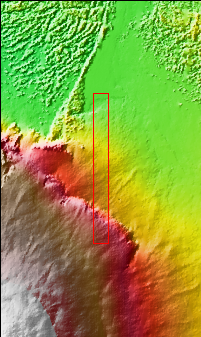
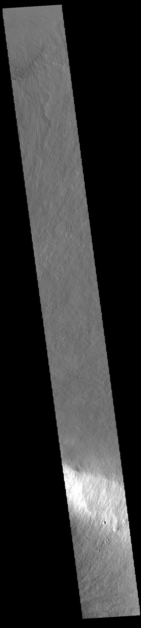
Context imageToday's VIS image shows part of the lower flank of Olympus Mons. The bright band in the image is an escarpment, where there is a large elevation change over a very short linear range – a cliff. This escarpment is called Olympus Rupes. In 2-D images it is very difficult to interpret the height component. In this case, the elevation change from the highest point (bottom of image) to the lowest point (top of image) is 7757m (25,449 feet). Olympus Mons is 21.9km (13.6 miles, 72,000 feet) tall. For comparison, Mt Everest is only 29,032 feet tall.
Orbit Number: 94579 Latitude: 22.7256 Longitude: 229.336 Instrument: VIS Captured: 2023-04-10 22:38
Please see the THEMIS Data Citation Note for details on crediting THEMIS images.
NASA's Jet Propulsion Laboratory manages the 2001 Mars Odyssey mission for NASA's Science Mission Directorate, Washington, D.C. The Thermal Emission Imaging System (THEMIS) was developed by Arizona State University, Tempe, in collaboration with Raytheon Santa Barbara Remote Sensing. The THEMIS investigation is led by Dr. Philip Christensen at Arizona State University. Lockheed Martin Astronautics, Denver, is the prime contractor for the Odyssey project, and developed and built the orbiter. Mission operations are conducted jointly from Lockheed Martin and from JPL, a division of the California Institute of Technology in Pasadena.