PDS logoPlanetary Data System
PDS Information
Find a Node - Use these links to navigate to any of the 8 publicly accessible PDS Nodes.

This bar indicates that you are within the PDS enterprise which includes 6 science discipline nodes and 2 support nodes which are overseen by the Project Management Office at NASA's Goddard Space Flight Center (GSFC). Each node is led by an expert in the subject discipline, supported by an advisory group of other practitioners of that discipline, and subject to selection and approval under a regular NASA Research Announcement.
Click here to return to the Photojournal Home Page Click here to view a list of Photojournal Image Galleries Photojournal_inner_header
Latest Images  |  Spacecraft & Technology  |  Animations  |  Space Images App  |  Feedback  |  Photojournal Search  
Your search criteria found 10 images
Spacecraft
Go to PIAxxxxx:
Refine this list of images by:
Mission:
Instrument:
Click on an image for detailed information
Click on a column heading to sort in ascending or descending order
My
List
Addition DateSort Ascending Target Mission Instrument Size
Add Image to Favorite List 2019-08-29 Earth CloudSat
Cloud Profiling Radar (CPR)
1632x918x3
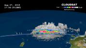
Data from NASA's CloudSat satellite, acquired on Aug., 2019, at 2 p.m. EDT (11 a.m. PDT) was used to make this 3D animation of then-Tropical Storm Dorian. It shows cloud heights extending 9 miles (15 kilometers) into the atmosphere.
PIA23359:
NASA's CloudSat Images Dorian in 3D
Full Resolution:     TIFF (1.707 MB)     JPEG (97.89 kB)
Add Image to Favorite List 2018-10-11 Earth CloudSat
Cloud Profiling Radar (CPR)
953x533x3
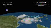
NASA's CloudSat satellite passed over Hurricane Michael on October 9, 2018, at 3:15 p.m. EDT (19:15 UTC) as the storm was intensifying and moving northwest toward the Florida panhandle in the Gulf of Mexico.
PIA22753:
NASA's CloudSat Passes Over Hurricane Michael
Full Resolution:     TIFF (720.4 kB)     JPEG (50.54 kB)
Add Image to Favorite List 2017-09-20 Earth CloudSat
Cloud Profiling Radar (CPR)
1672x938x3
NASA's CloudSat satellite flew over Hurricane Maria on Sept. 17, 2017, at 1:23 p.m. EDT (17:23 UTC) as the storm had just strengthened into a hurricane in the Atlantic Ocean.
PIA21961:
Taking a 3-D Slice of Hurricane Maria's Cloud Structure
Full Resolution:     TIFF (1.581 MB)     JPEG (63.81 kB)
Add Image to Favorite List 2017-09-08 Earth CloudSat
Cloud Profiling Radar (CPR)
1672x938x3
NASA's CloudSat satellite flew over Hurricane Irma on Sept. 6, 2017 at 1:45 p.m. EDT (17:45 UTC) as the storm was approaching Puerto Rico in the Atlantic Ocean.
PIA21947:
Powerful Hurricane Irma Seen in 3D by NASA's CloudSat
Full Resolution:     TIFF (1.206 MB)     JPEG (50.3 kB)
Add Image to Favorite List 2017-08-29 Earth CloudSat
Cloud Profiling Radar (CPR)
960x540x3
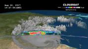
NASA's CloudSat satellite flew over then-Tropical Storm Harvey on Aug. 26, 2017, at 2:45 p.m. CDT (19:45 UTC) as the storm was nearly stationary over south Texas.
PIA17392:
NASA's CloudSat Sees Tropical Storm Harvey in 3D
Full Resolution:     TIFF (1.012 MB)     JPEG (68.11 kB)
Add Image to Favorite List 2016-10-14 Earth Aqua
MODIS
VIIRS
1000x1000x3
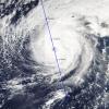
NASA's CloudSat satellite completed an eye overpass of Hurricane Nicole on Oct. 12, 2016, at 10:55 a.m. PDT (17:55 UTC) as the storm was moving toward Bermuda.
PIA21098:
NASA's CloudSat Looks Hurricane Nicole in the Eye
Full Resolution:     TIFF (2.794 MB)     JPEG (195.4 kB)
Add Image to Favorite List 2016-10-07 Earth CloudSat
Cloudsat
1258x1395x3
NASA's CloudSat flew east of Hurricane Matthew's center on Oct. 6 at 11:30 a.m. PDT (2:30 p.m. EDT), intersecting parts of Matthew's outer rain bands and revealing Matthew's anvil clouds.
PIA21095:
CloudSat Takes a 3D Slice of Hurricane Matthew
Full Resolution:     TIFF (4.619 MB)     JPEG (337.9 kB)
Add Image to Favorite List 2015-05-22 Earth CloudSat
MODIS
960x540x3
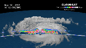
NASA's CloudSat satellite completed a stunning eye overpass of Typhoon Dolphin in the western Pacific Ocean on May 16, 2015, at 0407 UTC.
PIA19475:
NASA's CloudSat Peers Into the Eye of Powerful Typhoon Dolphin Animation Icon
Full Resolution:     TIFF (1.556 MB)     JPEG (61.88 kB)
Add Image to Favorite List 2012-10-30 Earth CloudSat
Cloud Profiling Radar (CPR)
1201x206x3
NASA's CloudSat spacecraft overpassed Hurricane Sandy on Oct. 29, 2012 just as Sandy was approaching the Atlantic coastline. Sandy contained estimated maximum sustained winds of 90 miles per hour (78 knots).
PIA16201:
CloudSat's View of Hurricane Sandy Animation Icon
Full Resolution:     TIFF (742.7 kB)     JPEG (52.4 kB)
Add Image to Favorite List 2012-10-29 Earth CloudSat
Cloud Profiling Radar (CPR)
1196x206x3
NASA's CloudSat passed over Sandy at 10:32 a.m. EDT on Oct. 27, 2012. Light to moderate precipitation associated with parts of the outer bands of Hurricane Sandy were moving on shore into parts of North Carolina.
PIA16436:
NASA's CloudSat Views Hurricane Sandy
Full Resolution:     TIFF (739.6 kB)     JPEG (44.93 kB)
Currently displaying images: 1 - 10 of 10