My
List |
Addition Date
|
Target
|
Mission
|
Instrument
|
Size
|

|
2015-10-19 |
Earth
|
OSTM/Jason-2
|
Altimeter
|
3300x1791x3 |
|
-
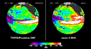
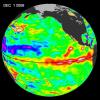
PIA20009:
-
NASA Studying 2015 El Niño Event as Never Before

Full Resolution:
TIFF
(6.183 MB)
JPEG
(459.8 kB)
|
|
|
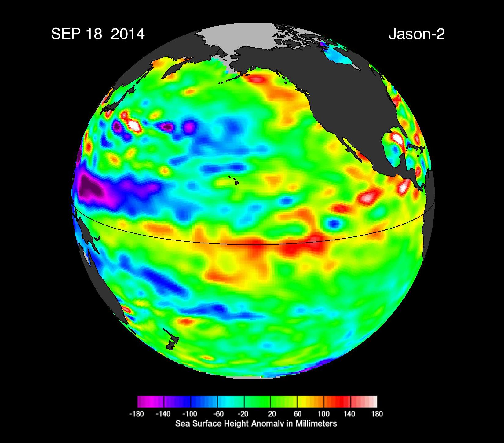
2014-09-22 |
Earth
|
OSTM/Jason-2
|
Altimeter
|
1650x1450x3 |
|
-
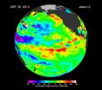
PIA17809:
-
The Fickle El Niño of 2014
Full Resolution:
TIFF
(7.181 MB)
JPEG
(203.9 kB)
|
|
|
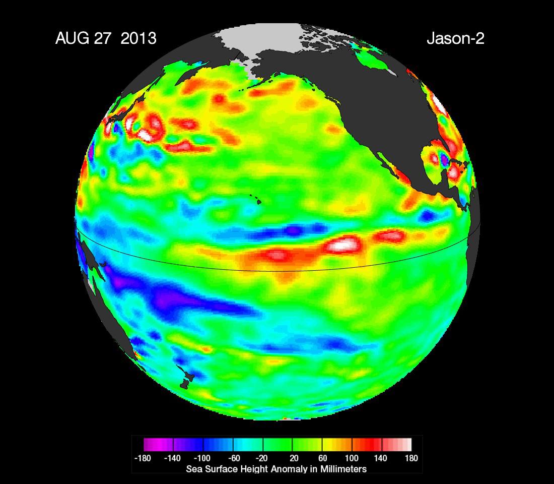
2013-09-09 |
Earth
|
OSTM/Jason-2
|
Altimeter
|
1100x960x3 |
|
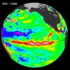
-
PIA17454:
-
'La Nada' Climate Pattern Lingers in the Pacific
Full Resolution:
TIFF
(3.169 MB)
JPEG
(108.7 kB)
|
|
|
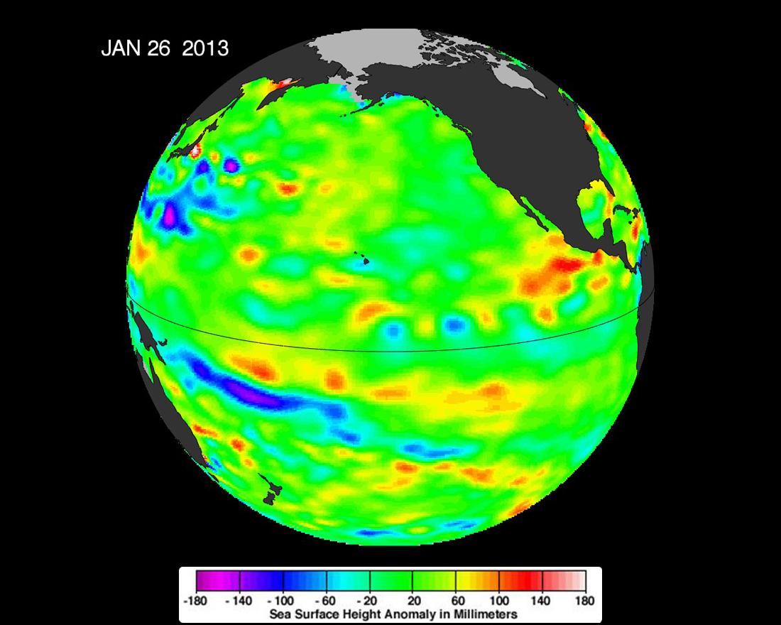
2013-02-07 |
Earth
|
OSTM/Jason-2
|
Altimeter
|
1100x880x3 |
|
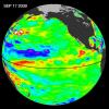
-
PIA16787:
-
Pacific Locked in 'La Nada' Limbo
Full Resolution:
TIFF
(2.905 MB)
JPEG
(93.08 kB)
|
|
|
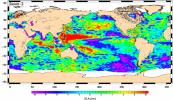
2012-10-17 |
Earth
|
Jason-1 (Topex/Poseidon)
OSTM/Jason-2
|
Altimeter
|
1384x858x3 |
|
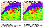
-
PIA16294:
-
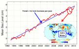
After Brief Dip, Global Mean Sea Level Resumes Climb
Full Resolution:
TIFF
(3.564 MB)
JPEG
(143.3 kB)
|
|
|
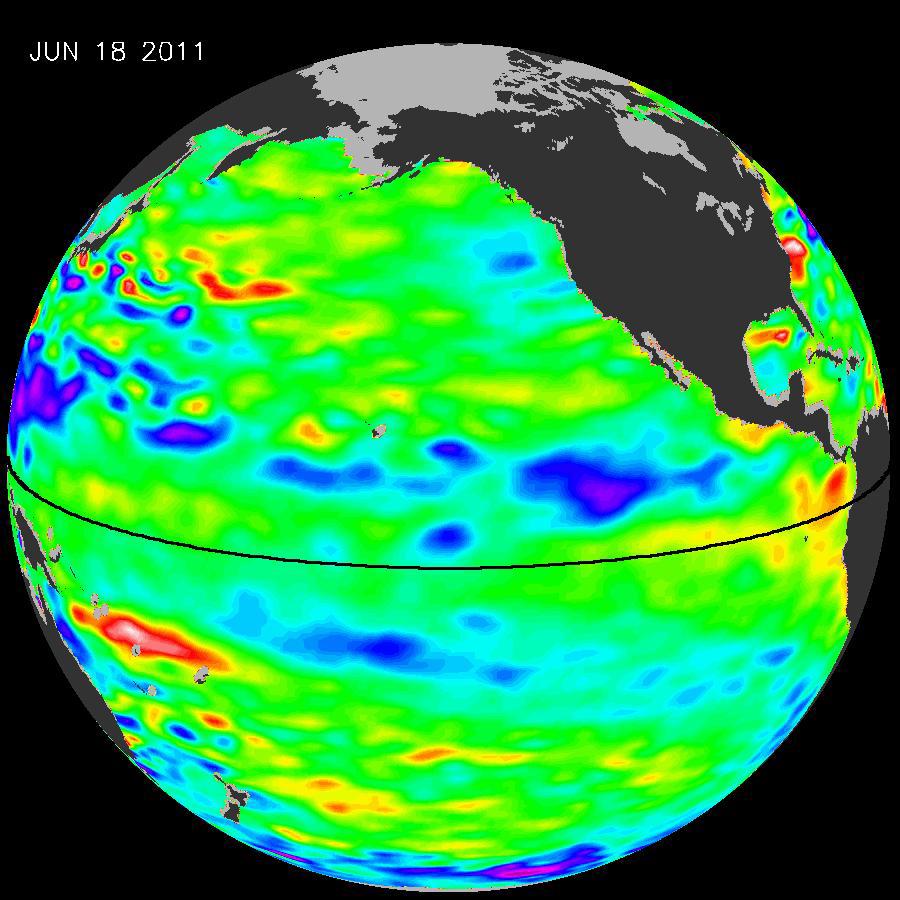
2011-07-06 |
Earth
|
OSTM/Jason-2
|
Altimeter
|
900x900x3 |
|
-
PIA14383:
-
La Niña's Exit Leaves Climate Forecasts in Limbo
Full Resolution:
TIFF
(2.433 MB)
JPEG
(104.9 kB)
|
|
|
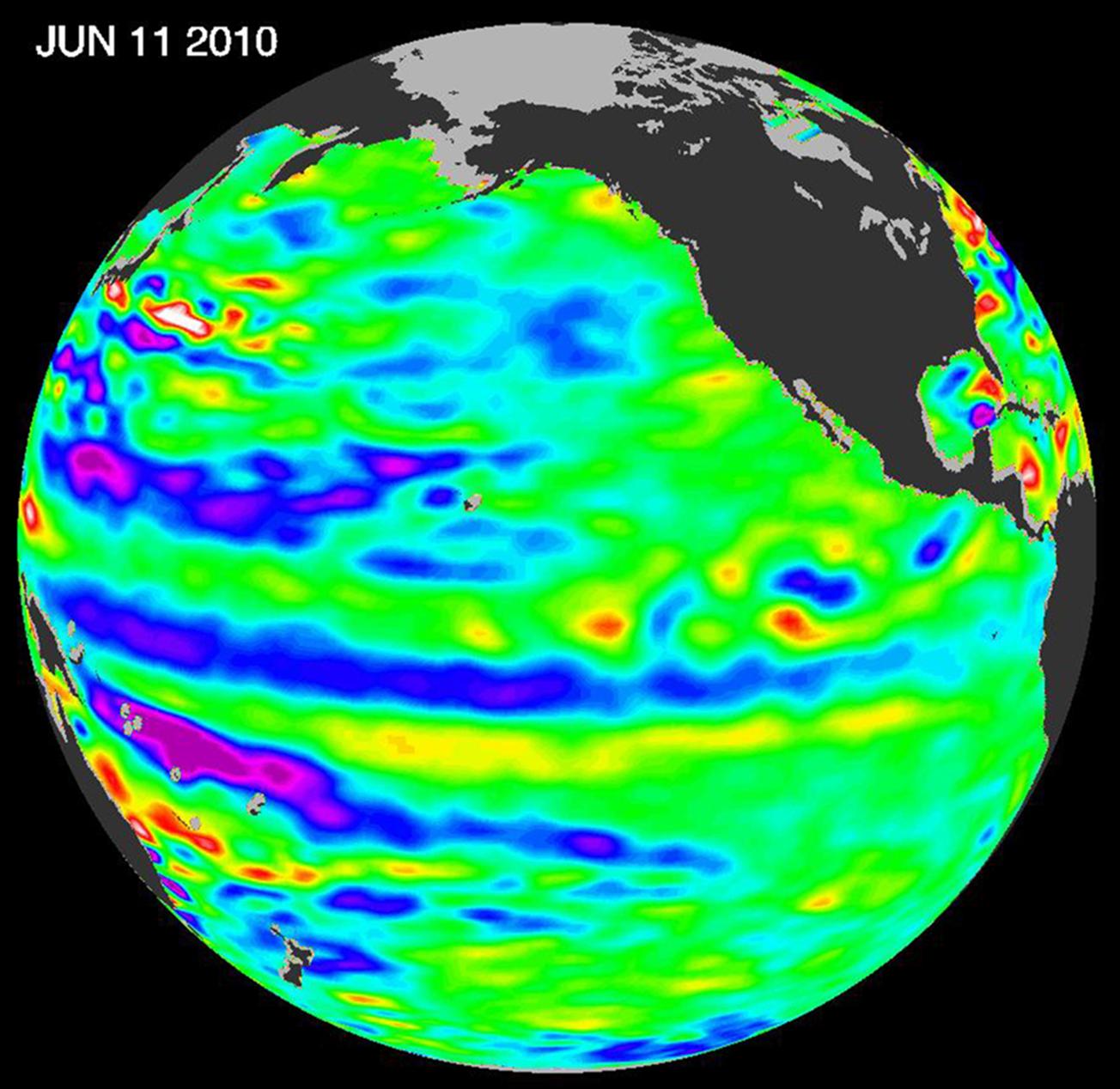
2010-06-22 |
Earth
|
OSTM/Jason-2
|
Altimeter
|
1304x1268x3 |
|
-
PIA13211:
-
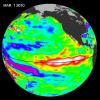
Adios El Niño, Hello La Niña?
Full Resolution:
TIFF
(4.966 MB)
JPEG
(158.7 kB)
|
|
|
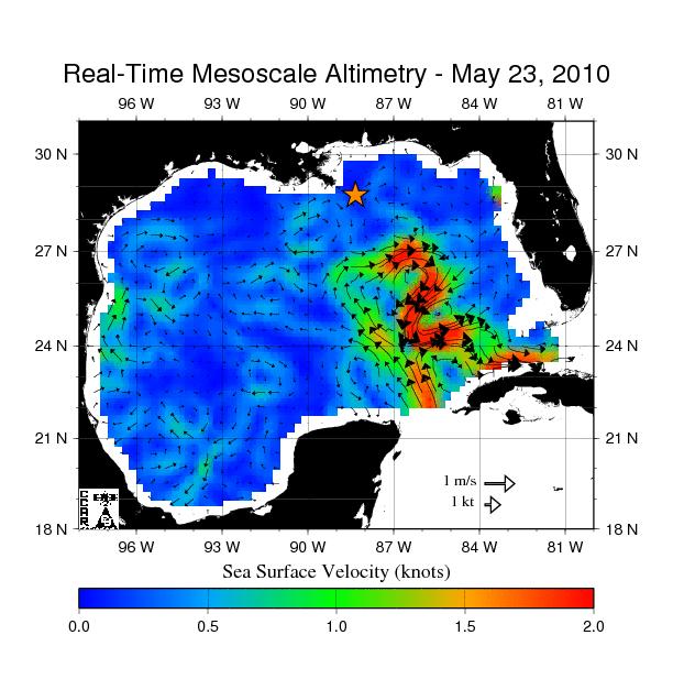
2010-05-24 |
Earth
|
OSTM/Jason-2
|
Altimeter
|
612x627x3 |

|
-
PIA13155:
-
Birth of a Loop Current Eddy
Full Resolution:
TIFF
(385.9 kB)
JPEG
(69.75 kB)
|
|
|
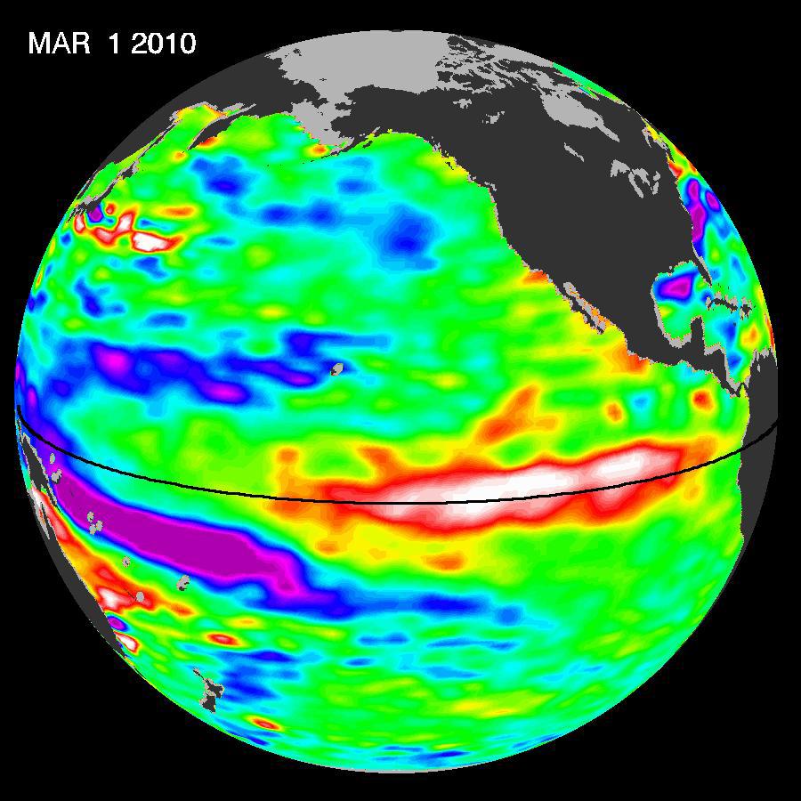
2010-03-16 |
Earth
|
OSTM/Jason-2
|
Altimeter
|
900x900x3 |
|
-
PIA12962:
-
El Niño's Last Stand?
Full Resolution:
TIFF
(2.433 MB)
JPEG
(108.4 kB)
|
|
|
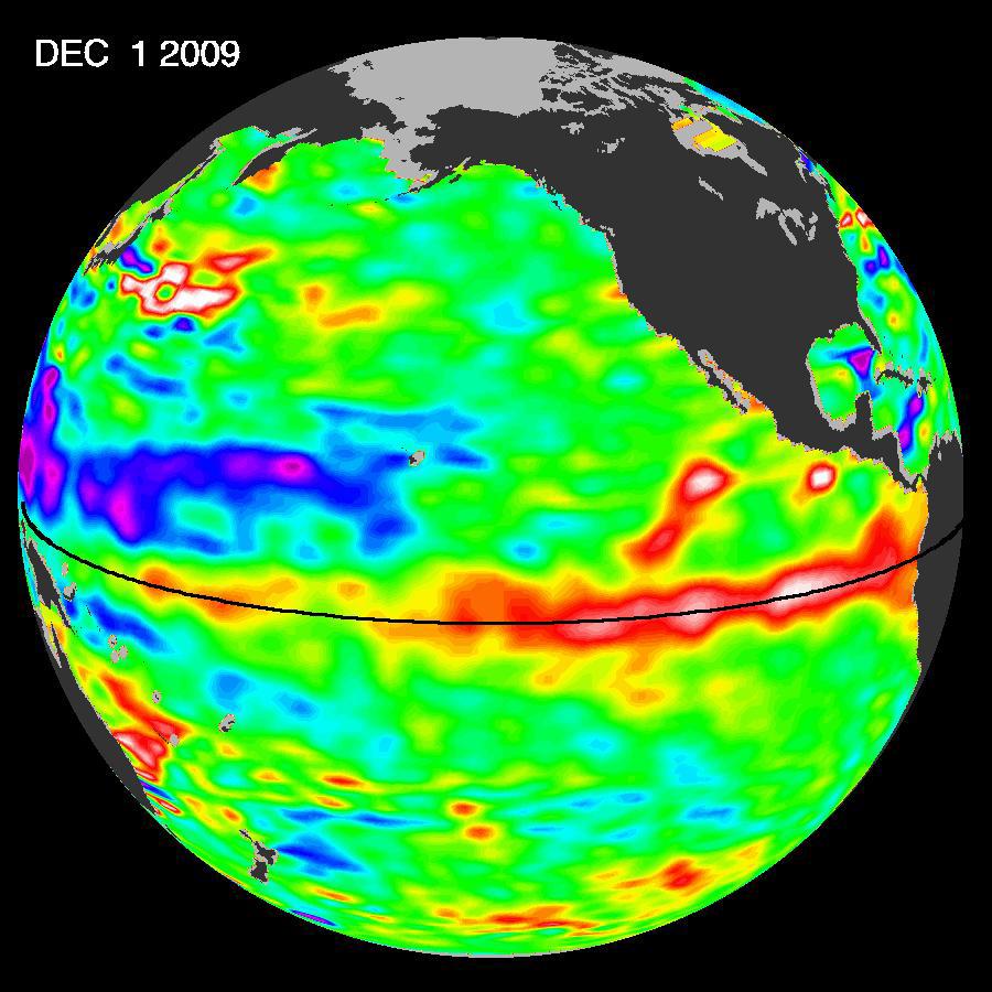
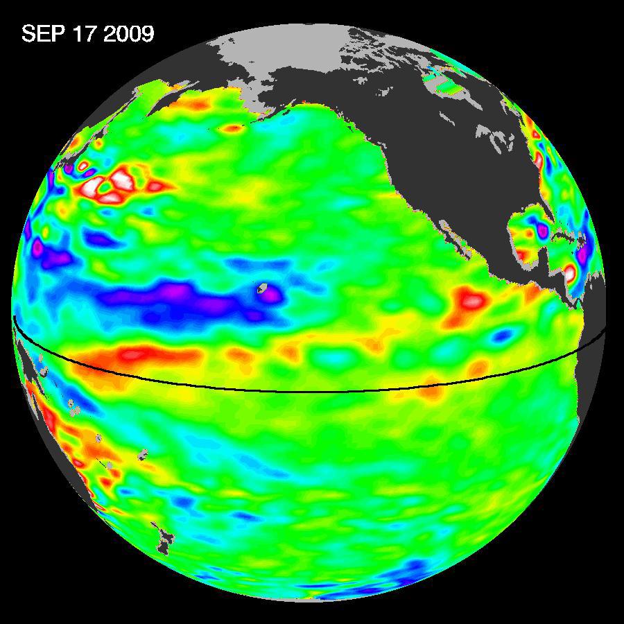
2009-12-17 |
Earth
|
OSTM/Jason-2
|
Altimeter
|
900x900x3 |
|
-
PIA12404:
-
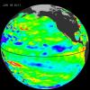
El Niño Surges; Warm Kelvin Wave Headed for South America
Full Resolution:
TIFF
(2.433 MB)
JPEG
(109.1 kB)
|
|
|
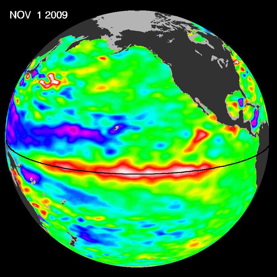
2009-11-12 |
Earth
|
OSTM/Jason-2
|
Altimeter
|
900x900x3 |
|
-
PIA12326:
-
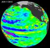
El Niño Pumping Up, Warm Kelvin Wave Surges Toward South America
Full Resolution:
TIFF
(2.433 MB)
JPEG
(106 kB)
|
|
|
2009-10-29 |
Earth
|
OSTM/Jason-2
|
Altimeter
|
900x900x3 |
|
-
PIA12334:
-
Waves That Feed El Niños
Full Resolution:
TIFF
(2.433 MB)
JPEG
(104.4 kB)
|
|
|
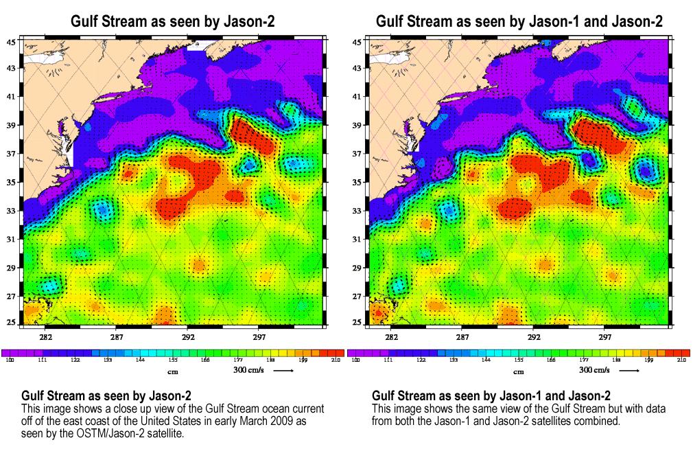
2009-04-27 |
Earth
|
Jason-1
OSTM/Jason-2
|
Altimeter
|
1010x654x3 |
|
-
PIA11997:
-
OSTM/Jason-2 and Jason-1 Tandem Mission View of the Gulf Stream
Full Resolution:
TIFF
(663 kB)
JPEG
(187.6 kB)
|
|
|
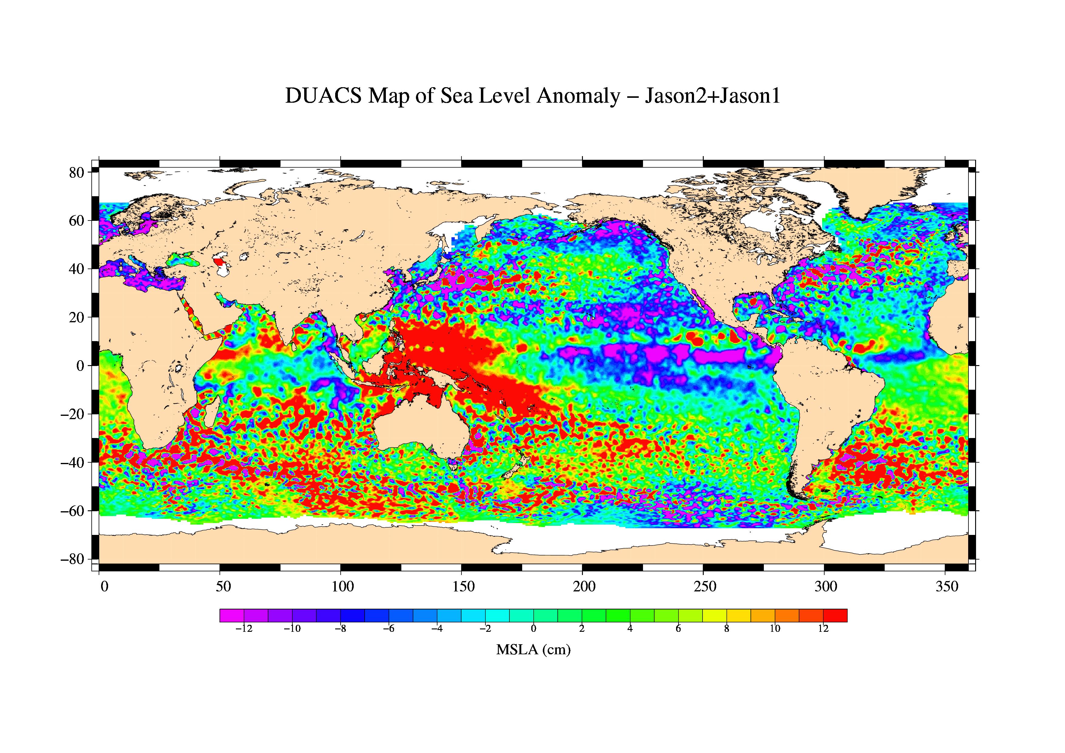
2009-03-26 |
Earth
|
Jason-1
OSTM/Jason-2
|
Altimeter
|
3508x2479x3 |

|
-
PIA11859:
-
First Jason-1 and OSTM/Jason-2 Tandem Global View
Full Resolution:
TIFF
(26.09 MB)
JPEG
(1.128 MB)
|
|
|
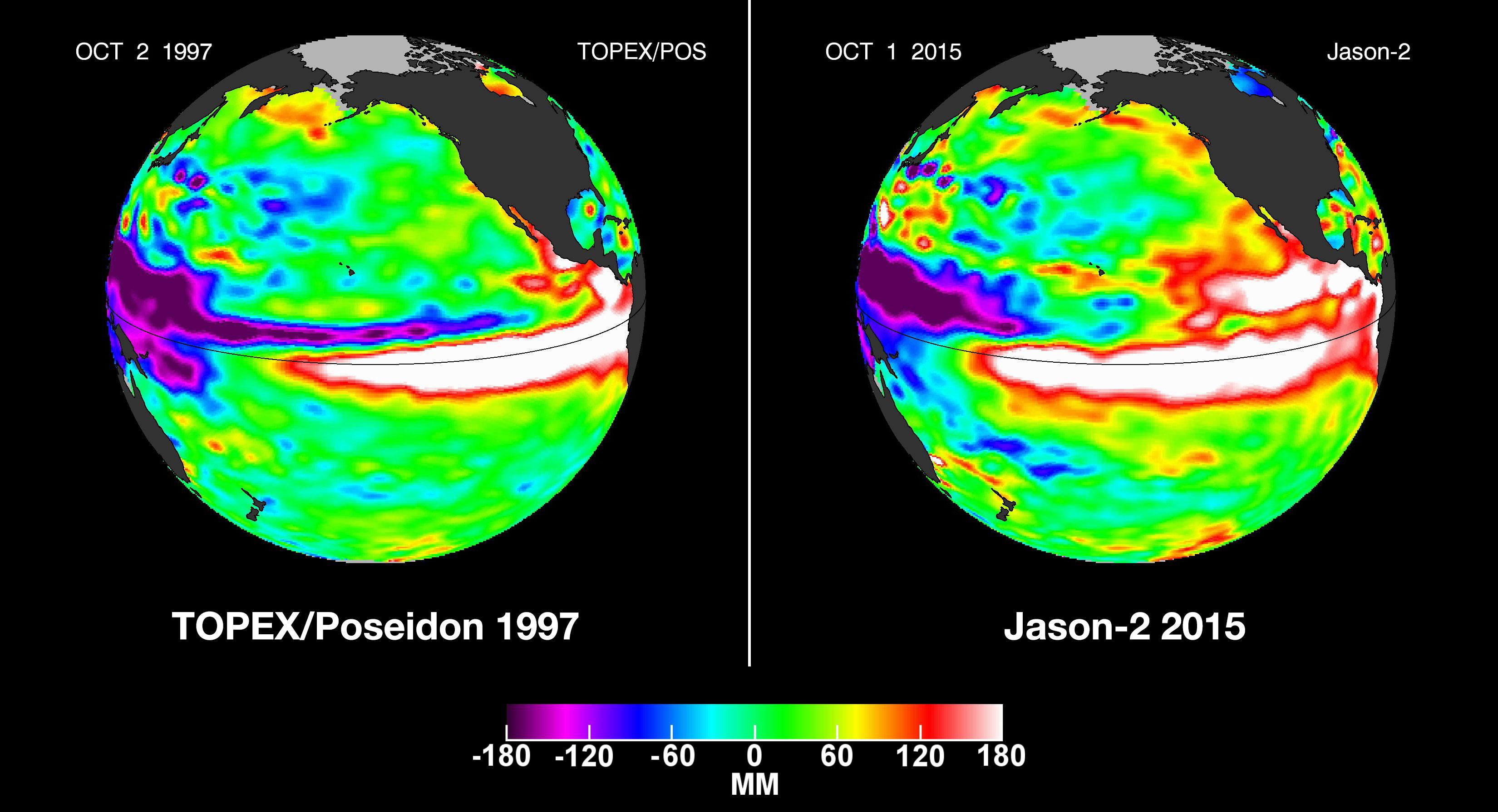
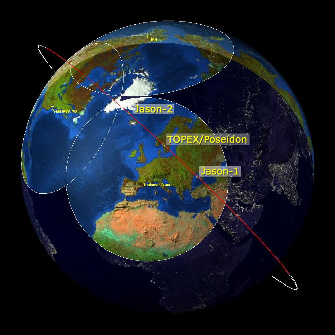
2009-02-06 |
Earth
|
Jason-1
OSTM/Jason-2
|
Altimeter
|
1074x1074x3 |

|
-
PIA11794:
-
Altimeter Family Portrait: Topex/Poseidon, Jason-1 and OSTM/Jason-2
Full Resolution:
TIFF
(3.465 MB)
JPEG
(131 kB)
|
|
|
2008-09-24 |
Earth
|
OSTM/Jason-2
|
Altimeter
|
1225x710x3 |
|
-
PIA11197:
-
Newest Ocean-Observing Satellite Records Recent Sea Level Changes
Full Resolution:
TIFF
(872.5 kB)
JPEG
(211.1 kB)
|
|
|
2008-09-23 |
|
OSTM/Jason-2
|
|
2000x1650x3 |

|
-
PIA18158:
-
Ocean Surface Topography Mission/Jason 2 (Artist's Concept)
Full Resolution:
TIFF
(9.904 MB)
JPEG
(267.8 kB)
|
|
|
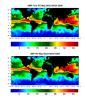
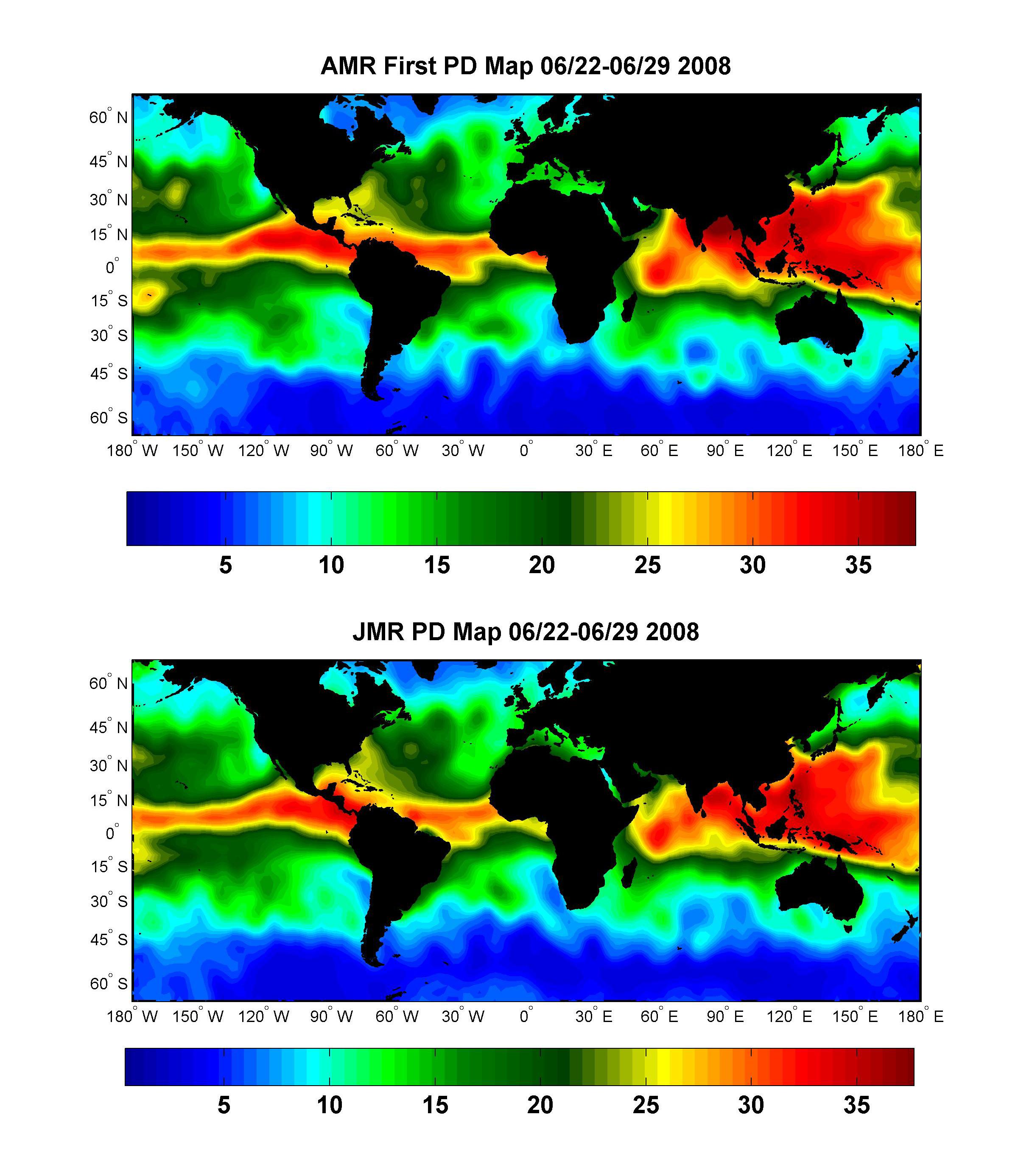
2008-07-15 |
Earth
|
OSTM/Jason-2
|
Advanced Microwave Radiometer (AMR)
|
2400x2772x3 |
|
-
PIA10954:
-
Global Views of Atmospheric Water Vapor:
First Data from OSTM/Jason-2's Advanced Microwave Radiometer
Full Resolution:
TIFF
(19.98 MB)
JPEG
(537.4 kB)
|
 Planetary Data System


