My
List |
Addition Date
|
Target
|
Mission
|
Instrument
|
Size
|

|
2004-03-05 |
Mars
|
Mars Exploration Rover (MER)
|
Microscopic Imager
Rock Abrasion Tool (RAT)
|
1024x1024x1 |
|
-
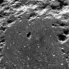
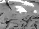
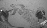
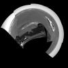
PIA05500:
-
Humphrey on the Inside
Full Resolution:
TIFF
(1.05 MB)
JPEG
(237.7 kB)
|
|
|
2004-03-05 |
Mars
|
Mars Exploration Rover (MER)
|
Navigation Camera
Rock Abrasion Tool (RAT)
|
956x962x1 |
|
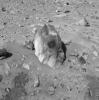
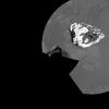
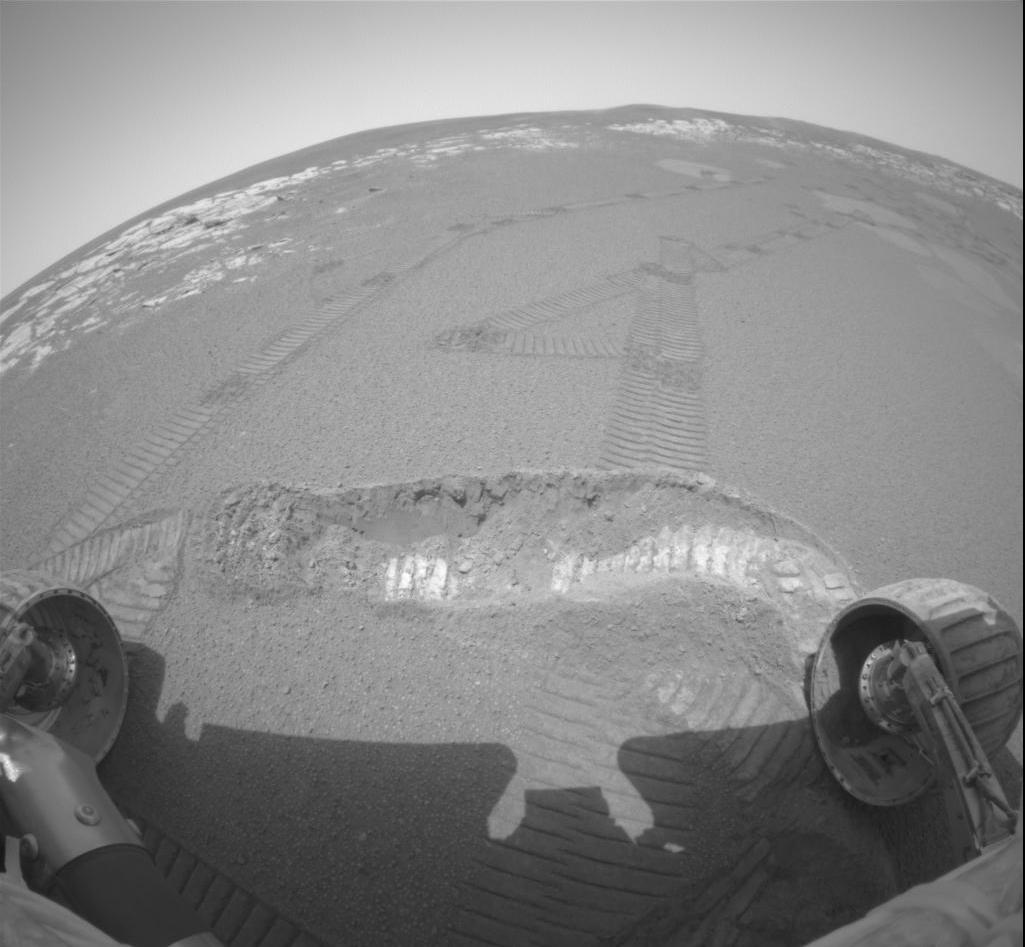
-
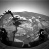
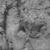
PIA05499:
-
A Hole in Humphrey
Full Resolution:
TIFF
(872.7 kB)
JPEG
(125.7 kB)
|
|
|
2004-03-05 |
Mars
|
Mars Exploration Rover (MER)
|
Panoramic Camera
|
1920x1080x3 |
|
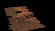
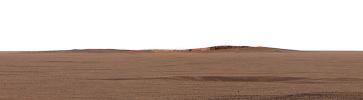
-
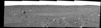
PIA05503:
-
Rare Glance at "Last Chance"
Full Resolution:
TIFF
(2.228 MB)
JPEG
(101.8 kB)
|
|
|
2004-03-04 |
Mars
|
Mars Exploration Rover (MER)
|
Panoramic Camera
|
1024x1024x1 |
|
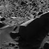
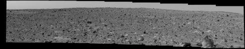
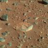
-
PIA05497:
-
Accidental Art
Full Resolution:
TIFF
(988.2 kB)
JPEG
(166.1 kB)
|
|
|
2004-03-04 |
Mars
|
Mars Exploration Rover (MER)
|
Microscopic Imager
|
1024x1024x1 |
|
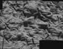
-
PIA05496:
-
Mars Magnet Hits the Bull's-Eye
Full Resolution:
TIFF
(1.028 MB)
JPEG
(168.7 kB)
|
|
|
2004-03-03 |
Mars
|
Mars Exploration Rover (MER)
|
Microscopic Imager
Navigation Camera
Rock Abrasion Tool (RAT)
|
1024x1024x1 |
|
-
PIA05495:
-
Evidence of a Water-Soaked Past
Full Resolution:
TIFF
(1.05 MB)
JPEG
(226 kB)
|
|
|
2004-03-03 |
Mars
|
Mars Exploration Rover (MER)
|
Hazcam
|
256x256x1 |
|
-
PIA05494:
-
A View of Opportunity's Dance Moves
Full Resolution:
TIFF
(65.83 kB)
JPEG
(11.85 kB)
|
|
|
2004-03-02 |
Mars
|
Mars Exploration Rover (MER)
|
Microscopic Imager
|
1537x1149x1 |
|
-
PIA05493:
-
Vugs Provide Clues to Martian Past
Full Resolution:
TIFF
(1.768 MB)
JPEG
(299.4 kB)
|
|
|
2004-03-02 |
Mars
|
Mars Exploration Rover (MER)
|
Panoramic Camera
|
3100x1373x3 |

|
-
PIA05492:
-
"El Capitan's" Scientific Gems
Full Resolution:
TIFF
(9.472 MB)
JPEG
(495.7 kB)
|
|
|
2004-03-02 |
Mars
|
Mars Exploration Rover (MER)
|
Microscopic Imager
|
817x617x1 |
|
-
PIA05481:
-
Which Came First? Vug or Spherule?
Full Resolution:
TIFF
(349.5 kB)
JPEG
(42.63 kB)
|
|
|
2004-03-02 |
Mars
|
Mars Exploration Rover (MER)
|
Panoramic Camera
|
447x333x3 |
|
-
PIA05482:
-
Ripples in Rocks Point to Water
Full Resolution:
TIFF
(427 kB)
JPEG
(21.8 kB)
|
|
|
2004-03-02 |
Mars
|
Mars Exploration Rover (MER)
|
Microscopic Imager
|
1022x1023x1 |
|
-
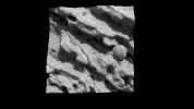
PIA05480:
-
Larger Grains Suggest Presence of Fluid
Full Resolution:
TIFF
(1.047 MB)
JPEG
(188.8 kB)
|
|
|
2004-03-02 |
Mars
|
Mars Exploration Rover (MER)
|
Alpha Particle X-ray Spectrometer
Rock Abrasion Tool (RAT)
|
720x486x3 |
|
-
PIA05483:
-
A Trail of Salts
Full Resolution:
TIFF
(110.4 kB)
JPEG
(29.02 kB)
|
|
|
2004-03-02 |
Mars
|
Mars Exploration Rover (MER)
|
Panoramic Camera
|
1278x352x3 |
|
-
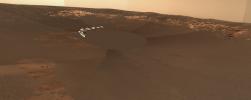
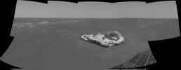
PIA05484:
Opportunity Spies "Endurance" on the Horizon
Full Resolution:
TIFF
(712.3 kB)
JPEG
(41.42 kB)
|
|
|
2004-03-02 |
Mars
|
Mars Exploration Rover (MER)
|
Microscopic Imager
|
1628x1272x1 |
|
-
PIA05479:
-
Focus on Guadalupe
Full Resolution:
TIFF
(2 MB)
JPEG
(293.3 kB)
|
|
|
2004-03-02 |
Mars
|
Mars Exploration Rover (MER)
|
Panoramic Camera
|
1024x1024x3 |

|
-
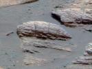
PIA05478:
-
The Texture of El Capitan
Full Resolution:
TIFF
(3.15 MB)
JPEG
(192.8 kB)
|
|
|
2004-03-02 |
Mars
|
Mars Exploration Rover (MER)
|
Navigation Camera
|
3940x1809x1 |
|
-
PIA05477:
-
Over Here, Over There
Full Resolution:
TIFF
(3.206 MB)
JPEG
(608.7 kB)
|
|
|
2004-03-02 |
Mars
|
Mars Exploration Rover (MER)
|
Microscopic Imager
|
1021x1024x1 |
|
-
PIA05476:
-
Focus on El Capitan-3
Full Resolution:
TIFF
(1.047 MB)
JPEG
(208.7 kB)
|
|
|
2004-03-02 |
Mars
|
Mars Exploration Rover (MER)
|
Microscopic Imager
|
509x503x1 |
|
-
PIA05475:
-
Focus on El Capitan-2
Full Resolution:
TIFF
(256.5 kB)
JPEG
(41.59 kB)
|
|
|
2004-03-02 |
Mars
|
Mars Exploration Rover (MER)
|
Microscopic Imager
|
431x428x1 |
|
-
PIA05474:
-
Focus on El Capitan
Full Resolution:
TIFF
(184.9 kB)
JPEG
(31.96 kB)
|
|
|
2004-03-02 |
Mars
|
Mars Exploration Rover (MER)
|
Microscopic Imager
|
732x733x1 |
|
-
PIA05473:
-
Focused on Robert E
Full Resolution:
TIFF
(462.5 kB)
JPEG
(43.92 kB)
|
|
|
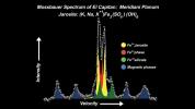
2004-03-02 |
Mars
|
Mars Exploration Rover (MER)
|
Moessbauer Spectrometer
|
1920x1080x3 |
|
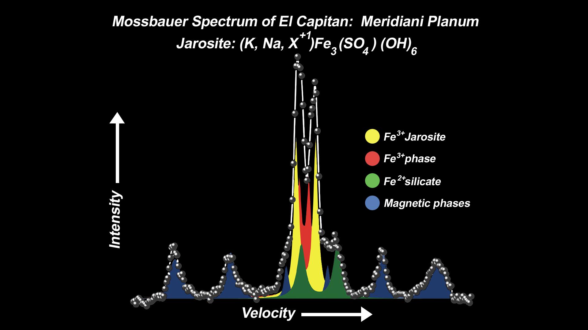
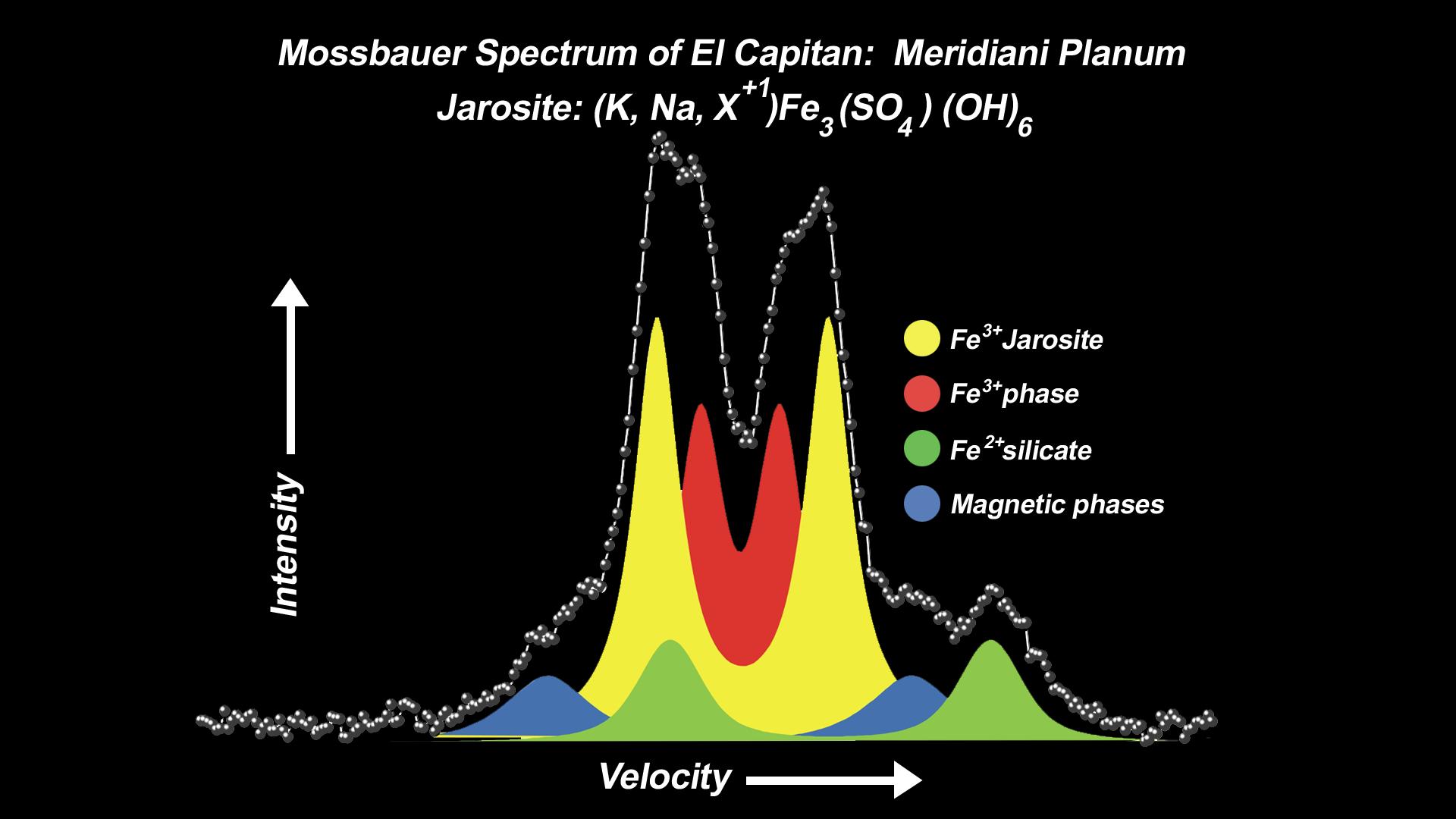
-
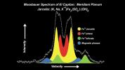
PIA05471:
-
Mineral Tells Tale of Watery Past-2
Full Resolution:
TIFF
(402.9 kB)
JPEG
(116.1 kB)
|
|
|
2004-03-02 |
Mars
|
Mars Exploration Rover (MER)
|
Miniature Thermal Emission Spectrometer
|
1920x1080x3 |
|
-
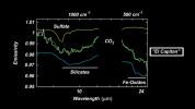
PIA05472:
-
"El Capitan" Exposed!
Full Resolution:
TIFF
(436.2 kB)
JPEG
(107.3 kB)
|
|
|
2004-03-02 |
Mars
|
Mars Exploration Rover (MER)
|
Alpha Particle X-ray Spectrometer
Rock Abrasion Tool (RAT)
|
1920x1080x3 |

|
-
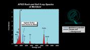
PIA05469:
-
Salty Martian Rock
Full Resolution:
TIFF
(597 kB)
JPEG
(161.6 kB)
|
|
|
2004-03-02 |
Mars
|
Mars Exploration Rover (MER)
|
Moessbauer Spectrometer
|
1920x1080x3 |
|
-
PIA05470:
-
Mineral Tells Tale of Watery Past
Full Resolution:
TIFF
(427.8 kB)
JPEG
(118.6 kB)
|
|
|
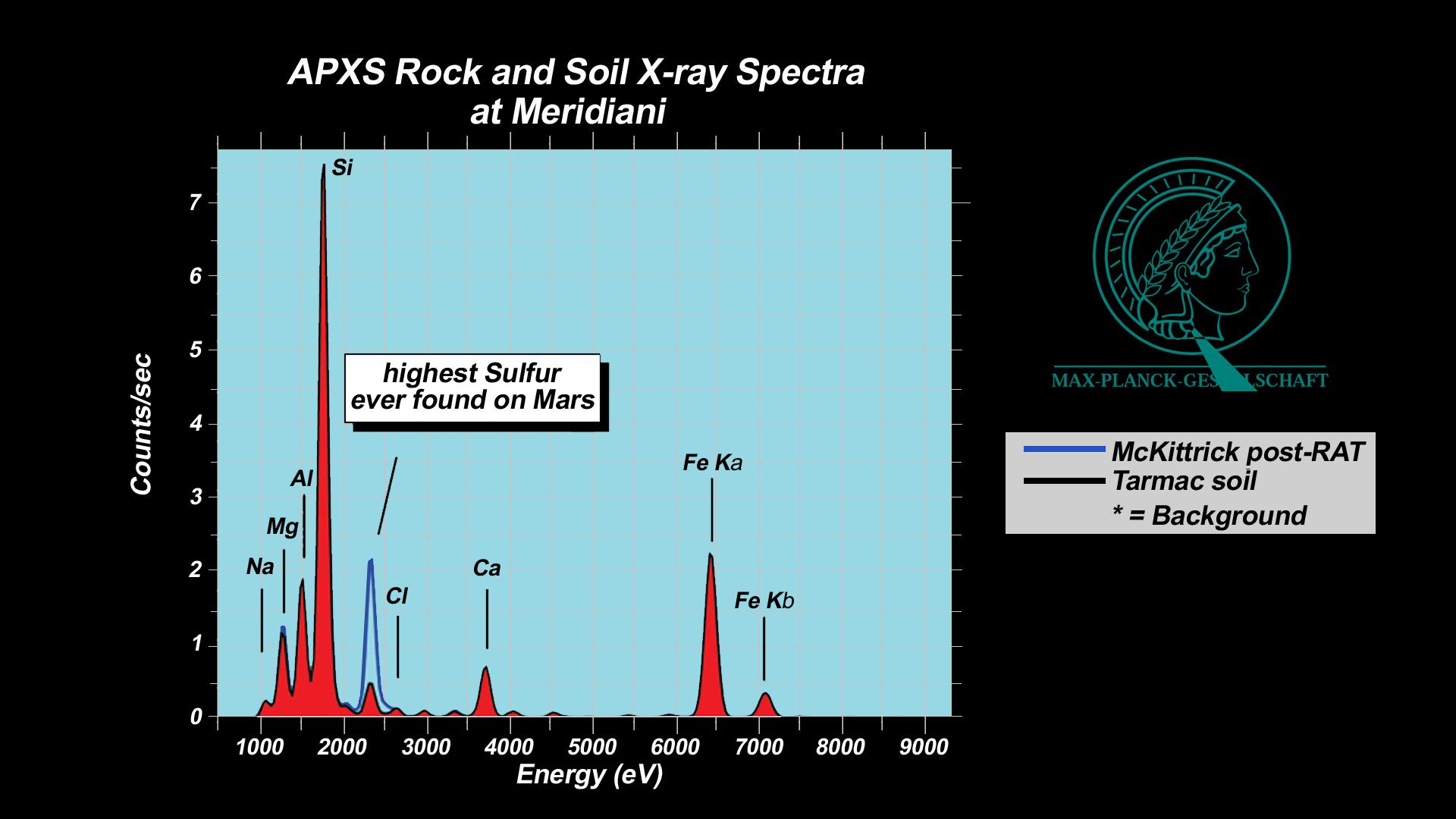
2004-03-02 |
Mars
|
Mars Exploration Rover (MER)
|
Alpha Particle X-ray Spectrometer
Rock Abrasion Tool (RAT)
|
1920x1080x3 |
|
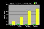
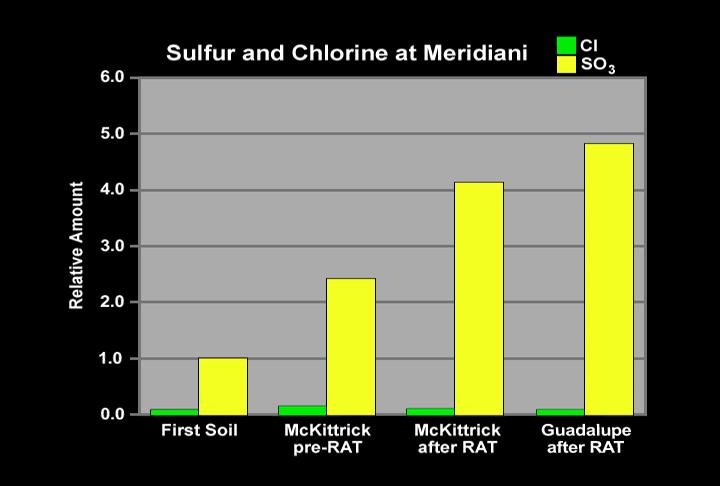
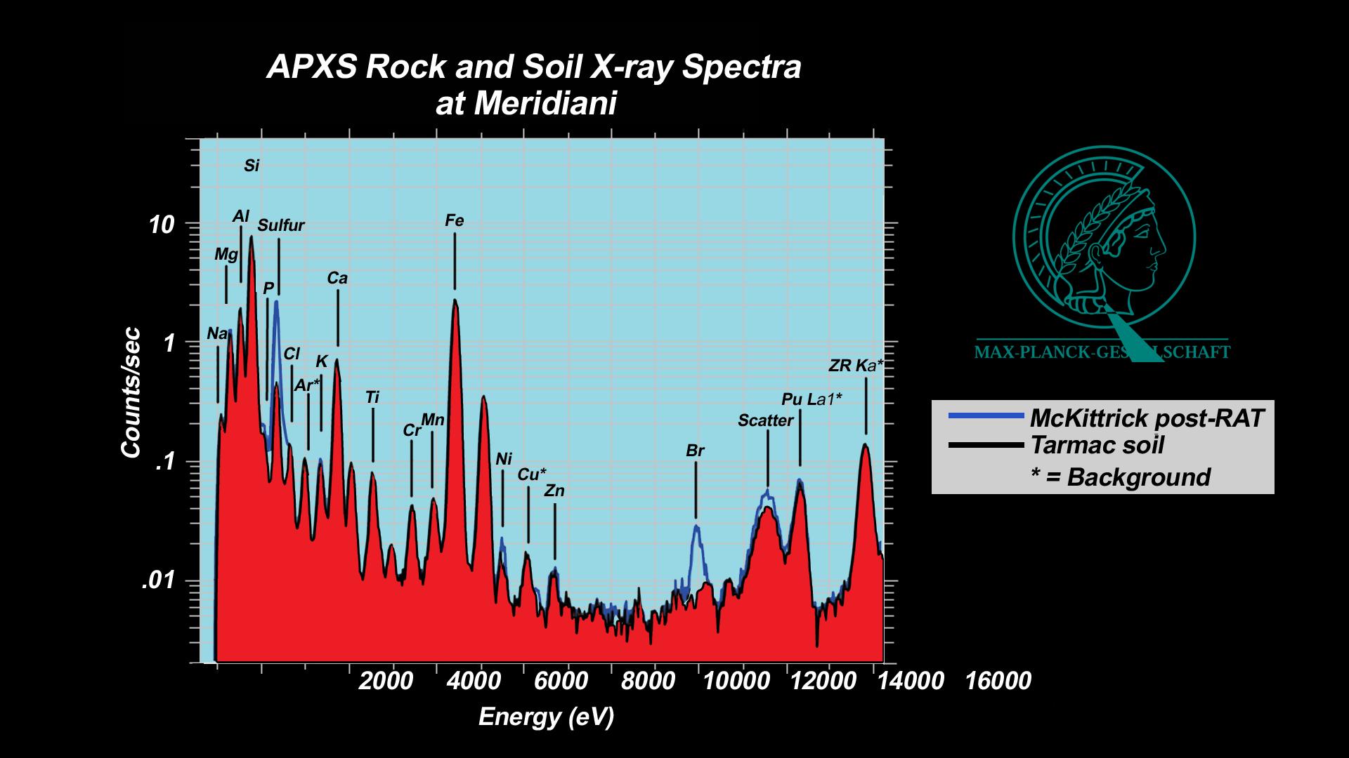
-
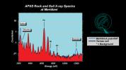
PIA05468:
-
"McKittrick" Rich in Sulfur
Full Resolution:
TIFF
(546.9 kB)
JPEG
(137.5 kB)
|
|
|
2004-03-02 |
Mars
|
Mars Exploration Rover (MER)
|
Alpha Particle X-ray Spectrometer
|
1920x1080x3 |
|
-
PIA05467:
-
History Leaves Salts Behind
Full Resolution:
TIFF
(600.3 kB)
JPEG
(143.3 kB)
|
|
|
2004-02-28 |
Mars
|
Mars Exploration Rover (MER)
|
Navigation Camera
|
600x600x1 |

|
-
PIA05466:
-
Heading for Humphrey
Full Resolution:
TIFF
(358 kB)
JPEG
(50.53 kB)
|
|
|
2004-02-27 |
Mars
|
Mars Exploration Rover (MER)
|
Panoramic Camera
|
1113x731x3 |
|
-
PIA05461:
-
Pre-Planning the "Last Chance"
Full Resolution:
TIFF
(852.1 kB)
JPEG
(152.5 kB)
|
|
|
2004-02-27 |
Mars
|
Mars Exploration Rover (MER)
|
Panoramic Camera
|
4367x2997x3 |

|
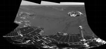
-
PIA05460:
-
Opportunity's Empty Nest
Full Resolution:
TIFF
(24.87 MB)
JPEG
(741.8 kB)
|
|
|
2004-02-27 |
Mars
|
Mars Exploration Rover (MER)
|
Hazcam
Rock Abrasion Tool (RAT)
|
1024x1024x1 |
|
-
PIA05459:
-
Circular Signs of the Rock Abrasion Tool
Full Resolution:
TIFF
(1.023 MB)
JPEG
(133.8 kB)
|
|
|
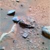
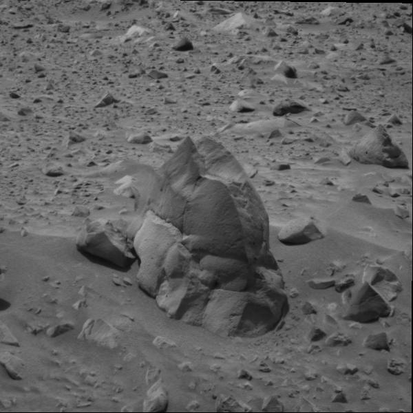
2004-02-26 |
Mars
|
Mars Exploration Rover (MER)
|
Panoramic Camera
|
1661x1400x3 |
|
-
PIA05457:
-
El Capitan
Full Resolution:
TIFF
(5.975 MB)
JPEG
(551.8 kB)
|
|
|
2004-02-26 |
Mars
|
Mars Exploration Rover (MER)
|
Panoramic Camera
|
512x512x3 |
|
-
PIA05456:
-
Charlie Flats
Full Resolution:
TIFF
(787.5 kB)
JPEG
(66.55 kB)
|
|
|
2004-02-26 |
Mars
|
Mars Exploration Rover (MER)
|
Microscopic Imager
|
1024x612x1 |
|
-
PIA05454:
-
The Answer is in the Crests and Troughs
Full Resolution:
TIFF
(627.5 kB)
JPEG
(202.1 kB)
|
|
|
2004-02-26 |
Mars
|
Mars Exploration Rover (MER)
|
Microscopic Imager
|
1024x612x1 |
|
-
PIA05455:
-
The Answer is in the Crests and Troughs -2
Full Resolution:
TIFF
(627.5 kB)
JPEG
(140.4 kB)
|
|
|
2004-02-26 |
Mars
|
Mars Exploration Rover (MER)
|
Panoramic Camera
|
1024x1024x3 |
|
-
PIA05453:
-
Are They Telltale Ripples?
Full Resolution:
TIFF
(2.633 MB)
JPEG
(215 kB)
|
|
|
2004-02-26 |
Mars
|
Mars Exploration Rover (MER)
|
Panoramic Camera
|
1012x818x3 |
|
-
PIA05452:
-
Ripples or Dunes?
Full Resolution:
TIFF
(2.384 MB)
JPEG
(93.27 kB)
|
|
|
2004-02-26 |
Mars
|
Mars Exploration Rover (MER)
|
Navigation Camera
|
7466x1008x1 |
|
-
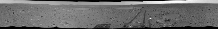
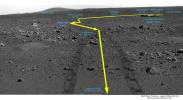
PIA05450:
Long and Winding Road
Full Resolution:
TIFF
(6.214 MB)
JPEG
(966.5 kB)
|
|
|
2004-02-26 |
Mars
|
Mars Exploration Rover (MER)
|
Panoramic Camera
|
2560x1022x3 |
|
-
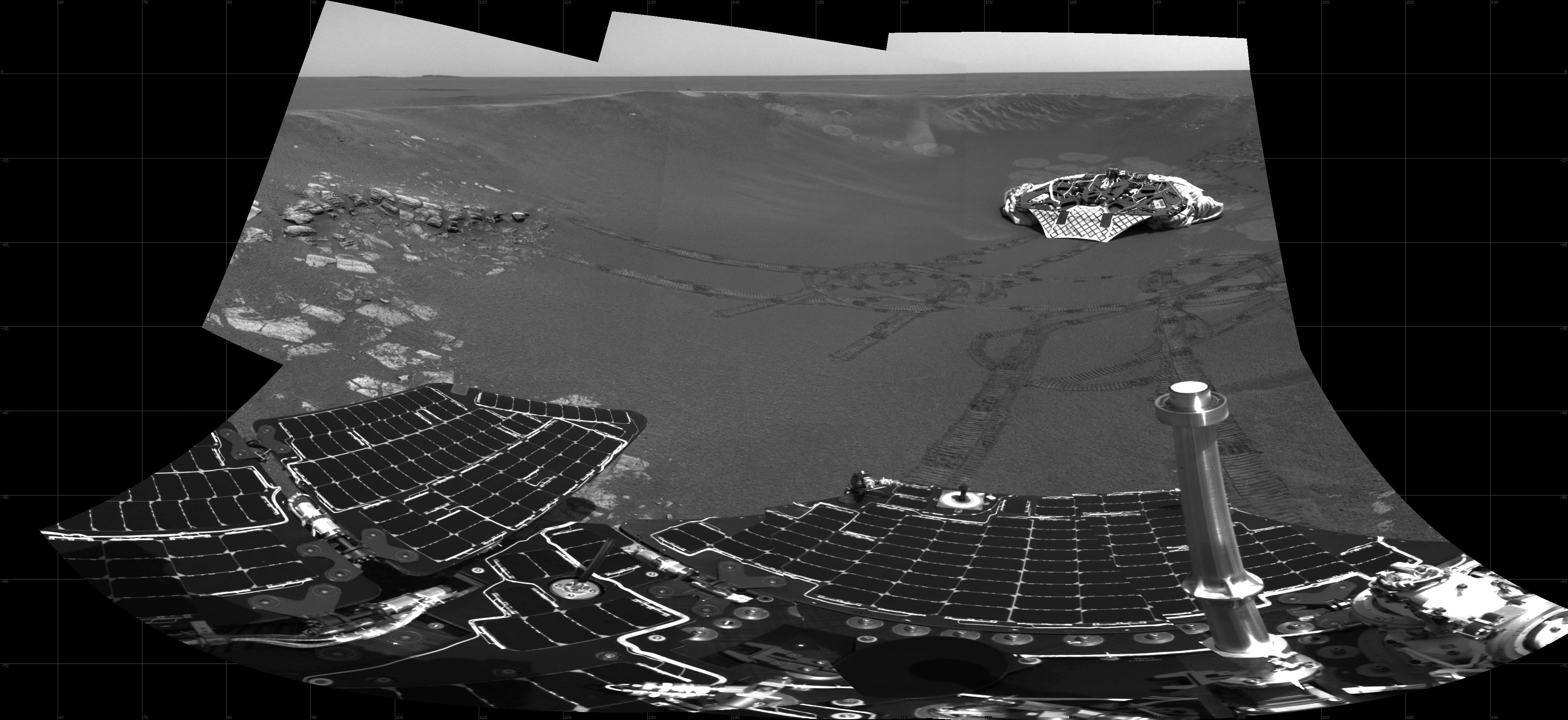
PIA05451:
-
Opportunity Landing Spot Panorama (3-D Model)
Full Resolution:
TIFF
(4.896 MB)
JPEG
(191 kB)
|
|
|
2004-02-26 |
Mars
|
Mars Exploration Rover (MER)
|
Panoramic Camera
|
5857x1185x1 |
|
-
PIA05449:
The Bumpy Road Ahead
Full Resolution:
TIFF
(5.548 MB)
JPEG
(845.4 kB)
|
|
|
2004-02-26 |
Mars
|
Mars Global Surveyor (MGS)
Mars Exploration Rover (MER)
|
Descent Image Motion Estimation System (DIMES)
Mars Orbiter Camera (MOC)
|
5760x4328x3 |
|
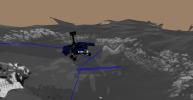
-
PIA05448:
-
Getting Closer
Full Resolution:
TIFF
(32 MB)
JPEG
(1.508 MB)
|
|
|
2004-02-26 |
Mars
|
Mars Exploration Rover (MER)
|
Panoramic Camera
|
360x240x101 |
|
-
PIA05343:
-
The Sun Sets on Mars

Full Resolution:
|
|
|
2004-02-25 |
Mars
|
Mars Exploration Rover (MER)
|
Microscopic Imager
Rock Abrasion Tool (RAT)
|
963x963x1 |
|
-
PIA05445:
-
Opportunity Slices into the Surface of Mars
Full Resolution:
TIFF
(928.6 kB)
JPEG
(207.1 kB)
|
|
|
2004-02-25 |
Mars
|
Mars Exploration Rover (MER)
|
Microscopic Imager
Rock Abrasion Tool (RAT)
|
965x965x3 |
|
-
PIA05446:
-
Grinding Wheel Profile
Full Resolution:
TIFF
(1.878 MB)
JPEG
(226.9 kB)
|
|
|
2004-02-24 |
Mars
|
Mars Exploration Rover (MER)
|
Hazcam
|
512x512x10 |
|
-
PIA05345:
-
Draped in the Rover's Shadow
Full Resolution:
|
|
|
2004-02-24 |
Mars
|
Mars Exploration Rover (MER)
|
Hazcam
|
1024x624x11 |
|
-
PIA05344:
-
Breaking Martian Ground
Full Resolution:
|
|
|
2004-02-24 |
Mars
|
Mars Exploration Rover (MER)
|
Hazcam
Rock Abrasion Tool (RAT)
|
512x512x1 |
|
-
PIA05442:
-
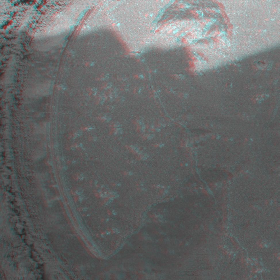
Opportunity at El Capitan
Full Resolution:
TIFF
(262.6 kB)
JPEG
(38.01 kB)
|
|
|
2004-02-24 |
Mars
|
Mars Exploration Rover (MER)
|
Panoramic Camera
|
1871x1022x3 |
|
-
PIA05441:
-
Covered Ground
Full Resolution:
TIFF
(2.336 MB)
JPEG
(422.8 kB)
|
|
|
2004-02-22 |
Mars
|
Mars Exploration Rover (MER)
|
Hazcam
|
512x512x1 |

|
-
PIA05339:
-
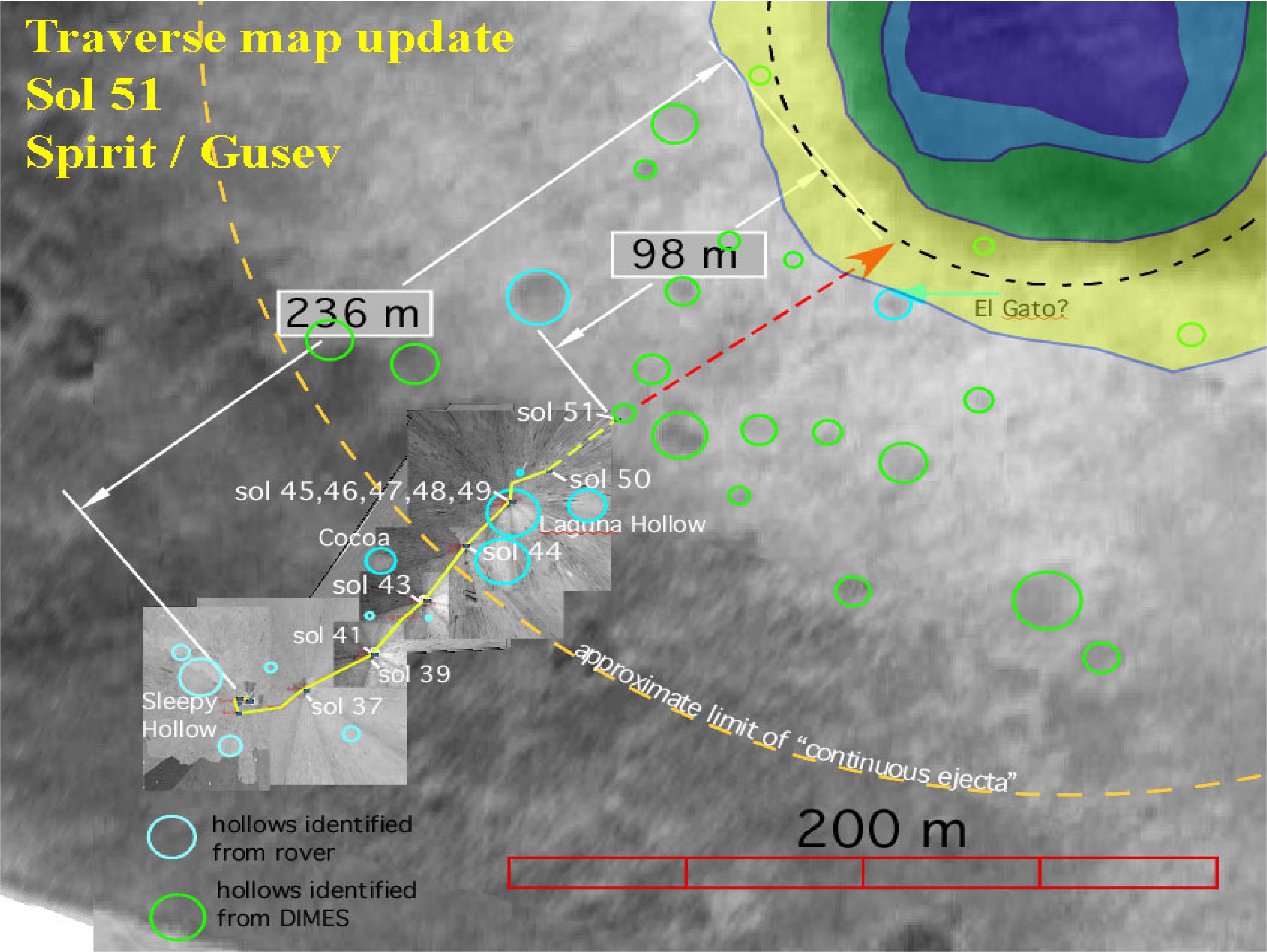
Spirit Shadow over Laguna Trench
Full Resolution:
TIFF
(254.3 kB)
JPEG
(29.59 kB)
|
|
|
2004-02-20 |
Mars
|
Mars Exploration Rover (MER)
|
Panoramic Camera
Rock Abrasion Tool (RAT)
|
1274x896x3 |
|
-
PIA05338:
-
Plotting and Scheming
Full Resolution:
TIFF
(2.938 MB)
JPEG
(208 kB)
|
|
|
2004-02-20 |
Mars
|
Mars Exploration Rover (MER)
|
Hazcam
|
1024x1024x1 |
|
-
PIA05337:
-
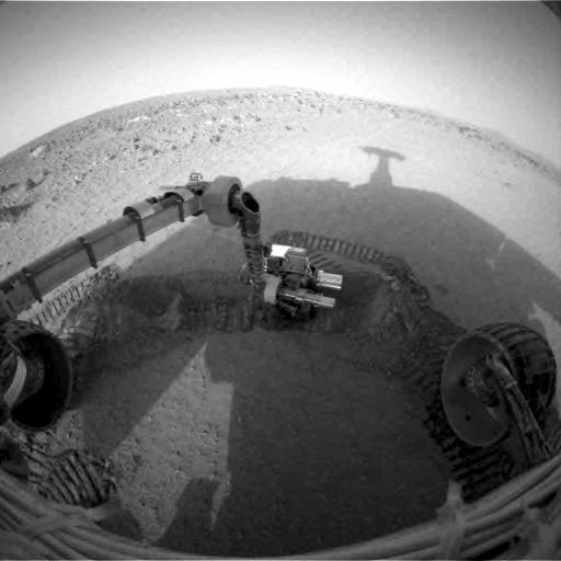
Spirit Digs a Trench
Full Resolution:
TIFF
(1.018 MB)
JPEG
(127.5 kB)
|
|
|
2004-02-19 |
Mars
|
Mars Exploration Rover (MER)
|
Hazcam
|
512x512x9 |
|
-
PIA05323:
-
Grooving in Trenchtown
Full Resolution:
|
|
|
2004-02-19 |
Mars
|
Mars Exploration Rover (MER)
|
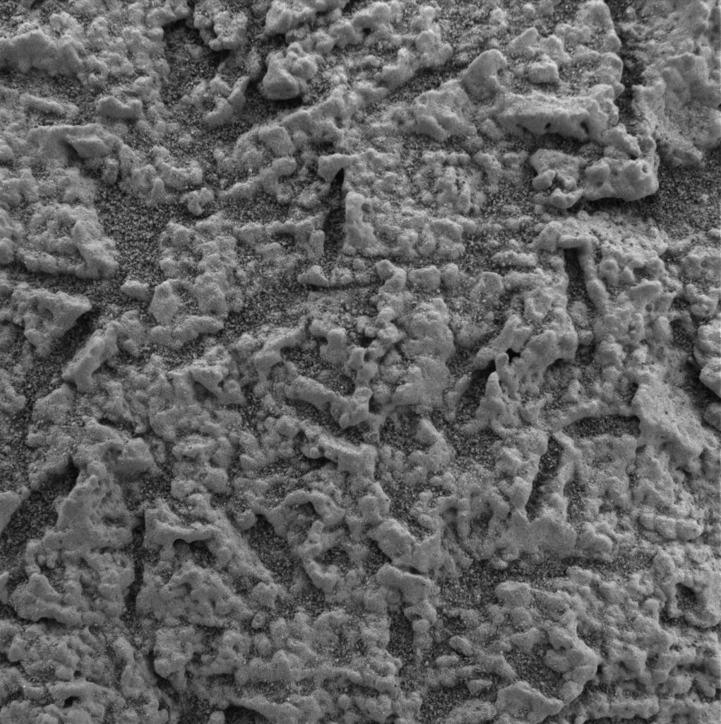
Microscopic Imager
|
1024x1024x1 |
|
-
PIA05332:
-
"Stucco" Walls-2
Full Resolution:
TIFF
(1.05 MB)
JPEG
(232.7 kB)
|
|
|
2004-02-19 |
Mars
|
Mars Exploration Rover (MER)
|
Microscopic Imager
|
1735x2272x1 |
|
-
PIA05331:
-
"Stucco" Walls
Full Resolution:
TIFF
(2.167 MB)
JPEG
(443.7 kB)
|
|
|
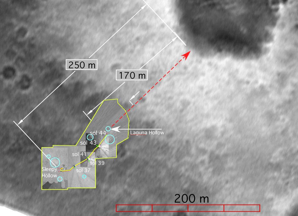
2004-02-19 |
Mars
|
Mars Exploration Rover (MER)
|
Panoramic Camera
|
1024x1024x3 |
|
-
PIA05330:
-
'Laguna Hollow'Undisturbed
Full Resolution:
TIFF
(3.15 MB)
JPEG
(136.2 kB)
|
|
|
2004-02-19 |
Mars
|
Mars Global Surveyor (MGS)
Mars Exploration Rover (MER)
|
Descent Image Motion Estimation System (DIMES)
Mars Orbiter Camera (MOC)
|
889x723x3 |
|
-
PIA05329:
-
Halfway There
Full Resolution:
TIFF
(1.261 MB)
JPEG
(85.96 kB)
|
|
|
2004-02-19 |
Mars
|
Mars Exploration Rover (MER)
|
Panoramic Camera
|
13884x3356x1 |
|
-
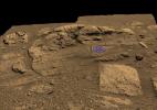
PIA05328:
Charlie Flats and El Capitan
Full Resolution:
TIFF
(25.4 MB)
JPEG
(6.156 MB)
|
|
|
2004-02-19 |
Mars
|
Mars Exploration Rover (MER)
|
Microscopic Imager
Moessbauer Spectrometer
|
1024x1024x1 |
|
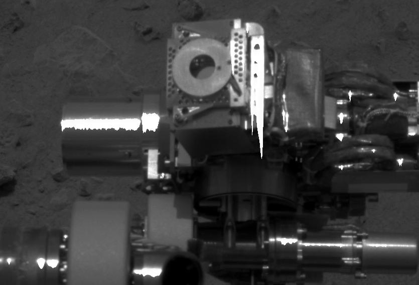
-
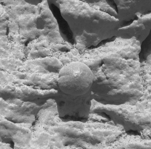
PIA05327:
-
Moessbauer Nose Print
Full Resolution:
TIFF
(913.4 kB)
JPEG
(146.4 kB)
|
|
|
2004-02-19 |
Mars
|
Mars Exploration Rover (MER)
|
Microscopic Imager
|
1024x1024x1 |

|
-
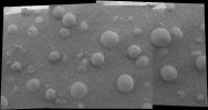
PIA05326:
-
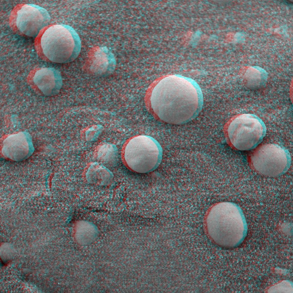
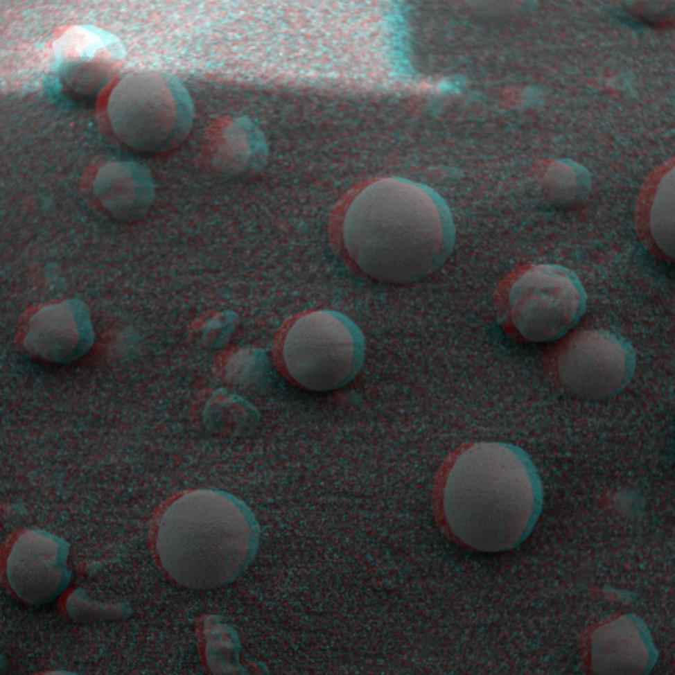
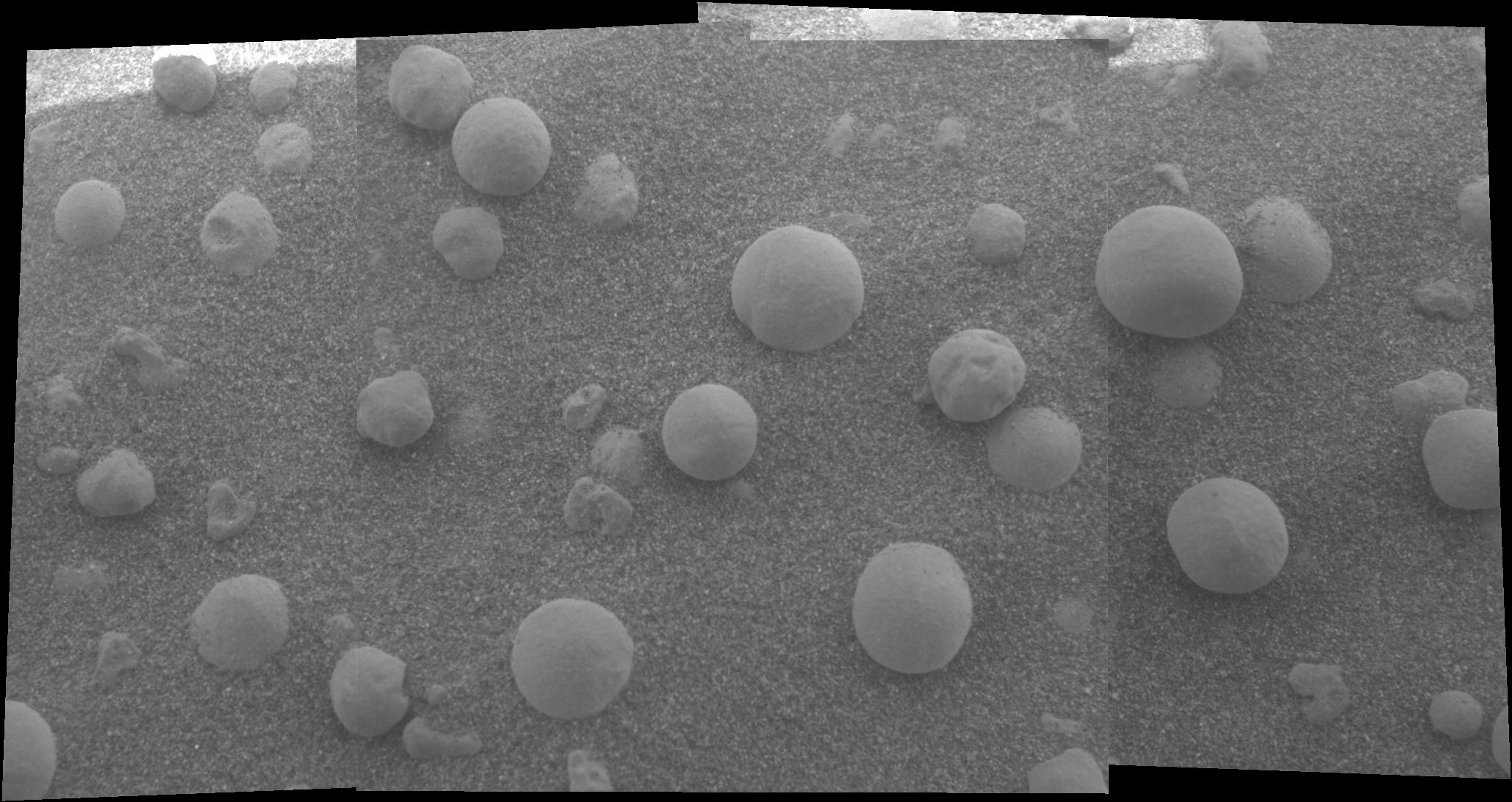
The Mystery of the Sparkling Spheres
Full Resolution:
TIFF
(1.05 MB)
JPEG
(317.9 kB)
|
|
|
2004-02-19 |
Mars
|
Mars Exploration Rover (MER)
|
Microscopic Imager
Navigation Camera
|
1508x853x1 |
|
-
PIA05325:
-
Taking a Deeper Look
Full Resolution:
TIFF
(861.1 kB)
JPEG
(132.6 kB)
|
|
|
2004-02-19 |
Mars
|
Mars Exploration Rover (MER)
|
Microscopic Imager
|
1024x1024x1 |

|
-
PIA05324:
-
Tiny Pebbles
Full Resolution:
TIFF
(1.05 MB)
JPEG
(288.2 kB)
|
|
|
2004-02-19 |
Mars
|
Mars Exploration Rover (MER)
|
Alpha Particle X-ray Spectrometer
|
1092x724x3 |
|
-
PIA05322:
-
Grooving in Trenchtown (computer animation)
Full Resolution:
TIFF
(1.137 MB)
JPEG
(77.74 kB)
|
|
|
2004-02-19 |
Mars
|
Mars Exploration Rover (MER)
|
Hazcam
|
1024x1024x1 |
|
-
PIA05333:
-
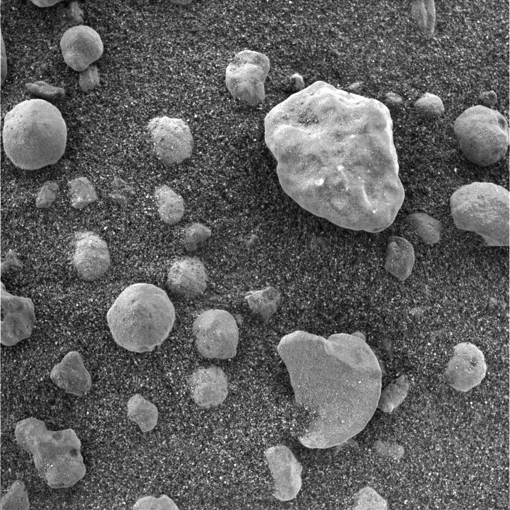
Wiggling Its Way to Discovery
Full Resolution:
TIFF
(1.05 MB)
JPEG
(262.5 kB)
|
|
|
2004-02-19 |
Mars
|
Mars Exploration Rover (MER)
|
Hazcam
|
1024x1024x1 |
|
-
PIA05321:
-
Wiggling Its Way to Discovery
Full Resolution:
TIFF
(912.8 kB)
JPEG
(97.27 kB)
|
|
|
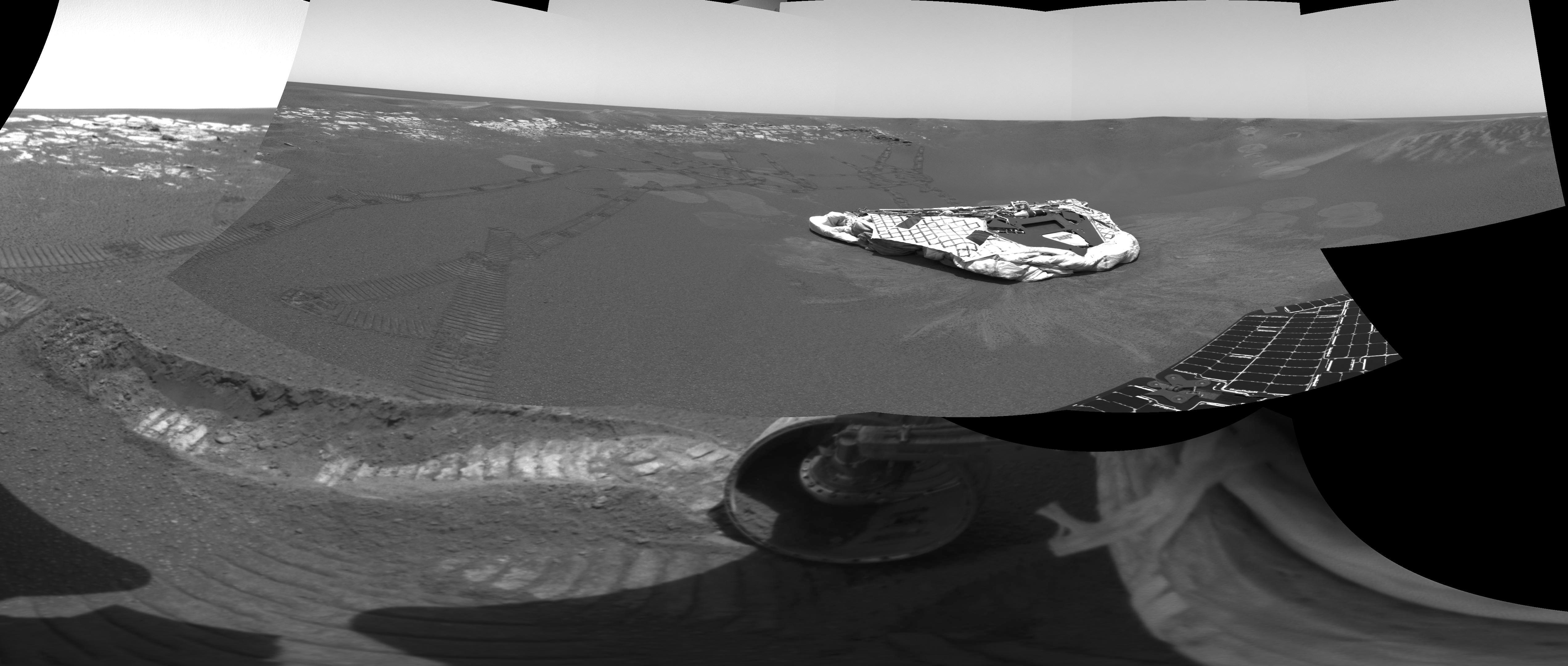
2004-02-18 |
Mars
|
Mars Global Surveyor (MGS)
Mars Exploration Rover (MER)
|
Hazcam
Mars Orbiter Camera (MOC)
Panoramic Camera
|
2014x1482x1 |

|
-
PIA05304:
-
Dragging Its Foot
Full Resolution:
TIFF
(2.505 MB)
JPEG
(202.4 kB)
|
|
|
2004-02-18 |
Mars
|
Mars Exploration Rover (MER)
|
Hazcam
|
1024x1024x1 |
|
-
PIA05318:
-
Spirit Does a "Jig" at Laguna Hollow
Full Resolution:
TIFF
(809.7 kB)
JPEG
(76.45 kB)
|
|
|
2004-02-18 |
Mars
|
Mars Exploration Rover (MER)
|
Microscopic Imager
|
1024x1024x1 |
|
-
PIA05319:
-
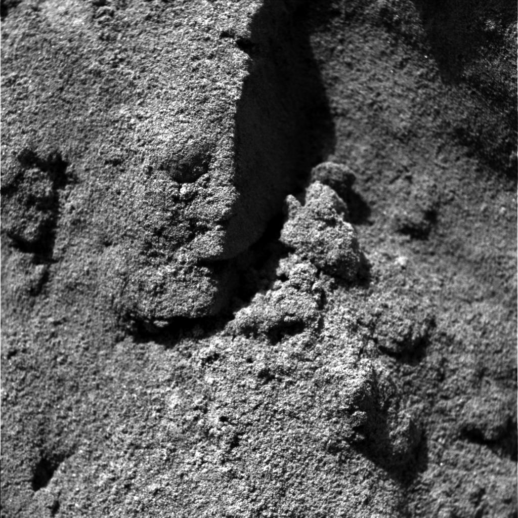
The Trench Throws a Dirt Clod at Scientists
Full Resolution:
TIFF
(1.05 MB)
JPEG
(193.5 kB)
|
|
|
2004-02-18 |
Mars
|
Mars Exploration Rover (MER)
|
Descent Image Motion Estimation System (DIMES)
Navigation Camera
Panoramic Camera
|
979x709x3 |

|
-
PIA05317:
-
Spirit's Path to Bonneville
Full Resolution:
TIFF
(861.8 kB)
JPEG
(75.48 kB)
|
|
|
2004-02-18 |
Mars
|
Mars Exploration Rover (MER)
|
Hazcam
|
544x624x7 |
|
-
PIA05308:
-
Dragging Its Foot
Full Resolution:
|
|
|
2004-02-18 |
Mars
|
Mars Exploration Rover (MER)
|
Navigation Camera
|
7466x989x1 |
|
-
PIA05315:
Spirit Keeps Rolling
Full Resolution:
TIFF
(5.752 MB)
JPEG
(947.1 kB)
|
|
|
2004-02-18 |
Mars
|
Mars Exploration Rover (MER)
|
Panoramic Camera
|
3897x1100x1 |
|
-
PIA05314:
Spirit Spies "Bonneville"
Full Resolution:
TIFF
(3.195 MB)
JPEG
(569.4 kB)
|
|
|
2004-02-17 |
Mars
|
Mars Exploration Rover (MER)
|
Microscopic Imager
Moessbauer Spectrometer
|
1024x1024x1 |
|
-
PIA05313:
-
Mark of the Moessbauer
Full Resolution:
TIFF
(1.05 MB)
JPEG
(198.9 kB)
|
|
|
2004-02-17 |
Mars
|
Mars Exploration Rover (MER)
|
Navigation Camera
|
4476x1734x1 |
|
-
PIA05312:
-
At Home in the Crater
Full Resolution:
TIFF
(3.667 MB)
JPEG
(423.4 kB)
|
|
|
2004-02-17 |
Mars
|
Mars Exploration Rover (MER)
|
Hazcam
Navigation Camera
|
5087x2160x1 |

|
-
PIA05311:
-
Opportunity Trenches Martian Soil
Full Resolution:
TIFF
(6.251 MB)
JPEG
(739.6 kB)
|
|
|
2004-02-17 |
Mars
|
Mars Exploration Rover (MER)
|
|
904x469x3 |
|
-
PIA05310:
-
The Road Less Traveled
Full Resolution:
TIFF
(394 kB)
JPEG
(36.64 kB)
|
|
|
2004-02-17 |
Mars
|
Mars Exploration Rover (MER)
|
|
692x609x3 |
|
-
PIA05309:
-
Opportunity Digs
Full Resolution:
TIFF
(340 kB)
JPEG
(31.04 kB)
|
|
|
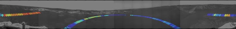
2004-02-17 |
Mars
|
Mars Exploration Rover (MER)
|
Hazcam
|
1022x624x1 |
|
-
PIA05307:
-
What Lies Beneath
Full Resolution:
TIFF
(566.1 kB)
JPEG
(67.3 kB)
|
|
|
2004-02-17 |
Mars
|
Mars Exploration Rover (MER)
|
Hazcam
|
1431x953x1 |
|
-
PIA05306:
-
Peeling Back the Layers of Mars
Full Resolution:
TIFF
(1.184 MB)
JPEG
(140.7 kB)
|
|
|
2004-02-17 |
Mars
|
Mars Exploration Rover (MER)
|
Hazcam
|
1025x947x1 |

|
-
PIA05305:
-
Fresh Soil for Inspection
Full Resolution:
TIFF
(811.3 kB)
JPEG
(89.32 kB)
|
|
|
2004-02-17 |
Mars
|
Mars Exploration Rover (MER)
|
Microscopic Imager
Moessbauer Spectrometer
|
723x1005x3 |
|
-
PIA05303:
-
Map of Moessbauer Placement
Full Resolution:
TIFF
(2.133 MB)
JPEG
(95.85 kB)
|
|
|
2004-02-17 |
Mars
|
Mars Exploration Rover (MER)
|
Moessbauer Spectrometer
Panoramic Camera
|
835x569x1 |

|
-
PIA05302:
-
Moessbauer Close-Up
Full Resolution:
TIFF
(364.3 kB)
JPEG
(38.28 kB)
|
|
|
2004-02-17 |
Mars
|
Mars Exploration Rover (MER)
|
Hazcam
Navigation Camera
|
5405x5405x1 |
|
-
PIA05301:
-
Track-and-Trench 2
Full Resolution:
TIFF
(10.22 MB)
JPEG
(1.208 MB)
|
|
|
2004-02-17 |
Mars
|
Mars Exploration Rover (MER)
|
Hazcam
Navigation Camera
|
2000x2000x1 |
|
-
PIA05300:
-
Track-and-Trench
Full Resolution:
TIFF
(1.403 MB)
JPEG
(198.3 kB)
|
|
|
2004-02-16 |
Mars
|
Mars Exploration Rover (MER)
|
Hazcam
|
1024x1024x1 |

|
-
PIA05291:
-
After a U-Turn
Full Resolution:
TIFF
(930.2 kB)
JPEG
(115.3 kB)
|
|
|
2004-02-15 |
Mars
|
Mars Exploration Rover (MER)
|
Panoramic Camera
|
1025x1025x3 |
|
-
PIA05290:
-
Sailing to White Boat
Full Resolution:
TIFF
(3.156 MB)
JPEG
(177.1 kB)
|
|
|
2004-02-14 |
Mars
|
Mars Exploration Rover (MER)
|
Miniature Thermal Emission Spectrometer
Panoramic Camera
|
5781x731x3 |
|
-
PIA05289:
Red Marks the Spot
Full Resolution:
TIFF
(3.704 MB)
JPEG
(299.6 kB)
|
|
|
2004-02-14 |
Mars
|
Mars Exploration Rover (MER)
|
Microscopic Imager
|
512x512x1 |
|
-
PIA05288:
-
Ground Inspection
Full Resolution:
TIFF
(262.6 kB)
JPEG
(57.54 kB)
|
|
|
2004-02-14 |
Mars
|
Mars Exploration Rover (MER)
|
Microscopic Imager
Moessbauer Spectrometer
|
974x974x3 |
|
-
PIA05287:
-
Moessbauer Footprint in the Soil
Full Resolution:
TIFF
(2.636 MB)
JPEG
(227.1 kB)
|
|
|
2004-02-13 |
Mars
|
Mars Exploration Rover (MER)
|
Microscopic Imager
|
974x974x3 |
|
-
PIA05286:
-
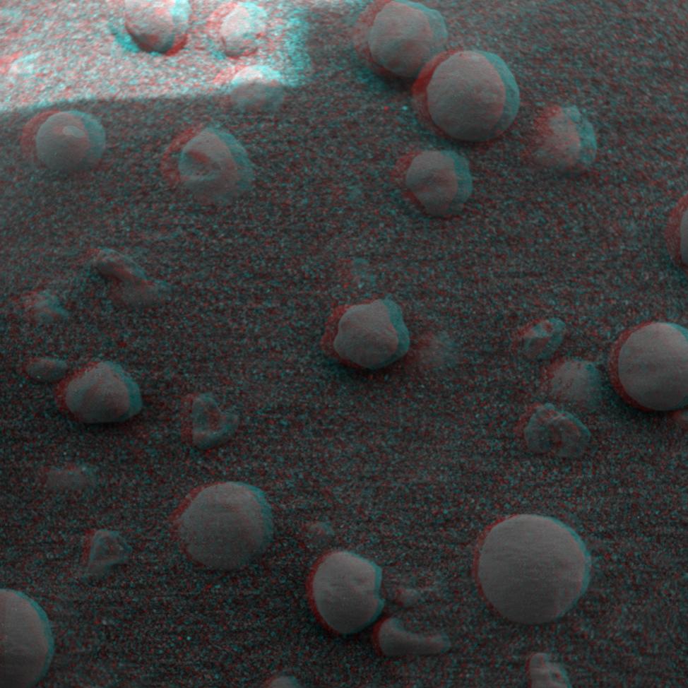
Even More Eye-popping 'Berries'
Full Resolution:
TIFF
(2.674 MB)
JPEG
(204.2 kB)
|
|
|
2004-02-13 |
Mars
|
Mars Exploration Rover (MER)
|
Microscopic Imager
|
974x974x3 |
|
-
PIA05285:
-
More Eye-popping 'Berries'
Full Resolution:
TIFF
(2.385 MB)
JPEG
(130.6 kB)
|
|
|
2004-02-13 |
Mars
|
Mars Exploration Rover (MER)
|
Microscopic Imager
|
974x974x3 |
|
-
PIA05284:
-
Eye-popping 'Berries'
Full Resolution:
TIFF
(2.339 MB)
JPEG
(117.8 kB)
|
|
|
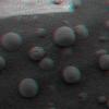
2004-02-13 |
Mars
|
Mars Exploration Rover (MER)
|
Panoramic Camera
|
1024x1024x3 |
|
-
PIA05283:
-
Flaky "Mimi"
Full Resolution:
TIFF
(3.15 MB)
JPEG
(230.6 kB)
|
|
|
2004-02-13 |
Mars
|
Mars Exploration Rover (MER)
|
Microscopic Imager
Rock Abrasion Tool (RAT)
|
974x974x3 |
|
-
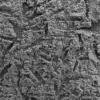
PIA05278:
-
Adirondack Post-Drill (3-D)
Full Resolution:
TIFF
(2.161 MB)
JPEG
(105.7 kB)
|
|
|
2004-02-13 |
Mars
|
Mars Exploration Rover (MER)
|
Microscopic Imager
Rock Abrasion Tool (RAT)
|
974x974x3 |
|
-
PIA05277:
-
A Clean Adirondack (3-D)
Full Resolution:
TIFF
(2.642 MB)
JPEG
(162.6 kB)
|
|
|
2004-02-12 |
Mars
|
Mars Exploration Rover (MER)
|
Microscopic Imager
|
1920x1080x1 |
|
-
PIA05276:
-
A Sharp Look at Robert E
Full Resolution:
TIFF
(817.1 kB)
JPEG
(109.9 kB)
|
|
|
2004-02-12 |
Mars
|
Mars Exploration Rover (MER)
|
Moessbauer Spectrometer
|
974x974x3 |
|
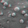
-
PIA05275:
-
"Berries" on the Ground 2 (3-D)
Full Resolution:
TIFF
(2.621 MB)
JPEG
(190.1 kB)
|
|
|
2004-02-12 |
Mars
|
Mars Exploration Rover (MER)
|
Moessbauer Spectrometer
|
974x974x3 |
|
-
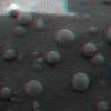
PIA05274:
-
"Berries" on the Ground 2 (3-D)
Full Resolution:
TIFF
(2.211 MB)
JPEG
(107.9 kB)
|
|
|
2004-02-12 |
Mars
|
Mars Exploration Rover (MER)
|
Microscopic Imager
|
2058x1092x1 |
|
-
PIA05273:
-
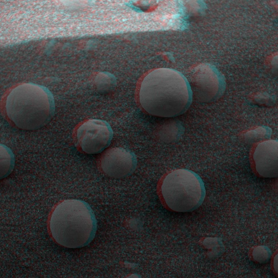
"Berries" on the Ground
Full Resolution:
TIFF
(1.894 MB)
JPEG
(275.8 kB)
|
|
|
2004-02-12 |
Mars
|
Mars Exploration Rover (MER)
|
Miniature Thermal Emission Spectrometer
|
2820x2040x3 |
|
-
PIA05272:
-
Martian Heat on the Rise
Full Resolution:
TIFF
(6.715 MB)
JPEG
(368.5 kB)
|
|
|
2004-02-12 |
Mars
|
Mars Exploration Rover (MER)
|
Miniature Thermal Emission Spectrometer
|
2760x1072x3 |
|
-
PIA05271:
-
The Heat Below
Full Resolution:
TIFF
(8.88 MB)
JPEG
(233.7 kB)
|
 Planetary Data System


