This composite image shows a bird's-eye view of the crater occupied by the Mars Exploration Rover Opportunity at Meridiani Planum, Mars. A portion of the lander can be seen to the bottom left of the image's circular center. Bounce marks can be seen below and to the top left of the center. The rock outcrop containing many of the rover's rock targets runs from the top right of the image to the left of the image. The rover, which cannot be seen in the image, is located in the southwest quadrant, just left of the lander. Data depicting the inside of the crater wall is from the rover's panoramic camera. Data depicting the outside of the crater wall is from the camera on the orbiting Mars Global Surveyor. The top of the image faces north, and the image area measures approximately 22 meters (72 feet) wide.
 Figure 1 (Click on image for larger view)
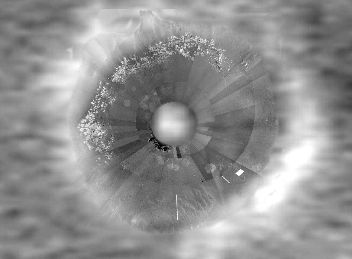
Opportunity Traverse Map
This composite image (Figure 1) maps the areas traveled by the Mars Exploration Rover Opportunity at Meridiani Planum, Mars. Dotted lines represent areas the rover has already traveled. Solid lines represent areas still on the rover's travel agenda. Data depicting the inside of the crater wall is from the rover's panoramic camera. Data depicting the outside of the crater wall is from the camera on the orbiting Mars Global Surveyor. The top of the image faces north, and the image area measures approximately 22 meters (72 feet) wide.
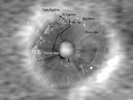 Figure 2 (Click on image for larger view)
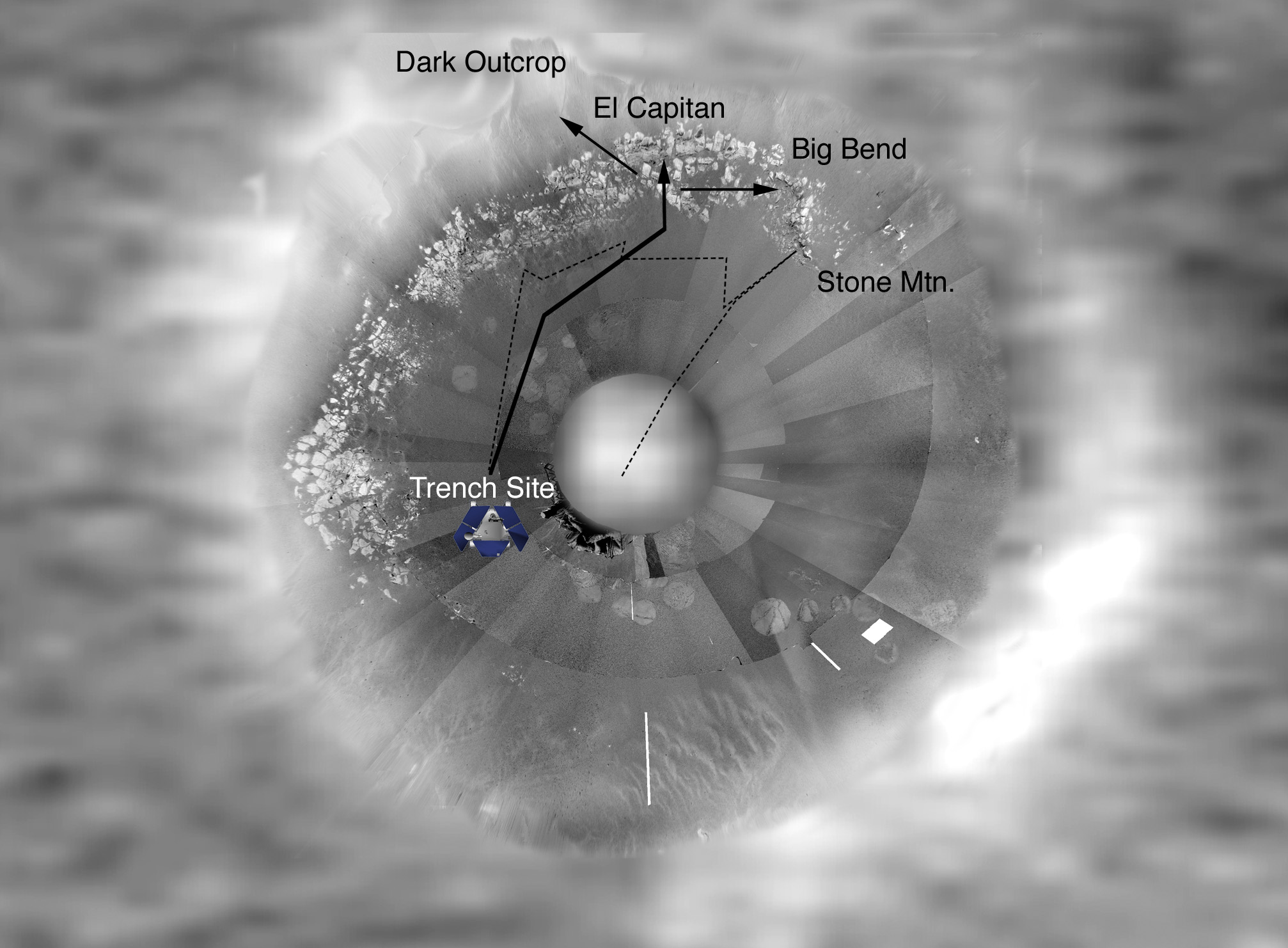
Opportunity Future Traverse Map
This composite image maps a future travel itinerary for the Mars Exploration Rover Opportunity at Meridiani Planum, Mars. The rover is currently located at the trench site toward the bottom left of the image. It has already been to the location named "Stone Mountain." Controllers plan to investigate the other labeled areas on the rock outcrop. Data depicting the inside of the crater wall is from the rover's panoramic camera. Data depicting the outside of the crater wall is from the camera on the orbiting Mars Global Surveyor. The top of the image faces north, and the image area measures approximately 22 meters (72 feet) wide.
 Planetary Data System


