Click on an image for detailed information
Click on a column heading to sort in ascending or descending order

My
List |
Addition Date
|
Target
|
Mission
|
Instrument
|
Size
|

|
2006-04-13 |
Mars
|
Mars Global Surveyor (MGS)
Mars Reconnaissance Orbiter (MRO)
|
CTX
Mars Orbiter Camera
|
5056x5222x1 |

|
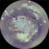
-
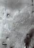
PIA08068:
-
First Context Camera Image of Mars
Full Resolution:
TIFF
(26.44 MB)
JPEG
(1.394 MB)
|
|
|
2006-10-16 |
Mars
|
Mars Global Surveyor (MGS)
Mars Reconnaissance Orbiter (MRO)
|
CTX
Mars Color Imager (MARCI)
|
2219x2219x3 |
|
-
PIA01929:
-
Map of Context Camera's North Polar Coverage During Checkout
Full Resolution:
TIFF
(14.79 MB)
JPEG
(408.2 kB)
|
|
|
2006-10-16 |
Mars
|
Mars Reconnaissance Orbiter (MRO)
|
CTX
|
1264x12544x1 |

|
-
PIA01930:
-
Context Camera Image of North Polar Chasma Boreale
Full Resolution:
TIFF
(15.87 MB)
JPEG
(611.2 kB)
|
|
|
2006-10-16 |
Mars
|
Mars Reconnaissance Orbiter (MRO)
|
CTX
|
5056x7168x1 |
|
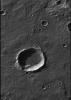
-
PIA01931:
-
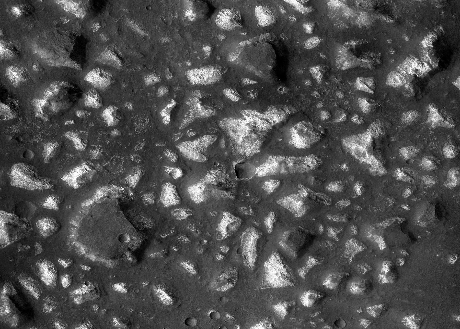
Crater in Terra Sirenum with Gullied Walls
Full Resolution:
TIFF
(36.3 MB)
JPEG
(5.535 MB)
|
|
|
2006-10-16 |
Mars
|
Mars Reconnaissance Orbiter (MRO)
|
CTX
|
5056x12288x1 |
|
-
PIA01932:
-
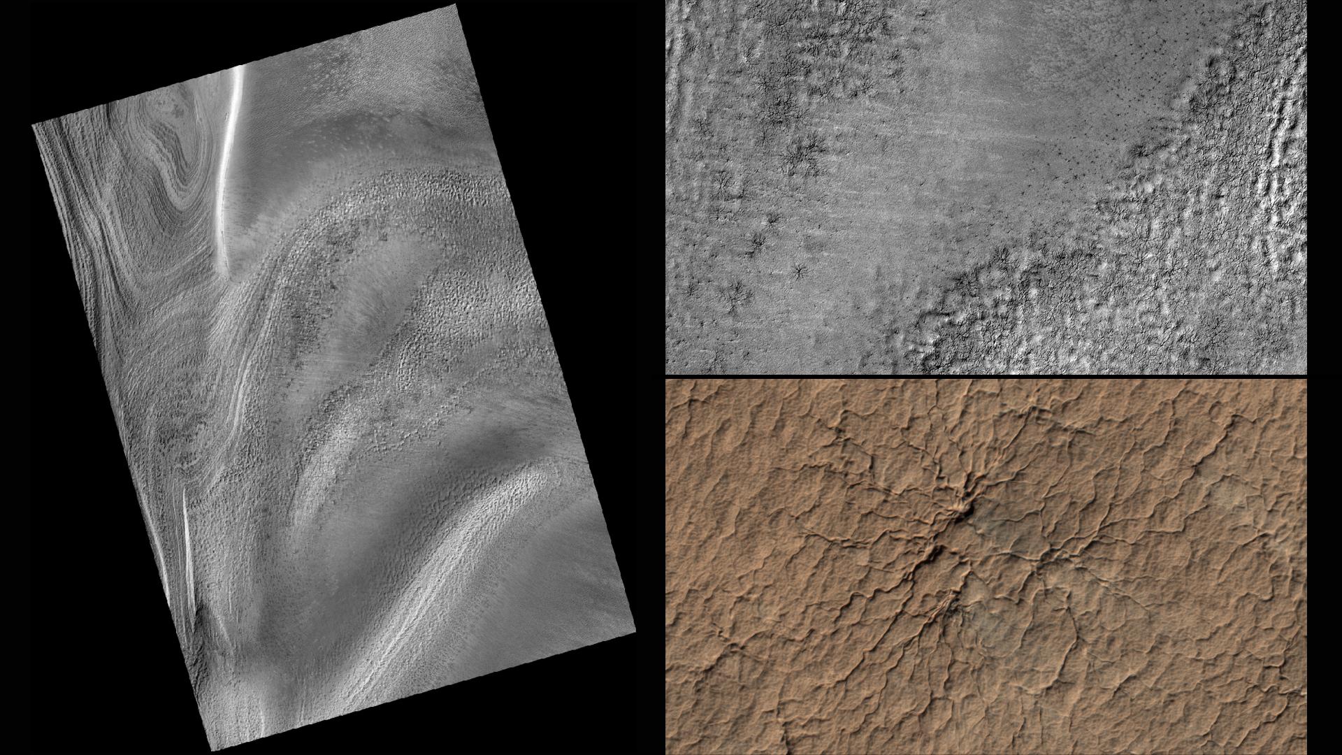
Layered Rocks Near Mawrth Vallis
Full Resolution:
TIFF
(62.23 MB)
JPEG
(6.478 MB)
|
|
|
2007-08-02 |
Mars
|
Mars Reconnaissance Orbiter (MRO)
Phoenix
|
CTX
|
1159x858x3 |
|
-
PIA09946:
-
Possible Landing Ellipses for Phoenix
Full Resolution:
TIFF
(2.987 MB)
JPEG
(191.5 kB)
|
|
|
2007-08-02 |
Mars
|
Mars Reconnaissance Orbiter (MRO)
Phoenix
|
CTX
|
1300x1300x1 |
|
-
PIA09947:
-
Context Image of Planned Landing Site
Full Resolution:
TIFF
(1.692 MB)
JPEG
(108.2 kB)
|
|
|
2008-05-06 |
Mars
|
Mars Reconnaissance Orbiter (MRO)
|
CTX
|
499x5222x1 |

|
-
PIA10632:
-
Context Camera View in Phoenix Landing Region in Martian Arctic
Full Resolution:
TIFF
(2.609 MB)
JPEG
(328.2 kB)
|
|
|
2008-05-06 |
Mars
|
Mars Reconnaissance Orbiter (MRO)
|
CTX
|
4096x4096x1 |
|
-
PIA10633:
-
Context Camera Spots Dust Devils at Phoenix Landing Site
Full Resolution:
TIFF
(16.79 MB)
JPEG
(2.521 MB)
|
|
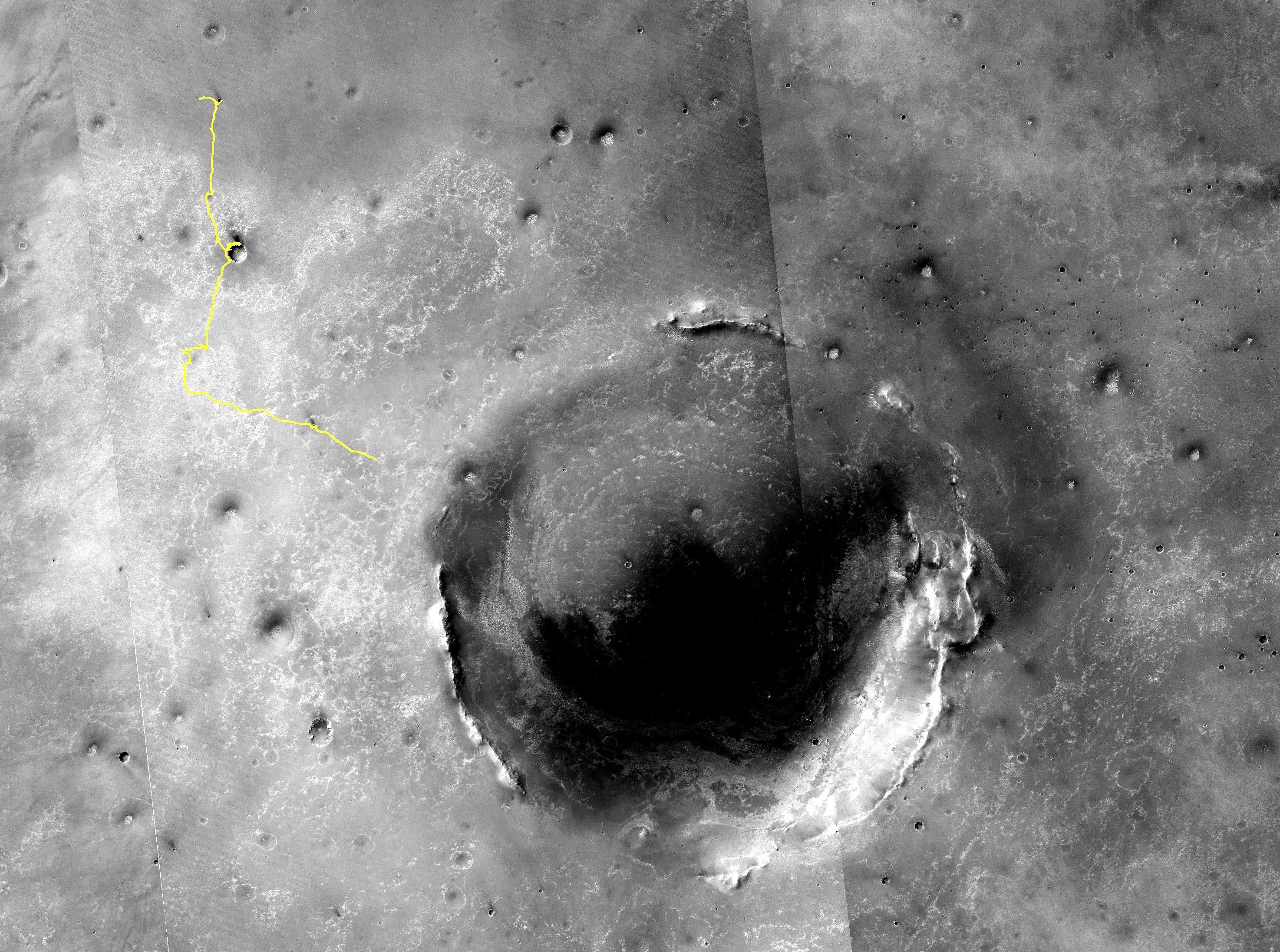
|
2009-03-18 |
Mars
|
Mars Reconnaissance Orbiter (MRO)
|
CTX
|
2000x1554x1 |

|
-
PIA11837:
-
Endeavour Crater in Context
Full Resolution:
TIFF
(3.111 MB)
JPEG
(298 kB)
|
|
|
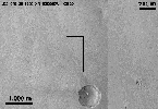
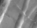
2009-09-24 |
Mars
|
Mars Reconnaissance Orbiter (MRO)
|
CTX
|
1338x1094x1 |
|
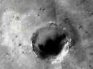
-
PIA12215:
-
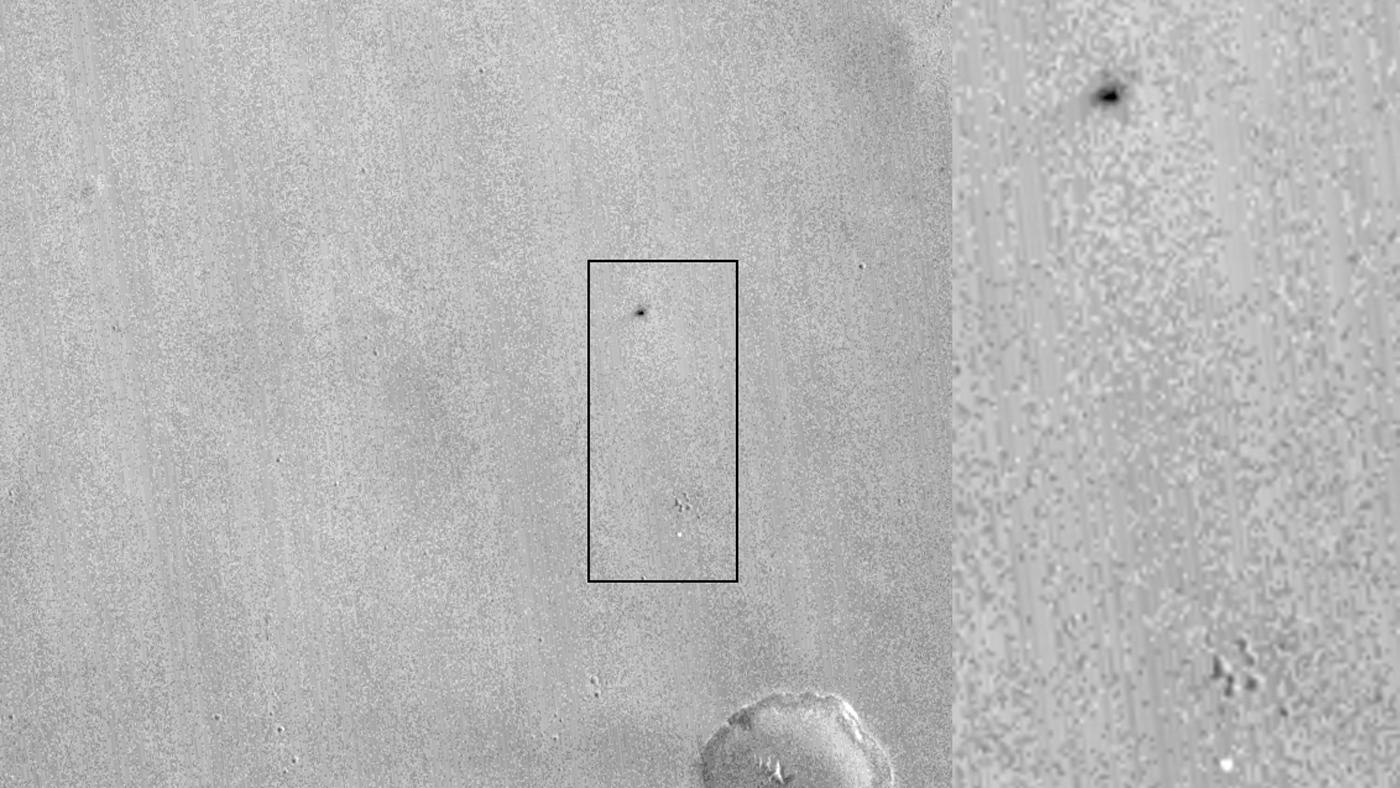
New Impact Craters on Mars
Full Resolution:
TIFF
(1.465 MB)
JPEG
(183.8 kB)
|
|
|
2010-03-04 |
Mars
|
Mars Reconnaissance Orbiter (MRO)
|
CTX
|
535x645x1 |
|
-
PIA12857:
-
Location Map for Images of Changing Martian Dunes
Full Resolution:
TIFF
(345.6 kB)
JPEG
(82.61 kB)
|
|
|
2010-06-29 |
Mars
|
Mars Exploration Rover (MER)
|
CTX
|
4056x4096x1 |

|
-
PIA13196:
-
Opportunity Amid Mars Craters
Full Resolution:
TIFF
(16.63 MB)
JPEG
(2.577 MB)
|
|
|
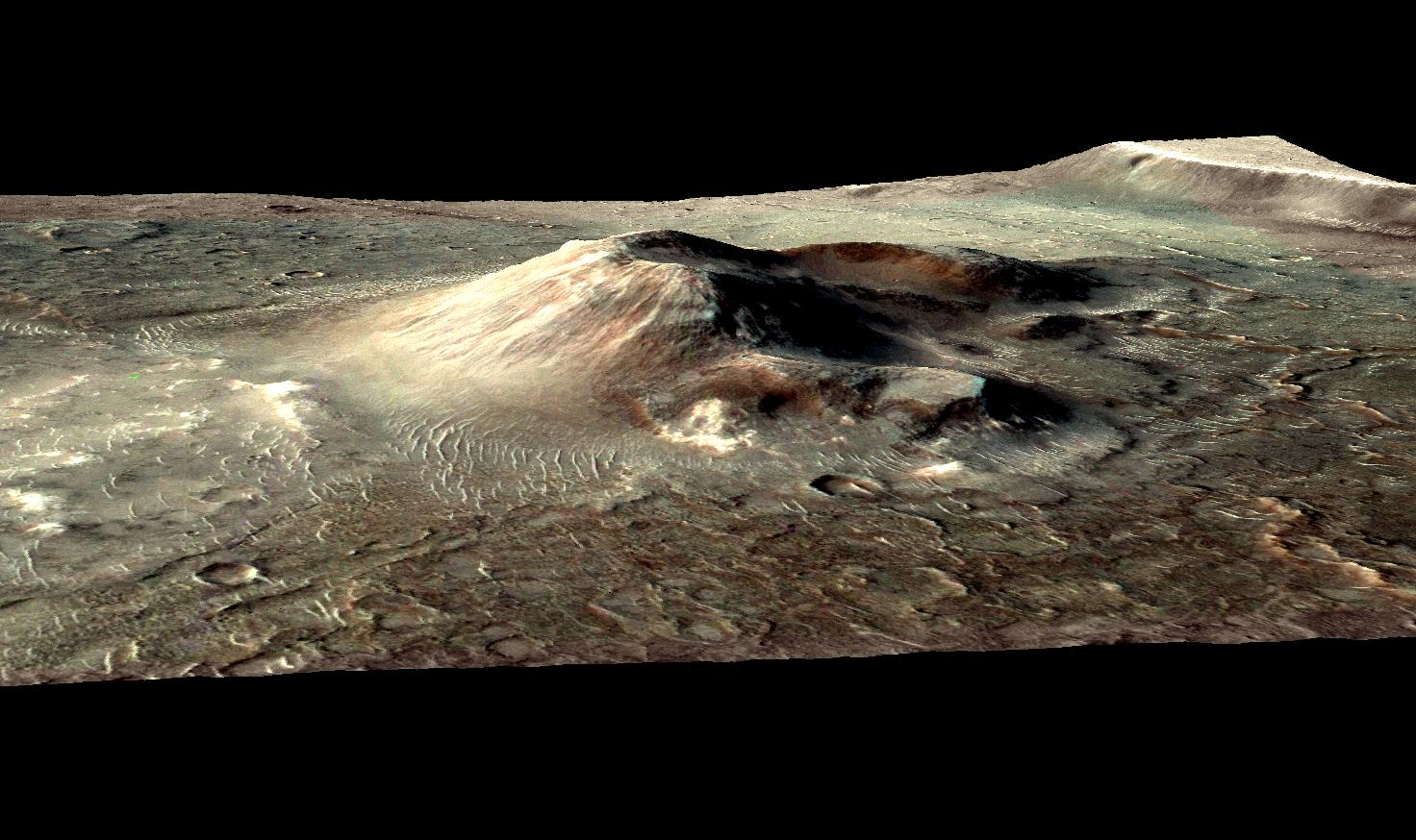
2010-10-31 |
Mars
|
Mars Reconnaissance Orbiter (MRO)
|
CRISM
CTX
|
1472x874x3 |
|
-
PIA13556:
-
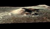
Mars Volcanic Cone with Hydrothermal Deposits
Full Resolution:
TIFF
(3.867 MB)
JPEG
(193.8 kB)
|
|
|
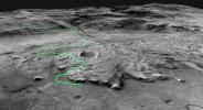
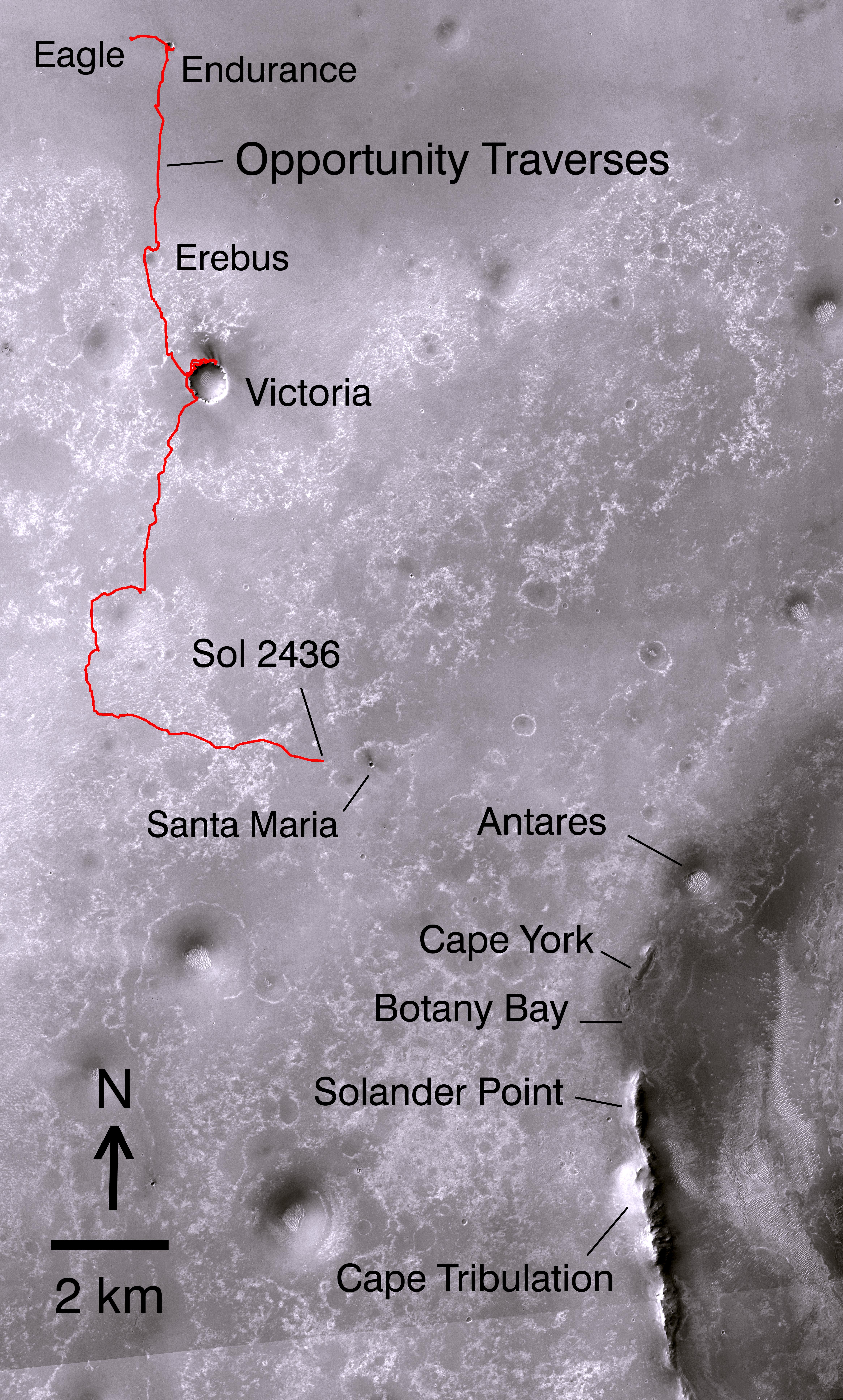
2010-12-10 |
Mars
|
Mars Exploration Rover (MER)
|
CTX
HiRISE
|
3038x6485x1 |
|
-
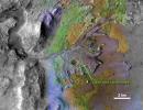
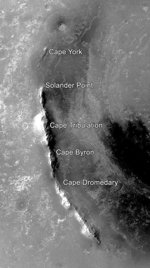
PIA13598:
-
Opportunity's Martian Traverse Through Sol 2442
Full Resolution:
TIFF
(19.73 MB)
JPEG
(1.488 MB)
|
|
|
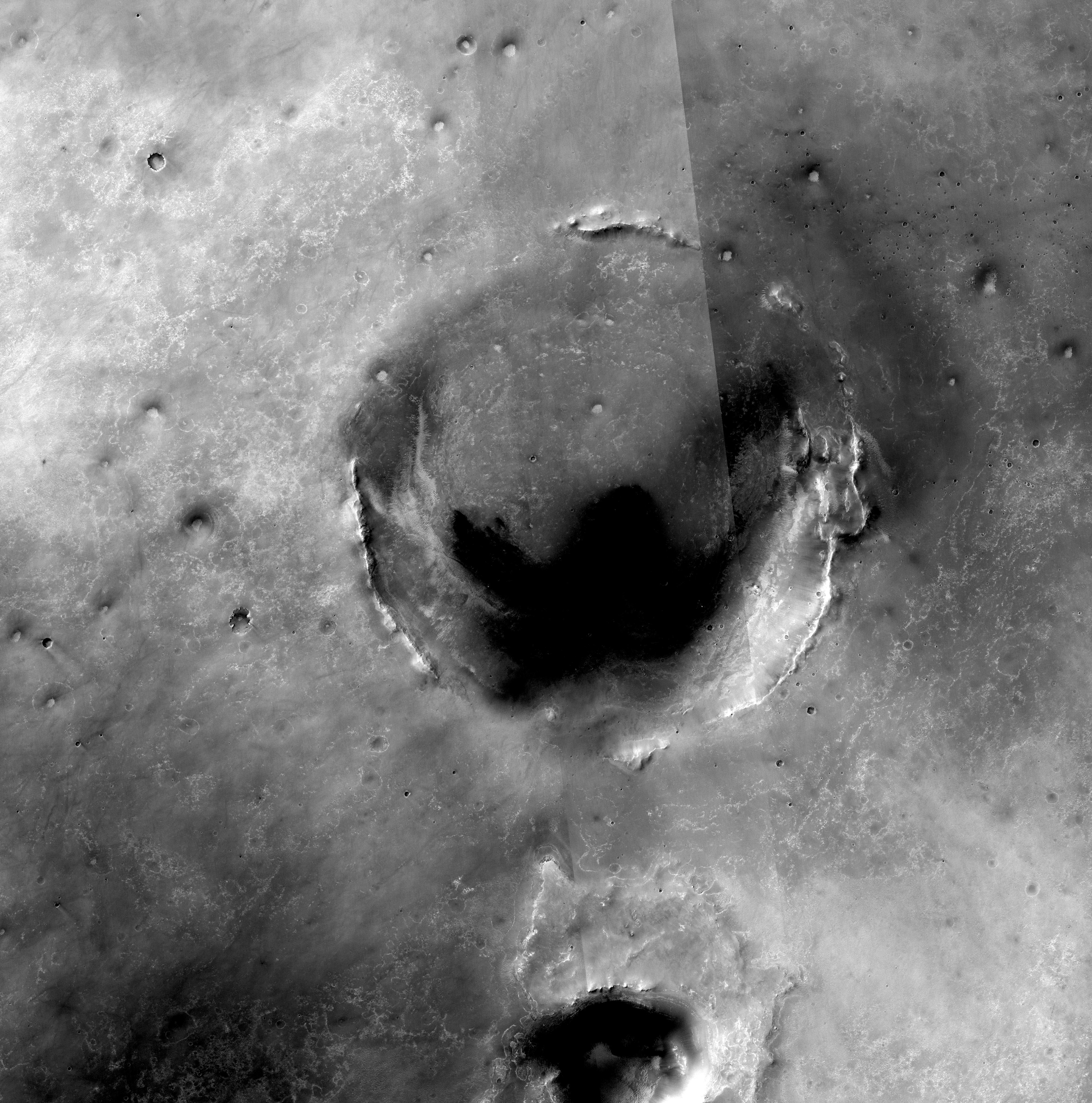
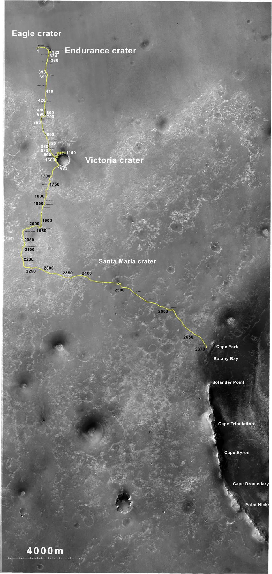
2010-12-16 |
Mars
|
Mars Reconnaissance Orbiter (MRO)
|
CTX
|
4664x7746x3 |

|
-
PIA13705:
-
Opportunity's Path on Mars Through Sol 2436
Full Resolution:
TIFF
(108.4 MB)
JPEG
(5.199 MB)
|
|
|
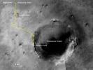
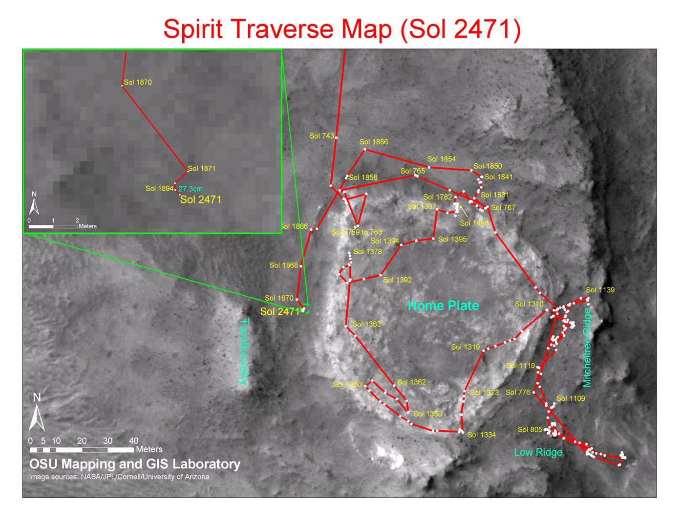
2010-12-17 |
Mars
|
Mars Exploration Rover (MER)
Mars Reconnaissance Orbiter (MRO)
|
CTX
|
1392x1080x3 |
|
-
PIA13730:
-
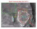
Spirit Traverse Map, Sol 2471
Full Resolution:
TIFF
(4.519 MB)
JPEG
(176.5 kB)
|
|
|
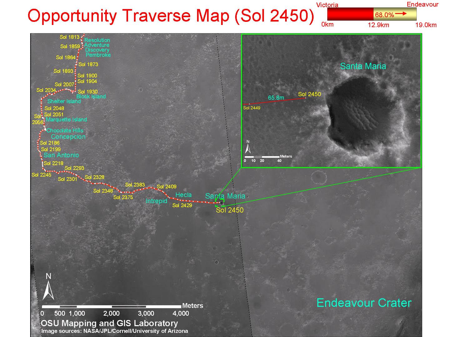
2010-12-17 |
Mars
|
Mars Exploration Rover (MER)
Mars Reconnaissance Orbiter (MRO)
|
CTX
|
1460x1080x3 |
|
-
PIA13731:
-
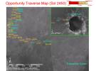
Opportunity Traverse Map, Sol 2450
Full Resolution:
TIFF
(4.739 MB)
JPEG
(178 kB)
|
|
|
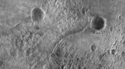
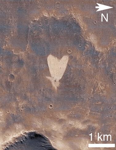
2011-02-14 |
Mars
|
Mars Reconnaissance Orbiter (MRO)
|
CTX
|
377x487x3 |
|
-
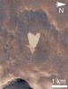
PIA13798:
-
Heart-Shaped Feature in Arabia Terra
Full Resolution:
TIFF
(185.6 kB)
JPEG
(41.39 kB)
|
|
|
2011-02-14 |
Mars
|
Mars Reconnaissance Orbiter (MRO)
|
CTX
|
420x487x3 |

|
-
PIA13799:
-
Heart-Shaped Feature in Arabia Terra (Wide View)
Full Resolution:
TIFF
(206.5 kB)
JPEG
(25.93 kB)
|
|
|
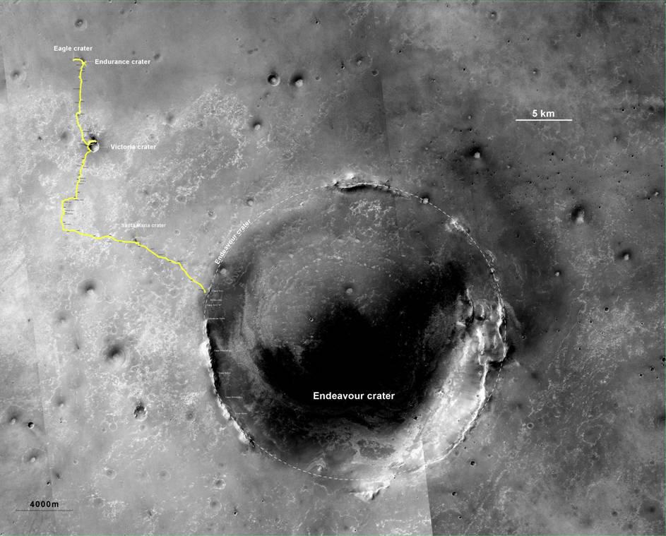
2011-06-08 |
Mars
|
Mars Exploration Rover (MER)
Mars Reconnaissance Orbiter (MRO)
|
CTX
|
2948x2193x3 |
|
-
PIA14135:
-
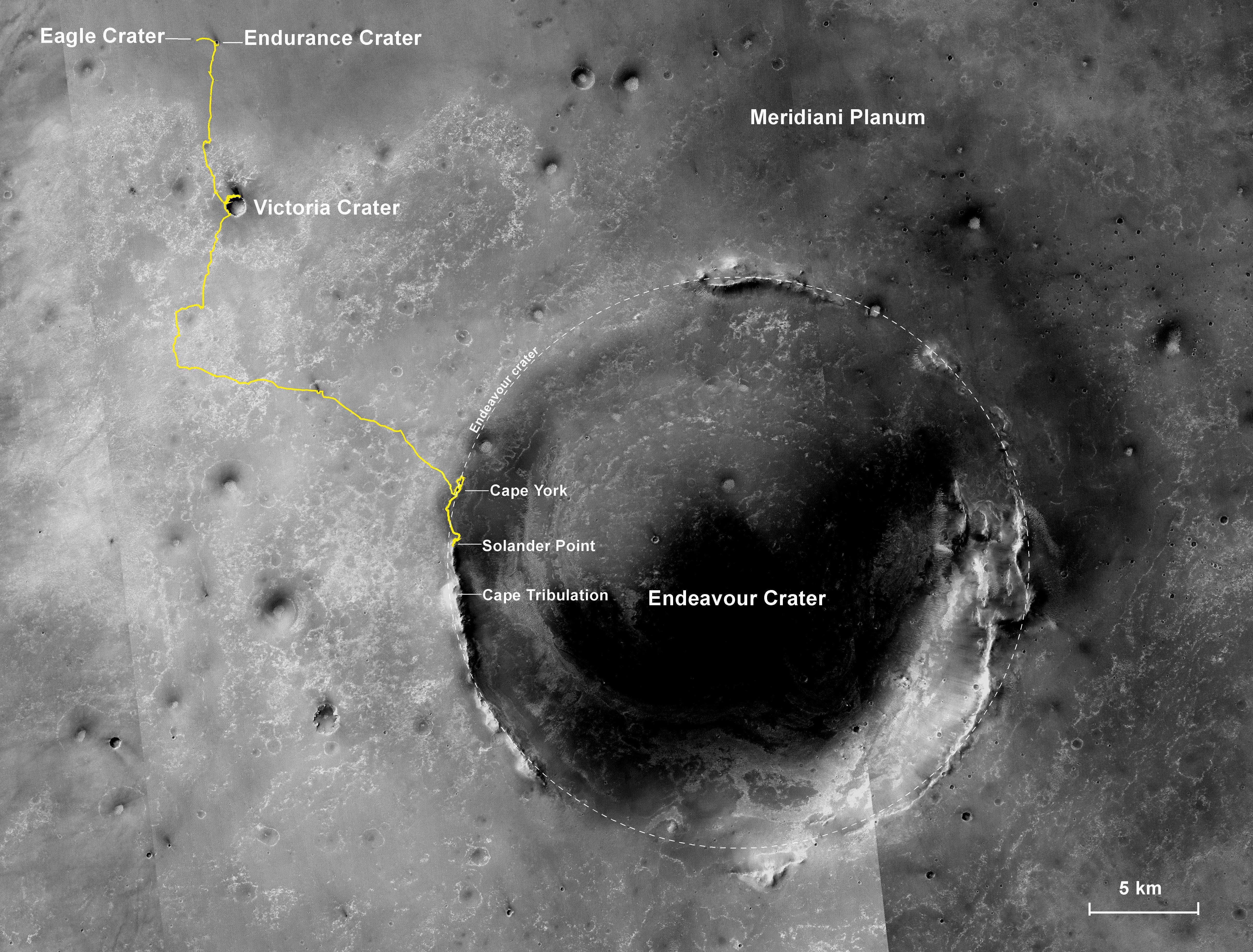
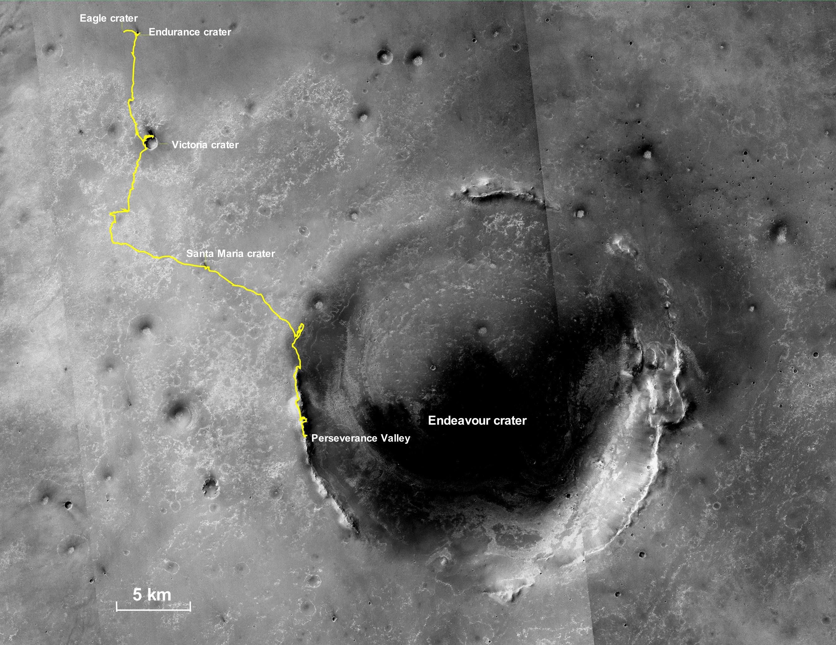
Eagle to Endeavour: Opportunity's Path, Sol 2609
Full Resolution:
TIFF
(19.4 MB)
JPEG
(1.319 MB)
|
|
|
2011-08-05 |
Mars
|
Mars Exploration Rover (MER)
|
CTX
|
943x1989x3 |
|
-
PIA14504:
-
Opportunity's Route to Endeavour Crater
Full Resolution:
TIFF
(5.635 MB)
JPEG
(260 kB)
|
|
|
2011-08-05 |
Mars
|
Mars Exploration Rover (MER)
|
CTX
|
943x759x3 |
|
-
PIA14505:
-
Opportunity's Route to Endeavour Crater (Wide View)
Full Resolution:
TIFF
(2.15 MB)
JPEG
(101 kB)
|
|
|
2011-09-01 |
Mars
|
Mars Exploration Rover (MER)
Mars Reconnaissance Orbiter (MRO)
|
CTX
|
5664x7979x3 |
|
-
PIA14536:
-
Opportunity Traverses Through 2,700 Martian Days
Full Resolution:
TIFF
(45.26 MB)
JPEG
(6.766 MB)
|
|
|
2011-11-21 |
Mars
|
Mars Reconnaissance Orbiter (MRO)
|
CRISM
CTX
|
935x720x3 |
|
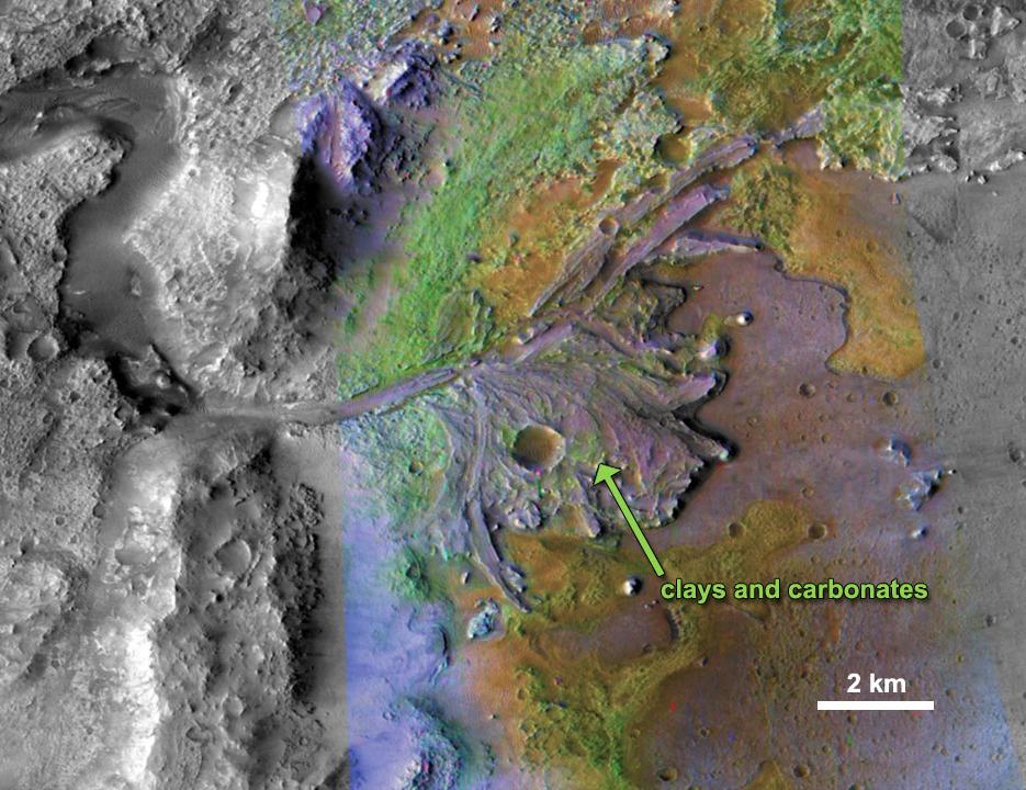
-
PIA15097:
-
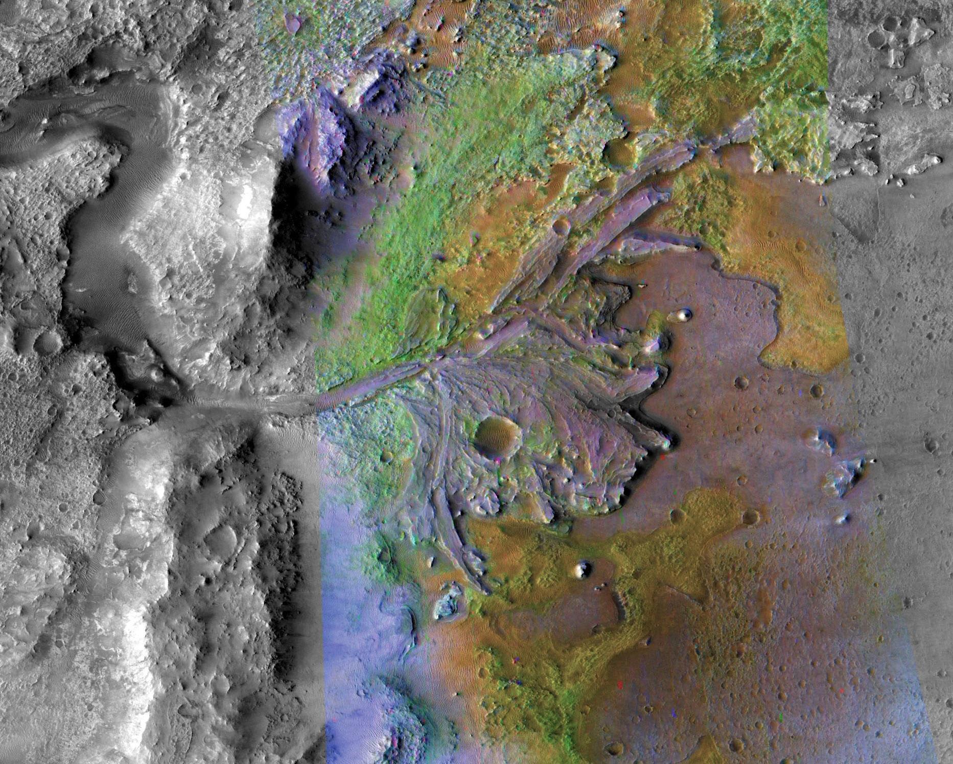
Chemical Alteration by Water, Jezero Crater Delta
Full Resolution:
TIFF
(2.023 MB)
JPEG
(132 kB)
|
|
|
2011-11-21 |
Mars
|
Mars Reconnaissance Orbiter (MRO)
|
CRISM
CTX
|
857x517x3 |

|
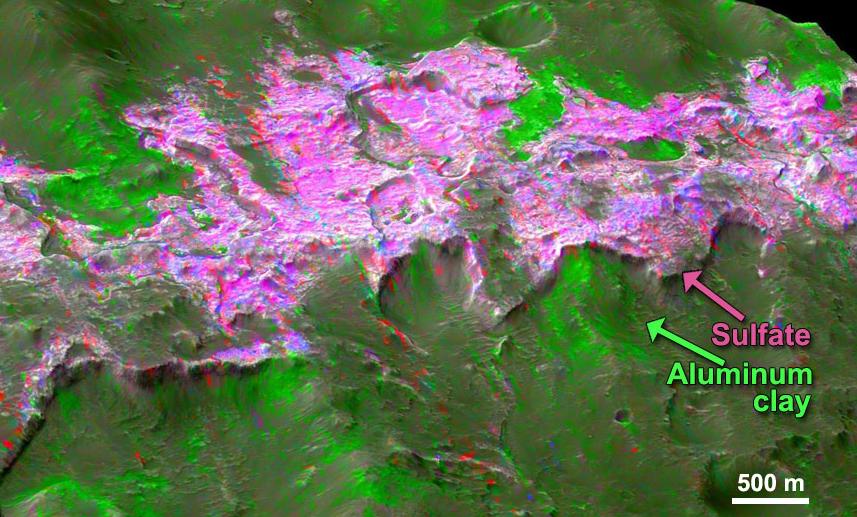
-
PIA15099:
-
Sulfates and Clays in Columbus Crater, Mars
Full Resolution:
TIFF
(1.331 MB)
JPEG
(97.63 kB)
|
|
|
2012-08-08 |
Mars
|
Mars Reconnaissance Orbiter (MRO)
Mars Science Laboratory (MSL)
|
CTX
|
1709x1193x1 |
|
-
PIA16014:
-
Before and After Curiosity's Touchdown

Full Resolution:
TIFF
(2.041 MB)
JPEG
(305.4 kB)
|
|
|
2012-08-08 |
Mars
|
Mars Reconnaissance Orbiter (MRO)
Mars Science Laboratory (MSL)
|
CTX
|
758x511x1 |

|
-
PIA16015:
-
Ballasts Hitting the Surface, Close-Up (with arrows)
Full Resolution:
TIFF
(388 kB)
JPEG
(58.05 kB)
|
|
|
2012-08-08 |
Mars
|
Mars Reconnaissance Orbiter (MRO)
Mars Science Laboratory (MSL)
|
CTX
|
758x511x1 |
|
-
PIA16016:
-
Ballasts Hitting the Surface, Close-Up
Full Resolution:
TIFF
(388 kB)
JPEG
(58 kB)
|
|
|
2012-12-05 |
Mars
|
Mars Reconnaissance Orbiter (MRO)
Mars Science Laboratory (MSL)
|
CTX
HiRISE
|
4985x2619x3 |
|
-
PIA16456:
-
Impact Scars from MSL Cruise Stage and Two Balance Weights
Full Resolution:
TIFF
(39.19 MB)
JPEG
(1.692 MB)
|
|
|
2013-05-15 |
Mars
|
Mars Reconnaissance Orbiter (MRO)
|
CTX
HiRISE
|
1253x1822x3 |
|
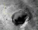
-
PIA16928:
-
Fresh Cluster of Impact Craters on Mars
Full Resolution:
TIFF
(6.852 MB)
JPEG
(311.5 kB)
|
|
|
2013-06-07 |
Mars
|
Mars Exploration Rover (MER)
Mars Reconnaissance Orbiter (MRO)
|
CTX
|
5198x3900x3 |
|
-
PIA17070:
-
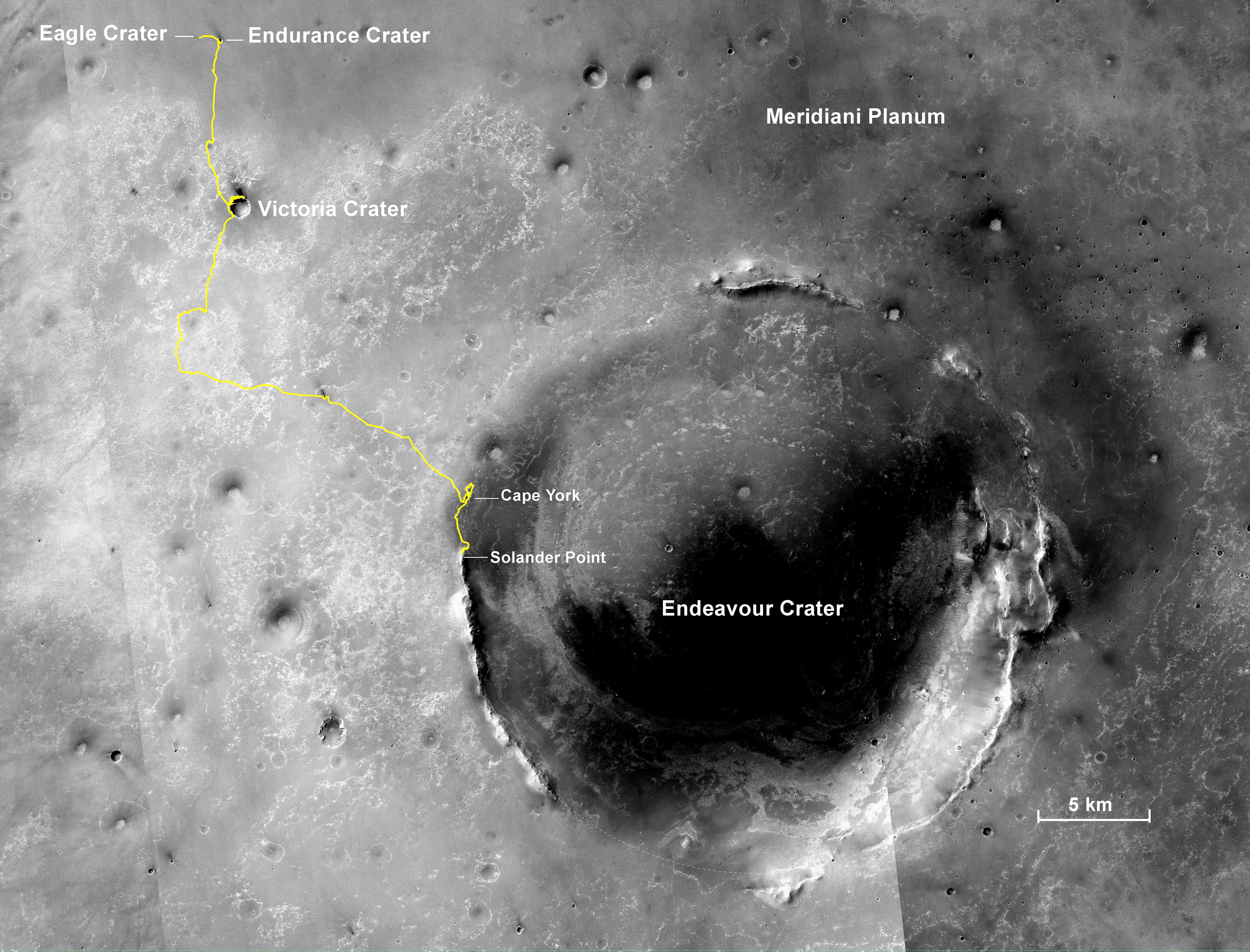
Opportunity's Traverse Through 112 Months
Full Resolution:
TIFF
(60.85 MB)
JPEG
(3.973 MB)
|
|
|
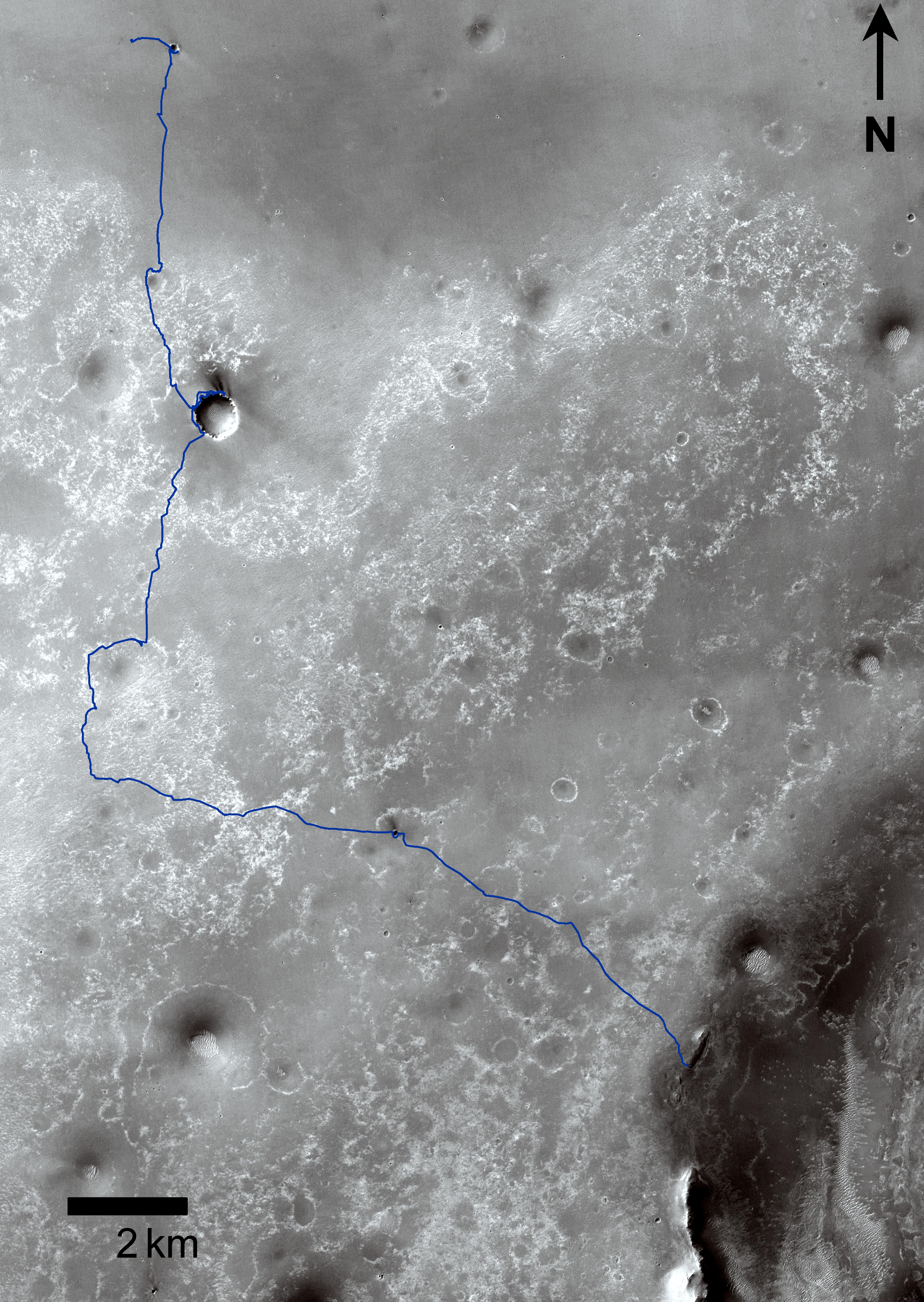
2013-12-03 |
Mars
|
Mars Exploration Rover (MER)
Mars Reconnaissance Orbiter (MRO)
|
CTX
|
4731x3605x3 |
|
-
PIA17589:
-
Opportunity's Journey, Approaching 10th Anniversary
Full Resolution:
TIFF
(51.19 MB)
JPEG
(3.199 MB)
|
|
|
2013-12-09 |
Mars
|
Mars Reconnaissance Orbiter (MRO)
Mars Science Laboratory (MSL)
|
CTX
|
3300x2550x3 |
|
-
PIA17596:
-
Possible Extent of Ancient Lake in Gale Crater, Mars
Full Resolution:
TIFF
(25.26 MB)
JPEG
(1.34 MB)
|
|
|
2014-01-23 |
Mars
|
Mars Exploration Rover (MER)
Mars Reconnaissance Orbiter (MRO)
|
CTX
|
4853x3687x3 |
|
-
PIA17758:
-
Opportunity's First Decade of Driving on Mars
Full Resolution:
TIFF
(53.71 MB)
JPEG
(3.168 MB)
|
|
|
2014-05-22 |
Mars
|
Mars Reconnaissance Orbiter (MRO)
|
CTX
|
1980x2176x1 |
|
-
PIA18382:
-
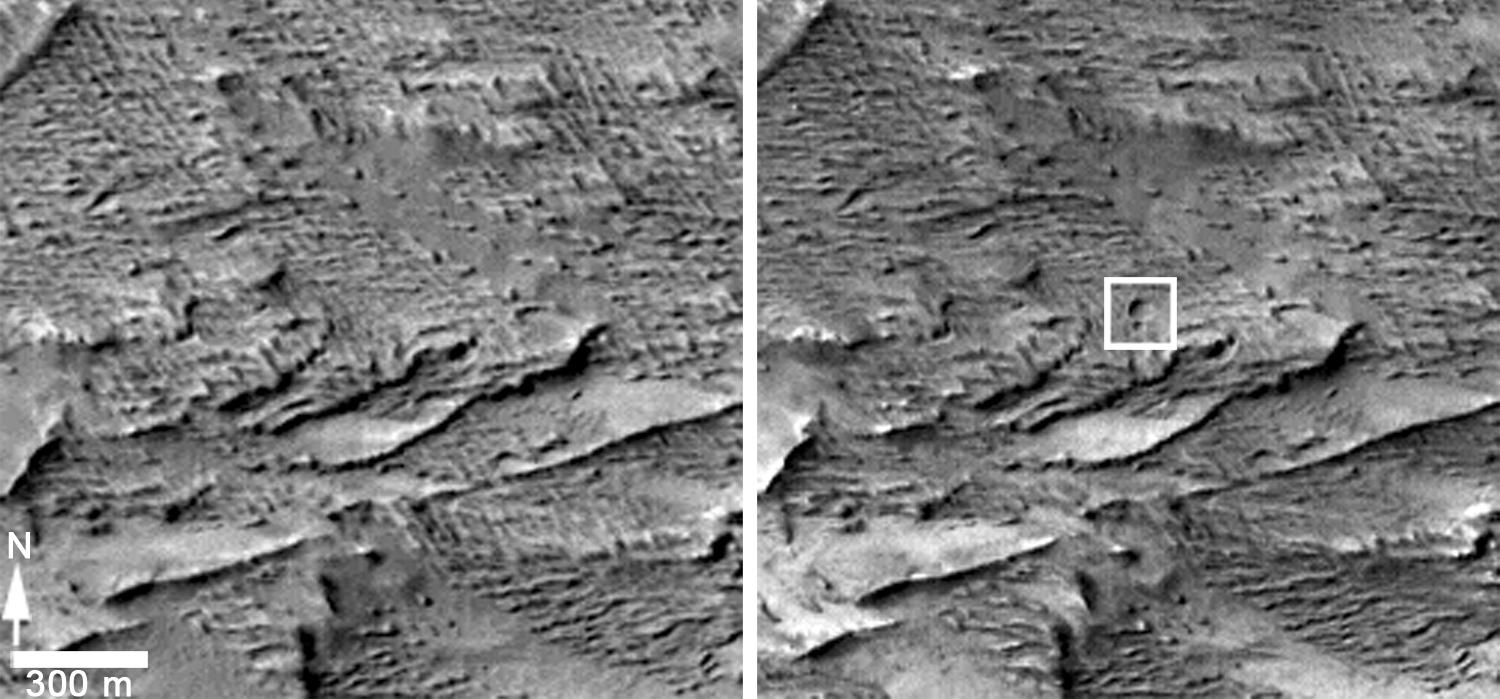
Fresh Mars Crater Confirmed Within Impact Scar
Full Resolution:
TIFF
(4.313 MB)
JPEG
(1.148 MB)
|
|
|
2014-05-22 |
Mars
|
Mars Reconnaissance Orbiter (MRO)
|
CTX
|
1500x699x1 |

|
-
PIA18383:
-
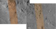
Before-and-After Views Confirm Fresh Craters
Full Resolution:
TIFF
(1.05 MB)
JPEG
(153.2 kB)
|
|
|
2014-07-28 |
Mars
|
Mars Exploration Rover (MER)
Mars Reconnaissance Orbiter (MRO)
|
CTX
|
2420x1838x3 |
|
-
PIA18404:
-
Opportunity's Journey Exceeds 25 Miles
Full Resolution:
TIFF
(13.35 MB)
JPEG
(943.2 kB)
|
|
|
2015-03-24 |
Mars
|
Mars Exploration Rover (MER)
|
CTX
|
3360x2537x3 |
|
-
PIA19154:
-
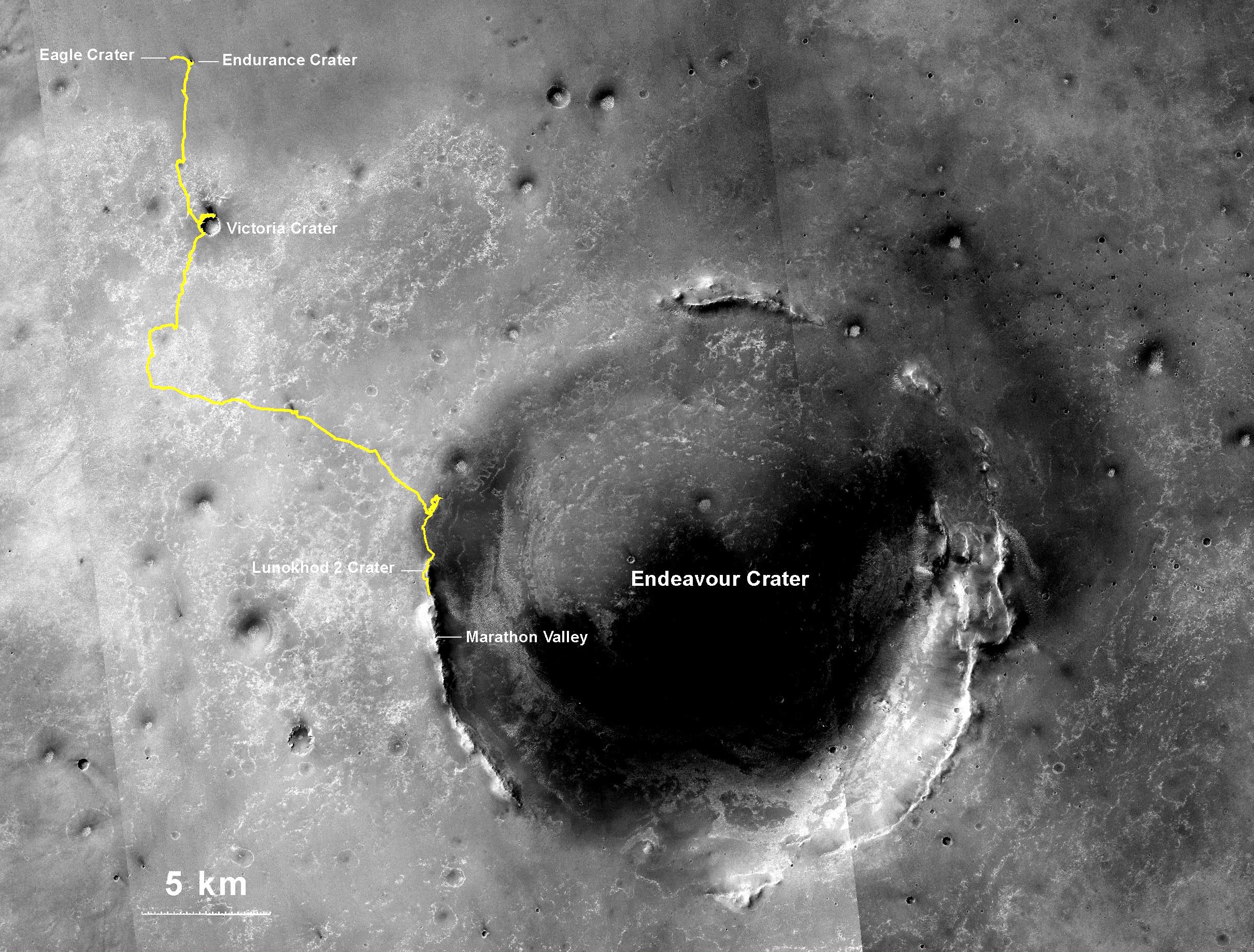
Opportunity Rover's Full Marathon-Length Traverse
Full Resolution:
TIFF
(25.58 MB)
JPEG
(1.516 MB)
|
|
|
2015-07-22 |
Mars
|
Mars Reconnaissance Orbiter (MRO)
|
CTX
HiRISE
|
1920x1080x3 |
|
-
PIA19823:
-
Volunteers Help Decide Where to Point Mars Camera
Full Resolution:
TIFF
(6.223 MB)
JPEG
(386.9 kB)
|
|
|
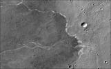
2016-09-15 |
Mars
|
Mars Reconnaissance Orbiter (MRO)
|
CTX
|
1934x2471x1 |

|
-
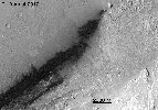
PIA20837:
-
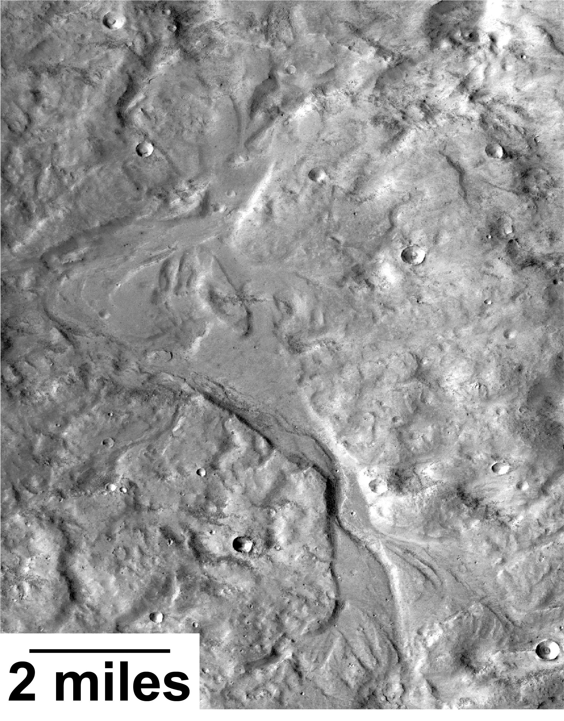
Outflow Stream from Relatively Recent Martian Lake
Full Resolution:
TIFF
(4.784 MB)
JPEG
(973.5 kB)
|
|
|
2016-10-21 |
Mars
|
Mars Reconnaissance Orbiter (MRO)
|
CTX
|
1400x788x1 |
|
-
PIA21130:
-
Signs of Schiaparelli Test Lander Seen From Orbit
Full Resolution:
TIFF
(1.057 MB)
JPEG
(162.8 kB)
|
|
|
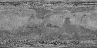
2017-03-29 |
Mars
|
Mars Reconnaissance Orbiter (MRO)
|
CTX
|
10000x5000x1 |

|
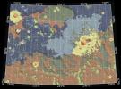
-
PIA21487:
-
A Decade of Compiling the Sharpest Mars Map
Full Resolution:
TIFF
(48.71 MB)
JPEG
(8.229 MB)
|
|
|
2017-03-29 |
Mars
|
Mars Reconnaissance Orbiter (MRO)
|
CTX
|
10000x5000x1 |
|
-
PIA21488:
-
Mars Global Coverage by Context Camera on MRO
Full Resolution:
TIFF
(48.71 MB)
JPEG
(8.229 MB)
|
|
|
2017-04-19 |
Mars
|
Mars Exploration Rover (MER)
|
CTX
|
509x905x1 |
|
-
PIA21490:
-
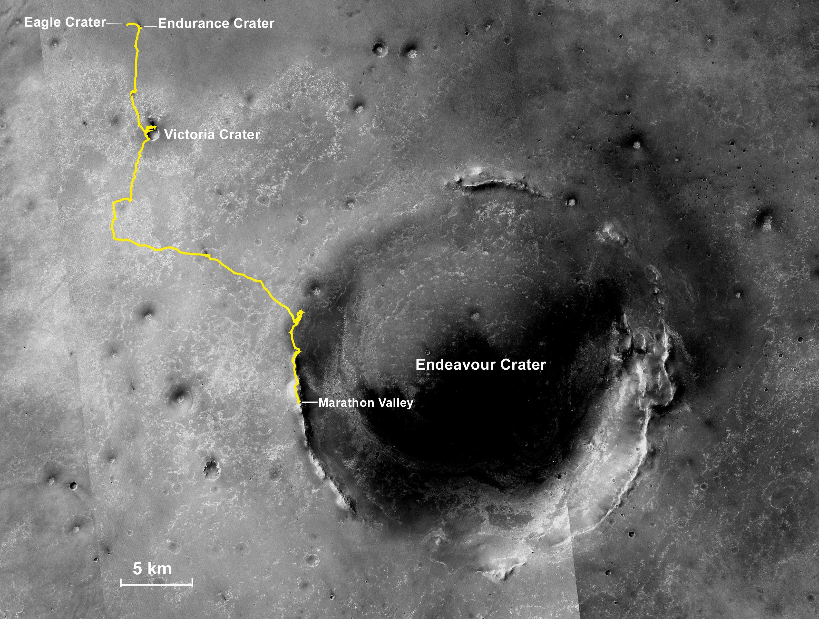
Segments on Western Rim of Endeavour Crater, Mars
Full Resolution:
TIFF
(461.3 kB)
JPEG
(88.6 kB)
|
|
|
2017-10-06 |
Mars
|
Mars Reconnaissance Orbiter (MRO)
|
CTX
|
1800x1290x1 |

|
-
PIA22058:
-
Possible Floor of an Ancient Martian Sea
Full Resolution:
TIFF
(2.325 MB)
JPEG
(490.4 kB)
|
|
|
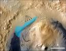
2019-04-25 |
Mars
|
Mars Reconnaissance Orbiter (MRO)
|
CTX
|
2667x2058x3 |
|
-
PIA23178:
-
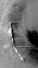
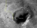
Opportunity's Final Traverse Map
Full Resolution:
TIFF
(8.623 MB)
JPEG
(1.094 MB)
|
|
|
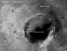
2019-05-15 |
Mars
|
Mars Reconnaissance Orbiter (MRO)
|
CRISM
CTX
|
1865x1495x3 |
|
-
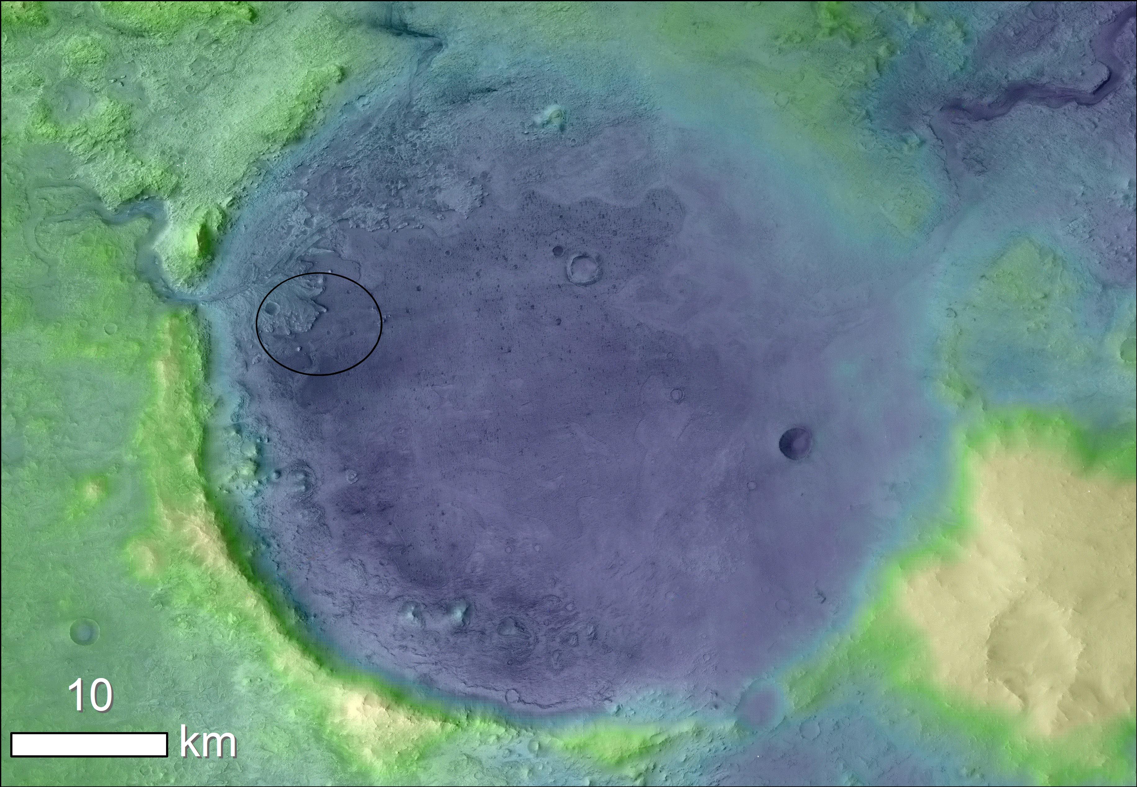
PIA23239:
-
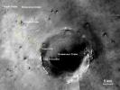
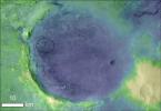
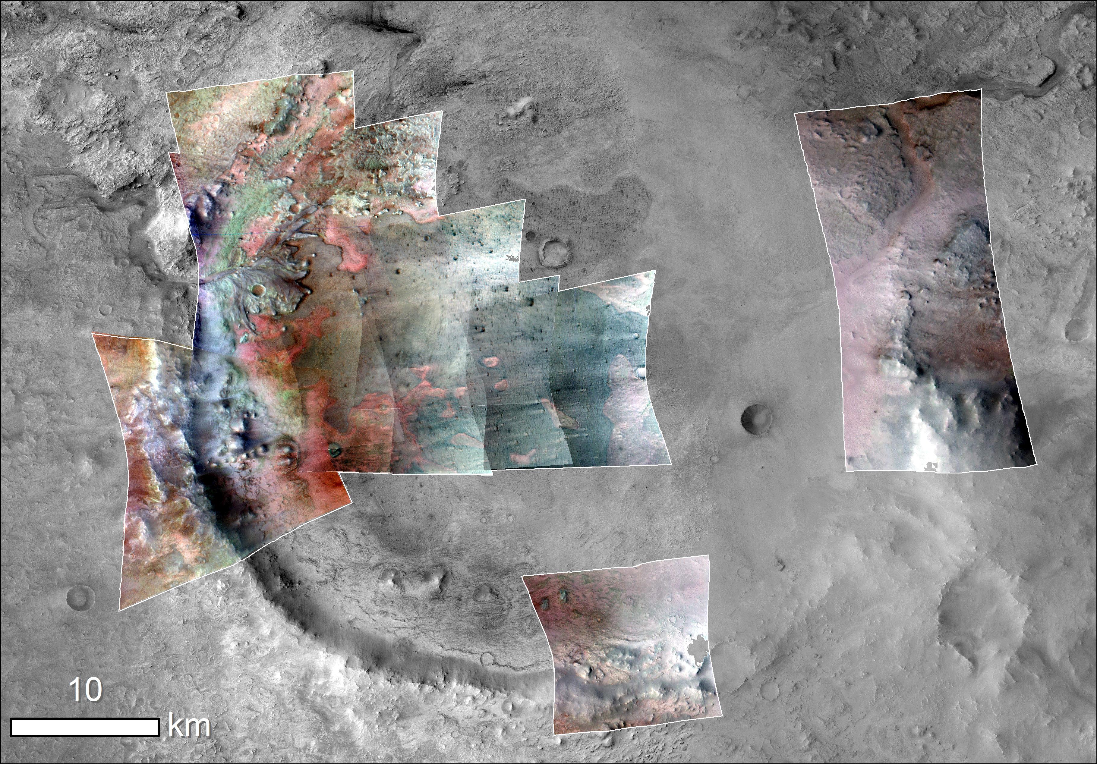
Jezero Crater, Mars 2020's Landing Site
Full Resolution:
TIFF
(8.341 MB)
JPEG
(550.2 kB)
|
|
|
2019-11-12 |
Mars
|
Mars Reconnaissance Orbiter (MRO)
|
CRISM
CTX
|
3639x2535x3 |

|
-
PIA23380:
-
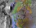
Jezero Crater Minerals
Full Resolution:
TIFF
(12.61 MB)
JPEG
(2.144 MB)
|
|
|
2019-11-12 |
Mars
|
Mars Reconnaissance Orbiter (MRO)
Mars Express (MEX)
Mars Global Surveyor (MGS)
|
CRISM
CTX
MOLA
High Resolution Stereo Camera
|
3663x2535x3 |
|
-
PIA23511:
-
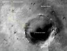
Jezero Crater's Ancient Lakeshore
Full Resolution:
TIFF
(16.31 MB)
JPEG
(2.37 MB)
|
|
|
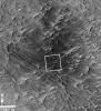
2020-10-01 |
Mars
|
Mars Reconnaissance Orbiter (MRO)
|
CTX
|
992x755x1 |
|
-
PIA24091:
-
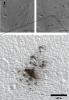
Machine Learning Spots a Cluster of Mars Craters: Context Camera's view
Full Resolution:
TIFF
(729.4 kB)
JPEG
(80.05 kB)
|
|
|
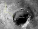
2021-01-27 |
Mars
|
Mars Reconnaissance Orbiter (MRO)
|
CTX
|
4000x2176x3 |
|
-
PIA24379:
-
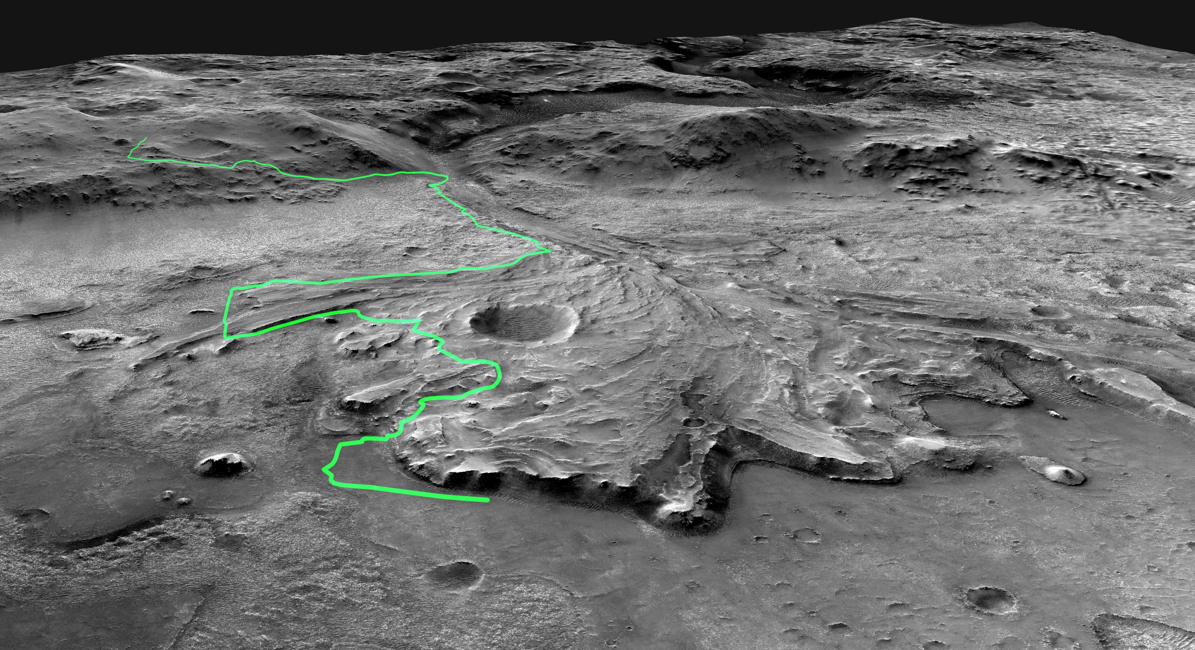
Possible Path for Perseverance Rover
Full Resolution:
TIFF
(12.68 MB)
JPEG
(2.118 MB)
|
|
|
2021-01-27 |
Mars
|
Mars Reconnaissance Orbiter (MRO)
|
CTX
|
4000x2176x3 |

|
-
PIA24310:
-
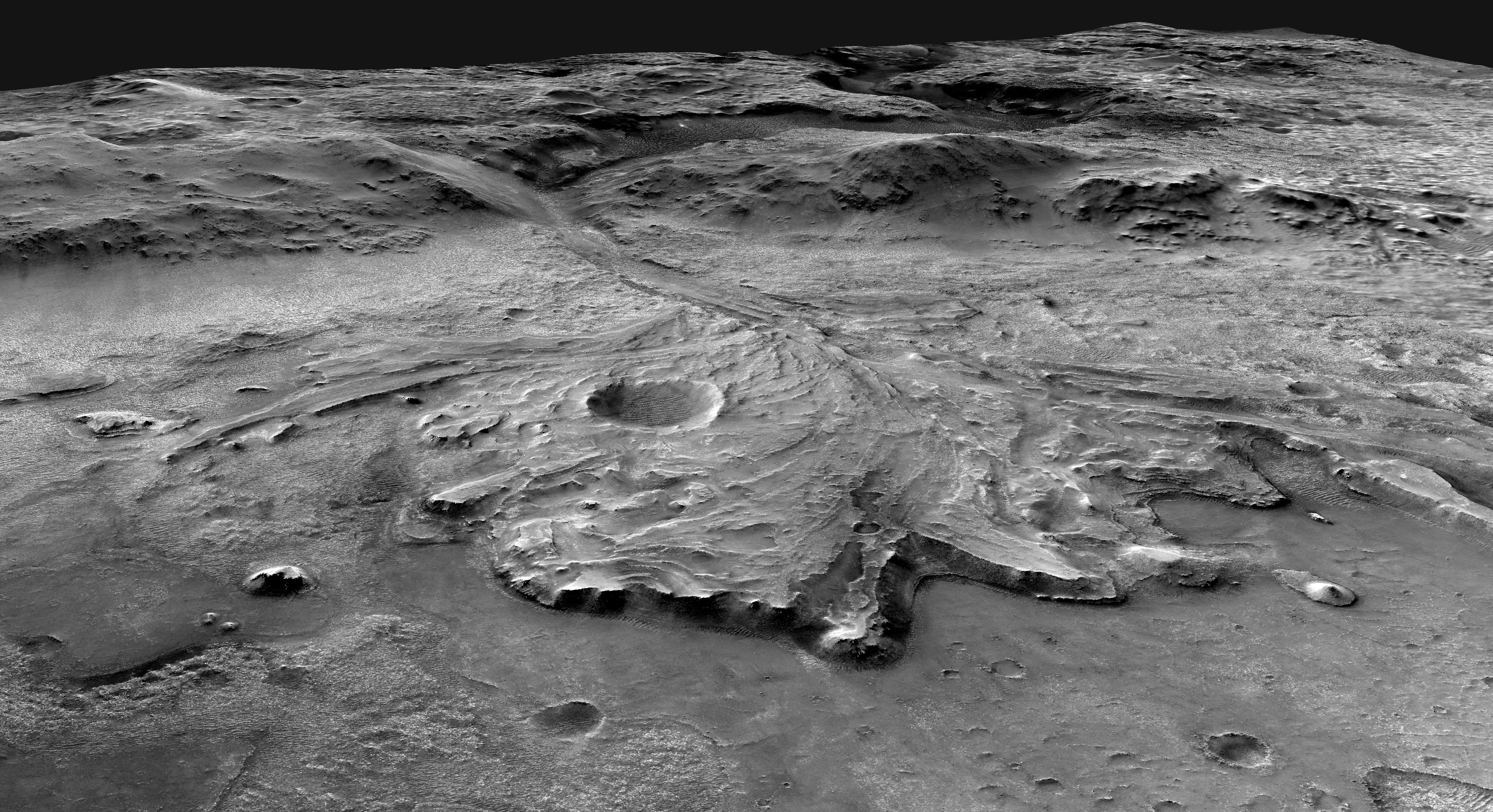
Angle on Jezero Crater (Illustration)
Full Resolution:
TIFF
(7.208 MB)
JPEG
(2.069 MB)
|
|
|
2021-02-22 |
Mars
|
Mars Reconnaissance Orbiter (MRO)
|
CTX
|
4376x2400x1 |
|
-
PIA24333:
-
Perseverance and Mars 2020 Spacecraft Components on the Surface
Full Resolution:
TIFF
(10.28 MB)
JPEG
(1.305 MB)
|
|
|
2022-01-26 |
Mars
|
Mars Reconnaissance Orbiter (MRO)
|
CTX
|
2100x1306x1 |
|
-
PIA25047:
-
MRO's View of Salt Deposits in Bosporos Planum
Full Resolution:
TIFF
(2.511 MB)
JPEG
(680.2 kB)
|
|
|
2022-10-27 |
Mars
|
Mars Reconnaissance Orbiter (MRO)
|
CTX
|
5448x3523x1 |

|
-
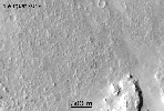
PIA25584:
-
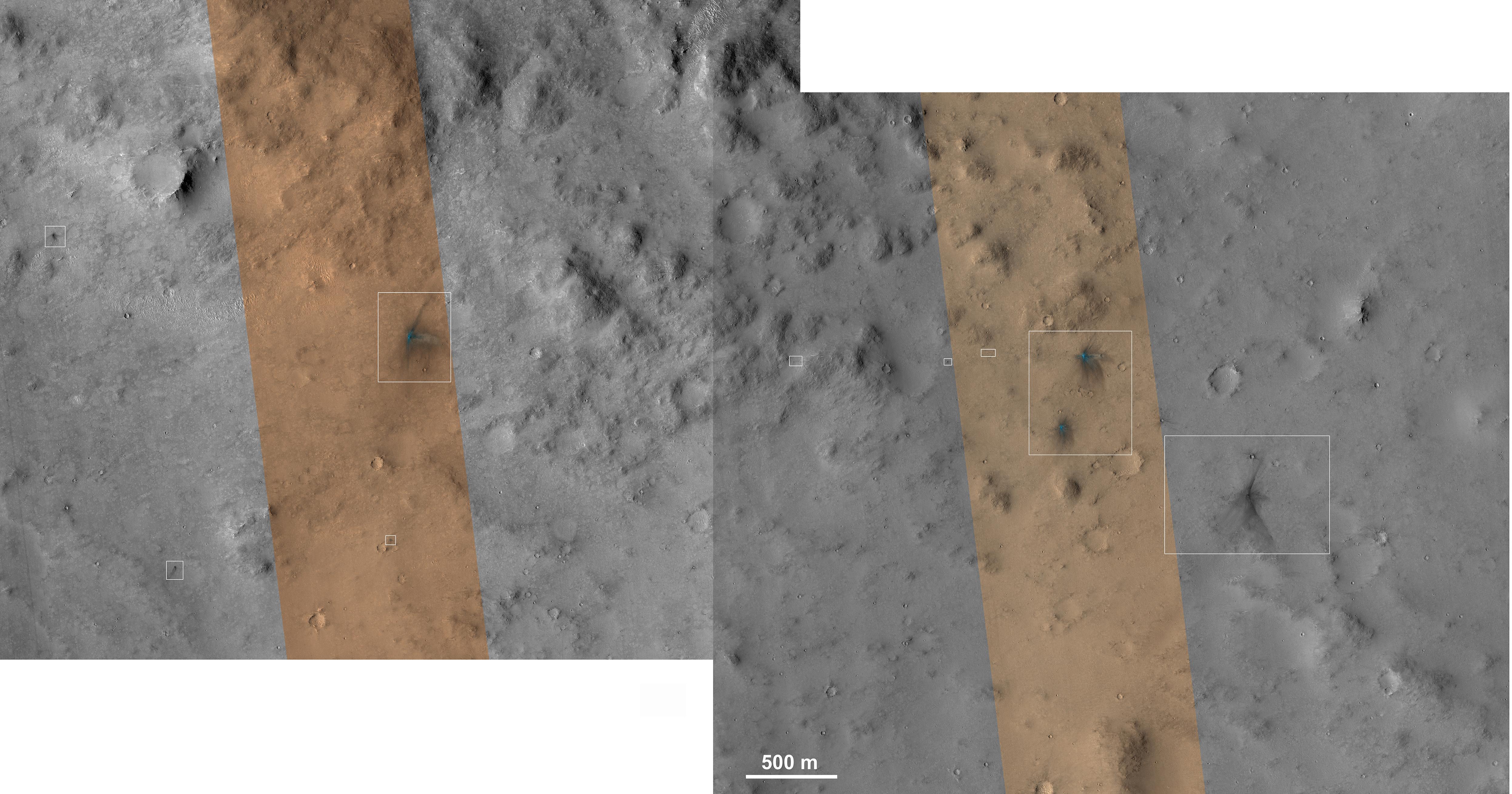
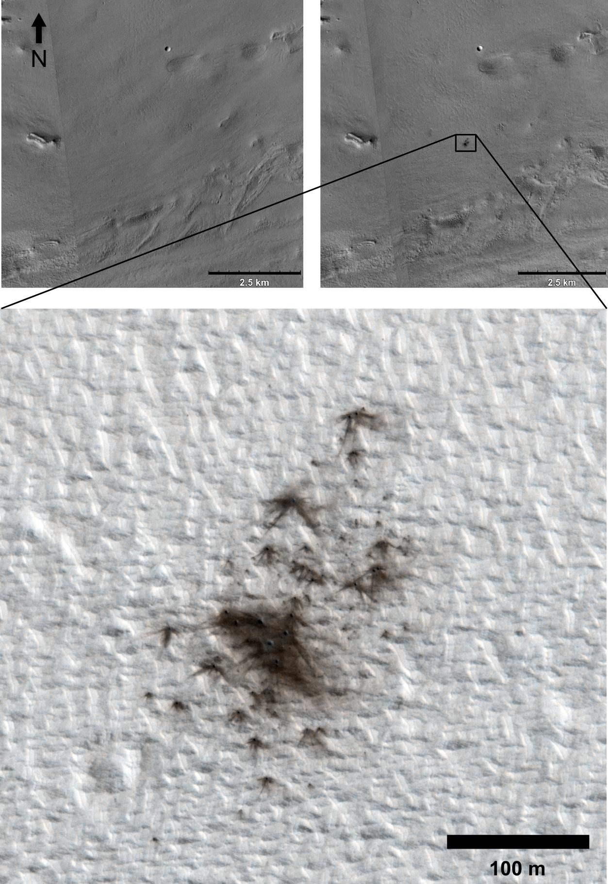
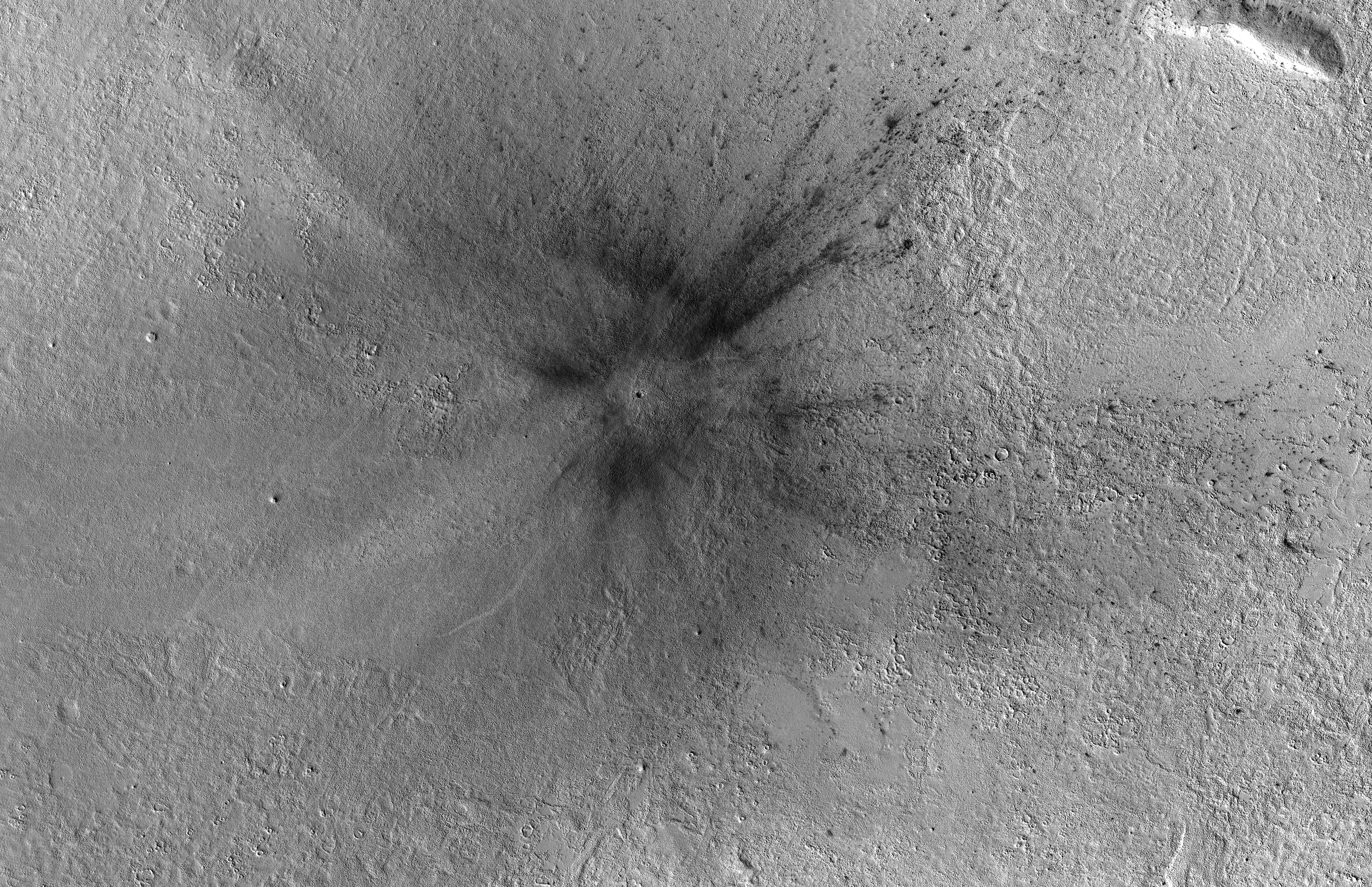
Context Camera Views an Impact Crater in Amazonis Planitia
Full Resolution:
TIFF
(19.22 MB)
JPEG
(5.28 MB)
|
|
|
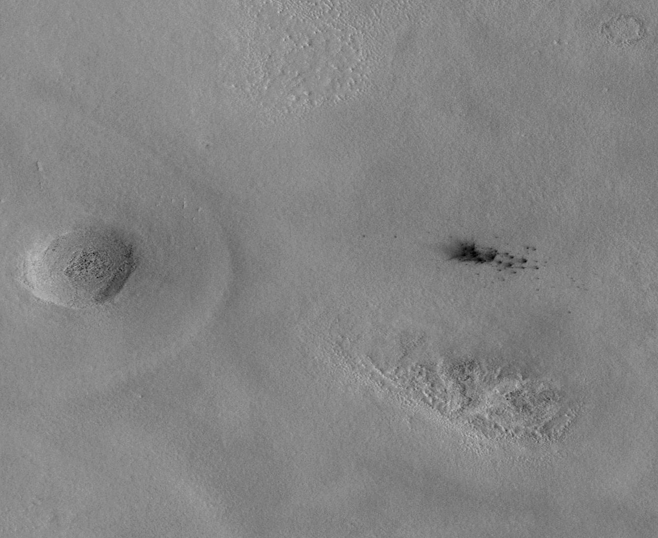
2022-10-27 |
Mars
|
Mars Reconnaissance Orbiter (MRO)
|
CTX
|
3351x3083x1 |
|
-
PIA25587:
-
Context Camera Views a Mars Impact Crater in Tempe Terra
Full Resolution:
TIFF
(8.751 MB)
JPEG
(1.998 MB)
|