 |  |  |  |
| Figure 1 | Figure 2 | Figure 3 | Figure 4 |
This is the first image of Mars taken by the Context Camera on NASA's Mars Reconnaissance Orbiter. The spacecraft began orbiting the red planet on March 10, 2006. During its 10th close approach to Mars, on March 24, it turned its cameras to view the planet's surface. Although the images acquired were about 10 times lower in resolution than will ultimately be obtained when the spacecraft has finished reshaping its orbit for the mission's primary science phase, these test images provide important confirmation of the performance of the cameras and the spacecraft.
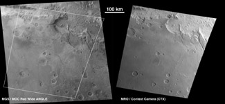
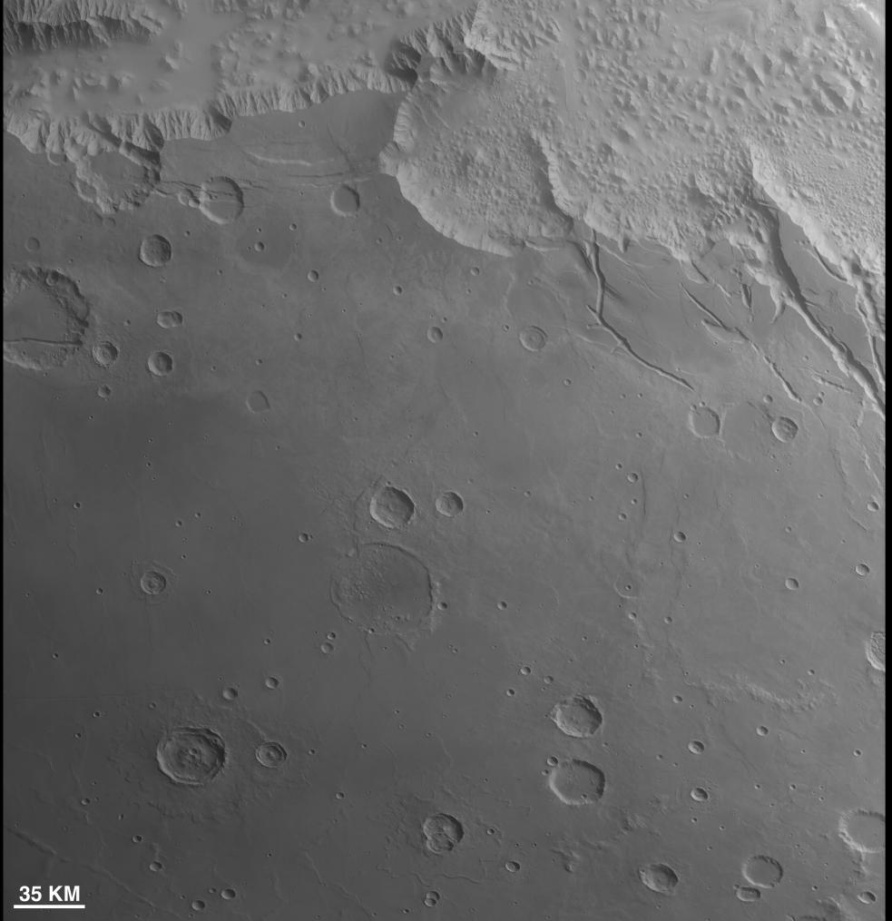
This first image by the Context Camera includes some chaotic terrain at the east end of Mars' Valles Marineris, seen along the top (northern) edge of the image. The image has a scale of about 87 meters (285 feet) per pixel, which is 14.5 times lower resolution than will be acquired during the primary science phase. Typical images from the Context Camera acquired during that phase of the mission will have a resolution of 6 meters (20 feet) per pixel, and will cover an area about 30 kilometers (18.6 miles) wide.
Note that, because these are initial, test images, there is some linear striping in the images. This results from incomplete removal of pixel-to-pixel variations in the Context Camera detector by the present calibration software. One use of the test imaging is an opportunity to fine-tune the calibrations before the primary science phase begins.
Figure 1 is a comparison of a wide-angle, red-filter image from the Mars Orbiter Camera on NASA's Mars Global Surveyor (left) with the first Mars image from the Context Camera. The image from the Mars Orbiter Camera was taken the same day, but about 6.2 hours after the image from the Context Camera, at a local solar time of 1:42 p.m. The Context Camera image was taken at roughly 7:32 a.m., local solar time.
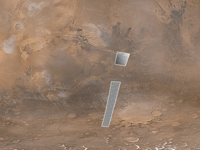
Figure 2 shows a color view cropped from a Mars Orbiter Camera daily global map acquired on the same day as the first two Mars images by the Context Camera. The map shows the planet as if every part could be imaged at some time between 1 p.m. and 3 p.m., that is, with early afternoon illumination. The cameras on Mars Reconnaissance Orbiter, conversely, imaged the planet during morning hours. The Mars Orbiter Camera view was obtained about four hours later in the day than the Context Camera data. Inserted into the daily global map are two grayscale views from the Context Camera. This shows that the Context Camera began imaging when it was over the southernmost portion of the chaotic terrain at the east end of the Valles Marineris. A second image was acquired several minutes later, as Mars Reconnaissance Orbiter flew southward towards the west side of the large Argyre impact basin. The tops of the two Context Camera images were obtained about 13 minutes apart.
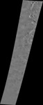
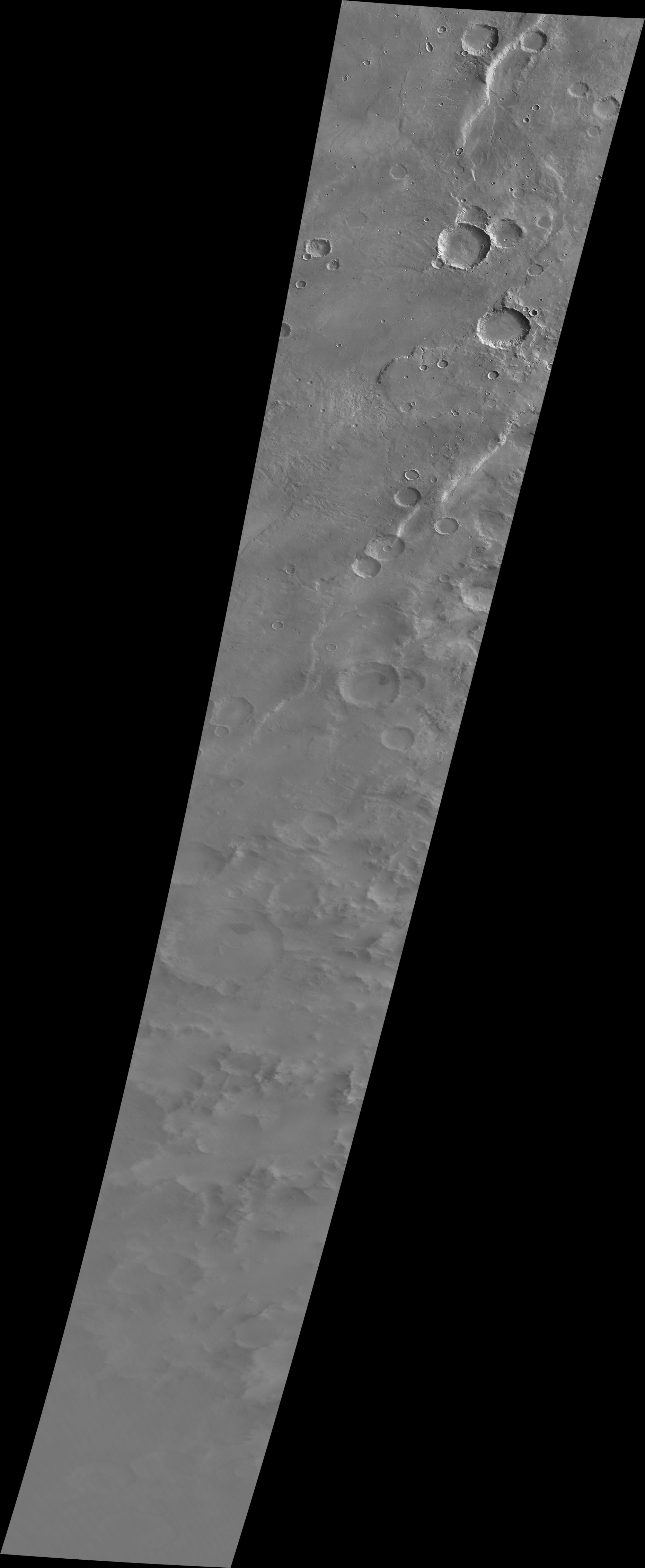
Figure 3 the second image obtained by the Context Camera, is much longer than the first: 260 kilometers (162 miles) at its widest point and about 122 kilometers (76 miles) at its narrowest, some 1,590 kilometers (988 miles) to the south. It covers an area of about 40,000 square kilometers (about 15,400 square miles). The change in width reflects a change in altitude of the Mars Reconnaissance Orbiter as it descended southward toward the orbit's closest point to the planet. The picture is shown here at one-third its original scale because the file size is large.
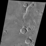
Figure 4 contains the northernmost portion of the second Context Camera image, reproduced at one-half its original scale (because of its large file size). The white box outlines the location of the first image from the orbiter's High Resolution Imaging Science Experiment (PIA08060). The Context Camera image and the High Resolution Imaging Science Experiment image were acquired simultaneously. As with the Context Camera, the first image from the High Resolution Imaging Science Experiment was of a much lower resolution than will be obtained during the primary science phase of the Mars Reconnaissance Orbiter mission, owing to the higher altitude during this test. This figure illustrates one of the key roles that Context Camera will play during the mission -- acquiring context images for the other science instruments aboard the Mars Reconnaissance Orbiter.


