PDS logoPlanetary Data System
PDS Information
Find a Node - Use these links to navigate to any of the 8 publicly accessible PDS Nodes.

This bar indicates that you are within the PDS enterprise which includes 6 science discipline nodes and 2 support nodes which are overseen by the Project Management Office at NASA's Goddard Space Flight Center (GSFC). Each node is led by an expert in the subject discipline, supported by an advisory group of other practitioners of that discipline, and subject to selection and approval under a regular NASA Research Announcement.
Click here to return to the Photojournal Home Page Click here to view a list of Photojournal Image Galleries Photojournal_inner_header
Latest Images  |  Spacecraft & Technology  |  Animations  |  Space Images App  |  Feedback  |  Photojournal Search  
Your search criteria found 6 images
Instrument
Go to PIAxxxxx:
Click on an image for detailed information
Click on a column heading to sort in ascending or descending order
My
List
Addition DateSort Ascending Target Mission Instrument Size
Add Image to Favorite List 2017-12-15 Earth Earth Observing System (EOS)
AVIRIS
2999x2249x3
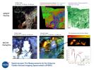
NASA's Airborne Visible Infrared Imaging Spectrometer instrument onboard an ER-2 aircraft observed wildfires burning in Southern California on Dec. 5-7, 2017.
PIA22194:
Multiple Aspects of the Southern California Wildfires as Seen by NASA's AVIRIS
Full Resolution:     TIFF (9.873 MB)     JPEG (835.3 kB)
Add Image to Favorite List 2017-12-08 Earth Earth Observing System (EOS)
AVIRIS
2933x1520x3
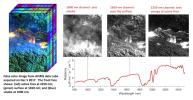
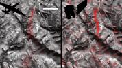
NASA's ER-2 aircraft flew over the wildfires burning in Southern California on Dec. 5, 2017 and acquired these images of active fires visible in red, ground surfaces in green and smoke in blue.
PIA11243:
NASA's AVIRIS Instrument Sheds New Light on Southern California Wildfires
Full Resolution:     TIFF (5.285 MB)     JPEG (586.6 kB)
Add Image to Favorite List 2016-06-27 Earth Earth Observing System (EOS)
AVIRIS
1019x1278x3
A new map created with measurements from an airborne instrument developed by NASA's Jet Propulsion Laboratory, Pasadena, California, reveals the devastating effect of California's ongoing drought on Sierra Nevada conifer forests.
PIA20717:
California Drought Effects on Sierra Trees Mapped by NASA
Full Resolution:     TIFF (635.6 kB)     JPEG (227.2 kB)
Add Image to Favorite List 2016-06-14 Earth Earth Observing System (EOS)
AVIRIS
Hyperion Hyperspectral Imager
1600x900x3
Comparison of detected methane plumes over Aliso Canyon, California, acquired 11 days apart in Jan. 2016 by NASA's AVIRIS and Hyperion instruments on NASA satellites in low-Earth orbit.
PIA20716:
A First: NASA Spots Single Methane Leak from Space
Full Resolution:     TIFF (4.049 MB)     JPEG (236.9 kB)
Add Image to Favorite List 2015-04-09 Earth AVIRIS
1404x813x3
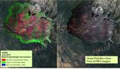
NASA's AVIRIS spectral map of the 2013 Rim fire in and near Yosemite National Park, California.
PIA19361:
NASA's AVIRIS Map shows Spectral Signature of 2013 Rim Fire
Full Resolution:     TIFF (3.426 MB)     JPEG (250.7 kB)
Add Image to Favorite List 2010-05-27 Earth AVIRIS
324x523x3
This image from NASA's Airborne Visible/Infrared Imaging Spectrometer instrument (AVIRIS) was collected on May 17, 2010, over the site of the Deepwater Horizon BP oil spill disaster. In the image, crude oil on the surface appears orange to brown.
PIA13167:
NASA's AVIRIS Aids in Gulf Oil Spill Response
Full Resolution:     TIFF (509.1 kB)     JPEG (29.06 kB)
Currently displaying images: 1 - 6 of 6