My
List |
Addition Date
|
Target
|
Mission
|
Instrument
|
Size
|

|
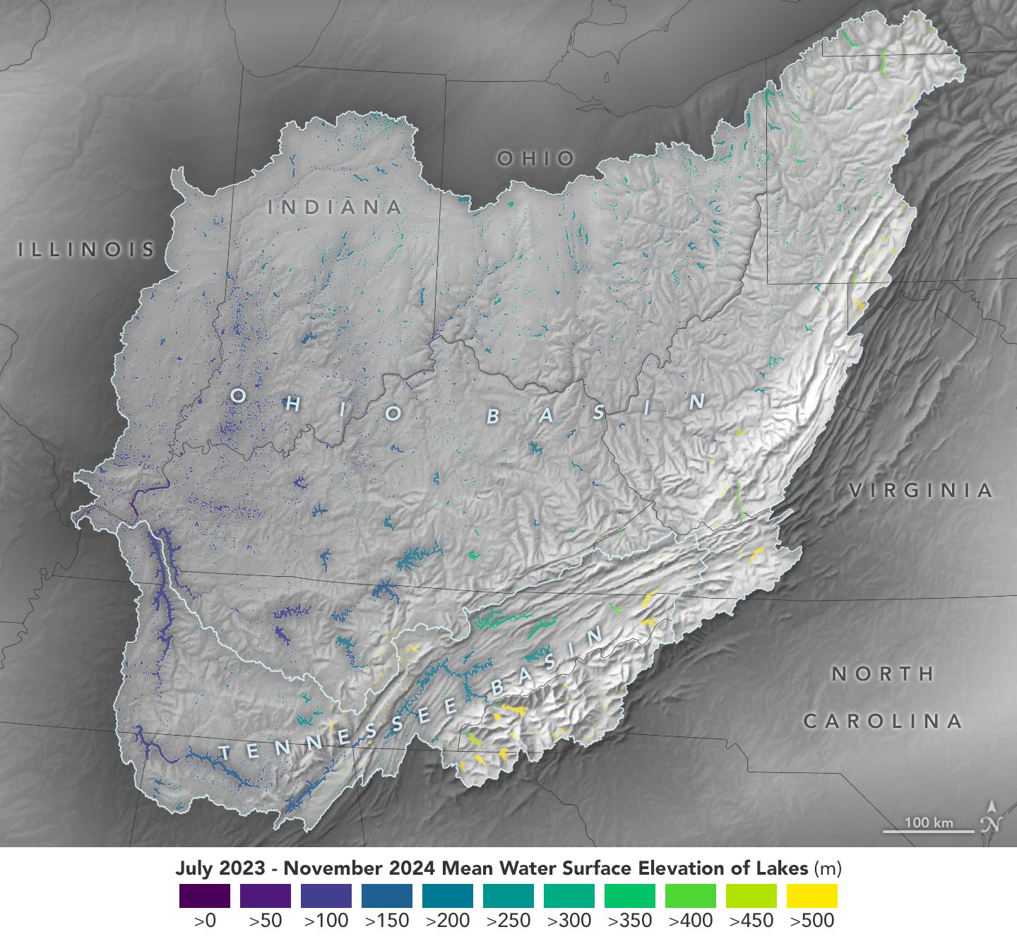
2024-12-17 |
Earth
|
SWOT
|
KaRIn
|
1440x1330x3 |

|
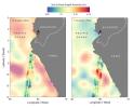
-
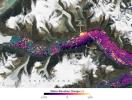
PIA26188:
-
Ohio Basin Lakes Water Levels
Full Resolution:
TIFF
(3.095 MB)
JPEG
(259.9 kB)
|
|
|
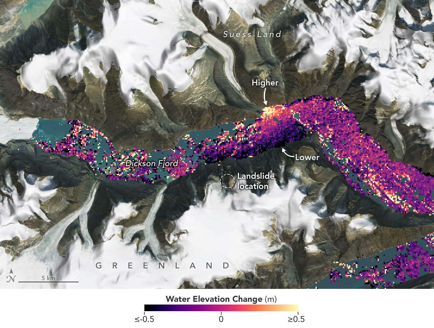
2024-10-31 |
Earth
|
SWOT
|
KaRIn
|
1440x1090x3 |
|
-
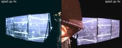
PIA26420:
-
SWOT Captures Planet-Rumbling Greenland Tsunami
Full Resolution:
TIFF
(4.089 MB)
JPEG
(256.9 kB)
|
|
|
2024-05-07 |
Earth
|
SWOT
|
KaRIn
|
4000x2250x3 |
|
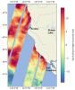
-
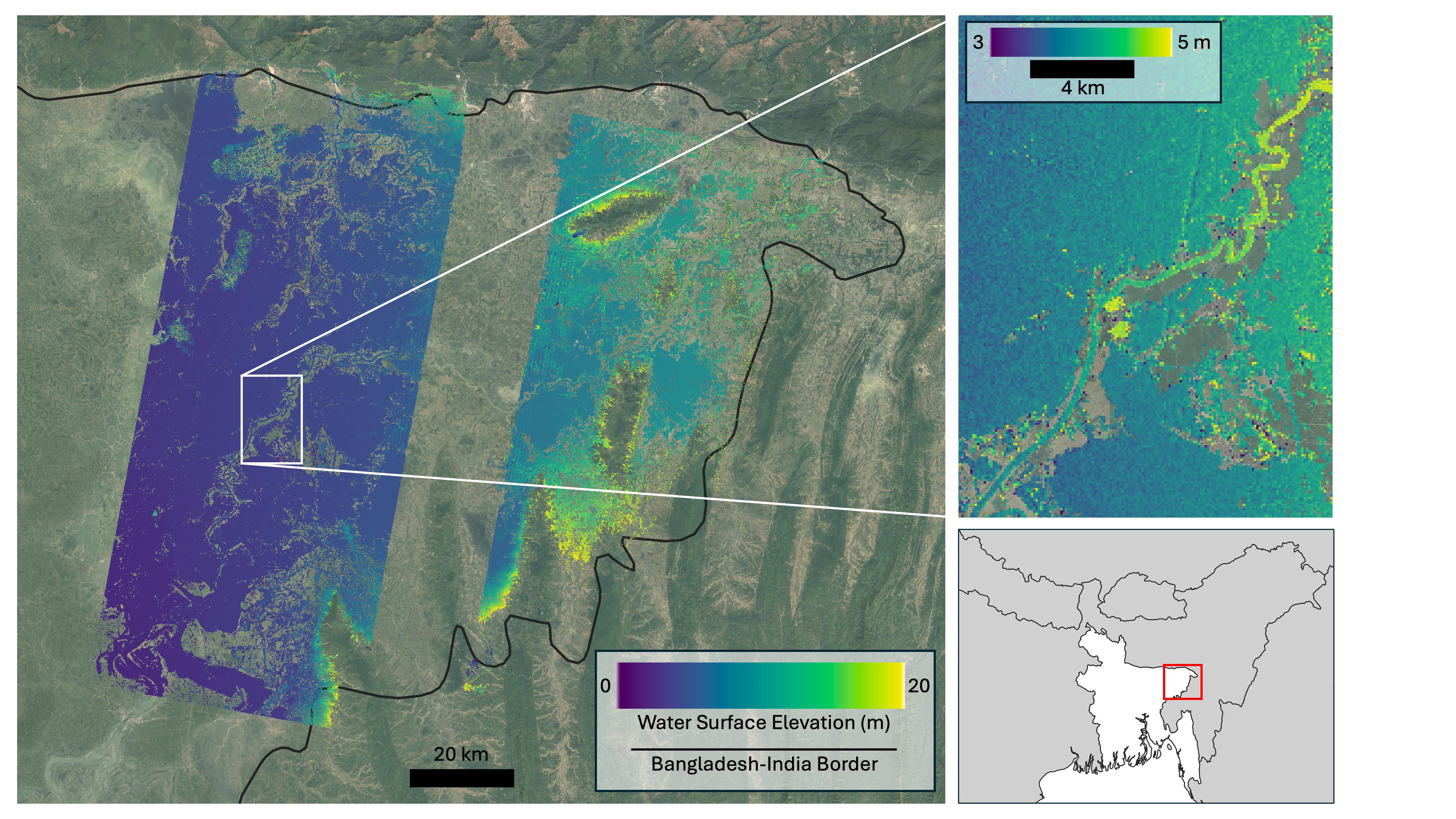
PIA26343:
-
SWOT Captures Flooding in Bangladesh
Full Resolution:
TIFF
(19.36 MB)
JPEG
(1.312 MB)
|
|
|
2024-04-15 |
Earth
|
SWOT
|
KaRIn
|
1440x1090x3 |
|
-
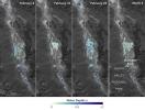
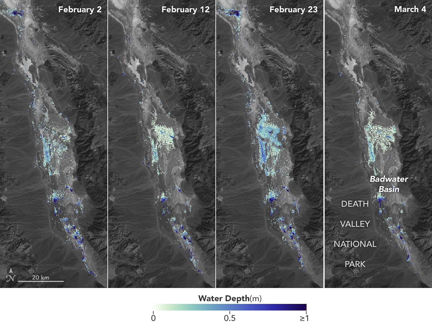
PIA26184:
-
SWOT Death Valley Lake Depth
Full Resolution:
TIFF
(2.295 MB)
JPEG
(265.3 kB)
|
|
|
2024-03-05 |
Earth
|
SWOT
|
KaRIn
|
1440x1090x3 |
|
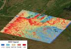
-
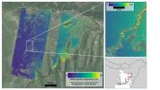
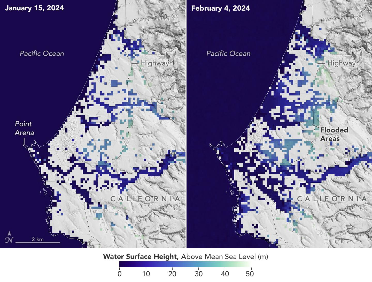
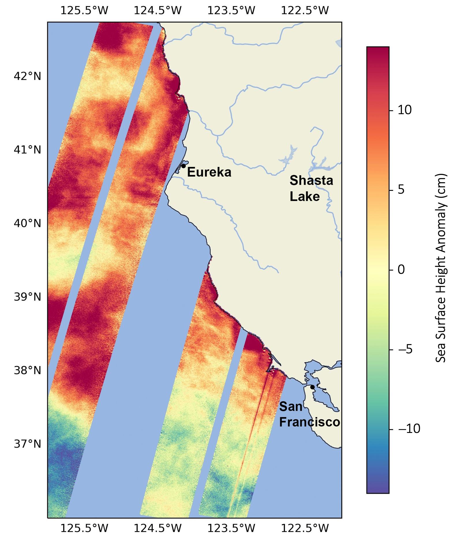
PIA26182:
-
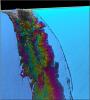
California Coastal Flooding Captured in SWOT Data
Full Resolution:
TIFF
(2.527 MB)
JPEG
(255.1 kB)
|
|
|
2023-11-08 |
Earth
|
SWOT
|
KaRIn
|
1264x1029x3 |
|
-
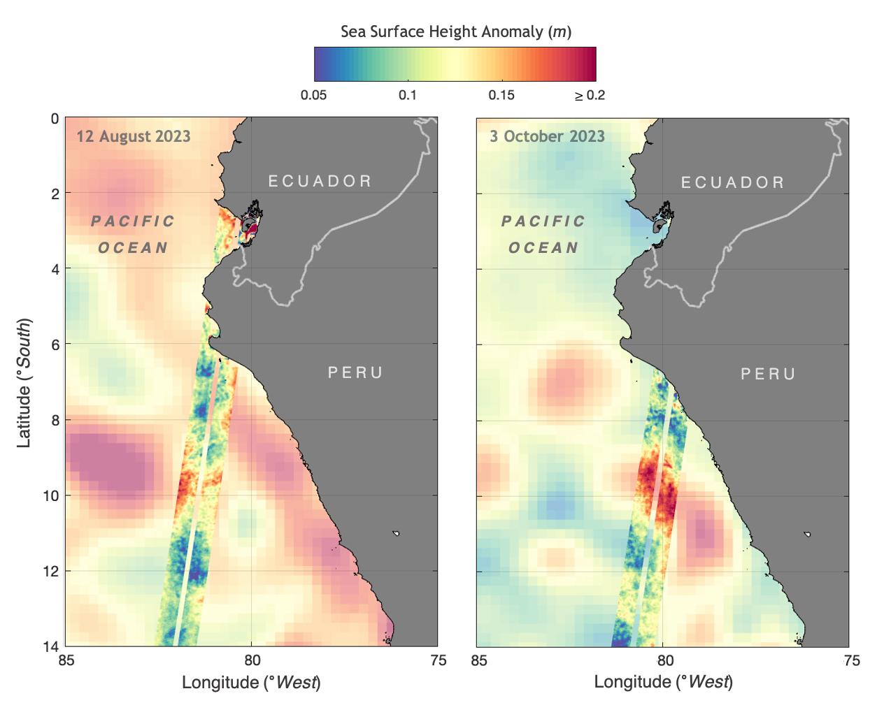
PIA26181:
-
SWOT Monitors El Niño off Peru
Full Resolution:
TIFF
(1.206 MB)
JPEG
(101.7 kB)
|
|
|
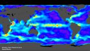
2023-10-30 |
Earth
|
SWOT
|
KaRIn
|
1920x1080x3 |

|
-
PIA26100:
-
SWOT's Detailed View of Global Sea Level
Full Resolution:
TIFF
(2.393 MB)
JPEG
(137.4 kB)
|
|
|
2023-09-19 |
Earth
|
SWOT
|
KaRIn
|
1570x1870x3 |
|
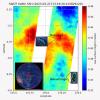
-
PIA26091:
-
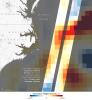
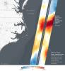
SWOT Monitors Warming Waters Off California Coast
Full Resolution:
TIFF
(4.064 MB)
JPEG
(286.6 kB)
|
|
|
2023-08-30 |
Earth
|
Surface Water and Ocean Topography (SWOT)
|
KaRIn
|
2794x1934x3 |
|
-
PIA25780:
-
SWOT Captures the Yukon River in Alaska
Full Resolution:
TIFF
(16.22 MB)
JPEG
(1.293 MB)
|
|
|
2023-06-27 |
Earth
|
Surface Water and Ocean Topography (SWOT)
|
|
1125x1122x3 |
|
-
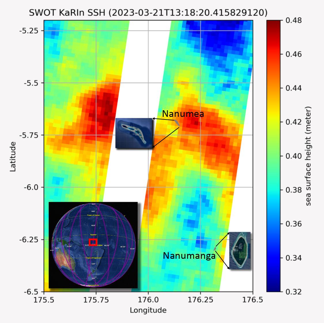
PIA25777:
-
SWOT Measures Tuvalu Sea Level
Full Resolution:
TIFF
(1.862 MB)
JPEG
(131.7 kB)
|
|
|
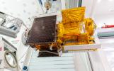
2023-03-24 |
Earth
|
Surface Water and Ocean Topography (SWOT)
|
KaRIn
|
787x879x3 |
|
-
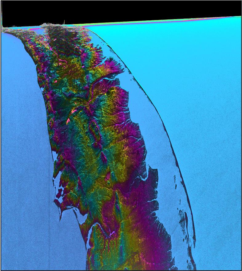
PIA25774:
-
SWOT Satellite's Land 'First Light'
Full Resolution:
TIFF
(2.076 MB)
JPEG
(135.1 kB)
|
|
|
2023-03-24 |
Earth
|
|
|
1440x1570x3 |
|
-
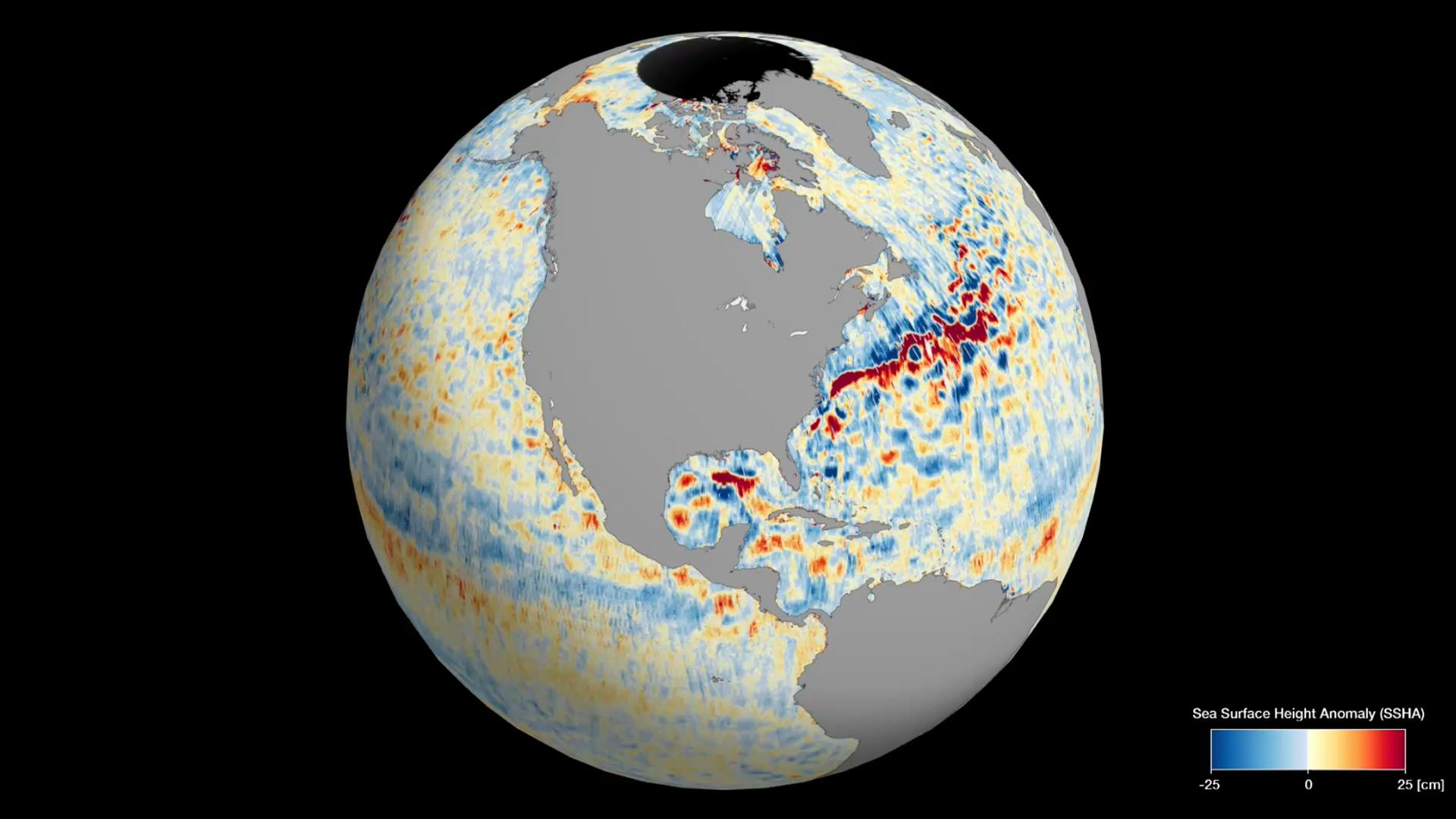
PIA25773:
-
Sea Level Visualization of Gulf Stream
Full Resolution:
TIFF
(2.24 MB)
JPEG
(159 kB)
|
|
|
2023-03-24 |
Earth
|
Surface Water and Ocean Topography (SWOT)
|
KaRIn
|
1440x1570x3 |
|
-
PIA25772:
-
SWOT Satellite's Sea Level 'First Light'
Full Resolution:
TIFF
(2.873 MB)
JPEG
(182.2 kB)
|
|
|
2023-01-03 |
|
Surface Water and Ocean Topography (SWOT)
|
Ka-band Radar Interferometer (KaRIn)
|
960x540x3 |
|
-
PIA25596:
-
SWOT KaRIn Antenna Deployment (Animation)
Full Resolution:
TIFF
(384.4 kB)
JPEG
(24.72 kB)
|
|
|
2022-12-21 |
|
Surface Water and Ocean Topography (SWOT)
|
|
1674x670x3 |
|
-
PIA25563:
-
Deployment of SWOT's Solar Arrays
Full Resolution:
TIFF
(2.037 MB)
JPEG
(100.8 kB)
|
|
|
2022-12-12 |
|
Surface Water and Ocean Topography (SWOT)
|
Ka-band Radar Interferometer (KaRIn)
|
6871x3946x3 |
|
-
PIA25595:
-
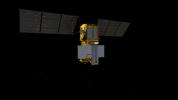
SWOT in Orbit (Illustration)
Full Resolution:
TIFF
(67.6 MB)
JPEG
(3.206 MB)
|
|
|
2022-12-12 |
|
Surface Water and Ocean Topography (SWOT)
|
Ka-band Radar Interferometer (KaRIn)
|
8256x5504x3 |

|
-
PIA25594:
-
SWOT KaRIn Antenna Test
Full Resolution:
TIFF
(118.4 MB)
JPEG
(8.21 MB)
|
|
|
2022-12-09 |
|
Surface Water and Ocean Topography (SWOT)
|
|
4912x7360x3 |
|
-
PIA25627:
-
SWOT Spacecraft Encapsulated in Payload Fairing
Full Resolution:
TIFF
(90.28 MB)
JPEG
(7.032 MB)
|
|
|
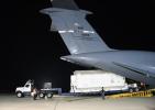
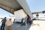
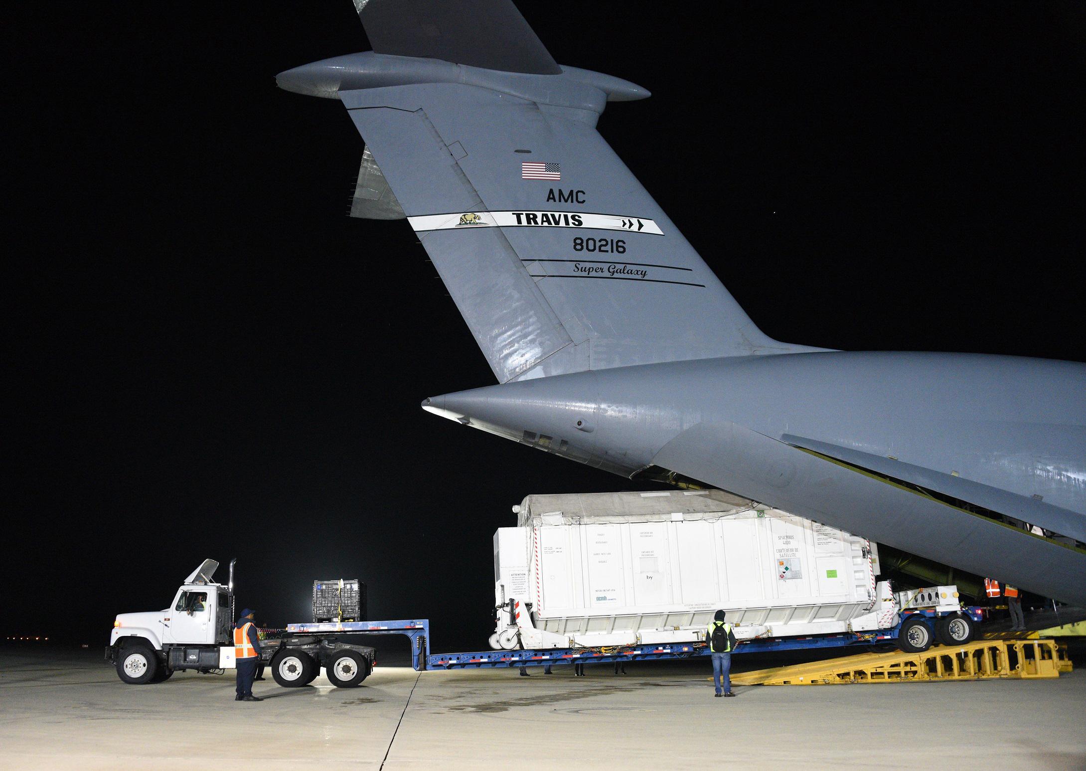
2022-11-14 |
|
Surface Water and Ocean Topography (SWOT)
|
|
8256x5504x3 |
|
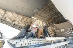
-
PIA25625:
-
SWOT Headed to France on C-17 Aircraft
Full Resolution:
TIFF
(105.8 MB)
JPEG
(5.21 MB)
|
|
|
2022-11-14 |
|
Surface Water and Ocean Topography (SWOT)
|
|
8256x5504x3 |
|
-
PIA25624:
-
SWOT Secured for Transport in C-17 Aircraft
Full Resolution:
TIFF
(120.2 MB)
JPEG
(6.204 MB)
|
|
|
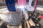
2022-11-14 |
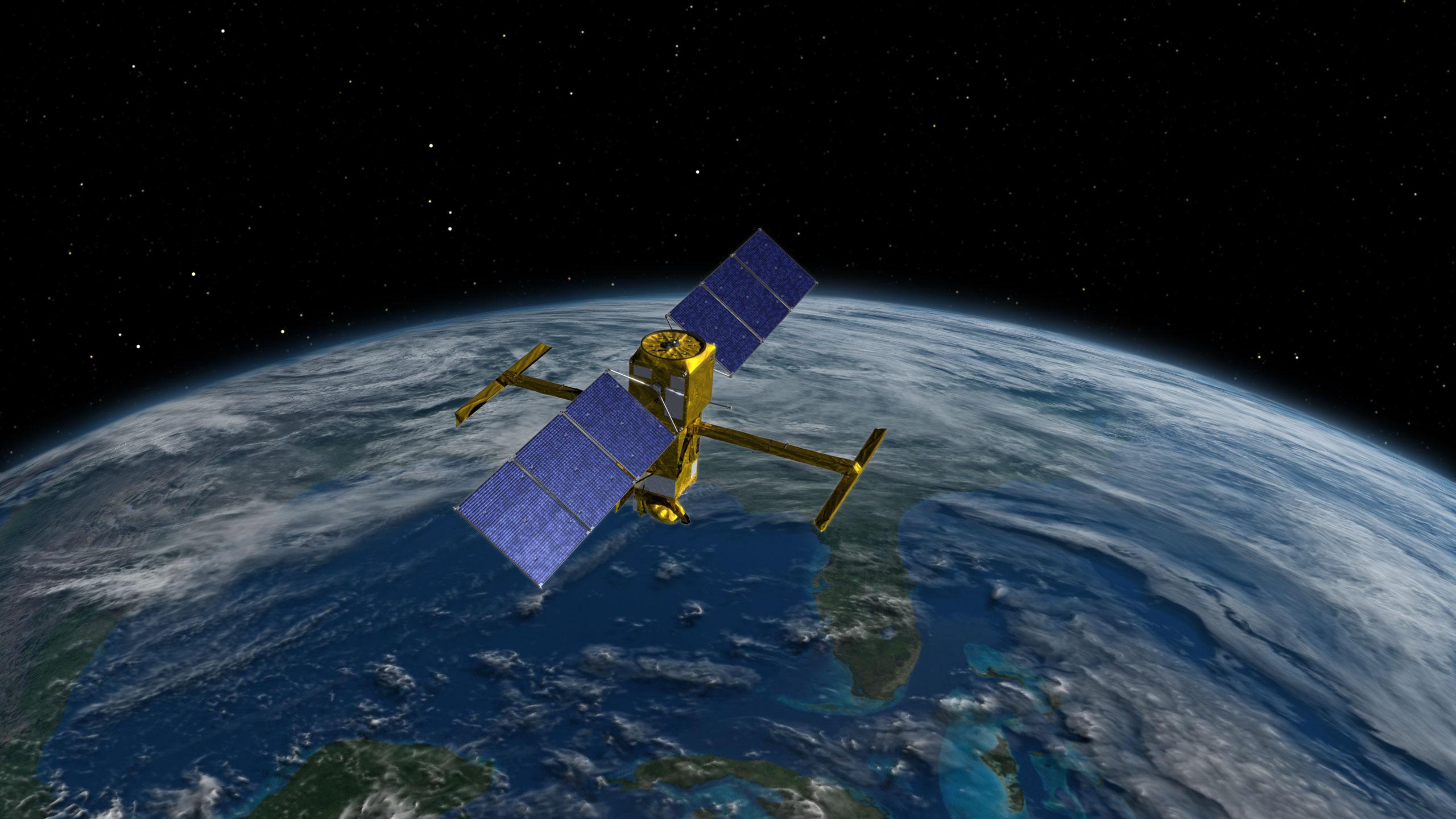
|
Surface Water and Ocean Topography (SWOT)
|
KaRIn
|
8889x5000x3 |
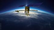
|
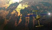
-
PIA25623:
-
SWOT Orbiting Earth (Illustration)
Full Resolution:
TIFF
(77.29 MB)
JPEG
(1.991 MB)
|
|
|
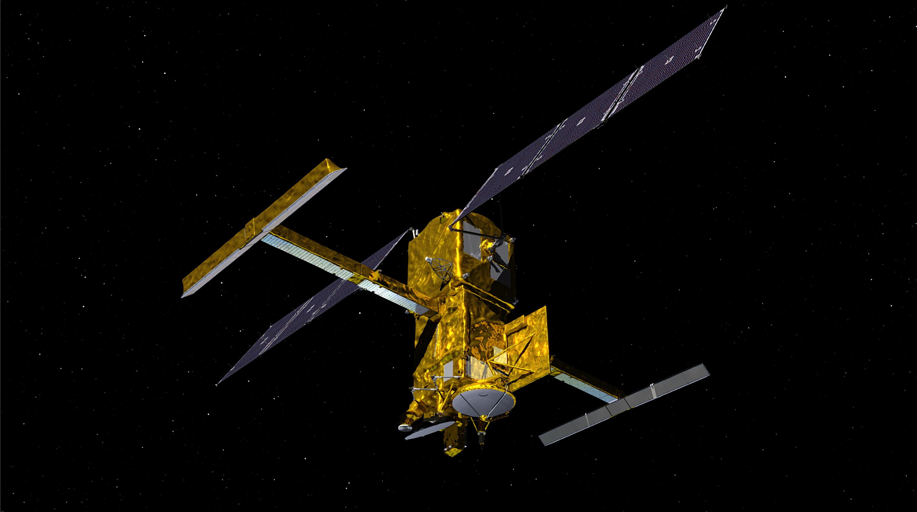
2022-11-14 |
|
Surface Water and Ocean Topography (SWOT)
|
|
2730x1530x3 |

|
-
PIA25622:
-
SWOT Satellite With Solar Arrays in Full View (Illustration)
Full Resolution:
TIFF
(10.28 MB)
JPEG
(431.7 kB)
|
|
|
2022-11-14 |
|
Surface Water and Ocean Topography (SWOT)
|
KaRIn
|
2560x1440x3 |
|
-
PIA25621:
-
SWOT Above Earth (Illustration)
Full Resolution:
TIFF
(6.479 MB)
JPEG
(308.8 kB)
|
|
|
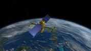
2022-11-14 |
|
Surface Water and Ocean Topography (SWOT)
|
KaRIn
|
2946x1646x3 |

|
-
PIA24530:
-
SWOT in Orbit With View of KaRIn Instrument (Illustration)
Full Resolution:
TIFF
(3.918 MB)
JPEG
(217.8 kB)
|
|
|
2022-11-14 |
Earth
|
Surface Water and Ocean Topography (SWOT)
|
|
1920x1080x3 |
|
-
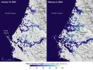
PIA25561:
-
SWOT Satellite will Improve Clarity and Detail of Sea Height Measurements
Full Resolution:
TIFF
(3.673 MB)
JPEG
(154 kB)
|
|
|
2022-10-20 |
|
Surface Water and Ocean Topography (SWOT)
|
|
2179x1547x3 |
|
-
PIA25591:
-
SWOT Arrives at Vandenberg Space Force Base
Full Resolution:
TIFF
(7.499 MB)
JPEG
(331.9 kB)
|
|
|
2022-10-18 |
|
Surface Water and Ocean Topography (SWOT)
|
|
6048x3749x3 |
|
-
PIA24910:
-
Packing SWOT For Launch
Full Resolution:
TIFF
(53.66 MB)
JPEG
(2.978 MB)
|
|
|
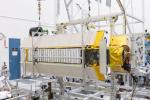
2022-05-11 |
|
Surface Water and Ocean Topography (SWOT)
|
|
6048x4024x3 |
|
-
PIA25147:
-
SWOT Solar Panels Deploy at Thales Alenia Space Facility in France
Full Resolution:
TIFF
(55.8 MB)
JPEG
(2.346 MB)
|
|
|
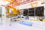
2021-06-30 |
|
Surface Water and Ocean Topography (SWOT)
|
|
8256x5504x3 |
|
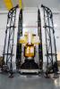
-
PIA24536:
-
SWOT Science Payload
Full Resolution:
TIFF
(105.1 MB)
JPEG
(7.342 MB)
|
|
|
2021-06-30 |
|
Surface Water and Ocean Topography (SWOT)
|
|
8256x5504x3 |

|
-
PIA24535:
-
SWOT Teamwork
Full Resolution:
TIFF
(108 MB)
JPEG
(5.043 MB)
|
|
|
2021-06-30 |
|
Surface Water and Ocean Topography (SWOT)
|
|
8256x5504x3 |
|
-
PIA24534:
-
Loading SWOT Into C-17 Aircraft
Full Resolution:
TIFF
(96.71 MB)
JPEG
(5.911 MB)
|
|
|
2021-05-06 |
|
Surface Water and Ocean Topography (SWOT)
|
|
8256x5504x3 |

|
-
PIA24531:
-
SWOT Project Manager Parag Vaze
Full Resolution:
TIFF
(82.94 MB)
JPEG
(2.592 MB)
|
|
|
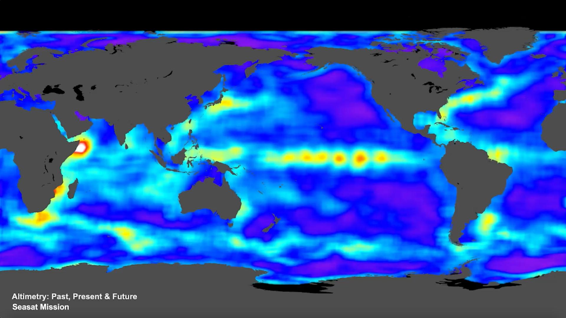
2015-04-14 |
Earth
|
|
|
4500x6000x3 |
|
-
PIA18055:
-
Sea Level Rise & Variability
Full Resolution:
TIFF
(81.05 MB)
JPEG
(1.722 MB)
|
 Planetary Data System


