Click here for animation
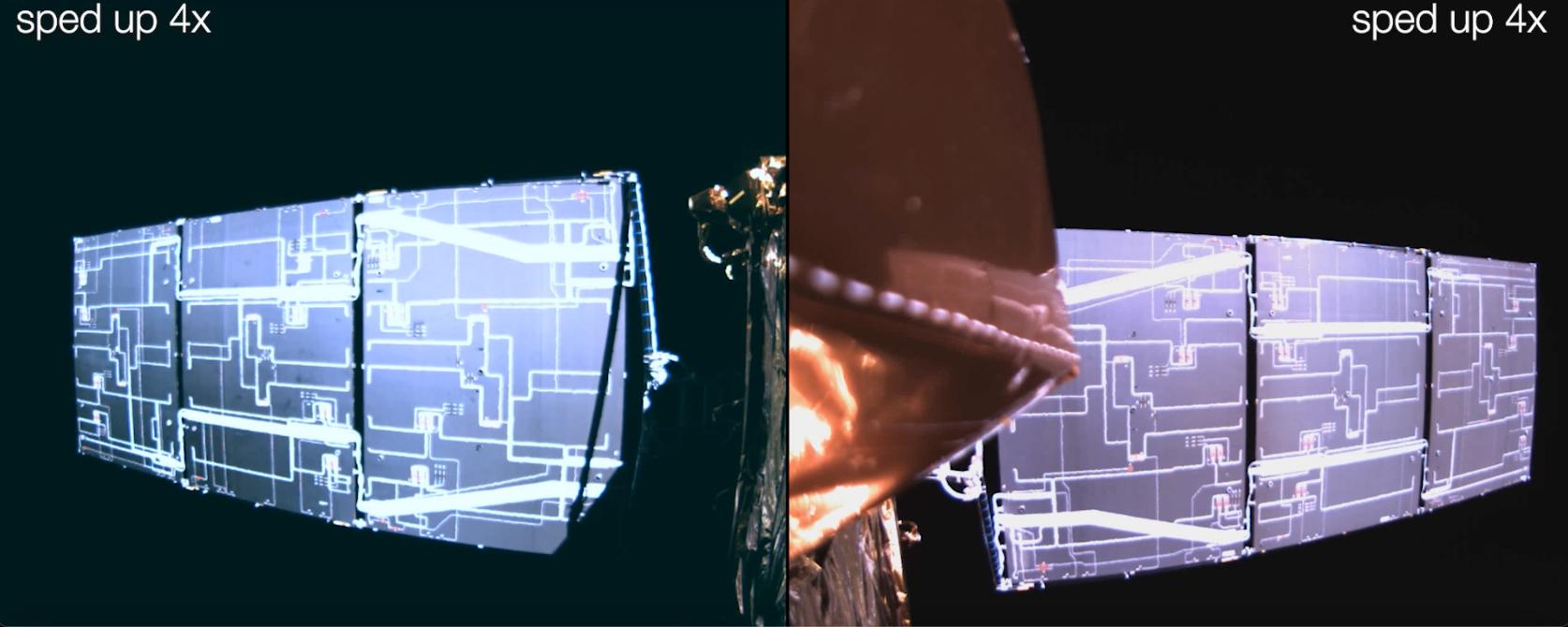
This video is a series of images showing the deployment of the solar arrays that power the international Surface Water and Ocean Topography satellite (SWOT). The mission captured the roughly 10-minute process with two of the four commercial cameras aboard the satellite (the same type used to capture NASA's Perseverance rover landing on Mars). The satellite launched Dec. 16, 2022, at 3:46 a.m. PST from Vandenberg Space Force Base in California, and the arrays started their deployment at 5:01 a.m. PST.
SWOT's two solar arrays measure 48.8 feet (14.9 meters) from end to end, with a total surface area of 335 square feet (31 square meters). Extending from opposite sides of the spacecraft bus, the arrays remain pointed at the Sun via small motors. They provide 8 kilowatts of power to the satellite, which has a 1.5-kilowatt total power demand.
SWOT will survey the height of water in Earth's lakes, rivers, reservoirs, and the ocean. The satellite will cover the planet's surface at least once every 21 days and has a prime mission of three years. It was jointly developed by NASA and France's Centre National d'Études Spatiales (CNES), with contributions from the Canadian Space Agency (CSA) and the UK Space Agency.
NASA's Jet Propulsion Laboratory, which is managed for the agency by Caltech in Pasadena, California, leads the U.S. component of the project. For the flight system payload, NASA is providing the Ka-band Radar Interferometer (KaRIn) instrument, a GPS science receiver, a laser retroreflector, a two-beam microwave radiometer, and NASA instrument operations. CNES is providing the Doppler Orbitography and Radioposition Integrated by Satellite (DORIS) system, the dual frequency Poseidon altimeter (developed by Thales Alenia Space), the KaRIn radio-frequency subsystem (together with Thales Alenia Space and with support from the UK Space Agency), the satellite platform, and ground control segment. CSA is providing the KaRIn high-power transmitter assembly. NASA is providing the launch vehicle and associated launch services.
For more information, see: https://swot.jpl.nasa.gov/
 Planetary Data System


