My
List |
Addition Date
|
Target
|
Mission
|
Instrument
|
Size
|

|
2004-10-21 |
Mars
|
Mars Exploration Rover (MER)
|
Panoramic Camera
|
3452x1300x3 |
|
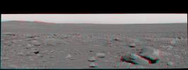
-
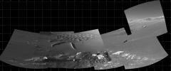
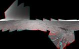
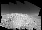
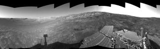
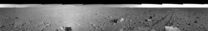
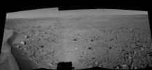
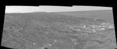
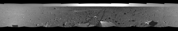
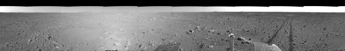
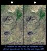
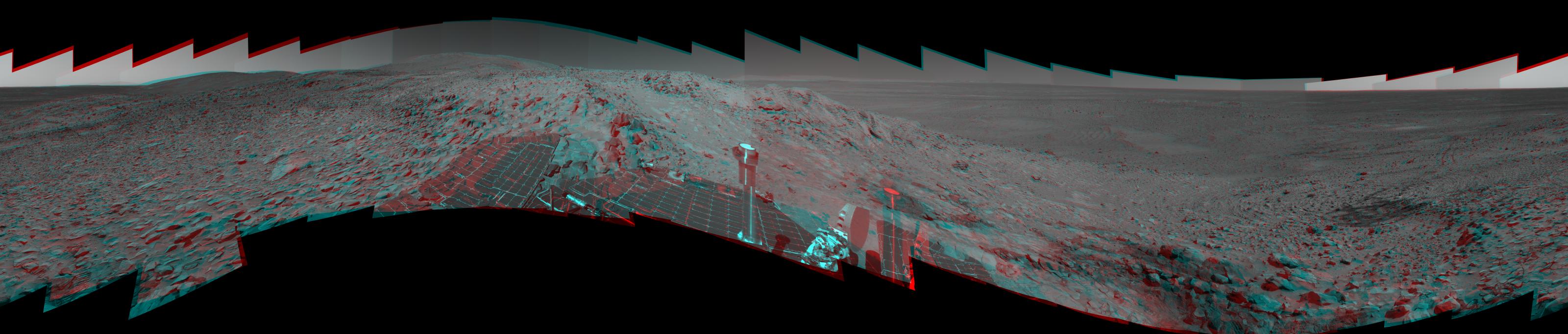
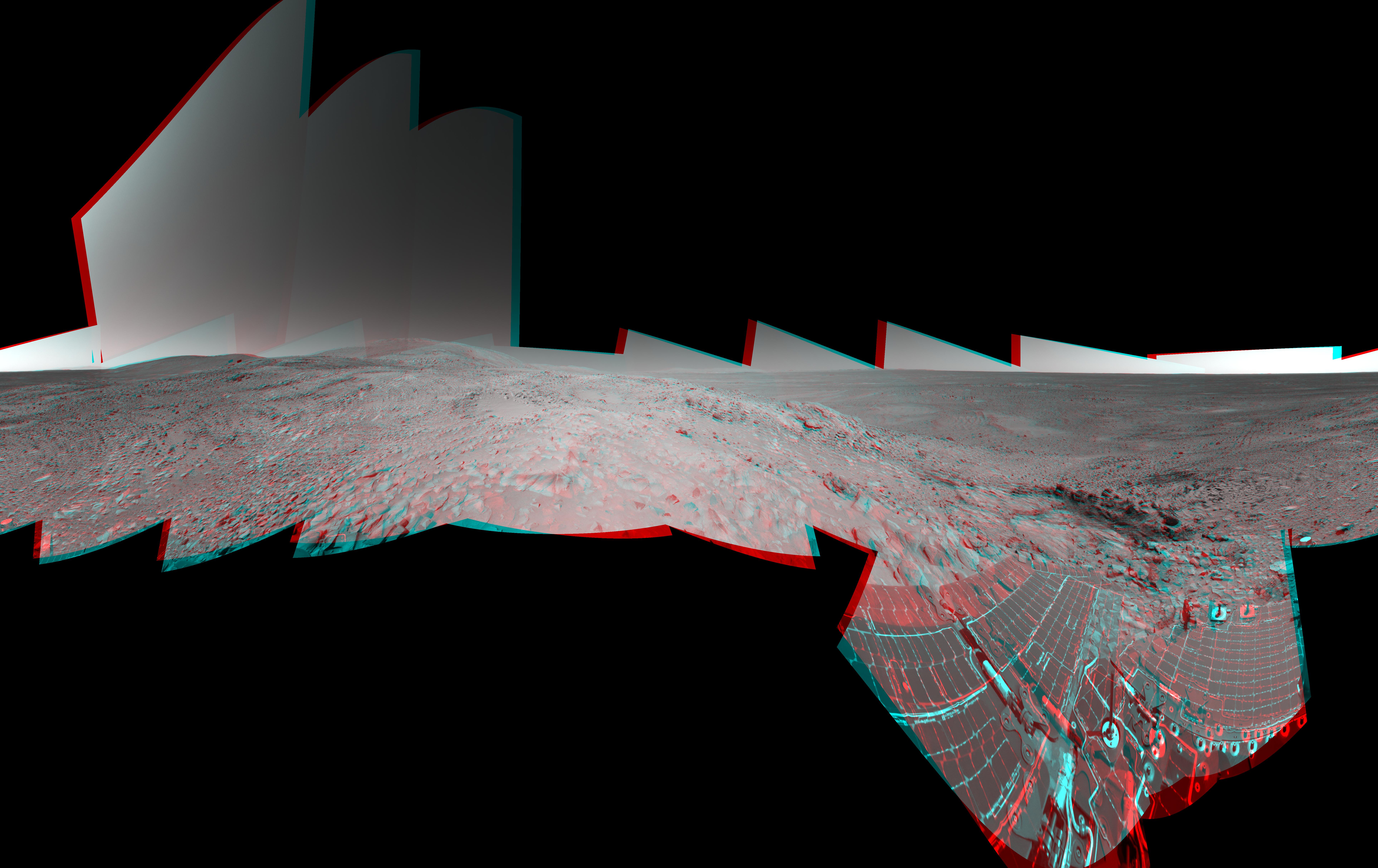
PIA06962:
-
Eyeing the Drive Ahead After 'Bonneville' (3-D)
Full Resolution:
TIFF
(7.477 MB)
JPEG
(408.8 kB)
|
|
|
2004-10-21 |
Mars
|
Mars Exploration Rover (MER)
|
Panoramic Camera
|
3200x683x3 |
|
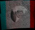
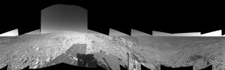
-
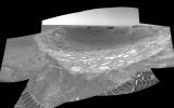
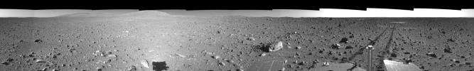
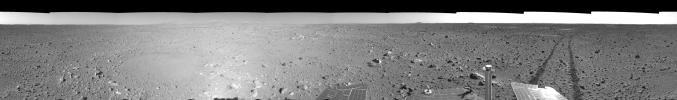
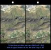
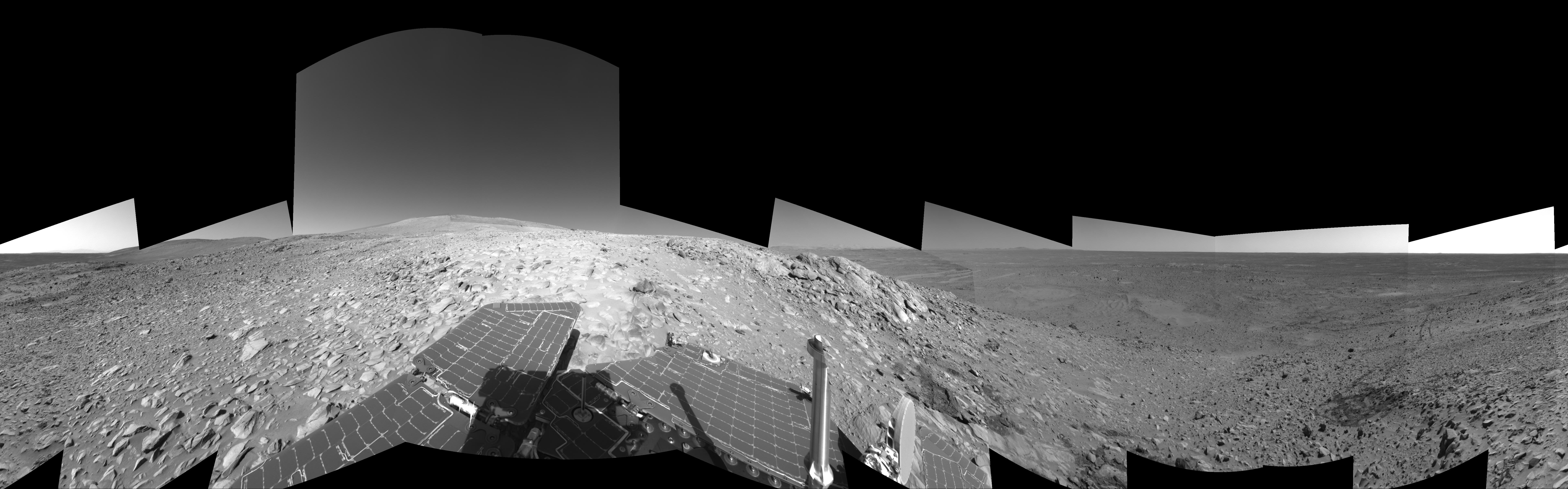
PIA06959:
'Columbia Hills' in Stereo
Full Resolution:
TIFF
(3.661 MB)
JPEG
(268.7 kB)
|
|
|
2004-10-20 |
Mars
|
Mars Exploration Rover (MER)
|
Navigation Camera
|
7704x2542x3 |
|
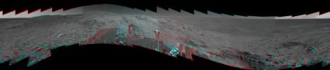
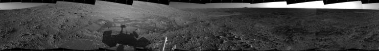
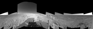
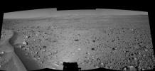
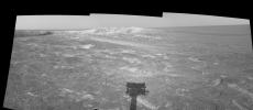
-
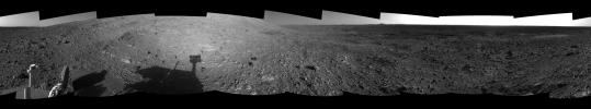
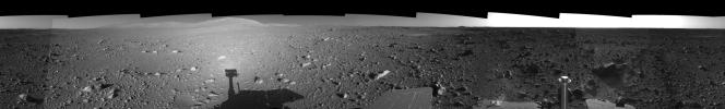
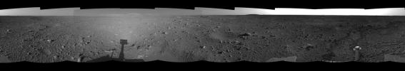
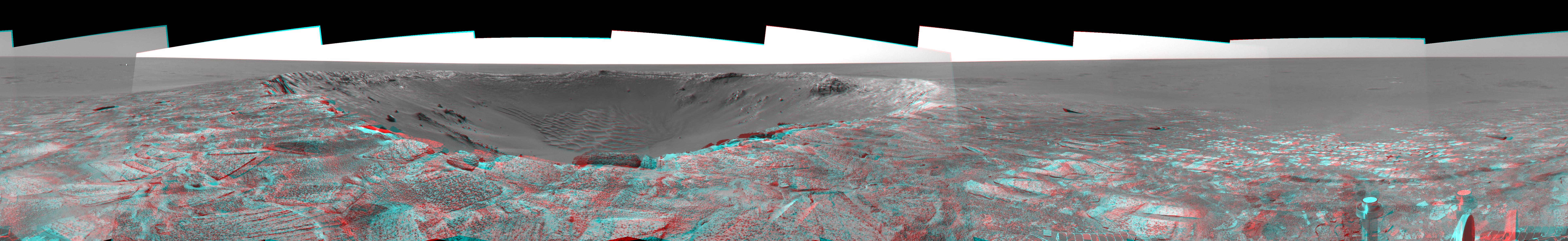
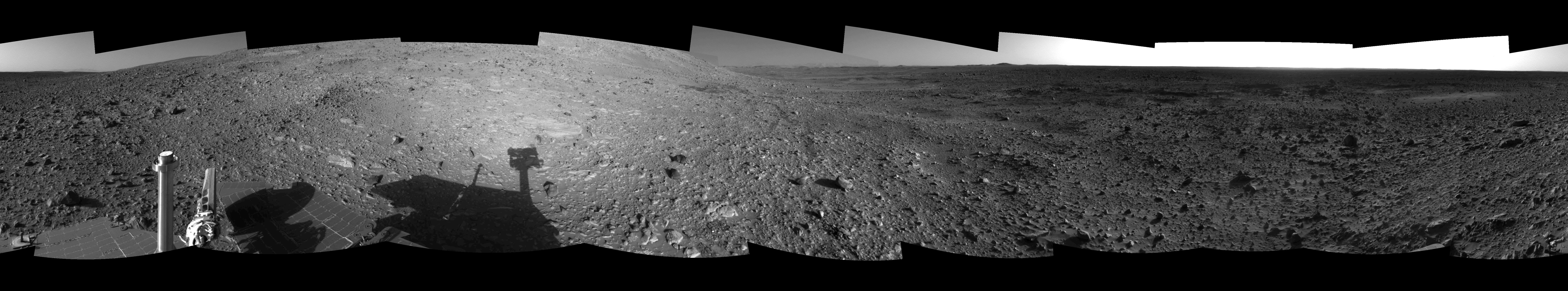
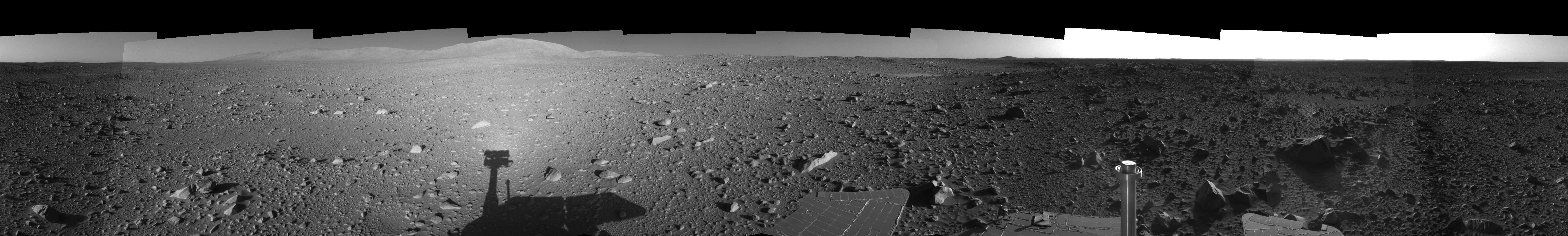
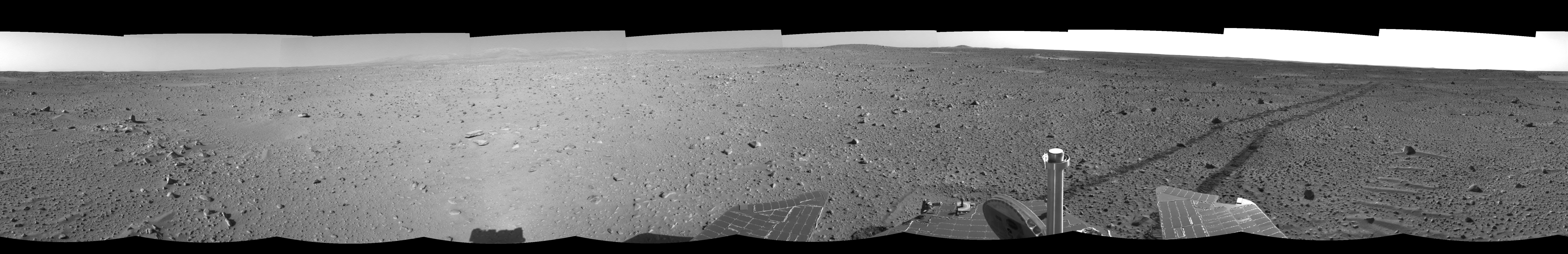
PIA06953:
-
Full-Circle View from Near 'Tetl' (3-D)
Full Resolution:
TIFF
(23.94 MB)
JPEG
(1.299 MB)
|
|
|
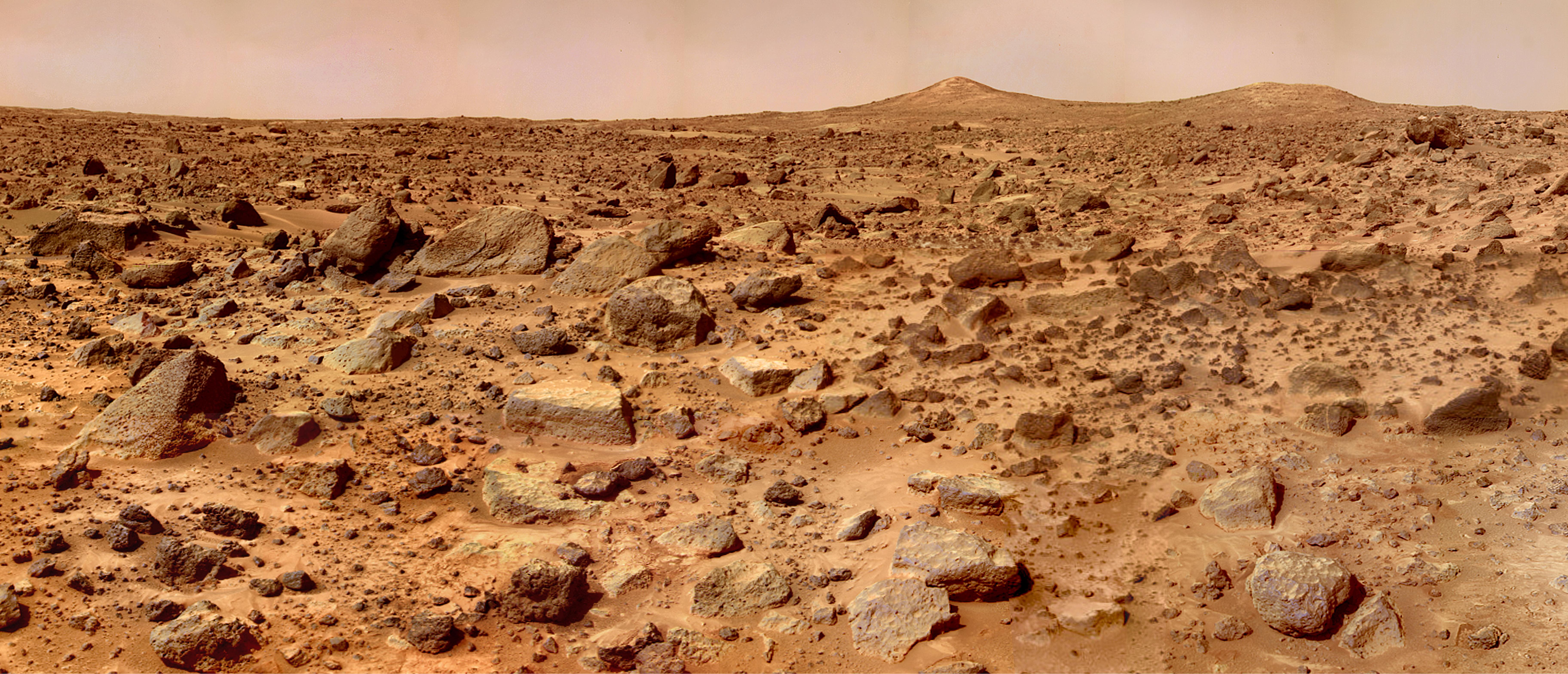
2004-10-08 |
Mars
|
Mars Exploration Rover (MER)
|
Navigation Camera
|
7704x1400x3 |
|
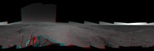
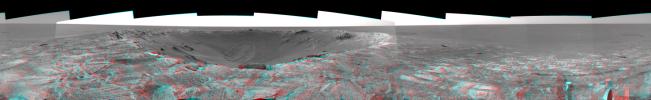
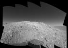
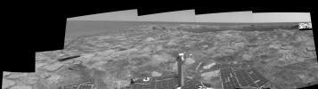
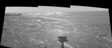
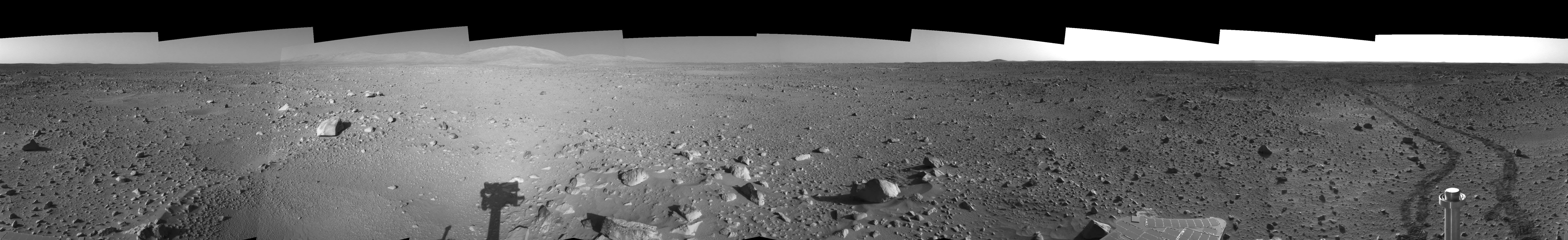
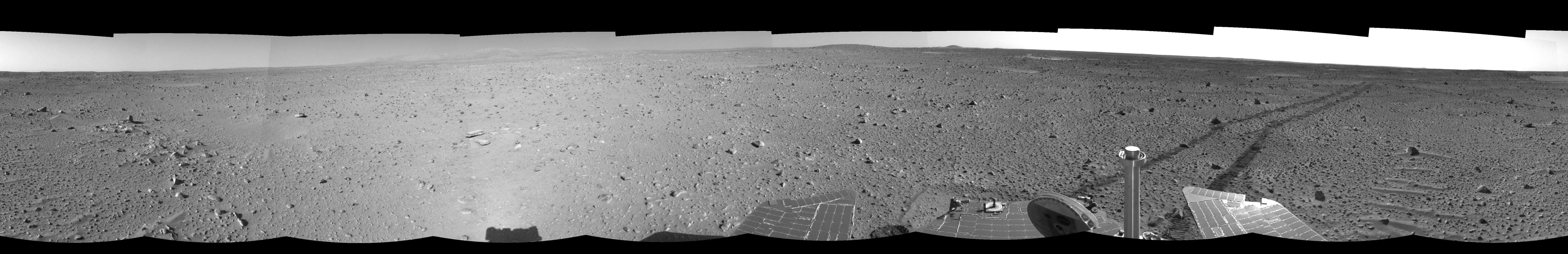
-
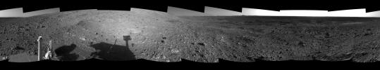
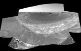
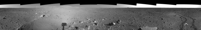
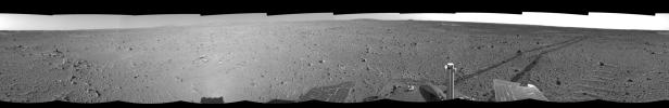
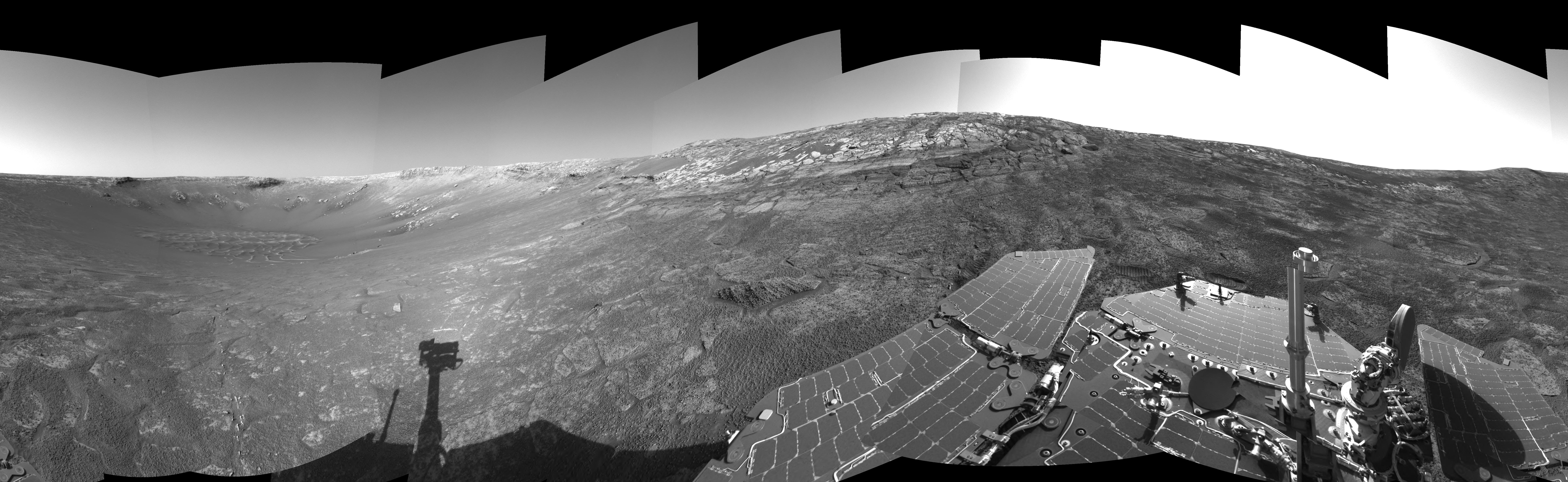
PIA06921:
Spirit's View of 'Columbia Hills' (3-D)
Full Resolution:
TIFF
(19.95 MB)
JPEG
(1.175 MB)
|
|
|
2004-09-30 |
Mars
|
Mars Exploration Rover (MER)
|
Navigation Camera
|
4571x1900x1 |
|
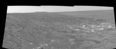
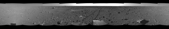
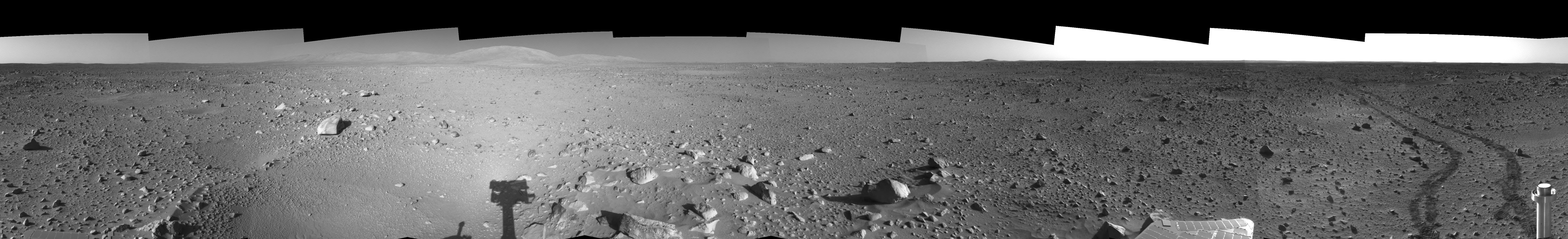
-
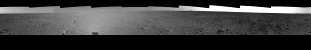
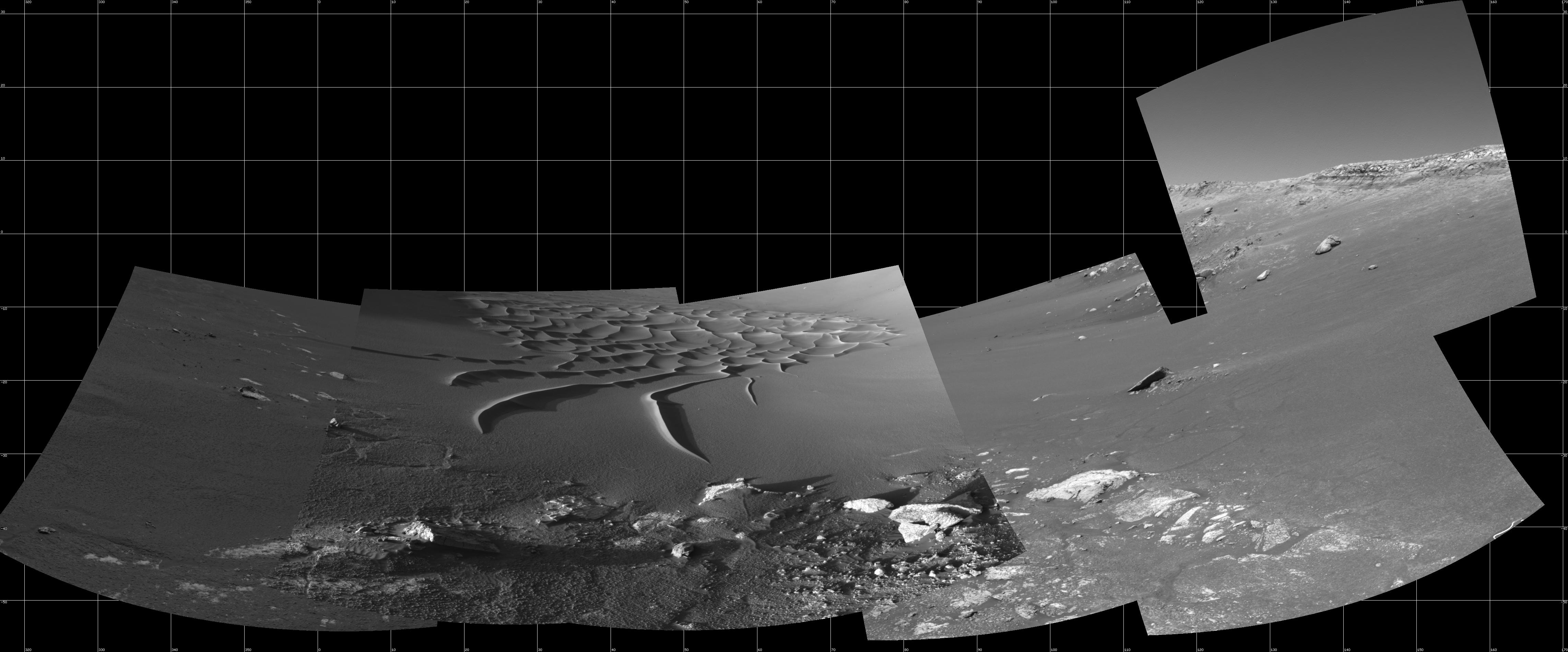
PIA06891:
-
Busy at the Bottom of 'Endurance Crater'
Full Resolution:
TIFF
(4.202 MB)
JPEG
(669.4 kB)
|
|
|
2004-09-24 |
Mars
|
Mars Exploration Rover (MER)
|
Microscopic Imager
Moessbauer Spectrometer
|
2167x1861x3 |
|
-
PIA06882:
-
Sampling Martian Soil (3-D)
Full Resolution:
TIFF
(8.466 MB)
JPEG
(659 kB)
|
|
|
2004-09-17 |
Mars
|
Mars Exploration Rover (MER)
|
Navigation Camera
|
7466x1007x1 |
|
-
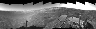
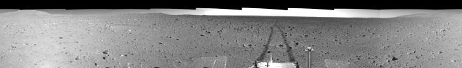
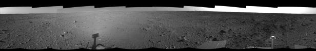
PIA06870:
Spirit's View from 'Engineering Flats'
Full Resolution:
TIFF
(6.267 MB)
JPEG
(1.026 MB)
|
|
|
2004-09-16 |
Mars
|
Mars Exploration Rover (MER)
|
Navigation Camera
|
7753x1193x3 |
|
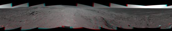
-
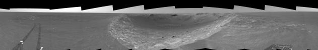
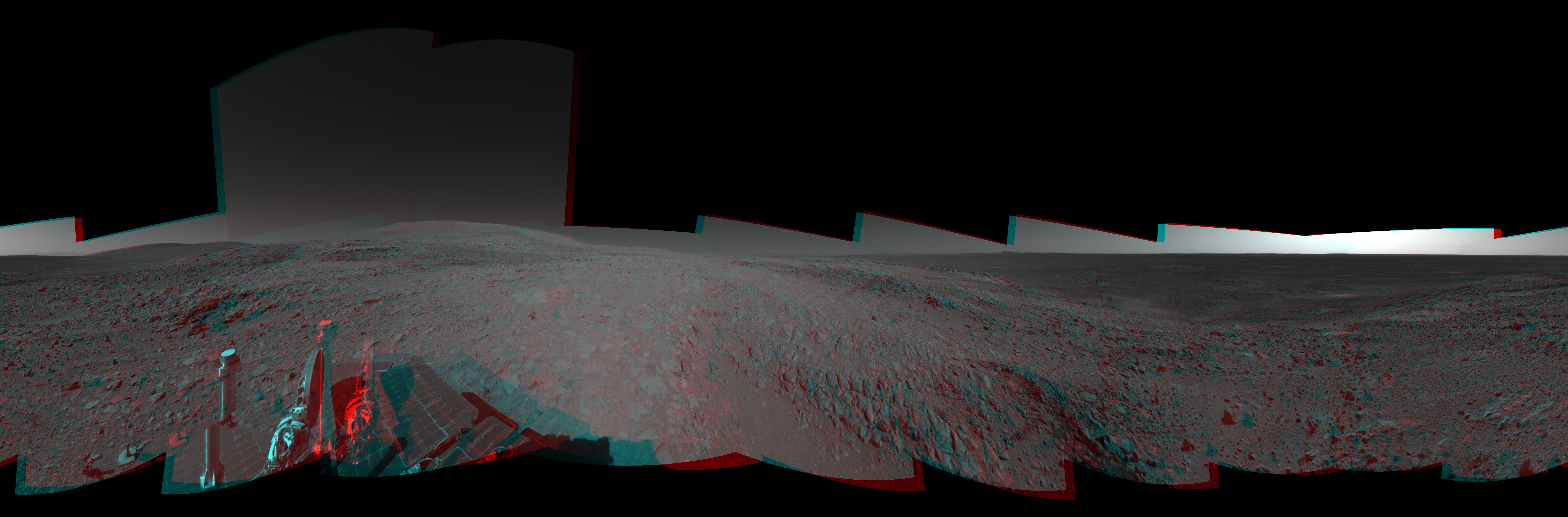
PIA06867:
'Endurance' Untouched (3-D)
Full Resolution:
TIFF
(18.05 MB)
JPEG
(1.233 MB)
|
|
|
2004-09-03 |
Mars
|
Mars Exploration Rover (MER)
|
Navigation Camera
|
7704x4853x3 |
|
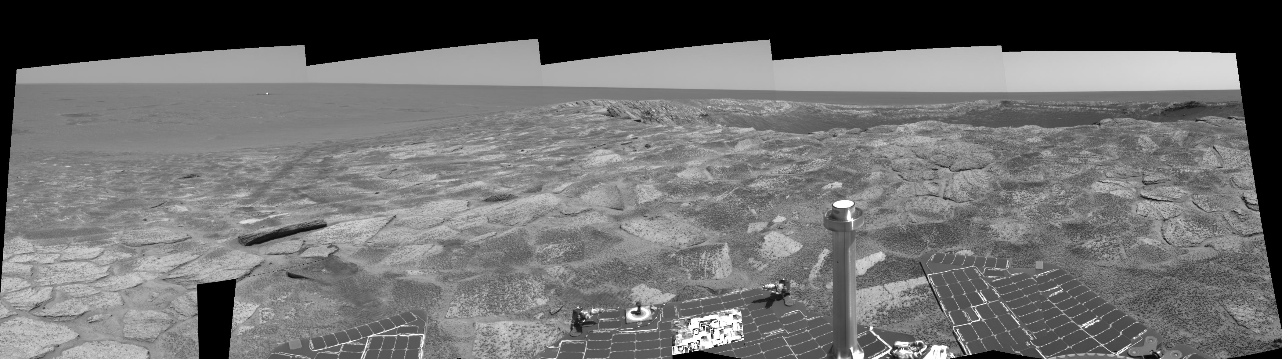
-
PIA06851:
-
Preparing for 'Lights Out' on Mars (3-D)
Full Resolution:
TIFF
(38.69 MB)
JPEG
(2.209 MB)
|
|
|
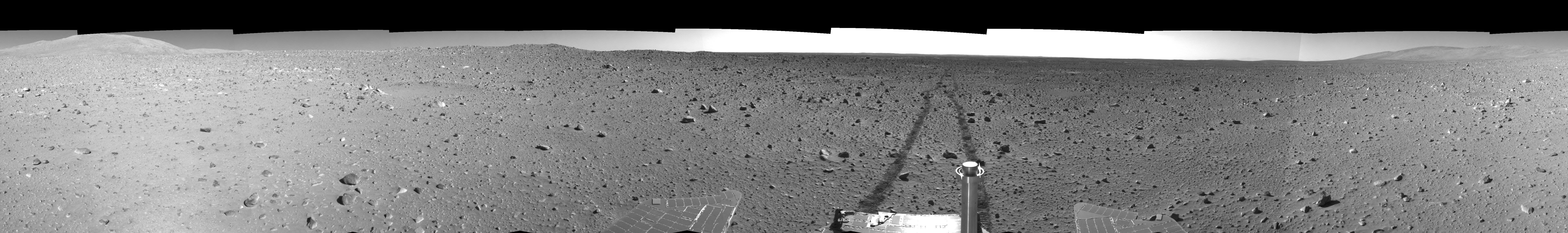
2004-08-12 |
Mars
|
Mars Exploration Rover (MER)
|
Navigation Camera
|
7704x2401x1 |
|
-
PIA06765:
-
Making Tracks on Mars (left-eye)
Full Resolution:
TIFF
(10.29 MB)
JPEG
(1.504 MB)
|
|
|
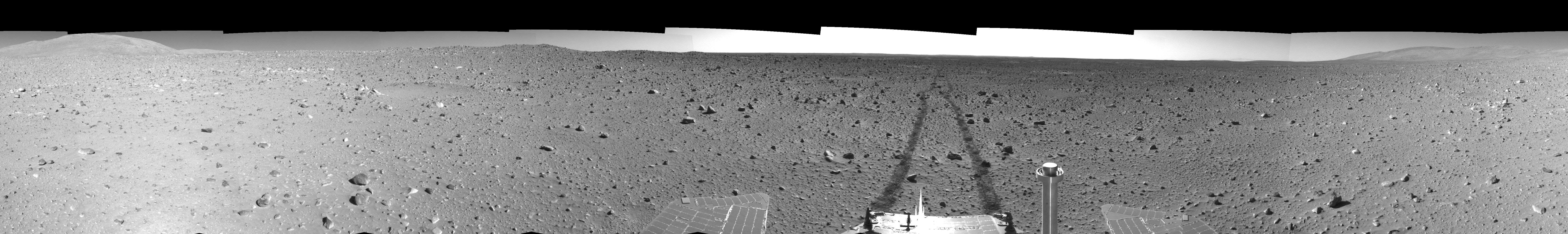
2004-08-12 |
Mars
|
Mars Exploration Rover (MER)
|
Navigation Camera
|
7704x2401x1 |
|
-
PIA06766:
-
Making Tracks on Mars (right-eye)
Full Resolution:
TIFF
(10.01 MB)
JPEG
(1.458 MB)
|
|
|
2004-08-02 |
Mars
|
Mars Exploration Rover (MER)
|
Navigation Camera
|
3617x2568x1 |
|
-
PIA06738:
-
High on 'West Spur' (Right Eye)
Full Resolution:
TIFF
(5.873 MB)
JPEG
(716.1 kB)
|
|
|
2004-08-02 |
Mars
|
Mars Exploration Rover (MER)
|
Navigation Camera
|
3617x2568x1 |
|
-
PIA06737:
-
High on 'West Spur' (Left Eye)
Full Resolution:
TIFF
(6.135 MB)
JPEG
(782.4 kB)
|
|
|
2004-07-22 |
Mars
|
Mars Exploration Rover (MER)
|
Navigation Camera
|
7704x1429x1 |
|
-
PIA06713:
Hilly Surroundings (Right Eye)
Full Resolution:
TIFF
(3.261 MB)
JPEG
(1.247 MB)
|
|
|
2004-07-22 |
Mars
|
Mars Exploration Rover (MER)
|
Navigation Camera
|
7704x1429x1 |
|
-
PIA06712:
Hilly Surroundings (Left Eye)
Full Resolution:
TIFF
(3.351 MB)
JPEG
(1.285 MB)
|
|
|
2004-07-21 |
Mars
|
Mars Exploration Rover (MER)
|
Navigation Camera
|
7753x2387x1 |
|
-
PIA06704:
-
'Endurance' All Around (Polar)
Full Resolution:
TIFF
(14.11 MB)
JPEG
(1.997 MB)
|
|
|
2004-07-21 |
Mars
|
Mars Exploration Rover (MER)
|
Navigation Camera
|
7753x2387x1 |
|
-
PIA06703:
-
'Endurance' All Around (Left Eye)
Full Resolution:
TIFF
(14.29 MB)
JPEG
(2.065 MB)
|
|
|
2004-06-14 |
Mars
|
Mars Exploration Rover (MER)
|
Navigation Camera
|
4138x2579x1 |
|
-
PIA06059:
-
Ready to Enter 'Endurance' (Right Eye)
Full Resolution:
TIFF
(6.959 MB)
JPEG
(1.107 MB)
|
|
|
2004-06-14 |
Mars
|
Mars Exploration Rover (MER)
|
Navigation Camera
|
4138x2579x1 |
|
-
PIA06058:
-
Ready to Enter 'Endurance' (Left Eye)
Full Resolution:
TIFF
(6.669 MB)
JPEG
(1.082 MB)
|
|
|
2004-06-14 |
Mars
|
Mars Exploration Rover (MER)
|
Navigation Camera
|
7704x1149x1 |

|
-
PIA06055:
Spirit Tracks on Mars, Sol 151 (Right Eye)
Full Resolution:
TIFF
(7.442 MB)
JPEG
(1.252 MB)
|
|
|
2004-06-14 |
Mars
|
Mars Exploration Rover (MER)
|
Navigation Camera
|
7704x1149x1 |
|
-
PIA06054:
Spirit Tracks on Mars, Sol 151 (Left Eye)
Full Resolution:
TIFF
(7.746 MB)
JPEG
(1.275 MB)
|
|
|
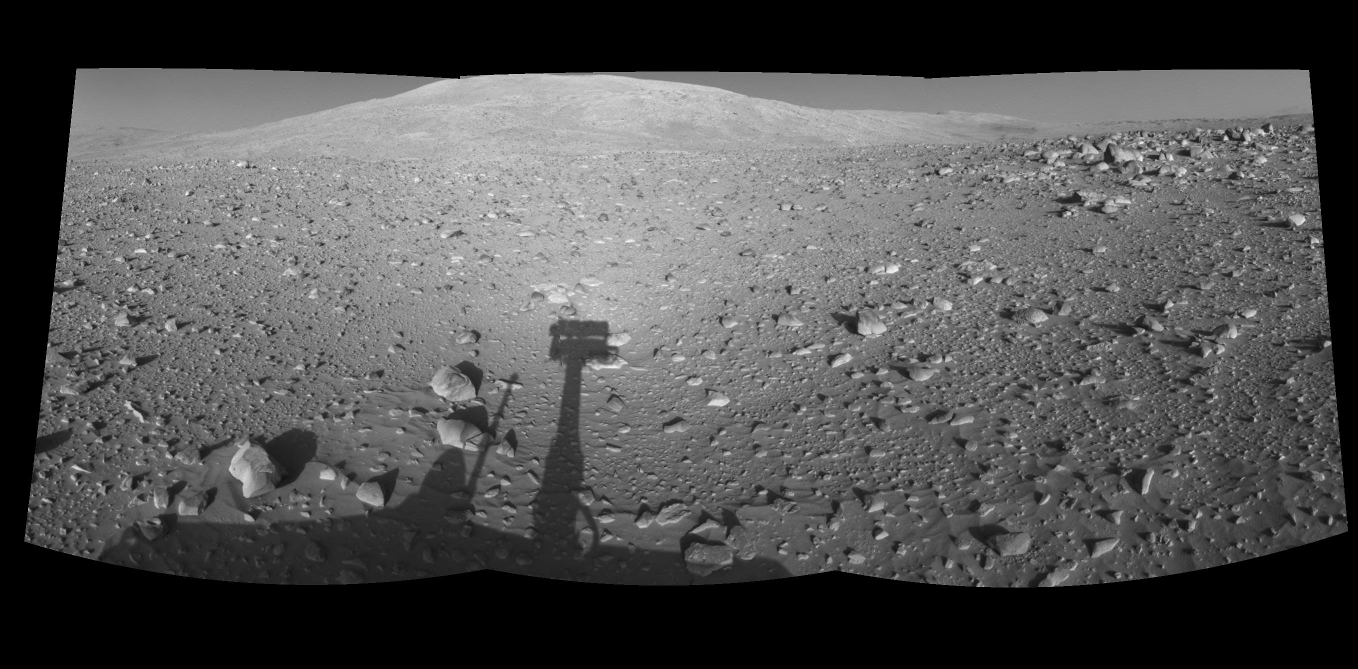
2004-06-14 |
Mars
|
Mars Exploration Rover (MER)
|
Navigation Camera
|
2716x1338x1 |

|
-
PIA06051:
-
Spirit's Shadow, Sol 153 (Right Eye)
Full Resolution:
TIFF
(2.559 MB)
JPEG
(391.9 kB)
|
|
|
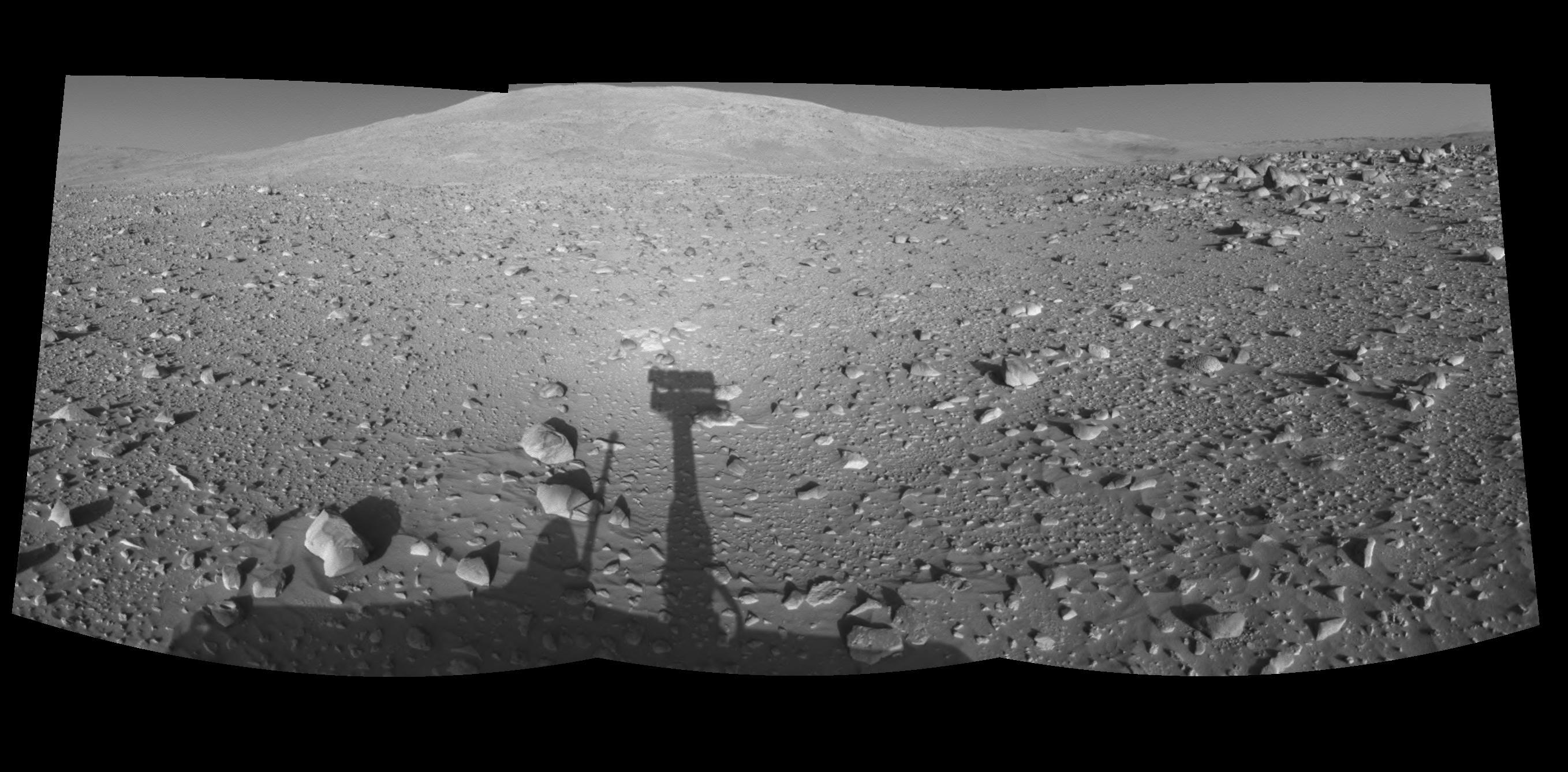
2004-06-14 |
Mars
|
Mars Exploration Rover (MER)
|
Navigation Camera
|
2716x1338x1 |

|
-
PIA06050:
-
Spirit's Shadow, Sol 153 (Left Eye)
Full Resolution:
TIFF
(2.596 MB)
JPEG
(397.3 kB)
|
|
|
2004-06-04 |
Mars
|
Mars Exploration Rover (MER)
|
Navigation Camera
|
7704x1155x1 |
|
-
PIA06040:
Spirit's View on Sol 148 (Right Eye)
Full Resolution:
TIFF
(7.506 MB)
JPEG
(1.216 MB)
|
|
|
2004-06-04 |
Mars
|
Mars Exploration Rover (MER)
|
Navigation Camera
|
7704x1155x1 |
|
-
PIA06039:
Spirit's View on Sol 148 (Left Eye)
Full Resolution:
TIFF
(7.683 MB)
JPEG
(1.256 MB)
|
|
|
2004-06-04 |
Mars
|
Mars Exploration Rover (MER)
|
Navigation Camera
|
7704x1160x1 |

|
-
PIA06034:
Spirit's View on Sol 147 (Right Eye)
Full Resolution:
TIFF
(7.035 MB)
JPEG
(1.086 MB)
|
|
|
2004-06-04 |
Mars
|
Mars Exploration Rover (MER)
|
Navigation Camera
|
7704x1160x1 |
|
-
PIA06033:
Spirit's View on Sol 147 (Left Eye)
Full Resolution:
TIFF
(7.201 MB)
JPEG
(1.114 MB)
|
|
|
2004-06-04 |
Mars
|
Mars Exploration Rover (MER)
|
Navigation Camera
|
7704x1177x1 |
|
-
PIA06028:
Spirit's View on Sol 142 (Right Eye)
Full Resolution:
TIFF
(7.135 MB)
JPEG
(1.157 MB)
|
|
|
2004-06-04 |
Mars
|
Mars Exploration Rover (MER)
|
Navigation Camera
|
7704x1177x1 |

|
-
PIA06027:
Spirit's View on Sol 142 (Left Eye)
Full Resolution:
TIFF
(7.284 MB)
JPEG
(1.19 MB)
|
|
|
2004-06-03 |
Mars
|
Mars Exploration Rover (MER)
|
Navigation Camera
|
2613x1200x1 |
|
-
PIA06024:
-
Lahontan Crater Looms (right eye)
Full Resolution:
TIFF
(2.564 MB)
JPEG
(404.6 kB)
|
|
|
2004-06-03 |
Mars
|
Mars Exploration Rover (MER)
|
Navigation Camera
|
2613x1200x1 |
|
-
PIA06023:
-
Lahontan Crater Looms (left eye)
Full Resolution:
TIFF
(2.621 MB)
JPEG
(418.2 kB)
|
|
|
2004-05-25 |
Mars
|
Mars Exploration Rover (MER)
|
Navigation Camera
|
4201x1176x1 |
|
-
PIA05987:
Near 'Endurance' on Sol 115 (right eye)
Full Resolution:
TIFF
(3.467 MB)
JPEG
(555.3 kB)
|
|
|
2004-05-25 |
Mars
|
Mars Exploration Rover (MER)
|
Navigation Camera
|
4201x1176x1 |

|
-
PIA05986:
Near 'Endurance' on Sol 115 (left eye)
Full Resolution:
TIFF
(3.631 MB)
JPEG
(588 kB)
|
|
|
2004-05-19 |
Mars
|
Mars Exploration Rover (MER)
|
Navigation Camera
|
2685x1140x1 |
|
-
PIA05967:
-
Opportunity View on Sol 109 (right eye)
Full Resolution:
TIFF
(2.362 MB)
JPEG
(389.1 kB)
|
|
|
2004-05-19 |
Mars
|
Mars Exploration Rover (MER)
|
Navigation Camera
|
2685x1140x1 |
|
-
PIA05966:
-
Opportunity View on Sol 109 (left eye)
Full Resolution:
TIFF
(2.317 MB)
JPEG
(386.4 kB)
|
|
|
2004-05-18 |
Mars
|
Mars Exploration Rover (MER)
|
Navigation Camera
|
2668x1161x1 |
|
-
PIA05963:
-
Looking at 'Endurance' on Sol 108 (right eye)
Full Resolution:
TIFF
(2.468 MB)
JPEG
(369.4 kB)
|
|
|
2004-05-18 |
Mars
|
Mars Exploration Rover (MER)
|
Navigation Camera
|
2668x1161x1 |
|
-
PIA05962:
-
Looking at 'Endurance' on Sol 108 (left eye)
Full Resolution:
TIFF
(2.431 MB)
JPEG
(368.6 kB)
|
|
|
2004-05-14 |
Mars
|
Mars Exploration Rover (MER)
|
Navigation Camera
|
7704x1349x1 |
|
-
PIA05925:
The Road Less Traveled (right eye)
Full Resolution:
TIFF
(6.908 MB)
JPEG
(1.076 MB)
|
|
|
2004-05-14 |
Mars
|
Mars Exploration Rover (MER)
|
Navigation Camera
|
7704x1349x1 |
|
-
PIA05924:
The Road Less Traveled (left eye)
Full Resolution:
TIFF
(7.074 MB)
JPEG
(1.106 MB)
|
|
|
2004-05-13 |
Mars
|
Mars Exploration Rover (MER)
|
Navigation Camera
|
7753x1230x1 |
|
-
PIA05909:
Riding the Rim of 'Endurance' (right eye)
Full Resolution:
TIFF
(6.558 MB)
JPEG
(940.8 kB)
|
|
|
2004-05-13 |
Mars
|
Mars Exploration Rover (MER)
|
Navigation Camera
|
7753x1230x1 |

|
-
PIA05908:
Riding the Rim of 'Endurance' (left eye)
Full Resolution:
TIFF
(6.589 MB)
JPEG
(954.8 kB)
|
|
|
2004-05-12 |
Mars
|
Mars Exploration Rover (MER)
|
Navigation Camera
|
7704x1250x1 |
|
-
PIA05903:
Spirit's View on Sol 124 (right eye)
Full Resolution:
TIFF
(7 MB)
JPEG
(1.068 MB)
|
|
|
2004-05-12 |
Mars
|
Mars Exploration Rover (MER)
|
Navigation Camera
|
7704x1250x1 |
|
-
PIA05902:
Spirit's View on Sol 124 (left eye)
Full Resolution:
TIFF
(4.99 MB)
JPEG
(803.8 kB)
|
|
|
2004-05-12 |
Mars
|
Mars Exploration Rover (MER)
|
Navigation Camera
|
7704x1138x1 |
|
-
PIA05897:
Spirit's View on Sol 123 (right eye)
Full Resolution:
TIFF
(7.378 MB)
JPEG
(1.212 MB)
|
|
|
2004-05-12 |
Mars
|
Mars Exploration Rover (MER)
|
Navigation Camera
|
7704x1138x1 |
|
-
PIA05896:
Spirit's View on Sol 123 (left eye)
Full Resolution:
TIFF
(7.538 MB)
JPEG
(1.247 MB)
|
|
|
2004-05-12 |
Mars
|
Mars Exploration Rover (MER)
|
Navigation Camera
|
7704x1359x1 |
|
-
PIA05891:
Spirit Heads Toward History (right eye)
Full Resolution:
TIFF
(7.046 MB)
JPEG
(1.09 MB)
|
|
|
2004-05-12 |
Mars
|
Mars Exploration Rover (MER)
|
Navigation Camera
|
7704x1359x1 |

|
-
PIA05890:
Spirit Heads Toward History (left eye)
Full Resolution:
TIFF
(7.202 MB)
JPEG
(1.117 MB)
|
|
|
2004-05-12 |
Mars
|
Mars Exploration Rover (MER)
|
Navigation Camera
|
7704x1250x1 |
|
-
PIA05885:
Spirit Keeps on Trekking (right eye)
Full Resolution:
TIFF
(7.386 MB)
JPEG
(1.206 MB)
|
|
|
2004-05-12 |
Mars
|
Mars Exploration Rover (MER)
|
Navigation Camera
|
7704x1250x1 |

|
-
PIA05884:
Spirit Keeps on Trekking (left eye)
Full Resolution:
TIFF
(7.554 MB)
JPEG
(1.238 MB)
|
|
|
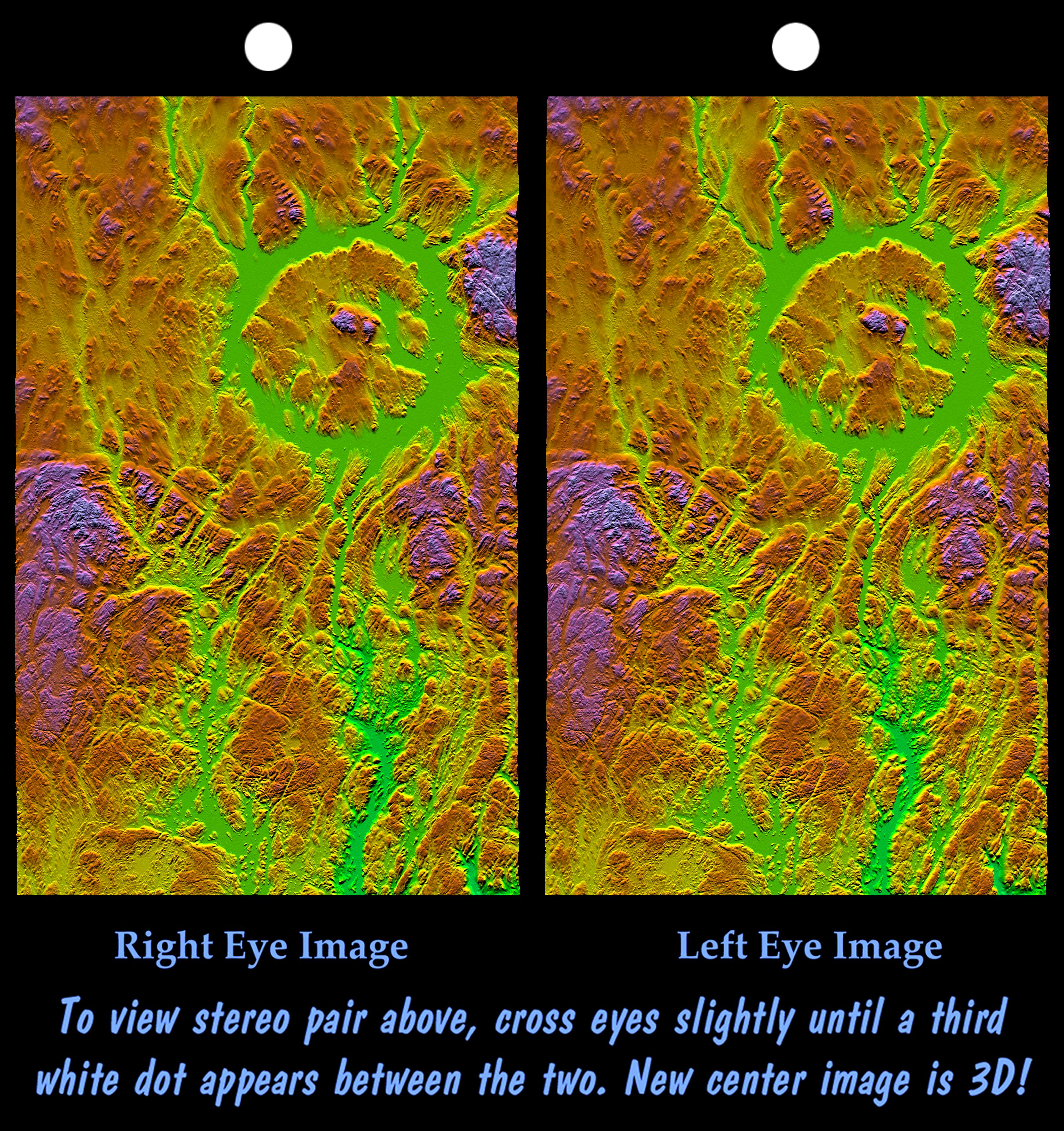
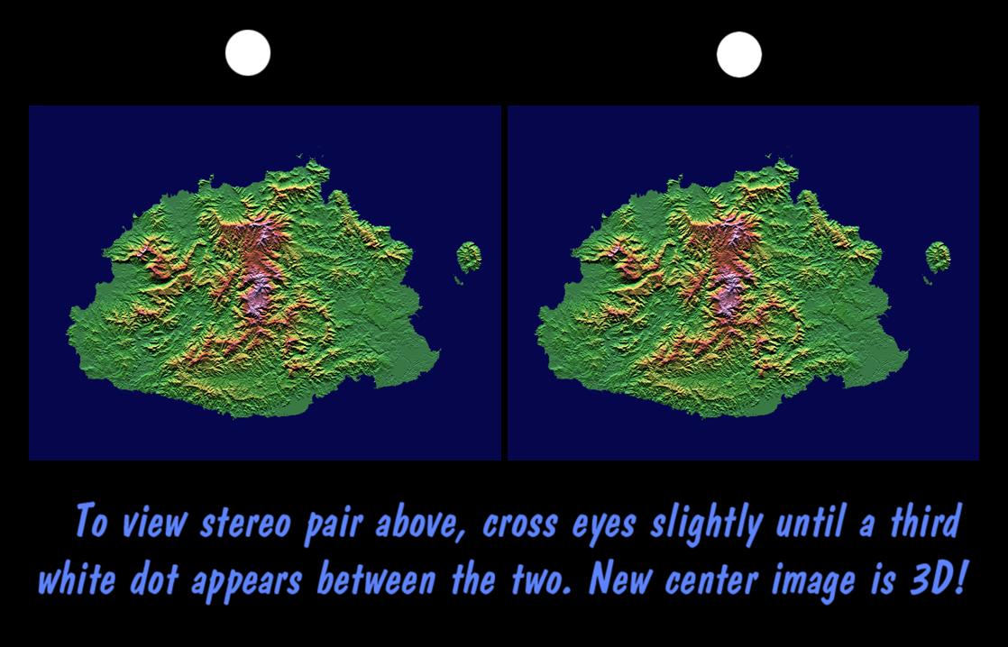
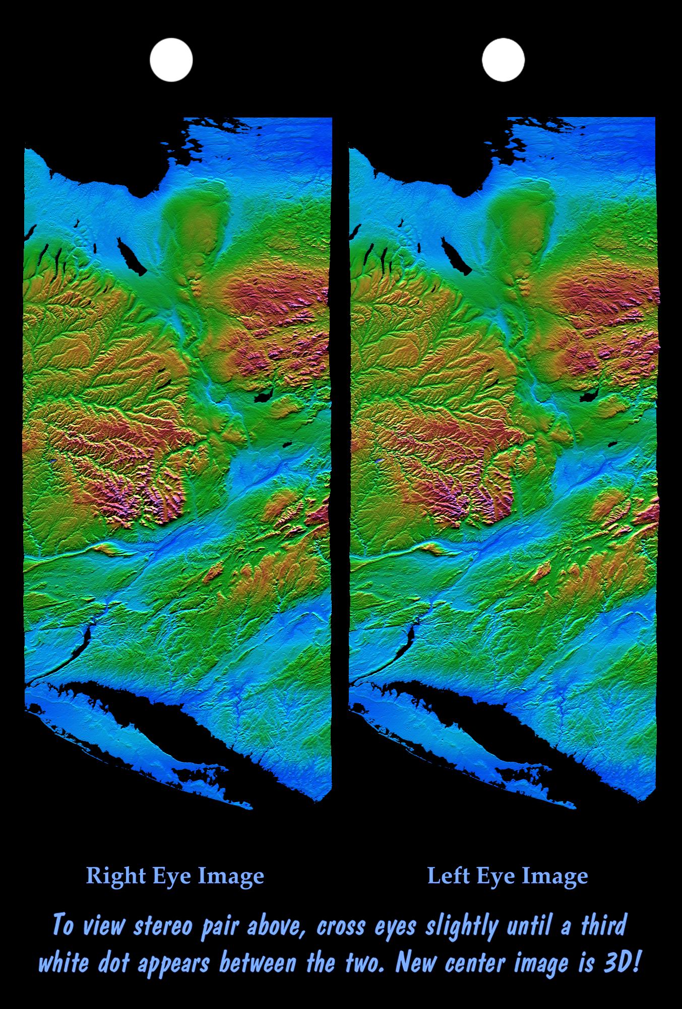
2003-03-27 |
Earth
|
Shuttle Radar Topography Mission (SRTM)
|
C-Band Interferometric Radar
|
3200x3400x3 |
|
-
PIA03384:
-
Stereo Pair, with Topographic Height as Color, Manicouagan Crater, Quebec, Canada
Full Resolution:
TIFF
(23.78 MB)
JPEG
(2.177 MB)
|
|
|
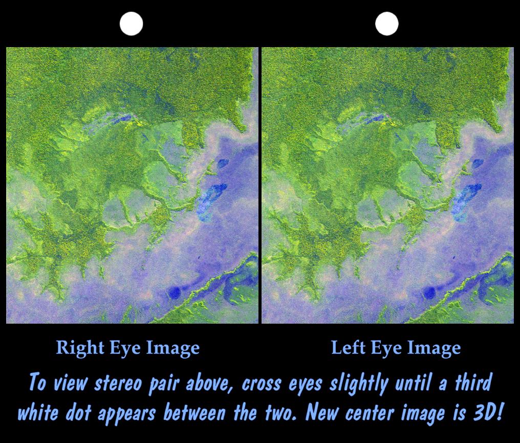
2002-09-26 |
Earth
|
Shuttle Radar Topography Mission (SRTM)
|
C-Band Interferometric Radar
|
1016x865x3 |
|
-
PIA03363:
-
Stereo Pair with ASTER Image, Iturralde Structure, Bolivia
Full Resolution:
TIFF
(2.168 MB)
JPEG
(186.8 kB)
|
|
|
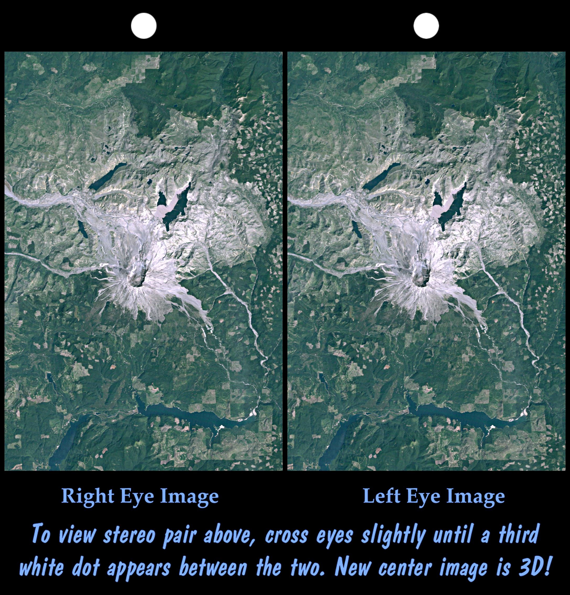
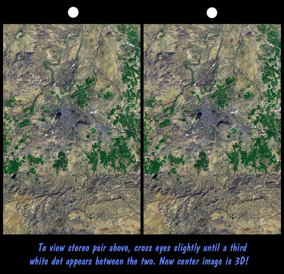
2002-09-19 |
Earth
|
Landsat
Shuttle Radar Topography Mission (SRTM)
|
C-Band Interferometric Radar
Thematic Mapper
|
2174x2271x3 |
|
-
PIA03361:
-
Stereo Pair, Mount St Helens, Washington State
Full Resolution:
TIFF
(10.66 MB)
JPEG
(779.8 kB)
|
|
|
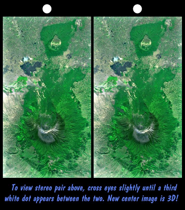
2002-09-12 |
Earth
|
Landsat
Shuttle Radar Topography Mission (SRTM)
|
C-Band Interferometric Radar
Thematic Mapper
|
712x808x3 |

|
-
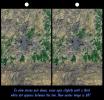
PIA03357:
-
Stereo Pair with Landsat Overlay, Mount Meru, Tanzania
Full Resolution:
TIFF
(1.649 MB)
JPEG
(145.2 kB)
|
|
|
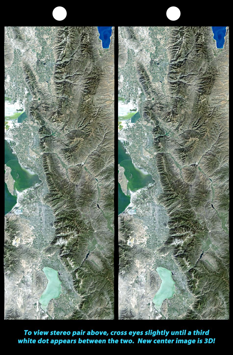
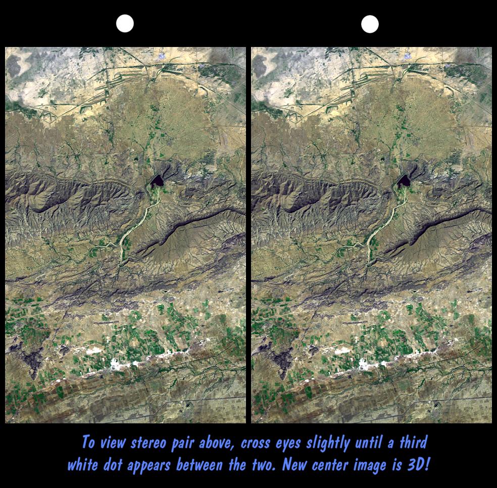
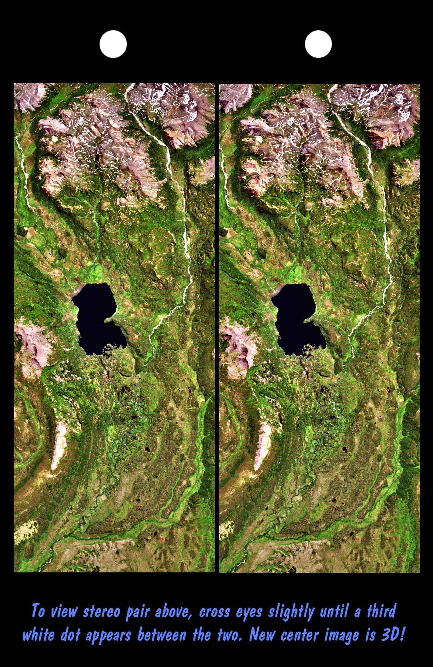
2002-02-06 |
Earth
|
Landsat
Shuttle Radar Topography Mission (SRTM)
|
C-Band Interferometric Radar
Thematic Mapper
|
950x1444x3 |
|
-
PIA03344:
-
Stereo Pair, Salt Lake City, Utah
Full Resolution:
TIFF
(3.961 MB)
JPEG
(380.7 kB)
|
|
|
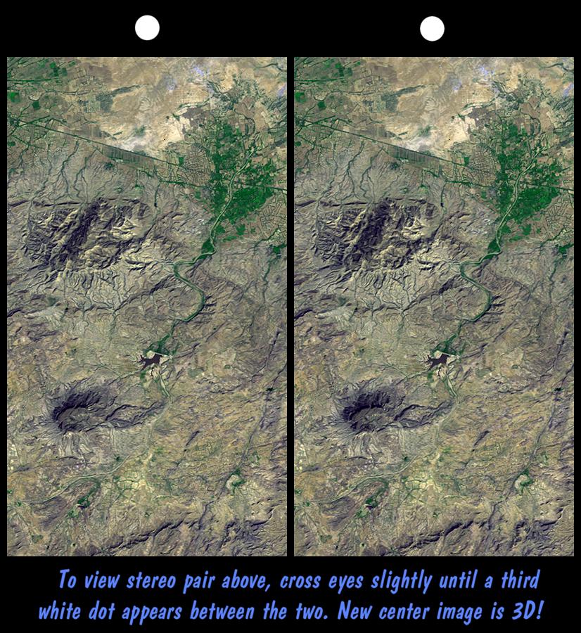
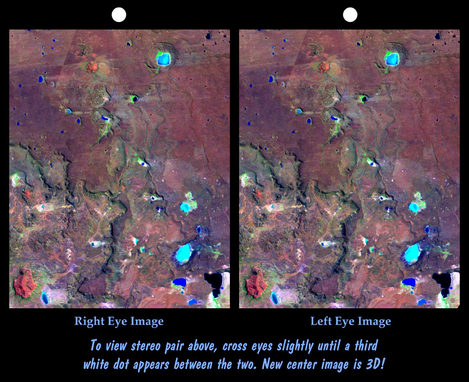
2001-05-31 |
Earth
|
Landsat
Shuttle Radar Topography Mission (SRTM)
|
C-Band Interferometric Radar
Thematic Mapper
|
826x900x3 |
|
-
PIA03308:
-
SRTM Stereo Pair: Northwest of Bhuj, India
Full Resolution:
TIFF
(2.061 MB)
JPEG
(184.8 kB)
|
|
|
2001-05-02 |
Earth
|
Landsat
Shuttle Radar Topography Mission (SRTM)
|
C-Band Interferometric Radar
Thematic Mapper
|
984x966x3 |
|
-
PIA03302:
-
SRTM Stereo Pair: Haro and Kas Hills, India
Full Resolution:
TIFF
(2.602 MB)
JPEG
(226.3 kB)
|
|
|
2001-04-05 |
Earth
|
Landsat
Shuttle Radar Topography Mission (SRTM)
|
C-Band Interferometric Radar
Thematic Mapper
|
932x900x3 |
|
-
PIA02796:
-
SRTM Stereo Pair: Bhuj, India, Two Weeks After Earthquake
Full Resolution:
TIFF
(2.291 MB)
JPEG
(212.9 kB)
|
|
|
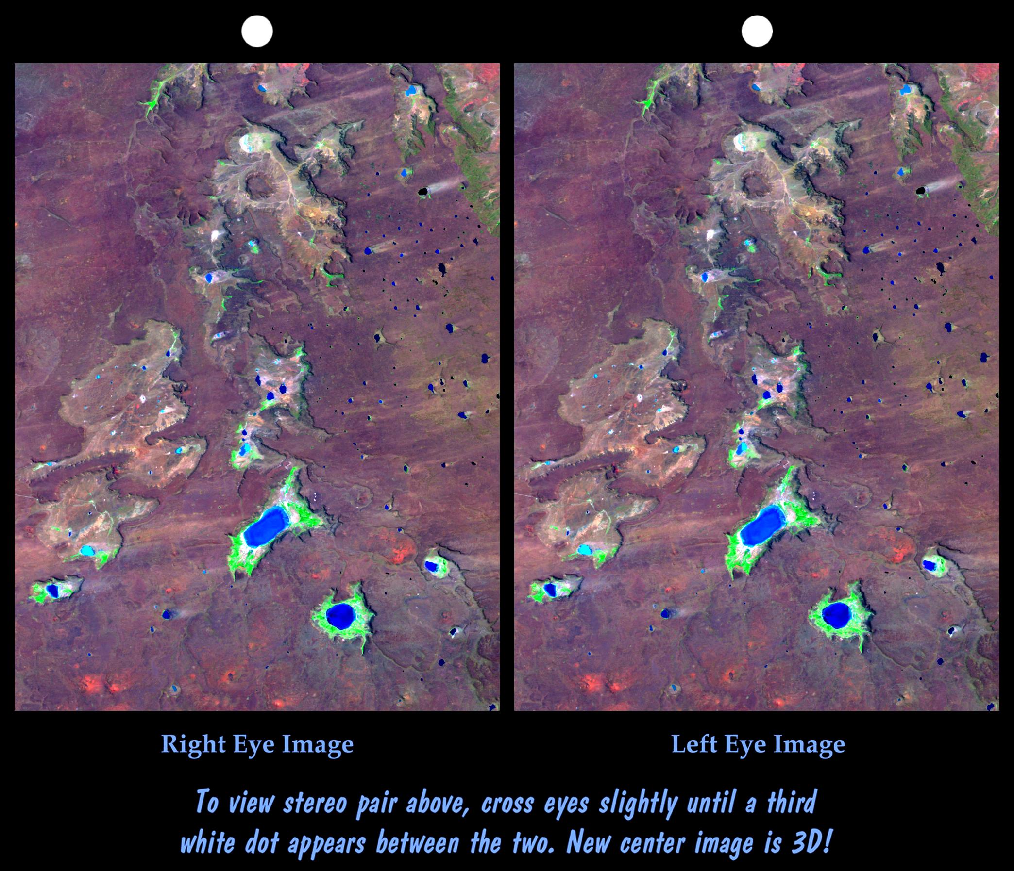
2000-11-02 |
Earth
|
Shuttle Radar Topography Mission (SRTM)
|
C-Band Interferometric Radar
|
1118x718x3 |
|
-
PIA02785:
-
SRTM Stereo Pair: Fiji Islands
Full Resolution:
TIFF
(753.3 kB)
JPEG
(106.5 kB)
|
|
|
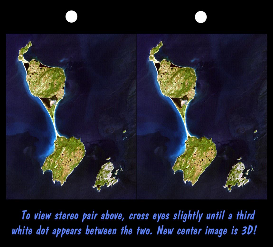
2000-10-20 |
Earth
|
Landsat
Shuttle Radar Topography Mission (SRTM)
|
C-Band Interferometric Radar
Thematic Mapper
|
1150x1039x3 |
|
-
PIA02782:
-
SRTM Stereo Pair with Landsat Overlay: Miquelon and Saint Pierre Islands
Full Resolution:
TIFF
(2.43 MB)
JPEG
(129.1 kB)
|
|
|
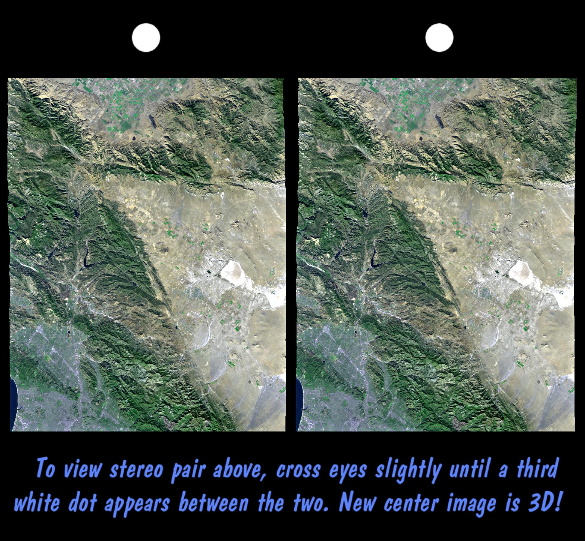
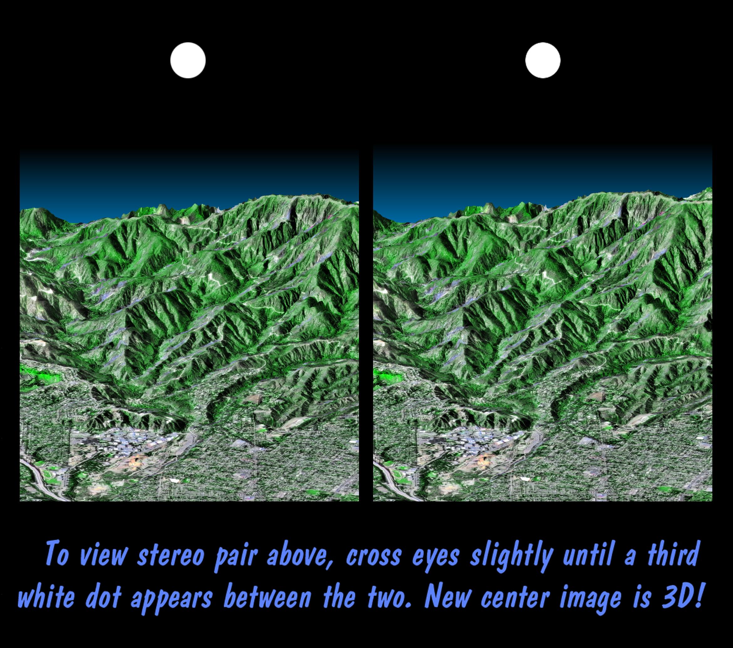
2000-09-21 |
Earth
|
Landsat
Shuttle Radar Topography Mission (SRTM)
|
C-Band Interferometric Radar
Thematic Mapper
|
1951x1803x3 |
|
-
PIA02776:
-
SRTM Stereo Pair with Landsat Overlay: Los Angeles to San Joaquin Valley, California
Full Resolution:
TIFF
(7.883 MB)
JPEG
(685.1 kB)
|
|
|
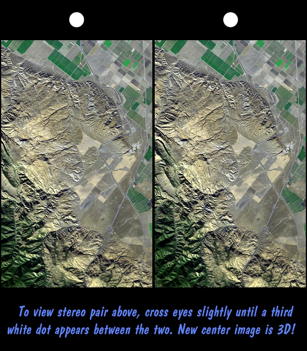
2000-08-31 |
Earth
|
Landsat
Shuttle Radar Topography Mission (SRTM)
|
C-Band Interferometric Radar
Thematic Mapper
|
984x1125x3 |
|
-
PIA02773:
-
SRTM Stereo Pair: Wheeler Ridge, California
Full Resolution:
TIFF
(2.866 MB)
JPEG
(281.4 kB)
|
|
|
2000-07-27 |
Earth
|
Landsat
Shuttle Radar Topography Mission (SRTM)
|
C-Band Interferometric Radar
Thematic Mapper
|
2088x1795x3 |
|
-
PIA02767:
-
SRTM Stereo Pair: Meseta de Somuncura, Patagonia, Argentina
Full Resolution:
TIFF
(5.983 MB)
JPEG
(516.6 kB)
|
|
|
2000-07-20 |
Earth
|
Landsat
Shuttle Radar Topography Mission (SRTM)
|
C-Band Interferometric Radar
Thematic Mapper
|
1526x1243x3 |
|
-
PIA02765:
-
Stereo Pair: Inverted Topography, Patagonia, Argentina
Full Resolution:
TIFF
(3.087 MB)
JPEG
(286.3 kB)
|
|
|
2000-07-13 |
Earth
|
Landsat
Shuttle Radar Topography Mission (SRTM)
|
C-Band Interferometric Radar
Thematic Mapper
|
2437x1466x3 |
|
-
PIA02763:
-
Stereo Pair: Basalt Cliffs, Patagonia, Argentina
Full Resolution:
TIFF
(5.358 MB)
JPEG
(505.6 kB)
|
|
|
2000-06-29 |
Earth
|
Landsat
Shuttle Radar Topography Mission (SRTM)
|
C-Band Interferometric Radar
Thematic Mapper
|
1102x1105x3 |
|
-
PIA02760:
-
Stereo Pair: Patagonia, Argentina
Full Resolution:
TIFF
(2.054 MB)
JPEG
(214.7 kB)
|
|
|
2000-06-22 |
Mars
|
Mars Global Surveyor (MGS)
|
Mars Orbiter Camera (MOC)
|
1613x1210x1 |
|
-
PIA01036:
-
Evidence for Recent Liquid Water on Mars: Seepage Sites in "Aerobraking Crater" Revisited
Full Resolution:
TIFF
(1.626 MB)
JPEG
(301.9 kB)
|
|
|
2000-06-22 |
Earth
|
Landsat
Shuttle Radar Topography Mission (SRTM)
|
C-Band Interferometric Radar
Thematic Mapper
|
2995x3129x3 |
|
-
PIA02756:
-
Stereo Pair, Patagonia, Argentina
Full Resolution:
TIFF
(24.23 MB)
JPEG
(1.777 MB)
|
|
|
2000-06-01 |
Earth
|
Shuttle Radar Topography Mission (SRTM)
|
C-Band Interferometric Radar
|
1353x2000x3 |
|
-
PIA02752:
-
Stereo Pair of Height as Color & Shaded Relief, New York State, Lake Ontario to Long Island
Full Resolution:
TIFF
(5.123 MB)
JPEG
(546.7 kB)
|
|
|
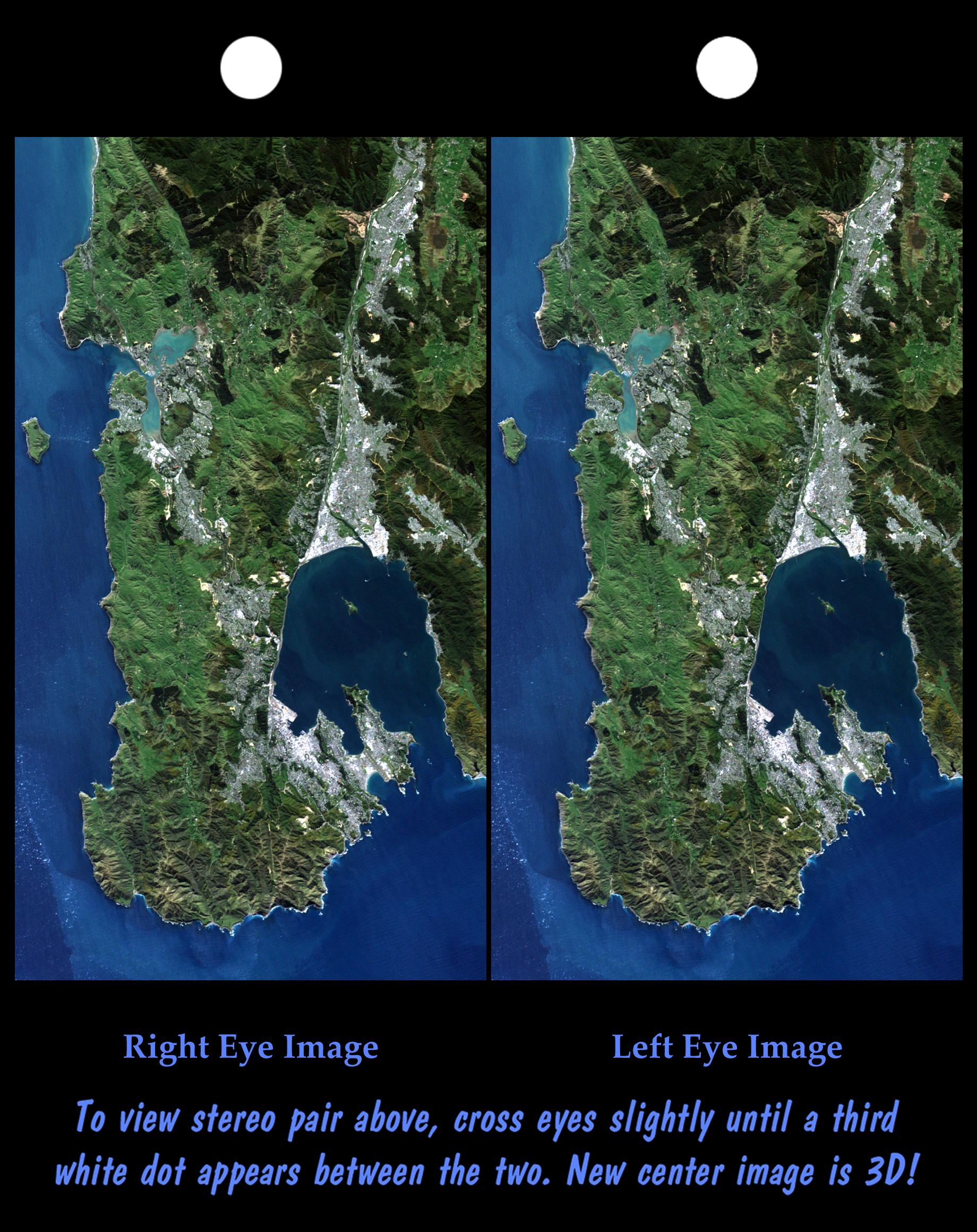
2000-05-11 |
Earth
|
Landsat
Shuttle Radar Topography Mission (SRTM)
|
C-Band Interferometric Radar
Thematic Mapper
|
1840x2320x3 |
|
-
PIA02749:
-
Stereo Pair: Wellington, New Zealand
Full Resolution:
TIFF
(9.859 MB)
JPEG
(619.5 kB)
|
|
|
2000-05-07 |
Eros
|
NEAR Shoemaker
|
Multi-Spectral Imager
|
500x531x3 |
|
-
PIA02473:
-
Eros' Global Morphology
Full Resolution:
TIFF
(207.5 kB)
JPEG
(38.08 kB)
|
|
|
2000-04-24 |
Amalthea
|
Galileo
|
Solid-State Imaging
|
860x410x1 |
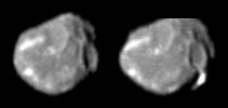
|
-
PIA02532:
-
Bright Streak on Amalthea
Full Resolution:
TIFF
(134.2 kB)
JPEG
(14.86 kB)
|
|
|
2000-04-13 |
Earth
|
Landsat
Shuttle Radar Topography Mission (SRTM)
|
C-Band Interferometric Radar
Thematic Mapper
|
1428x2200x3 |
|
-
PIA02743:
-
Stereo Pair, Lake Palanskoye Landslide, Kamchatka Peninsula, Russia
Full Resolution:
TIFF
(7.223 MB)
JPEG
(689.6 kB)
|
|
|
2000-03-10 |
Earth
|
Landsat
Shuttle Radar Topography Mission (SRTM)
|
C-Band Interferometric Radar
Thematic Mapper
|
1591x2005x3 |
|
-
PIA02738:
-
Stereo Pair, Honolulu, Oahu
Full Resolution:
TIFF
(6.849 MB)
JPEG
(439.6 kB)
|
|
|
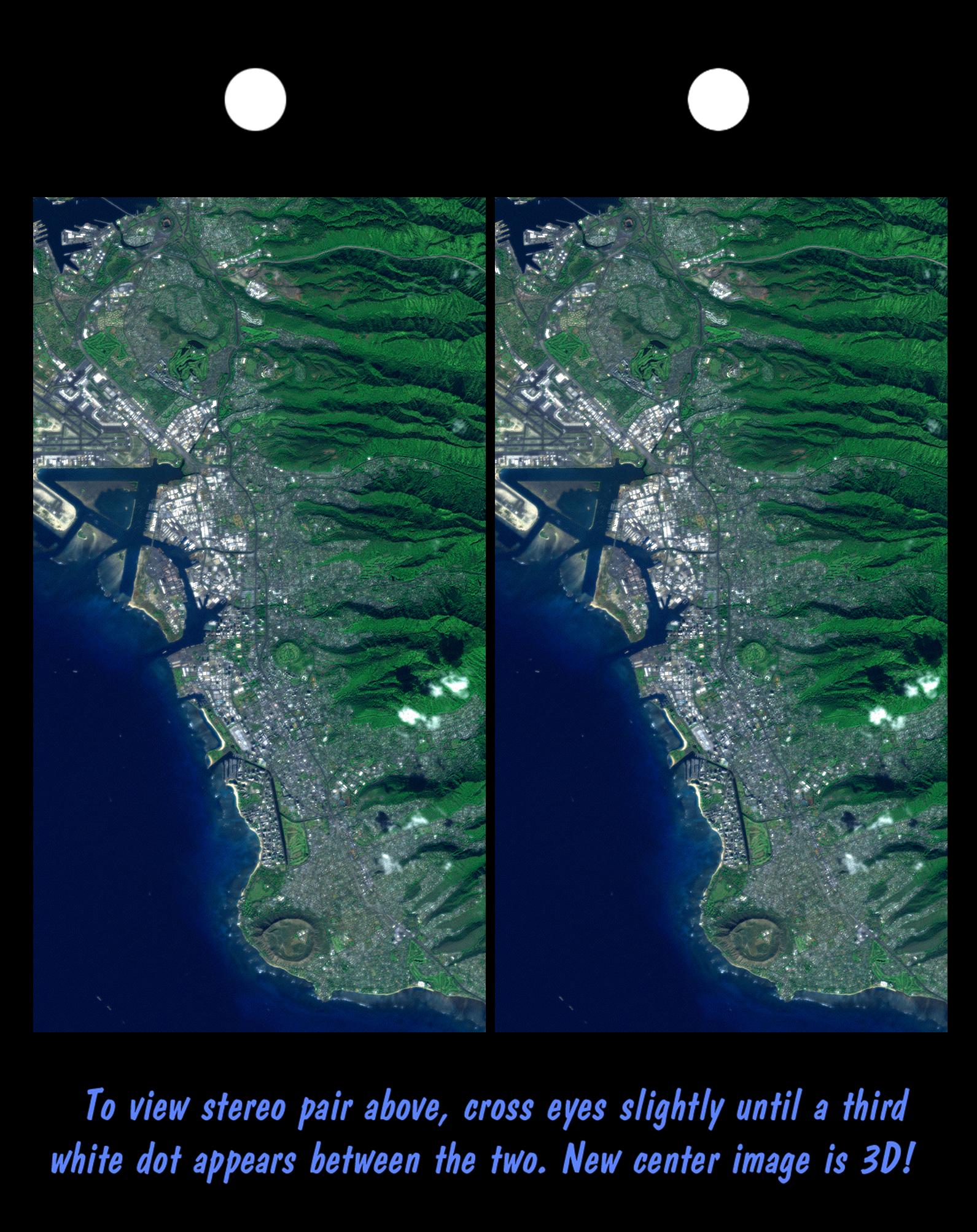
2000-03-10 |
Earth
|
Landsat
Shuttle Radar Topography Mission (SRTM)
|
C-Band Interferometric Radar
Thematic Mapper
|
2340x2069x3 |
|
-
PIA02737:
-
Stereo Pair, Pasadena, California
Full Resolution:
TIFF
(8.309 MB)
JPEG
(704.7 kB)
|
|
|
1999-09-08 |
Mars
|
Mars Pathfinder (MPF)
|
Imager for Mars Pathfinder
|
7296x3135x3 |
|
-
PIA02406:
-
Twin Peaks in Super Resolution - Right Eye
Full Resolution:
TIFF
(70.57 MB)
JPEG
(2.584 MB)
|
|
|
1999-09-08 |
Mars
|
Mars Pathfinder (MPF)
|
Imager for Mars Pathfinder
|
7238x3135x3 |
|
-
PIA02405:
-
Twin Peaks in Super Resolution - Left Eye
Full Resolution:
TIFF
(65.93 MB)
JPEG
(2.307 MB)
|
|
|
1999-07-02 |
Mars
|
Mars Pathfinder (MPF)
|
Imager for Mars Pathfinder
|
487x248x1 |
|
-
PIA01585:
-
Sojourner's APXS at "Chimp" - Right Eye
Full Resolution:
TIFF
(138.3 kB)
JPEG
(39.11 kB)
|
|
|
1999-07-02 |
Mars
|
Mars Pathfinder (MPF)
|
Rover Cameras
|
768x263x1 |
|
-
PIA01584:
-
Dunes, Big Crater and Twin Peaks - Left Eye
Full Resolution:
TIFF
(240.5 kB)
JPEG
(47.09 kB)
|
|
|
1999-07-02 |
Mars
|
Mars Pathfinder (MPF)
|
Imager for Mars Pathfinder
|
480x244x1 |

|
-
PIA01583:
-
Sojourner's Farthest Journey - Right Eye
Full Resolution:
TIFF
(124.1 kB)
JPEG
(31.93 kB)
|
|
|
1999-07-02 |
Mars
|
Mars Pathfinder (MPF)
|
Imager for Mars Pathfinder
|
477x245x1 |
|
-
PIA01582:
-
Sojourner's Farthest Journey - Left Eye
Full Resolution:
TIFF
(122.5 kB)
JPEG
(31.52 kB)
|
|
|
1999-07-02 |
Mars
|
Mars Pathfinder (MPF)
|
Imager for Mars Pathfinder
|
681x214x1 |
|
-
PIA01581:
-
Sojourner Rover Behind "Chimp" - Right Eye
Full Resolution:
TIFF
(175.6 kB)
JPEG
(48.65 kB)
|
|
|
1999-07-02 |
Mars
|
Mars Pathfinder (MPF)
|
Imager for Mars Pathfinder
|
681x220x1 |
|
-
PIA01580:
-
Sojourner Rover Behind "Chimp" - Left Eye
Full Resolution:
TIFF
(179.7 kB)
JPEG
(49.17 kB)
|
|
|
1999-07-02 |
Mars
|
Mars Pathfinder (MPF)
|
Rover Cameras
|
515x343x1 |
|
-
PIA01579:
-
Close-up View of "Chimp" - Right Eye
Full Resolution:
TIFF
(222.3 kB)
JPEG
(61.62 kB)
|
|
|
1999-07-02 |
Mars
|
Mars Pathfinder (MPF)
|
Rover Cameras
|
416x343x1 |
|
-
PIA01578:
-
Close-up View of "Chimp" - Left Eye
Full Resolution:
TIFF
(183 kB)
JPEG
(54.16 kB)
|
|
|
1999-07-02 |
Mars
|
Mars Pathfinder (MPF)
|
Rover Cameras
|
383x279x1 |
|
-
PIA01576:
-
North View from Sojourner - Left Eye
Full Resolution:
TIFF
(138.5 kB)
JPEG
(43.99 kB)
|
|
|
1999-07-02 |
Mars
|
Mars Pathfinder (MPF)
|
Rover Cameras
|
383x279x1 |
|
-
PIA01577:
-
North View from Sojourner - Right Eye
Full Resolution:
TIFF
(138.6 kB)
JPEG
(45.72 kB)
|
|
|
1999-07-02 |
Mars
|
Mars Pathfinder (MPF)
|
Rover Cameras
|
383x280x1 |
|
-
PIA01575:
-
Wind Tails Near "Chimp" - Right Eye
Full Resolution:
TIFF
(134.6 kB)
JPEG
(41.5 kB)
|
|
|
1999-07-02 |
Mars
|
Mars Pathfinder (MPF)
|
Rover Cameras
|
383x280x1 |

|
-
PIA01574:
-
Wind Tails Near "Chimp" - Left Eye
Full Resolution:
TIFF
(137 kB)
JPEG
(41.77 kB)
|
|
|
1999-07-02 |
Mars
|
Mars Pathfinder (MPF)
|
Imager for Mars Pathfinder
|
685x218x1 |
|
-
PIA01573:
-
Sojourner near "Chimp" - Right Eye
Full Resolution:
TIFF
(183 kB)
JPEG
(49.09 kB)
|
|
|
1999-07-02 |
Mars
|
Mars Pathfinder (MPF)
|
Imager for Mars Pathfinder
|
683x216x1 |

|
-
PIA01572:
-
Sojourner near "Chimp" - Left Eye
Full Resolution:
TIFF
(181.1 kB)
JPEG
(47.66 kB)
|
|
|
1999-07-02 |
Mars
|
Mars Pathfinder (MPF)
|
Rover Cameras
|
383x280x1 |

|
-
PIA01571:
-
Pits and Flutes on "Stimpy" - Right Eye
Full Resolution:
TIFF
(127 kB)
JPEG
(27.08 kB)
|
|
|
1999-07-02 |
Mars
|
Mars Pathfinder (MPF)
|
Rover Cameras
|
383x380x1 |
|
-
PIA01570:
-
Pits and Flutes on "Stimpy" - Left Eye
Full Resolution:
TIFF
(157.4 kB)
JPEG
(35.06 kB)
|
|
|
1999-07-02 |
Mars
|
Mars Pathfinder (MPF)
|
Imager for Mars Pathfinder
|
460x227x1 |

|
-
PIA01569:
-
Sojourner Rover Leaving the "Rock Garden" - Right Eye
Full Resolution:
TIFF
(119.1 kB)
JPEG
(31.94 kB)
|
|
|
1999-07-02 |
Mars
|
Mars Pathfinder (MPF)
|
Imager for Mars Pathfinder
|
455x227x1 |

|
-
PIA01568:
-
Sojourner Rover Leaving the "Rock Garden" - Left Eye
Full Resolution:
TIFF
(119.1 kB)
JPEG
(31.62 kB)
|
|
|
1999-07-02 |
Mars
|
Mars Pathfinder (MPF)
|
Rover Cameras
|
383x280x1 |
|
-
PIA01567:
-
"Half Dome" Rock - Right Eye
Full Resolution:
TIFF
(128.5 kB)
JPEG
(31.69 kB)
|
|
|
1999-07-02 |
Mars
|
Mars Pathfinder (MPF)
|
Rover Cameras
|
383x280x1 |
|
-
PIA01566:
-
"Half Dome" Rock - Left Eye
Full Resolution:
TIFF
(124.6 kB)
JPEG
(28.77 kB)
|
|
|
1999-07-02 |
Mars
|
Mars Pathfinder (MPF)
|
Rover Cameras
|
383x280x1 |
|
-
PIA01565:
-
Close-up of "Moe" - Right Eye
Full Resolution:
TIFF
(136.6 kB)
JPEG
(43.91 kB)
|
|
|
1999-07-02 |
Mars
|
Mars Pathfinder (MPF)
|
Rover Cameras
|
383x280x1 |
|
-
PIA01564:
-
Close-up of "Moe" - Left Eye
Full Resolution:
TIFF
(135.4 kB)
JPEG
(41.58 kB)
|
|
|
1999-07-02 |
Mars
|
Mars Pathfinder (MPF)
|
Imager for Mars Pathfinder
|
441x227x1 |
|
-
PIA01563:
-
Sojourner's APXS at "Stimpy" - Left Eye
Full Resolution:
TIFF
(123.3 kB)
JPEG
(37.35 kB)
|
|
|
1999-07-02 |
Mars
|
Mars Pathfinder (MPF)
|
Imager for Mars Pathfinder
|
455x447x1 |
|
-
PIA01562:
-
Sojourner Rover Backing Away from "Moe" - Right Eye
Full Resolution:
TIFF
(229.7 kB)
JPEG
(56.79 kB)
|
 Planetary Data System


