PDS logoPlanetary Data System
PDS Information
Find a Node - Use these links to navigate to any of the 8 publicly accessible PDS Nodes.

This bar indicates that you are within the PDS enterprise which includes 6 science discipline nodes and 2 support nodes which are overseen by the Project Management Office at NASA's Goddard Space Flight Center (GSFC). Each node is led by an expert in the subject discipline, supported by an advisory group of other practitioners of that discipline, and subject to selection and approval under a regular NASA Research Announcement.
Click here to return to the Photojournal Home Page Click here to view a list of Photojournal Image Galleries Photojournal_inner_header
Latest Images  |  Spacecraft & Technology  |  Animations  |  Space Images App  |  Feedback  |  Photojournal Search  
My Favorite Images from the Planetary Photojoural
I have 5 images in my list


The first time you select an image to My List, a separate browser window will open. This page will list the set of images you have selected as favorites from the Photojournal. This list is kept for a short period of time, approximately 60 days. The way we associate you with your list is through a persistent cookie left on your computer. This cookie is nothing more than a unique key that allows the Photojournal to make this association. Once created, this list is only modifiable from the same computer. Information stored in the cookie on your computer is used by the Photojournal server only during your session. If you configure your Web browser not to use cookies, you will not be able to create and refer back to a personal list of favorite images. To view your current list, click on a marked entry for your list from the catalog page, or add another favorite. For more information, see JPL's Privacy Policy.
My
List
Catalog # Target Mission Instrument Addition Date Size
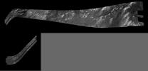
Remove Image from Favorite List PIA04392 Titan Cassini-Huygens
Radar Mapper
2008-02-22 4000x1923x1
These images were obtained by NASA's Cassini radar instrument during a flyby on Feb. 22, 2008. The radar antenna was pointing toward Titan at an altitude of 1,000 kilometers (621 miles) during the closest approach.
Title:
Titan Radar Swath (T-41 Flyby - Feb. 22, 2008)
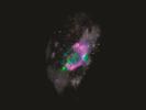
Remove Image from Favorite List PIA23895 Mars 2020 Project
Scanning Habitable Environments with Raman & Luminescence for Organics and Chemicals (SHERLOC)
2020-05-26 3214x2411x3
In this test image by SHERLOC, an instrument aboard NASA's Perseverance rover, each color represents a different mineral detected on a rock's surface.
Title:
Mineral Map Created During a Test of SHERLOC
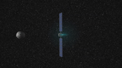
Remove Image from Favorite List PIA14123 Vesta Dawn
Framing Camera
2011-06-23 1280x720x3
This frame from a movie presents a series of animations showing NASA's Dawn spacecraft traveling to and operating at the giant asteroid Vesta.
Title:
Animation of Dawn's Visit to Vesta Animation Icon
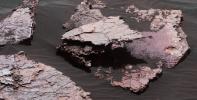
Remove Image from Favorite List PIA21263 Mars Mars Science Laboratory (MSL)
Mastcam
2017-01-17 4229x2149x3
A grid of small polygons on the Martian rock surface near the right edge of this view may have originated as cracks in drying mud more than 3 billion years ago. Multiple images of this view were combined for this view from NASA's Curiosity Mars rover.
Title:
Possible Signs of Ancient Drying in Martian Rock
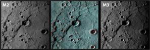
Remove Image from Favorite List PIA12282 Mercury MESSENGER
MDIS - Narrow Angle
2009-10-06 1561x525x3
Rembrandt in 3-D!
Title:
Rembrandt in 3-D!