My
List |
Addition Date
|
Target
|
Mission
|
Instrument
|
Size
|

|
2016-03-30 |
|
Spitzer Space Telescope
|
|
3300x2550x3 |
|
-
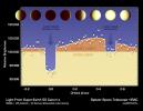
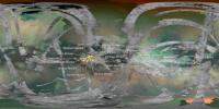
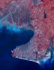
PIA20069:
-
Hot N' Hotter Planet Measured by Spitzer
Full Resolution:
TIFF
(2.151 MB)
JPEG
(402.8 kB)
|
|
|
2016-03-30 |
|
Spitzer Space Telescope
|
|
3840x2160x3 |
|
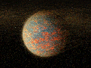
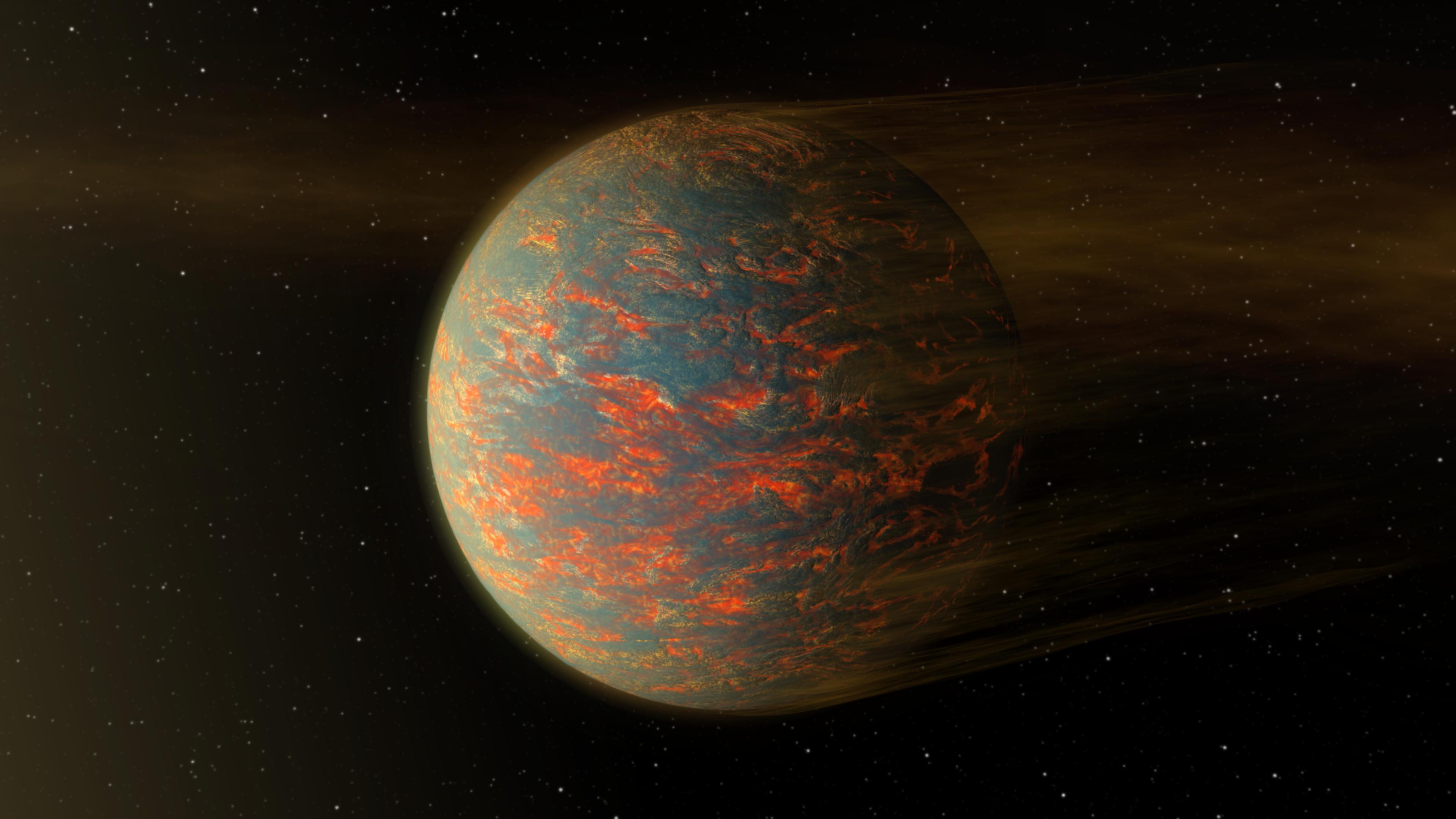
-
PIA20068:
-
Hot-Lava World Illustration

Full Resolution:
TIFF
(14.58 MB)
JPEG
(477 kB)
|
|
|
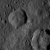
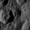
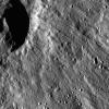
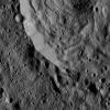
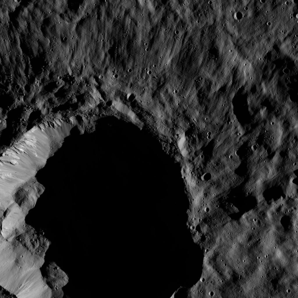
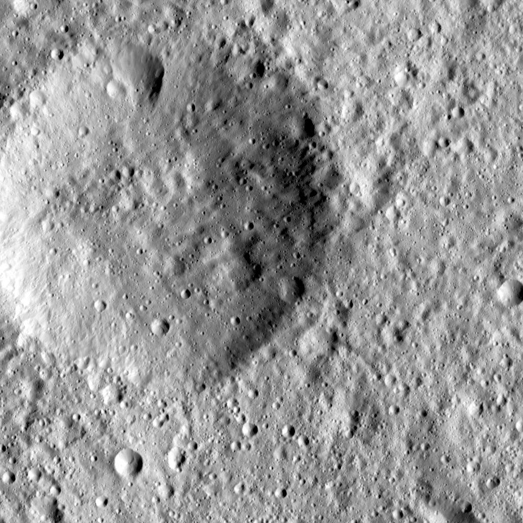
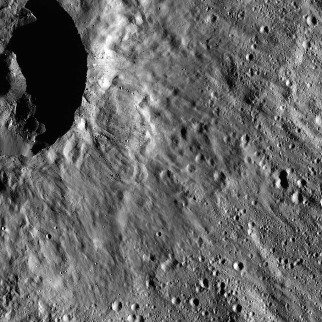
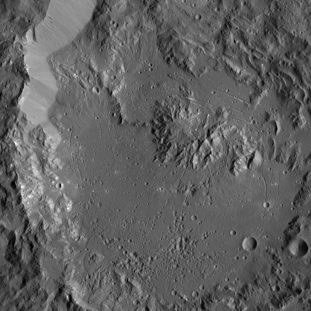
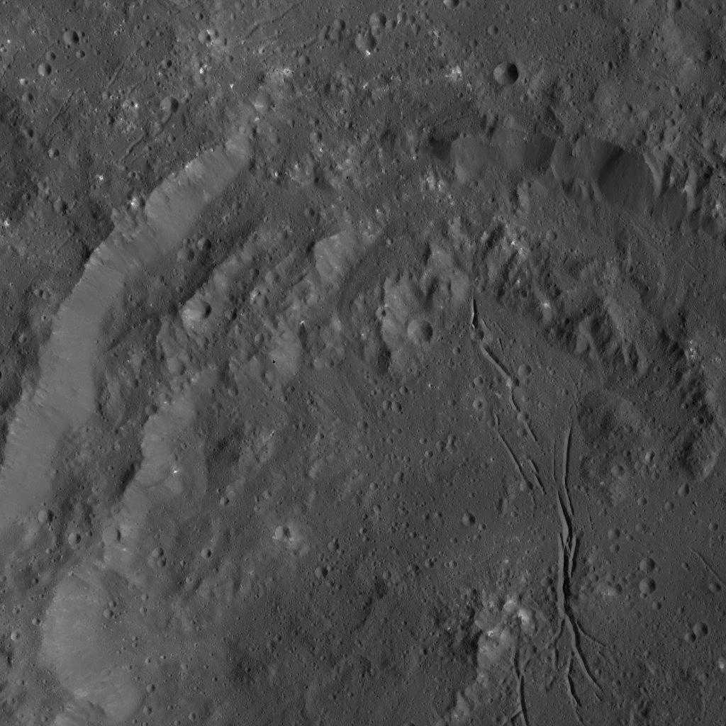
2016-03-30 |
Ceres
|
Dawn
|
Framing Camera
|
1024x1024x1 |
|
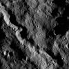
-
PIA20551:
-
Dawn LAMO Image 56
Full Resolution:
TIFF
(1.046 MB)
JPEG
(204.4 kB)
|
|
|
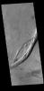
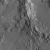
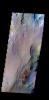
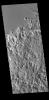
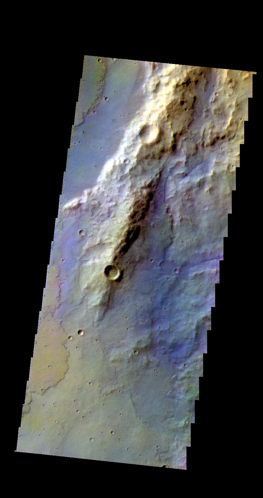
2016-03-30 |
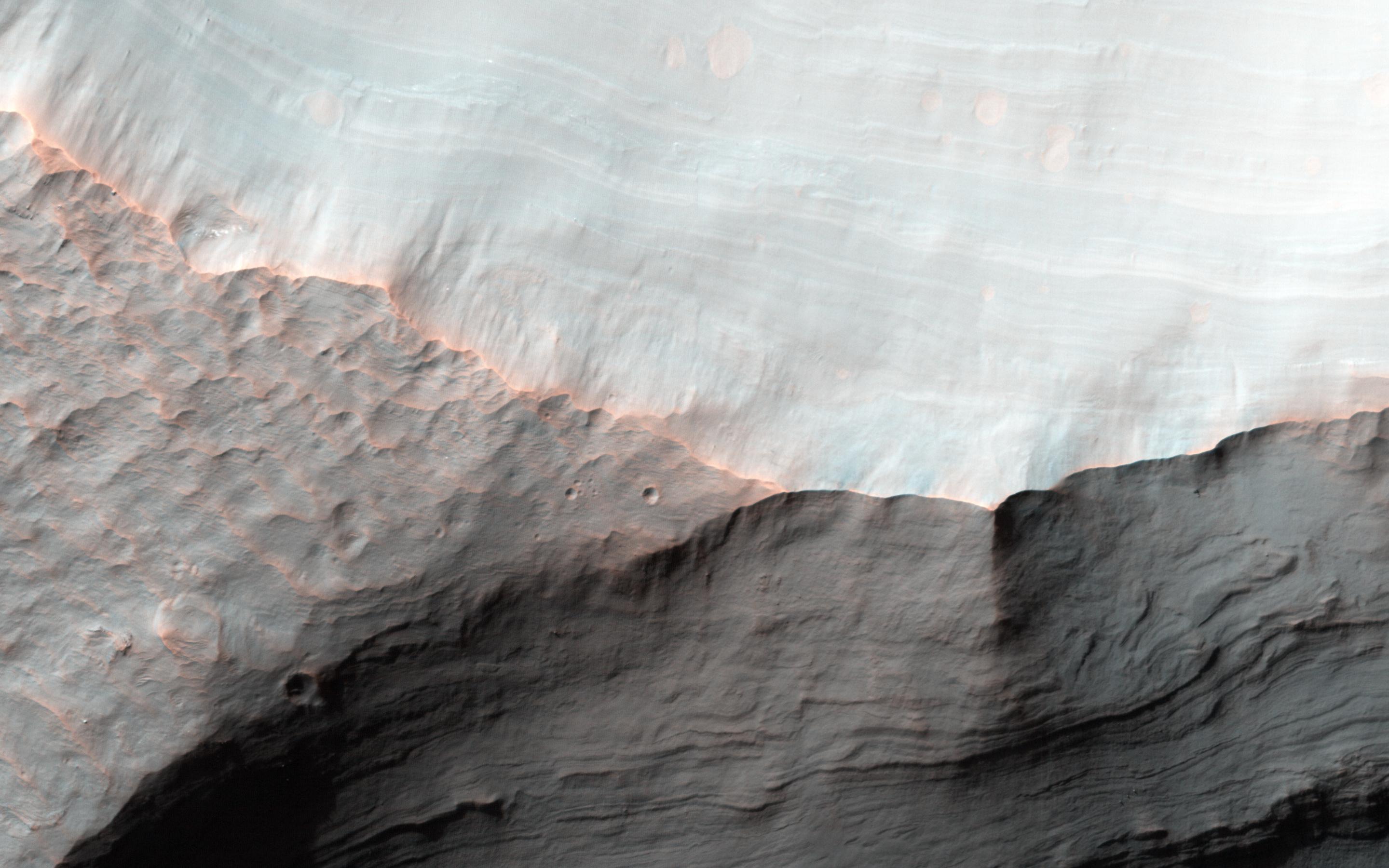
Mars
|
2001 Mars Odyssey
|
THEMIS
|
1389x2641x1 |

|
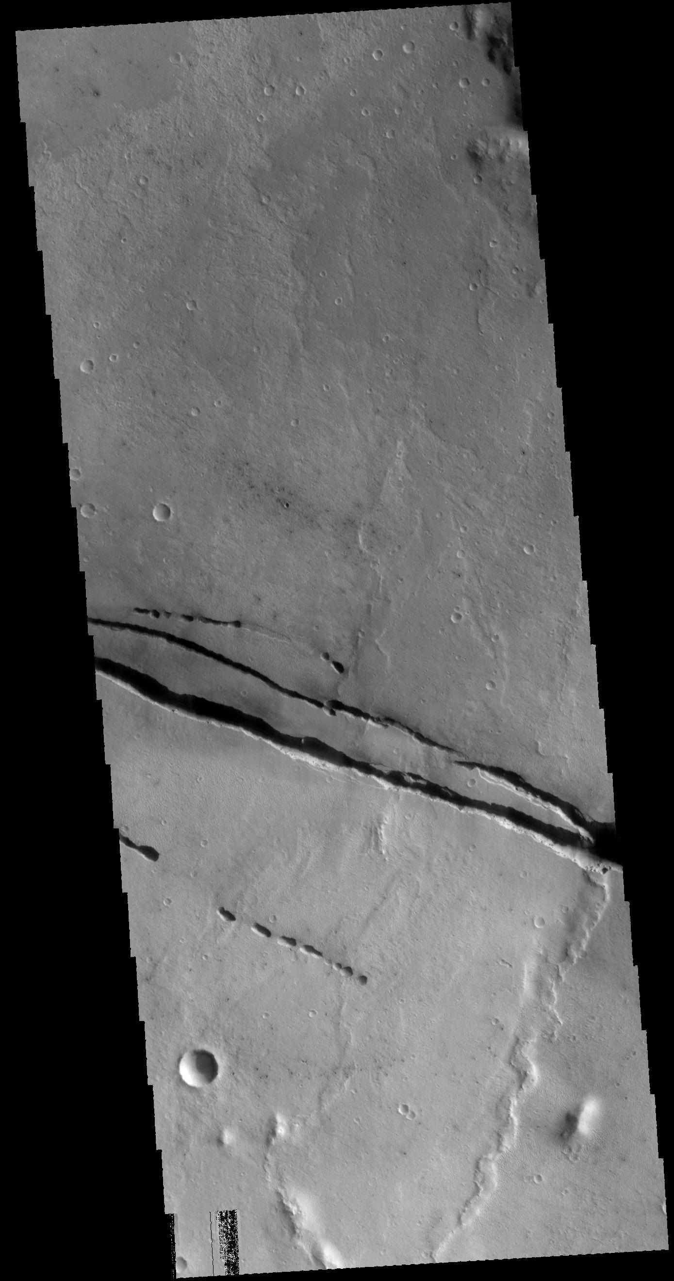
-
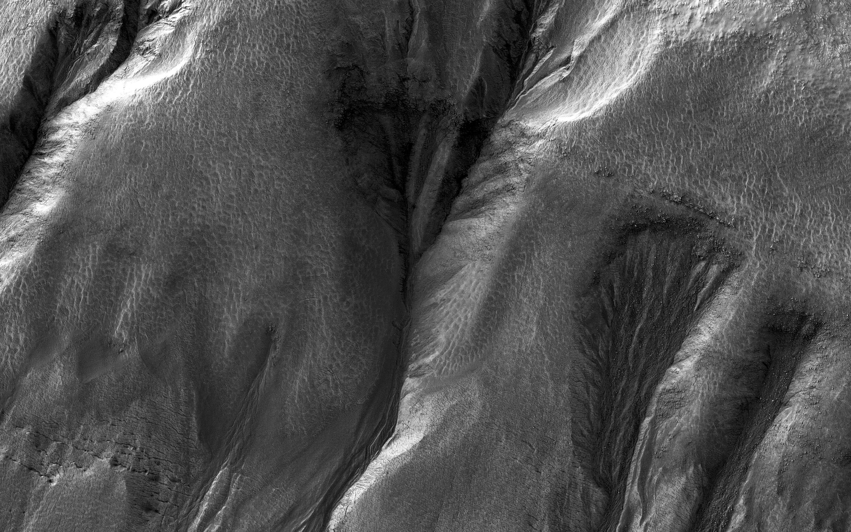
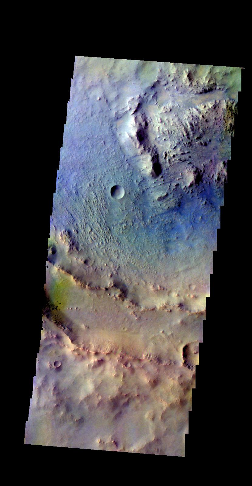
PIA20439:
-
Cerberus Fossae
Full Resolution:
TIFF
(2.542 MB)
JPEG
(324.6 kB)
|
|
|
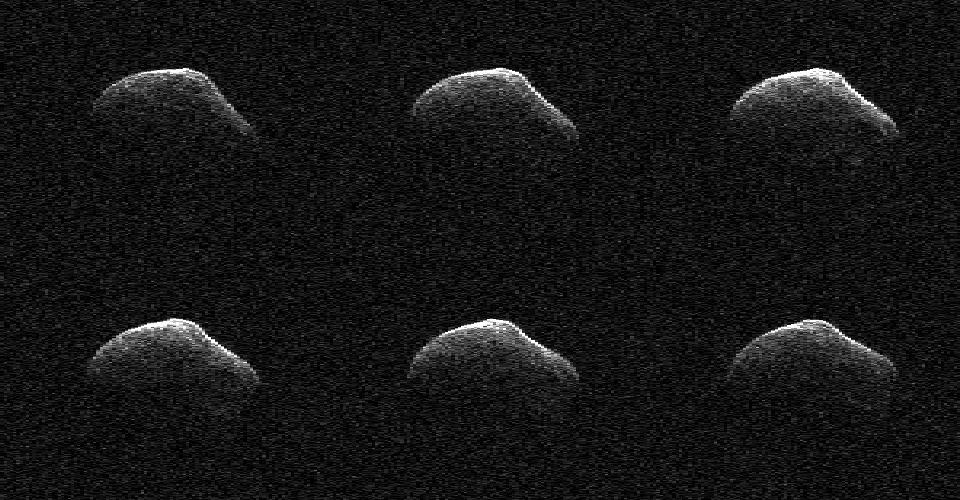
2016-03-29 |
Comet
|
Goldstone Deep Space Network (DSN)
|
Goldstone Solar System Radar
|
900x750x1 |
|
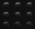
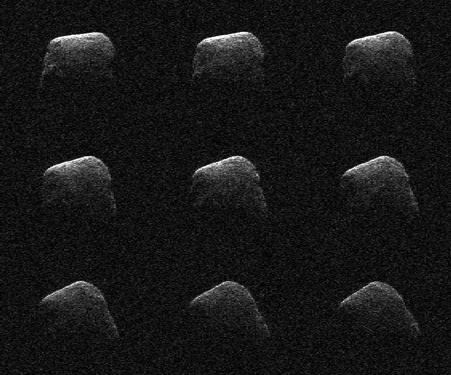
-
PIA19298:
-
Comet Scanned by NASA Radar
Full Resolution:
TIFF
(643.9 kB)
JPEG
(155.5 kB)
|
|
|
2016-03-29 |
Ceres
|
Dawn
|
Framing Camera
|
1024x1024x1 |
|
-
PIA20410:
-
Dawn LAMO Image 55
Full Resolution:
TIFF
(1.05 MB)
JPEG
(140.9 kB)
|
|
|
2016-03-29 |
Mars
|
2001 Mars Odyssey
|
THEMIS
|
703x1439x1 |
|
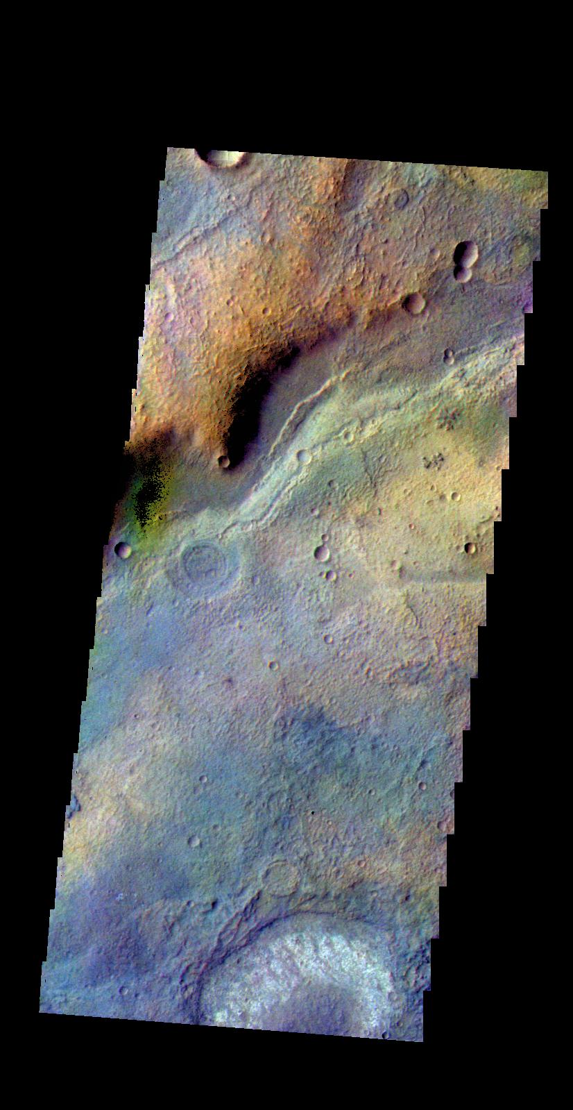
-
PIA20438:
-
Olympica Fossae
Full Resolution:
TIFF
(741.5 kB)
JPEG
(120.3 kB)
|
|
|
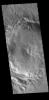
2016-03-28 |
Ceres
|
Dawn
|
Framing Camera
|
1024x1024x1 |

|
-
PIA20409:
-
Dawn LAMO Image 54
Full Resolution:
TIFF
(887.1 kB)
JPEG
(140.3 kB)
|
|
|
2016-03-28 |
|
Spitzer Space Telescope
|
|
2550x2550x3 |
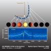
|
-
PIA20067:
-
HD 80606b Light Curve
Full Resolution:
TIFF
(1.47 MB)
JPEG
(354.4 kB)
|
|
|
2016-03-28 |
|
Spitzer Space Telescope
|
|
1920x1080x3 |
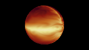
|
-
PIA20066:
-
Simulated Atmosphere of a Hot Gas Giant
Full Resolution:
TIFF
(1.294 MB)
JPEG
(52.89 kB)
|
|
|
2016-03-28 |
Mars
|
2001 Mars Odyssey
|
THEMIS
|
1185x2608x1 |
|
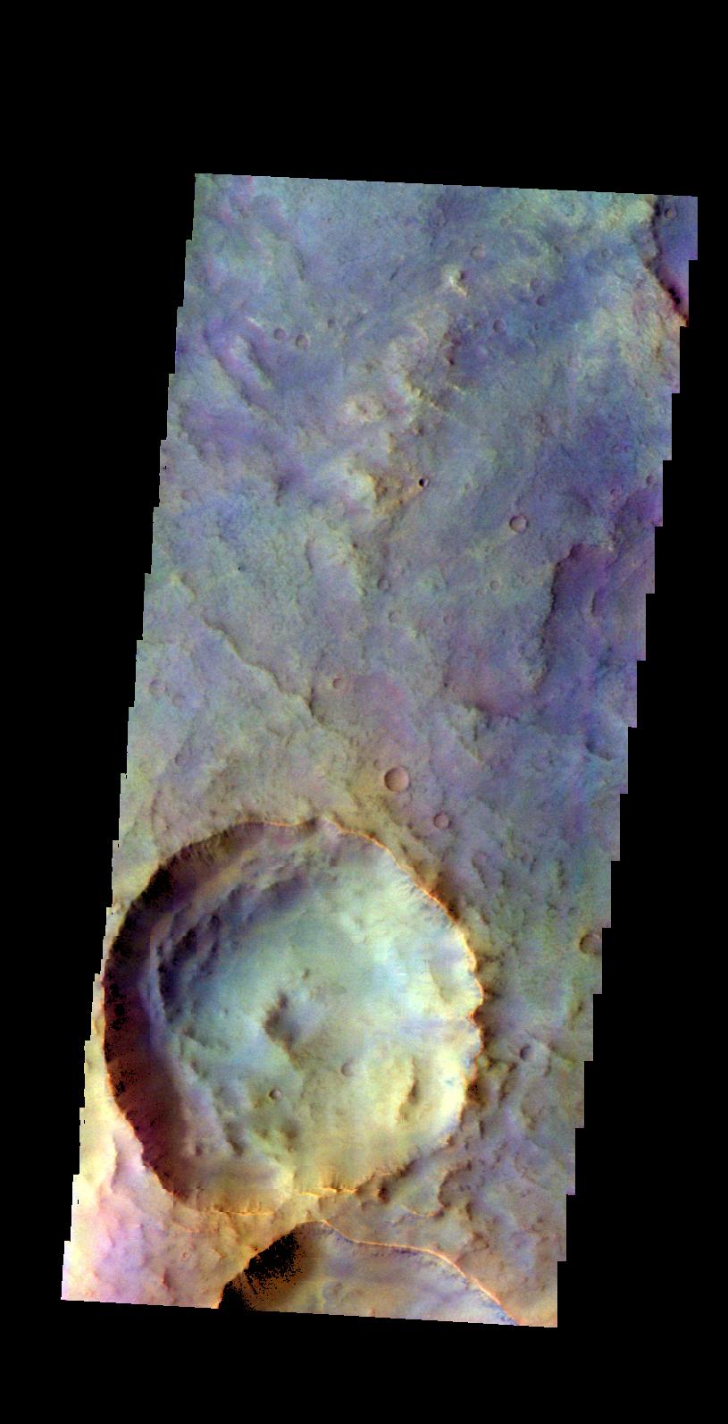
-
PIA20436:
-
More Olympia Undae
Full Resolution:
TIFF
(2.706 MB)
JPEG
(325.4 kB)
|
|
|
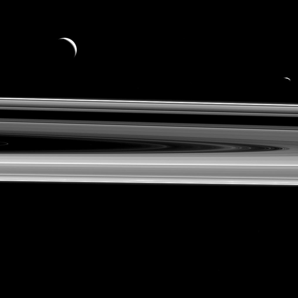
2016-03-28 |
S Rings
|
Cassini-Huygens
|
ISS - Narrow Angle
|
1016x1016x1 |
|
-
PIA18360:
-
Dark Moons, Dark Rings
Full Resolution:
TIFF
(243.4 kB)
JPEG
(40.83 kB)
|
|
|
2016-03-25 |
Ceres
|
Dawn
|
Framing Camera
|
1024x1024x1 |
|
-
PIA20408:
-
Dawn LAMO Image 53
Full Resolution:
TIFF
(1.05 MB)
JPEG
(192.6 kB)
|
|
|
2016-03-25 |
Mars
|
2001 Mars Odyssey
|
THEMIS
|
1179x2587x1 |
|
-
PIA20435:
-
Olympia Undae
Full Resolution:
TIFF
(2.953 MB)
JPEG
(415.4 kB)
|
|
|
2016-03-24 |
Comet
|
Goldstone Deep Space Network (DSN)
|
Goldstone Solar System Radar
|
960x500x1 |
|
-
PIA20542:
-
Comet Frozen In Time by NASA Radar
Full Resolution:
TIFF
(452.2 kB)
JPEG
(109.6 kB)
|
|
|
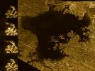
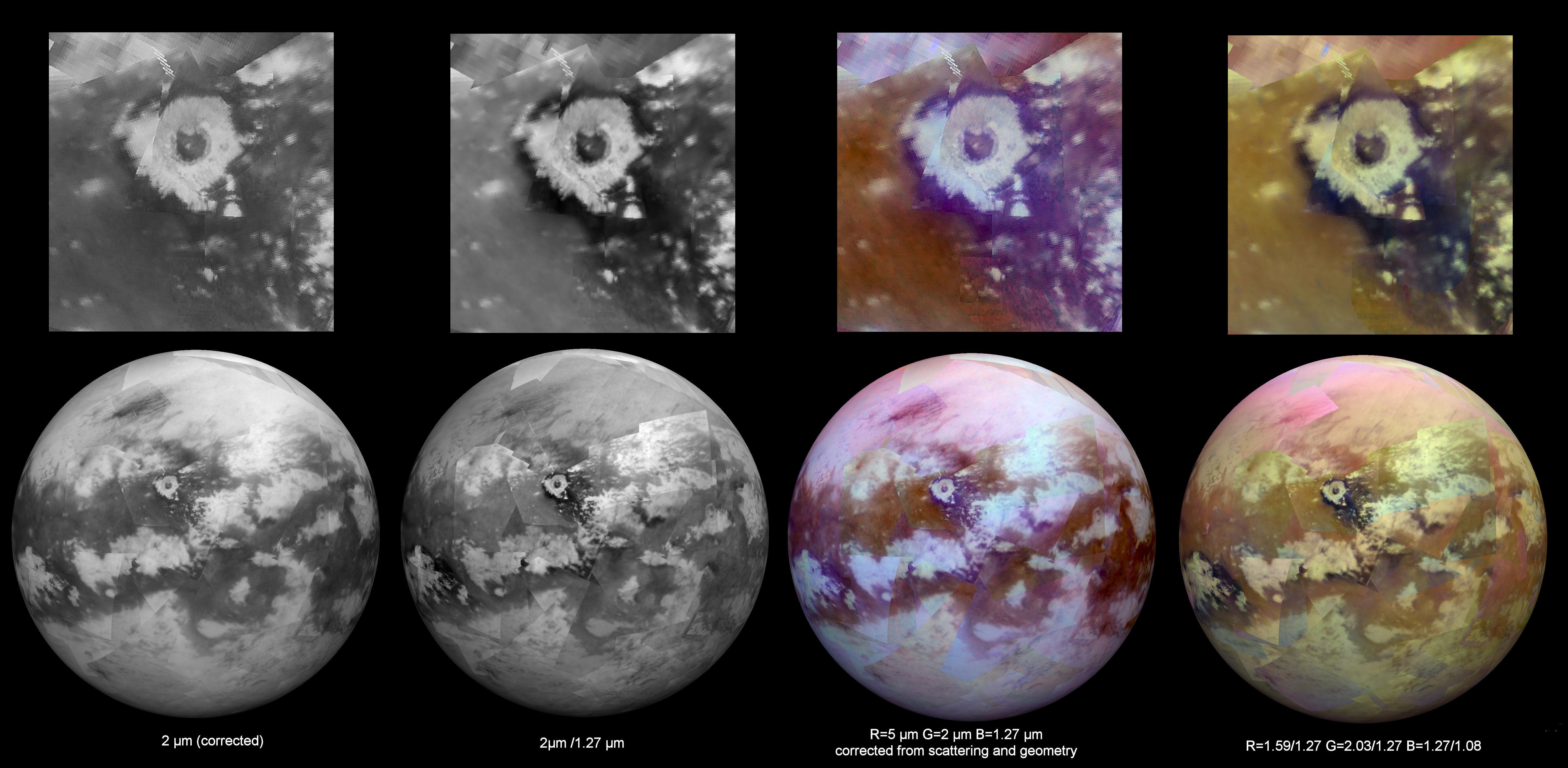
2016-03-24 |
Titan
|
Cassini-Huygens
|
Visual and Infrared Mapping Spectrometer
|
5675x2780x3 |
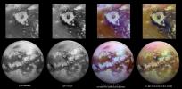
|
-
PIA20022:
-
Working Toward 'Seamless' Infrared Maps of Titan
Full Resolution:
TIFF
(23.51 MB)
JPEG
(1.041 MB)
|
|
|
2016-03-24 |
Sol (our sun)
|
SDO
|
Atmosphere Imaging Assembly
|
720x543x3 |
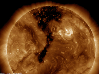
|
-
PIA19178:
-
Elongated Coronal Hole
Full Resolution:
TIFF
(961.2 kB)
JPEG
(37.28 kB)
|
|
|
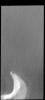
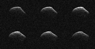
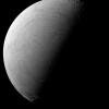
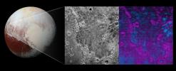
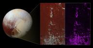
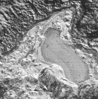
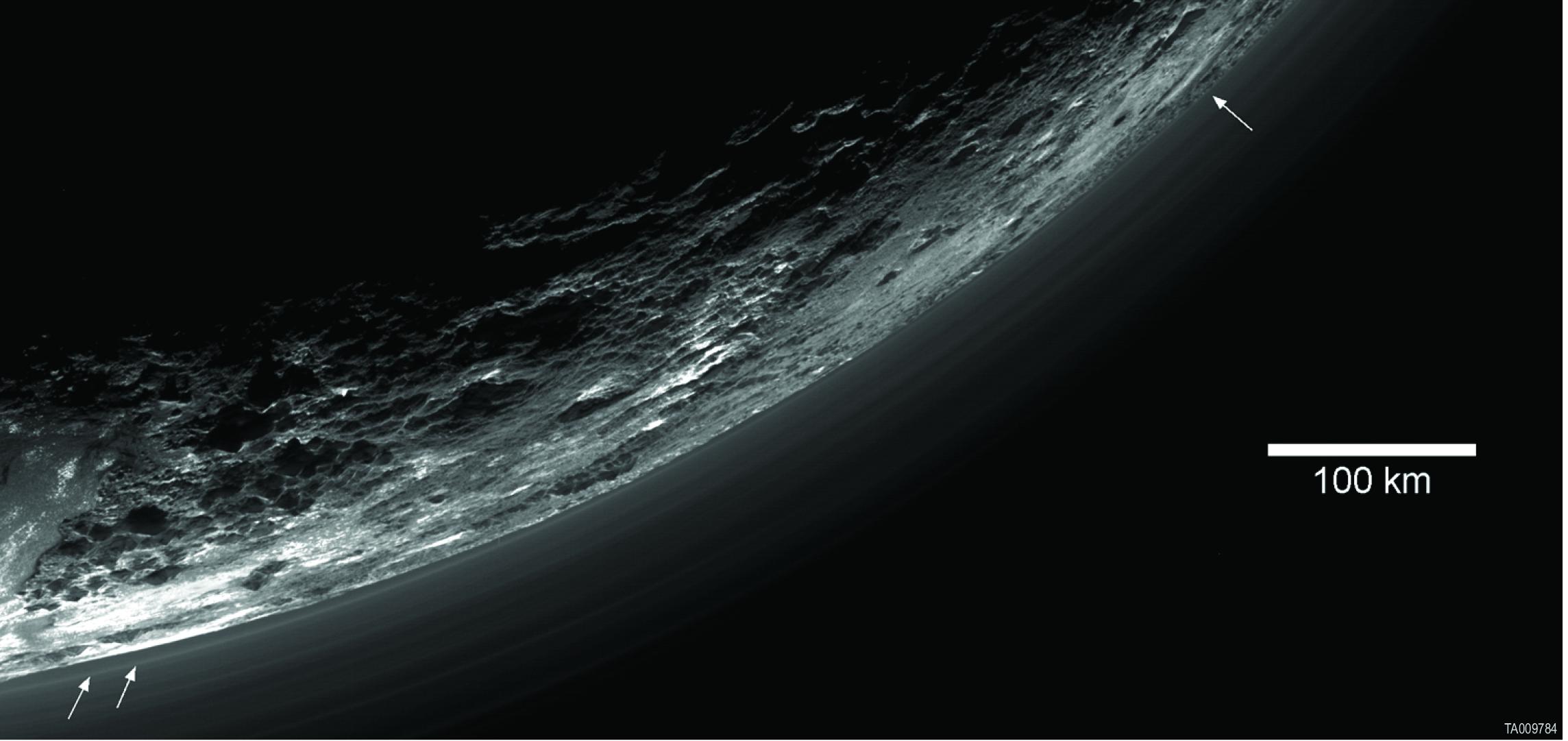
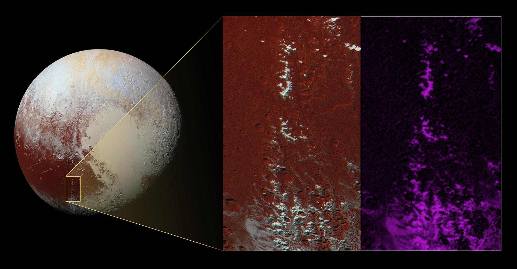
2016-03-24 |
Pluto
|
New Horizons
|
LORRI
|
344x348x1 |

|
-
PIA20543:
-
Pluto: On Frozen Pond
Full Resolution:
TIFF
(120.1 kB)
JPEG
(26.25 kB)
|
|
|
2016-03-24 |
Ceres
|
Dawn
|
Framing Camera
|
1024x1024x1 |
|
-
PIA20407:
-
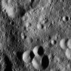
Dawn LAMO Image 52
Full Resolution:
TIFF
(863.8 kB)
JPEG
(137.9 kB)
|
|
|
2016-03-24 |
Mars
|
2001 Mars Odyssey
|
THEMIS
|
1170x2595x1 |

|
-
PIA20434:
-
Polar Cap Layers
Full Resolution:
TIFF
(2.617 MB)
JPEG
(298.5 kB)
|
|
|
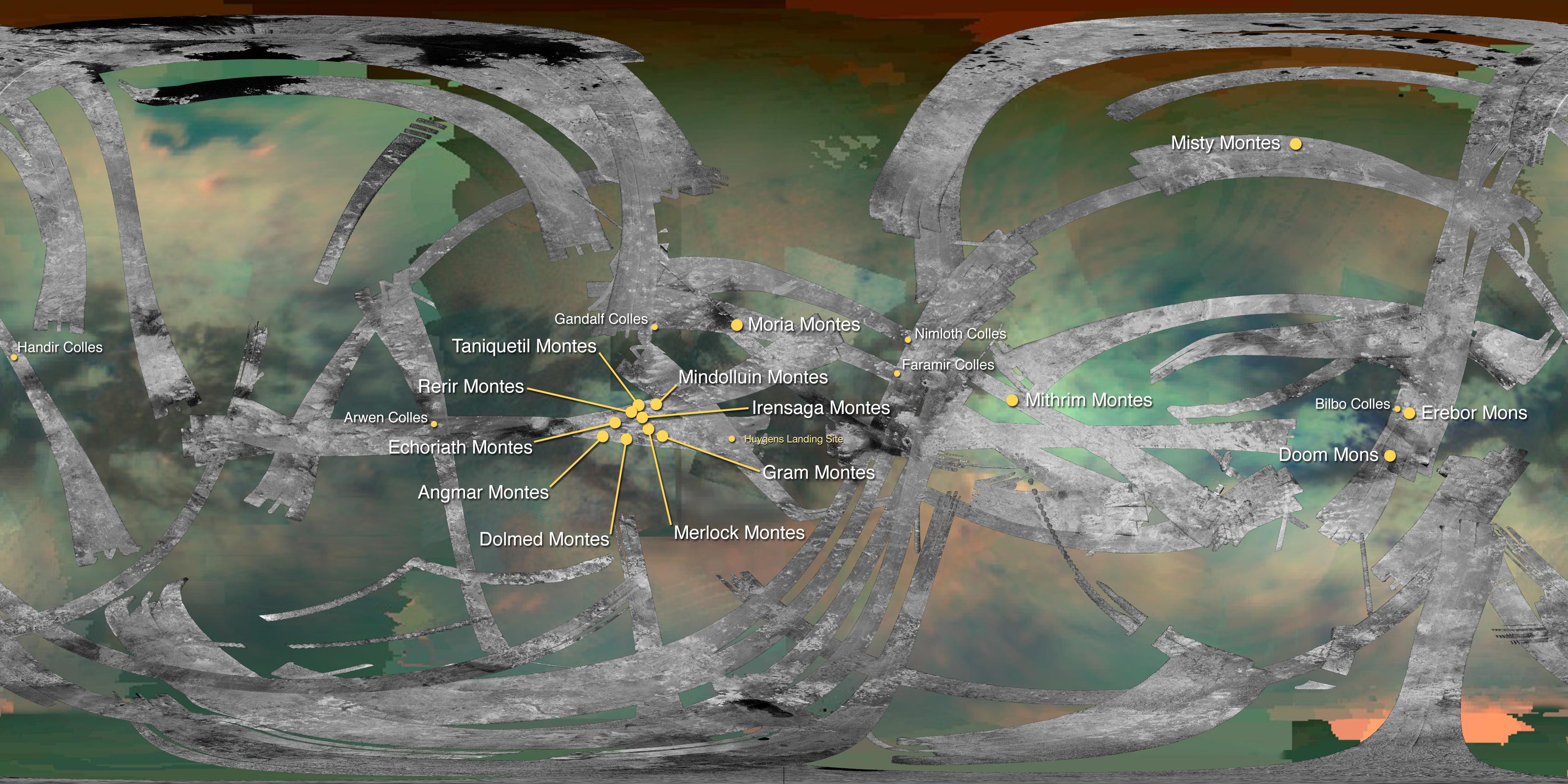
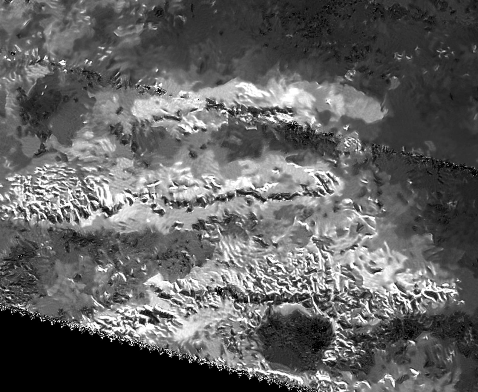
2016-03-24 |
Titan
|
Cassini-Huygens
|
Radar Mapper
Visual and Infrared Mapping Spectrometer
|
4043x2021x3 |
|
-
PIA20024:
-
Mountains of Titan Map - 2016 Update
Full Resolution:
TIFF
(17.24 MB)
JPEG
(1.082 MB)
|
|
|
2016-03-24 |
Titan
|
Cassini-Huygens
|
Radar Mapper
|
1600x1313x1 |

|
-
PIA20023:
-
Radar View of Titan's Tallest Mountains
Full Resolution:
TIFF
(2.032 MB)
JPEG
(264.3 kB)
|
|
|
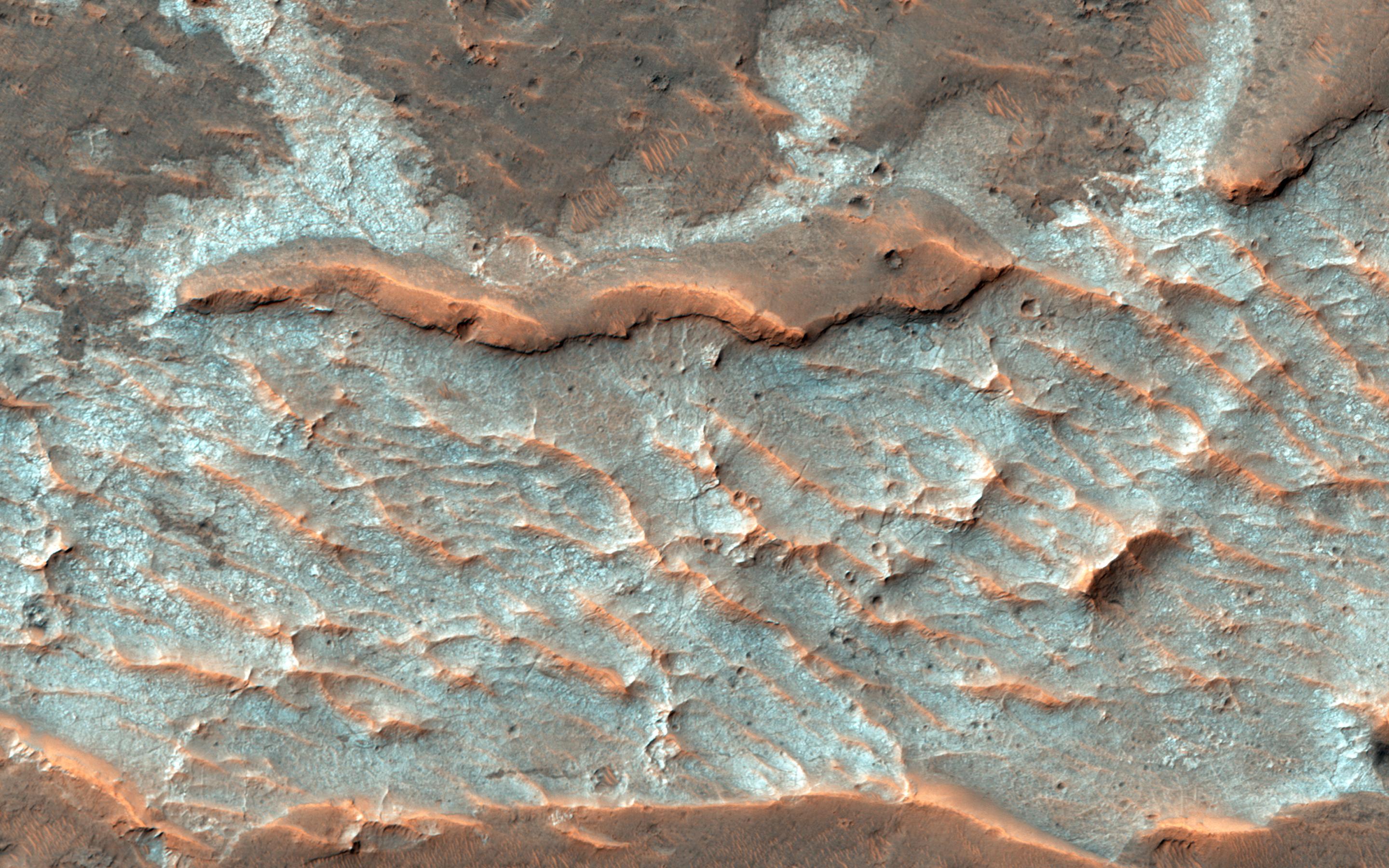
2016-03-23 |
Mars
|
Mars Reconnaissance Orbiter (MRO)
|
HiRISE
|
2880x1800x3 |

|
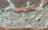
-
PIA20541:
-
Colorful Polar Layered Deposits
Full Resolution:
TIFF
(15.56 MB)
JPEG
(1.428 MB)
|
|
|
2016-03-23 |
Mars
|
Mars Reconnaissance Orbiter (MRO)
|
HiRISE
|
2880x1800x3 |
|
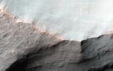
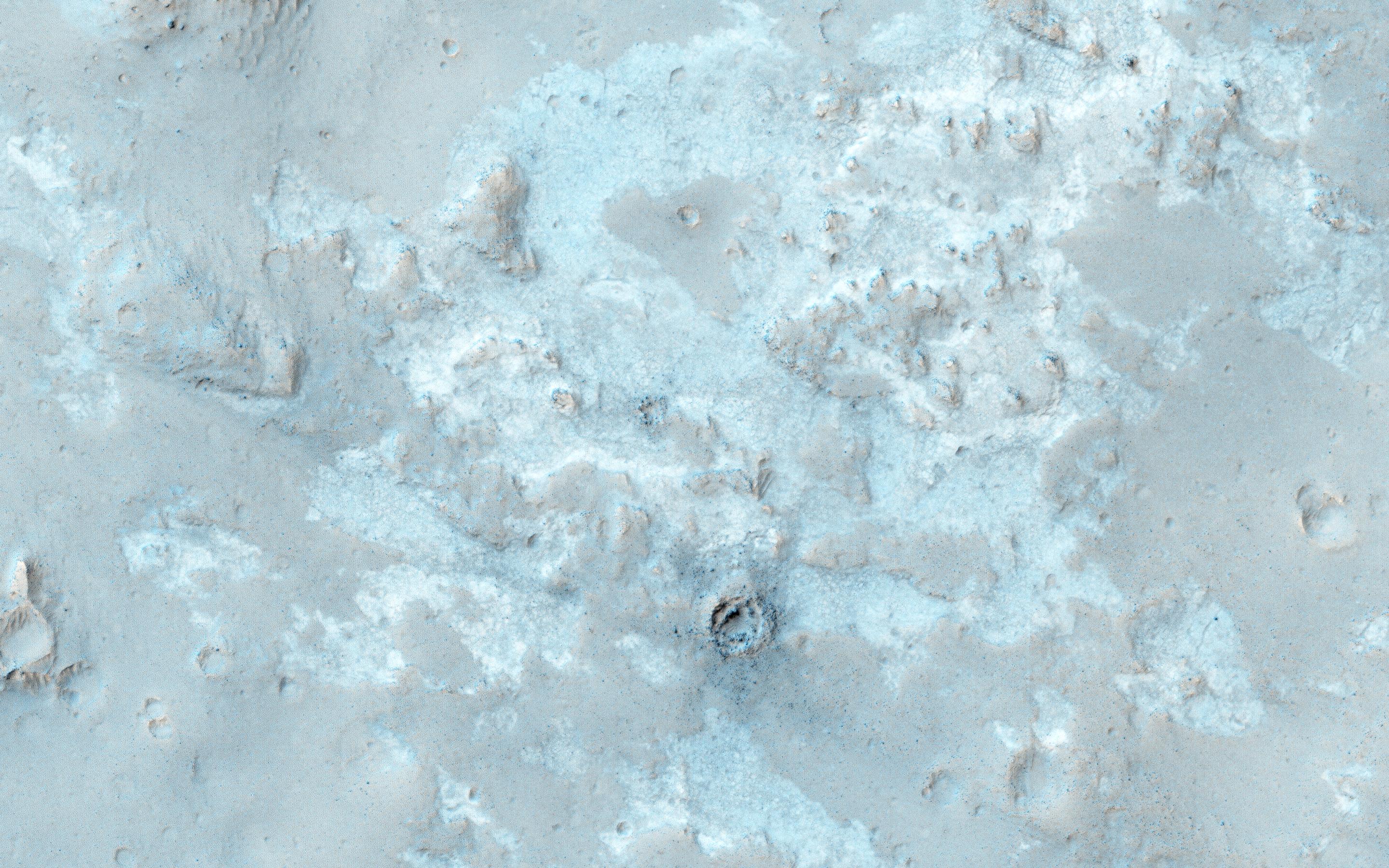
-
PIA20540:
-
Looking for Ice
Full Resolution:
TIFF
(15.56 MB)
JPEG
(1.829 MB)
|
|
|
2016-03-23 |
Mars
|
Mars Reconnaissance Orbiter (MRO)
|
HiRISE
|
2880x1800x3 |
|
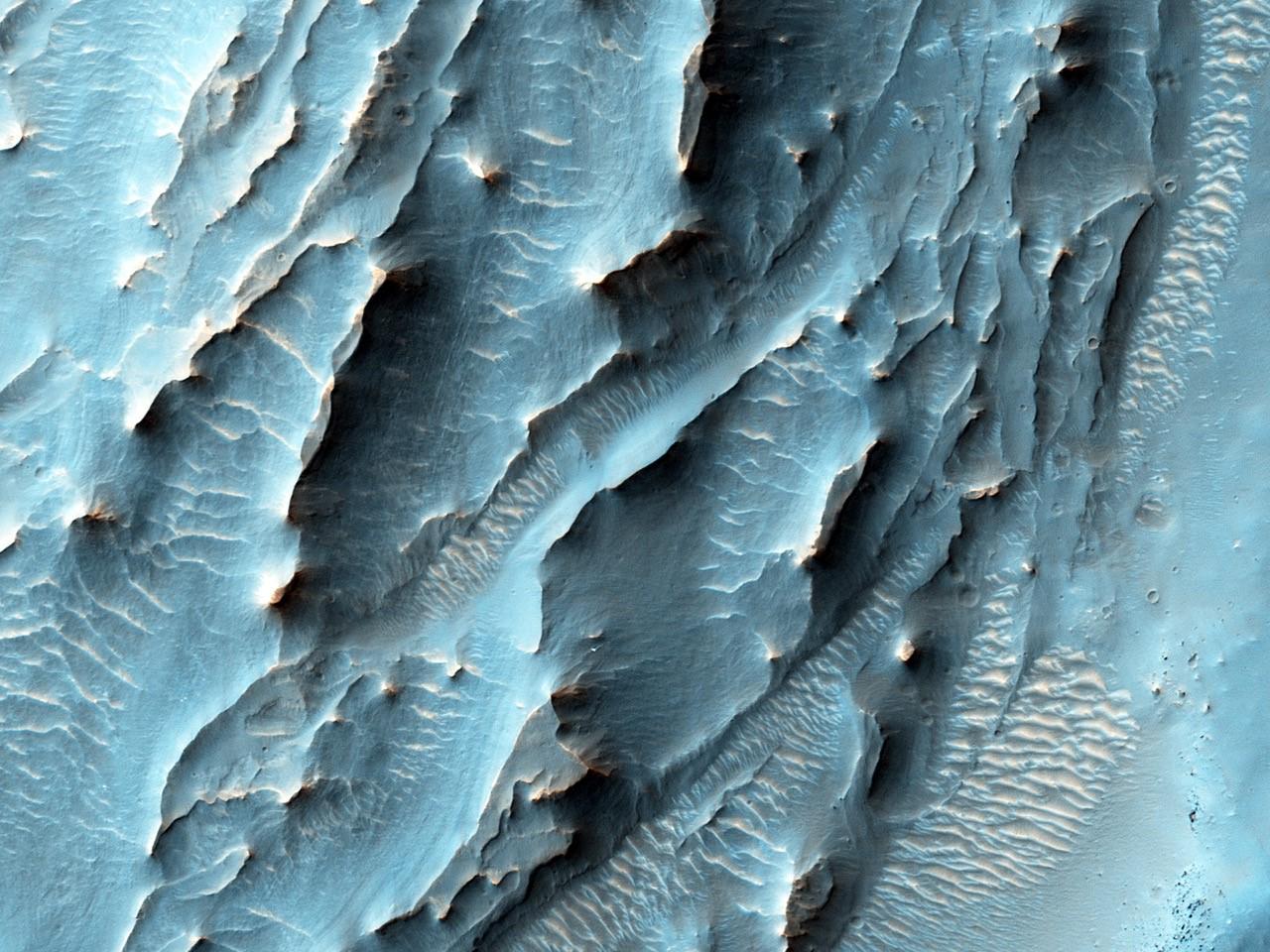
-
PIA20539:
-
Old Salt
Full Resolution:
TIFF
(15.56 MB)
JPEG
(803.7 kB)
|
|
|
2016-03-23 |
Mars
|
Mars Reconnaissance Orbiter (MRO)
|
HiRISE
|
2880x1800x3 |
|
-
PIA20538:
-
Stratigraphy of Alluvial Fans in Saheki Crater
Full Resolution:
TIFF
(13.24 MB)
JPEG
(436.8 kB)
|
|
|
2016-03-23 |
Ceres
|
Dawn
|
Framing Camera
|
1024x1024x1 |
|
-
PIA20406:
-
Dawn LAMO Image 51
Full Resolution:
TIFF
(1.05 MB)
JPEG
(145.1 kB)
|
|
|
2016-03-23 |
Mars
|
2001 Mars Odyssey
|
THEMIS
|
1183x2591x1 |
|
-
PIA20433:
-
Olympia Undae
Full Resolution:
TIFF
(3.032 MB)
JPEG
(433.2 kB)
|
|
|
2016-03-22 |
Ceres
|
Dawn
|
Framing Camera
|
640x360x3 |
|
-
PIA20537:
-
Unveiling Ceres (Animation)
Full Resolution:
TIFF
(178.3 kB)
JPEG
(18.84 kB)
|
|
|
2016-03-22 |
Ceres
|
Dawn
|
Framing Camera
|
1264x632x1 |
|
-
PIA20356:
-
Ceres LAMO Coverage Map
Full Resolution:
TIFF
(648 kB)
JPEG
(186.5 kB)
|
|
|
2016-03-22 |
Ceres
|
Dawn
|
Framing Camera
|
1704x868x3 |
|
-
PIA20355:
-
Center of Occator Crater (Enhanced Color)
Full Resolution:
TIFF
(2.21 MB)
JPEG
(99.78 kB)
|
|
|
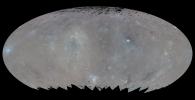
2016-03-22 |
Ceres
|
Dawn
|
Framing Camera
|
4000x2000x3 |
|
-
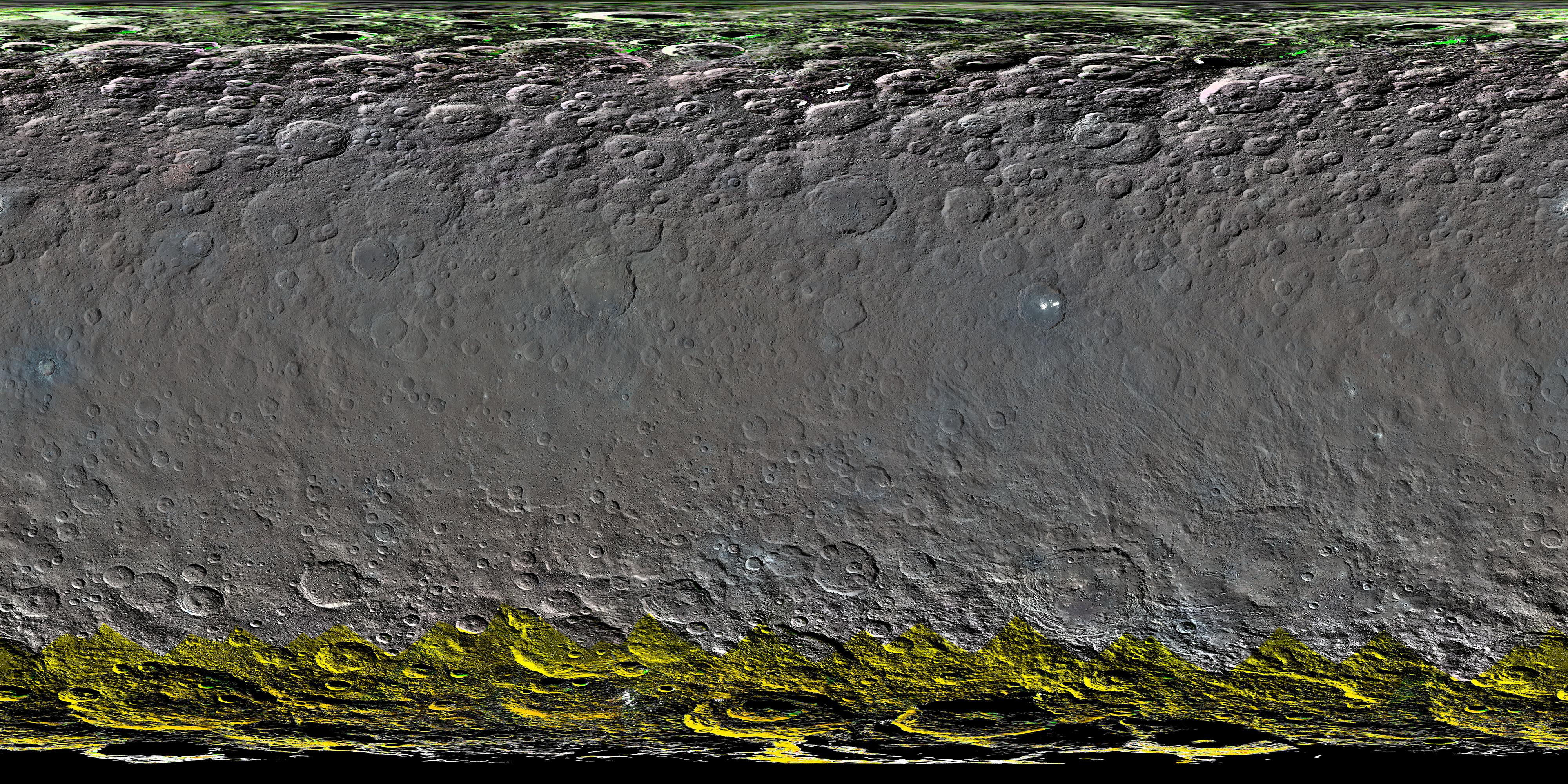
PIA20354:
-
Colorized Map of Ceres (Mercator Projection)
Full Resolution:
TIFF
(22.23 MB)
JPEG
(2.454 MB)
|
|
|
2016-03-22 |
Ceres
|
Dawn
|
Gamma Ray Spectrometer Suite
|
2011x1132x3 |

|
-
PIA20353:
-
Ceres Neutron Counts Reflect Hydrogen Abundance
Full Resolution:
TIFF
(2.622 MB)
JPEG
(135.2 kB)
|
|
|
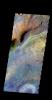
2016-03-22 |
Ceres
|
Dawn
|
VIR
|
2366x1331x3 |
|
-
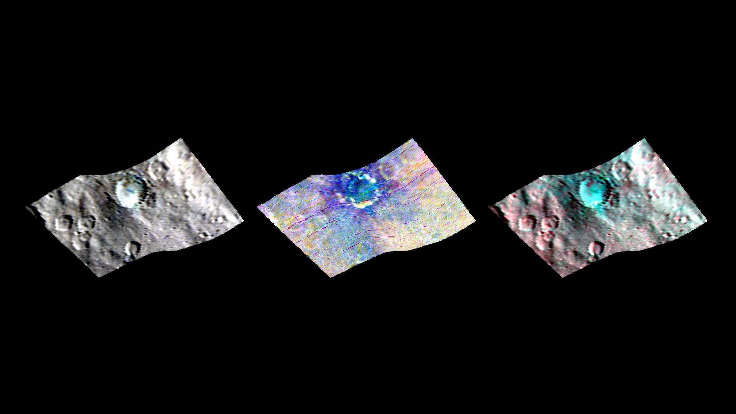
PIA20352:
-
Haulani Crater in Infrared
Full Resolution:
TIFF
(2.026 MB)
JPEG
(157.6 kB)
|
|
|
2016-03-22 |
Ceres
|
Dawn
|
Framing Camera
|
4000x2051x3 |
|
-
PIA20351:
-
Color Map of Ceres (Elliptical Projection)
Full Resolution:
TIFF
(16.64 MB)
JPEG
(1.736 MB)
|
|
|
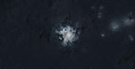
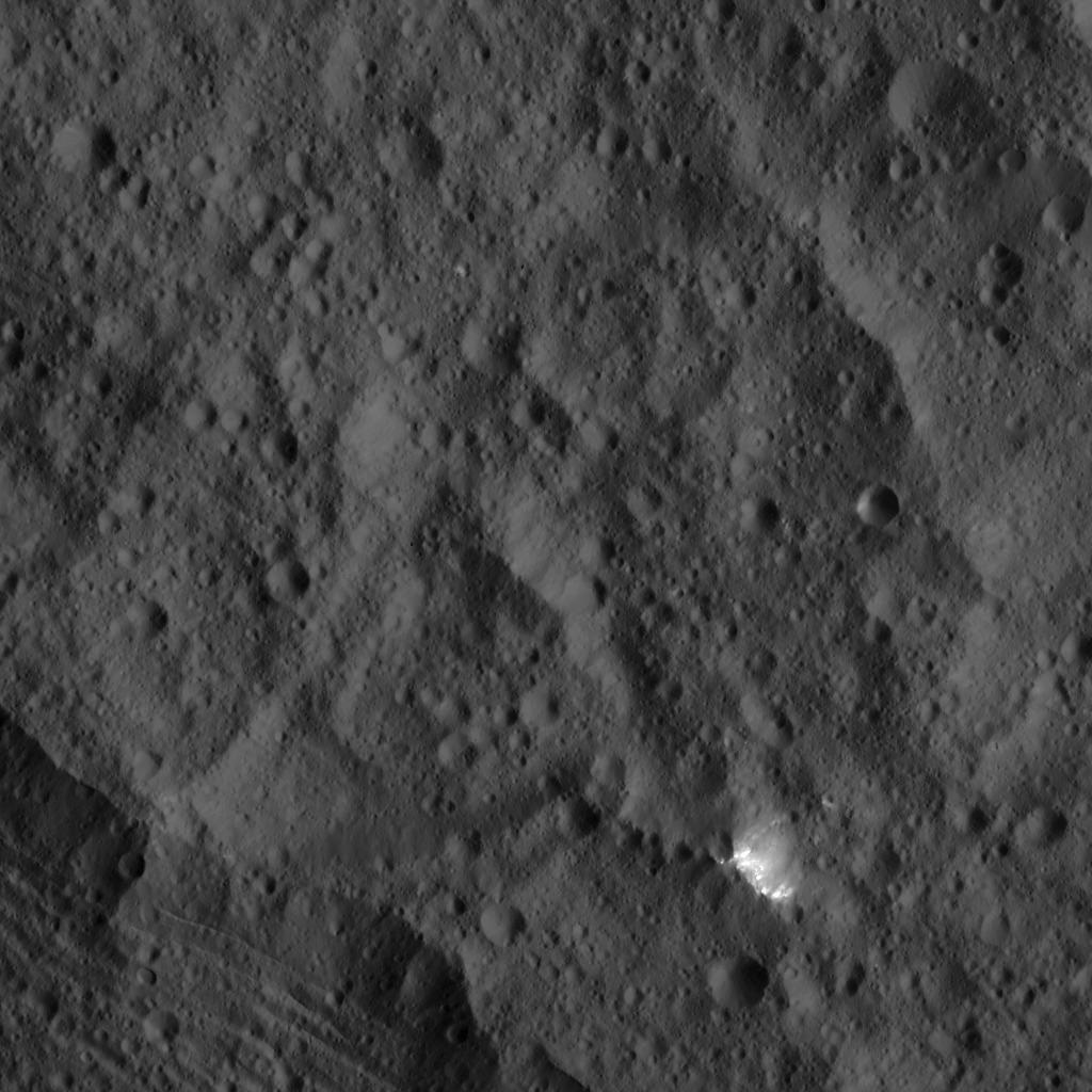
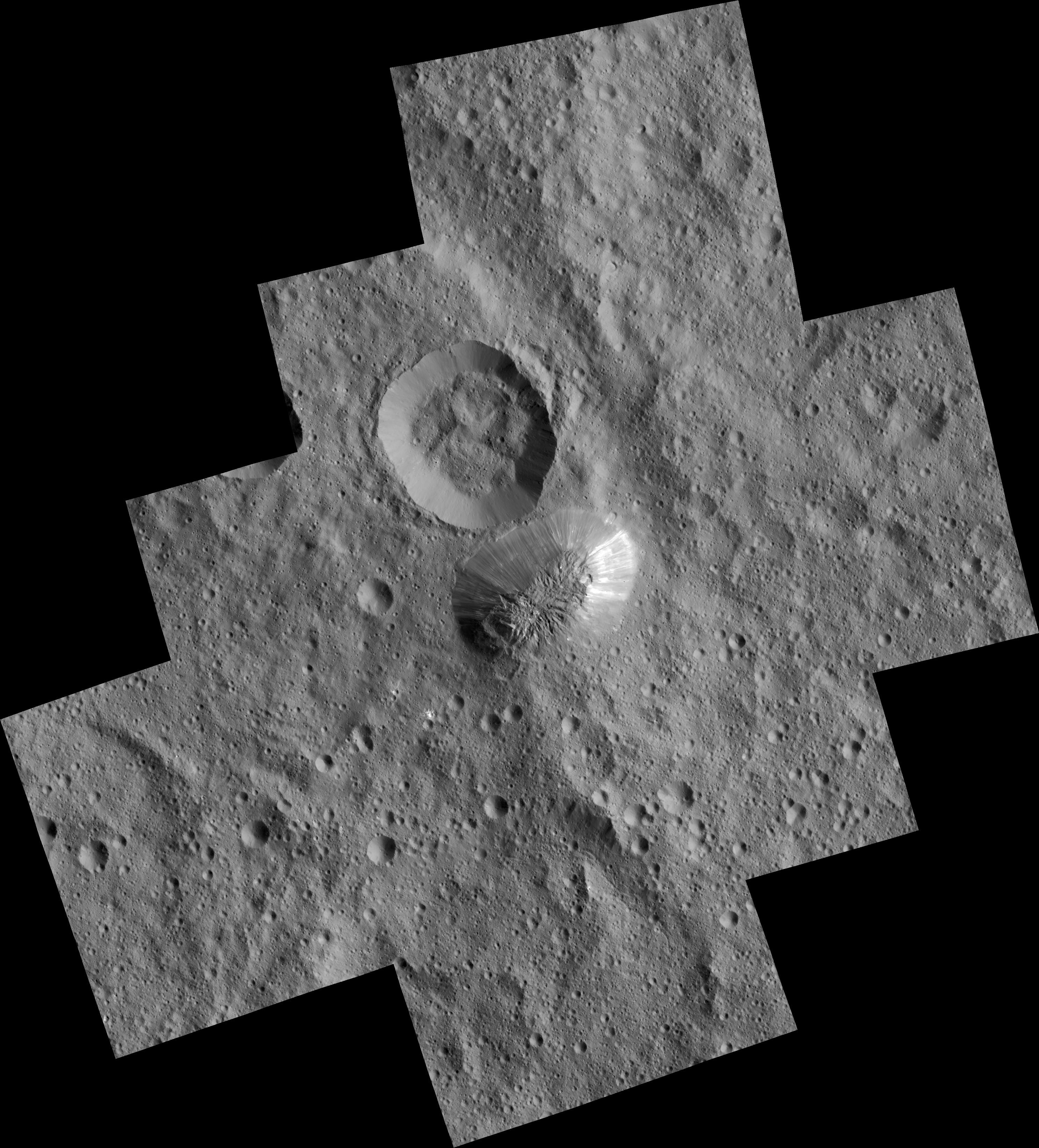
2016-03-22 |
Ceres
|
Dawn
|
Framing Camera
|
7702x7702x1 |
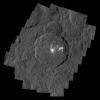
|
-
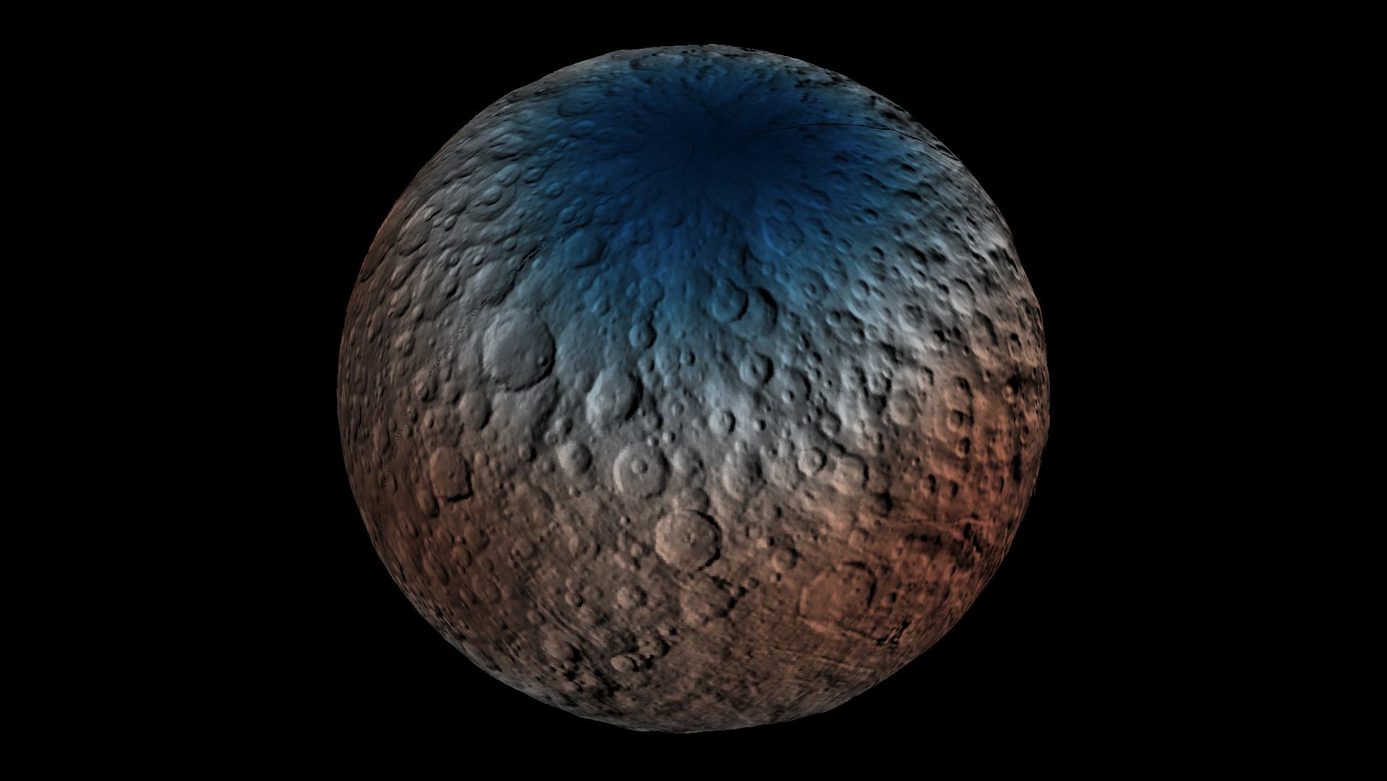
PIA20350:
-
Occator Crater and Ceres' Brightest Spots
Full Resolution:
TIFF
(30.67 MB)
JPEG
(4.377 MB)
|
|
|
2016-03-22 |
Mars
|
2001 Mars Odyssey
|
THEMIS
|
703x1435x1 |
|
-
PIA20432:
-
Cerberus Fossae
Full Resolution:
TIFF
(604.1 kB)
JPEG
(58.54 kB)
|
|
|
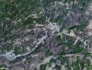
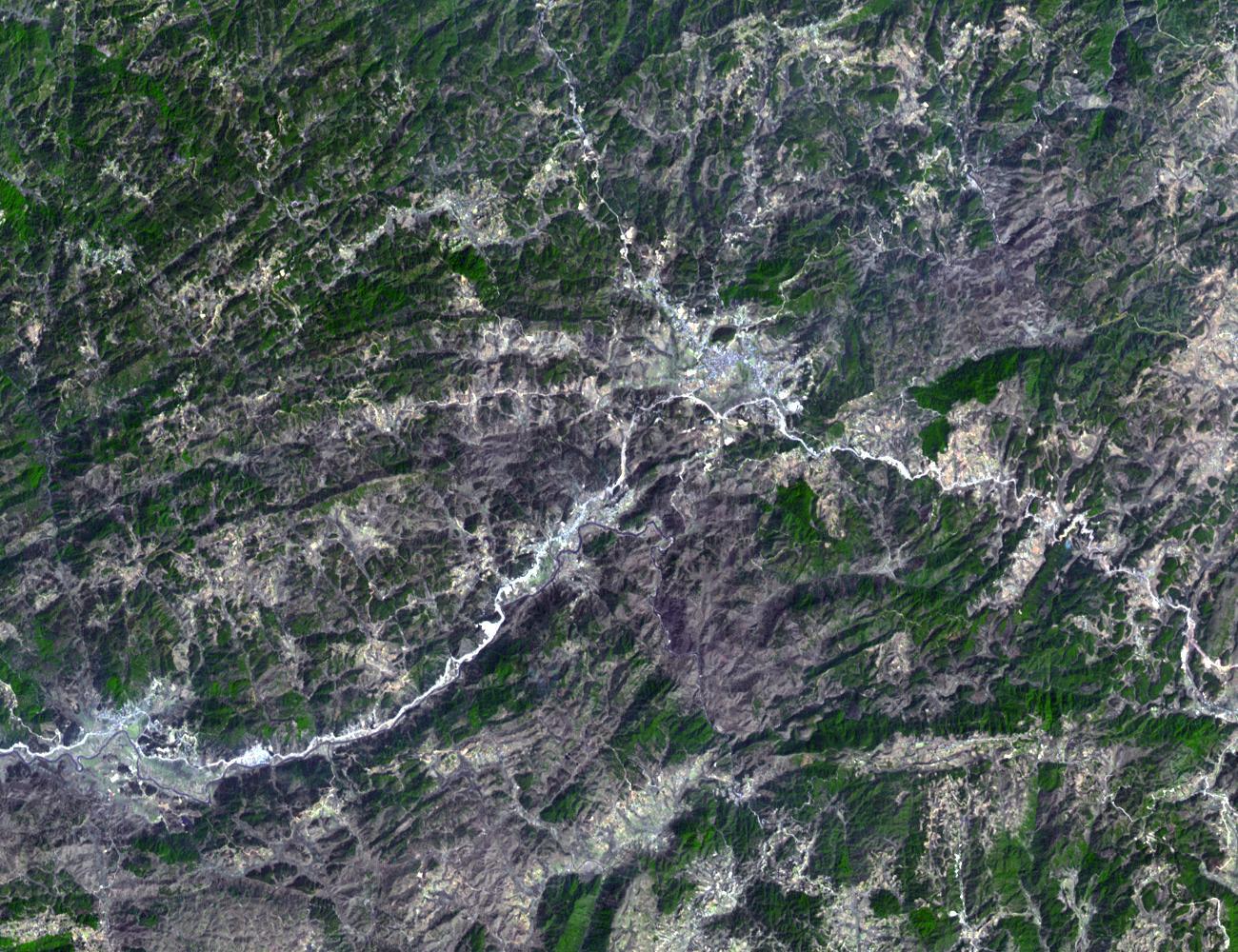
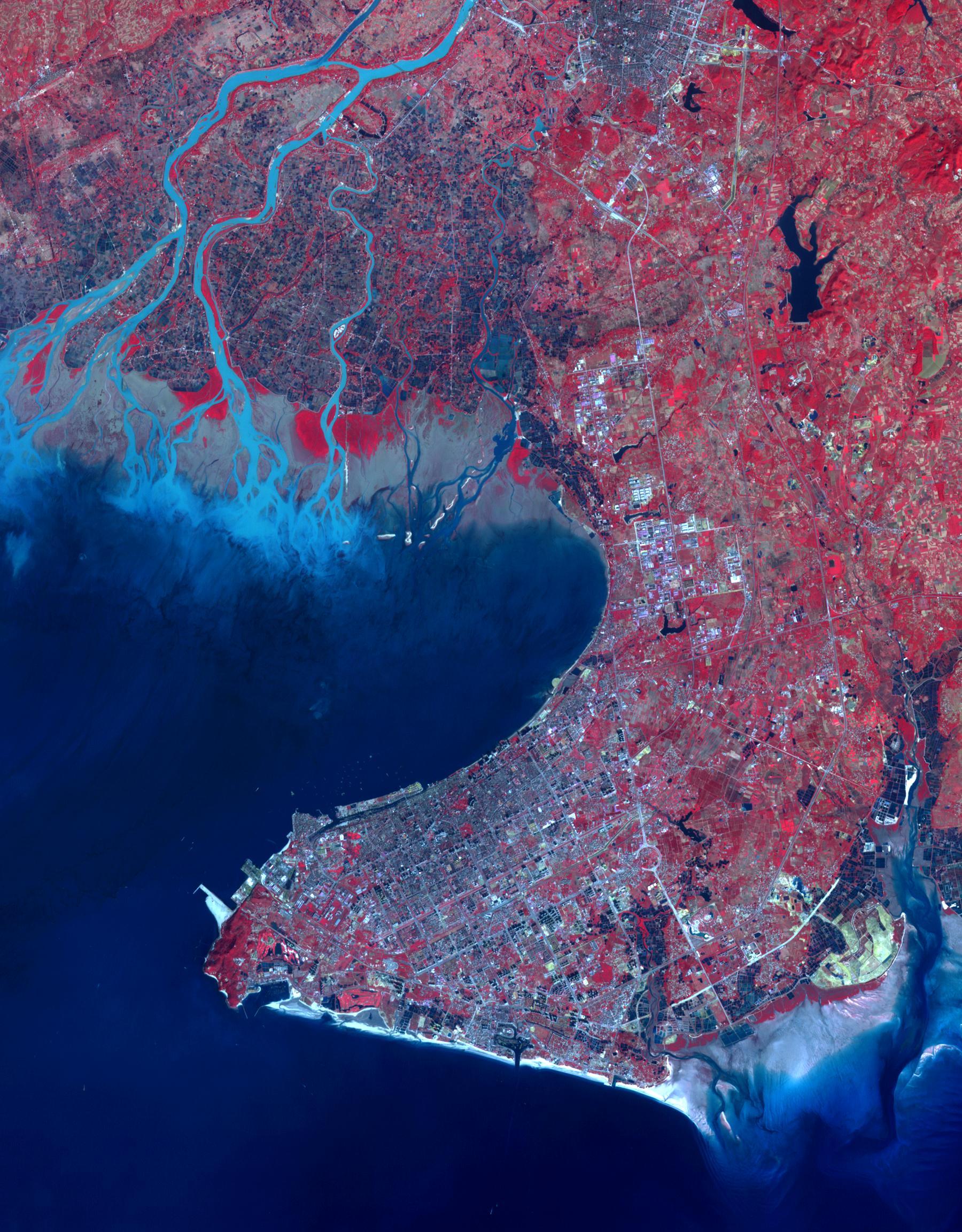
2016-03-21 |
Earth
|
Terra
|
ASTER
|
3836x2710x3 |
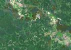
|
-
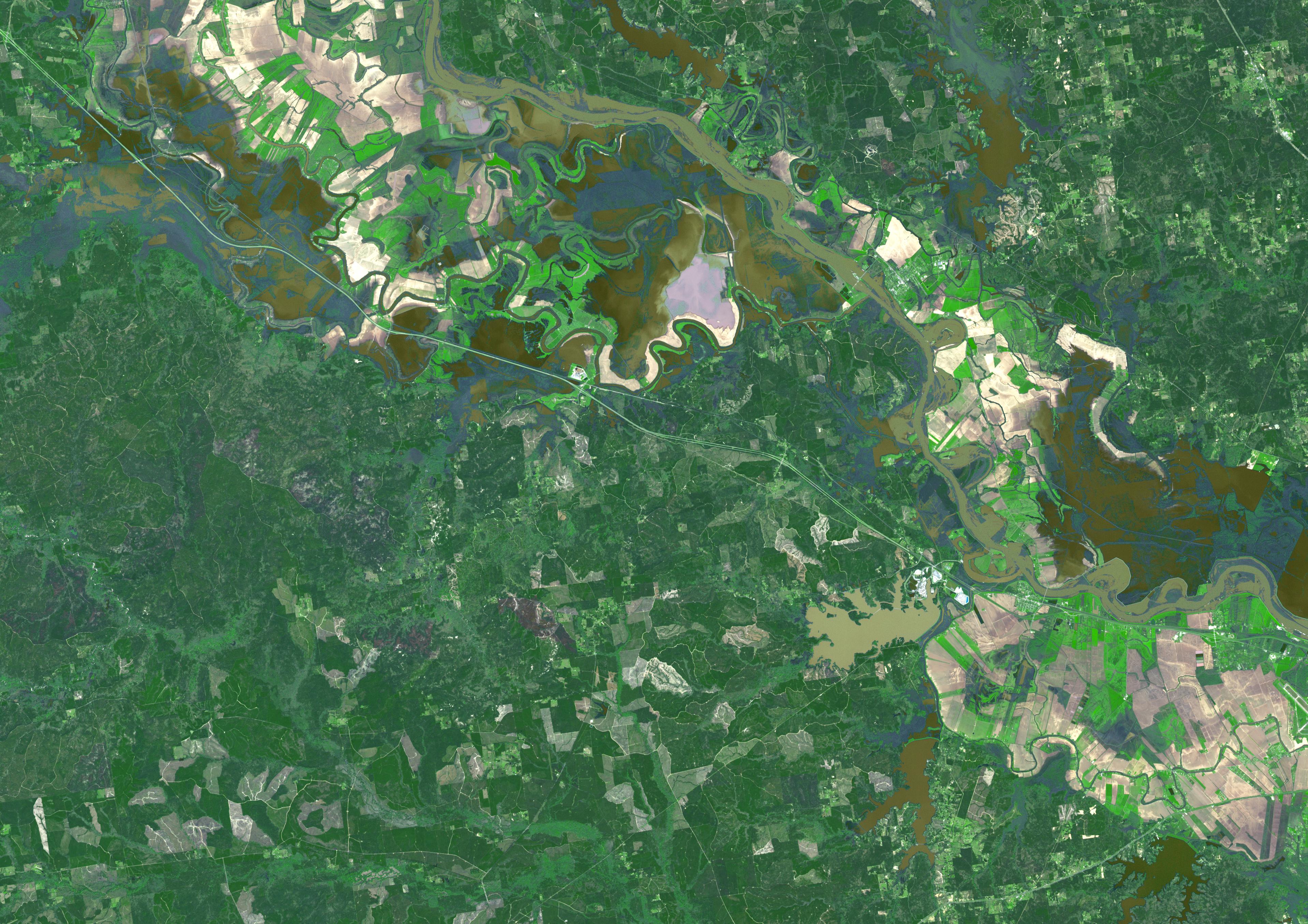
PIA20533:
-
Persistent Flooding in Louisiana Imaged by NASA Spacecraft
Full Resolution:
TIFF
(23.38 MB)
JPEG
(1.729 MB)
|
|
|
2016-03-21 |
|
Kepler
|
|
1920x1080x3 |
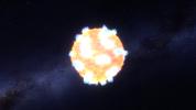
|
-
PIA20065:
-
Caught: A Supernova Shock Breakout (Artist Concept)
Full Resolution:
TIFF
(4.283 MB)
JPEG
(178.6 kB)
|
|
|
2016-03-21 |
Mars
|
2001 Mars Odyssey
Mars Global Surveyor (MGS)
Mars Reconnaissance Orbiter (MRO)
|
MOLA
|
2400x2400x3 |
|
-
PIA20327:
-
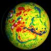
Local Variations in the Gravitational Pull of Mars
Full Resolution:
TIFF
(11.91 MB)
JPEG
(443.7 kB)
|
|
|
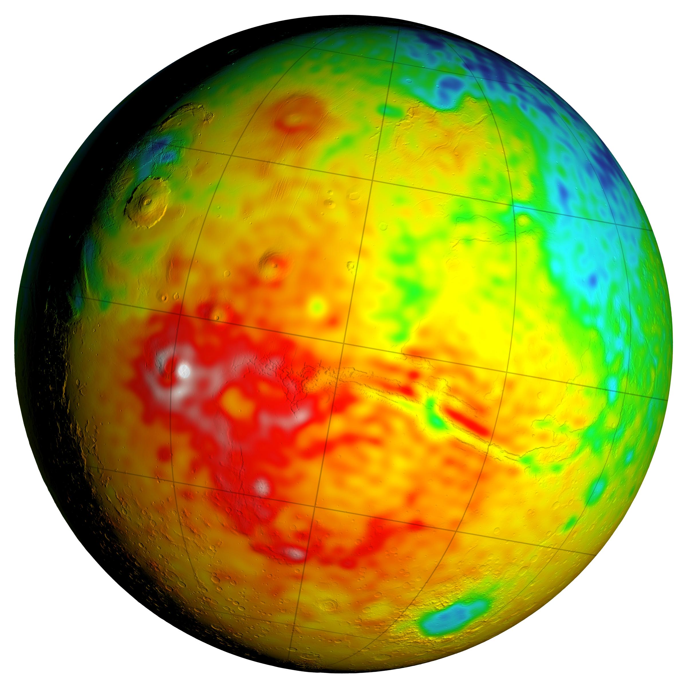
2016-03-21 |
Mars
|
2001 Mars Odyssey
Mars Global Surveyor (MGS)
Mars Reconnaissance Orbiter (MRO)
|
MOLA
|
2400x2400x3 |

|
-
PIA20326:
-
Newly Detailed Map of Mars' Crustal Thickness
Full Resolution:
TIFF
(10.76 MB)
JPEG
(398.9 kB)
|
|
|
2016-03-21 |
Mars
|
2001 Mars Odyssey
Mars Global Surveyor (MGS)
Mars Reconnaissance Orbiter (MRO)
|
MOLA
|
3200x1500x3 |
|
-
PIA20277:
-
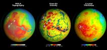
Using Gravity and Topography to Map Mars' Crustal Thickness
Full Resolution:
TIFF
(7.902 MB)
JPEG
(358.2 kB)
|
|
|
2016-03-21 |
Ceres
|
Dawn
|
Framing Camera
|
1024x1024x1 |
|
-
PIA20405:
-
Dawn LAMO Image 50
Full Resolution:
TIFF
(1.05 MB)
JPEG
(232.1 kB)
|
|
|
2016-03-21 |
Mars
|
2001 Mars Odyssey
|
THEMIS
|
706x1440x1 |

|
-
PIA20431:
-
Crater Interior
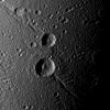
Full Resolution:
TIFF
(655 kB)
JPEG
(66.3 kB)
|
|
|
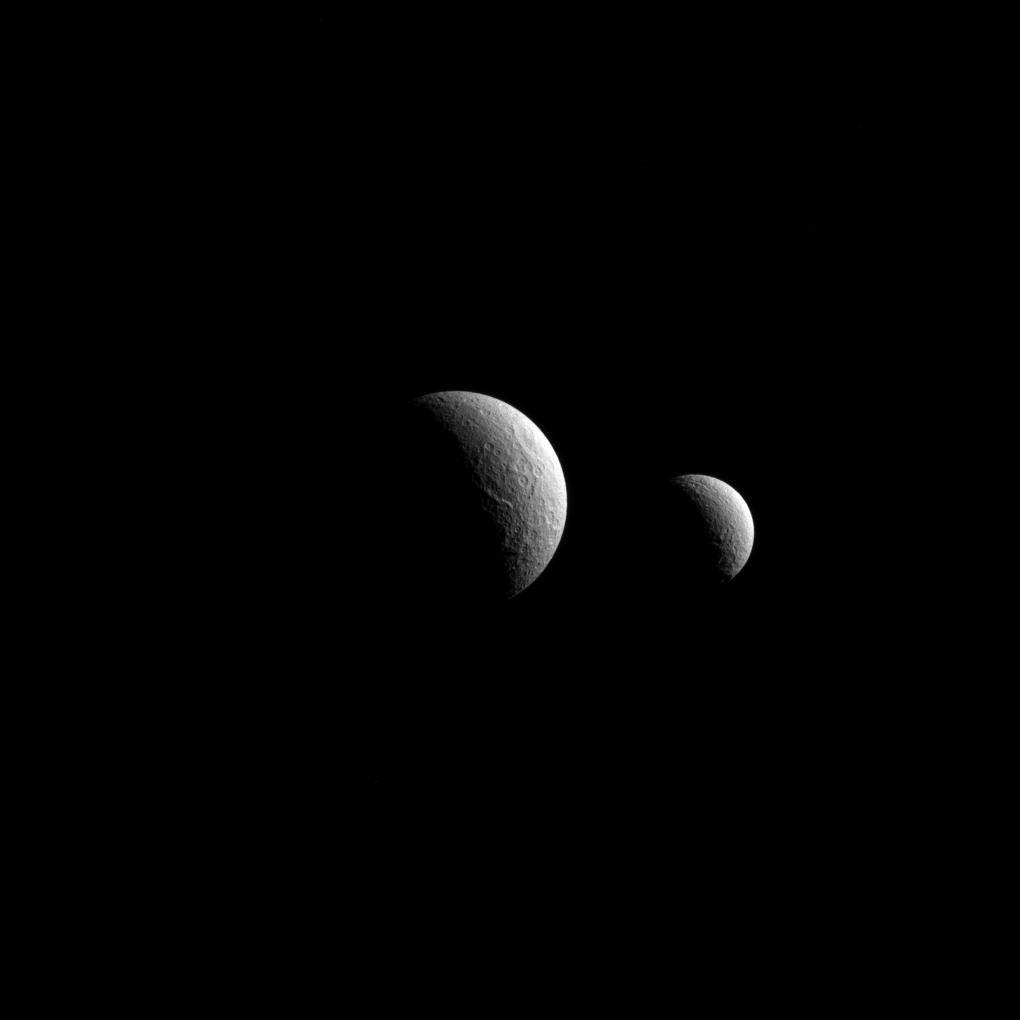
2016-03-21 |
Dione
|
Cassini-Huygens
|
ISS - Narrow Angle
|
1020x1020x1 |
|
-
PIA18359:
-
Helorus in Half-light
Full Resolution:
TIFF
(953.6 kB)
JPEG
(158.5 kB)
|
|
|
2016-03-18 |
Ceres
|
Dawn
|
Framing Camera
|
1024x1024x1 |
|
-
PIA20404:
-
Dawn LAMO Image 49
Full Resolution:
TIFF
(1.05 MB)
JPEG
(149.9 kB)
|
|
|
2016-03-18 |
Mars
|
2001 Mars Odyssey
|
THEMIS
|
775x1575x3 |
|
-
PIA20430:
-
Capri Mensa - False Color
Full Resolution:
TIFF
(2.372 MB)
JPEG
(118.4 kB)
|
|
|
2016-03-17 |
Pluto
|
New Horizons
|
MVIC
|
2288x1081x3 |

|
-
PIA20536:
-
Pluto's Haze
Full Resolution:
TIFF
(2.706 MB)
JPEG
(160.7 kB)
|
|
|
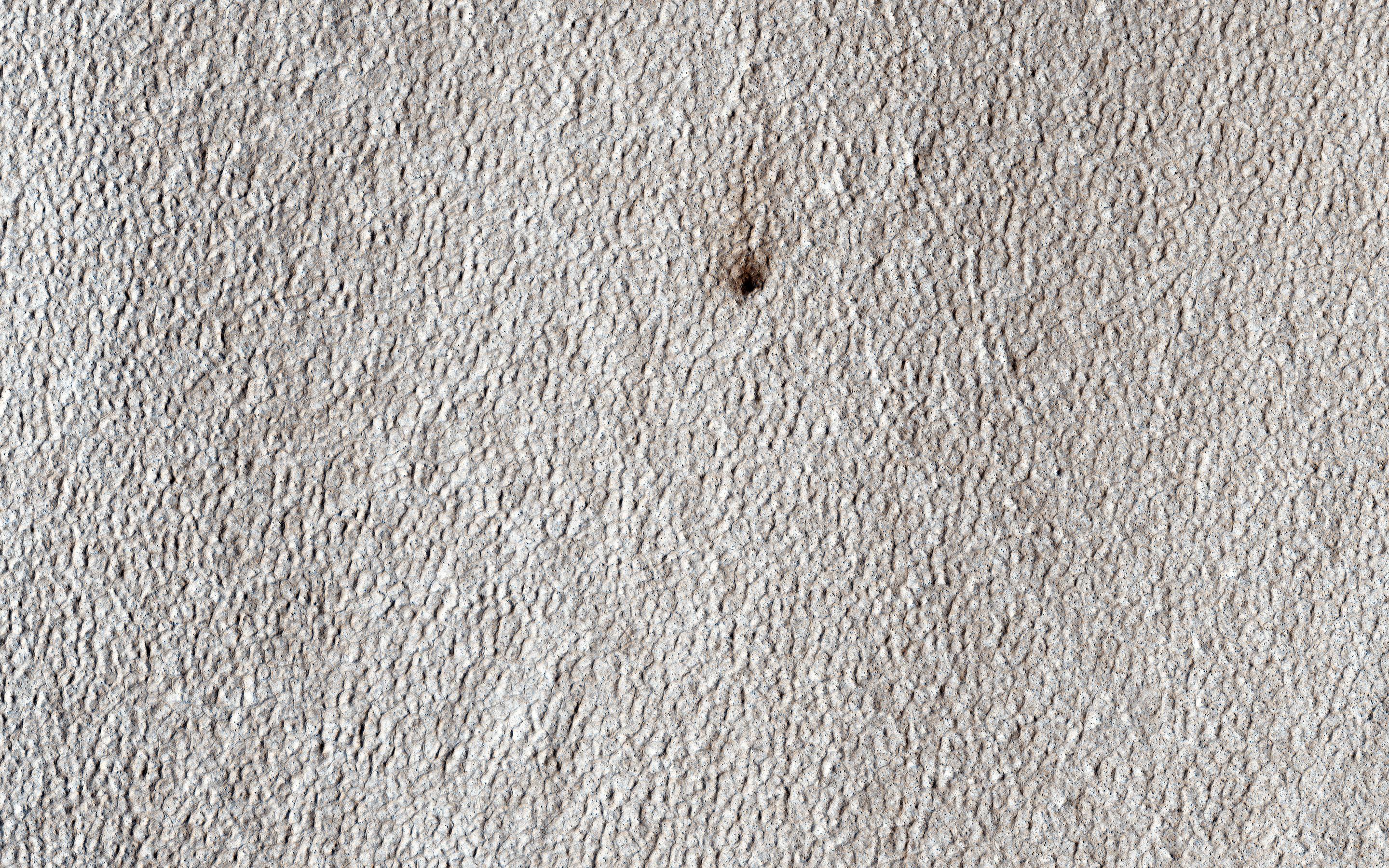
2016-03-17 |
Pluto
|
New Horizons
|
LORRI
MVIC
|
2100x1563x1 |
|
-
PIA20535:
-
Mountains, Craters and Plains
Full Resolution:
TIFF
(3.182 MB)
JPEG
(521.7 kB)
|
|
|
2016-03-17 |
Pluto
|
New Horizons
|
LORRI
MVIC
|
2042x1006x3 |
|
-
PIA20534:
-
Surface Diversity
Full Resolution:
TIFF
(6.165 MB)
JPEG
(411.7 kB)
|
|
|
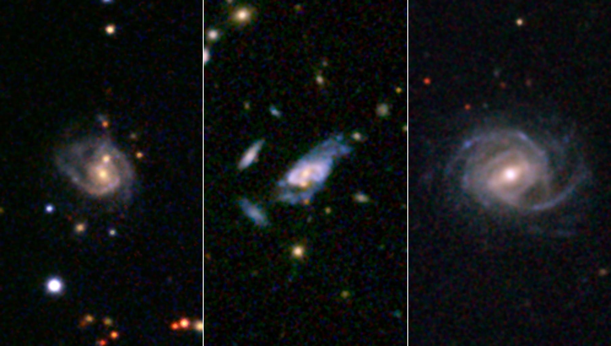
2016-03-17 |
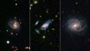
|
SDSS
|
|
1992x1128x3 |
|
-
PIA20064:
-
Gargantuan 'Super Spiral' Galaxies Loom Large in the Cosmos
Full Resolution:
TIFF
(5.495 MB)
JPEG
(152.6 kB)
|
|
|
2016-03-17 |
Ceres
|
Dawn
|
Framing Camera
|
1024x1024x1 |

|
-
PIA20403:
-
Dawn LAMO Image 48
Full Resolution:
TIFF
(1.05 MB)
JPEG
(191.3 kB)
|
|
|
2016-03-17 |
Mars
|
2001 Mars Odyssey
|
THEMIS
|
791x1584x3 |
|
-
PIA20429:
-
Tyrrhena Terra - False Color
Full Resolution:
TIFF
(2.564 MB)
JPEG
(133.4 kB)
|
|
|
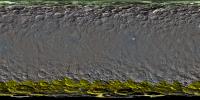
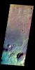
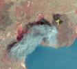
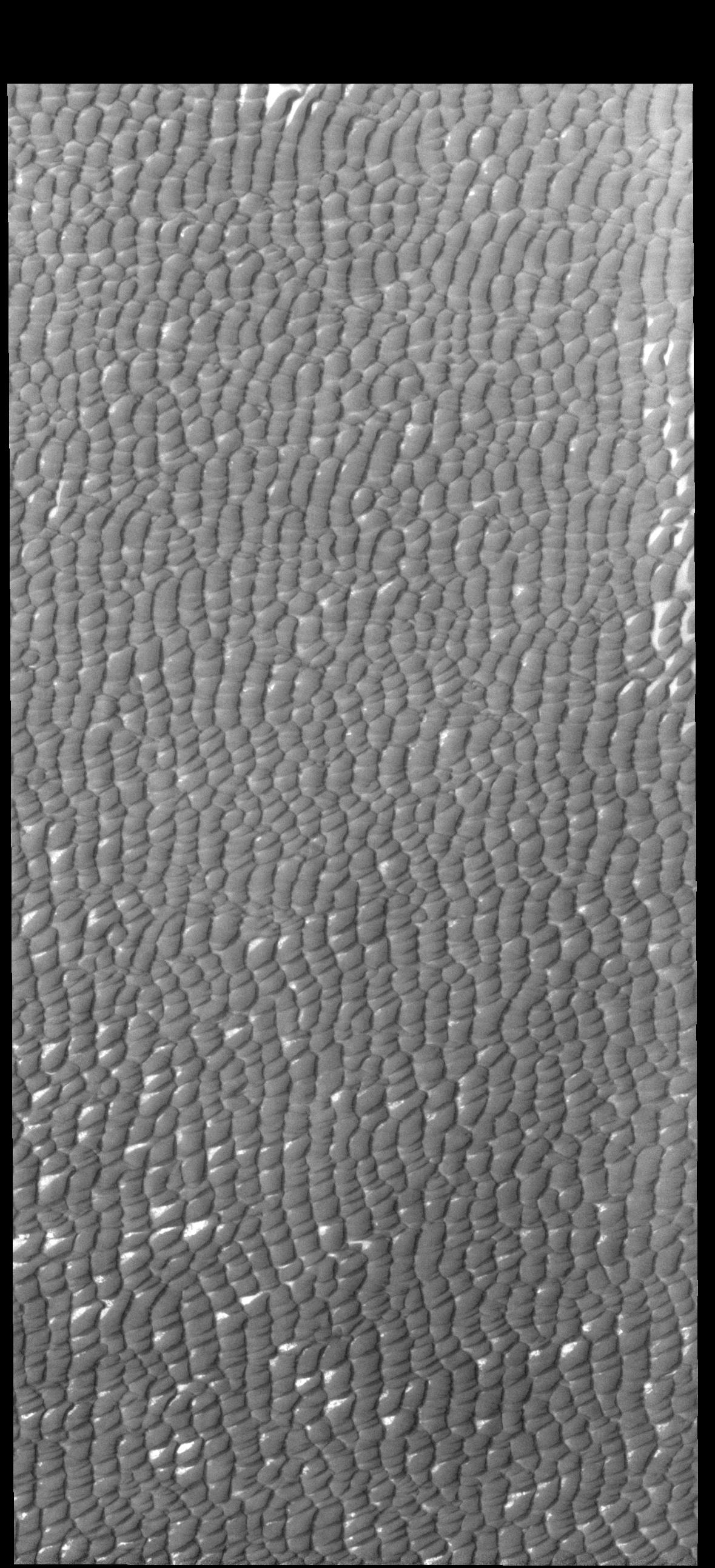
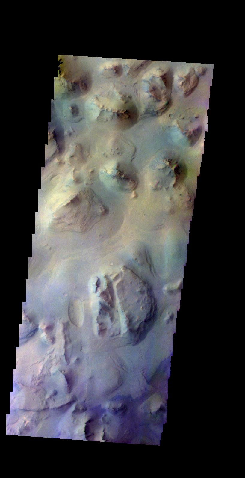
2016-03-16 |
Earth
|
Terra
|
ASTER
|
1300x1000x3 |
|
-
PIA20437:
-
Mawsynram, India
Full Resolution:
TIFF
(3.902 MB)
JPEG
(336.3 kB)
|
|
|
2016-03-16 |
Ceres
|
Dawn
|
Framing Camera
|
1024x1024x1 |

|
-
PIA20402:
-
Dawn LAMO Image 47
Full Resolution:
TIFF
(1.05 MB)
JPEG
(213.7 kB)
|
|
|
2016-03-16 |
Mars
|
2001 Mars Odyssey
|
THEMIS
|
783x1579x3 |
|
-
PIA20428:
-
Tyrrhena Terra - False Color
Full Resolution:
TIFF
(2.392 MB)
JPEG
(114.5 kB)
|
|
|
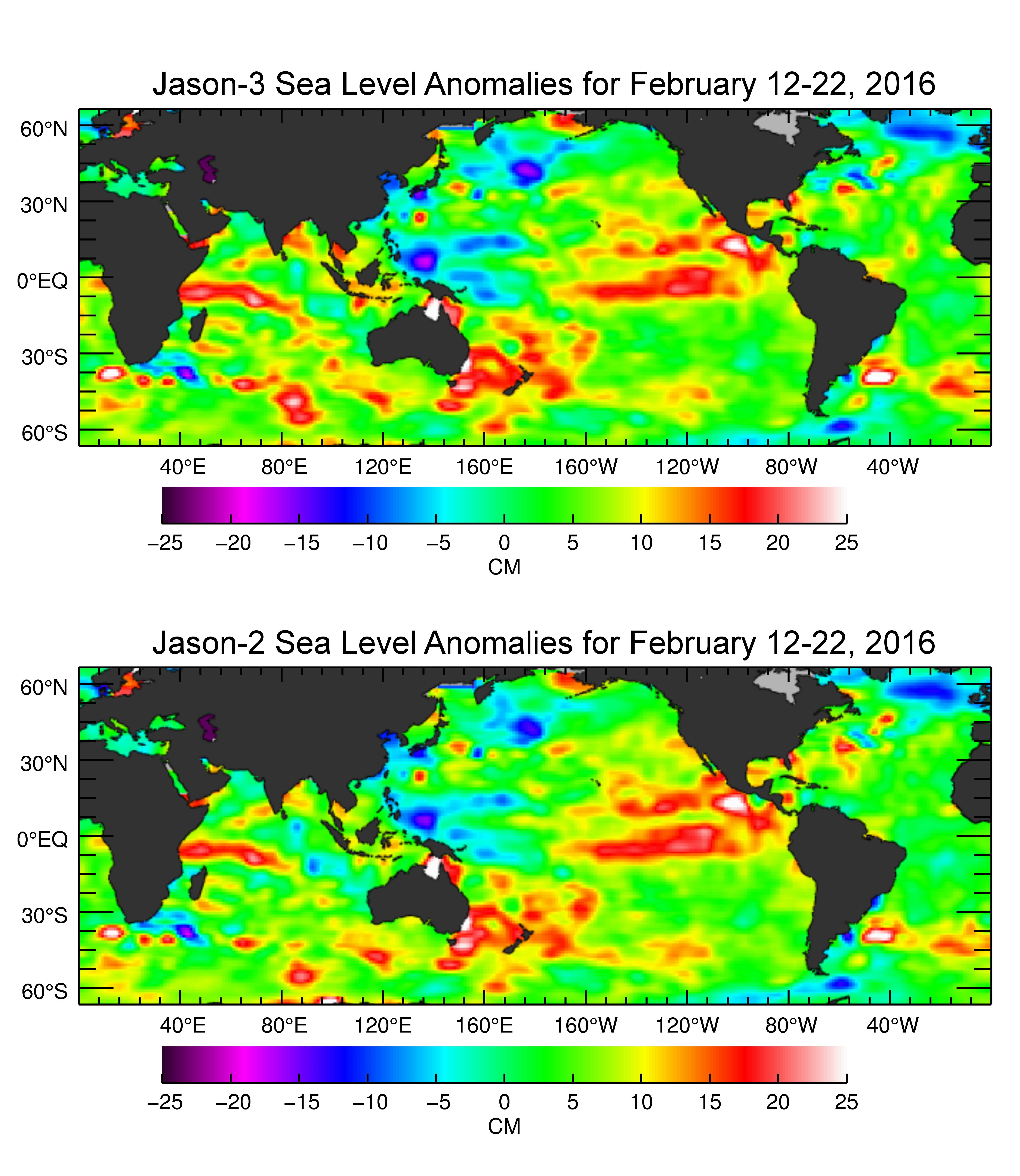
2016-03-16 |
Earth
|
Jason-3
|
|
4769x5500x3 |
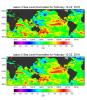
|
-
PIA20532:
-
Jason-3 Produces First Global Map of Sea Surface Height
Full Resolution:
TIFF
(20.12 MB)
JPEG
(1.521 MB)
|
|
|
2016-03-15 |
Ceres
|
Dawn
|
Framing Camera
|
1024x1024x1 |
|
-
PIA20401:
-
Dawn LAMO Image 46
Full Resolution:
TIFF
(1.05 MB)
JPEG
(158.9 kB)
|
|
|
2016-03-15 |
Mars
|
2001 Mars Odyssey
|
THEMIS
|
797x1590x3 |
|
-
PIA20427:
-
Terra Sirenum - False Color
Full Resolution:
TIFF
(2.447 MB)
JPEG
(144.7 kB)
|
|
|
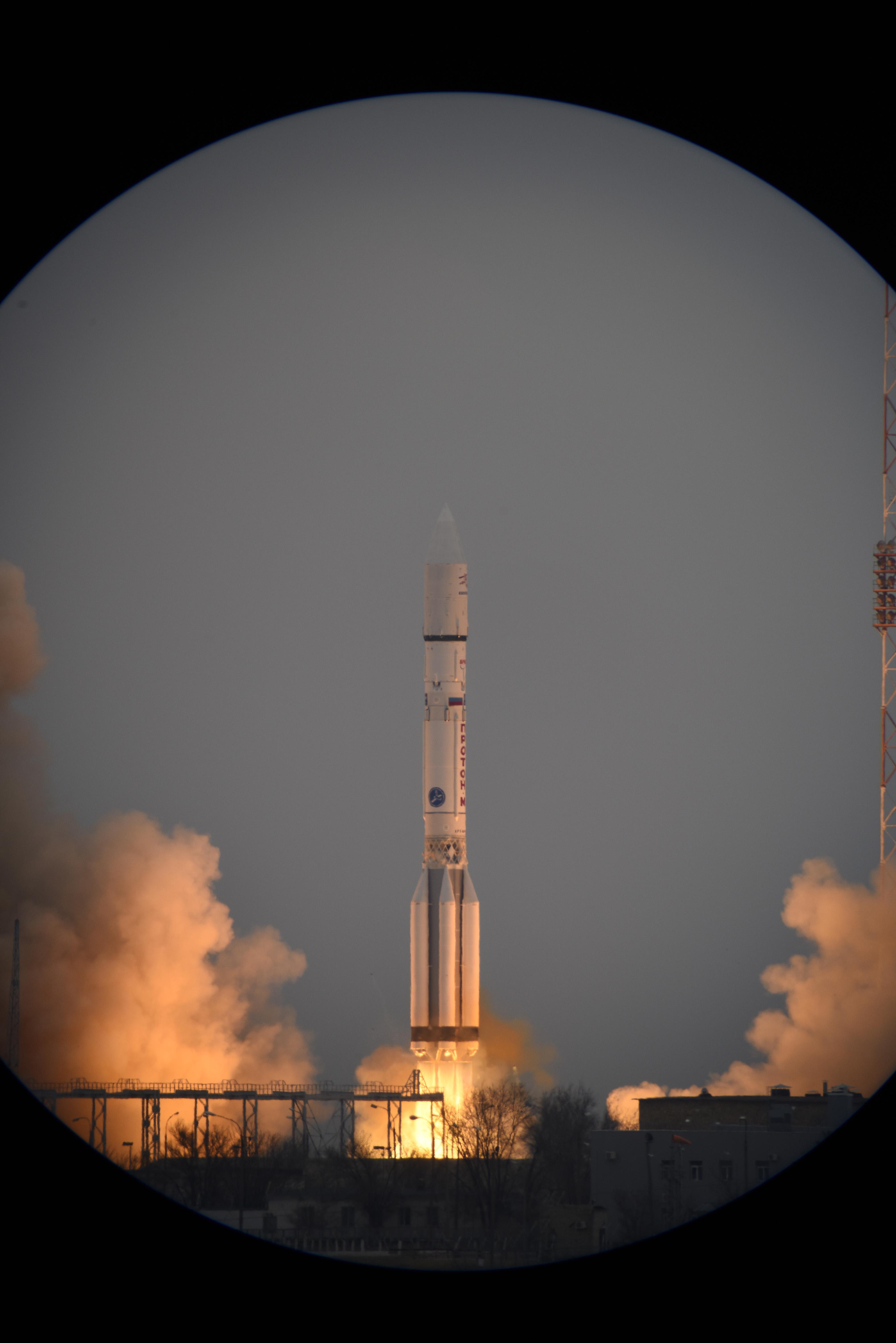
2016-03-14 |
|
ExoMars
|
|
3153x4724x3 |
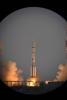
|
-
PIA20325:
-
Launch of Europe's ExoMars 2016 from Kazakhstan
Full Resolution:
TIFF
(20.05 MB)
JPEG
(651.5 kB)
|
|
|
2016-03-14 |
Ceres
|
Dawn
|
Framing Camera
|
1024x1024x1 |
|
-
PIA20400:
-
Dawn LAMO Image 45
Full Resolution:
TIFF
(1.05 MB)
JPEG
(183.4 kB)
|
|
|
2016-03-14 |
Mars
|
2001 Mars Odyssey
|
THEMIS
|
852x1611x3 |

|
-
PIA20426:
-
Terra Sirenum - False Color
Full Resolution:
TIFF
(2.608 MB)
JPEG
(114.2 kB)
|
|
|
2016-03-14 |
Enceladus
|
Cassini-Huygens
|
ISS - Narrow Angle
|
1020x1020x1 |
|
-
PIA18362:
-
Tilted Terminator
Full Resolution:
TIFF
(553.2 kB)
JPEG
(99.98 kB)
|
|
|
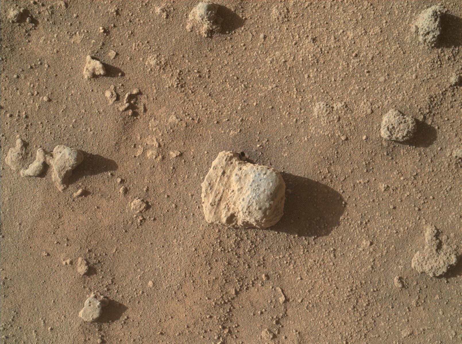
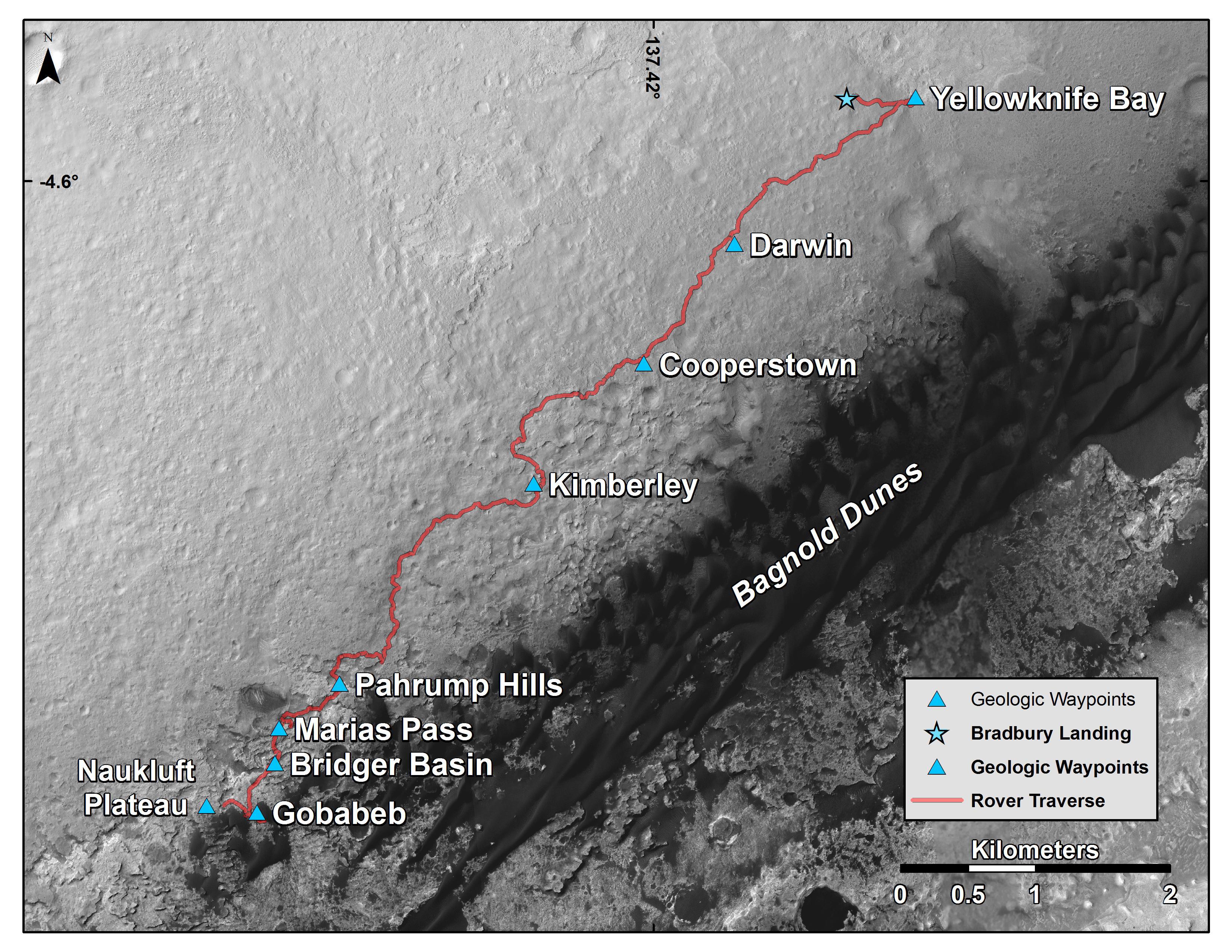
2016-03-11 |
Mars
|
Mars Science Laboratory (MSL)
|
MAHLI
|
1609x1198x3 |
|
-
PIA20324:
-
Sandstone Nodule Beside 'Naukluft Plateau' on Mount Sharp, Mars
Full Resolution:
TIFF
(5.785 MB)
JPEG
(491.8 kB)
|
|
|
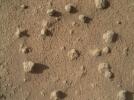
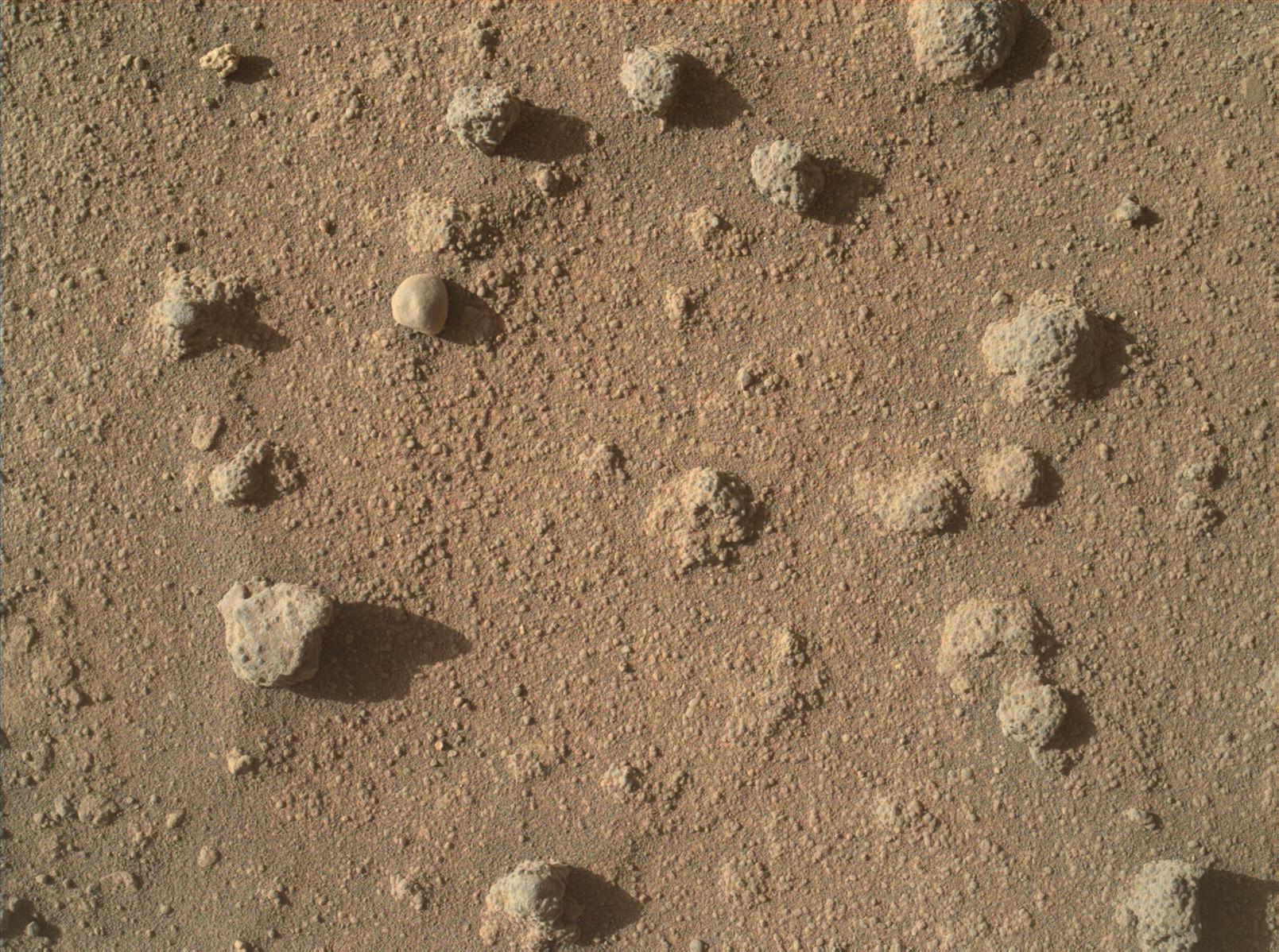
2016-03-11 |
Mars
|
Mars Science Laboratory (MSL)
|
MAHLI
|
1609x1198x3 |
|
-
PIA20323:
-
Nodules of Cemented Sand Grains Within Martian Sandstone
Full Resolution:
TIFF
(5.785 MB)
JPEG
(500.8 kB)
|
|
|
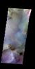
2016-03-11 |
Mars
|
Mars Science Laboratory (MSL)
|
Mastcam
|
4184x2799x3 |
|
-
PIA20322:
-
Knobbly Textured Sandstone on Mount Sharp, Mars
Full Resolution:
TIFF
(26.73 MB)
JPEG
(1.678 MB)
|
|
|
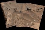
2016-03-11 |
Mars
|
Mars Science Laboratory (MSL)
|
HiRISE
|
3300x2550x3 |
|
-
PIA20166:
-
New Waypoint, Science Team Newcomers for Curiosity
Full Resolution:
TIFF
(12.44 MB)
JPEG
(1.458 MB)
|
|
|
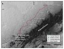
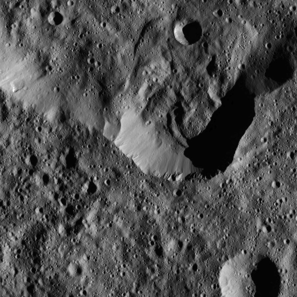
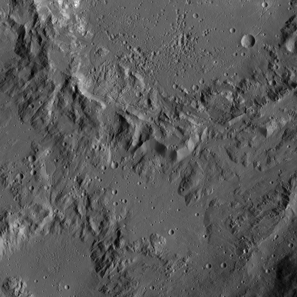
2016-03-11 |
Ceres
|
Dawn
|
Framing Camera
|
2969x3280x3 |
|
-
PIA20399:
-
Dawn Color Topography of Ahuna Mons on Ceres
Full Resolution:
TIFF
(19.07 MB)
JPEG
(886.2 kB)
|
|
|
2016-03-11 |
Mars
|
2001 Mars Odyssey
|
THEMIS
|
819x1594x3 |
|
-
PIA20425:
-
Coprates Chasma - False Color
Full Resolution:
TIFF
(2.389 MB)
JPEG
(96.45 kB)
|
|
|
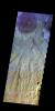
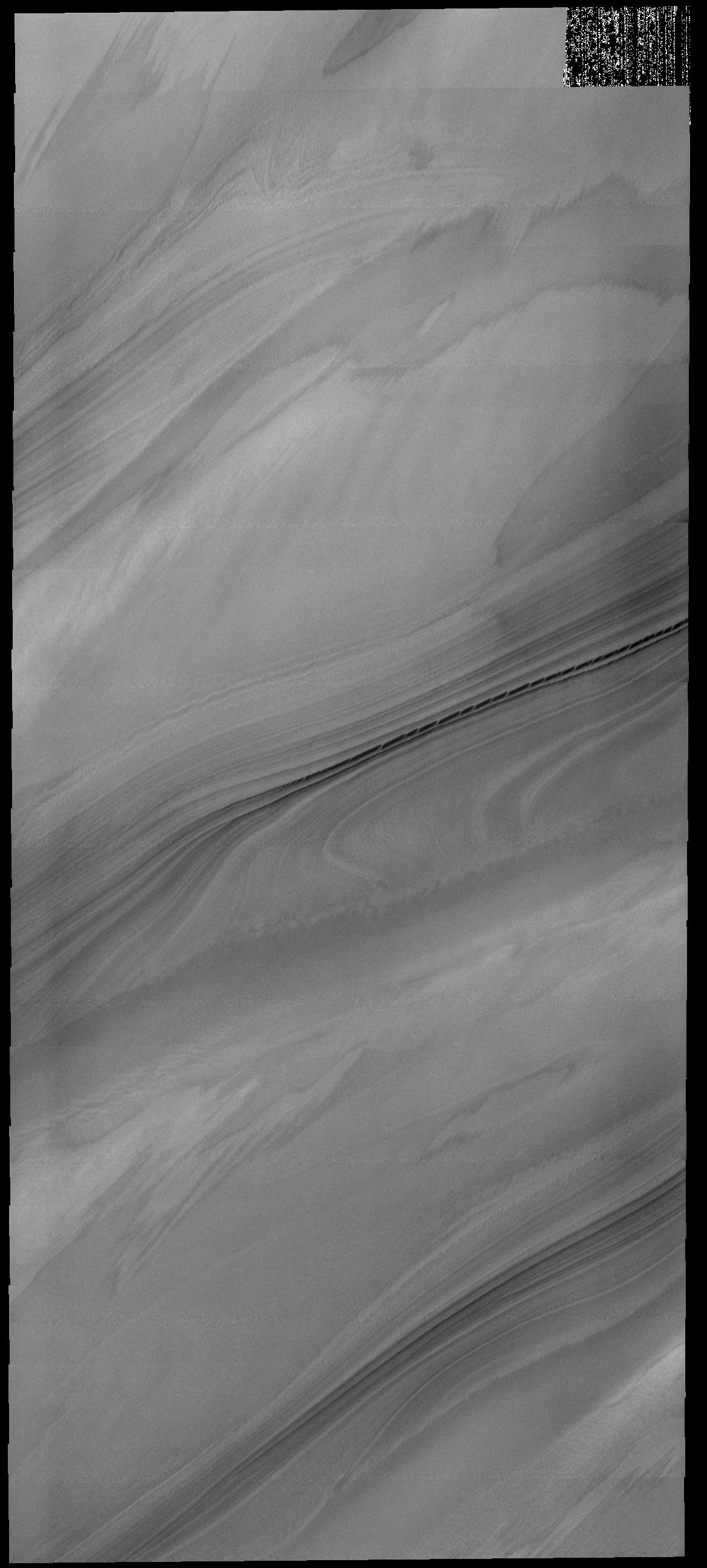
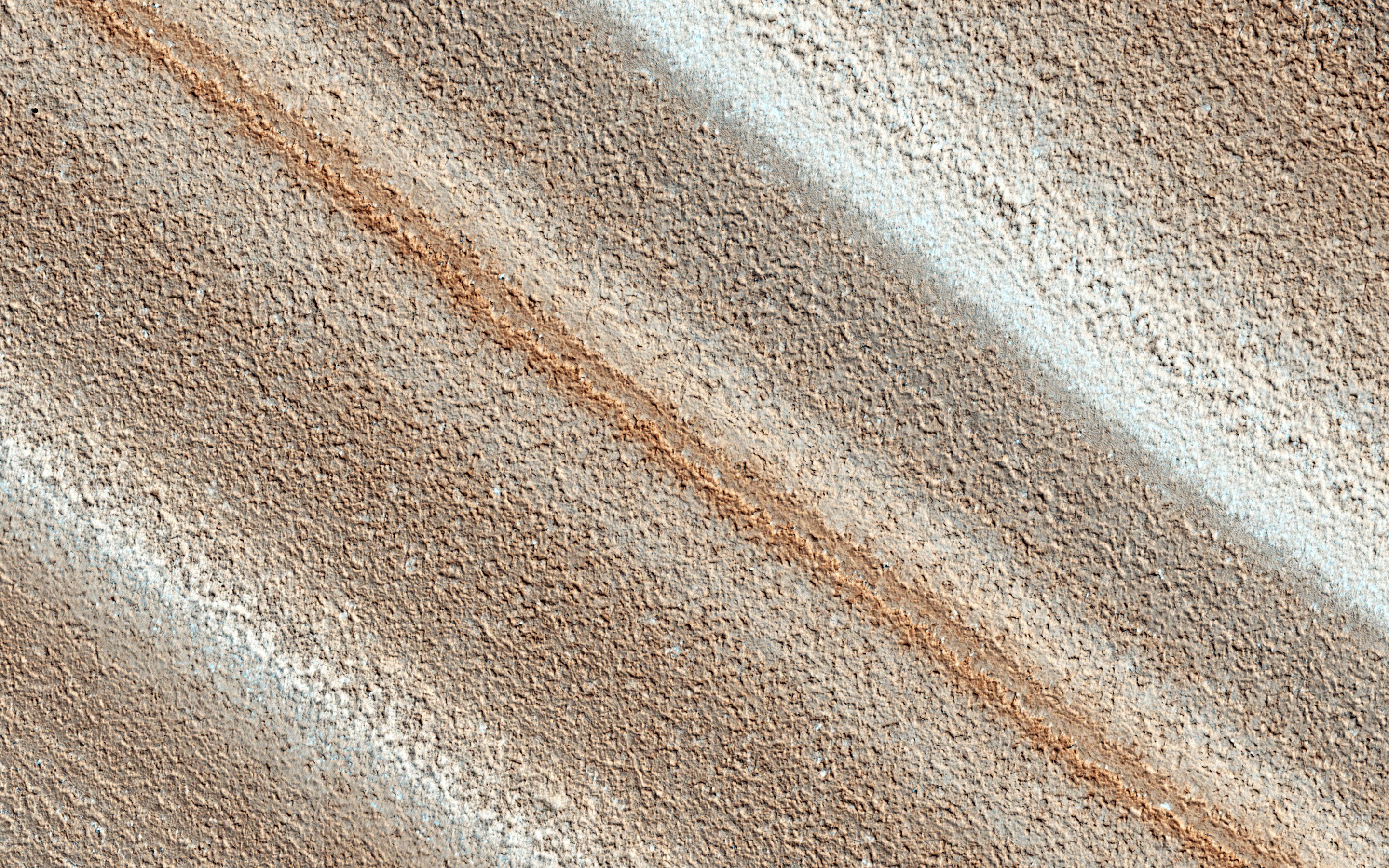
2016-03-10 |
Pluto
|
New Horizons
|
LEISA
|
2400x970x3 |
|
-
PIA20531:
-
What's Eating at Pluto?
Full Resolution:
TIFF
(4.748 MB)
JPEG
(316.9 kB)
|
|
|
2016-03-10 |
Ceres
|
Dawn
|
Framing Camera
|
1024x1024x1 |

|
-
PIA20398:
-
Dawn LAMO Image 44
Full Resolution:
TIFF
(1.05 MB)
JPEG
(129.3 kB)
|
|
|
2016-03-10 |
Mars
|
2001 Mars Odyssey
|
THEMIS
|
818x1595x3 |
|
-
PIA20424:
-
Chasma Chaos - False Color
Full Resolution:
TIFF
(2.446 MB)
JPEG
(98.09 kB)
|
|
|
2016-03-10 |
Mars
|
Mars Reconnaissance Orbiter (MRO)
|
HiRISE
|
2880x1800x1 |

|
-
PIA20480:
-
Night Vision
Full Resolution:
TIFF
(5.191 MB)
JPEG
(985.4 kB)
|
|
|
2016-03-10 |
Mars
|
Mars Reconnaissance Orbiter (MRO)
|
HiRISE
|
2880x1800x3 |
|
-
PIA20479:
-
The Northwest Floor of Gale Crater
Full Resolution:
TIFF
(15.56 MB)
JPEG
(973.1 kB)
|
|
|
2016-03-10 |
Mars
|
Mars Reconnaissance Orbiter (MRO)
|
HiRISE
|
2880x1800x1 |
|
-
PIA20478:
-
The Dune Sea of Ganges Chasma
Full Resolution:
TIFF
(5.191 MB)
JPEG
(788.9 kB)
|
|
|
2016-03-09 |
Mars
|
Mars Reconnaissance Orbiter (MRO)
|
HiRISE
|
1280x960x3 |

|
-
PIA20167:
-
For a Decade Orbiting Mars: One Recent View
Full Resolution:
TIFF
(3.688 MB)
JPEG
(200.3 kB)
|
|
|
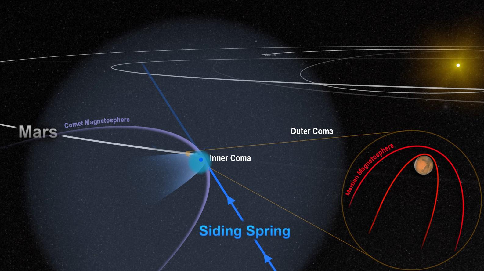
2016-03-09 |
Mars
|
MAVEN
|
|
1586x888x3 |
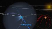
|
-
PIA20321:
-
Passing Comet Affects Magnetic Field at Mars
Full Resolution:
TIFF
(2.679 MB)
JPEG
(148.8 kB)
|
|
|
2016-03-09 |
Ceres
|
Dawn
|
Framing Camera
|
1024x1024x1 |
|
-
PIA20397:
-
Dawn LAMO Image 43
Full Resolution:
TIFF
(1.05 MB)
JPEG
(131.5 kB)
|
|
|
2016-03-09 |
Mars
|
2001 Mars Odyssey
|
THEMIS
|
830x1599x3 |

|
-
PIA20423:
-
Martin Crater - False Color
Full Resolution:
TIFF
(2.575 MB)
JPEG
(135.7 kB)
|
|
|
2016-03-08 |
Ceres
|
Dawn
|
Framing Camera
|
1024x1024x1 |
|
-
PIA20396:
-
Dawn LAMO Image 42
Full Resolution:
TIFF
(1.05 MB)
JPEG
(189.9 kB)
|
|
|
2016-03-08 |
Mars
|
2001 Mars Odyssey
|
THEMIS
|
826x1599x3 |
|
-
PIA20422:
-
Terra Sabaea - False Color
Full Resolution:
TIFF
(2.604 MB)
JPEG
(159 kB)
|
|
|
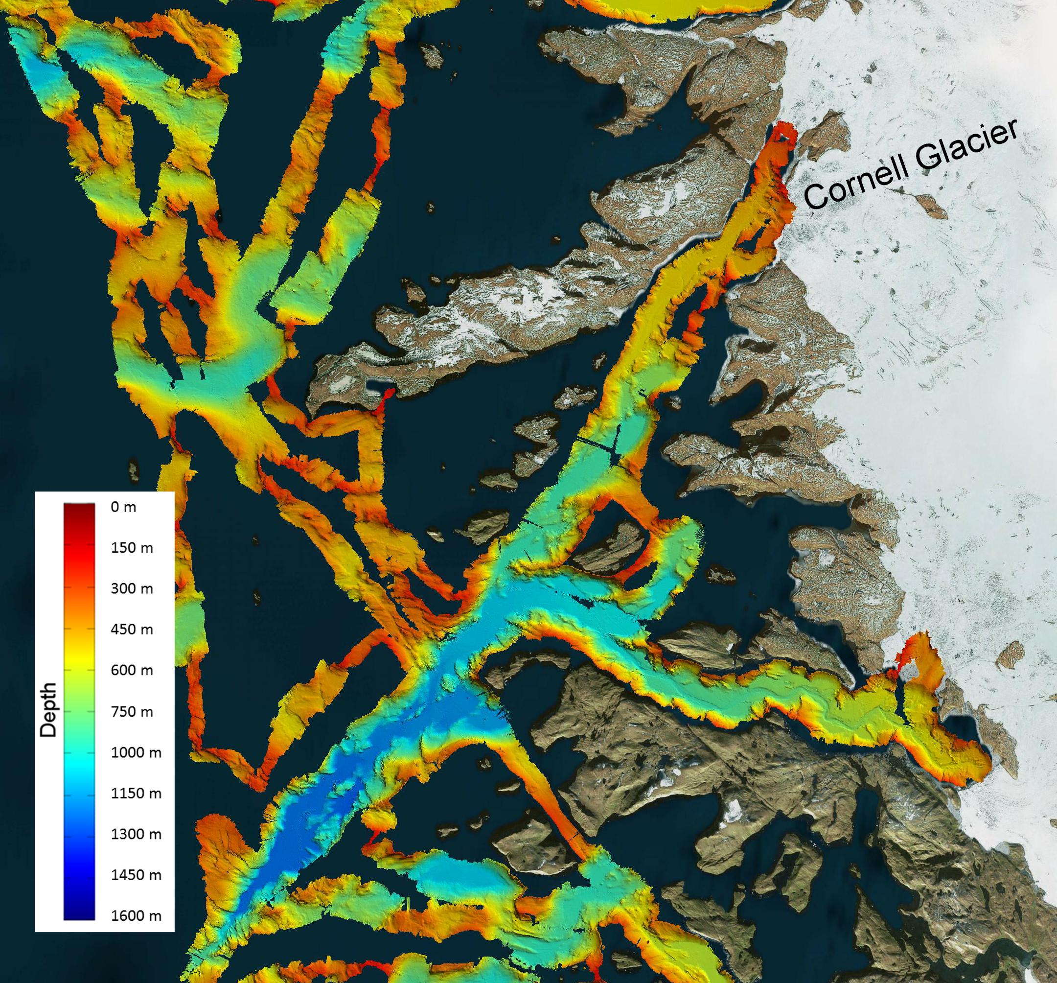
2016-03-08 |
Earth
|
OMG
|
|
2160x2008x3 |
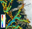
|
-
PIA20476:
-
NASA's OMG Mission Maps Sea Floor Depth off Greenland's Coast
Full Resolution:
TIFF
(11.12 MB)
JPEG
(733.1 kB)
|
|
|
2016-03-07 |
Ceres
|
Dawn
|
Framing Camera
|
1024x1024x1 |
|
-
PIA20395:
-
Dawn LAMO Image 41
Full Resolution:
TIFF
(981.6 kB)
JPEG
(175.2 kB)
|
|
|
2016-03-07 |
Mars
|
2001 Mars Odyssey
|
THEMIS
|
815x1593x3 |

|
-
PIA20420:
-
Crater - False Color
Full Resolution:
TIFF
(2.609 MB)
JPEG
(118.1 kB)
|
|
|
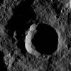
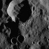
2016-03-07 |
Rhea
|
Cassini-Huygens
|
ISS - Narrow Angle
|
1020x1020x1 |

|
-
PIA18363:
-
The Saturnian Sisters
Full Resolution:
TIFF
(86.96 kB)
JPEG
(17.29 kB)
|
|
|
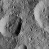
2016-03-07 |
Ceres
|
Dawn
|
Framing Camera
|
3840x2160x1 |

|
-
PIA20349:
-
Ahuna Mons Perspective View
Full Resolution:
TIFF
(2.548 MB)
JPEG
(482.1 kB)
|
|
|
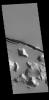
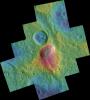
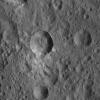
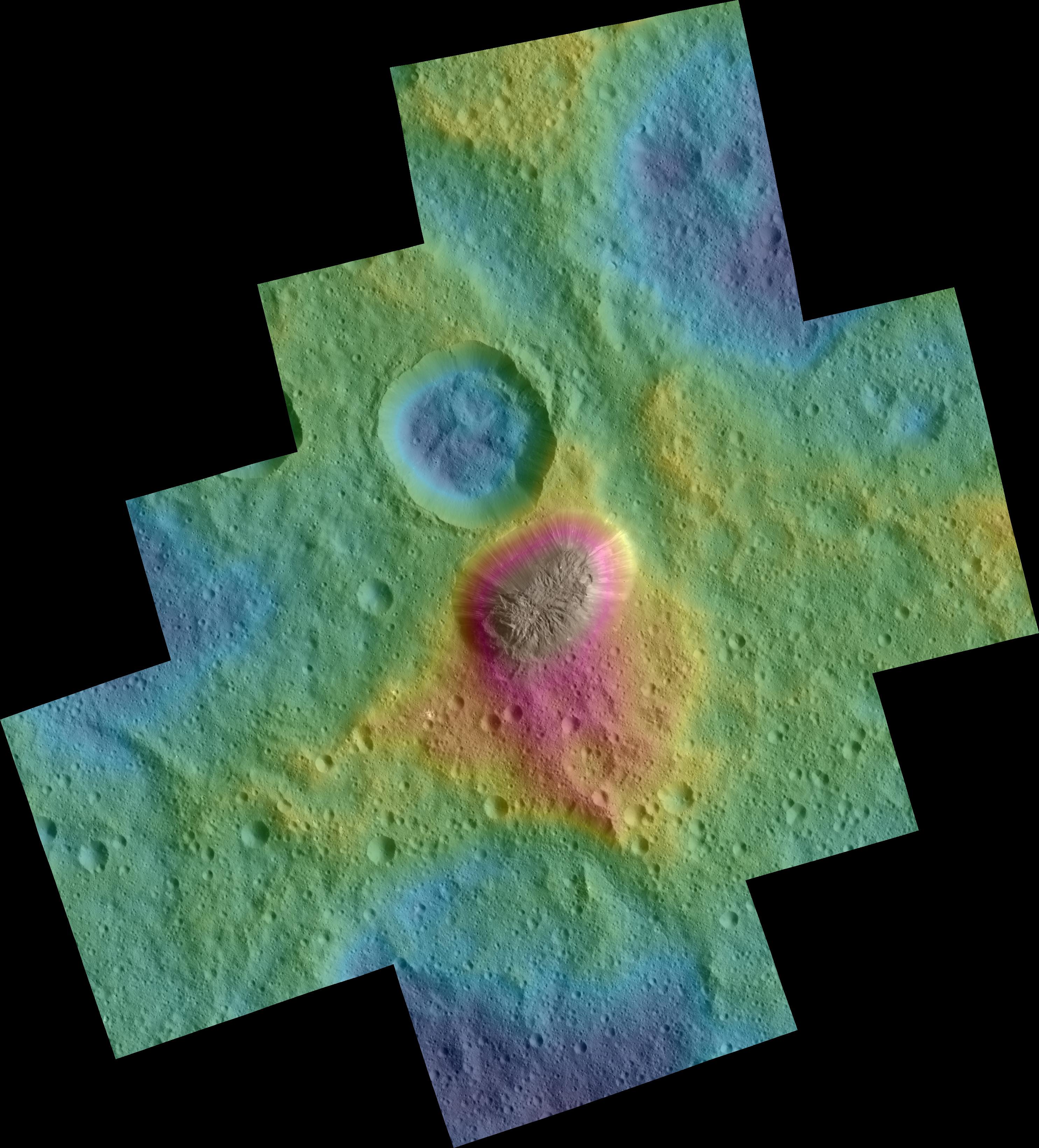
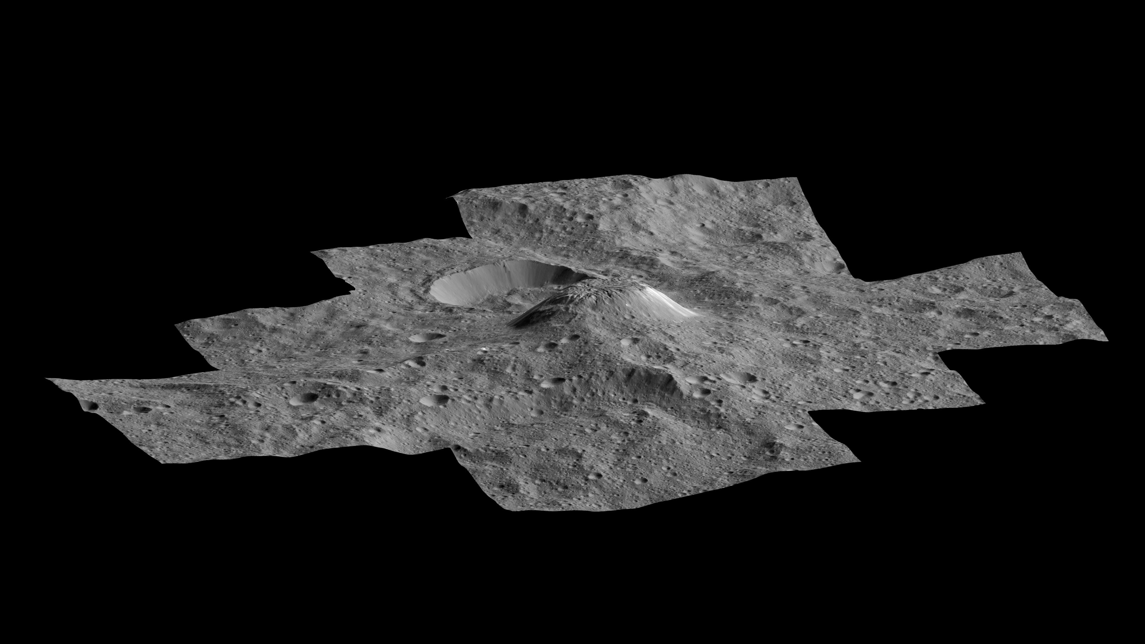
2016-03-07 |
Ceres
|
Dawn
|
Framing Camera
|
2969x3282x1 |
|
-
PIA20348:
-
Ahuna Mons Seen from LAMO
Full Resolution:
TIFF
(6.39 MB)
JPEG
(993.1 kB)
|
|
|
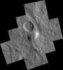
2016-03-04 |
Ceres
|
Dawn
|
Framing Camera
|
1024x1024x1 |

|
-
PIA20394:
-
Dawn LAMO Image 40
Full Resolution:
TIFF
(1.05 MB)
JPEG
(158.9 kB)
|
|
|
2016-03-04 |
Mars
|
2001 Mars Odyssey
|
THEMIS
|
1430x2651x1 |
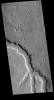
|
-
PIA20419:
-
Channel
Full Resolution:
TIFF
(2.888 MB)
JPEG
(456.9 kB)
|
|
|
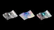
2016-03-03 |
|
|
CHIMERA
|
1007x1020x3 |
|
-
PIA20347:
-
Versatile Instrument to Scout for Kuiper Belt Objects
Full Resolution:
TIFF
(3.083 MB)
JPEG
(105.7 kB)
|
|
|
2016-03-03 |
Pluto
|
New Horizons
|
MVIC
|
2000x1042x3 |
|
-
PIA20477:
-
Methane Snow on Pluto's Peaks
Full Resolution:
TIFF
(4.598 MB)
JPEG
(242.2 kB)
|
|
|
2016-03-03 |
Ceres
|
Dawn
|
Framing Camera
|
1024x1024x1 |

|
-
PIA20393:
-
Dawn LAMO Image 39
Full Resolution:
TIFF
(1.05 MB)
JPEG
(167.4 kB)
|
|
|
2016-03-03 |
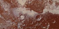
Mars
|
2001 Mars Odyssey
|
THEMIS
|
1436x2651x1 |
|
-
PIA20418:
-
Central Pit Crater
Full Resolution:
TIFF
(2.693 MB)
JPEG
(322.8 kB)
|
|
|
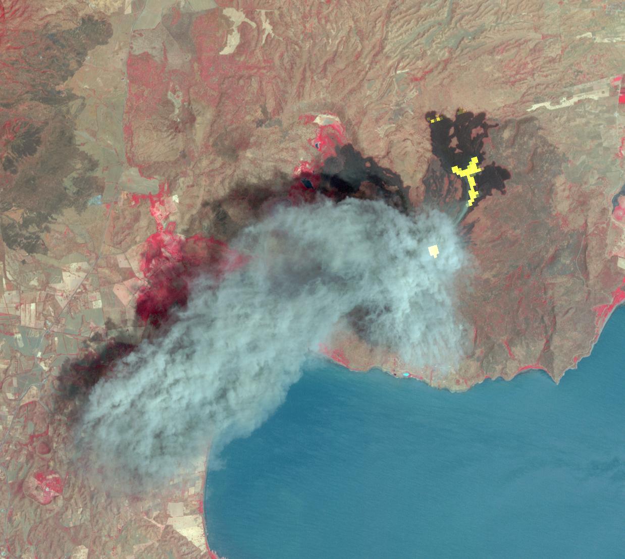
2016-03-02 |
Earth
|
Terra
|
ASTER
|
1238x1108x3 |
|
-
PIA20475:
-
Momotombo's Fury in Nicaragua Captured by NASA Satellite
Full Resolution:
TIFF
(3.738 MB)
JPEG
(162.3 kB)
|
|
|
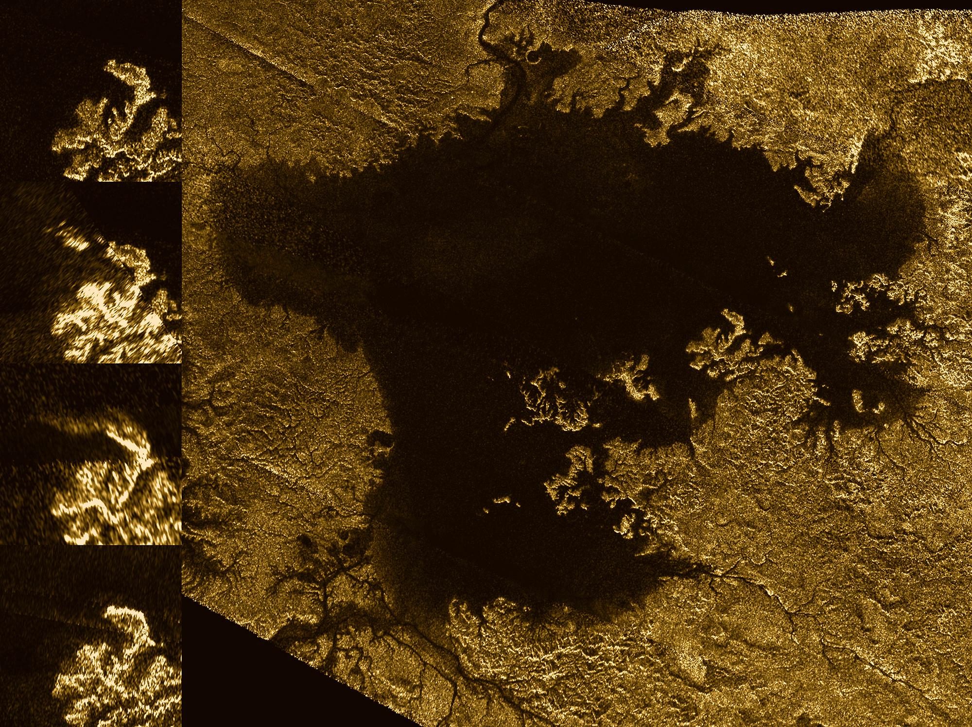
2016-03-02 |
Titan
|
Cassini-Huygens
|
Radar Mapper
|
2000x1496x3 |
|
-
PIA20021:
-
Mystery Feature Evolves in Titan's Ligeia Mare
Full Resolution:
TIFF
(7.761 MB)
JPEG
(753.8 kB)
|
|
|
2016-03-02 |
Ceres
|
Dawn
|
Framing Camera
|
1024x1024x1 |

|
-
PIA20392:
-
Dawn LAMO Image 38
Full Resolution:
TIFF
(1.038 MB)
JPEG
(161.3 kB)
|
|
|
2016-03-02 |
Mars
|
2001 Mars Odyssey
|
THEMIS
|
706x1440x1 |
|
-
PIA20417:
-
Nilus Chaos
Full Resolution:
TIFF
(727.4 kB)
JPEG
(90.49 kB)
|
|
|
2016-03-01 |
Ceres
|
Dawn
|
Framing Camera
|
1024x1024x1 |
|
-
PIA20391:
-
Dawn LAMO Image 37
Full Resolution:
TIFF
(1.05 MB)
JPEG
(218.6 kB)
|
|
|
2016-03-01 |
Mars
|
2001 Mars Odyssey
|
THEMIS
|
703x1436x1 |
|
-
PIA20416:
-
Crater
Full Resolution:
TIFF
(708.7 kB)
JPEG
(83.99 kB)
|
|
|
2016-02-29 |
Earth
|
Terra
|
ASTER
|
1800x2304x3 |
|
-
PIA20421:
-
Beihai, Guanxi, China
Full Resolution:
TIFF
(12.45 MB)
JPEG
(701.6 kB)
|
 Planetary Data System


