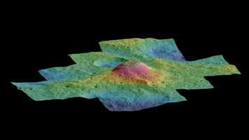
Side View
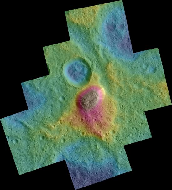
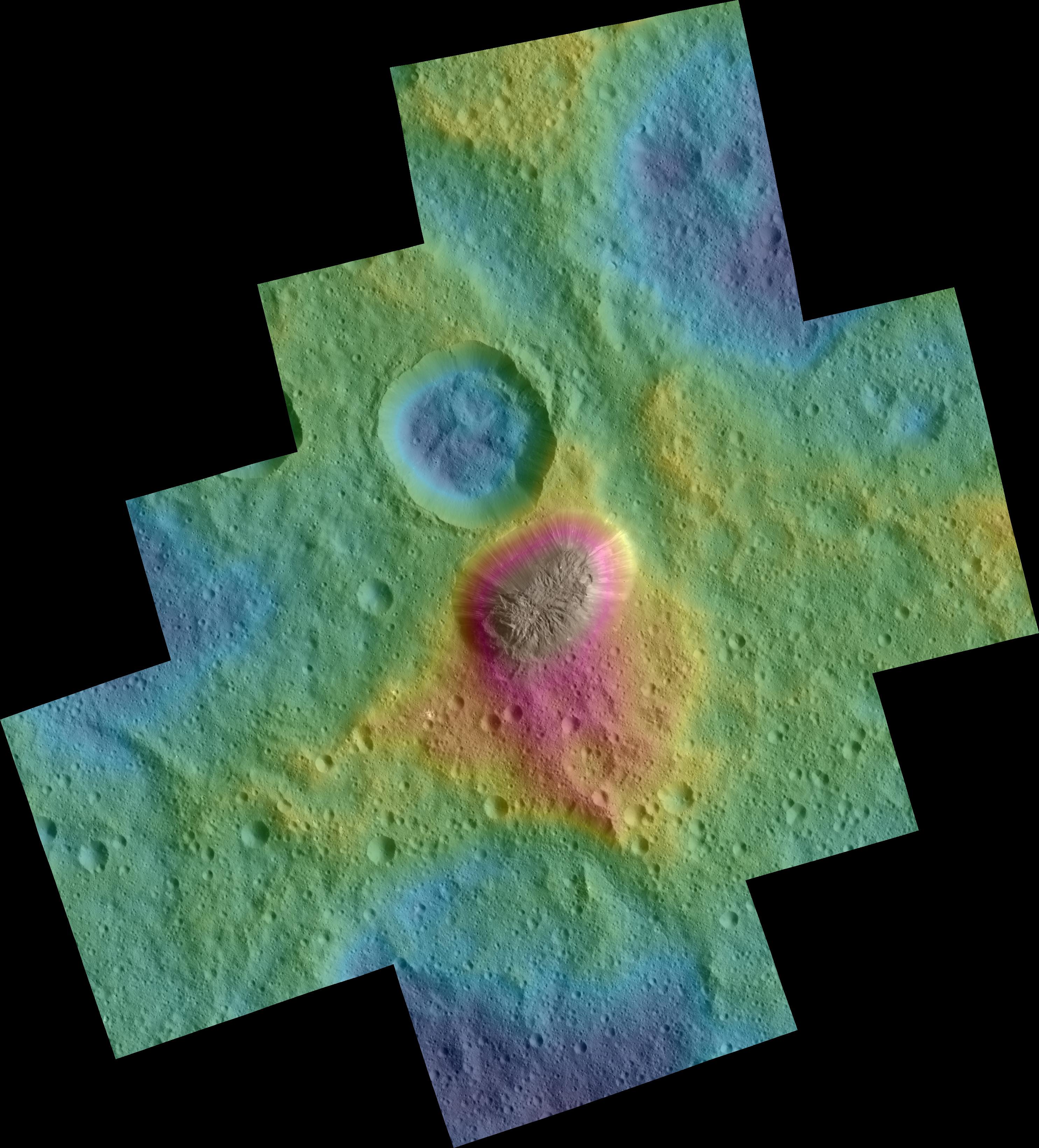
Click on the image for larger versionThese color topographic views show variations in surface height around Ahuna Mons, a mysterious mountain on Ceres.
The views are colorized versions of PIA20348 and PIA20349. They represent an update to the view in PIA19976, which showed the mountain using data from an earlier, higher orbit.
Both views were made using images taken by NASA's Dawn spacecraft during its low-altitude mapping orbit, at a distance of about 240 miles (385 kilometers) from the surface. The resolution of the component images is about 120 feet (35 meters) per pixel.
Elevations span a range of about 5.5 miles (9 kilometers) from the lowest places in the region to the highest terrains. Blue represents the lowest elevation, and brown is the highest. The streaks running down the side of the mountain, which appear white in the grayscale view, are especially bright parts of the surface (the brightness does not relate to elevation). The elevations are from a shape model generated using images taken at varying sun and viewing angles during Dawn's lower-resolution, high-altitude mapping orbit (HAMO) phase.
The side perspective view was generated by draping the image mosaics over the shape model.
Dawn's mission is managed by JPL for NASA's Science Mission Directorate in Washington. Dawn is a project of the directorate's Discovery Program, managed by NASA's Marshall Space Flight Center in Huntsville, Alabama. UCLA is responsible for overall Dawn mission science. Orbital ATK, Inc., in Dulles, Virginia, designed and built the spacecraft. The German Aerospace Center, the Max Planck Institute for Solar System Research, the Italian Space Agency and the Italian National Astrophysical Institute are international partners on the mission team. For a complete list of acknowledgments, see http://dawn.jpl.nasa.gov/mission.
For more information about the Dawn mission, visit http://dawn.jpl.nasa.gov.
 Planetary Data System


