Your search criteria found 33 images
Feature Name
Go to PIAxxxxx:
Refine this list of images by:
Mission:
Instrument:
Click on an image for detailed information
Click on a column heading to sort in ascending or descending order
My
List
Addition DateSort Ascending Target Mission Instrument Size
Add Image to Favorite List 2024-12-17 Earth SWOT
KaRIn
1440x1330x3
Data from the SWOT satellite was used to calculate average water levels for lakes and reservoirs in the Ohio River Basin from July 2023 to November 2024.

PIA26188:
Ohio Basin Lakes Water Levels
Full Resolution:     TIFF (3.095 MB)     JPEG (259.9 kB)
Add Image to Favorite List 2024-10-31 Earth SWOT
KaRIn
1440x1090x3
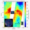
A SWOT data visualization shows high water levels on the northern side of Greenland's Dickson Fjord on Sept. 17, 2023. A huge rockslide into the fjord led to a tsunami.
PIA26420:
SWOT Captures Planet-Rumbling Greenland Tsunami
Full Resolution:     TIFF (4.089 MB)     JPEG (256.9 kB)
Add Image to Favorite List 2024-05-07 Earth SWOT
KaRIn
4000x2250x3
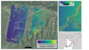
Flooding from monsoon rains covers a wide region of northeast Bangladesh in this Oct. 8, 2023, image showing data from SWOT. The U.S.-French satellite is the first to provide water surface elevation information over entire regions at high resolution.
PIA26343:
SWOT Captures Flooding in Bangladesh
Full Resolution:     TIFF (19.36 MB)     JPEG (1.312 MB)
Add Image to Favorite List 2024-04-15 Earth SWOT
KaRIn
1440x1090x3
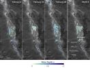
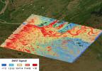
Water depths in Death Valley's temporary lake ranged between about 3 feet (or 1 meter, shown in dark blue) to less than 1.5 feet (0.5 meters, light yellow) from February through early March.
PIA26184:
SWOT Death Valley Lake Depth
Full Resolution:     TIFF (2.295 MB)     JPEG (265.3 kB)
Add Image to Favorite List 2024-03-05 Earth SWOT
KaRIn
1440x1090x3
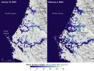
This image shows SWOT satellite data for water surface height in part of Mendocino County, Northern California, on Jan. 15, 2024, before several atmospheric rivers arrived, and on Feb. 4, after the first storms.
PIA26182:
California Coastal Flooding Captured in SWOT Data
Full Resolution:     TIFF (2.527 MB)     JPEG (255.1 kB)
Add Image to Favorite List 2023-11-08 Earth SWOT
KaRIn
1264x1029x3
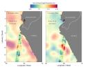
Data from the SWOT satellite shows sea level anomalies off the coast of Ecuador and Peru on Aug. 12, 2023, and Oct. 3, 2023. The data indicates the development of an El Niño along the west coast of the Americas.
PIA26181:
SWOT Monitors El Niño off Peru
Full Resolution:     TIFF (1.206 MB)     JPEG (101.7 kB)
Add Image to Favorite List 2023-10-30 Earth SWOT
KaRIn
1920x1080x3
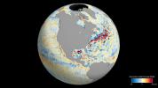
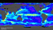
This animation shows global sea level data collected by the Surface Water and Ocean Topography satellite from July 26 to Aug. 16, 2023.
PIA26100:
SWOT's Detailed View of Global Sea Level
Full Resolution:     TIFF (2.393 MB)     JPEG (137.4 kB)
Add Image to Favorite List 2023-09-19 Earth SWOT
KaRIn
1570x1870x3
This data visualization shows sea surface heights off the northern California coast in August, 2023, as measured by the SWOT satellite.
PIA26091:
SWOT Monitors Warming Waters Off California Coast
Full Resolution:     TIFF (4.064 MB)     JPEG (286.6 kB)
Add Image to Favorite List 2023-08-30 Earth Surface Water and Ocean Topography (SWOT)
KaRIn
2794x1934x3
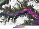
The mighty Yukon River and nearby lakes appear in red in this image produced using data recorded on June 18, 2023, by the international Surface Water and Ocean Topography (SWOT) satellite as it passed over Alaska.
PIA25780:
SWOT Captures the Yukon River in Alaska
Full Resolution:     TIFF (16.22 MB)     JPEG (1.293 MB)
Add Image to Favorite List 2023-06-27 Earth Surface Water and Ocean Topography (SWOT)
1125x1122x3
The Surface Water and Ocean Topography (SWOT) mission collected data on sea levels around two of the inhabited islands of Tuvalu, a nation in the South Pacific Ocean that has been threatened with sea level rise.
PIA25777:
SWOT Measures Tuvalu Sea Level
Full Resolution:     TIFF (1.862 MB)     JPEG (131.7 kB)
Add Image to Favorite List 2023-03-24 Earth Surface Water and Ocean Topography (SWOT)
KaRIn
787x879x3
This visualization shows water features on New York's Long Island – shown as bright pink splotches. Purple, yellow, green, and dark blue shades represent different land elevations. The data was collected on Jan. 21, 2023, by SWOT's KaRIn instrument.
PIA25774:
SWOT Satellite's Land 'First Light'
Full Resolution:     TIFF (2.076 MB)     JPEG (135.1 kB)
Add Image to Favorite List 2023-03-24 Earth 1440x1570x3
This visualization shows sea surface height measurements of the Gulf Stream off the coast of North Carolina and Virginia. The data was collected on Jan. 21, 2023, by seven satellites currently in operation.
PIA25773:
Sea Level Visualization of Gulf Stream
Full Resolution:     TIFF (2.24 MB)     JPEG (159 kB)
Add Image to Favorite List 2023-03-24 Earth Surface Water and Ocean Topography (SWOT)
KaRIn
1440x1570x3
This visualization shows sea surface height measurements in the Gulf Stream off the coast of North Carolina and Virginia. The data was collected on Jan. 21, 2023, by an instrument on the SWOT satellite called KaRIn.
PIA25772:
SWOT Satellite's Sea Level 'First Light'
Full Resolution:     TIFF (2.873 MB)     JPEG (182.2 kB)
Add Image to Favorite List 2023-01-03 Surface Water and Ocean Topography (SWOT)
Ka-band Radar Interferometer (KaRIn)
960x540x3
This animation shows the antennas for the Ka-band Radar Interferometer (KaRIn) instrument deploying on the SWOT satellite. The actual antennas deployed over the course of four days after the spacecraft's Dec. 16, 2022 launch.
PIA25596:
SWOT KaRIn Antenna Deployment (Animation)
Full Resolution:     TIFF (384.4 kB)     JPEG (24.72 kB)
Add Image to Favorite List 2022-12-21 Surface Water and Ocean Topography (SWOT)
1674x670x3
This video shows the deployment of the solar arrays that power the SWOT satellite. The arrays deployed over the course of about 10 minutes after the spacecraft's Dec. 16, 2022, launch.
PIA25563:
Deployment of SWOT's Solar Arrays
Full Resolution:     TIFF (2.037 MB)     JPEG (100.8 kB)
Add Image to Favorite List 2022-12-12 Surface Water and Ocean Topography (SWOT)
Ka-band Radar Interferometer (KaRIn)
6871x3946x3
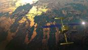
This illustration shows the SWOT satellite in orbit with sunlight glinting off one array of solar panels, as well as both KaRIn instrument antennas deployed.
PIA25595:
SWOT in Orbit (Illustration)
Full Resolution:     TIFF (67.6 MB)     JPEG (3.206 MB)
Add Image to Favorite List 2022-12-12 Surface Water and Ocean Topography (SWOT)
Ka-band Radar Interferometer (KaRIn)
8256x5504x3
Members of the international SWOT mission test one of the antennas for the Ka-band Radar Interferometer (KaRIn) instrument in a clean room at NASA's Jet Propulsion Laboratory in Southern California.
PIA25594:
SWOT KaRIn Antenna Test
Full Resolution:     TIFF (118.4 MB)     JPEG (8.21 MB)
Add Image to Favorite List 2022-12-09 Surface Water and Ocean Topography (SWOT)
4912x7360x3
The SWOT water-tracking satellite was encapsulated in its payload fairing on Dec. 8. It will now go atop a SpaceX Falcon 9 rocket in preparation for a launch targeting Dec. 15, 2022.
PIA25627:
SWOT Spacecraft Encapsulated in Payload Fairing
Full Resolution:     TIFF (90.28 MB)     JPEG (7.032 MB)
Add Image to Favorite List 2022-11-14 Surface Water and Ocean Topography (SWOT)
8256x5504x3
On June 27, 2021, teams from NASA's Jet Propulsion Laboratory and the March Air Reserve Base, loaded the scientific heart of the Surface Water and Ocean Topography (SWOT) mission into a C-17 airplane.
PIA25625:
SWOT Headed to France on C-17 Aircraft
Full Resolution:     TIFF (105.8 MB)     JPEG (5.21 MB)
Add Image to Favorite List 2022-11-14 Surface Water and Ocean Topography (SWOT)
8256x5504x3
On June 27, 2021, teams from NASA's Jet Propulsion Laboratory and the March Air Reserve Base, loaded the scientific heart of the Surface Water and Ocean Topography (SWOT) mission into a C-17 airplane.
PIA25624:
SWOT Secured for Transport in C-17 Aircraft
Full Resolution:     TIFF (120.2 MB)     JPEG (6.204 MB)
Add Image to Favorite List 2022-11-14 Surface Water and Ocean Topography (SWOT)
KaRIn
8889x5000x3
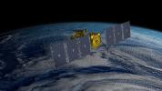
This illustration shows the Surface Water and Ocean Topography (SWOT) satellite in orbit with its solar panels and KaRIn instrument antennas deployed.
PIA25623:
SWOT Orbiting Earth (Illustration)
Full Resolution:     TIFF (77.29 MB)     JPEG (1.991 MB)
Add Image to Favorite List 2022-11-14 Surface Water and Ocean Topography (SWOT)
2730x1530x3
This illustration depicts the Surface Water and Ocean Topography (SWOT) satellite with solar arrays fully deployed.
PIA25622:
SWOT Satellite With Solar Arrays in Full View (Illustration)
Full Resolution:     TIFF (10.28 MB)     JPEG (431.7 kB)
Add Image to Favorite List 2022-11-14 Surface Water and Ocean Topography (SWOT)
KaRIn
2560x1440x3
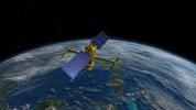
This illustration shows the SWOT satellite, which will use the Ka-band Radar Interferometer (KaRIn) instrument to measure the height of water in lakes, rivers, reservoirs, and ocean.
PIA25621:
SWOT Above Earth (Illustration)
Full Resolution:     TIFF (6.479 MB)     JPEG (308.8 kB)
Add Image to Favorite List 2022-11-14 Surface Water and Ocean Topography (SWOT)
KaRIn
2946x1646x3
The SWOT satellite, shown in this illustration, will use the Ka-band Radar Interferometer (KaRIn) to measure the height of water in lakes, rivers, reservoirs, and ocean.
PIA24530:
SWOT in Orbit With View of KaRIn Instrument (Illustration)
Full Resolution:     TIFF (3.918 MB)     JPEG (217.8 kB)
Add Image to Favorite List 2022-11-14 Earth Surface Water and Ocean Topography (SWOT)
1920x1080x3
This animation, created in 2012, shows the increasing clarity and detail of measurements of sea height made by successive satellite altimeters launched by NASA and other agencies over the past four decades.
PIA25561:
SWOT Satellite will Improve Clarity and Detail of Sea Height Measurements
Full Resolution:     TIFF (3.673 MB)     JPEG (154 kB)
Add Image to Favorite List 2022-10-20 Surface Water and Ocean Topography (SWOT)
2179x1547x3
A container with the Surface Water and Ocean Topography (SWOT) satellite is offloaded from an Air Force C-5 airplane on Oct. 16, 2022, at Vandenberg Space Force Base in Central California.
PIA25591:
SWOT Arrives at Vandenberg Space Force Base
Full Resolution:     TIFF (7.499 MB)     JPEG (331.9 kB)
Add Image to Favorite List 2022-10-18 Surface Water and Ocean Topography (SWOT)
6048x3749x3
Workers in a clean room in Cannes, France, load the Surface Water and Ocean Topography (SWOT) satellite into a container in preparation for shipping the spacecraft to the U.S.
PIA24910:
Packing SWOT For Launch
Full Resolution:     TIFF (53.66 MB)     JPEG (2.978 MB)
Add Image to Favorite List 2022-05-11 Surface Water and Ocean Topography (SWOT)
6048x4024x3
SWOT's solar panels unfold as part of a test in January at a Thales Alenia Space facility in Cannes, France, where the satellite is being assembled. SWOT will measure elevations of Earth's ocean and surface water.
PIA25147:
SWOT Solar Panels Deploy at Thales Alenia Space Facility in France
Full Resolution:     TIFF (55.8 MB)     JPEG (2.346 MB)
Add Image to Favorite List 2021-06-30 Surface Water and Ocean Topography (SWOT)
8256x5504x3
Part of the Surface Water and Ocean Topography (SWOT) satellite's science instrument payload sits in a clean room at NASA's Jet Propulsion Laboratory during assembly.
PIA24536:
SWOT Science Payload
Full Resolution:     TIFF (105.1 MB)     JPEG (7.342 MB)
Add Image to Favorite List 2021-06-30 Surface Water and Ocean Topography (SWOT)
8256x5504x3
Some of the people who helped to load the hardware for the Surface Water and Ocean Topography (SWOT) satellite's research instruments onto a C-17 airplane pose for a picture. The payload left March Air Reserve Base on June 27 and is headed to France.
PIA24535:
SWOT Teamwork
Full Resolution:     TIFF (108 MB)     JPEG (5.043 MB)
Add Image to Favorite List 2021-06-30 Surface Water and Ocean Topography (SWOT)
8256x5504x3
Teams from NASA's Jet Propulsion Laboratory and the March Air Reserve Base loaded the scientific payload for the SWOT Earth-observing satellite into a C-17 airplane on June 27. The hardware is headed to a clean room facility near Cannes, France.
PIA24534:
Loading SWOT Into C-17 Aircraft
Full Resolution:     TIFF (96.71 MB)     JPEG (5.911 MB)
Add Image to Favorite List 2021-05-06 Surface Water and Ocean Topography (SWOT)
8256x5504x3
Project Manger Parage Vaze stands in the JPL clean room where the SWOT satellite is being assembled. The spacecraft will help researchers survey the amount and distribution of Earth's surface water, including lakes and rivers, as well as the ocean.
PIA24531:
SWOT Project Manager Parag Vaze
Full Resolution:     TIFF (82.94 MB)     JPEG (2.592 MB)
Add Image to Favorite List 2015-04-14 Earth 4500x6000x3
This poster highlights NASA's JPL missions that provide important inputs to research in sea level rise and variability -- key measures of ocean circulation and global climate change.
PIA18055:
Sea Level Rise & Variability
Full Resolution:     TIFF (81.05 MB)     JPEG (1.722 MB)
Currently displaying images: 1 - 33 of 33