My
List |
Addition Date
|
Target
|
Mission
|
Instrument
|
Size
|

|
2019-11-18 |
Titan
|
Cassini-Huygens
|
Imaging Science Subsystem
Radar Mapper
|
6604x3746x3 |
|
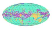
-
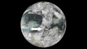
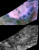
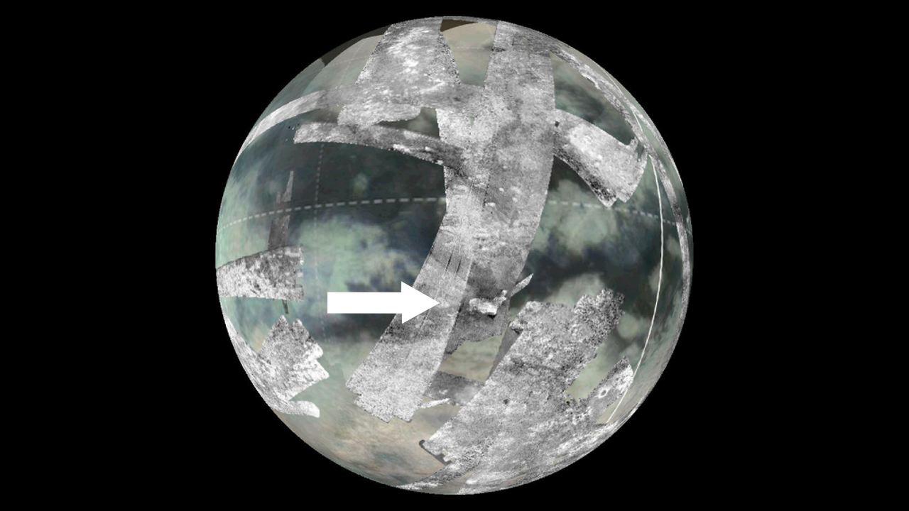
PIA23174:
-
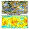
First Global Geologic Map of Titan
Full Resolution:
TIFF
(8.721 MB)
JPEG
(2.02 MB)
|
|
|
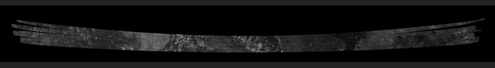
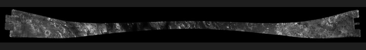
2017-08-11 |
Titan
|
Cassini-Huygens
|
Radar Mapper
|
14594x2578x1 |

|
-
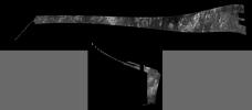
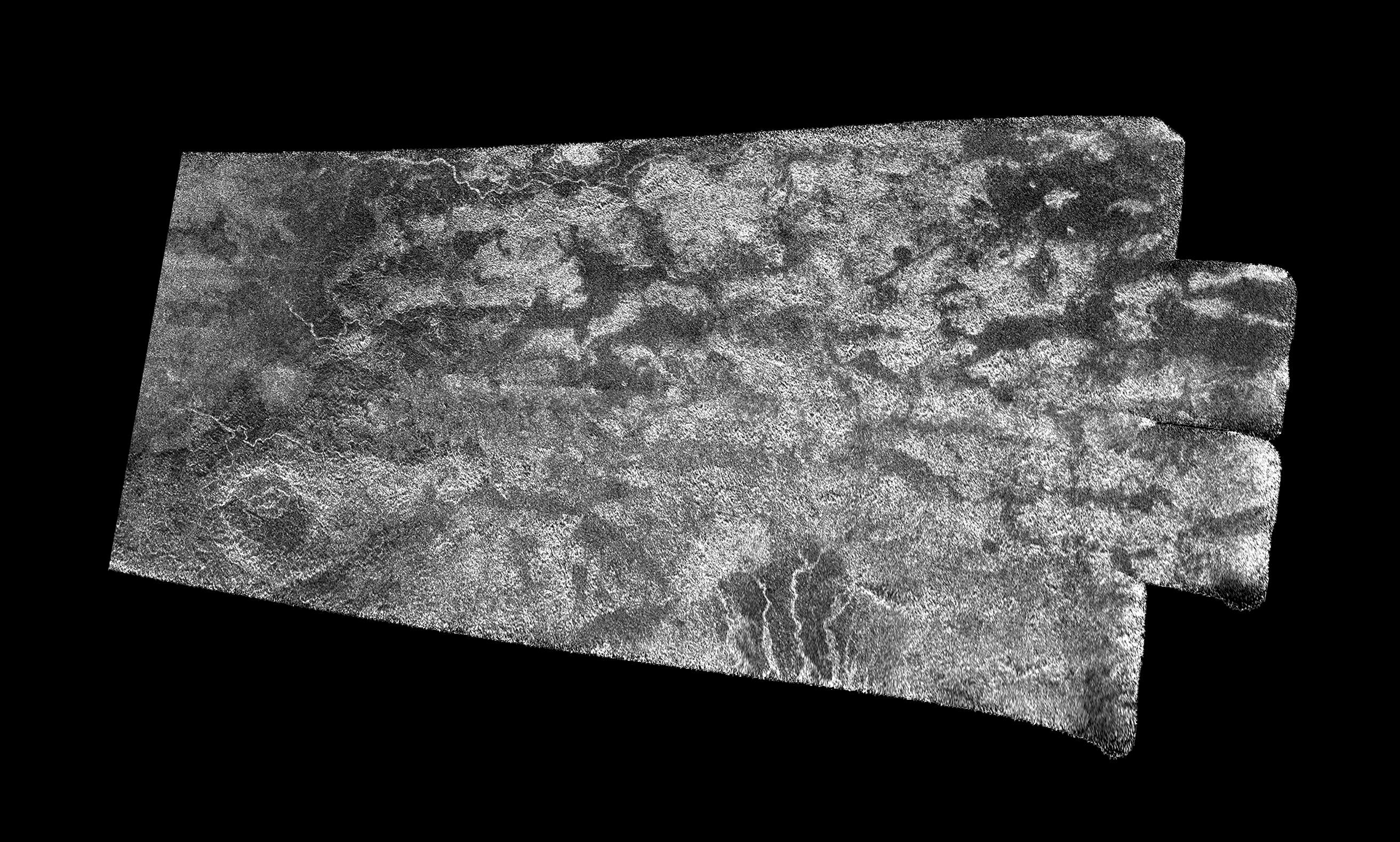
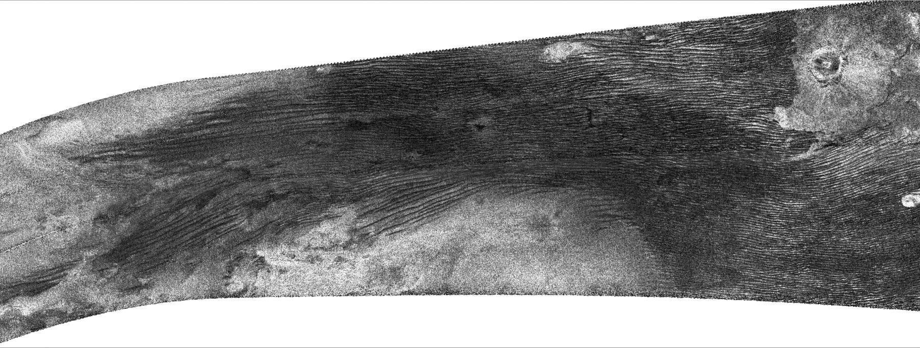
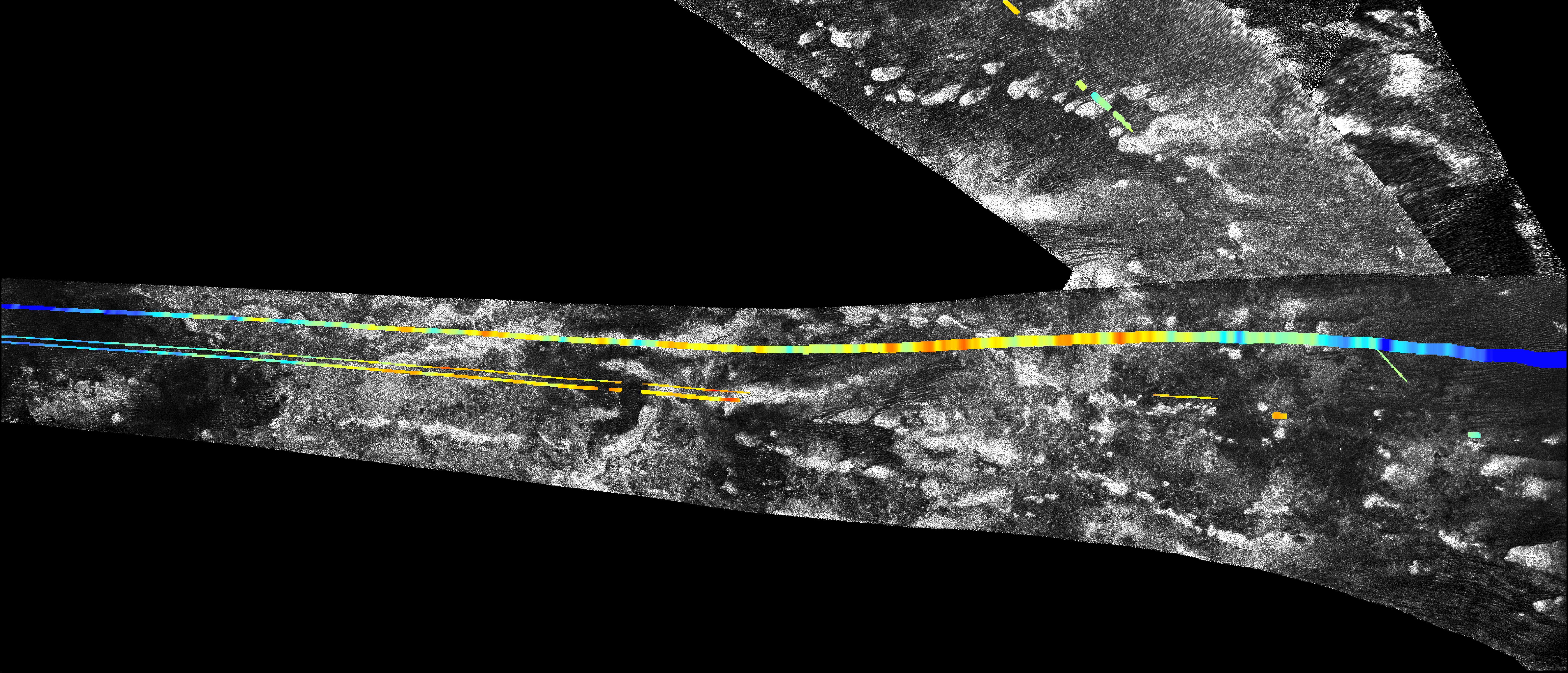
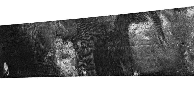
PIA21626:
Cassini's Final Titan Radar Swath
Full Resolution:
TIFF
(10.77 MB)
JPEG
(3.532 MB)
|
|
|
2016-09-07 |
Titan
|
Cassini-Huygens
|
Radar Mapper
|
931x592x1 |

|
-
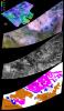
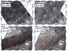
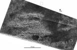
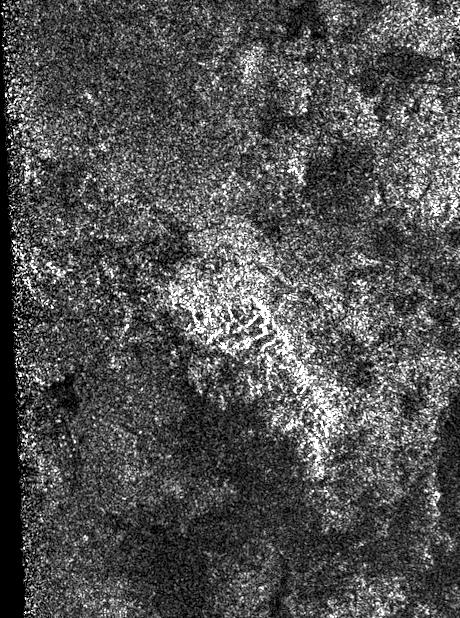
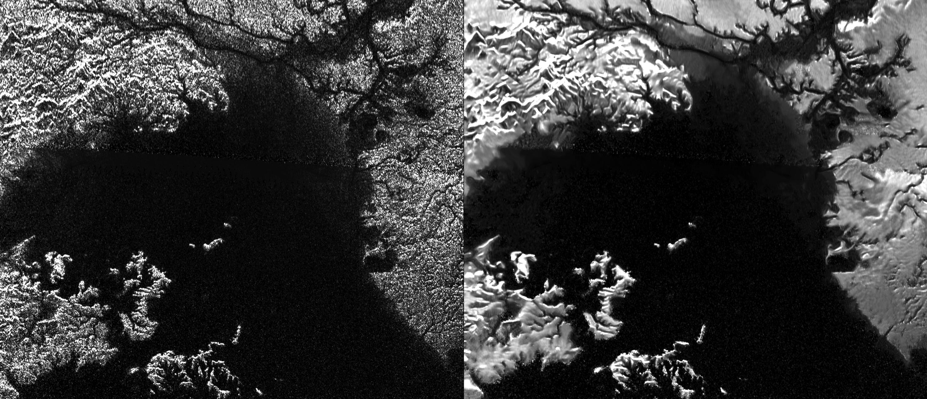
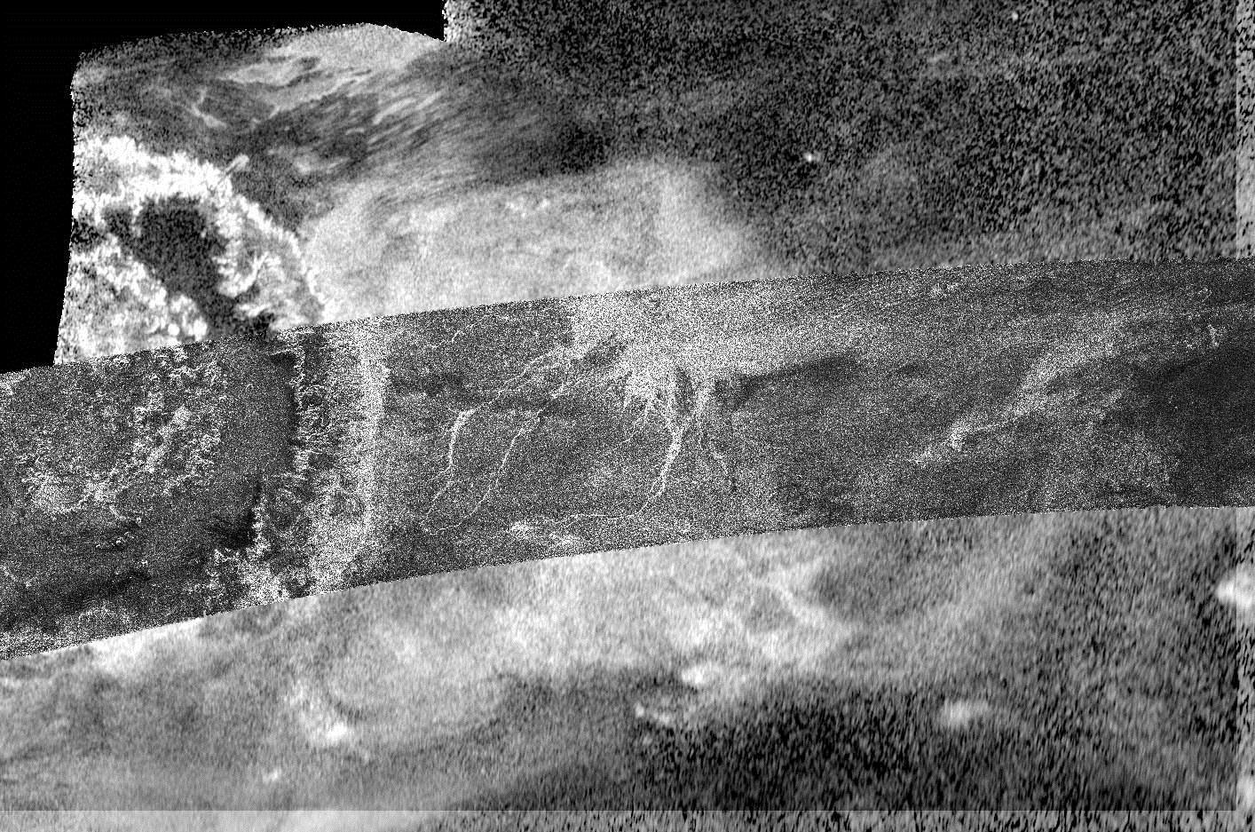
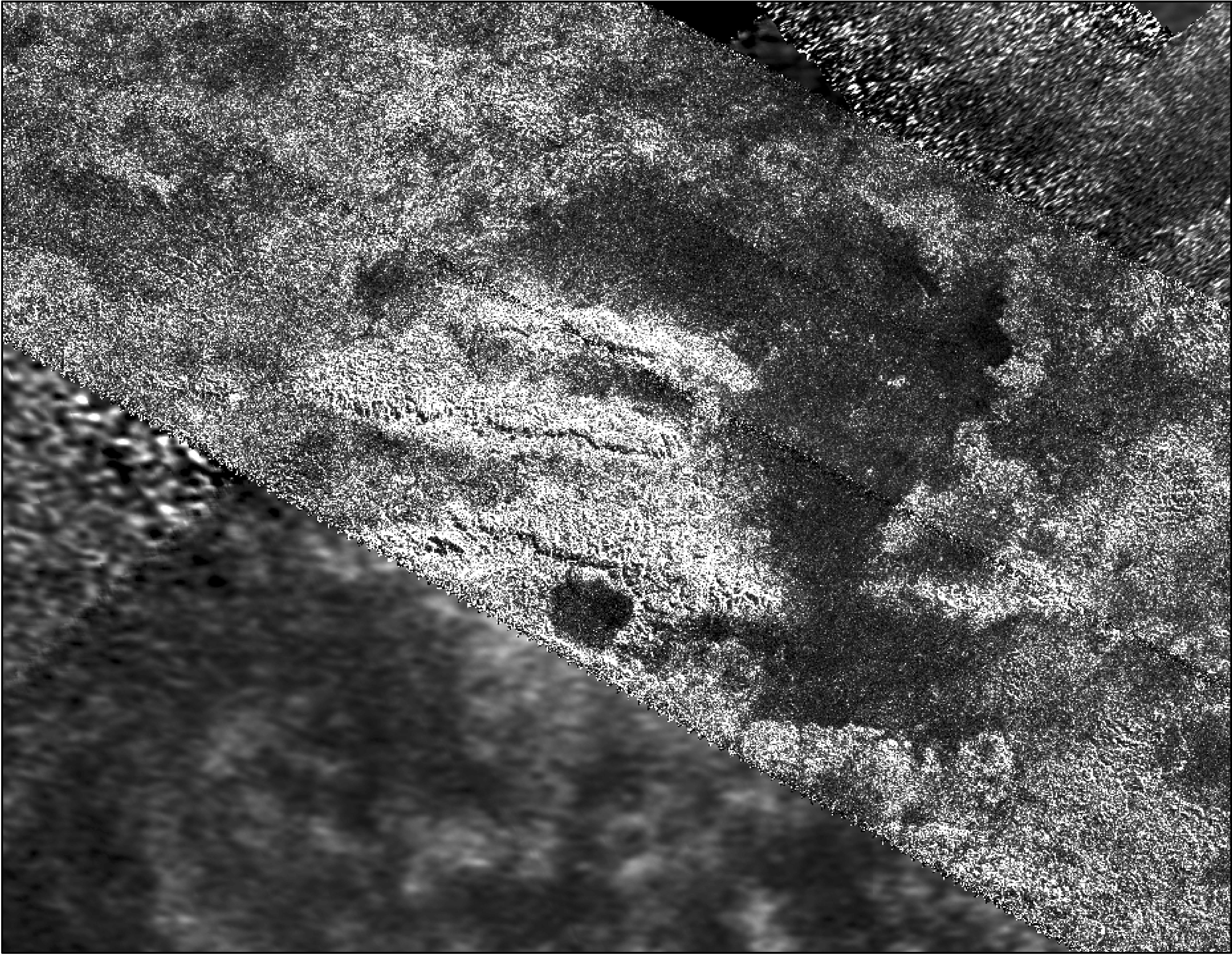
PIA20714:
-
The 'Xanadu Annex' on Titan (Denoised)
Full Resolution:
TIFF
(318.7 kB)
JPEG
(75.71 kB)
|
|
|
2016-09-07 |
Titan
|
Cassini-Huygens
|
Radar Mapper
|
2625x1580x1 |

|
-
PIA20712:
-
The 'Xanadu Annex' on Titan
Full Resolution:
TIFF
(2.684 MB)
JPEG
(800.5 kB)
|
|
|
2016-09-07 |
Titan
|
Cassini-Huygens
|
Radar Mapper
|
1920x2048x1 |

|
-
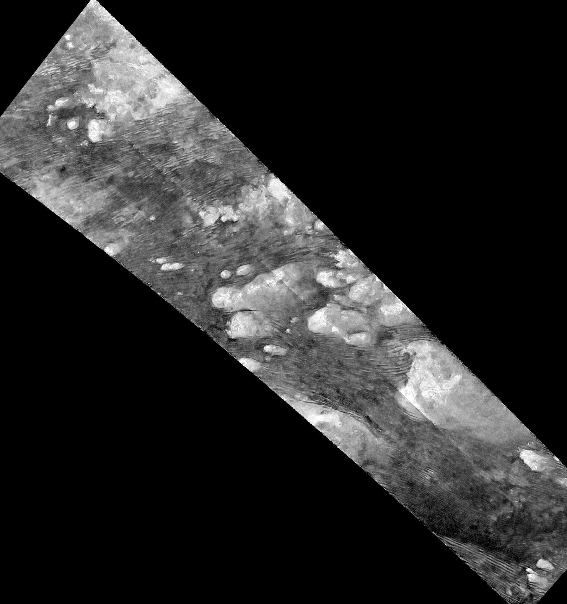
PIA20711:
-
Flowing Dunes of Shangri-La (Denoised)
Full Resolution:
TIFF
(1.628 MB)
JPEG
(338.2 kB)
|
|
|
2016-09-07 |
Titan
|
Cassini-Huygens
|
Radar Mapper
|
1896x1701x1 |

|
-
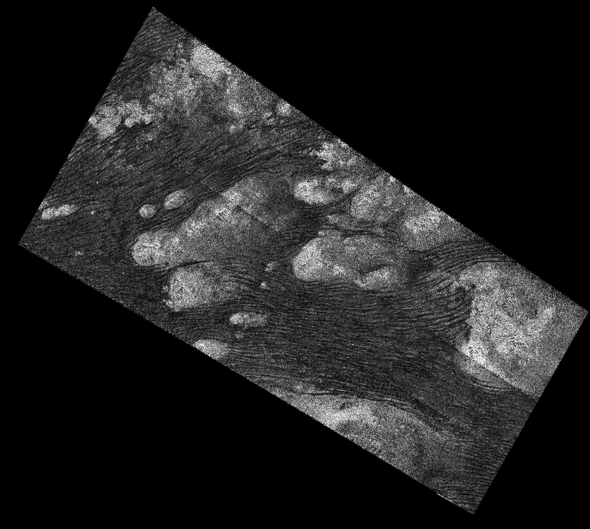
PIA20710:
-
Flowing Dunes of Shangri-La
Full Resolution:
TIFF
(1.775 MB)
JPEG
(534 kB)
|
|
|
2016-07-29 |
Titan
|
Cassini-Huygens
|
Radar Mapper
|
460x618x1 |

|
-
PIA20709:
-
Ridge of Jagged Peaks on Titan
Full Resolution:
TIFF
(284.8 kB)
JPEG
(114.3 kB)
|
|
|
2016-07-29 |
Titan
|
Cassini-Huygens
|
Radar Mapper
|
811x716x1 |
|
-
PIA20708:
-
A Titanic Labyrinth
Full Resolution:
TIFF
(581.5 kB)
JPEG
(270.5 kB)
|
|
|
2016-03-24 |
Titan
|
Cassini-Huygens
|
Radar Mapper
Visual and Infrared Mapping Spectrometer
|
4043x2021x3 |
|
-
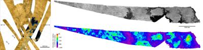
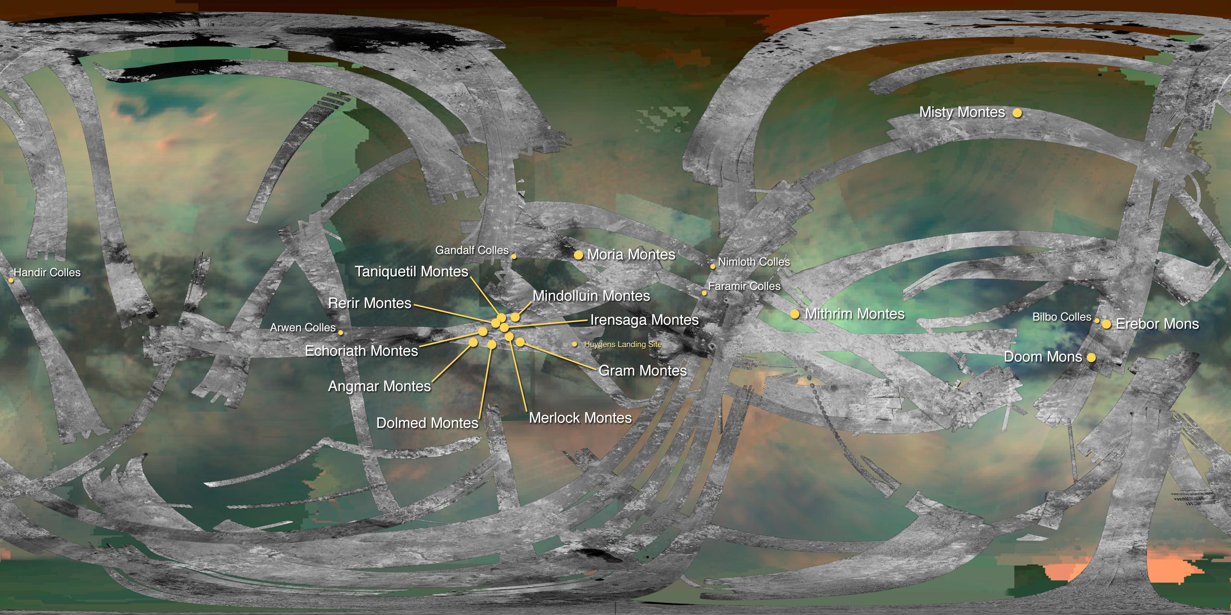
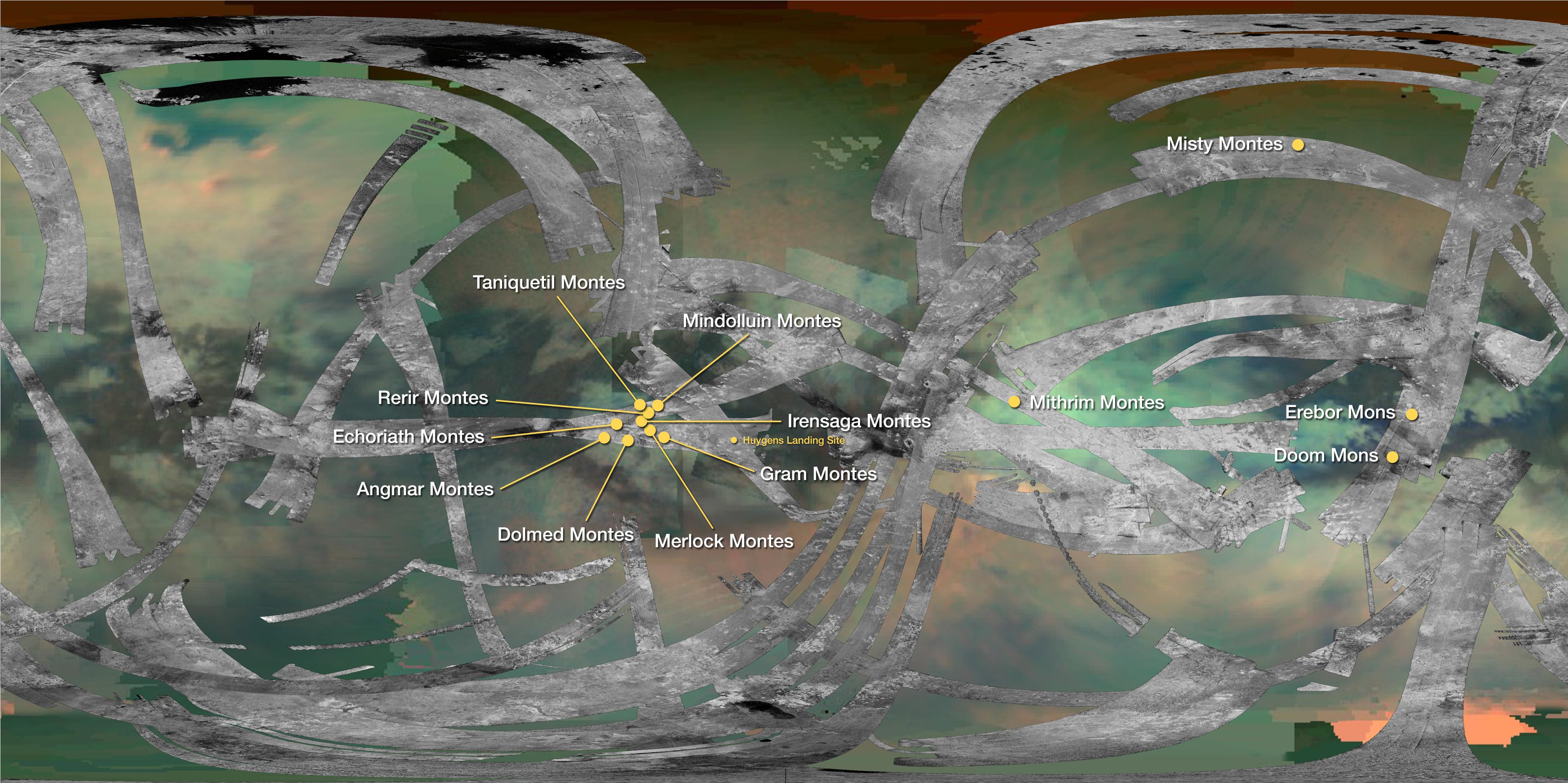
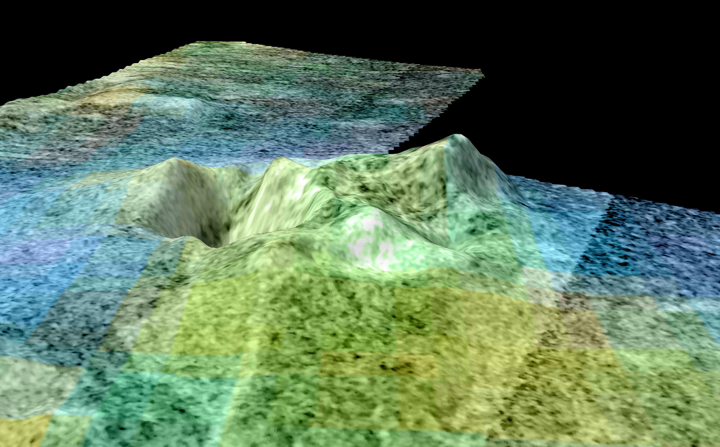
PIA20024:
-
Mountains of Titan Map - 2016 Update
Full Resolution:
TIFF
(17.24 MB)
JPEG
(1.082 MB)
|
|
|
2016-03-24 |
Titan
|
Cassini-Huygens
|
Radar Mapper
|
1600x1313x1 |

|
-
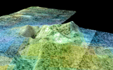
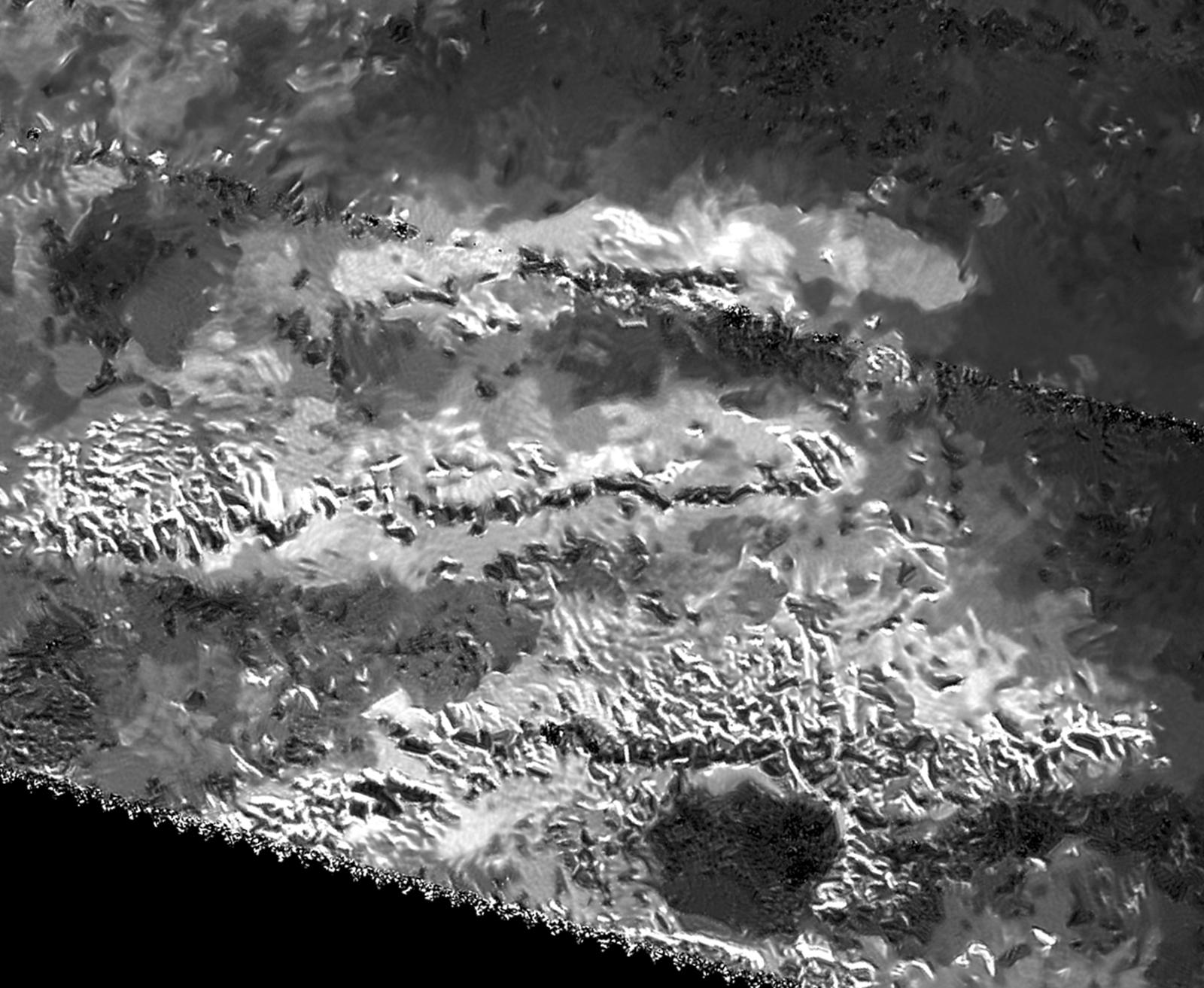
PIA20023:
-
Radar View of Titan's Tallest Mountains
Full Resolution:
TIFF
(2.032 MB)
JPEG
(264.3 kB)
|
|
|
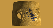
2016-03-02 |
Titan
|
Cassini-Huygens
|
Radar Mapper
|
2000x1496x3 |
|
-
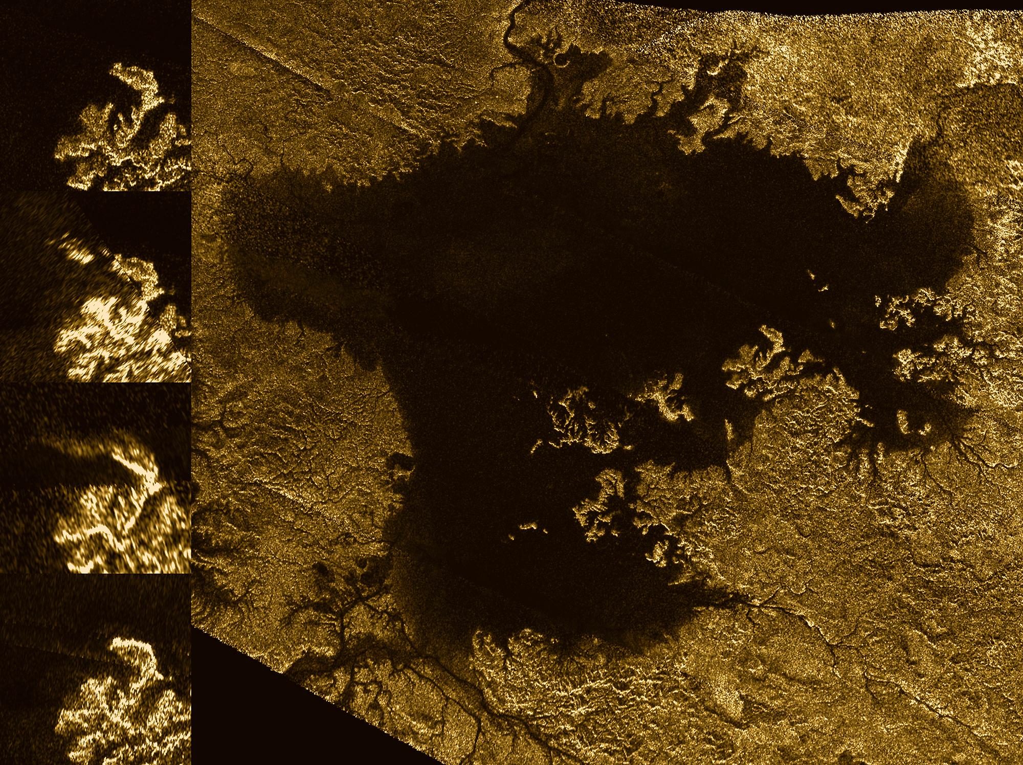
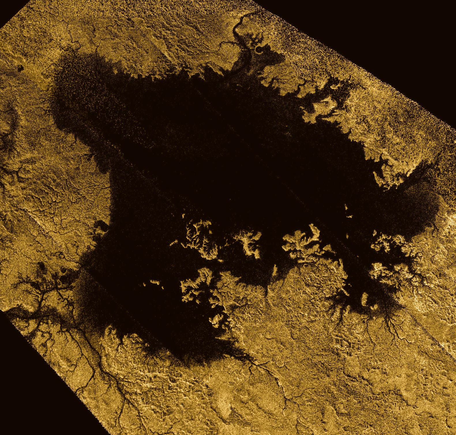
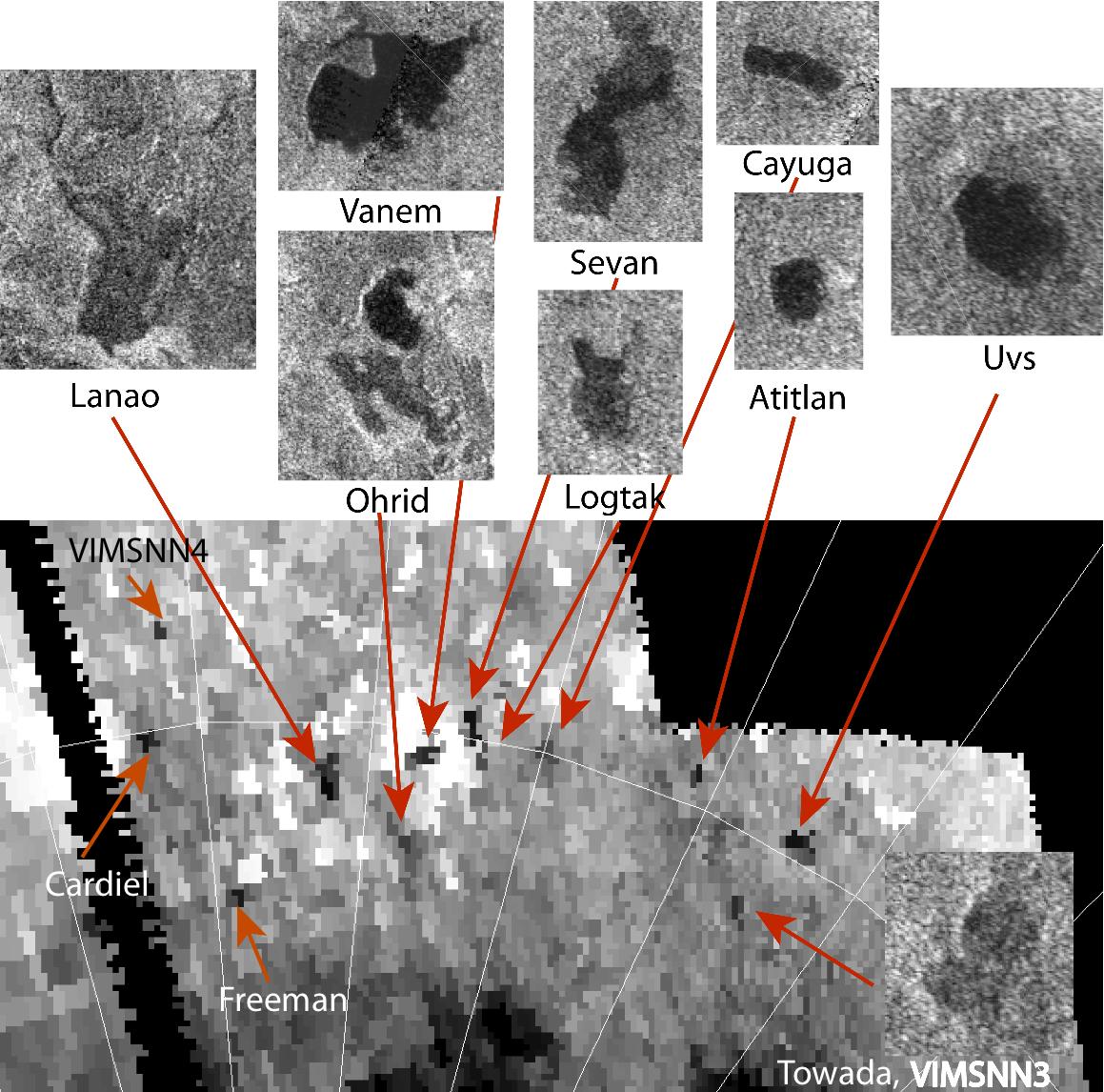
PIA20021:
-
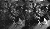
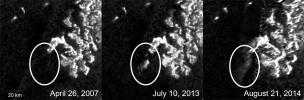
Mystery Feature Evolves in Titan's Ligeia Mare
Full Resolution:
TIFF
(7.761 MB)
JPEG
(753.8 kB)
|
|
|
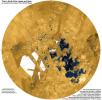
2015-02-12 |
Titan
|
Cassini-Huygens
|
Radar Mapper
|
1407x843x1 |
|
-
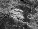
PIA19054:
-
Leilah Fluctus Despeckled
Full Resolution:
TIFF
(1.188 MB)
JPEG
(320.9 kB)
|
|
|
2015-02-12 |
Titan
|
Cassini-Huygens
|
Radar Mapper
|
1286x642x1 |
|
-
PIA19053:
-
Titan Despeckled Montage
Full Resolution:
TIFF
(826.7 kB)
JPEG
(166.4 kB)
|
|
|
2015-02-12 |
Titan
|
Cassini-Huygens
|
Radar Mapper
|
2980x1285x1 |

|
-
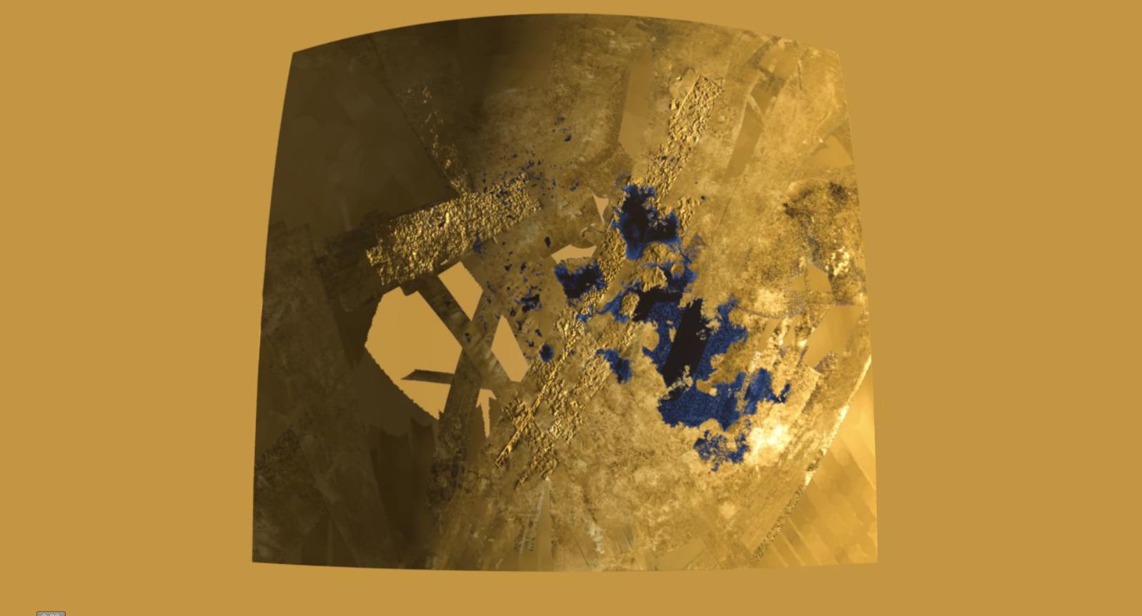
PIA19052:
-
Despeckling Ligea Mare
Full Resolution:
TIFF
(3.835 MB)
JPEG
(694.9 kB)
|
|
|
2015-02-12 |
Titan
|
Cassini-Huygens
|
Radar Mapper
|
604x590x1 |

|
-
PIA19051:
-
Perspective on Kraken Mare Shores
Full Resolution:
TIFF
(356.9 kB)
JPEG
(44.58 kB)
|
|
|
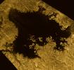
2014-11-10 |
Titan
|
Cassini-Huygens
|
Radar Mapper
|
1500x728x1 |

|
-
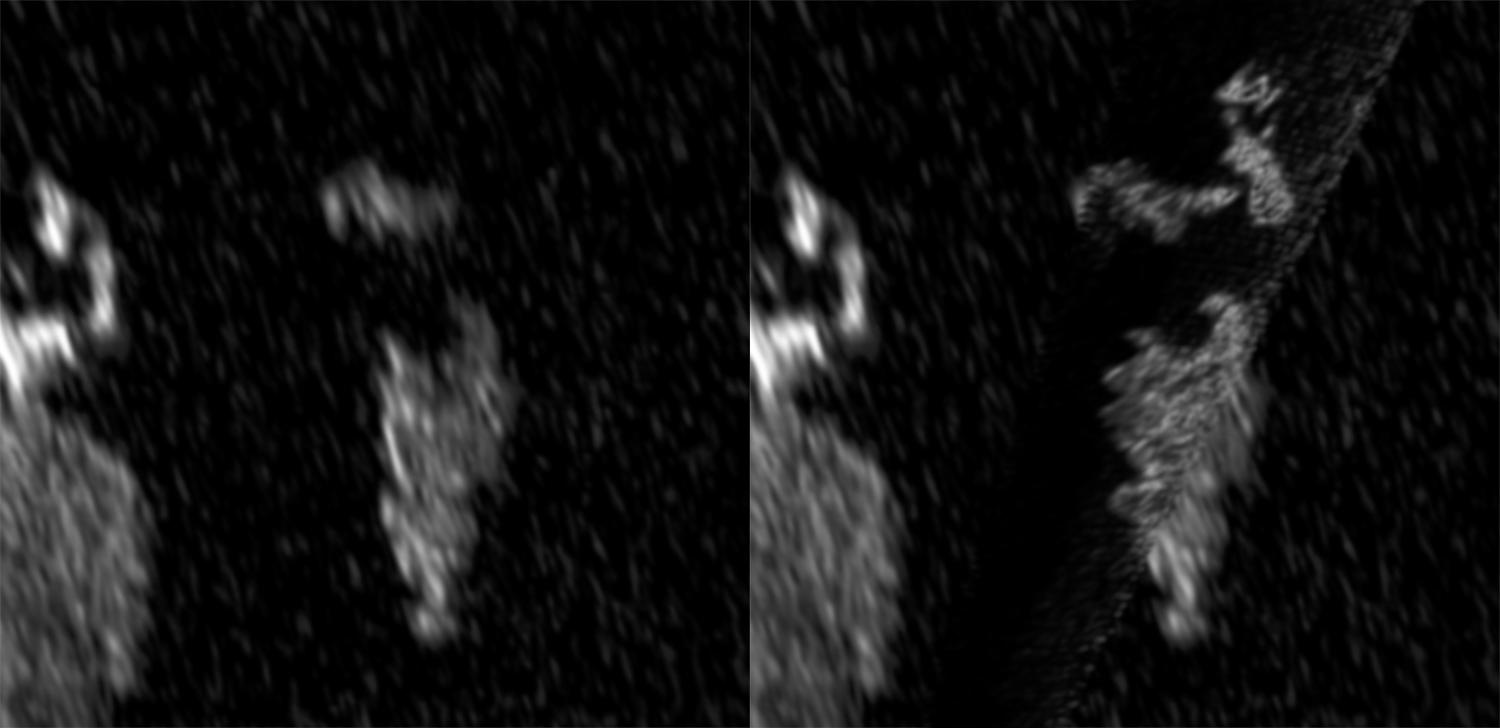
PIA19047:
-
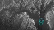
Bright Feature Appears in Titan's Kraken Mare
Full Resolution:
TIFF
(1.093 MB)
JPEG
(64.03 kB)
|
|
|
2014-11-10 |
Titan
|
Cassini-Huygens
|
Radar Mapper
|
1600x900x3 |
|
-
PIA19046:
-
Plumbing Coastal Depths in Titan's Kraken Mare
Full Resolution:
TIFF
(4.322 MB)
JPEG
(276.3 kB)
|
|
|
2014-09-29 |
Titan
|
Cassini-Huygens
|
Radar Mapper
|
2000x658x1 |
|
-
PIA18430:
-
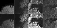
Mysterious Changing Feature in Ligeia Mare
Full Resolution:
TIFF
(1.318 MB)
JPEG
(124.8 kB)
|
|
|
2013-12-12 |
Titan
|
Cassini-Huygens
|
Radar Mapper
|
1598x863x3 |
|
-
PIA17656:
-
Flying over an Extraterrestrial Land of Lakes

Full Resolution:
TIFF
(4.139 MB)
JPEG
(91.84 kB)
|
|
|
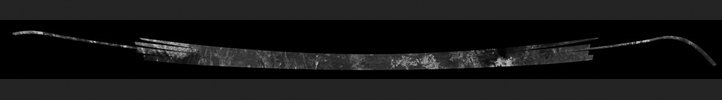
2013-12-12 |
Titan
|
Cassini-Huygens
|
Radar Mapper
|
24113x23588x3 |
|
-
PIA17655:
-
Titan's North
Full Resolution:
TIFF
(1.707 GB)
JPEG
(20.6 MB)
|
|
|
2013-05-22 |
Titan
|
Cassini-Huygens
|
Radar Mapper
|
1581x1507x3 |
|
-
PIA17031:
-
Vast Ligeia Mare in False Color
Full Resolution:
TIFF
(2.387 MB)
JPEG
(684.2 kB)
|
|
|
2013-05-15 |
Titan
|
Cassini-Huygens
|
Radar Mapper
|
2197x2197x3 |
|
-
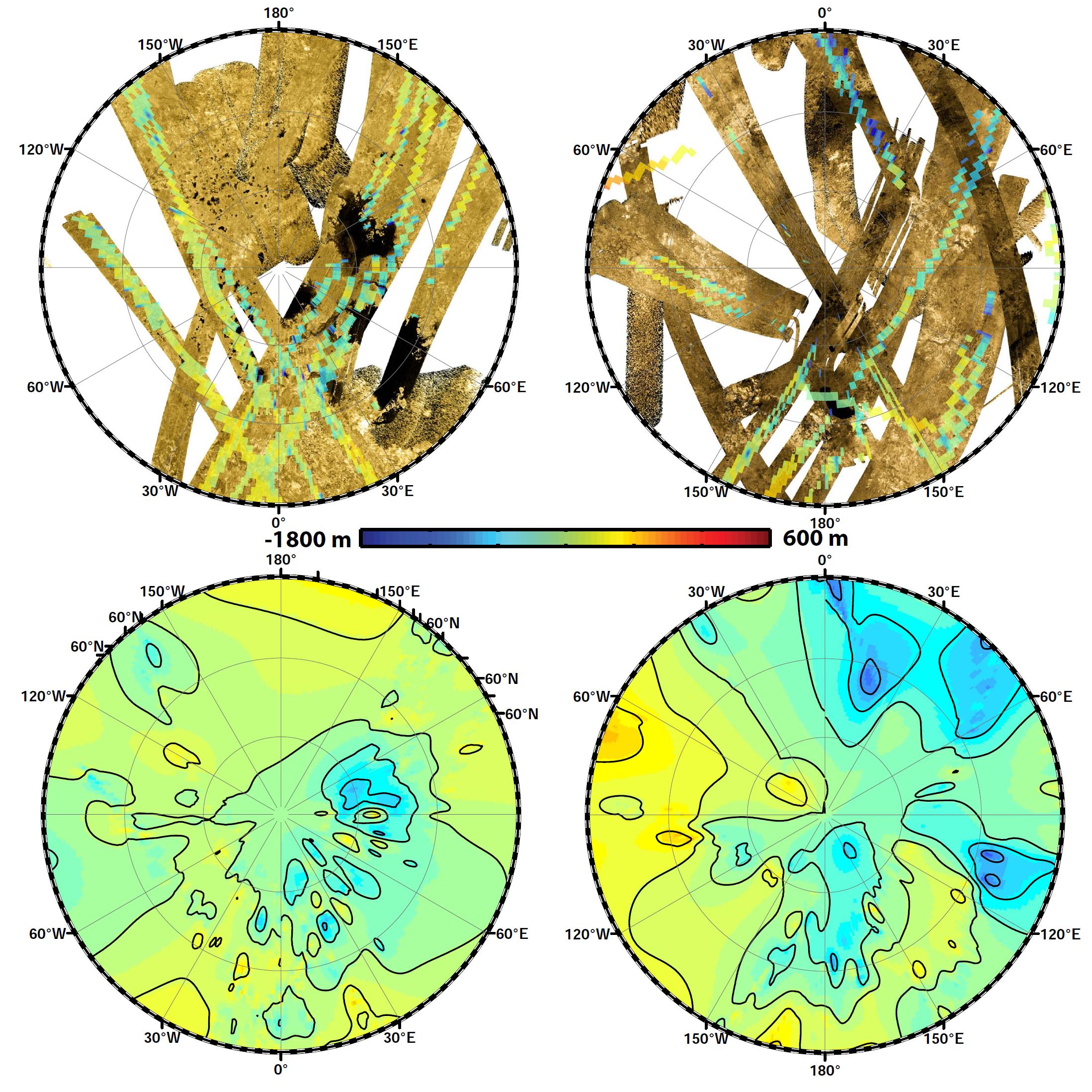
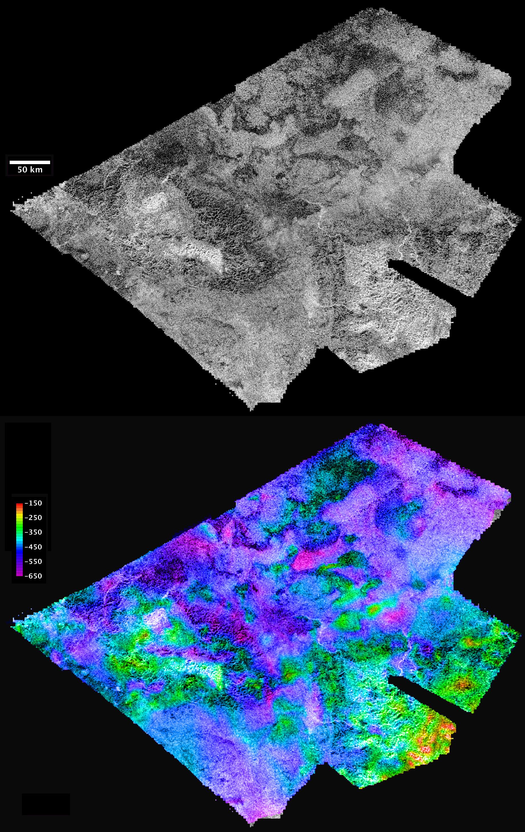
PIA17030:
-
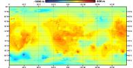
Polar Views of Titan's Global Topography
Full Resolution:
TIFF
(14.49 MB)
JPEG
(725.3 kB)
|
|
|
2013-05-15 |
Titan
|
Cassini-Huygens
|
Radar Mapper
Visual and Infrared Mapping Spectrometer
|
2197x2197x3 |
|
-
PIA16849:
-
Two Views of Titan's Topography
Full Resolution:
TIFF
(14.49 MB)
JPEG
(845.1 kB)
|
|
|
2013-05-15 |
Titan
|
Cassini-Huygens
|
Radar Mapper
|
2196x1126x3 |
|
-
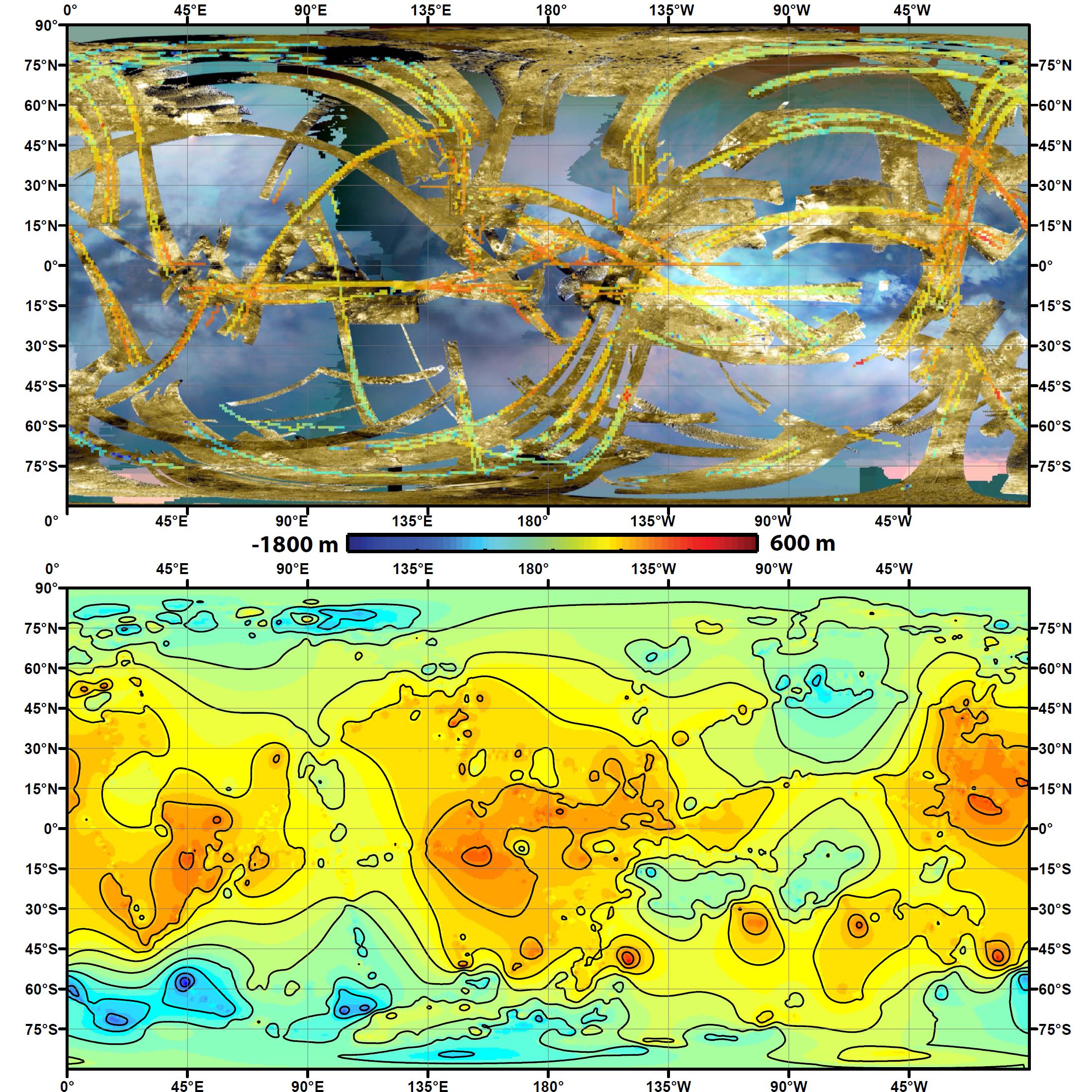
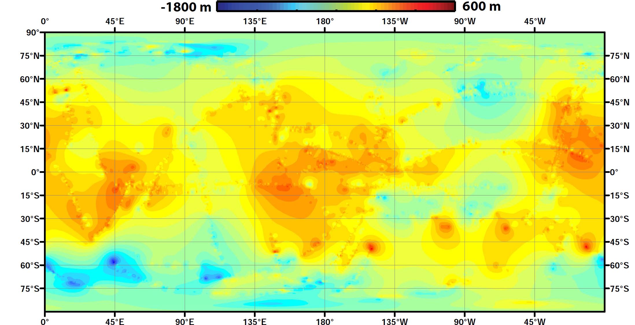
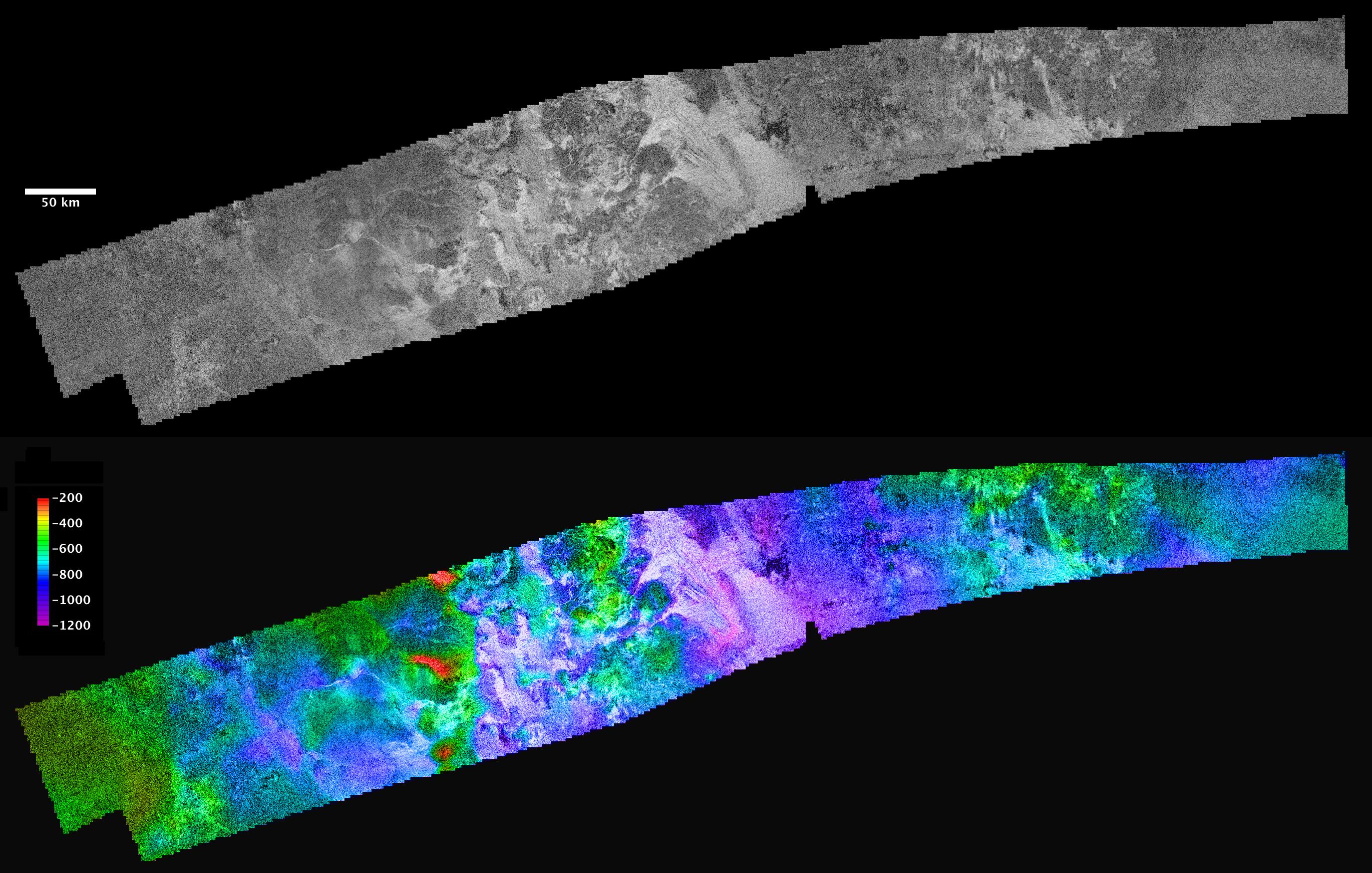
PIA16848:
-
Global Topographic Map of Titan
Full Resolution:
TIFF
(7.421 MB)
JPEG
(228.3 kB)
|
|
|
2013-04-15 |
Titan
|
Cassini-Huygens
|
Radar Mapper
Visual and Infrared Mapping Spectrometer
|
1159x1146x3 |
|
-
PIA16846:
-
A Sprinkling of Little Lakes
Full Resolution:
TIFF
(3.986 MB)
JPEG
(242.8 kB)
|
|
|
2013-04-15 |
Titan
|
Cassini-Huygens
|
Radar Mapper
Visual and Infrared Mapping Spectrometer
|
1226x441x3 |
|
-
PIA16845:
-
Titan Wetlands
Full Resolution:
TIFF
(1.623 MB)
JPEG
(118.8 kB)
|
|
|
2013-01-17 |
Titan
|
Cassini-Huygens
|
Radar Mapper
|
1000x500x1 |
|
-
PIA16638:
-
Titan Craters, the Old and the New
Full Resolution:
TIFF
(500.7 kB)
JPEG
(153.3 kB)
|
|
|
2013-01-08 |
Titan
|
Cassini-Huygens
|
Radar Mapper
|
1858x1354x1 |
|
-
PIA16635:
-
Different Looks for Titan Lakes
Full Resolution:
TIFF
(2.519 MB)
JPEG
(575.6 kB)
|
|
|
2012-12-14 |
Titan
|
Cassini-Huygens
|
Radar Mapper
Visual and Infrared Mapping Spectrometer
|
4038x2016x3 |
|
-
PIA16598:
-
Mountains of Titan
Full Resolution:
TIFF
(24.43 MB)
JPEG
(1.071 MB)
|
|
|
2012-12-12 |
Titan
|
Cassini-Huygens
|
Radar Mapper
|
372x1957x1 |

|
-
PIA16197:
-
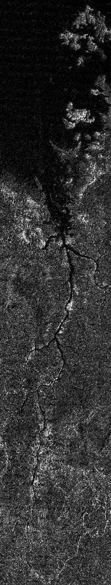
Titan's Nile-Like River Valley
Full Resolution:
TIFF
(728.9 kB)
JPEG
(274 kB)
|
|
|
2012-10-16 |
Titan
|
Cassini-Huygens
|
Radar Mapper
|
1911x1086x1 |
|
-
PIA16167:
-
Titan's Lake District, One Season Later
Full Resolution:
TIFF
(2.078 MB)
JPEG
(732.9 kB)
|
|
|
2012-10-16 |
Titan
|
Cassini-Huygens
|
Radar Mapper
|
648x883x1 |

|
-
PIA16166:
-
Outline of an Ancient Sea on Titan
Full Resolution:
TIFF
(573 kB)
JPEG
(196.4 kB)
|
|
|
2012-10-16 |
Titan
|
Cassini-Huygens
|
Radar Mapper
|
1870x780x1 |

|
-
PIA16165:
-
Titan's Hot Cross Bun
Full Resolution:
TIFF
(1.46 MB)
JPEG
(369.8 kB)
|
|
|
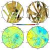
2012-01-23 |
Titan
|
Cassini-Huygens
Terra
|
ASTER
Radar Mapper
|
1770x1026x3 |
|
-
PIA15225:
-
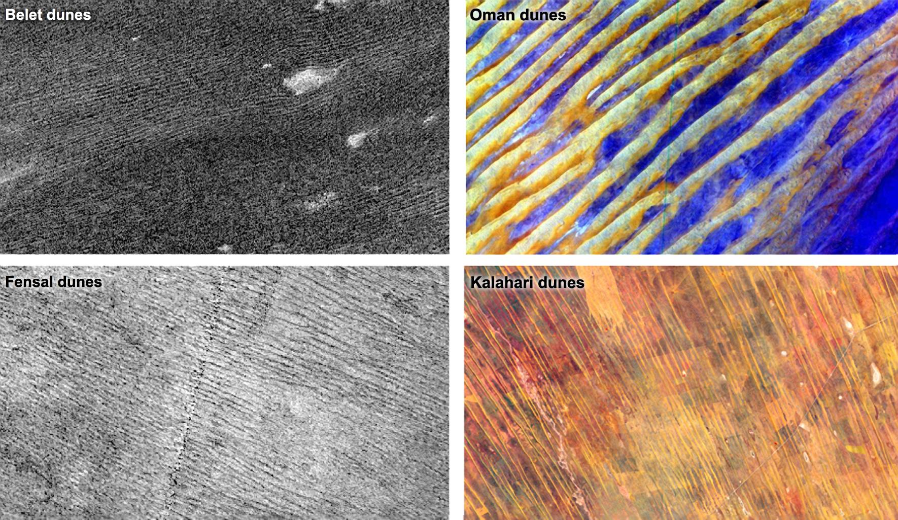
Dune Patterns
Full Resolution:
TIFF
(5.457 MB)
JPEG
(421.9 kB)
|
|
|
2011-08-29 |
Titan
|
Cassini-Huygens
|
Radar Mapper
|
1381x1310x1 |

|
-
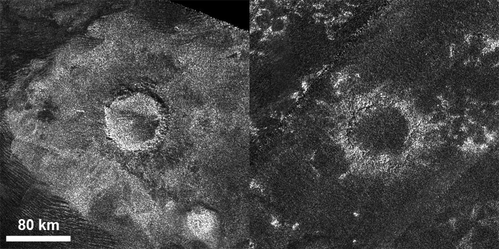
PIA14744:
-
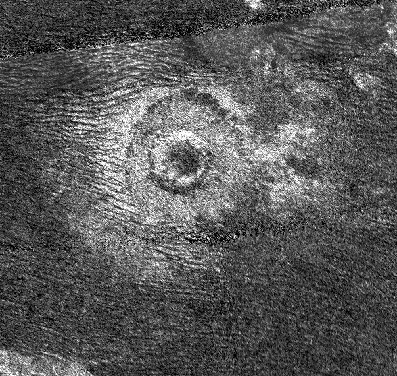
A New Crater for Titan
Full Resolution:
TIFF
(1.811 MB)
JPEG
(485.2 kB)
|
|
|
2011-08-15 |
Titan
|
Cassini-Huygens
|
Radar Mapper
|
1414x937x1 |
|
-
PIA14541:
-
Cassini Radar Zooms Out on Menrva
Full Resolution:
TIFF
(1.327 MB)
JPEG
(397.9 kB)
|
|
|
2011-08-01 |
Titan
|
Cassini-Huygens
|
Radar Mapper
|
1805x684x1 |

|
-
PIA14500:
-
Titan: Putting it all Together
Full Resolution:
TIFF
(1.236 MB)
JPEG
(331.1 kB)
|
|
|
2011-04-08 |
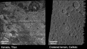
Saturn
|
Cassini-Huygens
Galileo
|
Radar Mapper
Solid-State Imaging
|
1620x909x1 |
|
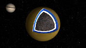
-
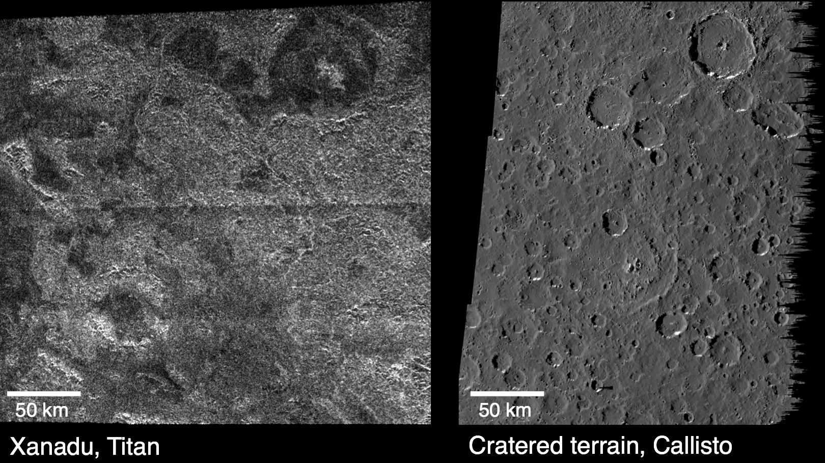
PIA13896:
-
Titan and Callisto
Full Resolution:
TIFF
(1.474 MB)
JPEG
(315.9 kB)
|
|
|
2011-04-08 |
Titan
|
Cassini-Huygens
|
Radar Mapper
Visual and Infrared Mapping Spectrometer
|
1600x893x1 |
|
-
PIA13895:
-
Tortula Facula
Full Resolution:
TIFF
(1.43 MB)
JPEG
(299.7 kB)
|
|
|
2010-12-14 |
Titan
|
Cassini-Huygens
|
Radar Mapper
Visual and Infrared Mapping Spectrometer
|
1280x720x3 |
|
-
PIA13696:
-
Global View of Sotra Facula, Titan
Full Resolution:
TIFF
(2.768 MB)
JPEG
(79.04 kB)
|
|
|
2010-12-14 |
Titan
|
Cassini-Huygens
|
Radar Mapper
Visual and Infrared Mapping Spectrometer
|
2305x1431x3 |
|
-
PIA13695:
-
Flyover of Sotra Facula, Titan
Full Resolution:
TIFF
(9.907 MB)
JPEG
(411.6 kB)
|
|
|
2010-08-12 |
Titan
|
Cassini-Huygens
|
Radar Mapper
|
6332x2720x3 |
|
-
PIA13332:
-
Mountains near Adiri on Titan
Full Resolution:
TIFF
(51.67 MB)
JPEG
(3.48 MB)
|
|
|
2010-08-12 |
Titan
|
Cassini-Huygens
|
Radar Mapper
|
6344x4920x1 |
|
-
PIA13331:
-
Mountains on the Northwest Border of Xanadu, Titan
Full Resolution:
TIFF
(31.25 MB)
JPEG
(6.506 MB)
|
|
|
2010-08-12 |
Titan
|
Cassini-Huygens
|
Radar Mapper
|
6304x4880x3 |
|
-
PIA13330:
-
Mountains North of Aaru on Titan
Full Resolution:
TIFF
(92.29 MB)
JPEG
(5.537 MB)
|
|
|
2010-07-15 |
Titan
|
Cassini-Huygens
|
Radar Mapper
|
484x359x3 |
|
-
PIA13173:
-
Flying Over Ontario Lacus
Full Resolution:
TIFF
(522.1 kB)
JPEG
(17.02 kB)
|
|
|
2010-07-15 |
Titan
|
Cassini-Huygens
|
Radar Mapper
|
1411x1276x1 |
|
-
PIA13172:
-
Footprint of Ontario Lacus
Full Resolution:
TIFF
(1.803 MB)
JPEG
(337.1 kB)
|
|
|
2010-07-07 |
Titan
|
Cassini-Huygens
|
Radar Mapper
|
14165x894x1 |
|
-
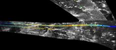
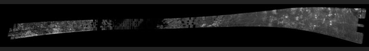
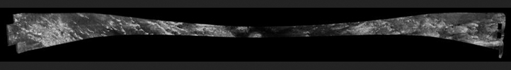
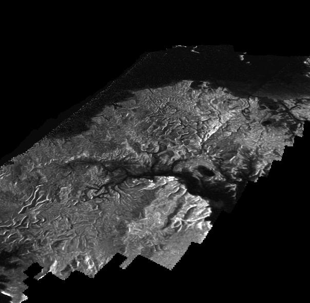
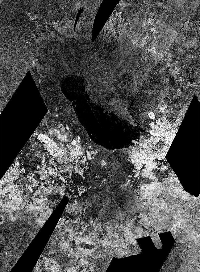
PIA06679:
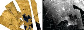
Titan Radar Swath (T-71 Flyby - July 7, 2010)
Full Resolution:
TIFF
(6.765 MB)
JPEG
(1.677 MB)
|
|
|
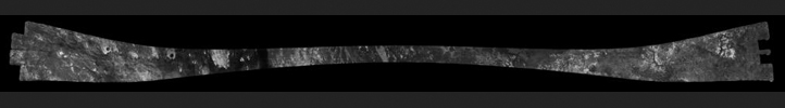
2010-05-11 |
Titan
|
Cassini-Huygens
|
Radar Mapper
|
9024x960x1 |

|
-
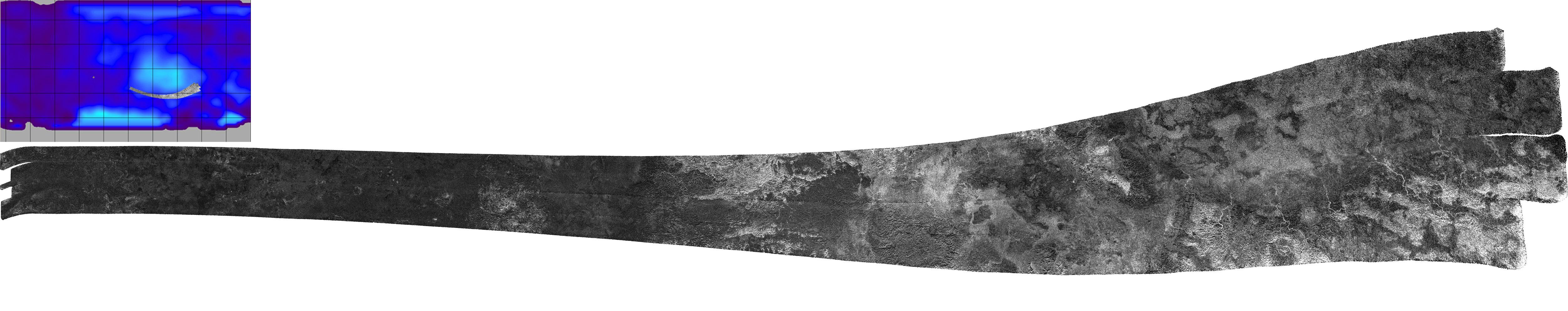
PIA12989:
Xanadu's Channels and Dunes
Full Resolution:
TIFF
(8.663 MB)
JPEG
(1.337 MB)
|
|
|
2010-05-11 |
Titan
|
Cassini-Huygens
|
Radar Mapper
|
9746x960x1 |

|
-
PIA12988:
Dunes, Tectonics and Possible Ice Volcanoes on Titan
Full Resolution:
TIFF
(9.356 MB)
JPEG
(1.268 MB)
|
|
|
2010-02-25 |
Titan
|
Cassini-Huygens
|
Radar Mapper
Visual and Infrared Mapping Spectrometer
|
2480x3232x3 |
|
-
PIA12849:
-
Channels and Minerals at Hotei Regio
Full Resolution:
TIFF
(24.07 MB)
JPEG
(890.1 kB)
|
|
|
2010-02-25 |
Titan
|
Cassini-Huygens
|
Radar Mapper
Visual and Infrared Mapping Spectrometer
|
3454x5980x3 |
|
-
PIA12848:
-
Looking for Ice Volcano Flows at Hotei Regio
Full Resolution:
TIFF
(61.96 MB)
JPEG
(2.049 MB)
|
|
|
2010-01-25 |
Titan
|
Cassini-Huygens
|
Radar Mapper
|
795x827x1 |
|
-
PIA12496:
-
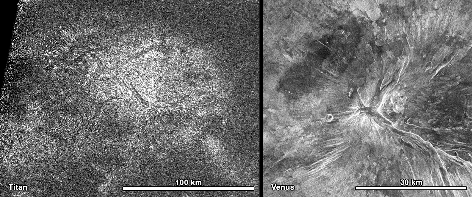
New Wrinkles on Titan
Full Resolution:
TIFF
(658.4 kB)
JPEG
(194.3 kB)
|
|
|
2010-01-12 |
Titan
|
Cassini-Huygens
|
Radar Mapper
|
9179x3260x1 |

|
-
PIA00927:
-
Titan Radar Swath (T-65 Flyby - Jan. 12, 2010)
Full Resolution:
TIFF
(4.485 MB)
JPEG
(1.197 MB)
|
|
|
2009-12-28 |
Titan
|
Cassini-Huygens
|
Radar Mapper
|
15360x1792x1 |
|
-
PIA06678:
Titan Radar Swath (T-64 Flyby - Dec. 28, 2009)
Full Resolution:
TIFF
(11.43 MB)
JPEG
(3.356 MB)
|
|
|
2009-10-09 |
Titan
|
Cassini-Huygens
|
Radar Mapper
|
1440x1080x3 |
|
-
PIA12281:
-
Disappearing Lakes
Full Resolution:
TIFF
(4.674 MB)
JPEG
(408 kB)
|
|
|
2009-10-09 |
Titan
|
Cassini-Huygens
|
Radar Mapper
|
1224x1080x3 |
|
-
PIA12280:
-
Changing Seasons on Titan
Full Resolution:
TIFF
(3.97 MB)
JPEG
(274.2 kB)
|
|
|
2009-08-25 |
Titan
|
Cassini-Huygens
|
Radar Mapper
|
19200x2048x1 |
|
-
PIA06677:
Titan Radar Swath (T-61 Flyby - Aug. 25, 2009)
Full Resolution:
TIFF
(18.06 MB)
JPEG
(5.284 MB)
|
|
|
2009-08-06 |
Titan
|
Cassini-Huygens
|
Radar Mapper
|
1036x874x1 |
|
-
PIA12162:
-
Lake-like but Different
Full Resolution:
TIFF
(906.7 kB)
JPEG
(208.7 kB)
|
|
|
2009-07-24 |
Titan
|
Cassini-Huygens
|
Radar Mapper
|
12288x1408x1 |
|
-
PIA04399:
Titan Radar Swath (T-59 Flyby - July. 24, 2009)
Full Resolution:
TIFF
(6.674 MB)
JPEG
(2.059 MB)
|
|
|
2009-07-16 |
Titan
|
Cassini-Huygens
|
Radar Mapper
|
814x587x1 |

|
-
PIA12111:
-
South Polar Basin on Titan
Full Resolution:
TIFF
(478.5 kB)
JPEG
(168.5 kB)
|
|
|
2009-07-08 |
Titan
|
Cassini-Huygens
|
Radar Mapper
|
768x349x1 |

|
-
PIA04398:
-
Titan Radar Swath (T-58 Flyby - July 8, 2009)
Full Resolution:
TIFF
(221.9 kB)
JPEG
(49.56 kB)
|
|
|
2009-06-22 |
Titan
|
Cassini-Huygens
|
Radar Mapper
|
18816x1536x1 |
|
-
PIA04397:
Titan Radar Swath (T-57 Flyby - June 22, 2009)
Full Resolution:
TIFF
(7.828 MB)
JPEG
(2.507 MB)
|
|
|
2009-06-10 |
Titan
|
Cassini-Huygens
|
Radar Mapper
|
1798x818x1 |

|
-
PIA12037:
-
The Story Titan's Dunes Tell
Full Resolution:
TIFF
(1.473 MB)
JPEG
(363.8 kB)
|
|
|
2009-06-10 |
Titan
|
Cassini-Huygens
|
Radar Mapper
|
957x811x1 |
|
-
PIA12036:
-
Southern Canyons of Titan
Full Resolution:
TIFF
(777.2 kB)
JPEG
(274 kB)
|
|
|
2009-06-06 |
Titan
|
Cassini-Huygens
|
Radar Mapper
|
19456x1920x1 |
|
-
PIA04396:
Titan Radar Swath (T-56 Flyby - June 6, 2009)
Full Resolution:
TIFF
(18.07 MB)
JPEG
(5.091 MB)
|
|
|
2009-05-21 |
Titan
|
Cassini-Huygens
|
Radar Mapper
|
19584x1920x1 |
|
-
PIA04395:
Titan Radar Swath (T-55 Flyby - May 21, 2009)
Full Resolution:
TIFF
(18.25 MB)
JPEG
(5.111 MB)
|
|
|
2009-03-24 |
Titan
|
Cassini-Huygens
|
Radar Mapper
|
1844x2920x3 |
|
-
PIA11831:
-
Hotei
Full Resolution:
TIFF
(16.18 MB)
JPEG
(1.07 MB)
|
|
|
2009-03-24 |
Titan
|
Cassini-Huygens
|
Radar Mapper
|
2748x1750x3 |
|
-
PIA11830:
-
Ganesa Macula
Full Resolution:
TIFF
(14.43 MB)
JPEG
(728.8 kB)
|
|
|
2009-03-24 |
Titan
|
Cassini-Huygens
|
Radar Mapper
|
3008x3850x3 |
|
-
PIA11829:
-
Titan's "Sand Sea" Belet
Full Resolution:
TIFF
(34.74 MB)
JPEG
(1.143 MB)
|
|
|
2009-03-06 |
Titan
|
Cassini-Huygens
|
Radar Mapper
|
5000x993x3 |

|
-
PIA11822:
Skirting Xanadu's Southern Boundary
Full Resolution:
TIFF
(14.9 MB)
JPEG
(708.6 kB)
|
|
|
2009-02-26 |
Titan
|
Cassini-Huygens
|
Radar Mapper
|
1042x1378x1 |
|
-
PIA11802:
-
At the Edge of Titan's Dunes
Full Resolution:
TIFF
(1.438 MB)
JPEG
(454.1 kB)
|
|
|
2009-02-26 |
Titan
|
Cassini-Huygens
|
Radar Mapper
|
2048x1024x3 |
|
-
PIA11801:
-
Mapping Titan's Global Wind Patterns
Full Resolution:
TIFF
(6.3 MB)
JPEG
(282.2 kB)
|
|
|
2009-02-07 |
Titan
|
Cassini-Huygens
|
Radar Mapper
|
13440x1408x1 |
|
-
PIA04394:
Titan Radar Swath (T-50 Flyby - Feb. 7, 2009)
Full Resolution:
TIFF
(7.549 MB)
JPEG
(2.394 MB)
|
|
|
2009-01-29 |
Titan
|
Cassini-Huygens
|
Imaging Science Subsystem
Radar Mapper
Visual and Infrared Mapping Spectrometer
|
1884x2000x3 |
|
-
PIA11146:
-
Maps of Titan - January 2009
Full Resolution:
TIFF
(11.32 MB)
JPEG
(448.9 kB)
|
|
|
2008-12-21 |
Titan
|
Cassini-Huygens
|
Radar Mapper
|
6912x3030x1 |
|
-
PIA04393:
-
Titan Radar Swath (T-49 Flyby - Dec. 21, 2008)
Full Resolution:
TIFF
(3.639 MB)
JPEG
(1.043 MB)
|
|
|
2008-12-15 |
Titan
|
Cassini-Huygens
|
Radar Mapper
|
3000x2250x1 |

|
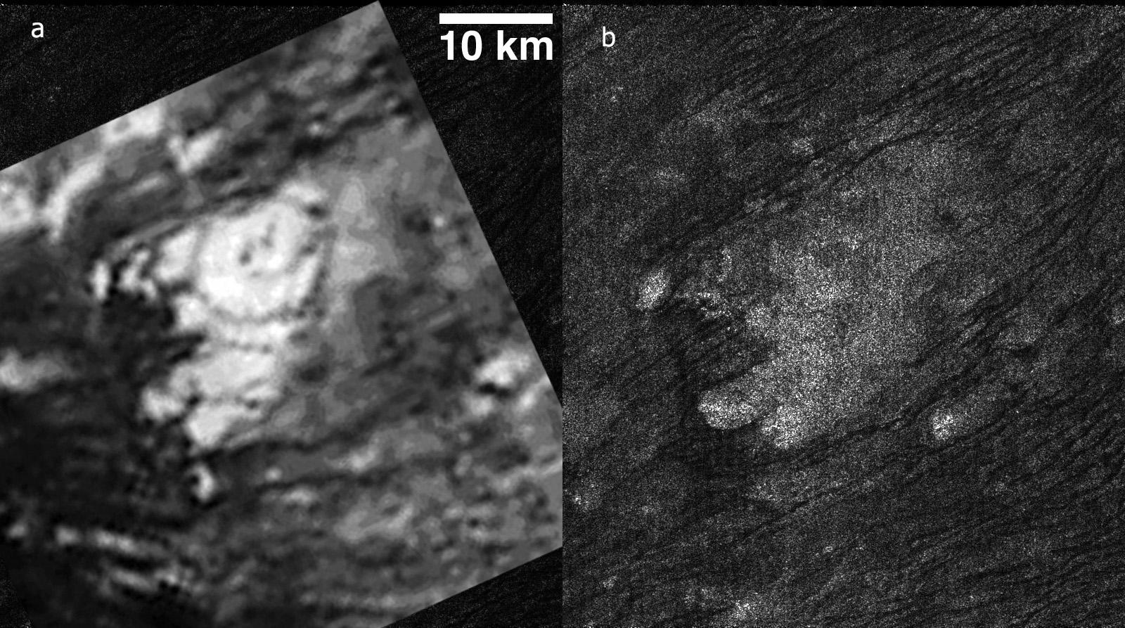
-
PIA11702:
-
Active Cryovolcanic Features on Titan?
Full Resolution:
TIFF
(6.759 MB)
JPEG
(437.8 kB)
|
|
|
2008-12-05 |
Titan
|
Cassini-Huygens
|
Radar Mapper
|
16363x1543x1 |

|
-
PIA00699:
Titan Radar Swath (T-48 Flyby - Dec. 5, 2008)
Full Resolution:
TIFF
(4.783 MB)
JPEG
(1.184 MB)
|
|
|
2008-08-08 |
Titan
|
Cassini-Huygens
|
Radar Mapper
|
1060x979x1 |

|
-
PIA10956:
-
Xanadu's Channels
Full Resolution:
TIFF
(1.039 MB)
JPEG
(375.5 kB)
|
|
|
2008-05-21 |
Titan
|
Cassini-Huygens
|
Radar Mapper
|
2000x1000x1 |

|
-
PIA10655:
-
Impact Craters
Full Resolution:
TIFF
(2.002 MB)
JPEG
(529.7 kB)
|
|
|
2008-05-21 |
Titan
|
Cassini-Huygens
|
Radar Mapper
|
1457x947x1 |
|
-
PIA10654:
-
Tectonics on Titan
Full Resolution:
TIFF
(1.382 MB)
JPEG
(388.1 kB)
|
|
|
2008-03-31 |
Titan
|
Cassini-Huygens
|
Radar Mapper
|
2800x700x3 |
|
-
PIA10353:
Topographic Map of Titan's North Polar Region
Full Resolution:
TIFF
(5.88 MB)
JPEG
(292.4 kB)
|
|
|
2008-03-20 |
Titan
|
Cassini-Huygens
|
Radar Mapper
|
5120x2880x3 |
|
-
PIA10243:
-
An Ocean Runs Through It
Full Resolution:
TIFF
(44.24 MB)
JPEG
(680.7 kB)
|
|
|
2008-03-06 |
Enceladus
|
Cassini-Huygens
|
Radar Mapper
|
1225x806x3 |
|
-
PIA08408:
-
Close Brush with Enceladus
Full Resolution:
TIFF
(990.2 kB)
JPEG
(123.3 kB)
|
|
|
2008-02-22 |
Titan
|
Cassini-Huygens
|
Radar Mapper
|
4000x1923x1 |

|
-
PIA04392:
-
Titan Radar Swath (T-41 Flyby - Feb. 22, 2008)
Full Resolution:
TIFF
(2.375 MB)
JPEG
(629.2 kB)
|
|
|
2008-01-08 |
Titan
|
Cassini-Huygens
|
Radar Mapper
|
1536x3548x1 |
|
-
PIA10219:
-
Flowing Liquids on Titan
Full Resolution:
TIFF
(5.456 MB)
JPEG
(1.504 MB)
|
|
|
2008-01-08 |
Titan
|
Cassini-Huygens
|
Radar Mapper
|
1538x1538x3 |
|
-
PIA10218:
-
Radar Images Titan's South Pole
Full Resolution:
TIFF
(7.109 MB)
JPEG
(468.6 kB)
|
|
|
2007-12-20 |
Titan
|
Cassini-Huygens
|
Radar Mapper
|
16640x1920x1 |
|
-
PIA01854:
Titan Radar Swath (T-39 Flyby - Dec. 20, 2007)
Full Resolution:
TIFF
(14.13 MB)
JPEG
(4.306 MB)
|
|
|
2007-10-11 |
Titan
|
Cassini-Huygens
|
Radar Mapper
|
1631x816x3 |
|
-
PIA10018:
-
Radar Sees Lakes in Titan's Southern Hemisphere
Full Resolution:
TIFF
(3.999 MB)
JPEG
(237.9 kB)
|
|
|
2007-10-11 |
Titan
|
Cassini-Huygens
|
Radar Mapper
|
7861x7861x3 |

|
-
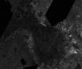
PIA10008:
-
Titan's North Polar Region
Full Resolution:
TIFF
(185.4 MB)
JPEG
(9.957 MB)
|
|
|
2007-10-02 |
Titan
|
Cassini-Huygens
|
Radar Mapper
|
18944x2048x1 |
|
-
PIA04390:
Titan Radar Swath (T-36 Flyby - Oct. 2, 2007)
Full Resolution:
TIFF
(17.17 MB)
JPEG
(4.914 MB)
|
|
|
2007-08-13 |
Titan
|
Cassini-Huygens
|
Radar Mapper
|
8442x2007x1 |
|
-
PIA09218:
Titan (T30) Viewed by Cassini's Radar - May 12, 2007
Full Resolution:
TIFF
(16.94 MB)
JPEG
(2.8 MB)
|
|
|
2007-07-27 |
Titan
|
Cassini-Huygens
|
Radar Mapper
|
19556x1920x1 |

|
-
PIA09217:
Titan (T28) Viewed by Cassini's Radar-- April 10, 2007
Full Resolution:
TIFF
(37.55 MB)
JPEG
(5.212 MB)
|
|
|
2007-05-23 |
Titan
|
Cassini-Huygens
|
Radar Mapper
|
1544x1292x1 |

|
-
PIA09211:
-
Coasts and Drowned Mountains
Full Resolution:
TIFF
(1.997 MB)
JPEG
(337.6 kB)
|
|
|
2007-04-26 |
Titan
|
Cassini-Huygens
|
Radar Mapper
|
6209x634x1 |
|
-
PIA04391:
Titan Radar Swath (T-29 Flyby - April 26, 2007)
Full Resolution:
TIFF
(1.662 MB)
JPEG
(348.5 kB)
|
|
|
2007-03-13 |
Titan
|
Cassini-Huygens
|
Radar Mapper
|
604x357x3 |
|
-
PIA09184:
-
Titan Sea and Lake Superior
Full Resolution:
TIFF
(647.8 kB)
JPEG
(36.37 kB)
|
|
|
2007-03-13 |
Titan
|
Cassini-Huygens
|
Radar Mapper
|
481x357x3 |
|
-
PIA09183:
-
Radar Shows Evidence of Seas
Full Resolution:
TIFF
(516 kB)
JPEG
(39.37 kB)
|
|
|
2007-03-13 |
Titan
|
Cassini-Huygens
|
Radar Mapper
|
18881x1792x1 |

|
-
PIA09182:
Titan (T25) Viewed by Cassini's Radar - Feb. 22, 2007
Full Resolution:
TIFF
(33.83 MB)
JPEG
(6.055 MB)
|
|
|
2007-03-01 |
Titan
|
Cassini-Huygens
|
Radar Mapper
|
640x1151x1 |
|
-
PIA09181:
-
Titan Features and Interactions
Full Resolution:
TIFF
(737.6 kB)
JPEG
(292.3 kB)
|
|
|
2007-02-27 |
Titan
|
Cassini-Huygens
|
Radar Mapper
|
1571x958x1 |
|
-
PIA09180:
-
Titan: Larger and Larger Lakes
Full Resolution:
TIFF
(1.507 MB)
JPEG
(404.4 kB)
|
|
|
2007-02-20 |
Titan
|
Cassini-Huygens
|
Radar Mapper
|
18340x2560x1 |
|
-
PIA09179:
Titan (T18) Viewed by Cassini's Radar - Sept. 23, 2006
Full Resolution:
TIFF
(46.95 MB)
JPEG
(6.432 MB)
|
 Planetary Data System


