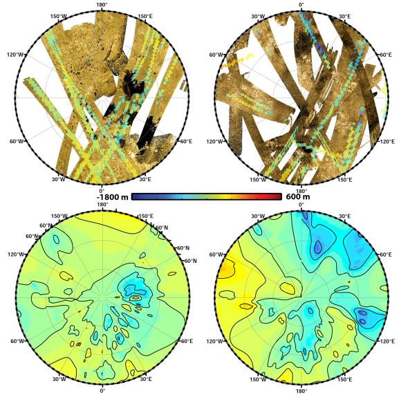
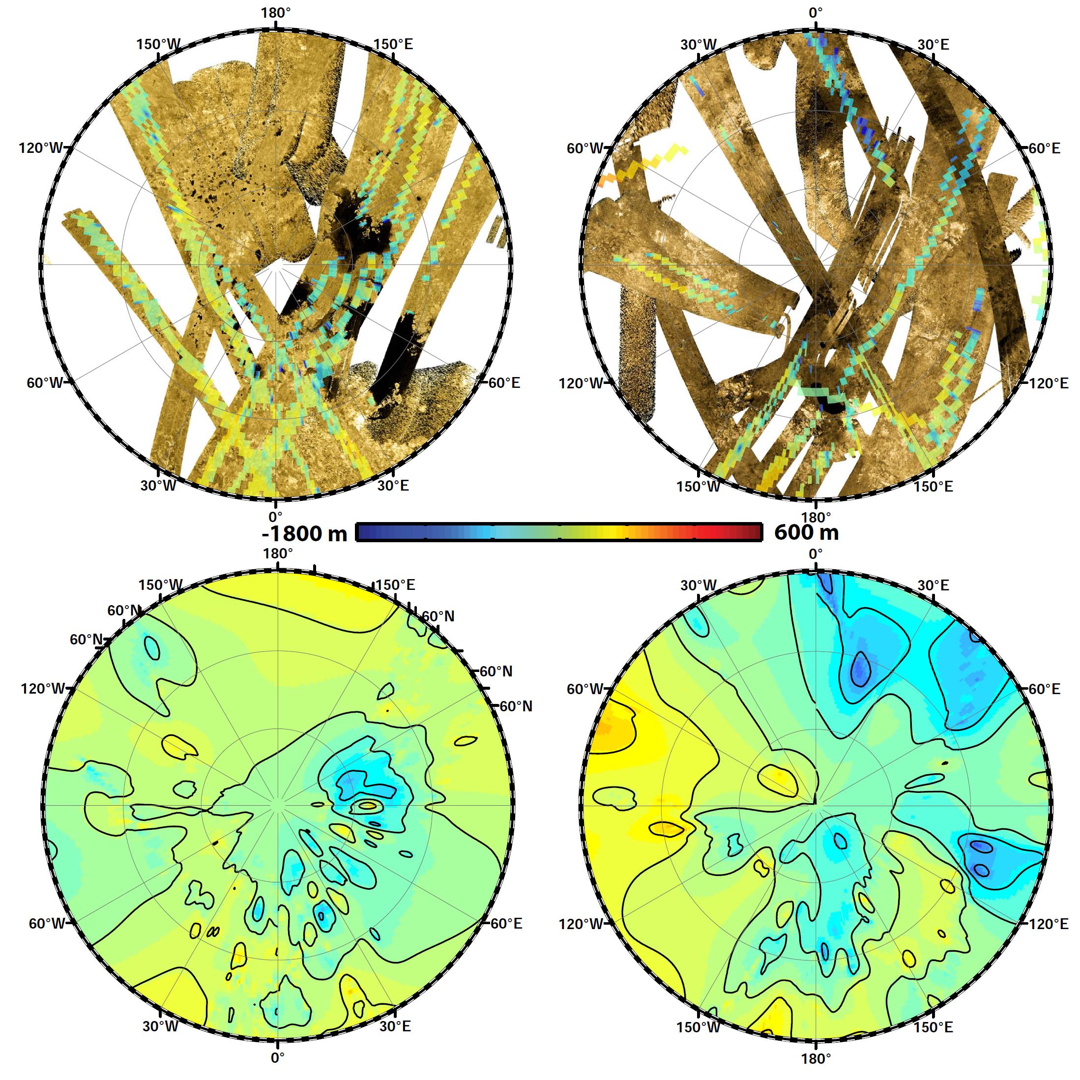
These polar maps show the first global, topographic mapping of Saturn's moon Titan, using data from NASA's Cassini mission. To create these maps, scientists employed a mathematical process called splining, which uses smooth curved surfaces to "join" the areas between grids of existing topography profiles obtained by Cassini's radar instrument. The topography maps at bottom focus on the polar regions (north at left, south at right) in stereographic projection. The top maps show the 2-D radar data in gold and black, with topography data color-coded by elevation. The bottom images are from the new topography map, with contour lines added at 656 feet (200 meters) apart in elevation.
Visible are deep basins at 72 degrees south latitude and 20 degrees east longitude, and a wider basin at 68 degrees south latitude and 105 degrees east longitude.
The Cassini-Huygens mission is a cooperative project of NASA, the European Space Agency and ASI, the Italian Space Agency. JPL, a division of the California Institute of Technology in Pasadena, manages the mission for NASA's Science Mission Directorate, Washington. The radar instrument was built by JPL and the Italian Space Agency, working with team members from the US and several European countries.