Your search criteria found
12742
images
Target is Mars (and available satellites)
Go to PIAxxxxx:
Refine this list of images by:
Target:
Deimos
Mars
Phobos
Mission:
2001 Mars Odyssey
Antarctic Meteorite Location and Mapping Project (AMLAMP)
Dawn
ExoMars
Hubble Space Telescope
InSight
MAVEN
Mariner Mars 1964 (Mariner 4)
Mariner Mars 1969 (Mariner 7)
Mariner Mars 1971 (Mariner 9)
Mars 2020
Mars 2020 Rover
Mars Atmosphere and Volatile Evolution MissioN (MAVEN)
Mars Climate Orbiter
Mars Cube One (MarCO)
Mars Exploration Rover (MER)
Mars Express (MEX)
Mars Global Surveyor (MGS)
Mars Helicopter
Mars Pathfinder (MPF)
Mars Reconnaissance Orbiter (MRO)
Mars Sample Return
Mars Sample Return (MSR)
Mars Science Laboratory (MSL)
Phoenix
Rosetta
Viking
Spacecraft:
2001 Mars Odyssey
Curiosity
Dawn
InSight Mars Lander
Ingenuity
MAVEN
MarCO-B
Mariner 4
Mariner 7
Mariner 9
Mars Climate Orbiter
Mars Express (MEX)
Mars Express (MEX) Orbiter
Mars Global Surveyor Orbiter
Mars Pathfinder Lander
Mars Pathfinder Rover
Mars Reconnaissance Orbiter (MRO)
Mars Sample Return
Mars Science Laboratory (MSL)
NASA's Mars Pathfinder Lander
Opportunity
Perseverance
Philae Lander
Phoenix Lander
Phoenix Mars Lander
Spirit
Viking Lander 1
Viking Lander 2
Viking Orbiter 1
Viking Orbiter 2
Instrument:
Alpha Particle X-ray Spectrometer
Alpha Particle X-ray Spectrometer (MSL)
Atmospheric Structure / Meteorology Instrument
CHIMRA
Camera 1
Camera 2
Chemistry & Mineralogy (CheMin)
Chemistry and Camera (ChemCam)
Comet Infrared and Visible Analyser (CIVA
Compact Reconnaissance Imaging Spectrometer for Mars (CRISM)
Context Camera (CTX)
Deep Space Network
Descent Image Motion Estimation System (DIMES)
Dynamic Albedo of Neutrons
Dynamic Albedo of Neutrons (DAN)
Gamma Ray Spectrometer - Neutron Spectrometer
Gamma Ray Spectrometer Suite
Hazard Avoidance Camera
Hazard Avoidance Camera (M2020)
Hazard Avoidance Camera (MSL)
Heat and Physical Properties Package (HP3)
High Resolution Imaging Science Experiment (HiRISE)
High Resolution Instrument (HRI)
High Resolution Stereo Camera
Imager for Mars Pathfinder
Imaging Ultraviolet Spectrograph
Imaging Ultraviolet Spectrograph (IUVS)
Instrument Context Camera (ICC)
Instrument Deployment Camera (IDC)
Lander Vision System Camera (LCAM)
Magnetometer
Mars Advanced Radar for Subsurface and Ionosphere Sounding (MARSIS)
Mars Advanced Radar for Subsurface and Ionospheric Sounding (MARSIS)
Mars Climate Sounder (MCS)
Mars Color Imager (MARCI)
Mars Descent Imager
Mars Environmental Dynamics Analyzer (MEDA)
Mars Hand Lens Imager (MAHLI)
Mars Horizon Sensor Assembly
Mars Orbiter Camera (MOC)
Mars Orbiter Laser Altimeter
Mars Radiation Experiment
Mastcam
Mastcam-Z
Microscopic Imager
Microscopy Electrochemistry and Conductivity Analyzer (MECA)
Miniature Thermal Emission Spectrometer
Moessbauer Spectrometer
Navigation Camera
Navigation Camera (M2020)
Navigation Camera (MSL)
Neutral Gas and Ion Mass Spectrometer
Neutron Spectrometer
Optical Microscope
Optical Navigation Camera
Panoramic Camera
Planetary Instrument for X-ray Lithochemistry (PIXL)
Radar System
Radiation Assessment Detector (RAD)
Radio Science Subsystem
Robotic Arm
Robotic Arm (MSL)
Robotic Arm Camera (RAC)
Rock Abrasion Tool (RAT)
Rover Cameras
Rover Environmental Monitoring Station (REMS)
Sample Analysis at Mars (SAM)
Scanning Habitable Environments with Raman & Luminescence for Organics and Chemicals (SHERLOC)
Seismic Experiment for Interior Structure (SEIS)
Shallow Subsurface Radar (SHARAD)
Stereo Imager (SSI)
SuperCam
Surface Stereo Imager (SSI)
Thermal Emission Imaging System
Thermal Emission Spectrometer
Thermal and Electrical Conductivity Probe
Thermal and Evolved Gas Analyzer
Trace Gas Orbiter
Visual Imaging Subsystem
Visual Imaging Subsystem - Camera A
Visual Imaging Subsystem - Camera B
Wide Field Planetary Camera 2
Click on an image for detailed information
Click on a column heading to sort in ascending or descending order
My
List
Addition Date
Target
Mission
Instrument
Size
2004-06-21
Mars
Mars Global Surveyor (MGS)
Mars Orbiter Camera (MOC)
1024x1536x1
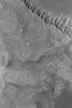
PIA06325:
Exposing Memnonia Terrain
Full Resolution:
TIFF
(1.575 MB)
JPEG
(369.9 kB)
2004-06-22
Mars
2001 Mars Odyssey
THEMIS
1000x1600x1
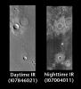
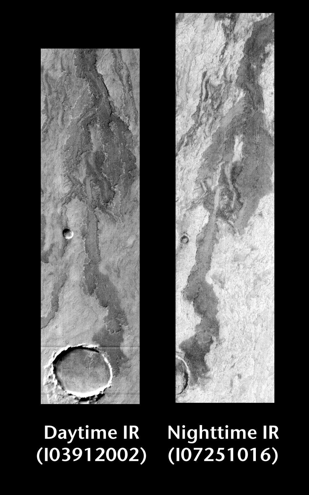
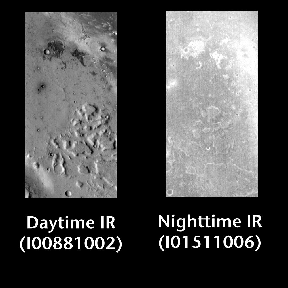
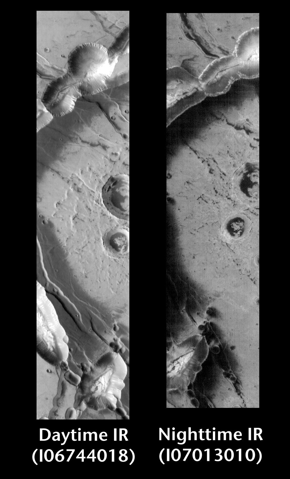
PIA06399:
Arsia Mons by Day and Night
Full Resolution:
TIFF
(975.6 kB)
JPEG
(213 kB)
2004-06-22
Mars
Mars Global Surveyor (MGS)
Mars Orbiter Camera (MOC)
836x1254x1
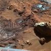
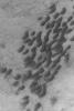
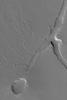
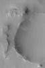
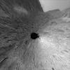
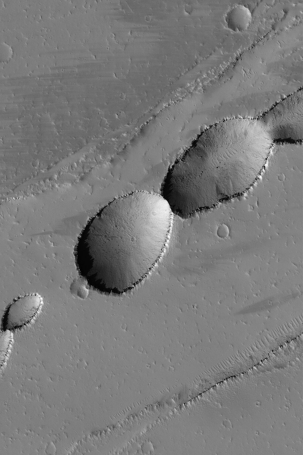
PIA06326:
Amenthes Crater Cluster
Full Resolution:
TIFF
(1.05 MB)
JPEG
(229 kB)
2004-06-23
Mars
2001 Mars Odyssey
THEMIS
1000x1000x1
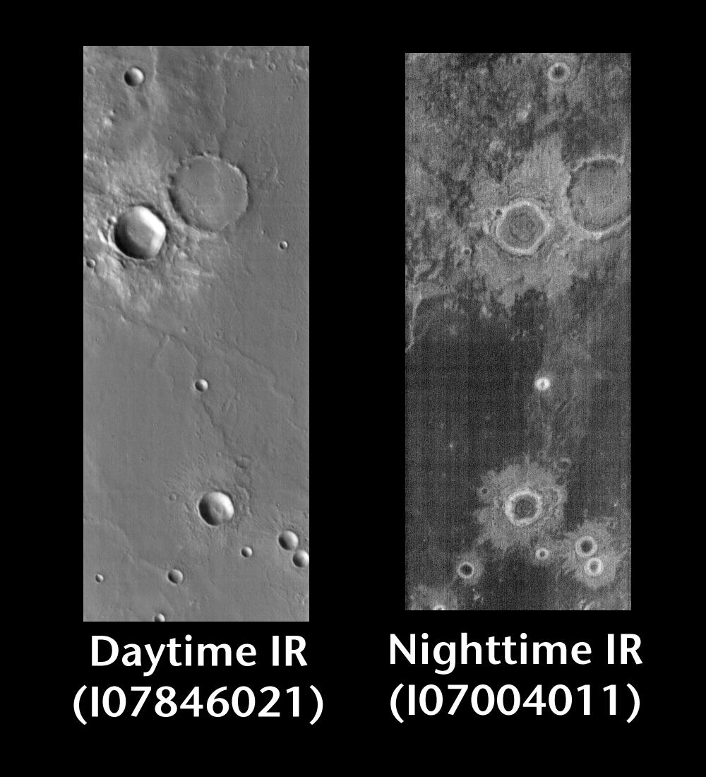
PIA06444:
Gusev Crater by Day and Night
Full Resolution:
TIFF
(518.1 kB)
JPEG
(98.34 kB)
2004-06-23
Mars
Mars Global Surveyor (MGS)
Mars Orbiter Camera (MOC)
836x1254x1
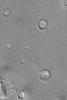
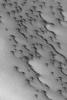
PIA06327:
Tithonium Dust Devil
Full Resolution:
TIFF
(1.05 MB)
JPEG
(224.1 kB)
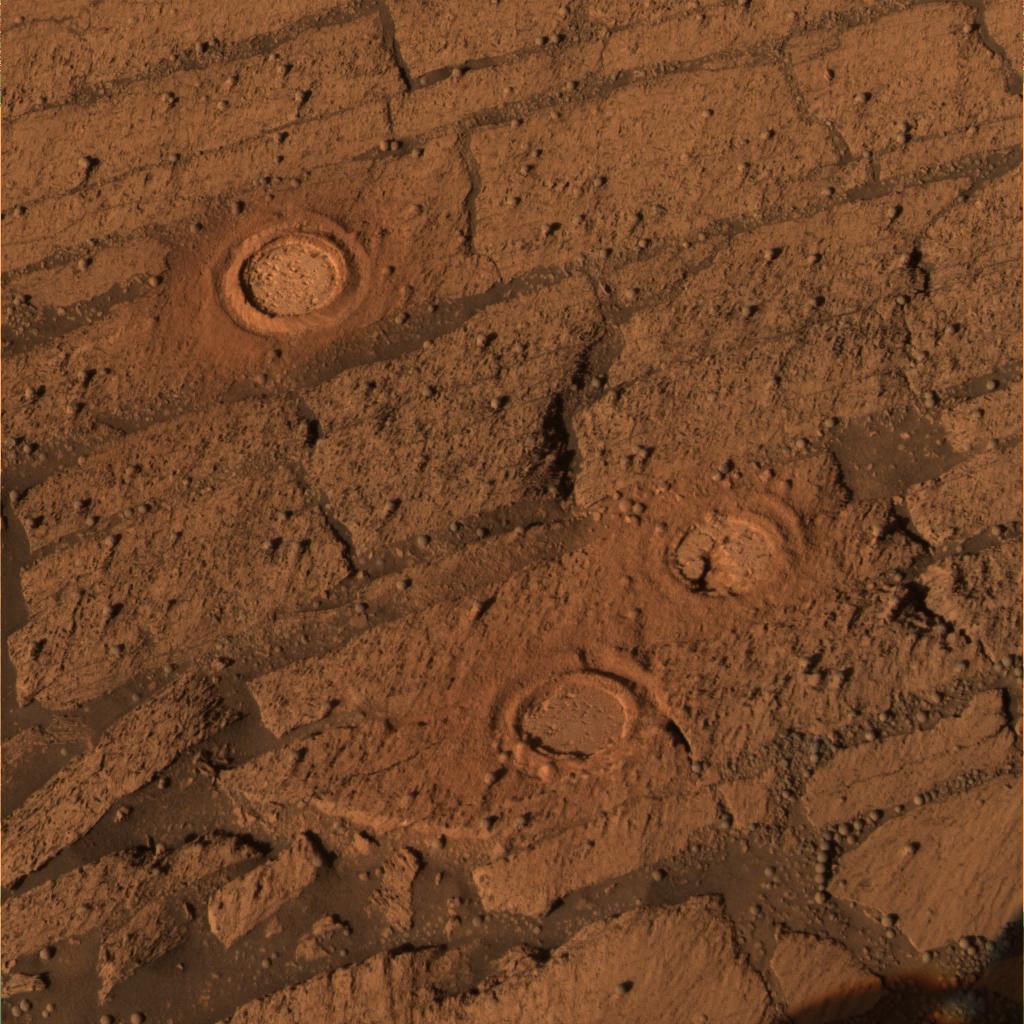
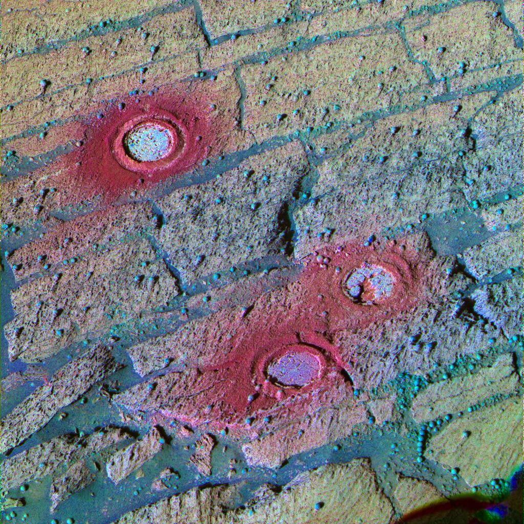
2004-06-23
Mars
Mars Exploration Rover (MER)
Microscopic Imager
2311x2413x1
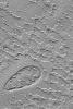
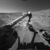
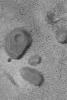
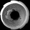
PIA06309:
Microscopic Image Inside 'Endurance'
Full Resolution:
TIFF
(4.568 MB)
JPEG
(651.5 kB)
2004-06-24
Mars
2001 Mars Odyssey
THEMIS
1000x1100x1
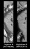
PIA06445:
Crater Ejecta by Day and Night
Full Resolution:
TIFF
(614.5 kB)
JPEG
(118.7 kB)
2004-06-24
Mars
Mars Global Surveyor (MGS)
Mars Orbiter Camera (MOC)
512x768x1
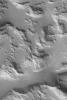
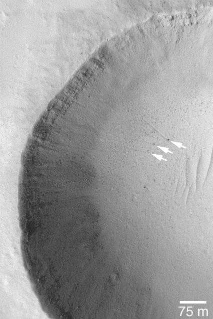
PIA06328:
South Polar Erosion
Full Resolution:
TIFF
(393.8 kB)
JPEG
(91.54 kB)
2004-06-25
Mars
2001 Mars Odyssey
THEMIS
1000x1650x1
PIA06446:
Noctus Labyrinthus by Day and Night
Full Resolution:
TIFF
(1.066 MB)
JPEG
(173.3 kB)
2004-06-25
Mars
Mars Global Surveyor (MGS)
Mars Orbiter Camera (MOC)
1024x1536x1
PIA06329:
Pits Near Rhabon Valles
Full Resolution:
TIFF
(1.488 MB)
JPEG
(210.1 kB)
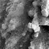
2004-06-25
Mars
Mars Exploration Rover (MER)
Microscopic Imager
1024x1024x1
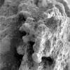
PIA06312:
A 'Pot of Gold' Rich with Nuggets
Full Resolution:
TIFF
(1.05 MB)
JPEG
(202.6 kB)
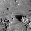
2004-06-25
Mars
Mars Exploration Rover (MER)
Microscopic Imager
1024x1024x1
PIA06313:
A 'Pot of Gold' Rich with Nuggets (Sol 163)
Full Resolution:
TIFF
(1.05 MB)
JPEG
(136.2 kB)
2004-06-25
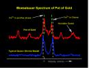
Mars
Mars Exploration Rover (MER)
Moessbauer Spectrometer
2076x1603x3
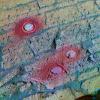
PIA06314:
Spirit, Too, Finds Hematite
Full Resolution:
TIFF
(9.991 MB)
JPEG
(363.1 kB)
2004-06-25
Mars
Mars Exploration Rover (MER)
Panoramic Camera
1024x1024x1
PIA06315:
In the Shadows
Full Resolution:
TIFF
(1.05 MB)
JPEG
(258.8 kB)
2004-06-25
Mars
Mars Exploration Rover (MER)
Panoramic Camera
1352x852x3
PIA06317:
'Endurance' Tells Story of Mars' History
Full Resolution:
TIFF
(3.459 MB)
JPEG
(217.5 kB)
2004-06-25
Mars
Mars Exploration Rover (MER)
Navigation Camera
840x840x1
PIA06318:
Reading 'Endurance Crater'
Full Resolution:
TIFF
(706.6 kB)
JPEG
(112.2 kB)
2004-06-25
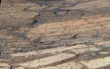
Mars
Mars Exploration Rover (MER)
Microscopic Imager
2332x2250x1
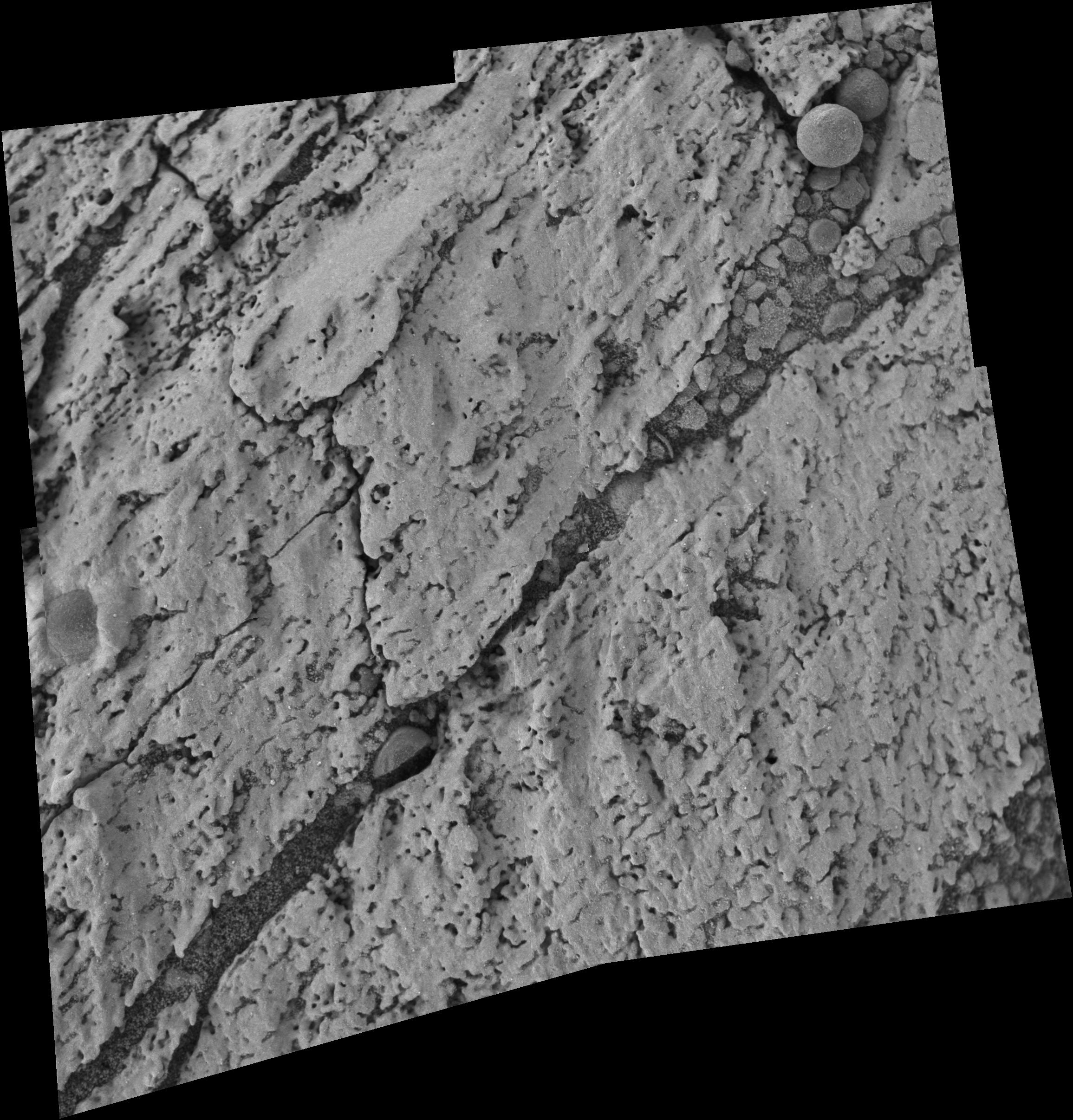
PIA06319:
'Cobble Hill' Profile
Full Resolution:
TIFF
(5.097 MB)
JPEG
(796.2 kB)
2004-06-25
Mars
Mars Exploration Rover (MER)
Microscopic Imager
1024x1024x1
PIA06320:
A 'Pot of Gold' Rich with Nuggets (Sol 163-2)
Full Resolution:
TIFF
(1.05 MB)
JPEG
(146.1 kB)
2004-06-25
Mars
Mars Exploration Rover (MER)
Panoramic Camera
3856x1601x3
PIA06321:
'Endurance' Tells Story of Mars' History
Full Resolution:
TIFF
(11.11 MB)
JPEG
(642.2 kB)
2004-06-26
Mars
Mars Global Surveyor (MGS)
Mars Orbiter Camera (MOC)
764x1146x1
PIA06330:
Isidis Planitia Features
Full Resolution:
TIFF
(803.6 kB)
JPEG
(199.5 kB)
2004-06-27
Mars
Mars Global Surveyor (MGS)
Mars Orbiter Camera (MOC)
416x624x1
PIA06331:
Faulted Sedimentary Rocks
Full Resolution:
TIFF
(260.1 kB)
JPEG
(68.57 kB)
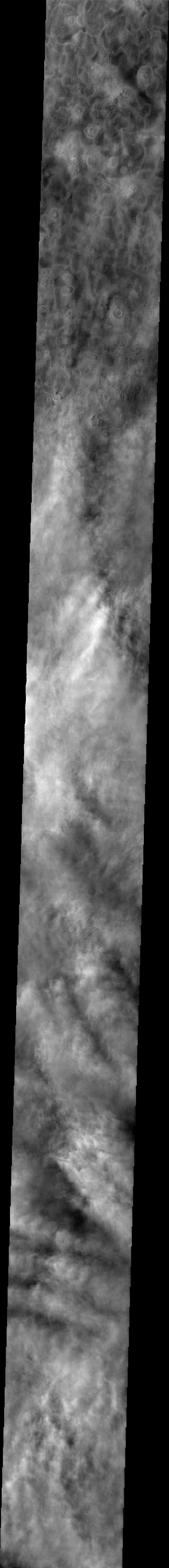
2004-06-28
Mars
2001 Mars Odyssey
THEMIS
636x6679x1
PIA06447:
Martian Clouds
Full Resolution:
TIFF
(3.299 MB)
JPEG
(337.3 kB)
2004-06-28
Mars
Mars Global Surveyor (MGS)
Mars Orbiter Camera (MOC)
672x1008x1
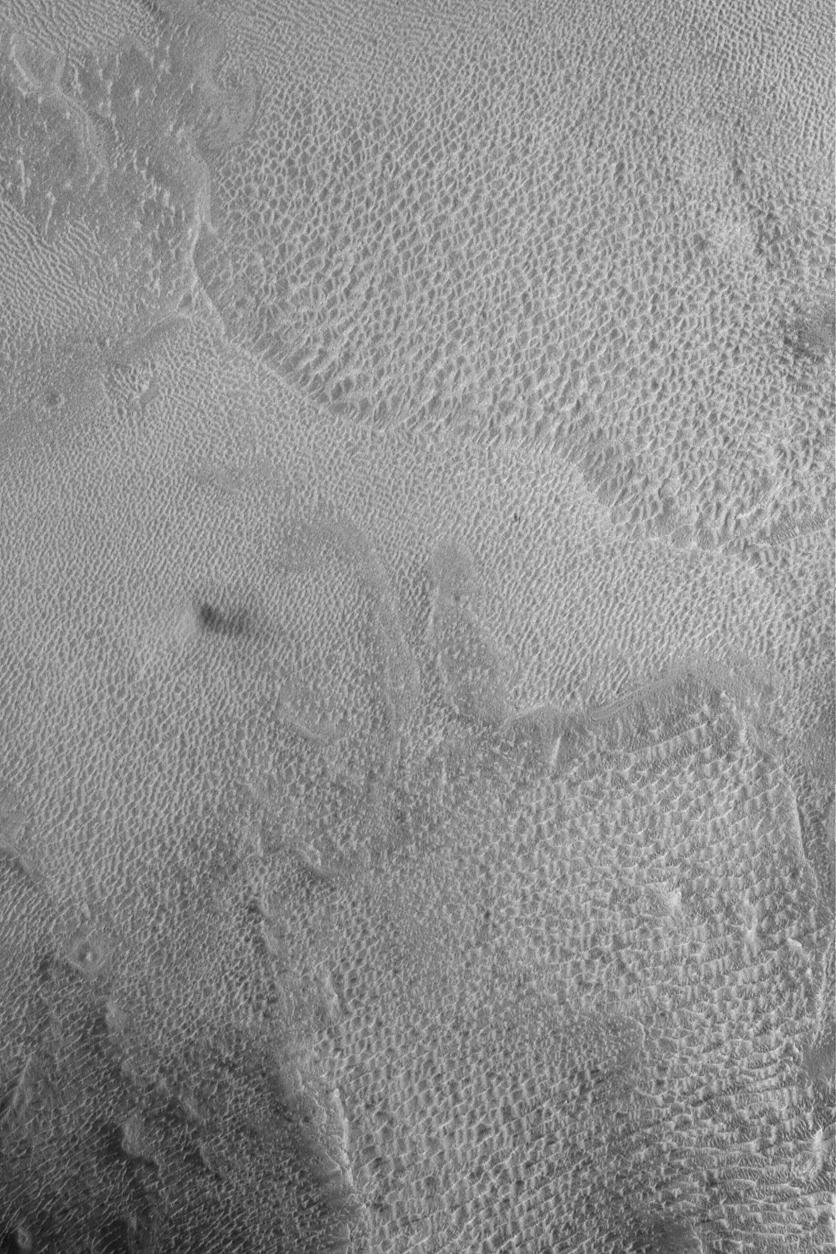
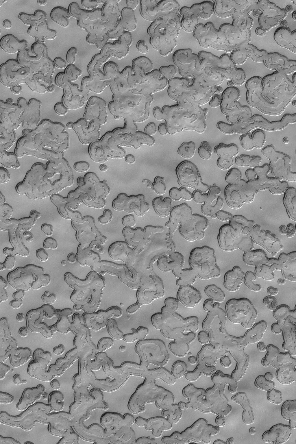
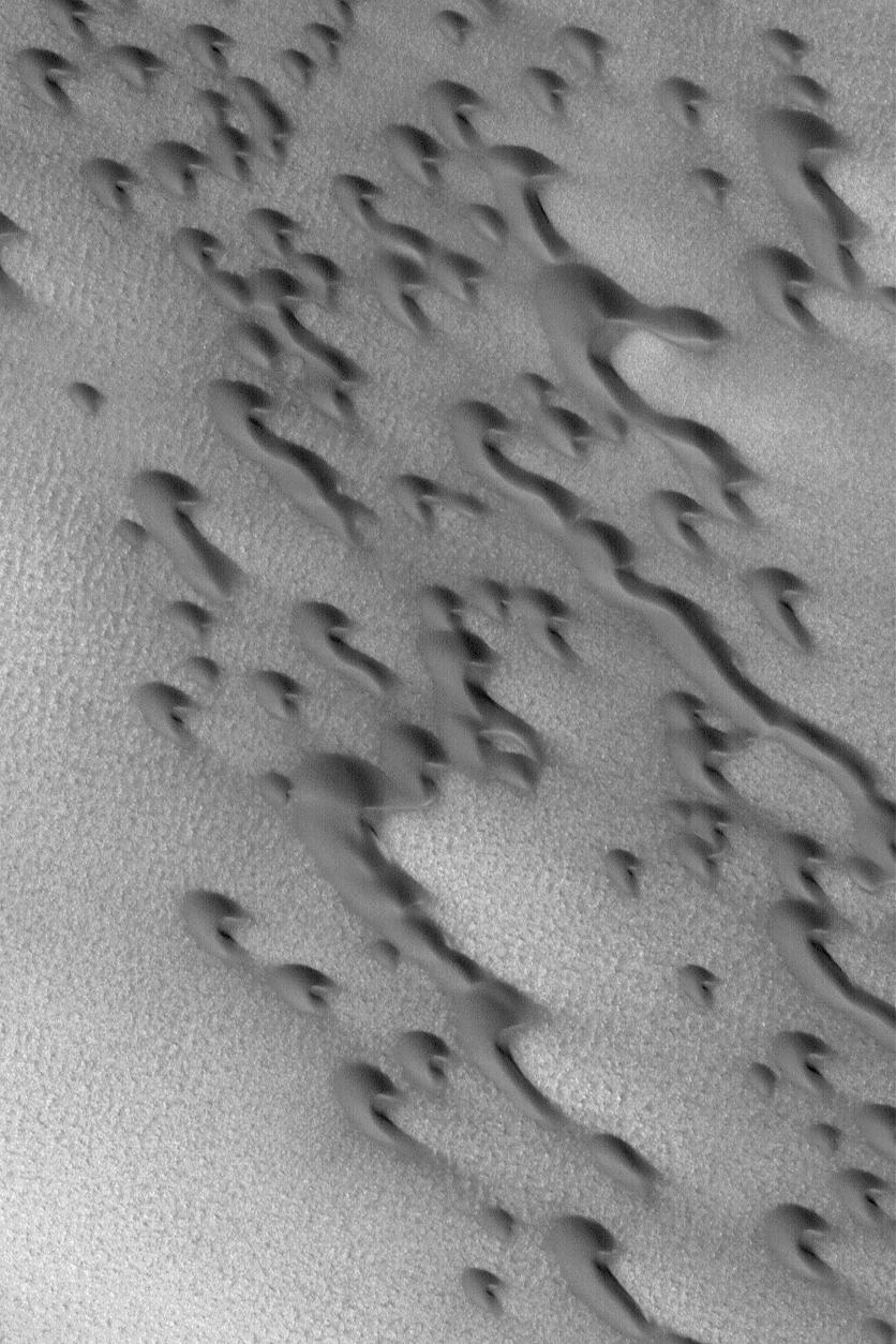
PIA06332:
Caterpillar Dunes
Full Resolution:
TIFF
(526.8 kB)
JPEG
(85.89 kB)
2004-06-29
Mars
2001 Mars Odyssey
THEMIS
637x6652x1
PIA06448:
Clouds Over the North Pole
Full Resolution:
TIFF
(3.579 MB)
JPEG
(345.6 kB)
2004-06-29
Mars
Mars Global Surveyor (MGS)
Mars Orbiter Camera (MOC)
672x1008x1
PIA06333:
Remnant Layered Rocks
Full Resolution:
TIFF
(678.3 kB)
JPEG
(128.4 kB)
2004-06-30
Mars
2001 Mars Odyssey
THEMIS
642x6740x1
PIA06449:
Cloud-Ground Interaction
Full Resolution:
TIFF
(2.846 MB)
JPEG
(236.4 kB)
2004-06-30
Mars
Mars Global Surveyor (MGS)
Mars Orbiter Camera (MOC)
672x1319x1
PIA06334:
Polar Dust Devil Streaks
Full Resolution:
TIFF
(887.5 kB)
JPEG
(169.1 kB)
2004-07-01
Mars
Mars Global Surveyor (MGS)
Mars Orbiter Camera (MOC)
836x1254x1
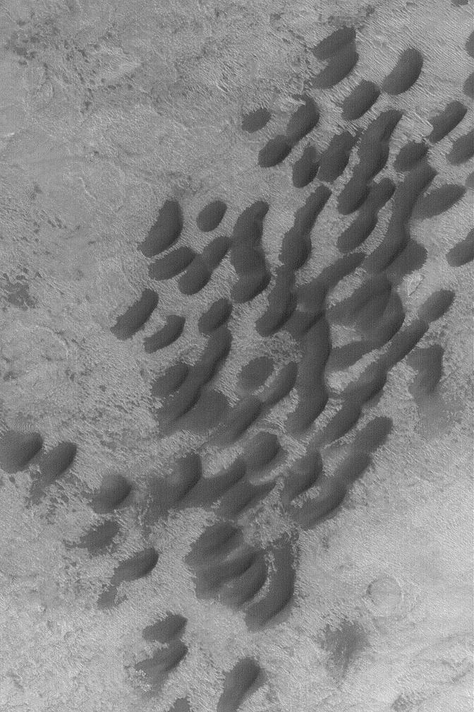
PIA06361:
Dunes in Noachis
Full Resolution:
TIFF
(1.017 MB)
JPEG
(140 kB)
2004-07-01
Mars
2001 Mars Odyssey
THEMIS
641x6663x1
PIA06451:
Cloud Interactions
Full Resolution:
TIFF
(3.295 MB)
JPEG
(254.4 kB)
2004-07-02
Mars
Mars Global Surveyor (MGS)
Mars Orbiter Camera (MOC)
836x1254x1
PIA06362:
South Polar Layers
Full Resolution:
TIFF
(1.05 MB)
JPEG
(279.7 kB)
2004-07-02
Mars
2001 Mars Odyssey
THEMIS
692x6397x1
PIA06452:
Clouds and Dust Storms
Full Resolution:
TIFF
(3.598 MB)
JPEG
(358.7 kB)
2004-07-02
Mars
Mars Exploration Rover (MER)
Panoramic Camera
1024x1024x3
PIA06355:
Three Fresh Exposures in 'Endurance' Layers
Full Resolution:
TIFF
(3.066 MB)
JPEG
(181.1 kB)
2004-07-02
Mars
Mars Exploration Rover (MER)
Panoramic Camera
1024x1024x3
PIA06356:
Three Fresh Exposures, Enhanced Color
Full Resolution:
TIFF
(3.15 MB)
JPEG
(289.1 kB)
2004-07-02
Mars
Mars Exploration Rover (MER)
Panoramic Camera
1024x1024x3
PIA06357:
Three Fresh Exposures, Stretched Color
Full Resolution:
TIFF
(3.15 MB)
JPEG
(373.3 kB)
2004-07-02
Mars
Mars Exploration Rover (MER)
Panoramic Camera
1024x1024x3
PIA06358:
'Hank's Hollow' Sparkles
Full Resolution:
TIFF
(3.15 MB)
JPEG
(204.1 kB)
2004-07-02
Mars
Mars Exploration Rover (MER)
Hazcam
1024x1024x1
PIA06359:
Up-Close Look at 'Bread-Basket'
Full Resolution:
TIFF
(660.1 kB)
JPEG
(86.1 kB)
2004-07-03
Mars
Mars Global Surveyor (MGS)
Mars Orbiter Camera (MOC)
836x1254x1
PIA06363:
Sulci Gordii
Full Resolution:
TIFF
(1.05 MB)
JPEG
(166.3 kB)
2004-07-04
Mars
Mars Global Surveyor (MGS)
Mars Orbiter Camera (MOC)
672x1008x1
PIA06364:
Small Dunes in Hellas
Full Resolution:
TIFF
(678.3 kB)
JPEG
(144.9 kB)
2004-07-05
Mars
Mars Global Surveyor (MGS)
Mars Orbiter Camera (MOC)
672x1008x1
PIA06365:
Exhumed Craters
Full Resolution:
TIFF
(678.3 kB)
JPEG
(132.9 kB)
2004-07-06
Mars
Mars Global Surveyor (MGS)
Mars Orbiter Camera (MOC)
836x1254x1
PIA06366:
Dark Mesas of Aram Chaos
Full Resolution:
TIFF
(1.05 MB)
JPEG
(223.1 kB)
2004-07-06
Mars
2001 Mars Odyssey
THEMIS
1058x918x1
PIA06453:
Dust Devil Days
Full Resolution:
TIFF
(916.1 kB)
JPEG
(141.5 kB)
2004-07-07
Mars
Mars Global Surveyor (MGS)
Mars Orbiter Camera (MOC)
1024x1536x1
PIA06367:
Carbon Dioxide Landscape
Full Resolution:
TIFF
(1.575 MB)
JPEG
(281 kB)
2004-07-07
Mars
2001 Mars Odyssey
THEMIS
1334x3103x1
PIA06454:
Kaiser Crater Dust Devils
Full Resolution:
TIFF
(3.254 MB)
JPEG
(481.4 kB)
2004-07-07
Mars
Mars Exploration Rover (MER)
Panoramic Camera
3544x2016x1
PIA06360:
Gusev on the Horizon
Full Resolution:
TIFF
(5.622 MB)
JPEG
(950 kB)
2004-07-08
Mars
Mars Global Surveyor (MGS)
Mars Orbiter Camera (MOC)
572x1835x1
PIA06368:
Concentric Crater Floor
Full Resolution:
TIFF
(1.051 MB)
JPEG
(252 kB)
2004-07-08
Mars
2001 Mars Odyssey
THEMIS
710x1295x1
PIA06455:
Plentiful Dust Devils
Full Resolution:
TIFF
(701.5 kB)
JPEG
(84.54 kB)
2004-07-09
Mars
Mars Global Surveyor (MGS)
Mars Orbiter Camera (MOC)
2048x3072x1
PIA06369:
Wind Erosion in Tithonium
Full Resolution:
TIFF
(6.298 MB)
JPEG
(1.393 MB)
2004-07-09
Mars
2001 Mars Odyssey
THEMIS
1349x3113x1
PIA06456:
Southern Dust Devils
Full Resolution:
TIFF
(3.401 MB)
JPEG
(571.5 kB)
2004-07-10
Mars
Mars Global Surveyor (MGS)
Mars Orbiter Camera (MOC)
836x1254x1
PIA06377:
Coprates Outcrop
Full Resolution:
TIFF
(1.044 MB)
JPEG
(194.4 kB)
2004-07-11
Mars
Mars Global Surveyor (MGS)
Mars Orbiter Camera (MOC)
672x1008x1
PIA06378:
Nili Buttes and Mesas
Full Resolution:
TIFF
(678.3 kB)
JPEG
(165.7 kB)
2004-07-12
Mars
Mars Global Surveyor (MGS)
Mars Orbiter Camera (MOC)
672x1008x1
PIA06379:
Exposed Crater
Full Resolution:
TIFF
(678.3 kB)
JPEG
(146.4 kB)
2004-07-12
Mars
2001 Mars Odyssey
THEMIS
1376x3053x1
PIA06457:
Wind Streaks
Full Resolution:
TIFF
(2.804 MB)
JPEG
(308.7 kB)
2004-07-13
Mars
Mars Exploration Rover (MER)
Microscopic Imager
974x974x1
PIA06382:
'String of Pearls' Up-Close
Full Resolution:
TIFF
(919.6 kB)
JPEG
(128.2 kB)
2004-07-13
Mars
Mars Exploration Rover (MER)
Microscopic Imager
2447x2397x1
PIA06383:
Looking into "London"
Full Resolution:
TIFF
(4.132 MB)
JPEG
(792.3 kB)
2004-07-13
Mars
Mars Exploration Rover (MER)
Navigation Camera
1580x635x1
PIA06384:
Clouds Roll in for Martian Winter
Full Resolution:
TIFF
(369.1 kB)
JPEG
(45.27 kB)
2004-07-13
Mars
Mars Global Surveyor (MGS)
Mars Orbiter Camera (MOC)
836x1254x1
PIA06385:
Medusae Sulci Yardangs
Full Resolution:
TIFF
(1.05 MB)
JPEG
(239 kB)
2004-07-13
Mars
2001 Mars Odyssey
THEMIS
1368x3236x1
PIA06458:
Windstreaks in Daedalia
Full Resolution:
TIFF
(2.712 MB)
JPEG
(369.7 kB)
2004-07-14
Mars
2001 Mars Odyssey
THEMIS
1356x3064x1
PIA06459:
Windstreaks in Daedalia
Full Resolution:
TIFF
(3.325 MB)
JPEG
(589.7 kB)
2004-07-14
Mars
Mars Global Surveyor (MGS)
Mars Orbiter Camera (MOC)
1254x1881x1
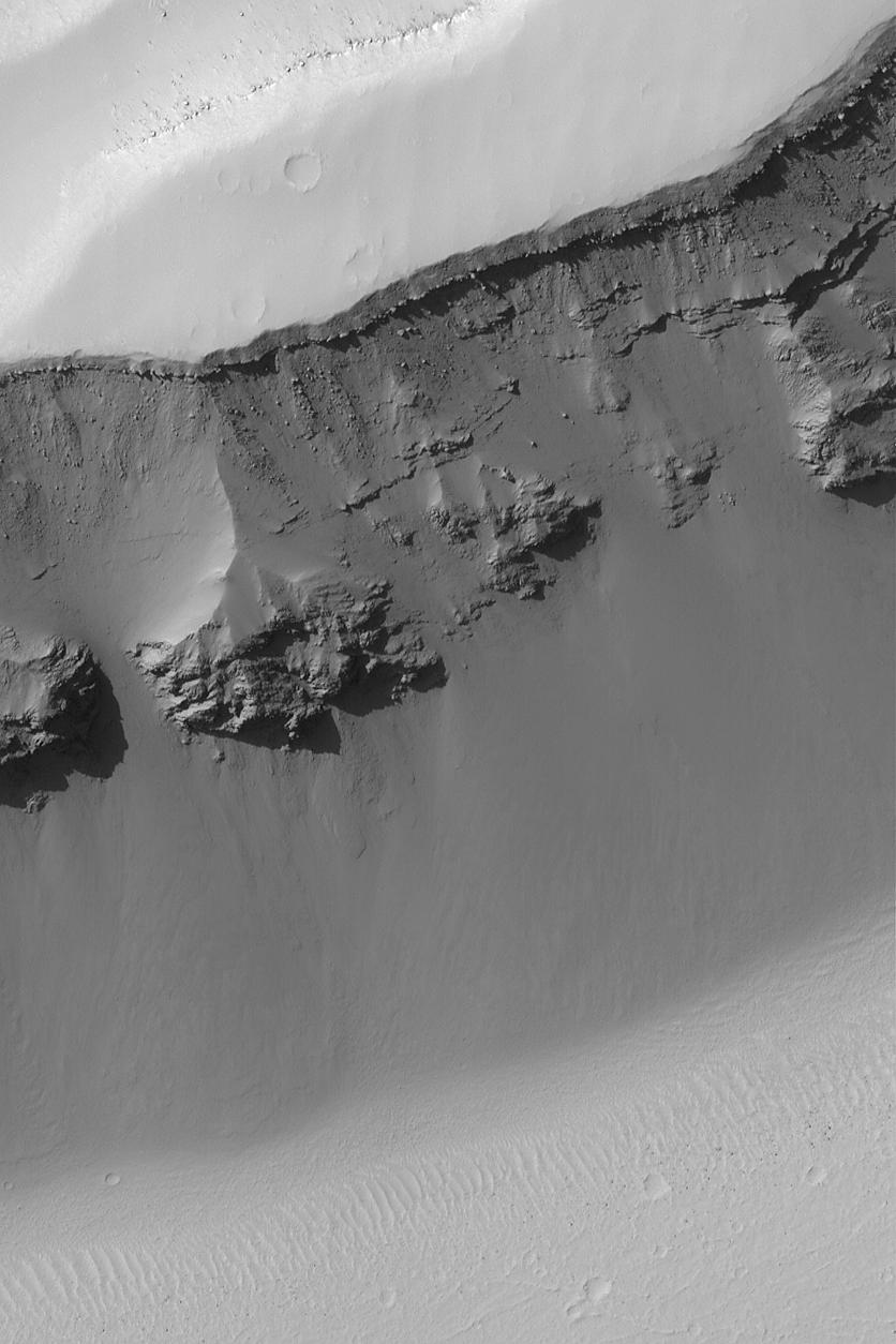
PIA06391:
Martian Gullies
Full Resolution:
TIFF
(2.362 MB)
JPEG
(422.5 kB)
2004-07-14
Mars
Mars Exploration Rover (MER)
Hazcam
1024x1024x1
PIA06392:
'Engineering Flats'
Full Resolution:
TIFF
(983.3 kB)
JPEG
(135.3 kB)
2004-07-15
Mars
Mars Global Surveyor (MGS)
Mars Orbiter Camera (MOC)
426x639x1
PIA06450:
Boulder Tracks
Full Resolution:
TIFF
(272.7 kB)
JPEG
(43.94 kB)
2004-07-15
Mars
2001 Mars Odyssey
THEMIS
651x1281x1
PIA06680:
Ejecta Yardangs
Full Resolution:
TIFF
(707.2 kB)
JPEG
(141.4 kB)
2004-07-16
Mars
Mars Global Surveyor (MGS)
Mars Orbiter Camera (MOC)
836x1254x1
PIA06681:
Terra Sirenum Slope
Full Resolution:
TIFF
(952.7 kB)
JPEG
(107 kB)
2004-07-16
Mars
2001 Mars Odyssey
THEMIS
1384x3056x1
PIA06682:
Yardang Development
Full Resolution:
TIFF
(3.193 MB)
JPEG
(384.4 kB)
2004-07-16
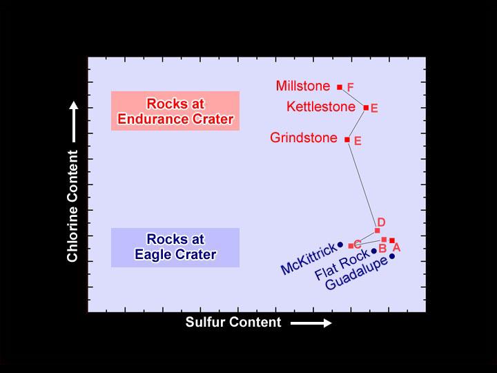
Mars
Mars Exploration Rover (MER)
Alpha Particle X-ray Spectrometer
720x540x3
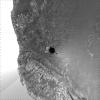
PIA06683:
Chlorine Clues
Full Resolution:
TIFF
(271.6 kB)
JPEG
(30.27 kB)
2004-07-16
Mars
Mars Exploration Rover (MER)
Hazcam
1024x1024x3
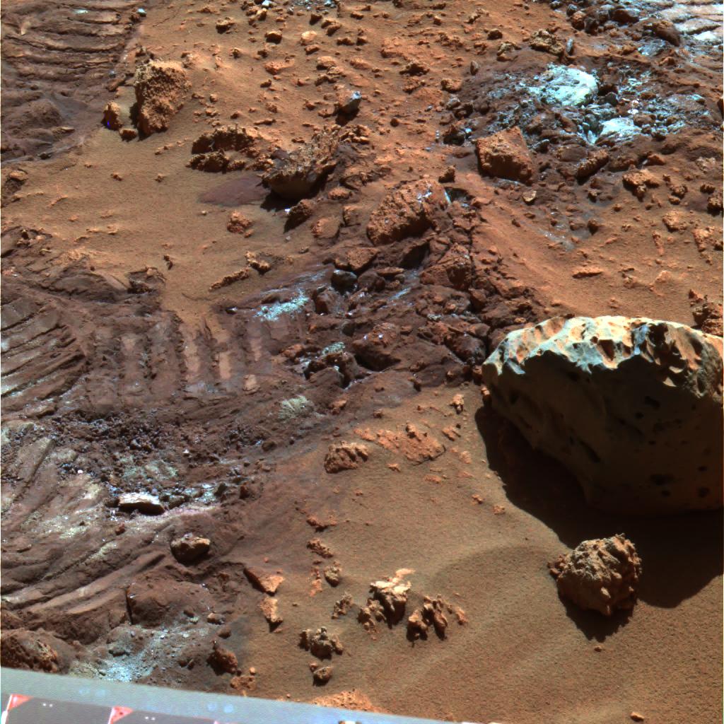
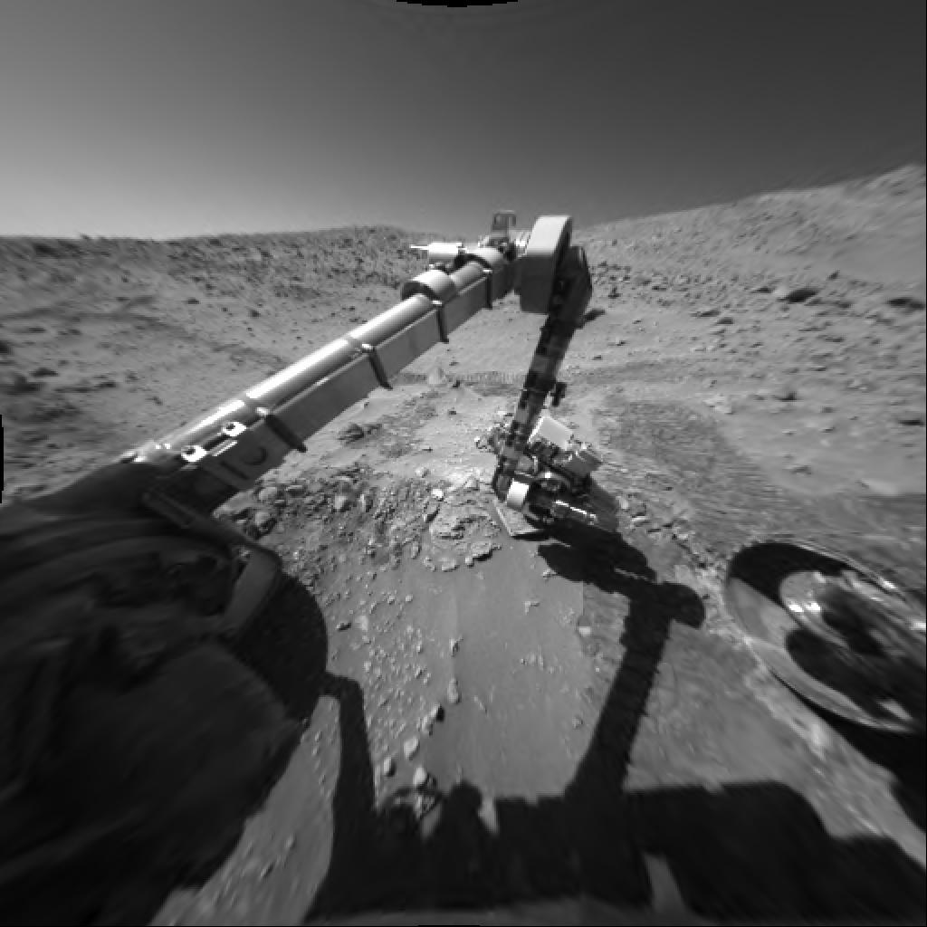
PIA06686:
Way to Go Spirit!
Full Resolution:
TIFF
(1.301 MB)
JPEG
(119.5 kB)
2004-07-16
Mars
Mars Exploration Rover (MER)
Hazcam
1014x1014x1
PIA06687:
Rock Outcrop Under Spirit's Wheels
Full Resolution:
TIFF
(936.1 kB)
JPEG
(131.9 kB)
2004-07-16
Mars
2001 Mars Odyssey
Mars Global Surveyor (MGS)
Mars Exploration Rover (MER)
Mars Orbiter Camera (MOC)
Thermal Emission Spectrometer
1183x638x3
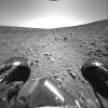
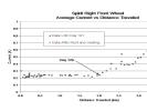
PIA06688:
Spirit Traverse Map
Full Resolution:
TIFF
(2.267 MB)
JPEG
(102.9 kB)
2004-07-16
Mars
Mars Exploration Rover (MER)
Panoramic Camera
22348x2639x3
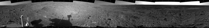
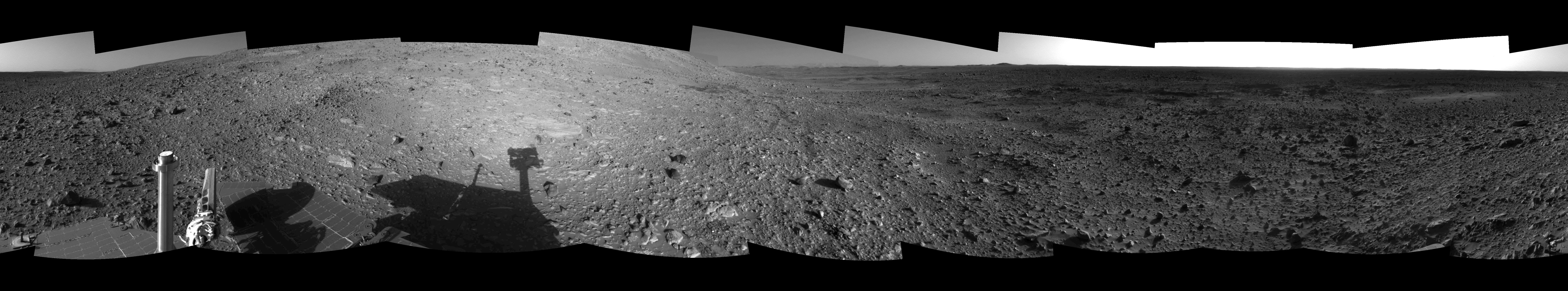
PIA06689:
'Santa Anita' Panorama
Full Resolution:
TIFF
(155.8 MB)
JPEG
(11.45 MB)
QTVR
(16.67 MB)
2004-07-16
Mars
Mars Exploration Rover (MER)
Panoramic Camera
2030x1171x3
PIA06690:
A Peak of Interest
Full Resolution:
TIFF
(5.272 MB)
JPEG
(297.7 kB)
2004-07-17
Mars
Mars Exploration Rover (MER)
Panoramic Camera
1024x768x3
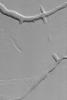
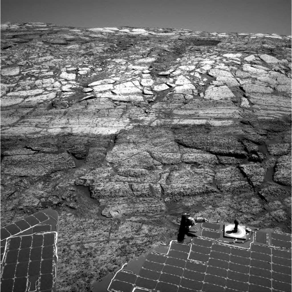
PIA06692:
The 'Razorback' Mystery
Full Resolution:
TIFF
(2.363 MB)
JPEG
(215.6 kB)
2004-07-17
Mars
Mars Exploration Rover (MER)
720x540x3
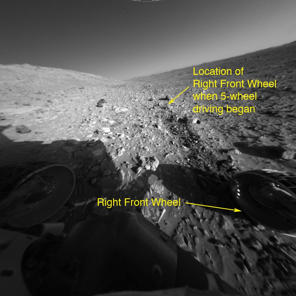
PIA06684:
Portrait of an Aging Wheel
Full Resolution:
TIFF
(42.64 kB)
JPEG
(35.66 kB)
2004-07-17
Mars
Mars Global Surveyor (MGS)
Mars Exploration Rover (MER)
Mars Orbiter Camera (MOC)
1696x1028x1
PIA06691:
Spirit's Course
Full Resolution:
TIFF
(433.4 kB)
JPEG
(107 kB)
2004-07-19
Mars
2001 Mars Odyssey
THEMIS
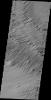
1369x3060x1
PIA06693:
Channel Floor Yardangs
Full Resolution:
TIFF
(3.427 MB)
JPEG
(651.1 kB)
2004-07-19
Mars
Mars Global Surveyor (MGS)
Mars Orbiter Camera (MOC)
836x1254x1
PIA06694:
Melas Sedimentary Rocks
Full Resolution:
TIFF
(1.05 MB)
JPEG
(208.2 kB)
2004-07-19
Mars
Mars Global Surveyor (MGS)
Mars Orbiter Camera (MOC)
836x1254x1
PIA06695:
Troughs Near Ascraeus
Full Resolution:
TIFF
(1.05 MB)
JPEG
(203.2 kB)
2004-07-19
Mars
Mars Global Surveyor (MGS)
Mars Orbiter Camera (MOC)
1024x2440x1
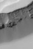
PIA06696:
South Polar Terrain
Full Resolution:
TIFF
(2.501 MB)
JPEG
(386.5 kB)
2004-07-20
Mars
Mars Global Surveyor (MGS)
Mars Orbiter Camera (MOC)
836x1254x1
PIA06697:
Polar Barchans
Full Resolution:
TIFF
(1.05 MB)
JPEG
(176.5 kB)
2004-07-21
Mars
2001 Mars Odyssey
THEMIS
1378x3063x1
PIA06698:
Yardangs and Crosshatching
Full Resolution:
TIFF
(3.38 MB)
JPEG
(652.5 kB)
2004-07-21
Mars
Mars Global Surveyor (MGS)
Mars Orbiter Camera (MOC)
512x768x1
PIA06699:
Light and Dark Slope Streaks
Full Resolution:
TIFF
(374.6 kB)
JPEG
(27.72 kB)
2004-07-21
Mars
2001 Mars Odyssey
THEMIS
1386x3231x1
PIA06700:
A Change of Direction
Full Resolution:
TIFF
(3.384 MB)
JPEG
(624.7 kB)
2004-07-21
Mars
Mars Exploration Rover (MER)
Navigation Camera
7688x1831x1
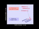
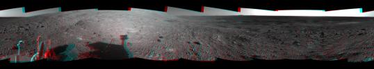
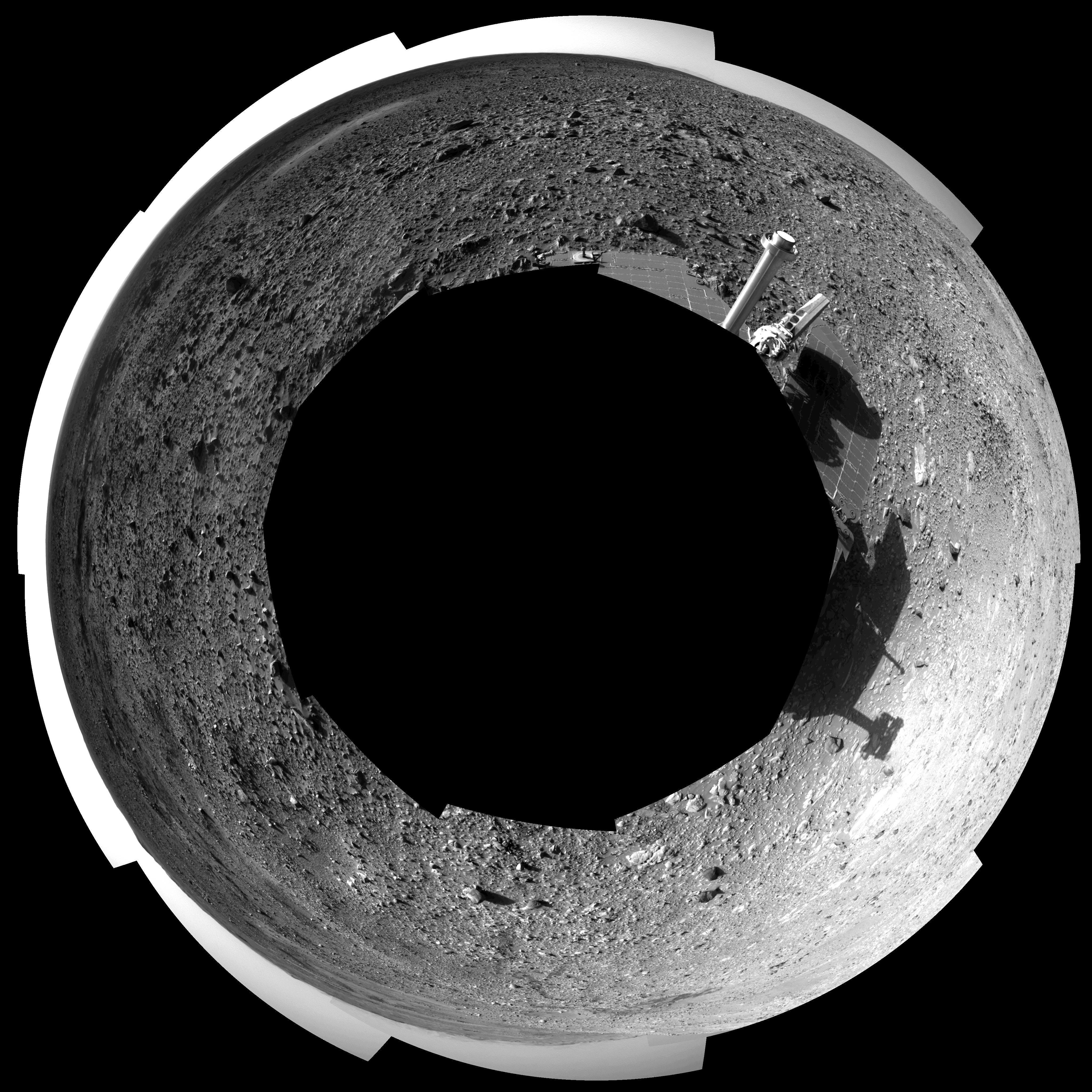
PIA06701:
'Endurance' All Around (cylindrical)
Full Resolution:
TIFF
(11.44 MB)
JPEG
(1.732 MB)
2004-07-21
Mars
Mars Exploration Rover (MER)
Navigation Camera
7753x2387x3
PIA06702:
'Endurance' All Around (3-D)
Full Resolution:
TIFF
(42.92 MB)
JPEG
(2.233 MB)
2004-07-21
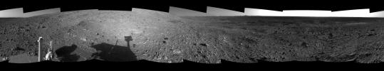
Mars
Mars Exploration Rover (MER)
Navigation Camera
7753x2387x1
PIA06703:
'Endurance' All Around (Left Eye)
Full Resolution:
TIFF
(14.29 MB)
JPEG
(2.065 MB)
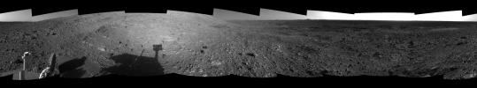
2004-07-21
Mars
Mars Exploration Rover (MER)
Navigation Camera
7753x2387x1
PIA06704:
'Endurance' All Around (Polar)
Full Resolution:
TIFF
(14.11 MB)
JPEG
(1.997 MB)
2004-07-21
Mars
Mars Exploration Rover (MER)
Navigation Camera
4911x4911x1
PIA06705:
'Endurance' All Around (Polar)
Full Resolution:
TIFF
(15.47 MB)
JPEG
(2.155 MB)
2004-07-21
Mars
Mars Exploration Rover (MER)
Navigation Camera
4000x4000x1
PIA06706:
'Endurance' All Around Vertical)
Full Resolution:
TIFF
(12.55 MB)
JPEG
(1.535 MB)
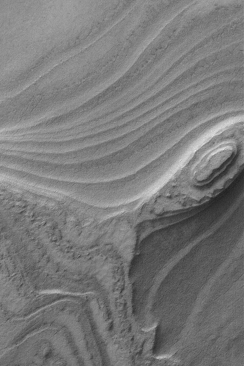
2004-07-22
Mars
Mars Global Surveyor (MGS)
Mars Orbiter Camera (MOC)
836x1254x1
PIA06707:
Gordii Fossae Troughs
Full Resolution:
TIFF
(982.6 kB)
JPEG
(156 kB)
2004-07-22
Mars
2001 Mars Odyssey
THEMIS
1369x3059x1
PIA06708:
A Question of Interpretation
Full Resolution:
TIFF
(3.358 MB)
JPEG
(689.9 kB)
2004-07-22
Mars
Mars Exploration Rover (MER)
Navigation Camera
7466x1034x1
PIA06710:
Hilly Surroundings (cylindrical)
Full Resolution:
TIFF
(2.949 MB)
JPEG
(1.153 MB)
2004-07-22
Mars
Mars Exploration Rover (MER)
Navigation Camera
7704x1429x3
PIA06711:
Hilly Surroundings (3-D)
Full Resolution:
TIFF
(10.59 MB)
JPEG
(1.374 MB)
2004-07-22
Mars
Mars Exploration Rover (MER)
Navigation Camera
7704x1429x1
PIA06712:
Hilly Surroundings (Left Eye)
Full Resolution:
TIFF
(3.351 MB)
JPEG
(1.285 MB)
2004-07-22
Mars
Mars Exploration Rover (MER)
Navigation Camera
7704x1429x1
PIA06713:
Hilly Surroundings (Right Eye)
Full Resolution:
TIFF
(3.261 MB)
JPEG
(1.247 MB)
2004-07-22
Mars
Mars Exploration Rover (MER)
Navigation Camera
4099x4099x1
PIA06714:
Hilly Surroundings (polar)
Full Resolution:
TIFF
(4.564 MB)
JPEG
(1.786 MB)
2004-07-22
Mars
Mars Exploration Rover (MER)
Navigation Camera
4000x4000x1
PIA06715:
Hilly Surroundings (vertical)
Full Resolution:
TIFF
(8.645 MB)
JPEG
(2.129 MB)
2004-07-22
Mars
Mars Exploration Rover (MER)
Navigation Camera
1024x1024x1
PIA06716:
Can You Find the Rat Holes?
Full Resolution:
TIFF
(1.05 MB)
JPEG
(236.3 kB)
2004-07-23
Mars
Mars Global Surveyor (MGS)
Mars Orbiter Camera (MOC)
916x4276x1
PIA06717:
Polar Layers and Dunes
Full Resolution:
TIFF
(3.921 MB)
JPEG
(685.2 kB)
2004-07-23
Mars
2001 Mars Odyssey
THEMIS
658x1279x1
PIA06718:
Complete Makeover
Full Resolution:
TIFF
(736.4 kB)
JPEG
(157.9 kB)
2004-07-23
Mars
Mars Exploration Rover (MER)
Navigation Camera
536x527x3
PIA06719:
Opportunity Leaves a Trail of 'Rat' Holes
Full Resolution:
TIFF
(487 kB)
JPEG
(71.16 kB)
2004-07-24
Mars
Mars Global Surveyor (MGS)
Mars Orbiter Camera (MOC)
836x1254x1
PIA06721:
Layers in Oudemans
Full Resolution:
TIFF
(1.05 MB)
JPEG
(188.7 kB)
1-100
101-200
201-300
301-400
401-500
501-600
601-700
701-800
801-900
901-1000
Currently displaying images:
2681 - 2780
of 12742


