- Original Caption Released with Image:
-
24 July 2004
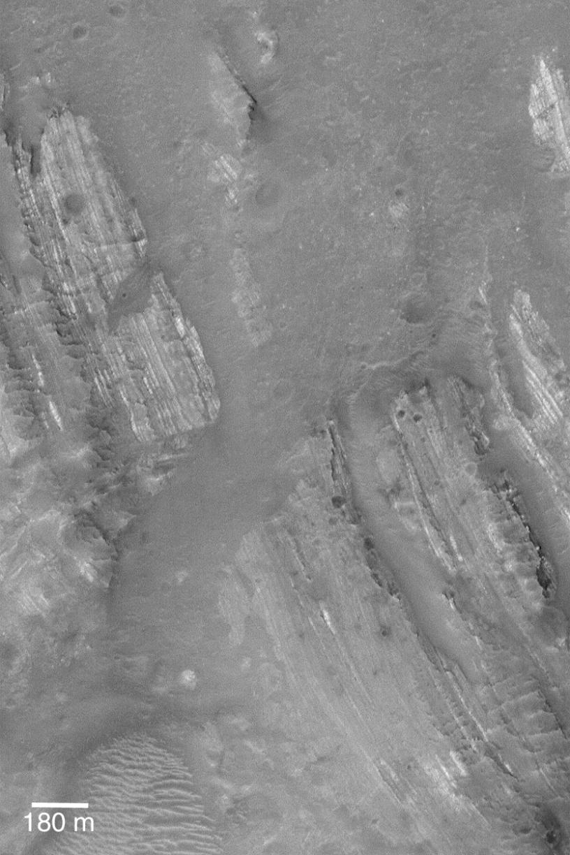
The central peak of Oudemans Crater, located near 10.0°S, 92.1°W, contains light-toned, layered rock that has been uplifted and severely tilted. When seen from overhead, as in this Mars Global Surveyor (MGS) Mars Orbiter Camera (MOC) image, the dipping layered rocks form a banded pattern on the landscape. These rocks were once in the ground beneath the present floor of Oudemans Crater. The impact which produced the crater brought these rocks to the surface. They are light-toned and very similar to some of the varieties of sedimentary rock outcrops found in portions of the vast Valles Marineris trough system. Oudemans Crater sits on the edge of the Valles Marineris, near the intersection of the Labyrinthus Noctis and Ius Chasma. The image is illuminated by sunlight from the left/upper left. The 180 meter scale bar is equal to about 197 yards.
- Image Credit:
-
NASA/JPL/Malin Space Science Systems
Image Addition Date: -
2004-07-24
|