- Original Caption Released with Image:
-
24 June 2004
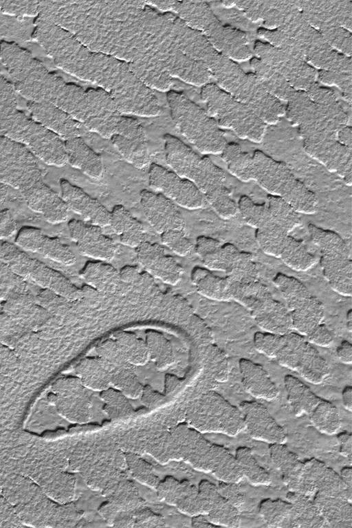
This Mars Global Surveyor (MGS) Mars Orbiter Camera (MOC) image shows the results of erosion acting upon a layer of material in the south polar region of Mars. The elliptical pit in the lower left corner of the image was once buried beneath this eroding layer, as well. The processes that eroded the material, and the composition of the material, are unknown. The image is located near 80.7°S, 300.9°W, and covers an area about 3 km (1.9 mi) wide. Sunlight illuminates this scene from the top.
- Image Credit:
-
NASA/JPL/Malin Space Science Systems
Image Addition Date: -
2004-06-24
|