- Original Caption Released with Image:
-
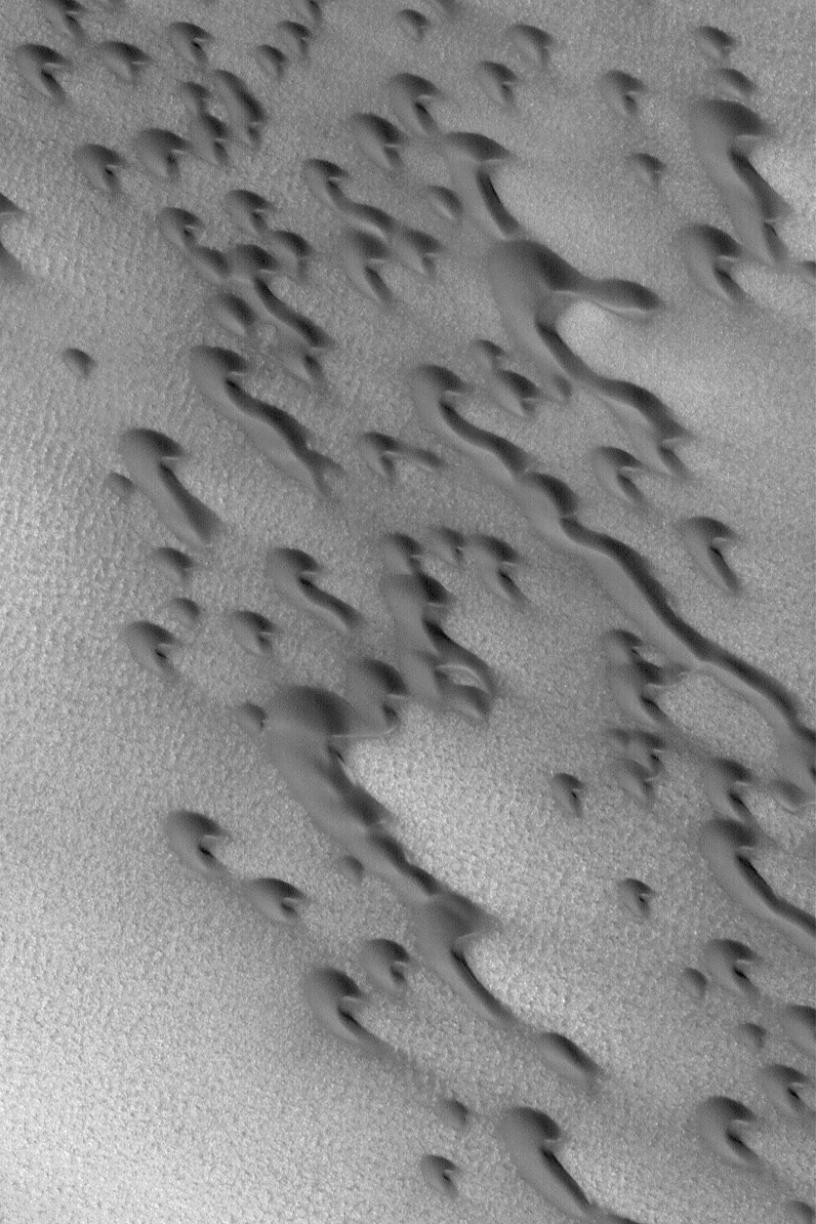
20 July 2004
This Mars Global Surveyor (MGS) Mars Orbiter Camera (MOC) image shows dark, barchan sand dunes of the north polar region of Mars. Barchan dunes are simple, rounded forms with two horns that extend downwind. Inequalities in local wind patterns may result in one horn being extended farther than the other, as is the case for several dunes in this image. The image also shows several barchans may merge to form a long dune ridge. The horns and attendant slip faces on these dunes indicate wind transport of sand from the upper left toward the lower right. The image is located near 77.6°N, 103.6°W. The picture covers an area about 3 km (1.9 mi) wide; sunlight illuminates the scene from the lower left.
- Image Credit:
-
NASA/JPL/Malin Space Science Systems
Image Addition Date: -
2004-07-20
|