|
Your search criteria found 12731 images Target is Mars (and available satellites) |
| My List |
Addition Date | Target |
Mission
|
Instrument | Size |

|
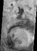
2002-06-17 | Mars |
2001 Mars Odyssey |
THEMIS |
1212x2935x1 |
|
|
|||||
|
|
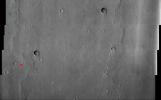
2002-06-17 | Mars |
2001 Mars Odyssey |
THEMIS |
1230x2935x1 |
|
|
|||||
|
|
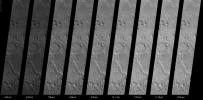
2002-06-17 | Mars |
2001 Mars Odyssey |
THEMIS |
1194x3205x1 |
|
|
|||||
|
|
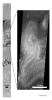
2002-06-17 | Mars |
2001 Mars Odyssey |
THEMIS |
1239x3043x1 |
|
|
|||||
|
|
2002-06-17 | Mars |
2001 Mars Odyssey |
THEMIS |
1221x3025x1 |
|
|
|||||
|
|
2002-06-17 | Mars |
2001 Mars Odyssey |
THEMIS |
1233x2971x1 |
|
|
|||||
|
|
2002-06-26 | Mars |
2001 Mars Odyssey |
THEMIS |
1240x3043x1 |
|
|
|||||
|
|
2002-06-26 | Mars |
2001 Mars Odyssey |
THEMIS |
1201x3061x1 |
|
|
|||||
|
|
2002-06-26 | Mars |
2001 Mars Odyssey |
THEMIS |
1151x3061x1 |
|
|
|||||
|
|
2002-06-26 | Mars |
2001 Mars Odyssey |
THEMIS |
1199x3061x1 |
|
|
|||||
|
|
2002-06-26 | Mars |
2001 Mars Odyssey |
THEMIS |
1233x3043x1 |
|
|
|||||
|
|
2002-06-26 | Mars |
2001 Mars Odyssey |
THEMIS |
1213x3025x1 |
|
|
|||||
|
|
2002-06-27 | Mars |
2001 Mars Odyssey |
THEMIS |
1189x3007x1 |
|
|
|||||
|
|
2002-06-26 | Mars |
2001 Mars Odyssey |
THEMIS |
1227x3061x1 |
|
|
|||||
|
|
2002-07-03 | Mars |
2001 Mars Odyssey |
THEMIS |
1239x3043x1 |
|
|
|||||
|
|
2003-04-09 | Mars |
2001 Mars Odyssey |
THEMIS |
1106x1521x1 |
|
|||||
|
|
2002-07-03 | Mars |
2001 Mars Odyssey |
THEMIS |
1203x3061x1 |
|
|
|||||
|
|
2002-07-03 | Mars |
2001 Mars Odyssey |
THEMIS |
1183x3007x1 |
|
|
|||||
|
|
2002-07-03 | Mars |
2001 Mars Odyssey |
THEMIS |
1224x3025x1 |
|
|
|||||
|
|
2002-07-08 | Mars |
2001 Mars Odyssey |
THEMIS |
1221x3025x1 |
|
|
|||||
|
|
2002-07-08 | Mars |
2001 Mars Odyssey |
THEMIS |
1172x3007x1 |
|
|
|||||
|
|
2002-07-15 | Mars |
2001 Mars Odyssey |
THEMIS |
1238x3025x1 |
|
|
|||||
|
|
2002-07-15 | Mars |
2001 Mars Odyssey |
THEMIS |
1212x3007x1 |
|
|
|||||
|
|
2002-07-15 | Mars |
2001 Mars Odyssey |
THEMIS |
1196x3007x1 |
|
|
|||||
|
|
2002-07-17 | Mars |
2001 Mars Odyssey |
THEMIS |
1191x3007x1 |
|
|
|||||
|
|
2002-07-17 | Mars |
2001 Mars Odyssey |
THEMIS |
1130x3061x1 |
|
|
|||||
|
|
2002-07-22 | Mars |
2001 Mars Odyssey |
THEMIS |
1239x3043x1 |
|
|
|||||
|
|
2002-07-22 | Mars |
2001 Mars Odyssey |
THEMIS |
314x1234x3 |
|
|
|||||
|
|
2002-07-22 | Mars |
2001 Mars Odyssey |
THEMIS |
1037x644x3 |
|
|||||
|
|
2002-07-22 | Mars |
2001 Mars Odyssey |
THEMIS |
1066x2665x1 |
|
|
|||||
|
|
2002-07-24 | Mars |
2001 Mars Odyssey |
THEMIS |
320x1393x1 |
|
|
|||||
|
|
2002-07-24 | Mars |
2001 Mars Odyssey |
THEMIS |
4036x1991x1 |
|
|||||
|
|
2002-08-05 | Mars |
2001 Mars Odyssey |
THEMIS |
1217x2863x1 |
|
|
|||||
|
|
2002-08-05 | Mars |
2001 Mars Odyssey |
THEMIS |
1199x3115x1 |
|
|
|||||
|
|
2002-08-05 | Mars |
2001 Mars Odyssey |
THEMIS |
1239x3043x1 |
|
|
|||||
|
|
2002-08-05 | Mars |
2001 Mars Odyssey |
THEMIS |
1237x3043x1 |
|
|
|||||
|
|
2002-08-05 | Mars |
2001 Mars Odyssey |
THEMIS |
1240x3043x1 |
|
|
|||||
|
|
2002-08-05 | Mars |
2001 Mars Odyssey |
THEMIS |
1239x3043x1 |
|
|
|||||
|
|
2002-08-05 | Mars |
2001 Mars Odyssey |
THEMIS |
1082x2701x1 |
|
|
|||||
|
|
2002-08-05 | Mars |
2001 Mars Odyssey |
THEMIS |
1175x3061x1 |
|
|
|||||
|
|
2002-10-01 | Mars |
2001 Mars Odyssey |
THEMIS |
2000x3825x1 |
|
|||||
|
|
2002-10-01 | Mars |
2001 Mars Odyssey |
THEMIS |
2000x3800x1 |
|
|||||
|
|
2002-10-01 | Mars |
2001 Mars Odyssey |
THEMIS |
1740x1176x1 |

|
|||||
|
|
2002-11-21 | Mars |
2001 Mars Odyssey |
THEMIS |
1239x3043x1 |
|
|
|||||
|
|
2002-11-14 | Mars |
2001 Mars Odyssey |
THEMIS |
1215x3007x1 |
|
|
|||||
|
|
2002-11-14 | Mars |
2001 Mars Odyssey |
THEMIS |
1222x3025x1 |
|
|
|||||
|
|
2002-11-15 | Mars |
2001 Mars Odyssey |
THEMIS |
1237x3043x1 |
|
|
|||||
|
|
2002-11-15 | Mars |
2001 Mars Odyssey |
THEMIS |
1240x3043x1 |
|
|
|||||
|
|
2002-11-22 | Mars |
2001 Mars Odyssey |
THEMIS |
1234x3025x1 |
|
|
|||||
|
|
2002-11-22 | Mars |
2001 Mars Odyssey |
THEMIS |
1207x3061x1 |
|
|
|||||
|
|
2002-11-23 | Mars |
2001 Mars Odyssey |
THEMIS |
1181x3007x1 |
|
|
|||||
|
|
2002-11-23 | Mars |
2001 Mars Odyssey |
THEMIS |
1239x3043x1 |
|
|
|||||
|
|
2002-11-23 | Mars |
2001 Mars Odyssey |
THEMIS |
1219x3169x1 |
|
|
|||||
|
|
2002-11-26 | Mars |
2001 Mars Odyssey |
THEMIS |
1183x3007x1 |
|
|
|||||
|
|
2002-11-26 | Mars |
2001 Mars Odyssey |
THEMIS |
1163x3241x1 |
|
|
|||||
|
|
2002-11-26 | Mars |
2001 Mars Odyssey |
THEMIS |
1240x3007x1 |
|
|
|||||
|
|
2002-11-26 | Mars |
2001 Mars Odyssey |
THEMIS |
1239x3025x1 |
|
|
|||||
|
|
2002-12-04 | Mars |
2001 Mars Odyssey |
THEMIS |
1191x3007x1 |
|
|
|||||
|
|
2002-12-04 | Mars |
2001 Mars Odyssey |
THEMIS |
1219x3025x1 |
|
|
|||||
|
|
2002-12-04 | Mars |
2001 Mars Odyssey |
THEMIS |
1062x2881x1 |
|
|
|||||
|
|
2002-12-04 | Mars |
2001 Mars Odyssey |
THEMIS |
1230x2917x1 |
|
|
|||||
|
|
2002-12-04 | Mars |
2001 Mars Odyssey |
THEMIS |
1213x2863x1 |
|
|
|||||
|
|
2002-12-04 | Mars |
2001 Mars Odyssey |
THEMIS |
1234x2989x1 |
|
|
|||||
|
|
2002-12-04 | Mars |
2001 Mars Odyssey |
THEMIS |
1239x3115x1 |
|
|
|||||
|
|
2002-12-07 | Mars |
2001 Mars Odyssey |
THEMIS |
952x1024x3 |
|
|||||
|
|
2002-12-07 | Mars |
2001 Mars Odyssey |
THEMIS |
547x1024x3 |
|
|||||
|
|
2002-12-07 | Mars |
2001 Mars Odyssey |
THEMIS |
981x656x1 |
|
|||||
|
|
2002-12-07 | Mars |
2001 Mars Odyssey |
THEMIS |
1276x895x3 |
|
|||||
|
|
2002-12-07 | Mars |
2001 Mars Odyssey |
THEMIS |
1276x925x3 |
|
|||||
|
|
2002-12-07 | Mars |
2001 Mars Odyssey |
THEMIS |
734x1024x3 |
|
|||||
|
|
2002-12-07 | Mars |
2001 Mars Odyssey |
Mars Radiation Experiment |
907x621x3 |
|
|||||
|
|
2002-12-10 | Mars |
2001 Mars Odyssey |
Gamma Ray Spectrometer Suite |
663x1024x3 |
|
|||||
|
|
2002-12-07 | Mars |
2001 Mars Odyssey |
THEMIS |
1238x338x1 |
|
|||||
|
|
2002-12-13 | Mars |
2001 Mars Odyssey |
THEMIS |
1191x3007x1 |
|
|
|||||
|
|
2002-12-13 | Mars |
2001 Mars Odyssey |
THEMIS |
1215x3025x1 |
|
|
|||||
|
|
2002-12-13 | Mars |
2001 Mars Odyssey |
THEMIS |
319x922x3 |
|
|
|||||
|
|
2002-12-13 | Mars |
2001 Mars Odyssey |
THEMIS |
1095x1485x1 |
|
|||||
|
|
2002-12-13 | Mars |
2001 Mars Odyssey |
THEMIS |
1082x1503x1 |
|
|||||
|
|
2002-12-13 | Mars |
2001 Mars Odyssey |
THEMIS |
1235x3025x1 |
|
|
|||||
|
|
2002-12-13 | Mars |
2001 Mars Odyssey |
THEMIS |
1217x3061x1 |
|
|
|||||
|
|
2002-12-17 | Mars |
2001 Mars Odyssey |
THEMIS |
858x1606x3 |
|
|||||
|
|
2002-12-13 | Mars |
2001 Mars Odyssey |
THEMIS |
1127x2989x1 |
|
|
|||||
|
|
2002-12-16 | Mars |
2001 Mars Odyssey |
THEMIS |
1186x2809x1 |
|
|
|||||
|
|
2002-12-16 | Mars |
2001 Mars Odyssey |
THEMIS |
1186x3115x1 |
|
|
|||||
|
|
2002-12-16 | Mars |
2001 Mars Odyssey |
THEMIS |
1239x3043x1 |
|
|
|||||
|
|
2002-12-16 | Mars |
2001 Mars Odyssey |
THEMIS |
1237x3025x1 |
|
|
|||||
|
|
2002-12-16 | Mars |
2001 Mars Odyssey |
THEMIS |
1189x3007x1 |
|
|
|||||
|
|
2002-12-16 | Mars |
2001 Mars Odyssey |
THEMIS |
1116x2971x1 |
|
|
|||||
|
|
2002-12-16 | Mars |
2001 Mars Odyssey |
THEMIS |
1231x3025x1 |
|
|
|||||
|
|
2002-12-16 | Mars |
2001 Mars Odyssey |
THEMIS |
1225x2863x1 |
|
|
|||||
|
|
2002-12-16 | Mars |
2001 Mars Odyssey |
THEMIS |
1186x3007x1 |
|
|
|||||
|
|
2002-12-16 | Mars |
2001 Mars Odyssey |
THEMIS |
1210x3025x1 |
|
|
|||||
|
|
2002-12-18 | Mars |
2001 Mars Odyssey |
THEMIS |
1181x2827x1 |
|
|
|||||
|
|
2002-12-18 | Mars |
2001 Mars Odyssey |
THEMIS |
1169x2845x1 |
|
|
|||||
|
|
2002-12-18 | Mars |
2001 Mars Odyssey |
THEMIS |
1169x2989x1 |
|
|
|||||
|
|
2002-12-18 | Mars |
2001 Mars Odyssey |
THEMIS |
1239x3043x1 |
|
|
|||||
|
|
2002-12-18 | Mars |
2001 Mars Odyssey |
THEMIS |
1194x2971x1 |
|
|
|||||
|
|
2002-12-18 | Mars |
2001 Mars Odyssey |
THEMIS |
1084x1503x1 |
|
|||||
|
|
2002-12-18 | Mars |
2001 Mars Odyssey |
THEMIS |
1169x2809x1 |
|
|
|||||
|
|
2002-12-18 | Mars |
2001 Mars Odyssey |
THEMIS |
1172x3079x1 |
|
|
|||||

|
 |
 |
 |
|
|
|
|
|
|
|

|
| 1-100 | 101-200 | 201-300 | 301-400 | 401-500 | 501-600 | 601-700 | 701-800 | 801-900 | 901-1000 |
| Currently displaying images: 101 - 200 of 12731 |