My
List |
Addition Date
|
Target
|
Mission
|
Instrument
|
Size
|

|
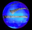
1998-09-26 |
Titan
|
Hubble Space Telescope
|
WFPC2
|
600x750x3 |
|
-
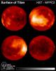
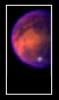
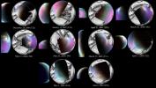
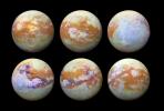
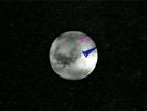
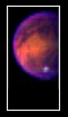
PIA01465:
-
Hubble Observes Surface of Titan
Full Resolution:
TIFF
(564.6 kB)
JPEG
(37.66 kB)
|
|
|
2005-04-27 |
Titan
|
Cassini-Huygens
|
Visual and Infrared Mapping Spectrometer
Radar Mapper
|
750x196x3 |
|
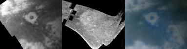
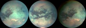
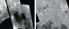
-
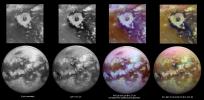
PIA07868:
Titan Crater in Three Views
Full Resolution:
TIFF
(441.8 kB)
JPEG
(21.34 kB)
|
|
|
2004-07-03 |
Titan
|
Cassini-Huygens
|
Visual and Infrared Mapping Spectrometer
|
720x540x1 |
|
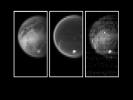
-
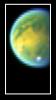
PIA06404:
-
Titan's Surface Revealed
Full Resolution:
TIFF
(147.7 kB)
JPEG
(22.16 kB)
|
|
|
2004-07-03 |
Titan
|
Cassini-Huygens
|
Visual and Infrared Mapping Spectrometer
|
690x481x3 |
|
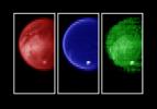
-
PIA06405:
-
Titan's Surface Revealed
Full Resolution:
TIFF
(321.7 kB)
JPEG
(23.38 kB)
|
|
|
2004-07-03 |
Titan
|
Cassini-Huygens
|
Visual and Infrared Mapping Spectrometer
|
233x398x3 |
|
-
PIA06406:
-
Titan's Surface Revealed
Full Resolution:
TIFF
(141.6 kB)
JPEG
(7.977 kB)
|
|
|
2004-07-03 |
Titan
|
Cassini-Huygens
|
Visual and Infrared Mapping Spectrometer
|
223x395x3 |
|
-
PIA06407:
-
Titan's Surface Revealed
Full Resolution:
TIFF
(148.1 kB)
JPEG
(8.707 kB)
|
|
|
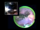
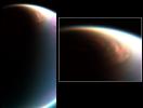
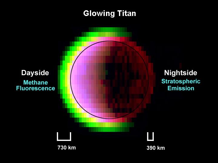
2004-08-05 |
Titan
|
Cassini-Huygens
|
Visual and Infrared Mapping Spectrometer
|
649x231x3 |
|
-
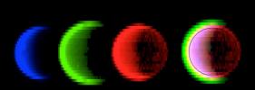
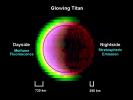
PIA06418:
-
Glowing Titan
Full Resolution:
TIFF
(215.6 kB)
JPEG
(13.79 kB)
|
|
|
2004-08-05 |
Titan
|
Cassini-Huygens
|
Visual and Infrared Mapping Spectrometer
|
720x540x3 |
|
-
PIA06419:
-
Glowing Titan
Full Resolution:
TIFF
(335.3 kB)
JPEG
(30.83 kB)
|
|
|
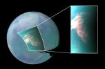
2004-10-27 |
Titan
|
Cassini-Huygens
|
Visual and Infrared Mapping Spectrometer
|
618x296x1 |

|
-
PIA06982:
-
Behold Titan's Surface
Full Resolution:
TIFF
(182.5 kB)
JPEG
(19.75 kB)
|
|
|
2004-10-27 |
Titan
|
Cassini-Huygens
|
Visual and Infrared Mapping Spectrometer
|
720x540x3 |
|
-
PIA06983:
-
Titan's Complex Surface
Full Resolution:
TIFF
(684.3 kB)
JPEG
(28.5 kB)
|
|
|
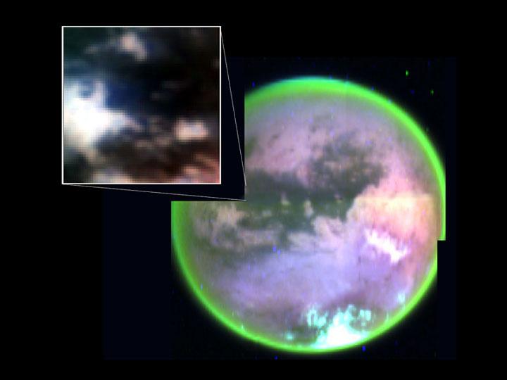
2004-12-16 |
Titan
|
Cassini-Huygens
|
Visual and Infrared Mapping Spectrometer
|
1209x617x3 |

|
-
PIA06996:
-
Spying Titan's Weather
Full Resolution:
TIFF
(1.483 MB)
JPEG
(50.84 kB)
|
|
|
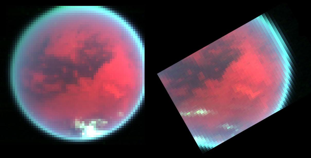
2004-12-16 |
Titan
|
Cassini-Huygens
|
Visual and Infrared Mapping Spectrometer
|
1485x517x3 |
|
-
PIA06997:
-
Haze Silhouettes Against Titan's Glow
Full Resolution:
TIFF
(673.5 kB)
JPEG
(38.35 kB)
|
|
|
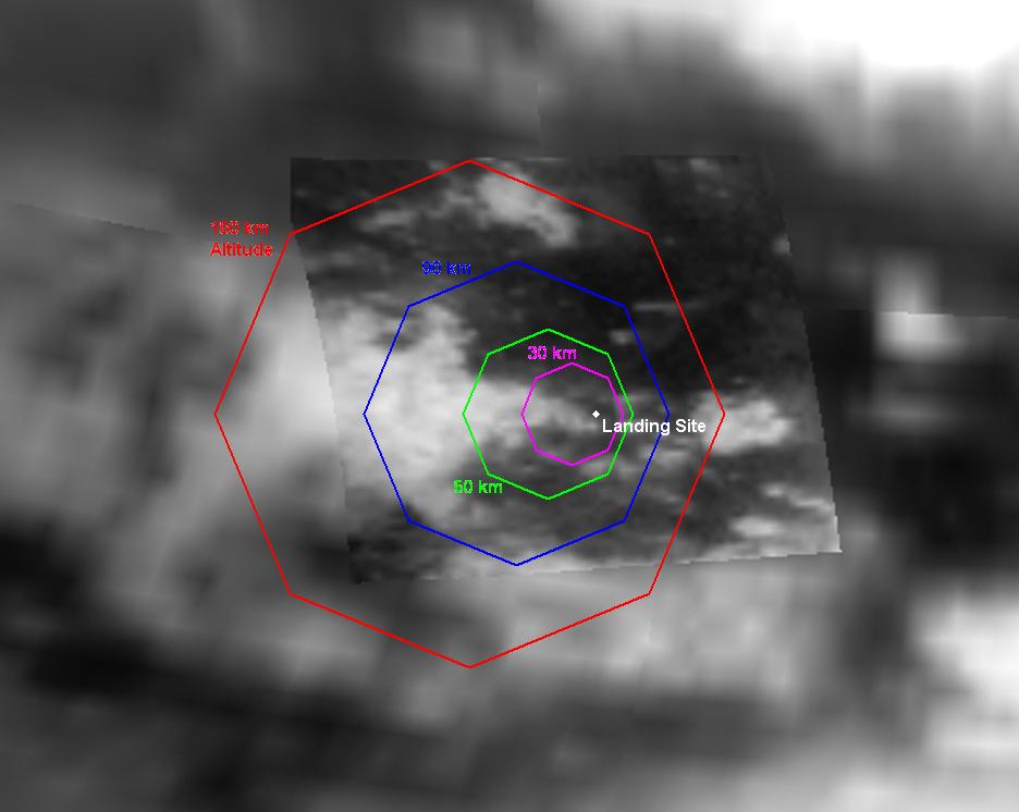
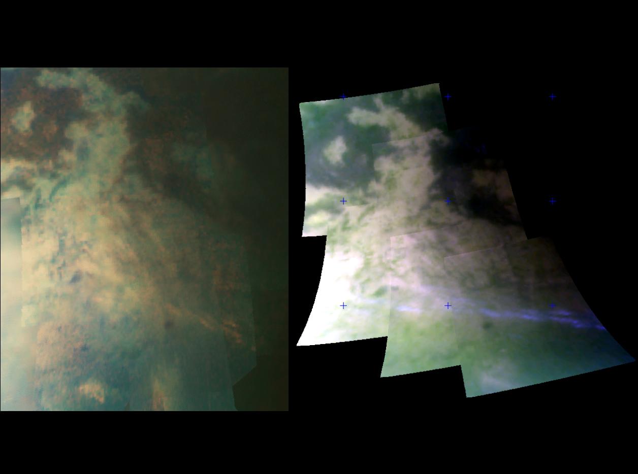
2005-01-13 |
Titan
|
Cassini-Huygens
|
Visual and Infrared Mapping Spectrometer
|
936x746x3 |
|
-
PIA07229:
-
Expected Footprints of 36-Image Panoramas from Huygens Camera
Full Resolution:
TIFF
(1.027 MB)
JPEG
(47.13 kB)
|
|
|
2005-05-25 |
Titan
|
Cassini-Huygens
|
Visual and Infrared Mapping Spectrometer
|
600x1000x3 |

|
-
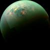
PIA07877:
-
Red Spot on Titan
Full Resolution:
TIFF
(1.802 MB)
JPEG
(22.81 kB)
|
|
|
2005-06-08 |
Titan
|
Cassini-Huygens
|
Visual and Infrared Mapping Spectrometer
|
800x454x3 |
|
-
PIA07961:
-
Map of Titan in Infrared
Full Resolution:
TIFF
(1.091 MB)
JPEG
(54.38 kB)
|
|
|
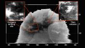
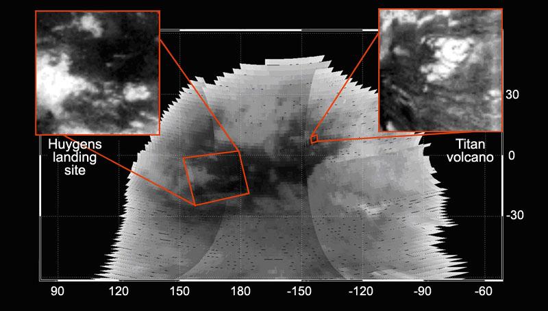
2005-06-08 |
Titan
|
Cassini-Huygens
|
Visual and Infrared Mapping Spectrometer
|
553x534x3 |
|
-
PIA07963:
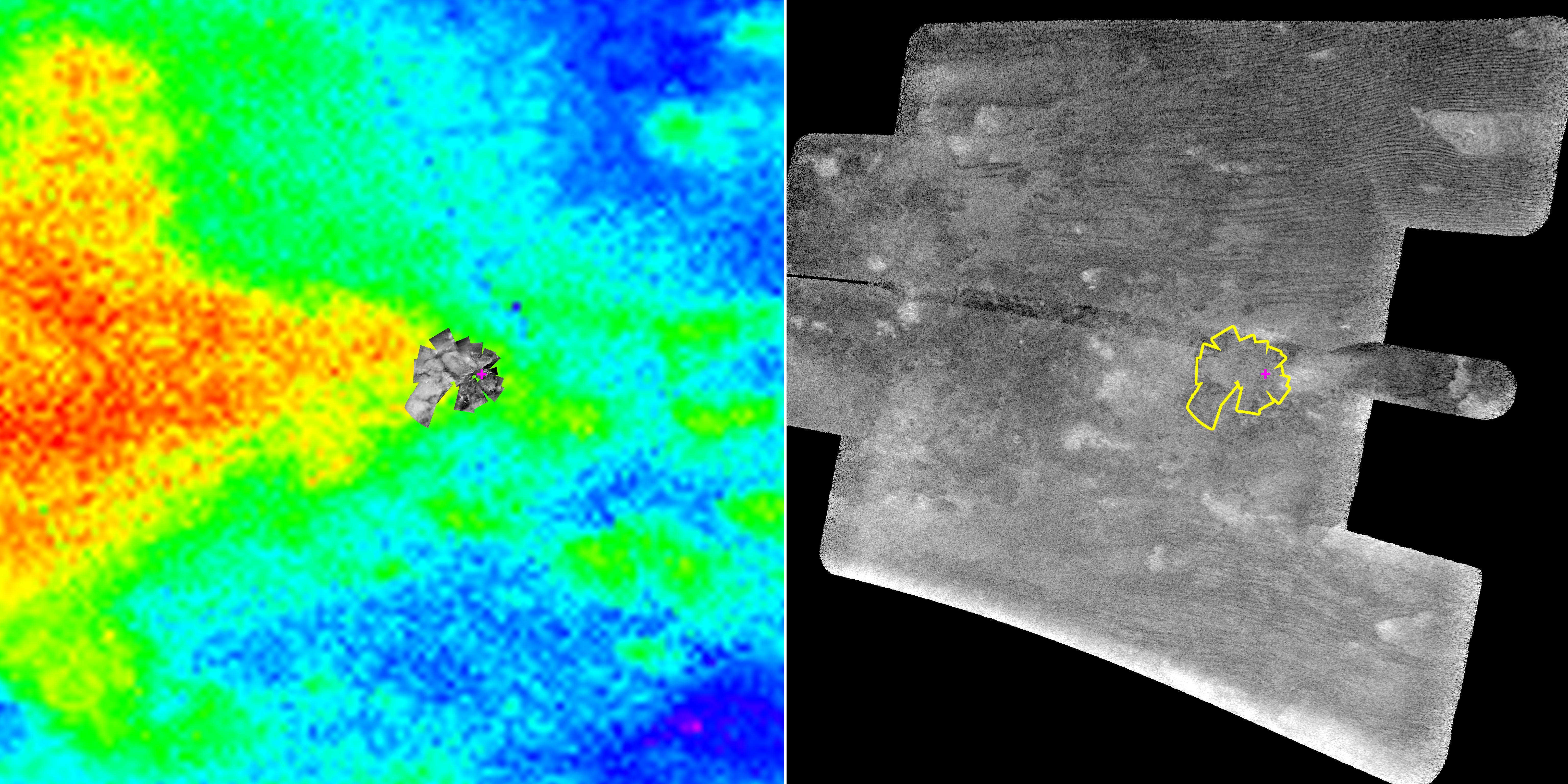
-
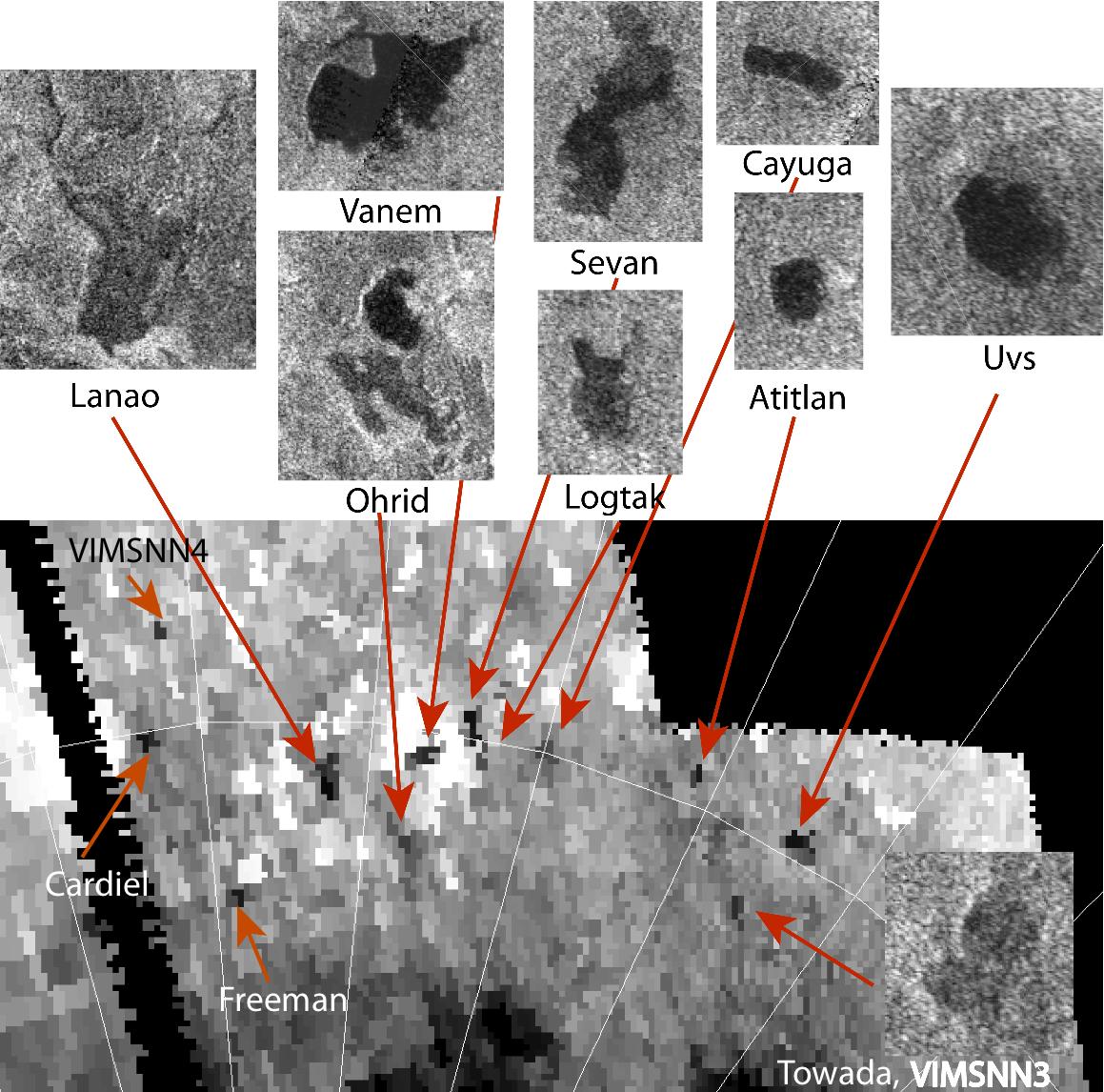
Titan Volcano in Several Infrared Wavelengths
Full Resolution:
TIFF
(887.2 kB)
JPEG
(59.73 kB)
|
|
|
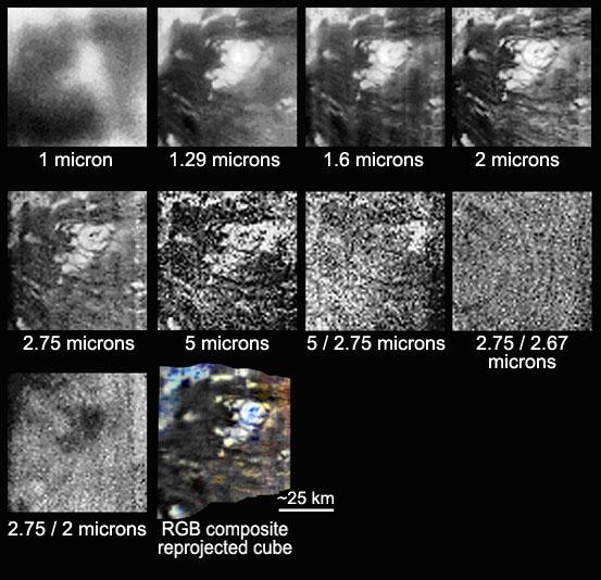
2005-06-08 |
Titan
|
Cassini-Huygens
|
Visual and Infrared Mapping Spectrometer
|
349x477x3 |
|
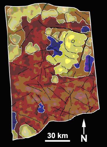
-
PIA07964:
-
Geologic Map of Titan Volcano
Full Resolution:
TIFF
(500.2 kB)
JPEG
(37.35 kB)
|
|
|
2005-06-08 |
Titan
|
Cassini-Huygens
|
Visual and Infrared Mapping Spectrometer
|
435x555x3 |
|
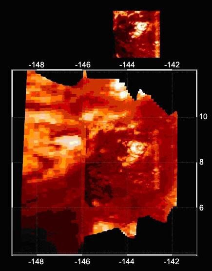
-
PIA07962:
-
Infrared Image of Titan Volcano
Full Resolution:
TIFF
(725.3 kB)
JPEG
(31.43 kB)
|
|
|
2005-06-09 |
Titan
|
Cassini-Huygens
|
Visual and Infrared Mapping Spectrometer
|
7458x4035x3 |
|
-
PIA07965:
-
Titan Volcano
Full Resolution:
TIFF
(90.28 MB)
JPEG
(858.3 kB)
|
|
|
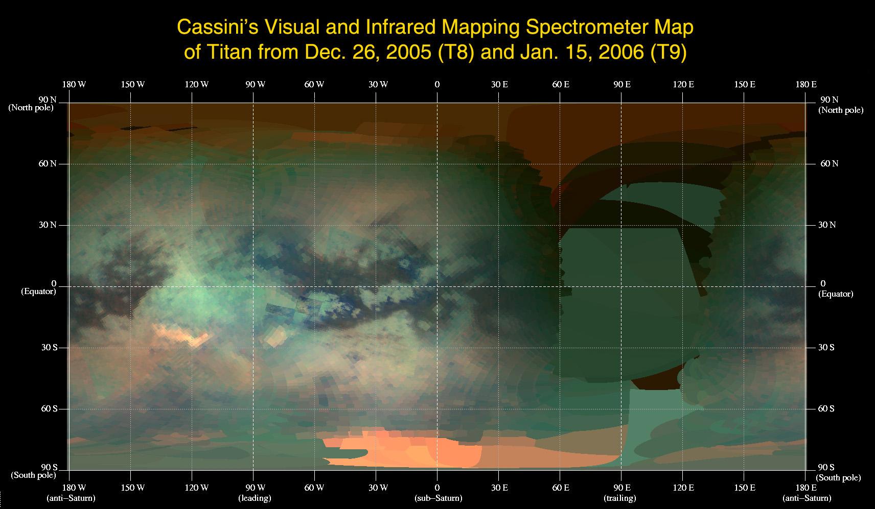
2006-02-10 |
Titan
|
Cassini-Huygens
|
Visual and Infrared Mapping Spectrometer
|
3606x1202x3 |
|
-
PIA02145:
-
Mapping Titan's Changes
Full Resolution:
TIFF
(13 MB)
JPEG
(190 kB)
|
|
|
2006-02-10 |
Titan
|
Cassini-Huygens
|
Visual and Infrared Mapping Spectrometer
|
402x402x72 |
|
-
PIA02146:
-
An Infrared Movie of Titan

Full Resolution:
TIFF
(163.6 kB)
JPEG
(19.26 kB)
|
|
|
2006-02-10 |
Titan
|
Cassini-Huygens
|
Visual and Infrared Mapping Spectrometer
|
1712x997x3 |

|
-
PIA02147:
-
An Infrared Map of Titan
Full Resolution:
TIFF
(5.129 MB)
JPEG
(182.7 kB)
|
|
|
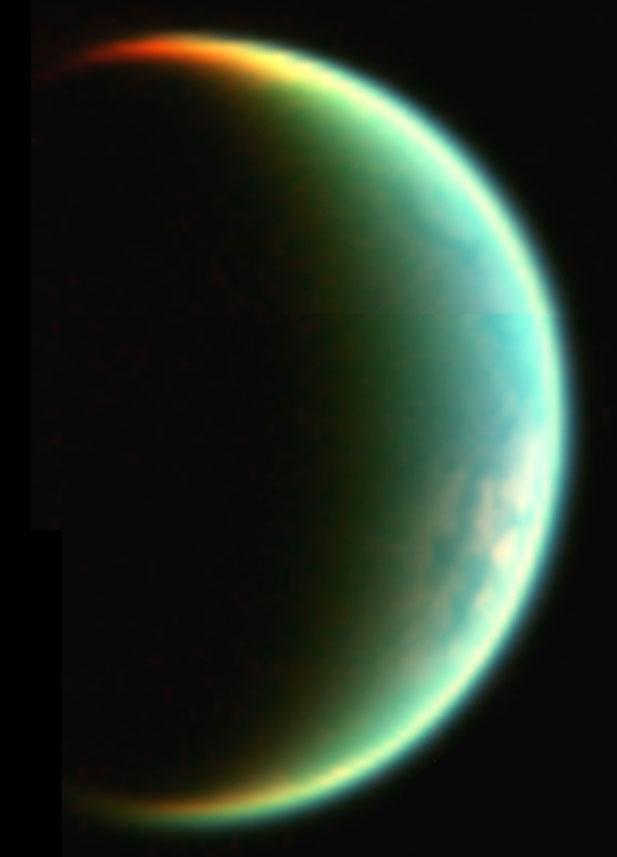
2006-09-13 |
Titan
|
Cassini-Huygens
|
Visual and Infrared Mapping Spectrometer
|
617x857x3 |
|
-
PIA08733:
-
Titan's Crescent View
Full Resolution:
TIFF
(1.588 MB)
JPEG
(22.72 kB)
|
|
|
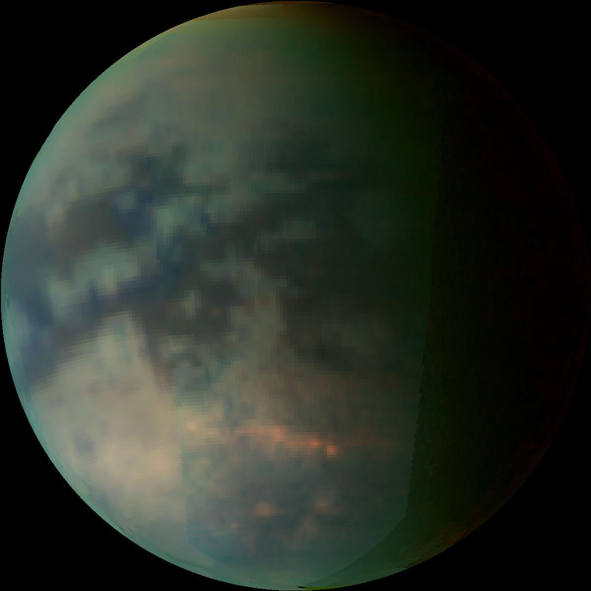
2006-09-13 |
Titan
|
Cassini-Huygens
|
Visual and Infrared Mapping Spectrometer
|
1202x1202x3 |
|
-
PIA08736:
-
Clouds over Titan
Full Resolution:
TIFF
(4.339 MB)
JPEG
(53.06 kB)
|
|
|
2006-09-14 |
Titan
|
Cassini-Huygens
|
Visual and Infrared Mapping Spectrometer
|
673x672x3 |
|
-
PIA08739:
-
Ethane Clouds Over Titan
Full Resolution:
TIFF
(1.358 MB)
JPEG
(57.13 kB)
|
|
|
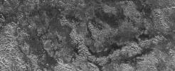
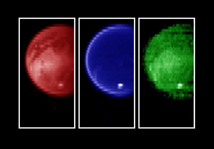
2006-12-12 |
Titan
|
Cassini-Huygens
|
Visual and Infrared Mapping Spectrometer
|
1256x934x3 |
|
-
PIA09032:
-
Titan's Sierras
Full Resolution:
TIFF
(3.523 MB)
JPEG
(42.52 kB)
|
|
|
2006-12-12 |
Titan
|
Cassini-Huygens
|
Visual and Infrared Mapping Spectrometer
|
1256x940x3 |
|
-
PIA09034:
-
Exposing Titan's Surface
Full Resolution:
TIFF
(3.546 MB)
JPEG
(51.35 kB)
|
|
|
2006-12-12 |
Titan
|
Cassini-Huygens
|
Visual and Infrared Mapping Spectrometer
|
1256x934x3 |
|
-
PIA09033:
-
Large Tectonic Complex
Full Resolution:
TIFF
(3.523 MB)
JPEG
(58.45 kB)
|
|
|
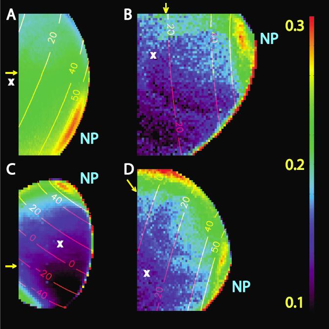
2007-02-01 |
Titan
|
Cassini-Huygens
|
Visual and Infrared Mapping Spectrometer
|
991x752x3 |
|
-
PIA09171:
-
Titan's Giant North Pole Cloud
Full Resolution:
TIFF
(2.239 MB)
JPEG
(30.94 kB)
|
|
|
2008-12-15 |
Titan
|
Cassini-Huygens
|
Visual and Infrared Mapping Spectrometer
|
637x478x3 |
|
-
PIA11700:
-
Titan's Chilly Volcanoes?
Full Resolution:
TIFF
(914.7 kB)
JPEG
(21.09 kB)
|
|
|
2008-12-15 |
Titan
|
Cassini-Huygens
|
Visual and Infrared Mapping Spectrometer
|
3000x2250x3 |
|
-
PIA11701:
-
Infrared Map of Titan's Active Regions
Full Resolution:
TIFF
(20.25 MB)
JPEG
(397.6 kB)
|
|
|
2009-04-03 |
Titan
|
Cassini-Huygens
|
Visual and Infrared Mapping Spectrometer
|
699x538x1 |

|
-
PIA11839:
-
Hotei Arcus in Infrared
Full Resolution:
TIFF
(376.7 kB)
JPEG
(22.35 kB)
|
|
|
2009-06-03 |
Titan
|
Cassini-Huygens
|
Visual and Infrared Mapping Spectrometer
|
1188x838x3 |

|
-
PIA12004:
-
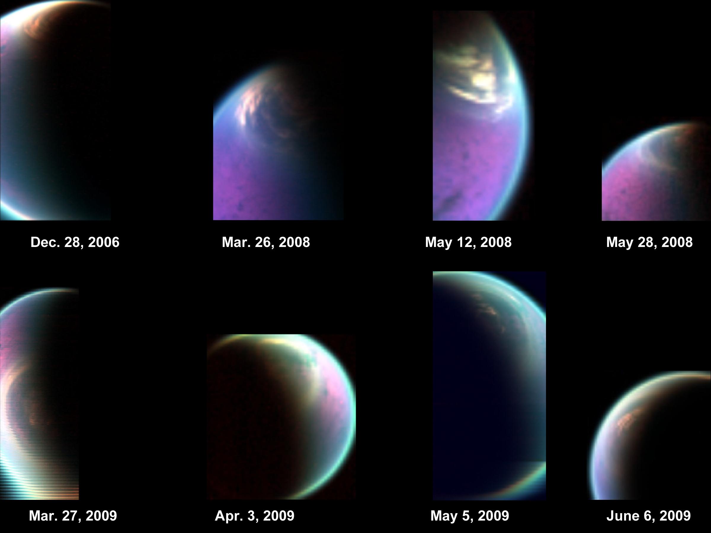
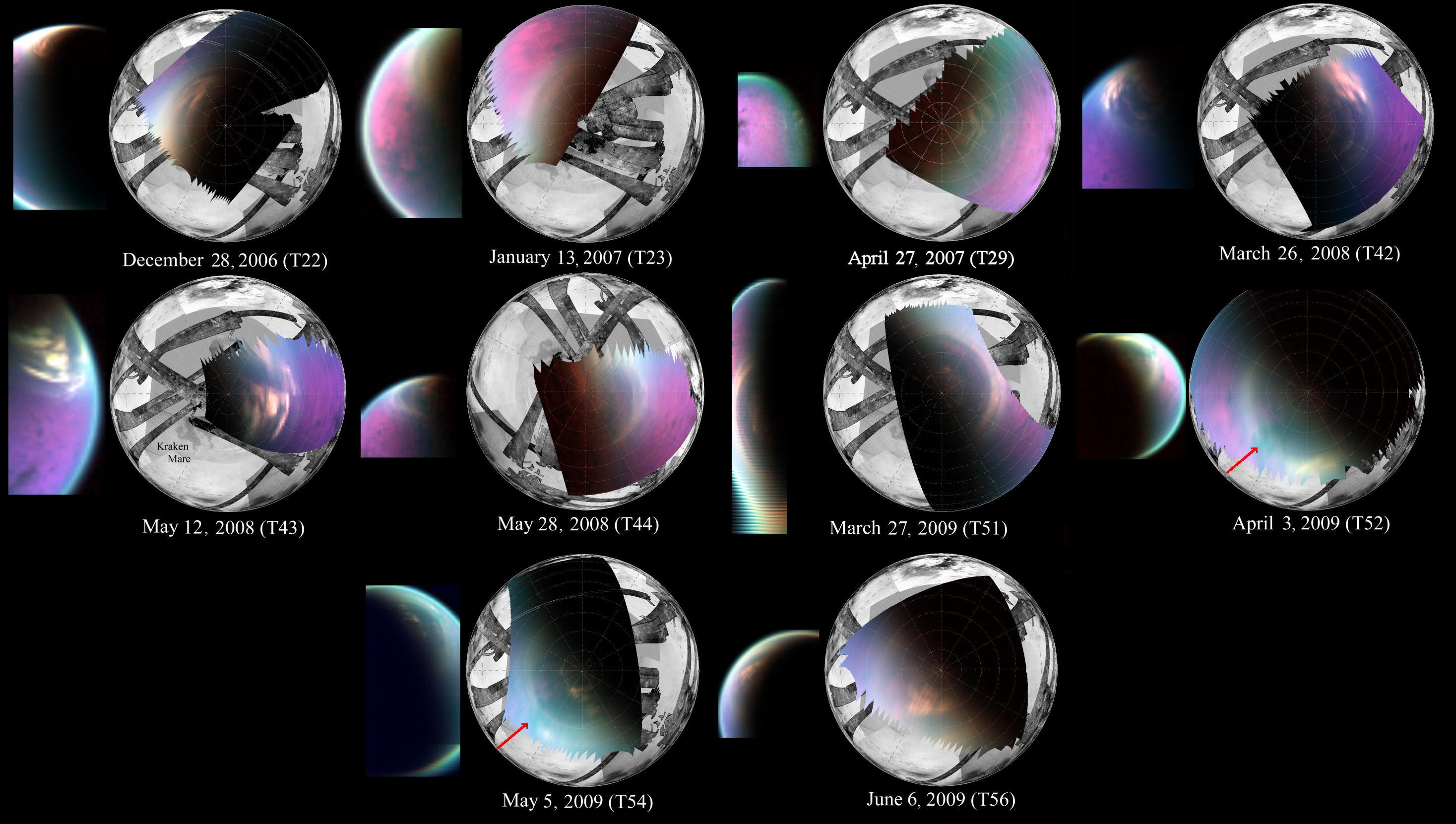
Titan's Lingering Clouds
Full Resolution:
TIFF
(2.99 MB)
JPEG
(56.13 kB)
|
|
|
2009-06-03 |
Titan
|
Cassini-Huygens
|
Visual and Infrared Mapping Spectrometer
|
1284x842x3 |
|
-
PIA12005:
-
Titan's South Polar Cloud Burst
Full Resolution:
TIFF
(3.247 MB)
JPEG
(52.52 kB)
|
|
|
2009-12-17 |
Titan
|
Cassini-Huygens
|
Visual and Infrared Mapping Spectrometer
|
768x768x3 |
|
-
PIA12481:
-
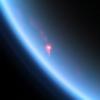
Reflection of Sunlight off Titan Lake
Full Resolution:
TIFF
(1.772 MB)
JPEG
(14.42 kB)
|
|
|
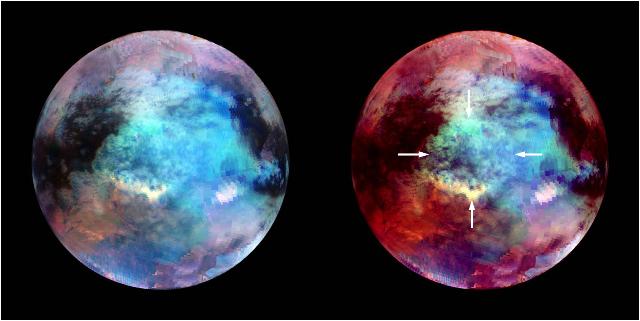
2010-09-21 |
Titan
|
Cassini-Huygens
|
Visual and Infrared Mapping Spectrometer
|
1500x868x3 |
|
-
PIA13400:
-
Clouds Clearing around Titan's North Pole
Full Resolution:
TIFF
(3.913 MB)
JPEG
(46.87 kB)
|
|
|
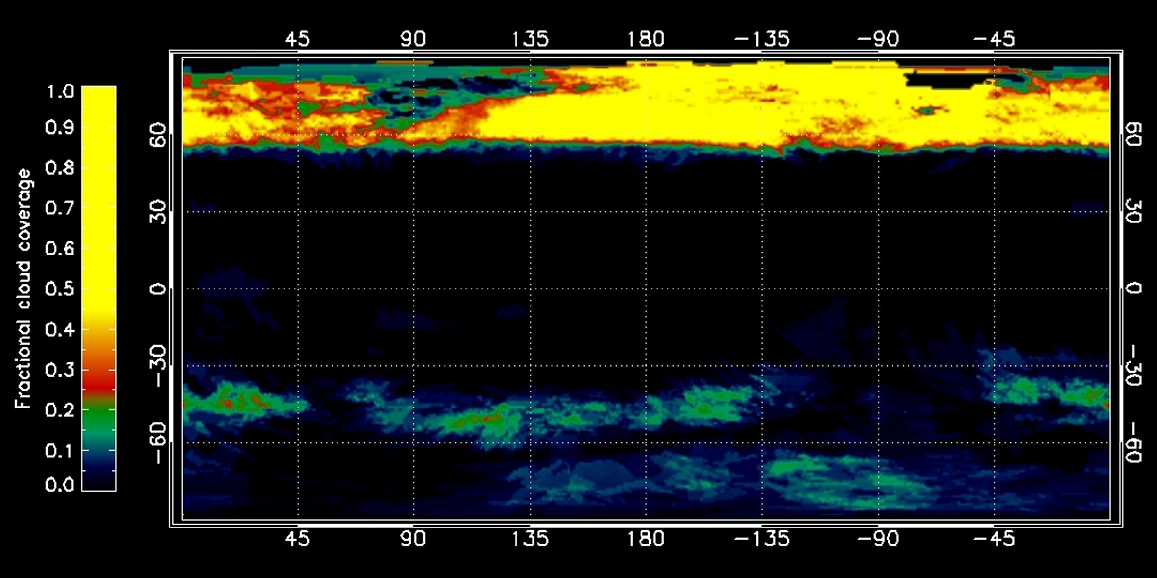
2010-09-21 |
Titan
|
Cassini-Huygens
|
Visual and Infrared Mapping Spectrometer
|
2379x1190x3 |

|
-
PIA13401:
-
Mapping Titan's Cloud Coverage
Full Resolution:
TIFF
(8.503 MB)
JPEG
(227 kB)
|
|
|
2011-07-14 |
Titan
|
Cassini-Huygens
|
Visual and Infrared Mapping Spectrometer
|
640x321x3 |
|
-
PIA14311:
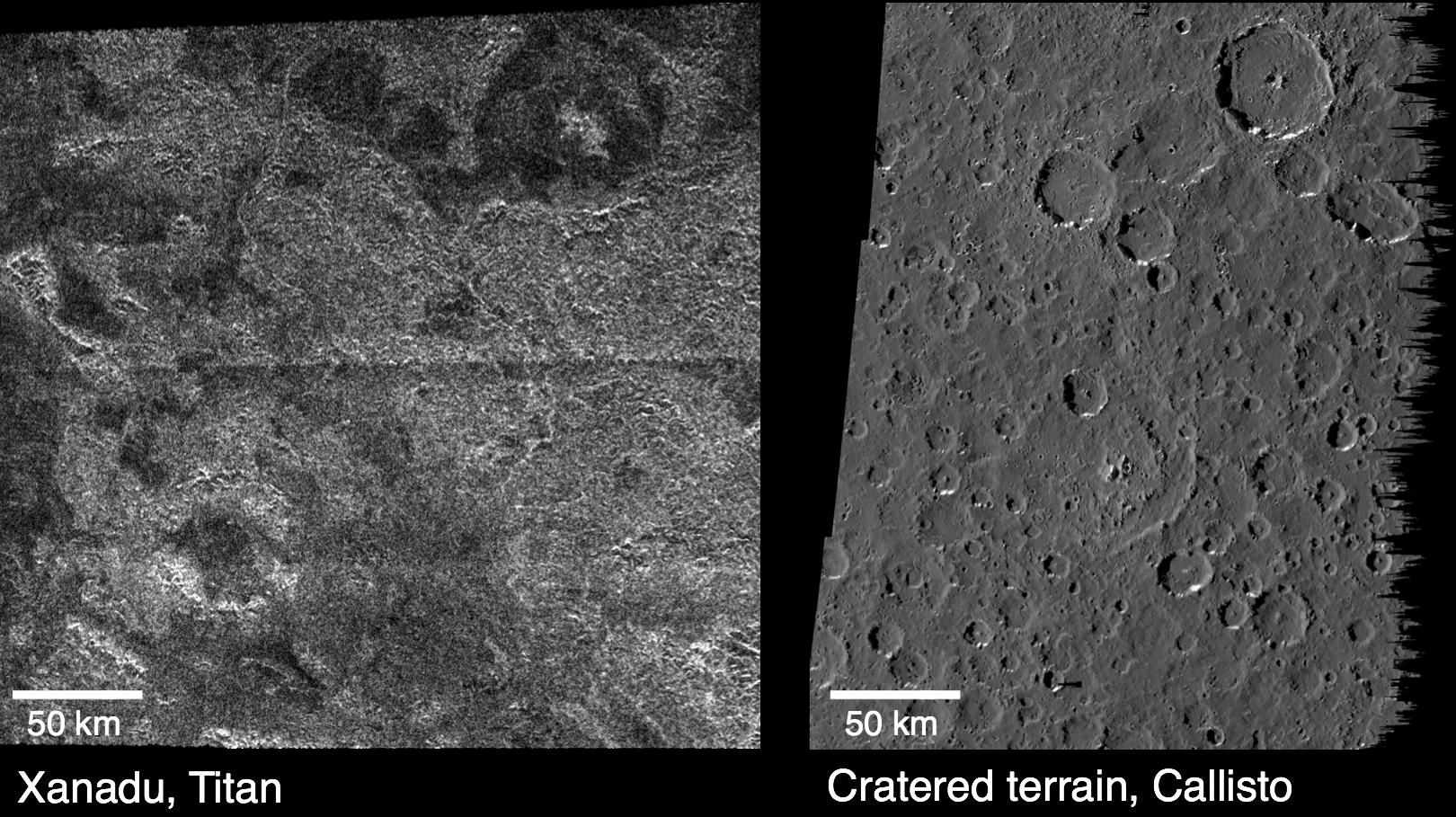
-
Circular Feature at Xanadu, Titan
Full Resolution:
TIFF
(617.2 kB)
JPEG
(28.37 kB)
|
|
|
2012-02-23 |
Titan
|
Cassini-Huygens
|
Visual and Infrared Mapping Spectrometer
|
2400x1800x3 |
|
-
PIA15230:
-
Snapshots of Titan's North Polar Cloud
Full Resolution:
TIFF
(12.97 MB)
JPEG
(172.7 kB)
|
|
|
2012-02-23 |
Titan
|
Cassini-Huygens
|
Visual and Infrared Mapping Spectrometer
|
2935x1661x3 |
|
-
PIA15231:
-
Changes in Titan's North Polar Cloud
Full Resolution:
TIFF
(14.63 MB)
JPEG
(451.5 kB)
|
|
|
2013-04-15 |
Titan
|
Cassini-Huygens
|
Visual and Infrared Mapping Spectrometer
|
1371x587x3 |
|
-
PIA16844:
-
Titan Lake Country
Full Resolution:
TIFF
(2.416 MB)
JPEG
(188.6 kB)
|
|
|
2013-10-23 |
Titan
|
Cassini-Huygens
|
Visual and Infrared Mapping Spectrometer
|
2002x2002x3 |
|
-
PIA17470:
-
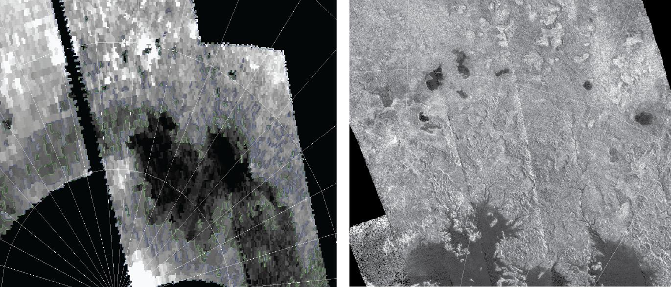
Titan's Northern Lakes: Salt Flats?
Full Resolution:
TIFF
(12.03 MB)
JPEG
(114.2 kB)
|
|
|
2014-05-27 |
Titan
|
Cassini-Huygens
|
Visual and Infrared Mapping Spectrometer
|
4600x4600x3 |
|
-
PIA18410:
-
Cassini Observes Sunsets on Titan (Artist's Rendering)
Full Resolution:
TIFF
(63.52 MB)
JPEG
(428.5 kB)
|
|
|
2014-10-30 |
Titan
|
Cassini-Huygens
|
Visual and Infrared Mapping Spectrometer
|
2002x2002x3 |
|
-
PIA18432:
-
Specular Spectacular
Full Resolution:
TIFF
(12.03 MB)
JPEG
(127.3 kB)
|
|
|
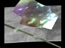
2014-10-30 |
Titan
|
Cassini-Huygens
|
Visual and Infrared Mapping Spectrometer
|
640x640x3 |
|
-
PIA18433:
-
Sunglint on a Hydrocarbon Lake
Full Resolution:
TIFF
(1.229 MB)
JPEG
(17.58 kB)
|
|
|
2015-12-04 |
Titan
|
Cassini-Huygens
|
Visual and Infrared Mapping Spectrometer
|
2002x2002x3 |
|
-
PIA20016:
-
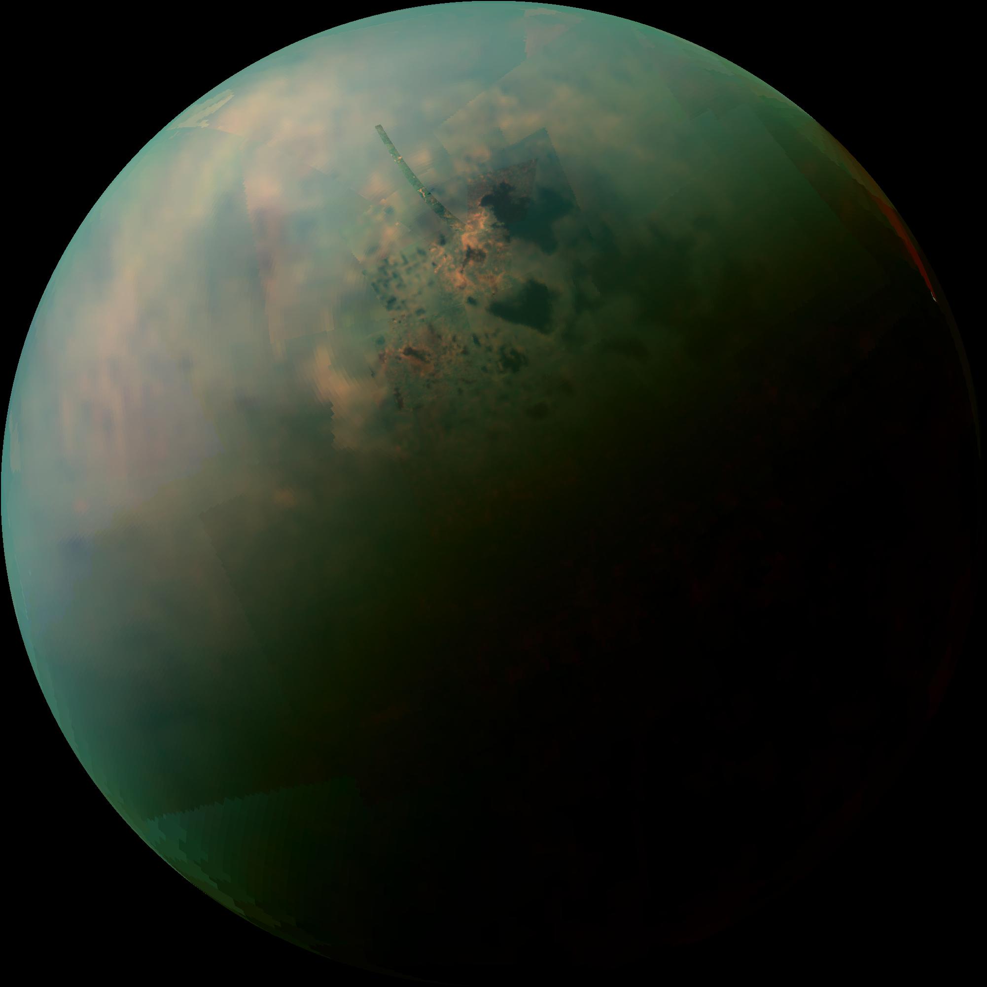
Peering Through Titan's Haze
Full Resolution:
TIFF
(6.69 MB)
JPEG
(160.3 kB)
|
|
|
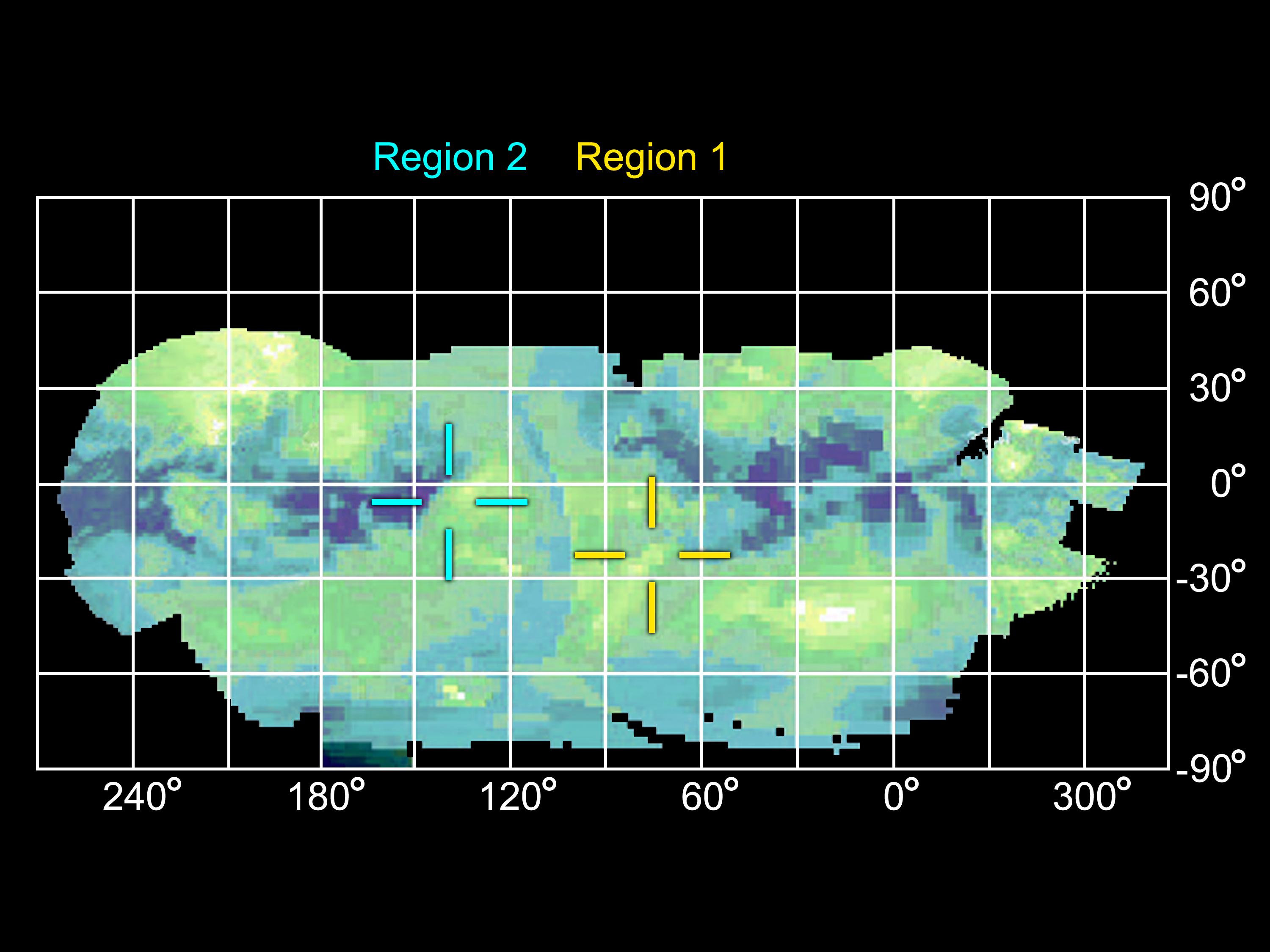
2016-03-24 |
Titan
|
Cassini-Huygens
|
Visual and Infrared Mapping Spectrometer
|
5675x2780x3 |
|
-
PIA20022:
-
Working Toward 'Seamless' Infrared Maps of Titan
Full Resolution:
TIFF
(23.51 MB)
JPEG
(1.041 MB)
|
|
|
2018-07-18 |
Titan
|
Cassini-Huygens
|
Visual and Infrared Mapping Spectrometer
|
5448x3686x3 |
|
-
PIA21923:
-
Seeing Titan with Infrared Eyes
Full Resolution:
TIFF
(30.68 MB)
JPEG
(900.4 kB)
|
|
|
2018-09-24 |
Titan
|
Cassini-Huygens
|
Visual and Infrared Mapping Spectrometer
|
1250x1250x3 |
|
-
PIA22483:
-
Spotting Dust Storms on Titan
Full Resolution:
TIFF
(1.103 MB)
JPEG
(1.206 MB)
|
|
|
2018-09-24 |
Titan
|
Cassini-Huygens
|
Visual and Infrared Mapping Spectrometer
|
13008x9984x3 |

|
-
PIA22484:
-
Dust Storms on Titan
Full Resolution:
TIFF
(86.64 MB)
JPEG
(4.45 MB)
|
|
|
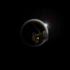
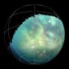
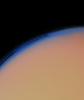
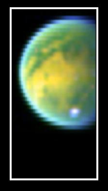
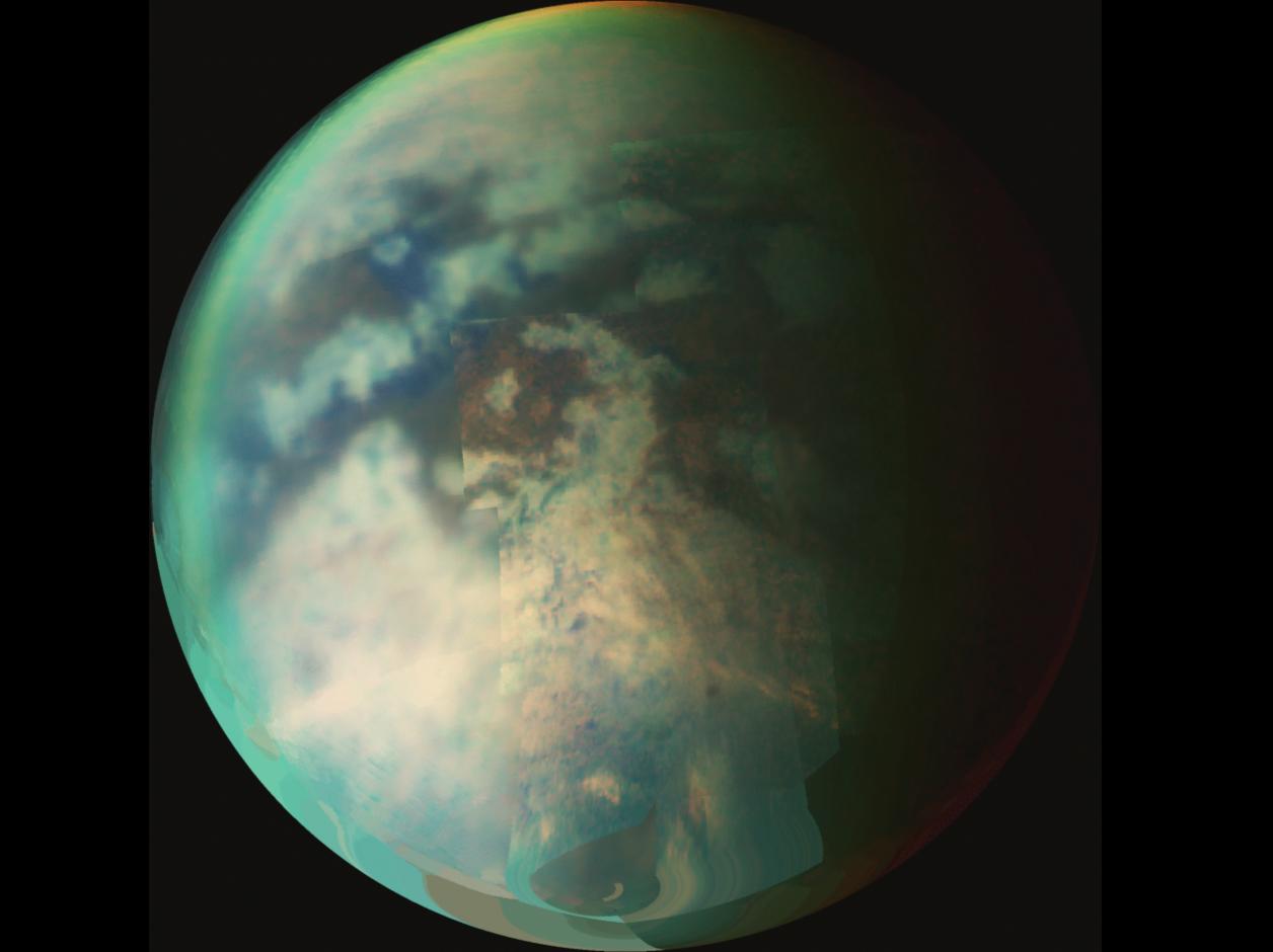
1999-02-23 |
Titan
|
Voyager
|
VG ISS - Wide Angle
|
200x200x3 |
|
-
PIA01393:
-
Night Side of Titan
Full Resolution:
TIFF
(50.26 kB)
JPEG
(5.725 kB)
|
|
|
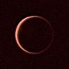
1997-09-25 |
Titan
|
Voyager
|
VG ISS - Narrow Angle
|
400x400x3 |
|
-
PIA00733:
-
Titan's Brighter Southern Hemisphere
Full Resolution:
TIFF
(37.73 kB)
JPEG
(4.127 kB)
|
|
|
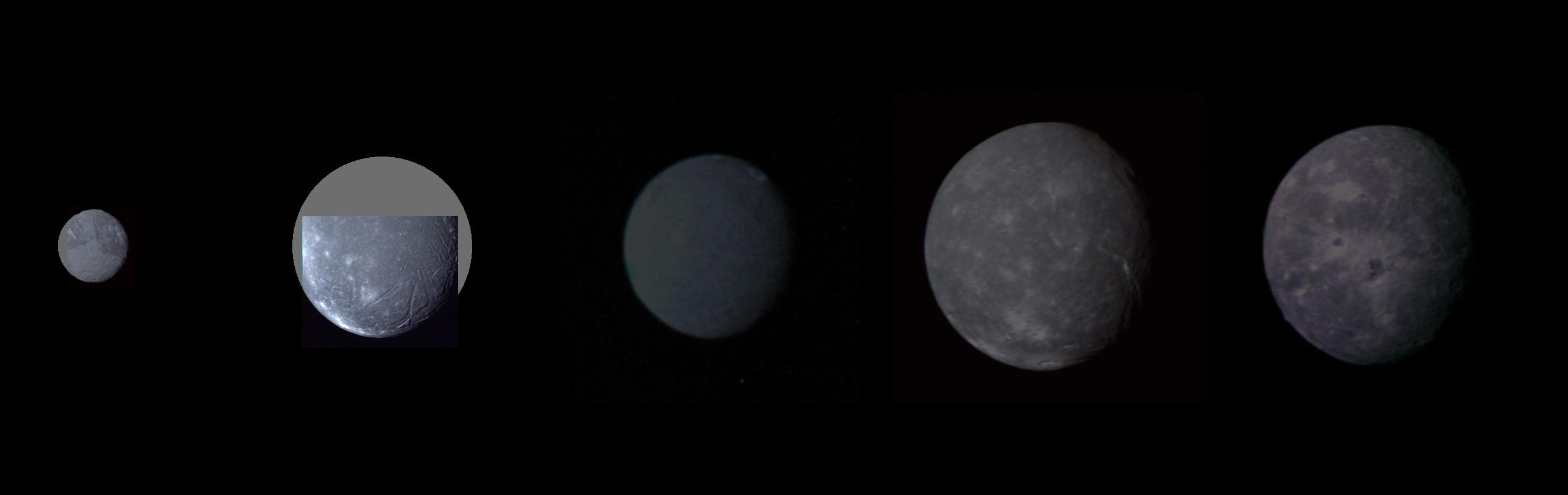
1999-08-20 |
Oberon
|
Voyager
|
VG ISS - Narrow Angle
|
2537x800x3 |
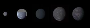
|
-
PIA01361:
-
Uranus - Montage of Uranus' Five Largest Satellites
Full Resolution:
TIFF
(1.533 MB)
JPEG
(59.14 kB)
|
|
|
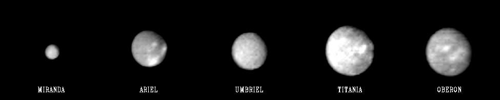
1999-06-22 |
Miranda
|
Voyager
|
VG ISS - Narrow Angle
|
975x195x1 |

|
-
PIA01975:
Uranus - Family Portrait
Full Resolution:
TIFF
(21.65 kB)
JPEG
(9.027 kB)
|
|
|
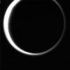
2000-03-16 |
Titan
|
Voyager
|
VG ISS - Narrow Angle
|
485x580x3 |
|
-
PIA02238:
-
Titan's Thick Haze Layer
Full Resolution:
TIFF
(408.2 kB)
JPEG
(14.33 kB)
|
|
|
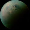
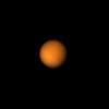
2000-05-25 |
Titan
|
Voyager
|
VG ISS - Narrow Angle
|
800x800x1 |
|
-
PIA02290:
-
Titan
Full Resolution:
TIFF
(230.7 kB)
JPEG
(42.41 kB)
|
|
|
2010-02-25 |
Titan
|
Cassini-Huygens
|
Radar Mapper
Visual and Infrared Mapping Spectrometer
|
3454x5980x3 |
|
-
PIA12848:
-
Looking for Ice Volcano Flows at Hotei Regio
Full Resolution:
TIFF
(61.96 MB)
JPEG
(2.049 MB)
|
|
|
2010-02-25 |
Titan
|
Cassini-Huygens
|
Radar Mapper
Visual and Infrared Mapping Spectrometer
|
2480x3232x3 |
|
-
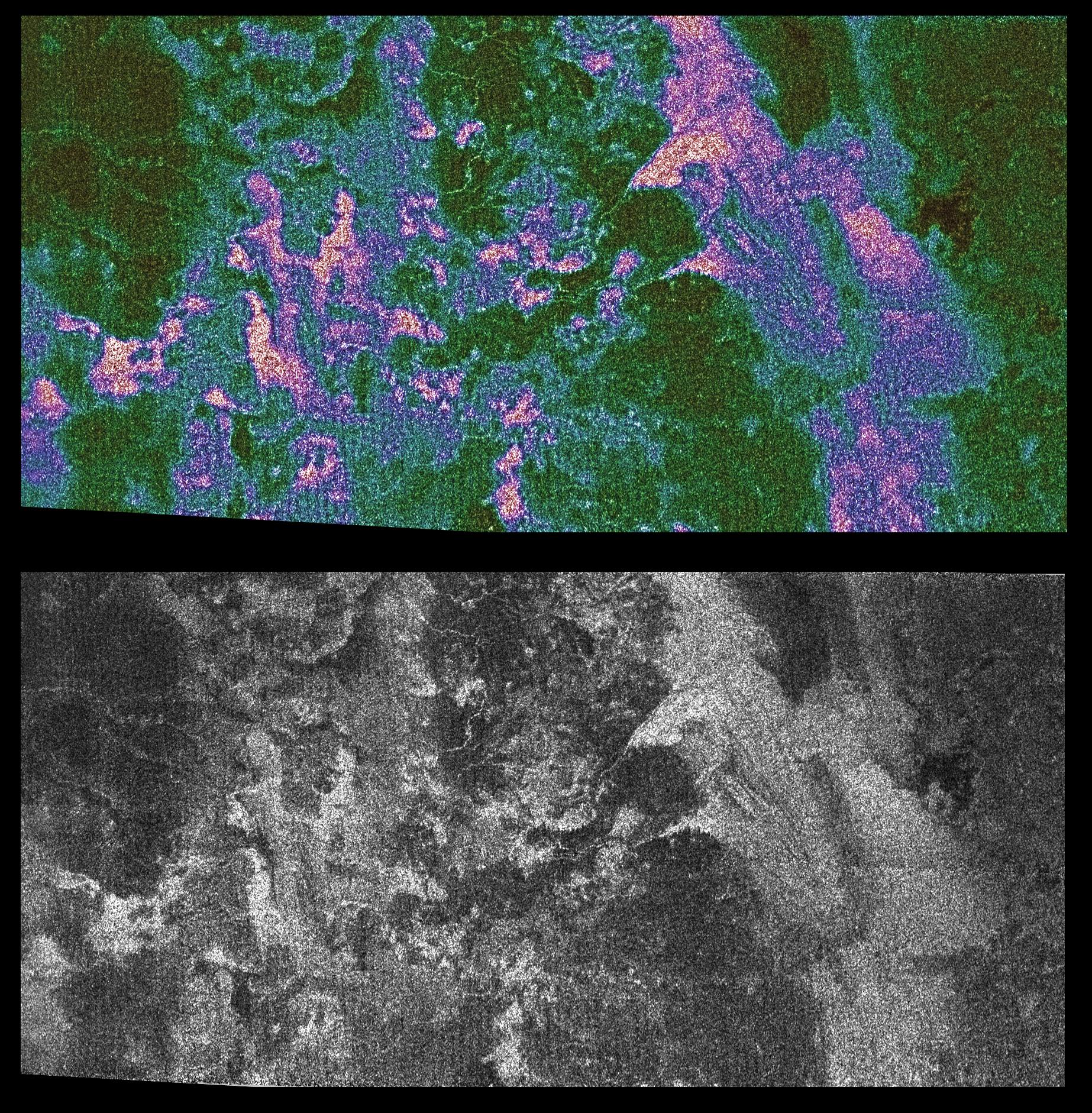
PIA12849:
-
Channels and Minerals at Hotei Regio
Full Resolution:
TIFF
(24.07 MB)
JPEG
(890.1 kB)
|
|
|
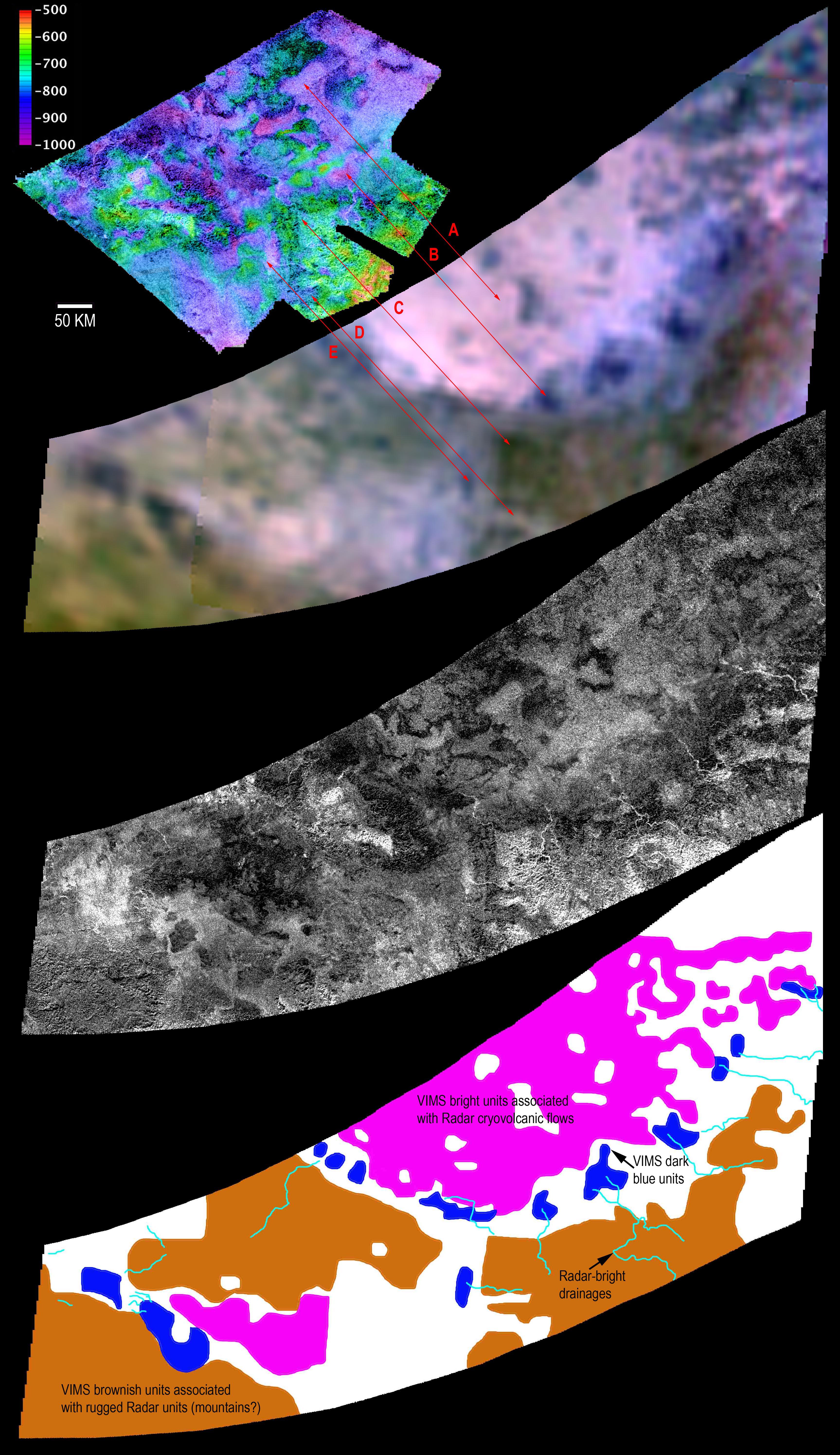
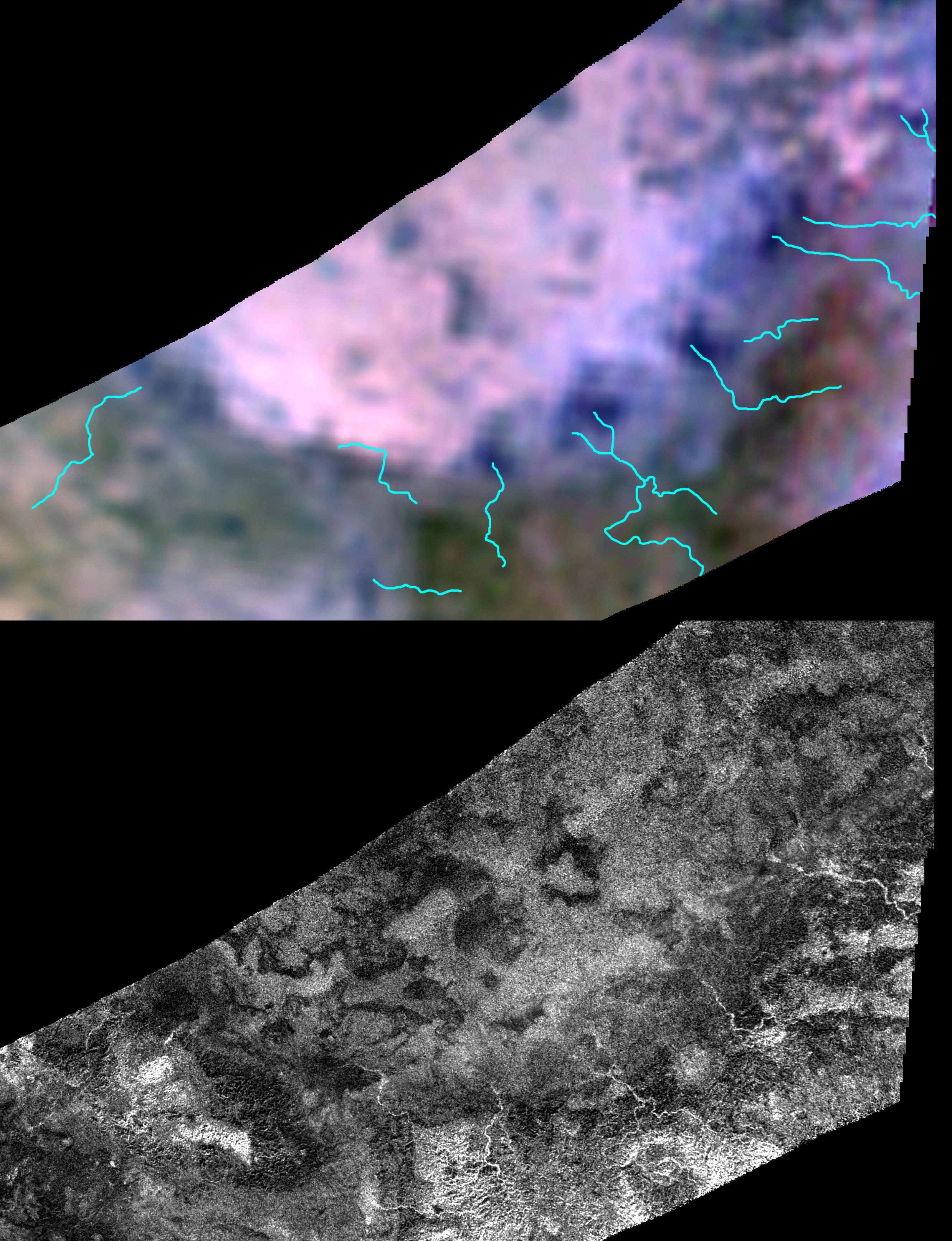
2010-12-14 |
Titan
|
Cassini-Huygens
|
Radar Mapper
Visual and Infrared Mapping Spectrometer
|
2305x1431x3 |
|
-
PIA13695:
-
Flyover of Sotra Facula, Titan
Full Resolution:
TIFF
(9.907 MB)
JPEG
(411.6 kB)
|
|
|
2010-12-14 |
Titan
|
Cassini-Huygens
|
Radar Mapper
Visual and Infrared Mapping Spectrometer
|
1280x720x3 |
|
-
PIA13696:
-
Global View of Sotra Facula, Titan
Full Resolution:
TIFF
(2.768 MB)
JPEG
(79.04 kB)
|
|
|
2011-04-08 |
Titan
|
Cassini-Huygens
|
Radar Mapper
Visual and Infrared Mapping Spectrometer
|
1600x893x1 |
|
-
PIA13895:
-
Tortula Facula
Full Resolution:
TIFF
(1.43 MB)
JPEG
(299.7 kB)
|
|
|
2012-12-14 |
Titan
|
Cassini-Huygens
|
Radar Mapper
Visual and Infrared Mapping Spectrometer
|
4038x2016x3 |
|
-
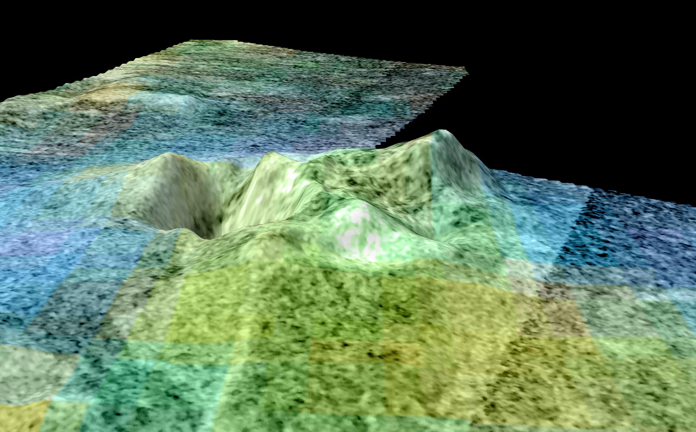
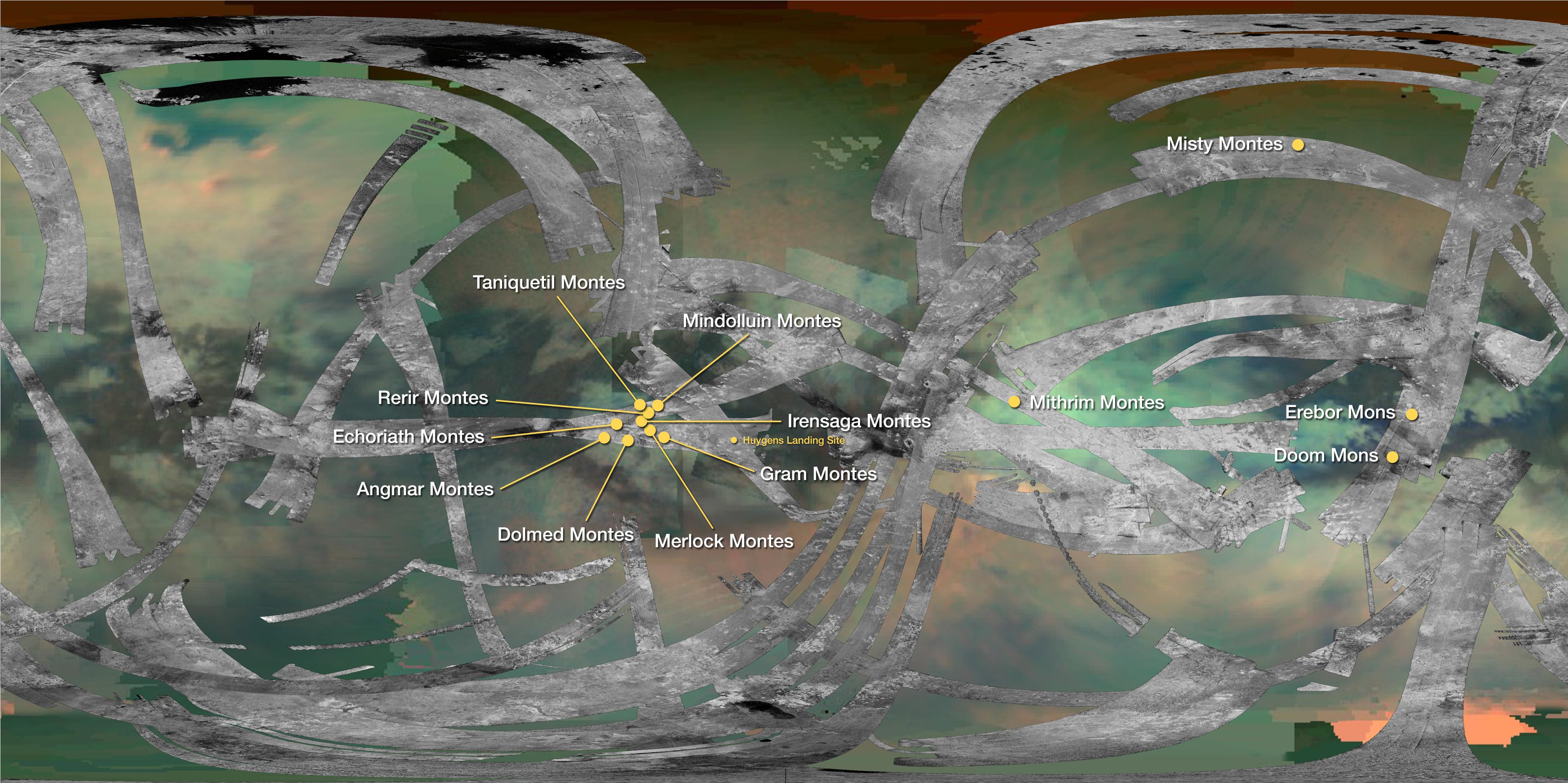
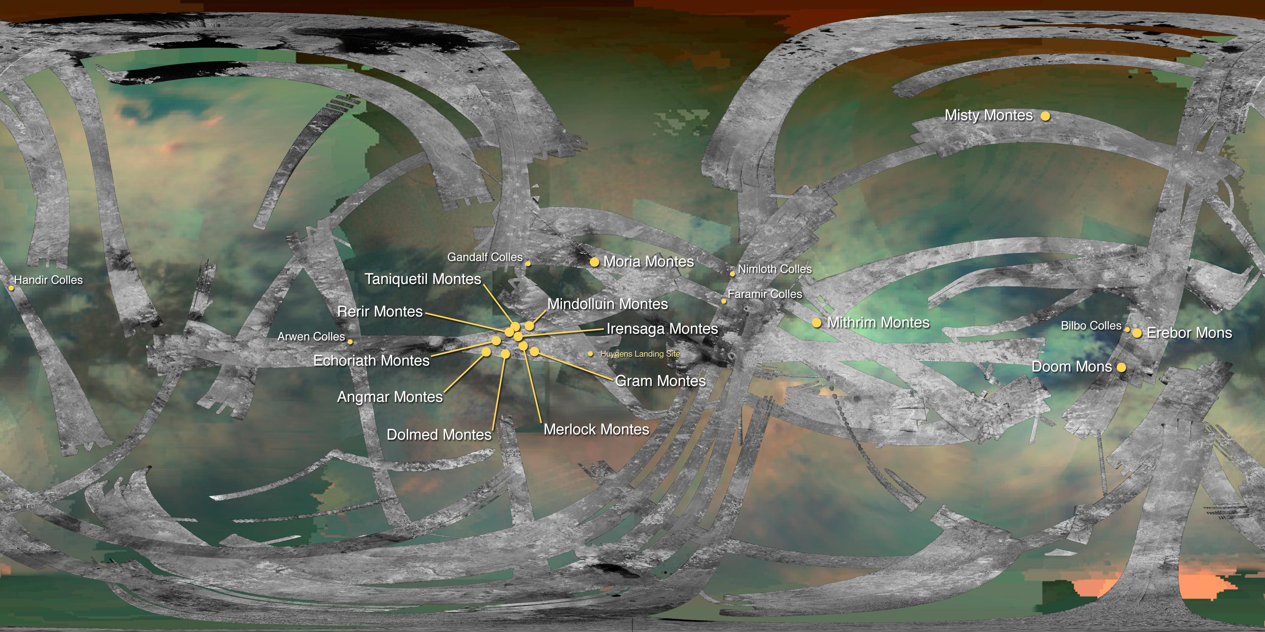
PIA16598:
-
Mountains of Titan
Full Resolution:
TIFF
(24.43 MB)
JPEG
(1.071 MB)
|
|
|
2013-04-15 |
Titan
|
Cassini-Huygens
|
Radar Mapper
Visual and Infrared Mapping Spectrometer
|
1226x441x3 |
|
-
PIA16845:
-
Titan Wetlands
Full Resolution:
TIFF
(1.623 MB)
JPEG
(118.8 kB)
|
|
|
2013-04-15 |
Titan
|
Cassini-Huygens
|
Radar Mapper
Visual and Infrared Mapping Spectrometer
|
1159x1146x3 |
|
-
PIA16846:
-
A Sprinkling of Little Lakes
Full Resolution:
TIFF
(3.986 MB)
JPEG
(242.8 kB)
|
|
|
2013-05-15 |
Titan
|
Cassini-Huygens
|
Radar Mapper
Visual and Infrared Mapping Spectrometer
|
2197x2197x3 |
|
-
PIA16849:
-
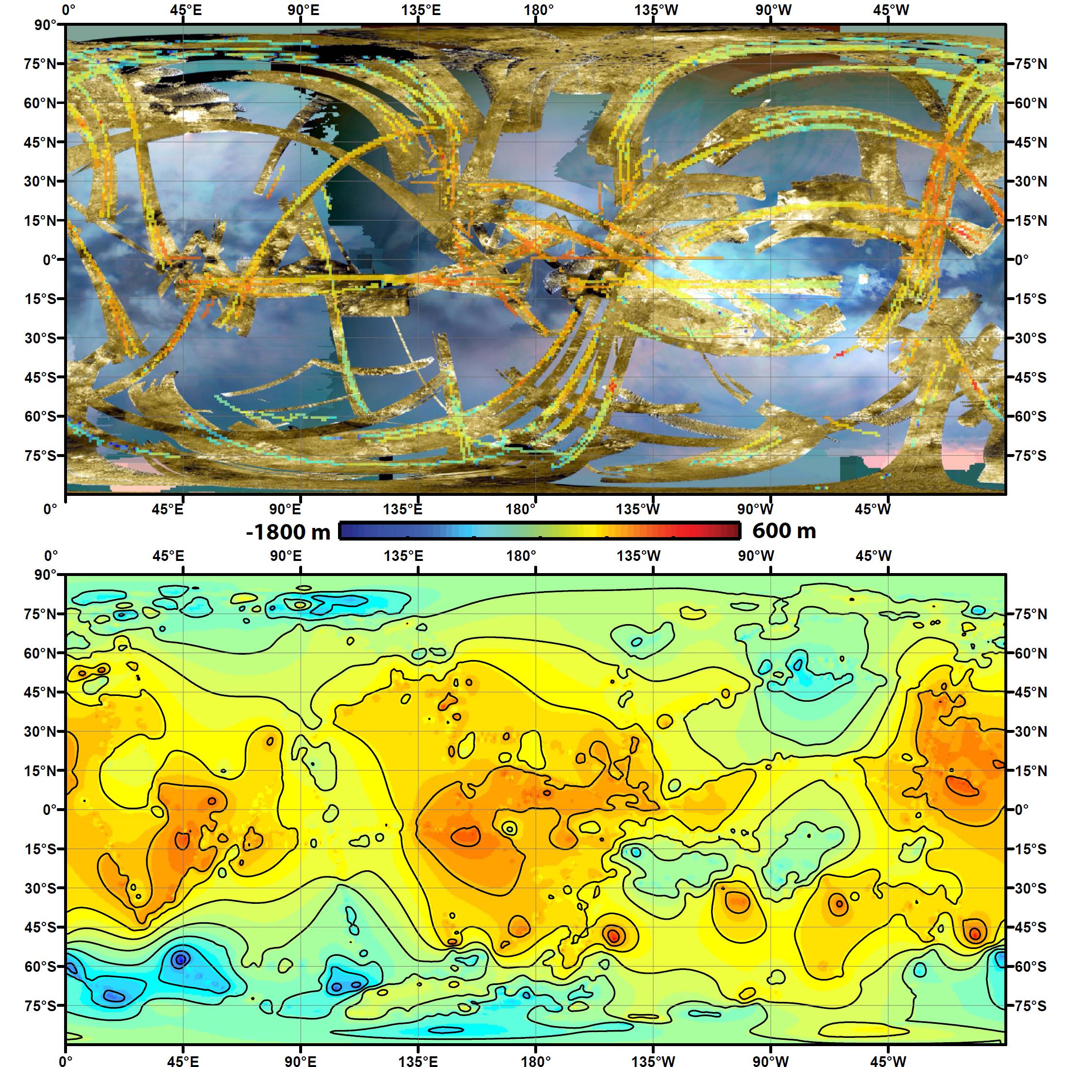
Two Views of Titan's Topography
Full Resolution:
TIFF
(14.49 MB)
JPEG
(845.1 kB)
|
|
|
2016-03-24 |
Titan
|
Cassini-Huygens
|
Radar Mapper
Visual and Infrared Mapping Spectrometer
|
4043x2021x3 |
|
-
PIA20024:
-
Mountains of Titan Map - 2016 Update
Full Resolution:
TIFF
(17.24 MB)
JPEG
(1.082 MB)
|
|
|
2011-04-08 |
Saturn
|
Cassini-Huygens
Galileo
|
Radar Mapper
Solid-State Imaging
|
1620x909x1 |
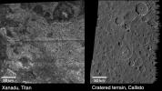
|
-
PIA13896:
-
Titan and Callisto
Full Resolution:
TIFF
(1.474 MB)
JPEG
(315.9 kB)
|
|
|
2005-11-01 |
Titan
|
Cassini-Huygens
|
Radar Mapper
Visual and Infrared Mapping Spectrometer
|
6144x3072x3 |

|
-
PIA03569:
-
Pinpointing Huygens Landing Site
Full Resolution:
TIFF
(56.62 MB)
JPEG
(1.875 MB)
|
|
|
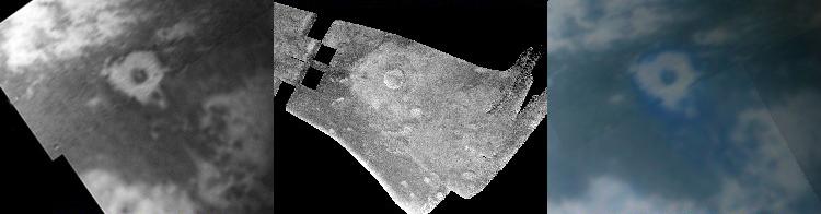
2006-12-12 |
Titan
|
Cassini-Huygens
|
Radar Mapper
Visual and Infrared Mapping Spectrometer
|
1260x942x3 |

|
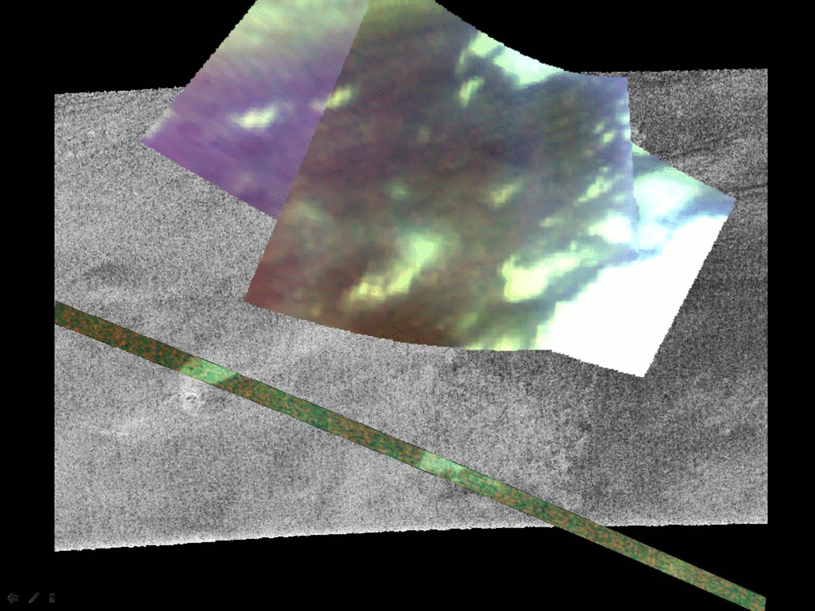
-
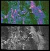
PIA09035:
-
Infrared and Radar Views of Titan
Full Resolution:
TIFF
(3.565 MB)
JPEG
(111.3 kB)
|
|
|
2006-12-12 |
Titan
|
Cassini-Huygens
|
Radar Mapper
Visual and Infrared Mapping Spectrometer
|
1600x1200x3 |
|
-
PIA09036:
-
Infrared and Radar Views of Titan #2
Full Resolution:
TIFF
(5.77 MB)
JPEG
(247 kB)
|
|
|
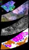
2004-10-28 |
Titan
|
Cassini-Huygens
|
Radar Mapper
|
2774x2048x3 |
|
-
PIA06988:
-
Diversity on Titan
Full Resolution:
TIFF
(4.557 MB)
JPEG
(970.7 kB)
|
|
|
2004-10-28 |
Titan
|
Cassini-Huygens
|
Radar Mapper
|
720x540x1 |
|
-
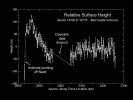
PIA06989:
-
Topography on Titan
Full Resolution:
TIFF
(154.4 kB)
JPEG
(39.7 kB)
|
|
|
2004-11-05 |
Titan
|
Cassini-Huygens
|
Radar Mapper
|
1846x1882x3 |
|
-
PIA06992:
-
Radar Shows Titan Live and in Color
Full Resolution:
TIFF
(8.428 MB)
JPEG
(1.142 MB)
|
|
|
2004-11-08 |
Titan
|
Cassini-Huygens
|
Radar Mapper
|
504x424x1 |
|
-
PIA06993:
-
Oozing Across Titan
Full Resolution:
TIFF
(214.1 kB)
JPEG
(59.3 kB)
|
|
|
2004-12-01 |
Titan
|
Cassini-Huygens
|
Radar Mapper
|
844x998x1 |
|
-
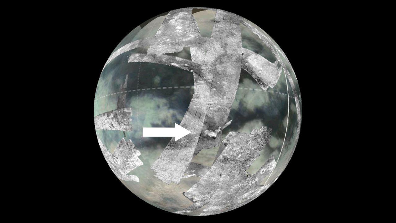
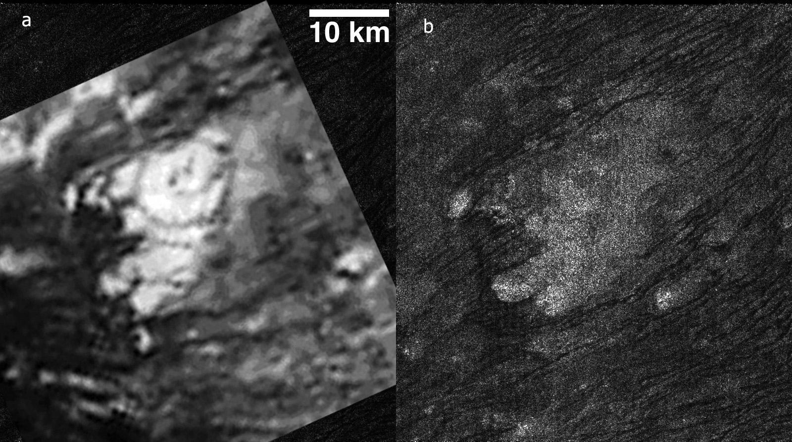
PIA06995:
-
Follow the Arrow
Full Resolution:
TIFF
(843.4 kB)
JPEG
(225.1 kB)
|
|
|
2005-02-16 |
Titan
|
Cassini-Huygens
|
Radar Mapper
|
2000x675x1 |

|
-
PIA07009:
-
Cat Scratches
Full Resolution:
TIFF
(1.352 MB)
JPEG
(480.5 kB)
|
|
|
2005-02-16 |
Titan
|
Cassini-Huygens
|
Radar Mapper
|
1287x724x1 |
|
-
PIA07365:
-
Circus Maximus
Full Resolution:
TIFF
(933 kB)
JPEG
(322.1 kB)
|
|
|
2005-02-18 |
Titan
|
Cassini-Huygens
|
Radar Mapper
|
1020x574x1 |
|
-
PIA07366:
-
Huygens Landing Site Similarities
Full Resolution:
TIFF
(586.3 kB)
JPEG
(225.6 kB)
|
|
|
2005-02-18 |
Titan
|
Cassini-Huygens
|
Radar Mapper
|
1304x648x1 |
|
-
PIA07367:
-
Dark Terrain
Full Resolution:
TIFF
(846.1 kB)
JPEG
(330.8 kB)
|
|
|
2005-02-18 |
Titan
|
Cassini-Huygens
|
Radar Mapper
|
1000x800x1 |
|
-
PIA07368:
-
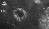
Impact Crater with Ejecta Blanket
Full Resolution:
TIFF
(801 kB)
JPEG
(210.1 kB)
|
|
|
2005-02-18 |
Titan
|
Cassini-Huygens
|
Radar Mapper
|
640x481x3 |
|
-
PIA07369:
-
Cassini Radar Titan Movie
Full Resolution:
TIFF
(445.1 kB)
JPEG
(30.5 kB)
|
|
|
2005-09-05 |
Titan
|
Cassini-Huygens
|
Radar Mapper
|
1591x1124x1 |

|
-
PIA03555:
-
Titan, a Geologically Dynamic World
Full Resolution:
TIFF
(1.79 MB)
JPEG
(569.1 kB)
|
|
|
2005-09-16 |
Titan
|
Cassini-Huygens
|
Radar Mapper
|
1909x1385x1 |

|
-
PIA03563:
-
Shoreline on Titan?
Full Resolution:
TIFF
(2.647 MB)
JPEG
(746.7 kB)
|
|
|
2005-09-16 |
Titan
|
Cassini-Huygens
|
Radar Mapper
|
1287x1516x1 |
|
-
PIA03565:
-
Titan's Rain Drains to the Plains
Full Resolution:
TIFF
(1.953 MB)
JPEG
(609.6 kB)
|
|
|
2005-09-16 |
Titan
|
Cassini-Huygens
|
Radar Mapper
|
1715x1400x1 |

|
-
PIA03564:
-
Canyonlands of Titan
Full Resolution:
TIFF
(2.404 MB)
JPEG
(709.1 kB)
|
|
|
2005-10-25 |
Titan
|
Cassini-Huygens
|
Radar Mapper
|
2538x1900x3 |

|
-
PIA08110:
-
Titan Viewed by Cassini's Radar
Full Resolution:
TIFF
(14.48 MB)
JPEG
(222.9 kB)
|
|
|
2005-10-25 |
Titan
|
Cassini-Huygens
|
Radar Mapper
|
2261x1131x3 |
|
-
PIA08111:
-
Titan Viewed by Cassini's Radar - Flat Map
Full Resolution:
TIFF
(7.681 MB)
JPEG
(166.3 kB)
|
|
|
2005-11-01 |
Titan
|
Cassini-Huygens
|
Radar Mapper
|
510x289x1 |
|
-
PIA03567:
-
Dunes Galore
Full Resolution:
TIFF
(147.8 kB)
JPEG
(42.52 kB)
|
|
|
2005-11-01 |
Titan
|
Cassini-Huygens
|
Radar Mapper
|
829x598x1 |
|
-
PIA03568:
-
Diverse Geology
Full Resolution:
TIFF
(496.5 kB)
JPEG
(142.4 kB)
|
|
|
2005-11-01 |
Titan
|
Cassini-Huygens
|
Radar Mapper
|
1138x649x1 |
|
-
PIA03566:
-
Tectonic Features
Full Resolution:
TIFF
(739.5 kB)
JPEG
(235.7 kB)
|
|
|
2005-11-16 |
Titan
|
Cassini-Huygens
|
Radar Mapper
|
1051x972x3 |

|
-
PIA03570:
-
Radar Swath of Oct. 28, 2005, Titan Flyby
Full Resolution:
TIFF
(3.069 MB)
JPEG
(65.05 kB)
|
|
|
2005-11-16 |
Titan
|
Cassini-Huygens
|
Radar Mapper
|
2538x1900x3 |

|
-
PIA03571:
-
Titan Viewed by Cassini's Radar
Full Resolution:
TIFF
(14.48 MB)
JPEG
(225.8 kB)
|
|
|
2006-04-27 |
Titan
|
Cassini-Huygens
|
Radar Mapper
|
1051x972x3 |
|
-
PIA08099:
-
Titan (T13) Viewed by Cassini's Radar
Full Resolution:
TIFF
(3.069 MB)
JPEG
(81.07 kB)
|
|
|
2006-04-27 |
Titan
|
Cassini-Huygens
|
Radar Mapper
|
6777x3390x3 |
|
-
PIA08100:
-
Titan (T13) Viewed by Cassini's Radar - Flat Map
Full Resolution:
TIFF
(68.92 MB)
JPEG
(996.8 kB)
|
|
|
2006-05-03 |
Titan
|
Cassini-Huygens
|
Radar Mapper
|
2070x1244x1 |
|
-
PIA08425:
-
Radar Images the Margin of Xanadu
Full Resolution:
TIFF
(2.579 MB)
JPEG
(571.4 kB)
|
|
|
2006-05-03 |
Titan
|
Cassini-Huygens
|
Radar Mapper
|
850x1107x1 |
|
-
PIA08426:
-
Radar Images Shikoku - "Great Britain"
Full Resolution:
TIFF
(942.2 kB)
JPEG
(331.6 kB)
|
|
|
2006-05-05 |
Titan
|
Cassini-Huygens
|
Radar Mapper
|
3289x1767x1 |
|
-
PIA08428:
-
Xanadu: Rivers Flowed onto a Sunless Sea
Full Resolution:
TIFF
(5.819 MB)
JPEG
(1.394 MB)
|
|
|
2006-05-05 |
Titan
|
Cassini-Huygens
|
Radar Mapper
|
1477x1448x1 |
|
-
PIA08429:
-
Impact Craters on Xanadu
Full Resolution:
TIFF
(2.141 MB)
JPEG
(786.5 kB)
|
|
|
2006-05-05 |
Titan
|
Cassini-Huygens
|
Radar Mapper
|
1051x972x3 |
|
-
PIA08430:
-
Radar Flyby of Titan - April 30, 2006
Full Resolution:
TIFF
(3.069 MB)
JPEG
(85.88 kB)
|
|
|
2006-05-09 |
Titan
|
Cassini-Huygens
|
Radar Mapper
|
2098x851x1 |
|
-
PIA08448:
-
Titan's Land-o-Lakes
Full Resolution:
TIFF
(1.788 MB)
JPEG
(614.8 kB)
|
 Planetary Data System


