- Original Caption Released with Image:
-
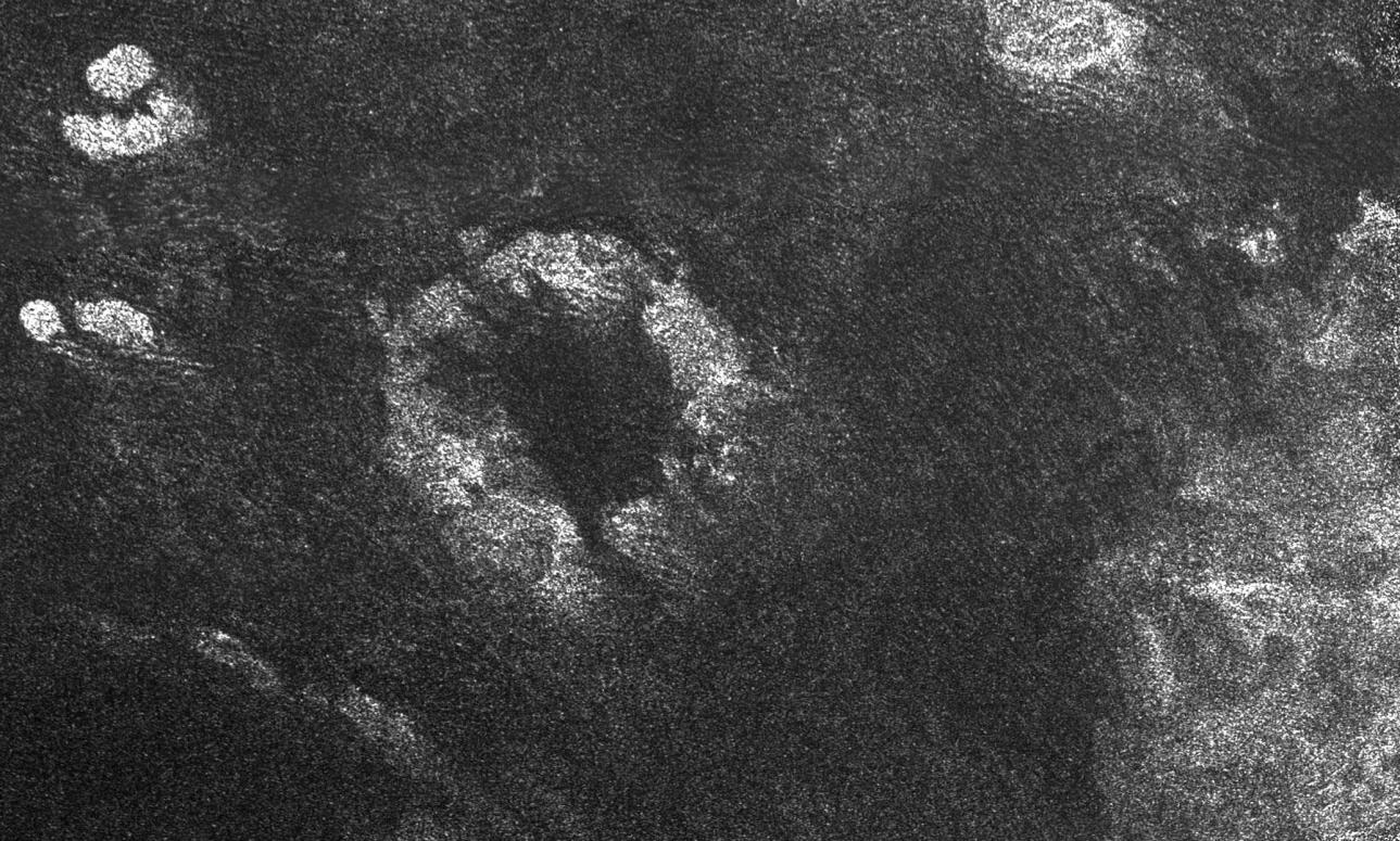
This image of Saturn's moon Titan from the Synthetic Aperture Radar instrument on the Cassini spacecraft shows the southwestern area of a feature called Xanadu (bottom right of the image). The area is bright because it reflects the radio wavelengths used to make this radar images. The image was taken on April 30, 2006. Xanadu is one of the most prominent features on Titan and was first seen in ground-based observations. The origin of Xanadu is still unknown, but this radar image reveals details previously unseen, such as numerous curvy features that may indicate fluid flows. Linear dark streaks visible in radar-dark areas are dune fields, also seen in previous radar images (see PIA03567).Near the center of the image is a prominent circular feature, named Guabonito, about 90 kilometers (56 miles) in diameter. It might be an impact crater or a cryovolcanic caldera. If this is an impact structure, the absence of an ejecta blanket suggests that the feature has been highly eroded, like some impact structures on Earth, or has been buried by the dune fields. Other radar-bright areas (top left and top right) appear to be topographically high and might act as obstacles, diverting the dunes around them. The Cassini-Huygens mission is a cooperative project of NASA, the European Space Agency and the Italian Space Agency. The Jet Propulsion Laboratory, a division of the California Institute of Technology in Pasadena, manages the mission for NASA's Science Mission Directorate, Washington, D.C. The Cassini orbiter was designed, developed and assembled at JPL. The radar instrument was built by JPL and the Italian Space Agency, working with team members from the United States and several European countries. For more information about the Cassini-Huygens mission visit http://saturn.jpl.nasa.gov/home/index.cfm.
- Image Credit:
-
NASA/JPL-Caltech/ASI
Image Addition Date: -
2006-05-03
|
 Planetary Data System


