Click on an image for detailed information
Click on a column heading to sort in ascending or descending order

My
List |
Addition Date
|
Target
|
Mission
|
Instrument
|
Size
|

|
2000-12-05 |
Mars
|
Mars Global Surveyor (MGS)
|
Mars Orbiter Camera (MOC)
|
512x875x3 |
|
-
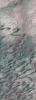
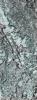
PIA02841:
-
Layered Material in West Arabia Terra Crater
Full Resolution:
TIFF
(1.283 MB)
JPEG
(114 kB)
|
|
|
2000-12-05 |
Mars
|
Mars Global Surveyor (MGS)
|
Mars Orbiter Camera (MOC)
|
512x875x3 |
|
-
PIA02842:
-
Layered Material in West Arabia Terra Crater
Full Resolution:
TIFF
(1.12 MB)
JPEG
(111.5 kB)
|
|
|
2000-12-05 |
Mars
|
Mars Global Surveyor (MGS)
|
Mars Orbiter Camera (MOC)
|
835x7367x1 |

|
-
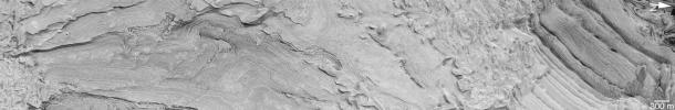
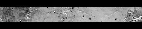
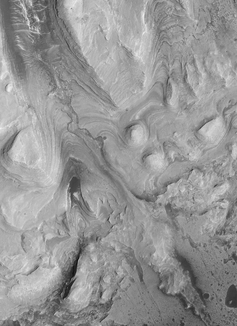
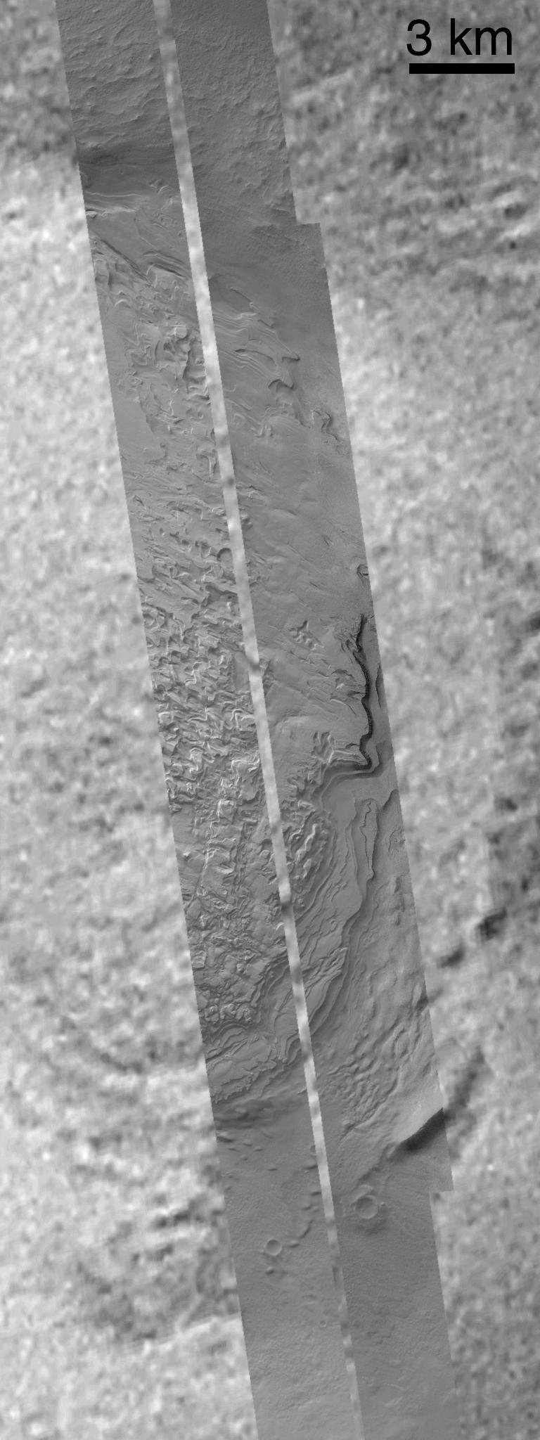
PIA02843:
-
Sediment History Preserved in Gale Crater Central Mound
Full Resolution:
TIFF
(5.051 MB)
JPEG
(734.4 kB)
|
|
|
2000-12-05 |
Mars
|
Mars Global Surveyor (MGS)
|
Mars Orbiter Camera (MOC)
|
781x1073x1 |
|
-
PIA02844:
-
Sediment History Preserved in Gale Crater Central Mound
Full Resolution:
TIFF
(845.7 kB)
JPEG
(140.4 kB)
|
|
|
2000-12-05 |
Mars
|
Mars Global Surveyor (MGS)
|
Mars Orbiter Camera (MOC)
|
780x1173x1 |
|
-
PIA02845:
-
Sediment History Preserved in Gale Crater Central Mound
Full Resolution:
TIFF
(874.7 kB)
JPEG
(139.1 kB)
|
|
|
2000-12-05 |
Mars
|
Mars Global Surveyor (MGS)
|
Mars Orbiter Camera (MOC)
|
836x916x3 |
|
-
PIA02846:
-
Sediment History Preserved in Gale Crater Central Mound
Full Resolution:
TIFF
(2.273 MB)
JPEG
(155.6 kB)
|
|
|
2000-12-05 |
Mars
|
Mars Global Surveyor (MGS)
|
Mars Orbiter Camera (MOC)
|
512x1642x1 |
|
-
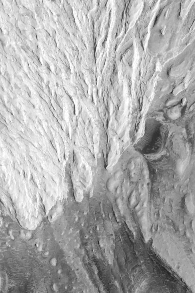
PIA02847:
-
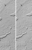
Light-toned Layered Outcrops in Valles Marineris Walls
Full Resolution:
TIFF
(848.8 kB)
JPEG
(172.5 kB)
|
|
|
2000-12-05 |
Mars
|
Mars Global Surveyor (MGS)
|
Mars Orbiter Camera (MOC)
|
836x3158x1 |
|
-
PIA02848:
-
'White Rock' of Pollack Crater
Full Resolution:
TIFF
(2.816 MB)
JPEG
(603.9 kB)
|
|
|
2000-12-05 |
Mars
|
Mars Global Surveyor (MGS)
|
Mars Orbiter Camera (MOC)
|
518x894x1 |
|
-
PIA02849:
-
'White Rock' of Pollack Crater
Full Resolution:
TIFF
(453.8 kB)
JPEG
(96.46 kB)
|
|
|
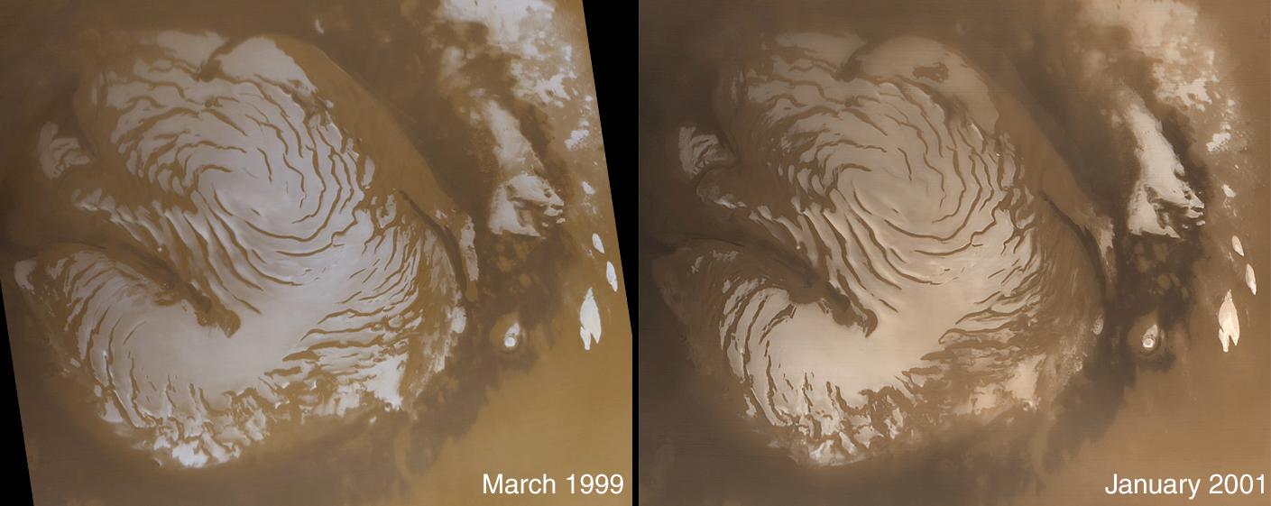
2001-01-13 |
Mars
|
Mars Global Surveyor (MGS)
|
Mars Orbiter Camera (MOC)
|
2003x601x1 |
|
-
PIA02897:
-
North Polar Cap Layers and Frost on the First Day of Summer
Full Resolution:
TIFF
(886.7 kB)
JPEG
(209.9 kB)
|
|
|
2001-01-13 |
Mars
|
Mars Global Surveyor (MGS)
|
Mars Orbiter Camera (MOC)
|
2003x601x1 |
|
-
PIA02898:
-
North Polar Ice Cap Surface
Full Resolution:
TIFF
(1.247 MB)
JPEG
(404.5 kB)
|
|
|
2001-01-13 |
Mars
|
Mars Global Surveyor (MGS)
|
Mars Orbiter Camera (MOC)
|
2003x601x1 |
|
-
PIA02899:
-
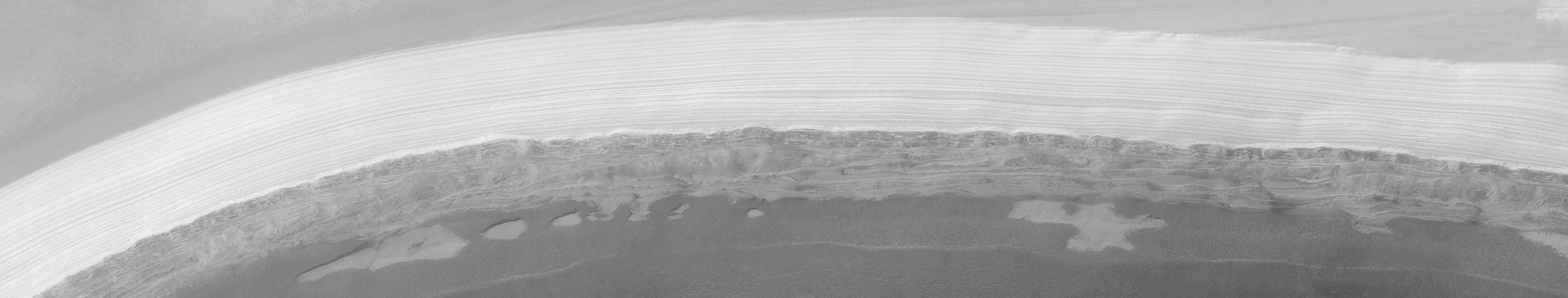
Complex exposures of North Polar layered material
Full Resolution:
TIFF
(1.13 MB)
JPEG
(239 kB)
|
|
|
2001-01-17 |
Mars
|
Mars Global Surveyor (MGS)
|
Thermal Emission Spectrometer
|
4000x2769x3 |
|
-
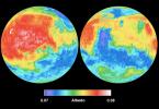
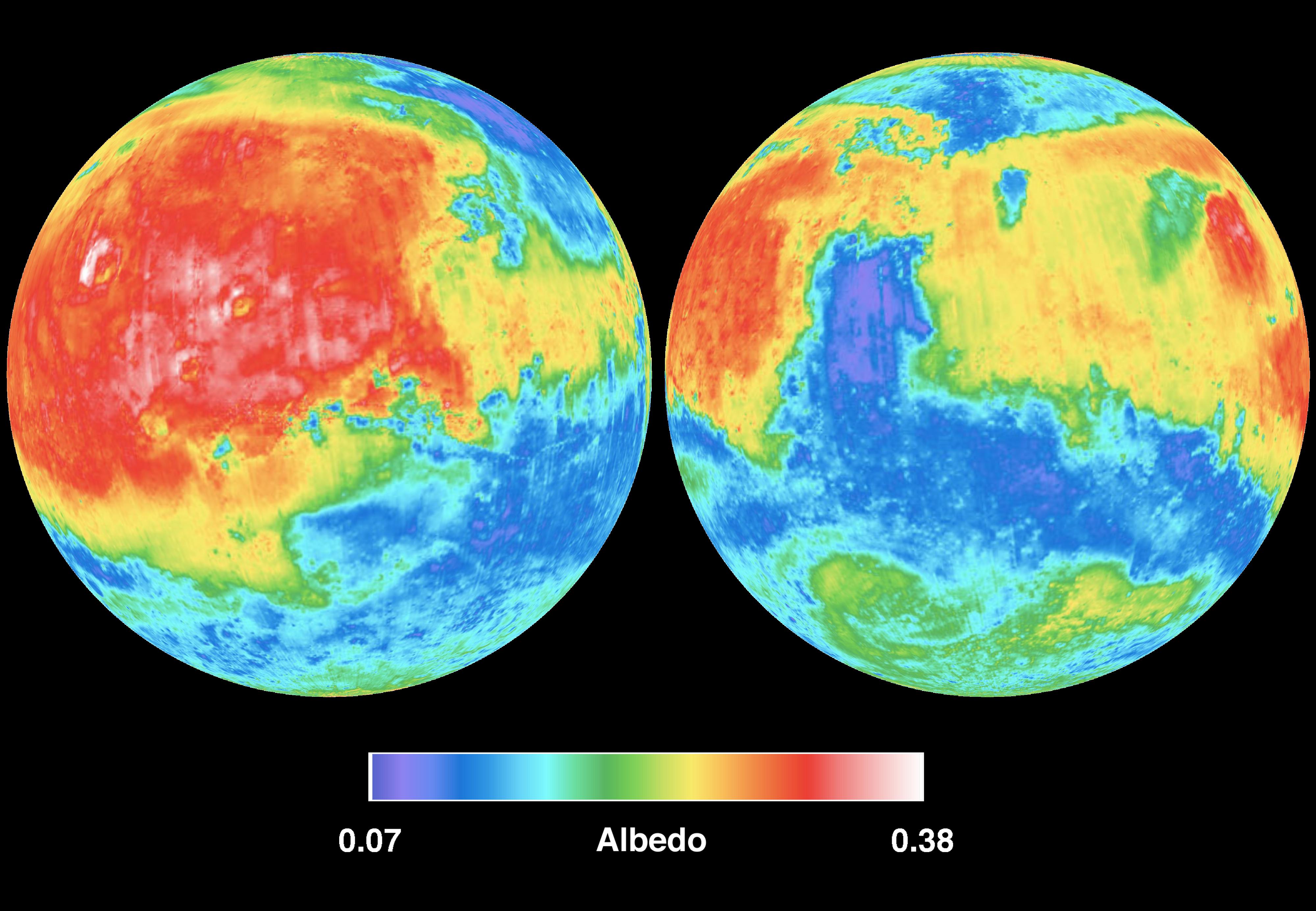
PIA02816:
-
Mars Albedo
Full Resolution:
TIFF
(20.01 MB)
JPEG
(715.4 kB)
|
|
|
2001-01-17 |
Mars
|
Mars Global Surveyor (MGS)
|
|
4000x2769x3 |
|
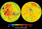
-
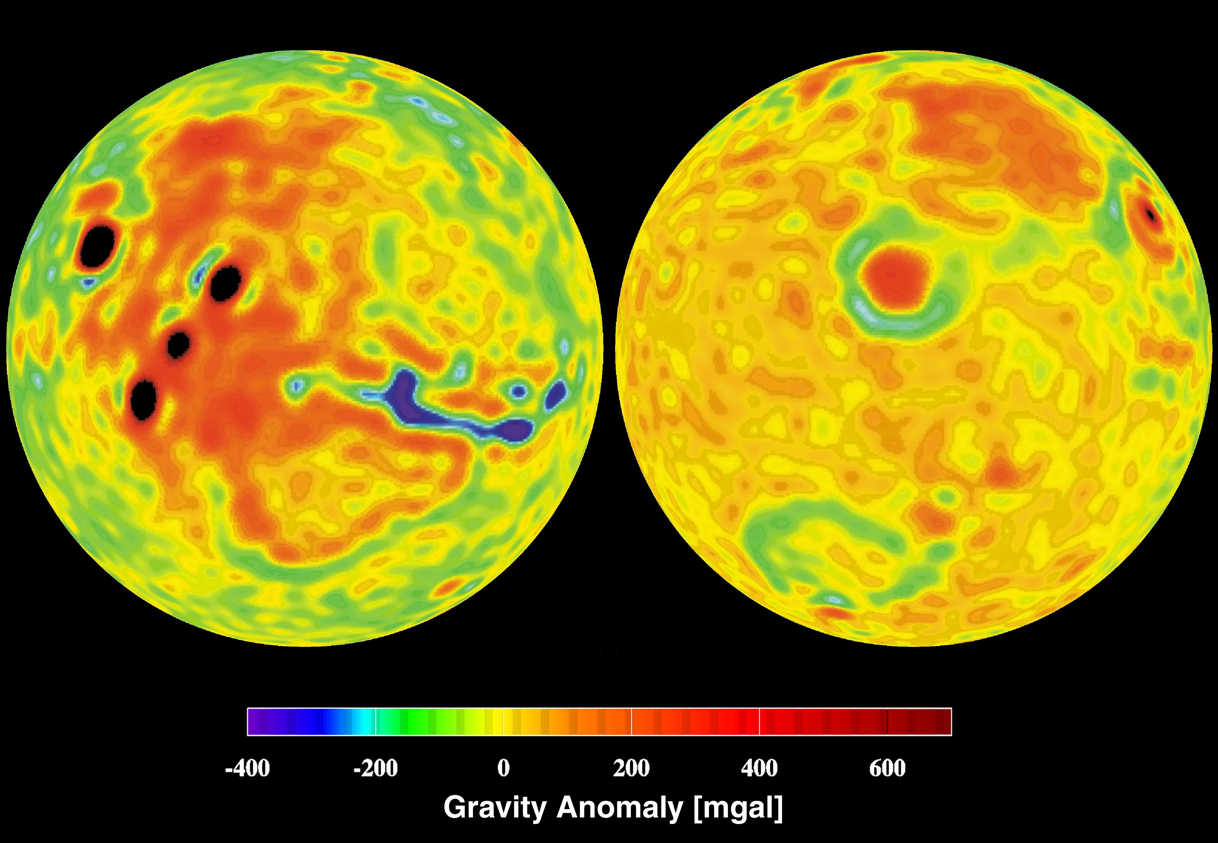
PIA02817:
-
Mars Gravity Anomoly Map
Full Resolution:
TIFF
(16.6 MB)
JPEG
(619.8 kB)
|
|
|
2001-01-17 |
Mars
|
Mars Global Surveyor (MGS)
|
Thermal Emission Spectrometer
|
4000x2769x3 |
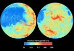
|
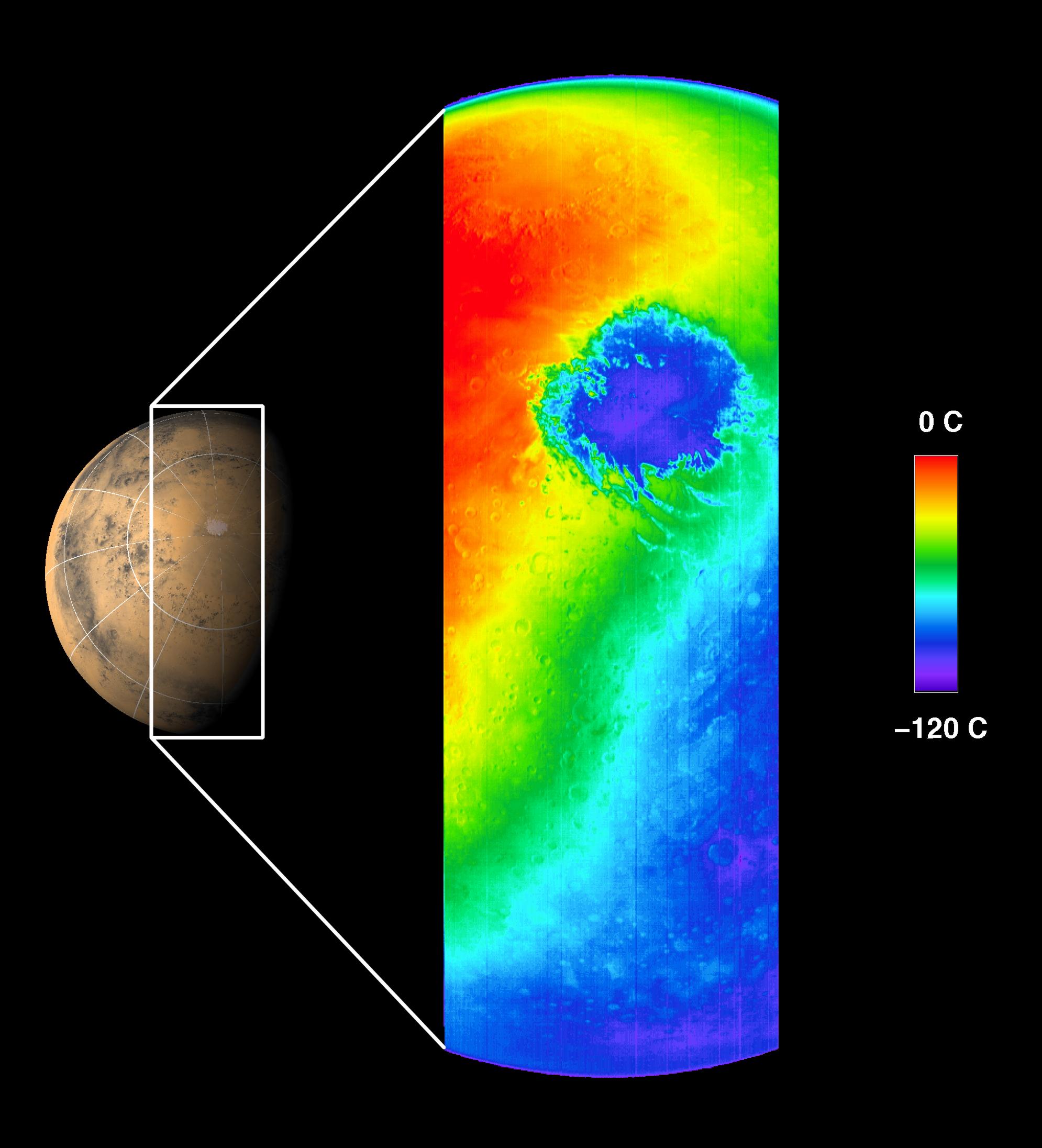
-
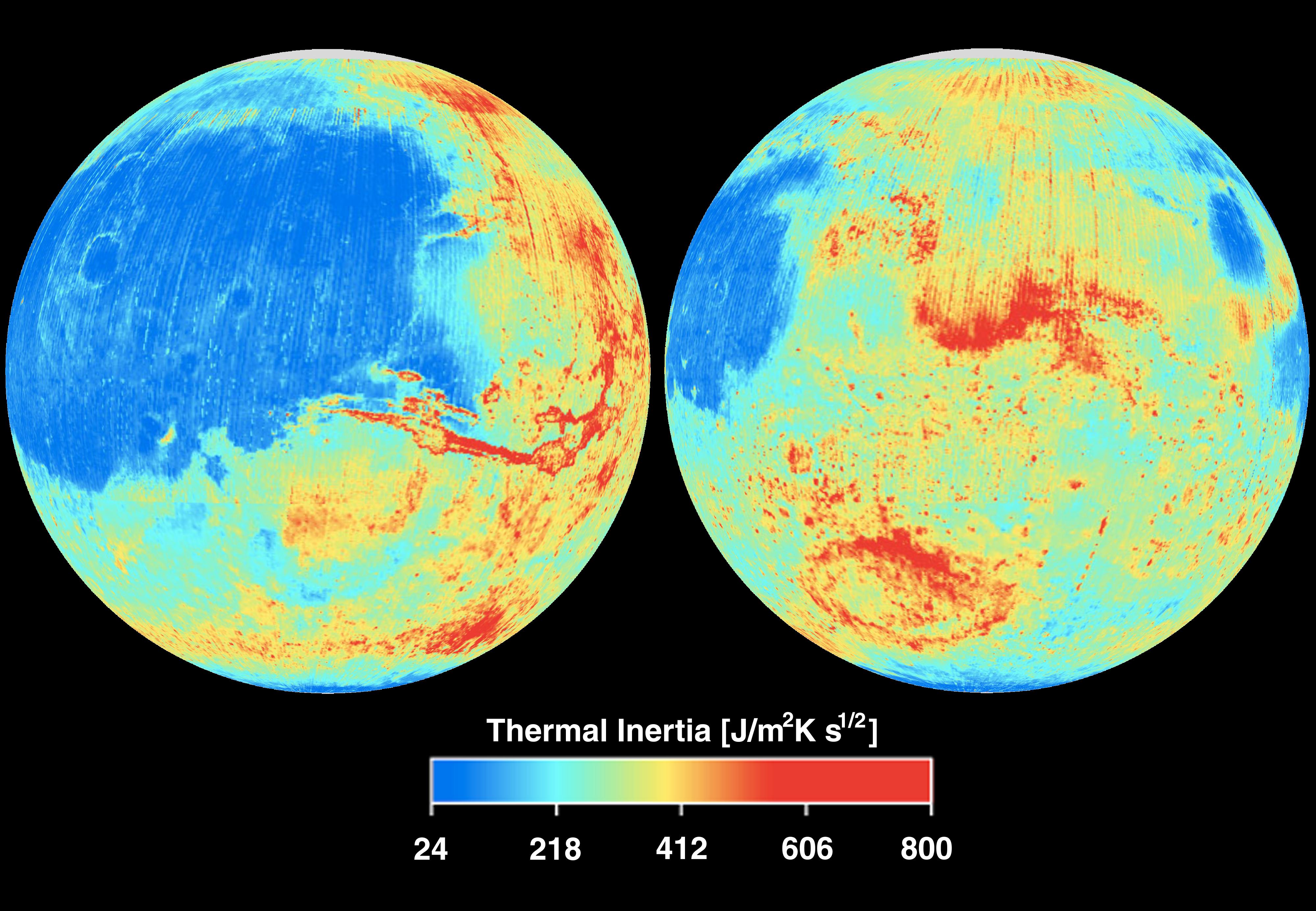
PIA02818:
-
Mars Thermal Inertia
Full Resolution:
TIFF
(21.3 MB)
JPEG
(883.2 kB)
|
|
|
2001-01-17 |
Mars
|
Mars Global Surveyor (MGS)
|
Magnetometer
|
4000x2769x3 |
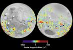
|
-
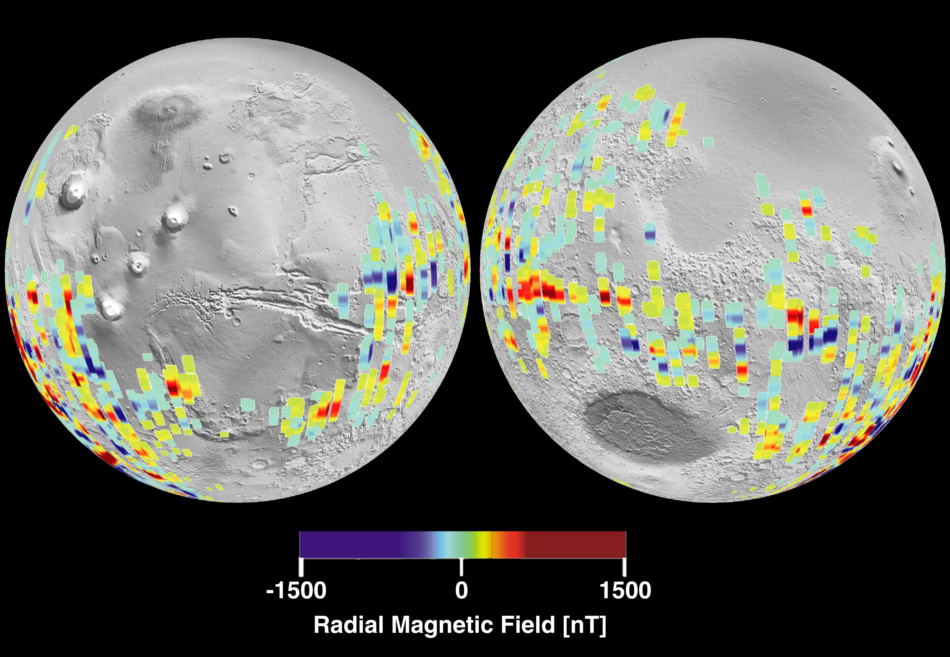
PIA02819:
-
Mars Crustal Magnetic Field Remnants
Full Resolution:
TIFF
(11.85 MB)
JPEG
(959.2 kB)
|
|
|
2001-01-17 |
Mars
|
Mars Global Surveyor (MGS)
|
MOLA
|
4000x2769x3 |
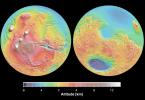
|
-
PIA02820:
-
Mars Topography
Full Resolution:
TIFF
(21.78 MB)
JPEG
(1.109 MB)
|
|
|
2001-02-08 |
Mars
|
Mars Global Surveyor (MGS)
|
Mars Orbiter Camera (MOC)
|
768x2048x1 |
|
-
PIA03203:
-
Mid-Latitude Sedimentary Rock: Spallanzani Crater
Full Resolution:
TIFF
(1.025 MB)
JPEG
(161.8 kB)
|
|
|
2001-02-08 |
Mars
|
Mars Global Surveyor (MGS)
|
Mars Orbiter Camera (MOC)
|
1409x561x3 |
|
-
PIA03204:
-
The Martian North Polar Cap in Summer - One Year Later
Full Resolution:
TIFF
(2.124 MB)
JPEG
(80.98 kB)
|
|
|
2001-02-08 |
Mars
|
Mars Global Surveyor (MGS)
|
Mars Orbiter Camera (MOC)
|
1970x1010x1 |
|
-
PIA03205:
-
Secrets of the Noachian Highlands: Pit Craters
Full Resolution:
TIFF
(2.092 MB)
JPEG
(399 kB)
|
|
|
2001-02-08 |
Mars
|
Mars Global Surveyor (MGS)
|
Mars Orbiter Camera (MOC)
|
1469x1327x3 |
|
-
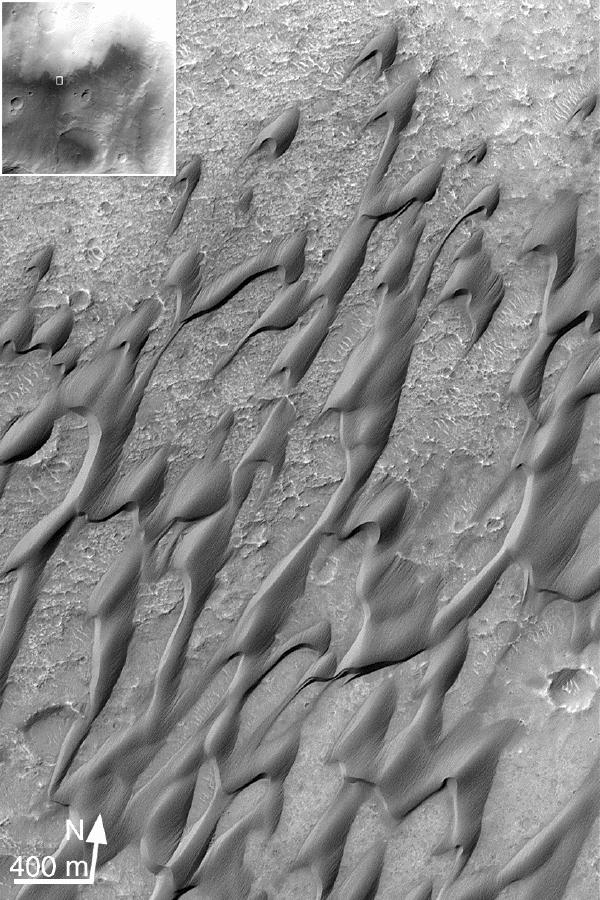
PIA03206:
-
Winter Frosted Dunes in Kaiser Crater
Full Resolution:
TIFF
(4.536 MB)
JPEG
(245.8 kB)
|
|
|
2001-02-08 |
Mars
|
Mars Global Surveyor (MGS)
|
Mars Orbiter Camera (MOC)
|
1029x909x1 |
|
-
PIA03207:
-
The Martian Prime Meridian -- Longitude "Zero"
Full Resolution:
TIFF
(876.3 kB)
JPEG
(181.6 kB)
|
|
|
2001-02-08 |
Mars
|
Mars Global Surveyor (MGS)
|
Mars Orbiter Camera (MOC)
|
836x2021x1 |
|
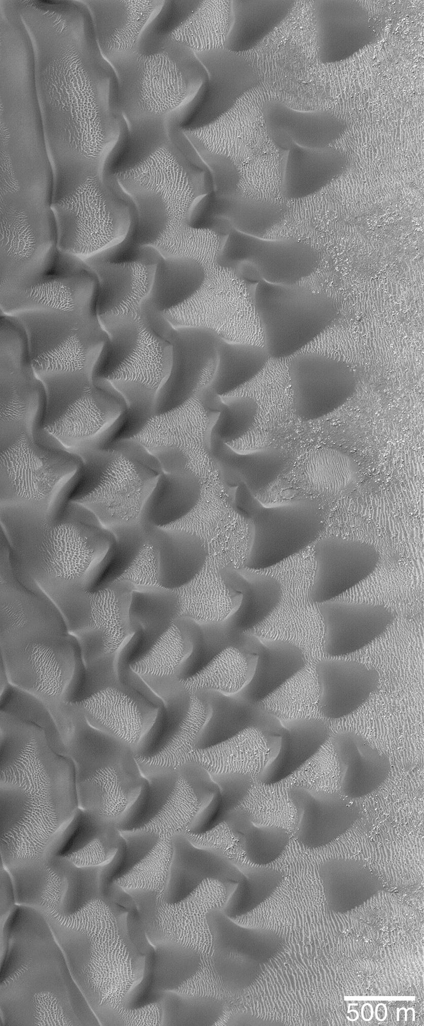
-
PIA03208:
-
"Sharks Teeth" -- Sand Dunes in Proctor Crater
Full Resolution:
TIFF
(1.747 MB)
JPEG
(314.3 kB)
|
|
|
2001-02-08 |
Mars
|
Mars Global Surveyor (MGS)
|
Mars Orbiter Camera (MOC)
|
1752x3553x3 |
|
-
PIA03209:
-
Lyot Crater and Northern Deuteronilus Mensae
Full Resolution:
TIFF
(10.9 MB)
JPEG
(512.9 kB)
|
|
|
2001-02-08 |
Mars
|
Mars Global Surveyor (MGS)
|
Mars Orbiter Camera (MOC)
|
640x917x1 |
|
-
PIA03210:
-
Strange Surfaces of Hellas Planitia
Full Resolution:
TIFF
(664.2 kB)
JPEG
(171.8 kB)
|
|
|
2001-02-08 |
Mars
|
Mars Global Surveyor (MGS)
|
Mars Orbiter Camera (MOC)
|
3124x512x1 |
|
-
PIA03211:
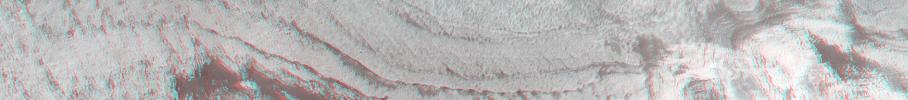
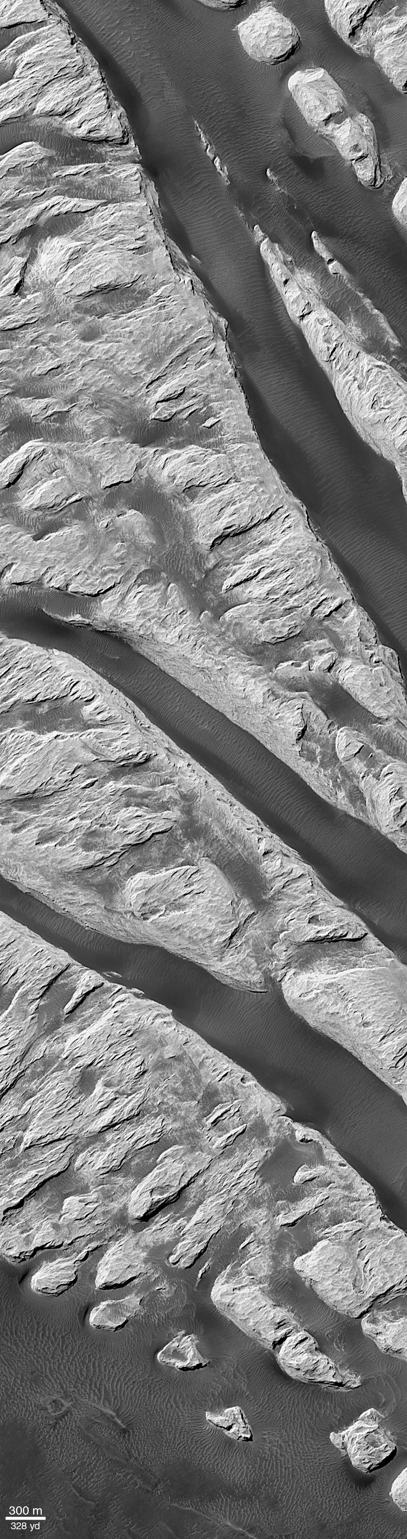
Spectacular Layers Exposed in Becquerel Crater
Full Resolution:
TIFF
(1.678 MB)
JPEG
(369.5 kB)
|
|
|
2001-02-21 |
Mars
|
Viking
|
Visual Imaging Subsystem
|
5072x4499x3 |
|
-
PIA03213:
-
Noctis Labyrinthus
Full Resolution:
TIFF
(81.9 MB)
JPEG
(4.397 MB)
|
|
|
2001-02-26 |
Io
|
Galileo
|
Solid-State Imaging
|
1270x660x3 |
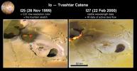
|
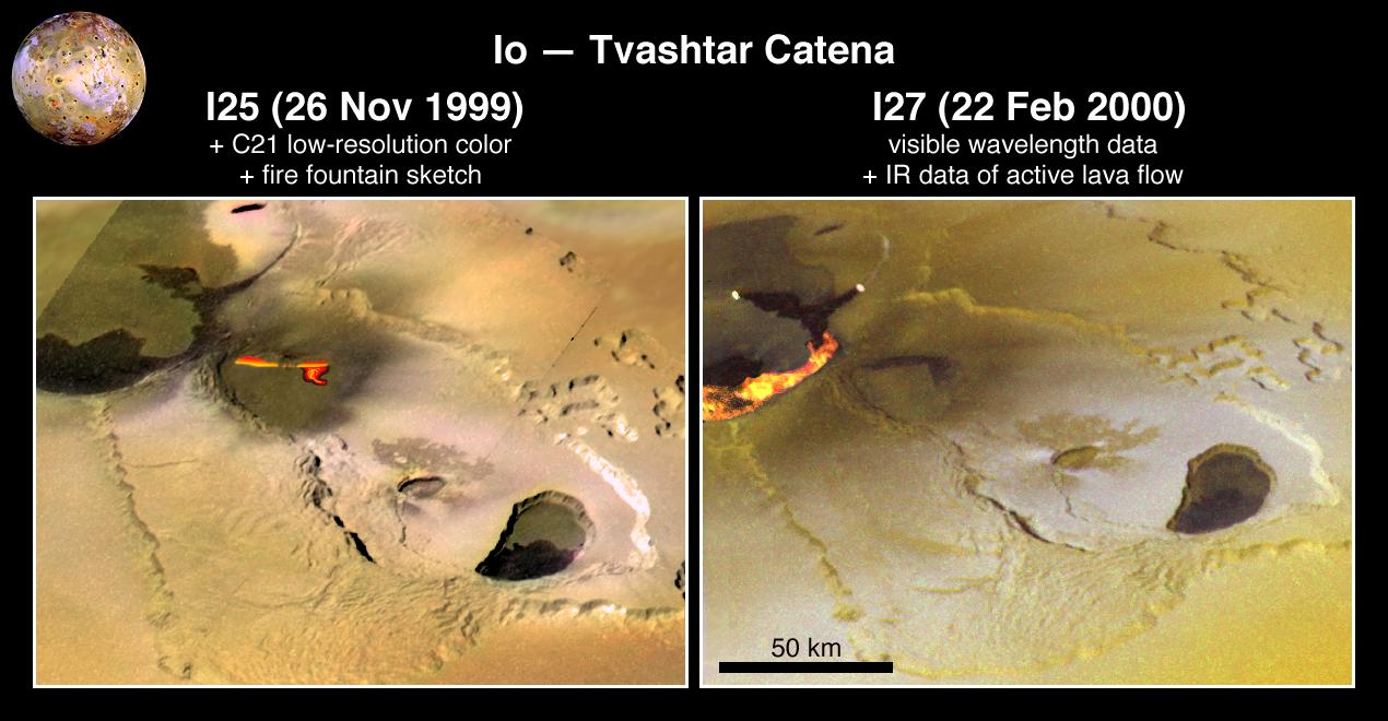
-
PIA02584:
-
Eruption at Tvashtar Catena on Io
Full Resolution:
TIFF
(1.901 MB)
JPEG
(114.5 kB)
|
|
|
2001-03-07 |
Earth
|
Airborne Synthetic Aperture Radar (AIRSAR)
|
AirSAR
|
1321x825x3 |
|
-
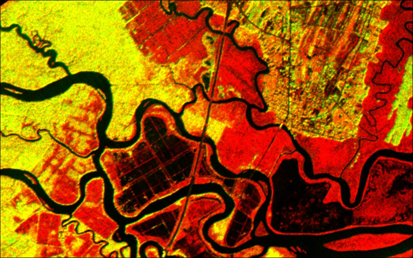
PIA03157:
-
Altamaha River Delta, Georgia Sea Islands
Full Resolution:
TIFF
(2.847 MB)
JPEG
(205.7 kB)
|
|
|
2001-03-27 |
Mars
|
2001 Mars Odyssey
|
Mars Orbiter Camera (MOC)
THEMIS
|
1440x1080x3 |
|
-
PIA03219:
-
Still From Odyssey Clip 1
Full Resolution:
TIFF
(997.2 kB)
JPEG
(53.55 kB)
|
|
|
2001-03-27 |
Mars
|
2001 Mars Odyssey
|
Mars Orbiter Camera (MOC)
THEMIS
|
1440x1080x3 |
|
-
PIA03220:
-
Still From Odyssey Clip 2
Full Resolution:
TIFF
(1.256 MB)
JPEG
(77.47 kB)
|
|
|
2001-03-27 |
Mars
|
2001 Mars Odyssey
|
Mars Orbiter Camera (MOC)
THEMIS
|
1440x1080x3 |
|
-
PIA03221:
-
Still From Odyssey Clip 3
Full Resolution:
TIFF
(977.6 kB)
JPEG
(61.99 kB)
|
|
|
2001-03-29 |
|
|
|
4500x5600x3 |
|
-
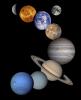
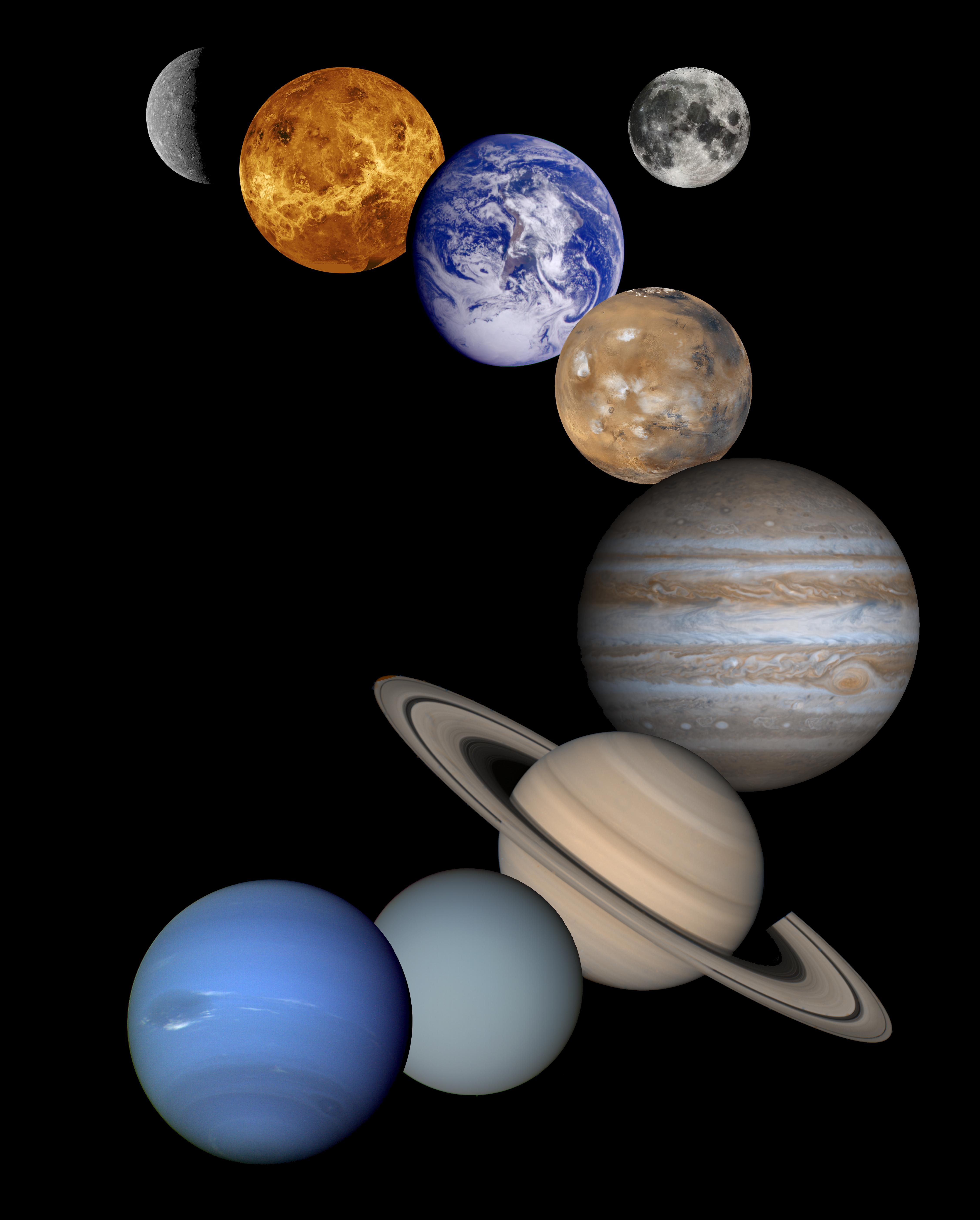
PIA03153:
-
Solar System Montage - High Resolution 2001 Version
Full Resolution:
TIFF
(23.45 MB)
JPEG
(955.2 kB)
|
|
|
2001-04-26 |
Earth
|
2001 Mars Odyssey
|
THEMIS
|
3000x1681x3 |
|
-
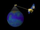
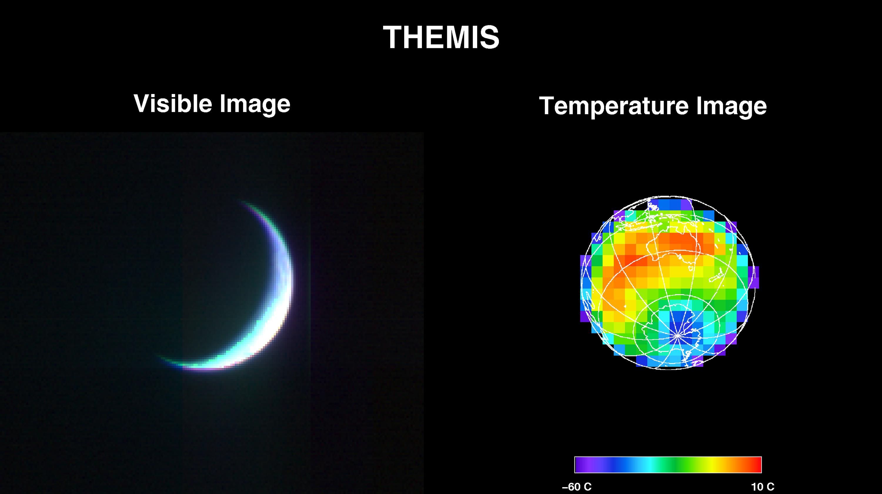
PIA00558:
-
2001 Mars Odyssey Images Earth (Visible and Infrared)
Full Resolution:
TIFF
(2.994 MB)
JPEG
(217.5 kB)
|
|
|
2001-05-01 |
Earth
|
2001 Mars Odyssey
|
THEMIS
|
3124x1342x1 |
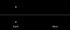
|
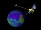
-
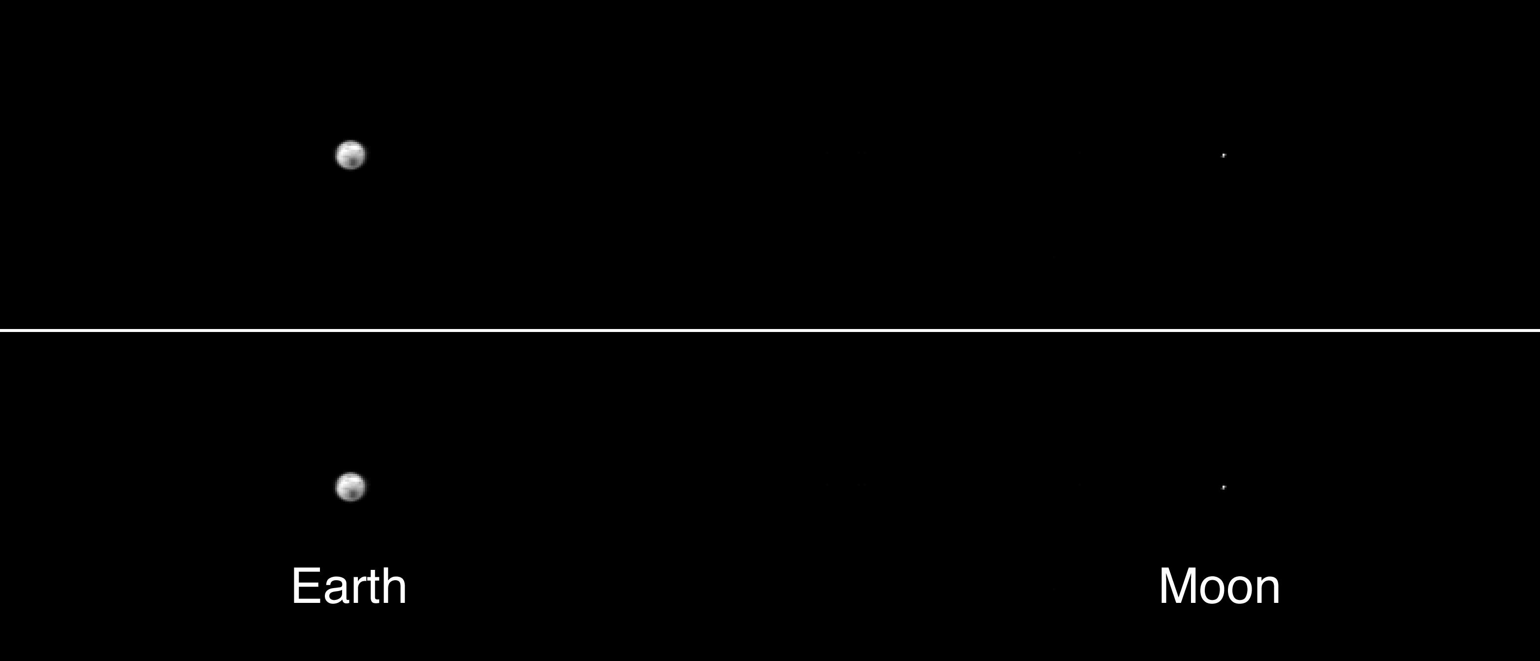
PIA00559:
-
The Earth and Moon As Seen by 2001 Mars Odyssey's Thermal Emission Imaging System
Full Resolution:
TIFF
(101.6 kB)
JPEG
(69.4 kB)
|
|
|
2001-05-24 |
Mars
|
Mars Global Surveyor (MGS)
|
Mars Orbiter Camera (MOC)
|
1460x1000x3 |
|
-
PIA03222:
-
Mid-Winter Dust Storms Near Hellas Planitia
Full Resolution:
TIFF
(2.467 MB)
JPEG
(106.9 kB)
|
|
|
2001-05-24 |
Mars
|
Mars Global Surveyor (MGS)
|
Mars Orbiter Camera (MOC)
|
512x703x1 |
|
-
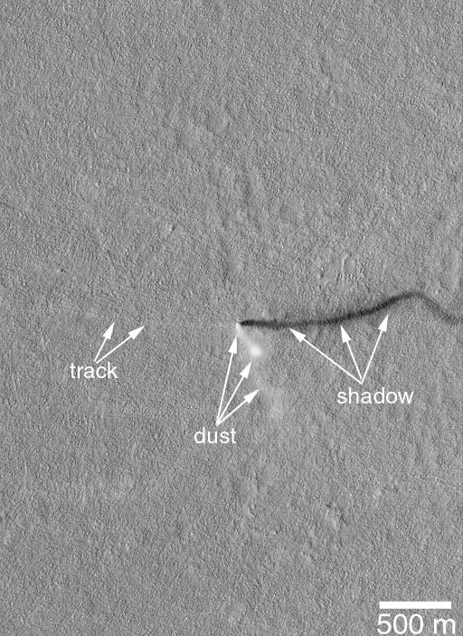
PIA03223:
-
A Mid-Summer's Dust Devil
Full Resolution:
TIFF
(386.1 kB)
JPEG
(97.34 kB)
|
|
|
2001-05-24 |
Mars
|
Mars Global Surveyor (MGS)
|
Mars Orbiter Camera (MOC)
|
907x2547x3 |
|
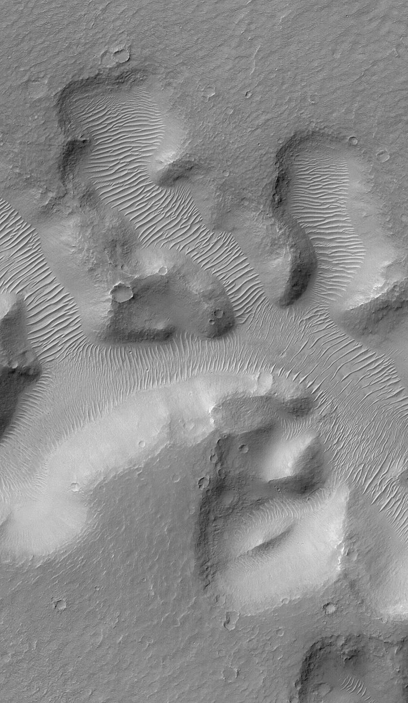
-
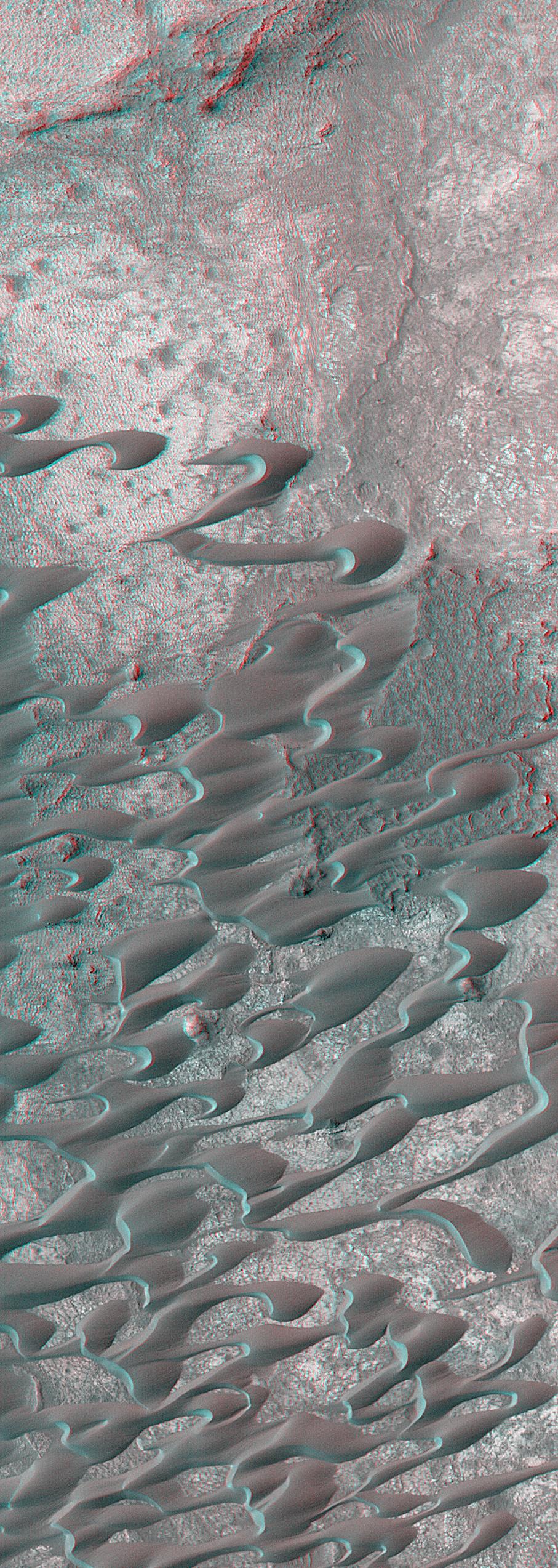
PIA03224:
-
Sand Dunes of Nili Patera in 3-D
Full Resolution:
TIFF
(7.497 MB)
JPEG
(540.1 kB)
|
|
|
2001-05-24 |
Mars
|
Mars Global Surveyor (MGS)
|
Mars Orbiter Camera (MOC)
|
2400x2400x1 |
|
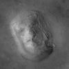
-
PIA03225:
-
Highest-Resolution View of "Face on Mars"
Full Resolution:
TIFF
(5.586 MB)
JPEG
(902 kB)
|
|
|
2001-05-24 |
Mars
|
Mars Global Surveyor (MGS)
|
Mars Orbiter Camera (MOC)
|
1044x1506x1 |
|
-
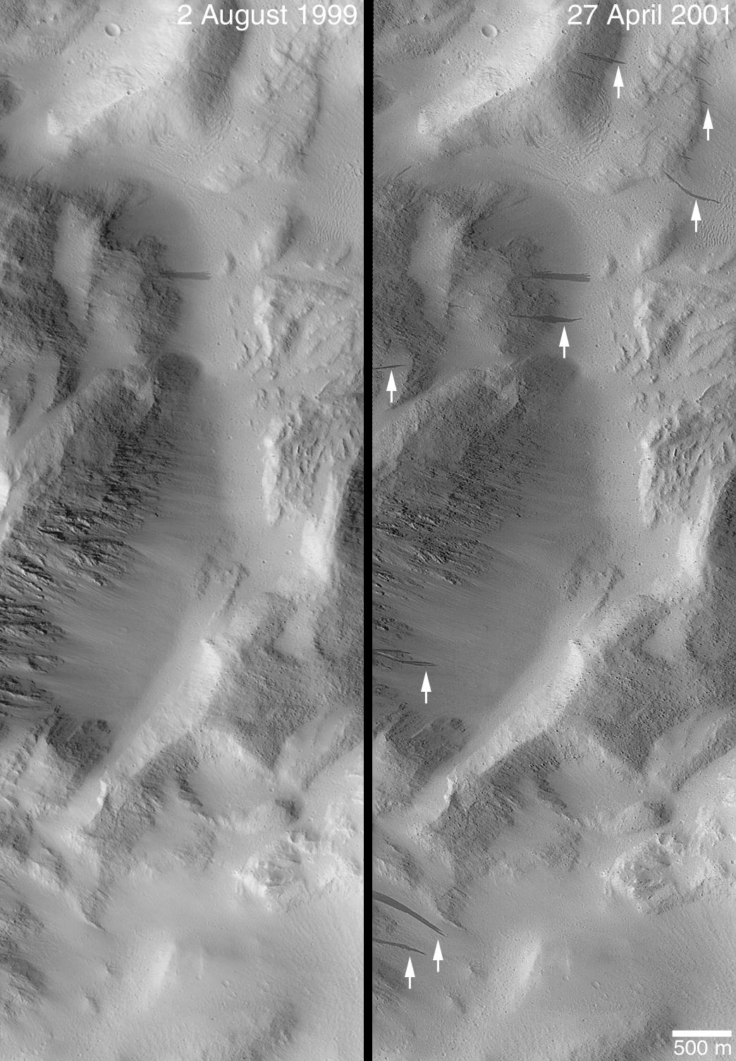
PIA03226:
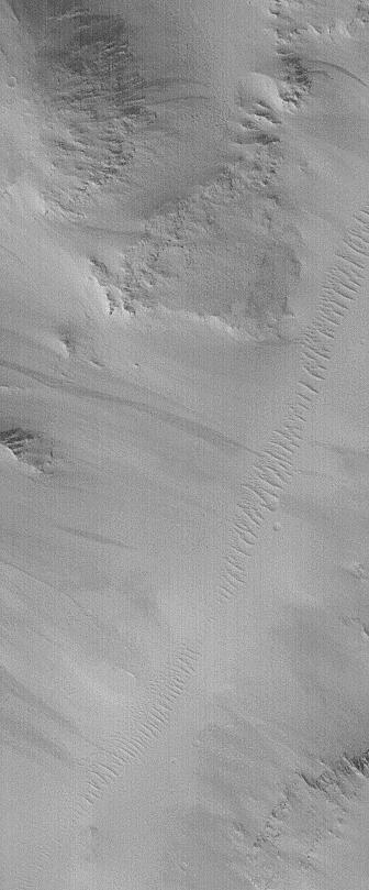
-
Changes Over a Martian Year -- New Dark Slope Streaks in Lycus Sucli
Full Resolution:
TIFF
(1.586 MB)
JPEG
(256.2 kB)
|
|
|
2001-06-18 |
Mars
|
Mars Global Surveyor (MGS)
|
Mars Orbiter Camera (MOC)
|
1505x5404x1 |
|
-
PIA03227:
-
Defrosting Sand Dunes in Late Southern Winter
Full Resolution:
TIFF
(3.104 MB)
JPEG
(513.9 kB)
|
|
|
2001-06-18 |
Mars
|
Mars Global Surveyor (MGS)
|
Mars Orbiter Camera (MOC)
|
1537x4156x3 |
|
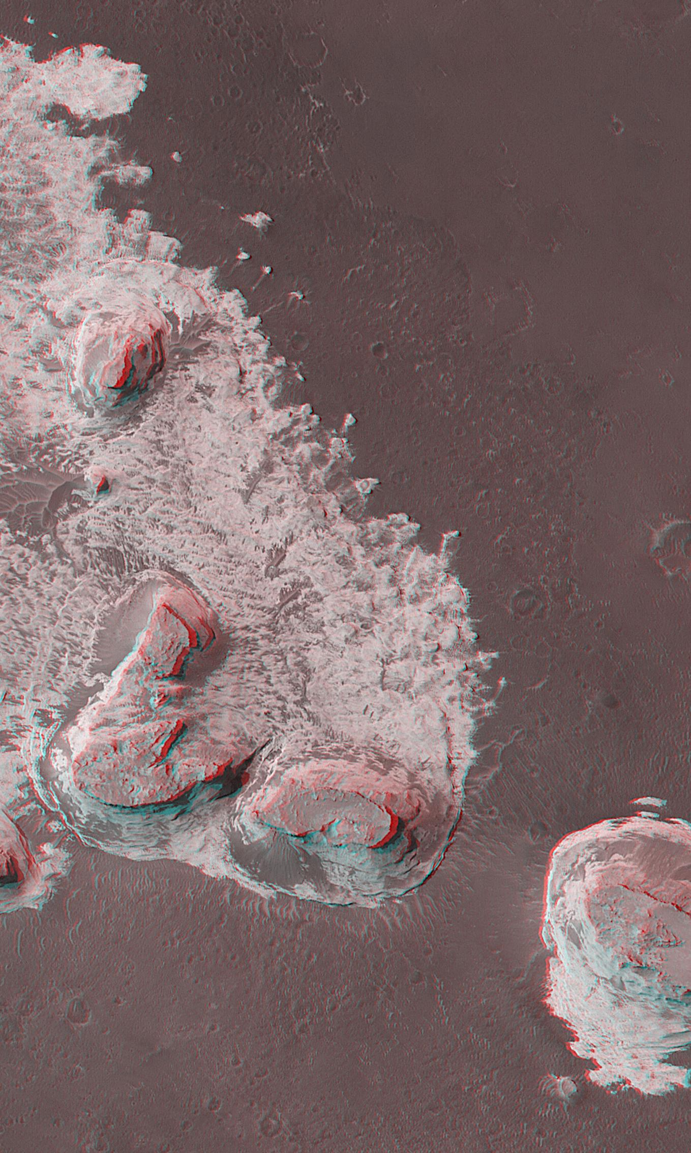
-
PIA03228:
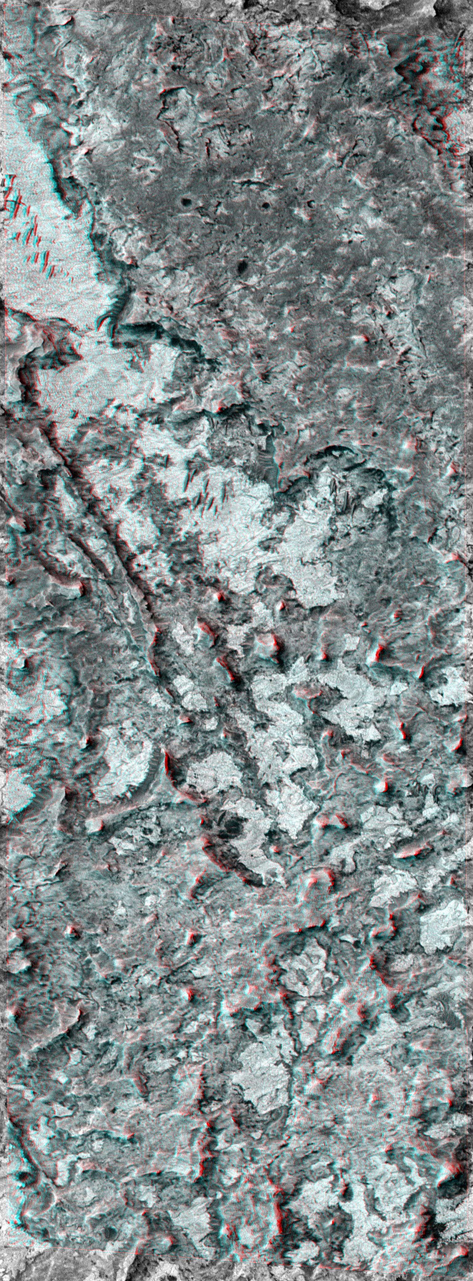
-
Northern Terra Meridiani Rocks and Cliffs in 3-D
Full Resolution:
TIFF
(22.26 MB)
JPEG
(1.427 MB)
|
|
|
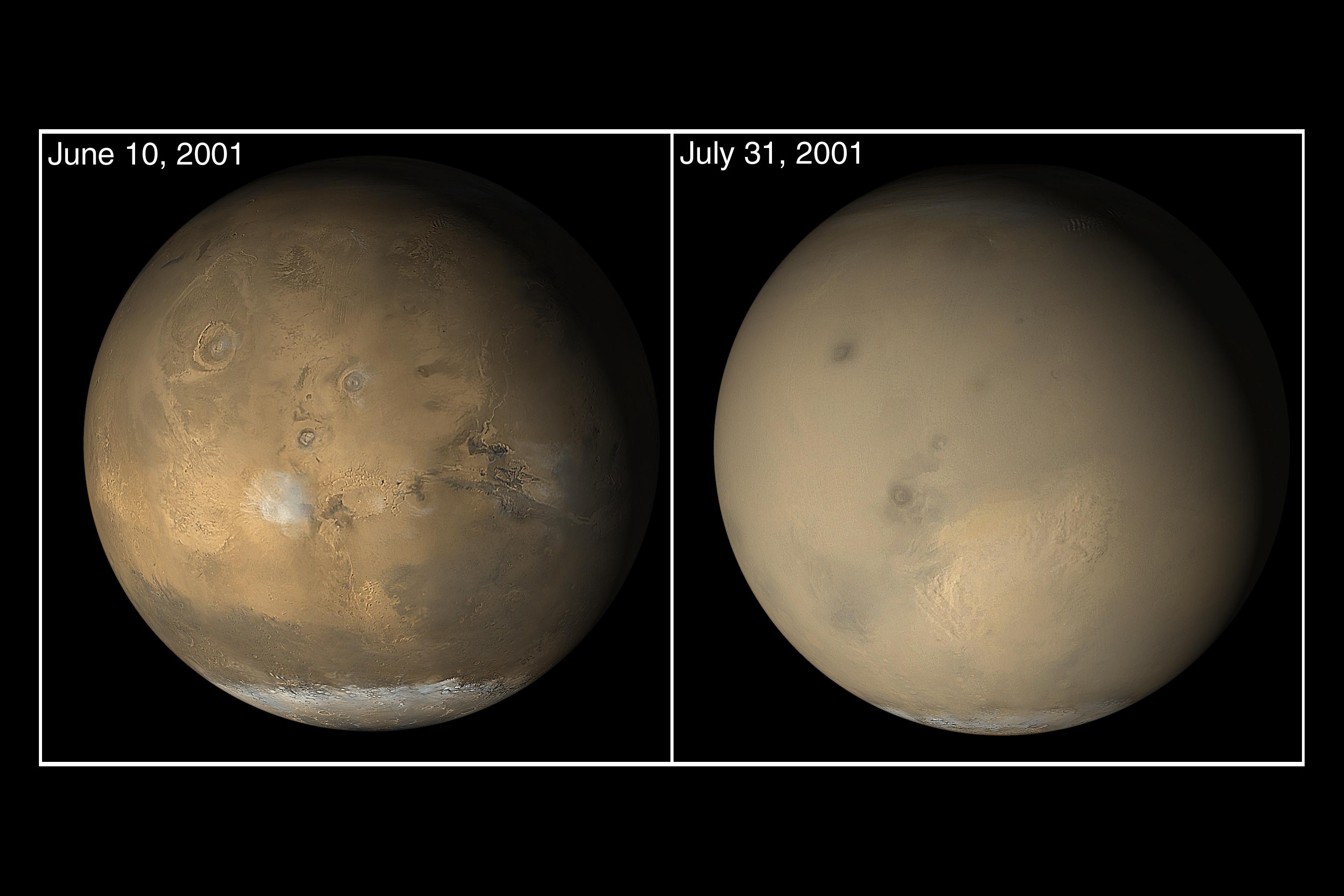
2001-06-18 |
Mars
|
Mars Global Surveyor (MGS)
|
Mars Orbiter Camera (MOC)
|
1280x1024x3 |
|
-
PIA03229:
-
Mars Opposition and Equinox
Full Resolution:
TIFF
(1.553 MB)
JPEG
(73.6 kB)
|
|
|
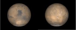
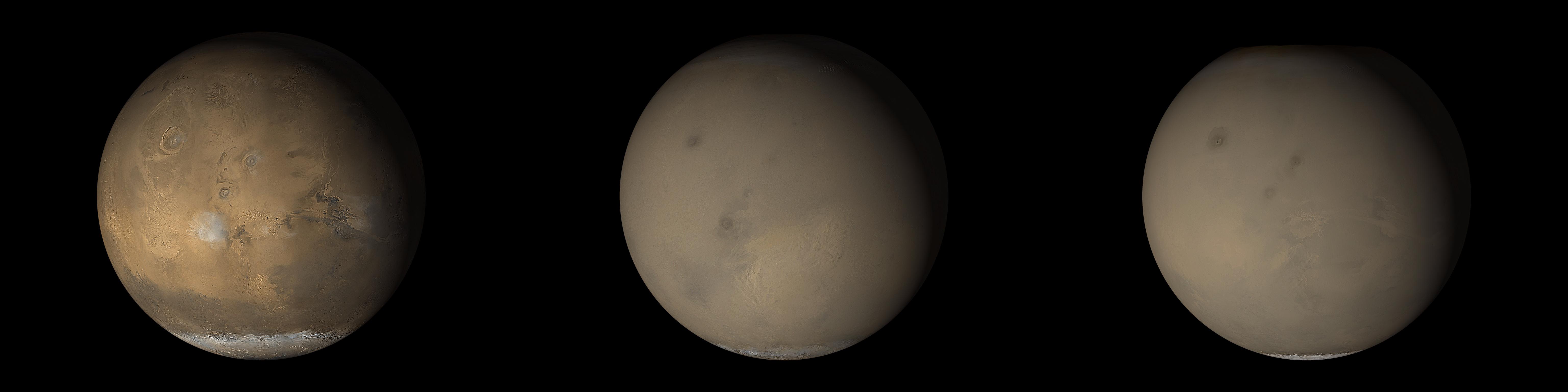
2001-06-26 |
Mars
|
Hubble Space Telescope
|
|
500x500x3 |

|
-
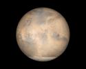
PIA18184:
-
Mars at 43 Million Miles From Earth
Full Resolution:
TIFF
(750.5 kB)
JPEG
(17.85 kB)
|
|
|
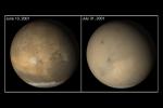
2001-07-21 |
Mars
|
Hubble Space Telescope
|
WFPC2
|
500x500x3 |

|
-
PIA03154:
-
Hubble Captures Best View of Mars Ever Obtained from Earth
Full Resolution:
TIFF
(463.3 kB)
JPEG
(17.85 kB)
|
|
|
2001-07-30 |
Mars
|
Viking
|
Camera 1
|
8550x1852x1 |
|
-
PIA03163:
Morning on Chryse Planitia - Viking Lander 1 Camera 1 Mosaic
Full Resolution:
TIFF
(6.985 MB)
JPEG
(1.413 MB)
|
|
|
2001-07-30 |
Mars
|
Viking
|
Camera 1
|
8550x1852x1 |
|
-
PIA03164:
Morning on Chryse Planitia - Viking Lander 1 Camera 2 Mosaic
Full Resolution:
TIFF
(7.228 MB)
JPEG
(1.383 MB)
|
|
|
2001-07-30 |
Mars
|
Viking
|
Camera 1
|
8550x1852x1 |

|
-
PIA03165:
Afternoon on Chryse Planitia - Viking Lander 1 Camera 1 Mosaic
Full Resolution:
TIFF
(6.989 MB)
JPEG
(1.123 MB)
|
|
|
2001-07-30 |
Mars
|
Viking
|
Camera 1
|
8550x1852x1 |
|
-
PIA03166:
Afternoon on Chryse Planitia - Viking Lander 1 Camera 2 Mosaic
Full Resolution:
TIFF
(7.736 MB)
JPEG
(1.24 MB)
|
|
|
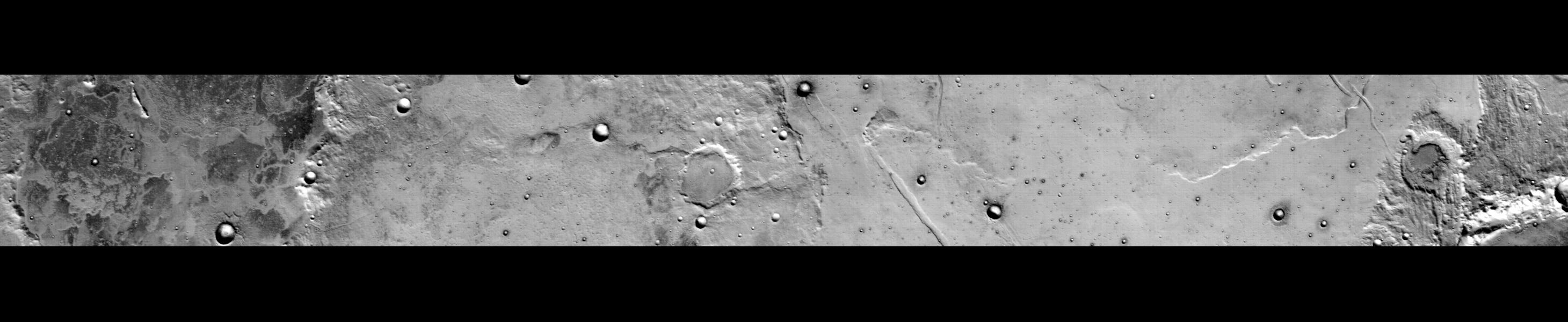
2001-10-13 |
Mars
|
Mars Global Surveyor (MGS)
|
Mars Orbiter Camera (MOC)
|
1339x2847x1 |
|
-
PIA03168:
-
Snapshot of Southern Spring Dust Storm Activity
Full Resolution:
TIFF
(1.977 MB)
JPEG
(192.2 kB)
|
|
|
2001-10-13 |
Mars
|
Mars Global Surveyor (MGS)
|
Mars Orbiter Camera (MOC)
|
522x734x3 |
|
-
PIA03169:
-
Springtime on the Martian South Polar Cap
Full Resolution:
TIFF
(954.6 kB)
JPEG
(34.89 kB)
|
|
|
2001-10-13 |
Mars
|
Mars Global Surveyor (MGS)
|
Mars Orbiter Camera (MOC)
|
6144x1536x3 |
|
-
PIA03170:
The 2001 Great Dust Storms - Hellas/Syrtis Major
Full Resolution:
TIFF
(11.1 MB)
JPEG
(376.4 kB)
|
|
|
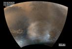
2001-10-13 |
Mars
|
Mars Global Surveyor (MGS)
|
Mars Orbiter Camera (MOC)
|
6144x1536x3 |
|
-
PIA03171:
The 2001 Great Dust Storms - Tharsis
Full Resolution:
TIFF
(11.29 MB)
JPEG
(378.3 kB)
|
|
|
2001-10-13 |
Mars
|
Mars Global Surveyor (MGS)
|
Mars Orbiter Camera (MOC)
|
1595x740x1 |

|
-
PIA03172:
-
The 2001 Great Dust Storms - Daedalia/Claritas/Syria Dust Plumes
Full Resolution:
TIFF
(743.2 kB)
JPEG
(120.8 kB)
|
|
|
2001-10-13 |
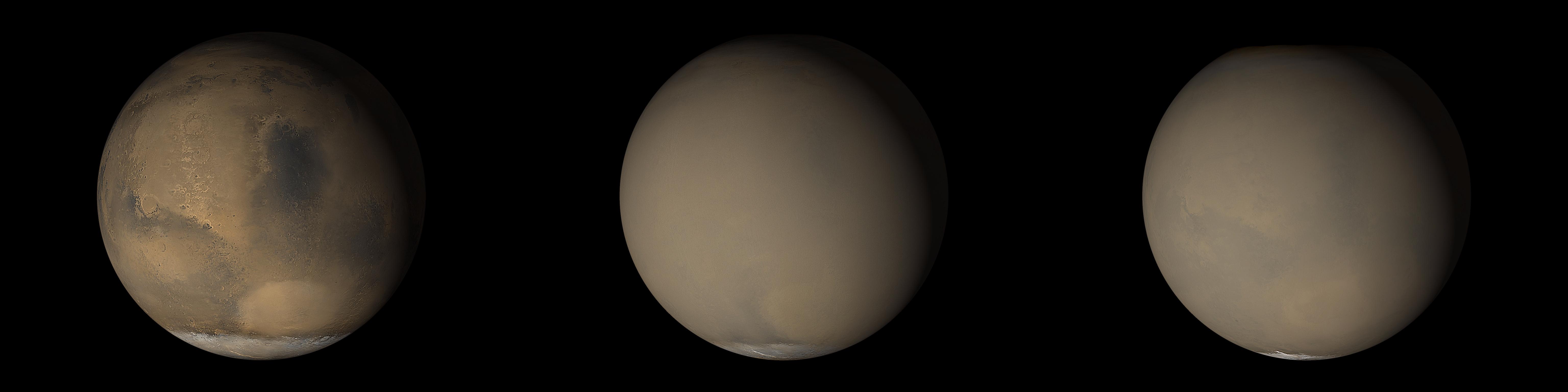
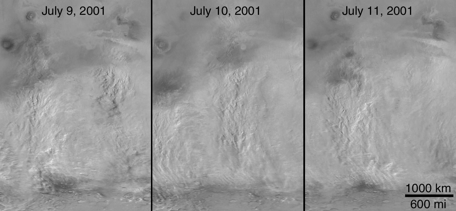
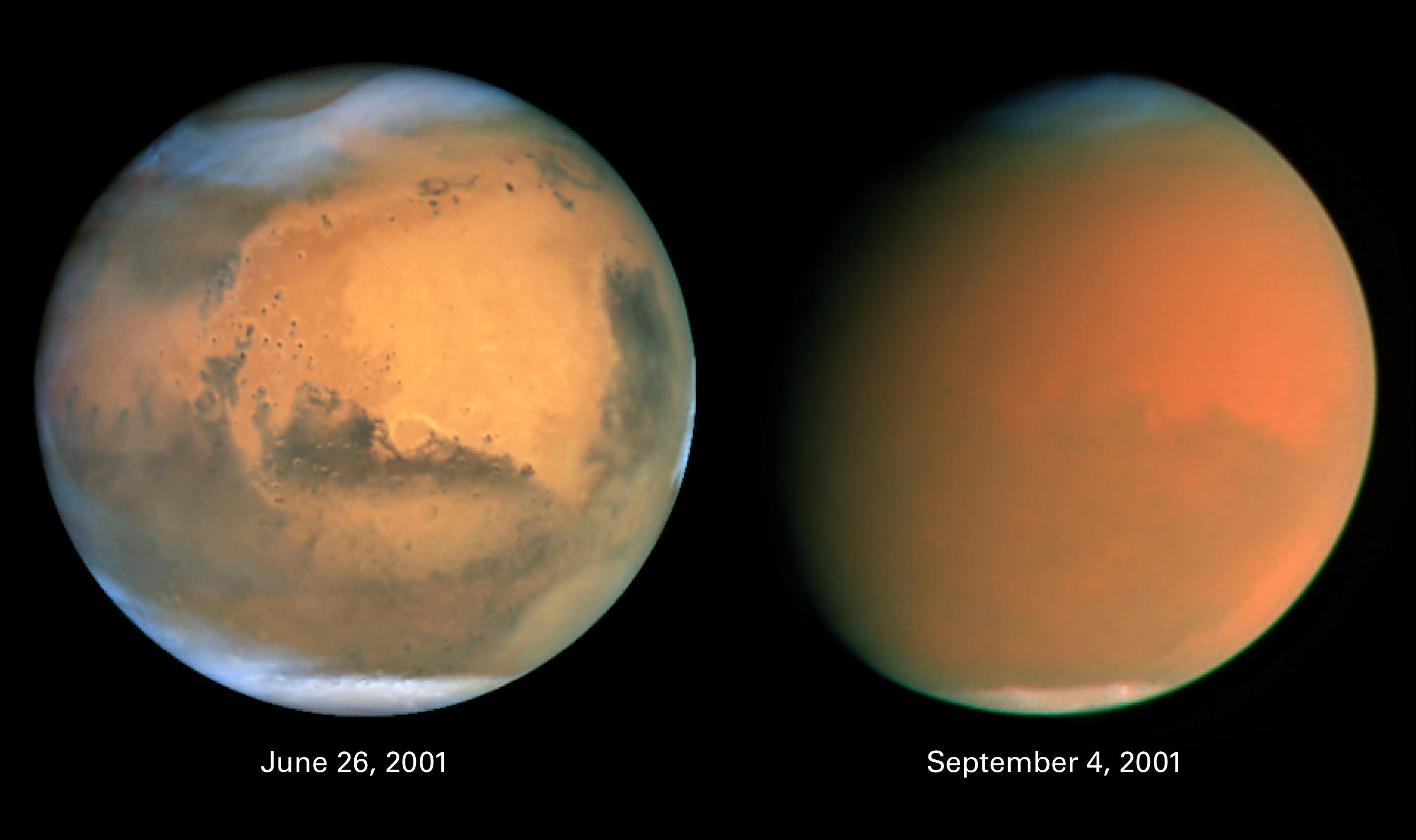
Mars
|
Hubble Space Telescope
|
WFPC2
|
2826x1677x3 |
|
-
PIA03173:
-
Scientists Track "Perfect Storm" on Mars
Full Resolution:
TIFF
(7.452 MB)
JPEG
(168.7 kB)
|
|
|
2001-10-22 |
Earth
|
Terra
|
ASTER
|
1300x1000x3 |
|
-
PIA11094:
-
Thar Desert
Full Resolution:
TIFF
(3.904 MB)
JPEG
(351.1 kB)
|
|
|
2001-10-22 |
Earth
|
Terra
|
ASTER
|
1800x2200x3 |
|
-
PIA11157:
-
Calcutta
Full Resolution:
TIFF
(11.9 MB)
JPEG
(1.91 MB)
|
|
|
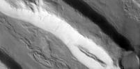
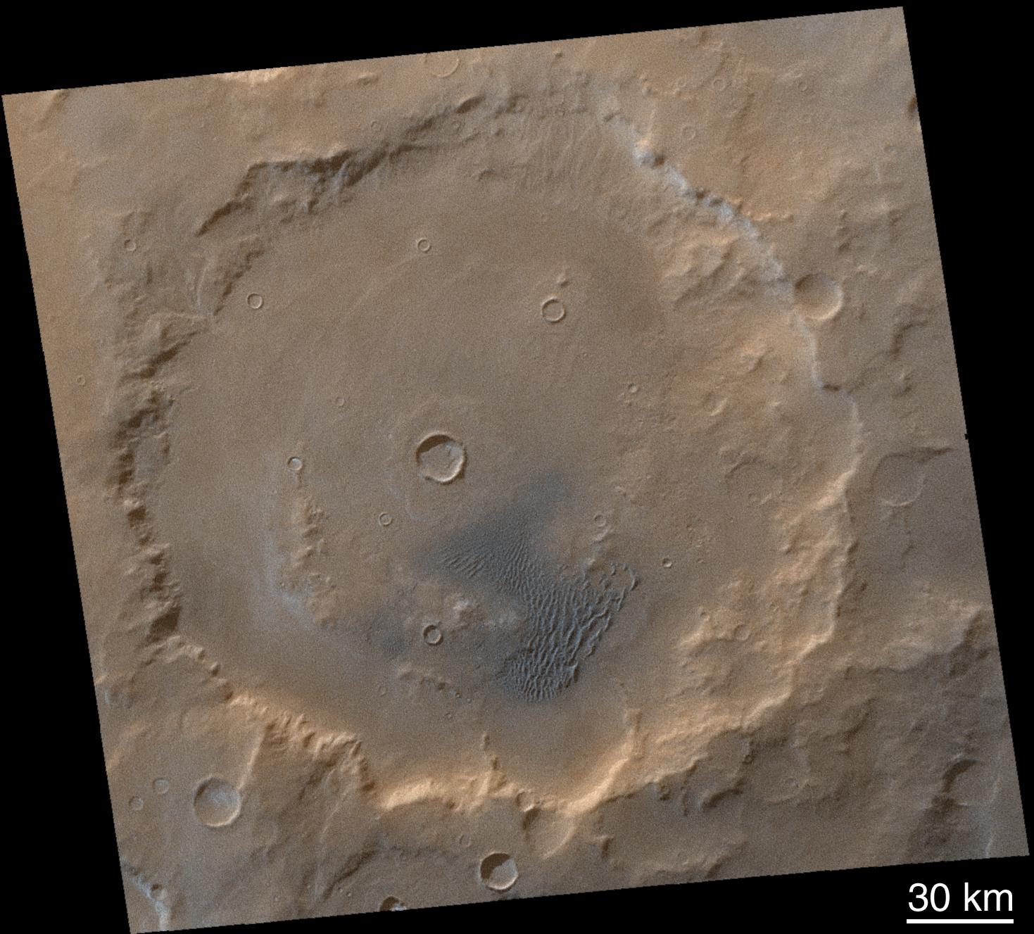
2001-10-26 |
Mars
|
Mars Global Surveyor (MGS)
|
Mars Orbiter Camera (MOC)
|
600x900x1 |

|
-
PIA03174:
-
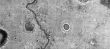
Fractures/Pits in Northern Plains (Utopia Plains: 44.9 N, 274.7 W)
Full Resolution:
TIFF
(349.4 kB)
JPEG
(190.4 kB)
|
|
|
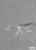
2001-10-26 |
Mars
|
Mars Global Surveyor (MGS)
|
Mars Orbiter Camera (MOC)
|
492x900x1 |

|
-
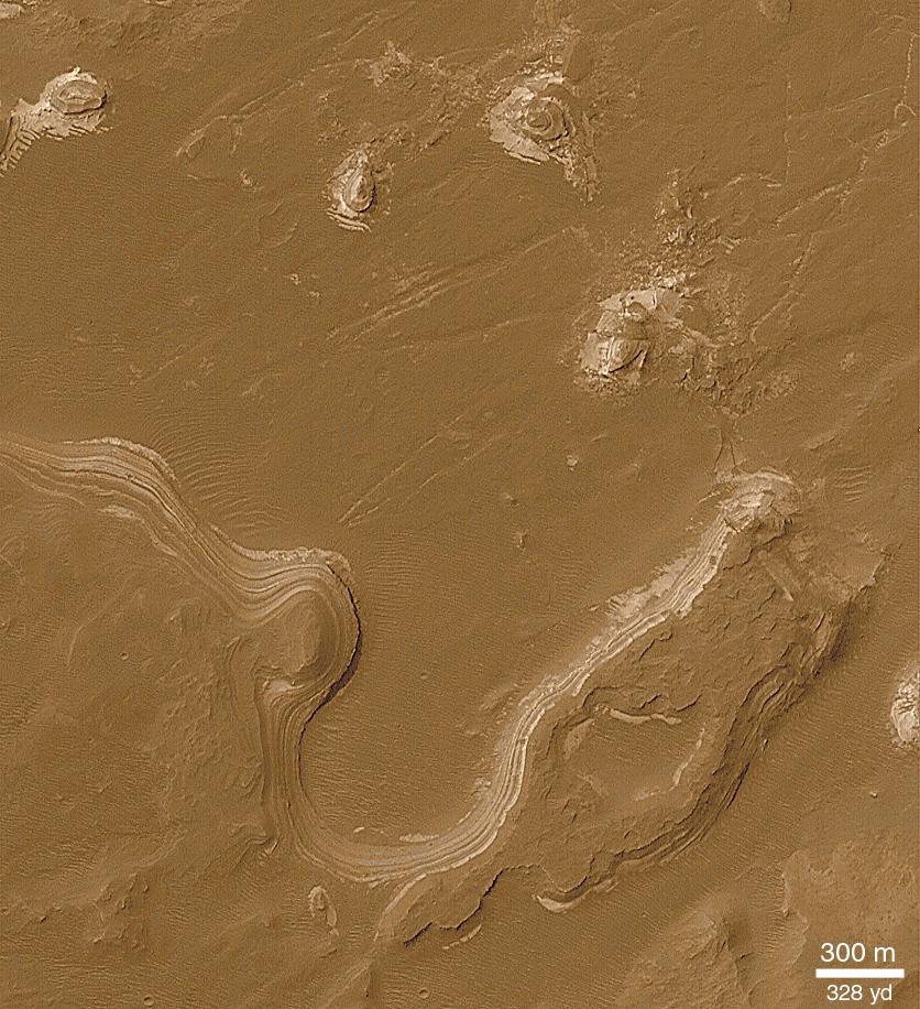
PIA03175:
-
Toe of Ganges Chasma Landslide ( 8.0 S, 44.4W)
Full Resolution:
TIFF
(256.8 kB)
JPEG
(129.7 kB)
|
|
|
2001-10-26 |
Mars
|
Mars Global Surveyor (MGS)
|
Mars Orbiter Camera (MOC)
|
600x900x1 |

|
-
PIA03176:
-
Dunes in Herschel Crater (Herschel Crater: 15.7 S, 228.8 W)
Full Resolution:
TIFF
(276.1 kB)
JPEG
(126.1 kB)
|
|
|
2001-10-31 |
Mars
|
Mars Global Surveyor (MGS)
|
Mars Orbiter Camera (MOC)
|
595x900x1 |
|
-
PIA03177:
-
Ancient Layered Rocks in Schiaparelli Crater
Full Resolution:
TIFF
(250.6 kB)
JPEG
(116 kB)
|
|
|
2001-11-09 |
Mars
|
2001 Mars Odyssey
|
THEMIS
|
1990x2192x3 |

|
-
PIA03459:
-
First THEMIS Image of Mars
Full Resolution:
TIFF
(3.93 MB)
JPEG
(262.9 kB)
|
|
|
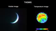
2001-11-13 |
Mars
|
2001 Mars Odyssey
|
THEMIS
|
3658x2671x3 |
|
-
PIA03461:
-
First THEMIS Infrared and Visible Images of Mars
Full Resolution:
TIFF
(4.385 MB)
JPEG
(645.9 kB)
|
|
|
2001-11-21 |
Earth
|
Terra
|
MISR
|
1940x1200x3 |
|
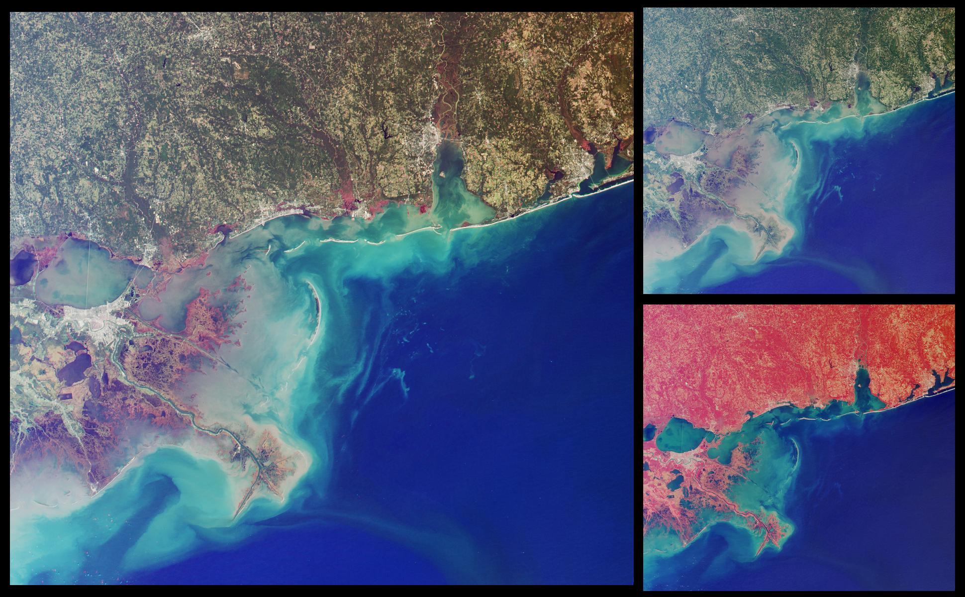
-
PIA03432:
-
Wetlands of the Gulf Coast
Full Resolution:
TIFF
(6.322 MB)
JPEG
(383.9 kB)
|
|
|
2001-11-21 |
Mars
|
Mars Global Surveyor (MGS)
|
Mars Orbiter Camera (MOC)
|
336x809x1 |
|
-
PIA03178:
-
MOC's 100,000th Image
Full Resolution:
TIFF
(183.5 kB)
JPEG
(44.18 kB)
|
|
|
2001-12-11 |
Mars
|
Mars Global Surveyor (MGS)
|
Mars Orbiter Camera (MOC)
|
2421x3220x3 |
|
-
PIA03180:
-
MOC View of the Martian South Polar Residual Cap
Full Resolution:
TIFF
(16.51 MB)
JPEG
(1.335 MB)
|
|
|
2001-12-11 |
Mars
|
Mars Global Surveyor (MGS)
|
Mars Orbiter Camera (MOC)
|
1048x524x1 |
|
-
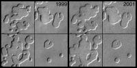
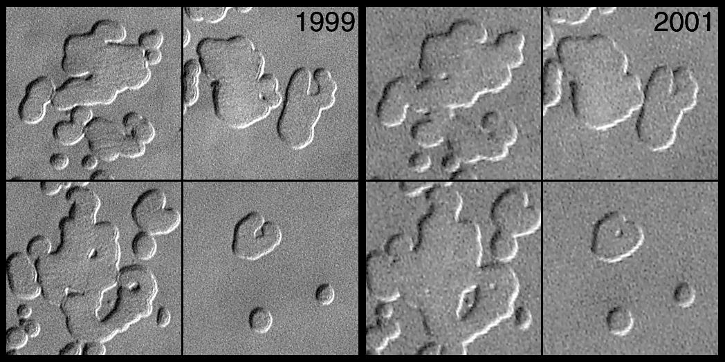
PIA03179:
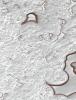
-
MOC Observes Changes in the South Polar Cap: Evidence for Recent Climate Change on Mars
Full Resolution:
TIFF
(515.7 kB)
JPEG
(117.9 kB)
|
|
|
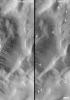
2002-02-16 |
Mars
|
Mars Global Surveyor (MGS)
|
Mars Orbiter Camera (MOC)
|
2000x1288x1 |
|
-
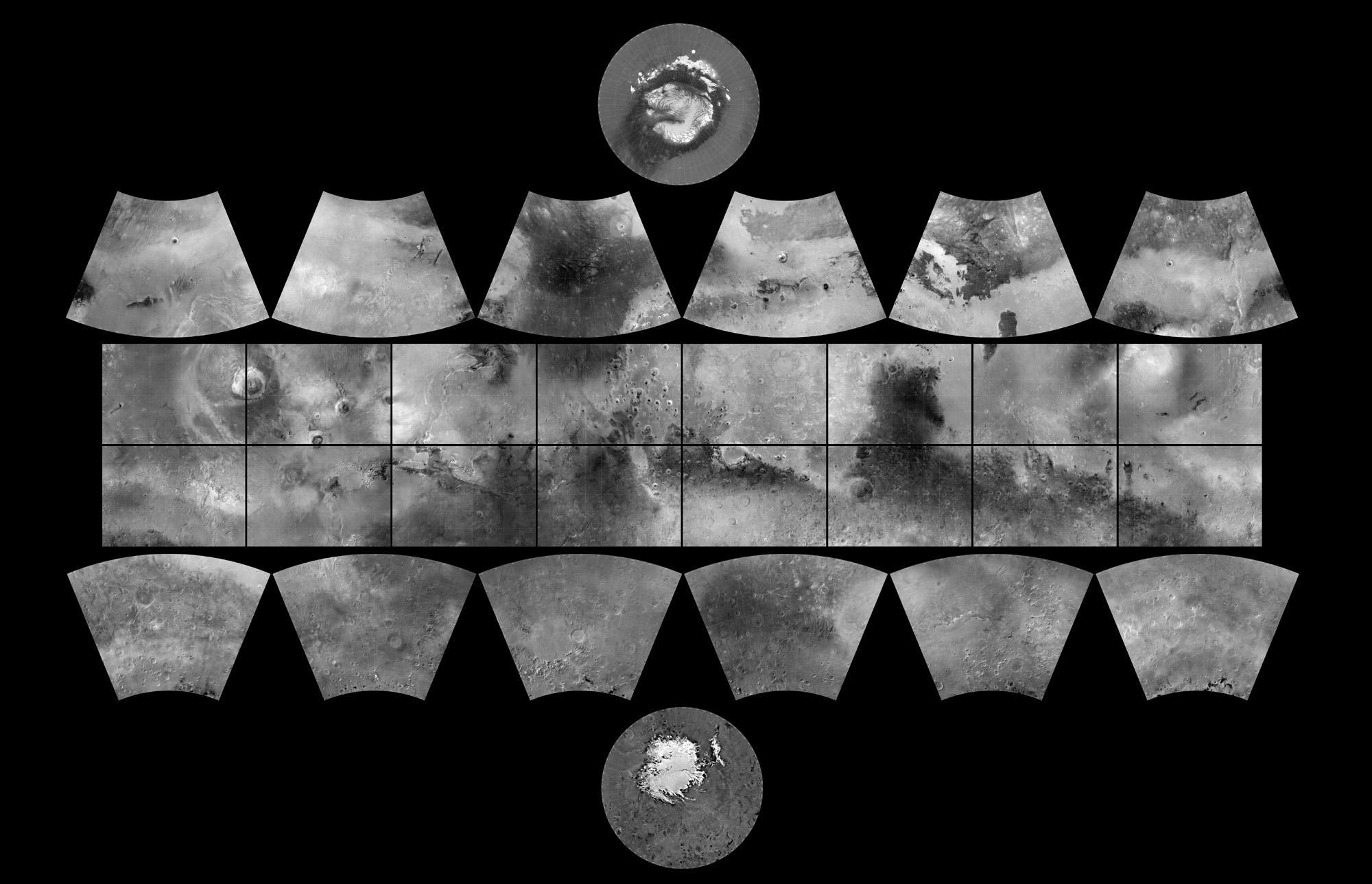
PIA03467:
-
The MGS MOC Wide Angle Map of Mars
Full Resolution:
TIFF
(1.242 MB)
JPEG
(216.9 kB)
|
|
|
2002-02-16 |
Mars
|
Mars Global Surveyor (MGS)
|
Mars Orbiter Camera (MOC)
|
3911x744x1 |

|
-
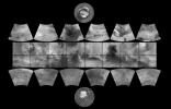
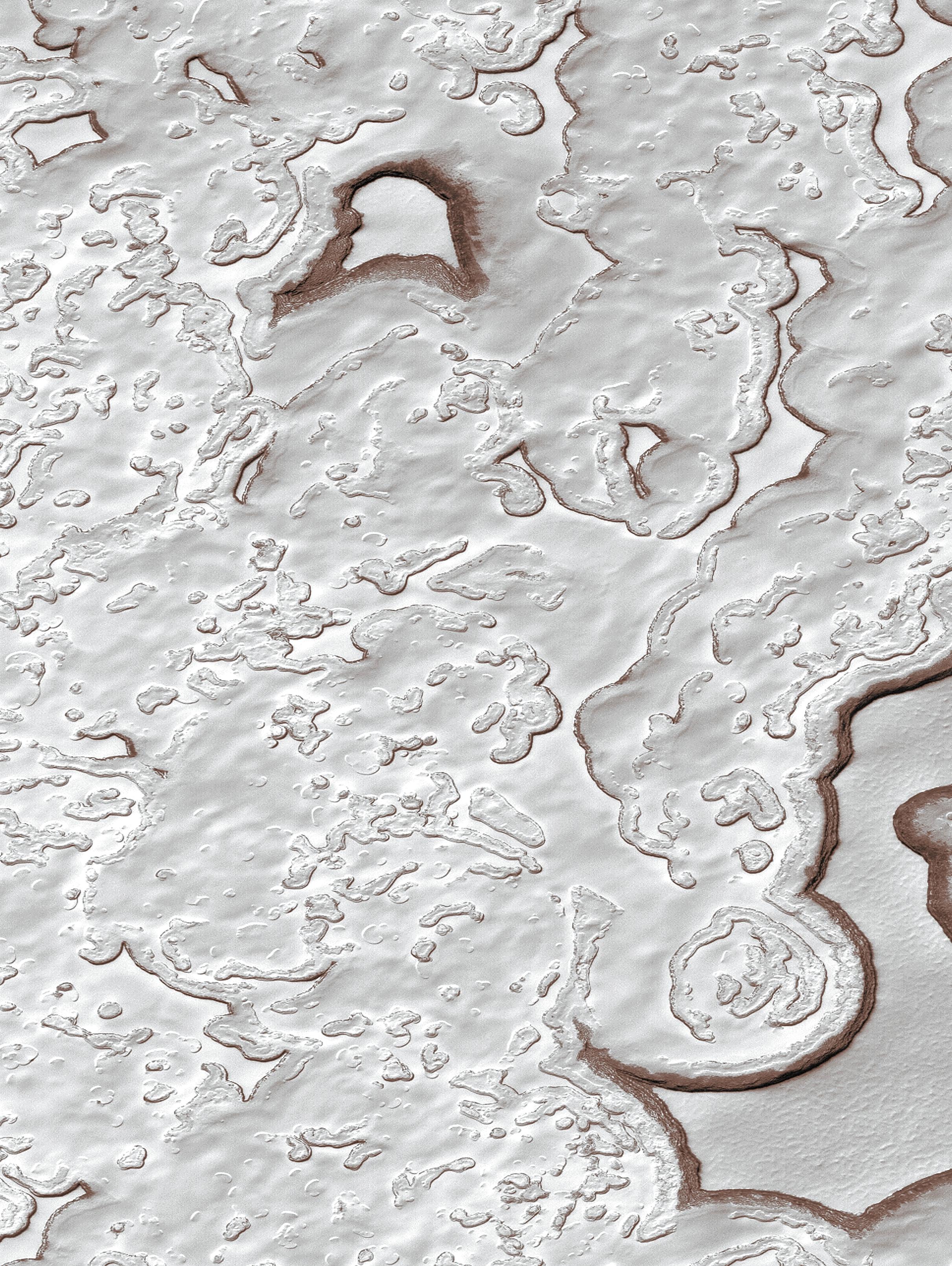
PIA03468:
MGS MOC Extended Mission View of North Polar Layers
Full Resolution:
TIFF
(2.44 MB)
JPEG
(343.1 kB)
|
|
|
2002-02-16 |
Mars
|
Mars Global Surveyor (MGS)
|
Mars Orbiter Camera (MOC)
|
3889x2958x1 |

|
-
PIA03469:
-
Fresh Impact Crater and Rays in Tharsis
Full Resolution:
TIFF
(7.301 MB)
JPEG
(828.3 kB)
|
|
|
2002-02-16 |
Mars
|
Mars Global Surveyor (MGS)
|
Mars Orbiter Camera (MOC)
|
838x838x3 |
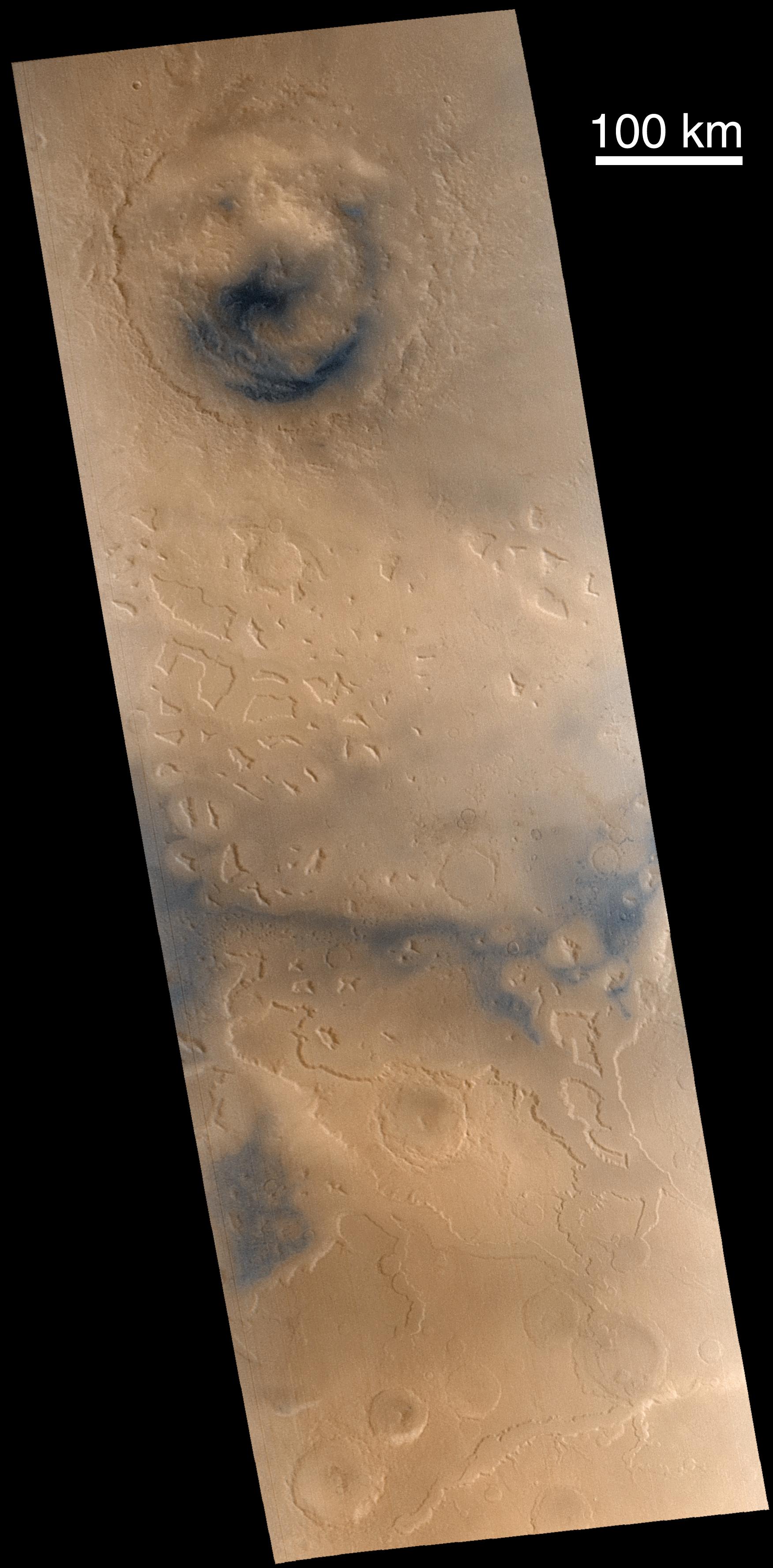
|
-
PIA03470:
-
Arsia Mons Spiral Cloud
Full Resolution:
TIFF
(1.393 MB)
JPEG
(36.53 kB)
|
|
|
2002-02-16 |
Mars
|
Mars Global Surveyor (MGS)
|
Mars Orbiter Camera (MOC)
|
1200x1868x1 |
|
-
PIA03471:
-
Changes in South Polar Carbon Dioxide Ice Cap
Full Resolution:
TIFF
(1.796 MB)
JPEG
(306 kB)
|
|
|
2002-02-16 |
Mars
|
Mars Global Surveyor (MGS)
|
Mars Orbiter Camera (MOC)
|
4377x480x3 |
|
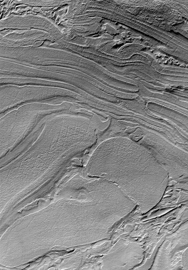
-
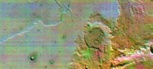
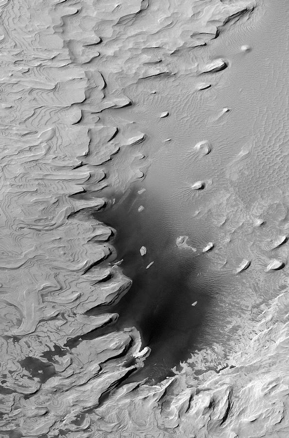
PIA03472:
Stereo View of Layer Outcrops in Iani Chaos
Full Resolution:
TIFF
(6.625 MB)
JPEG
(428.8 kB)
|
|
|
2002-03-01 |
Mars
|
2001 Mars Odyssey
|
Mars Radiation Experiment
|
3000x2400x3 |
|
-
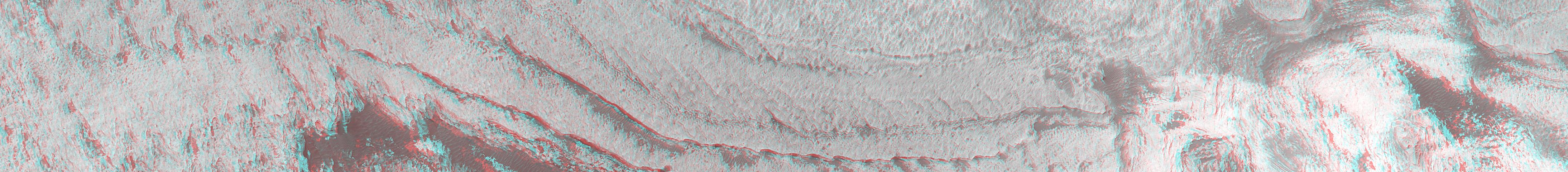
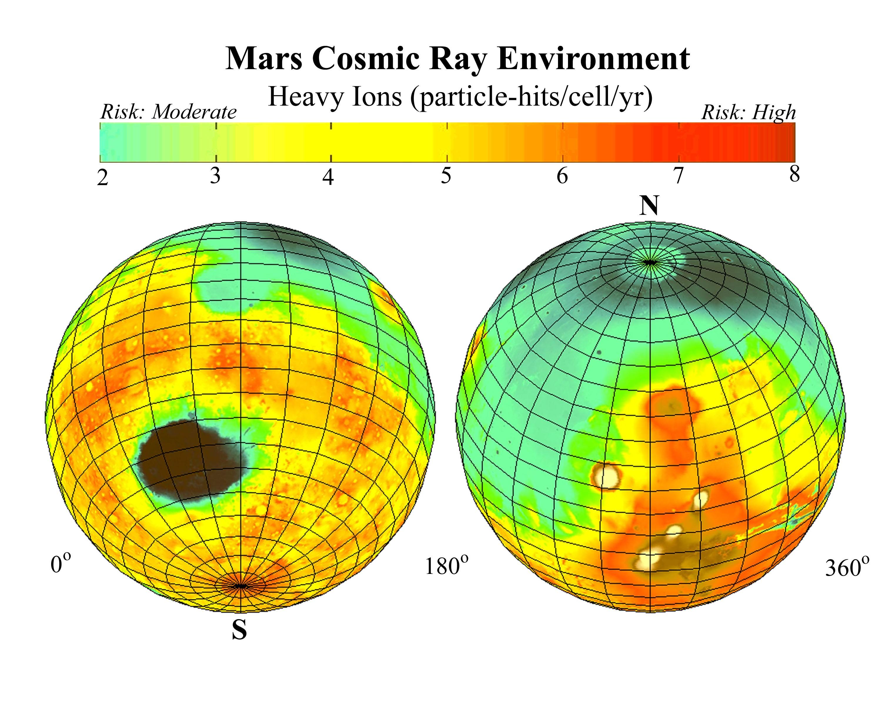
PIA03479:
-
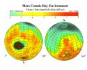
Estimated Radiation on Mars, Hits per Cell Nucleus
Full Resolution:
TIFF
(9.078 MB)
JPEG
(628.5 kB)
|
|
|
2002-03-01 |
Mars
|
2001 Mars Odyssey
|
Mars Radiation Experiment
|
3000x2400x3 |

|
-
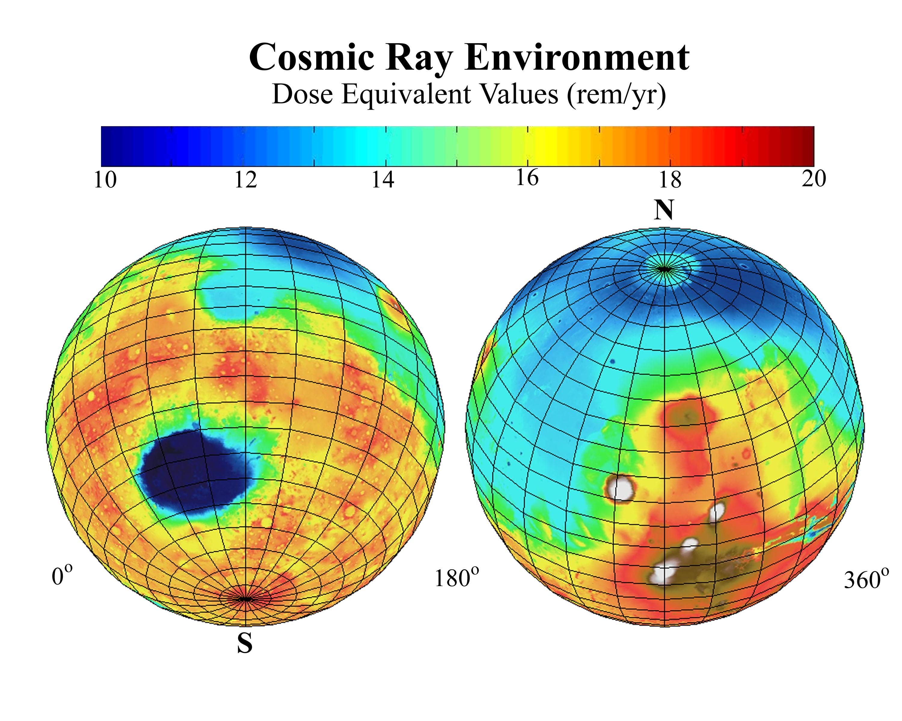
PIA03480:
-
Estimated Radiation Dosage on Mars
Full Resolution:
TIFF
(10.13 MB)
JPEG
(625.5 kB)
|
|
|
2002-03-01 |
Mars
|
2001 Mars Odyssey
|
THEMIS
|
697x314x1 |
|
-
PIA03482:
-
Channel at Night in Thermal Infrared
Full Resolution:
TIFF
(223.6 kB)
JPEG
(54.94 kB)
|
|
|
2002-03-01 |
Mars
|
2001 Mars Odyssey
|
THEMIS
|
2920x600x1 |
|
-
PIA03483:
Daytime Infrared, Terra Sirenum
Full Resolution:
TIFF
(527.2 kB)
JPEG
(165.6 kB)
|
|
|
2002-03-01 |
Mars
|
2001 Mars Odyssey
|
THEMIS
|
665x302x3 |
|
-
PIA03484:
-
Color Infrared, Terra Sirenum
Full Resolution:
TIFF
(780.3 kB)
JPEG
(60.56 kB)
|
|
|
2002-03-01 |
Mars
|
2001 Mars Odyssey
|
THEMIS
|
1063x320x1 |
|
-
PIA03485:
-
Hydaspis Chaos in Nighttime Infrared
Full Resolution:
TIFF
(375.6 kB)
JPEG
(65.8 kB)
|
|
|
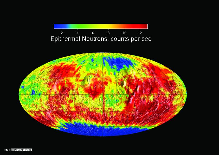
2002-03-01 |
Mars
|
2001 Mars Odyssey
|
Gamma Ray Spectrometer Suite
|
842x595x3 |

|
-
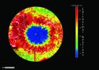
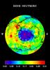
PIA03486:
-
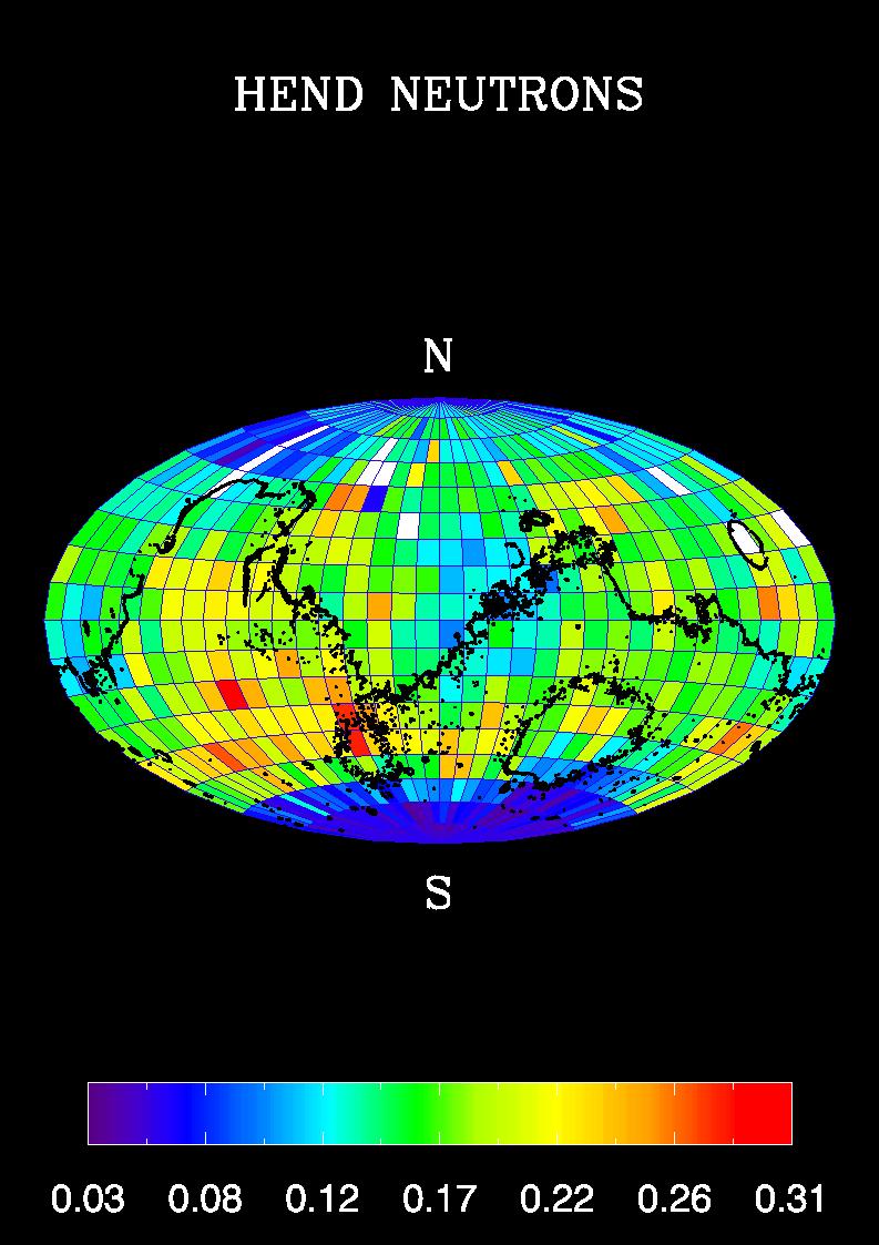
Global Neutron View
Full Resolution:
TIFF
(579.3 kB)
JPEG
(80.85 kB)
|
|
|
2002-03-01 |
Mars
|
2001 Mars Odyssey
|
Gamma Ray Spectrometer Suite
|
842x595x3 |
|
-
PIA03487:
-
South Pole Neutron View
Full Resolution:
TIFF
(581.8 kB)
JPEG
(80.74 kB)
|
|
|
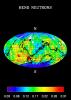
2002-03-01 |
Mars
|
2001 Mars Odyssey
|
Gamma Ray Spectrometer Suite
|
793x1123x3 |
|
-
PIA03488:
-
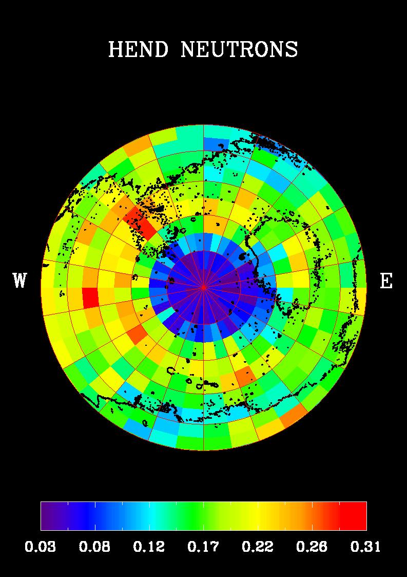
Southern Hemisphere Neutron Map
Full Resolution:
TIFF
(90.83 kB)
JPEG
(131.3 kB)
|
|
|
2002-03-05 |
Mars
|
2001 Mars Odyssey
|
THEMIS
|
952x474x1 |
|
-
PIA03481:
-
Acheron Fossae in Visible Light
Full Resolution:
TIFF
(391.5 kB)
JPEG
(62.4 kB)
|
|
|
2002-03-06 |
Mars
|
2001 Mars Odyssey
|
Gamma Ray Spectrometer Suite
|
793x1123x3 |
|
-
PIA03489:
-
Global Map, High-Energy Neutrons
Full Resolution:
TIFF
(88.48 kB)
JPEG
(141.2 kB)
|
|
|
2002-04-23 |
Mars
|
Mars Global Surveyor (MGS)
|
Mars Orbiter Camera (MOC)
|
933x1689x3 |
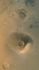
|
-
PIA03750:
-
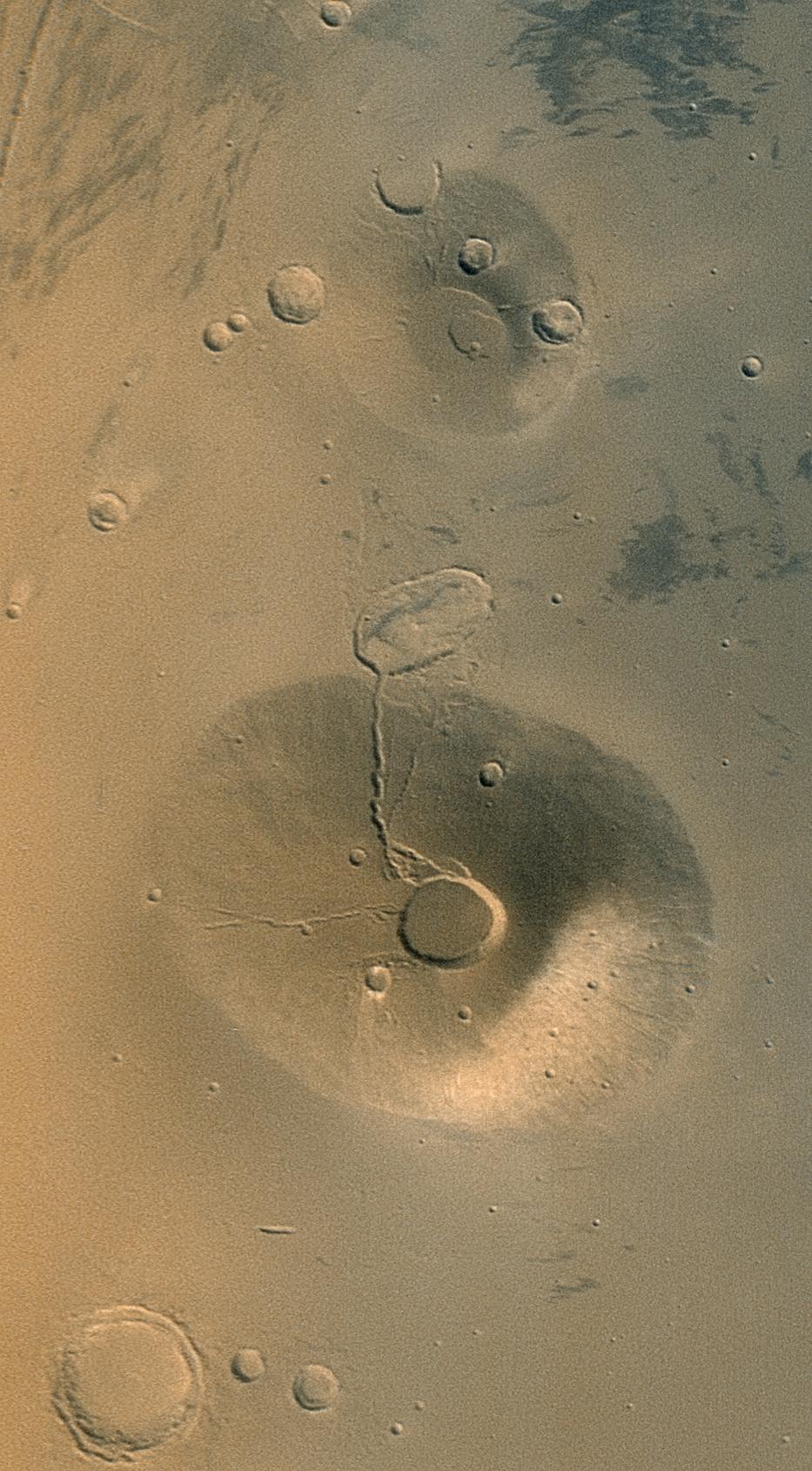
Volcanoes Ceraunius Tholus and Uranius Tholus
Full Resolution:
TIFF
(5.031 MB)
JPEG
(269.5 kB)
|
|
|
2002-04-23 |
Mars
|
Mars Global Surveyor (MGS)
|
Mars Orbiter Camera (MOC)
|
836x1051x1 |
|
-
PIA03751:
-
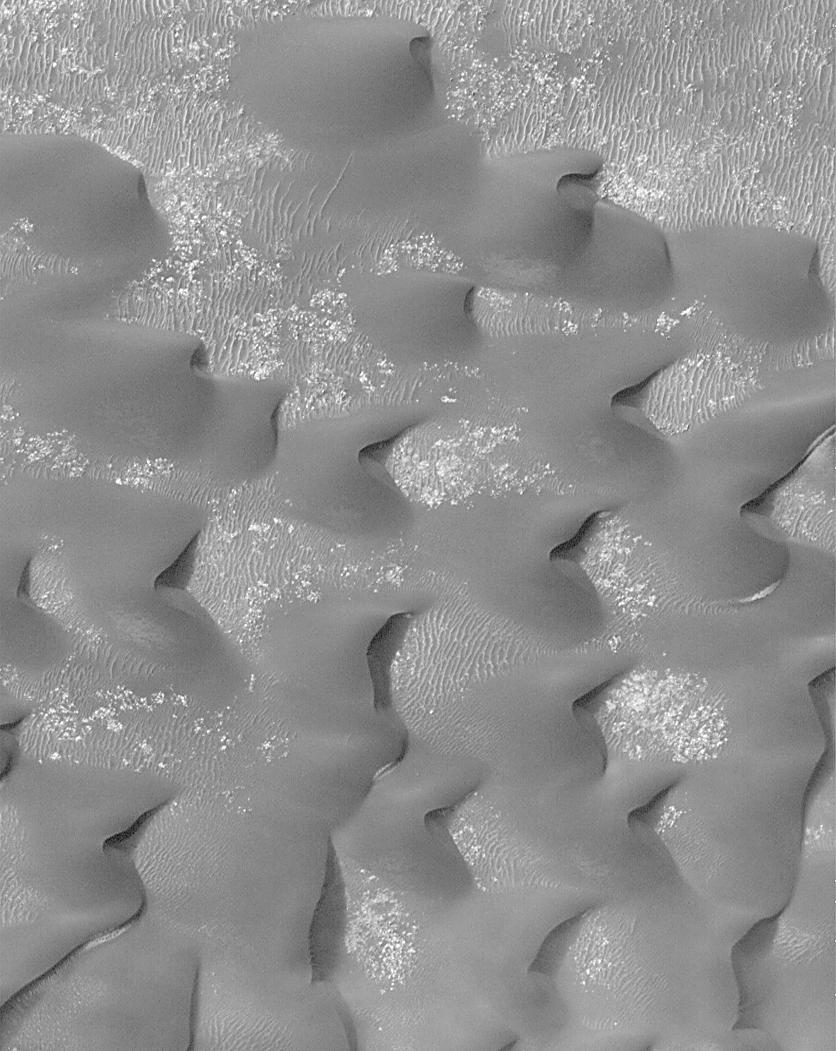
Sand Dunes in Kaiser Crater
Full Resolution:
TIFF
(796.8 kB)
JPEG
(130.2 kB)
|
|
|
2002-04-23 |
Mars
|
Mars Global Surveyor (MGS)
|
Mars Orbiter Camera (MOC)
|
768x2476x1 |
|
-
PIA03752:
-
Mesas and troughs in Nilosyrtis region, Mars
Full Resolution:
TIFF
(1.979 MB)
JPEG
(346.3 kB)
|
|
|
2002-04-23 |
Mars
|
Mars Global Surveyor (MGS)
|
Mars Orbiter Camera (MOC)
|
836x878x1 |
|
-
PIA03753:
-
Gullies and Streaks on Crater wall Kaiser
Full Resolution:
TIFF
(730.2 kB)
JPEG
(133 kB)
|
|
|
2002-04-23 |
Mars
|
Mars Global Surveyor (MGS)
|
Mars Orbiter Camera (MOC)
|
1024x1070x1 |
|
-
PIA03754:
-
Gullies and Layers in Crater Wall in Newton
Full Resolution:
TIFF
(1.134 MB)
JPEG
(227.8 kB)
|
|
|
2002-04-23 |
Mars
|
Mars Global Surveyor (MGS)
|
Mars Orbiter Camera (MOC)
|
2560x1024x3 |
|
-
PIA03755:
-
Global Views of Mars in late Northern Summer
Full Resolution:
TIFF
(2.993 MB)
JPEG
(129.4 kB)
|
|
|
2002-04-25 |
Mars
|
2001 Mars Odyssey
|
THEMIS
|
1212x3061x1 |
|
-
PIA03756:
-
Nirgal Vallis (Released 27 March 2002)
Full Resolution:
TIFF
(1.766 MB)
JPEG
(501.7 kB)
|
|
|
2002-05-07 |
Mars
|
Mars Global Surveyor (MGS)
|
Mars Orbiter Camera (MOC)
|
549x2174x1 |

|
-
PIA03777:
-
Erosion of North Polar Layers and Genesis of nearby Sand Dunes
Full Resolution:
TIFF
(996.6 kB)
JPEG
(135.8 kB)
|
|
|
2002-05-07 |
Mars
|
Mars Global Surveyor (MGS)
|
Mars Orbiter Camera (MOC)
|
1359x2266x3 |
|
-
PIA03778:
-
Northern Terra Meridiani's "Monument Valley"
Full Resolution:
TIFF
(8.969 MB)
JPEG
(467.3 kB)
|
|
|
2002-05-07 |
Mars
|
Mars Global Surveyor (MGS)
|
Mars Orbiter Camera (MOC)
|
836x1441x1 |
|
-
PIA03779:
-
Nirgal Vallis and its Windblown Dunes
Full Resolution:
TIFF
(1.199 MB)
JPEG
(215.2 kB)
|
|
|
2002-05-07 |
Mars
|
Mars Global Surveyor (MGS)
|
Mars Orbiter Camera (MOC)
|
3005x2004x3 |
|
-
PIA03780:
-
Nirgal Vallis and its Windblown Dunes
Full Resolution:
TIFF
(8.546 MB)
JPEG
(373.6 kB)
|
|
|
2002-05-21 |
Mars
|
2001 Mars Odyssey
|
THEMIS
|
1183x3061x1 |
|
-
PIA03757:
-
Gullied Craters 41�S
Full Resolution:
TIFF
(1.722 MB)
JPEG
(400.2 kB)
|
|
|
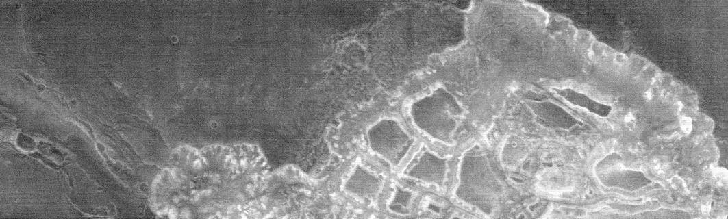
2002-05-21 |
Mars
|
2001 Mars Odyssey
|
THEMIS
|
1238x3043x1 |
|
-
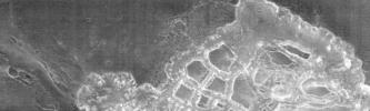
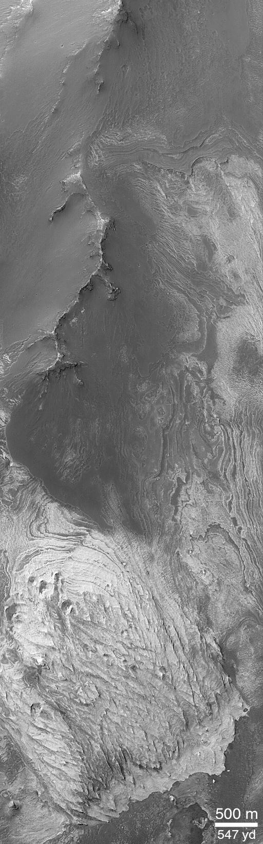
PIA03758:
-
Layered Deposits on the floor of Ganges Chasma
Full Resolution:
TIFF
(1.774 MB)
JPEG
(456.8 kB)
|
|
|
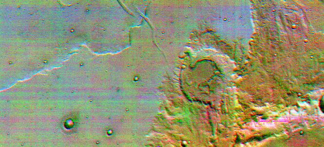
2002-05-21 |
Mars
|
2001 Mars Odyssey
|
THEMIS
|
1237x3043x1 |
|
-
PIA03759:
-
Ganges Chasma Landslide
Full Resolution:
TIFF
(1.716 MB)
JPEG
(465.6 kB)
|
|
|
2002-05-21 |
Mars
|
2001 Mars Odyssey
|
THEMIS
|
1235x3025x1 |
|
-
PIA03760:
-
Rim of Henry Crater
Full Resolution:
TIFF
(1.495 MB)
JPEG
(322.6 kB)
|
|
|
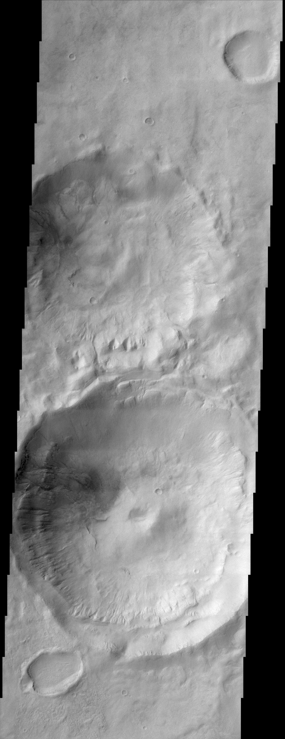
2002-05-21 |
Mars
|
2001 Mars Odyssey
|
THEMIS
|
1236x3025x1 |

|
-
PIA03761:
-
Isidis Rim
Full Resolution:
TIFF
(2.351 MB)
JPEG
(567.3 kB)
|


