Your search criteria found
14967
images
Feature Name
Go to PIAxxxxx:
Refine this list of images by:
Target:
2010 AB78
2014 MU69
55 Cancri
Annefrank
Asteroid
C/2008 Q3 (Garradd)
Callisto
Ceres
Charon
Comet
Deimos
Earth
Encke
Eros
Europa
Ganymede
Gaspra
HD 172555
HD 69830
Hydra
ISON
Iapetus
Ida
Io
Jupiter
Kleopatra
Kuiper Belt Object
Mars
Masursky
Mercury
Mira
Moon
Pan
Phobos
Phoebe
Pluto
S Rings
Saturn
Sedna
Sky
Solar System
Sun
Titan
Triton
Venus
Vesta
Mission:
2001 Mars Odyssey
Airborne Synthetic Aperture Radar (AIRSAR)
Antarctic Meteorite Location and Mapping Project (AMLAMP)
Aqua
Asteroid Redirect Mission (ARM)
Cassini-Huygens
Cooperative Autonomous Distributed Robotic Exploration (CADRE)
Dawn
Deep Impact
Deep Space 1 (DS1)
Deep Space Network (DSN)
DuAxel Project
Europa Clipper
ExoMars
Galaxy Evolution Explorer (GALEX)
Galileo
Goldstone Deep Space Network (DSN)
Gravity Recovery and Interior Laboratory (GRAIL)
Herschel Space Observatory
Hubble Space Telescope
ISS EarthKAM
InSight
International Space Station (ISS)
Juno
Kepler
Landsat
Low-Density Supersonic Decelerator Project (LDSD)
Lunar Flashlight
Lunar Reconnaissance Orbiter (LRO)
Lunar Trailblazer
MAVEN
MESSENGER
Magellan
Mariner Mars 1964 (Mariner 4)
Mariner Mars 1969 (Mariner 7)
Mariner Mars 1971 (Mariner 9)
Mars 2020
Mars 2020 Project
Mars 2020 Rover
Mars Atmosphere and Volatile Evolution MissioN (MAVEN)
Mars Climate Orbiter
Mars Cube One (MarCO)
Mars Exploration Rover (MER)
Mars Express (MEX)
Mars Global Surveyor (MGS)
Mars Helicopter
Mars Pathfinder (MPF)
Mars Reconnaissance Orbiter (MRO)
Mars Sample Return
Mars Sample Return (MSR)
Mars Science Helicopter
Mars Science Laboratory (MSL)
Mars Telecommunications Orbiter (MTO)
Mars Volcanic Emission Life Scout (MARVEL)
NEAR Shoemaker
NEO Surveyor
NEOWISE Project
New Horizons
NuSTAR
Phoenix
PlanetQuest
Psyche
Rosetta
Simplified High Impact Energy Landing Device (SHIELD)
Solar Dynamics Observatory (SDO)
Spaceborne Imaging Radar-C/X-Band Synthetic Aperture Radar
Spitzer Space Telescope
Stardust
Surface Water and Ocean Topography (SWOT)
Terra
VERITAS
Viking
Voyager
Wide-field Infrared Survey Explorer (WISE)
Spacecraft:
2001 Mars Odyssey
Aqua
Arecibo Observatory
Cassini Orbiter
Curiosity
Dawn
Deep Impact
Deep Space 1
Europa Clipper
Field Experiment
GALEX Orbiter
GRAIL Spacecraft
Galileo Orbiter
InSight Mars Lander
Ingenuity
Juno
Lunar Reconnaissance Orbiter (LRO)
MAVEN
MESSENGER
Magellan
MarCO-B
Mariner 4
Mariner 7
Mariner 9
Mars 2020 Rover
Mars Climate Orbiter
Mars Express (MEX)
Mars Express (MEX) Orbiter
Mars Global Surveyor Orbiter
Mars Pathfinder Lander
Mars Pathfinder Rover
Mars Reconnaissance Orbiter (MRO)
Mars Sample Return
Mars Science Laboratory (MSL)
Mars Telecommunications Orbiter (MTO)
Mars Volcanic Emission Life Scout (MARVEL)
NASA DC-8 Aircraft
NASA's Mars Pathfinder Lander
NEAR Shoemaker
NEO Surveyor
New Horizons
New Horizons Spacecraft
NuSTAR
Opportunity
Perseverance
Philae Lander
Phoenix Lander
Phoenix Mars Lander
Psyche
Rosetta
SWOT
SmallSat
Space Shuttle
Spirit
Stardust
Terra
Viking Lander 1
Viking Lander 2
Viking Orbiter 1
Viking Orbiter 2
Voyager 1
Voyager 2
WISE
Xombie
Instrument:
Advanced Spaceborne Thermal Emission and Reflection Radiometer (ASTER)
AirSAR
Alice Ultraviolet Spectrometer (UVS)
Alpha Particle X-ray Spectrometer
Alpha Particle X-ray Spectrometer (MSL)
Atmosphere Imaging Assembly (AIA)
Atmospheric Infrared Sounder (AIRS)
Atmospheric Structure / Meteorology Instrument
CHIMRA
Camera 1
Camera 2
Capture Magnet
Chemistry & Mineralogy (CheMin)
Chemistry and Camera (ChemCam)
Cold Operable Lunar Deployable Arm (COLDArm)
Comet Infrared and Visible Analyser (CIVA
Compact Reconnaissance Imaging Spectrometer for Mars (CRISM)
Context Camera (CTX)
Deep Space Network
Deep Space Network Antenna
Deep Space Optical Communications (DSOC)
Deep Space Station 14
Descent Image Motion Estimation System (DIMES)
Diviner
Dynamic Albedo of Neutrons
Dynamic Albedo of Neutrons (DAN)
Electra Relay Radio
Electronic Still Camera
ExoMars Trace Gas Orbiter
Faint Object Camera
Framing Camera
Gamma Ray Spectrometer - Neutron Spectrometer
Gamma Ray Spectrometer Suite
Gamma Ray and Neutron Spectrometer (GRNS)
Gamma-Ray and Neutron Spectrometer (GRNS)
Hazard Avoidance Camera
Hazard Avoidance Camera (M2020)
Hazard Avoidance Camera (MSL)
Heat and Physical Properties Package (HP3)
High Resolution Imaging Science Experiment (HiRISE)
High Resolution Instrument (HRI)
High Resolution Stereo Camera
High-resolution Volatiles and Minerals Moon Mapper (HVM³)
Imager for Mars Pathfinder
Imaging Science Subsystem
Imaging Science Subsystem - Narrow Angle
Imaging Science Subsystem - Wide Angle
Imaging Ultraviolet Spectrograph
Imaging Ultraviolet Spectrograph (IUVS)
Infrared Telescope
Instrument Context Camera (ICC)
Instrument Deployment Camera (IDC)
Ion Engine
JIRAM
Jovian Infrared Auroral Mapper (JIRAM)
JunoCam
Lander Vision System (LVS)
Lander Vision System Camera (LCAM)
Linear Etalon Infrared Spectral Imager (LEISA)
Long Range Reconnaissance Imager (LORRI)
Lunar Orbit Laser Altimeter
Lunar Orbiter Laser Altimeter
Lunar Reconnaissance Orbiter Camera (NAC)
Lunar Thermal Mapper (LTM)
Magnetometer
Magnetometer (MAG)
Mars Advanced Radar for Subsurface and Ionosphere Sounding (MARSIS)
Mars Advanced Radar for Subsurface and Ionospheric Sounding (MARSIS)
Mars Climate Sounder (MCS)
Mars Color Imager (MARCI)
Mars Descent Imager
Mars Environmental Dynamics Analyzer (MEDA)
Mars Hand Lens Imager (MAHLI)
Mars Horizon Sensor Assembly
Mars Orbiter Camera (MOC)
Mars Orbiter Laser Altimeter
Mars Oxygen In-Situ Resource Utilization Experiment (MOXIE)
Mars Radiation Experiment
Mars Volcanic Emission Life Scout (MARVEL)
Mastcam
Mastcam-Z
Medium Resolution Instrument (MRI)
Mercury Dual Imaging System - Narrow Angle
Mercury Dual Imaging System - Wide Angle
Mercury Laser Altimeter (MLA)
Microscopic Imager
Microscopy Electrochemistry and Conductivity Analyzer (MECA)
Microwave Radiometer (MWR)
Miniature Thermal Emission Spectrometer
Moessbauer Spectrometer
MoonKAM
Multi-Spectral Imager
Multi-angle Imaging SpectroRadiometer (MISR)
Multiband Imaging Photometer (MIPS)
Multispectral Visible Imaging Camera (MVIC)
NEOWISE Telescope
Navigation Camera
Navigation Camera (M2020)
Navigation Camera (MSL)
Near-InfraRed Imager (NIRI)
Neutral Gas and Ion Mass Spectrometer
Neutron Spectrometer
OSIRIS
Optical Microscope
Optical Navigation Camera
Optical PAyload for Lasercomm Science (OPALS)
PIXL
Panoramic Camera
Parachute Deployment Device
Planetary Instrument for X-RAY Lithochemistry (PIXL)
Planetary Instrument for X-ray Lithochemistry (PIXL)
Radar Imager for Mars' Subsurface Experiment (RIMFAX)
Radar System
Radiation Assessment Detector (RAD)
Radio Science Subsystem
Radio Telescope
Ralph Color Imager
Robotic Arm
Robotic Arm (MSL)
Robotic Arm Camera
Robotic Arm Camera (RAC)
Rock Abrasion Tool (RAT)
Rover Cameras
Rover Environmental Monitoring Station (REMS)
SRU
Sample Analysis at Mars (SAM)
Samuel Oschin Telescope
Scanning Habitable Environments with Raman & Luminescence for Organics and Chemicals (SHERLOC)
Seismic Experiment for Interior Structure (SEIS)
Shallow Subsurface Radar (SHARAD)
Solid-State Imaging
Spitzer Space Telescope
Star Tracker
Stardust Navigation Camera
Stellar Reference Unit (SRU-1)
Stereo Imager (SSI)
Subaru Telescope
SuperCam
Surface Stereo Imager (SSI)
TRAPPIST
Thermal Emission Imaging System
Thermal Emission Spectrometer
Thermal and Electrical Conductivity Probe
Thermal and Evolved Gas Analyzer
Trace Gas Orbiter
Ultraviolet Spectrograph
Ultraviolet/Visible Camera
Urey: Mars Organic and Oxidant Detector
VG Imaging Science Subsystem - Narrow Angle
VISAR
Very Large Array (VLA)
Visible and Infrared Spectrometer (VIR)
Visual Imaging Subsystem
Visual Imaging Subsystem - Camera A
Visual Imaging Subsystem - Camera B
WISE Telescope
Waves
Wide Field Planetary Camera 2
X-Ray Spectrometer (XRS)
[NULL]
Click on an image for detailed information
Click on a column heading to sort in ascending or descending order
My
List
Addition Date
Target
Mission
Instrument
Size
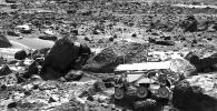
1999-07-02
Mars
Mars Pathfinder (MPF)
Imager for Mars Pathfinder
441x227x1
PIA01563:
Sojourner's APXS at "Stimpy" - Left Eye
Full Resolution:
TIFF
(123.3 kB)
JPEG
(37.35 kB)
1999-07-02
Mars
Mars Pathfinder (MPF)
Rover Cameras
383x280x1
PIA01564:
Close-up of "Moe" - Left Eye
Full Resolution:
TIFF
(135.4 kB)
JPEG
(41.58 kB)
1999-07-02
Mars
Mars Pathfinder (MPF)
Rover Cameras
383x280x1
PIA01565:
Close-up of "Moe" - Right Eye
Full Resolution:
TIFF
(136.6 kB)
JPEG
(43.91 kB)
1999-07-02
Mars
Mars Pathfinder (MPF)
Rover Cameras
383x280x1
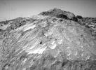
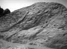
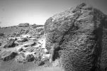
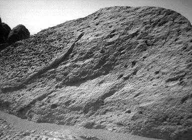
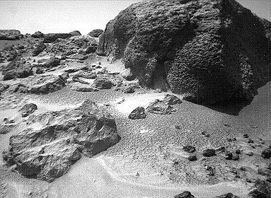
PIA01566:
"Half Dome" Rock - Left Eye
Full Resolution:
TIFF
(124.6 kB)
JPEG
(28.77 kB)
1999-07-02
Mars
Mars Pathfinder (MPF)
Rover Cameras
383x280x1
PIA01567:
"Half Dome" Rock - Right Eye
Full Resolution:
TIFF
(128.5 kB)
JPEG
(31.69 kB)
1999-07-02
Mars
Mars Pathfinder (MPF)
Imager for Mars Pathfinder
455x227x1
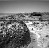
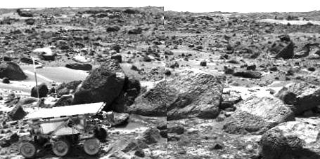
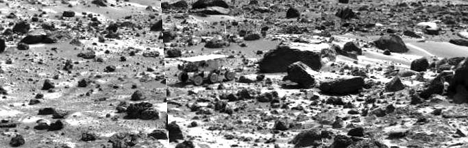
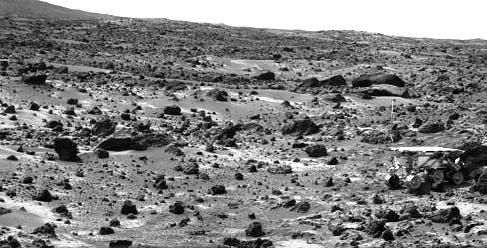
PIA01568:
Sojourner Rover Leaving the "Rock Garden" - Left Eye
Full Resolution:
TIFF
(119.1 kB)
JPEG
(31.62 kB)
1999-07-02
Mars
Mars Pathfinder (MPF)
Imager for Mars Pathfinder
460x227x1
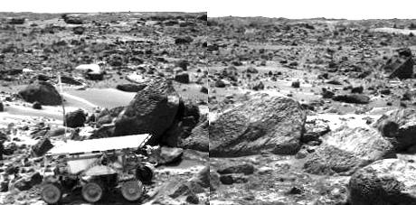
PIA01569:
Sojourner Rover Leaving the "Rock Garden" - Right Eye
Full Resolution:
TIFF
(119.1 kB)
JPEG
(31.94 kB)
1999-07-02
Mars
Mars Pathfinder (MPF)
Rover Cameras
383x380x1
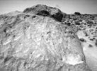
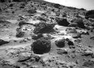
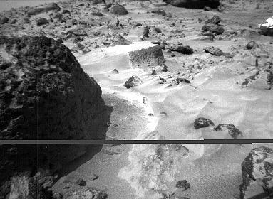
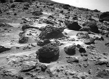
PIA01570:
Pits and Flutes on "Stimpy" - Left Eye
Full Resolution:
TIFF
(157.4 kB)
JPEG
(35.06 kB)
1999-07-02
Mars
Mars Pathfinder (MPF)
Rover Cameras
383x280x1
PIA01571:
Pits and Flutes on "Stimpy" - Right Eye
Full Resolution:
TIFF
(127 kB)
JPEG
(27.08 kB)
1999-07-02
Mars
Mars Pathfinder (MPF)
Imager for Mars Pathfinder
683x216x1
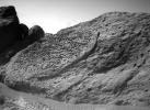
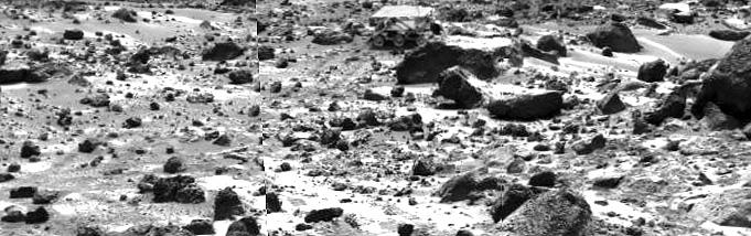
PIA01572:
Sojourner near "Chimp" - Left Eye
Full Resolution:
TIFF
(181.1 kB)
JPEG
(47.66 kB)
1999-07-02
Mars
Mars Pathfinder (MPF)
Imager for Mars Pathfinder
685x218x1
PIA01573:
Sojourner near "Chimp" - Right Eye
Full Resolution:
TIFF
(183 kB)
JPEG
(49.09 kB)
1999-07-02
Mars
Mars Pathfinder (MPF)
Rover Cameras
383x280x1
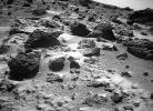
PIA01574:
Wind Tails Near "Chimp" - Left Eye
Full Resolution:
TIFF
(137 kB)
JPEG
(41.77 kB)
1999-07-02
Mars
Mars Pathfinder (MPF)
Rover Cameras
383x280x1
PIA01575:
Wind Tails Near "Chimp" - Right Eye
Full Resolution:
TIFF
(134.6 kB)
JPEG
(41.5 kB)
1999-07-02
Mars
Mars Pathfinder (MPF)
Rover Cameras
383x279x1
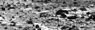
PIA01576:
North View from Sojourner - Left Eye
Full Resolution:
TIFF
(138.5 kB)
JPEG
(43.99 kB)
1999-07-02
Mars
Mars Pathfinder (MPF)
Rover Cameras
383x279x1
PIA01577:
North View from Sojourner - Right Eye
Full Resolution:
TIFF
(138.6 kB)
JPEG
(45.72 kB)
1999-07-02
Mars
Mars Pathfinder (MPF)
Rover Cameras
416x343x1
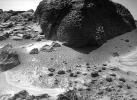
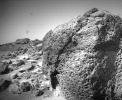
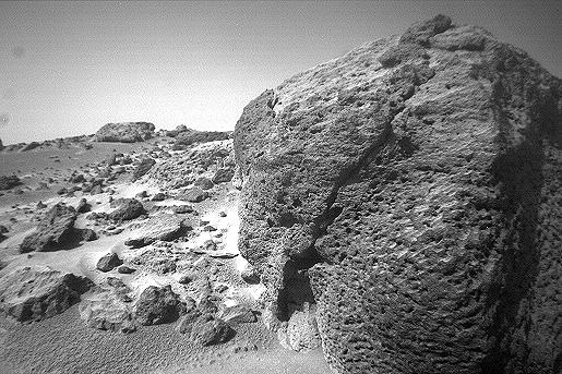
PIA01578:
Close-up View of "Chimp" - Left Eye
Full Resolution:
TIFF
(183 kB)
JPEG
(54.16 kB)
1999-07-02
Mars
Mars Pathfinder (MPF)
Rover Cameras
515x343x1
PIA01579:
Close-up View of "Chimp" - Right Eye
Full Resolution:
TIFF
(222.3 kB)
JPEG
(61.62 kB)
1999-07-02
Mars
Mars Pathfinder (MPF)
Imager for Mars Pathfinder
681x220x1
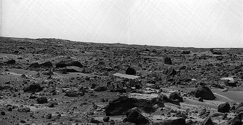
PIA01580:
Sojourner Rover Behind "Chimp" - Left Eye
Full Resolution:
TIFF
(179.7 kB)
JPEG
(49.17 kB)
1999-07-02
Mars
Mars Pathfinder (MPF)
Imager for Mars Pathfinder
681x214x1
PIA01581:
Sojourner Rover Behind "Chimp" - Right Eye
Full Resolution:
TIFF
(175.6 kB)
JPEG
(48.65 kB)
1999-07-02
Mars
Mars Pathfinder (MPF)
Imager for Mars Pathfinder
477x245x1
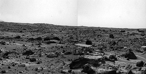
PIA01582:
Sojourner's Farthest Journey - Left Eye
Full Resolution:
TIFF
(122.5 kB)
JPEG
(31.52 kB)
1999-07-02
Mars
Mars Pathfinder (MPF)
Imager for Mars Pathfinder
480x244x1
PIA01583:
Sojourner's Farthest Journey - Right Eye
Full Resolution:
TIFF
(124.1 kB)
JPEG
(31.93 kB)
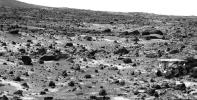
1999-07-02
Mars
Mars Pathfinder (MPF)
Rover Cameras
768x263x1
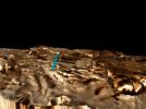
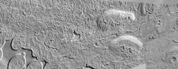
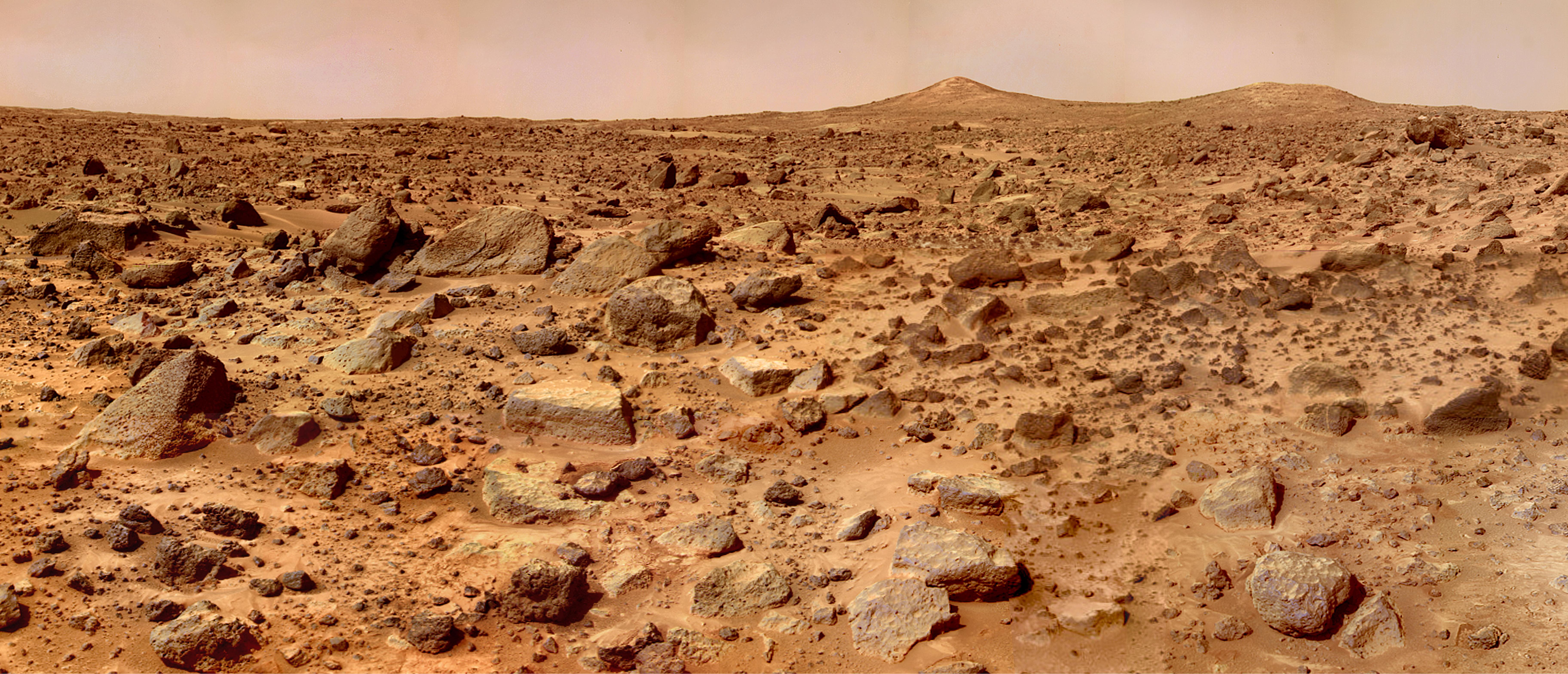
PIA01584:
Dunes, Big Crater and Twin Peaks - Left Eye
Full Resolution:
TIFF
(240.5 kB)
JPEG
(47.09 kB)
1999-07-02
Mars
Mars Pathfinder (MPF)
Imager for Mars Pathfinder
487x248x1
PIA01585:
Sojourner's APXS at "Chimp" - Right Eye
Full Resolution:
TIFF
(138.3 kB)
JPEG
(39.11 kB)
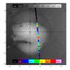
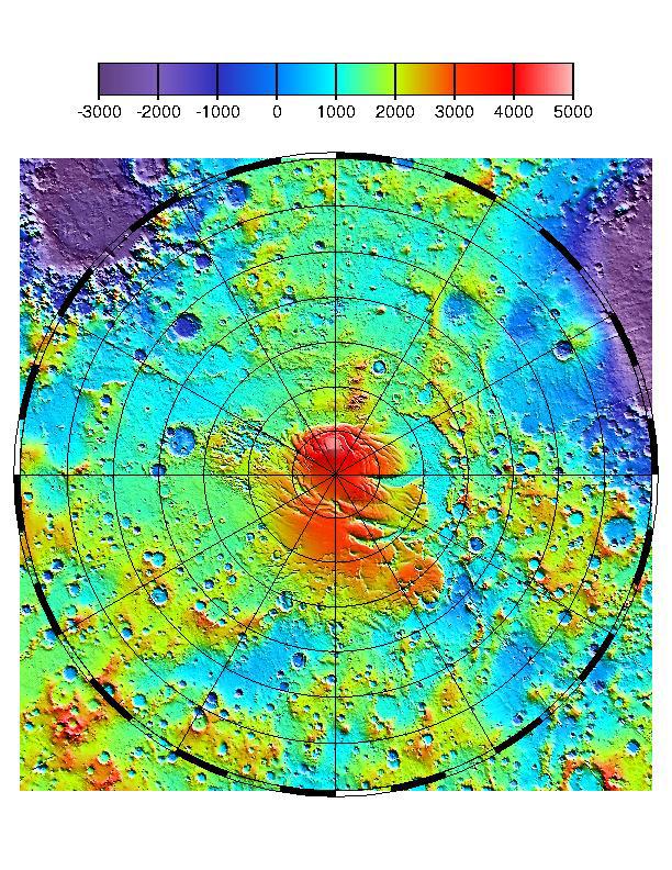
1999-07-06
Mars
Mars Global Surveyor (MGS)
MOLA
612x792x3
PIA02088:
MOLA TOPOGRAPHIC MAP
Full Resolution:
TIFF
(1.326 MB)
JPEG
(182.1 kB)
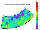
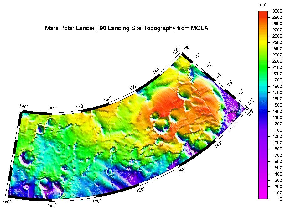
1999-07-06
Mars
Mars Global Surveyor (MGS)
MOLA
910x670x3
PIA02089:
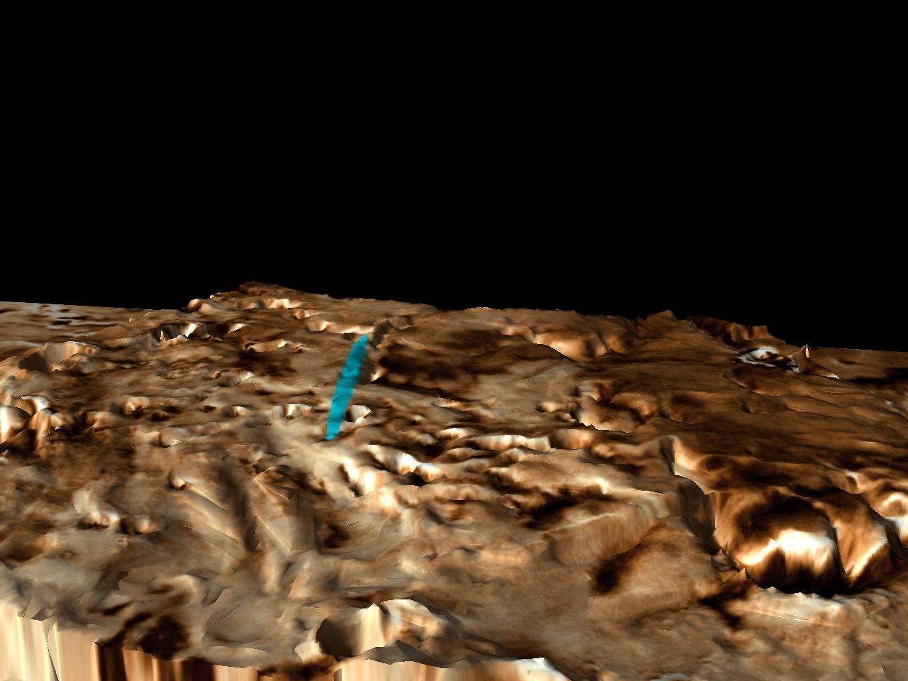
MPL LANDING SITE - DEM
Full Resolution:
TIFF
(172.2 kB)
JPEG
(111.2 kB)
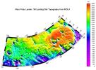
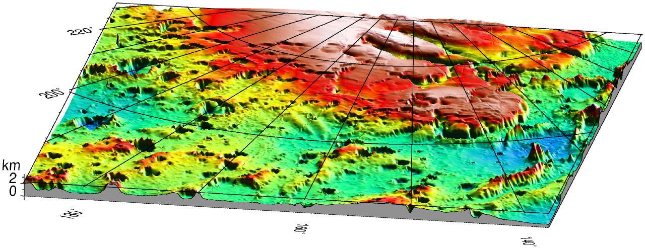
1999-07-06
Mars
Mars Global Surveyor (MGS)
MOLA
910x685x3
PIA02090:
MPL LANDING SITE CORRIDOR
Full Resolution:
TIFF
(151.7 kB)
JPEG
(86.71 kB)
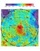
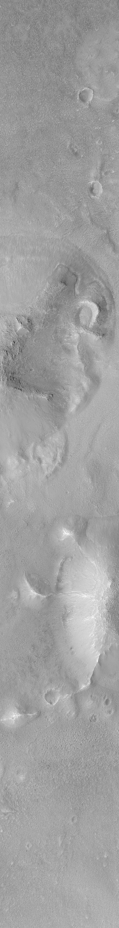
1999-07-06
Mars
Mars Global Surveyor (MGS)
MOLA
1280x493x3
PIA02091:
Mars '98 Polar landing site
Full Resolution:
TIFF
(1.607 MB)
JPEG
(150 kB)
1999-07-09
Mars
Mars Global Surveyor (MGS)
Mars Orbiter Camera (MOC)
415x3214x1
PIA02092:
New Cydonia Picture
Full Resolution:
TIFF
(1.158 MB)
JPEG
(186.2 kB)
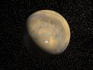
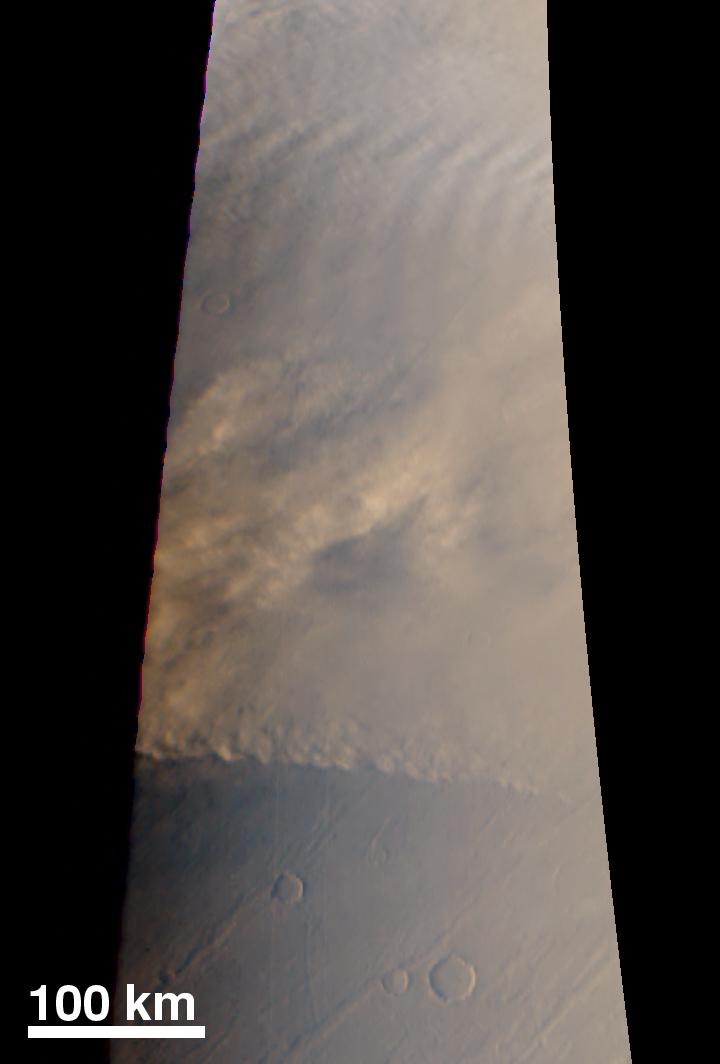
1999-07-19
Mars
Mars Global Surveyor (MGS)
Mars Orbiter Camera (MOC)
720x1064x3
PIA02067:
Dust Storm
Full Resolution:
TIFF
(1.096 MB)
JPEG
(35.41 kB)
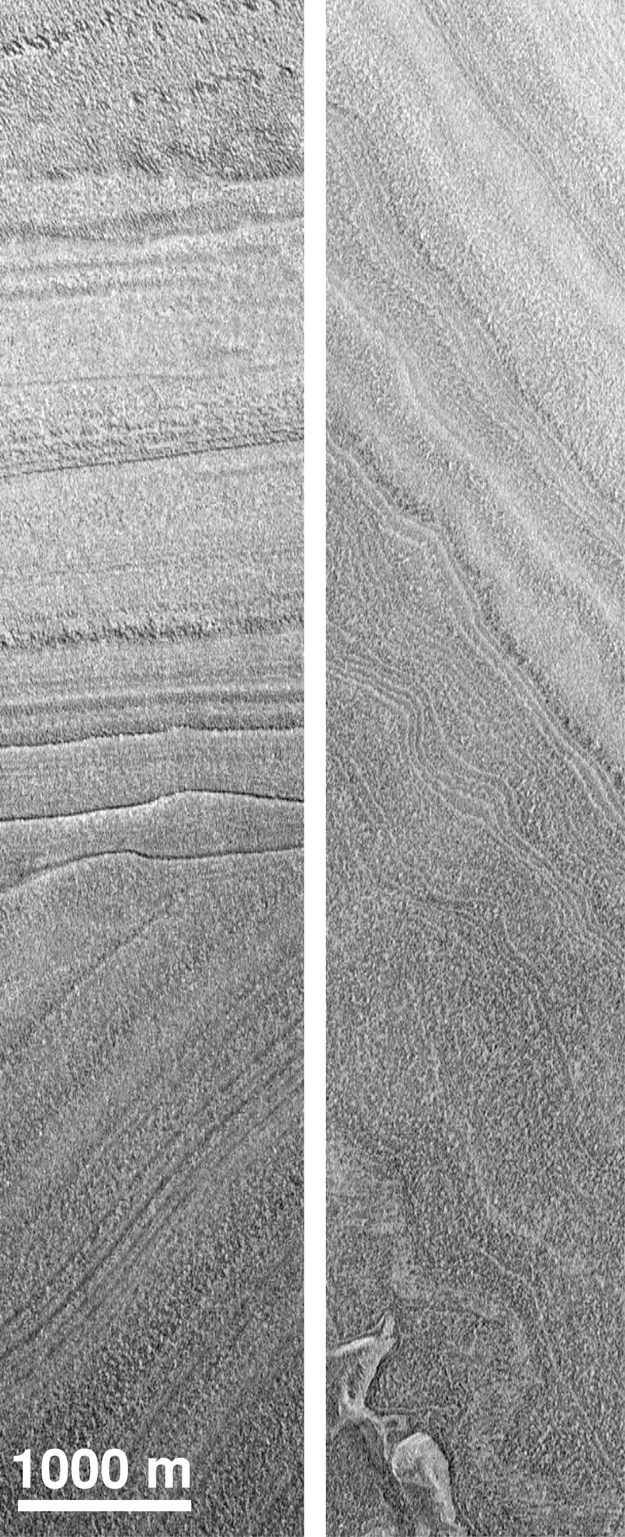
1999-07-19
Mars
Mars Global Surveyor (MGS)
Mars Orbiter Camera (MOC)
1216x2988x1
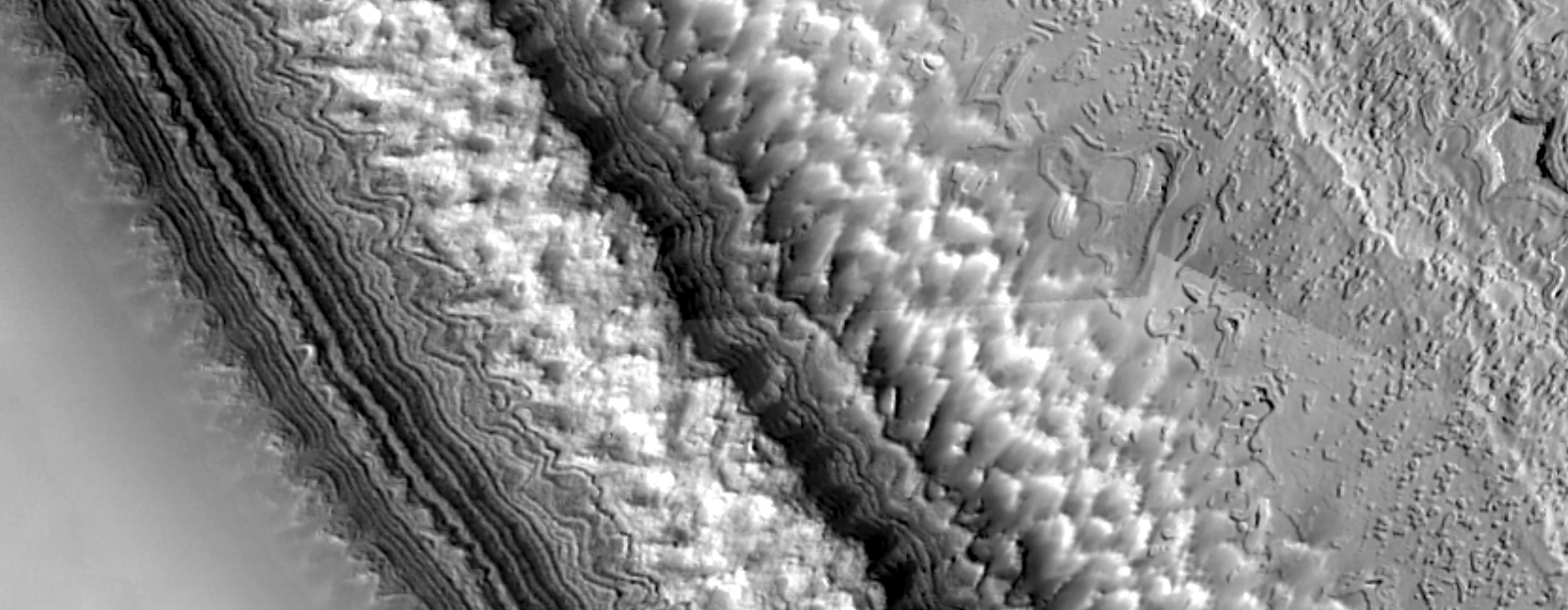
PIA02071:
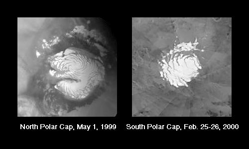
Polar Structures
Full Resolution:
TIFF
(3.936 MB)
JPEG
(676.1 kB)
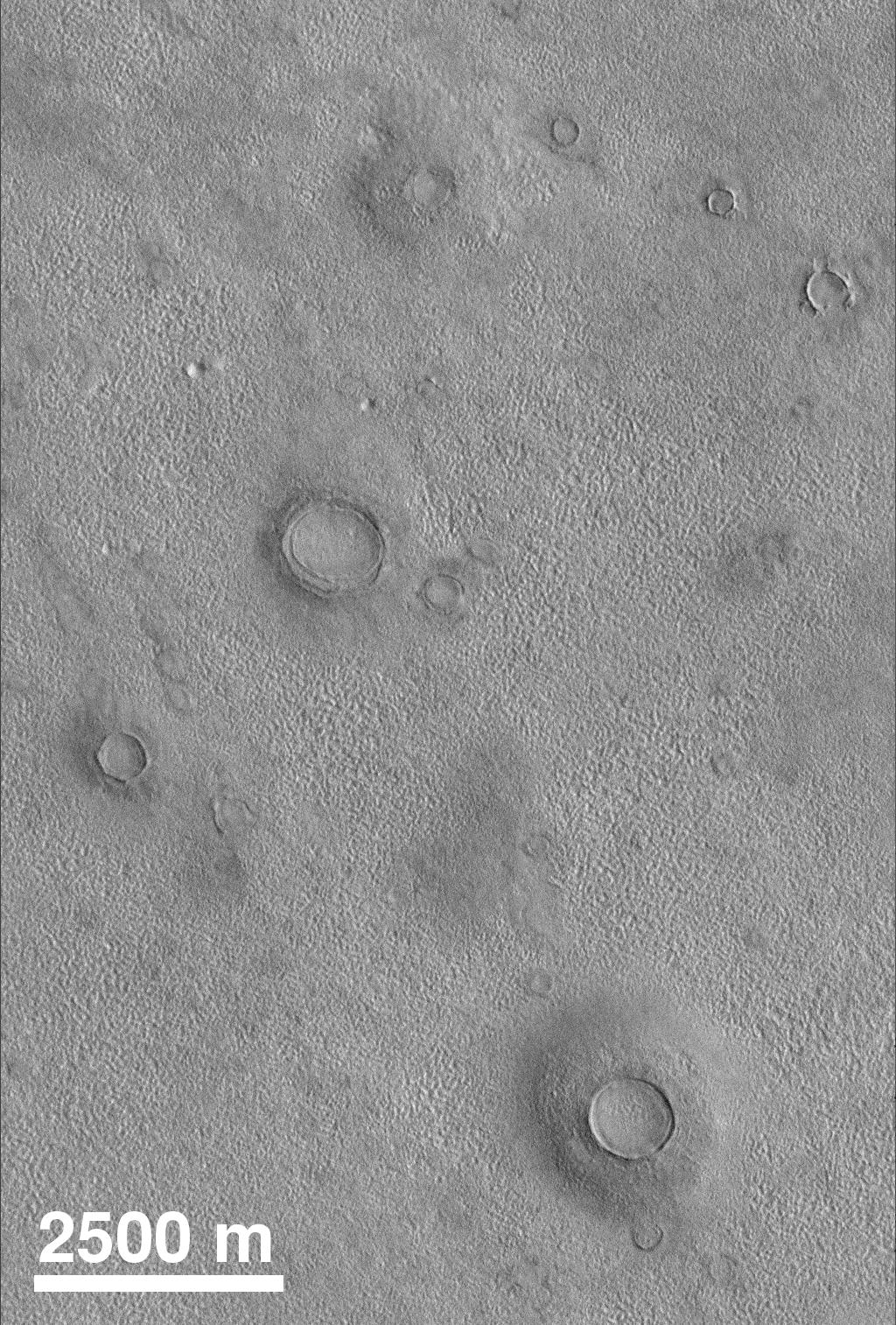
1999-07-19
Mars
Mars Global Surveyor (MGS)
Mars Orbiter Camera (MOC)
1024x1514x1
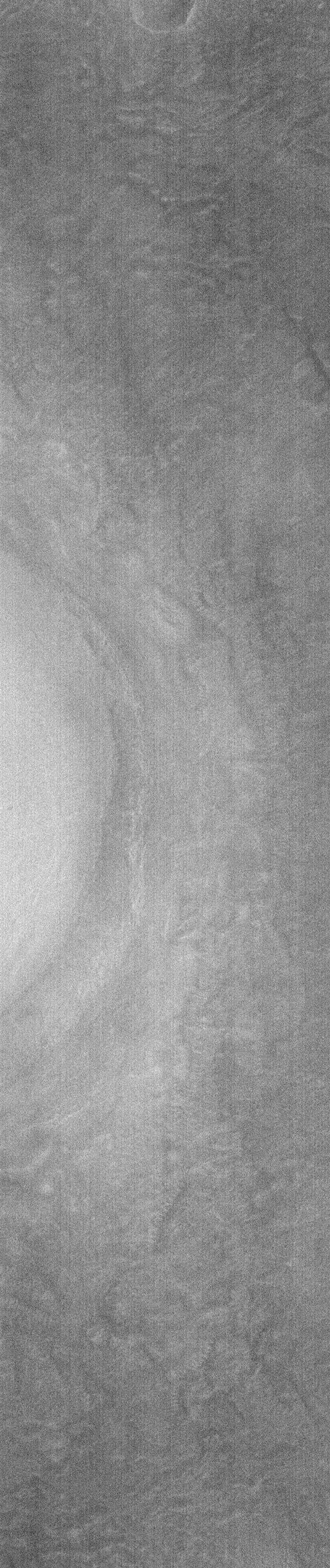
PIA02073:
Northern Plains
Full Resolution:
TIFF
(1.344 MB)
JPEG
(411.9 kB)
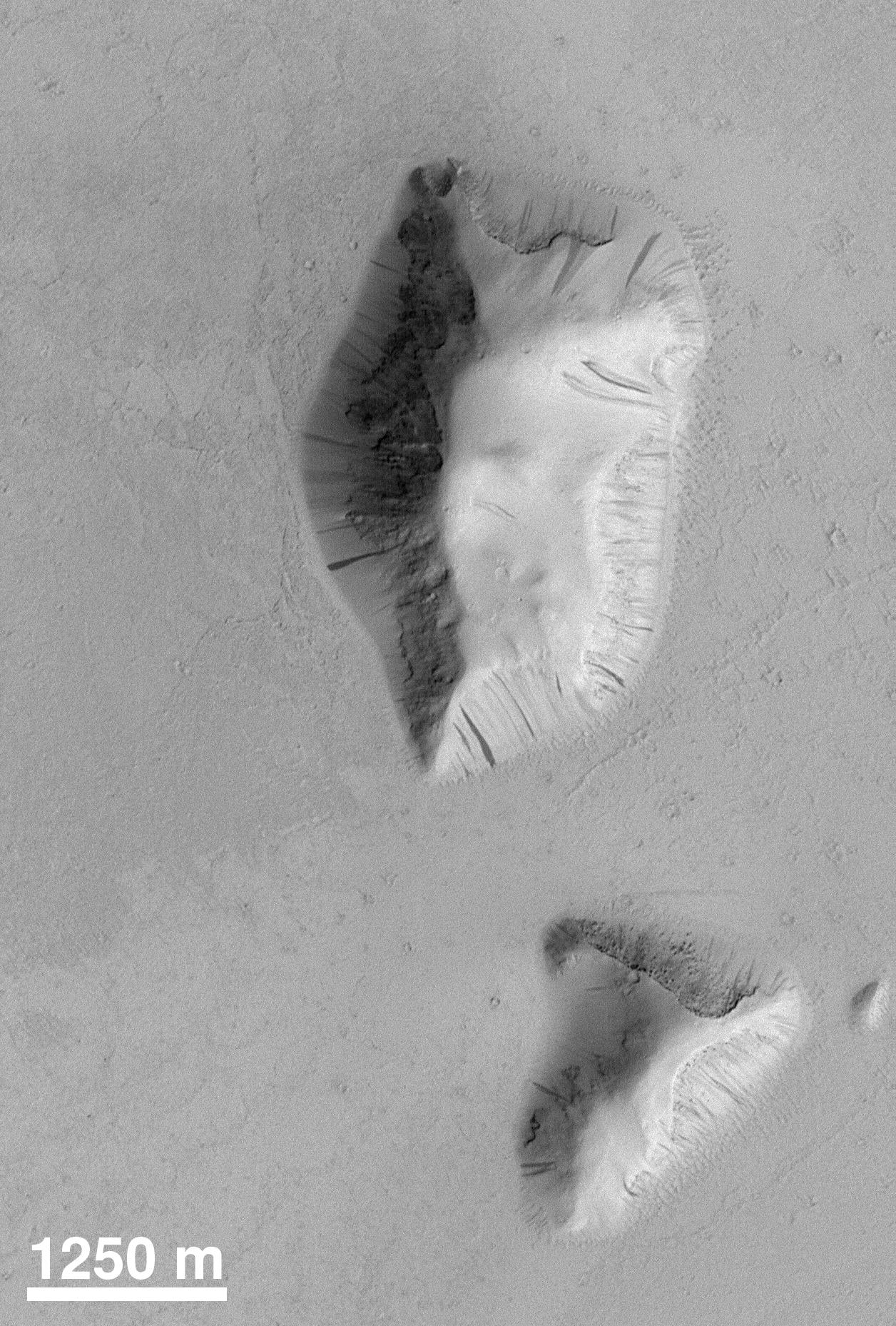
1999-07-19
Mars
Mars Global Surveyor (MGS)
Mars Orbiter Camera (MOC)
1256x1857x1
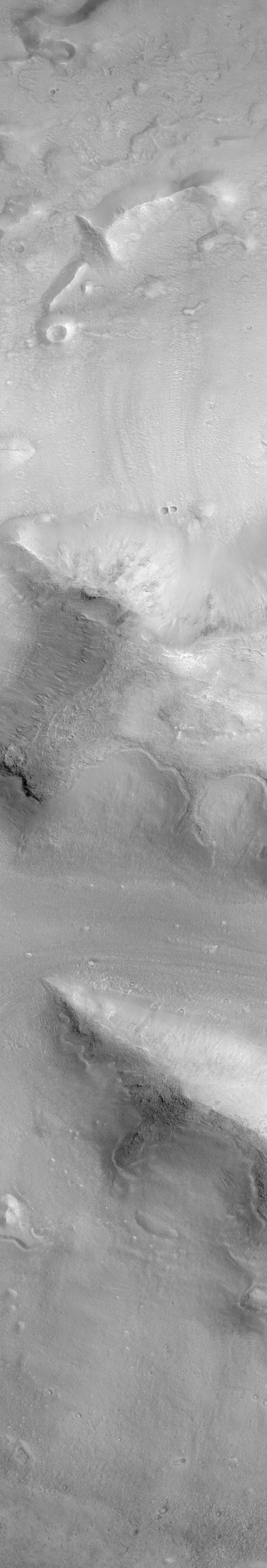
PIA02083:
Slope Processes
Full Resolution:
TIFF
(2.393 MB)
JPEG
(475.6 kB)
1999-07-19
Mars
Mars Global Surveyor (MGS)
Mars Orbiter Camera (MOC)
1024x1536x1
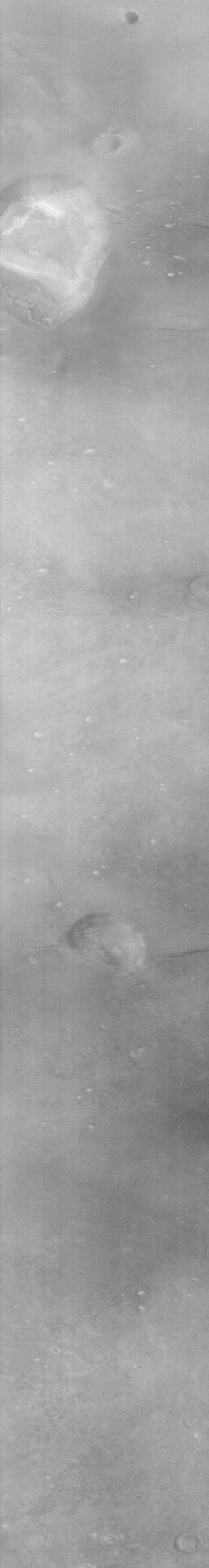
PIA02084:
Martian Crater
Full Resolution:
TIFF
(1.547 MB)
JPEG
(261.2 kB)
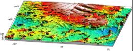
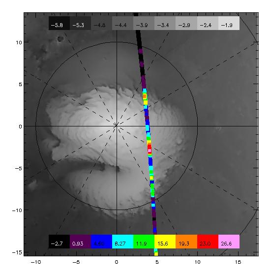
1999-08-17
Mars
Mars Global Surveyor (MGS)
Thermal Emission Spectrometer
551x561x3
PIA02307:
TES overlayed on MOLA DEM
Full Resolution:
TIFF
(119.9 kB)
JPEG
(34.92 kB)
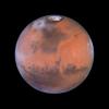
1999-08-23
Mars
Hubble Space Telescope
WFPC2
800x800x3
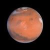
PIA01590:
A Closer Hubble Encounter With Mars - Tharsis
Full Resolution:
TIFF
(783.2 kB)
JPEG
(26.36 kB)
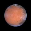
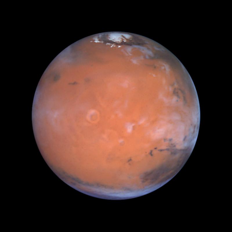
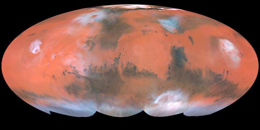
1999-08-23
Mars
Hubble Space Telescope
WFPC2
900x450x3
PIA01588:
A Closer Hubble Encounter With Mars - Global View
Full Resolution:
TIFF
(894 kB)
JPEG
(33.76 kB)
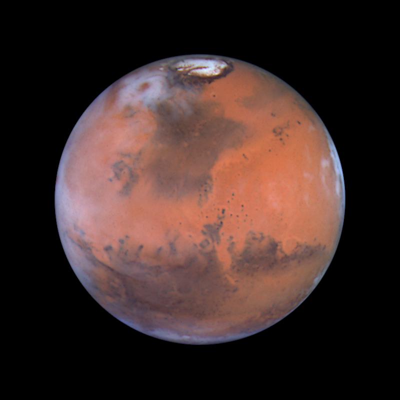
1999-08-23
Mars
Hubble Space Telescope
WFPC2
800x800x3
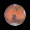
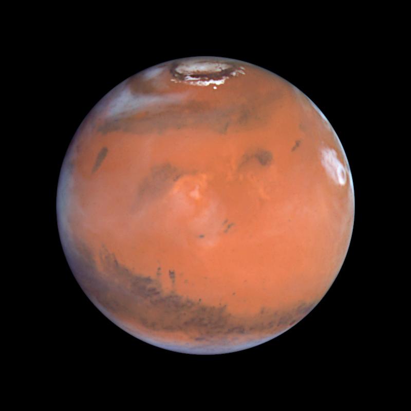
PIA01589:
A Closer Hubble Encounter With Mars - Pathfinder Landing Site
Full Resolution:
TIFF
(833.5 kB)
JPEG
(30.84 kB)
1999-08-23
Mars
Hubble Space Telescope
WFPC2
800x800x3
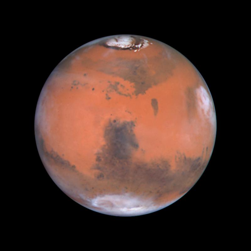
PIA01591:
A Closer Hubble Encounter With Mars - Elysium
Full Resolution:
TIFF
(743.6 kB)
JPEG
(26.86 kB)
1999-08-23
Mars
Hubble Space Telescope
WFPC2
800x800x3
PIA01592:
A Closer Hubble Encounter With Mars - Syrtis Major
Full Resolution:
TIFF
(767.3 kB)
JPEG
(28.49 kB)
1999-08-23
Mars
Hubble Space Telescope
WFPC2
3001x2070x3
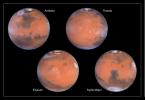
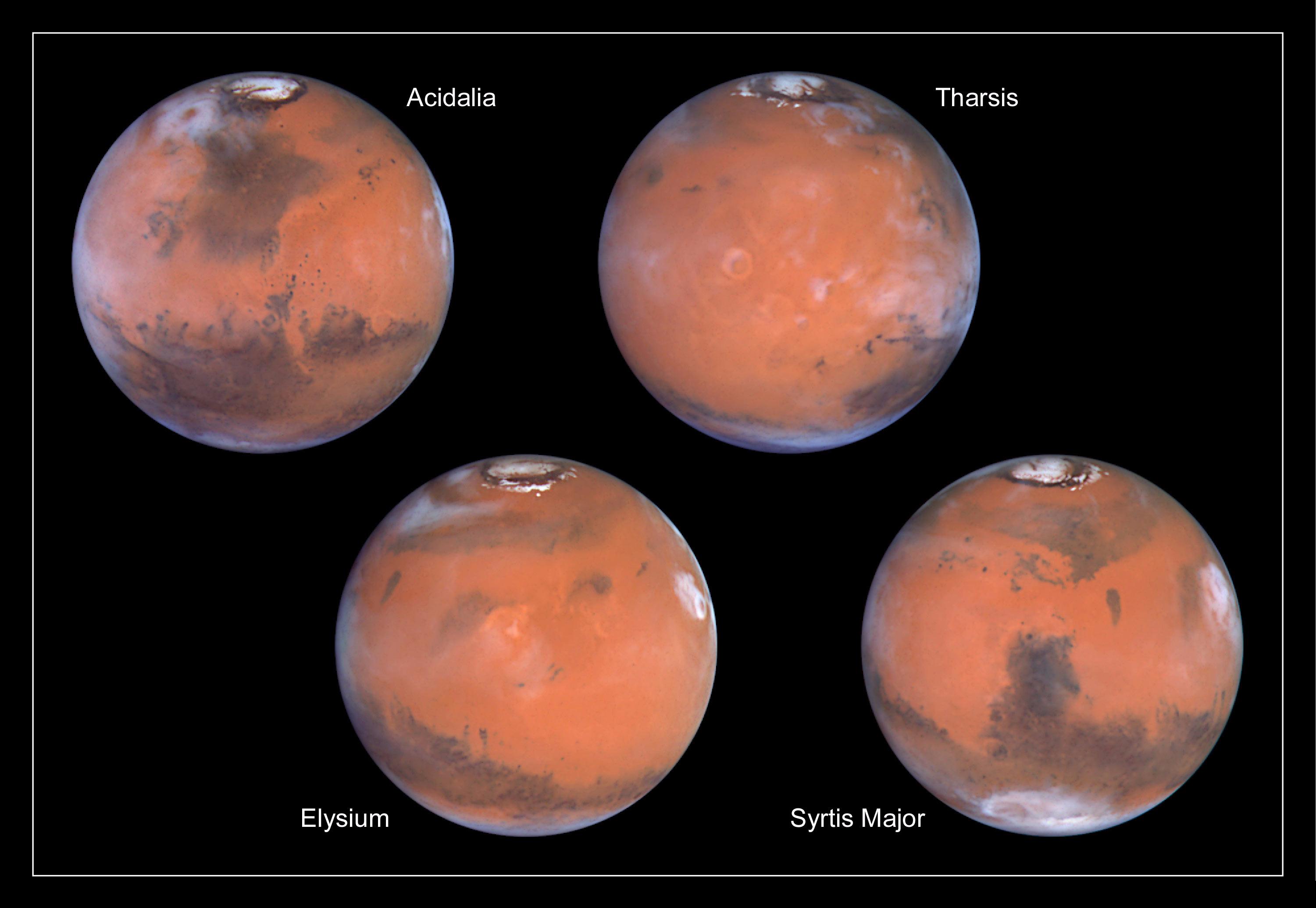
PIA01587:
A Closer Hubble Encounter With Mars - 4 Views
Full Resolution:
TIFF
(7.258 MB)
JPEG
(270.4 kB)
1999-08-25
Mars
Mars Global Surveyor (MGS)
Mars Orbiter Camera (MOC)
1145x1100x1
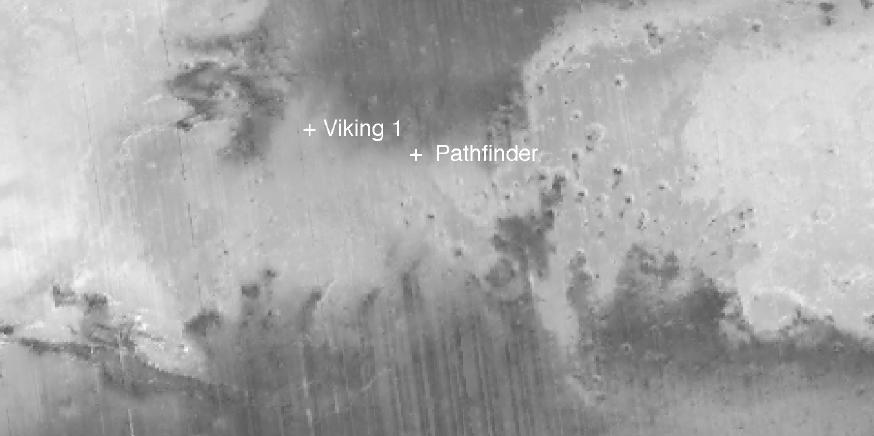
PIA02311:
Mars Polar Lander and Mars Pathfinder Sites Compared
Full Resolution:
TIFF
(1.24 MB)
JPEG
(315.7 kB)
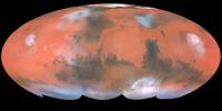
1999-08-26
Mars
Mars Global Surveyor (MGS)
Viking
1600x900x3
PIA02314:
Proposed Mars Polar Lander Landing Site (Flat Map)
Full Resolution:
TIFF
(3.895 MB)
JPEG
(258.4 kB)
1999-08-26
Mars
Mars Global Surveyor (MGS)
Viking
2560x1920x3
PIA02315:
Proposed Mars Polar Lander Landing Site (Global Perspective)
Full Resolution:
TIFF
(7.41 MB)
JPEG
(513.2 kB)
1999-08-26
Mars
Mars Global Surveyor (MGS)
Viking
2560x1920x3
PIA02316:
Proposed Mars Polar Lander Landing Site (Perspective View 1)
Full Resolution:
TIFF
(11.63 MB)
JPEG
(436.4 kB)
1999-08-26
Mars
Mars Global Surveyor (MGS)
Viking
2560x1920x3
PIA02317:
Proposed Mars Polar Lander Landing Site (Perspective View 2)
Full Resolution:
TIFF
(10.63 MB)
JPEG
(353 kB)
1999-08-26
Mars
Mars Global Surveyor (MGS)
Viking
1280x960x3
PIA02318:
Proposed Mars Polar Lander Landing Site (Perspective View 3)
Full Resolution:
TIFF
(2.251 MB)
JPEG
(110.4 kB)
1999-08-31
Mars
Mars Global Surveyor (MGS)
Thermal Emission Spectrometer
874x436x1
PIA02320:
New Views of Mars from the Thermal Emission Spectrometer Instrument
Full Resolution:
TIFF
(254.5 kB)
JPEG
(34.33 kB)
1999-09-08
Mars
Mars Pathfinder (MPF)
Imager for Mars Pathfinder
7238x3135x3
PIA02405:
Twin Peaks in Super Resolution - Left Eye
Full Resolution:
TIFF
(65.93 MB)
JPEG
(2.307 MB)
1999-09-08
Mars
Mars Pathfinder (MPF)
Imager for Mars Pathfinder
7296x3135x3
PIA02406:
Twin Peaks in Super Resolution - Right Eye
Full Resolution:
TIFF
(70.57 MB)
JPEG
(2.584 MB)
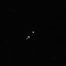
1999-09-10
Mars
Mars Climate Orbiter
MARCI
200x200x3
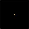
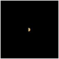
PIA02330:
Mars Climate Orbiter MARCI Approach Image
Full Resolution:
TIFF
(3.396 kB)
JPEG
(2.93 kB)
1999-09-18
Mars
Mars Global Surveyor (MGS)
Thermal Emission Spectrometer
555x555x3
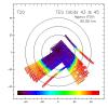
PIA02327:
Mars Polar Lander Landing Site Noon-time Temperatures
Full Resolution:
TIFF
(210.4 kB)
JPEG
(69.04 kB)
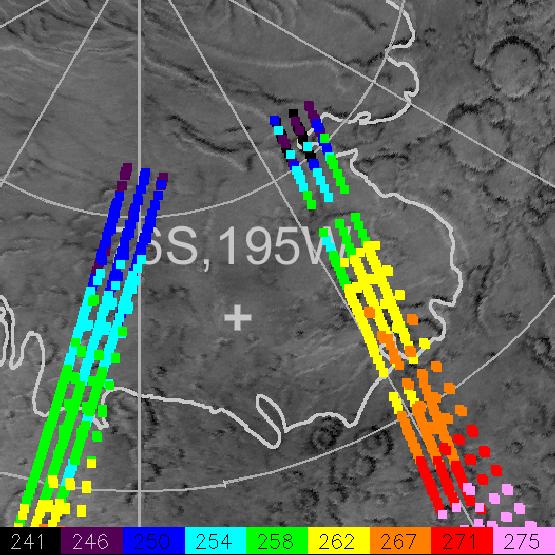
1999-09-18
Mars
Mars Global Surveyor (MGS)
Thermal Emission Spectrometer
516x529x3
PIA02328:
Slab Ice and Snow Flurries in the Mars Northern Polar Night
Full Resolution:
TIFF
(102.1 kB)
JPEG
(46.41 kB)
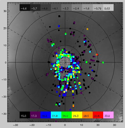
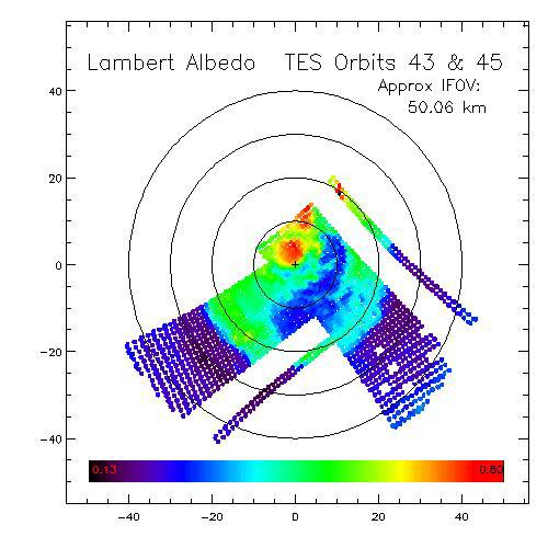
1999-09-18
Mars
Mars Global Surveyor (MGS)
Thermal Emission Spectrometer
500x500x3
PIA02332:
Dark Dry Ice on Southern Cap - Lambert Albedo Image
Full Resolution:
TIFF
(201.7 kB)
JPEG
(46.54 kB)
1999-09-18
Mars
Mars Global Surveyor (MGS)
Thermal Emission Spectrometer
500x500x3
PIA02333:
Dark Dry Ice on Southern Cap - Thermal Image
Full Resolution:
TIFF
(199.5 kB)
JPEG
(44.24 kB)
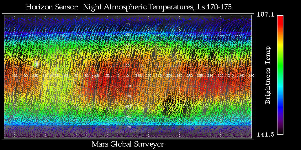
1999-09-18
Mars
Mars Global Surveyor (MGS)
Mars Horizon Sensor Assembly
960x480x3
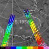
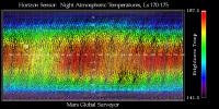
PIA02335:
Thermal Wave Phenomena
Full Resolution:
TIFF
(168.1 kB)
JPEG
(191.6 kB)
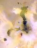
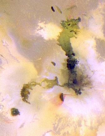
1999-10-08
Io
Galileo
Solid-State Imaging
336x436x3
PIA02506:
Amirani-Maui: Longest Known Active Lava Flow in the Solar System
Full Resolution:
TIFF
(392.2 kB)
JPEG
(21.24 kB)
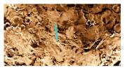
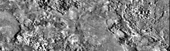
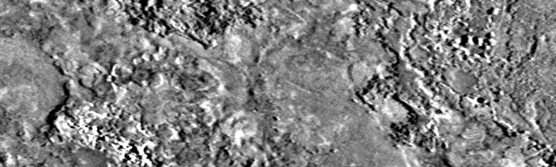
1999-10-25
Io
Galileo
Solid-State Imaging
797x240x1
PIA02507:
Highest Resolution Image Ever Obtained of Io
Full Resolution:
TIFF
(227.4 kB)
JPEG
(51.2 kB)
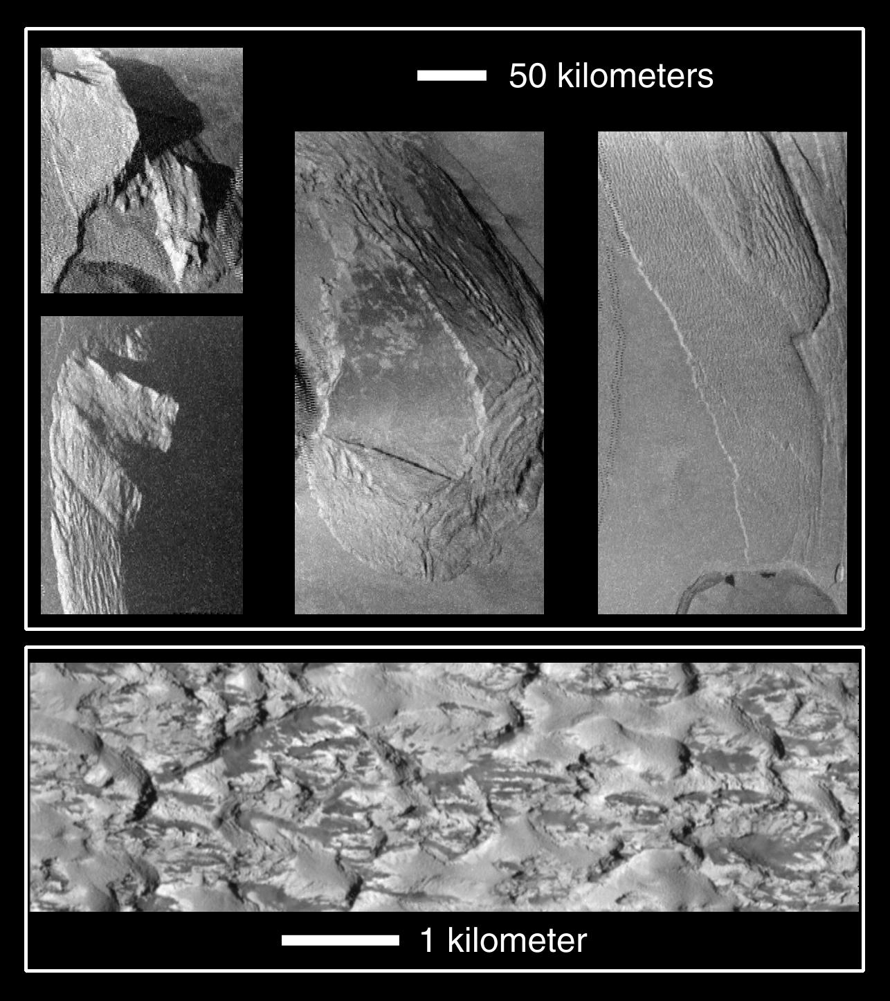
1999-11-19
Io
Galileo
Solid-State Imaging
1286x1447x1
PIA02513:
Collapsing Mountains on Io
Full Resolution:
TIFF
(1.291 MB)
JPEG
(251.9 kB)
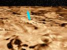
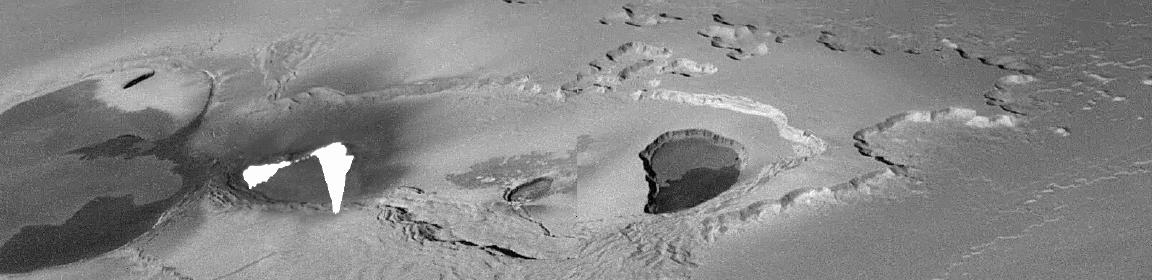
1999-12-17
Io
Galileo
Solid-State Imaging
1152x280x1
PIA02519:
Lava Fountains on Io
Full Resolution:
TIFF
(139.9 kB)
JPEG
(56.66 kB)
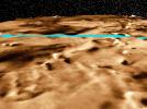
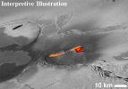
1999-12-17
Io
Galileo
Solid-State Imaging
717x653x3
PIA02525:
Interpreted Lava Fountains on Io
Full Resolution:
TIFF
(1.3 MB)
JPEG
(124.8 kB)
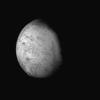
2000-01-16
Triton
Voyager
VG ISS - Narrow Angle
1000x1000x1
PIA02234:
Triton's Surface Topography
Full Resolution:
TIFF
(235.9 kB)
JPEG
(49.58 kB)
2000-02-11
Masursky
Cassini-Huygens
ISS - Narrow Angle
220x220x1
PIA02449:
Masursky
Full Resolution:
TIFF
(13.38 kB)
JPEG
(1.381 kB)
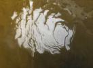
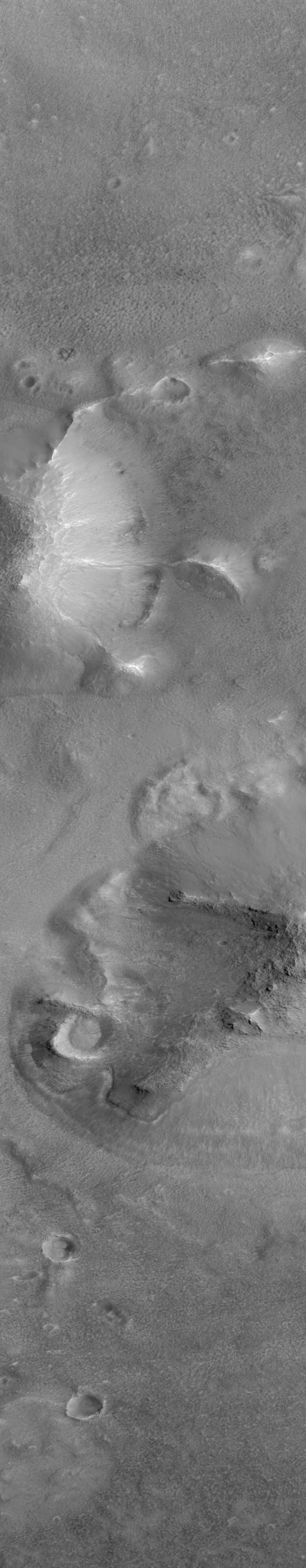
2000-03-08
Mars
Mars Global Surveyor (MGS)
Mars Orbiter Camera (MOC)
543x476x1
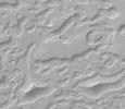
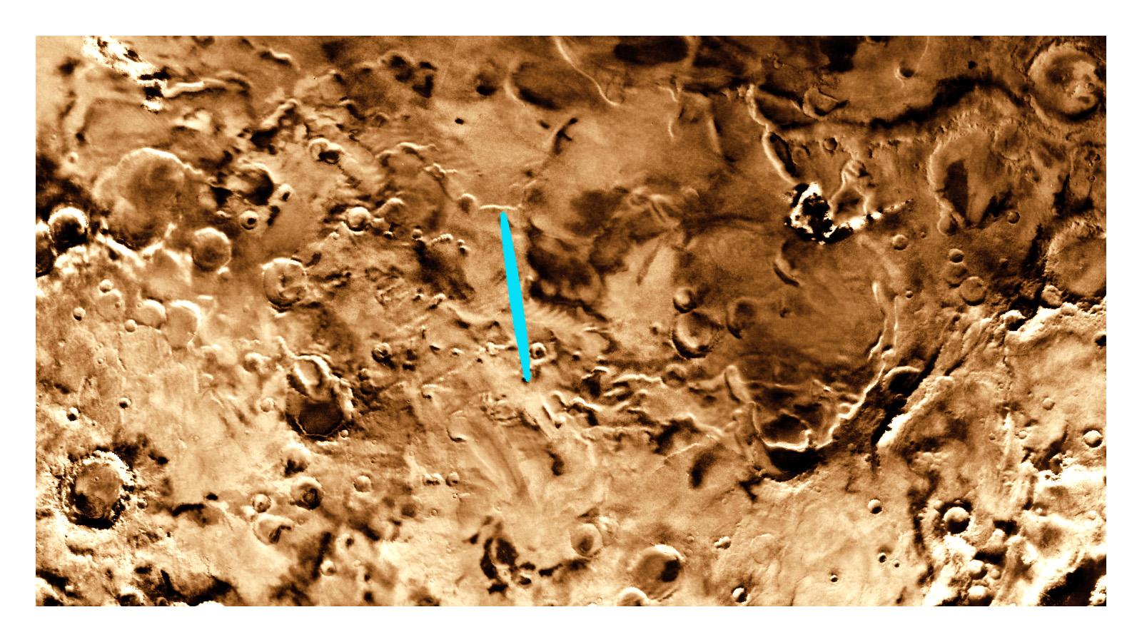
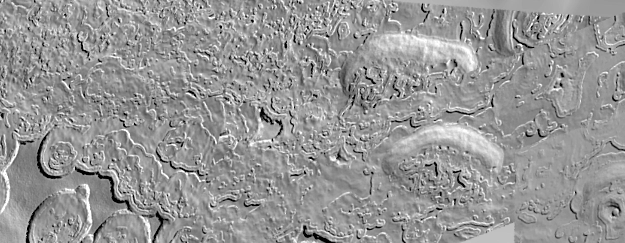
PIA02374:
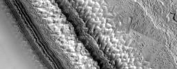
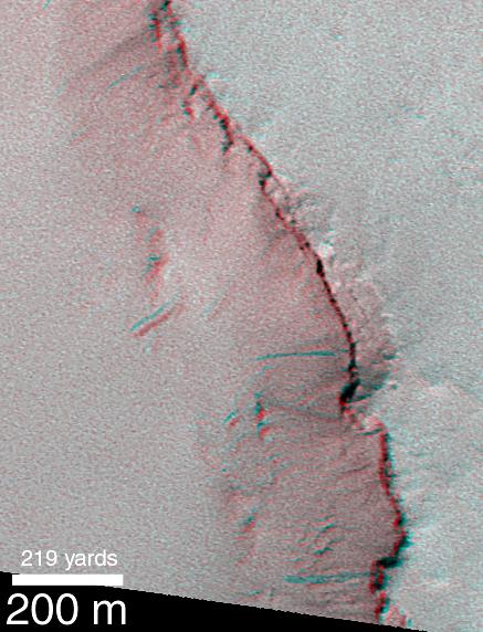
South Polar Cap Erosion and Aprons
Full Resolution:
TIFF
(246.7 kB)
JPEG
(47.83 kB)
2000-03-16
Titan
Voyager
VG ISS - Narrow Angle
485x580x3
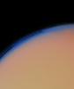
PIA02238:
Titan's Thick Haze Layer
Full Resolution:
TIFF
(408.2 kB)
JPEG
(14.33 kB)
2000-04-07
Mars
Mars Global Surveyor (MGS)
Mars Orbiter Camera (MOC)
1024x5248x1
PIA02382:
Cydonia: Two Years Later
Full Resolution:
TIFF
(3.85 MB)
JPEG
(630.9 kB)
2000-04-07
Mars
Mars Global Surveyor (MGS)
Mars Orbiter Camera (MOC)
768x3712x1
PIA02383:
Cydonia: Two Years Later
Full Resolution:
TIFF
(1.834 MB)
JPEG
(472.8 kB)
2000-04-07
Mars
Mars Global Surveyor (MGS)
Mars Orbiter Camera (MOC)
1024x6016x1
PIA02384:
Cydonia: Two Years Later
Full Resolution:
TIFF
(4.324 MB)
JPEG
(742.1 kB)
2000-04-07
Mars
Mars Global Surveyor (MGS)
Mars Orbiter Camera (MOC)
672x9856x1
PIA02385:
Cydonia: Two Years Later
Full Resolution:
TIFF
(5.211 MB)
JPEG
(906.6 kB)
2000-04-07
Mars
Mars Global Surveyor (MGS)
Mars Orbiter Camera (MOC)
512x2432x1
PIA02386:
Cydonia: Two Years Later
Full Resolution:
TIFF
(595.9 kB)
JPEG
(336.8 kB)
2000-04-07
Mars
Mars Global Surveyor (MGS)
Mars Orbiter Camera (MOC)
1024x7680x1
PIA02387:
Cydonia: Two Years Later
Full Resolution:
TIFF
(3.687 MB)
JPEG
(1.371 MB)
2000-04-07
Mars
Mars Global Surveyor (MGS)
Mars Orbiter Camera (MOC)
512x8064x1
PIA02388:
Cydonia: Two Years Later
Full Resolution:
TIFF
(2.664 MB)
JPEG
(439.3 kB)
2000-04-07
Mars
Mars Global Surveyor (MGS)
Mars Orbiter Camera (MOC)
768x5888x1
PIA02389:
Cydonia: Two Years Later
Full Resolution:
TIFF
(2.78 MB)
JPEG
(724.8 kB)
2000-04-11
Mars
Mars Global Surveyor (MGS)
Mars Orbiter Camera (MOC)
2496x972x1
PIA02390:
High-Resolution South Polar Cap Mosaics
Full Resolution:
TIFF
(2.268 MB)
JPEG
(248.1 kB)
2000-04-11
Mars
Mars Global Surveyor (MGS)
Mars Orbiter Camera (MOC)
2493x972x3
PIA02391:
High-Resolution South Polar Cap Mosaics
Full Resolution:
TIFF
(1.84 MB)
JPEG
(284.7 kB)
2000-04-20
Mars
Mars Global Surveyor (MGS)
Mars Orbiter Camera (MOC)
512x15488x3
PIA02392:
A Traverse Across the Summit of Olympus Mons
Full Resolution:
TIFF
(5.766 MB)
JPEG
(1.069 MB)
2000-04-24
Mars
Mars Global Surveyor (MGS)
Mars Orbiter Camera (MOC)
361x358x1
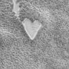
PIA02361:
Happy Valentine's Day From Mars!
Full Resolution:
TIFF
(143.8 kB)
JPEG
(38.89 kB)
2000-04-24
Mars
Mars Global Surveyor (MGS)
Mars Orbiter Camera (MOC)
662x824x1
PIA02362:
The Dark Surfaces of Mars: Mantles and Sand Sheets
Full Resolution:
TIFF
(383.2 kB)
JPEG
(49.09 kB)
2000-04-24
Mars
Mars Global Surveyor (MGS)
Mars Orbiter Camera (MOC)
720x1145x1
PIA02363:
Wind Streaks of Daedalia, Mars, and Amboy, California
Full Resolution:
TIFF
(880.1 kB)
JPEG
(201.8 kB)
2000-04-24
Mars
Mars Global Surveyor (MGS)
Mars Orbiter Camera (MOC)
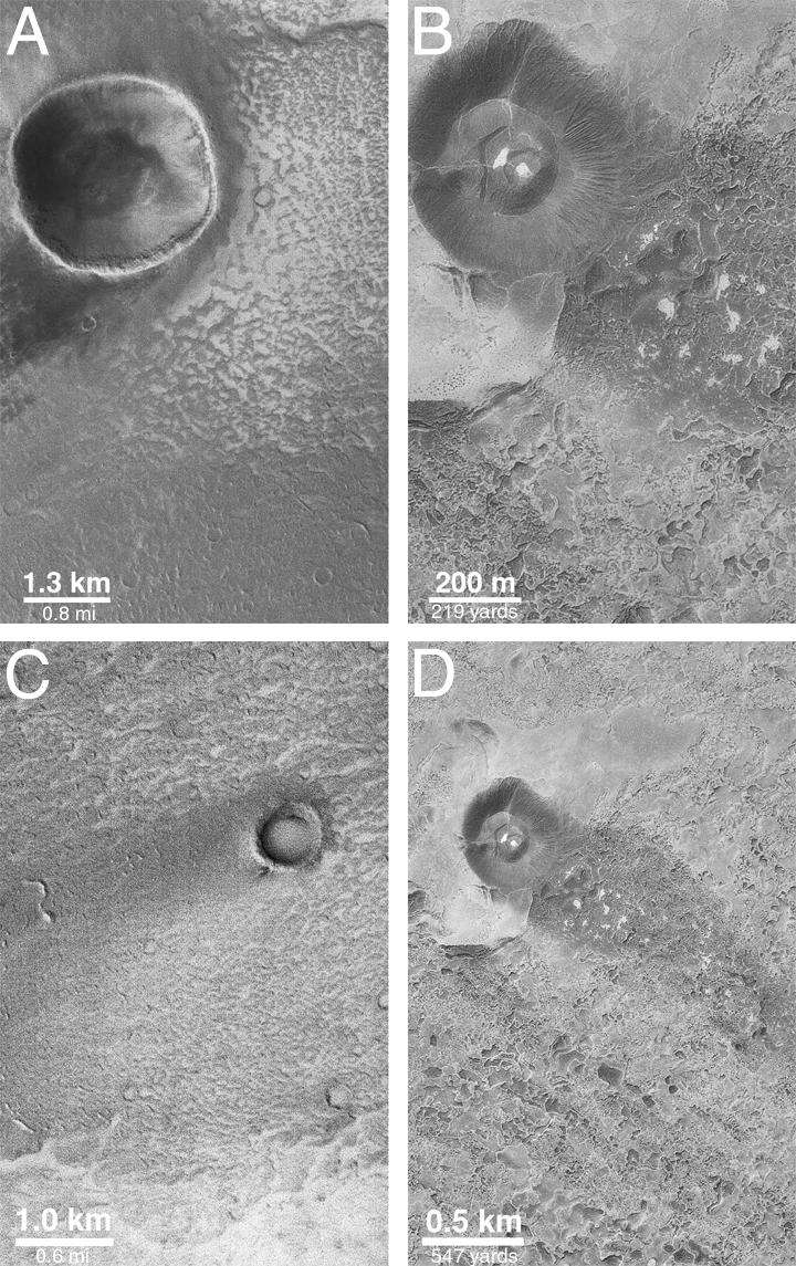
834x1149x1
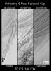
PIA02364:
A High-Resolution Look at the Spring Thaw of the Martian South Polar Cap
Full Resolution:
TIFF
(739 kB)
JPEG
(211.8 kB)
2000-04-24
Mars
Mars Global Surveyor (MGS)
Mars Orbiter Camera (MOC)
512x2432x1
PIA02365:
Return to "Giant's Footprint" 3 Decades After Mariner 7 Flyby
Full Resolution:
TIFF
(785.1 kB)
JPEG
(122 kB)
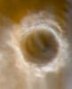
2000-04-24
Mars
Mars Global Surveyor (MGS)
Mars Orbiter Camera (MOC)
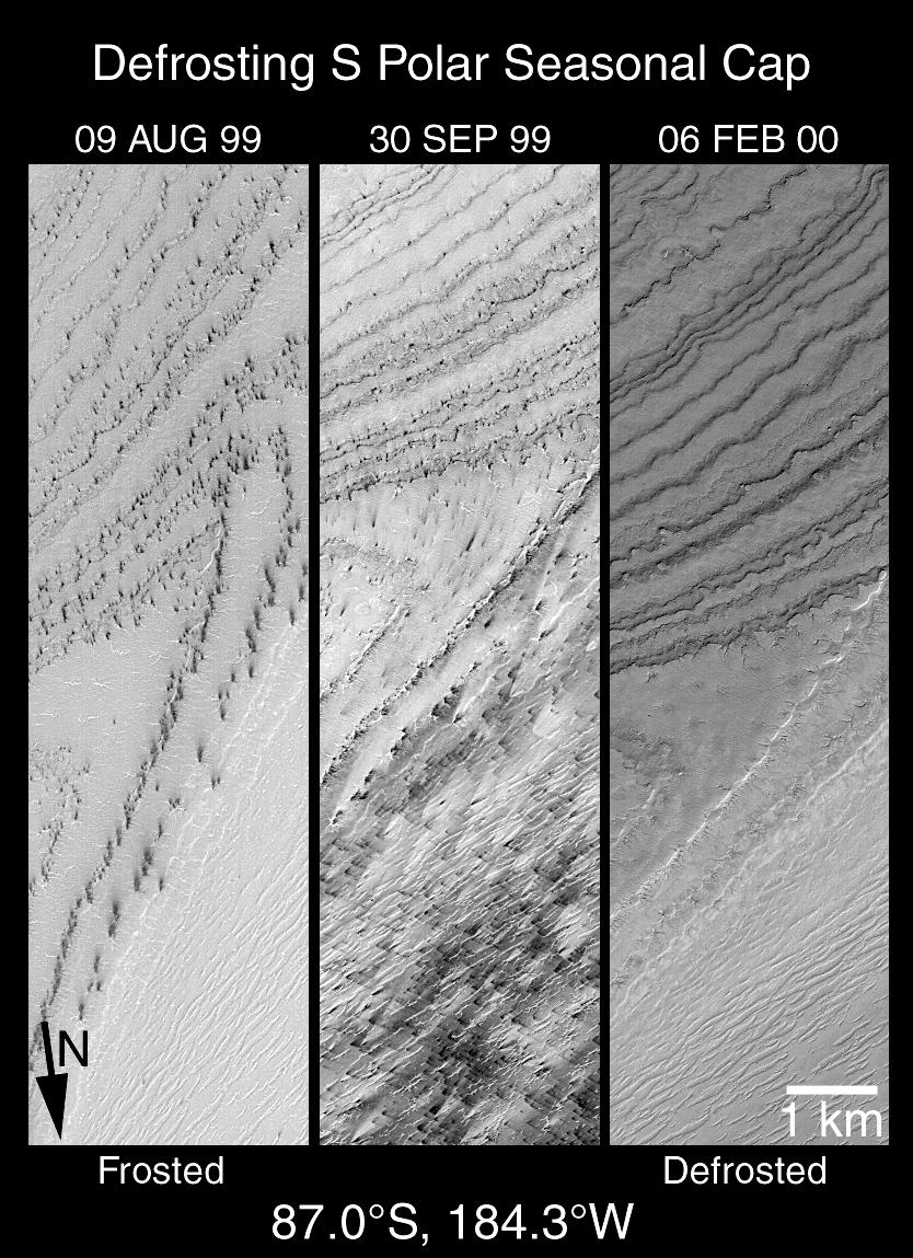
500x300x1
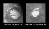
PIA02366:
What is a "Residual" Polar Cap?
Full Resolution:
TIFF
(67.98 kB)
JPEG
(18.06 kB)
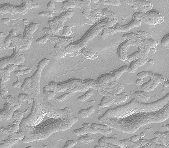
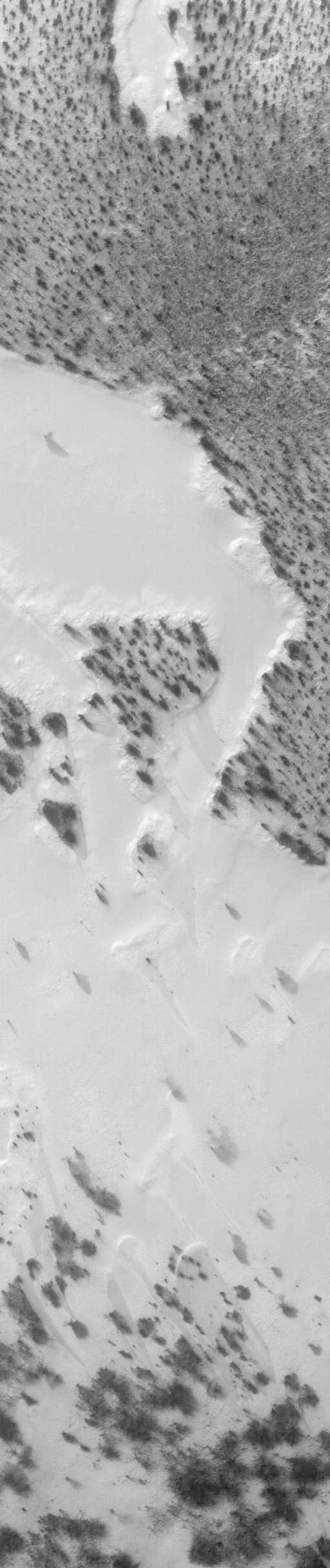
2000-04-24
Mars
Mars Global Surveyor (MGS)
Mars Orbiter Camera (MOC)
418x1150x1
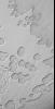
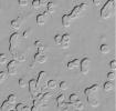
PIA02367:
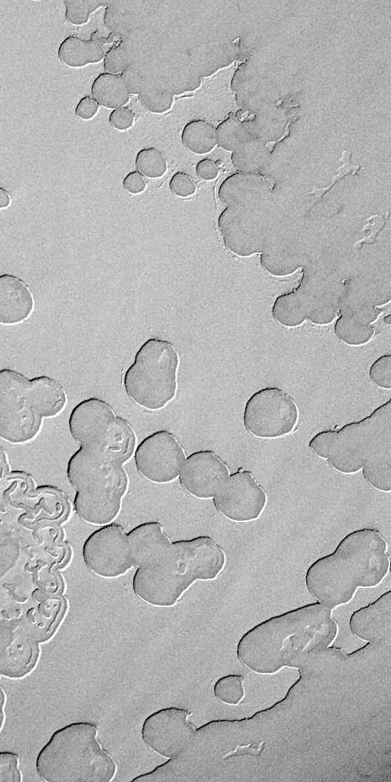
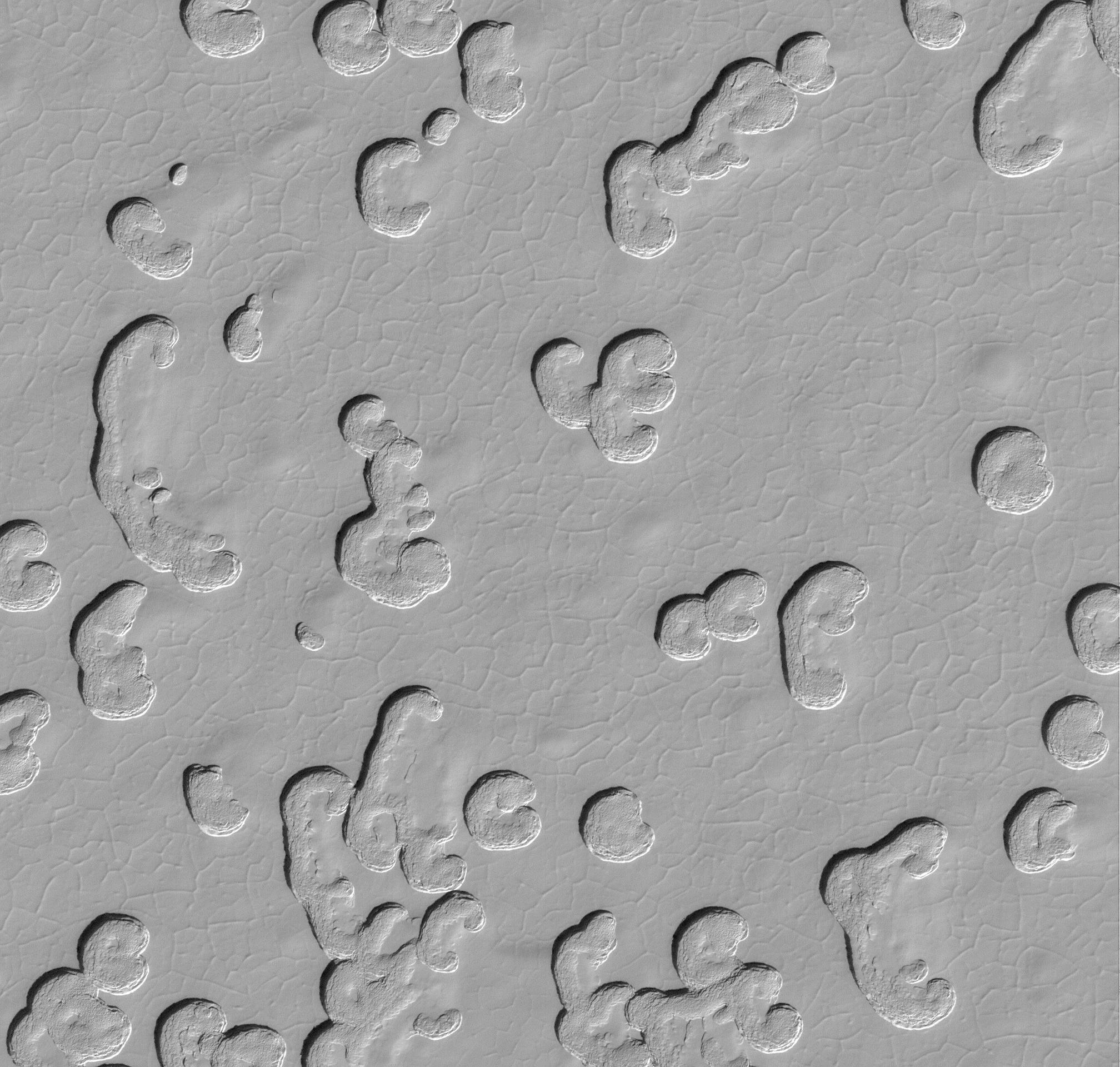
Martian "Swiss Cheese"
Full Resolution:
TIFF
(398.5 kB)
JPEG
(102.1 kB)
2000-04-24
Mars
Mars Global Surveyor (MGS)
Mars Orbiter Camera (MOC)
549x1096x1
PIA02368:
More South Polar "Swiss Cheese"
Full Resolution:
TIFF
(495.6 kB)
JPEG
(143.9 kB)
2000-04-24
Mars
Mars Global Surveyor (MGS)
Mars Orbiter Camera (MOC)
512x1024x1
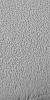
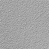
PIA02369:
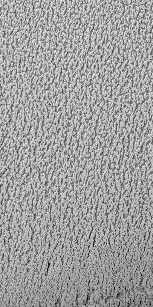
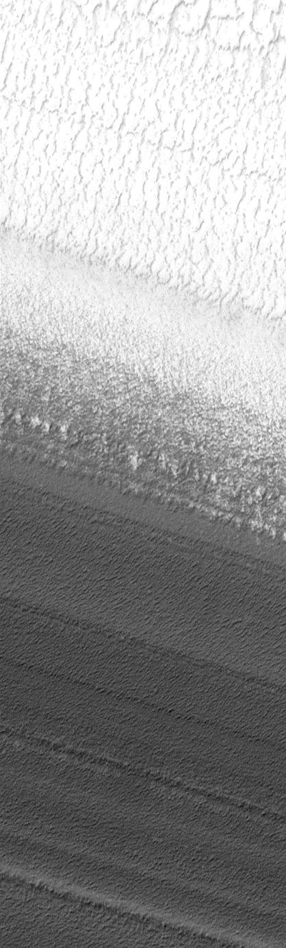
"Cottage Cheese" Texture on the Martian North Polar Cap in Summer
Full Resolution:
TIFF
(578.5 kB)
JPEG
(171.4 kB)
2000-04-24
Mars
Mars Global Surveyor (MGS)
Mars Orbiter Camera (MOC)
667x667x1
PIA02370:
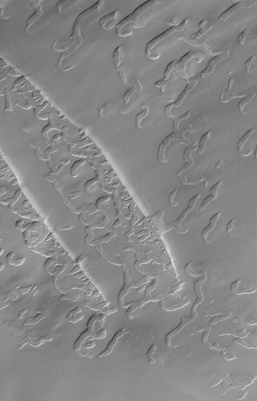
Martian "Kitchen Sponge"
Full Resolution:
TIFF
(486.2 kB)
JPEG
(157.5 kB)
2000-04-24
Mars
Mars Global Surveyor (MGS)
Mars Orbiter Camera (MOC)
418x1385x1
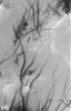
PIA02371:
Gradual Contact Between North Polar Ice and Layers
Full Resolution:
TIFF
(474.2 kB)
JPEG
(113.5 kB)
2000-04-24
Mars
Mars Global Surveyor (MGS)
Mars Orbiter Camera (MOC)
2016x1920x1
PIA02372:
Martian South Polar Cap Close-Up
Full Resolution:
TIFF
(2.845 MB)
JPEG
(549.8 kB)
2000-04-24
Mars
Mars Global Surveyor (MGS)
Mars Orbiter Camera (MOC)
418x641x1
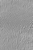
PIA02373:
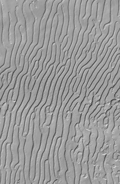
Mars South Polar Cap "Fingerprint" Terrain
Full Resolution:
TIFF
(229.6 kB)
JPEG
(56.02 kB)
2000-04-24
Mars
Mars Global Surveyor (MGS)
Mars Orbiter Camera (MOC)
836x1306x1
PIA02375:
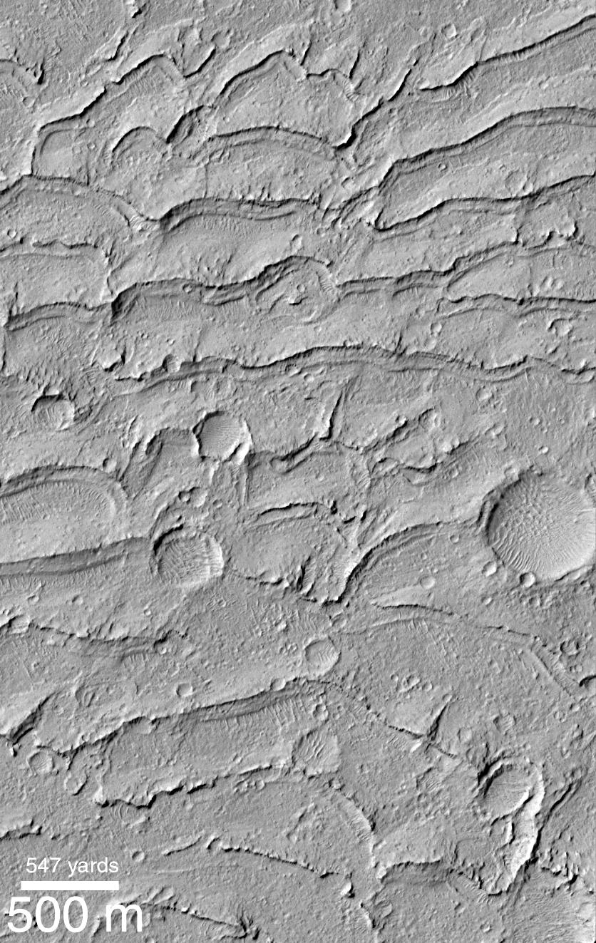
Complex Burial and Exhumation of South Polar Cap Pitted Terrain
Full Resolution:
TIFF
(836.5 kB)
JPEG
(145.7 kB)
2000-04-24
Mars
Mars Global Surveyor (MGS)
Mars Orbiter Camera (MOC)
836x1323x1
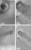
PIA02376:
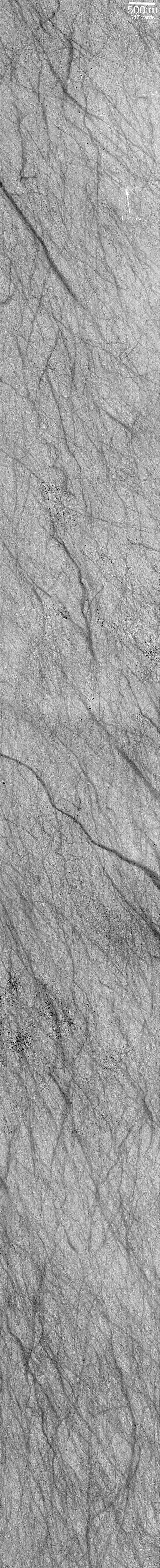
Dust Devils Seen Streaking Across Mars: PART 1--What Are These?
Full Resolution:
TIFF
(823.9 kB)
JPEG
(184.1 kB)
2000-04-24
Mars
Mars Global Surveyor (MGS)
Mars Orbiter Camera (MOC)
836x1382x1
PIA02377:
Dust Devils Seen Streaking Across Mars: PART 1--What Are These?
Full Resolution:
TIFF
(988.4 kB)
JPEG
(285.3 kB)
2000-04-24
Mars
Mars Global Surveyor (MGS)
Mars Orbiter Camera (MOC)
512x5000x1
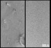
PIA02378:
Dust Devils Seen Streaking Across Mars: PART II--They're the Work of the Devil!
Full Resolution:
TIFF
(2.376 MB)
JPEG
(597.9 kB)
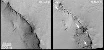
2000-04-24
Mars
Mars Global Surveyor (MGS)
Mars Orbiter Camera (MOC)
1105x535x1
PIA02379:
Recent Movements: New Landslides in Less than 1 Martian Year
Full Resolution:
TIFF
(431.2 kB)
JPEG
(136.4 kB)
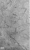
2000-04-24
Mars
Mars Global Surveyor (MGS)
Mars Orbiter Camera (MOC)
437x572x3
PIA02380:
Recent Movements: New Landslides in Less than 1 Martian Year
Full Resolution:
TIFF
(681.5 kB)
JPEG
(49.69 kB)
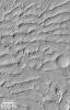
2000-04-29
Mars
Mars Global Surveyor (MGS)
Mars Orbiter Camera (MOC)
585x1458x1
PIA02360:
Ancient Paleo-Dunes Battered by Impact Craters
Full Resolution:
TIFF
(839.4 kB)
JPEG
(205.3 kB)
2000-04-29
Mars
Mars Global Surveyor (MGS)
Mars Orbiter Camera (MOC)
836x1323x1
PIA02359:
Ancient Paleo-Dunes Battered by Impact Craters
Full Resolution:
TIFF
(1.13 MB)
JPEG
(259 kB)
2000-04-29
Mars
Mars Global Surveyor (MGS)
Mars Orbiter Camera (MOC)
1690x1234x3
PIA02393:
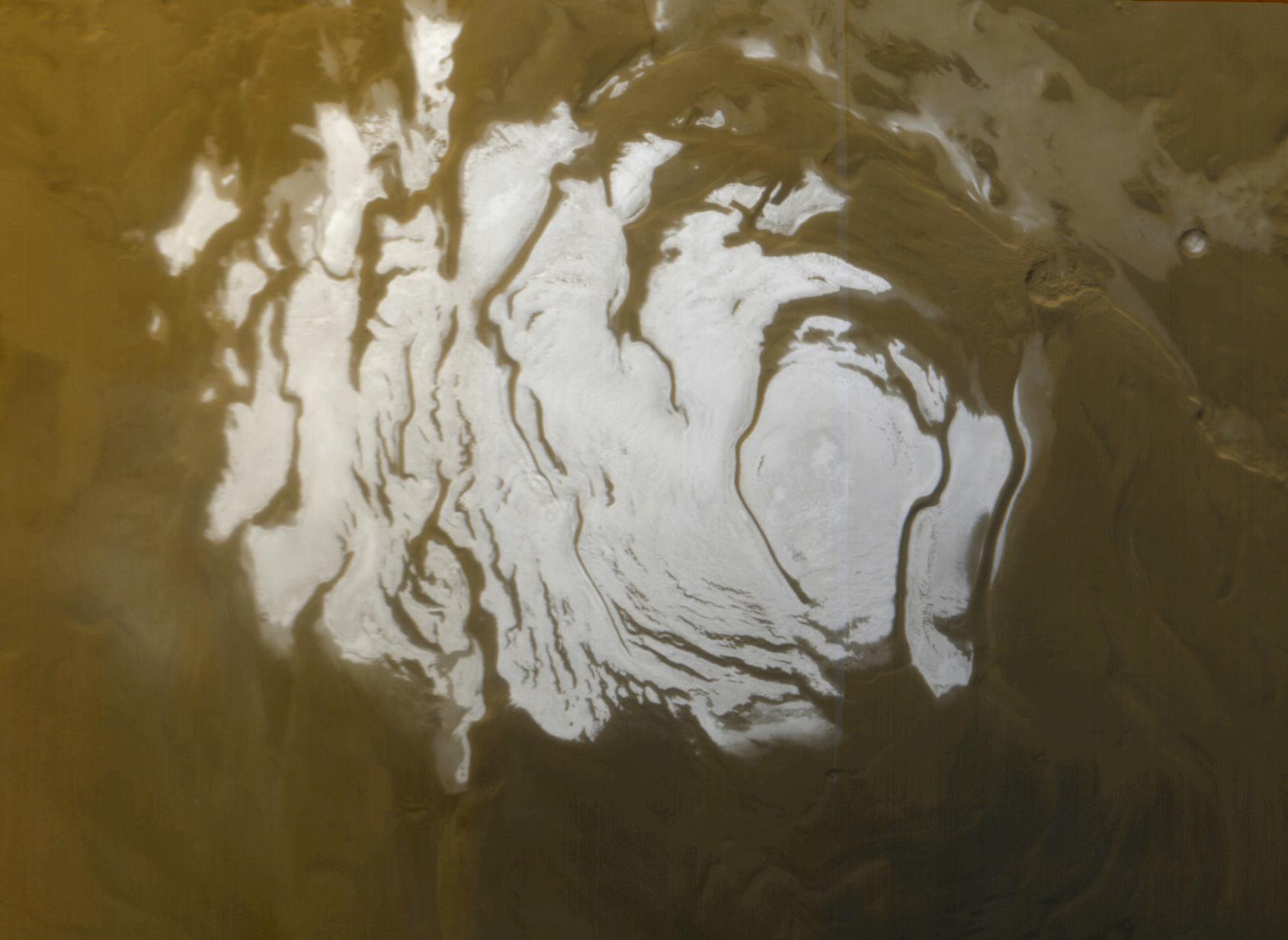
South Polar Cap, Summer 2000
Full Resolution:
TIFF
(5.016 MB)
JPEG
(142.7 kB)
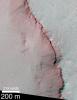
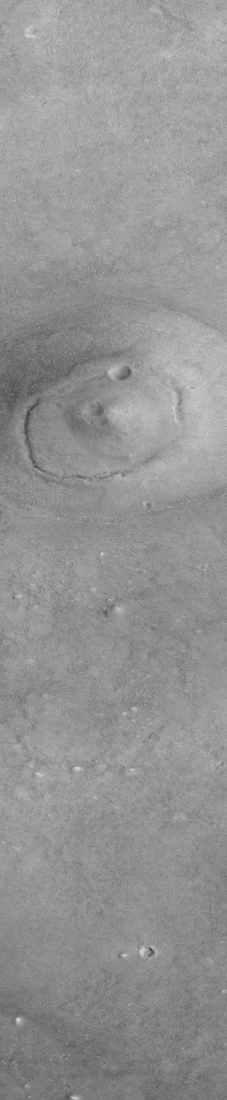
2000-04-29
Mars
Mars Global Surveyor (MGS)
Mars Orbiter Camera (MOC)
528x655x3
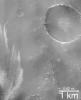
PIA02394:
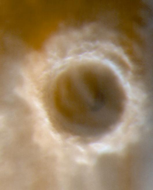
The Frosty Rims of Lomonosov Crater in Winter
Full Resolution:
TIFF
(1.022 MB)
JPEG
(21.97 kB)
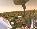
2000-05-02
Mars
Viking
Camera 1
2818x2224x3
PIA01522:
Viking 2 Image of Mars Utopian Plain
Full Resolution:
TIFF
(18.8 MB)
JPEG
(556.8 kB)
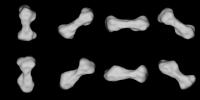
2000-05-04
Kleopatra
Radio Telescope
640x320x1
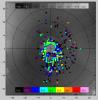
PIA02454:
Radar Model of Asteroid 216 Kleopatra
Full Resolution:
TIFF
(41.39 kB)
JPEG
(11.61 kB)
1-100
101-200
201-300
301-400
401-500
501-600
601-700
701-800
801-900
901-1000
Currently displaying images:
601 - 700
of 14967


