- Original Caption Released with Image:
-
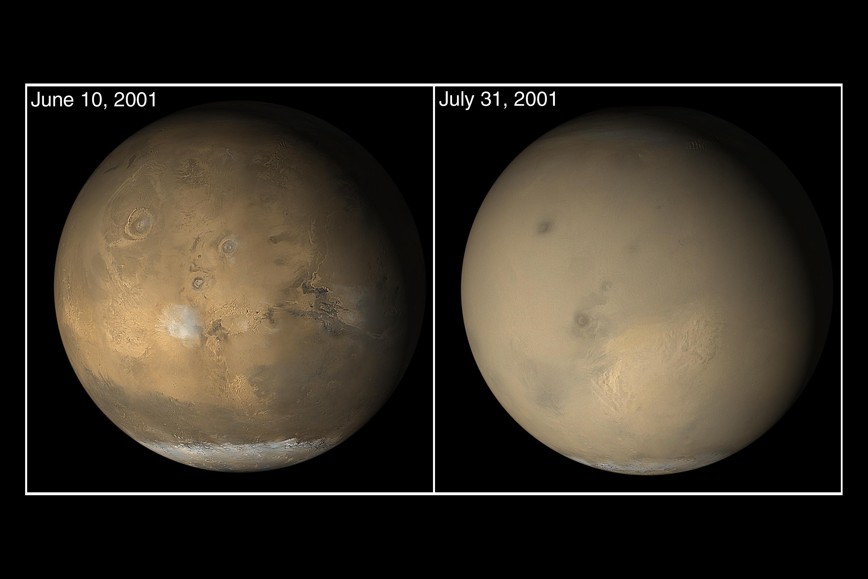
The wide angle cameras of the Mars Orbiter Camera (MOC) system onboard Mars Global Surveyor (MGS) are used every day to gather a global view of changes occurring in martian weather and surface frost patterns. Late in June 2001, as southern winter transitioned to spring, dust storm activity began to pick up as cold air from the south polar cap moved northward toward the warmer air at the martian equator. By early July, dust storms had popped up all over the planet, particularly throughout the southern hemisphere and in the Elysium/Amazonis regions of the northern hemisphere. Soon, the entire planet--except the south polar cap--was enshrouded in dust. Similar storms have occurred before. For example, the planet was obscured by dust when the Mariner 9, Mars 2, and Mars 3 spacecraft reached the planet in late 1971. The MGS MOC images showed the evolution of the 2001 great dust storm period. There was never a time when the entire planet was in the midst of a single storm. Several large storms would occur at the same time, and dust was kicked high into the atmosphere to cause much of the rest of the planet to be obscured. The dust storms largely subsided by late September 2001, but the atmosphere remained hazy into November of that year. The two pictures shown here come from the E05 (June 2001) and E06 (July 2001) subphases of the MGS MOC Extended Mission. The view from June shows the Tharsis volcanic region (left), Valles Marineris chasms (right) and the late winter south polar cap (bottom). The view from July shows the same regions, but most of the details are hidden by dust storms and haze.
- Image Credit:
-
NASA/JPL/MSSS
Image Addition Date: -
2002-05-07
|
