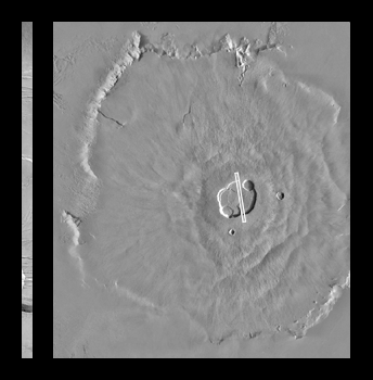
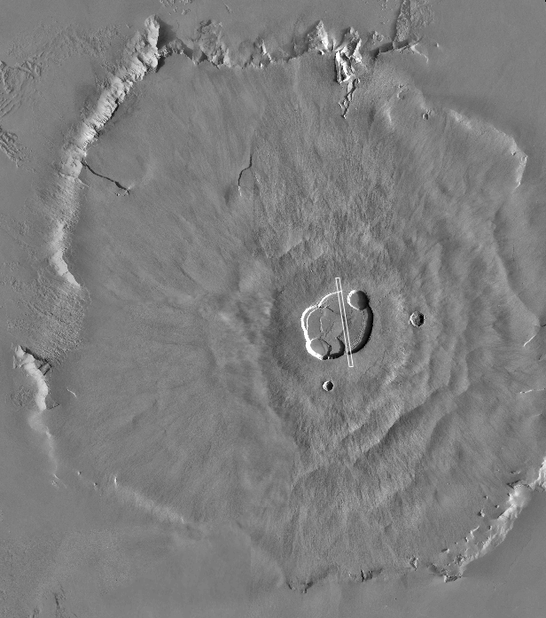
Click figure for larger view of context image.Olympus Mons is one of the largest volcanoes known. It is roughly the height of 3 Mount Everests and is nearly 550 km (340 miles) across. Despite its great height, the slopes of this volcano are only a few degrees--a person would not really climb Olympus Mons, but simply walk uphill toward its summit. Once reaching the summit, however, one would peer across and down into the large complex of nested craters--or calderae--formed by collapse after eruptions ceased and magma withdrew deep beneath the volcano. Similar sights--though smaller--can be seen by visiting the Hawaii Volcanoes National Park on the Island of Hawai'i. Descriptions and photographs of the Hawaiian volcanoes that are very much like Olympus Mons can be found at the site of the U. S. Geological Survey's Hawaiian Volcano Observatory.
Olympus Mons is not an active volcano. The MOC image shows that the summit region includes surfaces mantled by fine dust and pocked by small impact craters, and no surfaces exhibit fresh, dark lava flows like those seen near active volcanoes such as those in Hawai'i. The context image of Olympus Mons (above right) is a mosaic of Viking orbiter views obtained in the late 1970s. The white box crossing the summit craters (just right of center in the context image) shows the location of the high resolution MGS MOC view. The MOC high resolution image covers a strip across the summit region that is 3 kilometers (1.9 miles) wide by 91 kilometers (57 miles) long. Sunlight illuminates the MOC image from the lower left. Boulders can be seen in some of the troughs cut into the floor of the summit calderae in the 8 meter and 6 meter per pixel views; lava flows are visible in the northern portion of the image.
