My
List |
Addition Date
|
Target
|
Mission
|
Instrument
|
Size
|

|
2023-01-31 |
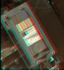
Mars
|
Mars Reconnaissance Orbiter (MRO)
|
HiRISE
|
2880x1800x3 |

|
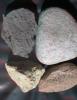
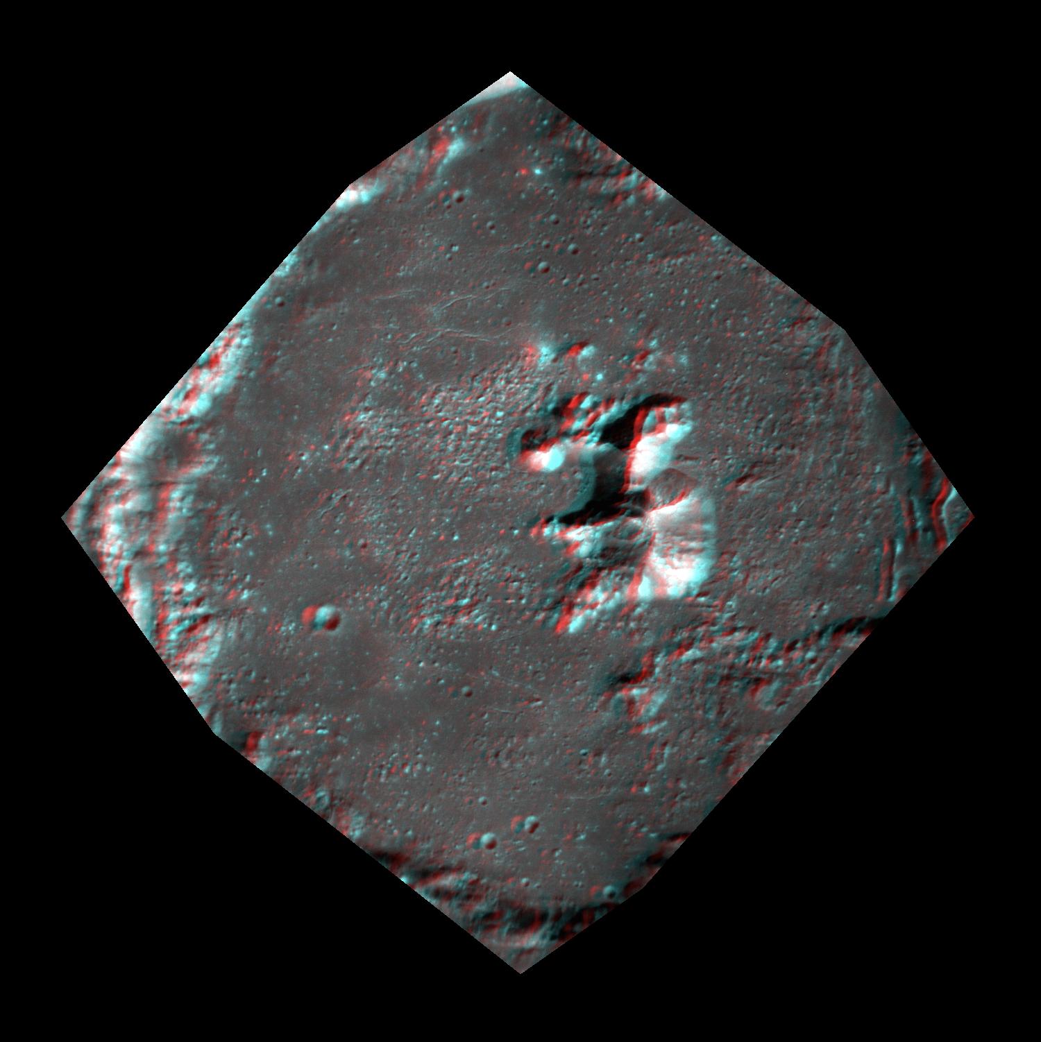
-
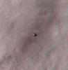
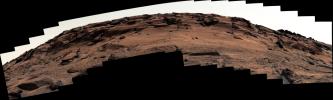
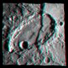
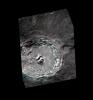
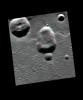
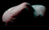
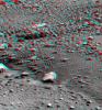
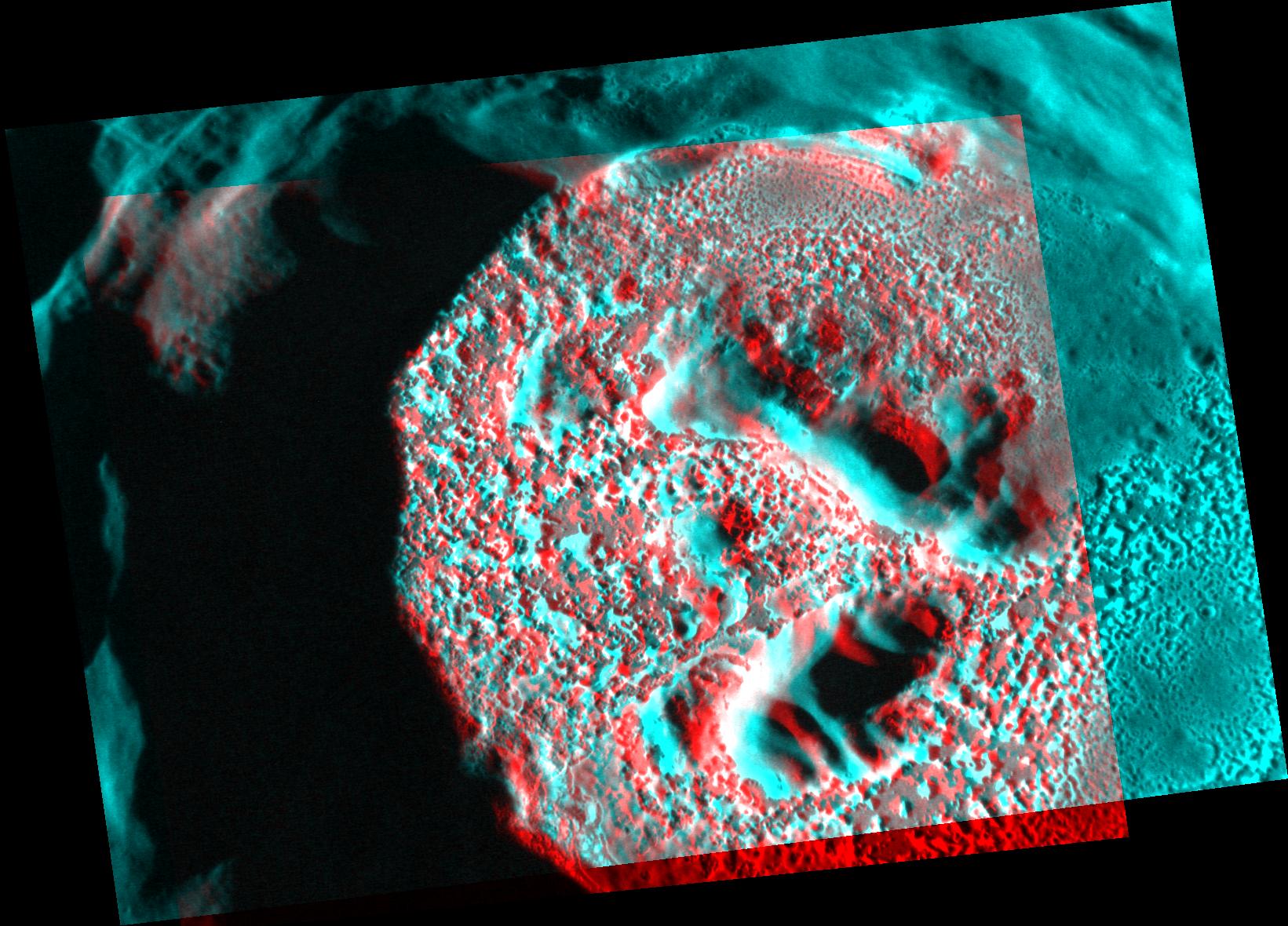
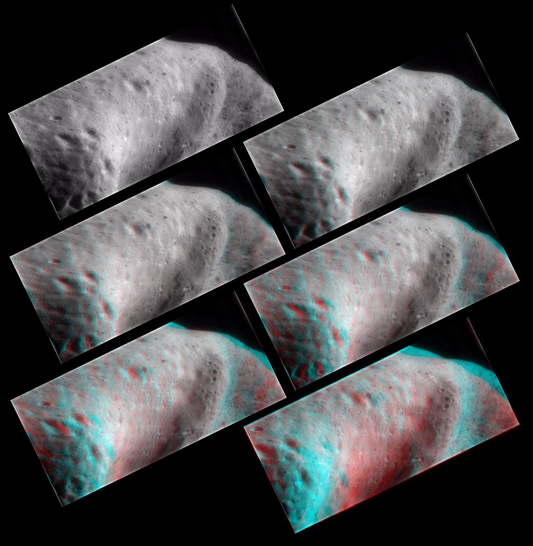
PIA25709:
-
A Bear on Mars?
Full Resolution:
TIFF
(8.108 MB)
JPEG
(1.166 MB)
|
|
|
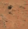
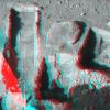
2012-10-10 |
Mars
|
Mars Reconnaissance Orbiter (MRO)
Mars Science Laboratory (MSL)
|
HiRISE
|
398x408x3 |
|
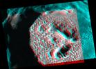
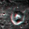
-
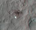
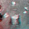
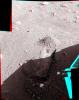
PIA16208:
-
Curiosity at Bradbury Landing Site in 3-D
Full Resolution:
TIFF
(487.5 kB)
JPEG
(17.84 kB)
|
|
|
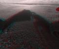
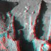
2012-10-10 |
Mars
|
Mars Reconnaissance Orbiter (MRO)
Mars Science Laboratory (MSL)
|
HiRISE
|
950x795x3 |
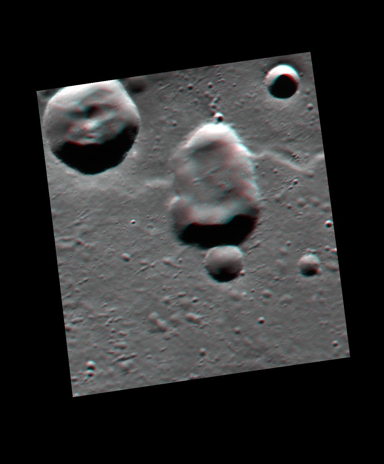
|
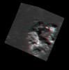
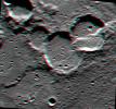
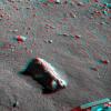
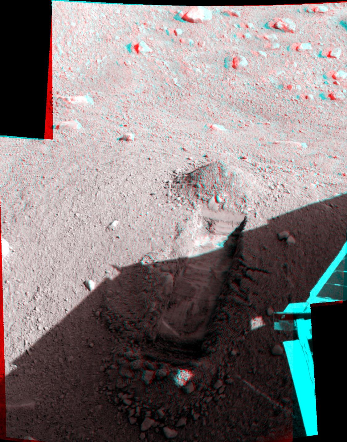
-
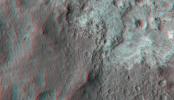
PIA16209:
-
Parachute and Back Shell in 3-D
Full Resolution:
TIFF
(2.267 MB)
JPEG
(87.85 kB)
|
|
|
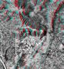
2012-10-10 |
Mars
|
Mars Reconnaissance Orbiter (MRO)
Mars Science Laboratory (MSL)
|
HiRISE
|
2414x1387x3 |
|
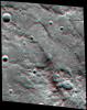
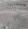
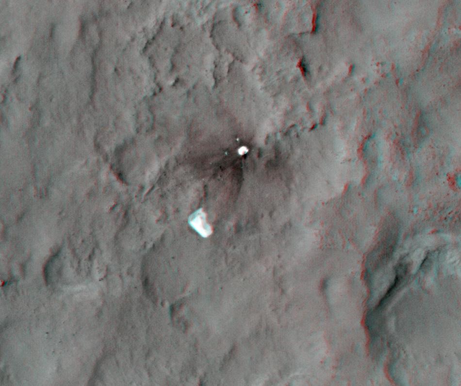
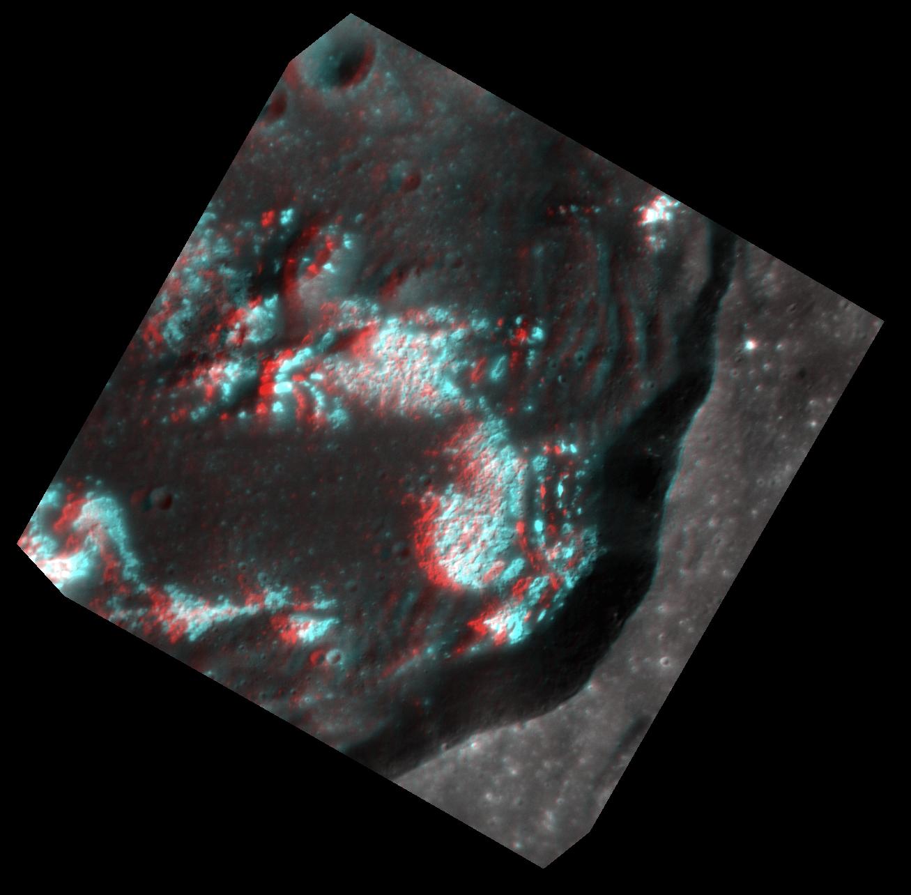
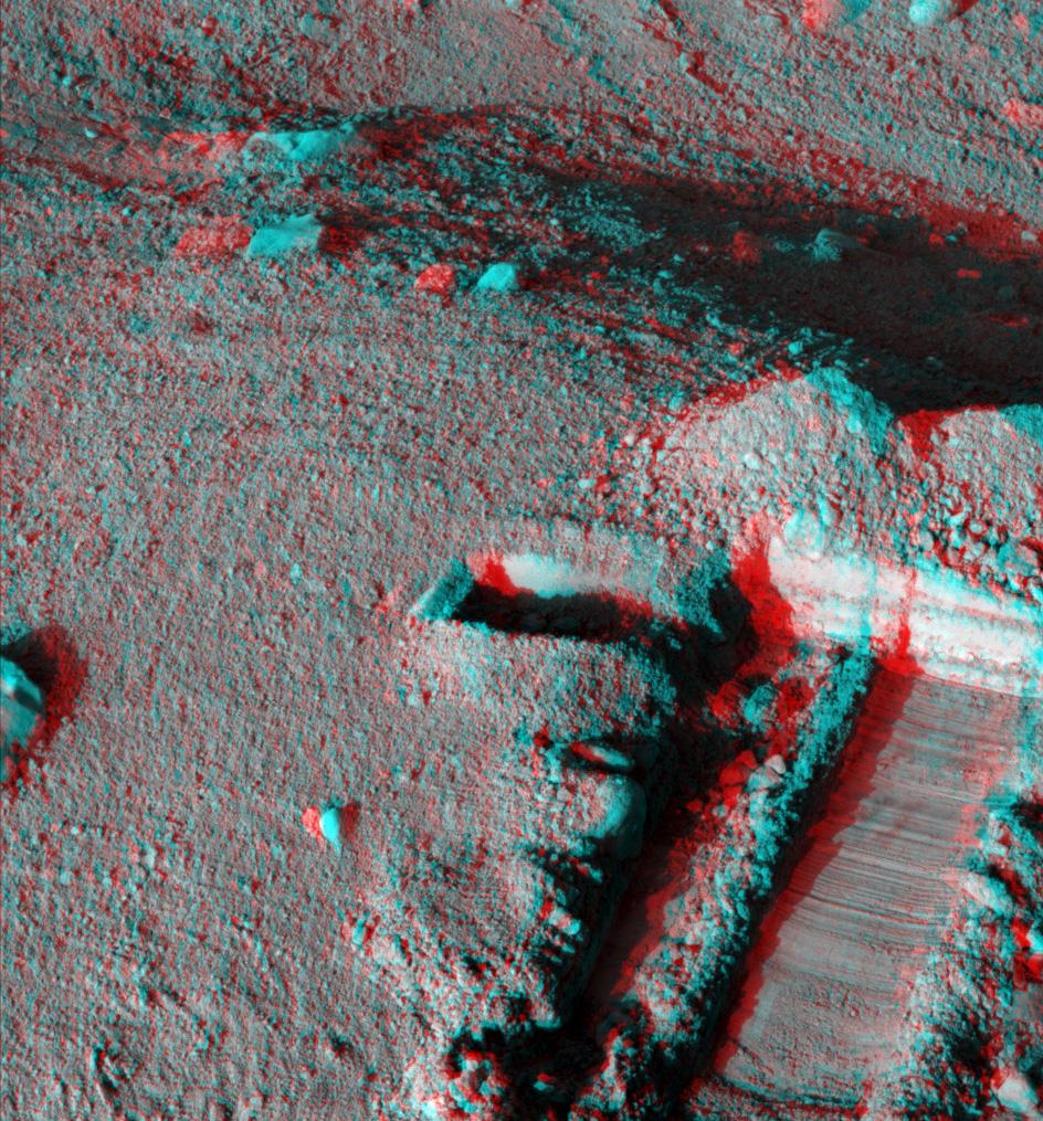
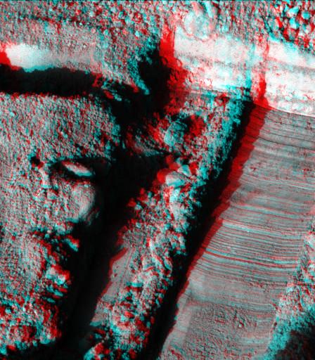
-
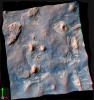
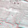
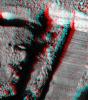
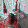
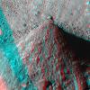
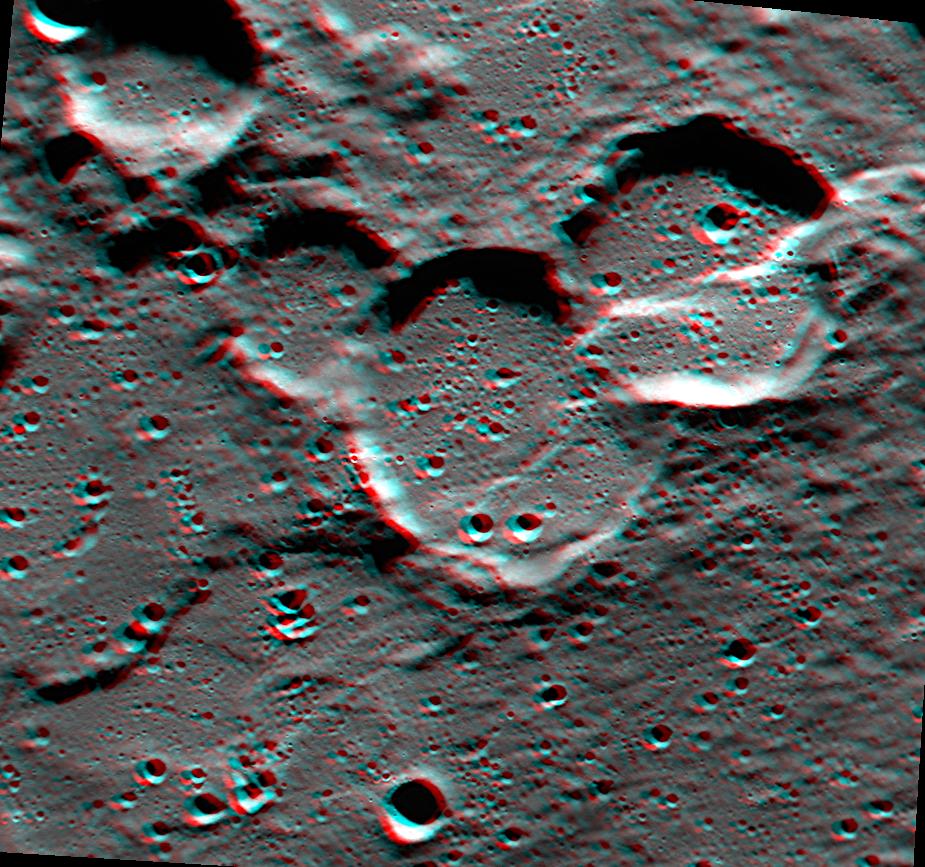
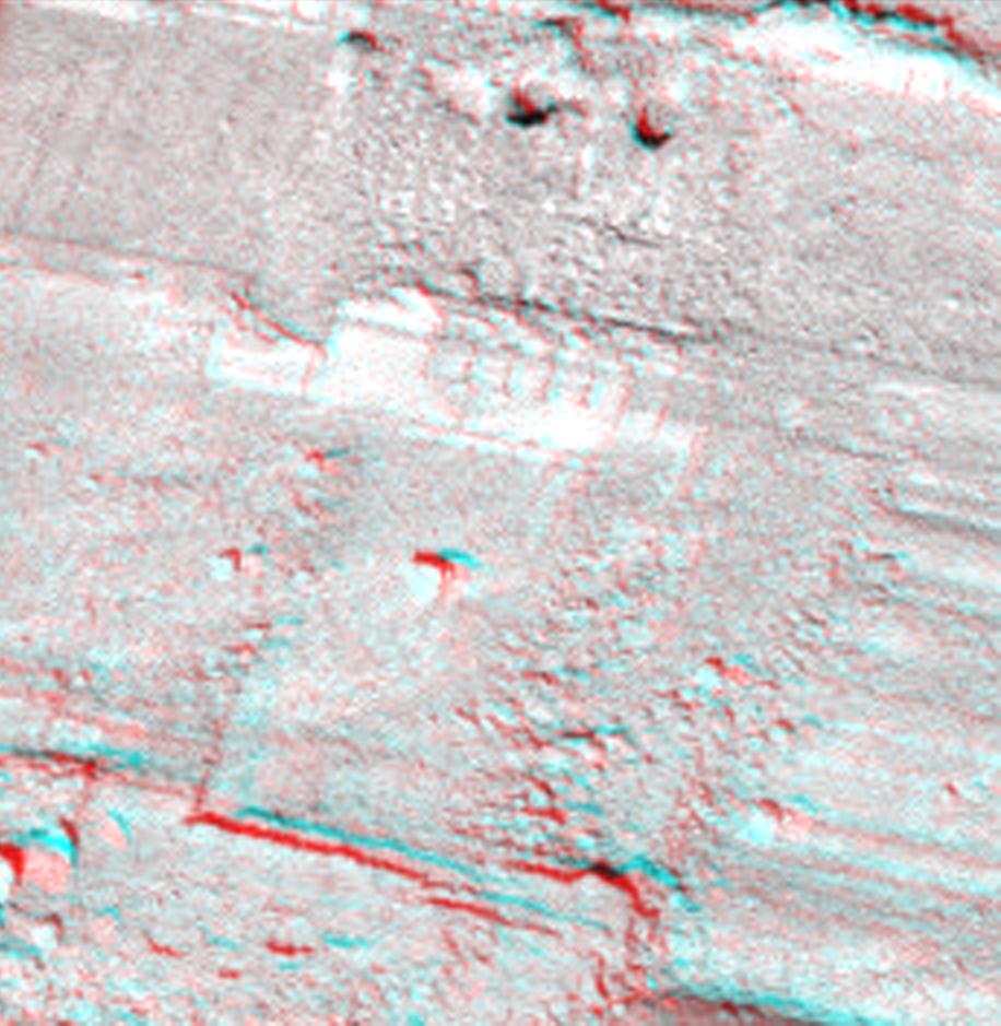
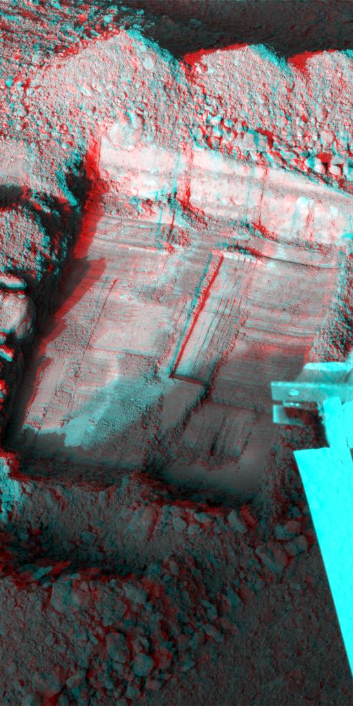
PIA16210:
-
'Glenelg' in 3-D
Full Resolution:
TIFF
(10.05 MB)
JPEG
(554.1 kB)
|
|
|
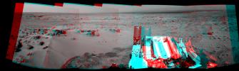
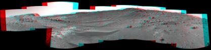
2014-04-16 |
Mars
|
Mars Reconnaissance Orbiter (MRO)
Mars Science Laboratory (MSL)
|
HiRISE
|
3287x3497x3 |
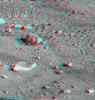
|
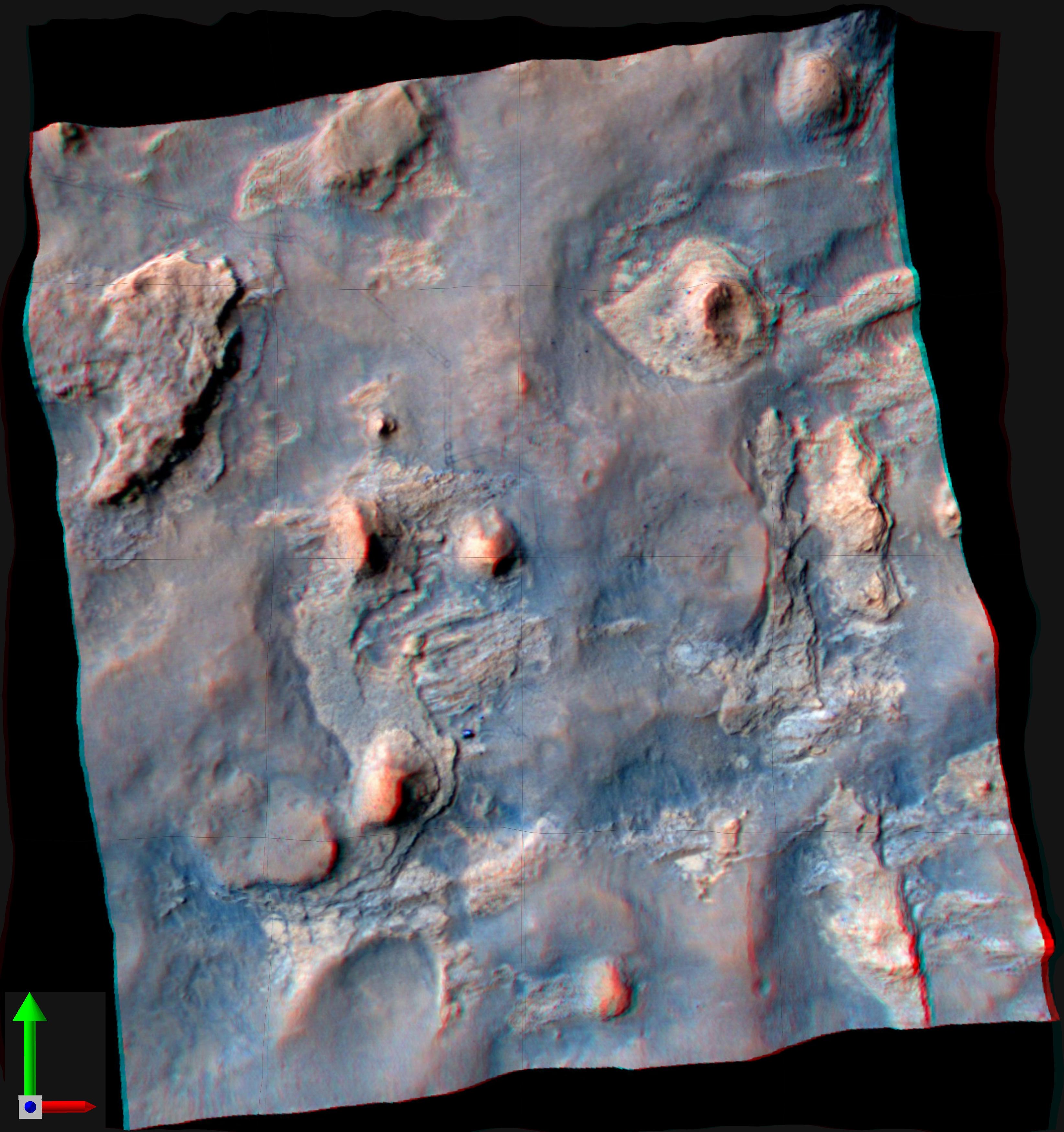
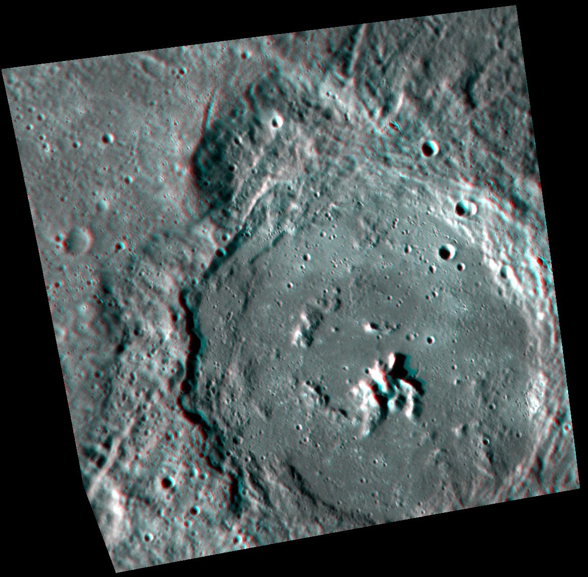
-
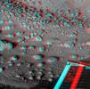
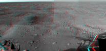
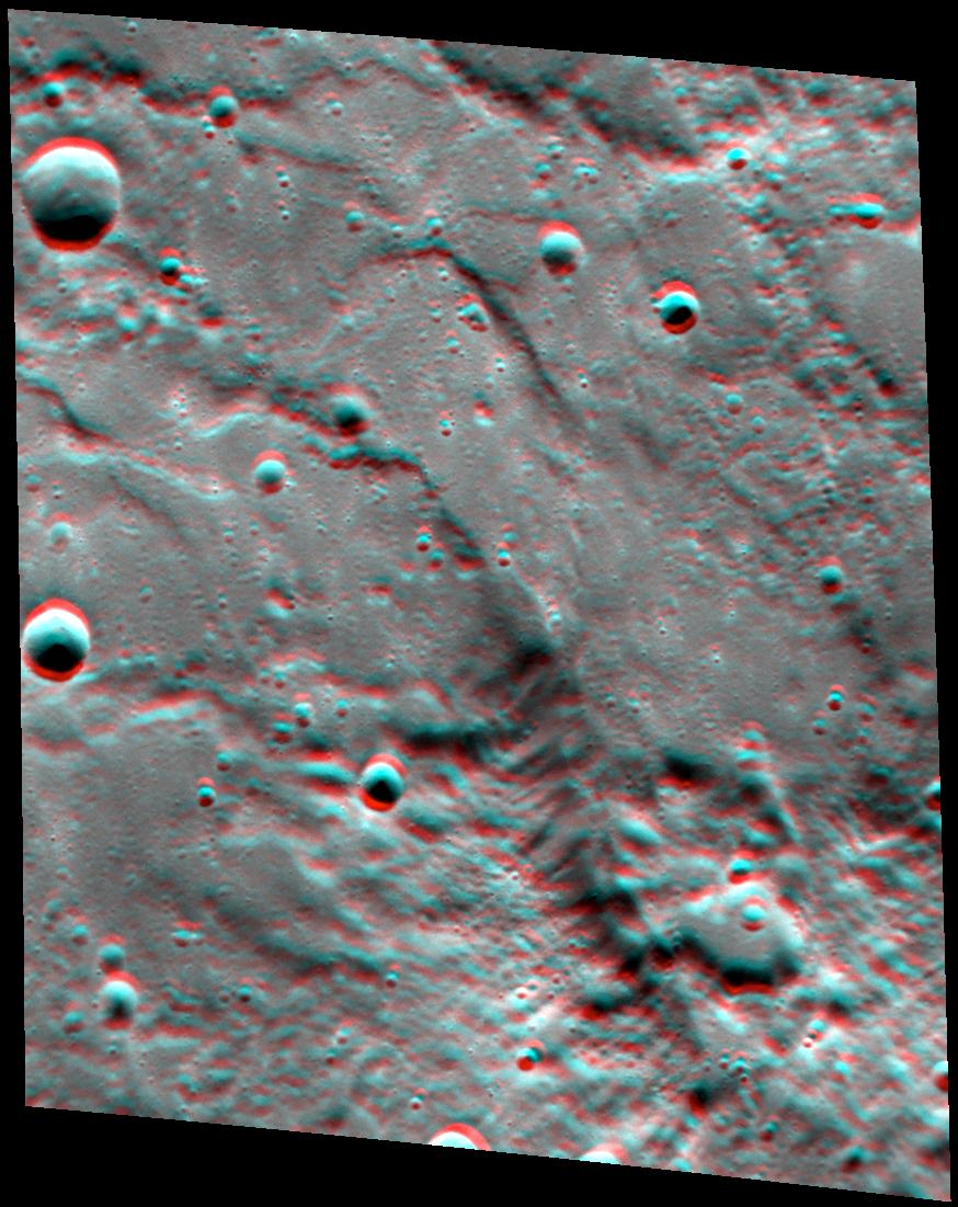
PIA18082:
-
Stereo View of Curiosity and Rover Tracks at 'the Kimberley,' April 2014
Full Resolution:
TIFF
(34.5 MB)
JPEG
(791.9 kB)
|
|
|
2010-11-16 |
Earth
|
Mars Science Laboratory (MSL)
|
MAHLI
|
1007x1305x3 |
|
-
PIA13585:
-
Test Image of Earth Rocks by Mars Camera (Stereo)
Full Resolution:
TIFF
(3.948 MB)
JPEG
(263.3 kB)
|
|
|
2011-07-22 |
|
Mars Science Laboratory (MSL)
|
|
3790x2532x3 |

|
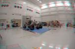
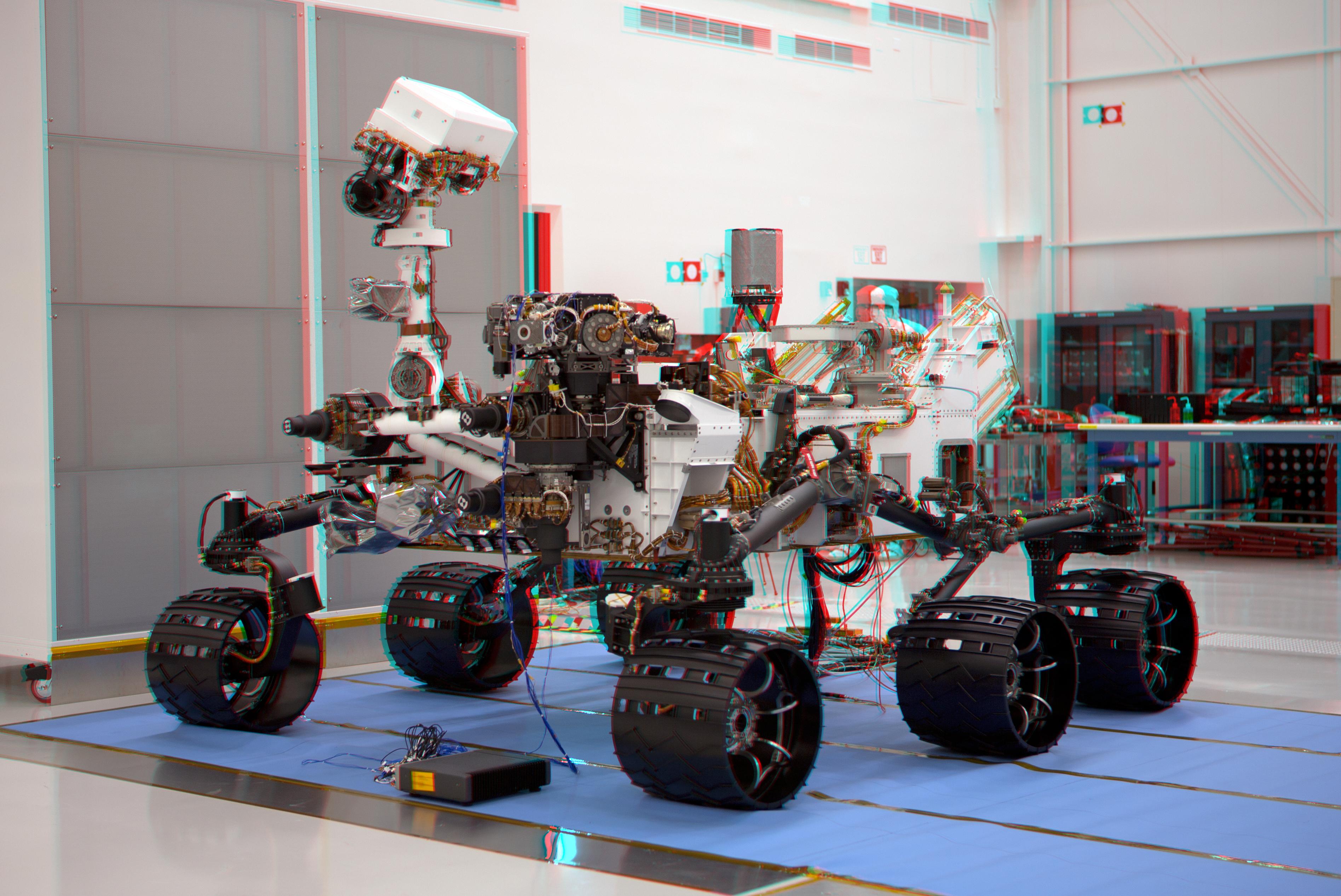
-
PIA14309:
-
Mars Science Laboratory Mission's Curiosity Rover (Stereo)
Full Resolution:
TIFF
(28.79 MB)
JPEG
(919.3 kB)
|
|
|
2011-12-09 |
|
Mars Science Laboratory (MSL)
|
|
4308x2828x3 |
|
-
PIA15180:
-
3-D Anaglyph Fish-eye View of NASA's Curiosity Rover and its Rocket-Powered Descent Vehicle
Full Resolution:
TIFF
(36.55 MB)
JPEG
(933.9 kB)
|
|
|
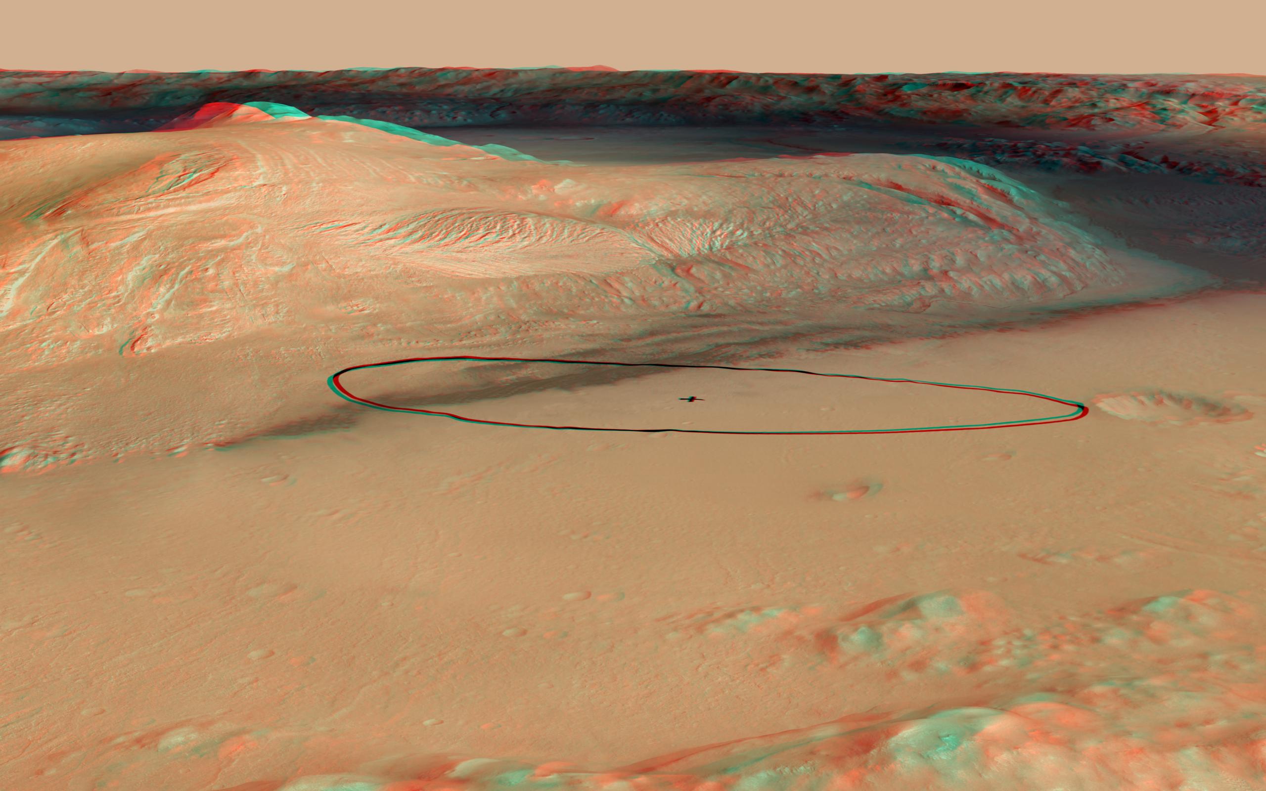
2012-06-11 |
Mars
|
Mars Science Laboratory (MSL)
|
|
2560x1600x3 |
|
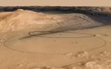
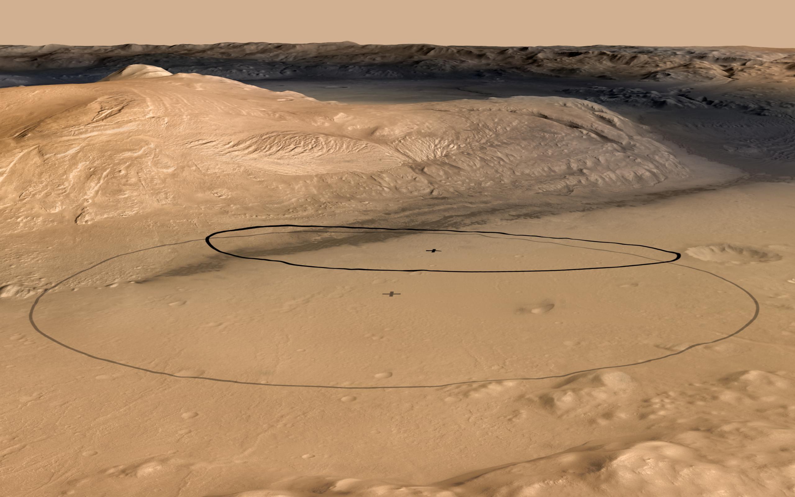
-
PIA15685:
-
Revised Landing Target for Mars Rover Curiosity
Full Resolution:
TIFF
(12.3 MB)
JPEG
(356.8 kB)
|
|
|
2012-06-11 |
Mars
|
Mars Science Laboratory (MSL)
|
|
2560x1600x3 |
|
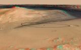
-
PIA15688:
-
Landing Target for Mars Rover Curiosity, in Stereo
Full Resolution:
TIFF
(12.3 MB)
JPEG
(341.3 kB)
|
|
|
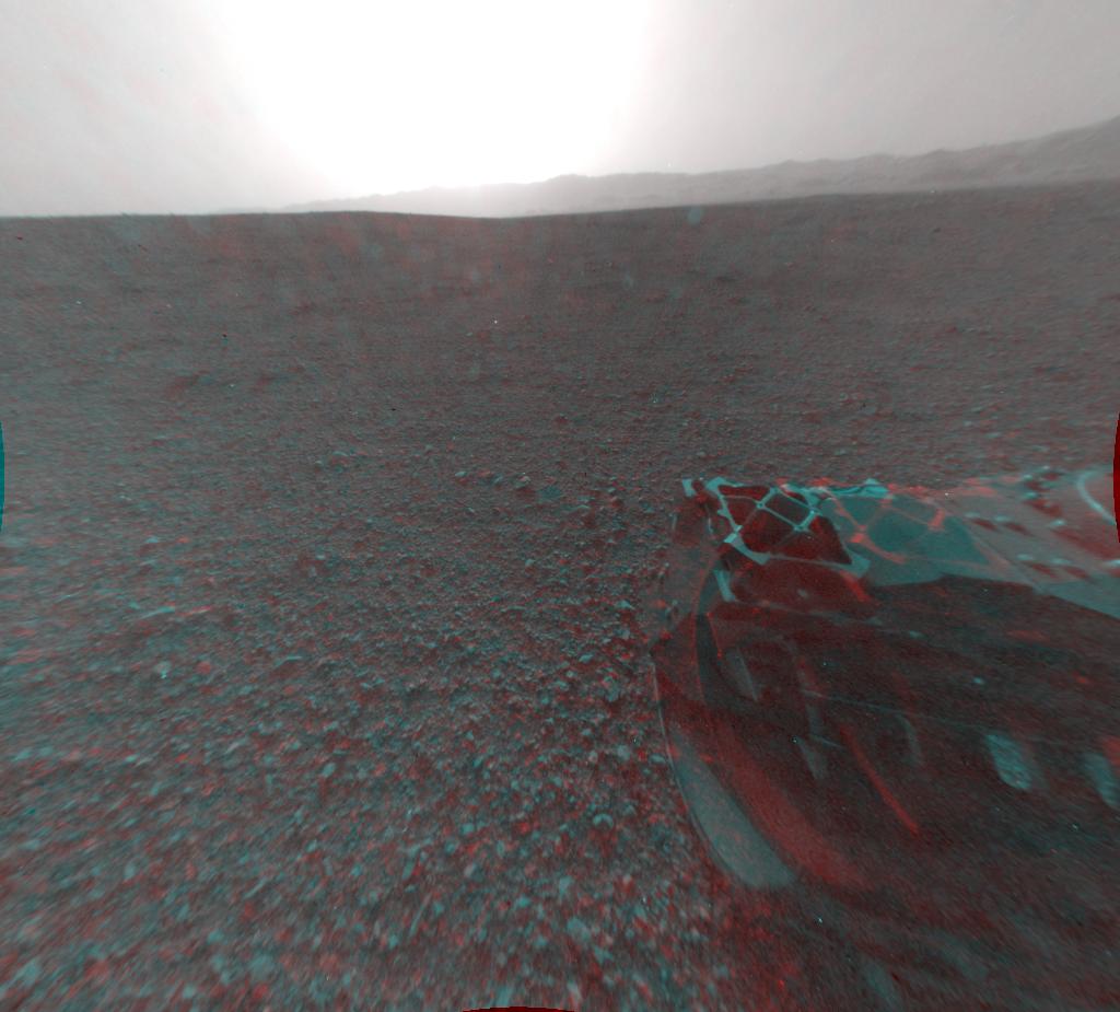
2012-08-07 |
Mars
|
Mars Science Laboratory (MSL)
|
|
1024x925x3 |
|
-
PIA16002:
-
3-D View from Behind Curiosity
Full Resolution:
TIFF
(2.843 MB)
JPEG
(94.86 kB)
|
|
|
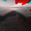
2012-08-07 |
Mars
|
Mars Science Laboratory (MSL)
|
|
1024x847x3 |
|
-
PIA16003:
-
3-D View from the Front of Curiosity
Full Resolution:
TIFF
(2.603 MB)
JPEG
(97.37 kB)
|
|
|
2012-08-07 |
Mars
|
Mars Science Laboratory (MSL)
|
|
1024x1024x3 |
|
-
PIA16004:
-
3-D View from the Front of Curiosity
Full Resolution:
TIFF
(3.147 MB)
JPEG
(109.6 kB)
|
|
|
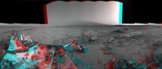
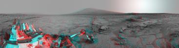
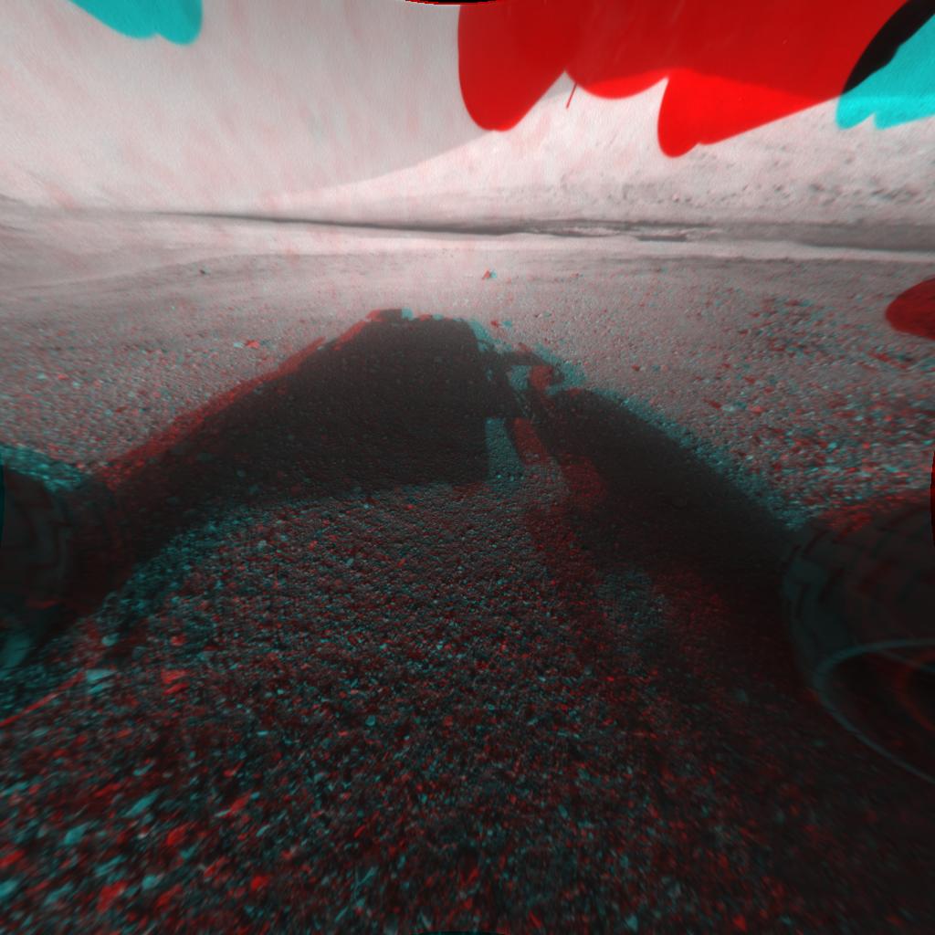
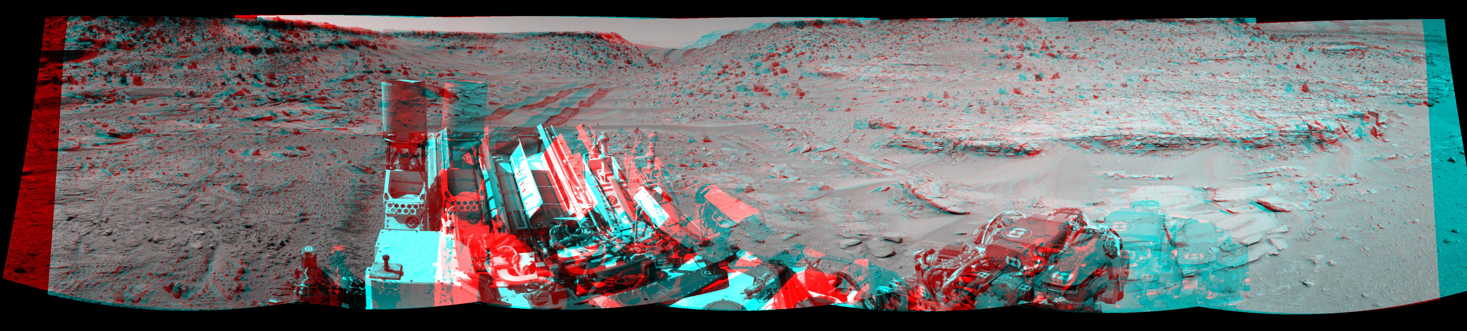
2012-09-04 |
Mars
|
Mars Science Laboratory (MSL)
|
|
7824x3337x3 |
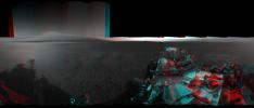
|
-
PIA16140:
-
3-D View from Bradbury Landing Site
Full Resolution:
TIFF
(78.35 MB)
JPEG
(1.916 MB)
|
|
|
2012-09-13 |
Mars
|
Mars Science Laboratory (MSL)
|
MAHLI
|
1096x1200x3 |
|
-
PIA15879:
-
3-D View of MAHLI Calibration Target
Full Resolution:
TIFF
(3.947 MB)
JPEG
(191.8 kB)
|
|
|
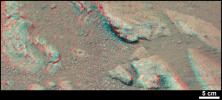
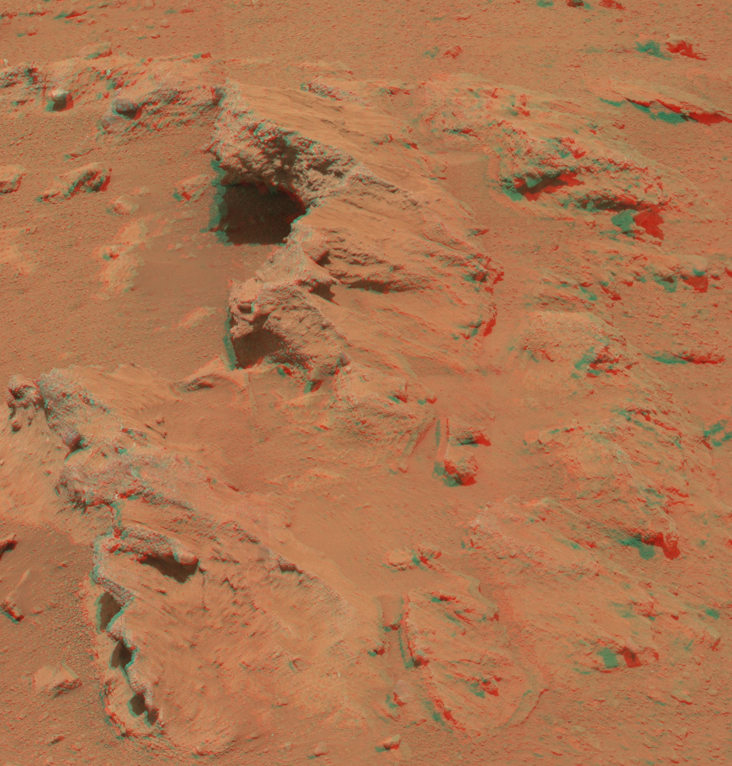
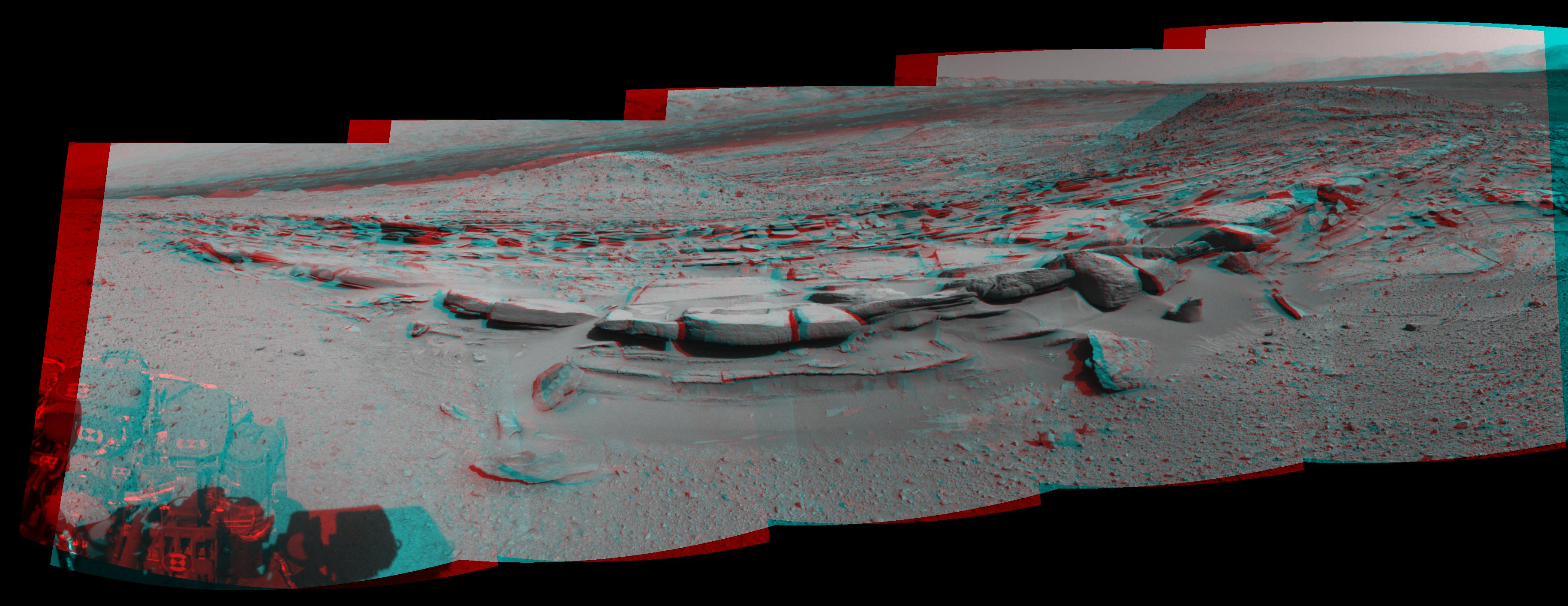
2012-10-03 |
Mars
|
Mars Science Laboratory (MSL)
|
Mastcam
|
2901x3036x3 |
|
-
PIA16223:
-
Martian Streambed Evidence Rock in 3-D
Full Resolution:
TIFF
(26.43 MB)
JPEG
(977.2 kB)
|
|
|
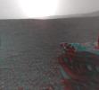
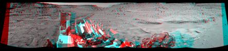
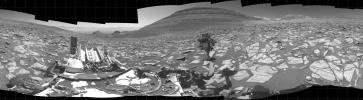
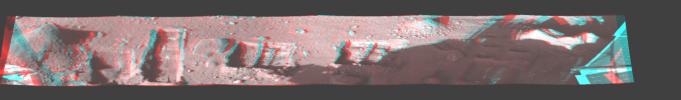
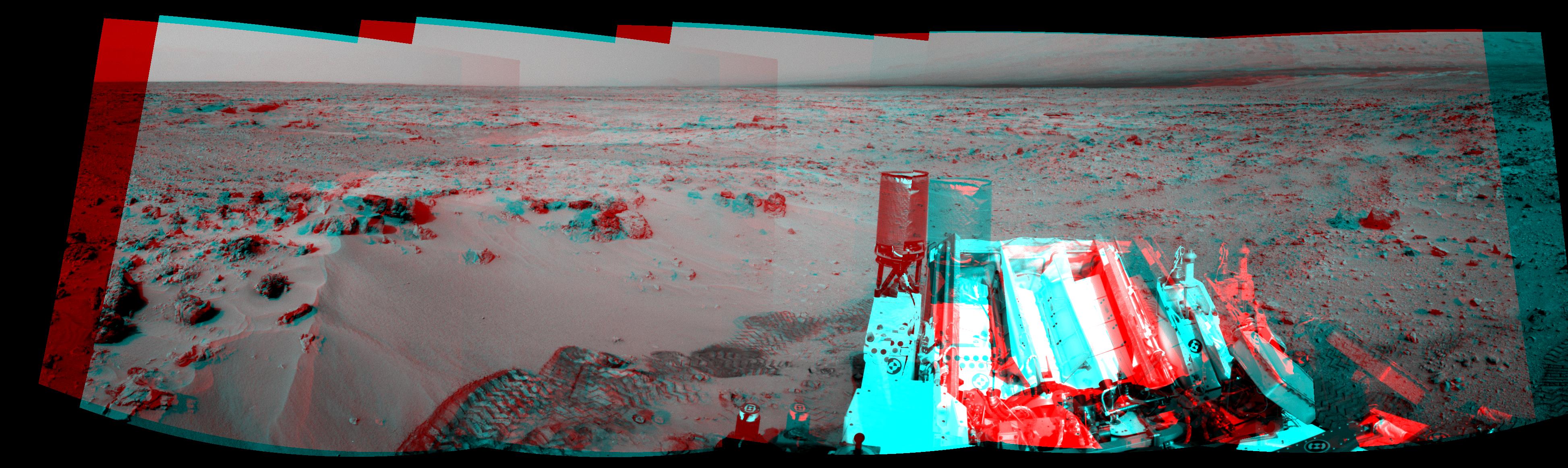
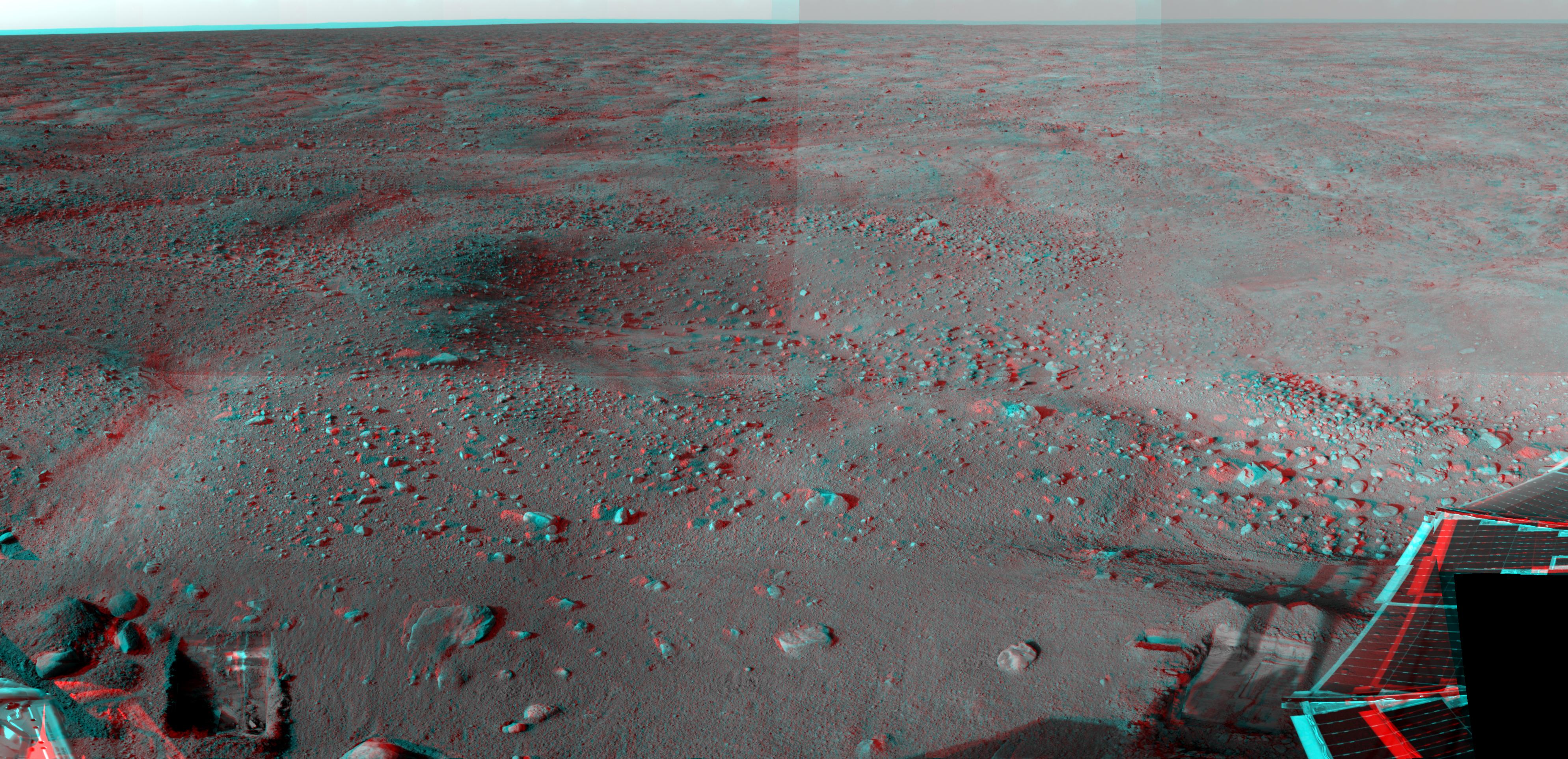
2012-11-20 |
Mars
|
Mars Science Laboratory (MSL)
|
Navcam (MSL)
|
3893x1162x3 |
|
-
PIA16449:
-
Curiosity's Eastward View After Sol 100 Drive, Stereo
Full Resolution:
TIFF
(13.58 MB)
JPEG
(640.8 kB)
|
|
|
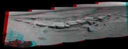
2013-04-23 |
Mars
|
Mars Science Laboratory (MSL)
|
Navcam (MSL)
|
7824x3328x3 |
|
-
PIA16847:
-
Mars Stereo View from "John Klein" to Mount Sharp (Raw)
Full Resolution:
TIFF
(78.14 MB)
JPEG
(2.325 MB)
|
|
|
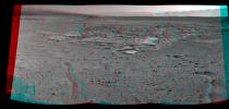
2013-04-23 |
Mars
|
Mars Science Laboratory (MSL)
|
Navcam (MSL)
|
7824x2131x3 |
|
-
PIA16925:
Mars Stereo View from "John Klein" to Mount Sharp
Full Resolution:
TIFF
(50.04 MB)
JPEG
(1.804 MB)
|
|
|
2013-05-30 |
Mars
|
Mars Science Laboratory (MSL)
|
Mastcam
|
2498x1126x3 |
|
-
PIA17063:
-
Evidence About a Martian Streambed (Stereo)
Full Resolution:
TIFF
(8.441 MB)
JPEG
(394.8 kB)
|
|
|
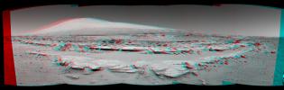
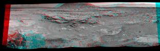
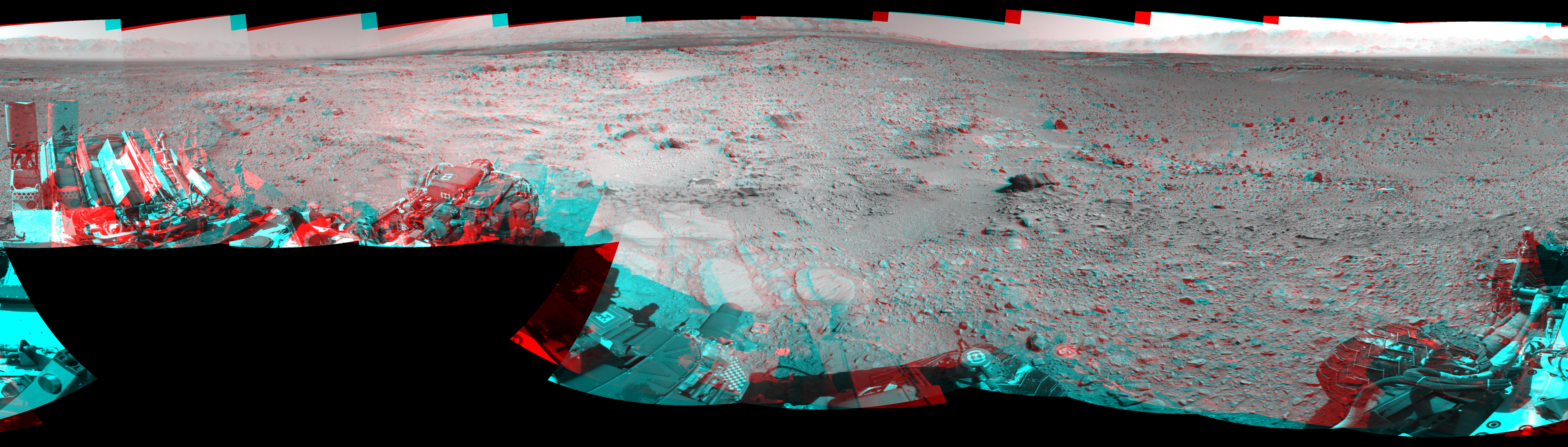
2013-12-20 |
Mars
|
Mars Science Laboratory (MSL)
|
Navcam (MSL)
|
7733x2206x3 |

|
-
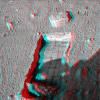
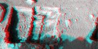
PIA17584:
Rocky Mars Ground Where Curiosity Has Been Driving (Stereo)
Full Resolution:
TIFF
(51.19 MB)
JPEG
(2.437 MB)
|
|
|
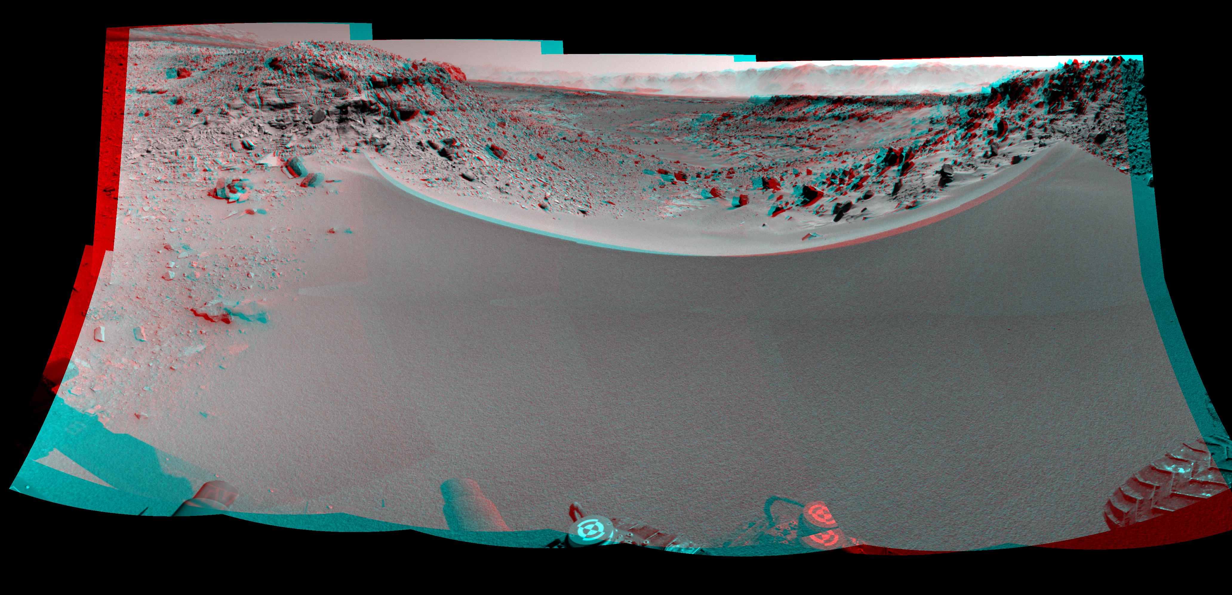
2014-01-31 |
Mars
|
Mars Science Laboratory (MSL)
|
Navcam (MSL)
|
4127x1993x3 |
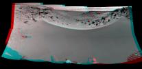
|
-
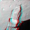
PIA17769:
-
Curiosity's View Past Dune at 'Dingo Gap' (Stereo)
Full Resolution:
TIFF
(24.69 MB)
JPEG
(1.066 MB)
|
|
|
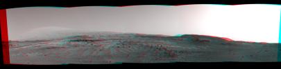
2014-02-27 |
Mars
|
Mars Science Laboratory (MSL)
|
Navcam (MSL)
|
3563x1131x3 |
|
-
PIA17948:
-
Martian Landscape With Rock Rows and Mount Sharp (Stereo)
Full Resolution:
TIFF
(12.09 MB)
JPEG
(503.8 kB)
|
|
|
2014-02-27 |
Mars
|
Mars Science Laboratory (MSL)
|
Navcam (MSL)
|
5015x1132x3 |
|
-
PIA17951:
Panoramic View From West of 'Dingo Gap' (Stereo)
Full Resolution:
TIFF
(17.04 MB)
JPEG
(954 kB)
|
|
|
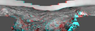
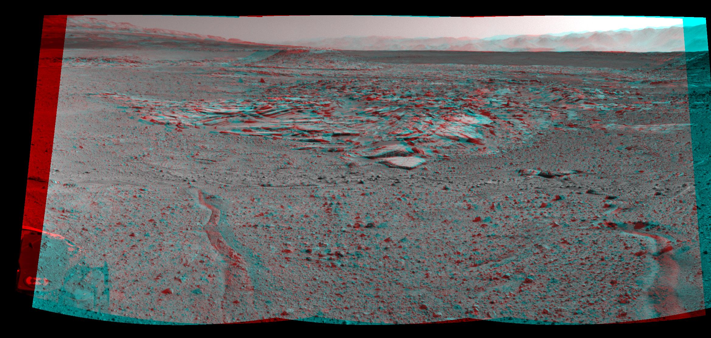
2014-03-24 |
Mars
|
Mars Science Laboratory (MSL)
|
Navcam (MSL)
|
3657x1414x3 |
|
-
PIA18070:
-
Panorama With Sandstone Outcrop Near 'The Kimberley' Waypoint (Stereo)
Full Resolution:
TIFF
(15.52 MB)
JPEG
(573.6 kB)
|
|
|
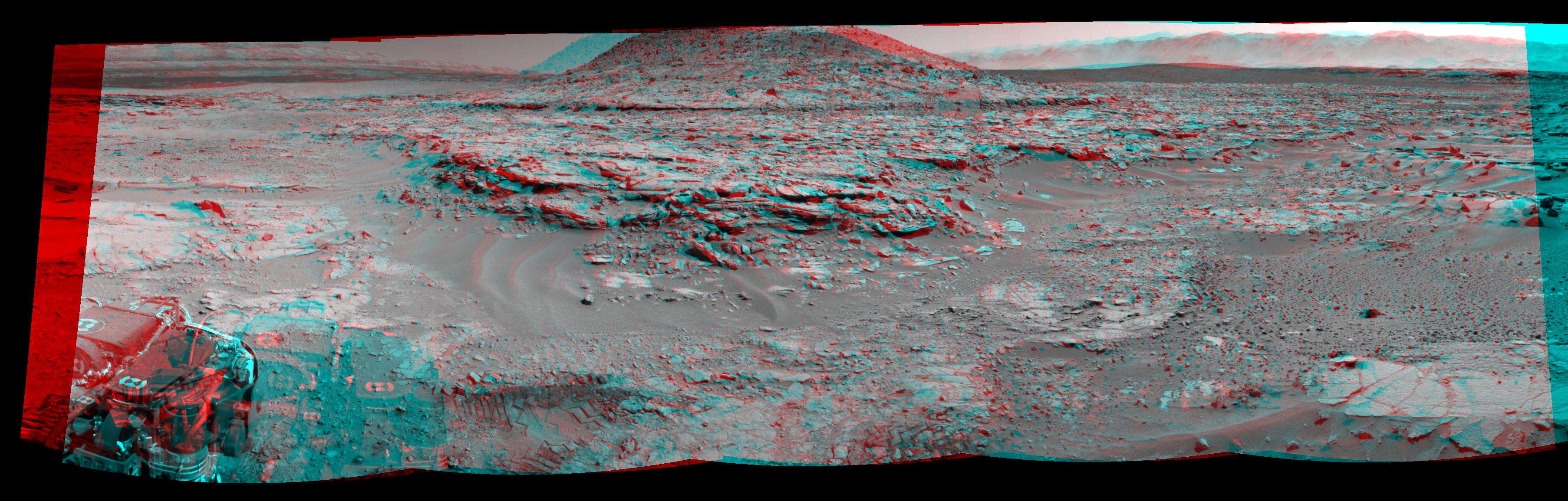
2014-04-03 |
Mars
|
Mars Science Laboratory (MSL)
|
Navcam (MSL)
|
2338x1111x3 |
|
-
PIA18074:
-
Curiosity's View From Arrival Point at 'The Kimberley' Waypoint (Stereo)
Full Resolution:
TIFF
(7.796 MB)
JPEG
(446.6 kB)
|
|
|
2014-04-16 |
Mars
|
Mars Science Laboratory (MSL)
|
Navcam (MSL)
|
3612x1155x3 |
|
-
PIA18084:
-
Stereo View of 'Mount Remarkable' and Surrounding Outcrops at Mars Rover's Waypoint
Full Resolution:
TIFF
(12.52 MB)
JPEG
(697.9 kB)
|
|
|
2015-04-13 |
Mars
|
Mars Science Laboratory (MSL)
|
Navcam (MSL)
|
6246x1497x3 |
|
-
PIA19165:
Curiosity View Ahead Through 'Artist's Drive' (Stereo)
Full Resolution:
TIFF
(28.06 MB)
JPEG
(1.019 MB)
|
|
|
2015-04-13 |
Mars
|
Mars Science Laboratory (MSL)
|
Navcam (MSL)
|
3368x832x3 |
|
-
PIA19387:
Scene From 'Artist's Drive' on Mars (Stereo)
Full Resolution:
TIFF
(8.41 MB)
JPEG
(231.6 kB)
|
|
|
2015-07-01 |
Mars
|
Mars Science Laboratory (MSL)
|
Navcam (MSL)
|
7729x2563x3 |
|
-
PIA19678:
-
Panorama from Curiosity's Sol 1000 Location (Stereo)
Full Resolution:
TIFF
(59.45 MB)
JPEG
(2.315 MB)
|
|
|
2016-01-04 |
Mars
|
Mars Science Laboratory (MSL)
|
Navcam (MSL)
|
4937x1190x3 |

|
-
PIA20282:
Downwind Side of 'Namib' Sand Dune on Mars, Stereo
Full Resolution:
TIFF
(13 MB)
JPEG
(596.7 kB)
|
|
|
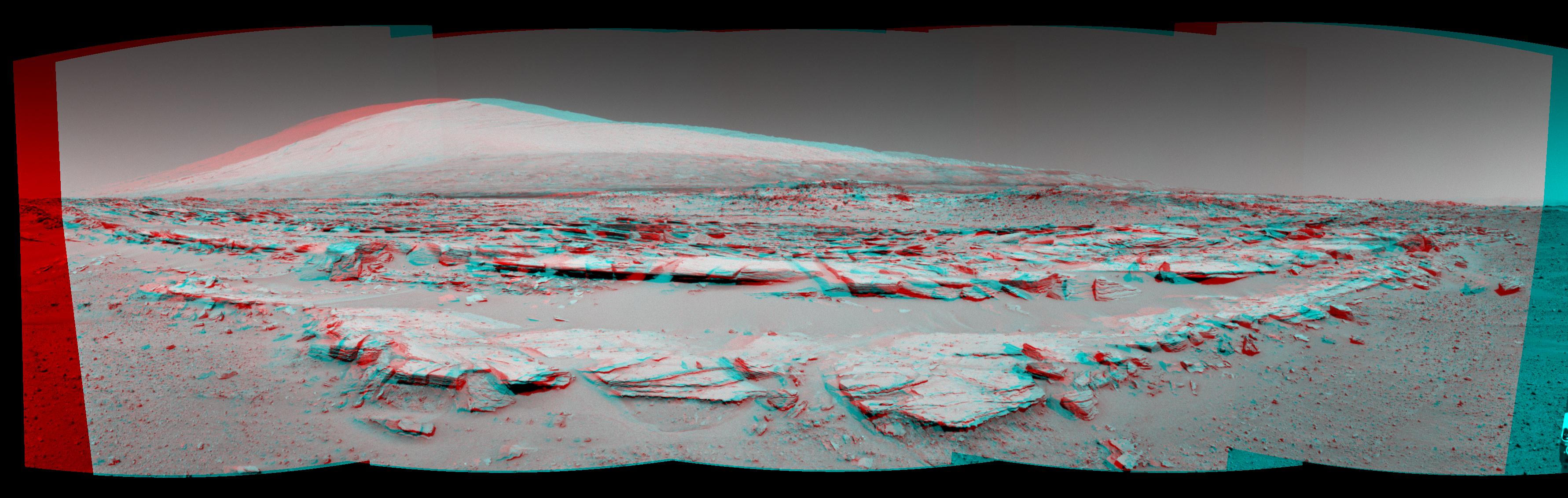
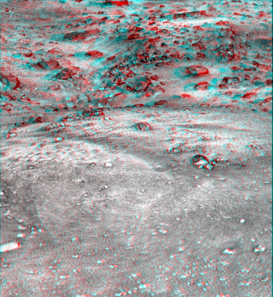
2016-08-19 |
Mars
|
Mars Science Laboratory (MSL)
|
Mastcam
|
4893x2642x3 |

|
-
PIA20836:
-
Breccia-Conglomerate Rocks on Lower Mount Sharp, Mars (Stereo)
Full Resolution:
TIFF
(18.52 MB)
JPEG
(976.6 kB)
|
|
|
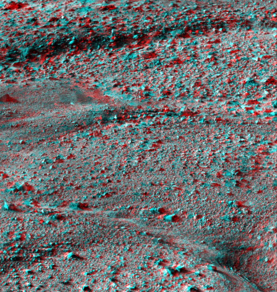
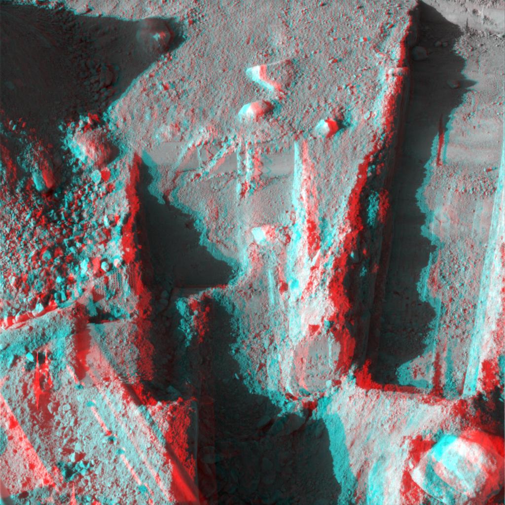
2021-03-30 |
Mars
|
Mars Science Laboratory (MSL)
|
Mastcam
|
1207x400x3 |
|
-
PIA24266:
-
Curiosity's 3D View of Mont Mercou
Full Resolution:
TIFF
(1.32 MB)
JPEG
(144.5 kB)
|
|
|
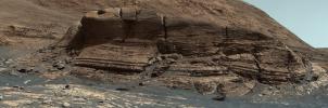
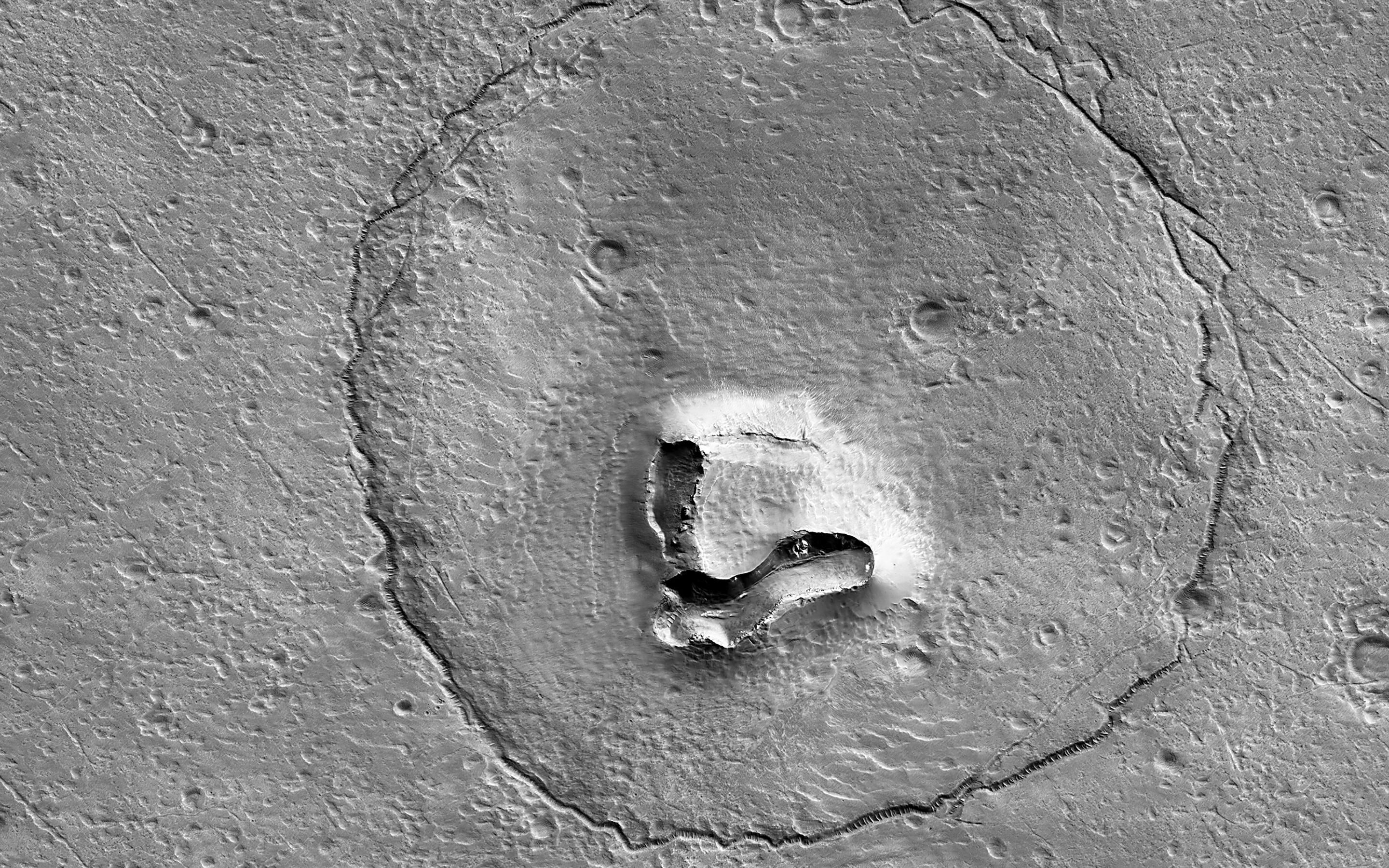
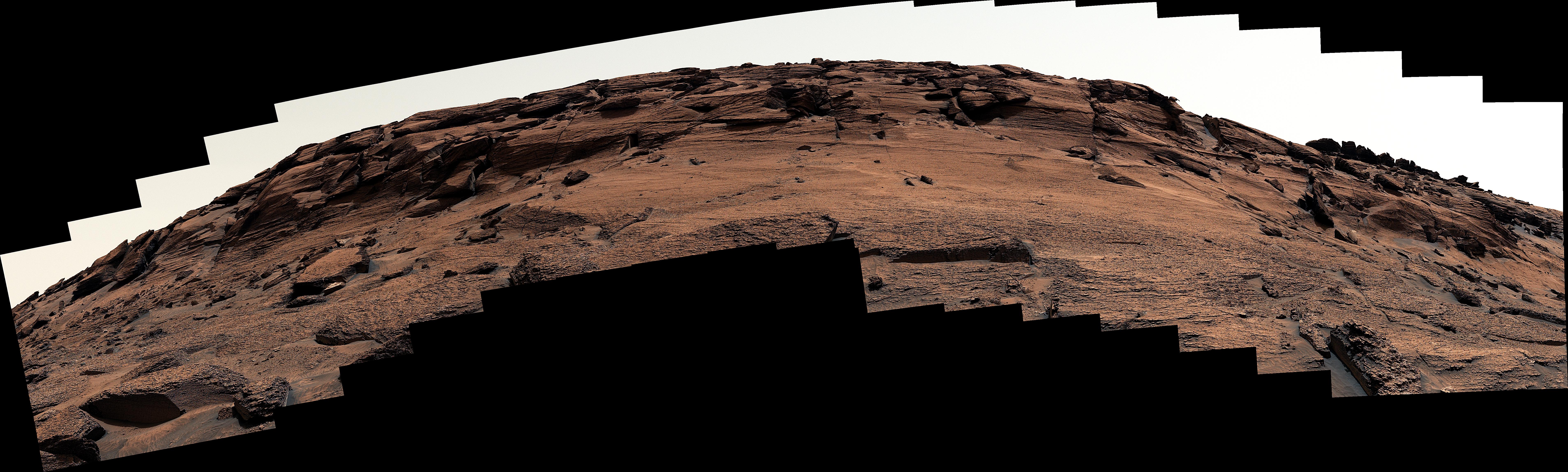
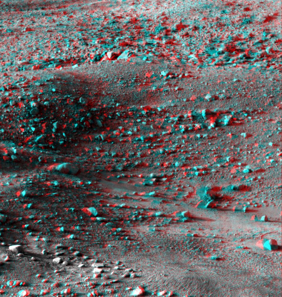
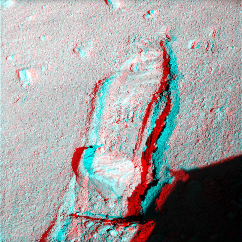
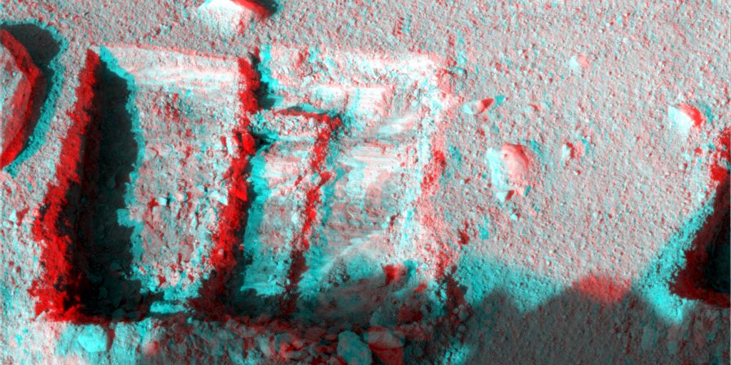
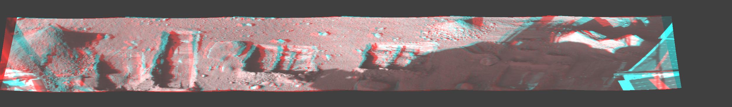
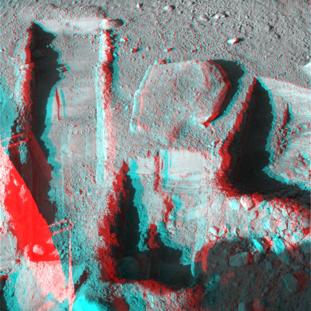
2022-05-18 |
Mars
|
Mars Science Laboratory (MSL)
|
Mastcam
|
7630x2295x3 |
|
-
PIA25288:
-
Door-Shaped Fracture Spotted by Curiosity at East Cliffs
Full Resolution:
TIFF
(30.19 MB)
JPEG
(2.872 MB)
|
|
|
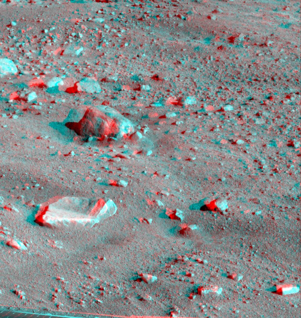
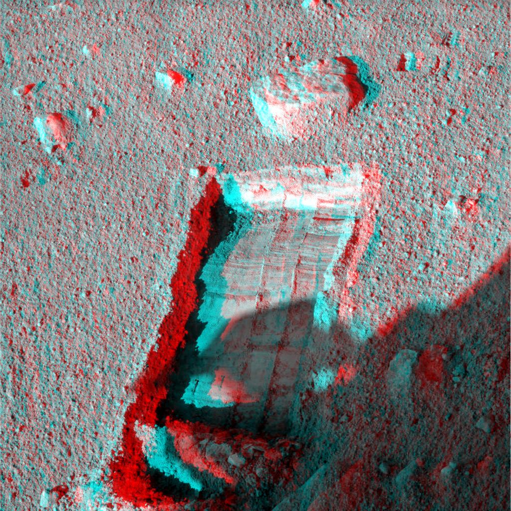
2023-05-08 |
Mars
|
Mars Science Laboratory (MSL)
|
MAHLI
|
1580x1179x3 |
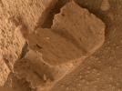
|
-
PIA25828:
-
Curiosity Finds a Book-Like Rock
Full Resolution:
TIFF
(5.575 MB)
JPEG
(316.9 kB)
|
|
|
2023-11-06 |
Mars
|
Mars Science Laboratory (MSL)
|
Navcam (MSL)
|
7665x2111x1 |
|
-
PIA26047:
Curiosity's Navcams View the Area Around 'Sequoia'
Full Resolution:
TIFF
(12.18 MB)
JPEG
(1.953 MB)
|
|
|
2004-12-21 |
|
Mars Volcanic Emission Life Scout (MARVEL)
|
Mars Volcanic Emission Life Scout (MARVEL)
|
4000x3170x3 |
|
-
PIA07086:
-
Concept for Mars Volcanic Emission Life Scout (3-D) (Artist Concept)
Full Resolution:
TIFF
(13.81 MB)
JPEG
(404.4 kB)
|
|
|
2008-09-09 |
Mercury
|
MESSENGER
|
MDIS - Narrow Angle
MDIS - Wide Angle
|
600x600x3 |
|
-
PIA11078:
-
Mercury - in 3-D!
Full Resolution:
TIFF
(1.081 MB)
JPEG
(60.73 kB)
|
|
|
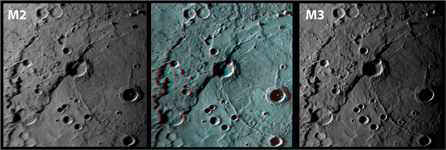
2009-10-06 |
Mercury
|
MESSENGER
|
MDIS - Narrow Angle
|
1561x525x3 |

|
-
PIA12282:
-
Rembrandt in 3-D!
Full Resolution:
TIFF
(2.463 MB)
JPEG
(156.6 kB)
|
|
|
2011-11-15 |
Mercury
|
MESSENGER
|
MDIS - Narrow Angle
|
1641x1180x3 |
|
-
PIA15078:
-
Hurrah for the Red and the Blue
Full Resolution:
TIFF
(5.819 MB)
JPEG
(293.2 kB)
|
|
|
2013-04-11 |
Mercury
|
MESSENGER
|
MDIS - Narrow Angle
|
1392x1399x3 |
|
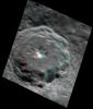
-
PIA16953:
-
A Mountain of Hollows (Anaglyph)
Full Resolution:
TIFF
(5.845 MB)
JPEG
(102.5 kB)
|
|
|
2013-04-12 |
Mercury
|
MESSENGER
|
MDIS - Narrow Angle
|
1208x1415x3 |
|
-
PIA16954:
-
Seeing to New Depths (Anaglyph)
Full Resolution:
TIFF
(5.13 MB)
JPEG
(127.1 kB)
|
|
|
2013-05-15 |
Mercury
|
MESSENGER
|
MDIS - Narrow Angle
|
1585x1713x3 |
|
-
PIA17055:
-
Kuiper³
Full Resolution:
TIFF
(8.148 MB)
JPEG
(180.6 kB)
|
|
|
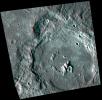
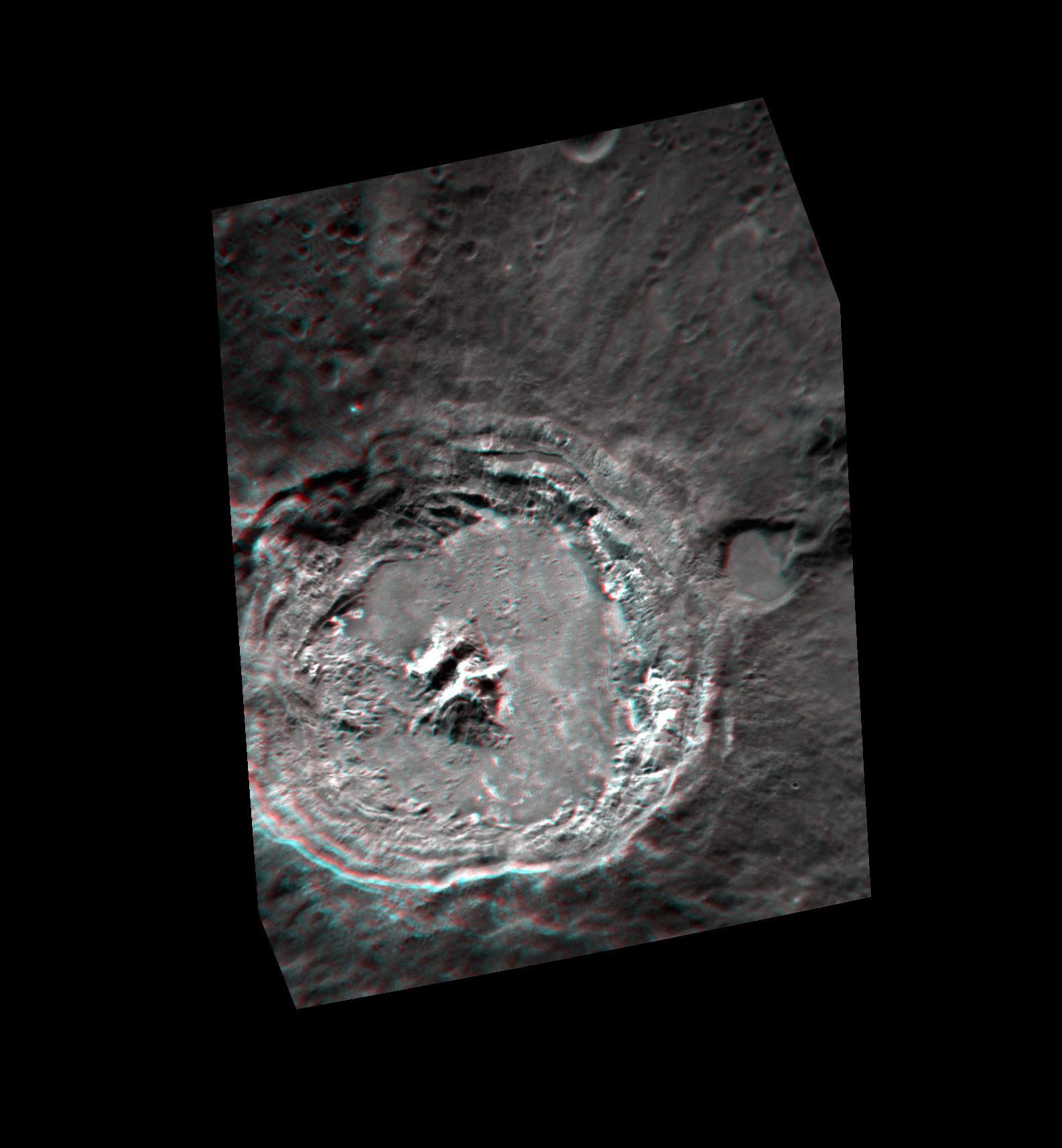
2013-06-26 |
Mercury
|
MESSENGER
|
MDIS - Narrow Angle
|
1500x1502x3 |
|
-
PIA17297:
-
Peaking Out -- in 3-D!
Full Resolution:
TIFF
(6.762 MB)
JPEG
(172.3 kB)
|
|
|
2013-08-02 |
Mercury
|
MESSENGER
|
MDIS - Narrow Angle
|
1307x1284x3 |
|
-
PIA17399:
-
Nothing Sleepy About These Hollows!
Full Resolution:
TIFF
(5.036 MB)
JPEG
(110.3 kB)
|
|
|
2013-08-08 |
Mercury
|
MESSENGER
|
MDIS - Narrow Angle
|
1154x1134x3 |
|
-
PIA17403:
-
Joplin's Central Peak
Full Resolution:
TIFF
(3.927 MB)
JPEG
(178.1 kB)
|
|
|
2013-09-24 |
Mercury
|
MESSENGER
|
MDIS - Narrow Angle
|
1237x1494x3 |
|
-
PIA17503:
-
And in 3-D!
Full Resolution:
TIFF
(5.546 MB)
JPEG
(111.2 kB)
|
|
|
2014-04-21 |
Mercury
|
MESSENGER
|
MDIS - Narrow Angle
|
898x897x3 |
|
-
PIA18216:
-
A Puzzling Peak
Full Resolution:
TIFF
(2.418 MB)
JPEG
(102.3 kB)
|
|
|
2014-04-29 |
Mercury
|
MESSENGER
|
MDIS - Narrow Angle
|
925x867x3 |
|
-
PIA18231:
-
Cuts Right Through
Full Resolution:
TIFF
(2.407 MB)
JPEG
(169.5 kB)
|
|
|
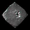
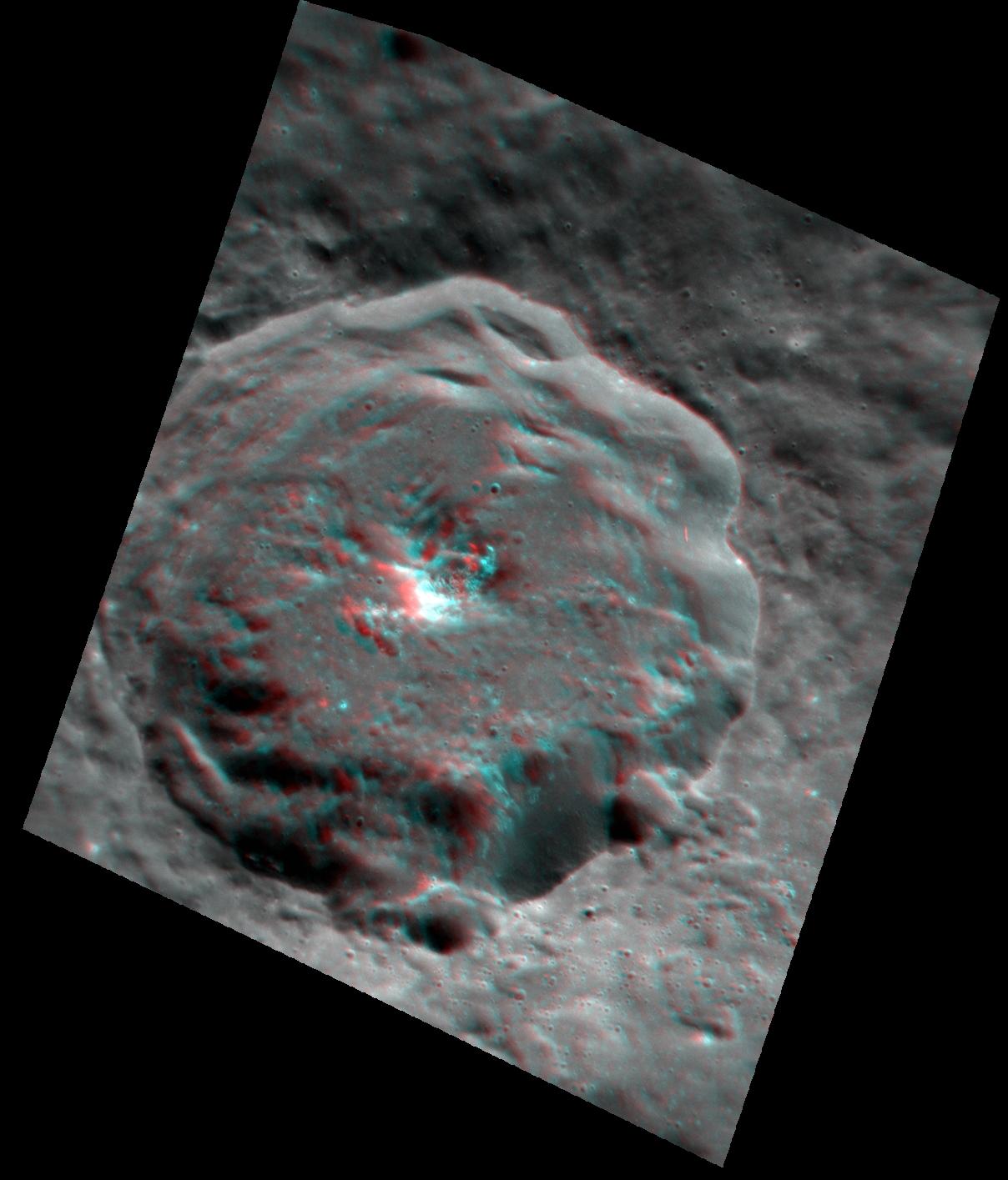
2014-09-22 |
Mercury
|
MESSENGER
|
MDIS - Narrow Angle
|
874x1101x3 |
|
-
PIA18717:
-
Paramour Rupes in 3-D
Full Resolution:
TIFF
(2.888 MB)
JPEG
(142.2 kB)
|
|
|
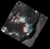
2000-05-07 |
Eros
|
NEAR Shoemaker
|
Multi-Spectral Imager
|
670x416x3 |
|
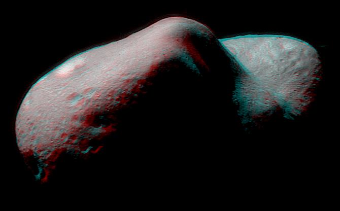
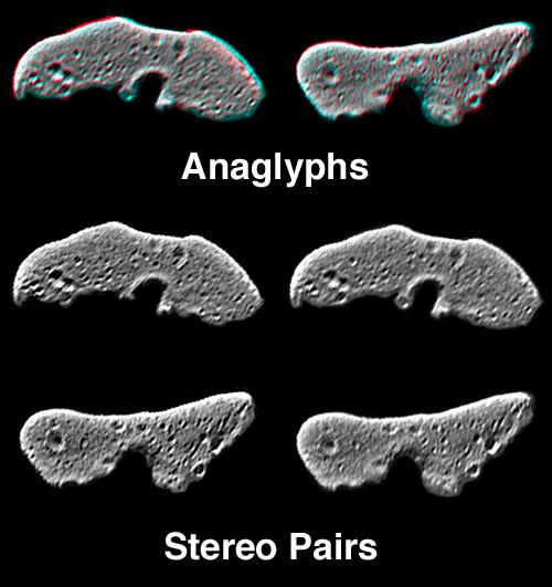
-
PIA02471:
-
Eros in Stereo
Full Resolution:
TIFF
(247.8 kB)
JPEG
(21.91 kB)
|
|
|
2000-05-07 |
Eros
|
NEAR Shoemaker
|
Multi-Spectral Imager
|
500x531x3 |
|
-
PIA02473:
-
Eros' Global Morphology
Full Resolution:
TIFF
(207.5 kB)
JPEG
(38.08 kB)
|
|
|
2001-02-17 |
Eros
|
NEAR Shoemaker
|
Multi-Spectral Imager
|
1093x1119x3 |
|
-
PIA03127:
-
The Saddle in 3-D
Full Resolution:
TIFF
(2.391 MB)
JPEG
(136.2 kB)
|
|
|
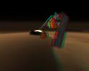
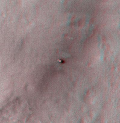
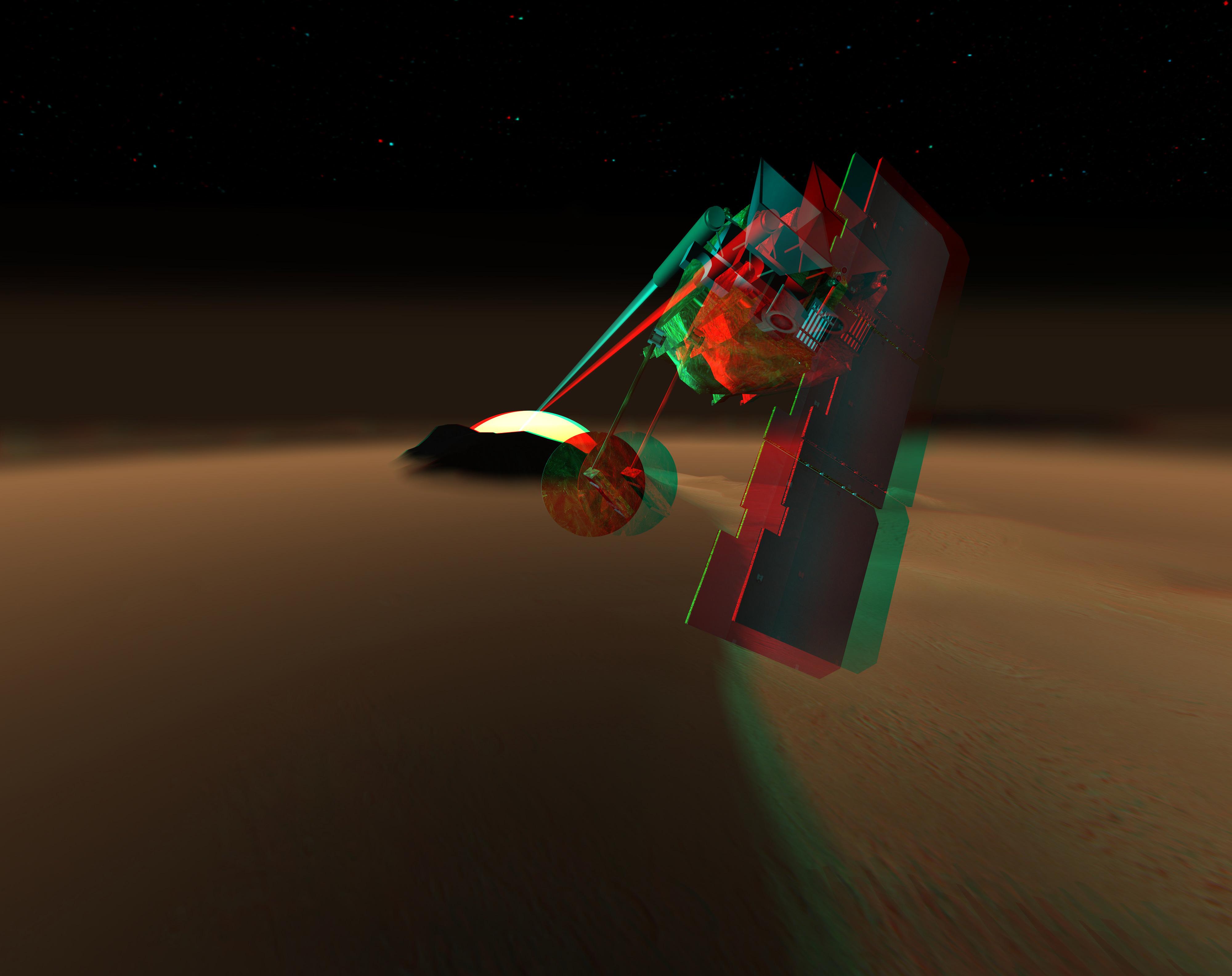
2007-05-10 |
|
Phoenix
|
|
8000x5000x3 |
|
-
PIA09345:
-
Phoenix Lander on Mars (Stereo)
Full Resolution:
TIFF
(120 MB)
JPEG
(3.08 MB)
|
|
|
2008-06-02 |
Mars
|
Phoenix
|
Surface Stereo Imager (SSI)
|
512x512x3 |
|
-
PIA10744:
-
Stereo View of Phoenix Test Sample Site
Full Resolution:
TIFF
(787.5 kB)
JPEG
(85.33 kB)
|
|
|
2008-07-22 |
Mars
|
Phoenix
|
Surface Stereo Imager (SSI)
|
916x939x3 |
|
-
PIA10972:
-
Two Holes from Using Rasp in 'Snow White' (Stereo)
Full Resolution:
TIFF
(2.584 MB)
JPEG
(116.9 kB)
|
|
|
2008-07-24 |
Mars
|
Phoenix
|
Robotic Arm
Surface Stereo Imager (SSI)
|
1024x1024x3 |

|
-
PIA10977:
-
'Snow White' Trench After Scraping (Stereo View)
Full Resolution:
TIFF
(3.15 MB)
JPEG
(257.3 kB)
|
|
|
2008-07-28 |
Mars
|
Phoenix
|
Surface Stereo Imager (SSI)
|
1020x1014x3 |
|
-
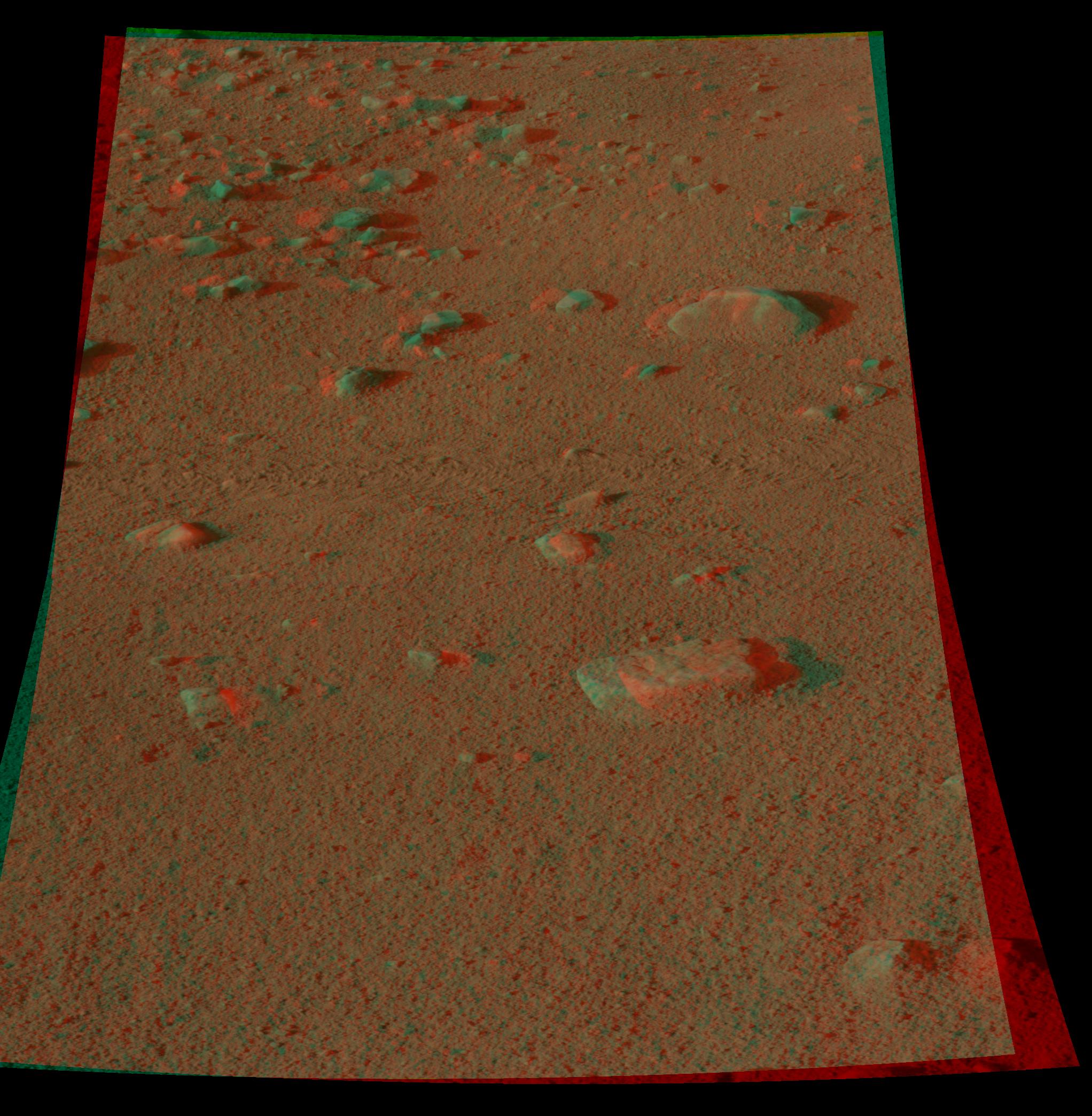
PIA10986:
-
Martian Surface as Seen by Phoenix
Full Resolution:
TIFF
(3.107 MB)
JPEG
(215.9 kB)
|
|
|
2008-07-28 |
Mars
|
Phoenix
|
Surface Stereo Imager (SSI)
|
2044x2089x3 |
|
-
PIA10985:
-
Martian Surface as Seen by Phoenix
Full Resolution:
TIFF
(12.83 MB)
JPEG
(485 kB)
|
|
|
2008-07-28 |
Mars
|
Phoenix
|
Surface Stereo Imager (SSI)
|
512x1024x3 |

|
-
PIA10987:
-
Martian Surface as Seen by Phoenix
Full Resolution:
TIFF
(1.575 MB)
JPEG
(116.2 kB)
|
|
|
2008-07-28 |
Mars
|
Phoenix
|
Surface Stereo Imager (SSI)
|
946x1016x3 |
|
-
PIA10988:
-
Martian Surface as Seen by Phoenix
Full Resolution:
TIFF
(2.888 MB)
JPEG
(265.4 kB)
|
|
|
2008-07-28 |
Mars
|
Phoenix
|
Surface Stereo Imager (SSI)
|
966x1016x3 |
|
-
PIA10989:
-
Martian Surface as Seen by Phoenix
Full Resolution:
TIFF
(2.949 MB)
JPEG
(218.5 kB)
|
|
|
2008-07-28 |
Mars
|
Phoenix
|
Surface Stereo Imager (SSI)
|
1024x1024x3 |
|
-
PIA10990:
-
Martian Surface as Seen by Phoenix
Full Resolution:
TIFF
(3.15 MB)
JPEG
(297 kB)
|
|
|
2008-07-28 |
Mars
|
Phoenix
|
Surface Stereo Imager (SSI)
|
963x1017x3 |
|
-
PIA10991:
-
Martian Surface as Seen by Phoenix
Full Resolution:
TIFF
(2.942 MB)
JPEG
(231.4 kB)
|
|
|
2008-07-28 |
Mars
|
Phoenix
|
Surface Stereo Imager (SSI)
|
958x1010x3 |
|
-
PIA10992:
-
Martian Surface as Seen by Phoenix
Full Resolution:
TIFF
(2.907 MB)
JPEG
(251.1 kB)
|
|
|
2008-07-28 |
Mars
|
Phoenix
|
Surface Stereo Imager (SSI)
|
965x1017x3 |
|
-
PIA10993:
-
Martian Surface as Seen by Phoenix
Full Resolution:
TIFF
(2.949 MB)
JPEG
(306.5 kB)
|
|
|
2008-07-28 |
Mars
|
Phoenix
|
Surface Stereo Imager (SSI)
|
937x1018x3 |
|
-
PIA10994:
-
Martian Surface as Seen by Phoenix
Full Resolution:
TIFF
(2.866 MB)
JPEG
(260.8 kB)
|
|
|
2008-07-28 |
Mars
|
Phoenix
|
Surface Stereo Imager (SSI)
|
944x1015x3 |
|
-
PIA10995:
-
Martian Surface as Seen by Phoenix
Full Resolution:
TIFF
(2.879 MB)
JPEG
(242.7 kB)
|
|
|
2008-07-28 |
Mars
|
Phoenix
|
Surface Stereo Imager (SSI)
|
448x512x3 |
|
-
PIA10996:
-
Martian Surface as Seen by Phoenix
Full Resolution:
TIFF
(689.1 kB)
JPEG
(62.14 kB)
|
|
|
2008-07-28 |
Mars
|
Phoenix
|
Surface Stereo Imager (SSI)
|
1126x1432x3 |
|
-
PIA10997:
-
Martian Surface as Seen by Phoenix
Full Resolution:
TIFF
(4.843 MB)
JPEG
(275.1 kB)
|
|
|
2008-07-28 |
Mars
|
Phoenix
|
Surface Stereo Imager (SSI)
|
3978x1926x3 |
|
-
PIA10998:
-
Martian Surface as Seen by Phoenix
Full Resolution:
TIFF
(22.99 MB)
JPEG
(1.304 MB)
|
|
|
2008-08-26 |
Mars
|
Phoenix
|
Surface Stereo Imager (SSI)
|
1024x1024x3 |
|
-
PIA11052:
-
Deep 'Stone Soup' Trenching by Phoenix (Stereo)
Full Resolution:
TIFF
(3.15 MB)
JPEG
(198 kB)
|
|
|
2008-09-01 |
Mars
|
Phoenix
|
Surface Stereo Imager (SSI)
|
512x512x3 |
|
-
PIA11057:
-
Picking up Clues from the Discard Pile (Stereo)
Full Resolution:
TIFF
(787.5 kB)
JPEG
(86.78 kB)
|
|
|
2008-09-23 |
Mars
|
Phoenix
|
Robotic Arm
Surface Stereo Imager (SSI)
|
1024x1024x3 |
|
-
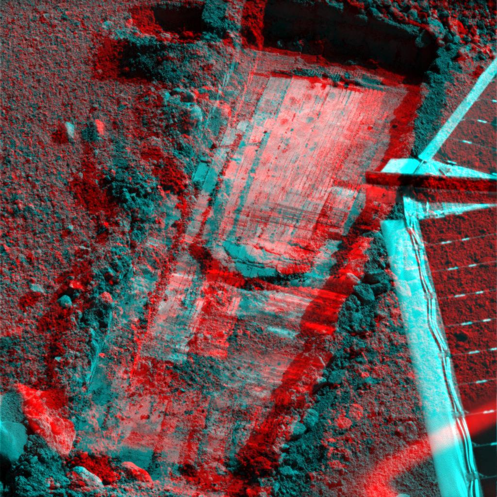
PIA11190:
-
Preparation for Moving a Rock on Mars, Stereo View
Full Resolution:
TIFF
(3.15 MB)
JPEG
(310.8 kB)
|
|
|
2008-09-23 |
Mars
|
Phoenix
|
Robotic Arm
Surface Stereo Imager (SSI)
|
1024x1024x3 |
|
-
PIA11192:
-
Rock Moved by Mars Lander Arm, Stereo View
Full Resolution:
TIFF
(3.15 MB)
JPEG
(244 kB)
|
|
|
2008-10-09 |
Mars
|
Phoenix
|
Surface Stereo Imager (SSI)
|
1024x512x3 |
|
-
PIA11130:
-
Phoenix's La Mancha Trench in 3-D
Full Resolution:
TIFF
(1.575 MB)
JPEG
(122.6 kB)
|
|
|
2008-10-13 |
Mars
|
Phoenix
|
Surface Stereo Imager (SSI)
|
2500x367x3 |
|
-
PIA11229:
Phoenix Trenches
Full Resolution:
TIFF
(2.756 MB)
JPEG
(102.7 kB)
|
|
|
2008-10-29 |
Mars
|
Phoenix
|
Surface Stereo Imager (SSI)
|
1024x1024x3 |
|
-
PIA11380:
-
Phoenix Deepens Trenches on Mars (3-D)
Full Resolution:
TIFF
(3.15 MB)
JPEG
(215 kB)
|
|
|
2008-10-29 |
Mars
|
Phoenix
|
Surface Stereo Imager (SSI)
|
1024x1024x3 |
|
-
PIA11381:
-
Phoenix Deepens Trenches on Mars (3-D)
Full Resolution:
TIFF
(3.15 MB)
JPEG
(203.9 kB)
|
|
|
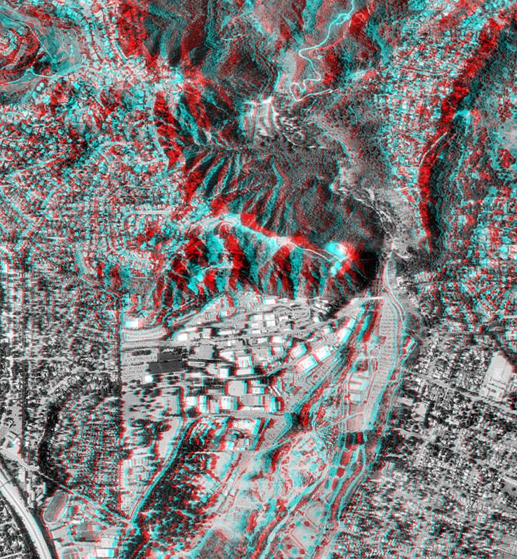
2000-02-18 |
Earth
|
Shuttle Radar Topography Mission (SRTM)
|
C-Band Interferometric Radar
|
737x797x3 |
|
-
PIA02721:
-
Pasadena, California Anaglyph with Aerial Photo Overlay
Full Resolution:
TIFF
(1.749 MB)
JPEG
(218.8 kB)
|
|
|
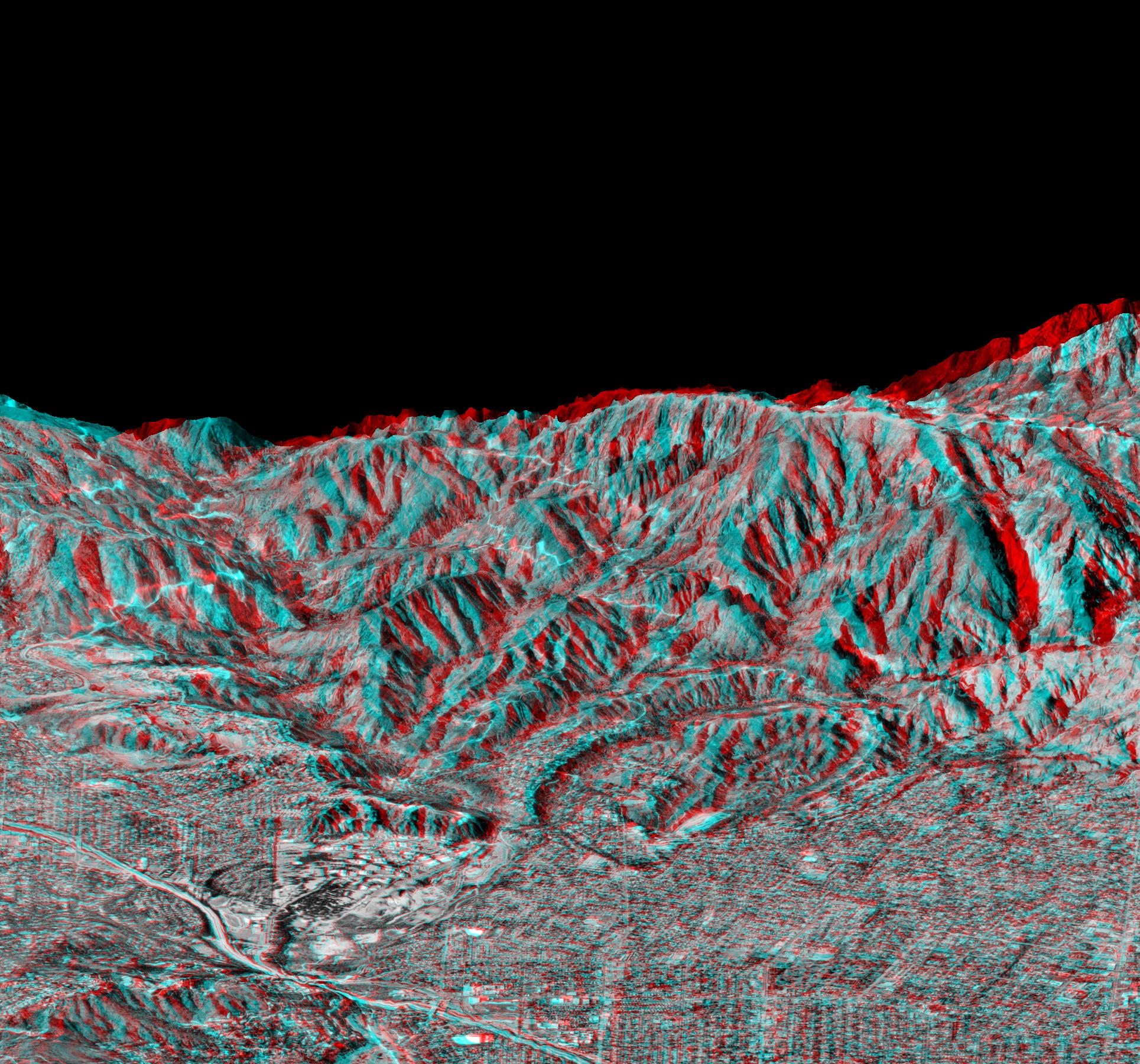
2000-02-21 |
Earth
|
Shuttle Radar Topography Mission (SRTM)
|
C-Band Interferometric Radar
|
1929x1800x3 |
|
-
PIA02731:
-
Anaglyph of Perspective View with Aerial Photo Overlay Pasadena, California
Full Resolution:
TIFF
(6.552 MB)
JPEG
(663.3 kB)
|
|
|
2000-06-01 |
Earth
|
Shuttle Radar Topography Mission (SRTM)
|
C-Band Interferometric Radar
|
669x1427x3 |
|
-
PIA02753:
-
Anaglyph of Shaded Relief New York State, Lake Ontario to Long Island
Full Resolution:
TIFF
(1.849 MB)
JPEG
(193.7 kB)
|
|
|
2000-11-02 |
Earth
|
Shuttle Radar Topography Mission (SRTM)
|
C-Band Interferometric Radar
|
1703x1181x3 |
|
-
PIA02784:
-
SRTM Anaglyph: Fiji Islands
Full Resolution:
TIFF
(1.719 MB)
JPEG
(232.7 kB)
|
|
|
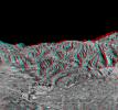
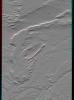
2001-06-14 |
Earth
|
Shuttle Radar Topography Mission (SRTM)
|
C-Band Interferometric Radar
|
1935x1240x3 |
|
-
PIA03311:
-
SRTM Anaglyph: Laguna Mellquina, Andes Mountains, Argentina
Full Resolution:
TIFF
(6.146 MB)
JPEG
(457 kB)
|
|
|
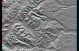
2001-07-05 |
Earth
|
Shuttle Radar Topography Mission (SRTM)
|
C-Band Interferometric Radar
|
1600x1763x3 |
|
-
PIA03313:
-
SRTM Anaglyph: Sredinnyy Khrebet, Kamchatka Peninsula, Russia
Full Resolution:
TIFF
(7.882 MB)
JPEG
(667.8 kB)
|
|
|
2001-07-26 |
Earth
|
Shuttle Radar Topography Mission (SRTM)
|
C-Band Interferometric Radar
|
2020x1350x3 |
|
-
PIA03317:
-
SRTM Anaglyph: Corral de Piedra, Argentina
Full Resolution:
TIFF
(6.425 MB)
JPEG
(486.8 kB)
|
|
|
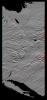
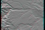
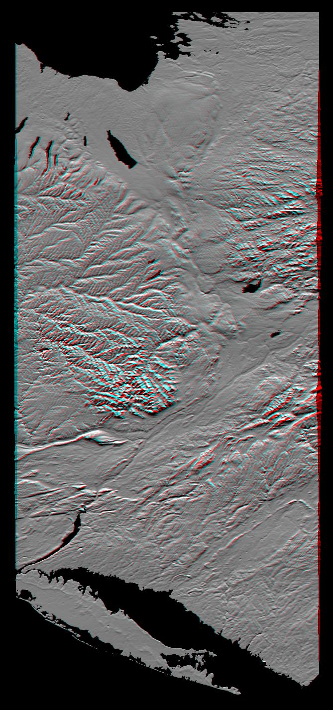
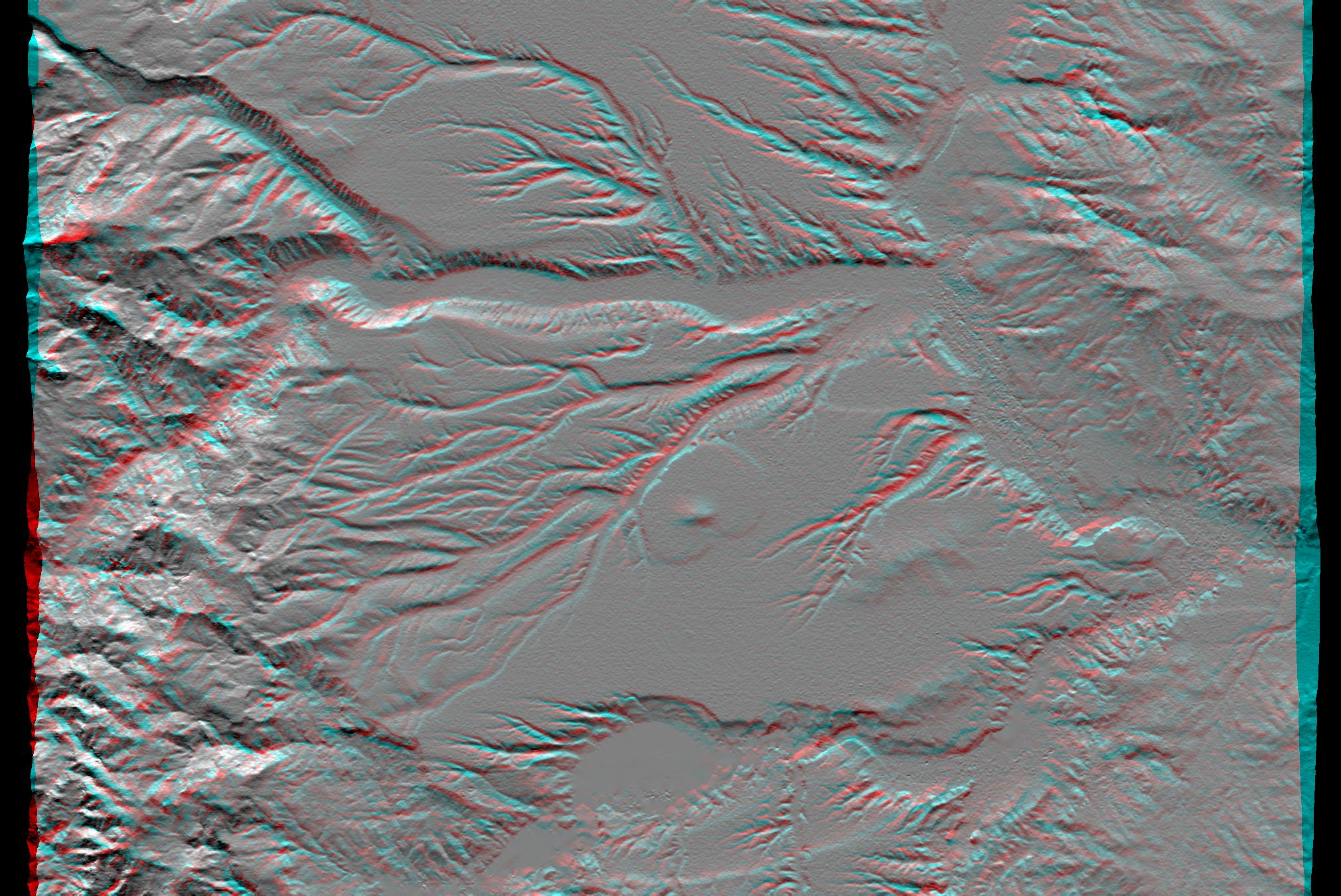
2001-08-03 |
Earth
|
Shuttle Radar Topography Mission (SRTM)
|
C-Band Interferometric Radar
|
2501x1201x3 |
|
-
PIA03320:
-
SRTM Anaglyph: Piñon Canyon region, Colorado
Full Resolution:
TIFF
(5.238 MB)
JPEG
(349.1 kB)
|
|
|
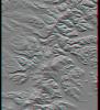
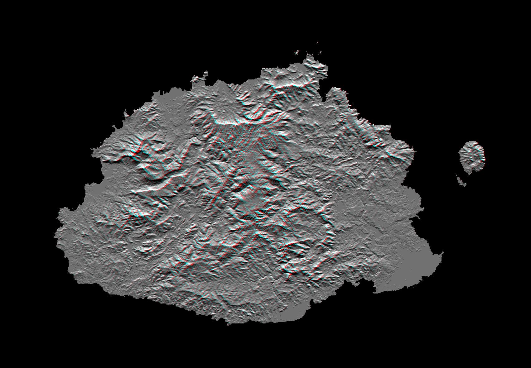
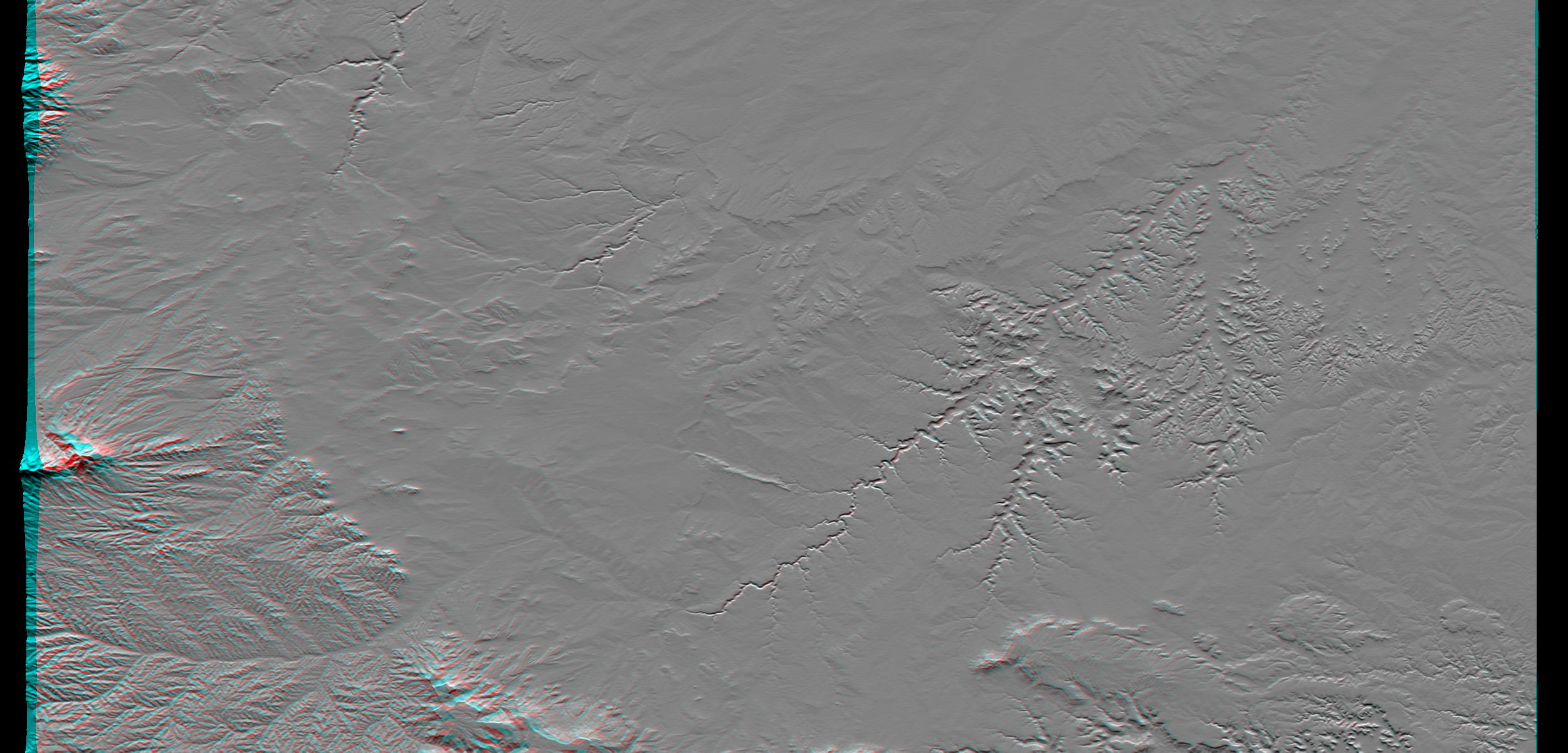
2001-08-16 |
Earth
|
Shuttle Radar Topography Mission (SRTM)
|
C-Band Interferometric Radar
|
1090x1480x3 |
|
-
PIA03323:
-
SRTM Anaglyph: Lava plateaus, Argentina
Full Resolution:
TIFF
(3.841 MB)
JPEG
(284.2 kB)
|
|
|
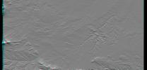
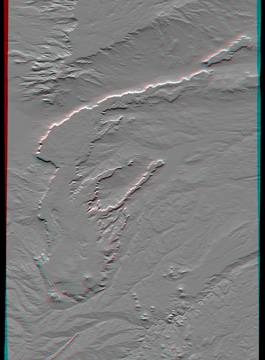
2001-08-24 |
Earth
|
Shuttle Radar Topography Mission (SRTM)
|
C-Band Interferometric Radar
|
1630x1200x3 |
|
-
PIA03325:
-
SRTM Anaglyph: Near Zapala, Argentina
Full Resolution:
TIFF
(4.867 MB)
JPEG
(318.9 kB)
|
|
|
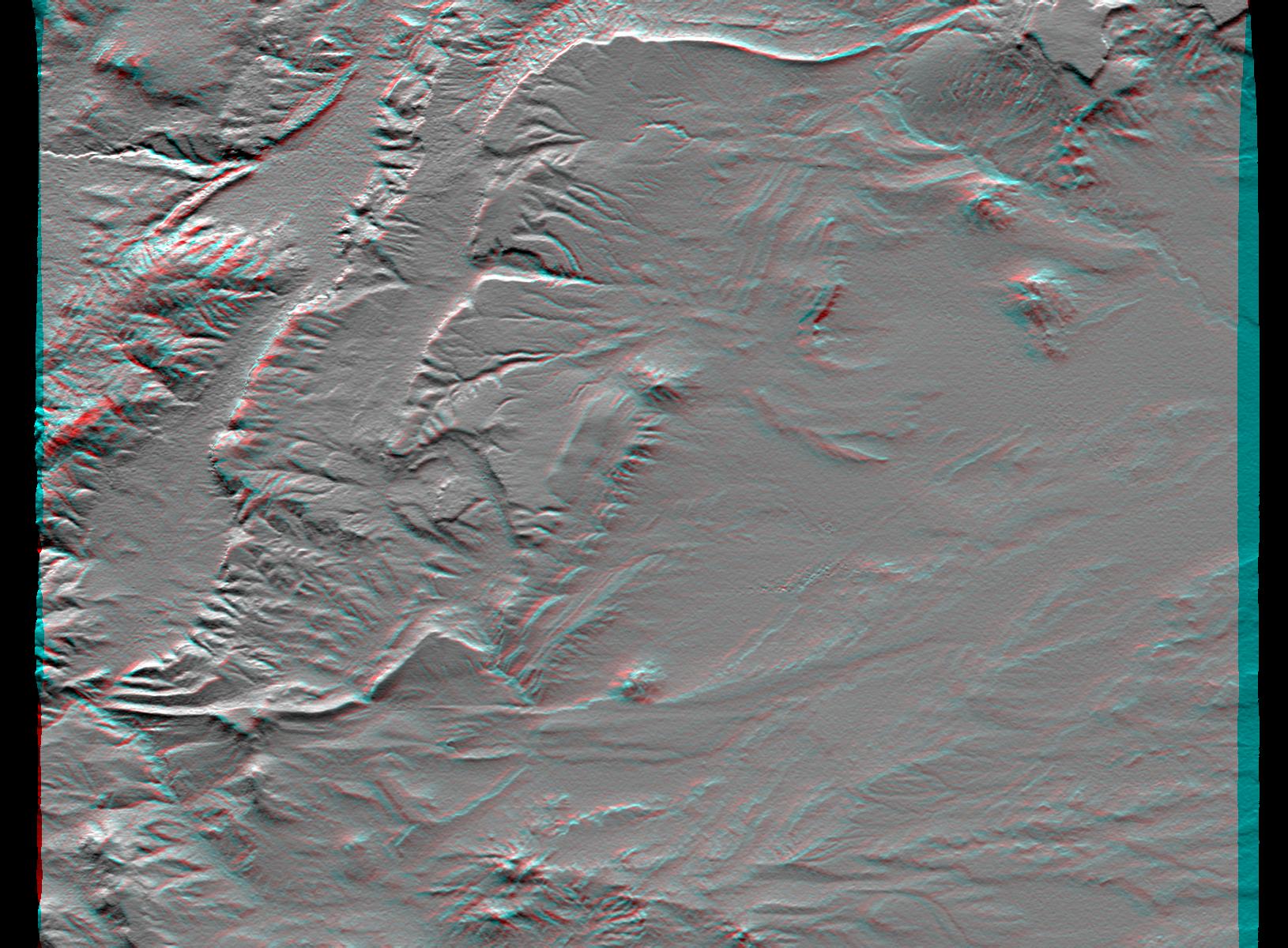
2001-09-01 |
Earth
|
Shuttle Radar Topography Mission (SRTM)
|
C-Band Interferometric Radar
|
1910x1215x3 |
|
-
PIA03326:
-
SRTM Anaglyph: Las Bayas, Argentina
Full Resolution:
TIFF
(5.28 MB)
JPEG
(429.3 kB)
|
|
|
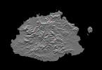
2002-09-26 |
Earth
|
Shuttle Radar Topography Mission (SRTM)
|
C-Band Interferometric Radar
|
1200x1200x3 |
|
-
PIA03362:
-
Anaglyph: Shaded Relief and Height as Brightness, Iturralde Structure, Bolivia
Full Resolution:
TIFF
(3.729 MB)
JPEG
(366.1 kB)
|
|
|
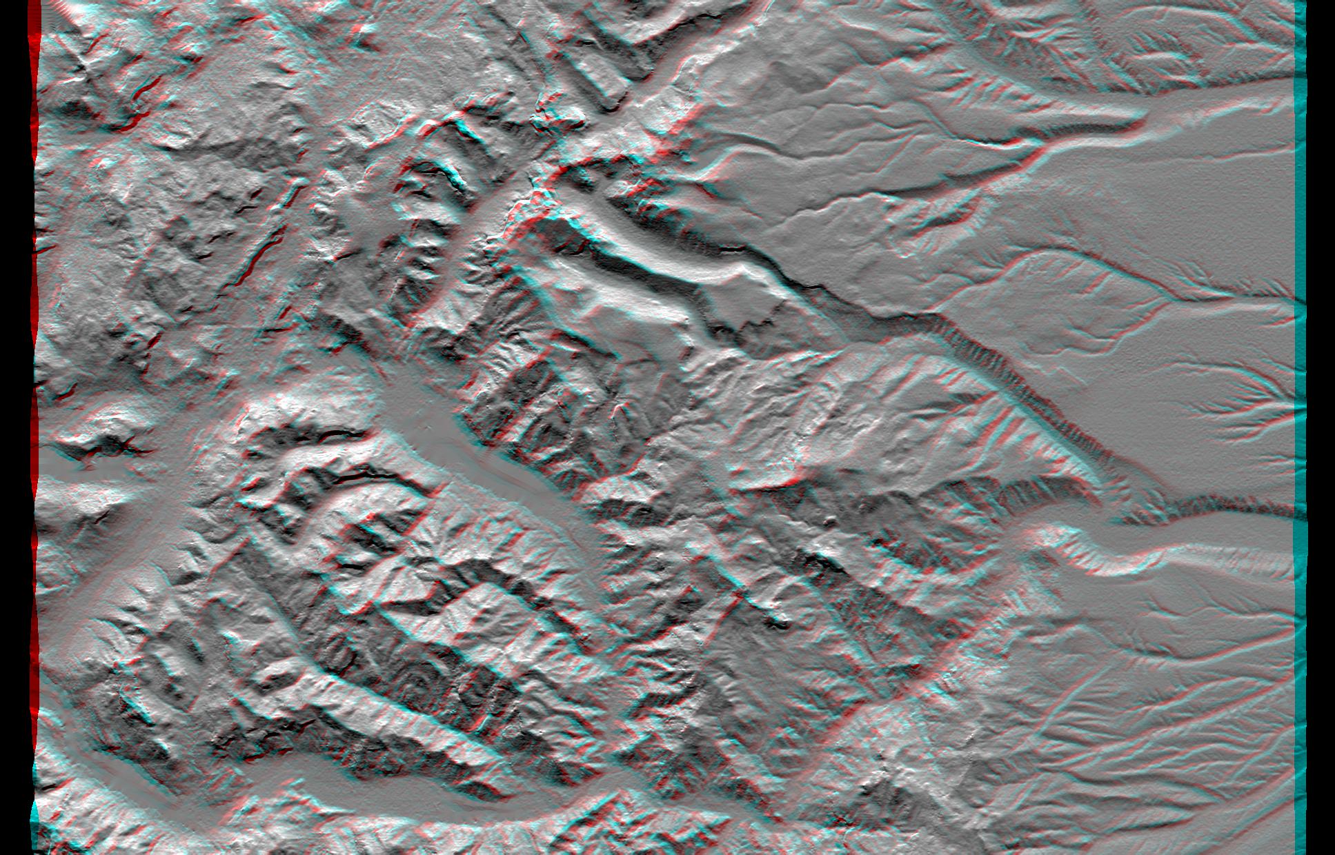
2003-03-06 |
Earth
|
Shuttle Radar Topography Mission (SRTM)
|
C-Band Interferometric Radar
|
9600x7240x3 |
|
-
PIA03378:
-
Anaglyph, North America
Full Resolution:
TIFF
(94.73 MB)
JPEG
(9.055 MB)
|
|
|
2003-03-06 |
Earth
|
Shuttle Radar Topography Mission (SRTM)
|
C-Band Interferometric Radar
|
1600x1080x3 |
|
-
PIA03380:
-
Anaglyph, Yucatan Peninsula, Mexico
Full Resolution:
TIFF
(2.651 MB)
JPEG
(362 kB)
|
|
|
2003-03-13 |
Earth
|
Shuttle Radar Topography Mission (SRTM)
|
C-Band Interferometric Radar
|
1587x1536x3 |
|
-
PIA03382:
-
Massanutten Mountain, Virginia, USA (Anaglyph)
Full Resolution:
TIFF
(6.914 MB)
JPEG
(527.2 kB)
|
|
|
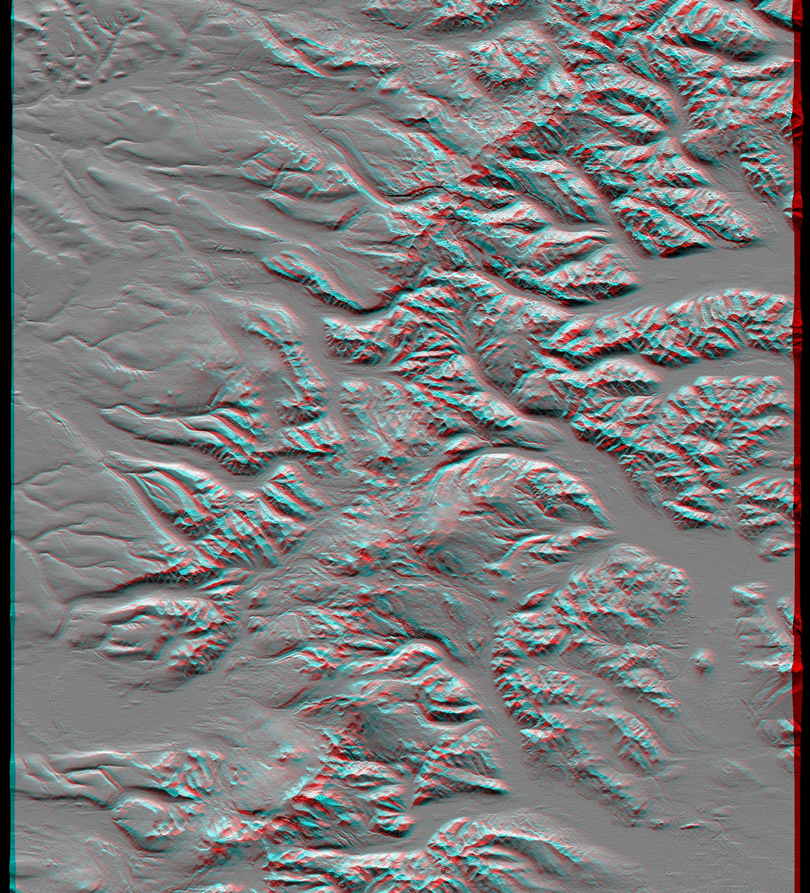
2003-03-27 |
Earth
|
Shuttle Radar Topography Mission (SRTM)
|
C-Band Interferometric Radar
|
1573x2401x3 |
|
-
PIA03385:
-
Anaglyph, Manicouagan Crater, Quebec, Canada
Full Resolution:
TIFF
(9.691 MB)
JPEG
(826 kB)
|
|
|
2003-06-19 |
Earth
|
Shuttle Radar Topography Mission (SRTM)
|
C-Band Interferometric Radar
|
7200x10886x3 |

|
-
PIA03389:
-
Anaglyph, South America
Full Resolution:
TIFF
(50.13 MB)
JPEG
(6.633 MB)
|
|
|
2004-06-17 |
Earth
|
Shuttle Radar Topography Mission (SRTM)
|
C-Band Interferometric Radar
X-Band Radar
|
1588x1060x3 |
|
-
PIA04955:
-
Zagros Mountains, Iran, SRTM Shaded Relief Anaglyph
Full Resolution:
TIFF
(4.247 MB)
JPEG
(318.1 kB)
|
|
|
2004-06-17 |
Earth
|
Shuttle Radar Topography Mission (SRTM)
|
C-Band Interferometric Radar
X-Band Radar
|
9600x10500x3 |
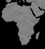
|
-
PIA04964:
-
Africa in SRTM 3-D, Anaglyph of Shaded Relief
Full Resolution:
TIFF
(123.1 MB)
JPEG
(13.79 MB)
|
|
|
2010-01-14 |
Earth
|
Shuttle Radar Topography Mission (SRTM)
|
C-Band Radar
X-Band Radar
|
6001x1201x3 |
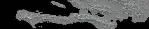
|
-
PIA12493:
Southern Haiti Anaglyph
Full Resolution:
TIFF
(21.62 MB)
JPEG
(900.4 kB)
|
|
|
2007-04-27 |
Sol (our sun)
|
Solar TErrestrial RElations Observatory (STEREO)
|
SECCHI/Extreme Ultraviolet Imaging Telescope
|
1920x1080x3 |

|
-
PIA09321:
-
Full Disk Image of the Sun, March 26, 2007 (Anaglyph)
Full Resolution:
TIFF
(6.23 MB)
JPEG
(91.3 kB)
|
 Planetary Data System


