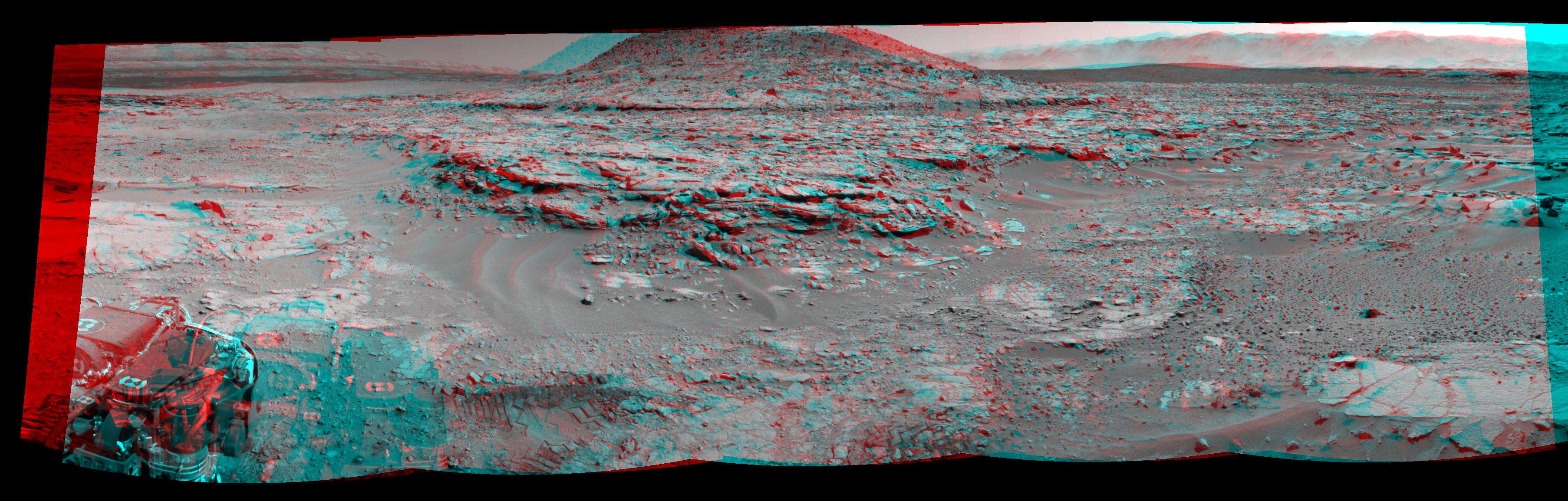
NASA's Curiosity Mars rover used its Navigation Camera (Navcam) to record this stereo scene of a butte called "Mount Remarkable" and surrounding outcrops at a waypoint called "the Kimberley" inside Gale Crater. The image appears three-dimensional when viewed through red-blue glasses with the red lens on the left.
The butte stands about 16 feet (5 meters) high. Its informal name comes from a mountain and national park in Australia. The rover team plans to drive Curiosity to the flatter outcrop at the base of the Martian Mount Remarkable for a close-up inspection that might include drilling into the rock.
This mosaic view combines multiple images taken during the 597th Martian day, or sol, of Curiosity's work on Mars (April 11, 2014). That same day, the rover had driven 90.2 feet (27.5 meters) and NASA's Mars Reconnaissance Orbiter observed Curiosity at the location from which the rover captured this panorama. The resulting image from the orbiter's High Resolution Imaging Science Experiment (HiRISE) camera is online at PIA18081. A map showing Curiosity's route from the August 2012 landing site to the Kimberley is online at http://mars.jpl.nasa.gov/msl/multimedia/images/?ImageID=6153.
Curiosity's science team chose the Kimberley in 2013 as a waypoint for science investigations along the route to the mission's long-term destinations on the lower slopes of Mount Sharp, in the middle of Gale Crater. This waypoint offers set of outcrops of different types of rock layers exposed close together, so that their relationship to each other can be studied. The team refers to the rock layer surrounding the base of Mount Remarkable as the "middle unit" because it is intermediate in location between rocks that form buttes in the area and lower-lying rocks that show a pattern of striations.
NASA's Jet Propulsion Laboratory, a division of the California Institute of Technology, Pasadena, manages the Mars Science Laboratory Project for NASA's Science Mission Directorate, Washington. JPL designed and built the project's Curiosity rover and the rover's Navcam.
For more information about Curiosity, visit http://www.nasa.gov/msl and http://mars.jpl.nasa.gov/msl/.
 Planetary Data System


