Your search criteria found
12735
images
Target is mars (and available satellites)
Go to PIAxxxxx:
Refine this list of images by:
Target:
Deimos
Mars
Phobos
Mission:
2001 Mars Odyssey
Antarctic Meteorite Location and Mapping Project (AMLAMP)
Dawn
ExoMars
Hubble Space Telescope
InSight
MAVEN
Mariner Mars 1964 (Mariner 4)
Mariner Mars 1969 (Mariner 7)
Mariner Mars 1971 (Mariner 9)
Mars 2020
Mars 2020 Rover
Mars Atmosphere and Volatile Evolution MissioN (MAVEN)
Mars Climate Orbiter
Mars Cube One (MarCO)
Mars Exploration Rover (MER)
Mars Express (MEX)
Mars Global Surveyor (MGS)
Mars Helicopter
Mars Pathfinder (MPF)
Mars Reconnaissance Orbiter (MRO)
Mars Sample Return
Mars Sample Return (MSR)
Mars Science Laboratory (MSL)
Phoenix
Rosetta
Viking
Spacecraft:
2001 Mars Odyssey
Curiosity
Dawn
InSight Mars Lander
Ingenuity
MAVEN
MarCO-B
Mariner 4
Mariner 7
Mariner 9
Mars Climate Orbiter
Mars Express (MEX)
Mars Express (MEX) Orbiter
Mars Global Surveyor Orbiter
Mars Pathfinder Lander
Mars Pathfinder Rover
Mars Reconnaissance Orbiter (MRO)
Mars Sample Return
Mars Science Laboratory (MSL)
NASA's Mars Pathfinder Lander
Opportunity
Perseverance
Philae Lander
Phoenix Lander
Phoenix Mars Lander
Spirit
Viking Lander 1
Viking Lander 2
Viking Orbiter 1
Viking Orbiter 2
Instrument:
Alpha Particle X-ray Spectrometer
Alpha Particle X-ray Spectrometer (MSL)
Atmospheric Structure / Meteorology Instrument
CHIMRA
Camera 1
Camera 2
Chemistry & Mineralogy (CheMin)
Chemistry and Camera (ChemCam)
Comet Infrared and Visible Analyser (CIVA
Compact Reconnaissance Imaging Spectrometer for Mars (CRISM)
Context Camera (CTX)
Deep Space Network
Descent Image Motion Estimation System (DIMES)
Dynamic Albedo of Neutrons
Dynamic Albedo of Neutrons (DAN)
Gamma Ray Spectrometer - Neutron Spectrometer
Gamma Ray Spectrometer Suite
Hazard Avoidance Camera
Hazard Avoidance Camera (M2020)
Hazard Avoidance Camera (MSL)
Heat and Physical Properties Package (HP3)
High Resolution Imaging Science Experiment (HiRISE)
High Resolution Instrument (HRI)
High Resolution Stereo Camera
Imager for Mars Pathfinder
Imaging Ultraviolet Spectrograph
Imaging Ultraviolet Spectrograph (IUVS)
Instrument Context Camera (ICC)
Instrument Deployment Camera (IDC)
Lander Vision System Camera (LCAM)
Magnetometer
Mars Advanced Radar for Subsurface and Ionosphere Sounding (MARSIS)
Mars Advanced Radar for Subsurface and Ionospheric Sounding (MARSIS)
Mars Climate Sounder (MCS)
Mars Color Imager (MARCI)
Mars Descent Imager
Mars Environmental Dynamics Analyzer (MEDA)
Mars Hand Lens Imager (MAHLI)
Mars Horizon Sensor Assembly
Mars Orbiter Camera (MOC)
Mars Orbiter Laser Altimeter
Mars Radiation Experiment
Mastcam
Mastcam-Z
Microscopic Imager
Microscopy Electrochemistry and Conductivity Analyzer (MECA)
Miniature Thermal Emission Spectrometer
Moessbauer Spectrometer
Navigation Camera
Navigation Camera (M2020)
Navigation Camera (MSL)
Neutral Gas and Ion Mass Spectrometer
Neutron Spectrometer
Optical Microscope
Optical Navigation Camera
Panoramic Camera
Planetary Instrument for X-ray Lithochemistry (PIXL)
Radar System
Radiation Assessment Detector (RAD)
Radio Science Subsystem
Robotic Arm
Robotic Arm (MSL)
Robotic Arm Camera (RAC)
Rock Abrasion Tool (RAT)
Rover Cameras
Rover Environmental Monitoring Station (REMS)
Sample Analysis at Mars (SAM)
Scanning Habitable Environments with Raman & Luminescence for Organics and Chemicals (SHERLOC)
Seismic Experiment for Interior Structure (SEIS)
Shallow Subsurface Radar (SHARAD)
Stereo Imager (SSI)
SuperCam
Surface Stereo Imager (SSI)
Thermal Emission Imaging System
Thermal Emission Spectrometer
Thermal and Electrical Conductivity Probe
Thermal and Evolved Gas Analyzer
Trace Gas Orbiter
Visual Imaging Subsystem
Visual Imaging Subsystem - Camera A
Visual Imaging Subsystem - Camera B
Wide Field Planetary Camera 2
Click on an image for detailed information
Click on a column heading to sort in ascending or descending order
My
List
Addition Date
Target
Mission
Instrument
Size
2003-05-08
Mars
Mars Global Surveyor (MGS)
Mars Orbiter Camera (MOC)
540x810x1
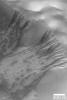
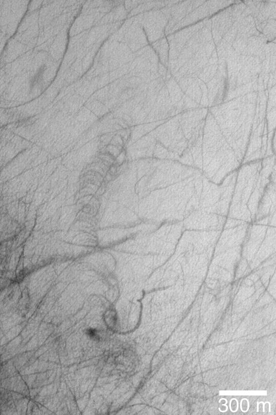
PIA04508:
Slope Streaks in Arabia
Full Resolution:
TIFF
(438.1 kB)
JPEG
(56.12 kB)
2003-05-08
Mars
Mars Global Surveyor (MGS)
Mars Orbiter Camera (MOC)
540x810x1
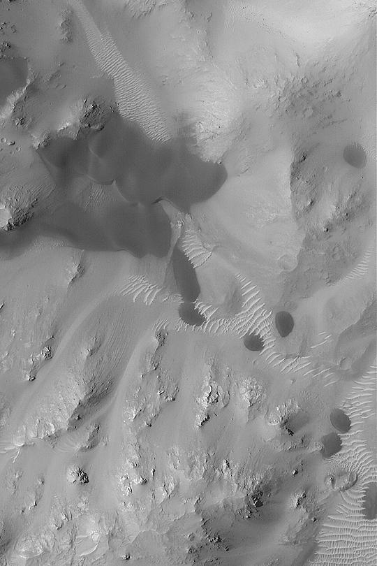
PIA04509:
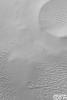
Chasma Boreale Dunes
Full Resolution:
TIFF
(438.1 kB)
JPEG
(88 kB)
2003-05-14
Mars
2001 Mars Odyssey
THEMIS
1413x3070x1
PIA04510:
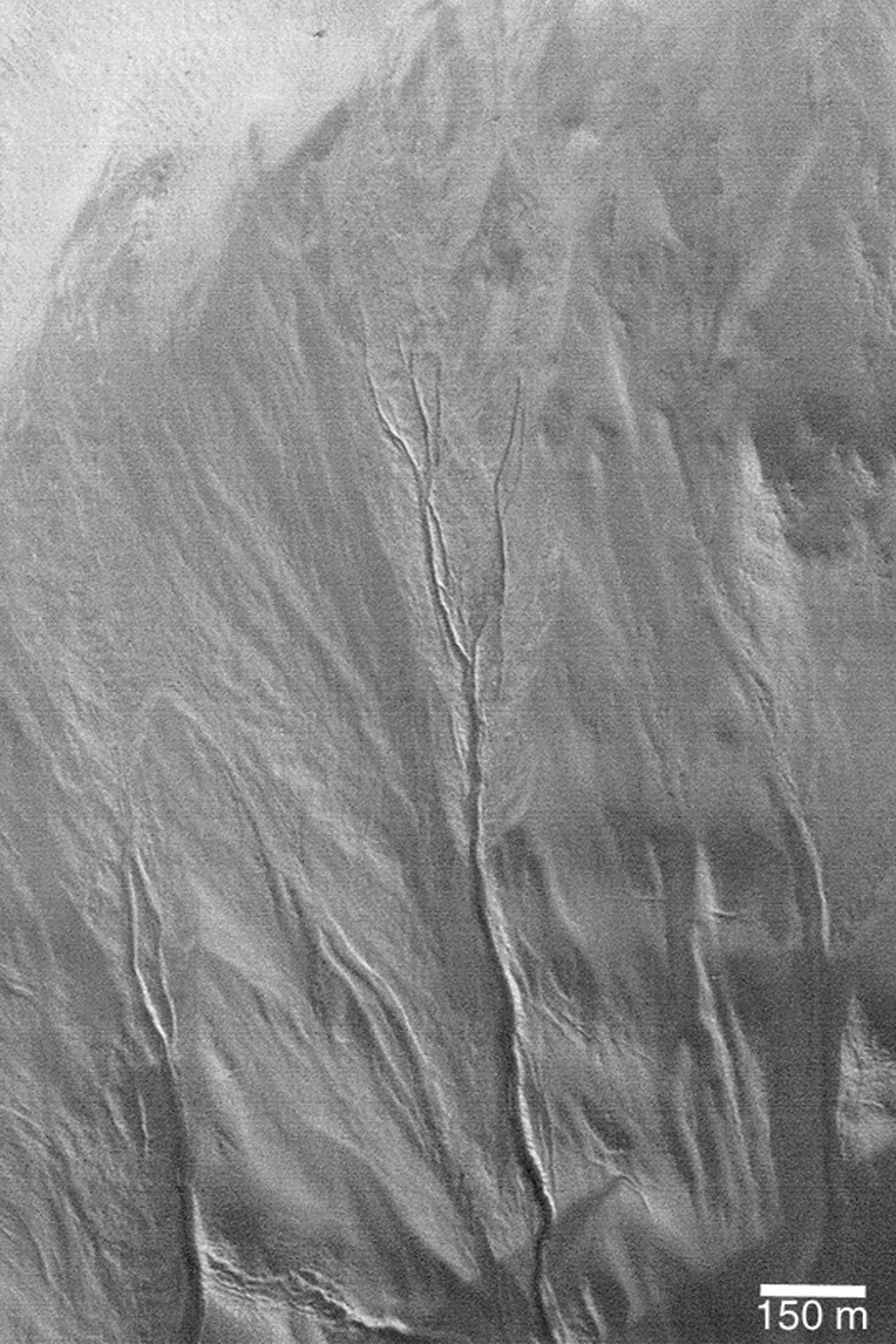
Flow Along Valley Floors
Full Resolution:
TIFF
(3.287 MB)
JPEG
(601.4 kB)
2003-05-14
Mars
2001 Mars Odyssey
THEMIS
1237x3043x1
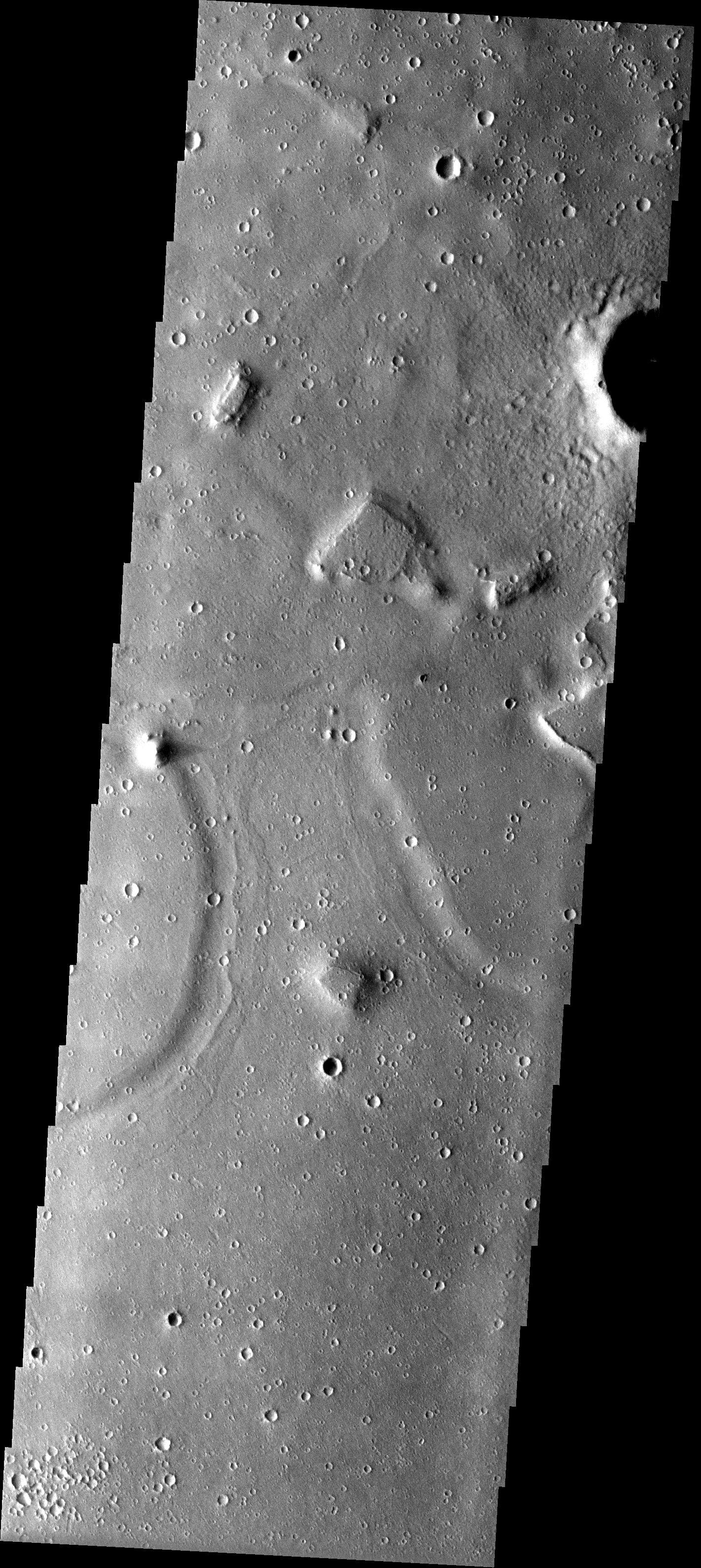
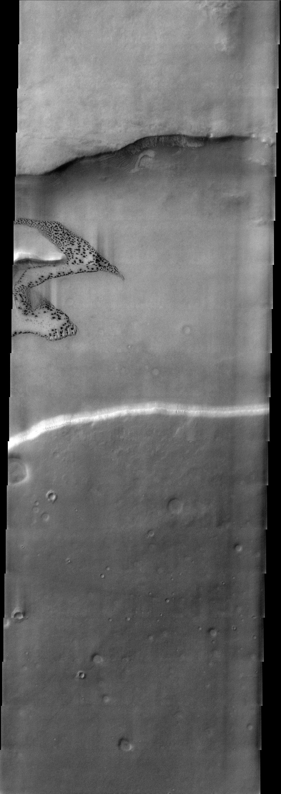
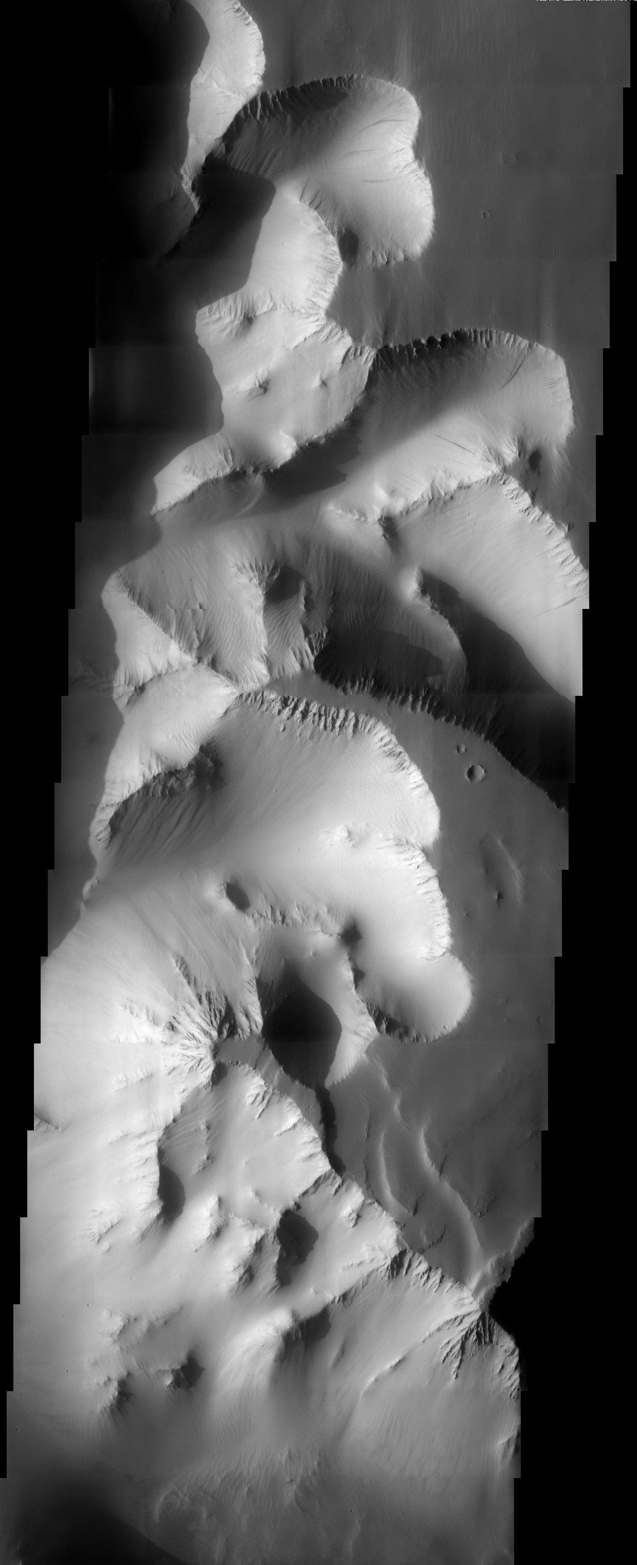
PIA04511:
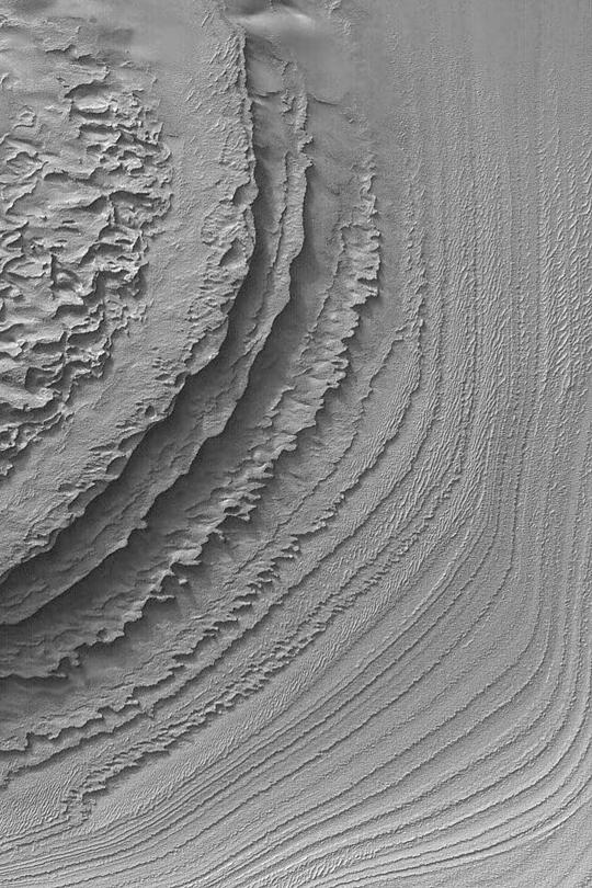
Layers Upon Layers
Full Resolution:
TIFF
(3.153 MB)
JPEG
(534.7 kB)
2003-05-14
Mars
2001 Mars Odyssey
THEMIS
1437x3312x1
PIA04512:
Ground Patterns
Full Resolution:
TIFF
(3.548 MB)
JPEG
(699.6 kB)
2003-05-14
Mars
2001 Mars Odyssey
THEMIS
1433x3246x1
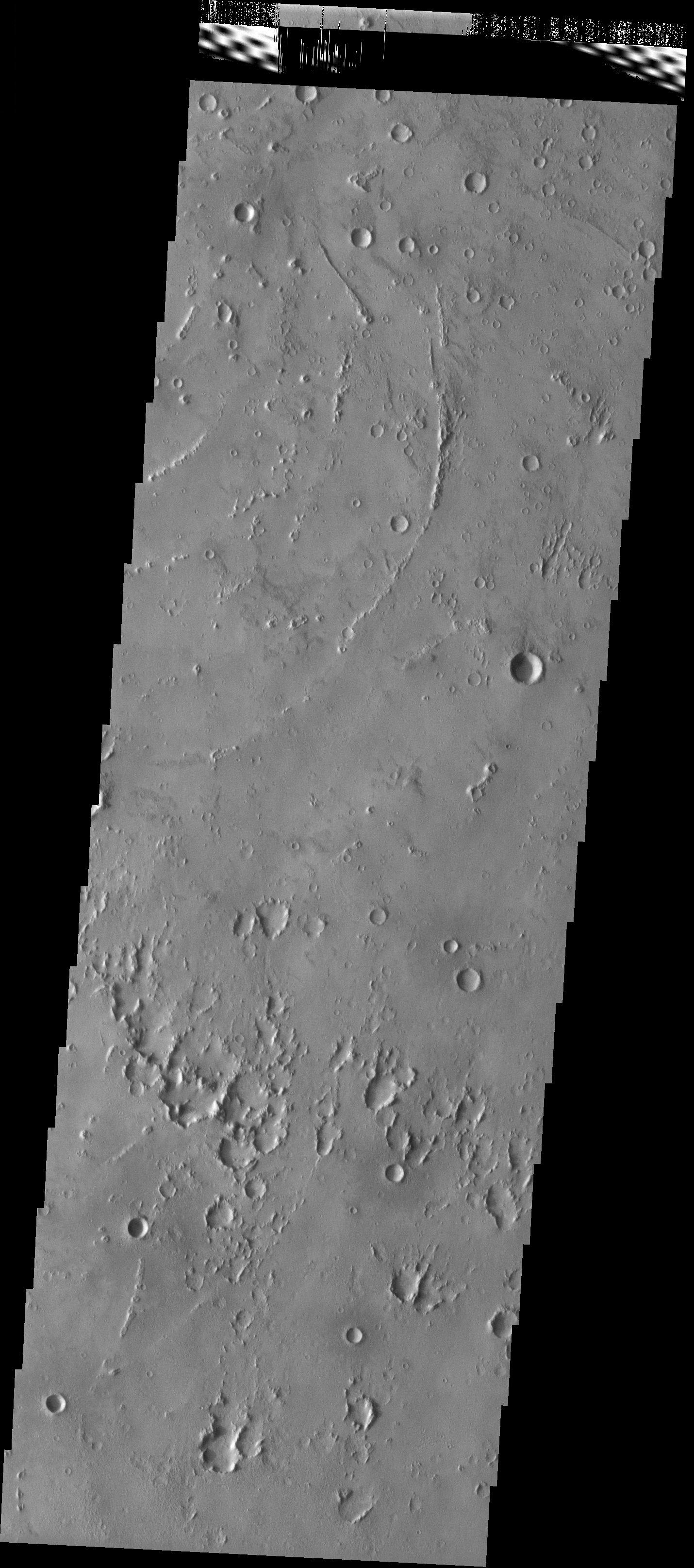
PIA04513:
Nili Patera
Full Resolution:
TIFF
(3.394 MB)
JPEG
(557.6 kB)
2003-05-14
Mars
Mars Global Surveyor (MGS)
Mars Orbiter Camera (MOC)
540x810x1
PIA04514:
Martian "Ground Rot"
Full Resolution:
TIFF
(438.1 kB)
JPEG
(58.47 kB)
2003-05-14
Mars
Mars Global Surveyor (MGS)
Mars Orbiter Camera (MOC)
540x810x1
PIA04515:
Dust Mantle Near Pavonis Mons
Full Resolution:
TIFF
(432.5 kB)
JPEG
(42.32 kB)
2003-05-14
Mars
Mars Global Surveyor (MGS)
Mars Orbiter Camera (MOC)
540x810x1
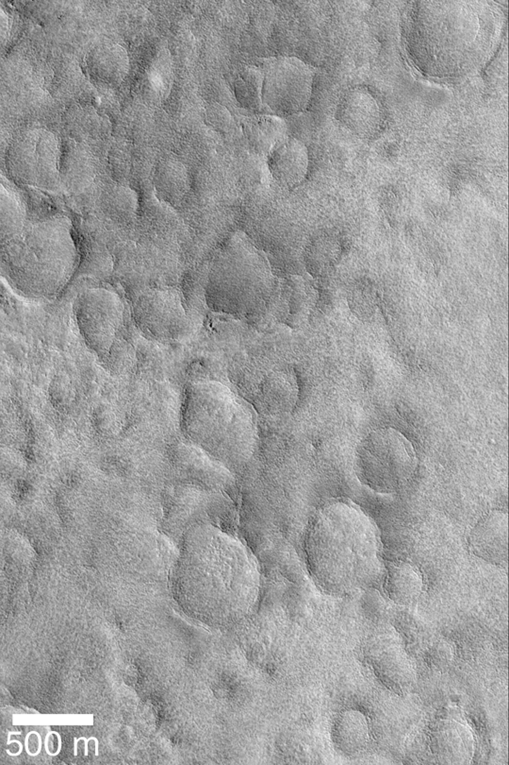
PIA04516:
Polygons on Crater Floor
Full Resolution:
TIFF
(438.1 kB)
JPEG
(93.46 kB)
2004-03-05
Mars
Mars Exploration Rover (MER)
Panoramic Camera
1920x1080x3
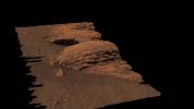
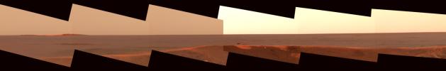
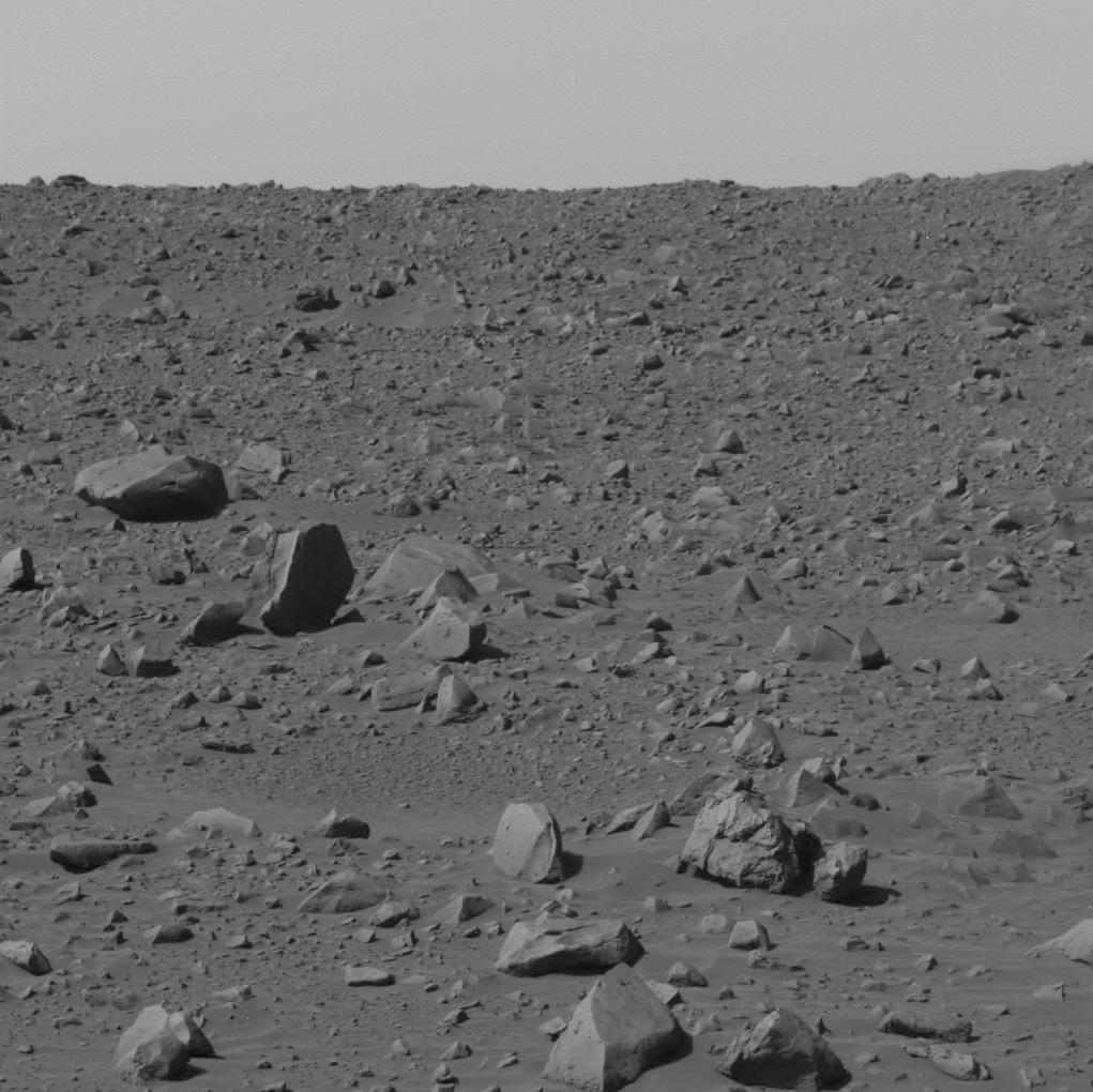
PIA05503:
Rare Glance at "Last Chance"
Full Resolution:
TIFF
(2.228 MB)
JPEG
(101.8 kB)
2003-05-14
Mars
Mars Global Surveyor (MGS)
Mars Orbiter Camera (MOC)
540x810x1
PIA04517:
Wind Streak Changes
Full Resolution:
TIFF
(438.1 kB)
JPEG
(99.86 kB)
2003-05-14
Mars
Mars Global Surveyor (MGS)
Mars Orbiter Camera (MOC)
540x810x1
PIA04518:
Yardangs and Exhumation
Full Resolution:
TIFF
(438.1 kB)
JPEG
(66.51 kB)
2003-05-16
Mars
Mars Global Surveyor (MGS)
Mars Orbiter Camera (MOC)
1995x2993x1
PIA04519:
Distributary Channels
Full Resolution:
TIFF
(5.566 MB)
JPEG
(647.9 kB)
2003-05-16
Mars
Mars Global Surveyor (MGS)
Mars Orbiter Camera (MOC)
1995x2993x3
PIA04520:
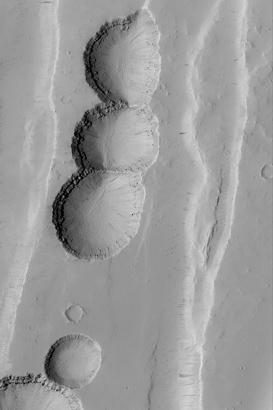
"Happy Face" Crater
Full Resolution:
TIFF
(14.63 MB)
JPEG
(238.6 kB)
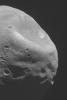
2003-05-16
Mars
Mars Global Surveyor (MGS)
Mars Orbiter Camera (MOC)
1995x2993x1
PIA04521:
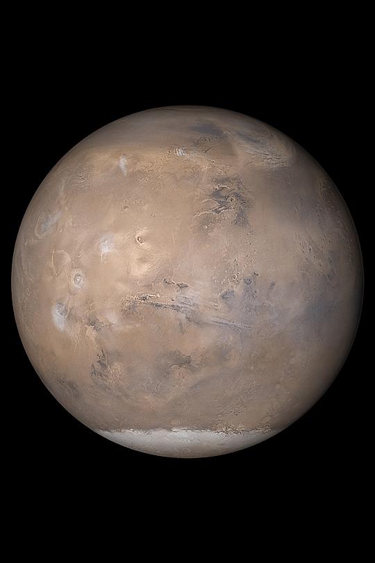
Martian Moon, Phobos
Full Resolution:
TIFF
(3.234 MB)
JPEG
(240.9 kB)
2003-05-16
Mars
2001 Mars Odyssey
THEMIS
1427x3201x1
PIA04522:
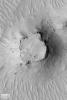
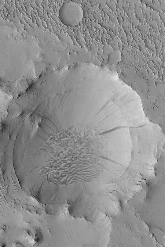
Unusual Crater
Full Resolution:
TIFF
(3.551 MB)
JPEG
(664.1 kB)
2003-05-16
Mars
2001 Mars Odyssey
THEMIS
1423x3200x1
PIA04523:
Streamlined Hills of Maja Vallis
Full Resolution:
TIFF
(3.46 MB)
JPEG
(685.1 kB)
2003-05-19
Mars
Mars Global Surveyor (MGS)
Mars Orbiter Camera (MOC)
1995x2993x1
PIA04524:
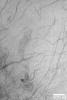
Argyre Dust Devil Tracks
Full Resolution:
TIFF
(5.457 MB)
JPEG
(573.1 kB)
2003-05-19
Mars
Mars Global Surveyor (MGS)
Mars Orbiter Camera (MOC)
1995x2993x1
PIA04525:
Layers, Boulders, and Dust
Full Resolution:
TIFF
(5.086 MB)
JPEG
(555.3 kB)
2003-05-19
Mars
Mars Global Surveyor (MGS)
Mars Orbiter Camera (MOC)
1995x2993x1
PIA04526:
Buried Craters of Utopia
Full Resolution:
TIFF
(5.791 MB)
JPEG
(679 kB)
2003-05-22
Mars
Mars Global Surveyor (MGS)
Mars Orbiter Camera (MOC)
1995x2993x3
PIA04527:
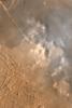
Dust Storm in Syria
Full Resolution:
TIFF
(12.35 MB)
JPEG
(278.1 kB)
2003-05-22
Mars
Mars Global Surveyor (MGS)
Mars Orbiter Camera (MOC)
1995x2993x1
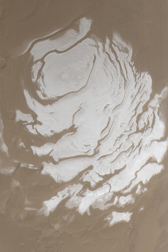
PIA04528:
Two Mars Years of South Polar Change
Full Resolution:
TIFF
(4.673 MB)
JPEG
(532.3 kB)
2003-05-26
Mars
2001 Mars Odyssey
THEMIS
1425x3222x1
PIA04534:
Fine-scale Textures
Full Resolution:
TIFF
(3.3 MB)
JPEG
(624.9 kB)
2003-05-26
Mars
2001 Mars Odyssey
THEMIS
1409x3077x1
PIA04535:
Crater Deformation
Full Resolution:
TIFF
(3.463 MB)
JPEG
(622.9 kB)
2003-05-26
Mars
2001 Mars Odyssey
THEMIS
1217x3025x1
PIA04536:
Kasei Valles
Full Resolution:
TIFF
(3.142 MB)
JPEG
(352.8 kB)
2003-05-26
Mars
2001 Mars Odyssey
THEMIS
1421x3177x1
PIA04537:
Channel to Nowhere
Full Resolution:
TIFF
(3.792 MB)
JPEG
(849.4 kB)
2003-05-26
Mars
2001 Mars Odyssey
THEMIS
1430x3229x1
PIA04538:
Isidis Planitia
Full Resolution:
TIFF
(2.949 MB)
JPEG
(497.2 kB)
2004-03-06
Mars
Mars Exploration Rover (MER)
Panoramic Camera
1021x1020x1
PIA05516:
Front Windshield after Sol 61 Drive
Full Resolution:
TIFF
(910.3 kB)
JPEG
(135.9 kB)
2003-05-27
Mars
Mars Global Surveyor (MGS)
Mars Orbiter Camera (MOC)
540x810x1
PIA04539:
Ridges and Sand Dunes
Full Resolution:
TIFF
(438.1 kB)
JPEG
(81.67 kB)
2003-05-27
Mars
Mars Global Surveyor (MGS)
Mars Orbiter Camera (MOC)
540x810x1
PIA04540:
Layered Walls of West Candor
Full Resolution:
TIFF
(438.1 kB)
JPEG
(78.7 kB)
2003-05-27
Mars
Mars Global Surveyor (MGS)
Mars Orbiter Camera (MOC)
540x810x1
PIA04541:
Gullied Crater Wall
Full Resolution:
TIFF
(438.1 kB)
JPEG
(61.75 kB)
2003-05-27
Mars
Mars Global Surveyor (MGS)
Mars Orbiter Camera (MOC)
540x810x1
PIA04542:
Eroded Sedimentary Rock
Full Resolution:
TIFF
(438.1 kB)
JPEG
(65.38 kB)
2003-05-27
Mars
Mars Global Surveyor (MGS)
Mars Orbiter Camera (MOC)
540x810x1
PIA04543:
Wind-Eroded Terrain in Tharsis
Full Resolution:
TIFF
(438.1 kB)
JPEG
(87.21 kB)
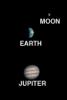
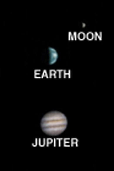
2003-05-28
Mars
Mars Global Surveyor (MGS)
Mars Orbiter Camera (MOC)
388x583x3
PIA04529:
Earth, Moon, and Jupiter, as seen from Mars
Full Resolution:
TIFF
(102 kB)
JPEG
(8.933 kB)
2003-05-29
Mars
2001 Mars Odyssey
THEMIS
1437x3325x1
PIA04544:
Crater in the Mangala Valles Region
Full Resolution:
TIFF
(3.074 MB)
JPEG
(516.7 kB)
2003-05-29
Mars
2001 Mars Odyssey
THEMIS
1437x3321x1
PIA04545:
Old Geology and New Geology
Full Resolution:
TIFF
(3.677 MB)
JPEG
(631.4 kB)
2003-05-29
Mars
2001 Mars Odyssey
THEMIS
1441x3334x1
PIA04546:
Grooved Terrain
Full Resolution:
TIFF
(3.797 MB)
JPEG
(793.1 kB)
2003-05-30
Mars
Mars Global Surveyor (MGS)
Mars Orbiter Camera (MOC)
540x810x3
PIA04547:
May Dust Storm in Acidalia
Full Resolution:
TIFF
(1.12 MB)
JPEG
(51.48 kB)
2003-05-30
Mars
Mars Global Surveyor (MGS)
Mars Orbiter Camera (MOC)
540x810x1
PIA04548:
Gullies in Terraced Crater Wall
Full Resolution:
TIFF
(438.1 kB)
JPEG
(89.34 kB)
2003-06-02
Mars
Mars Global Surveyor (MGS)
Mars Orbiter Camera (MOC)
540x810x1
PIA04549:
Old Arabian Crater
Full Resolution:
TIFF
(438.1 kB)
JPEG
(68.86 kB)
2003-06-02
Mars
Mars Global Surveyor (MGS)
Mars Orbiter Camera (MOC)
540x810x1
PIA04550:
Exhuming Platy Plains
Full Resolution:
TIFF
(438.1 kB)
JPEG
(118.3 kB)
2003-06-02
Mars
Mars Global Surveyor (MGS)
Mars Orbiter Camera (MOC)
540x810x1
PIA04551:
Apollinaris Patera Surfaces
Full Resolution:
TIFF
(414.3 kB)
JPEG
(62.39 kB)
2003-06-02
Mars
Mars Global Surveyor (MGS)
Mars Orbiter Camera (MOC)
540x810x3
PIA04552:
Syria/Claritas Dust Storm
Full Resolution:
TIFF
(1.303 MB)
JPEG
(41.12 kB)
2003-06-02
Mars
2001 Mars Odyssey
THEMIS
1233x3025x1
PIA04553:
Lava Flows
Full Resolution:
TIFF
(3.442 MB)
JPEG
(806.3 kB)
2003-06-02
Mars
2001 Mars Odyssey
THEMIS
1240x3043x1
PIA04554:
Hebes ILD
Full Resolution:
TIFF
(3.36 MB)
JPEG
(574.6 kB)
2003-06-03
Mars
2001 Mars Odyssey
THEMIS
1421x3194x1
PIA04555:
Eroded Crater Ejecta
Full Resolution:
TIFF
(3.276 MB)
JPEG
(519.5 kB)
2003-06-12
Mars
2001 Mars Odyssey
THEMIS
1238x3043x1
PIA04556:
Chaotic Terrain
Full Resolution:
TIFF
(3.316 MB)
JPEG
(498.3 kB)
2003-06-12
Mars
2001 Mars Odyssey
THEMIS
1234x3025x1
PIA04557:
Bizarre Crater Mound
Full Resolution:
TIFF
(3.129 MB)
JPEG
(491.8 kB)
2003-06-12
Mars
2001 Mars Odyssey
THEMIS
1223x3025x1
PIA04558:
Lycus Sulci
Full Resolution:
TIFF
(3.115 MB)
JPEG
(389.8 kB)
2003-06-12
Mars
2001 Mars Odyssey
THEMIS
1423x3204x1
PIA04559:
Masursky Crater
Full Resolution:
TIFF
(3.548 MB)
JPEG
(579.8 kB)
2003-06-12
Mars
2001 Mars Odyssey
THEMIS
1079x3043x1
PIA04560:
Dalmatian Terrain
Full Resolution:
TIFF
(3.081 MB)
JPEG
(555 kB)
2003-06-12
Mars
2001 Mars Odyssey
THEMIS
1435x3338x1
PIA04561:
Destination: Gusev
Full Resolution:
TIFF
(3.345 MB)
JPEG
(582.7 kB)
2003-06-12
Mars
Mars Global Surveyor (MGS)
Mars Orbiter Camera (MOC)
540x810x1
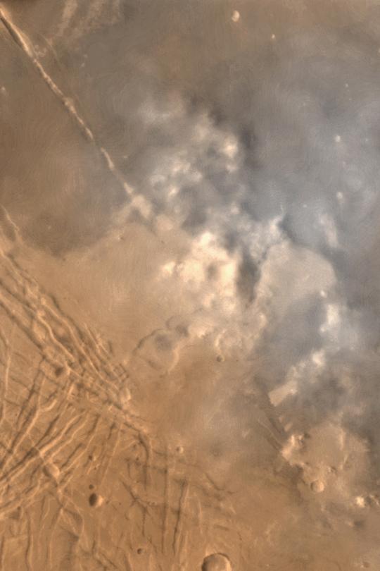
PIA04562:
Clouds Over Morning Limb
Full Resolution:
TIFF
(352.3 kB)
JPEG
(25.33 kB)
2003-06-12
Mars
Mars Global Surveyor (MGS)
Mars Orbiter Camera (MOC)
540x810x1
PIA04563:
Small Martian Mesa
Full Resolution:
TIFF
(438.1 kB)
JPEG
(102.6 kB)
2003-06-12
Mars
Mars Global Surveyor (MGS)
Mars Orbiter Camera (MOC)
540x810x1
PIA04564:
Cycloidal Dust Devil Track
Full Resolution:
TIFF
(438.1 kB)
JPEG
(65.17 kB)
2003-06-12
Mars
Mars Global Surveyor (MGS)
Mars Orbiter Camera (MOC)
540x810x1
PIA04565:
Terrain Near Gordii Dorsum
Full Resolution:
TIFF
(438.1 kB)
JPEG
(78.94 kB)
2003-06-12
Mars
Mars Global Surveyor (MGS)
Mars Orbiter Camera (MOC)
540x810x3
PIA04566:
South Polar Cap in Summer
Full Resolution:
TIFF
(1.088 MB)
JPEG
(43.23 kB)
2003-06-12
Mars
Mars Global Surveyor (MGS)
Mars Orbiter Camera (MOC)
540x810x1
PIA04567:
Layers in Galle Crater
Full Resolution:
TIFF
(438.1 kB)
JPEG
(113.8 kB)
2003-06-12
Mars
Mars Global Surveyor (MGS)
Mars Orbiter Camera (MOC)
540x810x1
PIA04568:
Tractus Catena Collapse Pits
Full Resolution:
TIFF
(412.8 kB)
JPEG
(43.4 kB)
2003-06-12
Mars
Mars Global Surveyor (MGS)
Mars Orbiter Camera (MOC)
540x810x3
PIA04569:
Frost in Charitum Montes
Full Resolution:
TIFF
(1.314 MB)
JPEG
(66.1 kB)
2003-06-12
Mars
Mars Global Surveyor (MGS)
Mars Orbiter Camera (MOC)
540x810x1
PIA04570:
Gullies in Crater Wall
Full Resolution:
TIFF
(438.1 kB)
JPEG
(75.76 kB)
2003-06-12
Mars
Mars Global Surveyor (MGS)
Mars Orbiter Camera (MOC)
540x810x1
PIA04571:
Layered Yardangs in Henry Crater
Full Resolution:
TIFF
(438.1 kB)
JPEG
(83.31 kB)
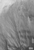
2003-06-16
Mars
Mars Global Surveyor (MGS)
Mars Orbiter Camera (MOC)
540x810x1
PIA04572:
Frosted Chasma Boreale Dunes
Full Resolution:
TIFF
(418.7 kB)
JPEG
(46.08 kB)
2003-06-16
Mars
Mars Global Surveyor (MGS)
Mars Orbiter Camera (MOC)
540x813x1
PIA04573:
Sand Dunes of Schaeberle Crater
Full Resolution:
TIFF
(439.7 kB)
JPEG
(93 kB)
2003-06-16
Mars
Mars Global Surveyor (MGS)
Mars Orbiter Camera (MOC)
540x810x1
PIA04574:
Daedalia Lava Flow Margin
Full Resolution:
TIFF
(438.1 kB)
JPEG
(65.57 kB)
2003-06-16
Mars
Mars Global Surveyor (MGS)
Mars Orbiter Camera (MOC)
540x810x1
PIA04575:
Richardson Dunes in Summer
Full Resolution:
TIFF
(438.1 kB)
JPEG
(48.46 kB)
2004-03-06
Mars
Mars Exploration Rover (MER)
Microscopic Imager
4158x3029x3
PIA05515:
Rules of Attraction
Full Resolution:
TIFF
(12.88 MB)
JPEG
(1.151 MB)
2003-06-17
Mars
2001 Mars Odyssey
THEMIS
1421x3186x1
PIA04576:
Lava-Filled Craters
Full Resolution:
TIFF
(3.665 MB)
JPEG
(701.2 kB)
2003-06-17
Mars
2001 Mars Odyssey
MOLA
Thermal Emission Imaging System
1239x3043x1
PIA04577:
Canyon Walls
Full Resolution:
TIFF
(2.865 MB)
JPEG
(287.6 kB)
2003-06-19
Mars
2001 Mars Odyssey
THEMIS
1423x3208x1
PIA04578:
Volcanic Surface Textures
Full Resolution:
TIFF
(3.929 MB)
JPEG
(958 kB)
2003-06-19
Mars
2001 Mars Odyssey
THEMIS
1068x3025x1
PIA04579:
Etched Terrain
Full Resolution:
TIFF
(2.867 MB)
JPEG
(390.9 kB)
2003-06-19
Mars
2001 Mars Odyssey
THEMIS
1229x3025x1
PIA04580:
Wind, Water, and Lava
Full Resolution:
TIFF
(3.37 MB)
JPEG
(538 kB)
2003-06-19
Mars
Mars Global Surveyor (MGS)
Mars Orbiter Camera (MOC)
540x810x1
PIA04581:
Impact on Arsia Mons
Full Resolution:
TIFF
(438.1 kB)
JPEG
(81.94 kB)
2003-06-19
Mars
Mars Global Surveyor (MGS)
Mars Orbiter Camera (MOC)
540x810x1
PIA04582:
Terby Crater Layers
Full Resolution:
TIFF
(438.1 kB)
JPEG
(105.7 kB)
2003-06-19
Mars
Mars Global Surveyor (MGS)
Mars Orbiter Camera (MOC)
540x810x1
PIA04583:
Flows on Olympus Mons
Full Resolution:
TIFF
(438.1 kB)
JPEG
(85.31 kB)
2003-06-20
Mars
Mars Global Surveyor (MGS)
Mars Orbiter Camera (MOC)
540x810x1
PIA04584:
Large, Bright Wind Ripples
Full Resolution:
TIFF
(438.1 kB)
JPEG
(91.3 kB)
2003-06-20
Mars
2001 Mars Odyssey
THEMIS
1239x3043x1
PIA04585:
Smooth and Scrambled
Full Resolution:
TIFF
(3.339 MB)
JPEG
(673 kB)
2003-06-20
Mars
2001 Mars Odyssey
THEMIS
1226x3025x1
PIA04586:
Channels and Erosion
Full Resolution:
TIFF
(3.23 MB)
JPEG
(613.6 kB)
2003-06-23
Mars
Mars Global Surveyor (MGS)
Mars Orbiter Camera (MOC)
540x810x1
PIA04587:
Defrosting Gully Aprons
Full Resolution:
TIFF
(438.1 kB)
JPEG
(71.13 kB)
2003-06-23
Mars
Mars Global Surveyor (MGS)
Mars Orbiter Camera (MOC)
540x810x1
PIA04588:
Defrosting Sand Dunes
Full Resolution:
TIFF
(433.8 kB)
JPEG
(69.73 kB)
2003-06-23
Mars
Mars Global Surveyor (MGS)
Mars Orbiter Camera (MOC)
93x140x3
PIA04589:
Phobos Over the Martian Limb
Full Resolution:
TIFF
(19.62 kB)
JPEG
(1.98 kB)
2003-06-24
Mars
Mars Global Surveyor (MGS)
Mars Orbiter Camera (MOC)
540x810x1
PIA04590:
Crater with Wind Streak
Full Resolution:
TIFF
(438.1 kB)
JPEG
(76.54 kB)
2004-03-09
Mars
Mars Exploration Rover (MER)
Microscopic Imager
Rock Abrasion Tool (RAT)
1024x1024x1
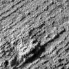
PIA05520:
Fleshing out "Flatrock"
Full Resolution:
TIFF
(1.05 MB)
JPEG
(294.8 kB)
2003-06-25
Mars
Mars Global Surveyor (MGS)
Mars Orbiter Camera (MOC)
540x810x3
PIA04591:
Mars 2003
Full Resolution:
TIFF
(701.4 kB)
JPEG
(33.73 kB)
2003-06-30
Mars
2001 Mars Odyssey
Gamma Ray Spectrometer Suite
2560x1918x3
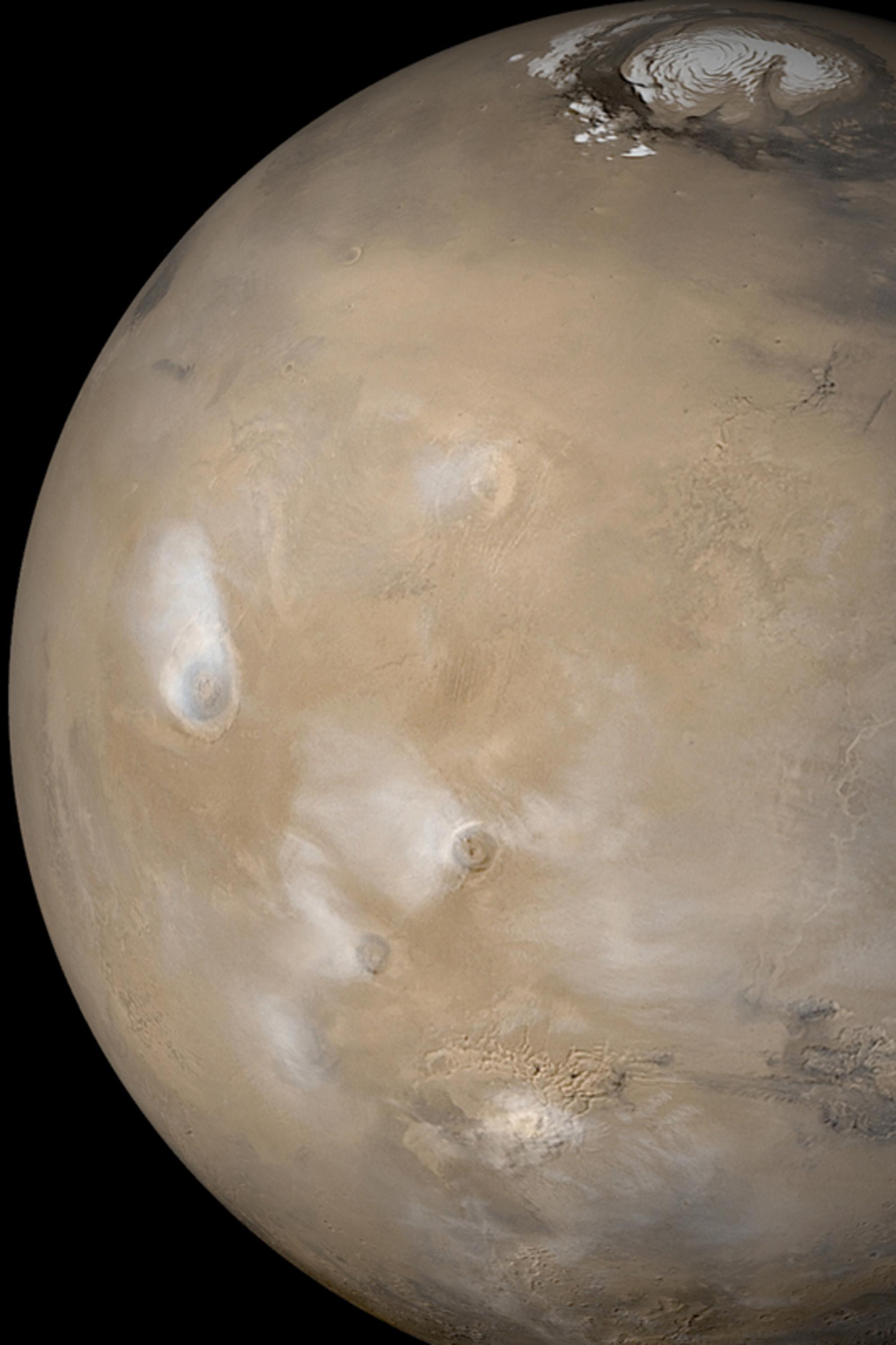
PIA04593:
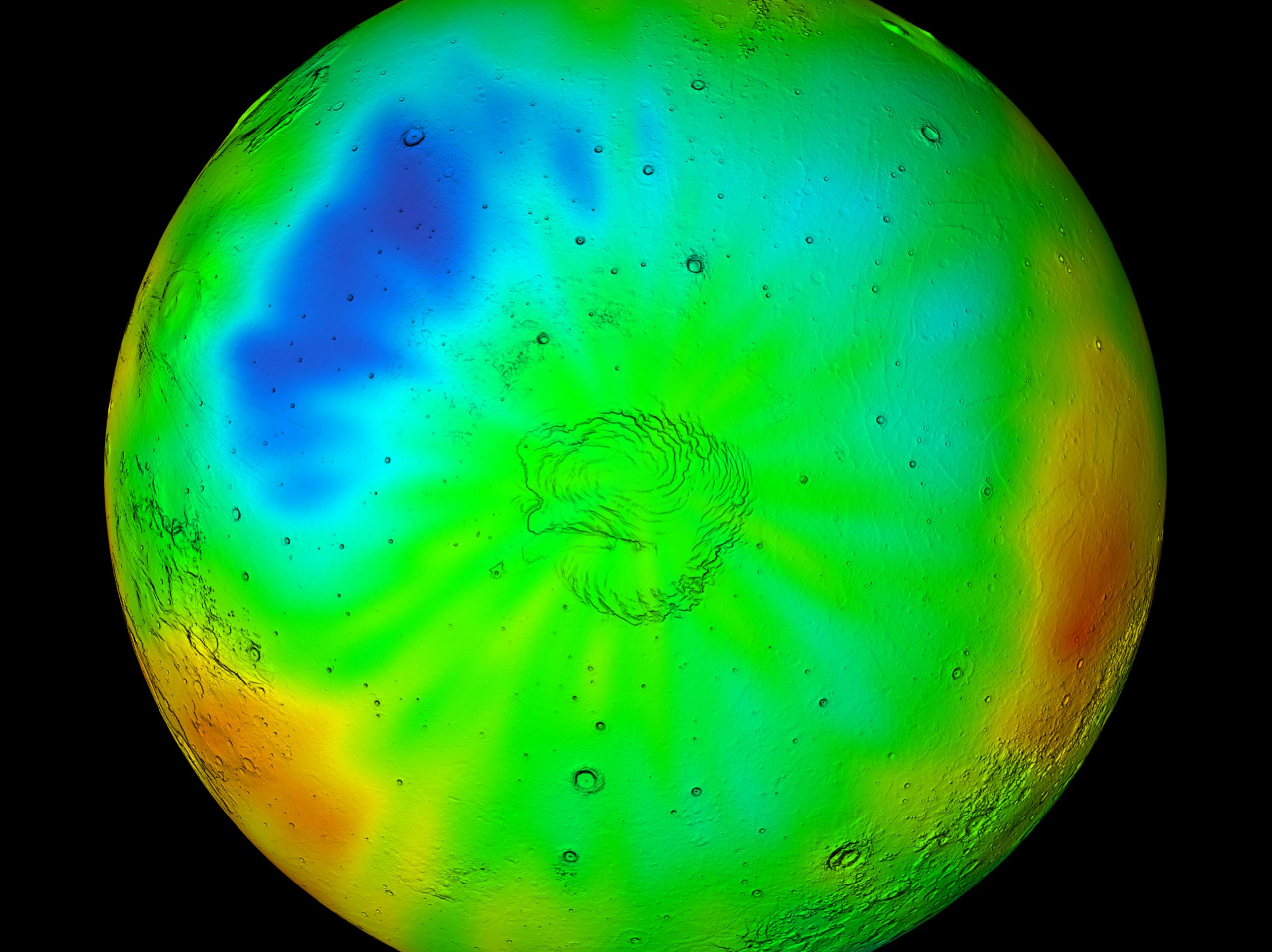
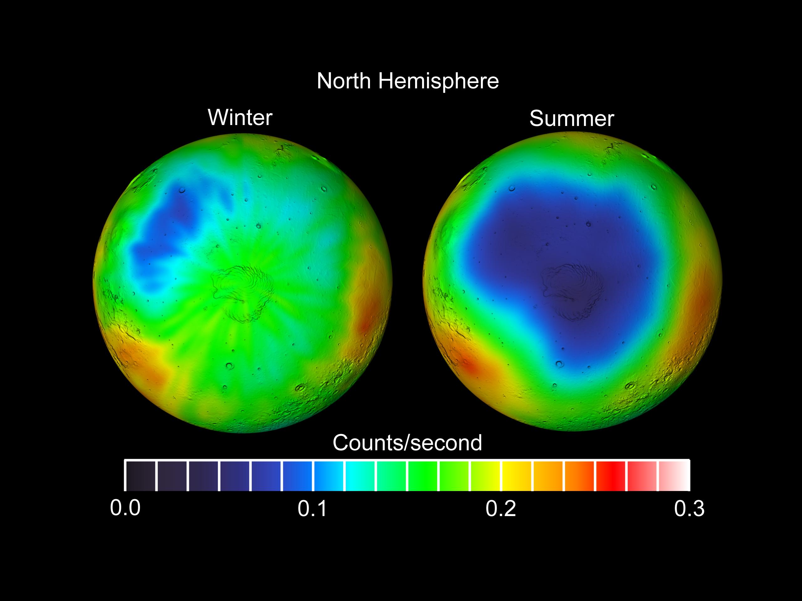
Summer in Mars' North Polar Region
Full Resolution:
TIFF
(10.15 MB)
JPEG
(337.8 kB)
2003-06-30
Mars
2001 Mars Odyssey
Gamma Ray Spectrometer Suite
2560x1918x3
PIA04595:
Winter in Mars' North Polar Region
Full Resolution:
TIFF
(9.608 MB)
JPEG
(381.1 kB)
2003-06-30
Mars
2001 Mars Odyssey
Gamma Ray Spectrometer Suite
2560x1918x3
PIA04596:
Seasonal Frost Changes on Mars
Full Resolution:
TIFF
(4.931 MB)
JPEG
(239.6 kB)
2003-07-01
Mars
2001 Mars Odyssey
THEMIS
1361x3057x1
PIA04597:
Syrtis in Retreat
Full Resolution:
TIFF
(3.201 MB)
JPEG
(538.5 kB)
2003-07-01
Mars
Mars Global Surveyor (MGS)
Mars Orbiter Camera (MOC)
540x810x3
PIA04598:
Autumn Dust Storm
Full Resolution:
TIFF
(1.012 MB)
JPEG
(40.09 kB)
2003-07-01
Mars
Mars Global Surveyor (MGS)
Mars Orbiter Camera (MOC)
540x810x1
PIA04599:
Gullies in Terra Sirenum
Full Resolution:
TIFF
(438.1 kB)
JPEG
(94.05 kB)
2003-07-01
Mars
Mars Global Surveyor (MGS)
Mars Orbiter Camera (MOC)
540x810x1
PIA04600:
Layers in Terby Crater
Full Resolution:
TIFF
(438.1 kB)
JPEG
(62.42 kB)
2010-03-25
Mars
2001 Mars Odyssey
THEMIS
1334x2770x1
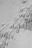
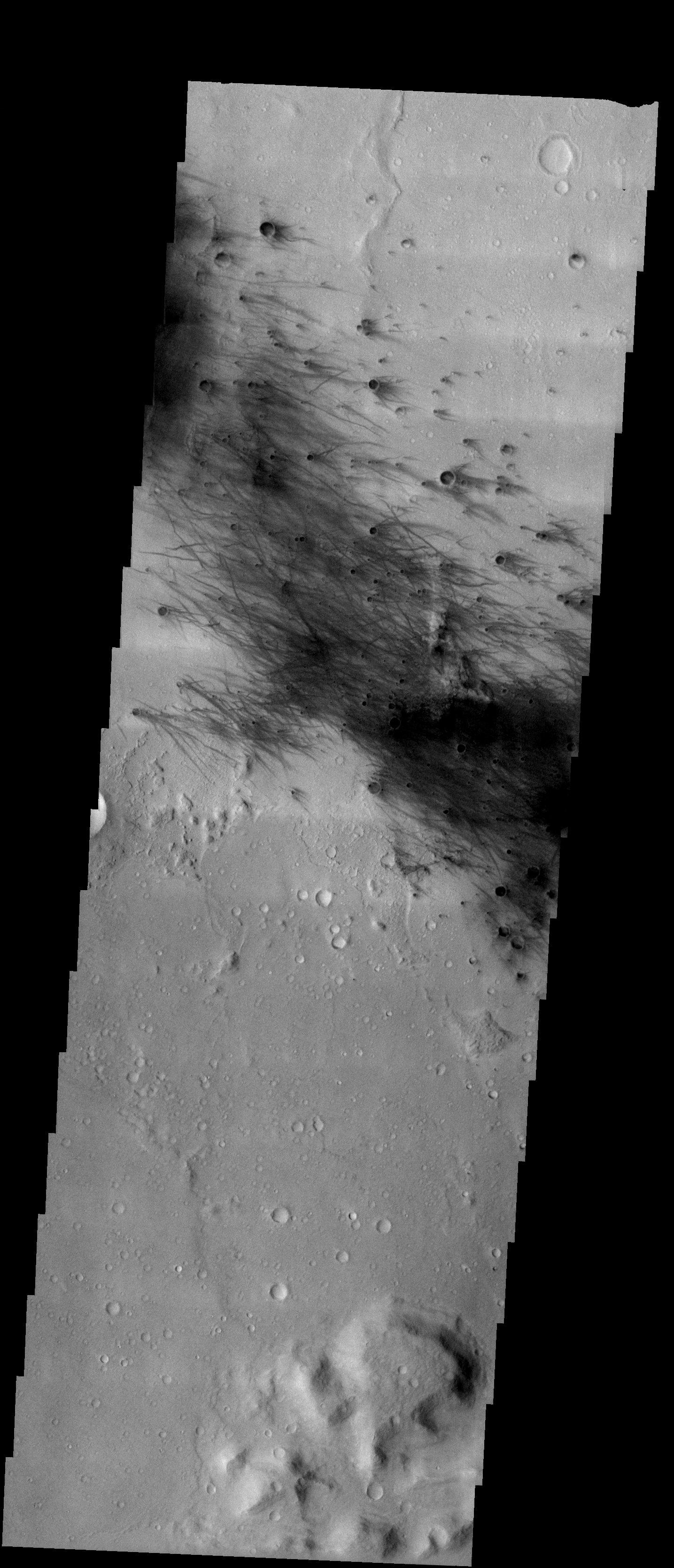
PIA12981:
Dark Slope Streak
Full Resolution:
TIFF
(3.699 MB)
JPEG
(284.9 kB)
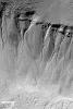
2003-07-02
Mars
Mars Global Surveyor (MGS)
Mars Orbiter Camera (MOC)
540x810x1
PIA04605:
Boulder Track
Full Resolution:
TIFF
(437.4 kB)
JPEG
(47.02 kB)
2004-03-06
Mars
Mars Exploration Rover (MER)
Panoramic Camera
5195x828x3
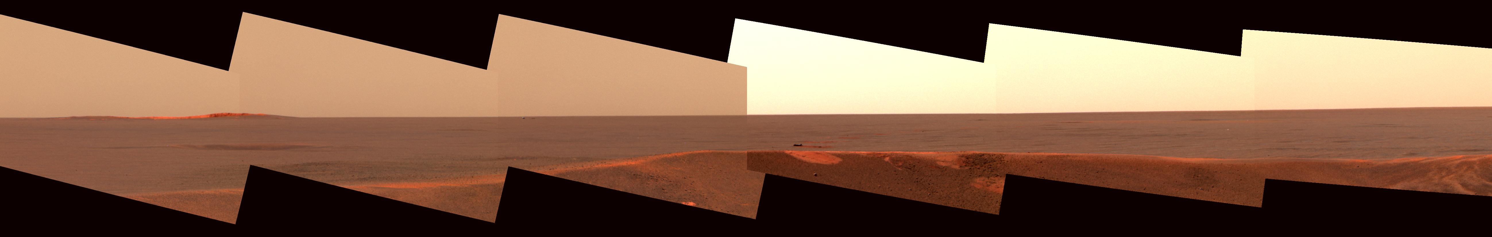
PIA05514:
Opportunity's Heatshield on the Horizon
Full Resolution:
TIFF
(5.996 MB)
JPEG
(239.5 kB)
QTVR
(297.2 kB)
2003-07-02
Mars
Mars Global Surveyor (MGS)
Mars Orbiter Camera (MOC)
540x810x3
PIA04606:
Frosty Mountains
Full Resolution:
TIFF
(904.1 kB)
JPEG
(28.75 kB)
2003-07-02
Mars
2001 Mars Odyssey
THEMIS
1095x3061x1
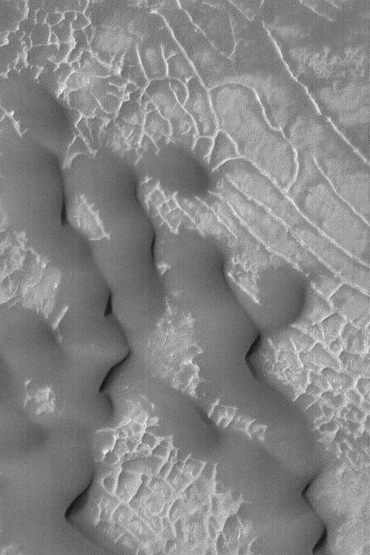
PIA04607:
Dalmatian Terrain
Full Resolution:
TIFF
(2.891 MB)
JPEG
(482.6 kB)
2003-07-02
Mars
2001 Mars Odyssey
THEMIS
1429x3223x1
PIA04608:
Bumps and Humps
Full Resolution:
TIFF
(3.673 MB)
JPEG
(805.3 kB)
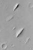
2003-07-03
Mars
Mars Global Surveyor (MGS)
Mars Orbiter Camera (MOC)
540x810x1
PIA04610:
Kaiser Dune Avalanches
Full Resolution:
TIFF
(438.1 kB)
JPEG
(64.97 kB)
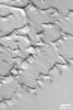
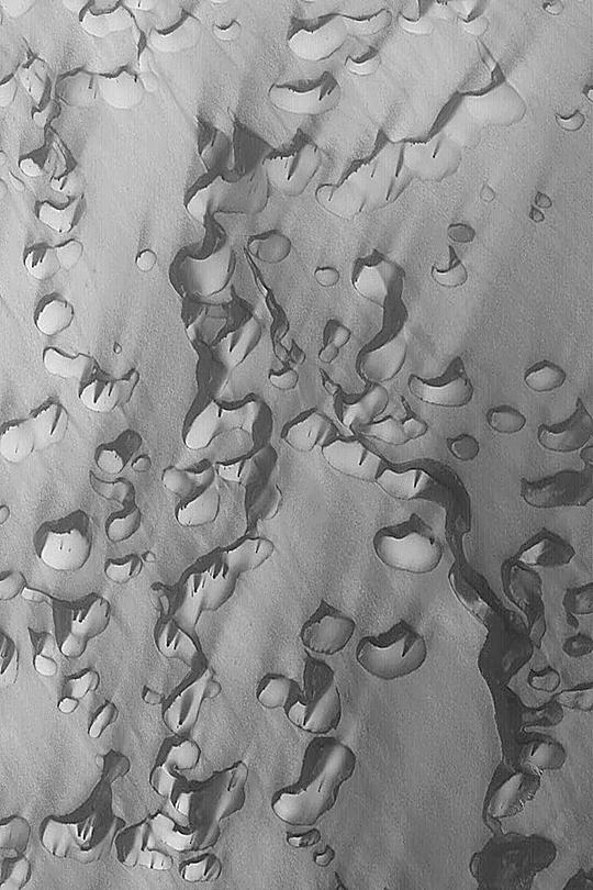
2003-07-03
Mars
2001 Mars Odyssey
THEMIS
1095x3061x1
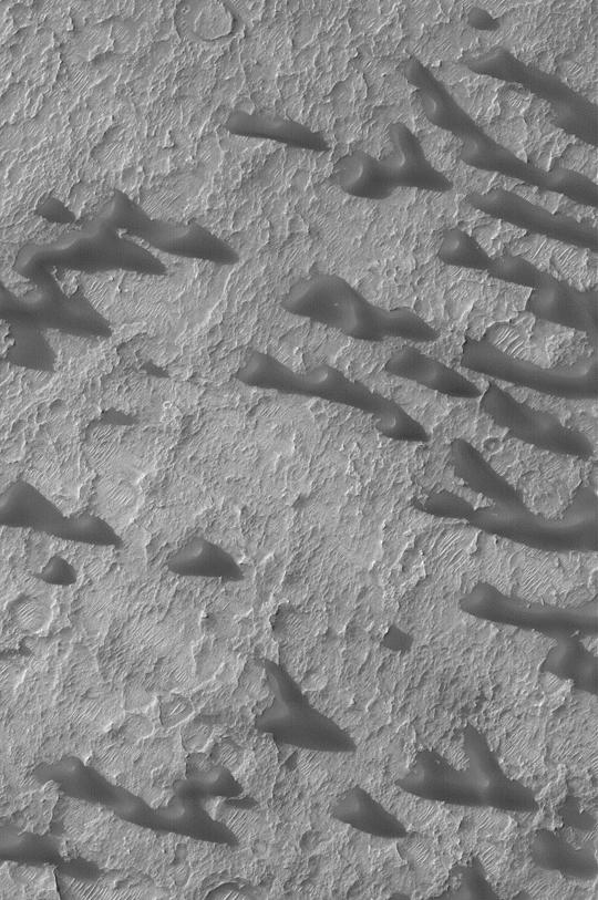
PIA04611:
Dunes
Full Resolution:
TIFF
(3.184 MB)
JPEG
(508.8 kB)
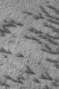
2003-07-07
Mars
Mars Global Surveyor (MGS)
Mars Orbiter Camera (MOC)
540x810x1
PIA04612:
Windblown Dunes and Ripples
Full Resolution:
TIFF
(438.1 kB)
JPEG
(66.4 kB)
1-100
101-200
201-300
301-400
401-500
501-600
601-700
701-800
801-900
901-1000
Currently displaying images:
1301 - 1400
of 12735


