- Original Caption Released with Image:
-
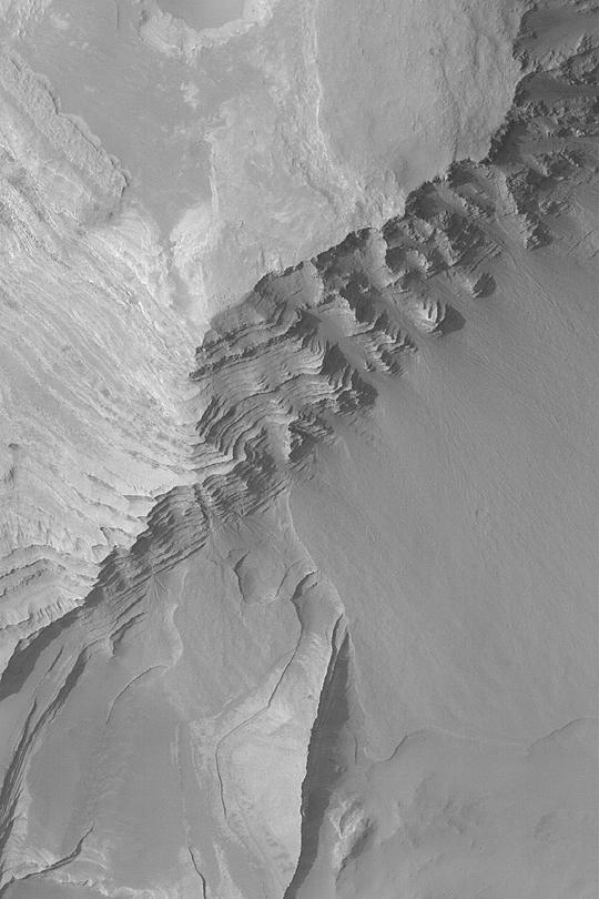
MGS MOC Release No. MOC2-407, 30 June 2003 Whether on Earth or Mars, sedimentary rocks provide a record of past environments. Of course, it is difficult to read that record without being able to visit the site. However, the Mars Global Surveyor (MGS) Mars Orbiter Camera (MOC) has revealed hundreds of locales on Mars at which sedimentary rocks are exposed at the surface. Terby Crater exhibits hundreds of layers of similar thickness and physical properties--some have speculated these may be the record of an ancient lake or sea. This MOC image shows some of the layer outcrops in Terby Crater. Fans of debris have eroded from the steep, layered slopes in some places. This picture covers an area 3 km (1.9 mi) wide near 27.5°S, 285.7°W. The image is illuminated from the upper left and was obtained in June 2003.
- Image Credit:
-
NASA/JPL/Malin Space Science Systems
Image Addition Date: -
2003-07-01
|