- Original Caption Released with Image:
-
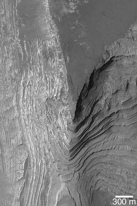
MGS MOC Release No. MOC2-395, 18 June 2003 A sequence of layered, sedimentary rock, more than 1 km (0.62 miles) thick, once filled or nearly filled Terby Crater, a basin just north of Hellas Planitia. The sedimentary rocks were eroded and exposed so that today, the Mars Global Surveyor (MGS) Mars Orbiter Camera (MOC) regularly takes pictures of these outcrops in an effort to better understand them. Exposures of sedimentary rock on Mars are extremely important because they show that the planet has a rich, diverse history. However, an opportunity to read the history recorded in these rocks may still be many years away. This image is near 27.6°S, 285.9°W. The picture is illuminated from the upper left.
- Image Credit:
-
NASA/JPL/Malin Space Science Systems
Image Addition Date: -
2003-06-19
|