My
List |
Addition Date
|
Target
|
Mission
|
Instrument
|
Size
|

|
2022-07-22 |
Mars
|
2001 Mars Odyssey
|
THEMIS
|
492x5383x1 |

|
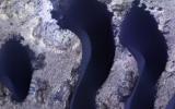
-
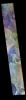
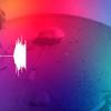
PIA25455:
-
South Polar Ice
Full Resolution:
TIFF
(2.651 MB)
JPEG
(448.1 kB)
|
|
|
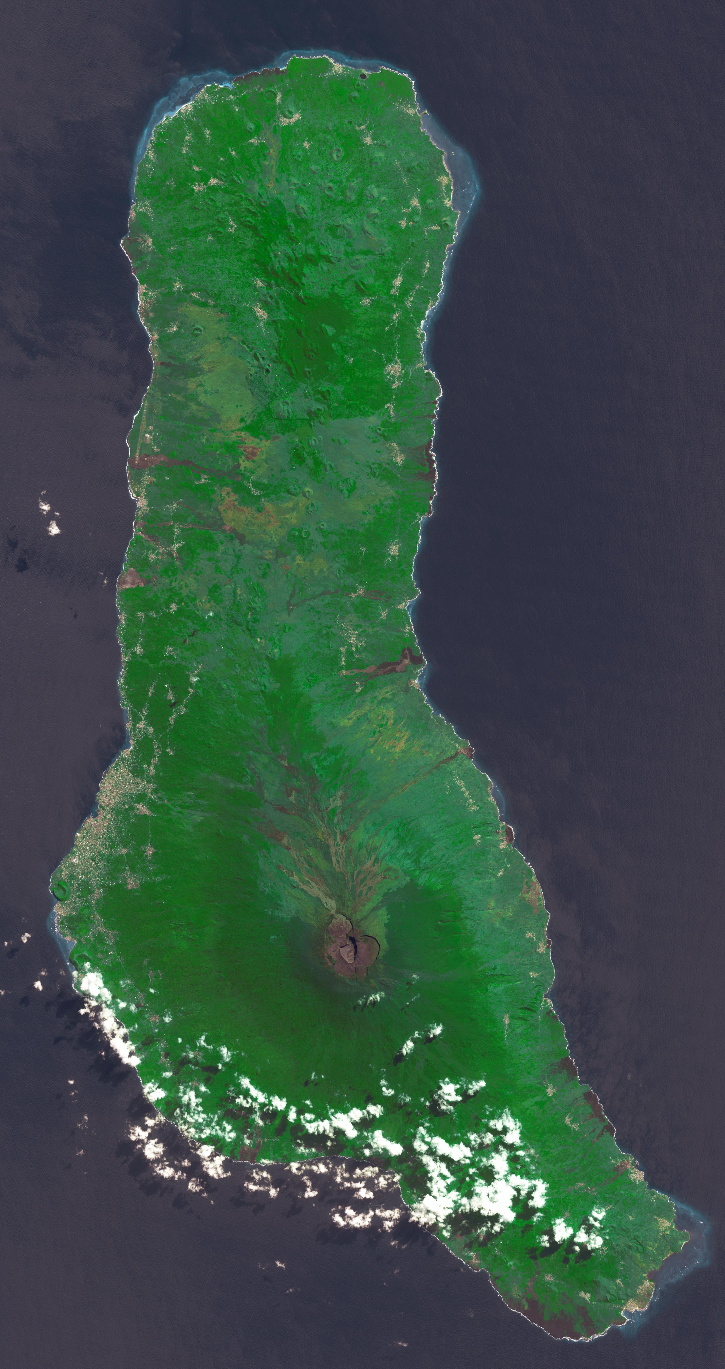
2022-07-21 |
Earth
|
Terra
|
ASTER
|
2382x4495x3 |

|
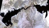
-
PIA25444:
-
Union of the Comoros
Full Resolution:
TIFF
(26.03 MB)
JPEG
(1.164 MB)
|
|
|
2022-07-21 |
Mars
|
2001 Mars Odyssey
|
THEMIS
|
603x2699x1 |

|
-
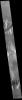
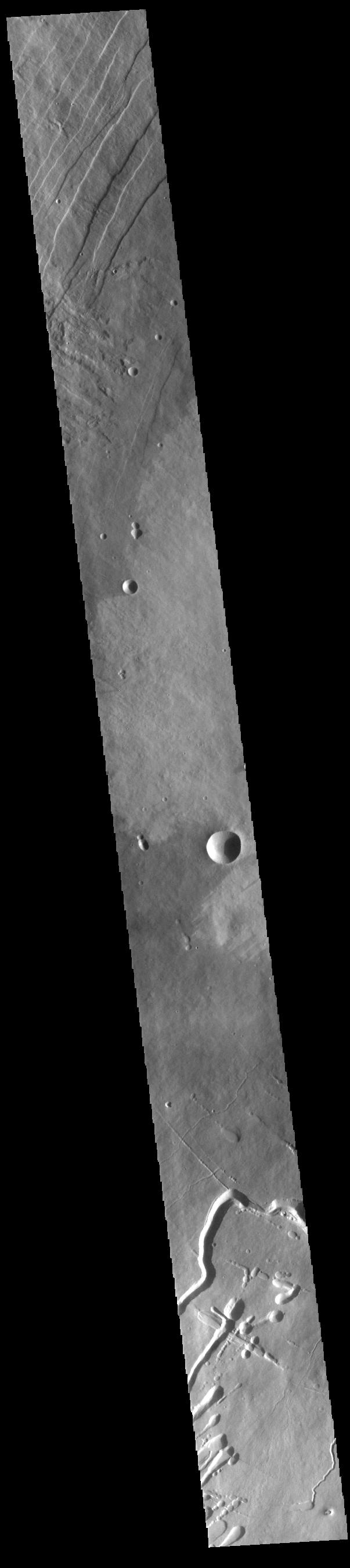
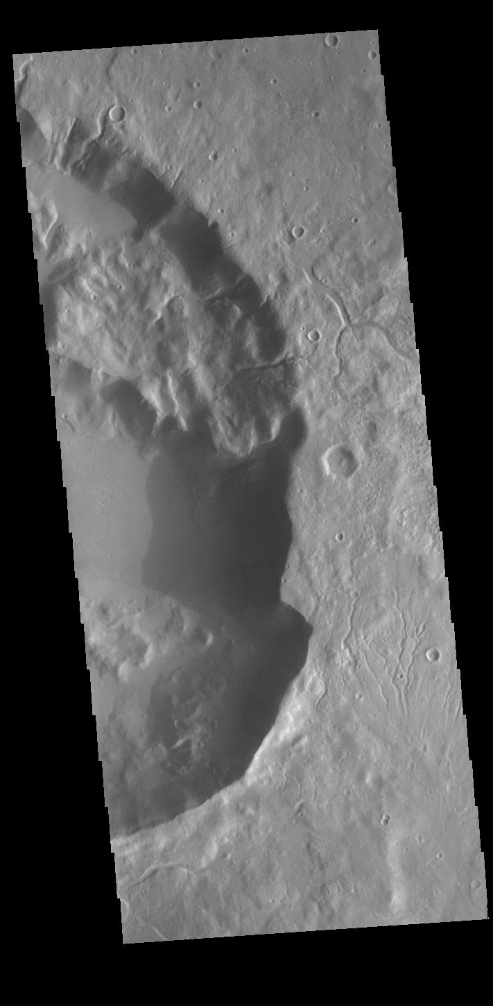
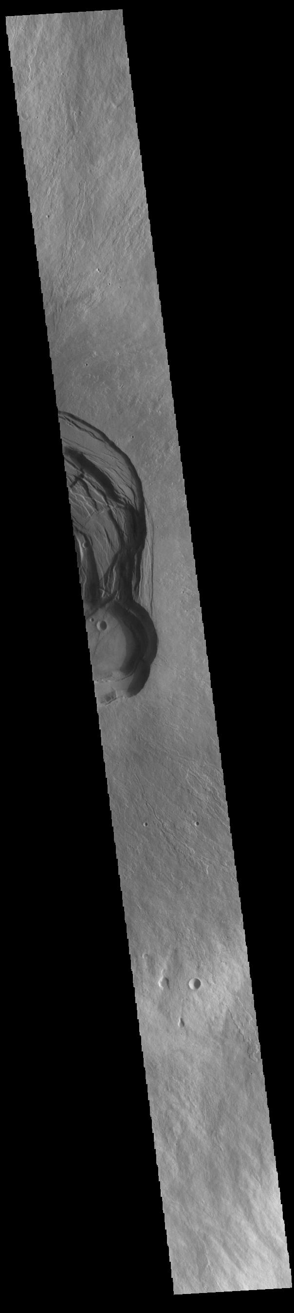
PIA25454:
-
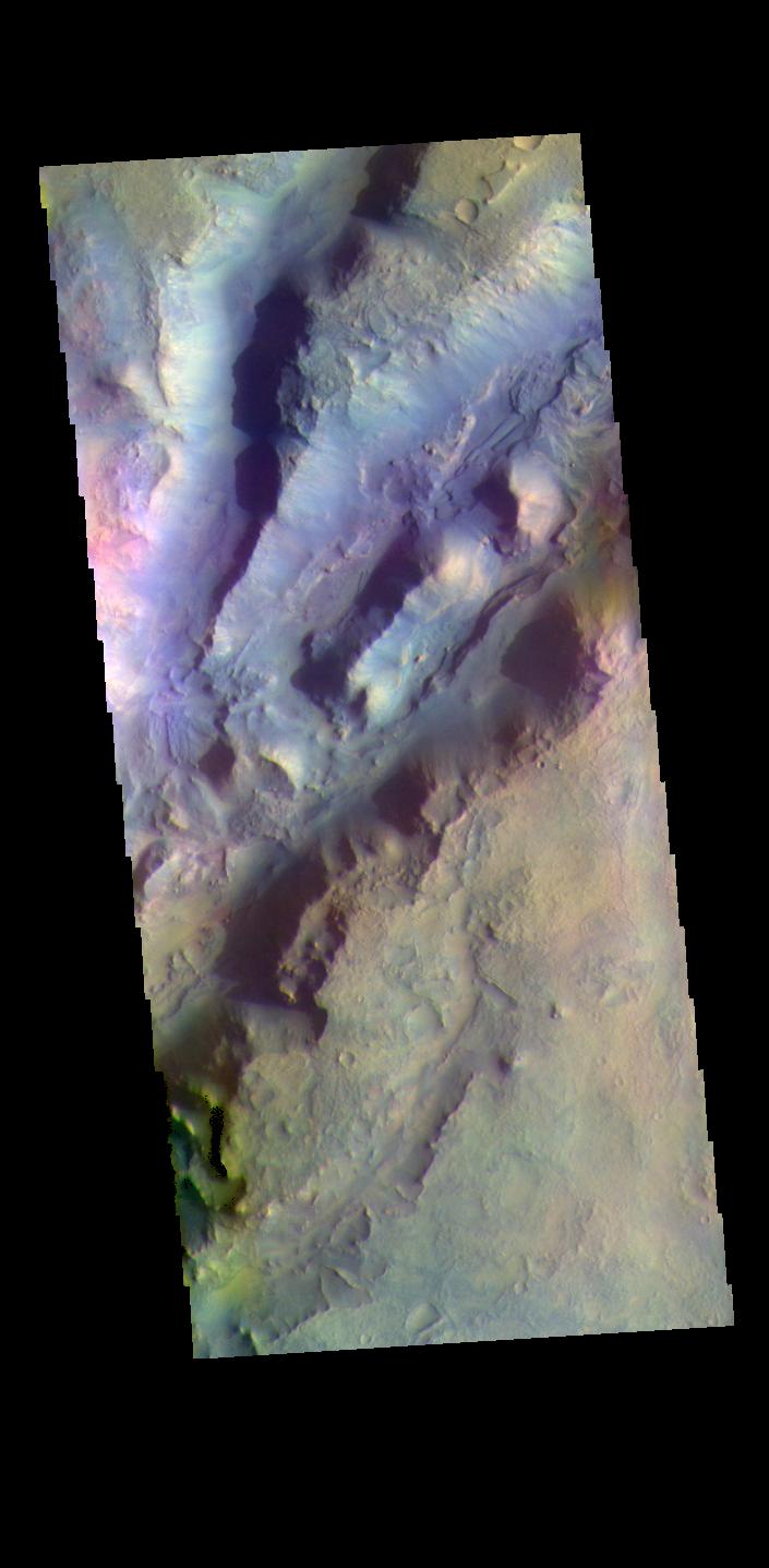
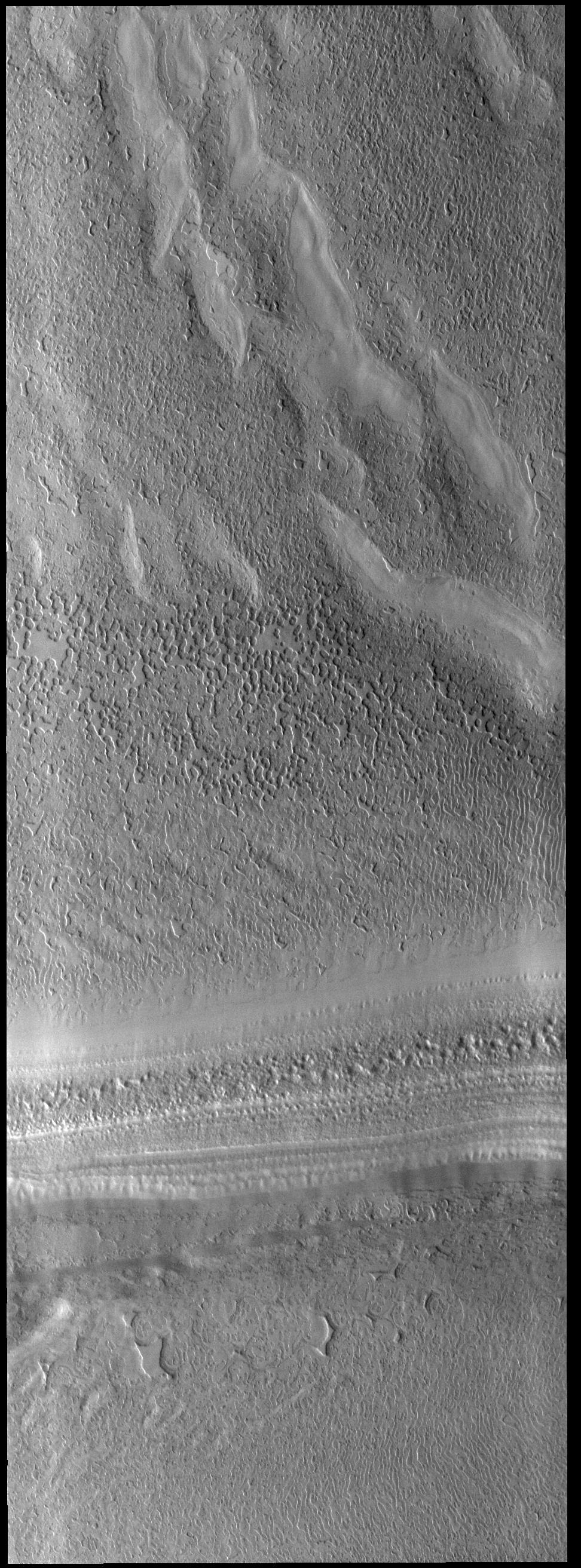
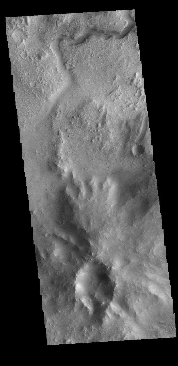
Pavonis Mons Flank
Full Resolution:
TIFF
(755.5 kB)
JPEG
(101.4 kB)
|
|
|
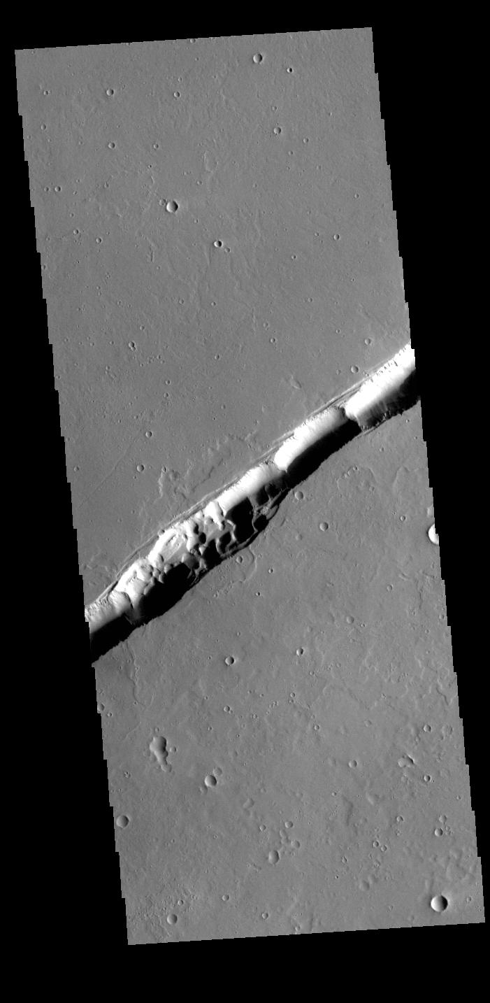
2022-07-20 |
Mars
|
2001 Mars Odyssey
|
THEMIS
|
697x1431x1 |
|
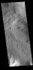
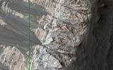
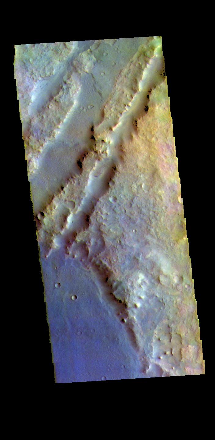
-
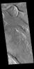
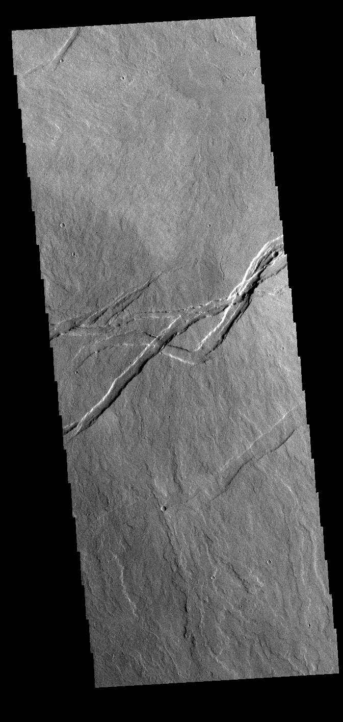
PIA25453:
-
Olympus Rupes
Full Resolution:
TIFF
(751.2 kB)
JPEG
(130.3 kB)
|
|
|
2022-07-19 |
Mars
|
2001 Mars Odyssey
|
THEMIS
|
667x1413x1 |
|
-
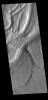
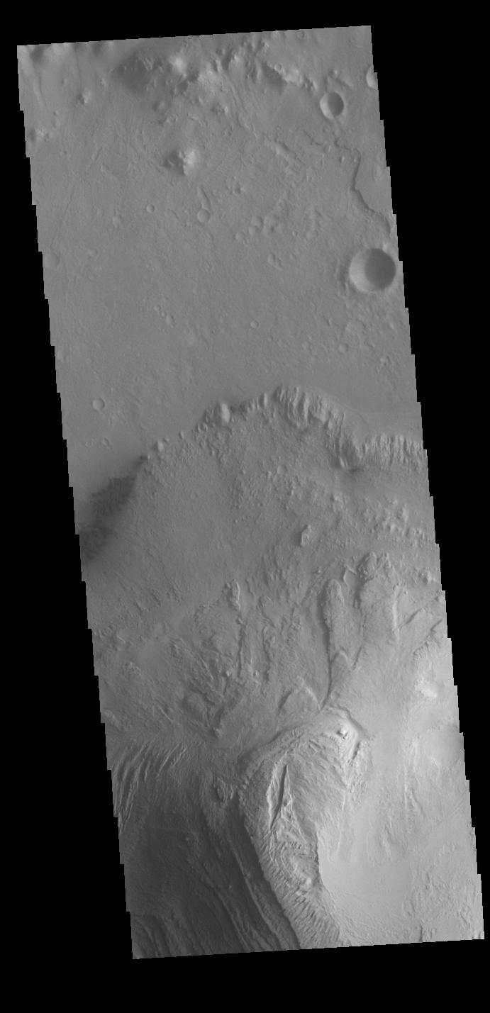
PIA25452:
-
Daedalia Planum
Full Resolution:
TIFF
(747.9 kB)
JPEG
(165.1 kB)
|
|
|
2022-07-18 |
Mars
|
2001 Mars Odyssey
|
THEMIS
|
687x1429x1 |
|
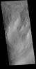
-
PIA25451:
-
Candor Chasma
Full Resolution:
TIFF
(657.6 kB)
JPEG
(64.75 kB)
|
|
|
2022-07-15 |
Mars
|
2001 Mars Odyssey
|
THEMIS
|
612x2708x1 |

|
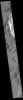
-
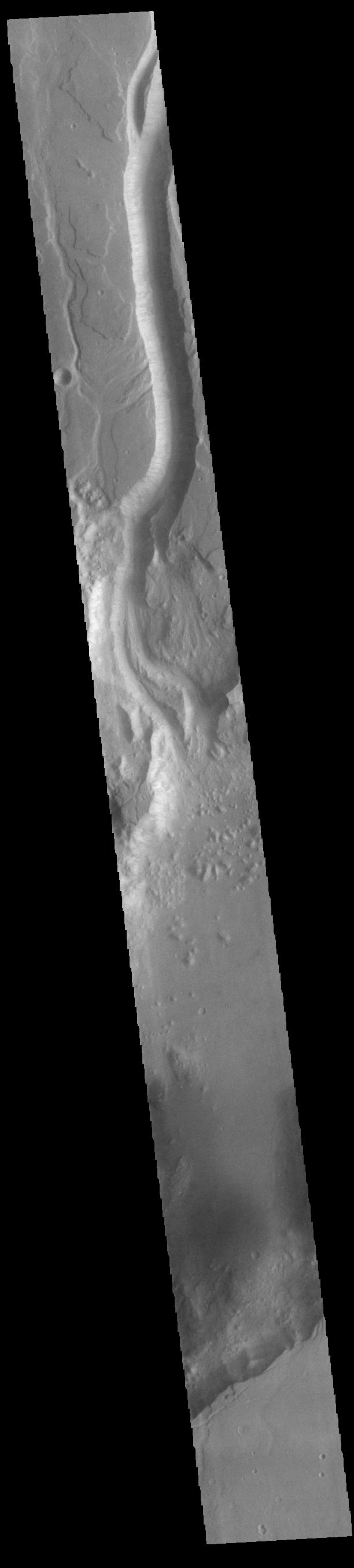
PIA25405:
-
Shalbatana Vallis
Full Resolution:
TIFF
(780.6 kB)
JPEG
(89.77 kB)
|
|
|
2022-07-14 |
Mars
|
2001 Mars Odyssey
|
THEMIS
|
712x1445x1 |
|
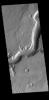
-
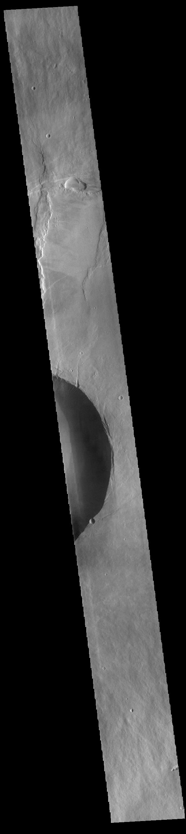
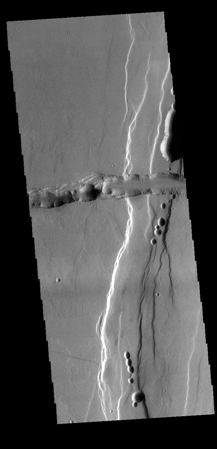
PIA25404:
-
Out of Round
Full Resolution:
TIFF
(717.8 kB)
JPEG
(83.71 kB)
|
|
|
2022-07-13 |
Mars
|
2001 Mars Odyssey
|
THEMIS
|
602x2700x1 |
|
-
PIA25403:
-
Pavonis Mons
Full Resolution:
TIFF
(734.2 kB)
JPEG
(84.95 kB)
|
|
|
2022-07-12 |
Mars
|
2001 Mars Odyssey
|
THEMIS
|
604x2710x1 |
|
-
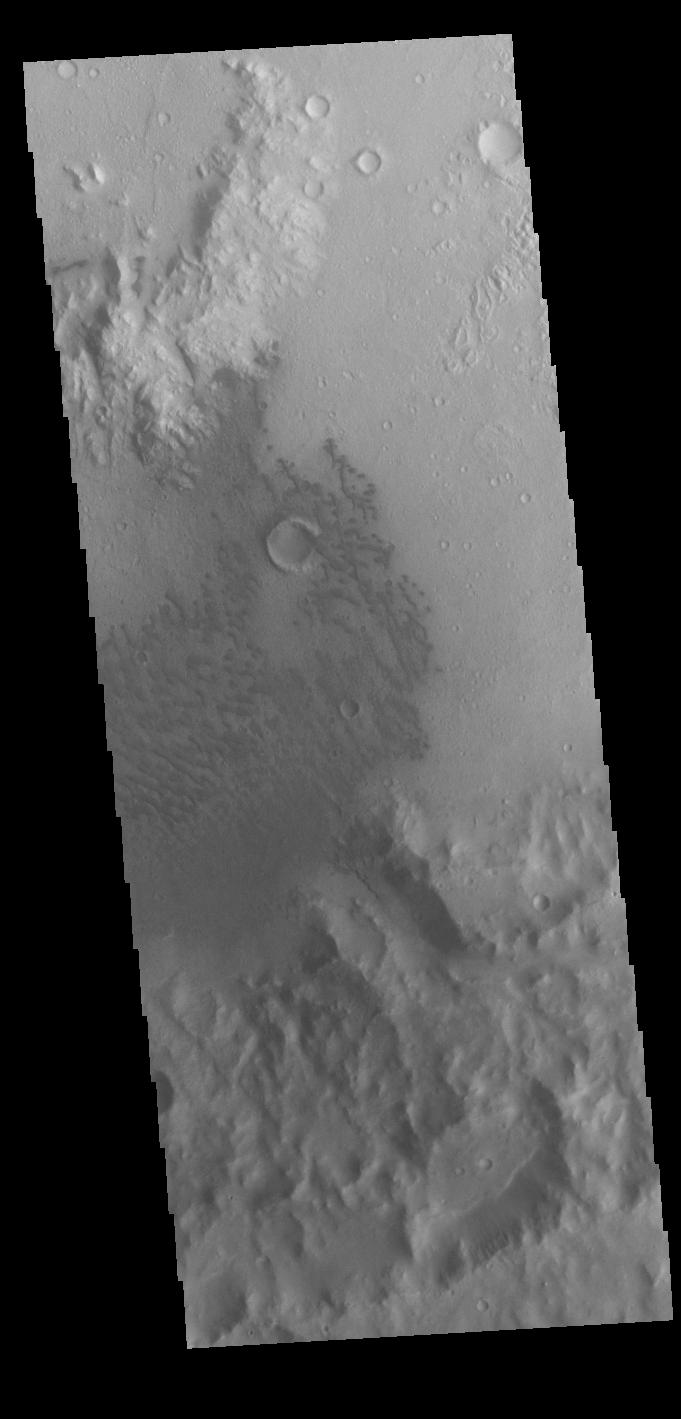
PIA25402:
-
Margaritifer Chaos
Full Resolution:
TIFF
(808 kB)
JPEG
(114.9 kB)
|
|
|
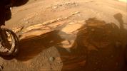
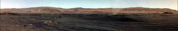
2022-07-11 |
Mars
|
Mars 2020 Rover
|
Navigation Camera (M2020)
|
16287x4459x3 |
|
-
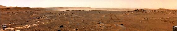
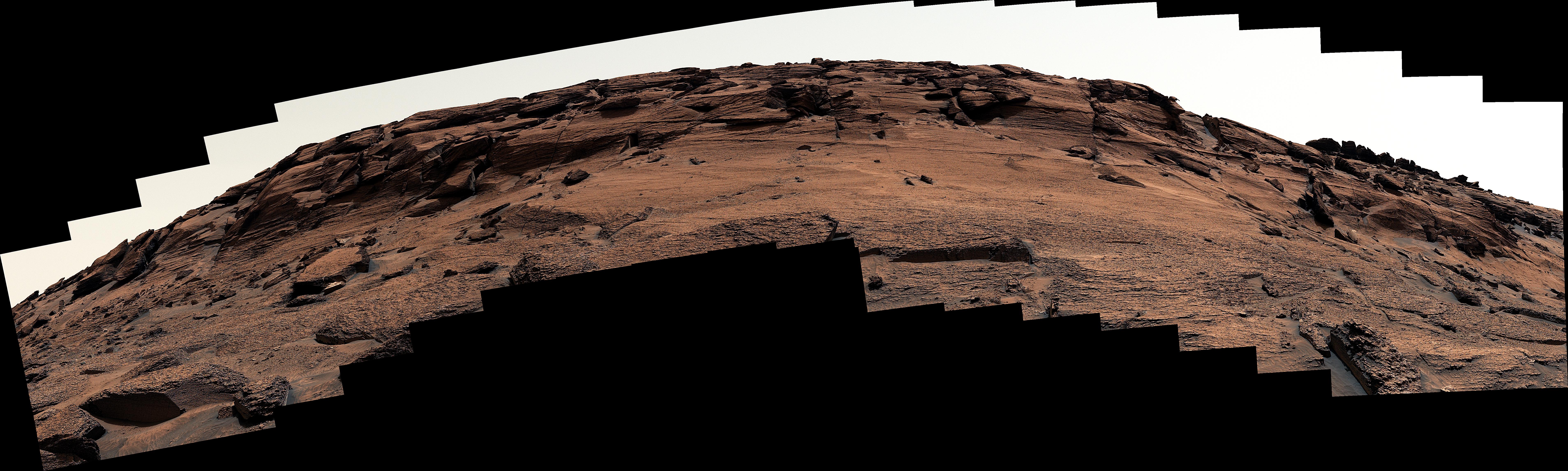
PIA25406:
Perseverance's Panorama of Potential Mars Sample Return Landing Site
Full Resolution:
TIFF
(131.2 MB)
JPEG
(5.311 MB)
|
|
|
2022-07-11 |
Mars
|
Mars 2020 Rover
|
Navigation Camera (M2020)
|
5120x3840x3 |
|
-
PIA25370:
-
Perseverance Scouts Landing Sites for Mars Sample Return Campaign
Full Resolution:
TIFF
(59.01 MB)
JPEG
(3.648 MB)
|
|
|
2022-07-11 |
Mars
|
2001 Mars Odyssey
|
THEMIS
|
681x1419x1 |
|
-
PIA25401:
-
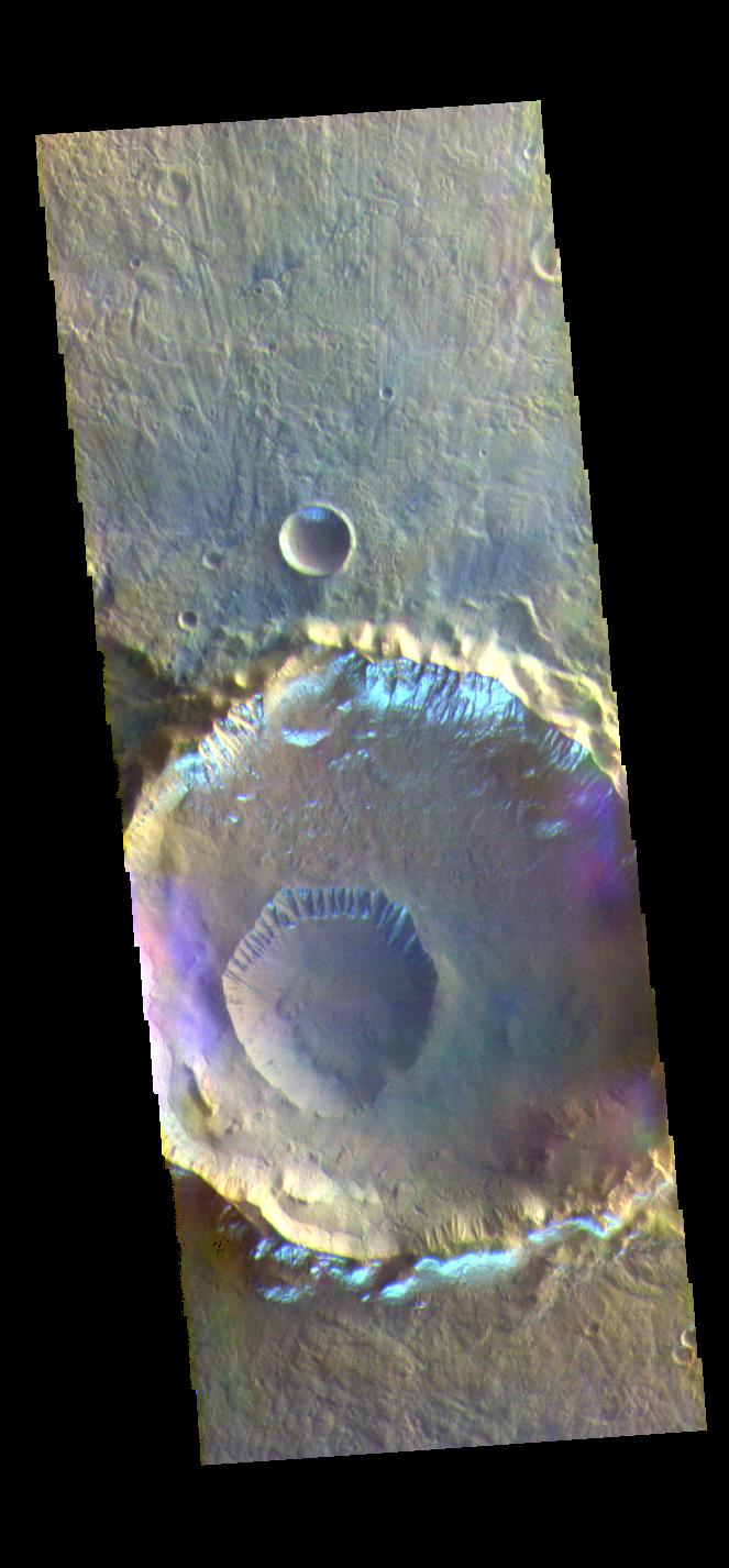
Terra Cimmeria Crater
Full Resolution:
TIFF
(651.4 kB)
JPEG
(65.83 kB)
|
|
|
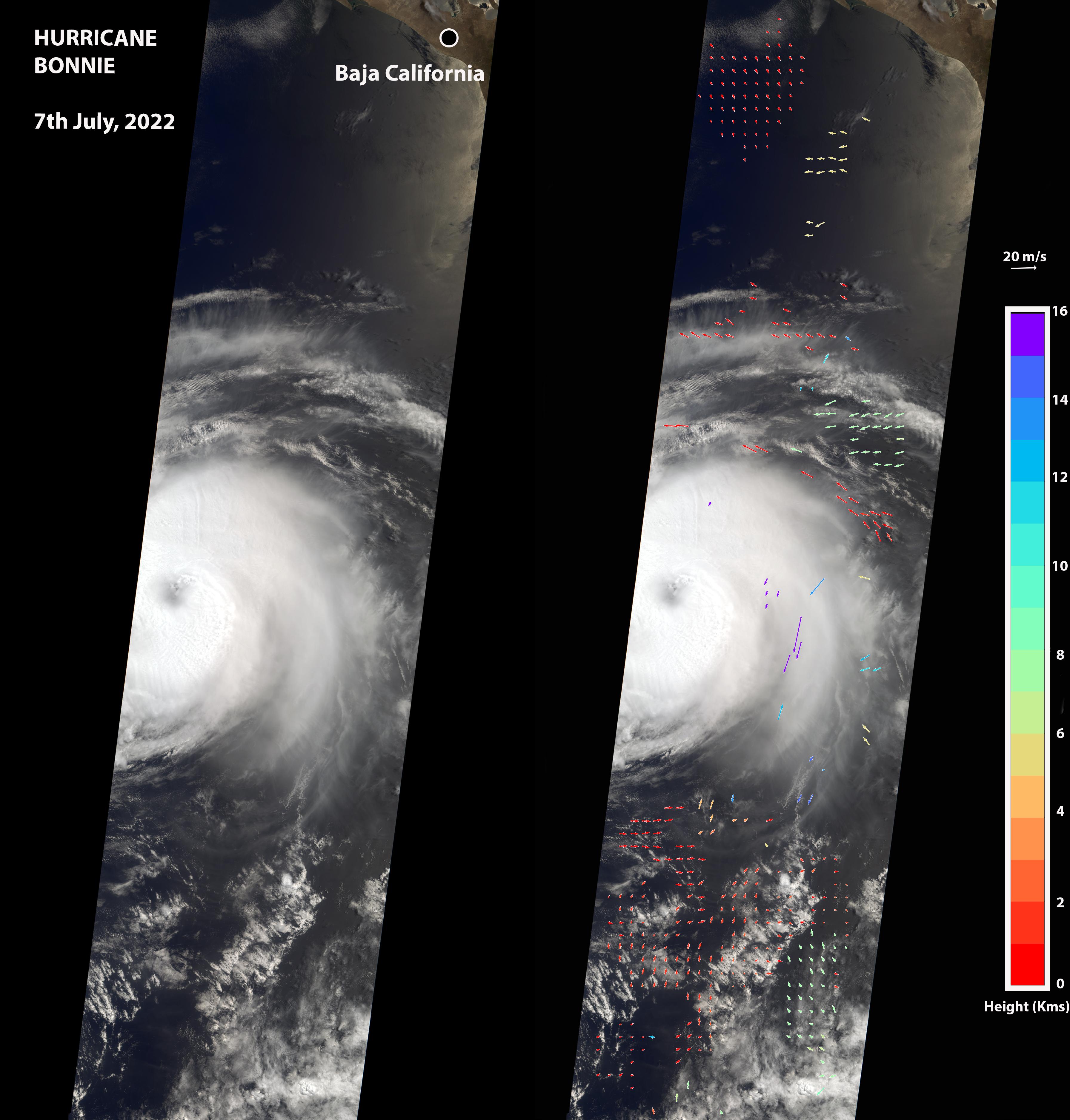
2022-07-08 |
Earth
|
Terra
|
MISR
|
3584x3754x3 |
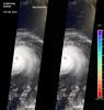
|
-
PIA24906:
-
NASA's MISR Captures Hurricane Bonnie
Full Resolution:
TIFF
(16.61 MB)
JPEG
(877 kB)
|
|
|
2022-07-08 |
Mars
|
2001 Mars Odyssey
|
THEMIS
|
690x1426x1 |
|
-
PIA25400:
-
Eumenides Dorsum
Full Resolution:
TIFF
(760.9 kB)
JPEG
(114.5 kB)
|
|
|
2022-07-07 |
Mars
|
2001 Mars Odyssey
|
THEMIS
|
666x1428x1 |
|
-
PIA25399:
-
Sirenum Fossae
Full Resolution:
TIFF
(722.8 kB)
JPEG
(100.3 kB)
|
|
|
2022-07-06 |
Mars
|
2001 Mars Odyssey
|
THEMIS
|
684x1417x1 |
|
-
PIA25398:
-
Eastern Candor Chasma
Full Resolution:
TIFF
(714 kB)
JPEG
(93.28 kB)
|
|
|
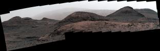
2022-07-05 |
Mars
|
2001 Mars Odyssey
|
THEMIS
|
1365x2645x1 |
|
-
PIA25397:
-
Gale Crater
Full Resolution:
TIFF
(2.671 MB)
JPEG
(342.2 kB)
|
|
|
2022-07-04 |
Mars
|
2001 Mars Odyssey
|
THEMIS
|
616x2700x1 |
|
-
PIA25396:
-
Northern Arabia Terra
Full Resolution:
TIFF
(806 kB)
JPEG
(100.5 kB)
|
|
|
2022-07-01 |
Mars
|
2001 Mars Odyssey
|
THEMIS
|
713x1447x1 |
|
-
PIA25395:
-
Mamers Valles
Full Resolution:
TIFF
(729.1 kB)
JPEG
(90.92 kB)
|
|
|
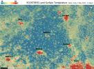
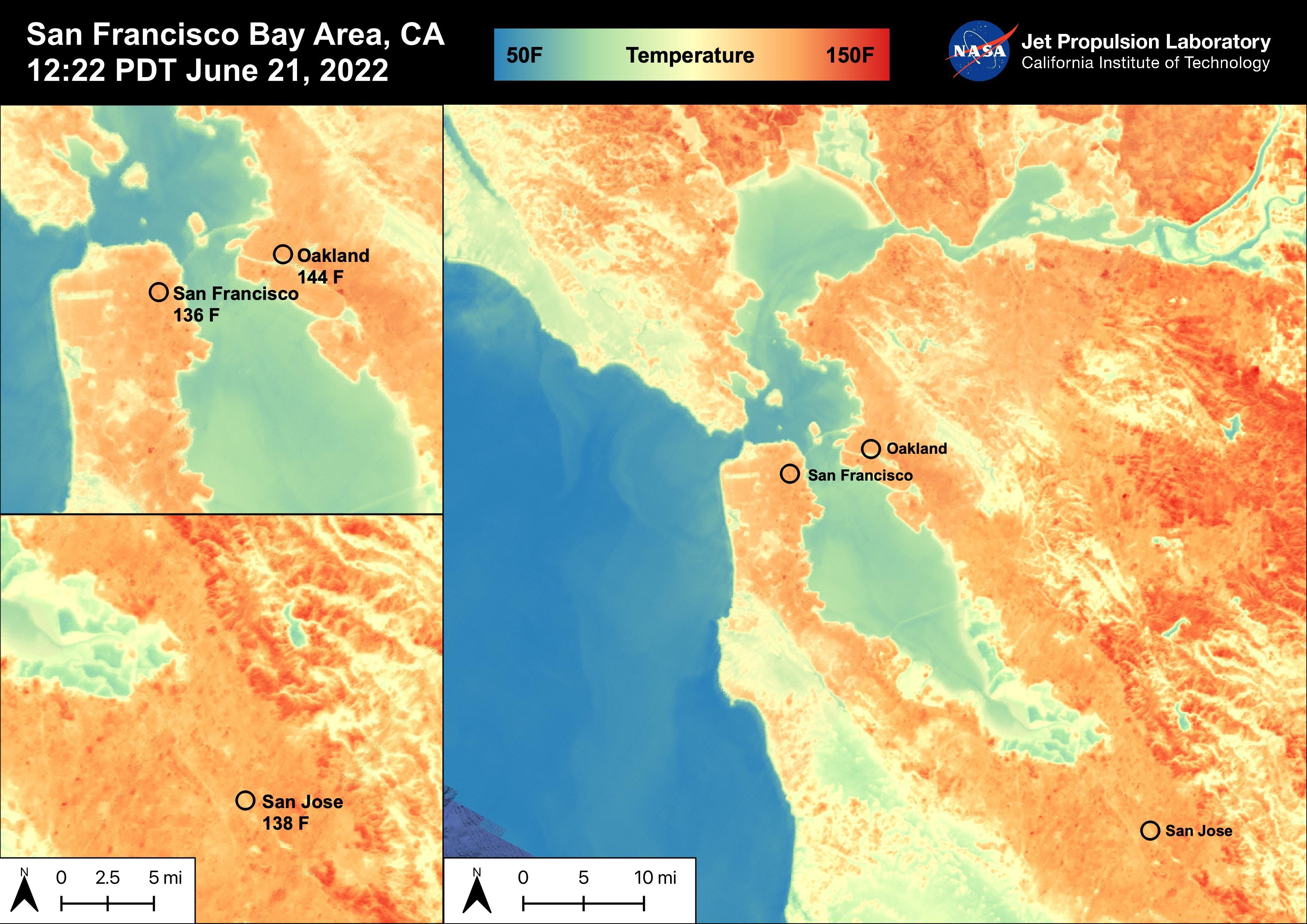
2022-06-30 |
Earth
|
ECOSTRESS
|
|
3507x2480x3 |
|
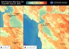
-
PIA25441:
-
High Temperatures in the San Francisco Bay Area
Full Resolution:
TIFF
(21.01 MB)
JPEG
(919.1 kB)
|
|
|
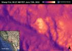
2022-06-30 |
Earth
|
ECOSTRESS
|
|
3507x2480x3 |
|
-
PIA25356:
-
Sheep Fire
Full Resolution:
TIFF
(16.45 MB)
JPEG
(598.1 kB)
|
|
|
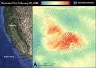
2022-06-30 |
Earth
|
ECOSTRESS
|
|
3507x2480x3 |
|
-
PIA25280:
-
Colorado Fire
Full Resolution:
TIFF
(17.17 MB)
JPEG
(810.7 kB)
|
|
|
2022-06-30 |
Mars
|
2001 Mars Odyssey
|
THEMIS
|
707x1440x1 |
|
-
PIA25394:
-
Nilus Chaos
Full Resolution:
TIFF
(722.8 kB)
JPEG
(89.91 kB)
|
|
|
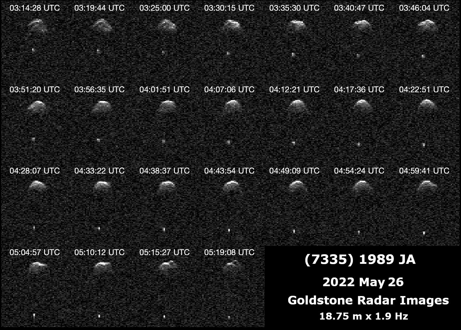
2022-06-29 |
Asteroid
|
Deep Space Network (DSN)
|
Deep Space Network
|
1587x1137x1 |
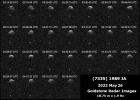
|
-
PIA25251:
-
Radar Observations of Near-Earth Asteroid 7335 1989 JA
Full Resolution:
TIFF
(972.3 kB)
JPEG
(398.1 kB)
|
|
|
2022-06-29 |
Mars
|
Mars 2020 Rover
|
Hazard Avoidance Camera (M2020)
|
5120x2880x3 |
|
-
PIA25325:
-
Enchanted View of Jezero Rocks
Full Resolution:
TIFF
(42.08 MB)
JPEG
(1.897 MB)
|
|
|
2022-06-29 |
Mars
|
2001 Mars Odyssey
|
THEMIS
|
611x2706x1 |
|
-
PIA25393:
-
Nanedi Valles
Full Resolution:
TIFF
(821.4 kB)
JPEG
(126.3 kB)
|
|
|
2022-06-28 |
Mars
|
2001 Mars Odyssey
|
THEMIS
|
673x1416x1 |
|
-
PIA25392:
-
Oti Fossae - Arsia Mons
Full Resolution:
TIFF
(697.7 kB)
JPEG
(103.3 kB)
|
|
|
2022-06-27 |
Mars
|
Mars Reconnaissance Orbiter (MRO)
|
HiRISE
|
2880x1800x3 |
|
-
PIA25360:
-
Young Fluvial Channels in Margaritifer Terra
Full Resolution:
TIFF
(8.422 MB)
JPEG
(1.514 MB)
|
|
|
2022-06-27 |
Mars
|
Mars Reconnaissance Orbiter (MRO)
|
HiRISE
|
2880x1800x3 |

|
-
PIA25359:
-
Flooded Impact Craters in Hebrus Valles
Full Resolution:
TIFF
(15.56 MB)
JPEG
(1.326 MB)
|
|
|
2022-06-27 |
Mars
|
Mars Reconnaissance Orbiter (MRO)
|
HiRISE
|
2880x1800x3 |
|
-
PIA25358:
-
A Complex Geologic History of Aram Chaos
Full Resolution:
TIFF
(15.56 MB)
JPEG
(812.7 kB)
|
|
|
2022-06-27 |
Mars
|
Mars Reconnaissance Orbiter (MRO)
|
HiRISE
|
2880x1800x3 |
|
-
PIA25357:
-
Spring Fans and Polygons
Full Resolution:
TIFF
(15.56 MB)
JPEG
(1.199 MB)
|
|
|
2022-06-27 |
Earth
|
Terra
|
ASTER
|
1101x1054x3 |
|
-
PIA25355:
-
Lake Shuwarang Chhat, Pakistan
Full Resolution:
TIFF
(3.483 MB)
JPEG
(232.6 kB)
|
|
|
2022-06-27 |
Mars
|
2001 Mars Odyssey
|
THEMIS
|
607x2708x1 |

|
-
PIA25391:
-
Ius Chasma
Full Resolution:
TIFF
(692.1 kB)
JPEG
(73.23 kB)
|
|
|
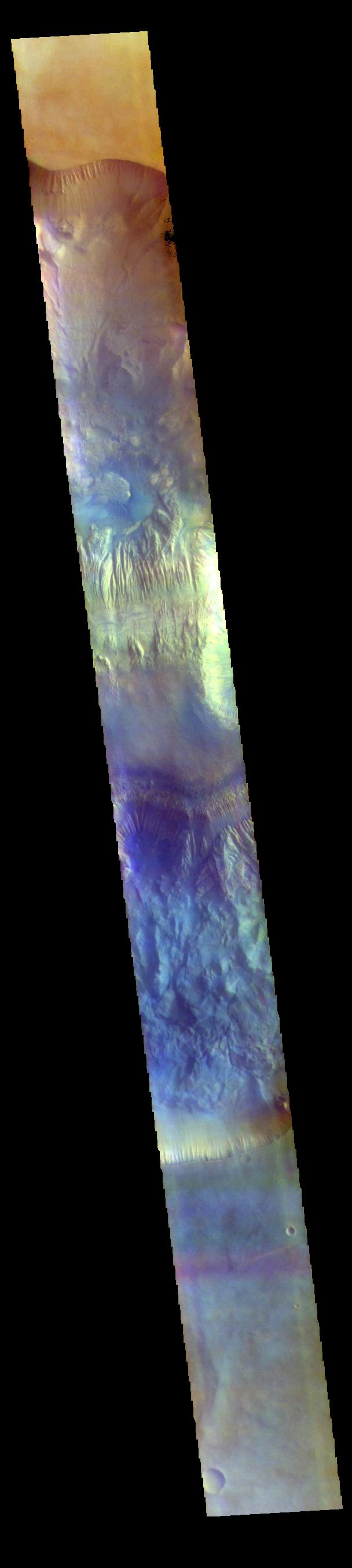
2022-06-24 |
Mars
|
2001 Mars Odyssey
|
THEMIS
|
705x1437x3 |

|
-
PIA25390:
-
Nili Fossae - False Color
Full Resolution:
TIFF
(2 MB)
JPEG
(81.81 kB)
|
|
|
2022-06-23 |
Mars
|
Mars Reconnaissance Orbiter (MRO)
|
CRISM
|
1600x900x3 |
|
-
PIA25364:
-
Six Views of Nili Fossae, as Seen by MRO's CRISM
Full Resolution:
TIFF
(4.022 MB)
JPEG
(329.6 kB)
|
|
|
2022-06-23 |
Mars
|
Mars Reconnaissance Orbiter (MRO)
|
CRISM
|
5204x2919x3 |
|
-
PIA25363:
-
One of CRISM's Final Maps of Mars
Full Resolution:
TIFF
(27.48 MB)
JPEG
(3.126 MB)
|
|
|
2022-06-23 |
Mars
|
2001 Mars Odyssey
|
THEMIS
|
663x1426x3 |

|
-
PIA25389:
-
Morning Frost - False Color
Full Resolution:
TIFF
(2.015 MB)
JPEG
(97.88 kB)
|
|
|
2022-06-22 |
Earth
|
ECOSTRESS
|
|
3099x2201x3 |
|
-
PIA25422:
-
NASA's ECOSTRESS Shows Heat in Dallas and Fort Worth
Full Resolution:
TIFF
(20.47 MB)
JPEG
(2.22 MB)
|
|
|
2022-06-22 |
Earth
|
ECOSTRESS
|
|
3161x2230x3 |
|
-
PIA25421:
-
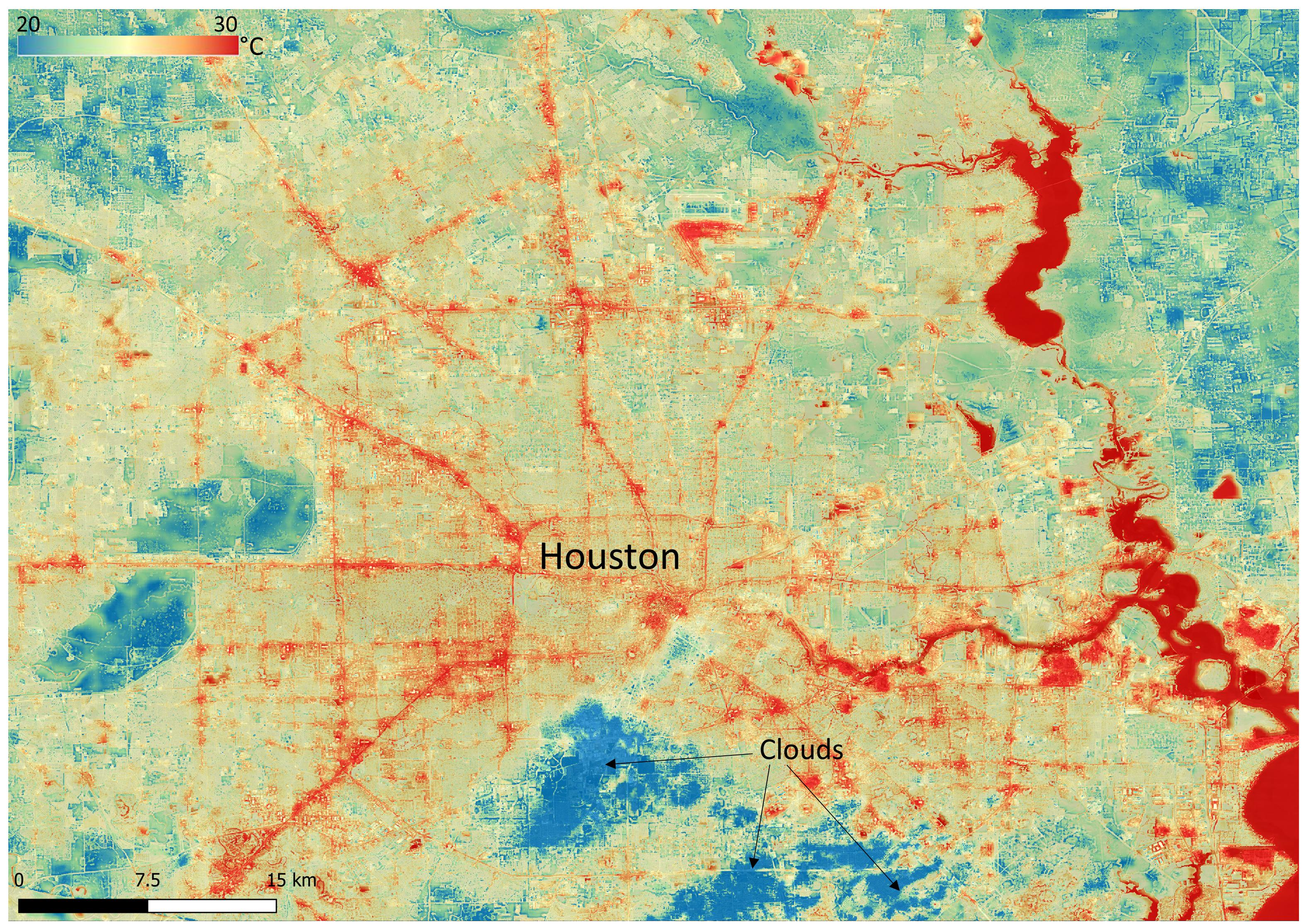
NASA's ECOSTRESS Shows Surface Heat in Houston
Full Resolution:
TIFF
(21.16 MB)
JPEG
(1.711 MB)
|
|
|
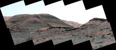
2022-06-22 |
Mars
|
Mars Science Laboratory (MSL)
|
Mastcam
|
6057x3373x3 |
|
-
PIA25369:
-
Curiosity's Mastcam Views Layers at Las Claritas
Full Resolution:
TIFF
(61.32 MB)
JPEG
(4.871 MB)
|
|
|
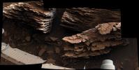
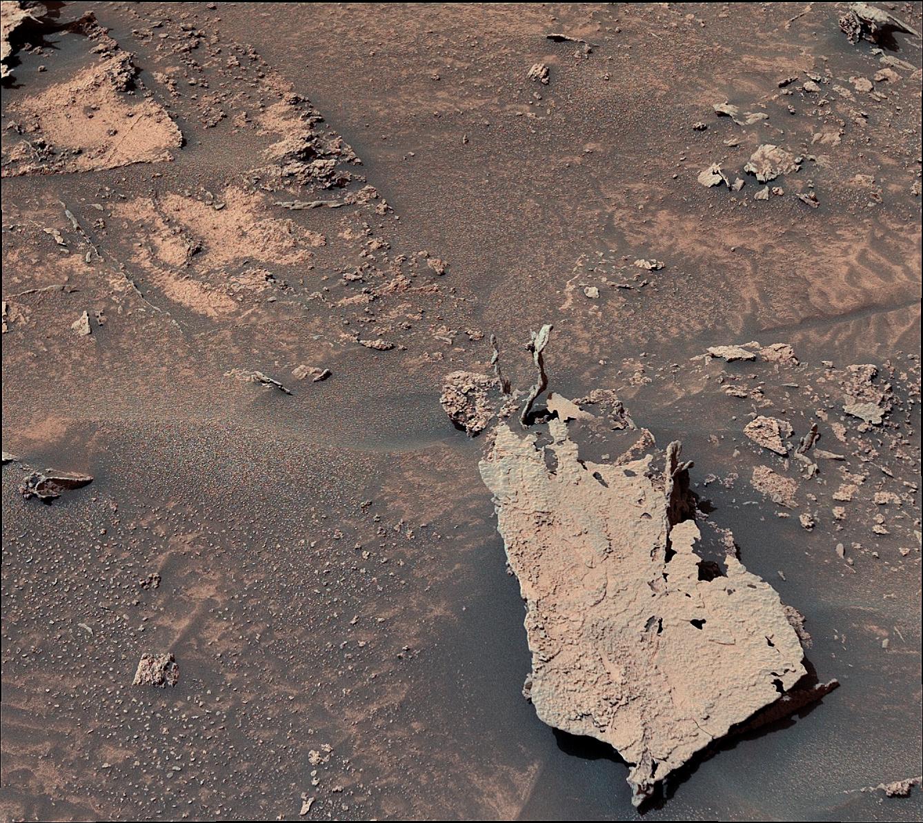
2022-06-22 |
Mars
|
Mars Science Laboratory (MSL)
|
Mastcam
|
4966x2494x3 |
|
-
PIA25368:
-
Curiosity's Mastcam Views Flaky, Streambed Rocks
Full Resolution:
TIFF
(27.36 MB)
JPEG
(1.796 MB)
|
|
|
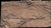
2022-06-22 |
Mars
|
Mars Science Laboratory (MSL)
|
Mastcam
|
6325x2726x3 |
|
-
PIA25367:
-
Curiosity's View of Sulfate-Bearing Region and Streambed Rocks
Full Resolution:
TIFF
(30.63 MB)
JPEG
(2.614 MB)
|
|
|
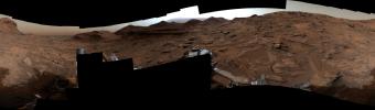
2022-06-22 |
Mars
|
Mars Science Laboratory (MSL)
|
Mastcam
|
29163x8571x3 |
|
-
PIA25366:
-
Curiosity's 360-degree Panorama Near Sierra Maigualida
Full Resolution:
TIFF
(442.9 MB)
JPEG
(33.48 MB)
|
|
|
2022-06-22 |
Mars
|
Mars Science Laboratory (MSL)
|
Mastcam
|
17708x5681x3 |
|
-
PIA25365:
-
Curiosity's View of Haze During Dust Season
Full Resolution:
TIFF
(166.9 MB)
JPEG
(11.07 MB)
|
|
|
2022-06-22 |
Mars
|
2001 Mars Odyssey
|
THEMIS
|
703x1435x3 |
|
-
PIA25388:
-
Nili Fossae - False Color
Full Resolution:
TIFF
(2.044 MB)
JPEG
(96.53 kB)
|
|
|
2022-06-21 |
Mars
|
2001 Mars Odyssey
|
THEMIS
|
704x1432x3 |
|
-
PIA25387:
-
Terra Sabaea - False Color
Full Resolution:
TIFF
(2.07 MB)
JPEG
(104.3 kB)
|
|
|
2022-06-20 |
Mars
|
2001 Mars Odyssey
|
THEMIS
|
719x1458x3 |

|
-
PIA25386:
-
Cydonia Colles - False Color
Full Resolution:
TIFF
(2.1 MB)
JPEG
(105.3 kB)
|
|
|
2022-06-17 |
Mars
|
2001 Mars Odyssey
|
THEMIS
|
607x2711x3 |
|
-
PIA25385:
-
Arabia Terra Crater - False Color
Full Resolution:
TIFF
(2.22 MB)
JPEG
(109.6 kB)
|
|
|
2022-06-16 |
Mars
|
2001 Mars Odyssey
|
THEMIS
|
608x2708x3 |
|
-
PIA25384:
-
Hebes Chasma - False Color
Full Resolution:
TIFF
(2.204 MB)
JPEG
(99.25 kB)
|
|
|
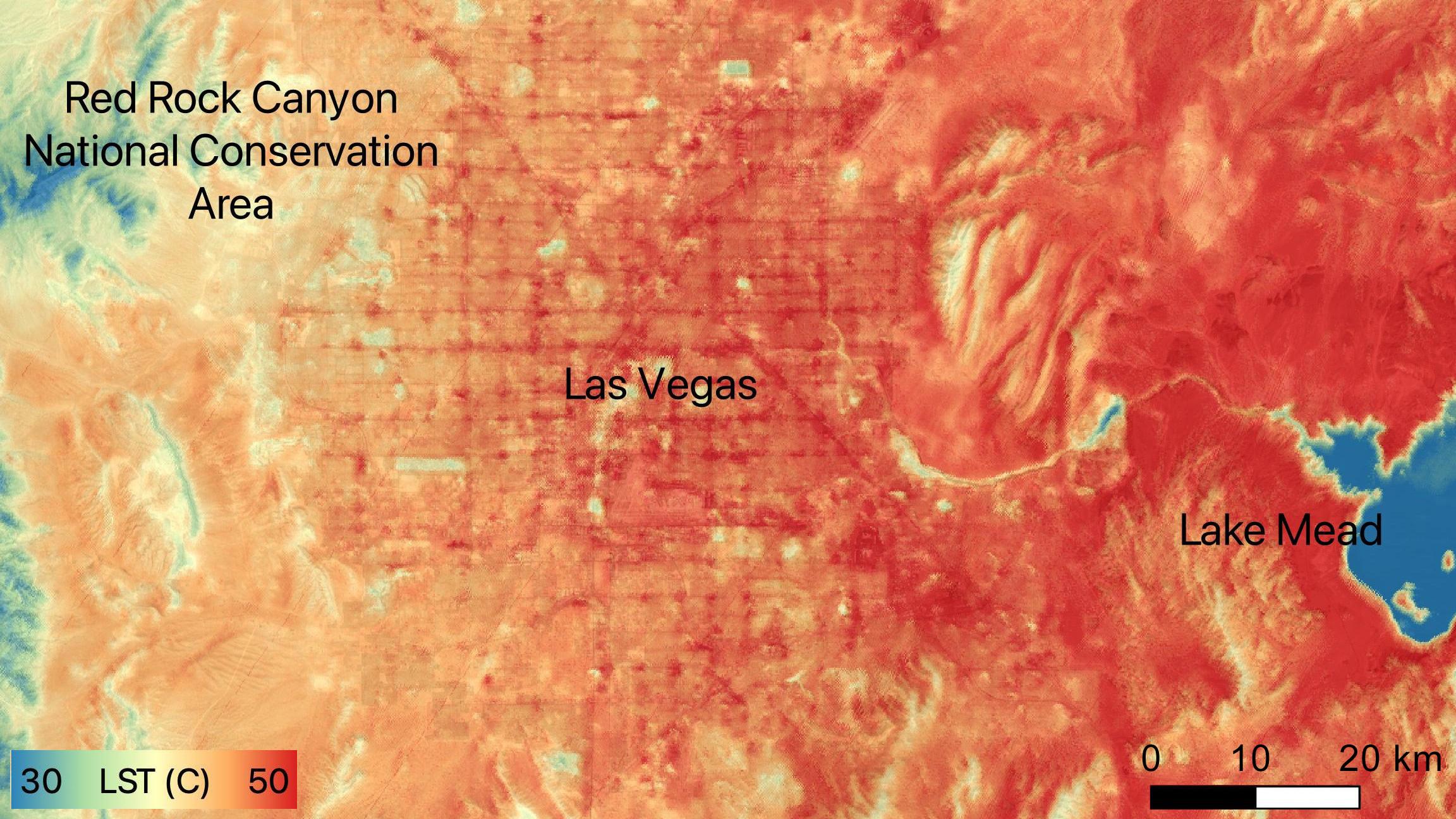
2022-06-15 |
Earth
|
ECOSTRESS
|
|
2304x1296x3 |

|
-
PIA24988:
-
NASA's ECOSTRESS Sees Las Vegas Streets Turn Up the Heat
Full Resolution:
TIFF
(8.962 MB)
JPEG
(479.4 kB)
|
|
|
2022-06-15 |
Mars
|
Mars Science Laboratory (MSL)
|
Mastcam
|
1338x1193x3 |
|
-
PIA25362:
-
Curiosity Spots Finger-Like Rocks
Full Resolution:
TIFF
(4.791 MB)
JPEG
(434.7 kB)
|
|
|
2022-06-15 |
Mars
|
2001 Mars Odyssey
|
THEMIS
|
606x2710x3 |
|
-
PIA25383:
-
Gale Crater - False Color
Full Resolution:
TIFF
(2.131 MB)
JPEG
(93.1 kB)
|
|
|
2022-06-14 |
Mars
|
2001 Mars Odyssey
|
THEMIS
|
693x1428x3 |
|
-
PIA25382:
-
Meridiani Planum - False Color
Full Resolution:
TIFF
(2.012 MB)
JPEG
(114.3 kB)
|
|
|
2022-06-13 |
Mars
|
2001 Mars Odyssey
|
THEMIS
|
525x2040x3 |
|
-
PIA25381:
-
Arabia Terra - False Color
Full Resolution:
TIFF
(1.739 MB)
JPEG
(111.9 kB)
|
|
|
2022-06-10 |
Mars
|
2001 Mars Odyssey
|
THEMIS
|
606x2633x3 |

|
-
PIA25380:
-
Terra Sabaea - False Color
Full Resolution:
TIFF
(2.263 MB)
JPEG
(132.4 kB)
|
|
|
2022-06-09 |
Mars
|
2001 Mars Odyssey
|
THEMIS
|
602x2709x1 |
|
-
PIA25379:
-
Eastern Candor Chasma
Full Resolution:
TIFF
(754.9 kB)
JPEG
(90.73 kB)
|
|
|
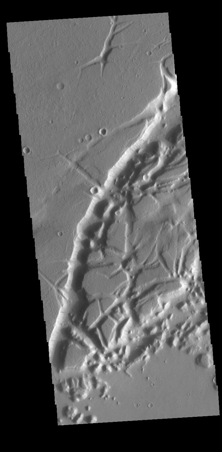
2022-06-08 |
Mars
|
2001 Mars Odyssey
|
THEMIS
|
709x1447x1 |
|
-
PIA25378:
-
Granicus Valles
Full Resolution:
TIFF
(787.4 kB)
JPEG
(134.7 kB)
|
|
|
2022-06-07 |
Mars
|
2001 Mars Odyssey
|
THEMIS
|
684x1421x1 |
|
-
PIA25377:
-
Mangala Valles
Full Resolution:
TIFF
(711.3 kB)
JPEG
(83.8 kB)
|
|
|
2022-06-06 |
Mars
|
2001 Mars Odyssey
|
THEMIS
|
611x2697x1 |
|
-
PIA25376:
-
Mamers Valles
Full Resolution:
TIFF
(783.3 kB)
JPEG
(83.46 kB)
|
|
|
2022-06-03 |
Mars
|
2001 Mars Odyssey
|
THEMIS
|
603x2706x1 |
|
-
PIA25375:
-
Ganges Chasma Landslide
Full Resolution:
TIFF
(715.5 kB)
JPEG
(79.68 kB)
|
|
|
2022-06-02 |
Mars
|
2001 Mars Odyssey
|
THEMIS
|
711x1450x1 |
|
-
PIA25374:
-
Arabia Terra Crater
Full Resolution:
TIFF
(734.6 kB)
JPEG
(78.71 kB)
|
|
|
2022-06-01 |
Earth
|
Earth Surface Mineral Dust Source Investigation (EMIT)
|
EMIT
|
5568x3712x3 |

|
-
PIA25150:
-
EMIT Put to the Test at JPL
Full Resolution:
TIFF
(43.37 MB)
JPEG
(1.852 MB)
|
|
|
2022-06-01 |
Mars
|
Mars 2020 Rover
|
Navigation Camera (M2020)
|
1280x224x3 |
|
-
PIA25361:
Perseverance Views Wind Lifting a Massive Dust Cloud
Full Resolution:
TIFF
(812.7 kB)
JPEG
(59.47 kB)
|
|
|
2022-06-01 |
Mars
|
Mars 2020 Rover
|
Navigation Camera (M2020)
|
2000x350x3 |
|
-
PIA25290:
Perseverance Views Dust Devils Swirling Across Jezero Crater
Full Resolution:
TIFF
(2.012 MB)
JPEG
(116.7 kB)
|
|
|
2022-06-01 |
Mars
|
2001 Mars Odyssey
|
THEMIS
|
696x1435x1 |
|
-
PIA25373:
-
Tractus Catena
Full Resolution:
TIFF
(717.3 kB)
JPEG
(91.82 kB)
|
|
|
2022-05-31 |
Mars
|
Mars 2020 Rover
|
|
2698x2055x3 |
|
-
PIA25289:
-
Perseverance's SuperCam Uses AEGIS For the First Time
Full Resolution:
TIFF
(11.58 MB)
JPEG
(506 kB)
|
|
|
2022-05-31 |
Mars
|
2001 Mars Odyssey
|
THEMIS
|
972x2625x1 |
|
-
PIA25372:
-
South Polar Cap
Full Resolution:
TIFF
(2.554 MB)
JPEG
(490 kB)
|
|
|
2022-05-30 |
Mars
|
2001 Mars Odyssey
|
THEMIS
|
603x2706x1 |

|
-
PIA25371:
-
Ganges Chasma Landslide
Full Resolution:
TIFF
(715.6 kB)
JPEG
(79.61 kB)
|
|
|
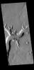
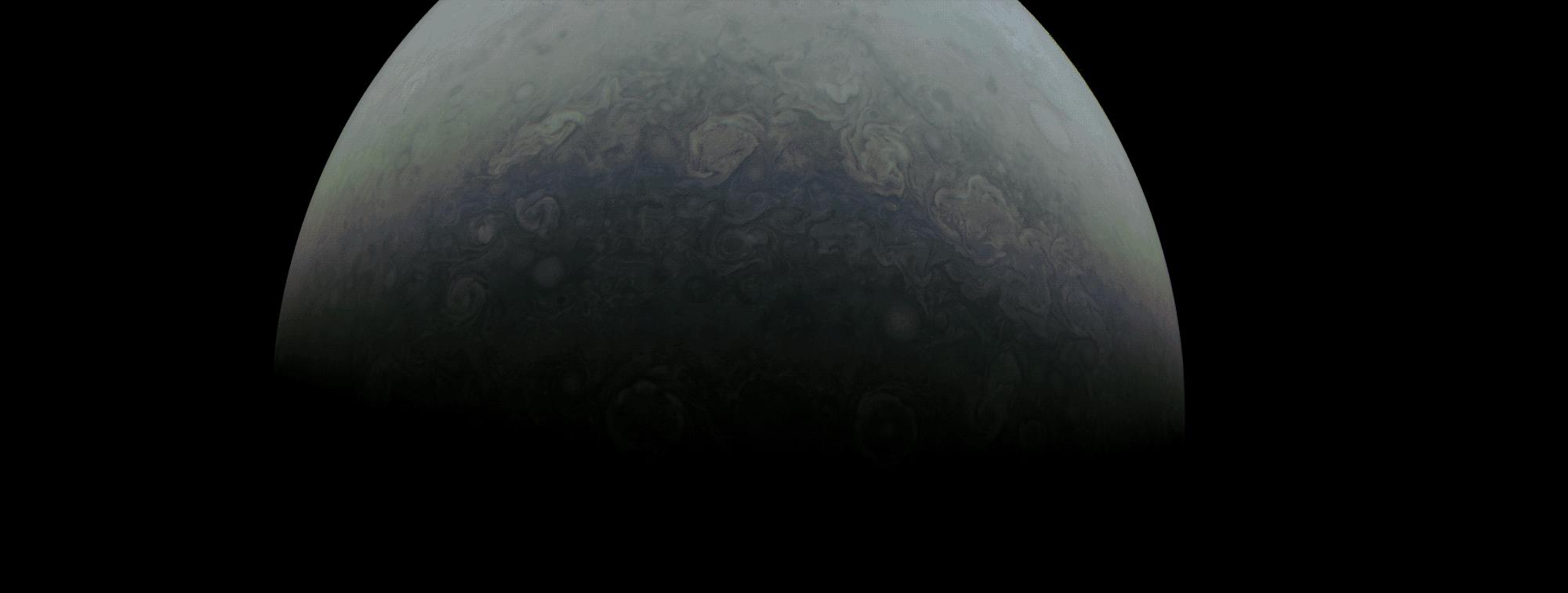
2022-05-27 |
Jupiter
|
Juno
|
JunoCam
|
2000x757x3 |
|
-
PIA25016:
-
Juno Skims the Cloud Tops of Jupiter
Full Resolution:
TIFF
(1.226 MB)
JPEG
(56.82 kB)
|
|
|
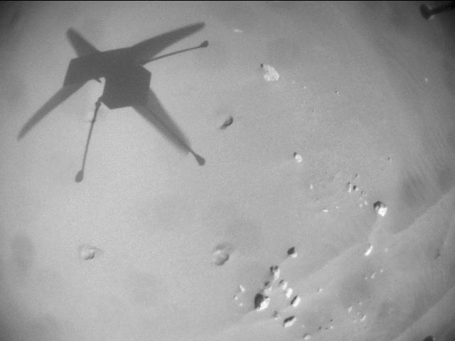
2022-05-27 |
Mars
|
Mars Helicopter
|
|
640x481x1 |

|
-
PIA25321:
-
Ingenuity Mars Helicopter's Record-Breaking Flight
Full Resolution:
TIFF
(222.4 kB)
JPEG
(25.66 kB)
|
|
|
2022-05-27 |
Mars
|
2001 Mars Odyssey
|
THEMIS
|
701x1439x1 |

|
-
PIA25350:
-
Jezero Crater
Full Resolution:
TIFF
(746.3 kB)
JPEG
(88.83 kB)
|
|
|
2022-05-26 |
Mars
|
Mars Helicopter
|
|
950x428x3 |
|
-
PIA25322:
-
Environmental Plot at Jezero
Full Resolution:
TIFF
(417.7 kB)
JPEG
(36.32 kB)
|
|
|
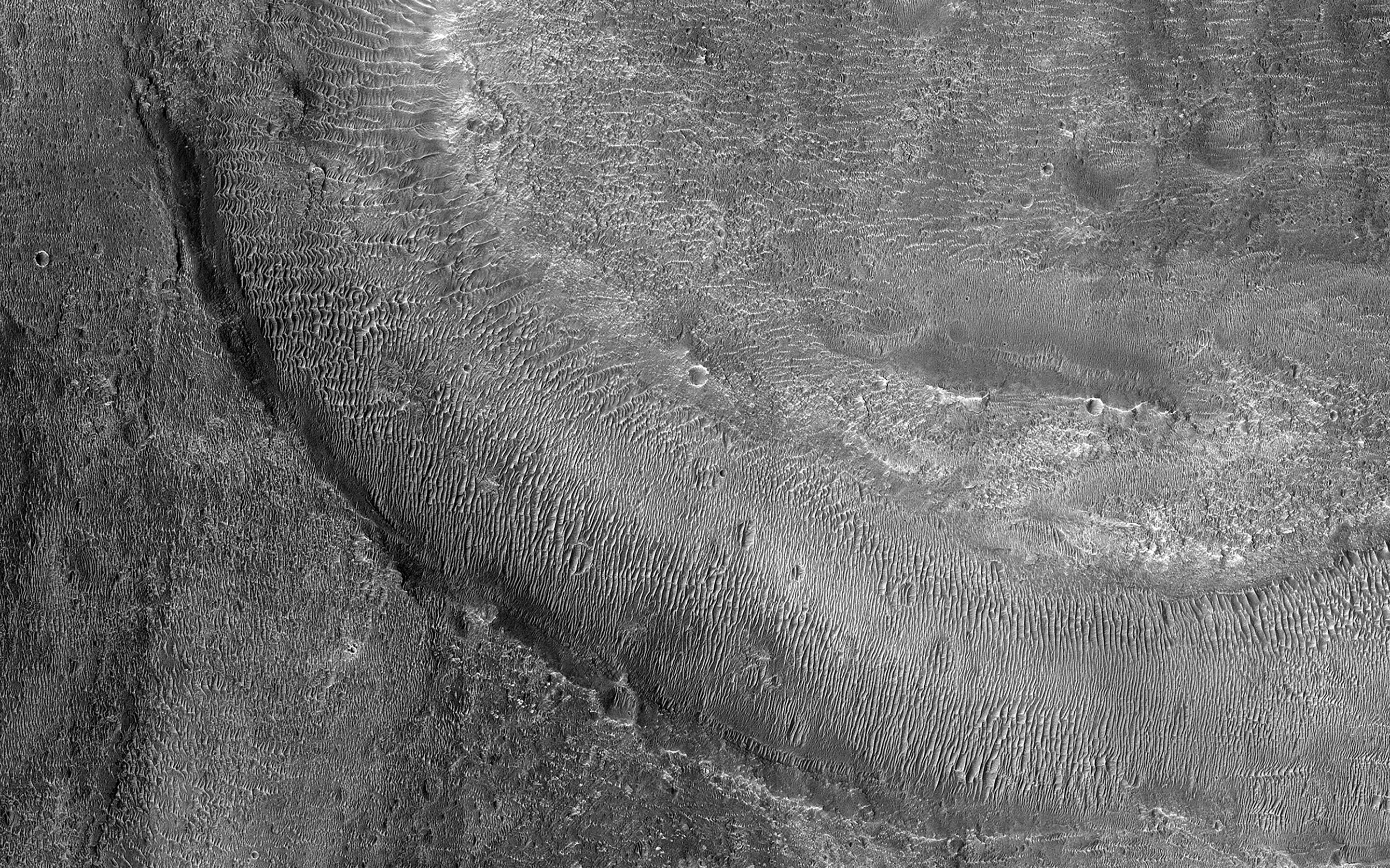
2022-05-26 |
Mars
|
Mars Reconnaissance Orbiter (MRO)
|
HiRISE
|
2880x1800x3 |
|
-
PIA25354:
-
Sedimentary Rocks inside Terby Crater
Full Resolution:
TIFF
(15.56 MB)
JPEG
(900.4 kB)
|
|
|
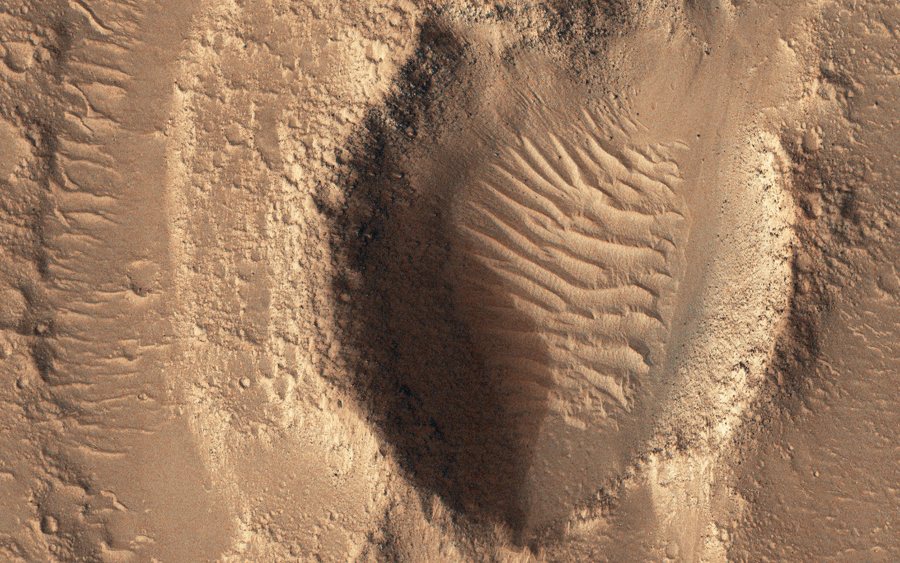
2022-05-26 |
Mars
|
Mars Reconnaissance Orbiter (MRO)
|
HiRISE
|
2880x1800x3 |
|
-
PIA25353:
-
Rapid Changes on the North Polar Cap
Full Resolution:
TIFF
(15.56 MB)
JPEG
(1.285 MB)
|
|
|
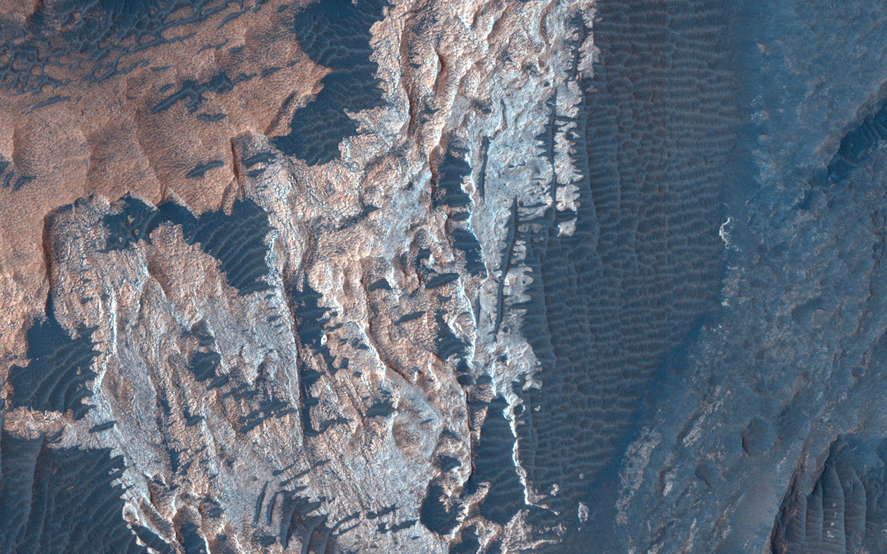
2022-05-26 |
Mars
|
Mars Reconnaissance Orbiter (MRO)
|
HiRISE
|
2880x1800x3 |
|
-
PIA25352:
-
Cliffs of Crumbling, Layered Sediments
Full Resolution:
TIFF
(15.28 MB)
JPEG
(707.7 kB)
|
|
|
2022-05-26 |
Mars
|
Mars Reconnaissance Orbiter (MRO)
|
HiRISE
|
2880x1800x3 |
|
-
PIA25351:
-
Dunes in Meridiani Planum
Full Resolution:
TIFF
(15.56 MB)
JPEG
(1.227 MB)
|
|
|
2022-05-26 |
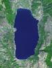
Earth
|
Terra
|
ASTER
|
2326x1369x3 |
|
-
PIA25279:
-
Lake Mead-2022
Full Resolution:
TIFF
(8.796 MB)
JPEG
(538 kB)
|
|
|
2022-05-26 |
Mars
|
2001 Mars Odyssey
|
THEMIS
|
604x2691x1 |
|
-
PIA25349:
-
Ascraeus Mons
Full Resolution:
TIFF
(750.1 kB)
JPEG
(95.99 kB)
|
|
|
2022-05-25 |
Mars
|
2001 Mars Odyssey
|
THEMIS
|
673x1415x1 |
|
-
PIA25348:
-
Tharsis Lava Flows
Full Resolution:
TIFF
(735.9 kB)
JPEG
(132.7 kB)
|
|
|
2022-05-24 |
Mars
|
2001 Mars Odyssey
|
THEMIS
|
692x1431x1 |
|
-
PIA25347:
-
Stege Crater - Maja Valles
Full Resolution:
TIFF
(729.1 kB)
JPEG
(87.93 kB)
|
|
|
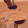
2022-05-23 |
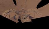
Mars
|
InSight
|
|
4391x2635x3 |
|
-
PIA25287:
-
InSight's Final Selfie
Full Resolution:
TIFF
(20.35 MB)
JPEG
(607.8 kB)
|
|
|
2022-05-23 |
Mars
|
2001 Mars Odyssey
|
THEMIS
|
673x1421x1 |
|
-
PIA25346:
-
Vichada Valles
Full Resolution:
TIFF
(753.4 kB)
JPEG
(133.4 kB)
|
|
|
2022-05-20 |
Mars
|
2001 Mars Odyssey
|
THEMIS
|
688x1425x1 |
|
-
PIA25345:
-
Margaritifer Chaos
Full Resolution:
TIFF
(708.5 kB)
JPEG
(75.1 kB)
|
|
|
2022-05-19 |
Mars
|
2001 Mars Odyssey
|
THEMIS
|
691x1429x1 |
|
-
PIA25344:
-
Gale Crater
Full Resolution:
TIFF
(655.9 kB)
JPEG
(71.24 kB)
|
|
|
2022-05-18 |
Mars
|
Mars Science Laboratory (MSL)
|
Mastcam
|
7630x2295x3 |
|
-
PIA25288:
-
Door-Shaped Fracture Spotted by Curiosity at East Cliffs
Full Resolution:
TIFF
(30.19 MB)
JPEG
(2.872 MB)
|
|
|
2022-05-18 |
Mars
|
2001 Mars Odyssey
|
THEMIS
|
705x1437x1 |
|
-
PIA25343:
-
Nili Fossae
Full Resolution:
TIFF
(716.5 kB)
JPEG
(78.74 kB)
|
|
|
2022-05-17 |
Mars
|
InSight
|
|
1024x1024x3 |
|
-
PIA25286:
-
InSight's Dusty Solar Panel
Full Resolution:
TIFF
(3.147 MB)
JPEG
(143.3 kB)
|
|
|
2022-05-17 |
Mars
|
|
|
3840x2160x3 |
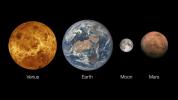
|
-
PIA25285:
-
Venus, Earth and Its Moon, and Mars
Full Resolution:
TIFF
(7.907 MB)
JPEG
(486.8 kB)
|
|
|
2022-05-17 |
Mars
|
InSight
|
|
3840x2160x3 |
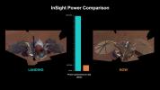
|
-
PIA25284:
-
InSight's Power Generation: After Landing and Spring 2022
Full Resolution:
TIFF
(6.892 MB)
JPEG
(436.2 kB)
|
|
|
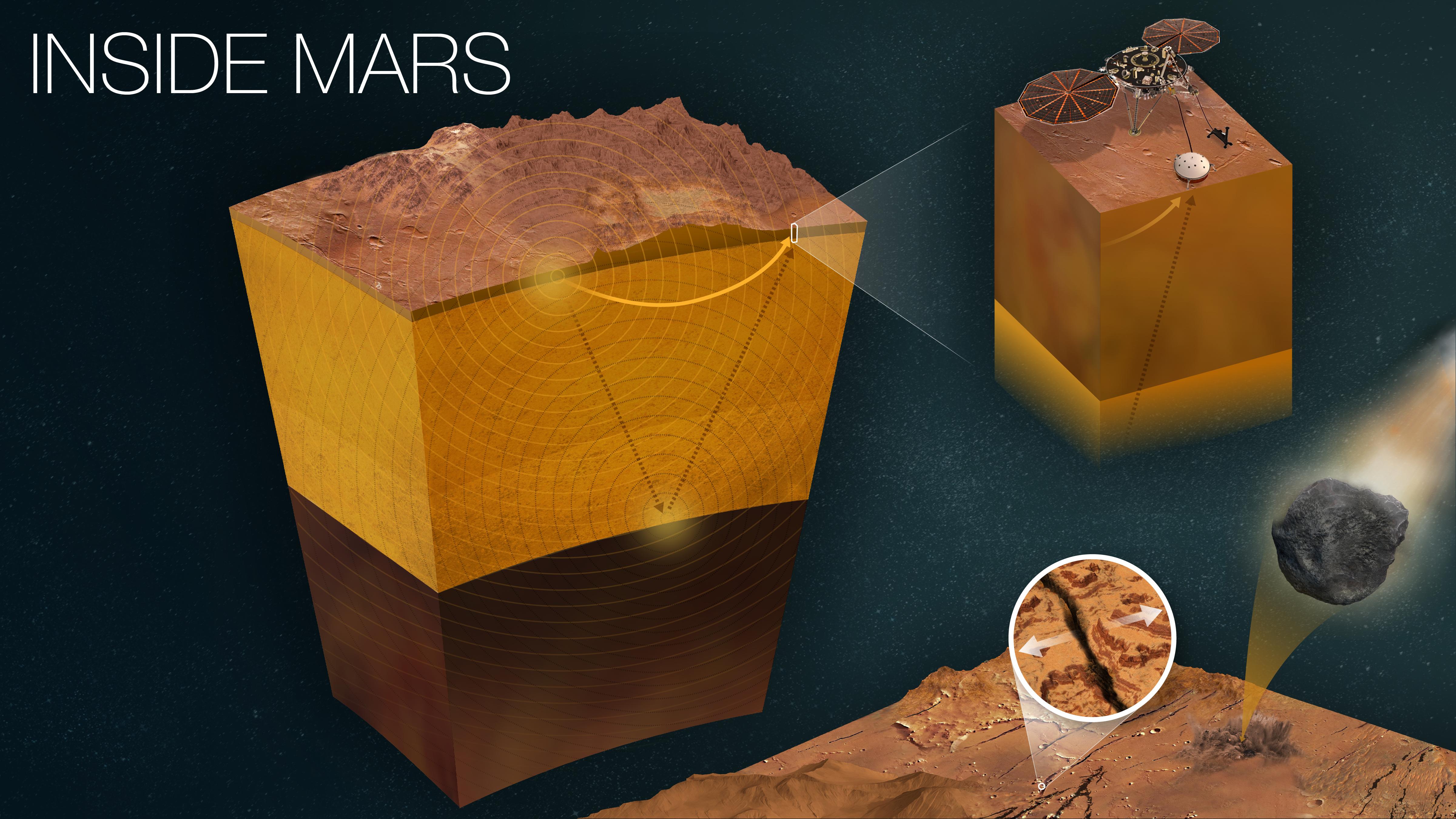
2022-05-17 |
Mars
|
InSight
|
|
4801x2700x3 |
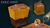
|
-
PIA25282:
-
How InSight Studies Mars' Inner Layers
Full Resolution:
TIFF
(27.36 MB)
JPEG
(1.18 MB)
|
|
|
2022-05-17 |
Mars
|
InSight
|
|
1080x1080x3 |
|
-
PIA25281:
-
Seismogram and Sonification of InSight's Big Martian Quake
Full Resolution:
TIFF
(3.257 MB)
JPEG
(61.34 kB)
|
|
|
2022-05-17 |
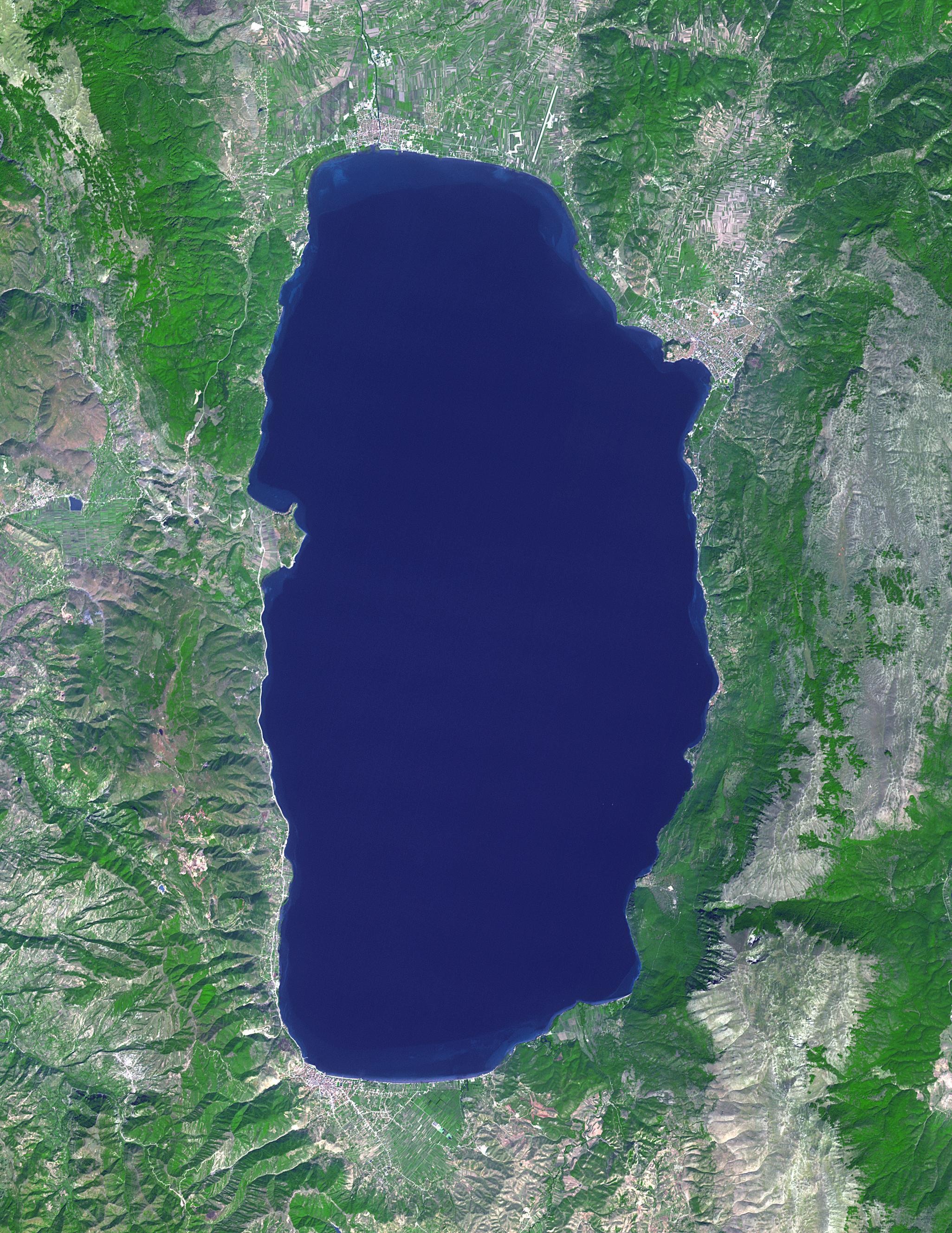
Earth
|
Terra
|
ASTER
|
2051x2656x3 |
|
-
PIA25306:
-
Lake Ohrid, Macedonia-Albania
Full Resolution:
TIFF
(16.35 MB)
JPEG
(1.048 MB)
|
|
|
2022-05-17 |
Mars
|
2001 Mars Odyssey
|
THEMIS
|
711x1446x1 |
|
-
PIA25342:
-
Mamers Valles
Full Resolution:
TIFF
(720.3 kB)
JPEG
(92.94 kB)
|
|
|
2022-05-16 |
Mars
|
2001 Mars Odyssey
|
THEMIS
|
687x1425x1 |
|
-
PIA25341:
-
Ceti Mensa - Western Candor Chasma
Full Resolution:
TIFF
(712.5 kB)
JPEG
(90.04 kB)
|
|
|
2022-05-13 |
Mars
|
2001 Mars Odyssey
|
THEMIS
|
701x1434x1 |

|
-
PIA25305:
-
Labeatis Fossae
Full Resolution:
TIFF
(656 kB)
JPEG
(83.99 kB)
|
|
|
2022-05-12 |
Earth
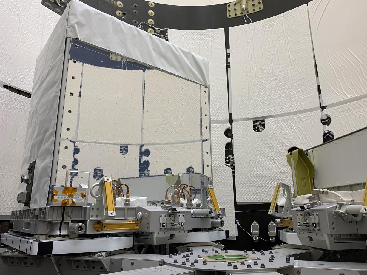
|
Earth Surface Mineral Dust Source Investigation (EMIT)
|
EMIT
|
1230x922x3 |
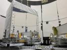
|
-
PIA25149:
-
EMIT Inside SpaceX Falcon 9 Trunk Ahead of Transport
Full Resolution:
TIFF
(2.82 MB)
JPEG
(178.1 kB)
|
|
|
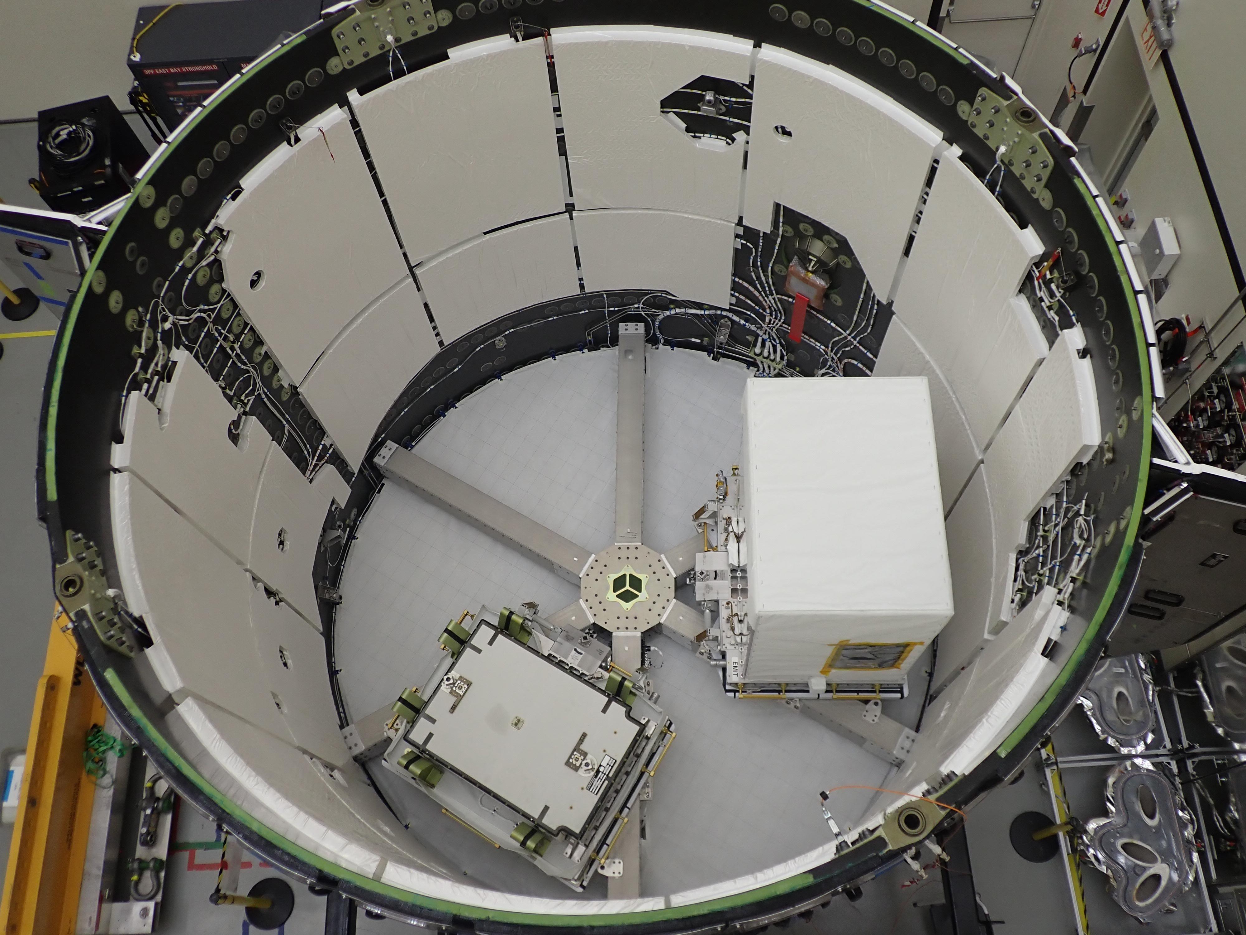
2022-05-12 |
Earth
|
Earth Surface Mineral Dust Source Investigation (EMIT)
|
EMIT
|
4000x3000x3 |
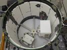
|
-
PIA25148:
-
EMIT Loaded Into SpaceX Falcon 9 Trunk Before Transport
Full Resolution:
TIFF
(28.26 MB)
JPEG
(1.117 MB)
|
|
|
2022-05-12 |
Earth
|
ECOSTRESS
|
|
3376x2477x3 |
|
-
PIA24987:
-
ECOSTRESS Detects Heat Islands in Indian Heat Wave
Full Resolution:
TIFF
(25.1 MB)
JPEG
(2.193 MB)
|
|
|
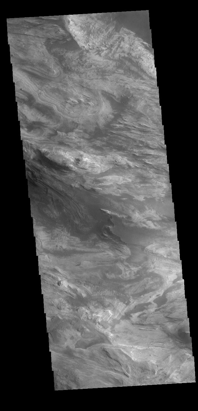
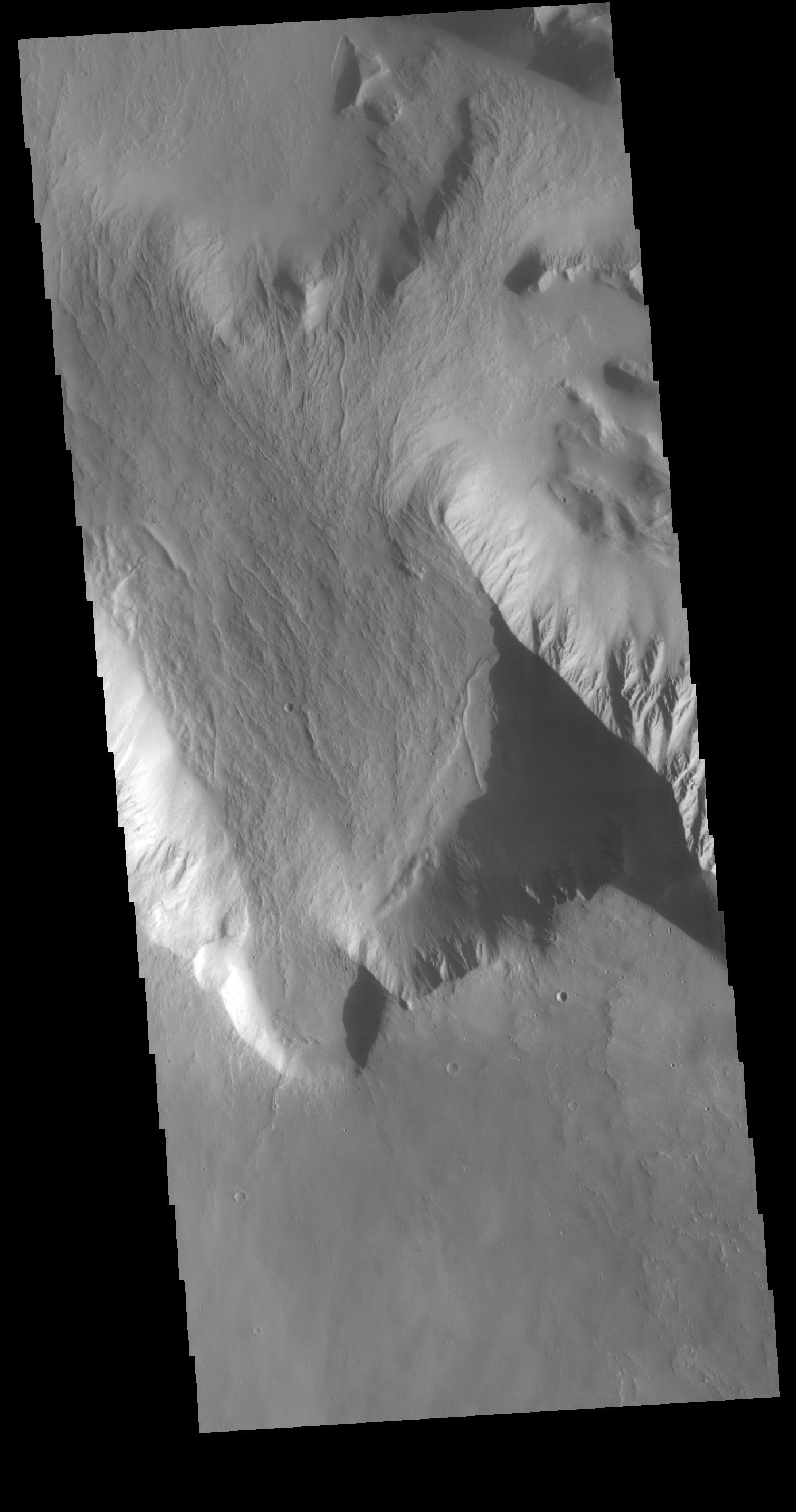
2022-05-12 |
Mars
|
2001 Mars Odyssey
|
THEMIS
|
1385x2632x1 |

|
-
PIA25304:
-
Olympus Rupes
Full Resolution:
TIFF
(2.308 MB)
JPEG
(213.5 kB)
|
 Planetary Data System


