My
List |
Addition Date
|
Target
|
Mission
|
Instrument
|
Size
|

|
2012-11-15 |
Mars
|
Mars Science Laboratory (MSL)
|
REMS
|
2999x2249x3 |
|
-
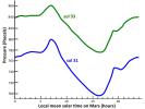
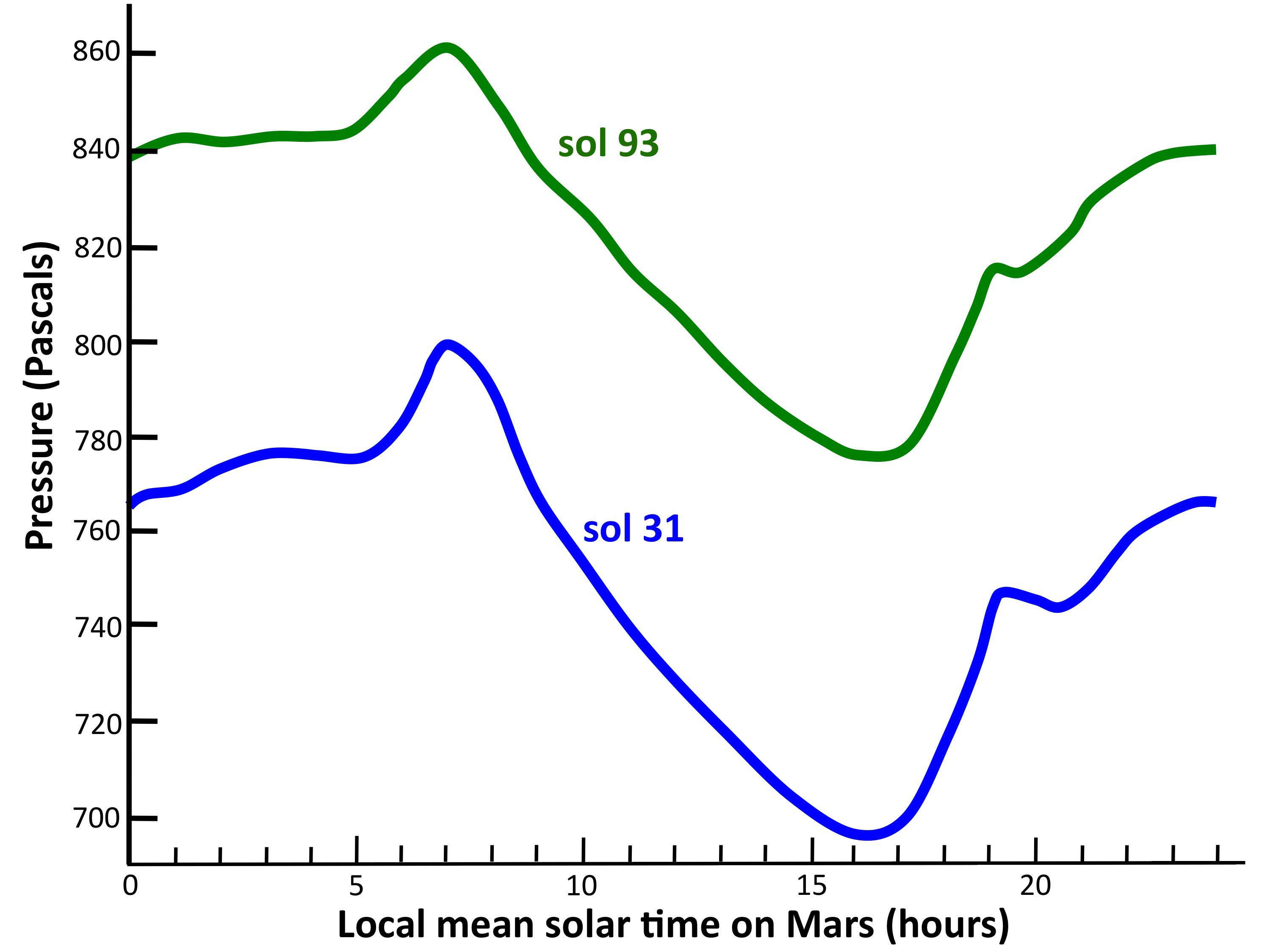
PIA16477:
-
Pressure Cycles on Mars
Full Resolution:
TIFF
(20.24 MB)
JPEG
(262.7 kB)
|
|
|
2012-11-15 |
Mars
|
Mars Science Laboratory (MSL)
|
REMS
|
2154x1986x3 |
|
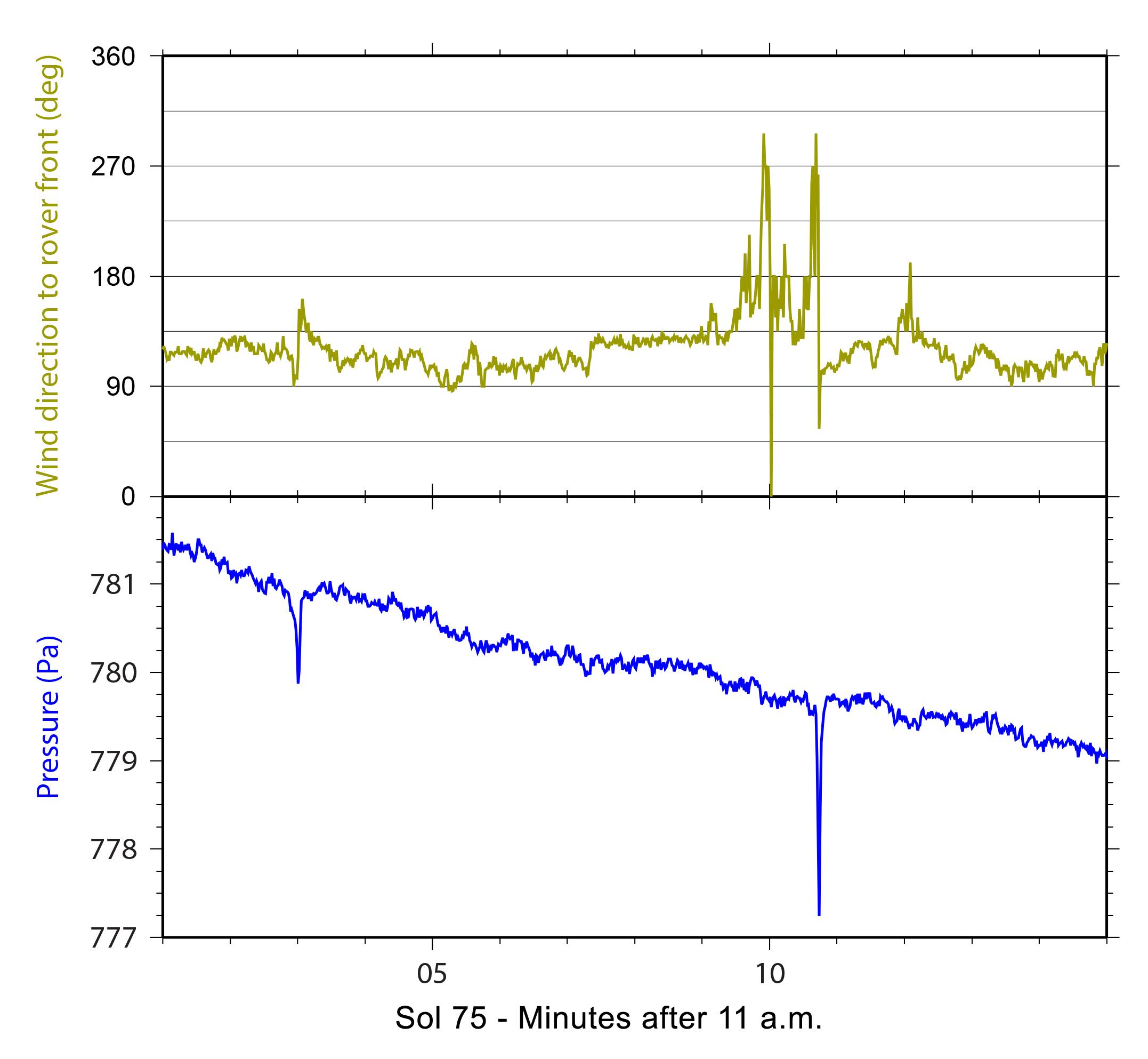
-
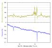
PIA16476:
-
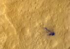
Signs of a Whirlwind in Gale Crater
Full Resolution:
TIFF
(12.84 MB)
JPEG
(224 kB)
|
|
|
2012-11-15 |
Mars
|
Mars Science Laboratory (MSL)
|
REMS
|
2004x1250x3 |
|
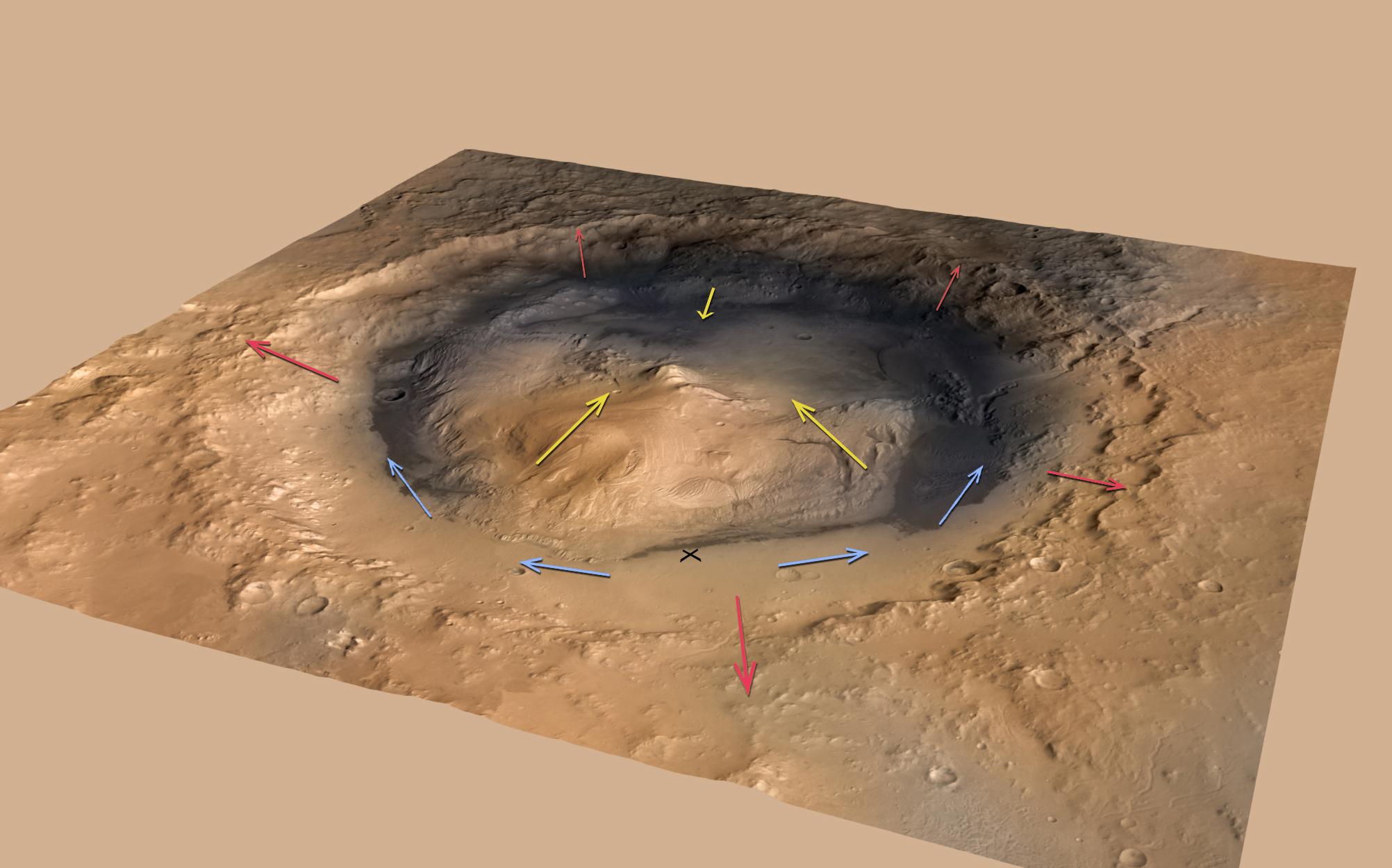
-
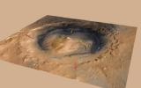
PIA16475:
-
Mountain Winds at Gale Crater
Full Resolution:
TIFF
(7.518 MB)
JPEG
(187.4 kB)
|
|
|
2012-11-13 |
Mars
|
Mars Science Laboratory (MSL)
|
SAM
|
1425x1038x3 |
|
-
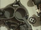
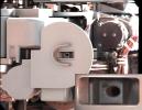
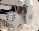
PIA16446:
-
Inlet Covers for Sample Analysis at Mars
Full Resolution:
TIFF
(4.439 MB)
JPEG
(128.1 kB)
|
|
|
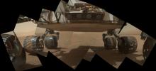
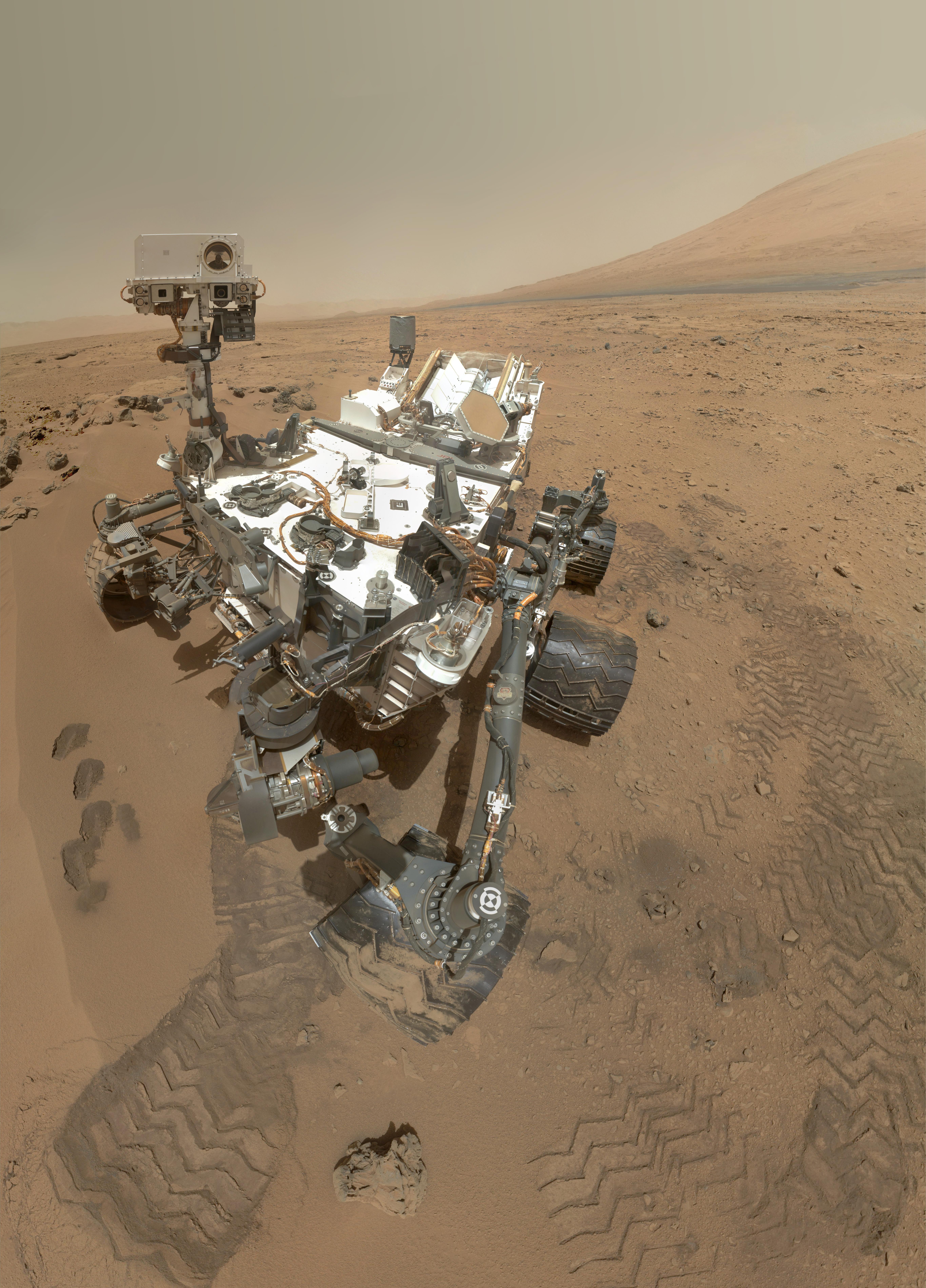
2012-11-01 |
Mars
|
Mars Science Laboratory (MSL)
|
MAHLI
|
5463x7595x3 |
|
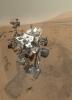
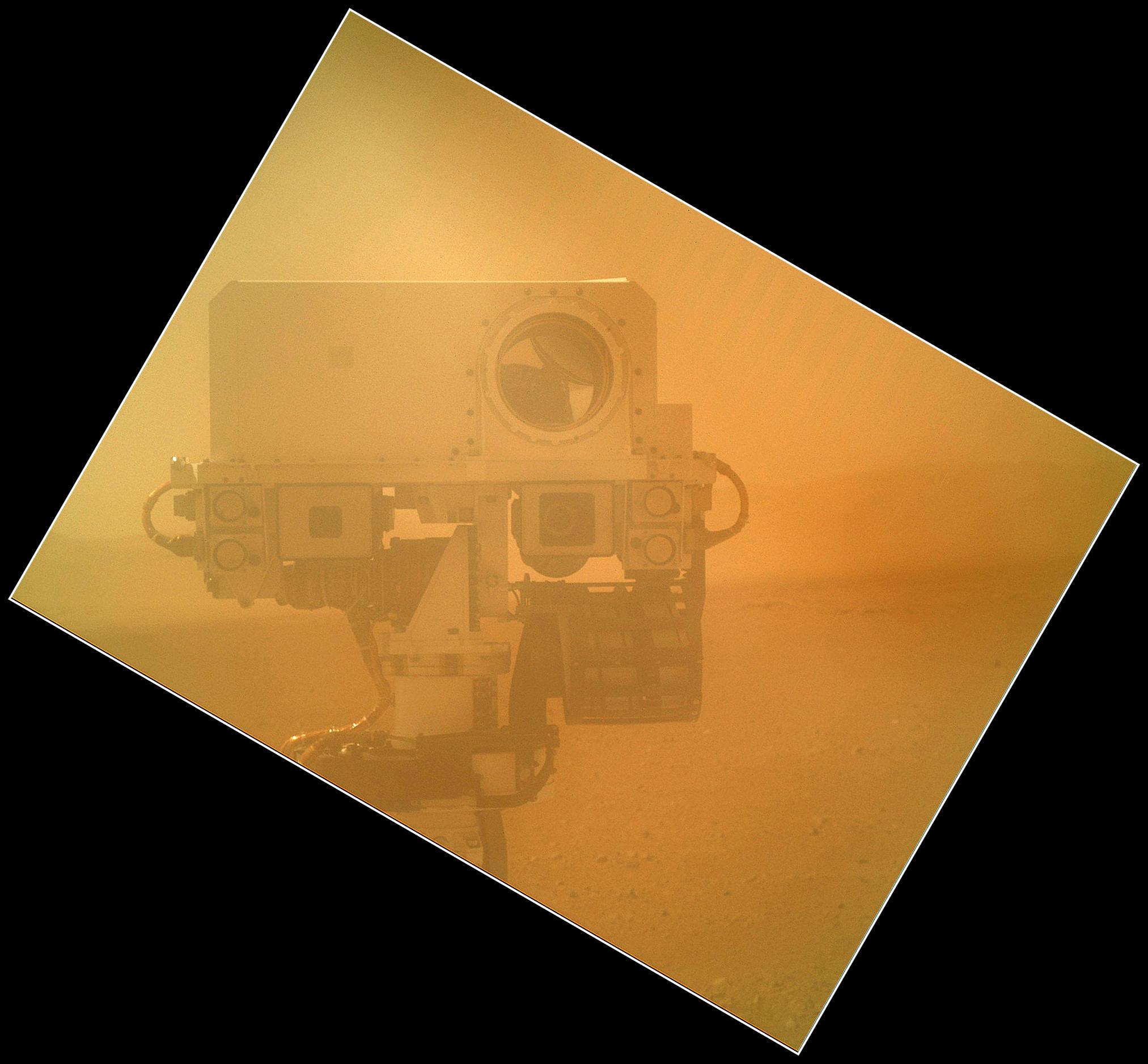
-
PIA16239:
-
High-Resolution Self-Portrait by Curiosity Rover Arm Camera
Full Resolution:
TIFF
(124.5 MB)
JPEG
(3.831 MB)
|
|
|
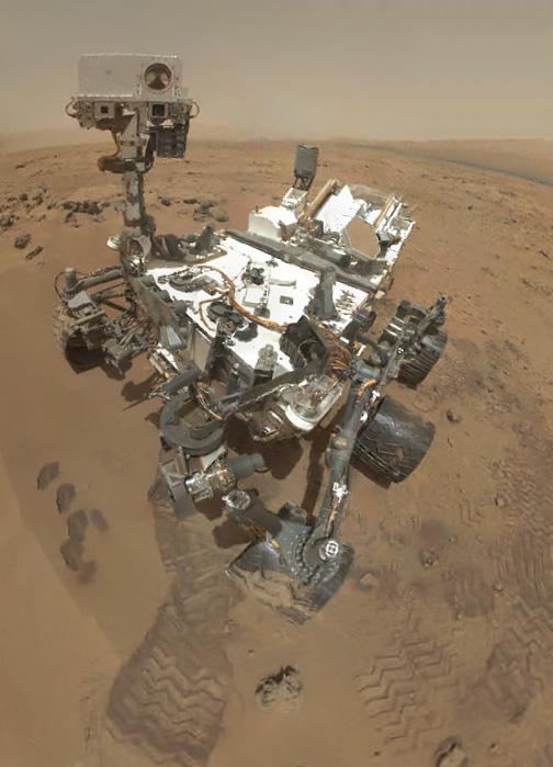
2012-11-01 |
Mars
|
Mars Science Laboratory (MSL)
|
MAHLI
|
504x699x3 |
|
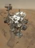
-
PIA16238:
-
Preliminary Self-Portrait of Curiosity by Rover's Arm Camera
Full Resolution:
TIFF
(1.057 MB)
JPEG
(45.02 kB)
|
|
|
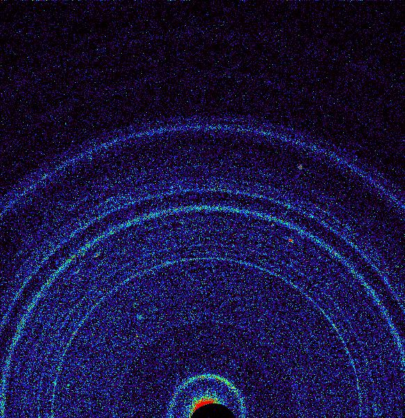
2012-10-30 |
Mars
|
Mars Science Laboratory (MSL)
|
CheMin
|
582x600x3 |
|
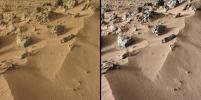
-
PIA16217:
-
First X-ray View of Martian Soil
Full Resolution:
TIFF
(351.3 kB)
JPEG
(157.3 kB)
|
|
|
2012-10-30 |
Mars
|
Mars Science Laboratory (MSL)
|
CheMin
Mastcam
|
2316x1152x3 |
|
-
PIA16174:
-
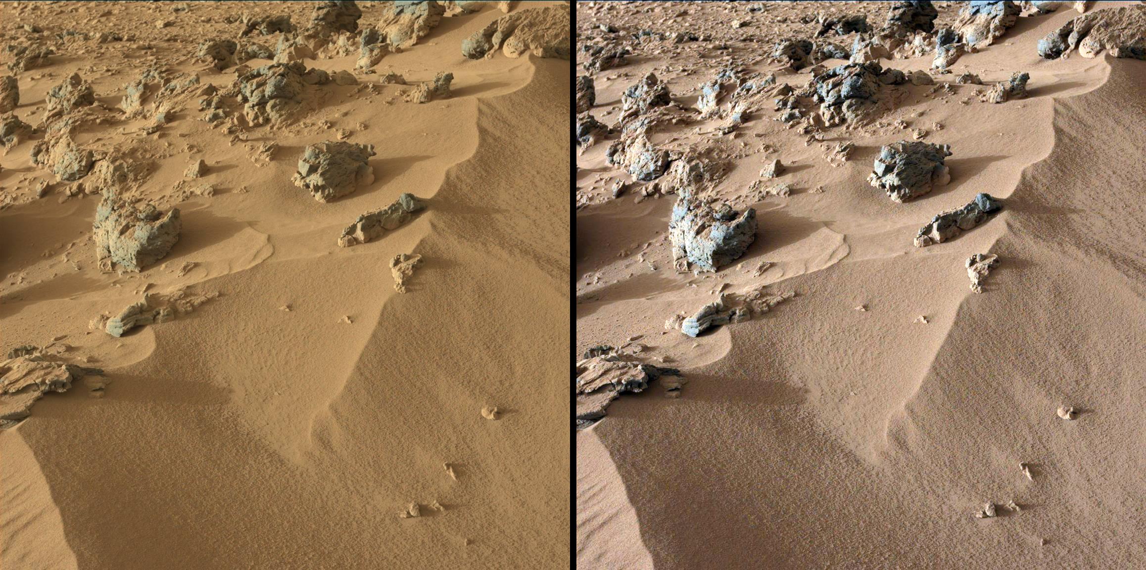
Wind-Blown Martian Sand
Full Resolution:
TIFF
(8.007 MB)
JPEG
(530.1 kB)
|
|
|
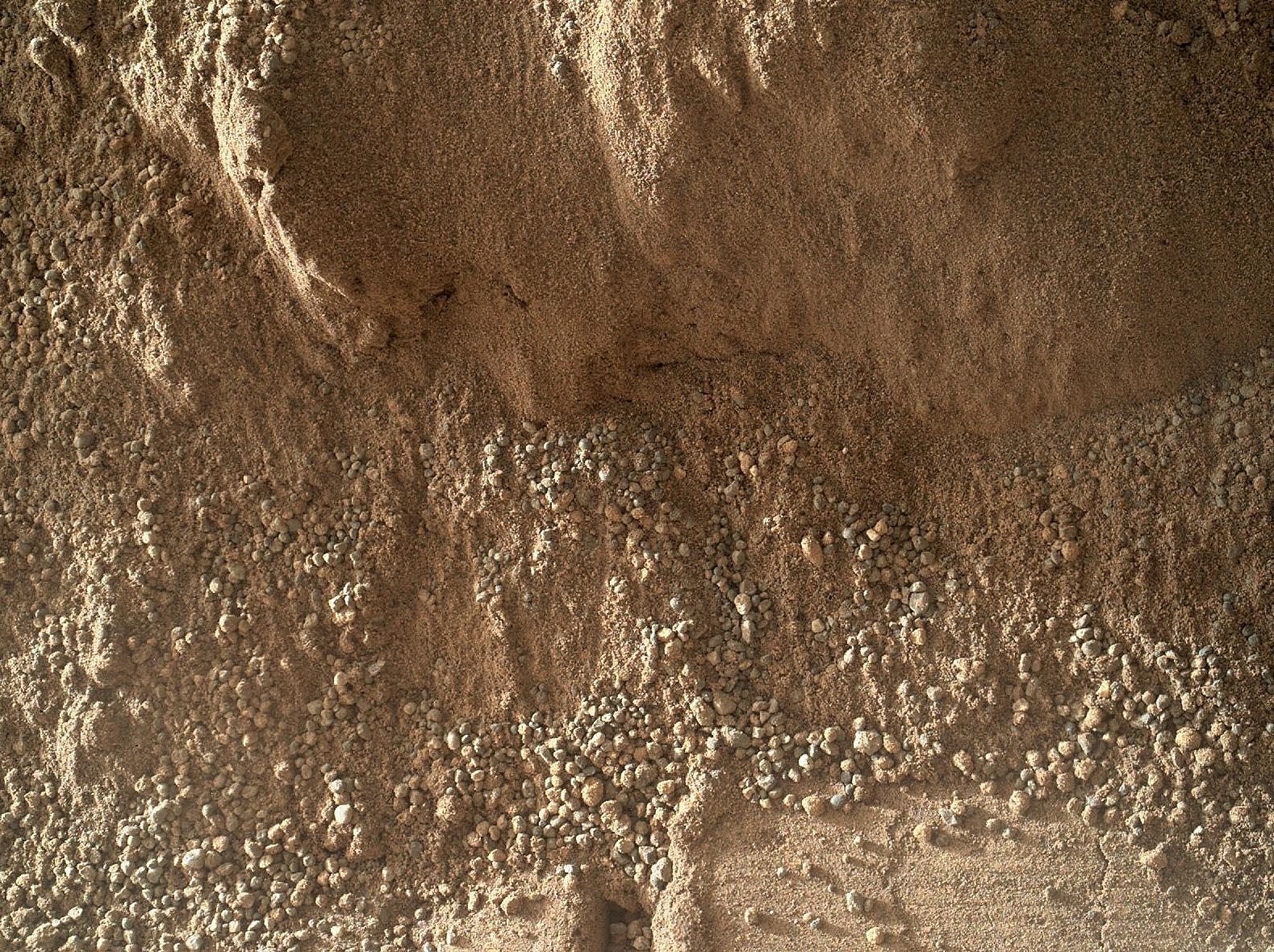
2012-10-30 |
Mars
|
Mars Science Laboratory (MSL)
|
CheMin
Mastcam
|
3027x1200x3 |
|
-
PIA16173:
-
Curiosity Digs In
Full Resolution:
TIFF
(10.9 MB)
JPEG
(660.7 kB)
|
|
|
2012-10-29 |
Mars
|
Mars Science Laboratory (MSL)
|
MAHLI
|
1584x1184x3 |
|
-
PIA16237:
-
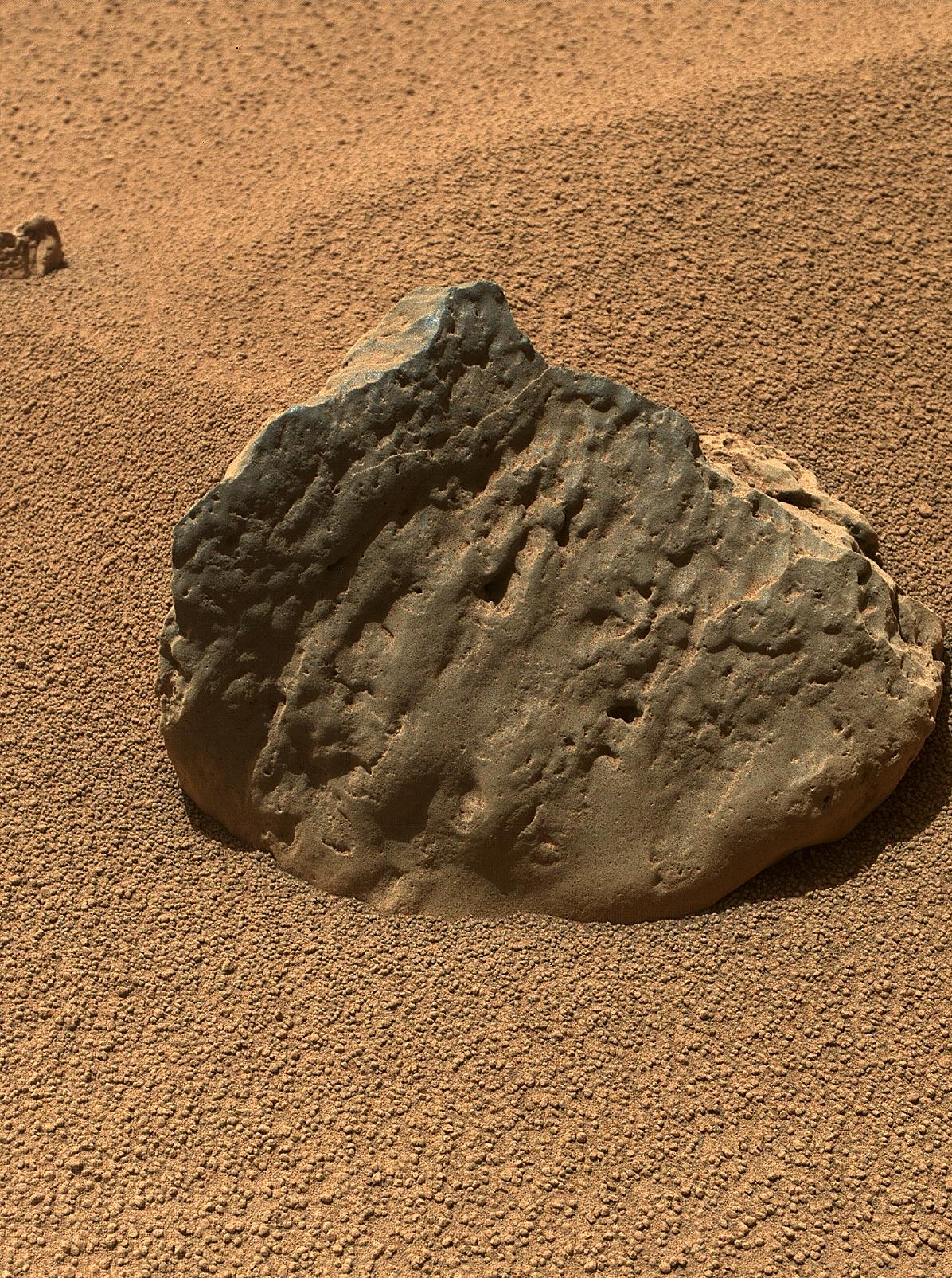
Rock 'Burwash' Near Curiosity, Sol 82
Full Resolution:
TIFF
(5.628 MB)
JPEG
(445.3 kB)
|
|
|
2012-10-29 |
Mars
|
Mars Science Laboratory (MSL)
|
MAHLI
|
1196x1605x3 |

|
-
PIA16236:
-
Rock 'Et-Then' Near Curiosity, Sol 82
Full Resolution:
TIFF
(5.761 MB)
JPEG
(666.8 kB)
|
|
|
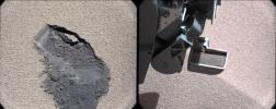
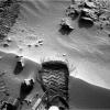
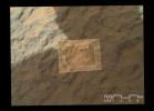
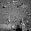
2012-10-25 |
Mars
|
Mars Science Laboratory (MSL)
|
Navcam (MSL)
|
438x200x1 |
|
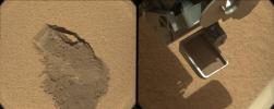
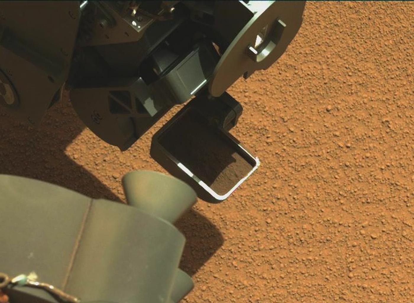
-
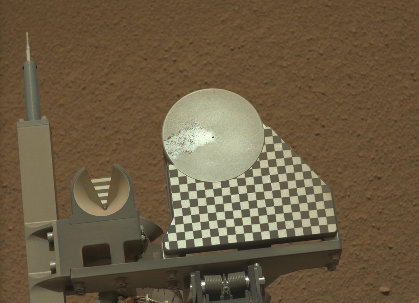
PIA16235:
-
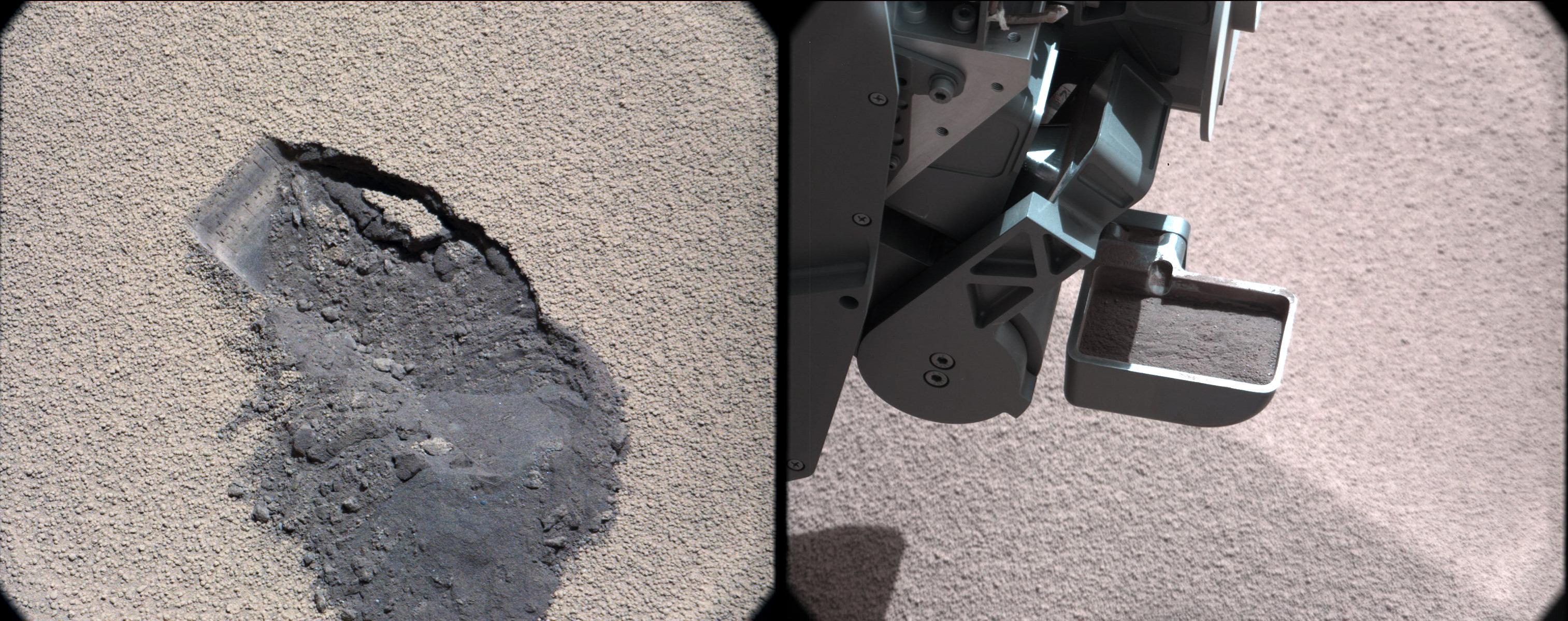
Scooped Material on Rover's Observation Tray
Full Resolution:
TIFF
(87.91 kB)
JPEG
(14.34 kB)
|
|
|
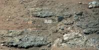
2012-10-22 |
Mars
|
Mars Science Laboratory (MSL)
|
ChemCam
|
720x720x1 |
|
-
PIA16234:
-
Laser Hit on Martian Sand Target, Before and After

Full Resolution:
TIFF
(519.1 kB)
JPEG
(102.3 kB)
|
|
|
2012-10-18 |
Mars
|
Mars Science Laboratory (MSL)
|
MAHLI
|
1083x678x3 |
|
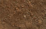
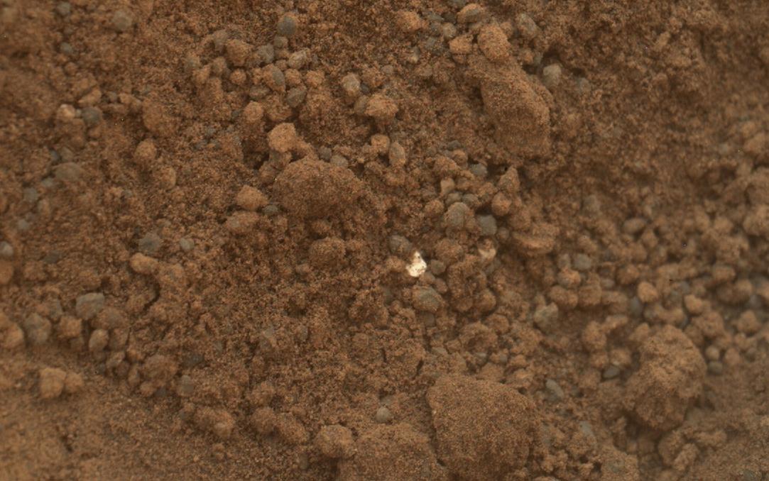
-
PIA16233:
-
Bright Particle in Hole Dug by Scooping of Martian Soil
Full Resolution:
TIFF
(2.204 MB)
JPEG
(122.5 kB)
|
|
|
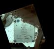
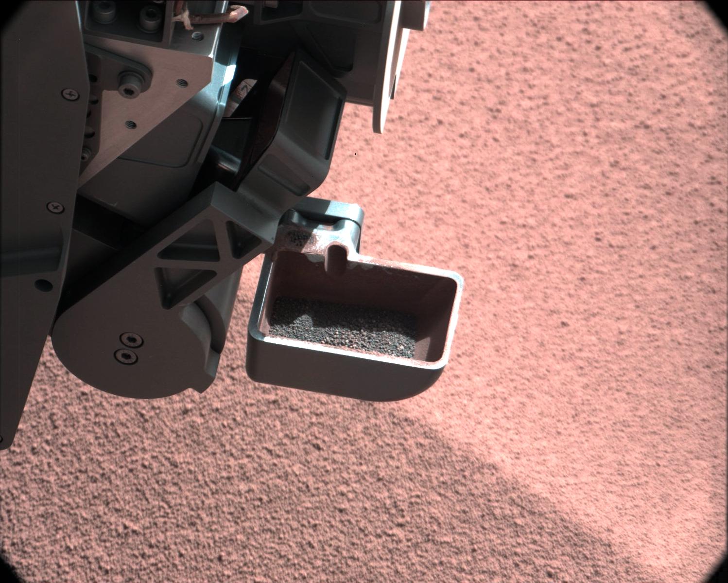
2012-10-18 |
Mars
|
Mars Science Laboratory (MSL)
|
Mastcam
|
1347x975x3 |

|
-
PIA16232:
-
First Sample Placed on Curiosity's Observation Tray
Full Resolution:
TIFF
(3.942 MB)
JPEG
(114.9 kB)
|
|
|
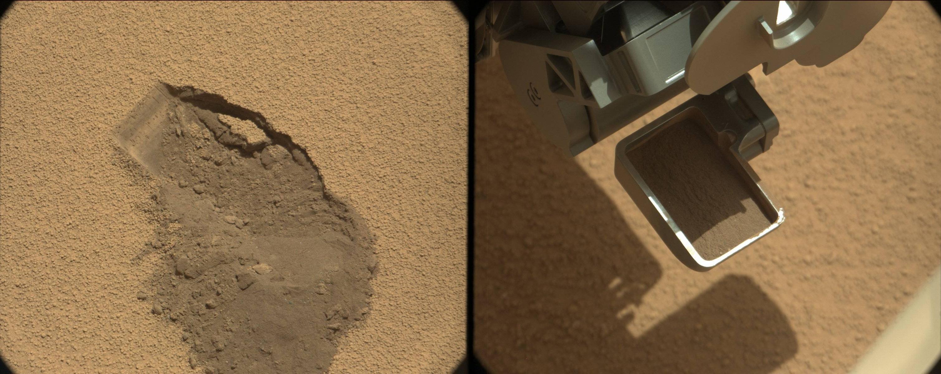
2012-10-18 |
Mars
|
Mars Science Laboratory (MSL)
|
Navcam (MSL)
|
1024x1024x1 |
|
-
PIA16231:
-
Curiosity's First Three Bites Into Martian Ground
Full Resolution:
TIFF
(1.05 MB)
JPEG
(161.7 kB)
|
|
|
2012-10-15 |
Mars
|
Mars Science Laboratory (MSL)
|
MAHLI
|
1584x1184x3 |
|
-
PIA16230:
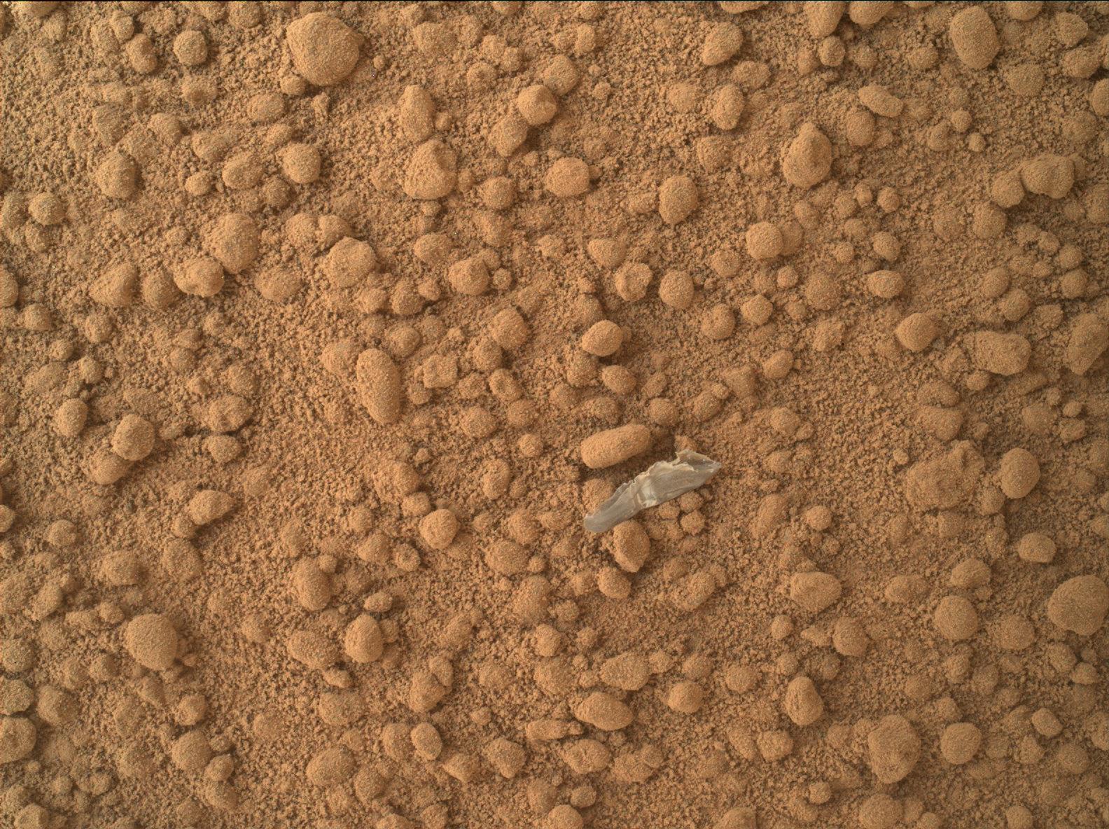
-
Small Debris on the Ground Beside Curiosity
Full Resolution:
TIFF
(5.628 MB)
JPEG
(485.9 kB)
|
|
|
2012-10-15 |
Mars
|
Mars Science Laboratory (MSL)
|
MAHLI
|
1608x1199x3 |
|
-
PIA16229:
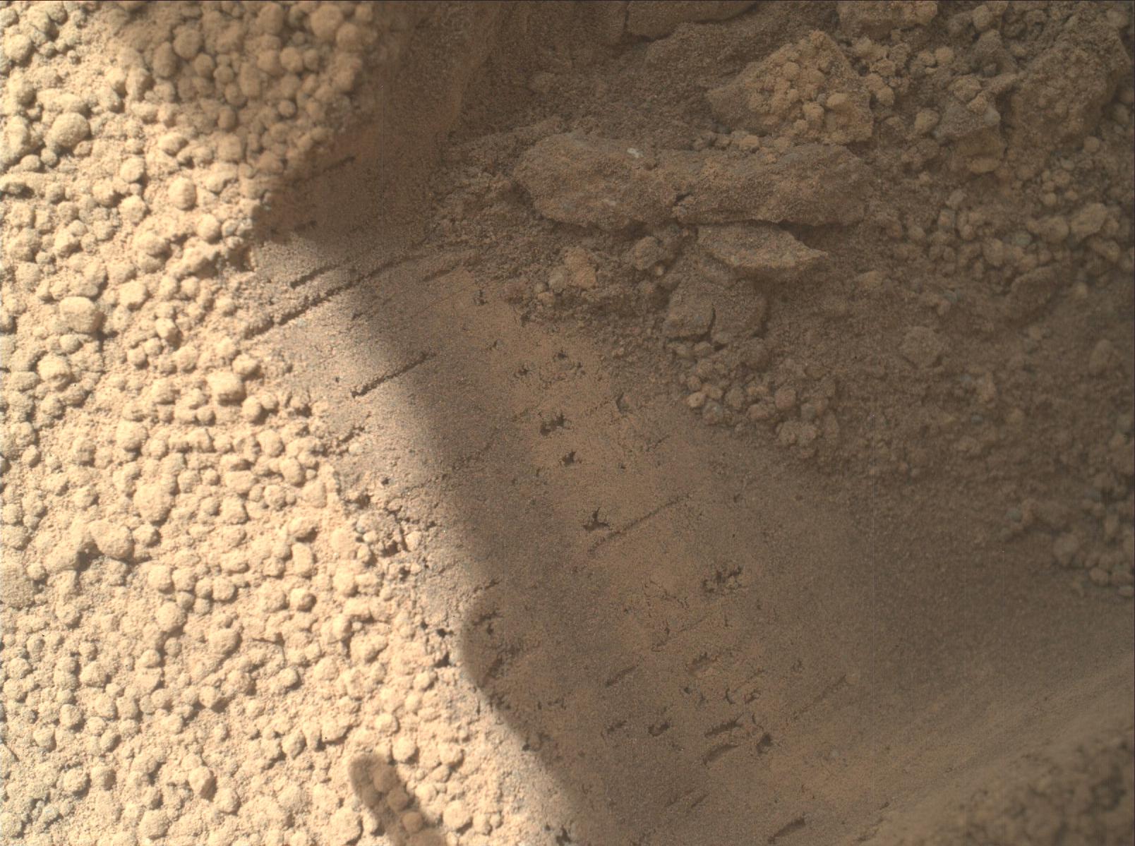
-
Bright Particle of Martian Origin in Scoop Hole
Full Resolution:
TIFF
(5.786 MB)
JPEG
(288 kB)
|
|
|
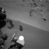
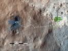
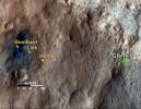
2012-10-12 |
Mars
|
Mars Science Laboratory (MSL)
|
Navcam (MSL)
|
7703x2198x1 |

|
-
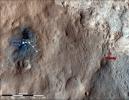
PIA16227:
Curiosity's Location During First Scooping
Full Resolution:
TIFF
(16.95 MB)
JPEG
(1.911 MB)
|
|
|
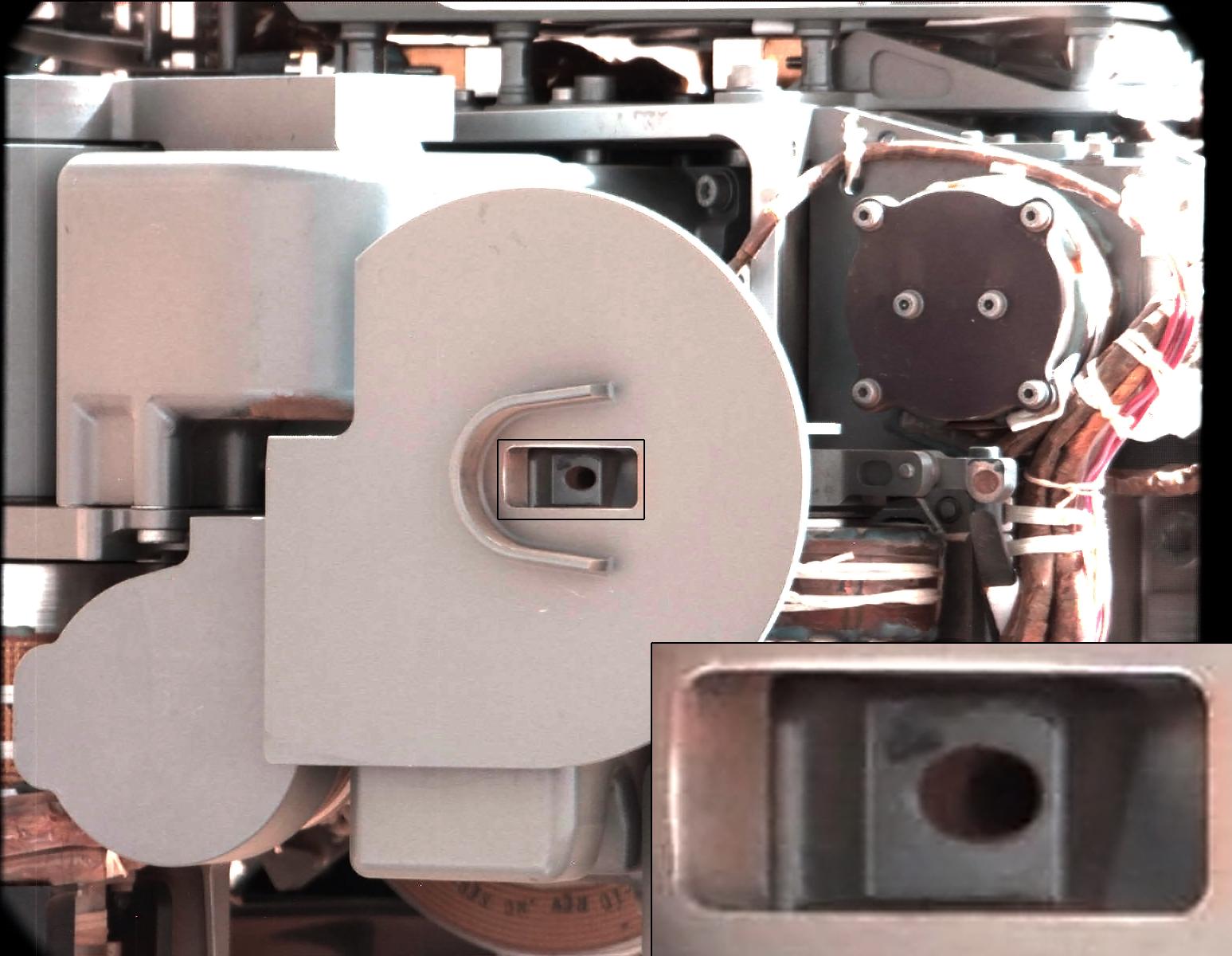
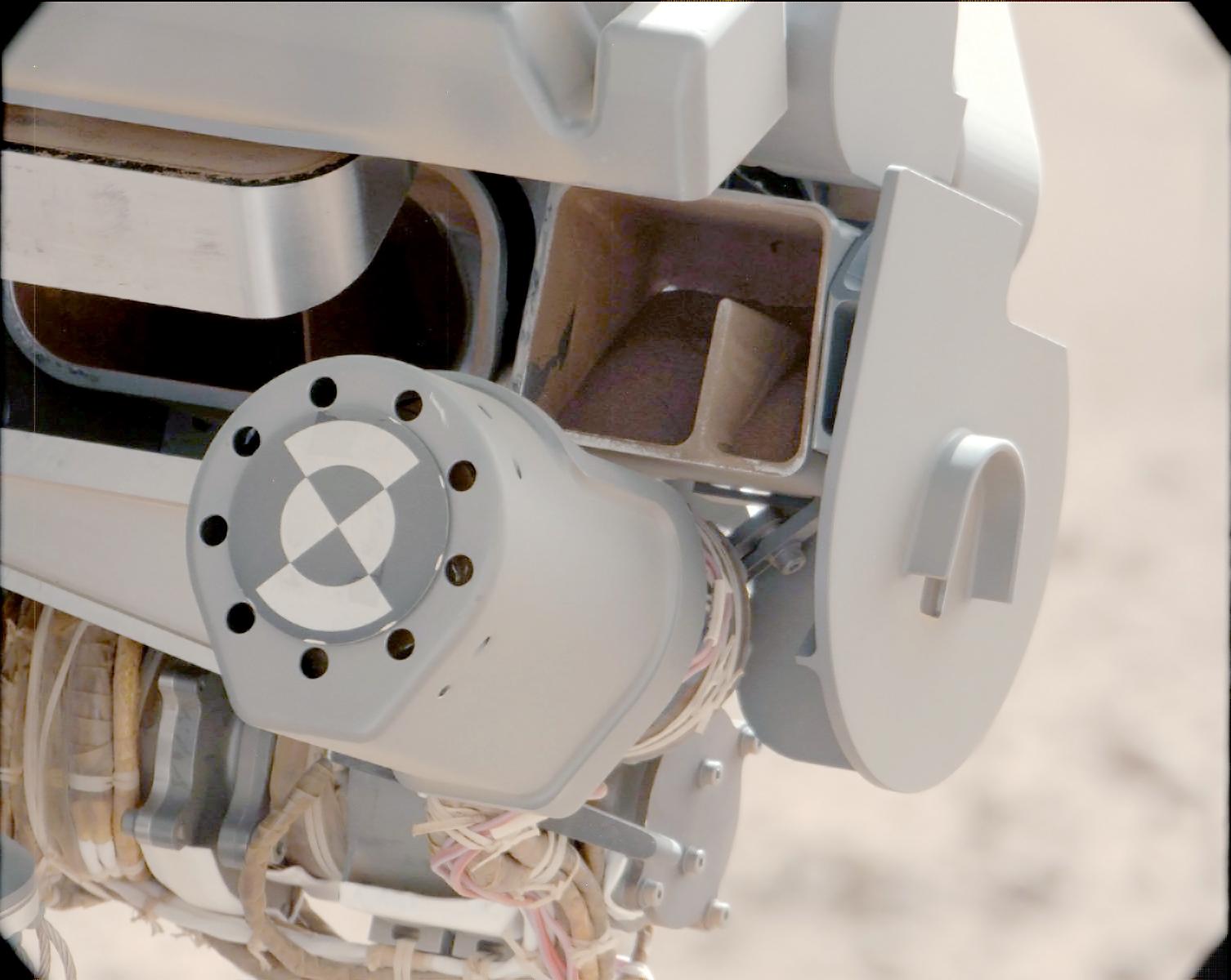
2012-10-11 |
Mars
|
Mars Science Laboratory (MSL)
|
CHIMRA
Mastcam
|
1547x1200x3 |
|
-
PIA16196:
-
Thanks for the Scrub
Full Resolution:
TIFF
(5.571 MB)
JPEG
(161.2 kB)
|
|
|
2012-10-11 |
Mars
|
Mars Science Laboratory (MSL)
|
CHIMRA
Mastcam
|
1506x1200x3 |
|
-
PIA16195:
-
Sand Filtered through Curiosity's Sieve
Full Resolution:
TIFF
(5.424 MB)
JPEG
(113.8 kB)
|
|
|
2012-10-11 |
Mars
|
Mars Science Laboratory (MSL)
|
CHIMRA
Mastcam
|
1498x1199x3 |

|
-
PIA16194:
-
Too Big for the Sieve
Full Resolution:
TIFF
(5.39 MB)
JPEG
(229.6 kB)
|
|
|
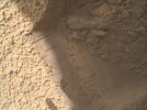
2012-10-11 |
Mars
|
Mars Science Laboratory (MSL)
|
MAHLI
|
1579x1180x3 |
|
-
PIA16193:
-
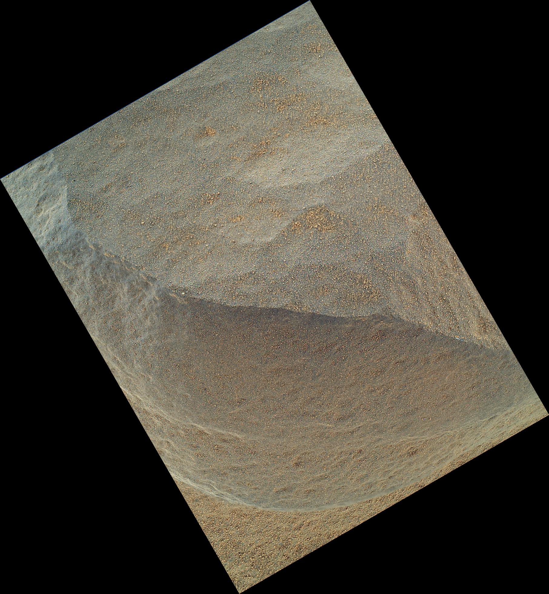
High-Resolution View of Cross-Section Through a Mars Ripple
Full Resolution:
TIFF
(5.592 MB)
JPEG
(611.4 kB)
|
|
|
2012-10-11 |
Mars
|
Mars Science Laboratory (MSL)
|
ChemCam
Mastcam
|
2668x2668x3 |
|
-
PIA16192:
-
Target: Jake Matijevic Rock
Full Resolution:
TIFF
(21.36 MB)
JPEG
(1.126 MB)
|
|
|
2012-10-10 |
Mars
|
Mars Science Laboratory (MSL)
|
Mastcam
|
3020x1200x3 |
|
-
PIA16226:
-
First Scoop by Curiosity, Sol 61 Views
Full Resolution:
TIFF
(10.88 MB)
JPEG
(479.7 kB)
|
|
|
2012-10-10 |
Mars
|
Mars Reconnaissance Orbiter (MRO)
Mars Science Laboratory (MSL)
|
HiRISE
|
2414x1387x3 |
|
-
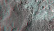
PIA16210:
-
'Glenelg' in 3-D
Full Resolution:
TIFF
(10.05 MB)
JPEG
(554.1 kB)
|
|
|
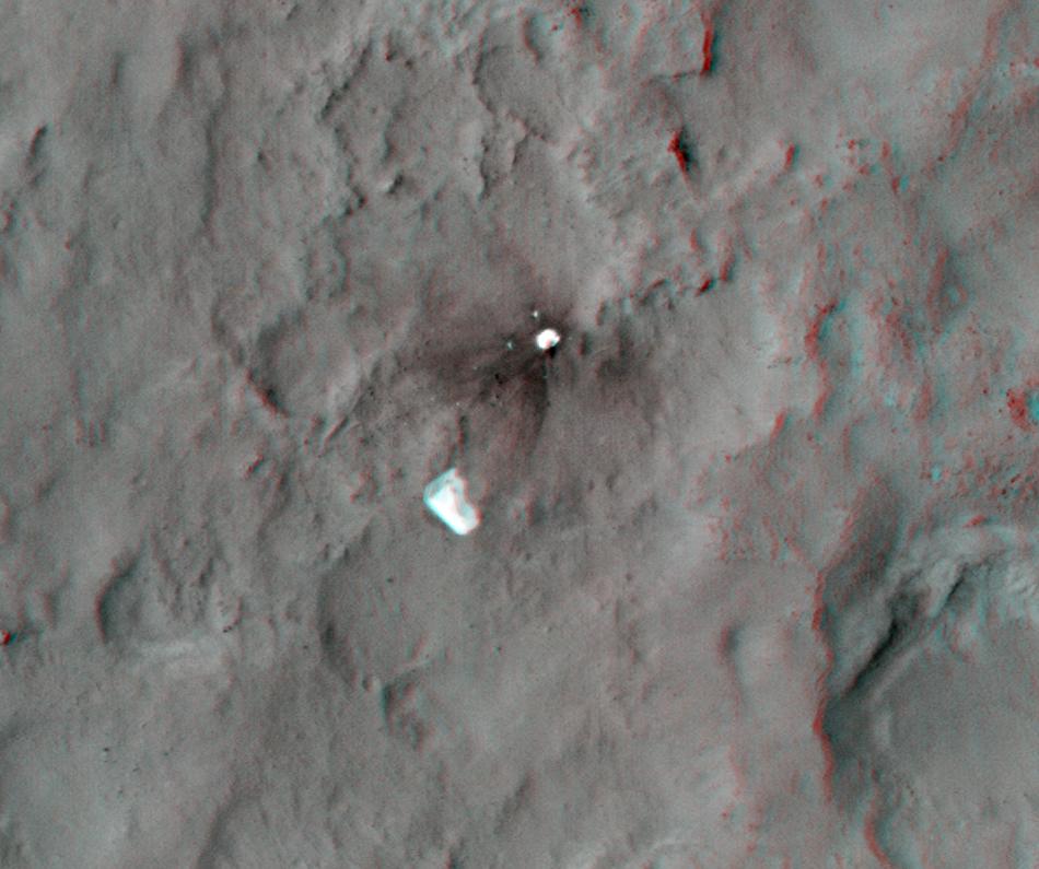
2012-10-10 |
Mars
|
Mars Reconnaissance Orbiter (MRO)
Mars Science Laboratory (MSL)
|
HiRISE
|
950x795x3 |
|
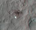
-
PIA16209:
-
Parachute and Back Shell in 3-D
Full Resolution:
TIFF
(2.267 MB)
JPEG
(87.85 kB)
|
|
|
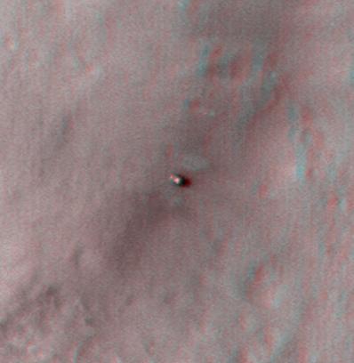
2012-10-10 |
Mars
|
Mars Reconnaissance Orbiter (MRO)
Mars Science Laboratory (MSL)
|
HiRISE
|
398x408x3 |
|
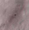
-
PIA16208:
-
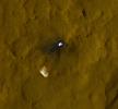
Curiosity at Bradbury Landing Site in 3-D
Full Resolution:
TIFF
(487.5 kB)
JPEG
(17.84 kB)
|
|
|
2012-10-08 |
Mars
|
Mars Science Laboratory (MSL)
|
Mastcam
|
1345x1200x3 |
|
-
PIA16225:
-
View of Curiosity's First Scoop Also Shows Bright Object
Full Resolution:
TIFF
(4.844 MB)
JPEG
(242.9 kB)
|
|
|
2012-10-08 |
Mars
|
Mars Science Laboratory (MSL)
|
Mastcam
|
1400x1024x3 |

|
-
PIA16224:
-
Curiosity's First Scoop of Mars, in Vibration Movie
Full Resolution:
TIFF
(4.303 MB)
JPEG
(148.8 kB)
|
|
|
2012-10-04 |
Mars
|
Mars Science Laboratory (MSL)
|
Navcam (MSL)
|
1024x1024x1 |
|
-
PIA16205:
-
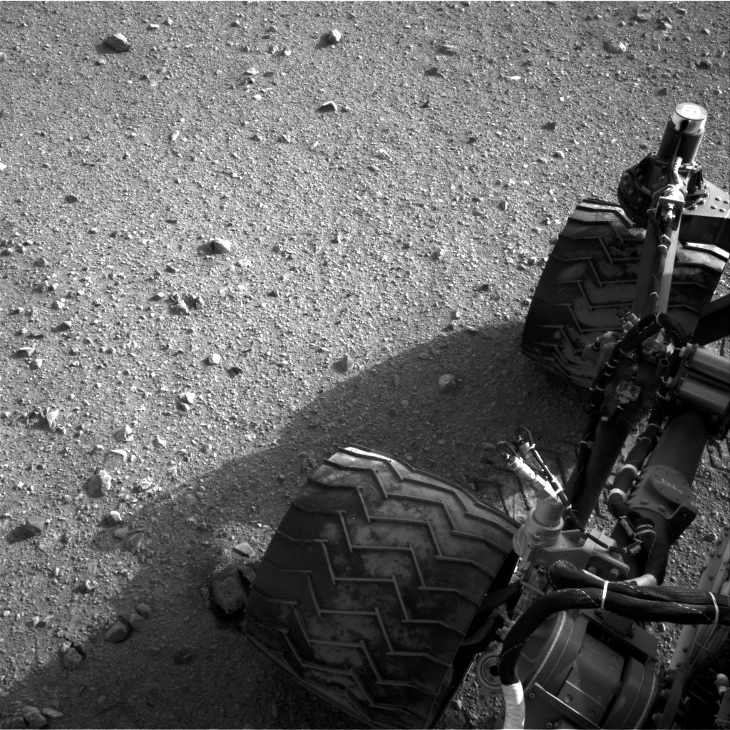
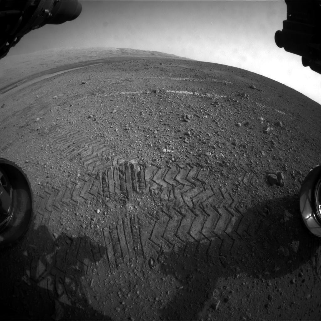
Wheel Scuff Mark at 'Rocknest'
Full Resolution:
TIFF
(1.05 MB)
JPEG
(281.5 kB)
|
|
|
2012-10-04 |
Mars
|
Mars Science Laboratory (MSL)
|
Mastcam
|
3926x2218x3 |
|
-
PIA16204:
-
'Rocknest' From Sol 52 Location
Full Resolution:
TIFF
(26.13 MB)
JPEG
(1.876 MB)
|
|
|
2012-10-04 |
Mars
|
Mars Science Laboratory (MSL)
|
Navcam (MSL)
|
7824x1488x1 |

|
-
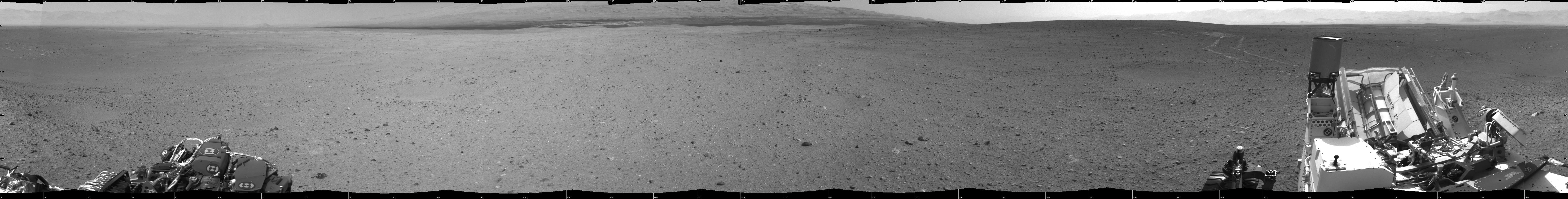
PIA16202:
View on the Way to 'Glenelg'
Full Resolution:
TIFF
(11.65 MB)
JPEG
(1.1 MB)
|
|
|
2012-10-04 |
Mars
|
Mars Science Laboratory (MSL)
|
HiRISE
|
3600x2700x3 |
|
-
PIA16200:
-
Curiosity's Travels Through Sol 56
Full Resolution:
TIFF
(29.17 MB)
JPEG
(1.87 MB)
|
|
|
2012-10-03 |
Mars
|
Mars Science Laboratory (MSL)
|
Mastcam
|
2901x3036x3 |
|
-
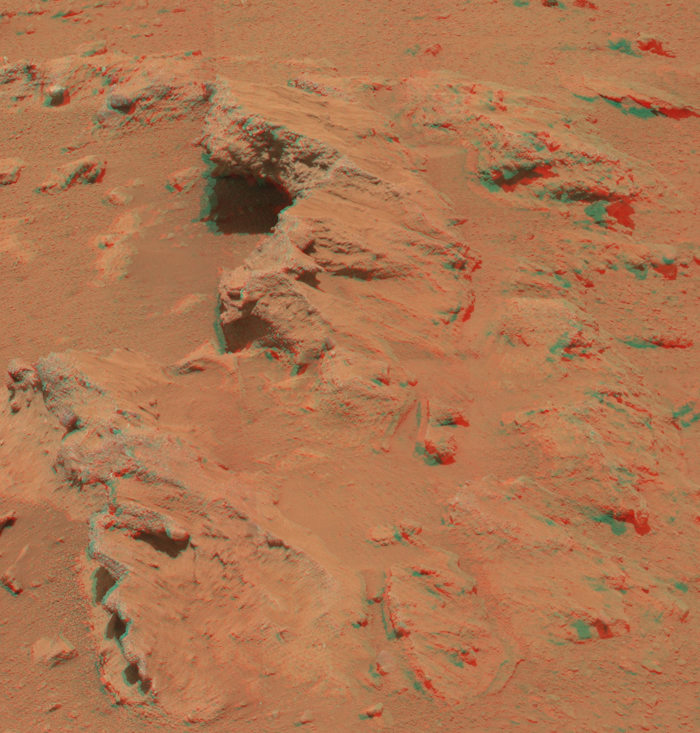
PIA16223:
-
Martian Streambed Evidence Rock in 3-D
Full Resolution:
TIFF
(26.43 MB)
JPEG
(977.2 kB)
|
|
|
2012-10-01 |
Mars
|
Mars Science Laboratory (MSL)
|
MAHLI
|
1812x1959x3 |
|
-
PIA14763:
-
'Bathurst Inlet' Rock on Curiosity's Sol 54, Close-Up View
Full Resolution:
TIFF
(10.65 MB)
JPEG
(618.9 kB)
|
|
|
2012-10-01 |
Mars
|
Mars Science Laboratory (MSL)
|
MAHLI
|
1812x1958x3 |
|
-
PIA14762:
-
'Bathurst Inlet' Rock on Curiosity's Sol 54, Context View
Full Resolution:
TIFF
(10.65 MB)
JPEG
(311.4 kB)
|
|
|
2012-09-27 |
Mars
|
Mars Science Laboratory (MSL)
|
Mastcam
|
1800x1350x3 |

|
-
PIA16189:
-
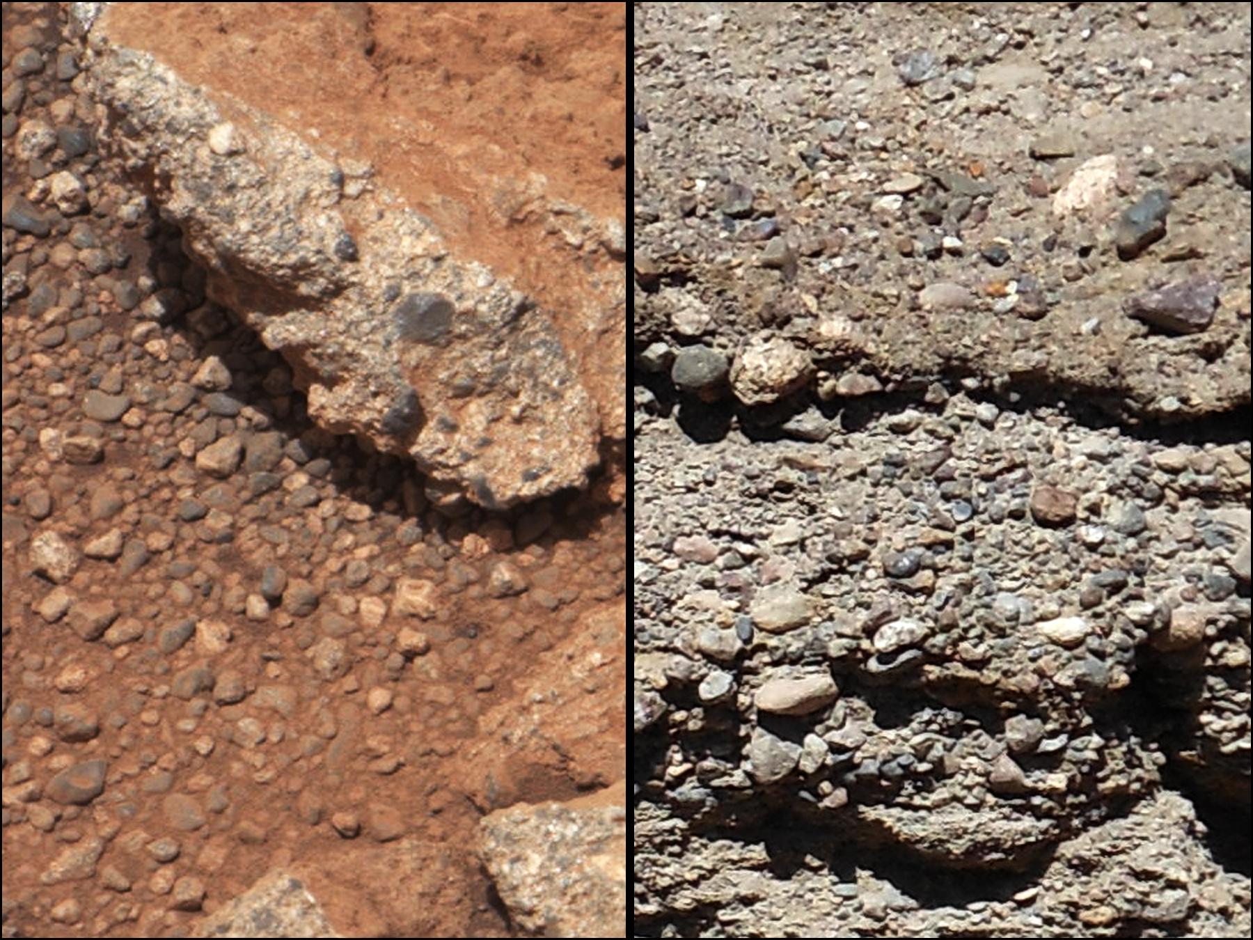
Rock Outcrops on Mars and Earth
Full Resolution:
TIFF
(7.293 MB)
JPEG
(399.8 kB)
|
|
|
2012-09-27 |
Mars
|
Mars Science Laboratory (MSL)
|
Mastcam
|
960x719x3 |
|
-
PIA16188:
-
Link to a Watery Past
Full Resolution:
TIFF
(2.072 MB)
JPEG
(143.4 kB)
|
|
|
2012-09-27 |
Mars
|
Mars Science Laboratory (MSL)
|
Mastcam
|
1280x646x3 |
|
-
PIA16187:
-
Best View of Goulburn Scour
Full Resolution:
TIFF
(2.482 MB)
JPEG
(227.5 kB)
|
|
|
2012-09-27 |
Mars
|
2001 Mars Odyssey
Mars Science Laboratory (MSL)
|
THEMIS
|
3338x2580x3 |

|
-
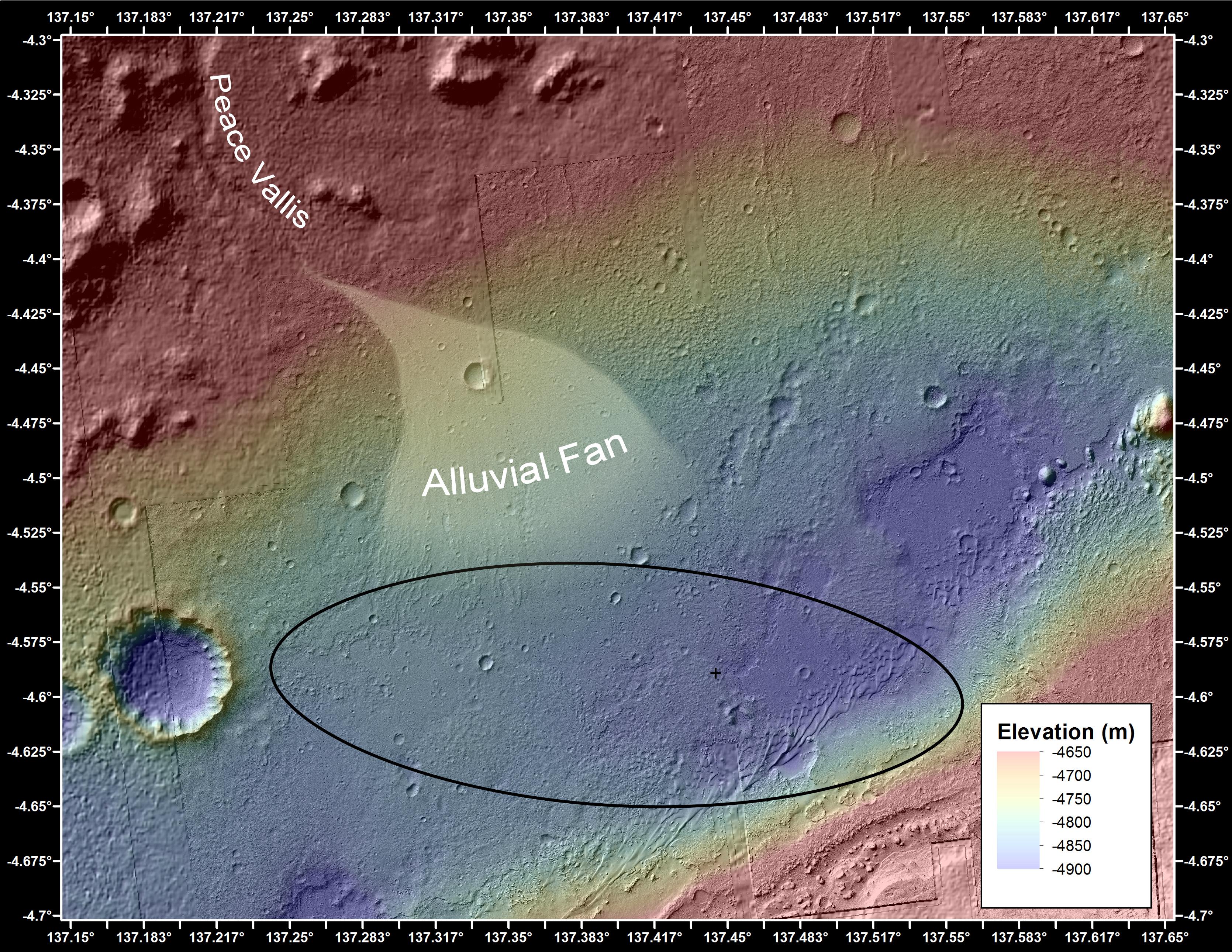
PIA16159:
-
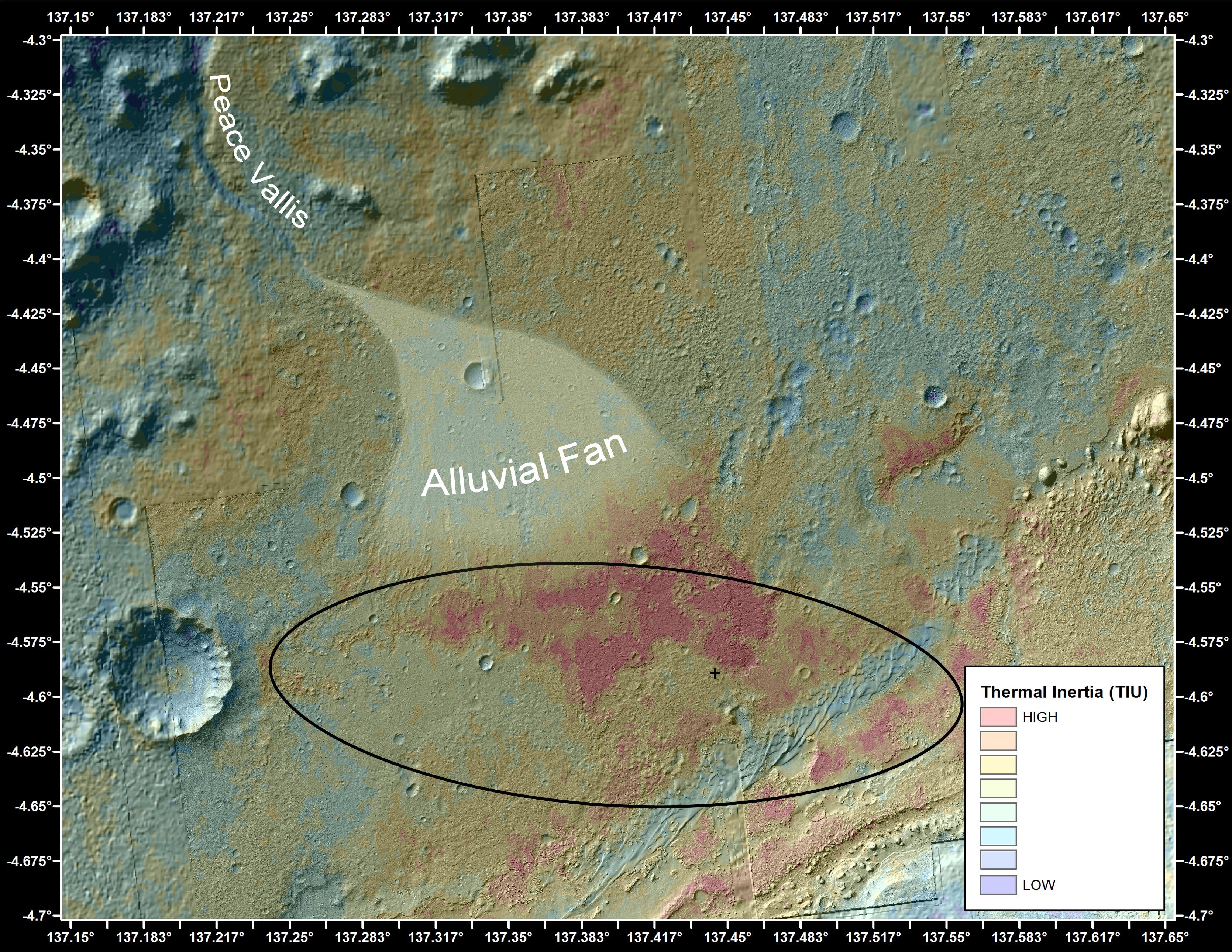
Downslope of the Fan
Full Resolution:
TIFF
(25.85 MB)
JPEG
(1.89 MB)
|
|
|
2012-09-27 |
Mars
|
Mars Reconnaissance Orbiter (MRO)
Mars Science Laboratory (MSL)
|
HiRISE
|
3339x2580x3 |

|
-
PIA16158:
-
Where Water Flowed Downslope
Full Resolution:
TIFF
(25.85 MB)
JPEG
(1.87 MB)
|
|
|
2012-09-27 |
Mars
|
Mars Reconnaissance Orbiter (MRO)
Mars Science Laboratory (MSL)
|
HiRISE
|
932x720x3 |
|
-
PIA16157:
-
Curiosity's Roadside Discoveries
Full Resolution:
TIFF
(2.014 MB)
JPEG
(132.4 kB)
|
|
|
2012-09-27 |
Mars
|
Mars Science Laboratory (MSL)
|
Mastcam
|
936x728x3 |

|
-
PIA16156:
-
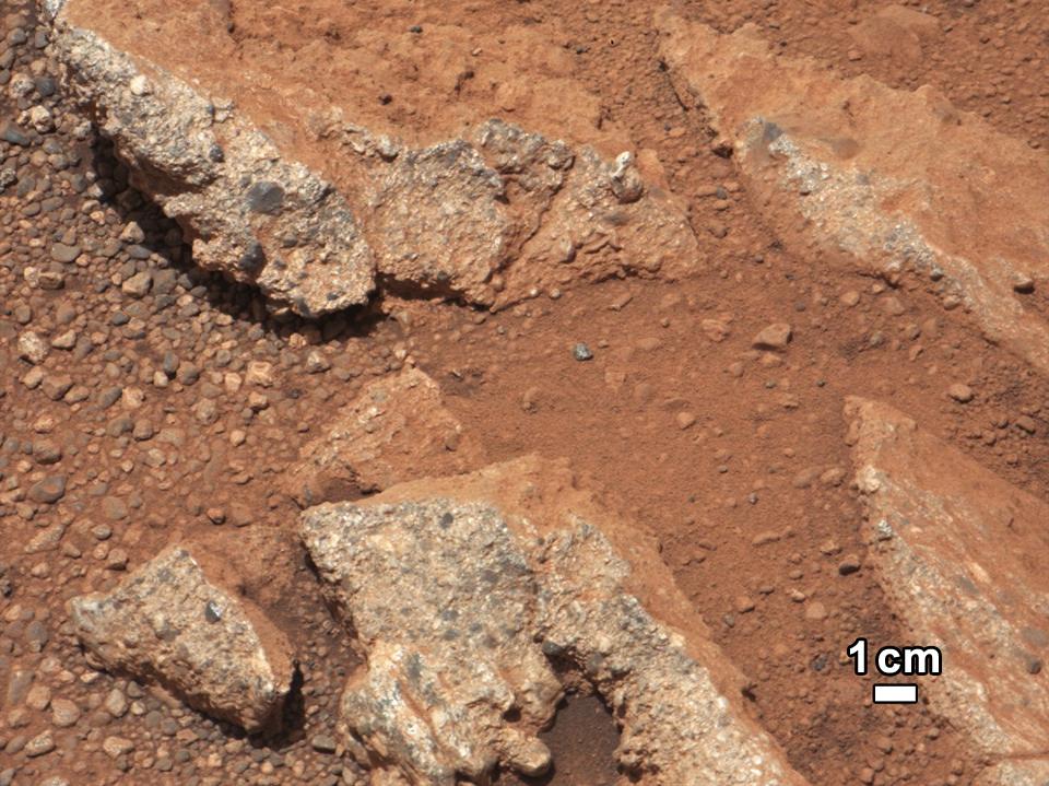
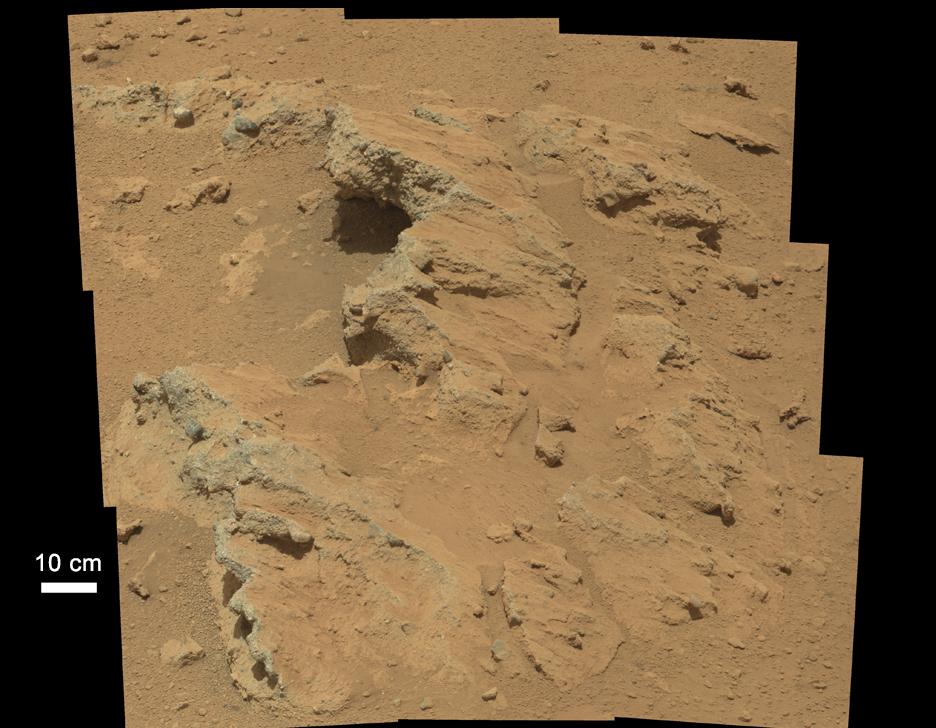
Remnants of Ancient Streambed on Mars
Full Resolution:
TIFF
(2.045 MB)
JPEG
(96.69 kB)
|
|
|
2012-09-24 |
Mars
|
Mars Science Laboratory (MSL)
|
MAHLI
|
2700x1950x3 |
|
-
PIA16221:
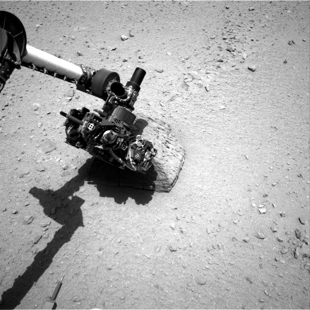
-
Mars Hand Lens Imager Nested Close-Ups of Rock 'Jake Matijevic'
Full Resolution:
TIFF
(15.8 MB)
JPEG
(525.3 kB)
|
|
|
2012-09-24 |
Mars
|
Mars Science Laboratory (MSL)
|
Navcam (MSL)
Robotic Arm (MSL)
|
1024x1024x1 |

|
-
PIA16220:
-
Curiosity's Rock-Contact Science Begins
Full Resolution:
TIFF
(1.05 MB)
JPEG
(226.7 kB)
|
|
|
2012-09-21 |
Mars
|
Mars Science Laboratory (MSL)
|
MAHLI
|
2199x2000x3 |
|
-
PIA15883:
-
President's Signature Onboard Curiosity
Full Resolution:
TIFF
(13.2 MB)
JPEG
(434.6 kB)
|
|
|
2012-09-21 |
Mars
|
Mars Science Laboratory (MSL)
|
MAHLI
|
1584x1184x3 |
|
-
PIA15882:
-
Curiosity's Stars and Stripes
Full Resolution:
TIFF
(5.628 MB)
JPEG
(223.5 kB)
|
|
|
2012-09-19 |
Mars
|
Mars Science Laboratory (MSL)
|
Navcam (MSL)
|
1024x1024x1 |
|
-
PIA16155:
-
'Jake Matijevic' Contact Target for Curiosity
Full Resolution:
TIFF
(1.05 MB)
JPEG
(254.6 kB)
|
|
|
2012-09-19 |
Mars
|
Mars Science Laboratory (MSL)
|
Mastcam
|
11909x3375x3 |
|
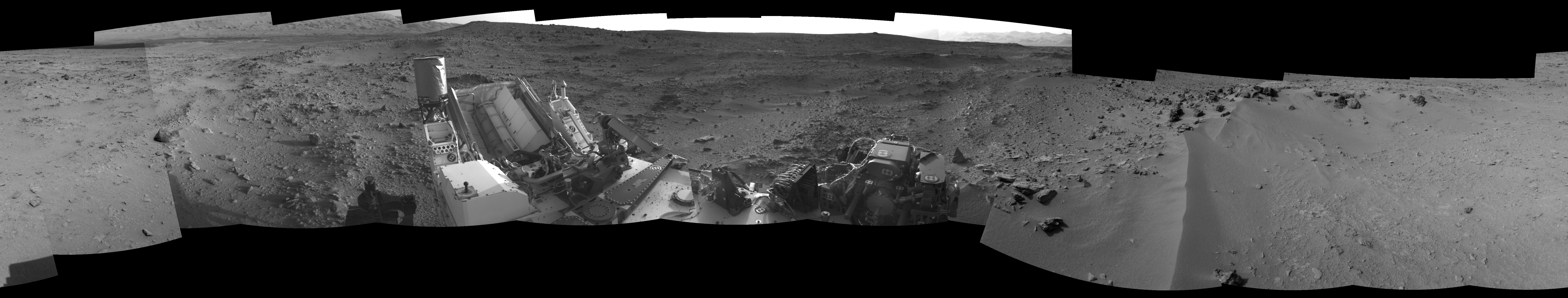
-
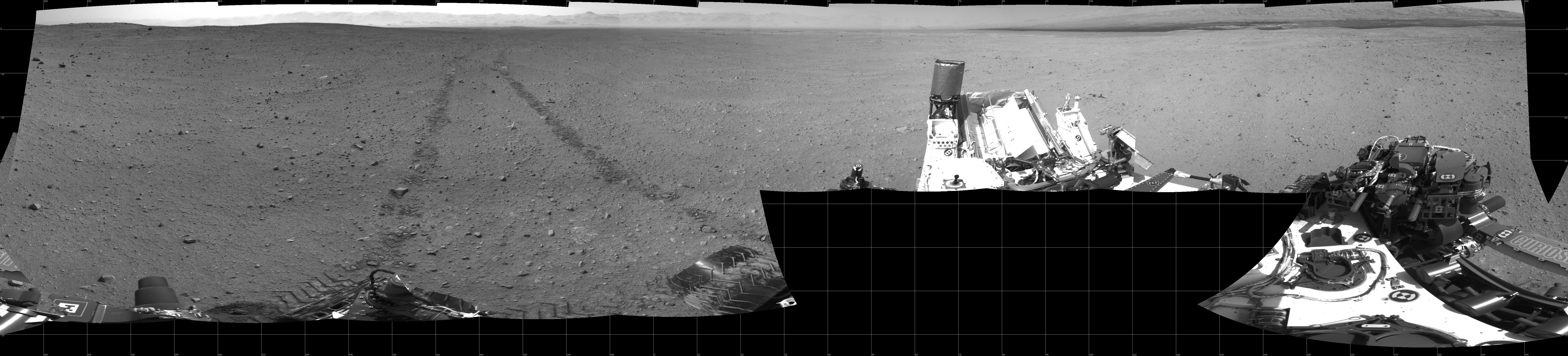
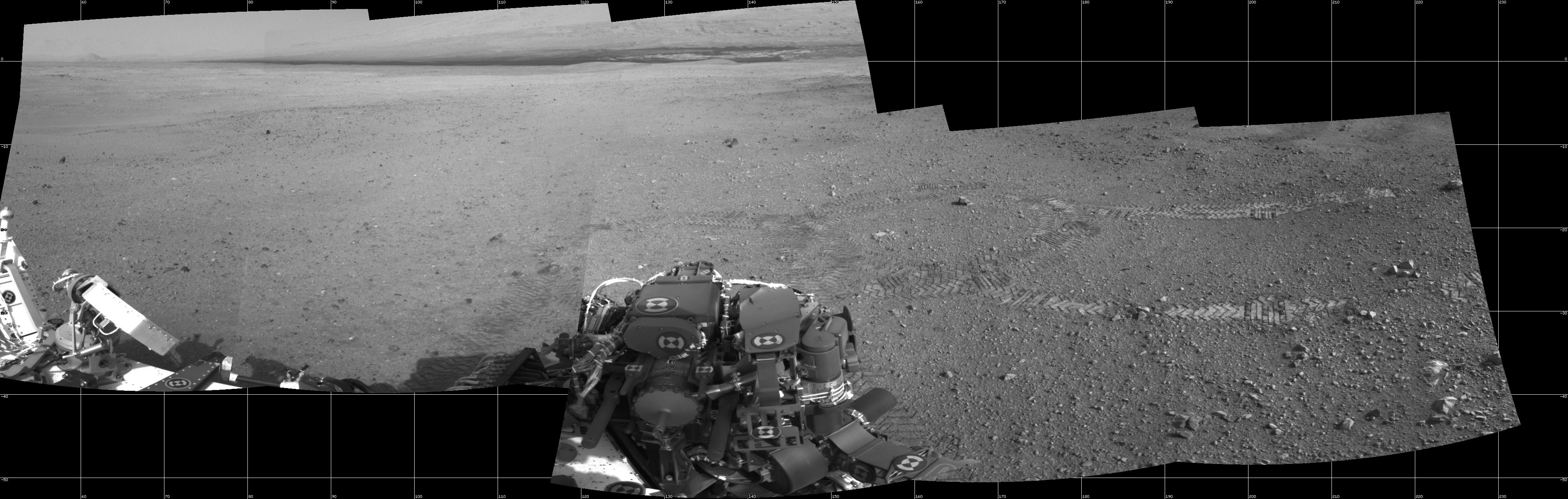
PIA16154:
On the Road to Glenelg
Full Resolution:
TIFF
(120.6 MB)
JPEG
(5.589 MB)
|
|
|
2012-09-19 |
Mars
|
Mars Reconnaissance Orbiter (MRO)
Mars Science Laboratory (MSL)
|
HiRISE
|
3300x2550x3 |
|
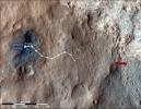
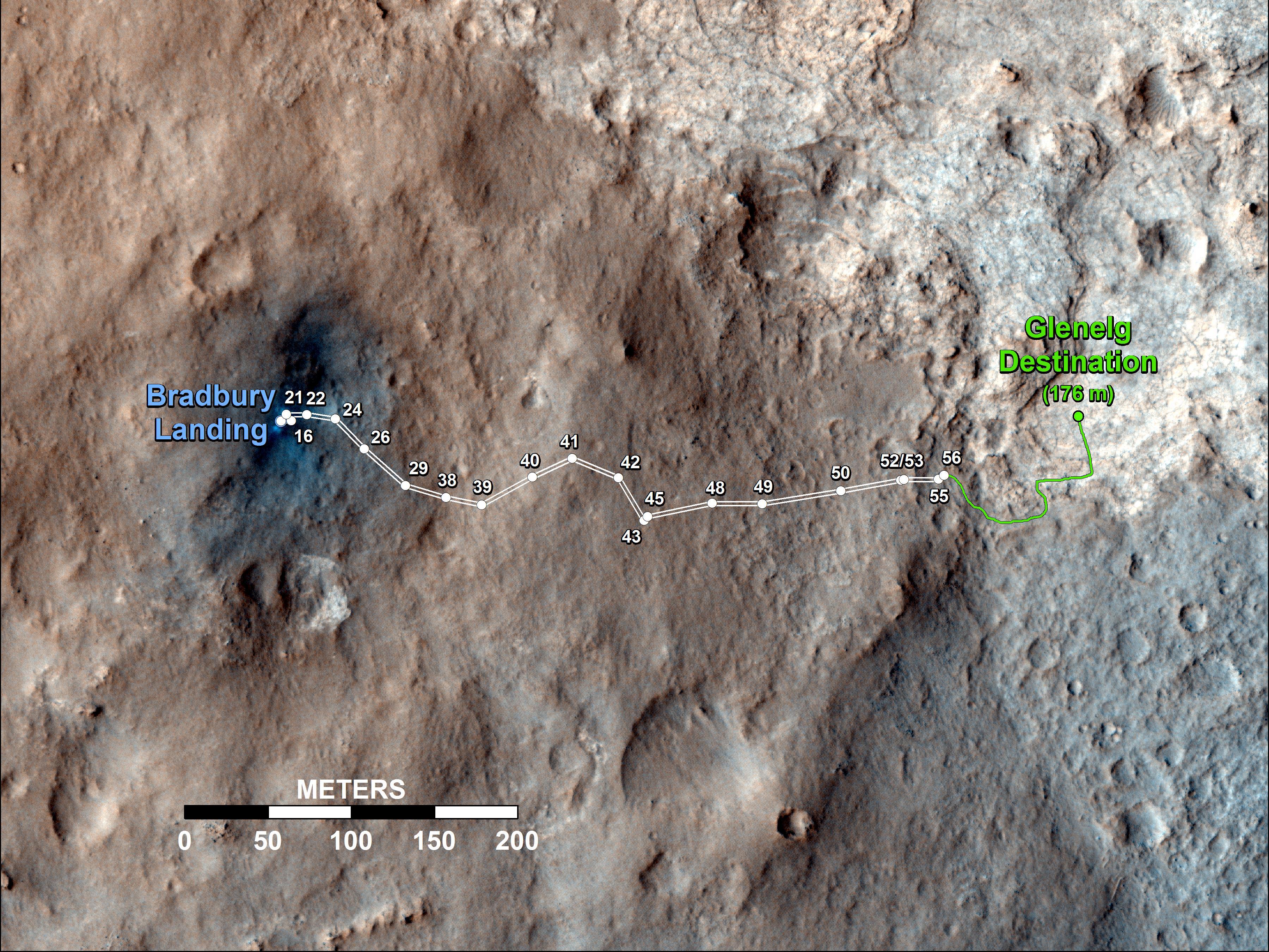
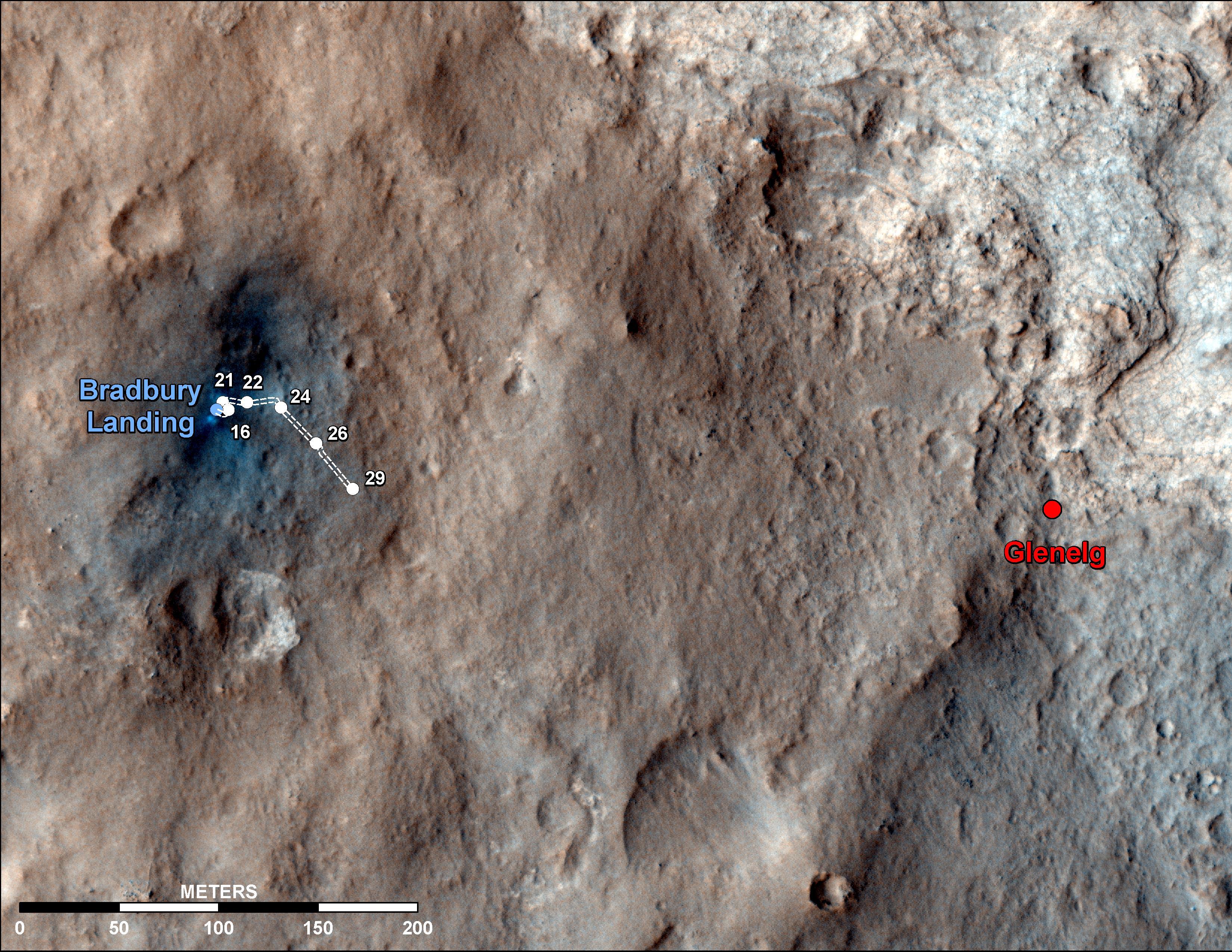
-
PIA16153:
-
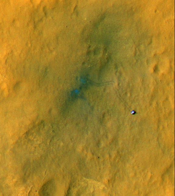
Curiosity Traverse Map Through Sol 43
Full Resolution:
TIFF
(25.26 MB)
JPEG
(1.57 MB)
|
|
|
2012-09-19 |
Mars
|
Mars Science Laboratory (MSL)
|
Mastcam
|
1090x545x1 |

|
-
PIA16152:
-
Comparing Phobos Views
Full Resolution:
TIFF
(594.9 kB)
JPEG
(16.81 kB)
|
|
|
2012-09-19 |
Mars
|
Mars Science Laboratory (MSL)
|
Mastcam
|
570x570x1 |
|
-
PIA16151:
-
Phobos in Transit
Full Resolution:
TIFF
(325.4 kB)
JPEG
(6.434 kB)
|
|
|
2012-09-19 |
Mars
|
Mars Science Laboratory (MSL)
|
Mastcam
|
3823x2333x3 |
|
-
PIA16150:
-
Dark Bands Run Through Light Layers
Full Resolution:
TIFF
(26.77 MB)
JPEG
(613.9 kB)
|
|
|
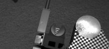
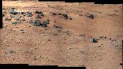
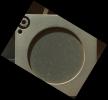
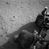
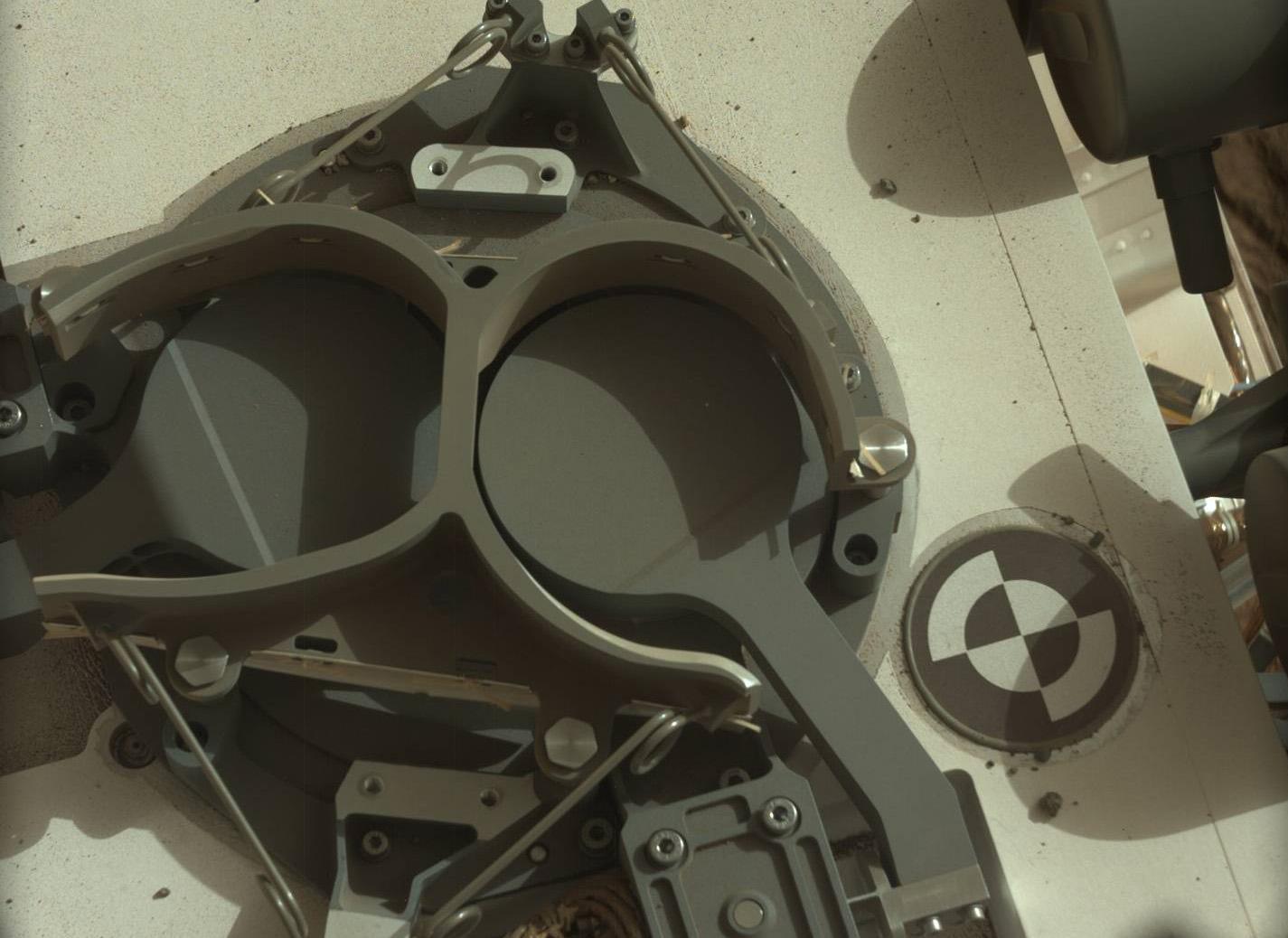
2012-09-13 |
Mars
|
Mars Science Laboratory (MSL)
|
MAHLI
|
1096x1200x3 |
|
-
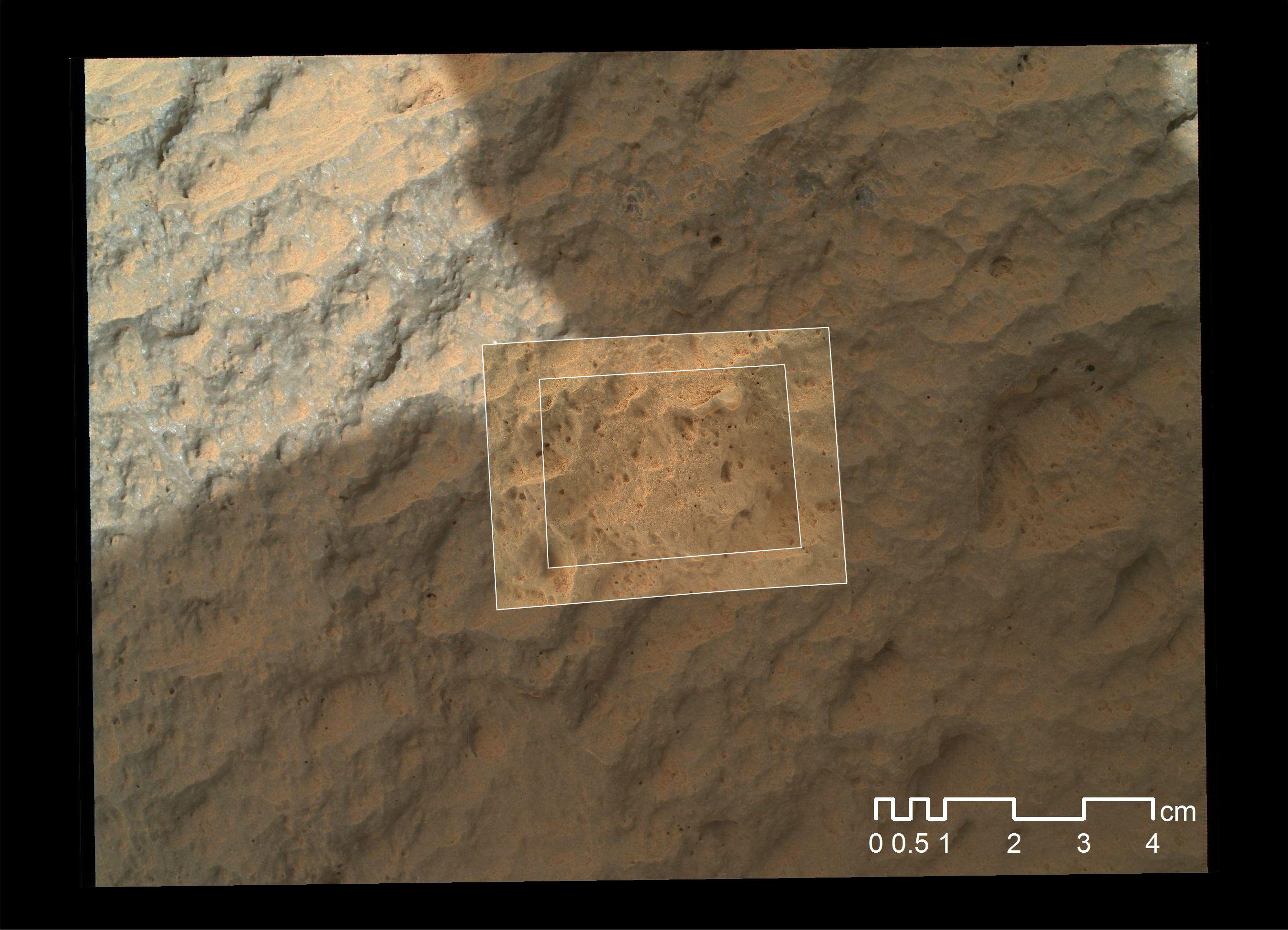
PIA15879:
-
3-D View of MAHLI Calibration Target
Full Resolution:
TIFF
(3.947 MB)
JPEG
(191.8 kB)
|
|
|
2012-09-12 |
Mars
|
Mars Science Laboratory (MSL)
|
Navcam (MSL)
|
1024x1024x1 |

|
-
PIA16164:
-
Opening and Closing SAM
Full Resolution:
TIFF
(1.05 MB)
JPEG
(101.4 kB)
|
|
|
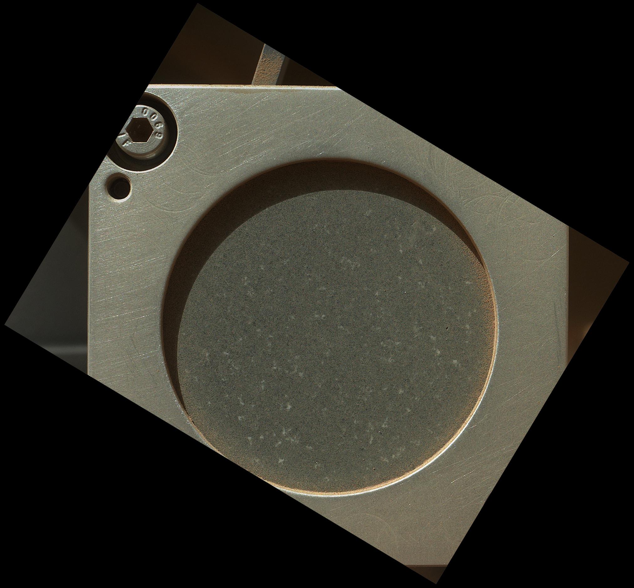
2012-09-12 |
Mars
|
Mars Science Laboratory (MSL)
|
CheMin
MAHLI
|
1581x1181x3 |
|
-
PIA16163:
-
Say 'Ahh' on Mars
Full Resolution:
TIFF
(5.604 MB)
JPEG
(242.9 kB)
|
|
|
2012-09-12 |
Mars
|
Mars Science Laboratory (MSL)
|
CheMin
MAHLI
|
1581x1181x3 |
|
-
PIA16162:
-
Getting Ready for Sampling on Mars
Full Resolution:
TIFF
(5.604 MB)
JPEG
(228.8 kB)
|
|
|
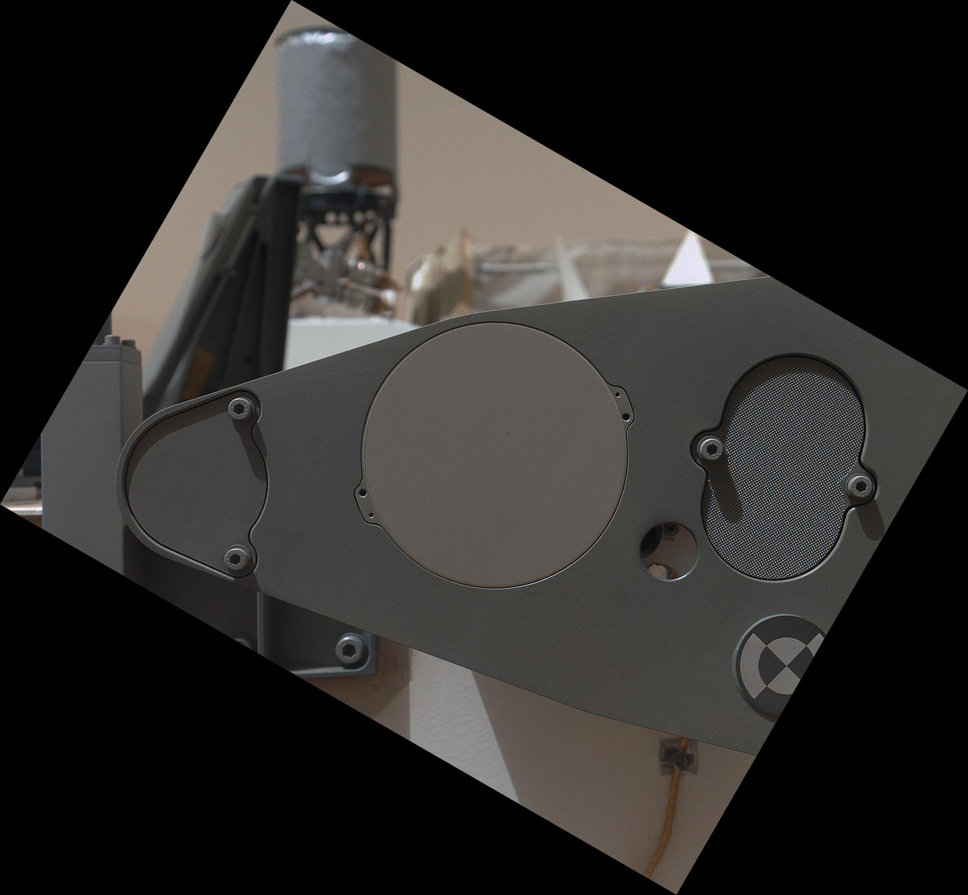
2012-09-12 |
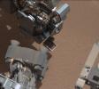
Mars
|
Mars Science Laboratory (MSL)
|
MAHLI
Mastcam
|
917x688x3 |
|
-
PIA16161:
-
Hello, MAHLI
Full Resolution:
TIFF
(1.894 MB)
JPEG
(70.73 kB)
|
|
|
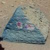
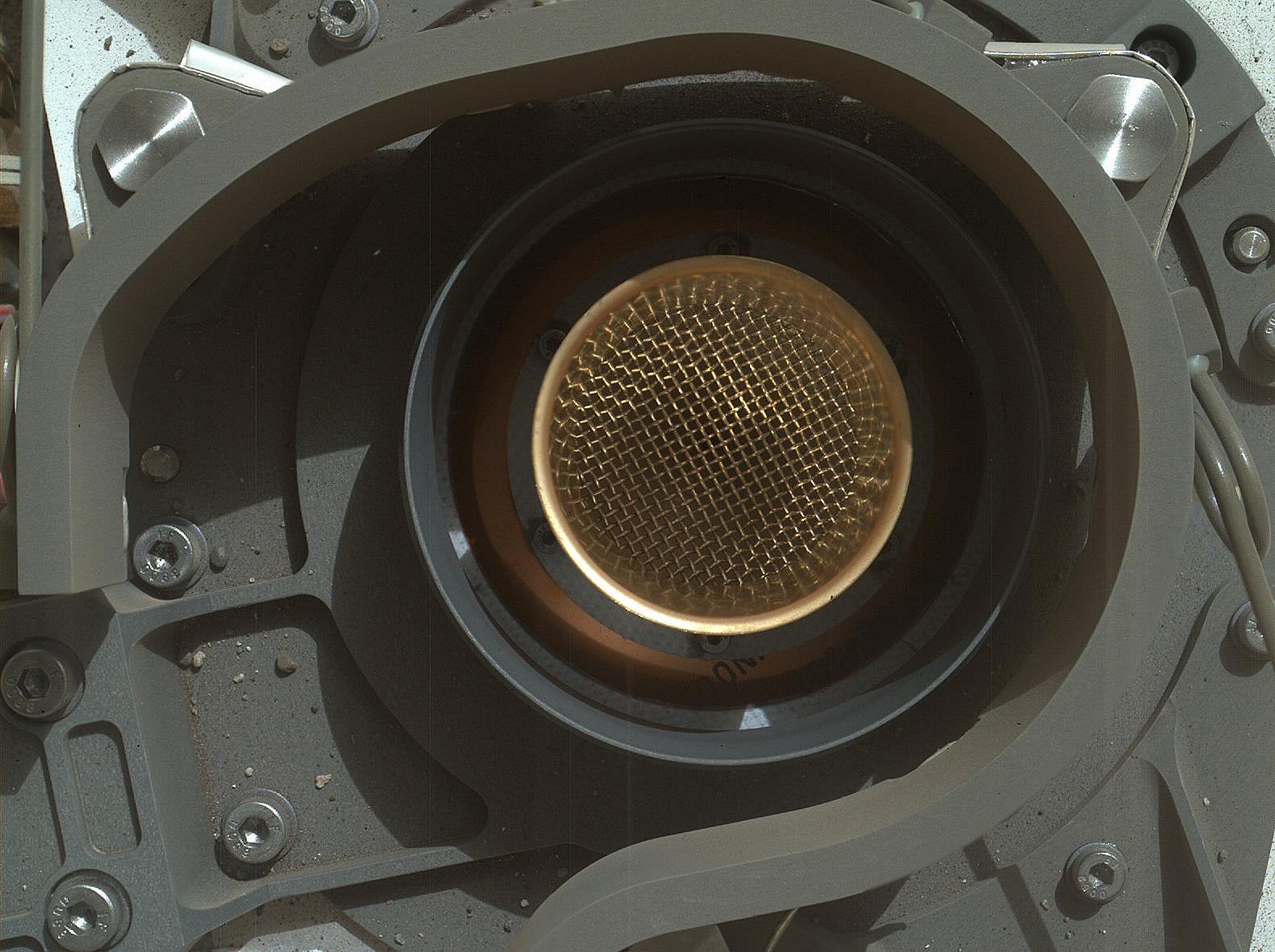
2012-09-12 |
Mars
|
Mars Science Laboratory (MSL)
|
Alpha Particle X-ray Spectrometer (MSL)
Mastcam
|
983x738x3 |

|
-
PIA16160:
-
Portrait of APXS on Mars
Full Resolution:
TIFF
(2.177 MB)
JPEG
(82.27 kB)
|
|
|
2012-09-10 |
Mars
|
Mars Science Laboratory (MSL)
|
MAHLI
|
5768x2624x3 |
|
-
PIA16137:
-
Panorama of Curiosity's Belly Check
Full Resolution:
TIFF
(45.43 MB)
JPEG
(934.1 kB)
|
|
|
2012-09-10 |
Mars
|
Mars Science Laboratory (MSL)
|
MAHLI
|
2023x1876x3 |
|
-
PIA16136:
-
A Piece of New Mexico on Mars
Full Resolution:
TIFF
(11.39 MB)
JPEG
(408.7 kB)
|
|
|
2012-09-10 |
Mars
|
Mars Science Laboratory (MSL)
|
MAHLI
|
1988x1839x3 |
|
-
PIA16135:
-
Sealed Organic Check Material on Curiosity
Full Resolution:
TIFF
(10.97 MB)
JPEG
(235.8 kB)
|
|
|
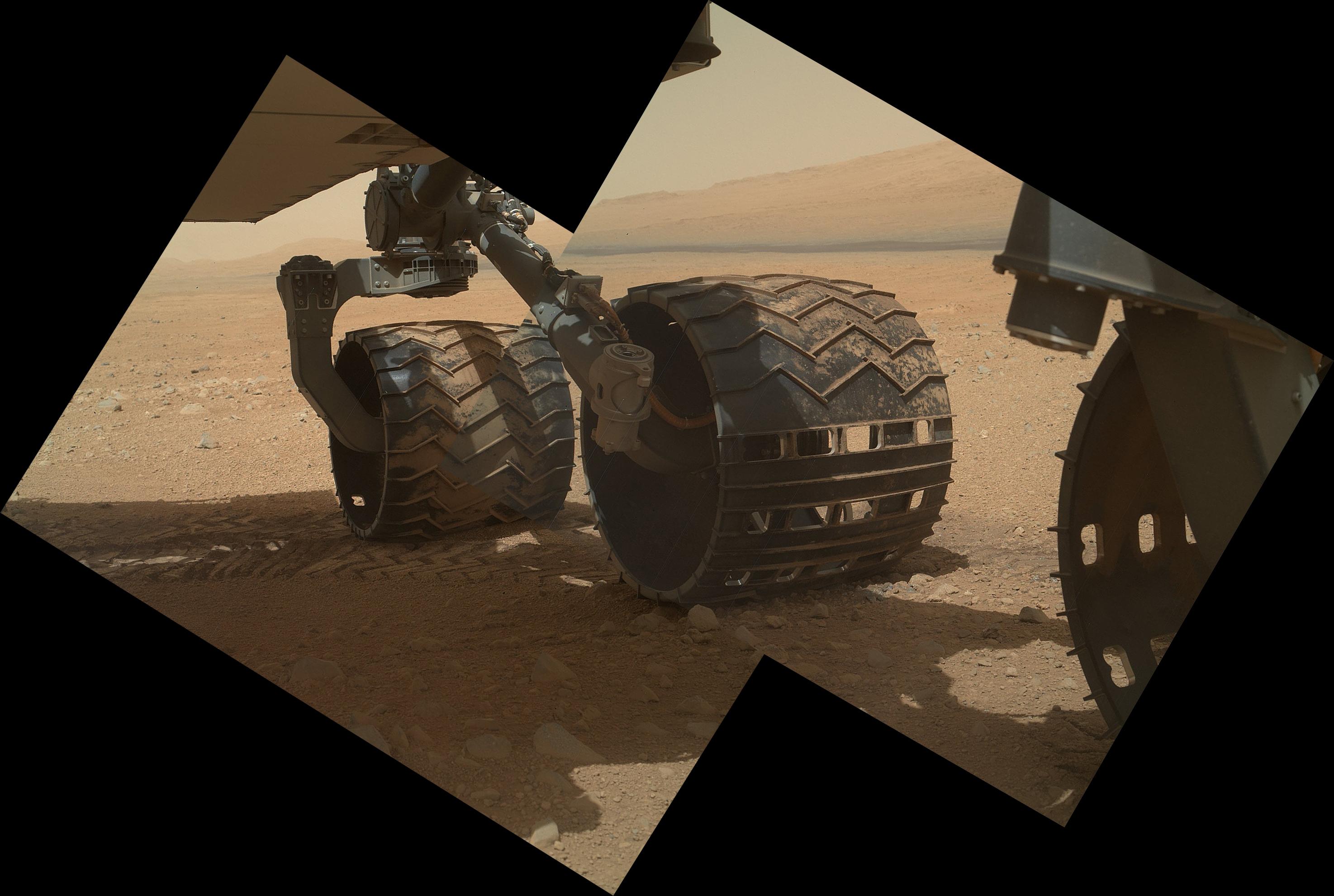
2012-09-10 |
Mars
|
Mars Science Laboratory (MSL)
|
MAHLI
|
2949x1981x3 |
|
-
PIA16134:
-
Wheels and a Destination
Full Resolution:
TIFF
(17.53 MB)
JPEG
(453.3 kB)
|
|
|
2012-09-10 |
Mars
|
Mars Science Laboratory (MSL)
|
Hazcam (MSL)
MAHLI
|
-1x-1x3 |
|
-
PIA16133:
-
Belly Check for Curiosity
Full Resolution:
TIFF
(10.76 MB)
JPEG
(237.4 kB)
|
|
|
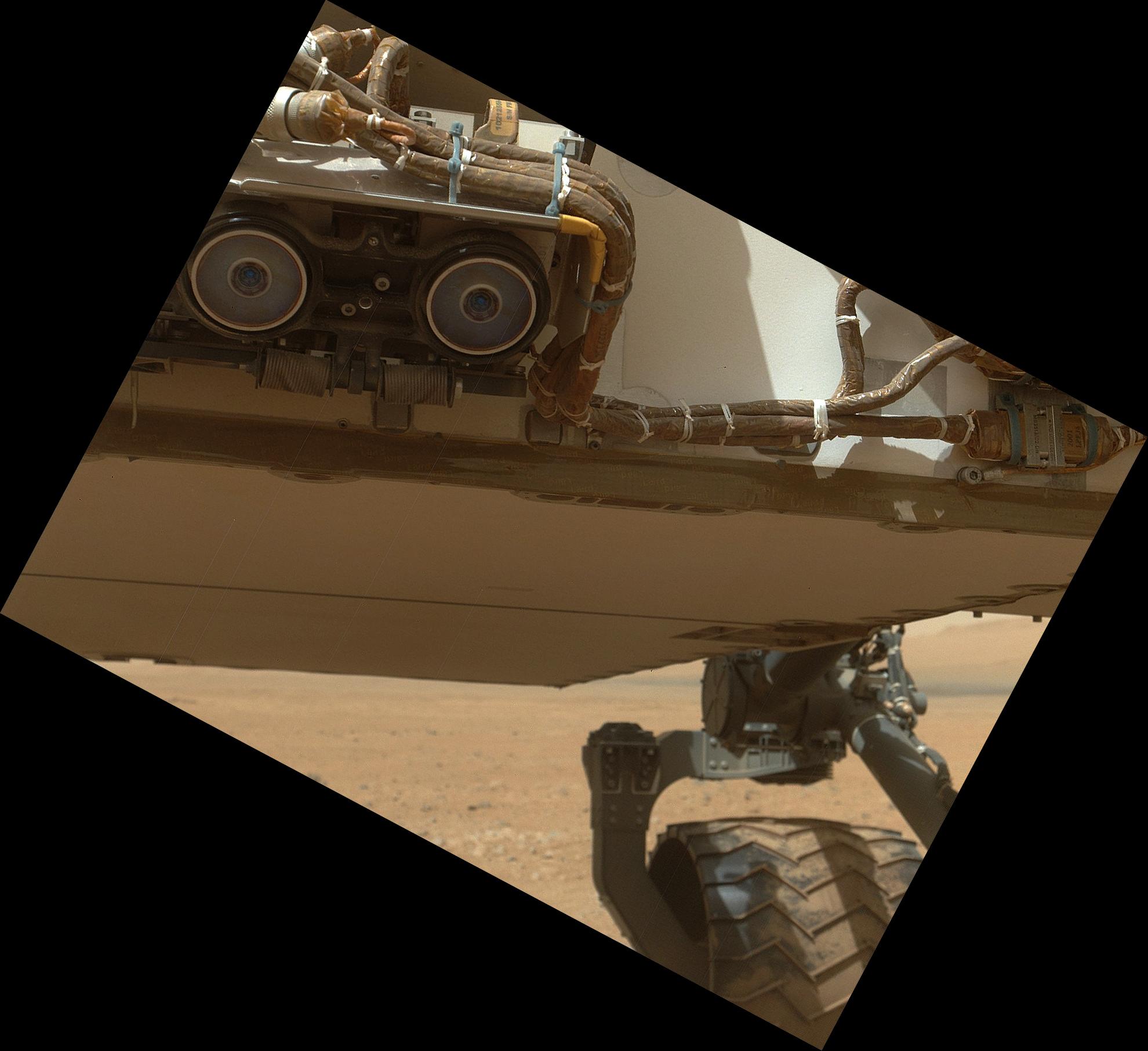
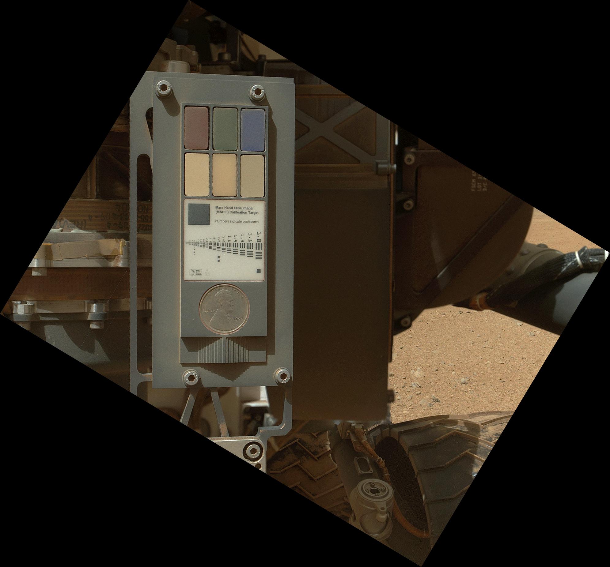
2012-09-10 |
Mars
|
Mars Science Laboratory (MSL)
|
MAHLI
|
1991x1852x3 |
|
-
PIA16132:
-
Calibration Target for Curiosity's Arm Camera
Full Resolution:
TIFF
(11.07 MB)
JPEG
(266.1 kB)
|
|
|
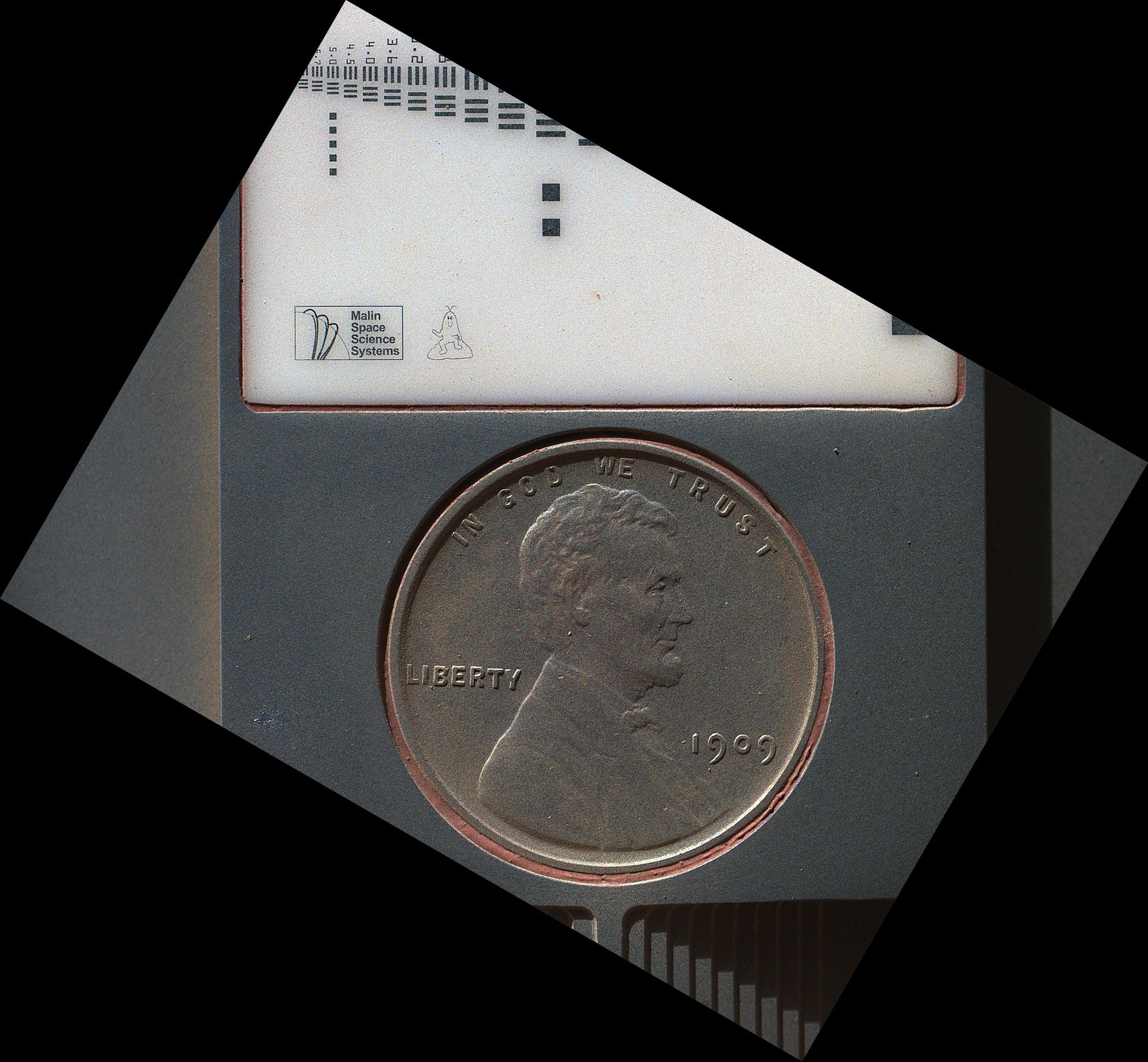
2012-09-10 |
Mars
|
Mars Science Laboratory (MSL)
|
MAHLI
|
1987x1839x3 |
|
-
PIA16131:
-
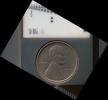
Lincoln Penny on Mars in Camera's Calibration Target
Full Resolution:
TIFF
(10.97 MB)
JPEG
(430.3 kB)
|
|
|
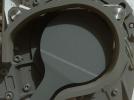
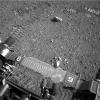
2012-09-09 |
Mars
|
Mars Science Laboratory (MSL)
|
MAHLI
|
1605x1193x3 |
|
-
PIA16130:
-
First Image From Curiosity's Arm Camera With Dust Cover Open
Full Resolution:
TIFF
(5.746 MB)
JPEG
(624.3 kB)
|
|
|
2012-09-09 |
Mars
|
Mars Science Laboratory (MSL)
|
MAHLI
|
573x144x3 |
|
-
PIA16129:
Martian Ground Seen by Arm Camera With and Without Dust Cover (Thumbnails)
Full Resolution:
TIFF
(247.8 kB)
JPEG
(13.73 kB)
|
|
|
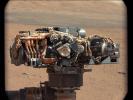
2012-09-08 |
Mars
|
Mars Science Laboratory (MSL)
|
MAHLI
|
2025x1877x3 |
|
-
PIA16149:
-
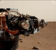
Rover Takes Self Portrait
Full Resolution:
TIFF
(11.41 MB)
JPEG
(268.4 kB)
|
|
|
2012-09-06 |
Mars
|
Mars Science Laboratory (MSL)
|
HiRISE
|
3300x2550x3 |
|
-
PIA16148:
-
Curiosity Traverse Map Through Sol 29
Full Resolution:
TIFF
(25.26 MB)
JPEG
(1.558 MB)
|
|
|
2012-09-06 |
Mars
|
Mars Science Laboratory (MSL)
|
|
1427x578x3 |
|
-
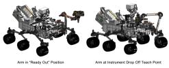
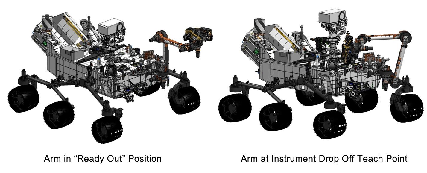
PIA16147:
-
Flexing Curiosity's Arm
Full Resolution:
TIFF
(2.476 MB)
JPEG
(116.9 kB)
|
|
|
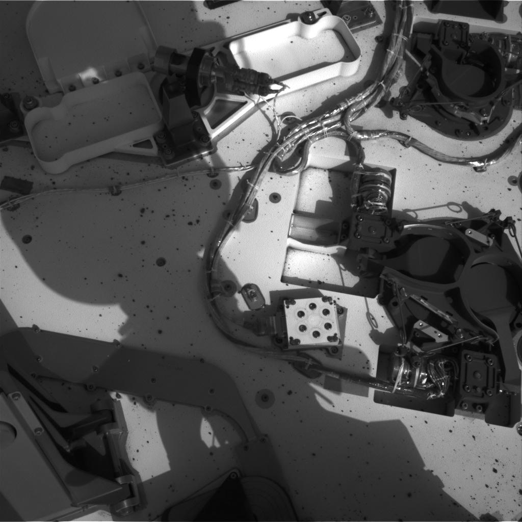
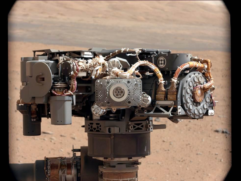
2012-09-06 |
Mars
|
Mars Science Laboratory (MSL)
|
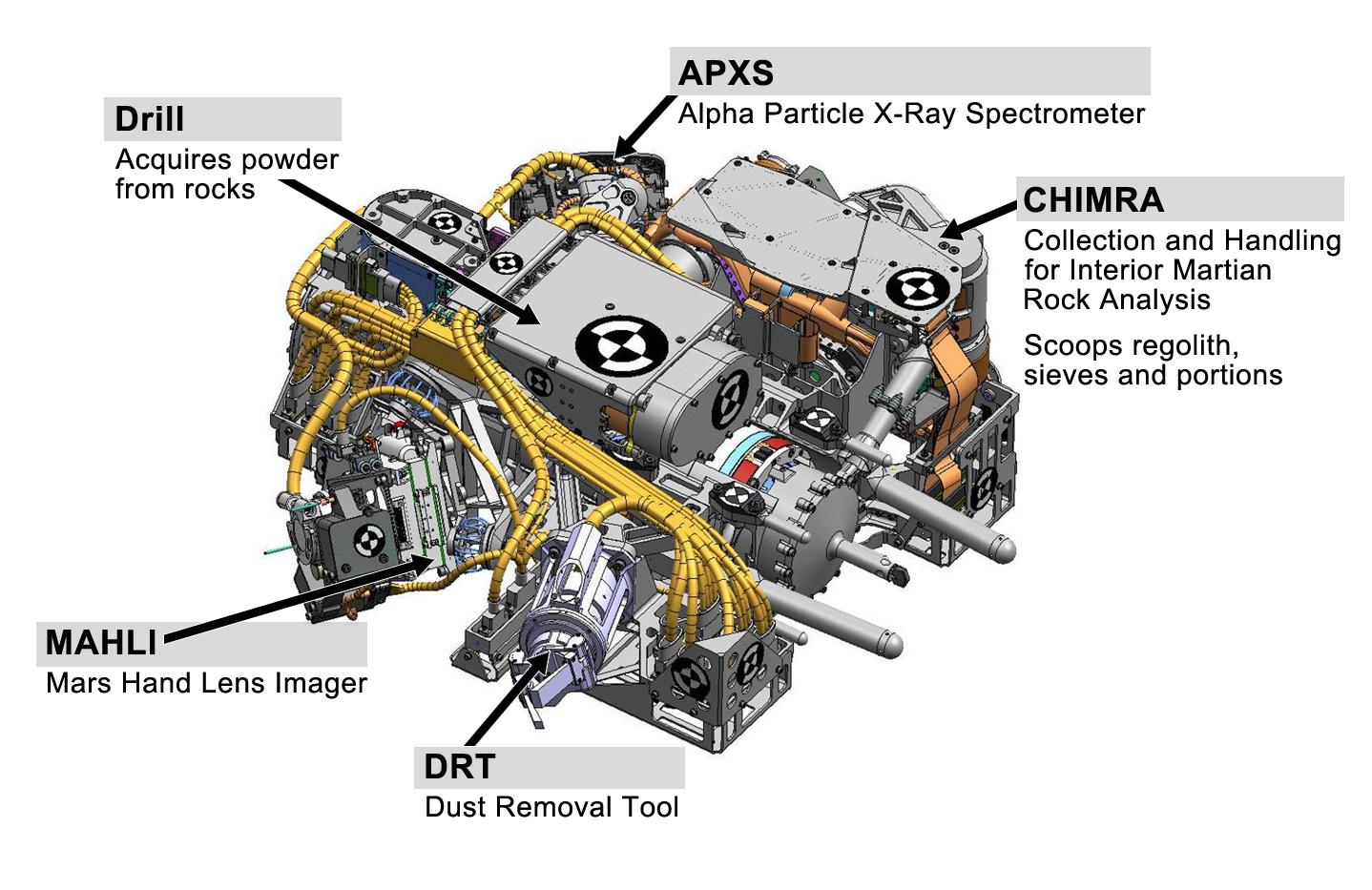
|
1438x933x3 |
|
-
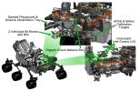
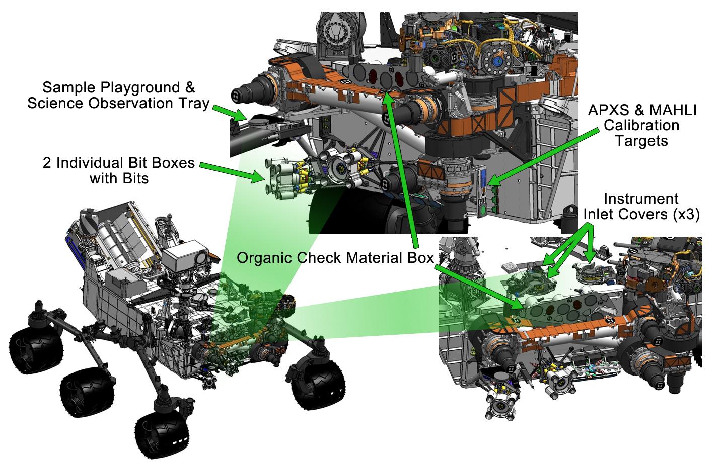
PIA16146:
-
Curiosity's Work Bench
Full Resolution:
TIFF
(4.027 MB)
JPEG
(223.4 kB)
|
|
|
2012-09-06 |
Mars
|
Mars Science Laboratory (MSL)
|
|
1438x933x3 |

|
-
PIA16145:
-
Tools at Curiosity's 'Fingertips'
Full Resolution:
TIFF
(4.027 MB)
JPEG
(192.1 kB)
|
|
|
2012-09-06 |
Mars
|
Mars Science Laboratory (MSL)
|
|
1438x933x3 |
|
-
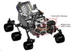
PIA16144:
-
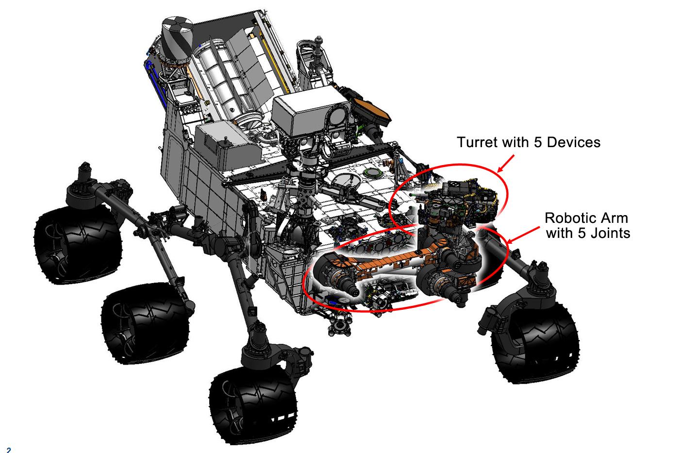
Curiosity's Robotic Arm
Full Resolution:
TIFF
(4.027 MB)
JPEG
(169 kB)
|
|
|
2012-09-06 |
Mars
|
Mars Science Laboratory (MSL)
|
HiRISE
|
2055x1437x3 |
|
-
PIA16143:
-
Dissecting the Scene of Sky Crane Crash
Full Resolution:
TIFF
(8.863 MB)
JPEG
(454.9 kB)
|
|
|
2012-09-06 |
Mars
|
Mars Science Laboratory (MSL)
|
HiRISE
|
579x538x3 |
|
-
PIA16142:
-
Relics of Rover's Landing
Full Resolution:
TIFF
(935 kB)
JPEG
(34.81 kB)
|
|
|
2012-09-06 |
Mars
|
Mars Science Laboratory (MSL)
|
HiRISE
|
574x643x3 |
|
-
PIA16141:
-
A Rover's Journey Begins
Full Resolution:
TIFF
(1.108 MB)
JPEG
(51.17 kB)
|
|
|
2012-09-06 |
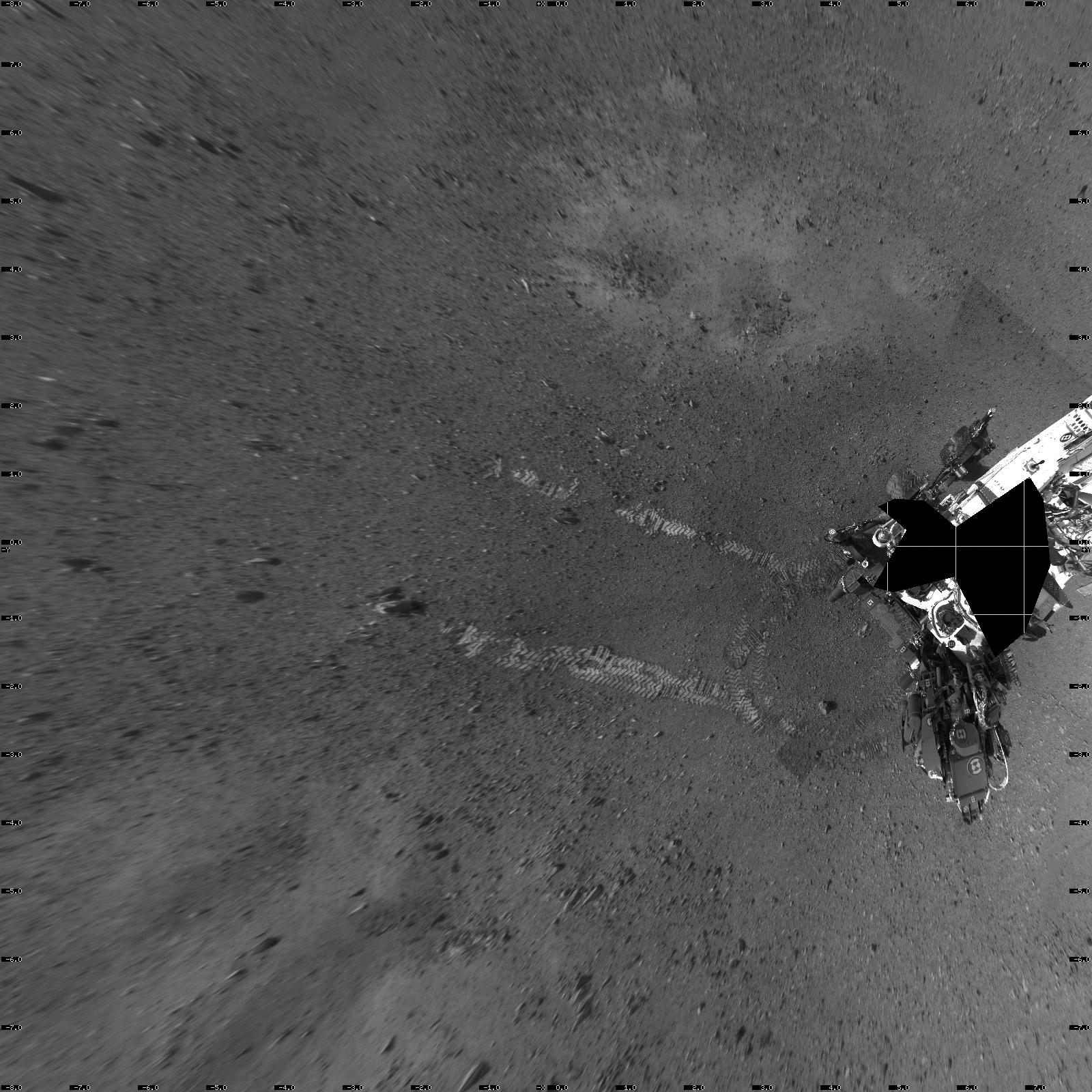
Mars
|
Mars Science Laboratory (MSL)
|
MAHLI
Mastcam
|
1347x1200x3 |
|
-
PIA15699:
-
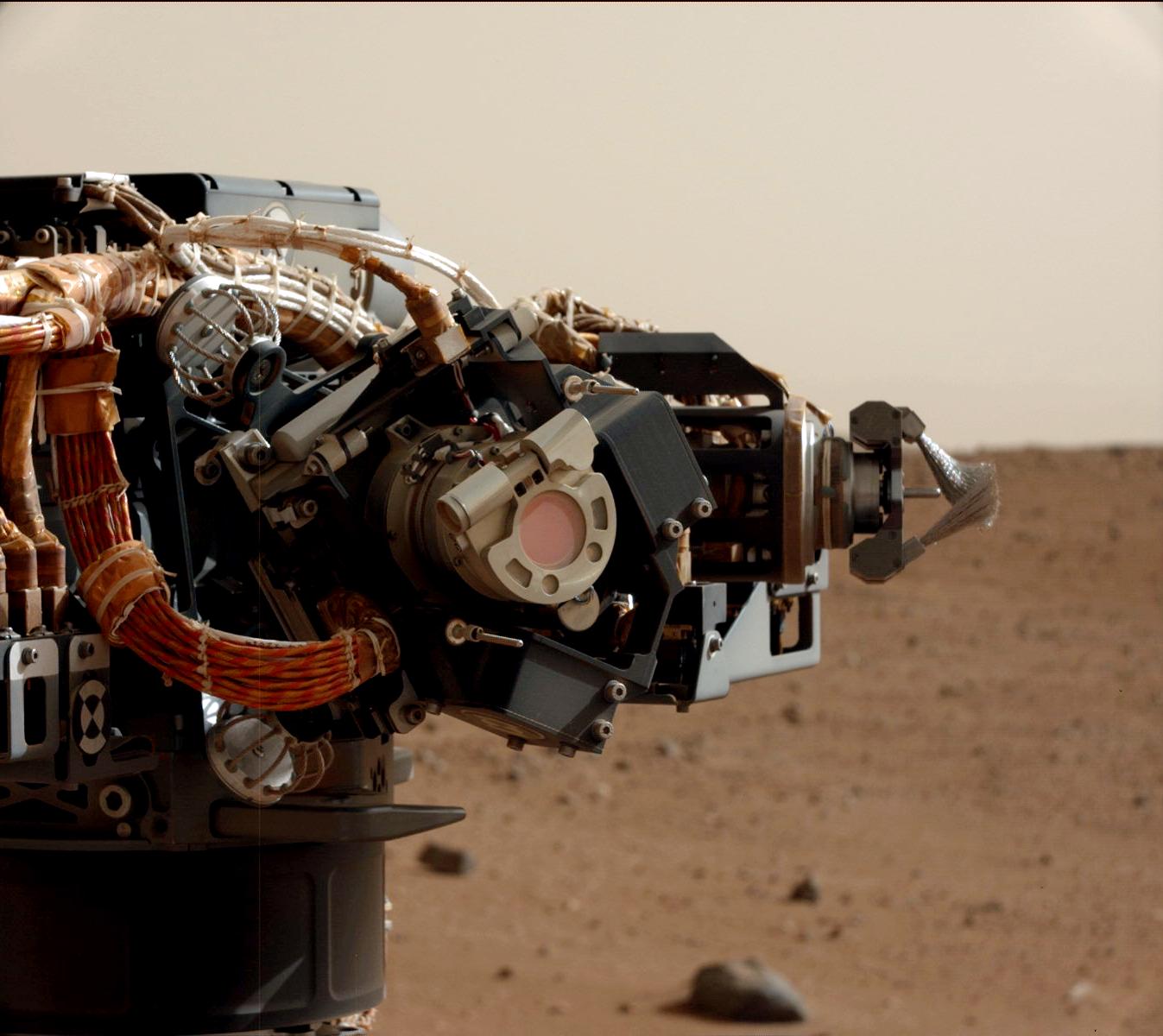
Camera on Curiosity's Arm as Seen by Camera on Mast
Full Resolution:
TIFF
(4.851 MB)
JPEG
(136.8 kB)
|
|
|
2012-09-06 |
Mars
|
Mars Science Laboratory (MSL)
|
Navcam (MSL)
|
7703x1749x1 |

|
-
PIA15698:
Curiosity's Location During Arm Checkouts
Full Resolution:
TIFF
(13.49 MB)
JPEG
(1.578 MB)
|
|
|
2012-09-04 |
Mars
|
Mars Science Laboratory (MSL)
|
|
7824x3337x3 |
|
-
PIA16140:
-
3-D View from Bradbury Landing Site
Full Resolution:
TIFF
(78.35 MB)
JPEG
(1.916 MB)
|
|
|
2012-08-31 |
Mars
|
Mars Science Laboratory (MSL)
|
Hazcam (MSL)
|
7703x977x1 |

|
-
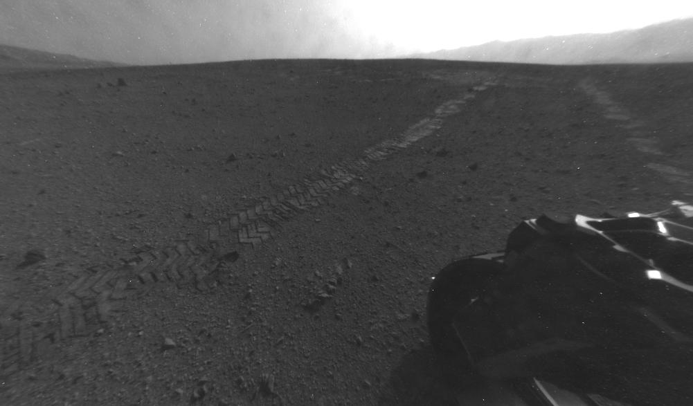
PIA15697:
Looking Back at Tracks from Sol 24 Drive
Full Resolution:
TIFF
(7.534 MB)
JPEG
(1.005 MB)
|
|
|
2012-08-31 |
Mars
|
Mars Reconnaissance Orbiter (MRO)
Mars Science Laboratory (MSL)
|
HiRISE
|
2800x1800x1 |
|
-
PIA15696:
-
Orbiter View of Curiosity From Nearly Straight Overhead
Full Resolution:
TIFF
(5.047 MB)
JPEG
(578.1 kB)
|
|
|
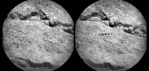
2012-08-30 |
Mars
|
Mars Science Laboratory (MSL)
|
ChemCam
|
1512x720x1 |
|
-
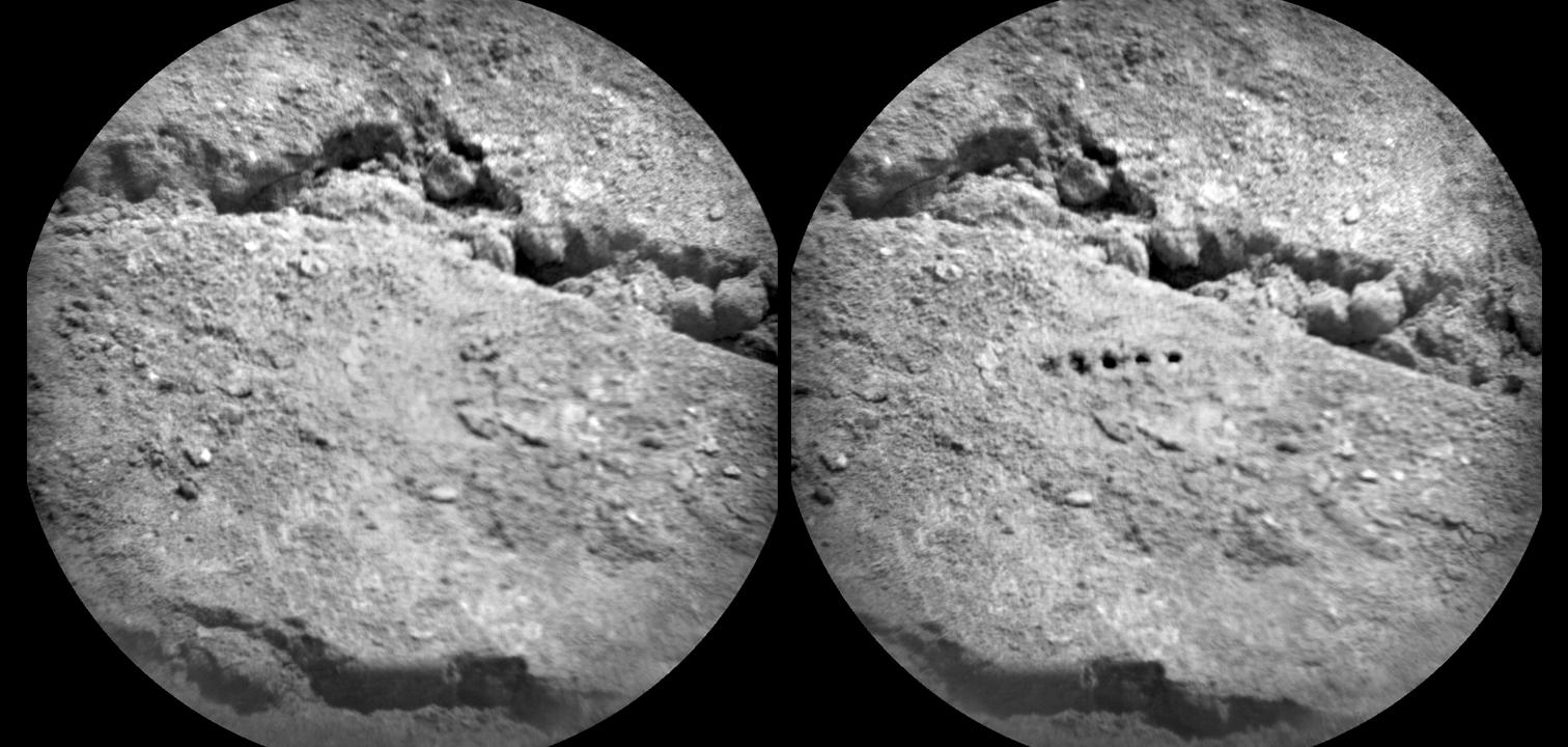
PIA15695:
-
Marks of Laser Exam on Martian Soil
Full Resolution:
TIFF
(1.09 MB)
JPEG
(156 kB)
|
|
|
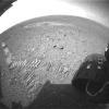
2012-08-29 |
Mars
|
Mars Science Laboratory (MSL)
|
Hazcam (MSL)
|
1001x587x1 |
|
-
PIA15694:
-
Tracks from Eastbound Drive on Curiosity's Sol 22
Full Resolution:
TIFF
(588.4 kB)
JPEG
(49.86 kB)
|
|
|
2012-08-29 |
Mars
|
Mars Science Laboratory (MSL)
|
Navcam (MSL)
|
1024x1024x1 |
|
-
PIA15693:
-
Martian Soil on Curiosity's Wheels After Sol 22 Drive
Full Resolution:
TIFF
(1.05 MB)
JPEG
(247.4 kB)
|
|
|
2012-08-29 |
Mars
|
Mars Science Laboratory (MSL)
|
|
1024x1024x1 |
|
-
PIA16112:
-
Curiosity Tracks Its Tracks
Full Resolution:
TIFF
(1.05 MB)
JPEG
(174.8 kB)
|
|
|
2012-08-29 |
Mars
|
Mars Science Laboratory (MSL)
|
|
1024x1024x1 |
|
-
PIA16111:
-
Reading the Rover's Tracks
Full Resolution:
TIFF
(1.05 MB)
JPEG
(274.3 kB)
|
|
|
2012-08-29 |
Mars
|
Mars Science Laboratory (MSL)
|
|
1024x1024x1 |
|
-
PIA16093:
-
Curiosity Leaves Its Mark
Full Resolution:
TIFF
(1.05 MB)
JPEG
(245.6 kB)
|
|
|
2012-08-27 |
Mars
|
Mars Science Laboratory (MSL)
|
|
4024x1282x1 |

|
-
PIA16110:
-
From Infinity and Beyond
Full Resolution:
TIFF
(5.164 MB)
JPEG
(628.4 kB)
|
|
|
2012-08-27 |
Mars
|
Mars Science Laboratory (MSL)
|
|
1024x1024x1 |
|
-
PIA16109:
-
Big Wheels Keep on Rollin'
Full Resolution:
TIFF
(1.05 MB)
JPEG
(133.4 kB)
|
|
|
2012-08-27 |
Mars
|
Mars Science Laboratory (MSL)
|
|
1024x1024x1 |
|
-
PIA16108:
-
Evidence of Curiosity's Second Drive
Full Resolution:
TIFF
(1.05 MB)
JPEG
(89.13 kB)
|
|
|
2012-08-27 |
Mars
|
Mars Science Laboratory (MSL)
|
Mastcam
|
1463x978x3 |
|
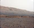
-
PIA16105:
-
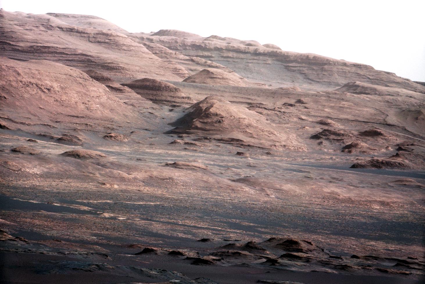
Layers at the Base of Mount Sharp
Full Resolution:
TIFF
(4.294 MB)
JPEG
(222.6 kB)
|
|
|
2012-08-27 |
Mars
|
Mars Science Laboratory (MSL)
|
Mastcam
|
1463x1928x3 |
|
-
PIA16104:
-
Focusing the 100-millimeter Mastcam
Full Resolution:
TIFF
(8.465 MB)
JPEG
(523.5 kB)
|
|
|
2012-08-27 |
Mars
|
Mars Science Laboratory (MSL)
|
Mastcam
|
1375x1148x3 |
|
-
PIA16103:
-
Focusing the 34-millimeter Mastcam
Full Resolution:
TIFF
(4.738 MB)
JPEG
(276.7 kB)
|
|
|
2012-08-27 |
Mars
|
Mars Science Laboratory (MSL)
|
Mastcam
|
14494x3560x3 |
|
-
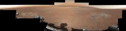
PIA16101:
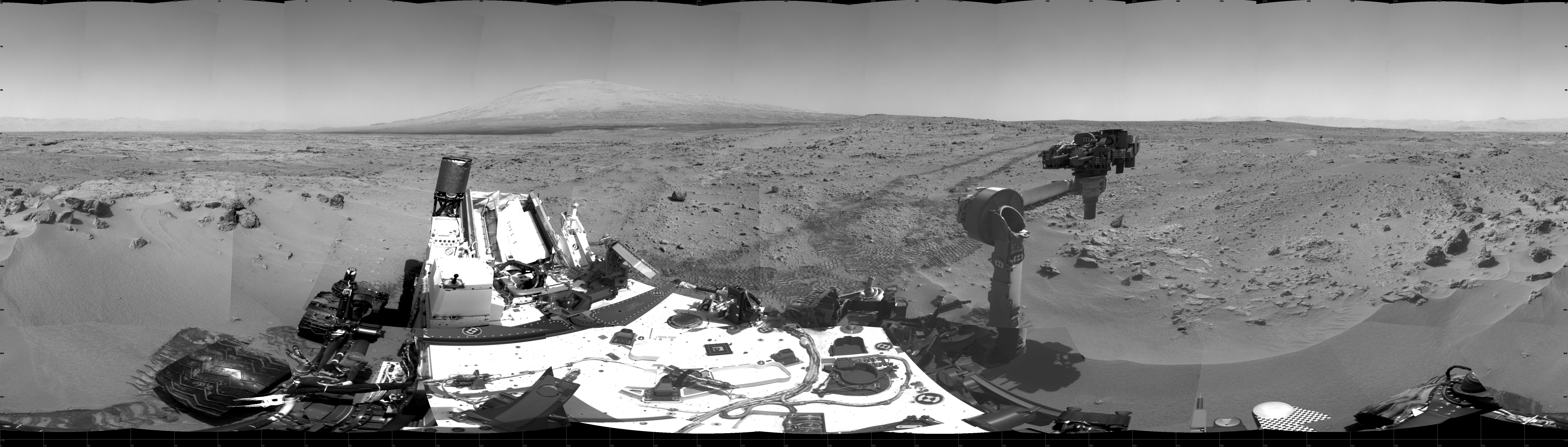
Landing Site Panorama, with the Heights of Mount Sharp
Full Resolution:
TIFF
(154.8 MB)
JPEG
(6.485 MB)
|
|
|
2012-08-27 |
Mars
|
Mars Science Laboratory (MSL)
|
Mastcam
|
3313x1660x3 |
|
-
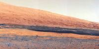
PIA16099:
-
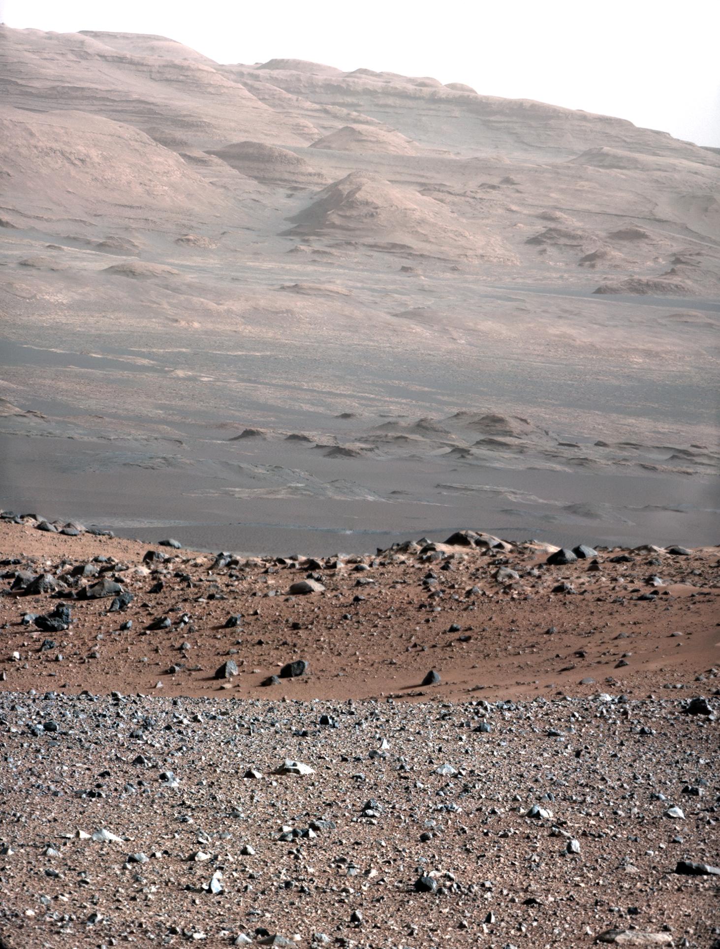
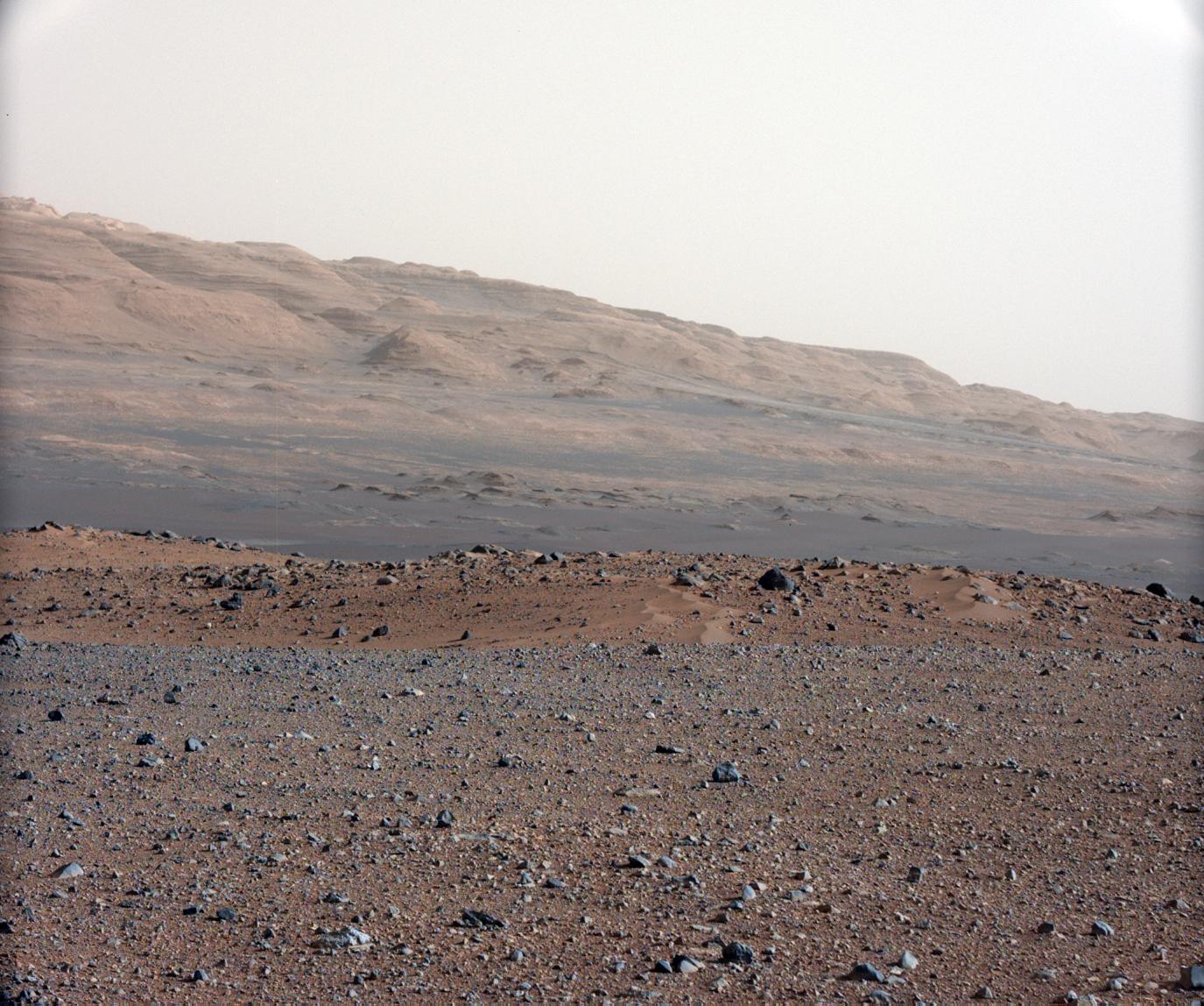
Getting to Know Mount Sharp
Full Resolution:
TIFF
(16.51 MB)
JPEG
(1.314 MB)
|
|
|
2012-08-22 |
Mars
|
Mars Science Laboratory (MSL)
|
Navcam (MSL)
Robotic Arm (MSL)
|
2089x2074x1 |
|
-
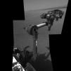
PIA16096:
-
Curiosity's First Arm Extension, Full Resolution
Full Resolution:
TIFF
(4.338 MB)
JPEG
(262 kB)
|
|
|
2012-08-22 |
Mars
|
Mars Science Laboratory (MSL)
|
|
1024x1024x1 |
|
-
PIA16095:
-
Making Tracks on Mars
Full Resolution:
TIFF
(1.05 MB)
JPEG
(131.4 kB)
|
|
|
2012-08-22 |
Mars
|
Mars Science Laboratory (MSL)
|
|
1600x1600x1 |

|
-
PIA16094:
-
Rover Takes Its First 'Steps'
Full Resolution:
TIFF
(2.563 MB)
JPEG
(378.2 kB)
|
 Planetary Data System


