Your search criteria found
12760
images
Target is Mars (and available satellites)
Go to PIAxxxxx:
Refine this list of images by:
Target:
Deimos
Mars
Phobos
Mission:
2001 Mars Odyssey
Antarctic Meteorite Location and Mapping Project (AMLAMP)
Dawn
ExoMars
Hubble Space Telescope
InSight
MAVEN
Mariner Mars 1964 (Mariner 4)
Mariner Mars 1969 (Mariner 7)
Mariner Mars 1971 (Mariner 9)
Mars 2020
Mars 2020 Rover
Mars Atmosphere and Volatile Evolution MissioN (MAVEN)
Mars Climate Orbiter
Mars Cube One (MarCO)
Mars Exploration Rover (MER)
Mars Express (MEX)
Mars Global Surveyor (MGS)
Mars Helicopter
Mars Pathfinder (MPF)
Mars Reconnaissance Orbiter (MRO)
Mars Sample Return
Mars Sample Return (MSR)
Mars Science Laboratory (MSL)
Phoenix
Rosetta
Viking
Spacecraft:
2001 Mars Odyssey
Curiosity
Dawn
InSight Mars Lander
Ingenuity
MAVEN
MarCO-B
Mariner 4
Mariner 7
Mariner 9
Mars Climate Orbiter
Mars Express (MEX)
Mars Express (MEX) Orbiter
Mars Global Surveyor Orbiter
Mars Pathfinder Lander
Mars Pathfinder Rover
Mars Reconnaissance Orbiter (MRO)
Mars Sample Return
Mars Science Laboratory (MSL)
NASA's Mars Pathfinder Lander
Opportunity
Perseverance
Philae Lander
Phoenix Lander
Phoenix Mars Lander
Spirit
Viking Lander 1
Viking Lander 2
Viking Orbiter 1
Viking Orbiter 2
Instrument:
Alpha Particle X-ray Spectrometer
Alpha Particle X-ray Spectrometer (MSL)
Atmospheric Structure / Meteorology Instrument
CHIMRA
Camera 1
Camera 2
Chemistry & Mineralogy (CheMin)
Chemistry and Camera (ChemCam)
Comet Infrared and Visible Analyser (CIVA
Compact Reconnaissance Imaging Spectrometer for Mars (CRISM)
Context Camera (CTX)
Deep Space Network
Descent Image Motion Estimation System (DIMES)
Dynamic Albedo of Neutrons
Dynamic Albedo of Neutrons (DAN)
Gamma Ray Spectrometer - Neutron Spectrometer
Gamma Ray Spectrometer Suite
Hazard Avoidance Camera
Hazard Avoidance Camera (M2020)
Hazard Avoidance Camera (MSL)
Heat and Physical Properties Package (HP3)
High Resolution Imaging Science Experiment (HiRISE)
High Resolution Instrument (HRI)
High Resolution Stereo Camera
Imager for Mars Pathfinder
Imaging Ultraviolet Spectrograph
Imaging Ultraviolet Spectrograph (IUVS)
Instrument Context Camera (ICC)
Instrument Deployment Camera (IDC)
Lander Vision System Camera (LCAM)
Magnetometer
Mars Advanced Radar for Subsurface and Ionosphere Sounding (MARSIS)
Mars Advanced Radar for Subsurface and Ionospheric Sounding (MARSIS)
Mars Climate Sounder (MCS)
Mars Color Imager (MARCI)
Mars Descent Imager
Mars Environmental Dynamics Analyzer (MEDA)
Mars Hand Lens Imager (MAHLI)
Mars Horizon Sensor Assembly
Mars Orbiter Camera (MOC)
Mars Orbiter Laser Altimeter
Mars Radiation Experiment
Mastcam
Mastcam-Z
Microscopic Imager
Microscopy Electrochemistry and Conductivity Analyzer (MECA)
Miniature Thermal Emission Spectrometer
Moessbauer Spectrometer
Navigation Camera
Navigation Camera (M2020)
Navigation Camera (MSL)
Neutral Gas and Ion Mass Spectrometer
Neutron Spectrometer
Optical Microscope
Optical Navigation Camera
Panoramic Camera
Planetary Instrument for X-ray Lithochemistry (PIXL)
Radar System
Radiation Assessment Detector (RAD)
Radio Science Subsystem
Robotic Arm
Robotic Arm (MSL)
Robotic Arm Camera (RAC)
Rock Abrasion Tool (RAT)
Rover Cameras
Rover Environmental Monitoring Station (REMS)
Sample Analysis at Mars (SAM)
Scanning Habitable Environments with Raman & Luminescence for Organics and Chemicals (SHERLOC)
Seismic Experiment for Interior Structure (SEIS)
Shallow Subsurface Radar (SHARAD)
Stereo Imager (SSI)
SuperCam
Surface Stereo Imager (SSI)
Thermal Emission Imaging System
Thermal Emission Spectrometer
Thermal and Electrical Conductivity Probe
Thermal and Evolved Gas Analyzer
Trace Gas Orbiter
Visual Imaging Subsystem
Visual Imaging Subsystem - Camera A
Visual Imaging Subsystem - Camera B
Wide Field Planetary Camera 2
Click on an image for detailed information
Click on a column heading to sort in ascending or descending order
My
List
Addition Date
Target
Mission
Instrument
Size
2016-09-09
Mars
2001 Mars Odyssey
THEMIS
728x1556x3
PIA20984:
Syrtis Major Planum - False Color
Full Resolution:
TIFF
(2.34 MB)
JPEG
(130 kB)
2016-09-09
Mars
Mars Science Laboratory (MSL)
Mastcam
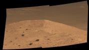
1344x1200x3
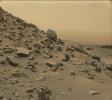
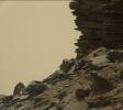
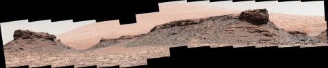
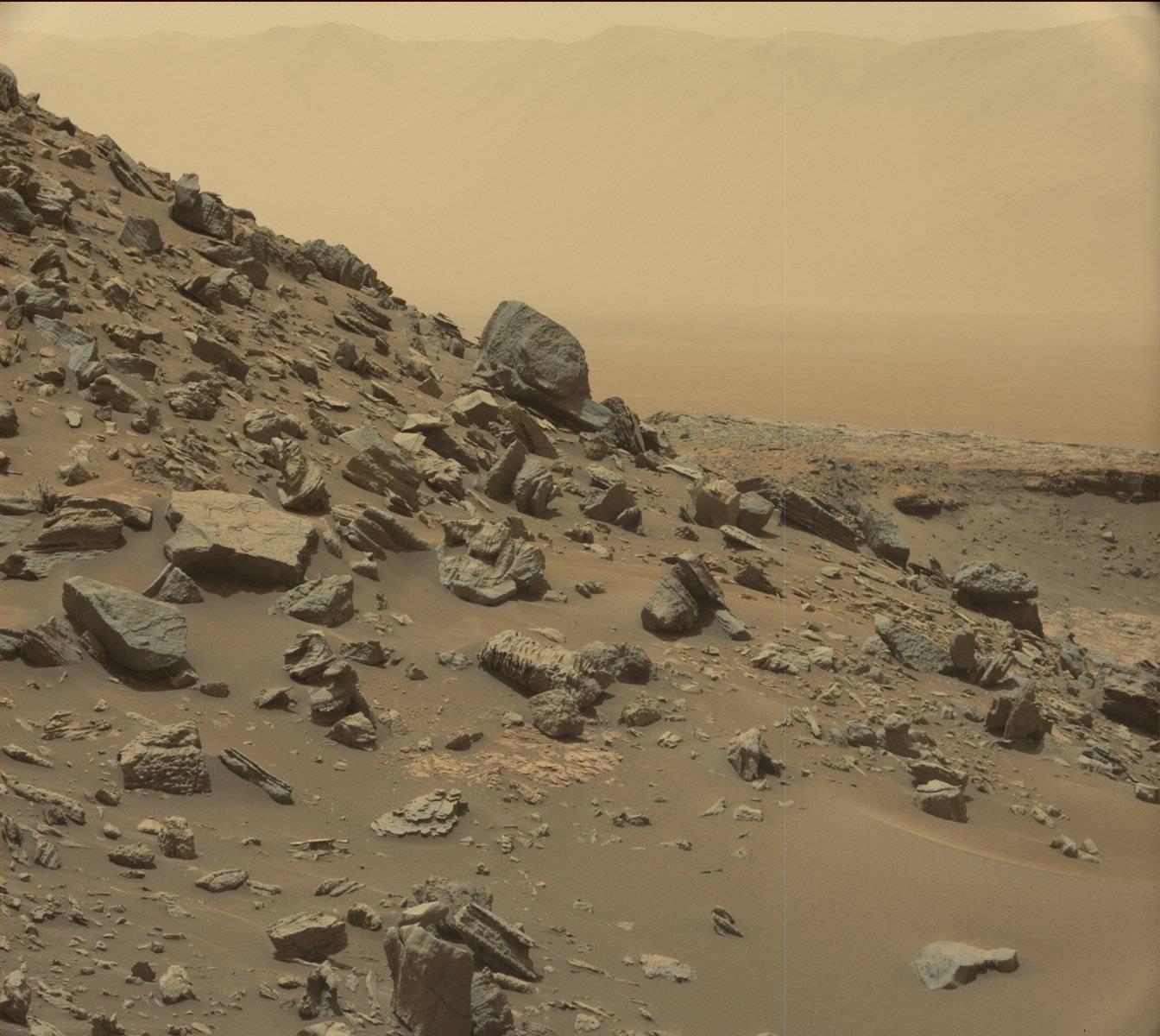
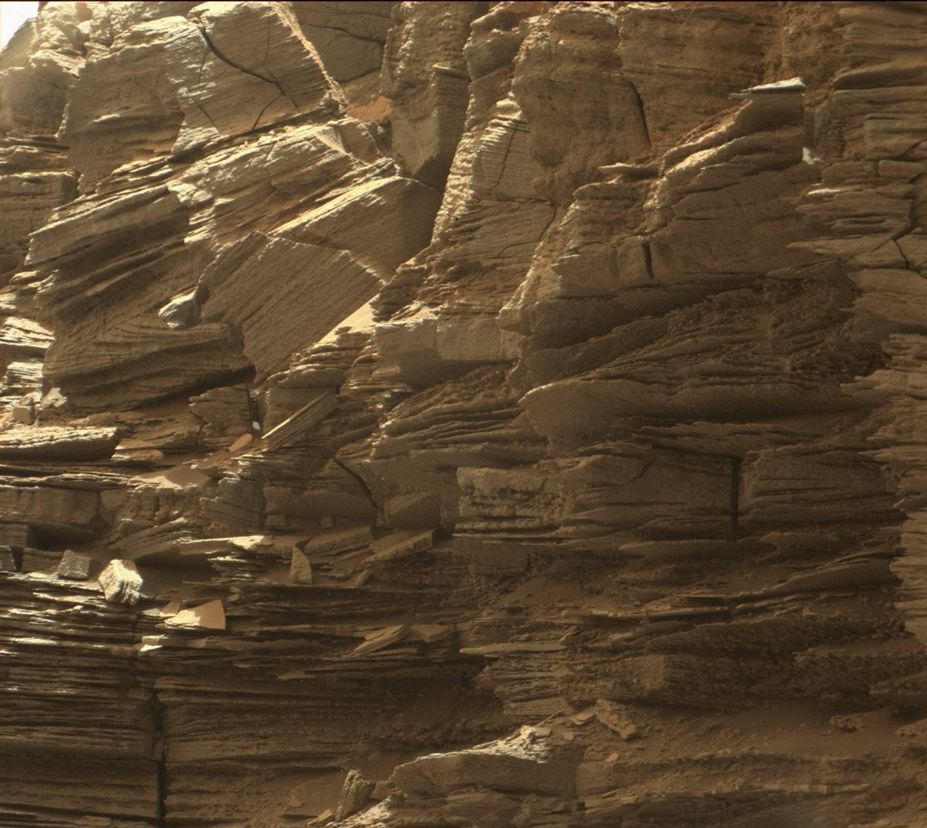
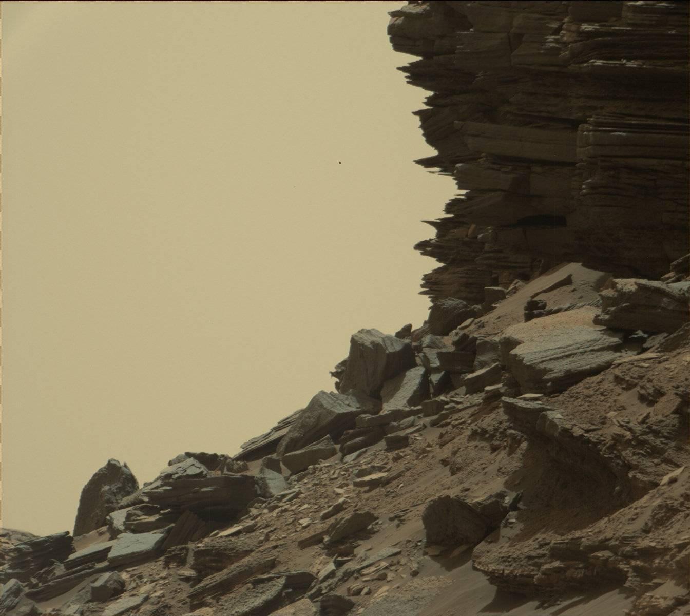
PIA21041:
Farewell to Murray Buttes (Image 1)
Full Resolution:
TIFF
(3.732 MB)
JPEG
(200.2 kB)
2016-09-09
Mars
Mars Science Laboratory (MSL)
Mastcam
1344x1200x3
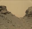
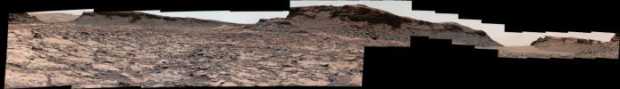
PIA21042:
Farewell to Murray Buttes (Image 2)
Full Resolution:
TIFF
(3.002 MB)
JPEG
(140.9 kB)
2016-09-09
Mars
Mars Science Laboratory (MSL)
Mastcam
1344x1200x3
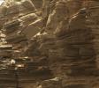
PIA21043:
Farewell to Murray Buttes (Image 3)
Full Resolution:
TIFF
(4.415 MB)
JPEG
(226.6 kB)
2016-09-09
Mars
Mars Science Laboratory (MSL)
Mastcam
1344x1200x3
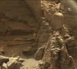
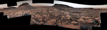
PIA21044:
Farewell to Murray Buttes (Image 4)
Full Resolution:
TIFF
(4.439 MB)
JPEG
(225.6 kB)
2016-09-09
Mars
Mars Science Laboratory (MSL)
Mastcam
1344x1200x3
PIA21045:
Farewell to Murray Buttes (Image 5)
Full Resolution:
TIFF
(3.097 MB)
JPEG
(140.9 kB)
2016-09-12
Mars
2001 Mars Odyssey
THEMIS
744x1563x3
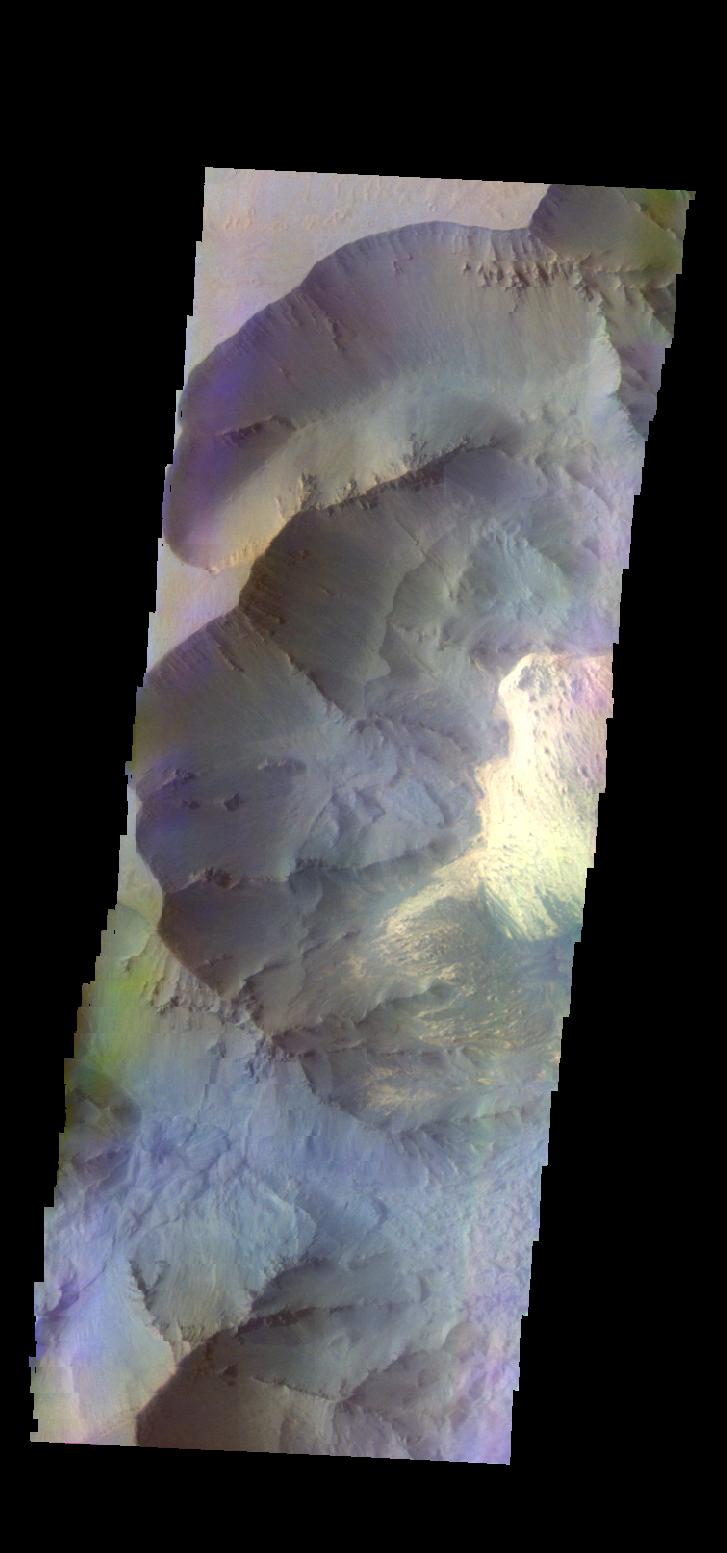
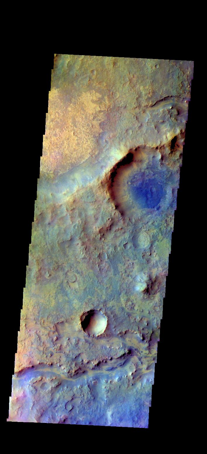
PIA20985:
Tyrrhena Terra - False Color
Full Resolution:
TIFF
(2.301 MB)
JPEG
(110.9 kB)
2016-09-13
Mars
2001 Mars Odyssey
THEMIS
727x1553x3
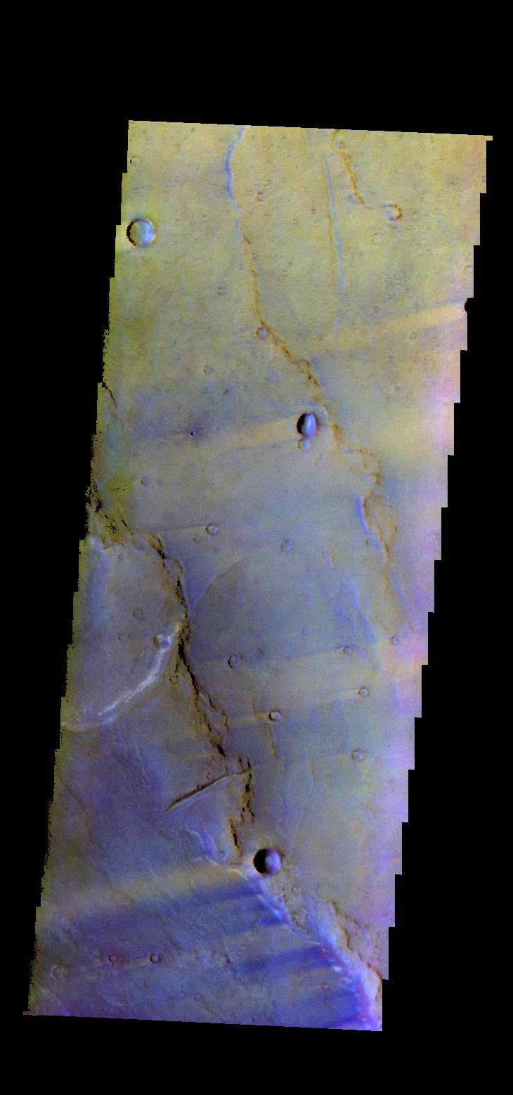
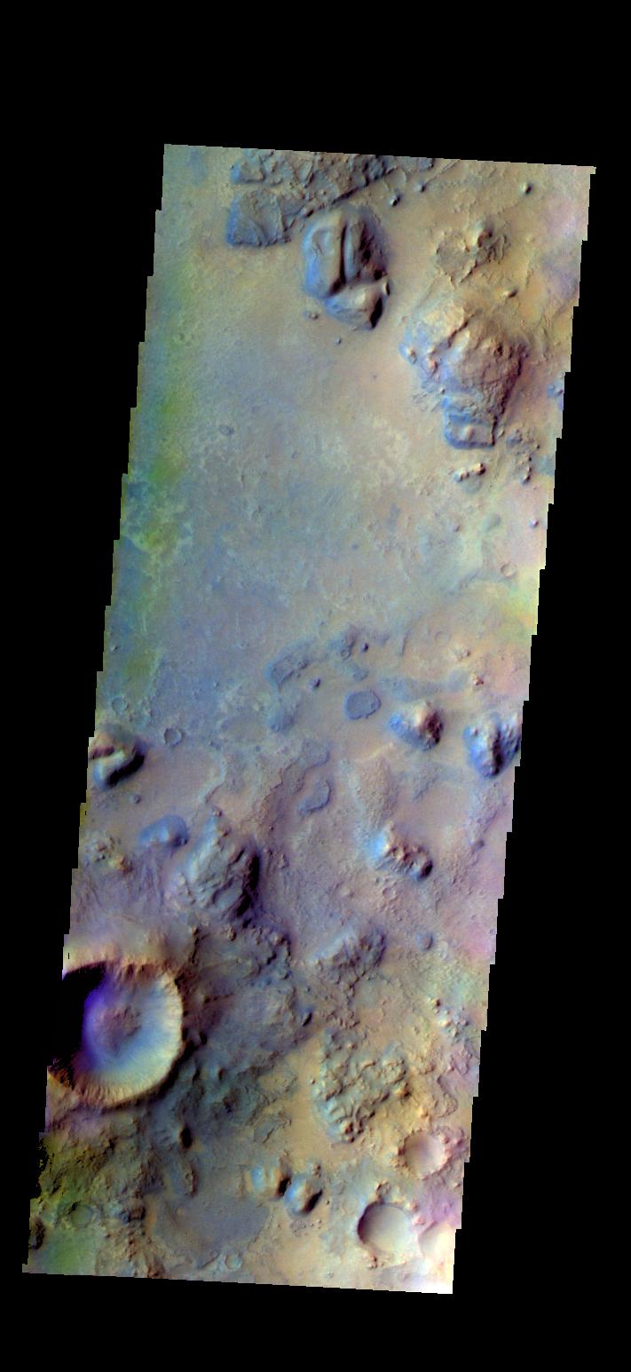
PIA20987:
Juventae Chasma - False Color
Full Resolution:
TIFF
(2.145 MB)
JPEG
(80.2 kB)
2016-09-14
Mars
2001 Mars Odyssey
THEMIS
730x1558x3
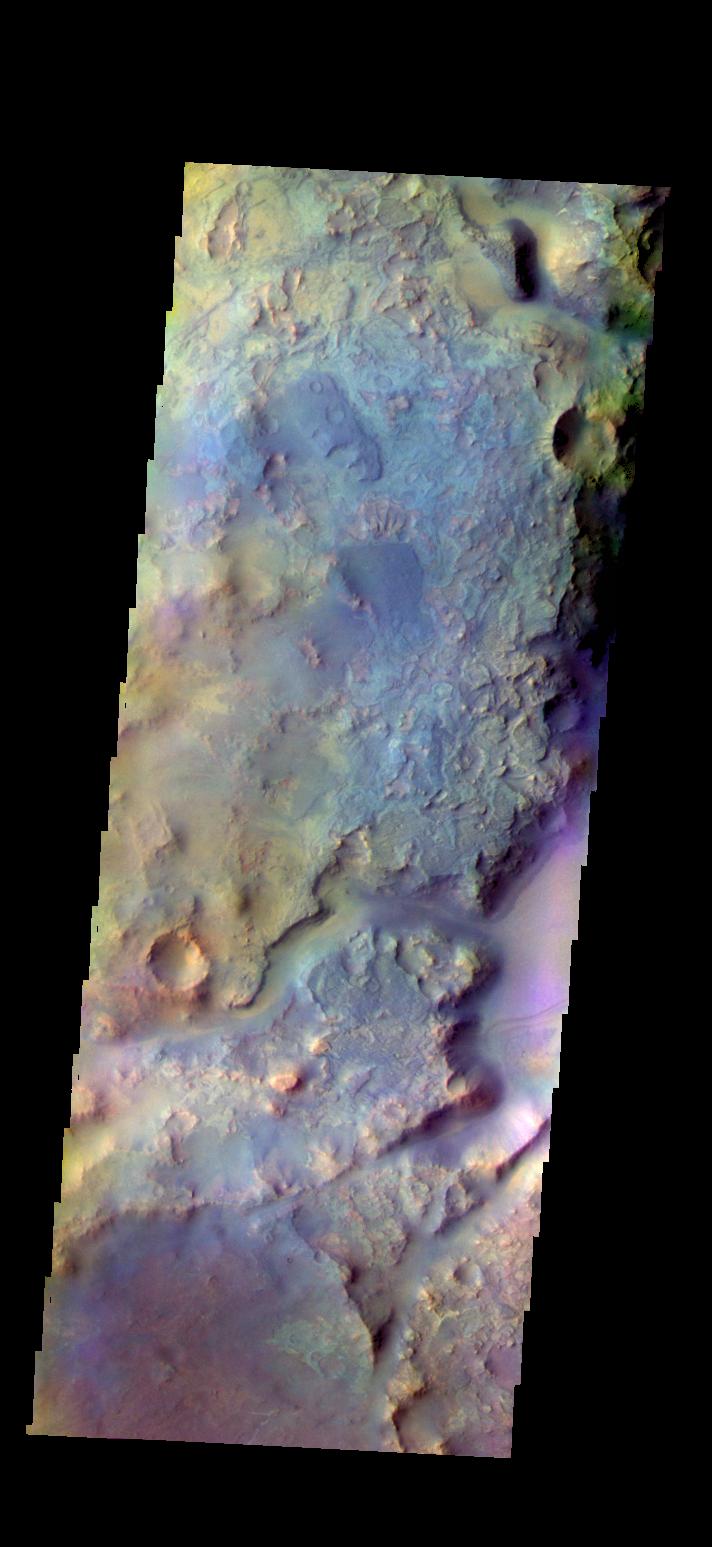
PIA20988:
Syrtis Major Planum - False Color
Full Resolution:
TIFF
(2.356 MB)
JPEG
(101.4 kB)
2016-09-15
Mars
2001 Mars Odyssey
THEMIS
732x1559x3
PIA20989:
Terra Cimmeria - False Color
Full Resolution:
TIFF
(2.317 MB)
JPEG
(102.2 kB)
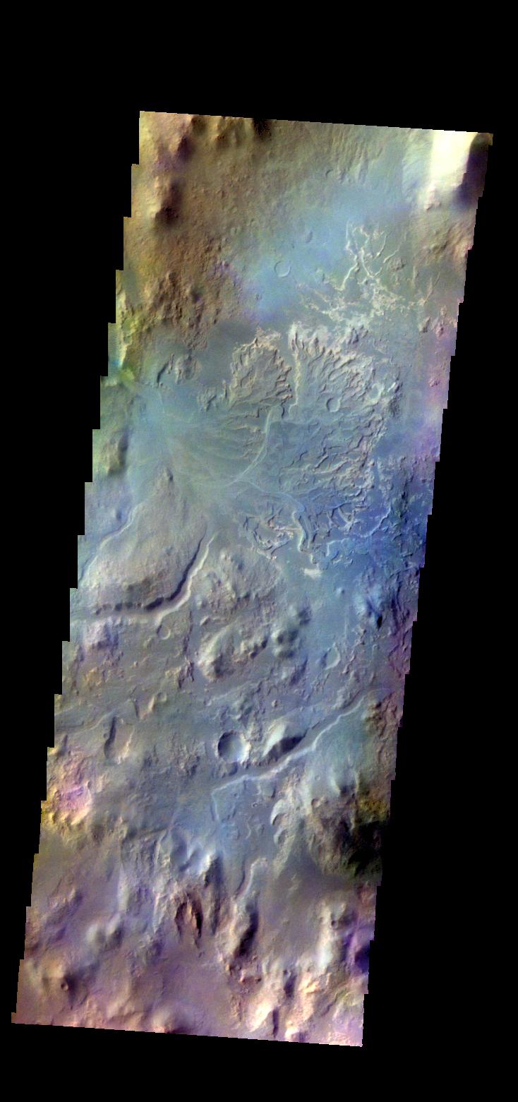
2016-09-15
Mars
Mars Reconnaissance Orbiter (MRO)
CTX
1934x2471x1
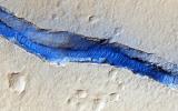
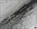
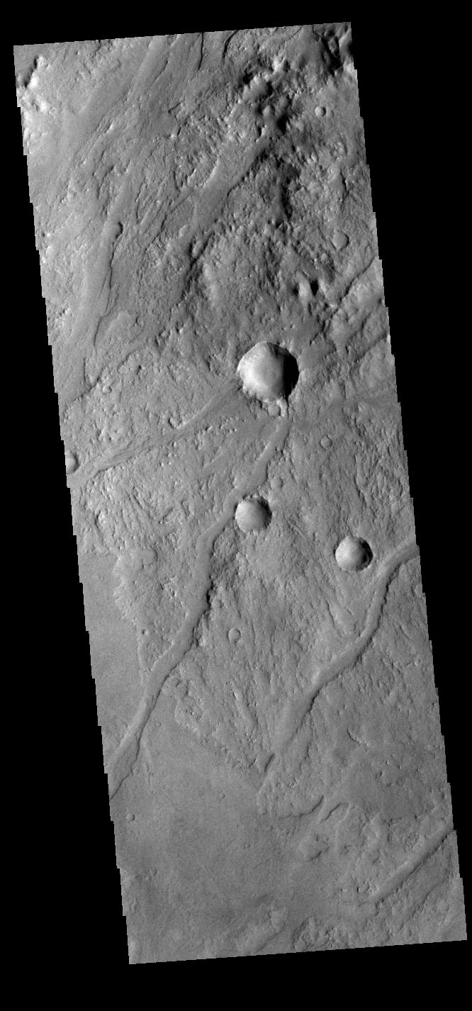
PIA20837:
Outflow Stream from Relatively Recent Martian Lake
Full Resolution:
TIFF
(4.784 MB)
JPEG
(973.5 kB)
2016-09-15
Mars
2001 Mars Odyssey
Mars Global Surveyor (MGS)
MOLA
THEMIS
1316x1840x3
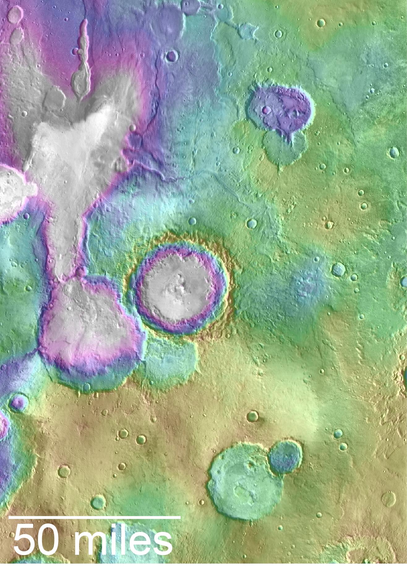
PIA20838:
Landscape of Former Lakes and Streams on Northern Mars
Full Resolution:
TIFF
(7.267 MB)
JPEG
(409.9 kB)
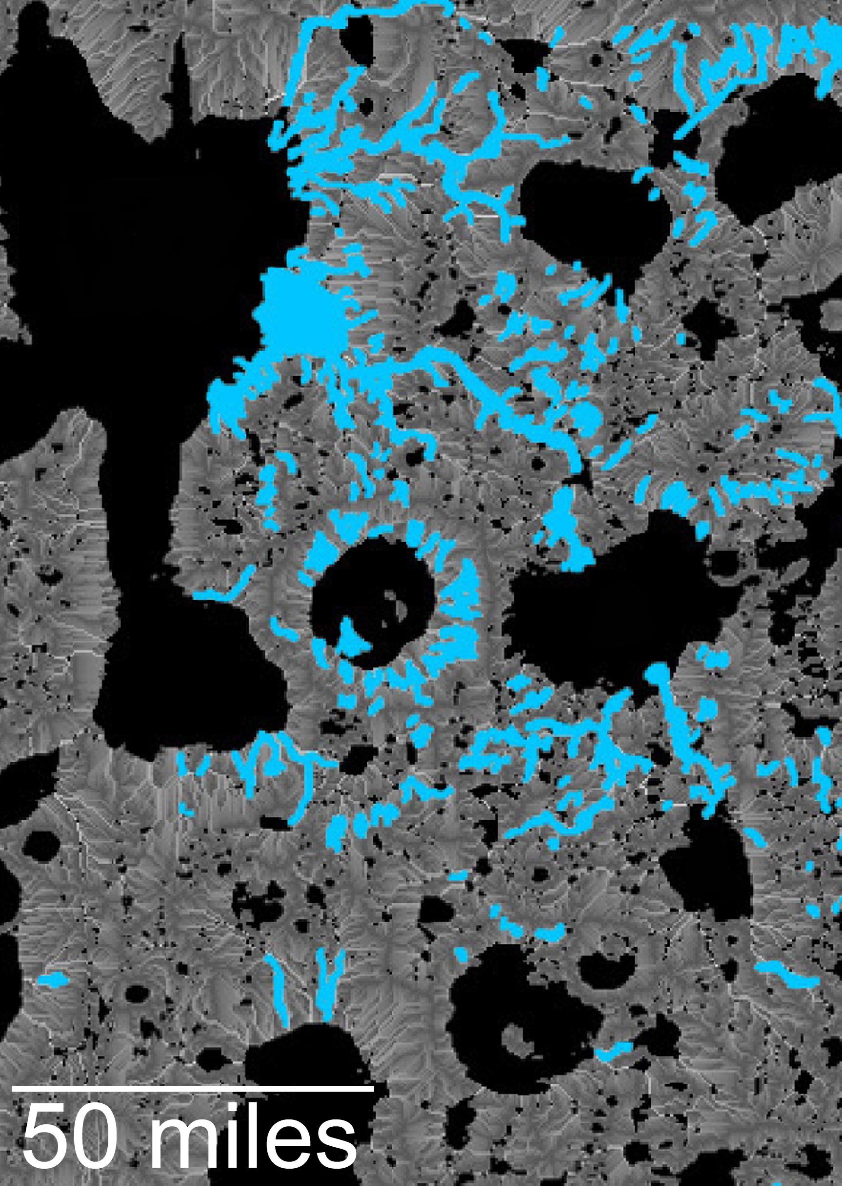
2016-09-15
Mars
2001 Mars Odyssey
Mars Global Surveyor (MGS)
MOLA
THEMIS
1726x2453x3
PIA20839:
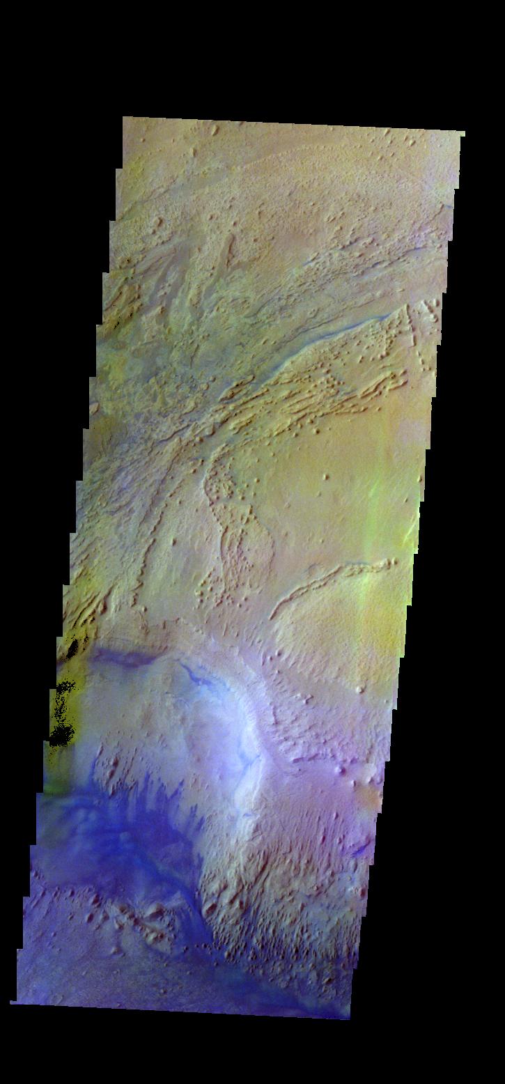
Hydrologic Modeling of Relatively Recent Martian Streams and Lake
Full Resolution:
TIFF
(7.388 MB)
JPEG
(549.4 kB)
2016-09-16
Mars
2001 Mars Odyssey
THEMIS
743x1563x3
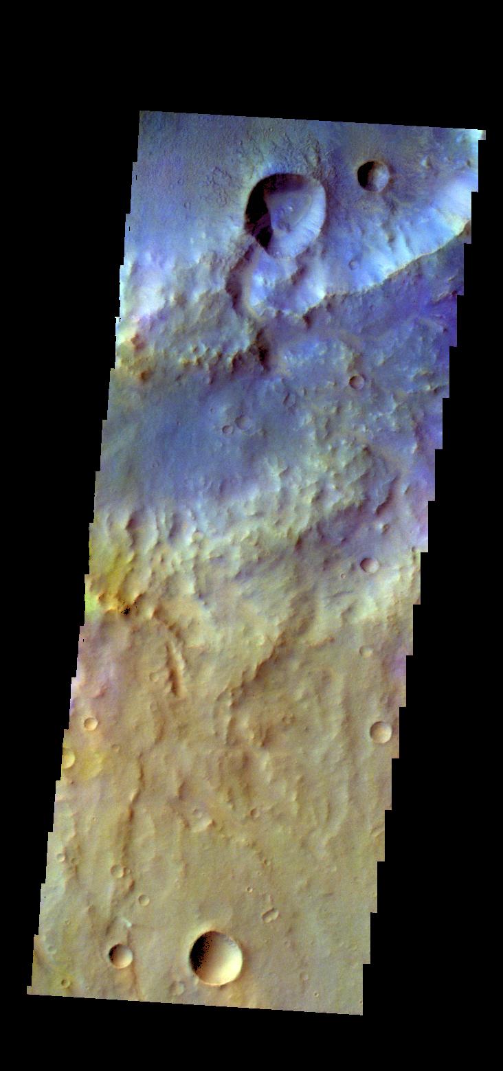
PIA20990:
Terby Crater - False Color
Full Resolution:
TIFF
(2.243 MB)
JPEG
(117.8 kB)
2016-09-19
Mars
2001 Mars Odyssey
THEMIS
666x1416x1
PIA20991:
Solis Planum
Full Resolution:
TIFF
(747.3 kB)
JPEG
(154.3 kB)
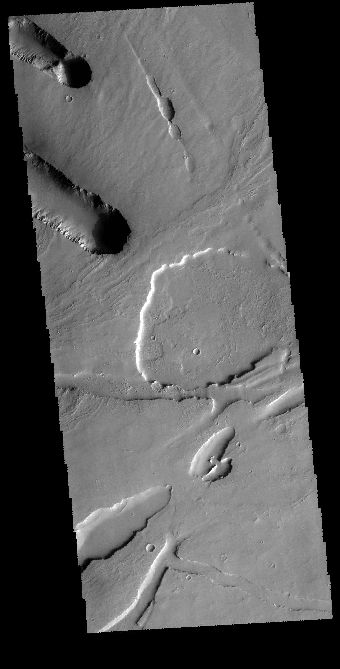
2016-09-20
Mars
2001 Mars Odyssey
THEMIS
611x2709x1
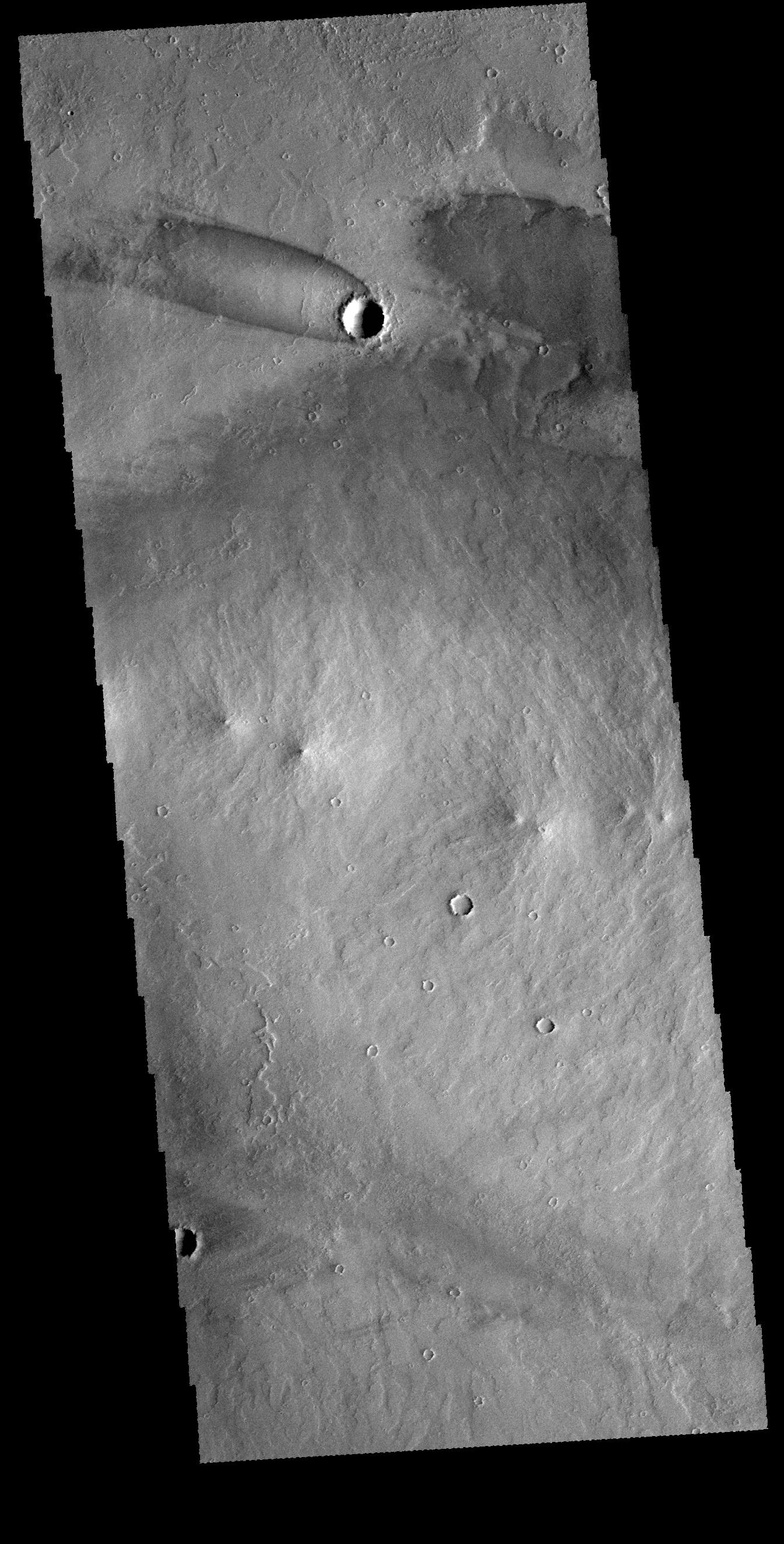
PIA20992:
Tiu Valles Landslide
Full Resolution:
TIFF
(723.5 kB)
JPEG
(71.88 kB)
2016-09-21
Mars
2001 Mars Odyssey
THEMIS
969x2627x1
PIA20993:
Polar Textures
Full Resolution:
TIFF
(2.548 MB)
JPEG
(578.7 kB)
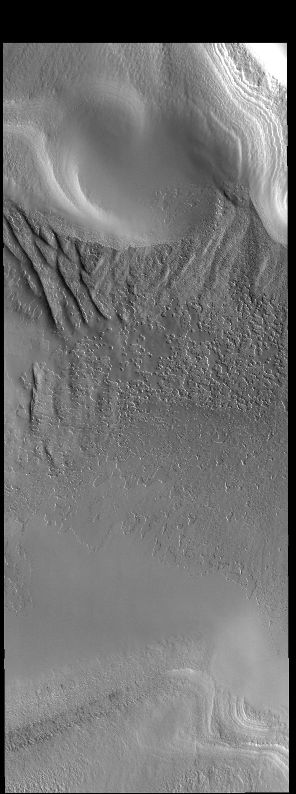
2016-09-21
Mars
Mars Reconnaissance Orbiter (MRO)
HiRISE
2880x1800x3
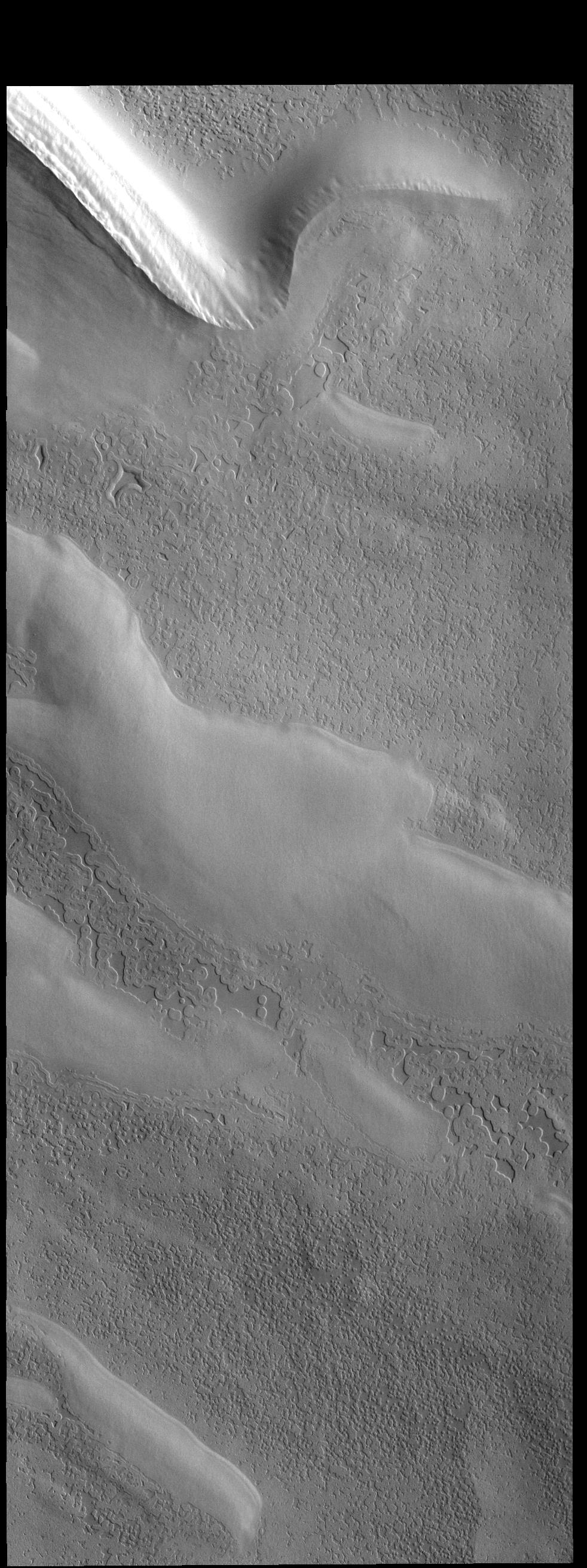
PIA21063:
River of Sand
Full Resolution:
TIFF
(15.56 MB)
JPEG
(972.4 kB)
2016-09-21
Mars
Mars Reconnaissance Orbiter (MRO)
HiRISE
2880x1800x3
PIA21064:
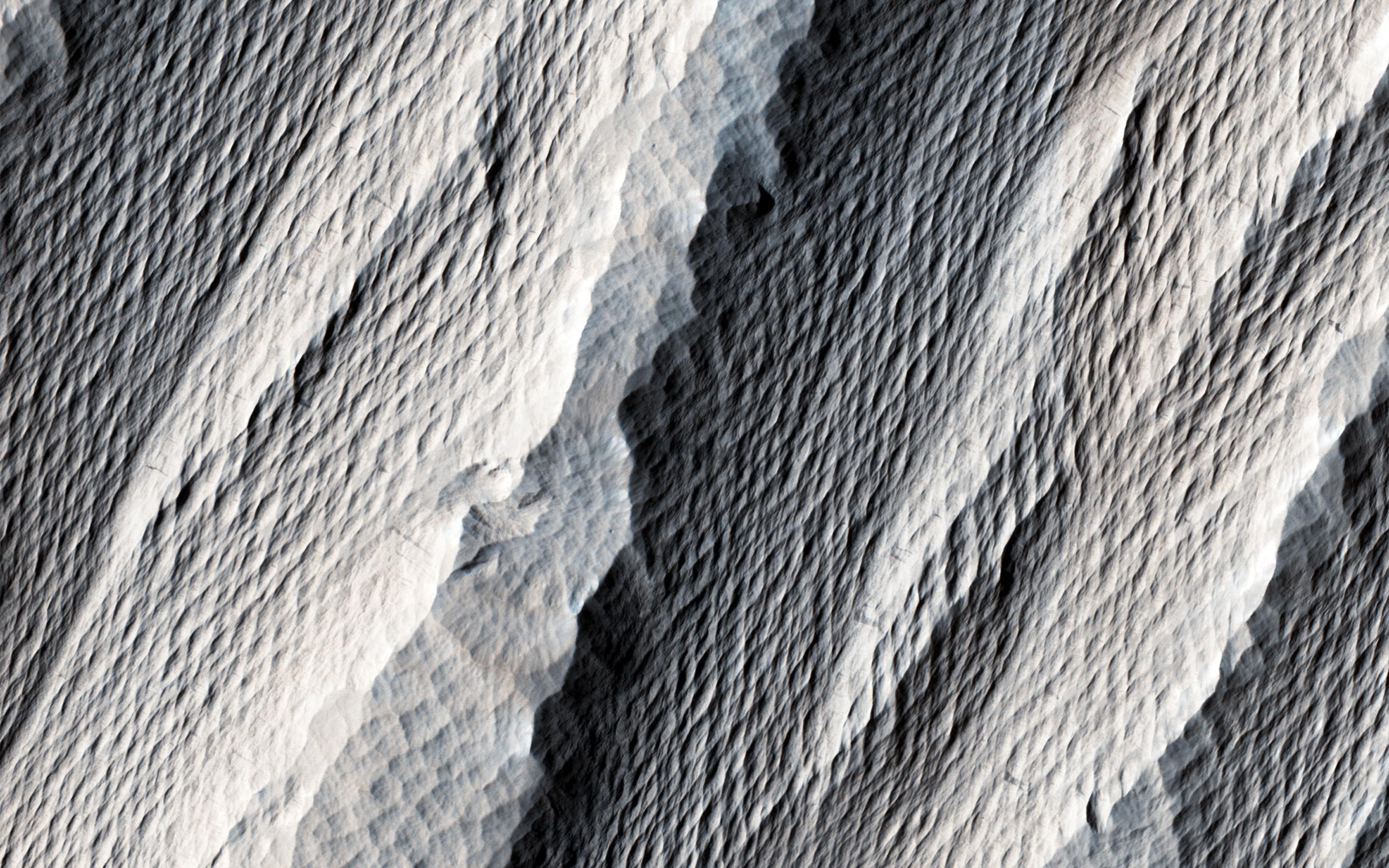
The Wind-Scoured Lava Flows of Pavonis Mons
Full Resolution:
TIFF
(15.4 MB)
JPEG
(549.7 kB)
2016-09-21
Mars
Mars Reconnaissance Orbiter (MRO)
HiRISE
2880x1800x3
PIA21065:
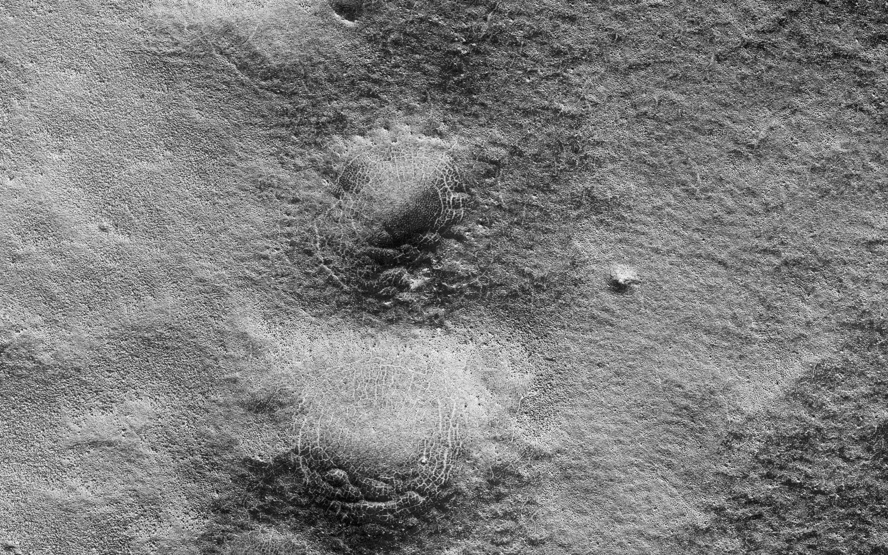
What Lies Beneath: Surface Patterns of Glacier-Like Landforms
Full Resolution:
TIFF
(15.56 MB)
JPEG
(1.393 MB)
2016-09-21
Mars
Mars Reconnaissance Orbiter (MRO)
HiRISE
2880x1800x1
PIA21066:
Intersecting Channels near Olympica Fossae
Full Resolution:
TIFF
(5.087 MB)
JPEG
(853.2 kB)
2016-09-22
Mars
2001 Mars Odyssey
THEMIS
977x2629x1
PIA20994:
South Polar Cap
Full Resolution:
TIFF
(2.357 MB)
JPEG
(307.1 kB)
2016-09-23
Mars
2001 Mars Odyssey
THEMIS
1344x2647x1
PIA20995:
Daedalia Planum Windstreaks
Full Resolution:
TIFF
(2.285 MB)
JPEG
(332.8 kB)
2016-09-26
Mars
2001 Mars Odyssey
THEMIS
1320x2656x1
PIA20997:
Daedalia Planum
Full Resolution:
TIFF
(2.3 MB)
JPEG
(308.3 kB)
2016-09-27
Mars
2001 Mars Odyssey
THEMIS
979x2627x1
PIA20998:
Polar Textures
Full Resolution:
TIFF
(2.273 MB)
JPEG
(298.9 kB)
2016-09-28
Mars
2001 Mars Odyssey
THEMIS
664x1429x1
PIA20999:
Terra Cimmeria Craters
Full Resolution:
TIFF
(708 kB)
JPEG
(82.02 kB)
2016-09-29
Mars
2001 Mars Odyssey
THEMIS
1346x2646x1
PIA21000:
Daedalia Planum Vents
Full Resolution:
TIFF
(2.756 MB)
JPEG
(479.9 kB)
2016-09-30
Mars
2001 Mars Odyssey
THEMIS
692x1429x1
PIA21001:
Juventae Chasma Dunes
Full Resolution:
TIFF
(634.1 kB)
JPEG
(61.12 kB)
2016-10-03
Mars
2001 Mars Odyssey
THEMIS
989x2631x1
PIA21002:
Polar Layers
Full Resolution:
TIFF
(2.462 MB)
JPEG
(309.5 kB)
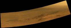
2016-10-03
Mars
Mars Science Laboratory (MSL)
Mastcam
10000x2848x3
PIA20840:
Rover's Panorama Taken Amid 'Murray Buttes' on Mars
Full Resolution:
TIFF
(56.19 MB)
JPEG
(3.787 MB)
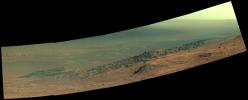
2016-10-03
Mars
Mars Science Laboratory (MSL)
Mastcam
10000x2086x3
PIA20841:
Martian Mesas in 'Murray Buttes' Area, Sol 1434
Full Resolution:
TIFF
(40.52 MB)
JPEG
(2.487 MB)
2016-10-03
Mars
Mars Science Laboratory (MSL)
Mastcam
10000x1441x3
PIA20842:
Cluster of Martian Mesas on Lower Mount Sharp, Sols 1438 and 1439
Full Resolution:
TIFF
(30.84 MB)
JPEG
(2.17 MB)
2016-10-03
Mars
Mars Science Laboratory (MSL)
Mastcam
10000x5027x3
PIA20843:
Butte 'M9a' in 'Murray Buttes' on Mars
Full Resolution:
TIFF
(122 MB)
JPEG
(6.811 MB)
2016-10-03
Mars
Mars Science Laboratory (MSL)
MAHLI
8000x4769x3
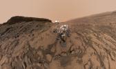
PIA20844:
Curiosity Self-Portrait at 'Murray Buttes'
Full Resolution:
TIFF
(83.67 MB)
JPEG
(3.836 MB)
2016-10-03
Mars
Mars Science Laboratory (MSL)
HiRISE
MAHLI
3300x2550x3
PIA20845:
Curiosity's First 16 Rock or Soil Sampling Sites on Mars
Full Resolution:
TIFF
(20.59 MB)
JPEG
(2.195 MB)
2016-10-03
Mars
Mars Science Laboratory (MSL)
HiRISE
3300x2550x3
PIA20846:
Curiosity Destinations for Second Extended Mission
Full Resolution:
TIFF
(13.9 MB)
JPEG
(1.797 MB)
2016-10-04
Mars
2001 Mars Odyssey
THEMIS
982x2623x1
PIA21003:
Polar Textures
Full Resolution:
TIFF
(2.475 MB)
JPEG
(396.1 kB)
2016-10-05
Mars
2001 Mars Odyssey
THEMIS
666x1426x1
PIA21004:
Claritas Fossae
Full Resolution:
TIFF
(736 kB)
JPEG
(122.8 kB)
2016-10-05
Mars
Mars Reconnaissance Orbiter (MRO)
HiRISE
2880x1800x3
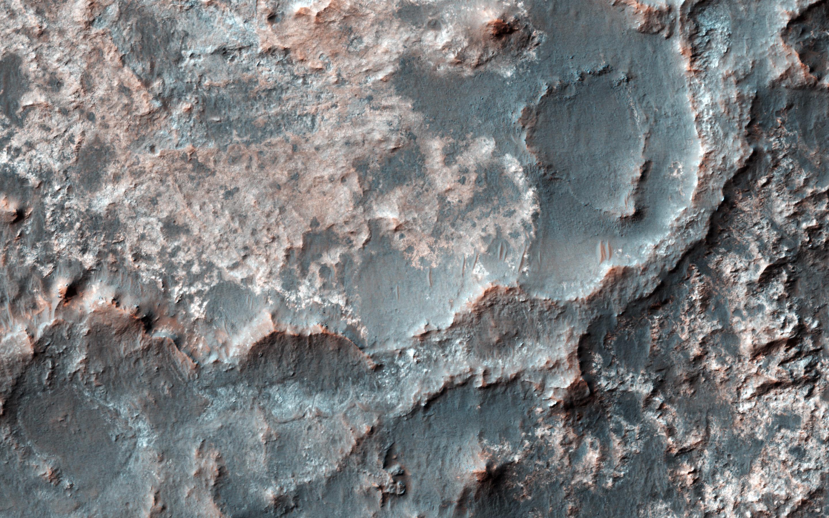
PIA21102:
Deposits along the Northern Wall of Melas Chasma
Full Resolution:
TIFF
(15.56 MB)
JPEG
(1.168 MB)
2016-10-05
Mars
Mars Reconnaissance Orbiter (MRO)
HiRISE
2880x1800x3
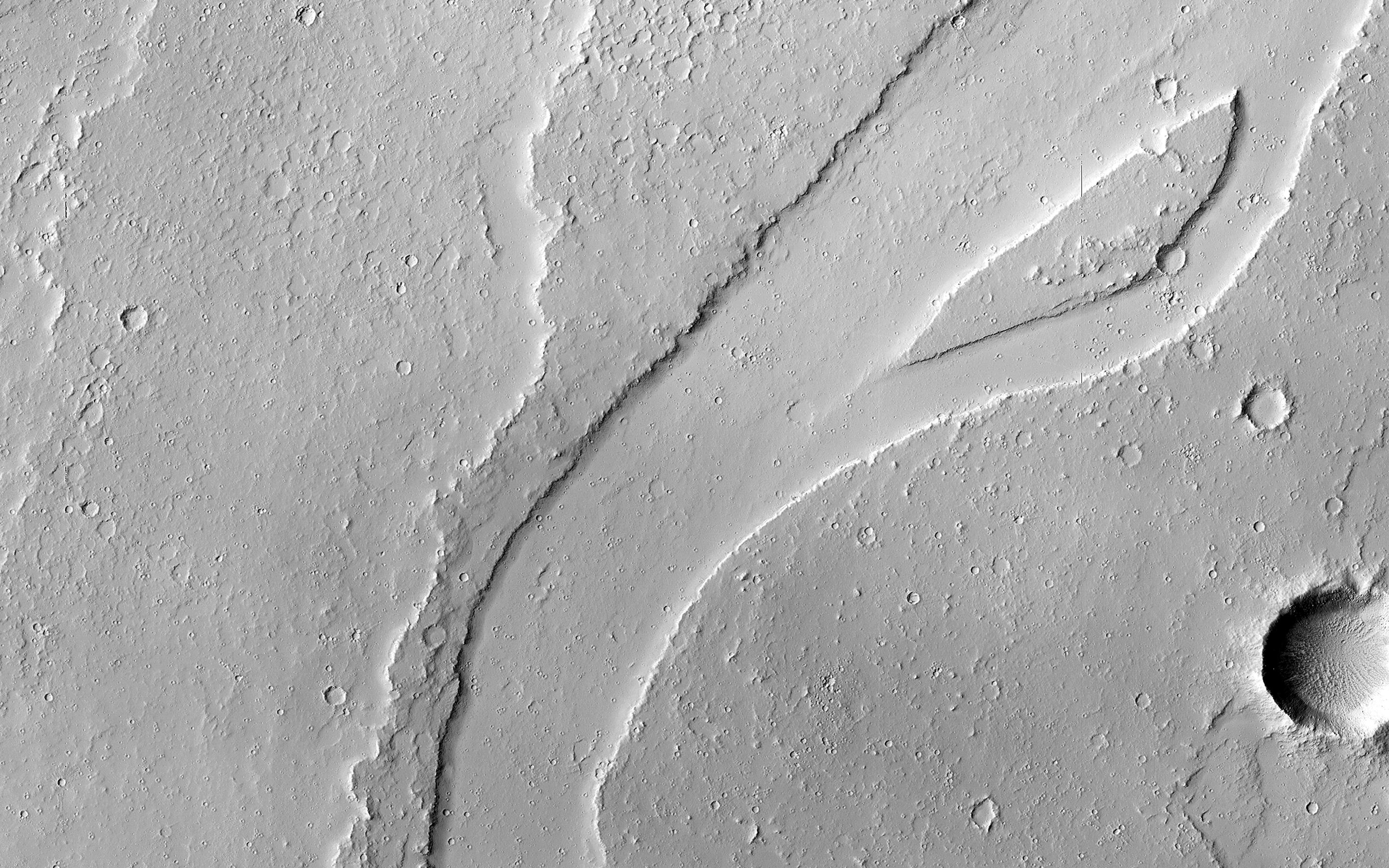
PIA21103:
A Transition from Depressed to Inverted Channels in Gorgonum Basin
Full Resolution:
TIFF
(15.56 MB)
JPEG
(896.6 kB)
2016-10-05
Mars
Mars Reconnaissance Orbiter (MRO)
HiRISE
2880x1800x1
PIA21104:
A Long and Winding Channel in Tharsis
Full Resolution:
TIFF
(5.191 MB)
JPEG
(944.1 kB)
2016-10-05
Mars
Mars Reconnaissance Orbiter (MRO)
HiRISE
2880x1800x3
PIA21105:
On the Edge of the South Pole Layered Deposit
Full Resolution:
TIFF
(15.56 MB)
JPEG
(795.1 kB)
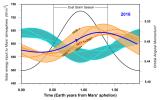
2016-10-05
Mars
3082x1899x3
PIA20855:
2016 Resembles Past Global Dust Storm Years on Mars
Full Resolution:
TIFF
(752.7 kB)
JPEG
(368.1 kB)
2016-10-06
Mars
2001 Mars Odyssey
THEMIS
1307x2673x1
PIA21005:
Claritas Fossae
Full Resolution:
TIFF
(2.455 MB)
JPEG
(293.7 kB)
2016-10-07
Mars
2001 Mars Odyssey
THEMIS
686x1428x1
PIA21006:
Gusev Crater
Full Resolution:
TIFF
(689.5 kB)
JPEG
(82.63 kB)
2016-10-07
Mars
Mars Exploration Rover (MER)
Panoramic Camera
4857x1956x3
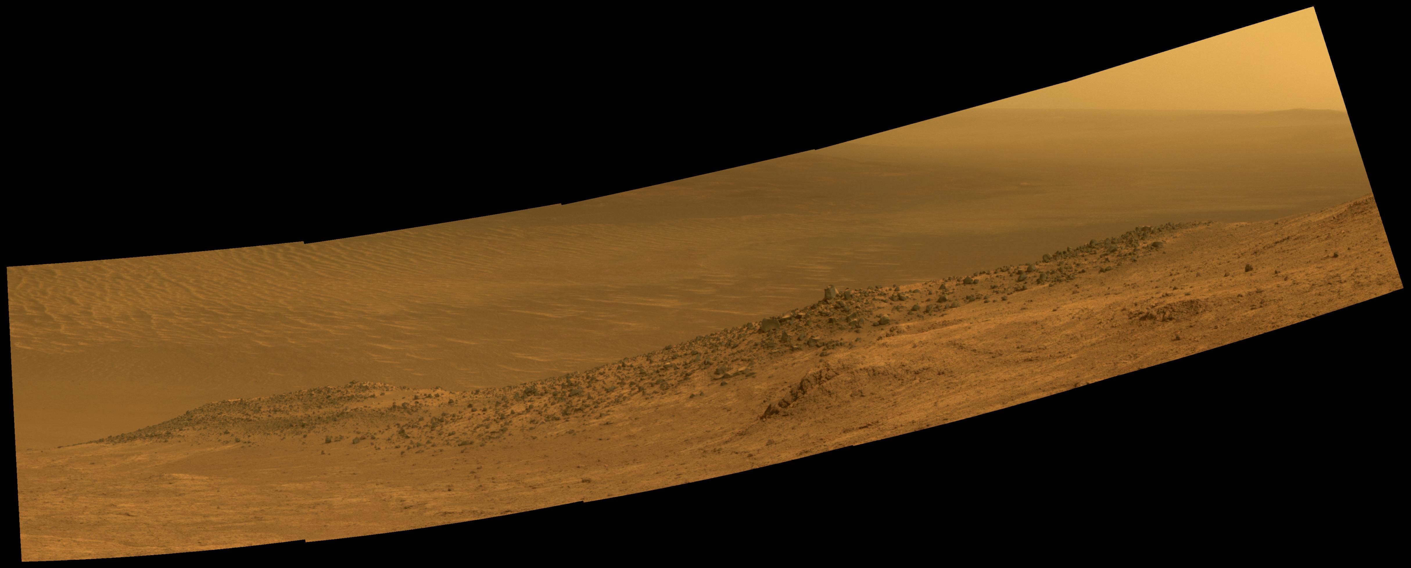
PIA20849:
Mars Rover Opportunity's Panorama of 'Wharton Ridge'
Full Resolution:
TIFF
(10.56 MB)
JPEG
(489 kB)
2016-10-07
Mars
Mars Exploration Rover (MER)
Panoramic Camera
4857x1956x3
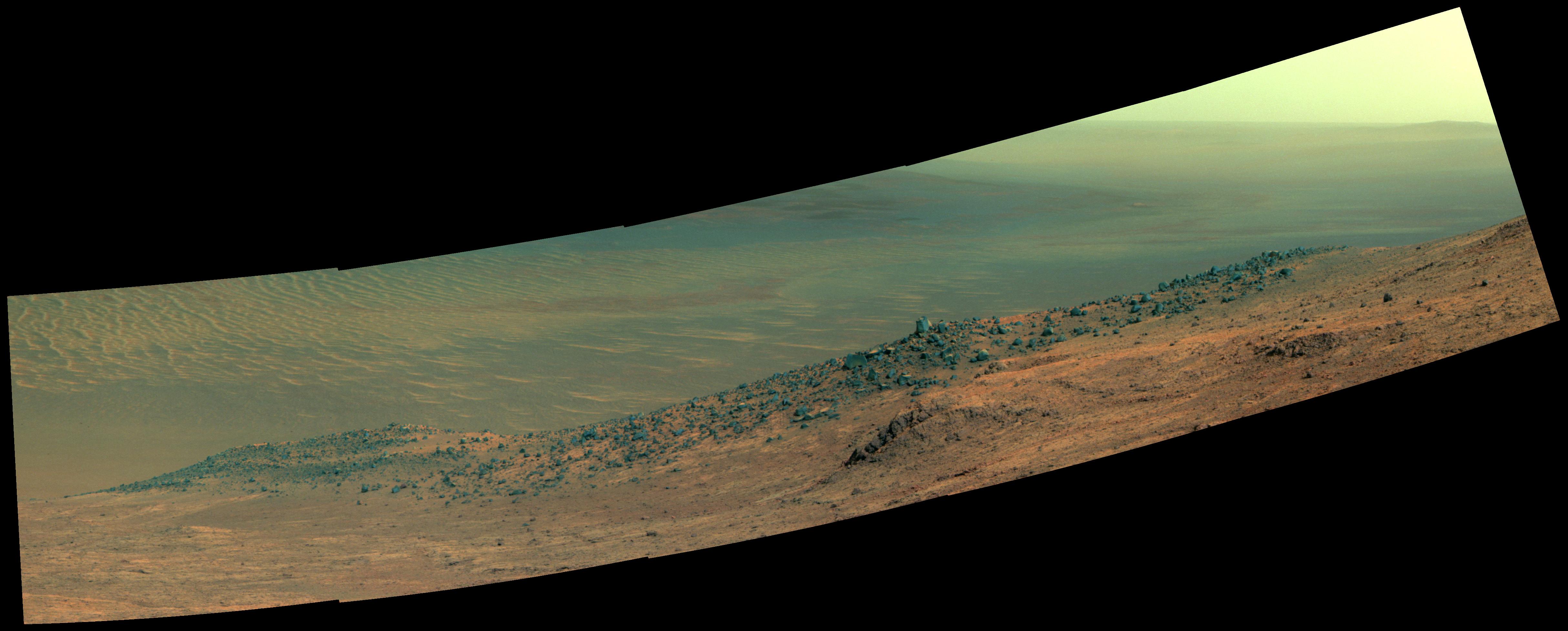
PIA20850:
Mars Rover Opportunity's Panorama of 'Wharton Ridge' (Enhanced Color)
Full Resolution:
TIFF
(14.8 MB)
JPEG
(659.4 kB)
2016-10-07
Mars
Mars Exploration Rover (MER)
Panoramic Camera
2144x1205x3
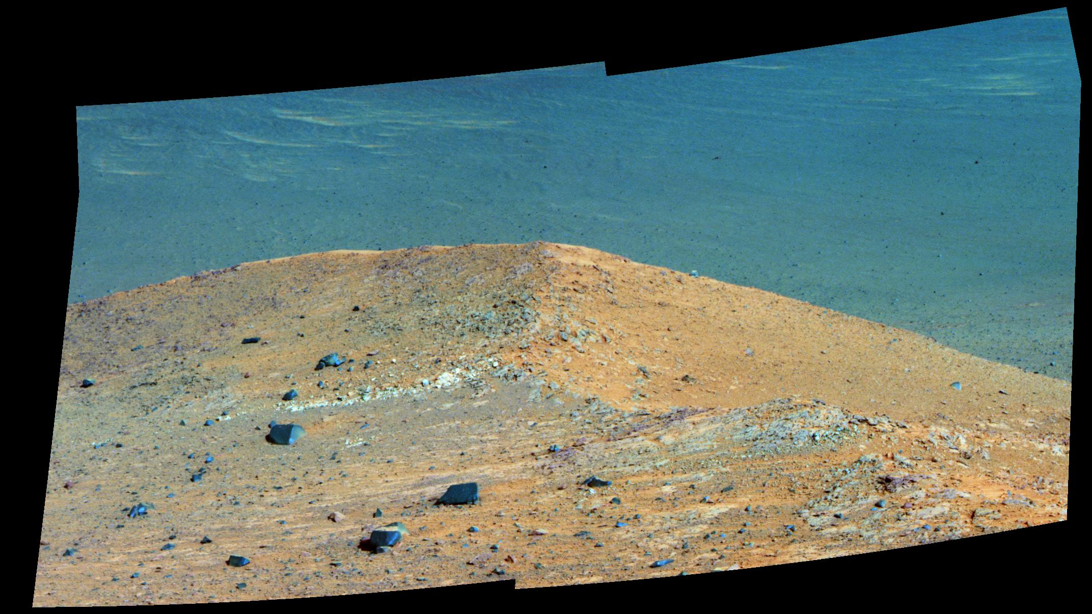
PIA20851:
'Spirit Mound' at Edge of Endeavour Crater, Mars
Full Resolution:
TIFF
(2.951 MB)
JPEG
(213.1 kB)
2016-10-07
Mars
Mars Exploration Rover (MER)
Panoramic Camera
2144x1205x3
PIA20852:
'Spirit Mound' at Edge of Endeavour Crater, Mars (Enhanced Color)
Full Resolution:
TIFF
(6.445 MB)
JPEG
(373.7 kB)
2016-10-07
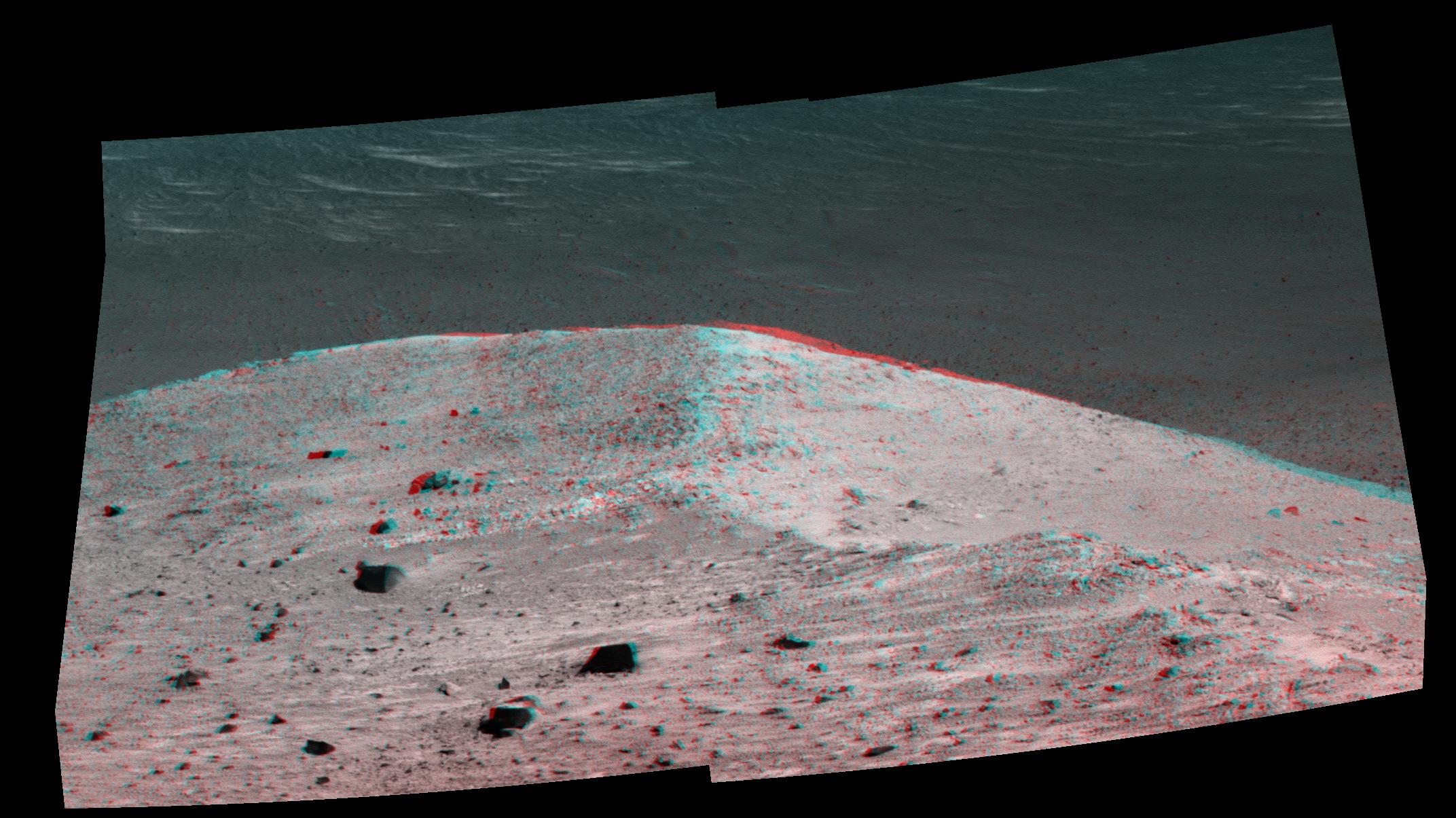
Mars
Mars Exploration Rover (MER)
Panoramic Camera
2144x1205x3
PIA20853:
'Spirit Mound' at Edge of Endeavour Crater, Mars (Anaglyph)
Full Resolution:
TIFF
(4.643 MB)
JPEG
(320.8 kB)
2016-10-07
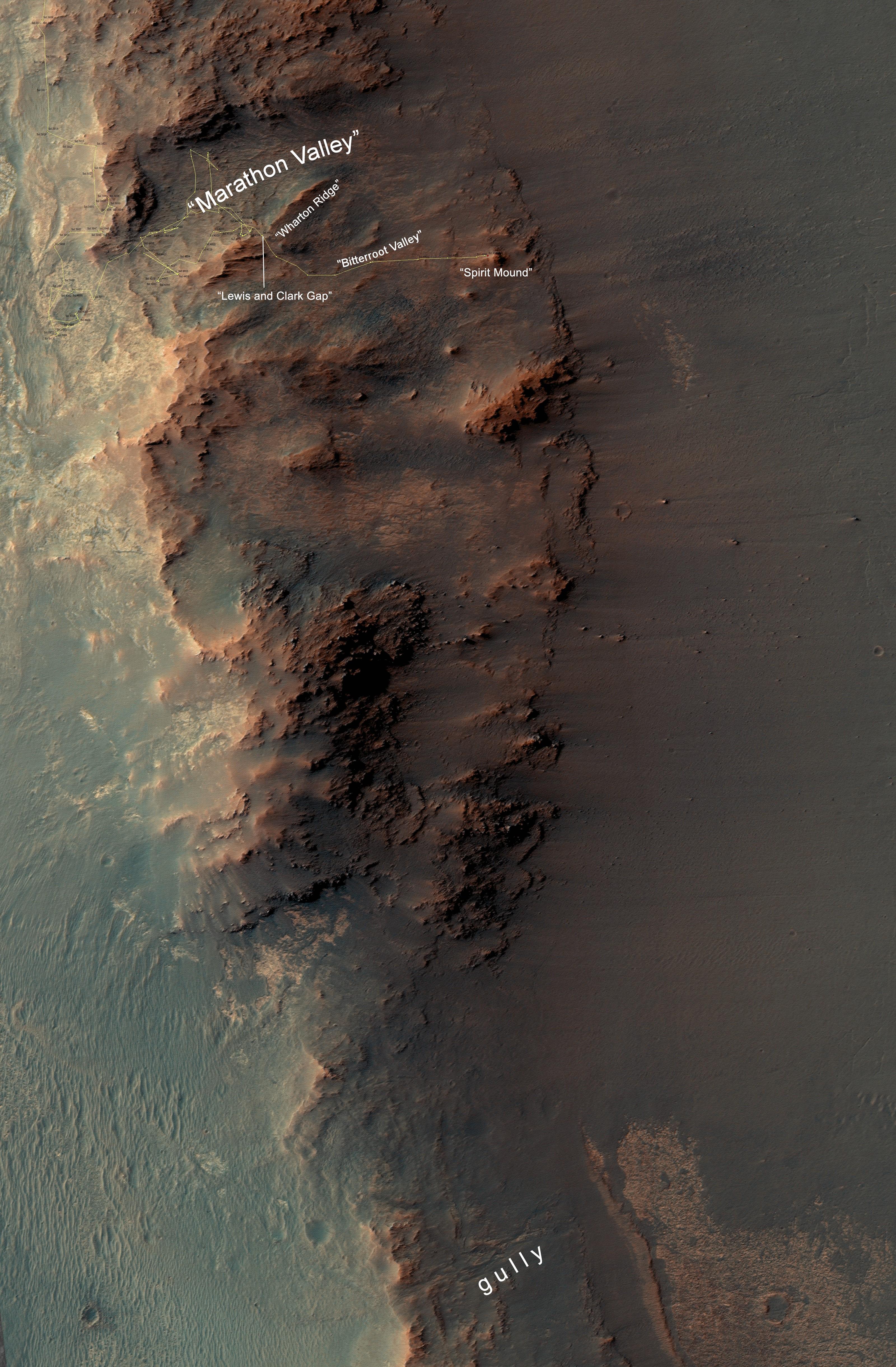
Mars
Mars Exploration Rover (MER)
Mars Reconnaissance Orbiter (MRO)
HiRISE
3200x4880x3
PIA20854:
From 'Marathon Valley' to Gully on Endeavour Rim
Full Resolution:
TIFF
(41.84 MB)
JPEG
(2.035 MB)
2016-10-10
Mars
2001 Mars Odyssey
THEMIS
709x1443x1
PIA21007:
Yuty Crater Ejecta
Full Resolution:
TIFF
(792.4 kB)
JPEG
(128.7 kB)
2016-10-11
Mars
2001 Mars Odyssey
THEMIS
790x1587x3
PIA21009:
Terra Cimmeria - False Color
Full Resolution:
TIFF
(2.27 MB)
JPEG
(97.04 kB)
2016-10-12
Mars
2001 Mars Odyssey
THEMIS
737x1563x3
PIA21010:
Terra Sabaea - False Color
Full Resolution:
TIFF
(2.329 MB)
JPEG
(143.8 kB)
2016-10-13
Mars
2001 Mars Odyssey
THEMIS
727x1557x3
PIA21011:
Firsoff Crater - False Color
Full Resolution:
TIFF
(2.275 MB)
JPEG
(129.5 kB)
2016-10-14
Mars
2001 Mars Odyssey
THEMIS
728x1556x3
PIA21012:
Ophir Chasma - False Color
Full Resolution:
TIFF
(2.251 MB)
JPEG
(97.27 kB)
2016-10-17
Mars
2001 Mars Odyssey
THEMIS
728x1556x3
PIA21013:
Gale Crater - False Color
Full Resolution:
TIFF
(2.352 MB)
JPEG
(109.1 kB)
2016-10-18
Mars
2001 Mars Odyssey
THEMIS
727x1563x3
PIA21015:
Lobo Vallis - False Color
Full Resolution:
TIFF
(2.387 MB)
JPEG
(99.63 kB)
2016-10-19
Mars
2001 Mars Odyssey
THEMIS
732x1559x3
PIA21016:
Tyrrhena Terra - False Color
Full Resolution:
TIFF
(2.32 MB)
JPEG
(157.2 kB)
2016-10-19
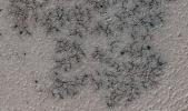
Mars
Mars Reconnaissance Orbiter (MRO)
HiRISE
2880x1800x1
PIA21110:
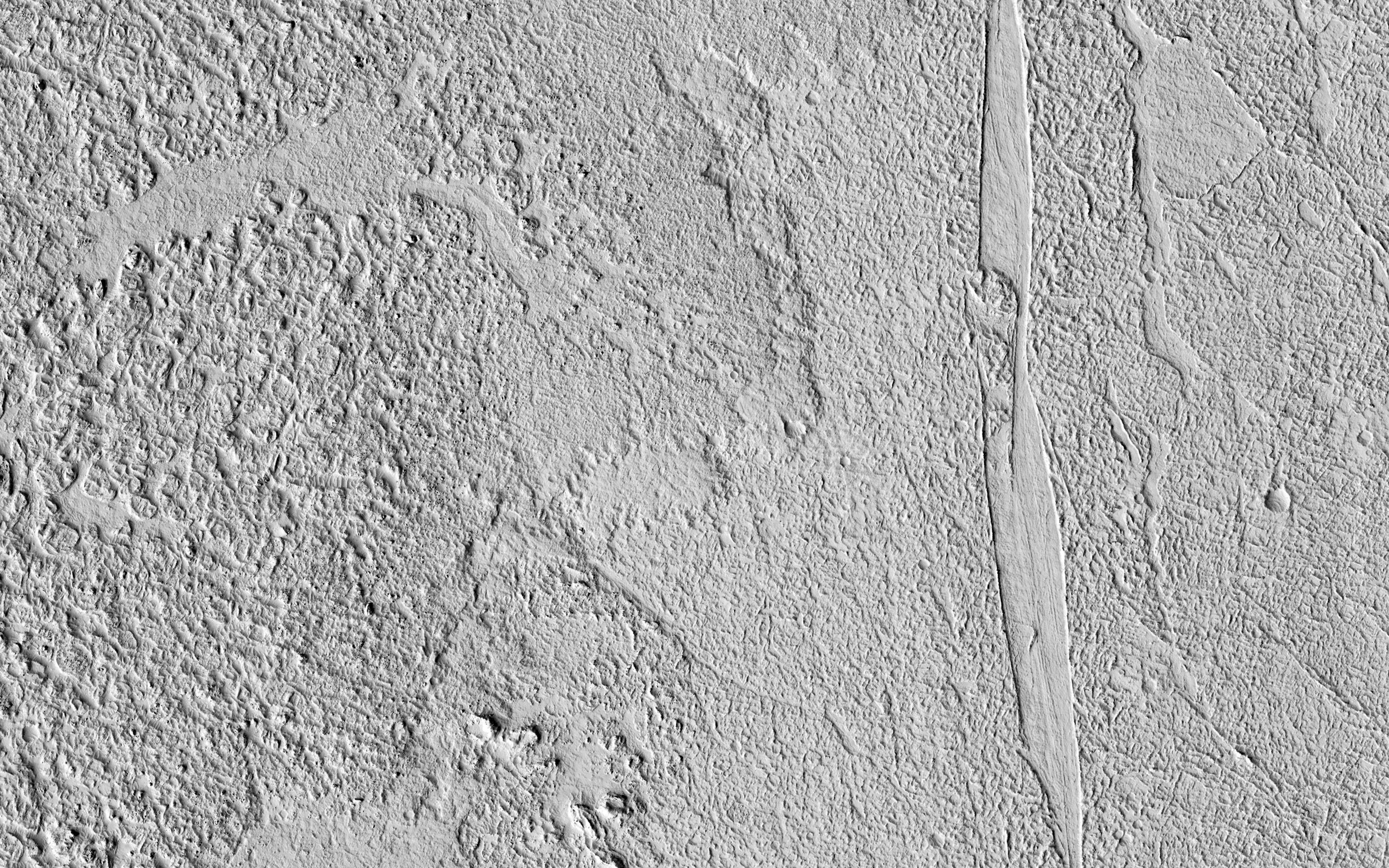
Spider Webs
Full Resolution:
TIFF
(5.191 MB)
JPEG
(1.679 MB)
2016-10-19
Mars
Mars Reconnaissance Orbiter (MRO)
HiRISE
2880x1800x3
PIA21111:
Wind Carved Rock
Full Resolution:
TIFF
(15.56 MB)
JPEG
(873.1 kB)
2016-10-19
Mars
Mars Reconnaissance Orbiter (MRO)
HiRISE
2880x1800x3
PIA21112:
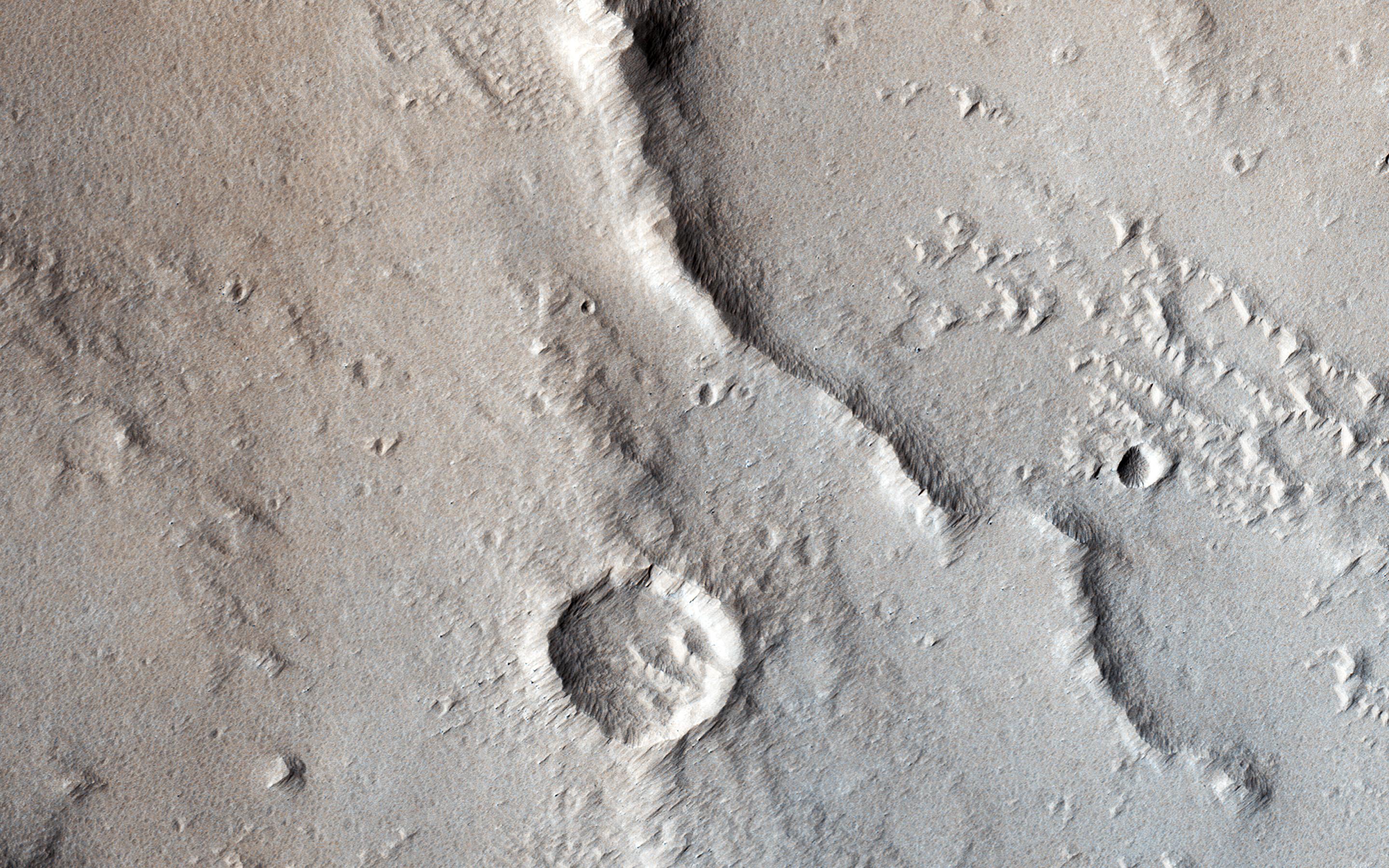
Wrinkle Ridges and Pit Craters
Full Resolution:
TIFF
(15.56 MB)
JPEG
(1.001 MB)
2016-10-19
Mars
Mars Reconnaissance Orbiter (MRO)
HiRISE
2880x1800x1
PIA21113:
Lava That Once Flowed
Full Resolution:
TIFF
(5.191 MB)
JPEG
(1.387 MB)
2016-10-20
Mars
Mars Reconnaissance Orbiter (MRO)
HiRISE
1359x804x3
PIA21126:
Martian 'Spiders' in Sharper Look, Thanks to Volunteers
Full Resolution:
TIFF
(3.218 MB)
JPEG
(232.4 kB)
2016-10-20
Mars
2001 Mars Odyssey
THEMIS
730x1559x3
PIA21017:
Noachis Terra Crater - False Color
Full Resolution:
TIFF
(2.225 MB)
JPEG
(96.49 kB)
2016-10-21
Mars
2001 Mars Odyssey
THEMIS
725x1556x3
PIA21018:
Firsoff Crater - False Color
Full Resolution:
TIFF
(2.314 MB)
JPEG
(117.8 kB)
2016-10-21
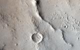
Mars
Mars Reconnaissance Orbiter (MRO)
CTX
1400x788x1
PIA21130:
Signs of Schiaparelli Test Lander Seen From Orbit
Full Resolution:
TIFF
(1.057 MB)
JPEG
(162.8 kB)
2016-10-24
Mars
2001 Mars Odyssey
THEMIS
1358x2648x1
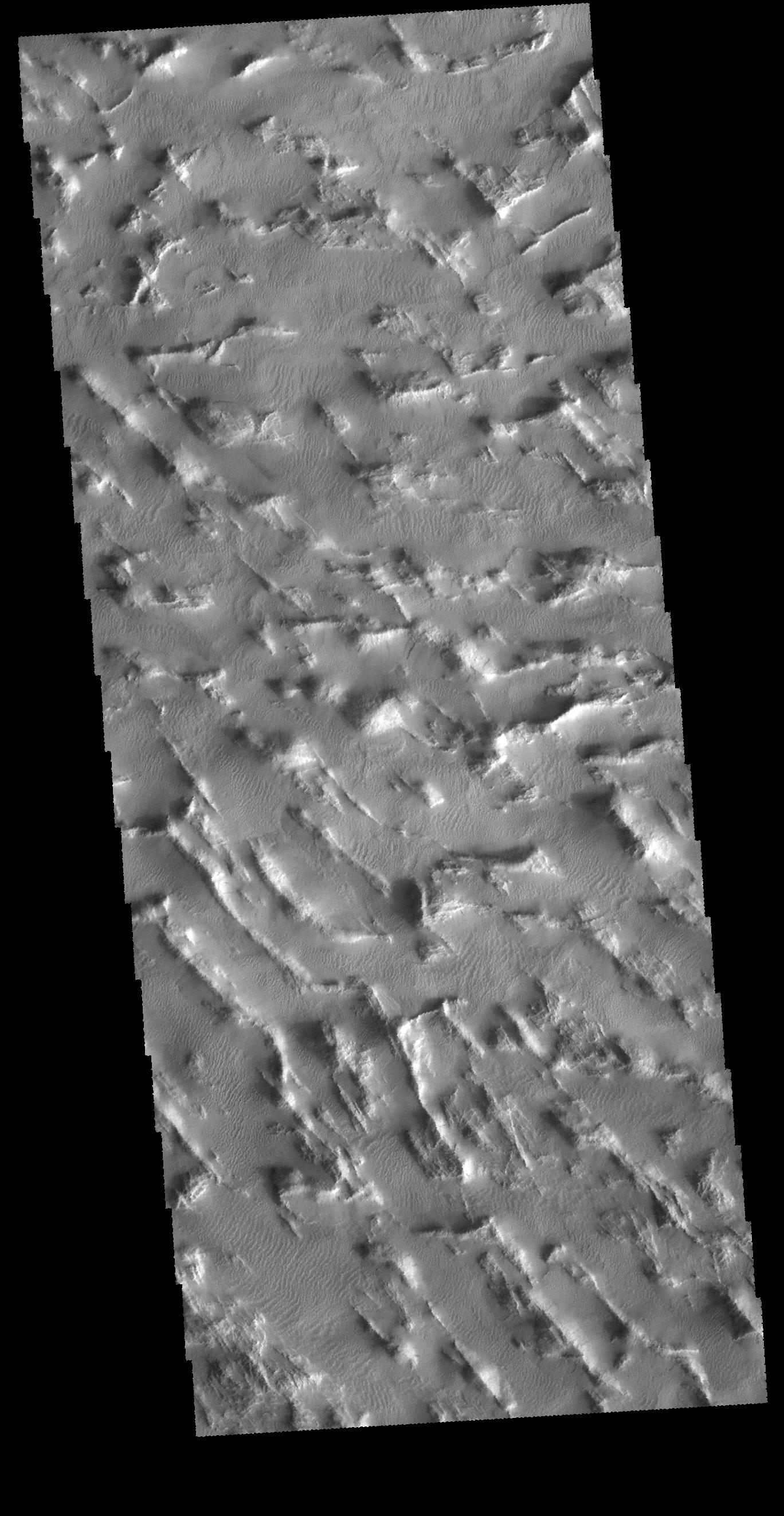
PIA21019:
Memnonia Sulci
Full Resolution:
TIFF
(2.83 MB)
JPEG
(527.7 kB)
2016-10-25
Mars
2001 Mars Odyssey
THEMIS
1337x2642x1
PIA21020:
Noctis Labyrinthus
Full Resolution:
TIFF
(2.178 MB)
JPEG
(219.2 kB)
2016-10-26
Mars
2001 Mars Odyssey
THEMIS
1344x2646x1
PIA21151:
Daedalia Planum Windstreak
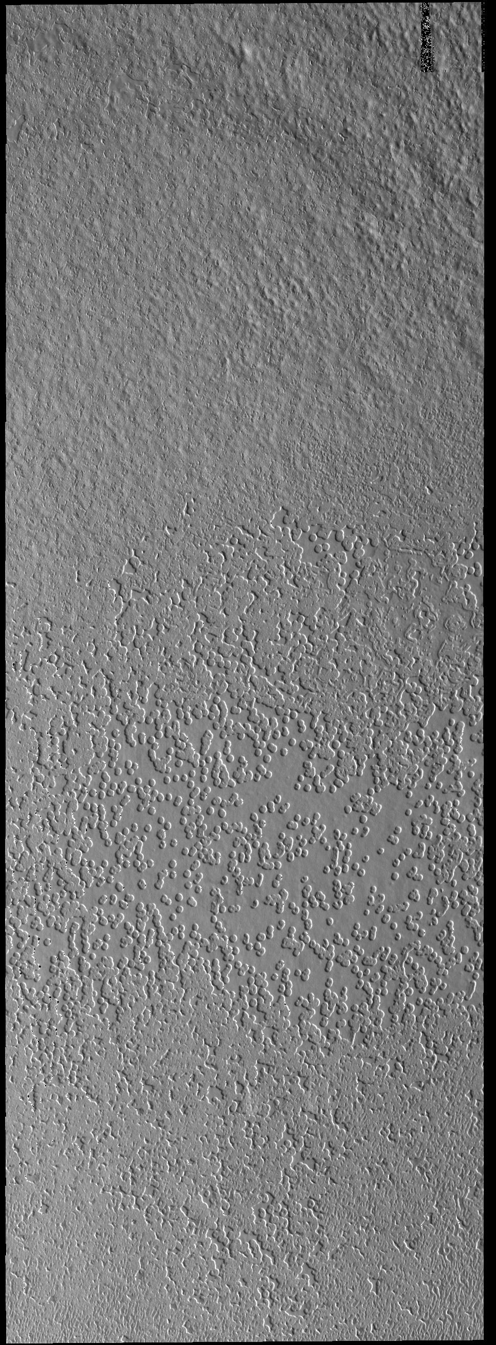
Full Resolution:
TIFF
(2.72 MB)
JPEG
(457.5 kB)
2016-10-27
Mars
2001 Mars Odyssey
THEMIS
1330x2677x1
PIA21152:
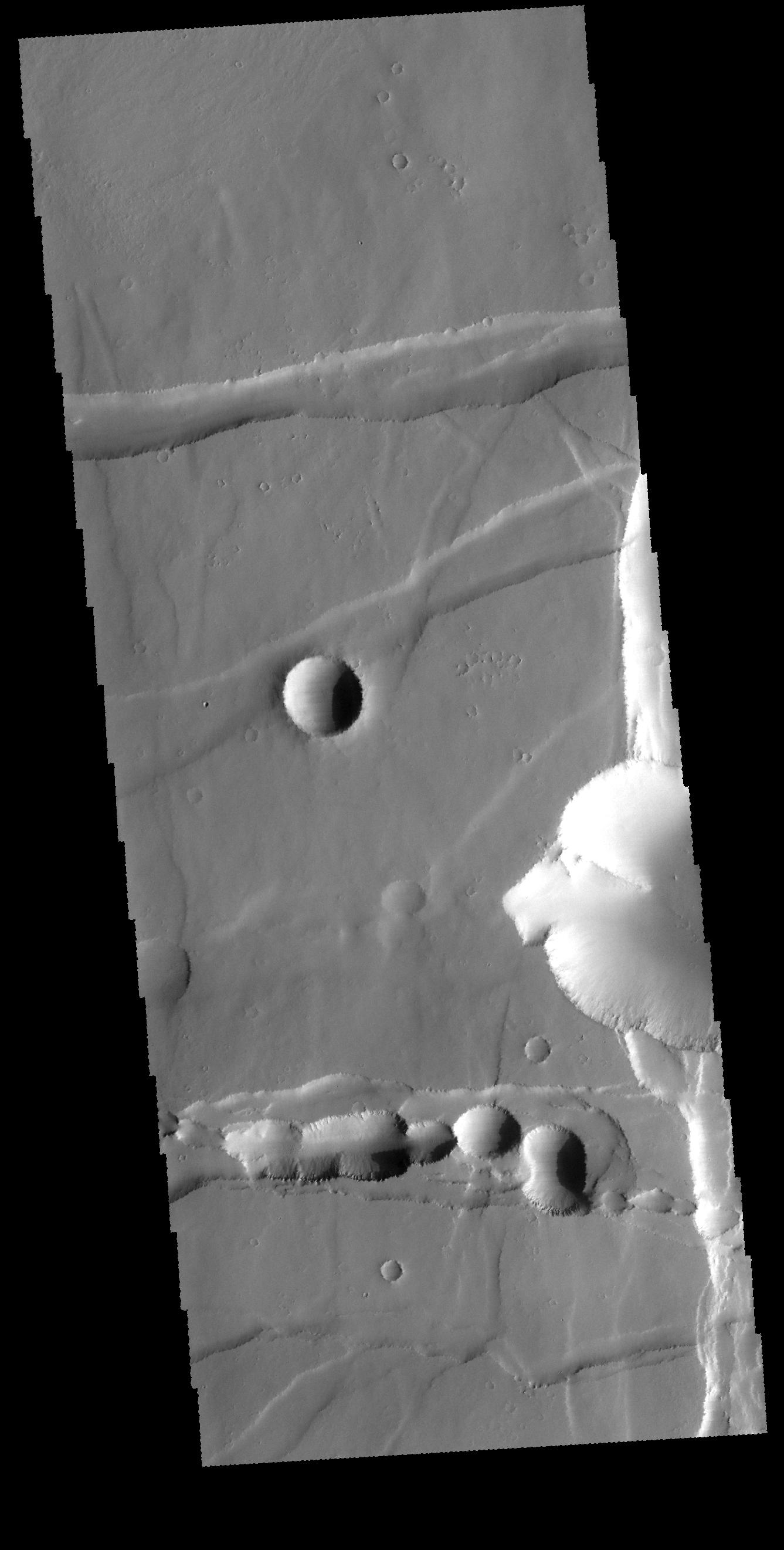
Palikir Crater
Full Resolution:
TIFF
(2.469 MB)
JPEG
(309.8 kB)
2016-10-27
Mars
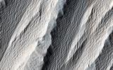
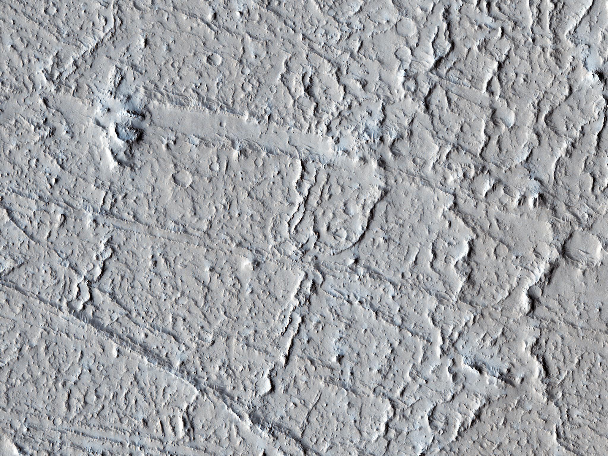
Mars Reconnaissance Orbiter (MRO)
HiRISE
4875x5243x1
PIA21131:
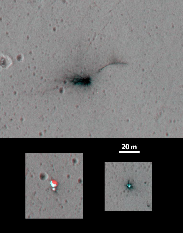
Closer Look at Schiaparelli Impact Site on Mars
Full Resolution:
TIFF
(20.38 MB)
JPEG
(2.661 MB)
2016-10-28
Mars
2001 Mars Odyssey
THEMIS
1330x2685x1
PIA21153:
Proctor Crater Dunes
Full Resolution:
TIFF
(2.345 MB)
JPEG
(241.5 kB)
2016-10-31
Mars
2001 Mars Odyssey
THEMIS
1323x2669x1
PIA21154:
Terra Sirenum
Full Resolution:
TIFF
(2.377 MB)
JPEG
(219.8 kB)
2016-11-01
Mars
2001 Mars Odyssey
THEMIS
1378x2640x1
PIA21155:
Olympus Rupes
Full Resolution:
TIFF
(2.817 MB)
JPEG
(438.7 kB)
2016-11-02
Mars
2001 Mars Odyssey
THEMIS
1370x2646x1
PIA21156:
Hydaspis Chaos
Full Resolution:
TIFF
(2.455 MB)
JPEG
(264.1 kB)
2016-11-03
Mars
2001 Mars Odyssey
THEMIS
1368x2643x1
PIA21157:
Gigas Sulci
Full Resolution:
TIFF
(2.778 MB)
JPEG
(397.5 kB)
2016-11-03
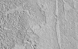
Mars
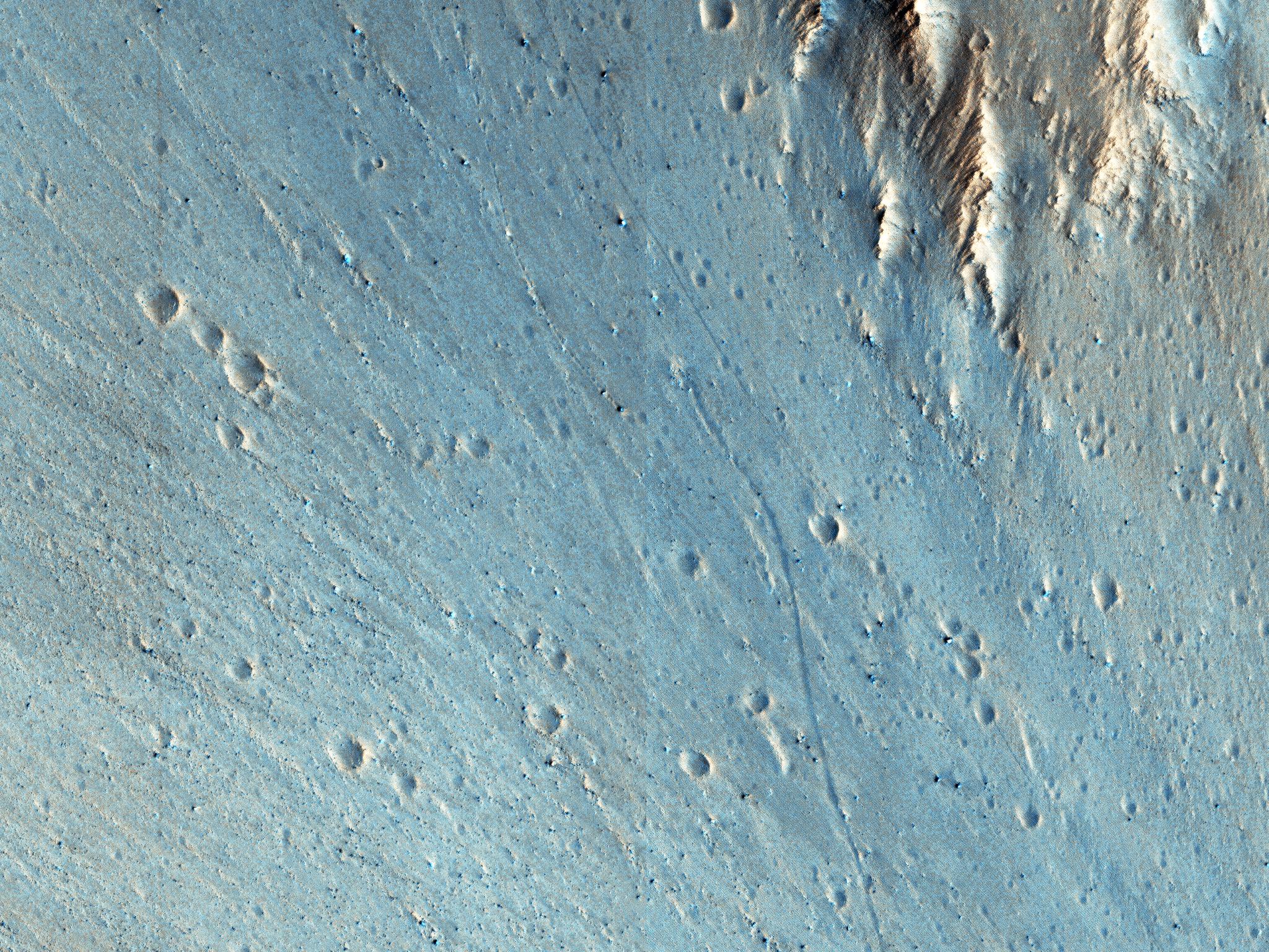
Mars Reconnaissance Orbiter (MRO)
HiRISE
394x500x3
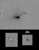
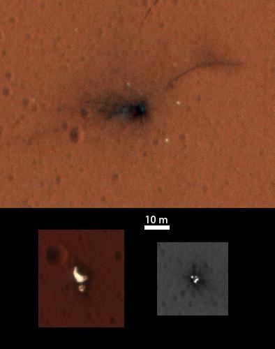
PIA21132:
Schiaparelli Impact Site on Mars, in Color
Full Resolution:
TIFF
(311.1 kB)
JPEG
(20.66 kB)
2016-11-04
Mars
2001 Mars Odyssey
THEMIS
665x1427x1
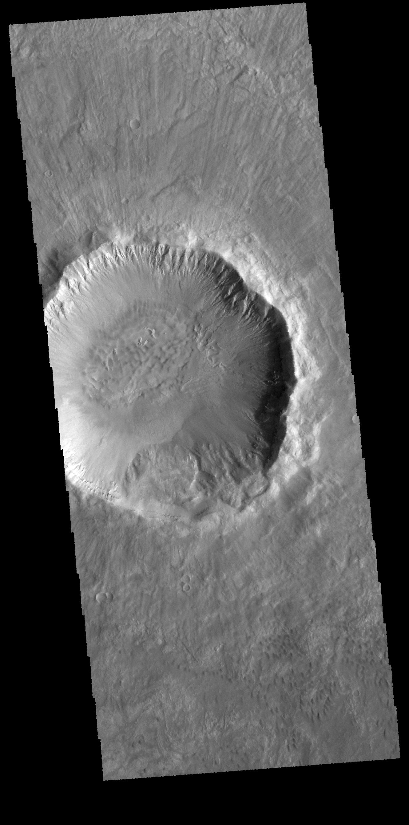
PIA21158:
Gasa Crater
Full Resolution:
TIFF
(686.9 kB)
JPEG
(87.72 kB)
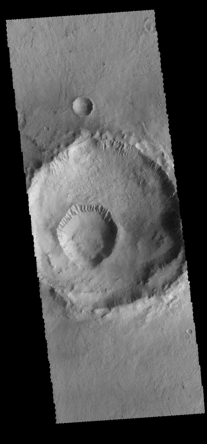
2016-11-07
Mars
2001 Mars Odyssey
THEMIS
1361x2634x1
PIA21159:
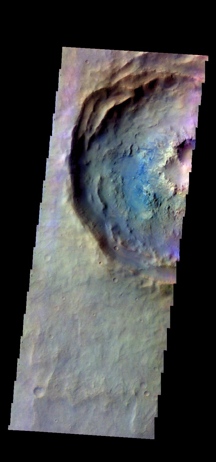
Crater and Caldera
Full Resolution:
TIFF
(2.543 MB)
JPEG
(306.1 kB)
2016-11-08
Mars
2001 Mars Odyssey
THEMIS
1344x2640x1
PIA21160:
Pavonis Mons
Full Resolution:
TIFF
(2.411 MB)
JPEG
(308.8 kB)
2016-11-09
Mars
2001 Mars Odyssey
THEMIS
734x1561x3
PIA21161:
Eberswalde Crater - False Color
Full Resolution:
TIFF
(2.34 MB)
JPEG
(116 kB)
2016-11-09
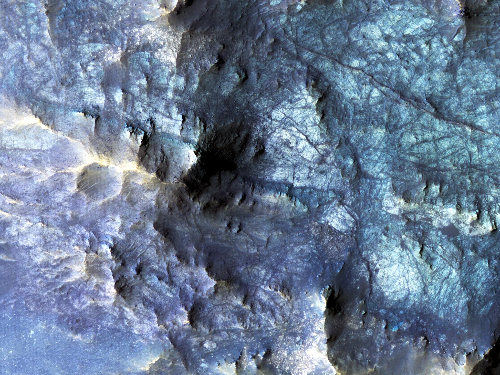
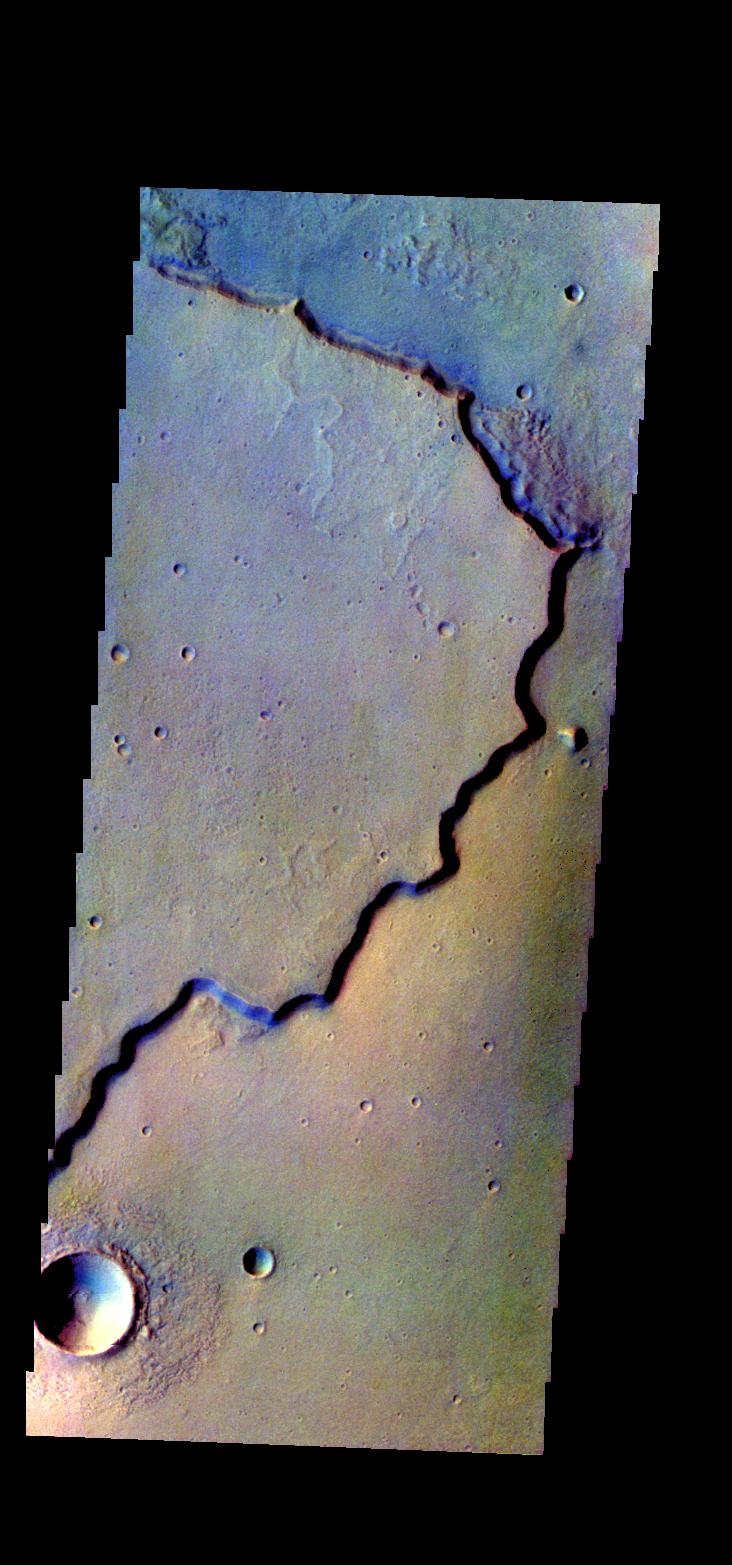
Mars
Mars Reconnaissance Orbiter (MRO)
HiRISE
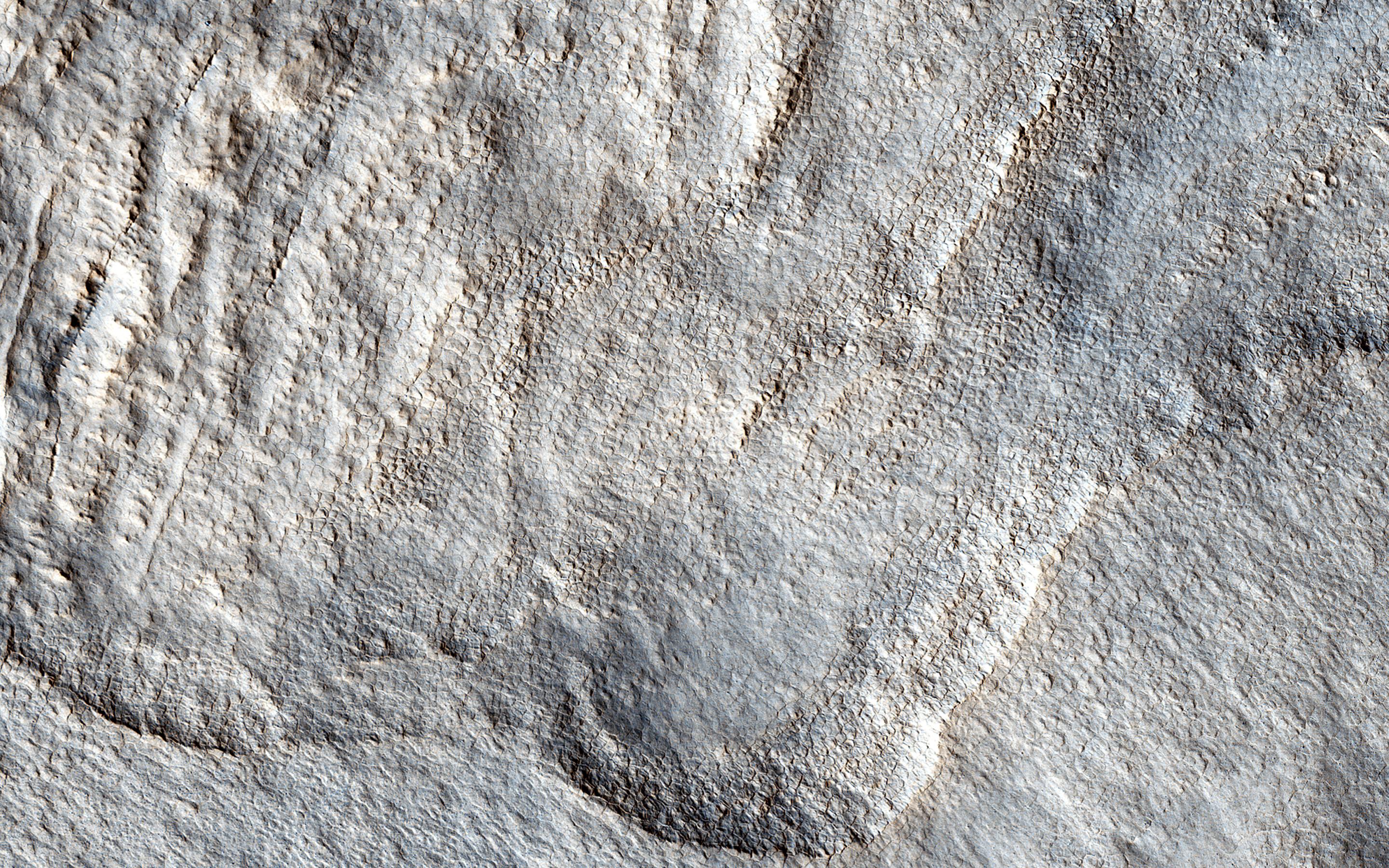
2048x1536x3
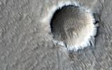
PIA21203:
Trundling Boulders
Full Resolution:
TIFF
(9.44 MB)
JPEG
(995.7 kB)
2016-11-09
Mars
Mars Reconnaissance Orbiter (MRO)
HiRISE
2048x1536x3
PIA21204:
Rafted Rock
Full Resolution:
TIFF
(9.44 MB)
JPEG
(713.5 kB)
2016-11-09
Mars
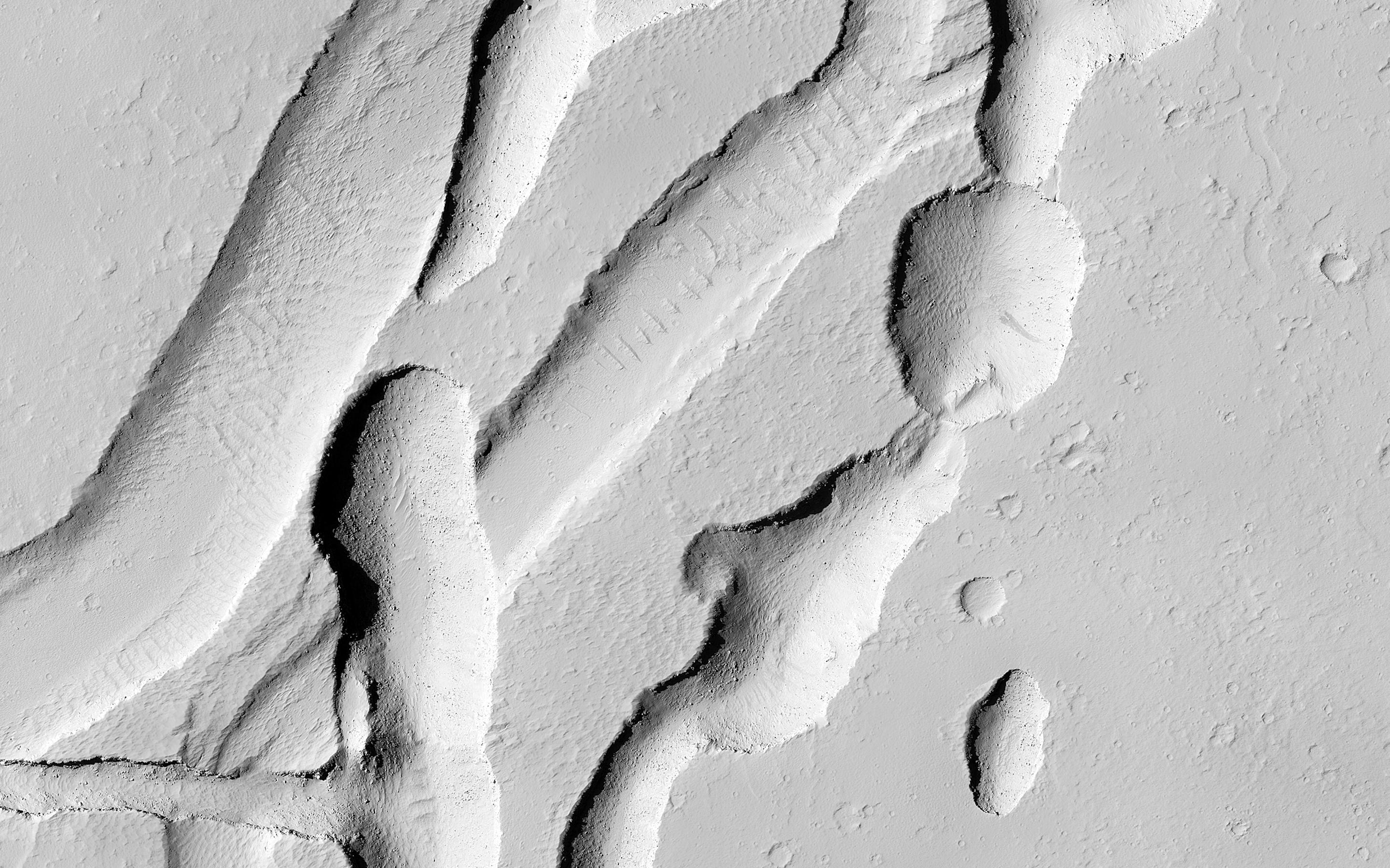
Mars Reconnaissance Orbiter (MRO)
HiRISE
2048x1536x3
PIA21205:
Exposed Fractured Bedrock in the Central Pit of a Crater
Full Resolution:
TIFF
(9.44 MB)
JPEG
(711.7 kB)
2016-11-09
Mars
Mars Reconnaissance Orbiter (MRO)
HiRISE
2048x1536x3
PIA21206:
A Glimpse into History
Full Resolution:
TIFF
(9.44 MB)
JPEG
(889.5 kB)
2016-11-10
Mars
2001 Mars Odyssey
THEMIS
732x1565x3
PIA21162:
Chryse Planitia - False Color
Full Resolution:
TIFF
(2.337 MB)
JPEG
(128.1 kB)
2016-11-11
Mars
2001 Mars Odyssey
THEMIS
727x1556x3
PIA21163:
Schiaparelli Crater - False Color
Full Resolution:
TIFF
(2.405 MB)
JPEG
(155.6 kB)
2016-11-14
Mars
2001 Mars Odyssey
THEMIS
729x1556x3
PIA21164:
Gale Crater - False Color
Full Resolution:
TIFF
(2.189 MB)
JPEG
(101.6 kB)
2016-11-15
Mars
2001 Mars Odyssey
THEMIS
703x1545x3
PIA21165:
Iani Chaos - False Color
Full Resolution:
TIFF
(2.179 MB)
JPEG
(81.02 kB)
2016-11-15
Mars
Mars Reconnaissance Orbiter (MRO)
HiRISE
763x968x3
PIA21135:
Schiaparelli Impact Site on Mars, Stereo
Full Resolution:
TIFF
(1.385 MB)
JPEG
(70.24 kB)
2016-11-16
Mars
2001 Mars Odyssey
THEMIS
706x1546x3
PIA21167:
Candor Chasma - False Color
Full Resolution:
TIFF
(1.962 MB)
JPEG
(89.23 kB)
2016-11-17
Mars
2001 Mars Odyssey
THEMIS
716x1551x3
PIA21168:
Crater Dunes - False Color
Full Resolution:
TIFF
(2.243 MB)
JPEG
(100.8 kB)
2016-11-18
Mars
2001 Mars Odyssey
THEMIS
708x1547x3
PIA21169:
Terra Sabaea - False Color
Full Resolution:
TIFF
(2.248 MB)
JPEG
(122.7 kB)
2016-11-21
Mars
2001 Mars Odyssey
THEMIS
711x1545x3
PIA21171:
Syrtis Major - False Color
Full Resolution:
TIFF
(2.24 MB)
JPEG
(101.1 kB)
2016-11-22
Mars
2001 Mars Odyssey
THEMIS
712x1547x3
PIA21172:
Nili Fossae - False Color
Full Resolution:
TIFF
(2.236 MB)
JPEG
(100.7 kB)
2016-11-22
Mars
Mars Reconnaissance Orbiter (MRO)
HiRISE
640x398x1
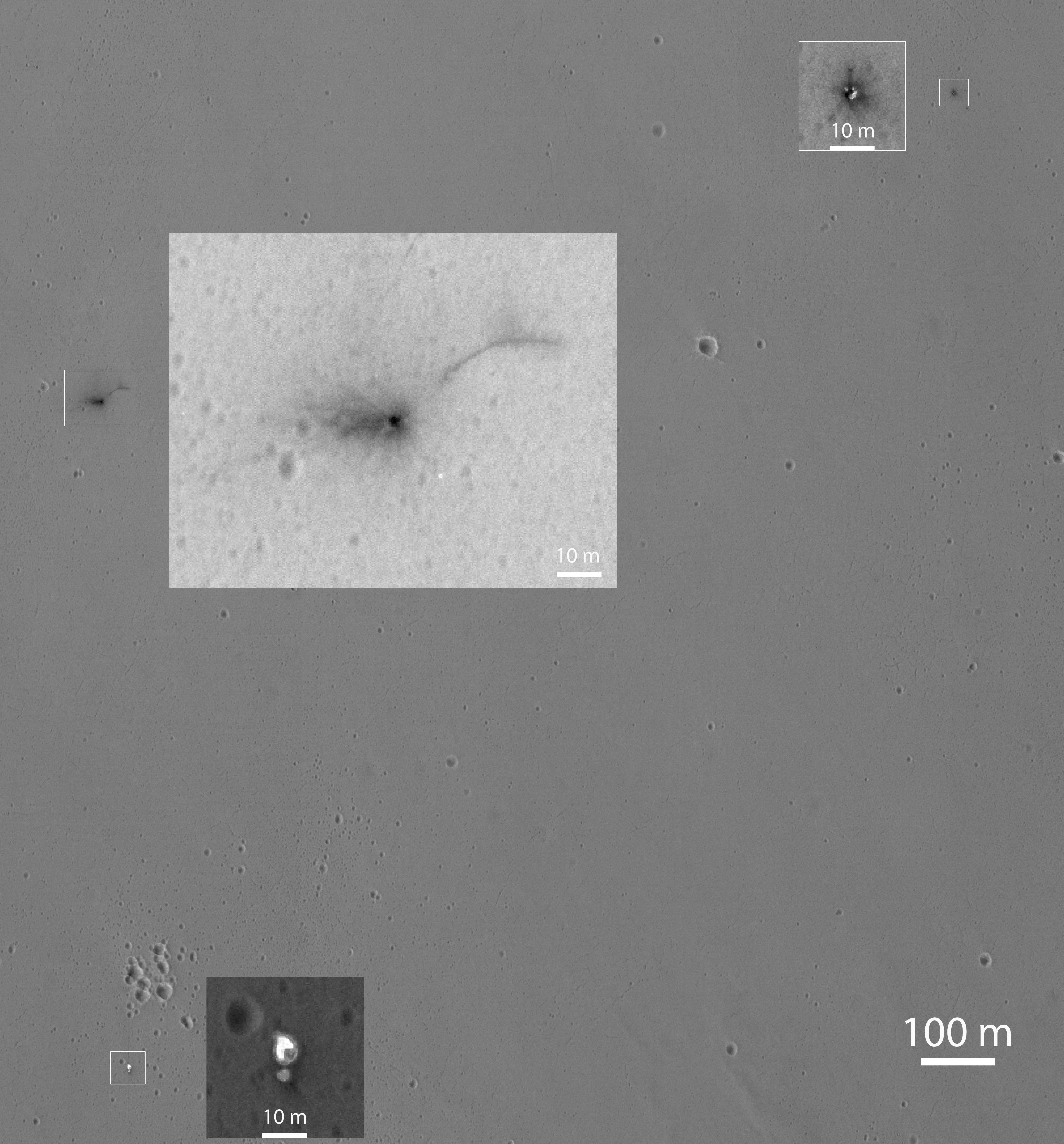
PIA21136:
Scalloped Terrain Led to Finding of Buried Ice on Mars
Full Resolution:
TIFF
(255.2 kB)
JPEG
(57.89 kB)
2016-11-22
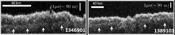
Mars
Mars Reconnaissance Orbiter (MRO)
Shallow Subsurface Radar (SHARAD)
602x122x1
PIA21137:
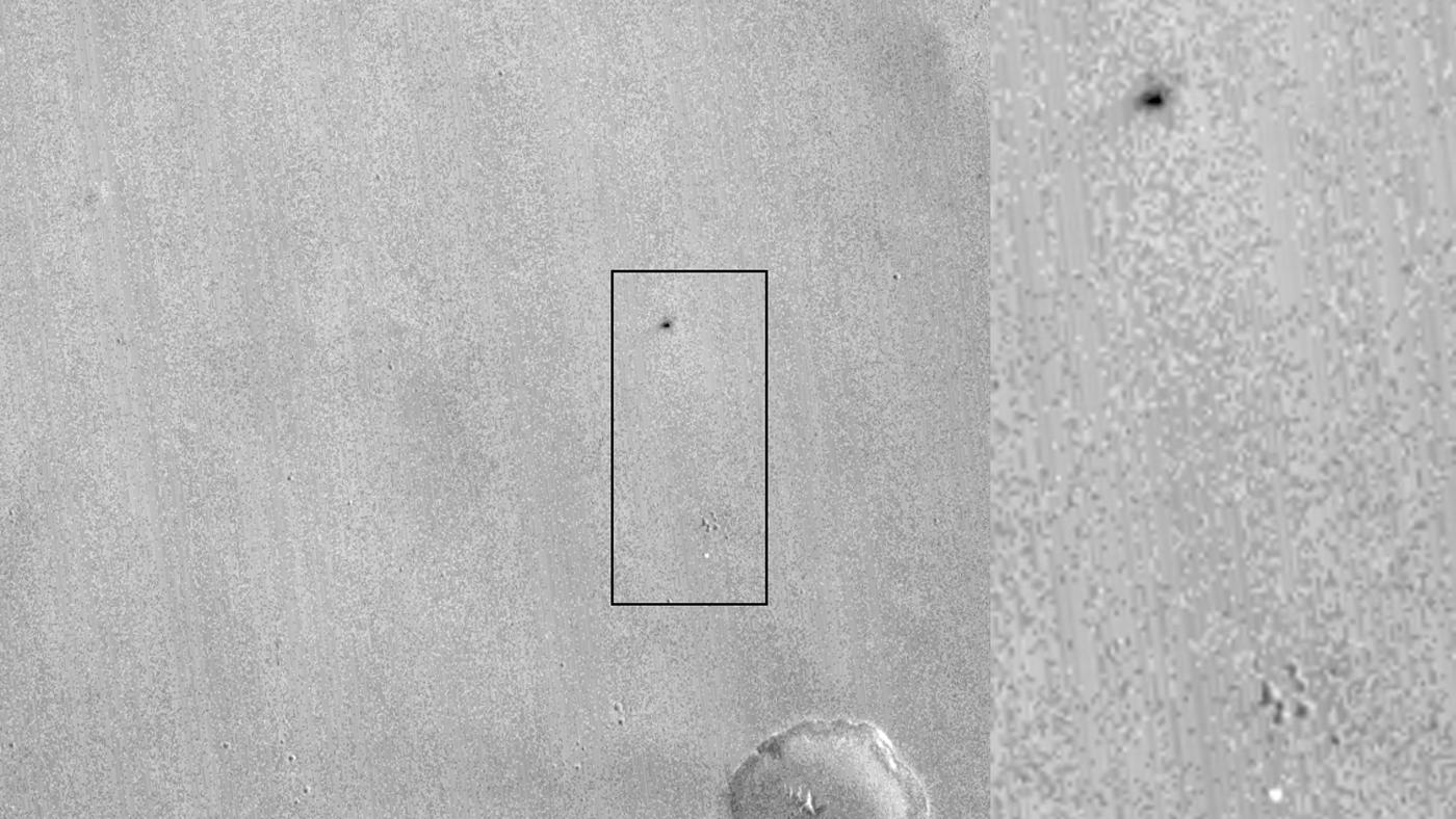
Radargrams Indicating Ice-Rich Subsurface Deposit
Full Resolution:
TIFF
(73.74 kB)
JPEG
(21.33 kB)
2016-11-22
Mars
Mars Reconnaissance Orbiter (MRO)
Shallow Subsurface Radar (SHARAD)
596x286x3
PIA21138:
Location of Large Subsurface Water-Ice Deposit in Utopia Planitia, Mars
Full Resolution:
TIFF
(322.1 kB)
JPEG
(44.46 kB)
2016-11-23
Mars
2001 Mars Odyssey
THEMIS
685x1534x3
PIA21173:
Ophir Chasma - False Color
Full Resolution:
TIFF
(2.083 MB)
JPEG
(76.59 kB)
1-100
101-200
201-300
301-400
401-500
501-600
601-700
701-800
801-900
901-1000
Currently displaying images:
9601 - 9700
of 12760


